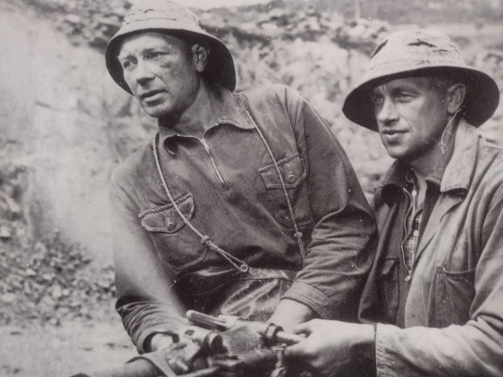
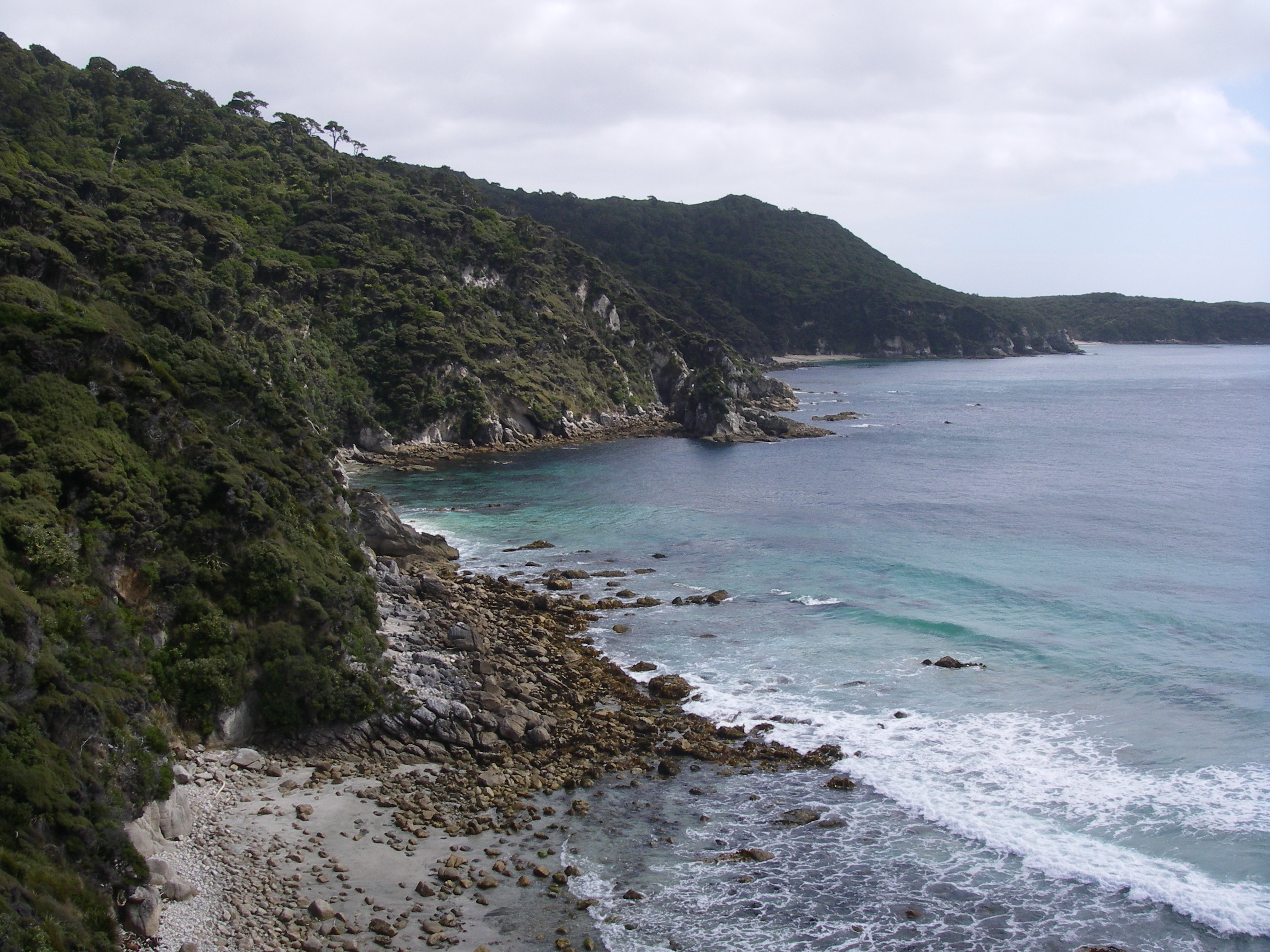
And so to the Brindle Bull. You may have read my previous account of our seven day saunter #1 along Kosciuszko’s highest peaks and ridgelines on The Kerries, Rolling Grounds and The Main Range. Our follow-up foray was into The Pilot Wilderness, south of Thredbo.
by Glenn Burns
But first, as it was Sunday, a day of rest, we parked ourselves in Thredbo. Along with hundreds of mountain bikers competing in the National Downhill Championships.
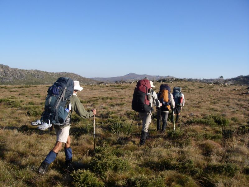
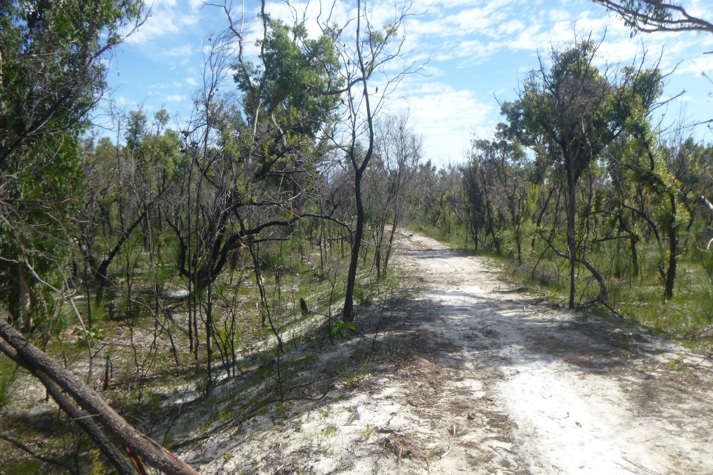
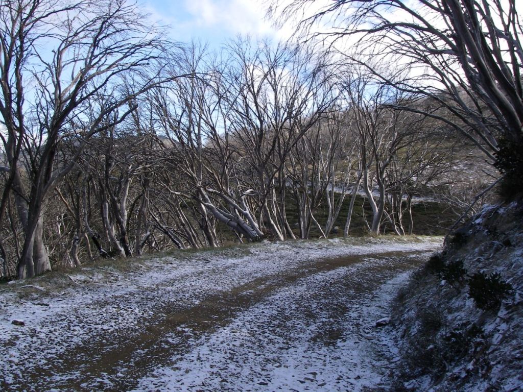
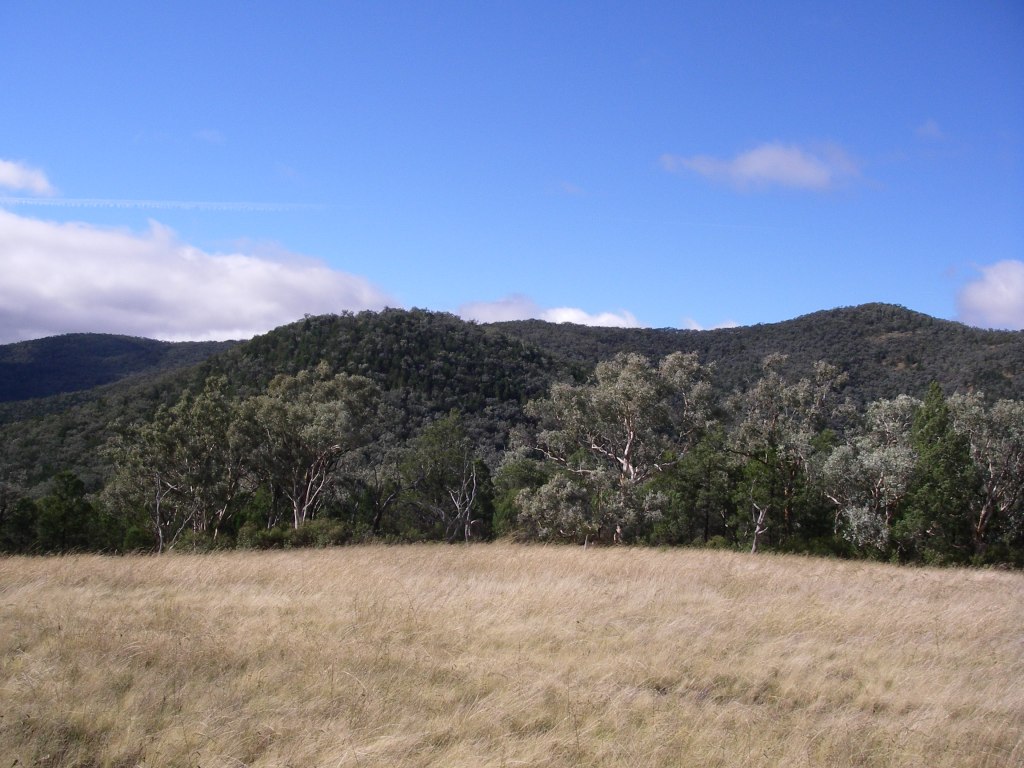
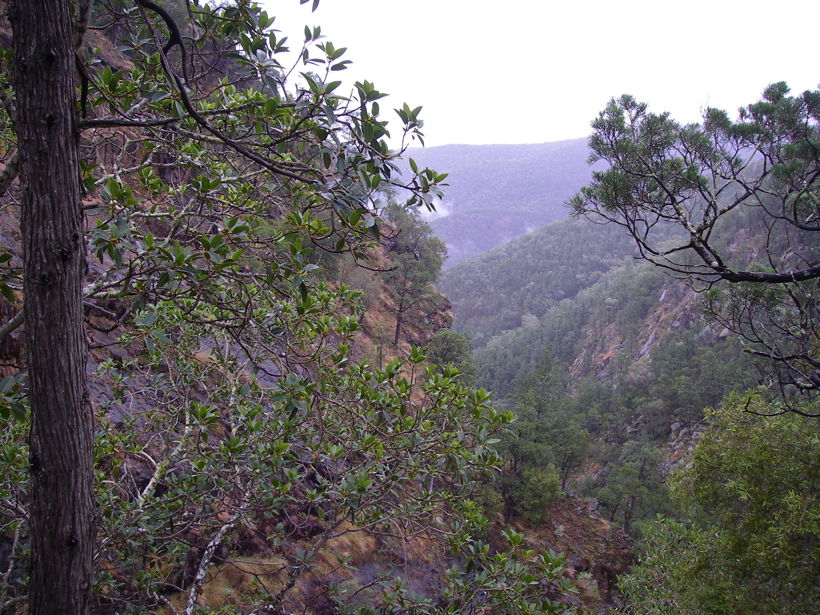
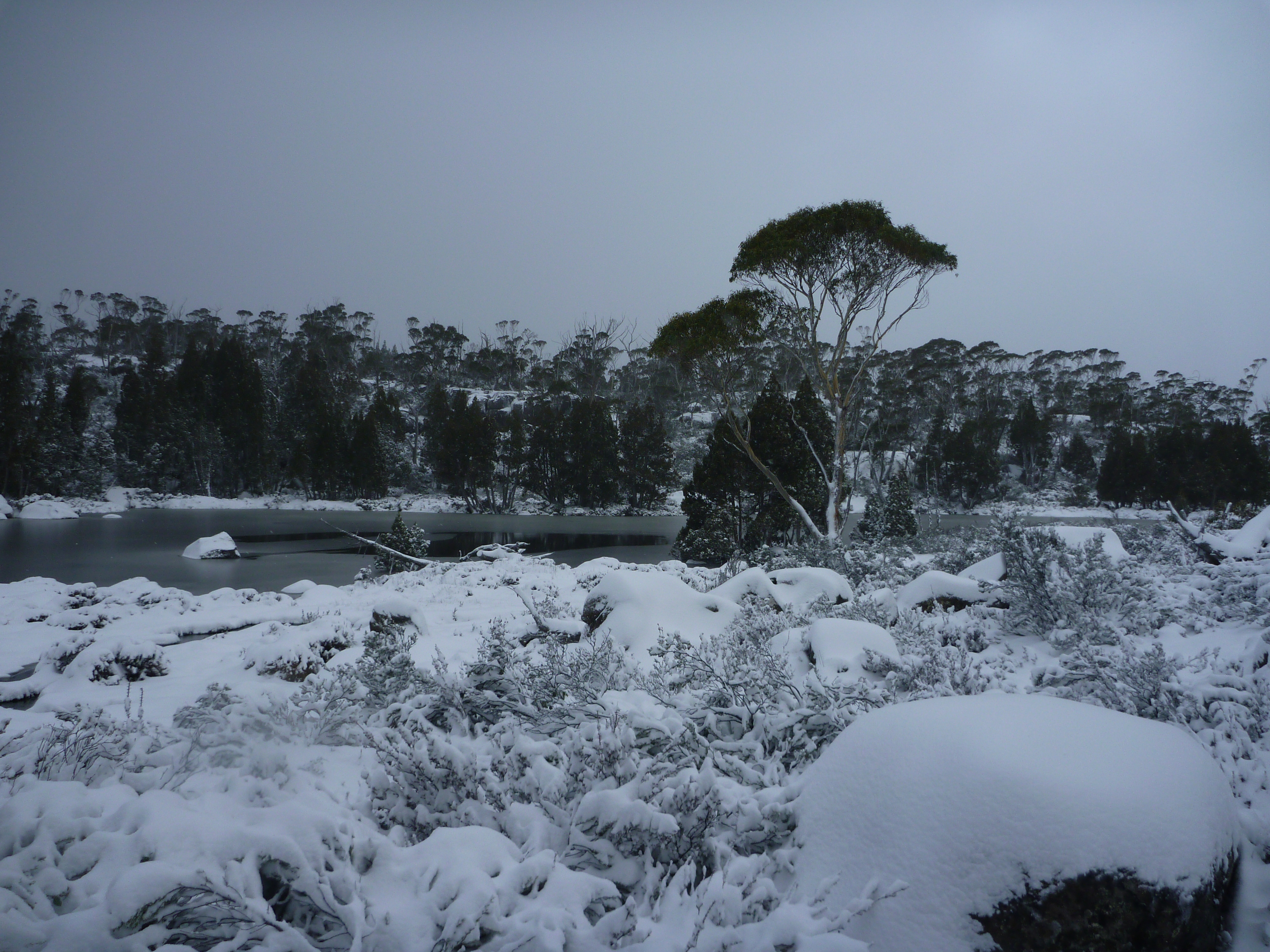
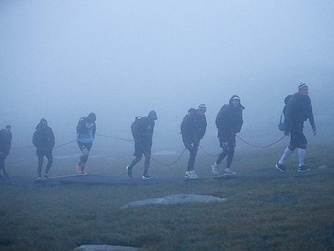
By Mondaymorning the drizzle eased, the BOM forecast was propitious so we set out again. This time on a shorter, forty kilometre circuit, at slightly lower altitudes but still over spectacular alpine terrain.
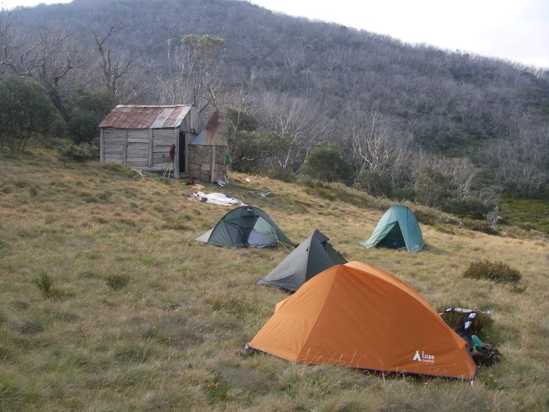
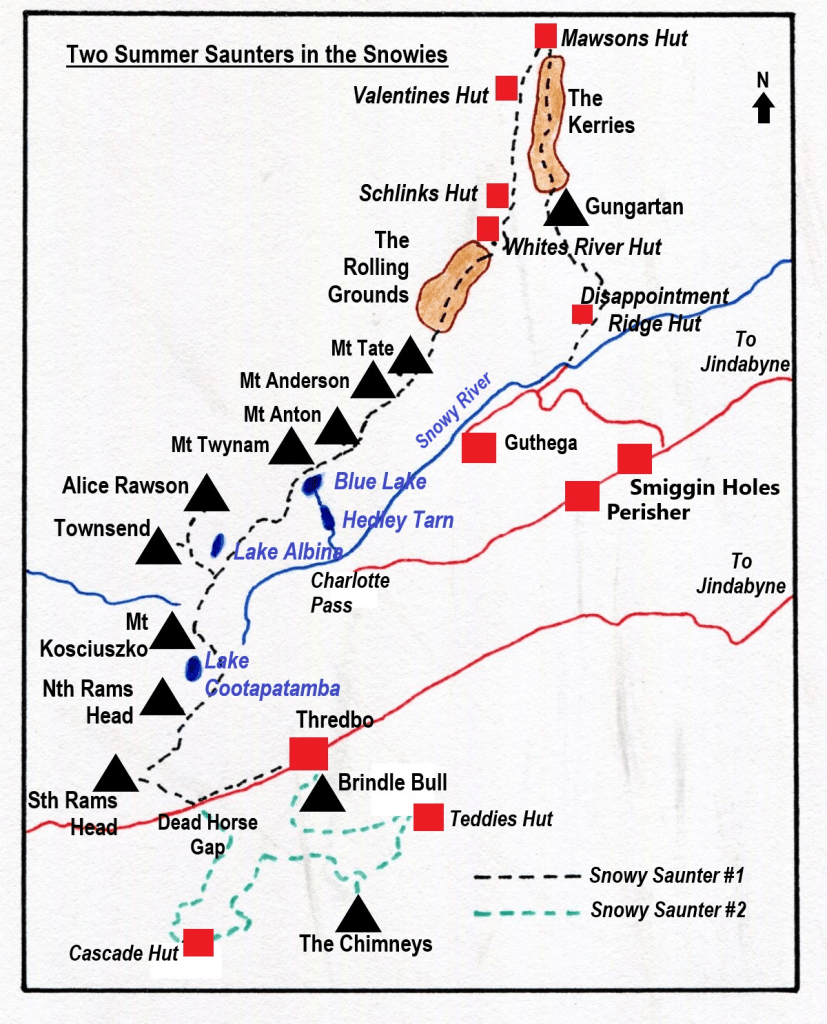
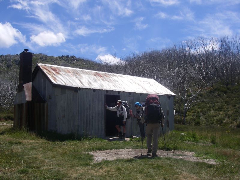
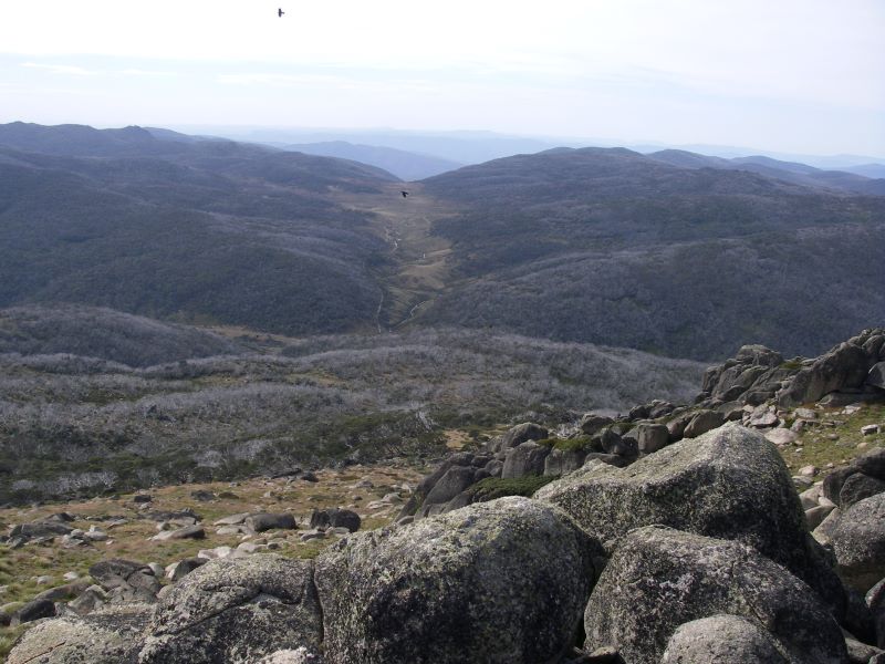
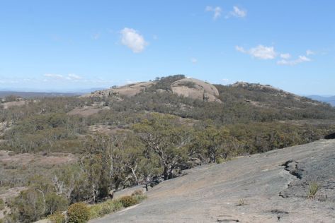
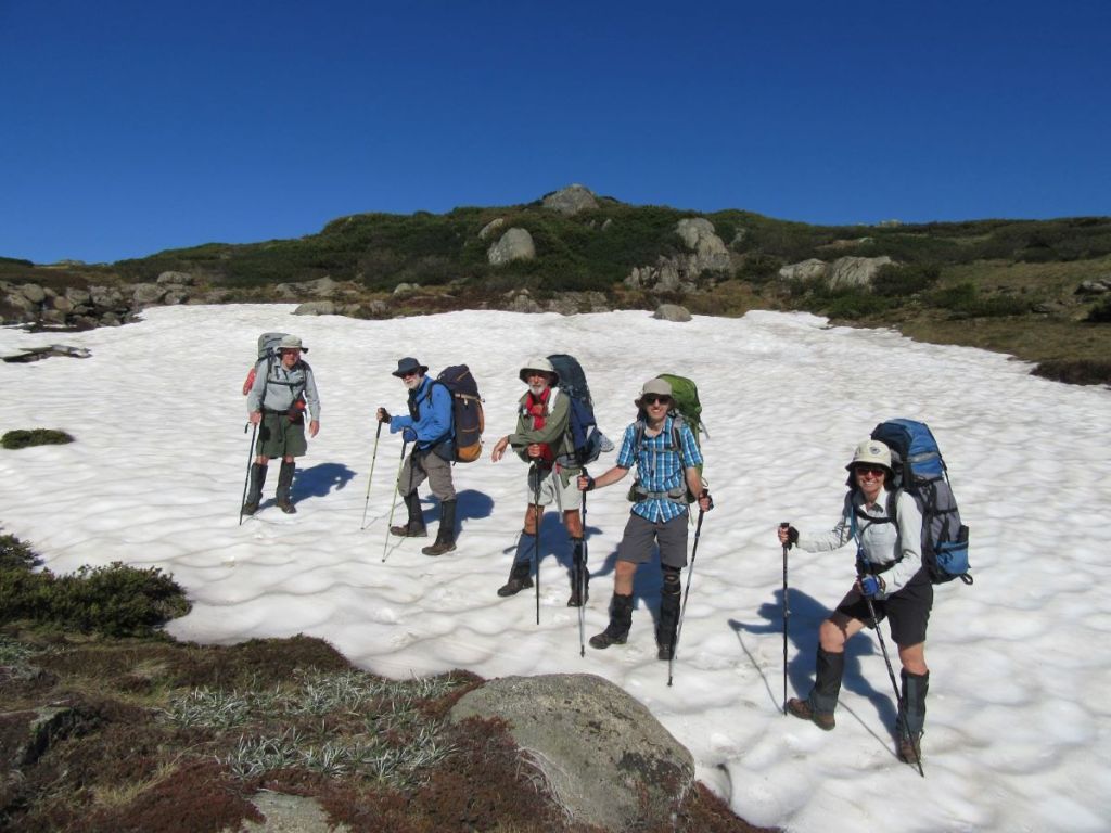
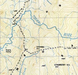
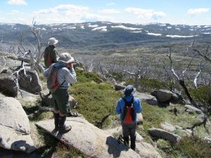
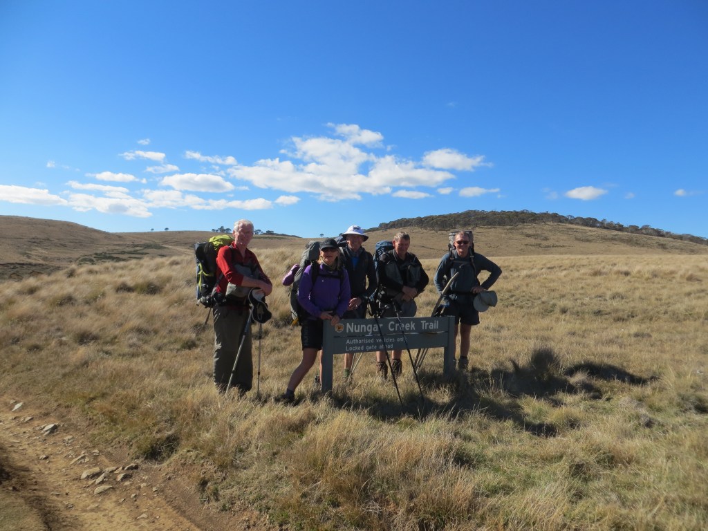
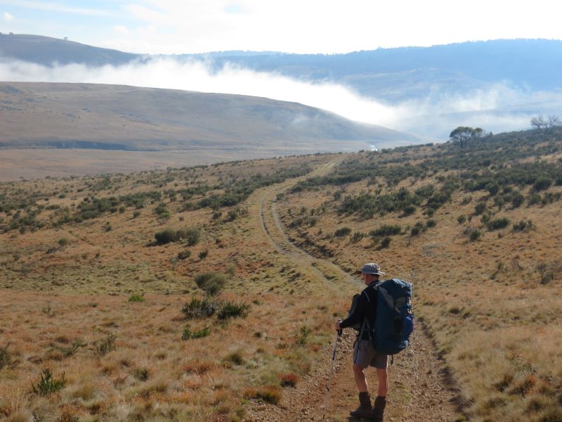
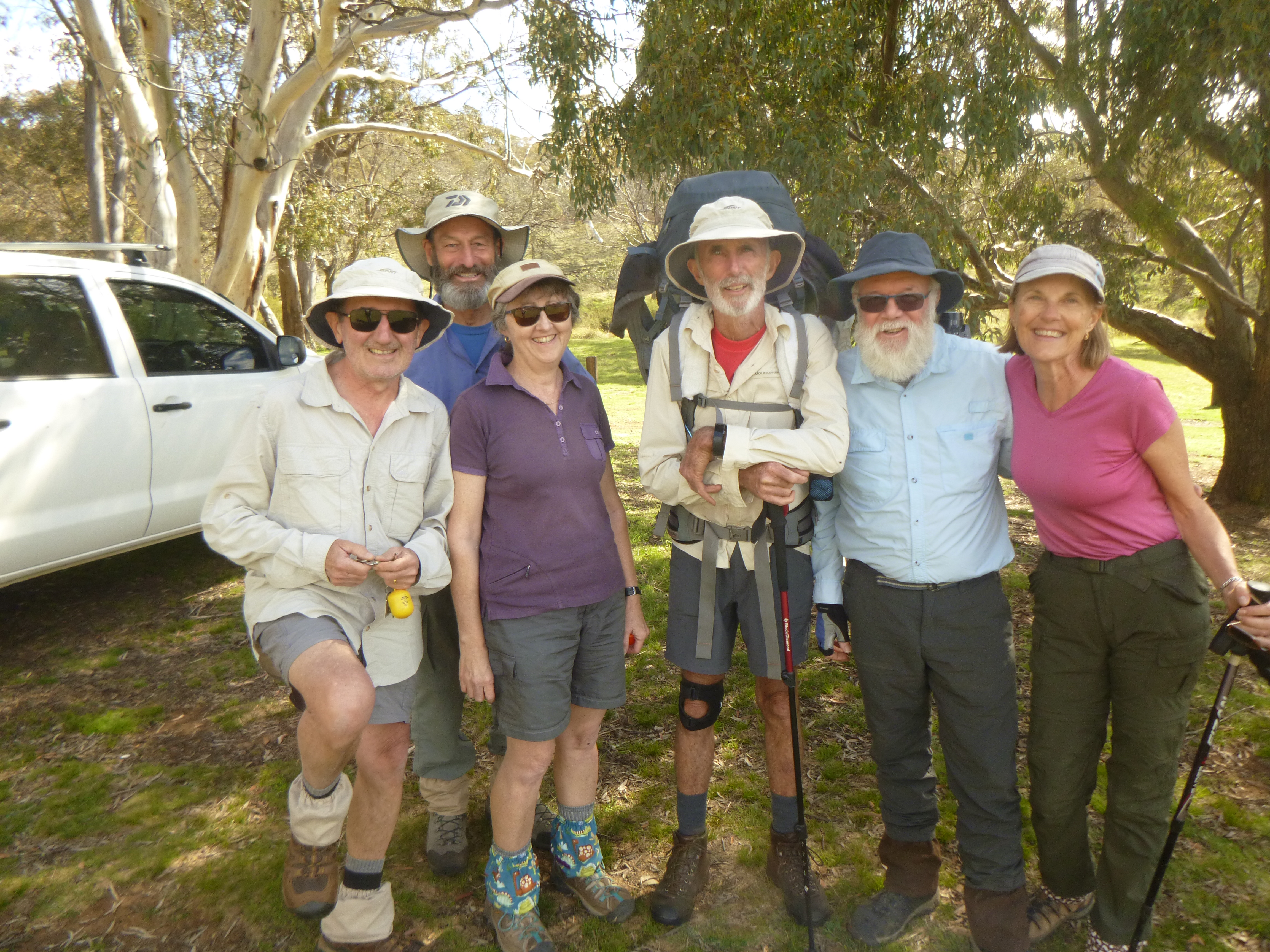
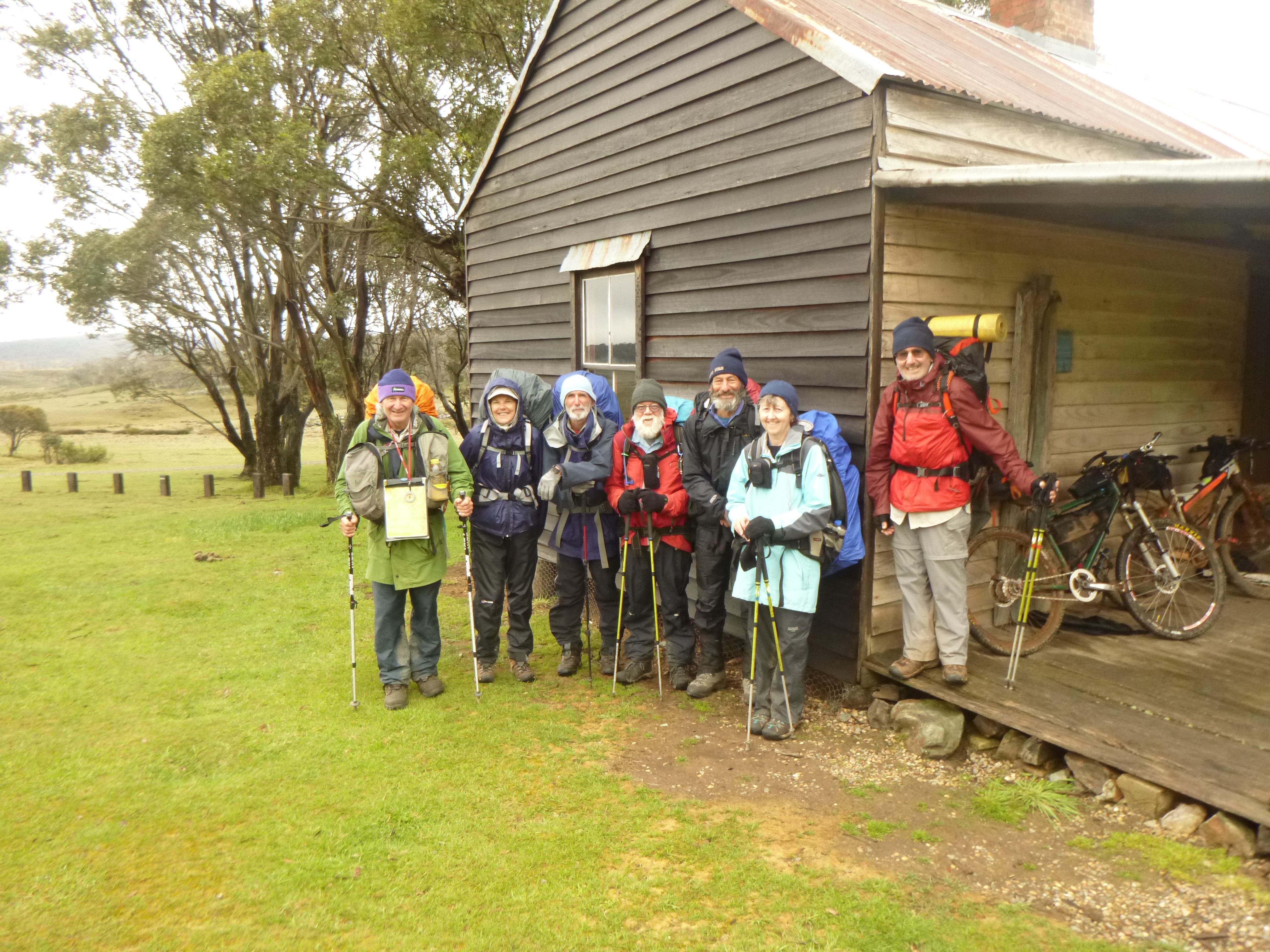
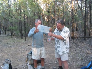
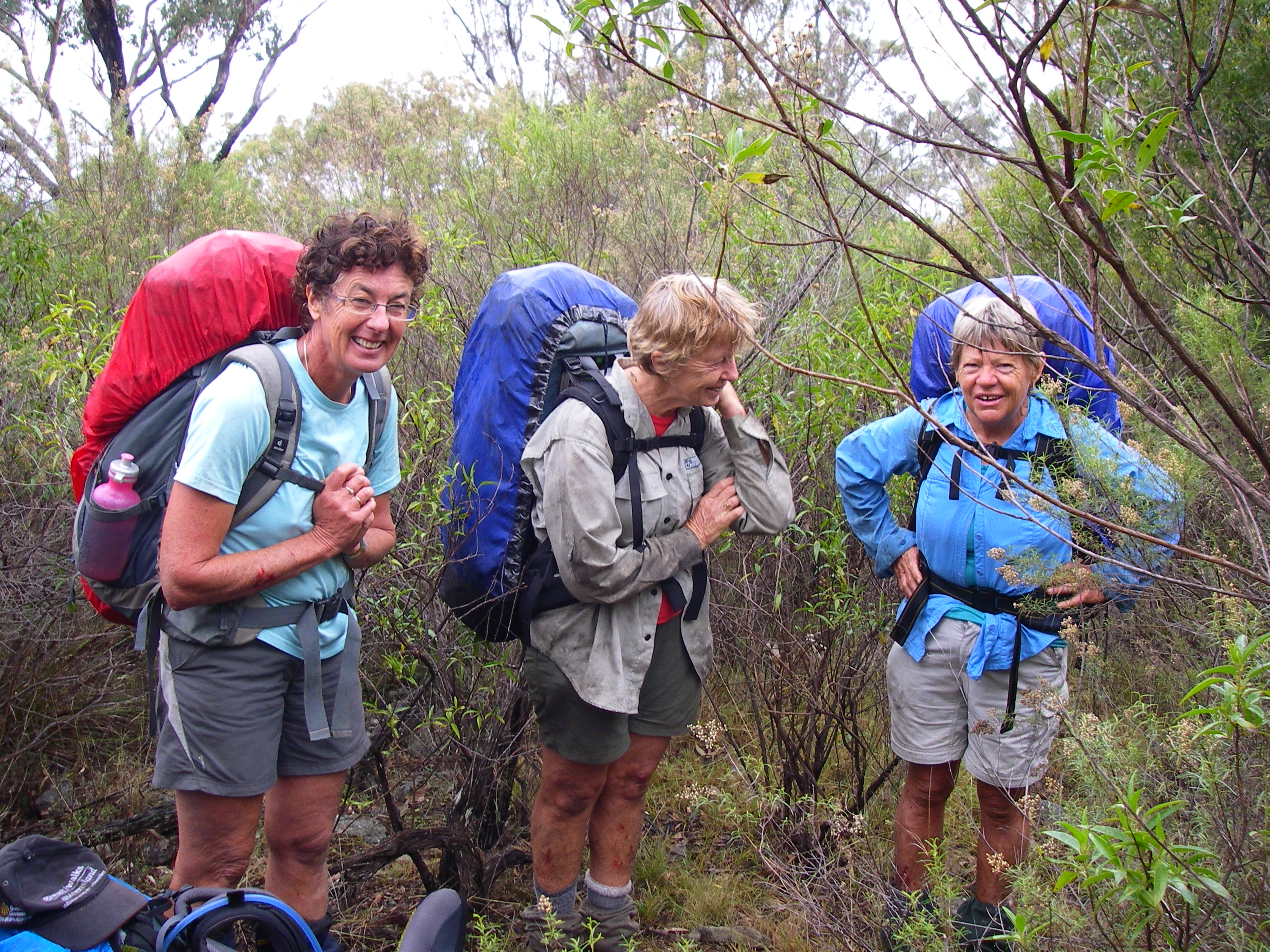
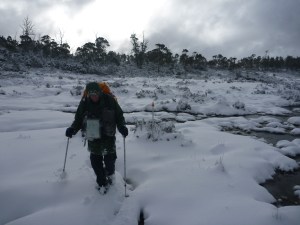
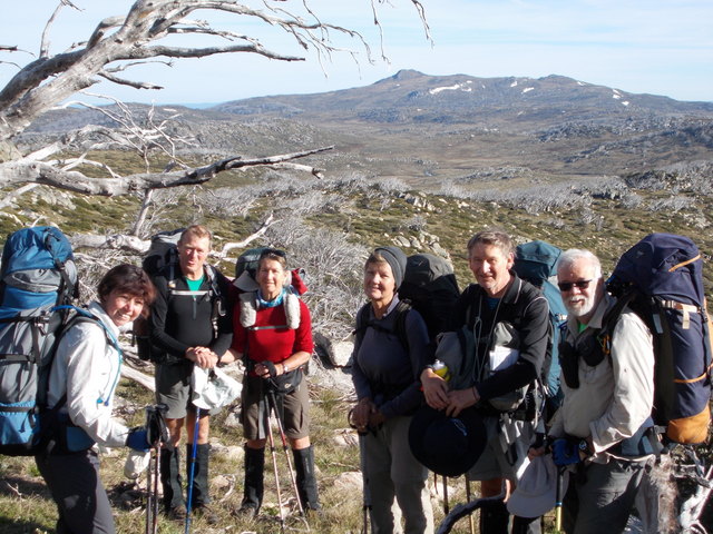
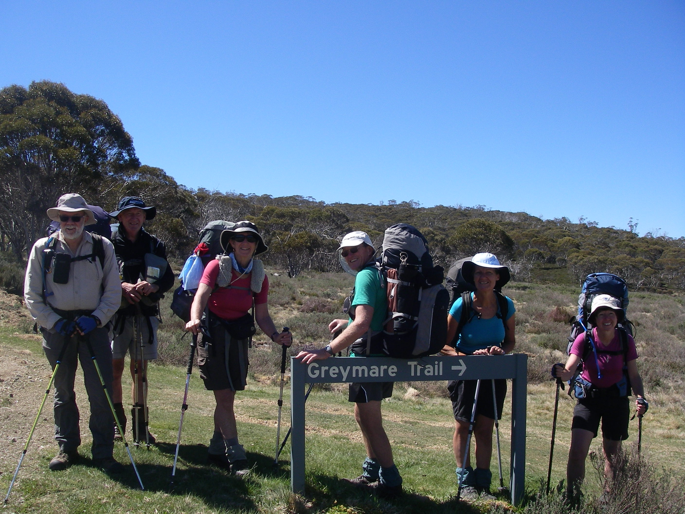
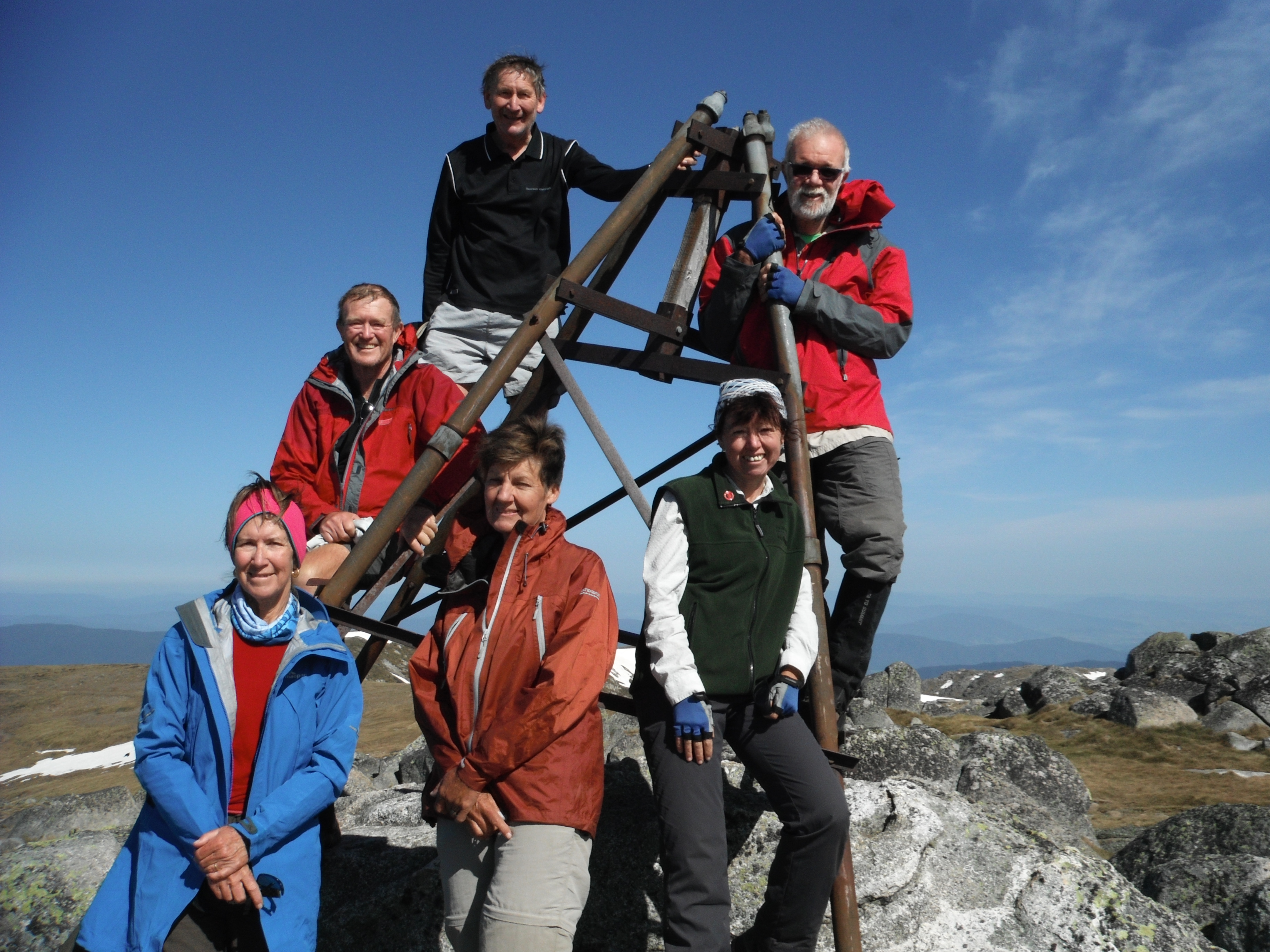
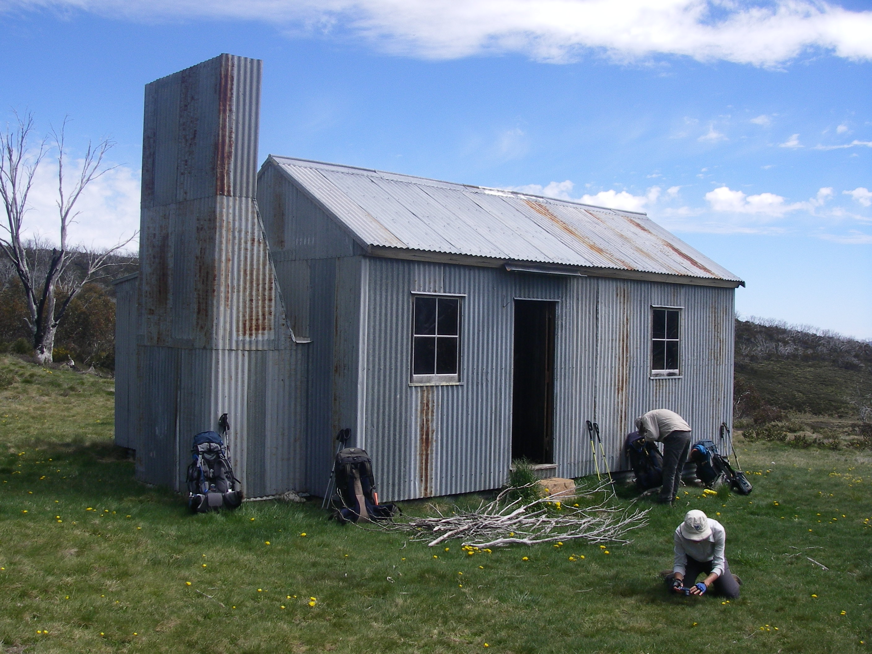
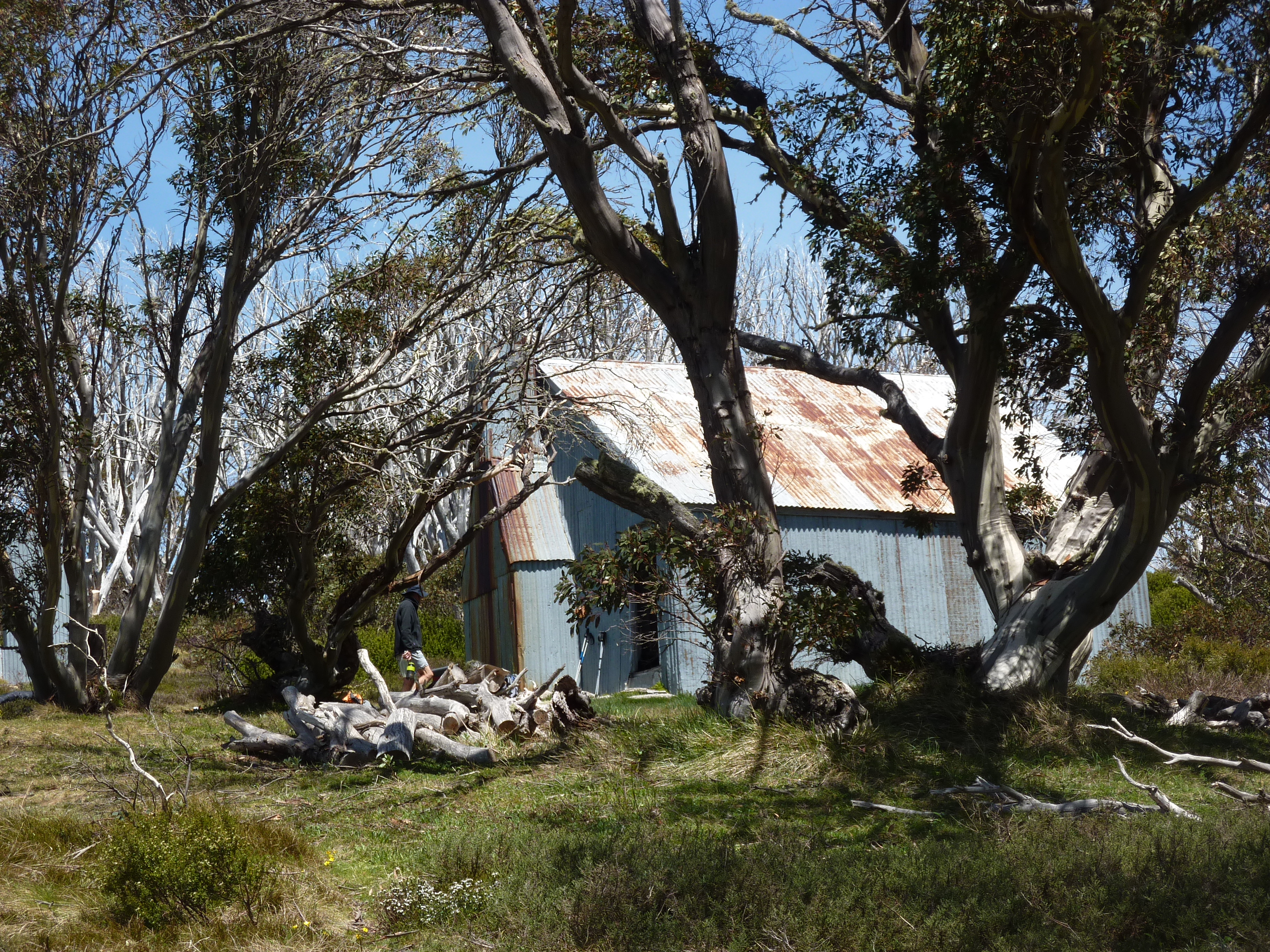
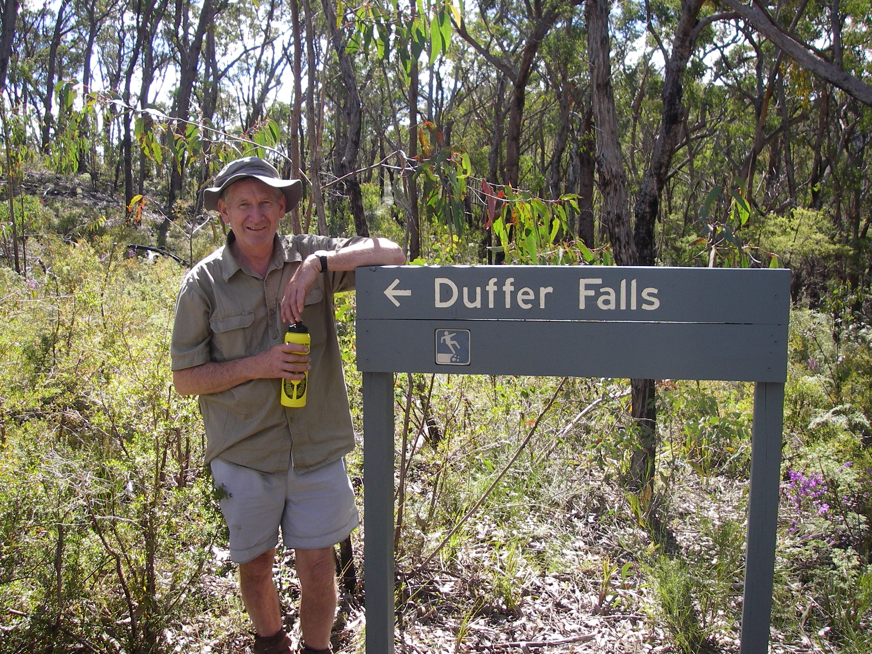
Our circuit started at Thredbo. Thence to Dead Horse Gap, the Cascade Trail, Bobs Ridge, Cascade Hut, the Big Boggy, Teddys Hut, The Chimneys, arriving back at Thredbo via the Brindle Bull Hill. A place name that Brian, our leader, seemed particularly smitten with and was determined to check out.My other companions on the Brindle Bull trip were Richard, Joe and Noel.
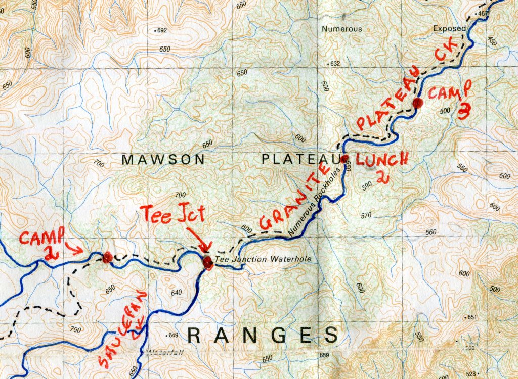
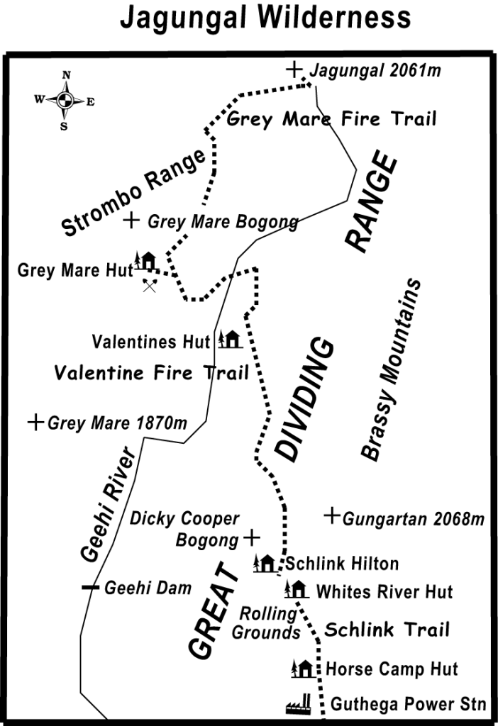
Map of Hike to Cascade Hut, Big Boggy, Teddys Hut, The Chimneys and the Brindle Bull
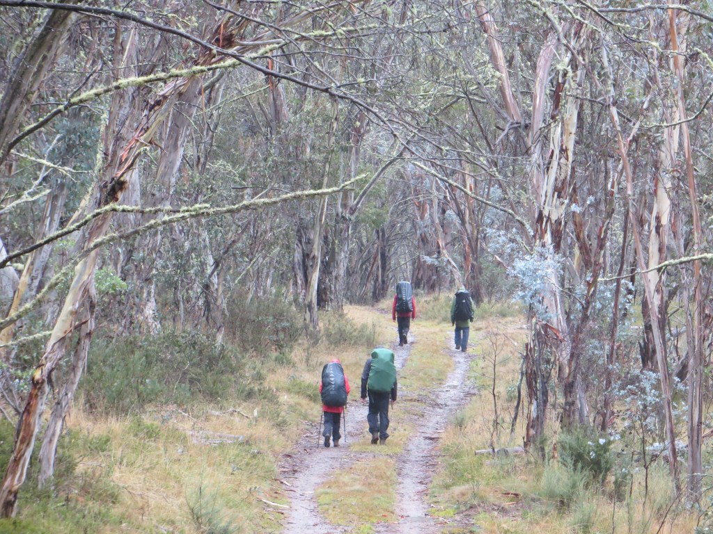
Monday : Thredbo to Cascade Hut: 12 kms.
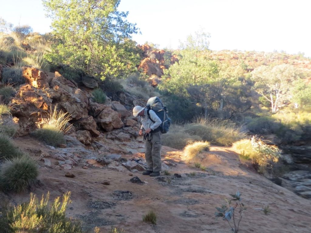
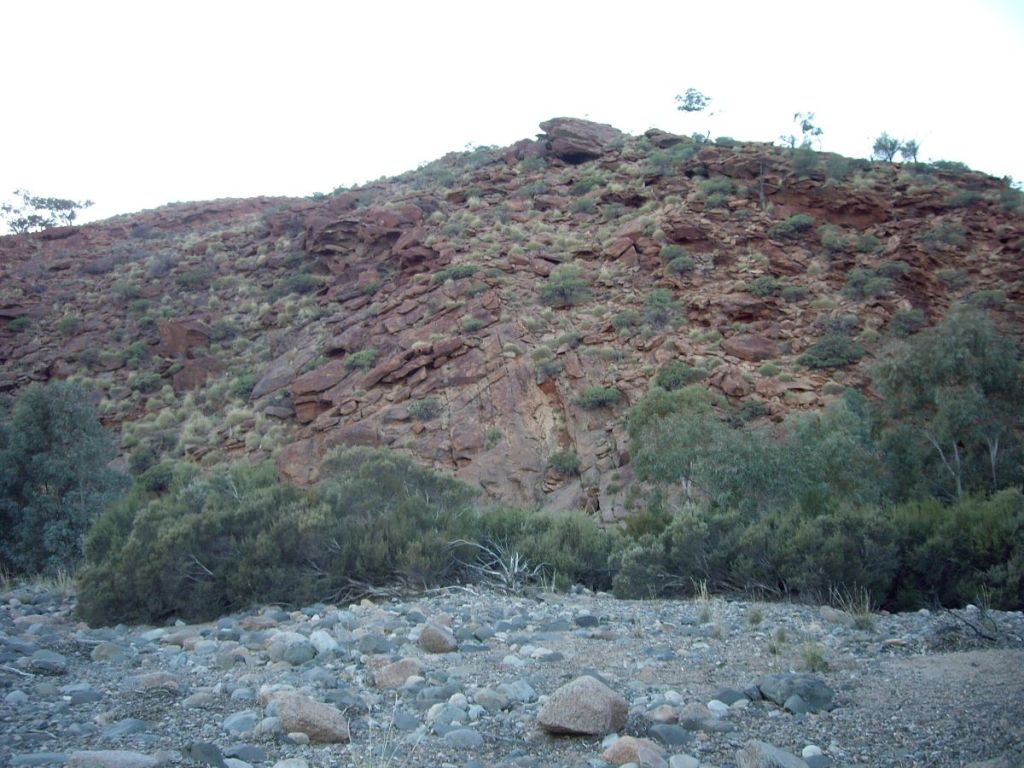
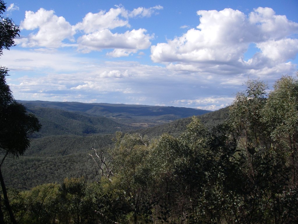
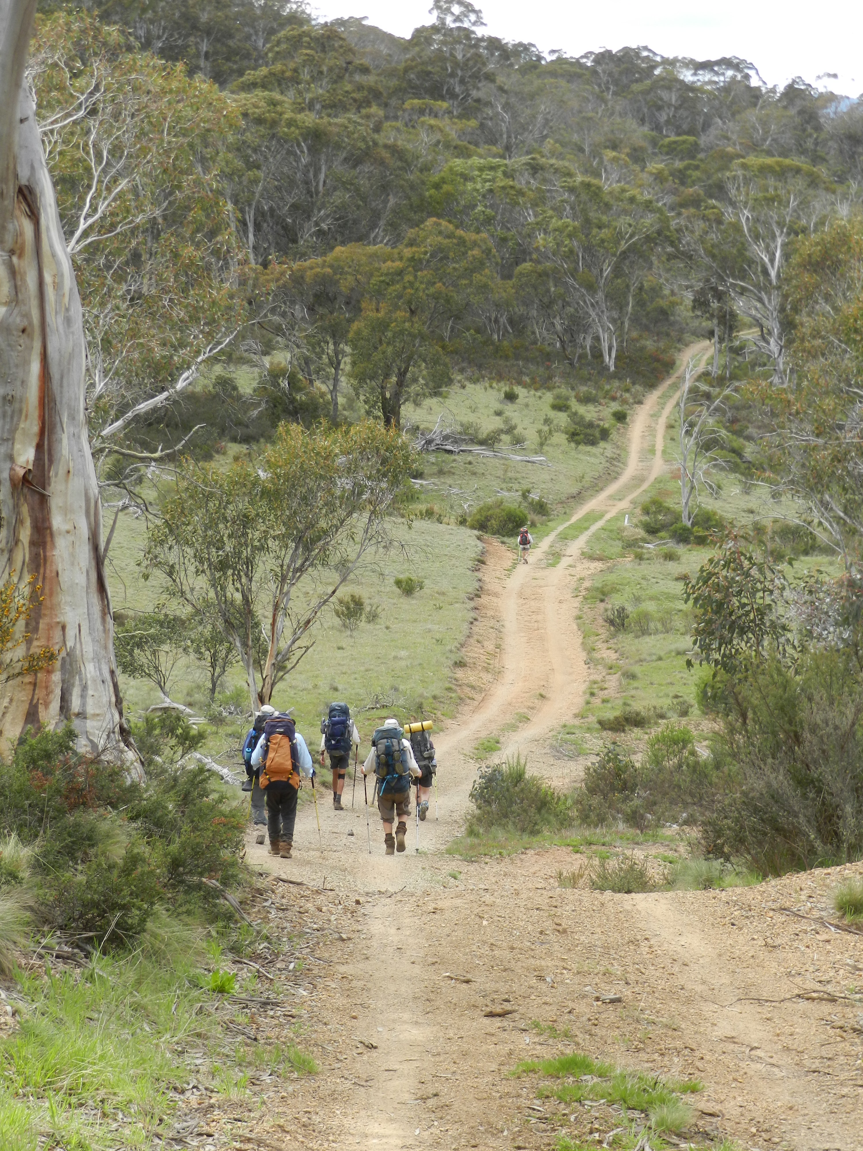
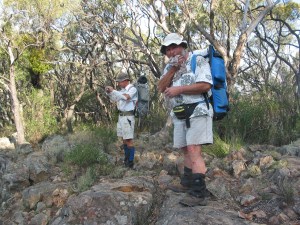
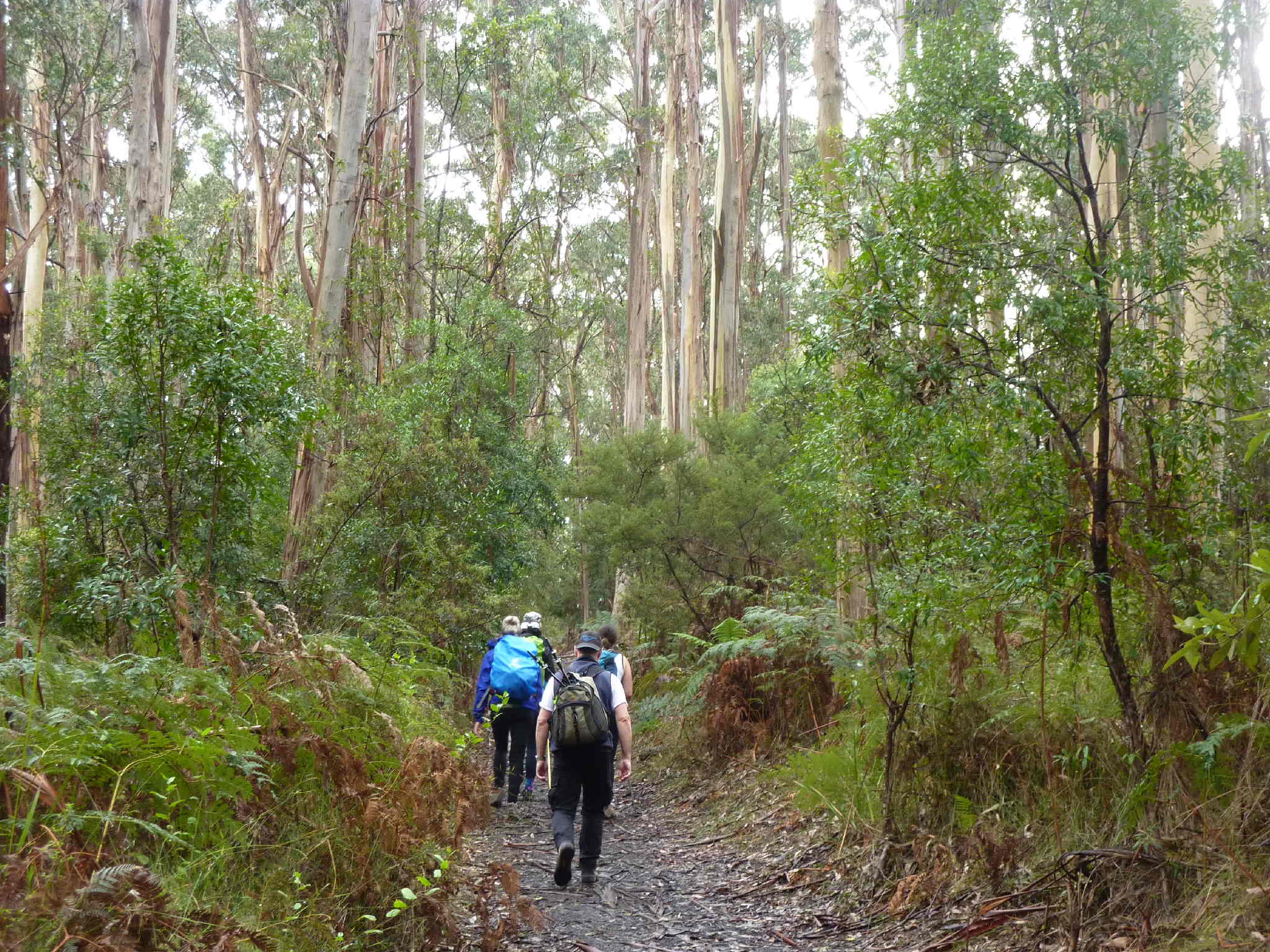
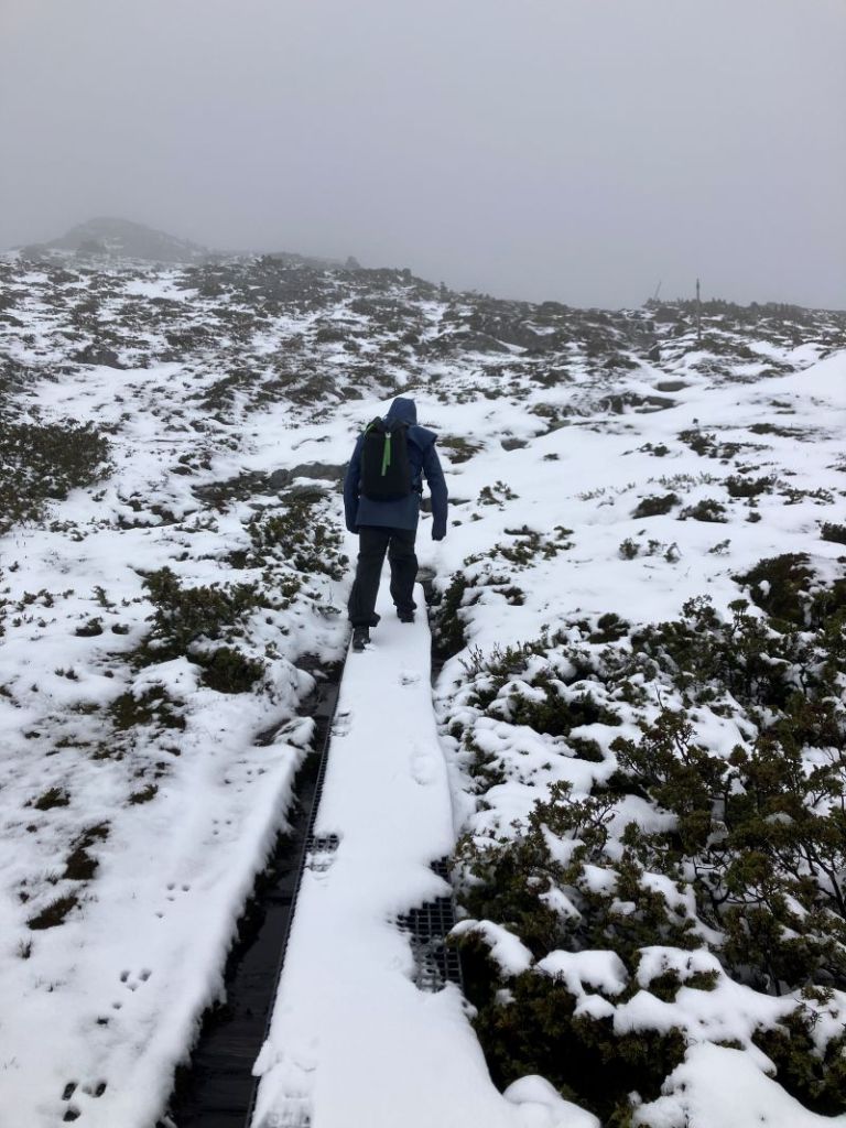
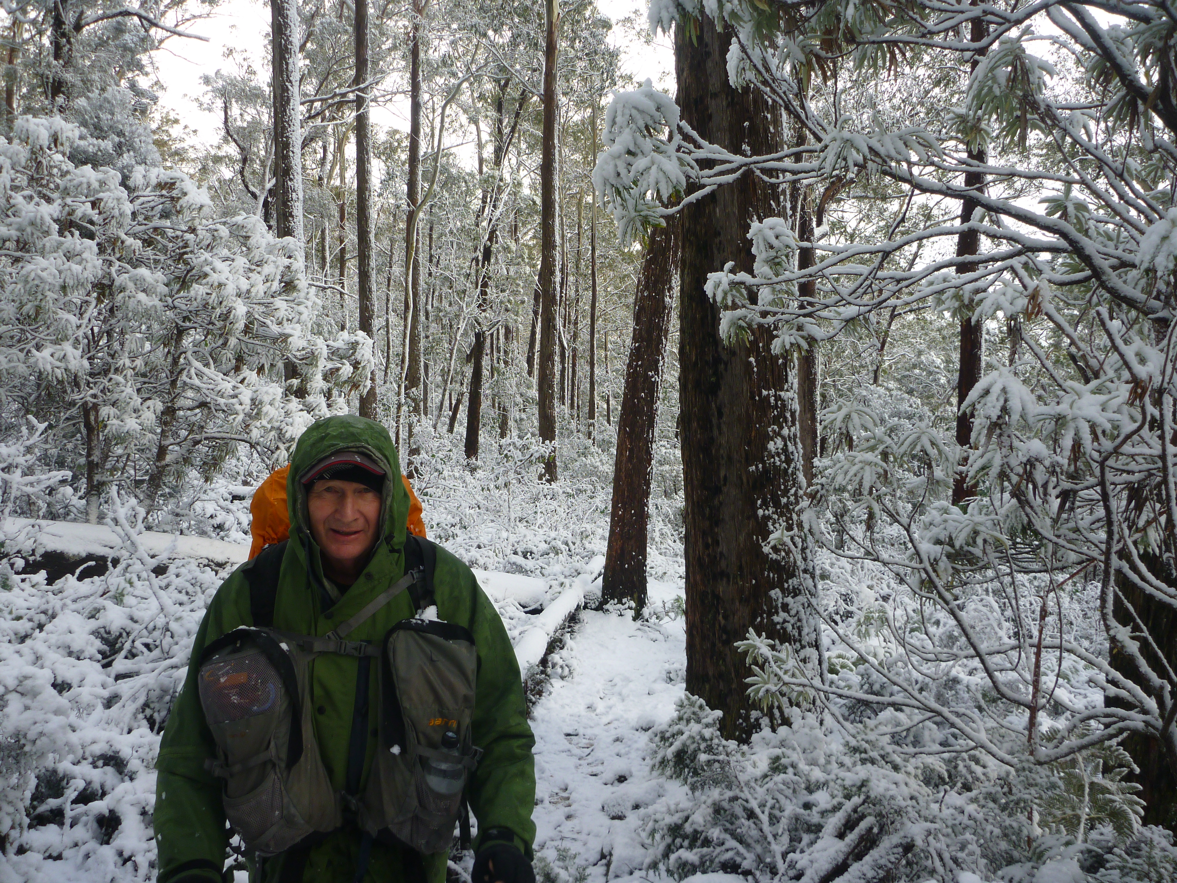
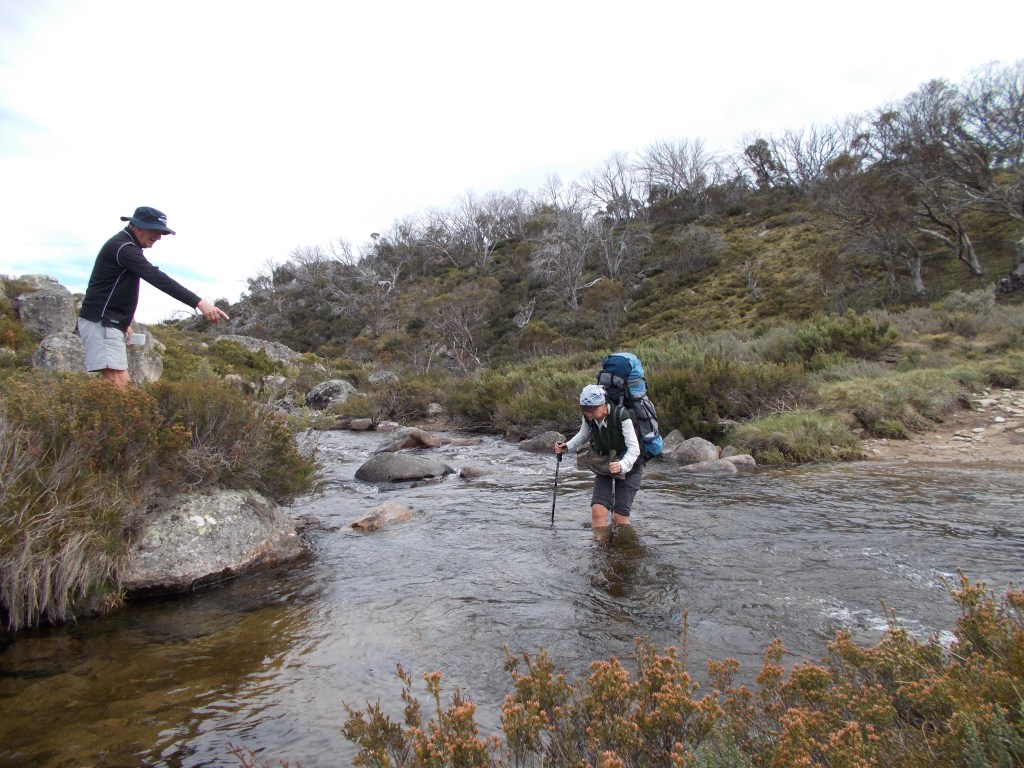
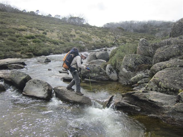
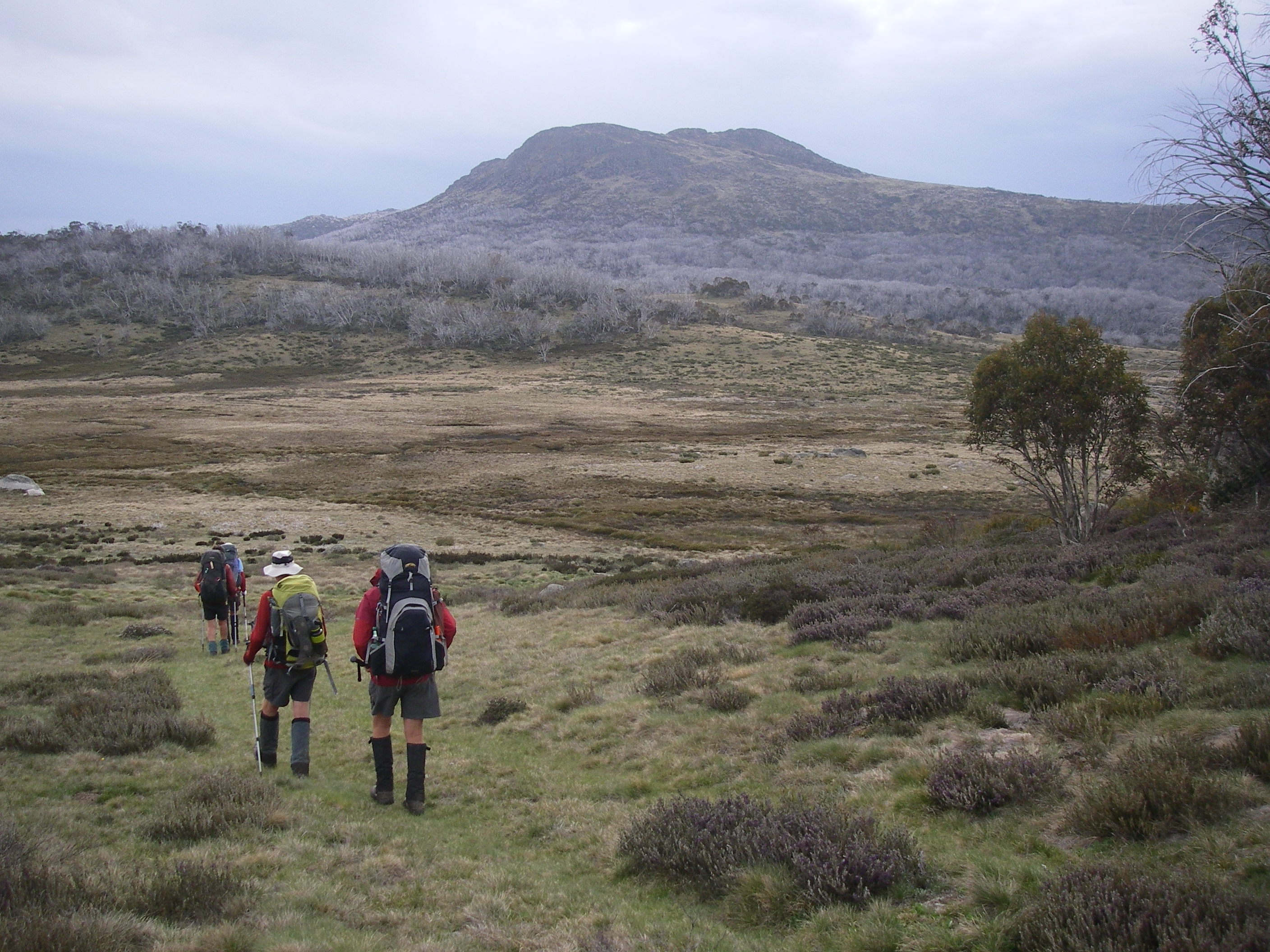
With the mist lifting, Richard loped off, at a disconcertingly eager pace after our lethargic day of rest. The morning’s walk took us up the four kilometre Thredbo River tourist track to Dead Horse Gap, the trail head for the Cascade Trail.From here we would climb the Cascade Trail to the crest of Bob’s Ridge (1800 metres), a major south-west spur of the Great Dividing Range.
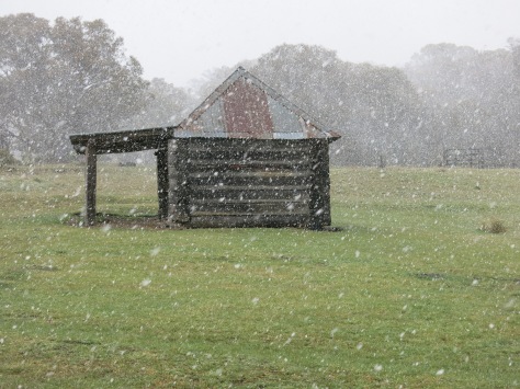
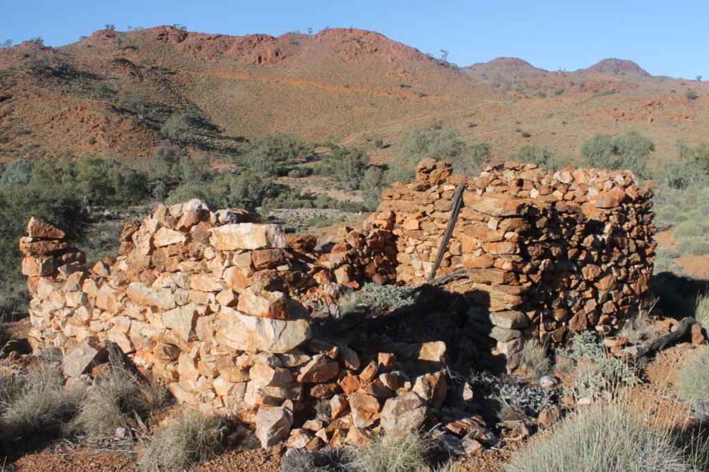
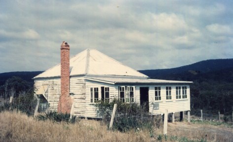
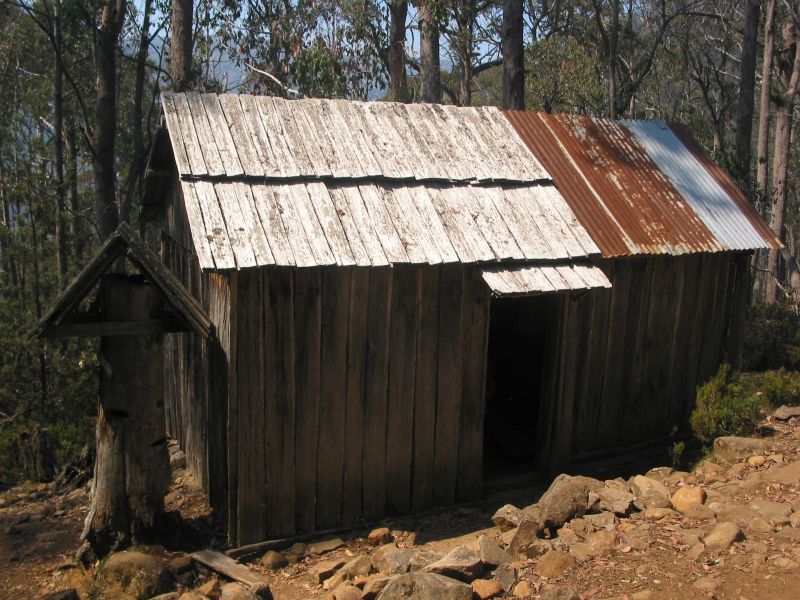
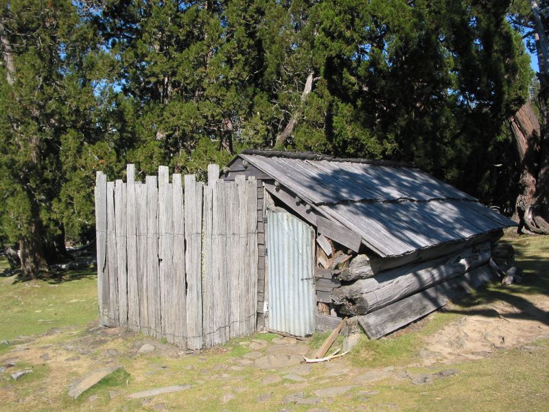
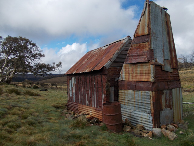
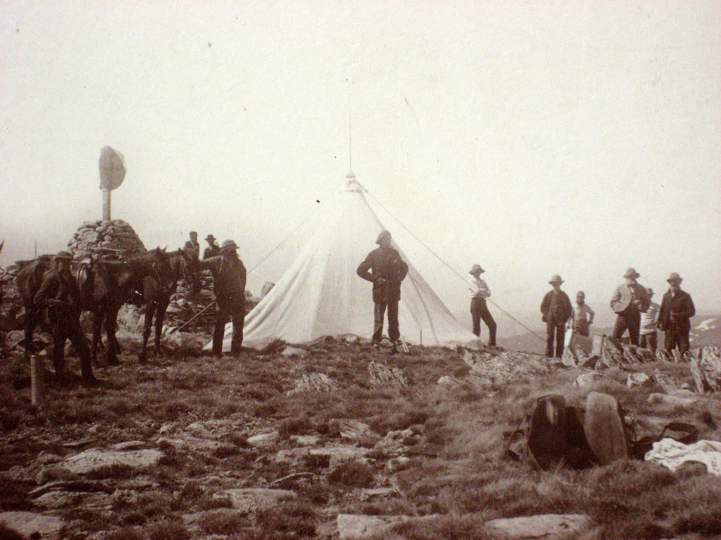
It is said that Dead Horse Gap takes its name from a herd of twenty or so unfortunate brumbies caught out in a blizzard. But today, the gap was merely a tame car park with an info board telling me that this was once the site of the Dead Horse Gap Hut, a summer grazing hut, built in 1932 by the Nankervis family of Tom Groggin Station.
Old Dead Horse Gap Hut
This type of shelter hut, one of nearly 230 built in the Kosciuszko area, was an integral part of the transhumance practice of herding cattle and sheep up to the high summer pastures or snow leases as they were called. Other huts were built by miners and the Snowy Mountains Authority. But, as with many high country shelters, Dead Horse was lost to fire.
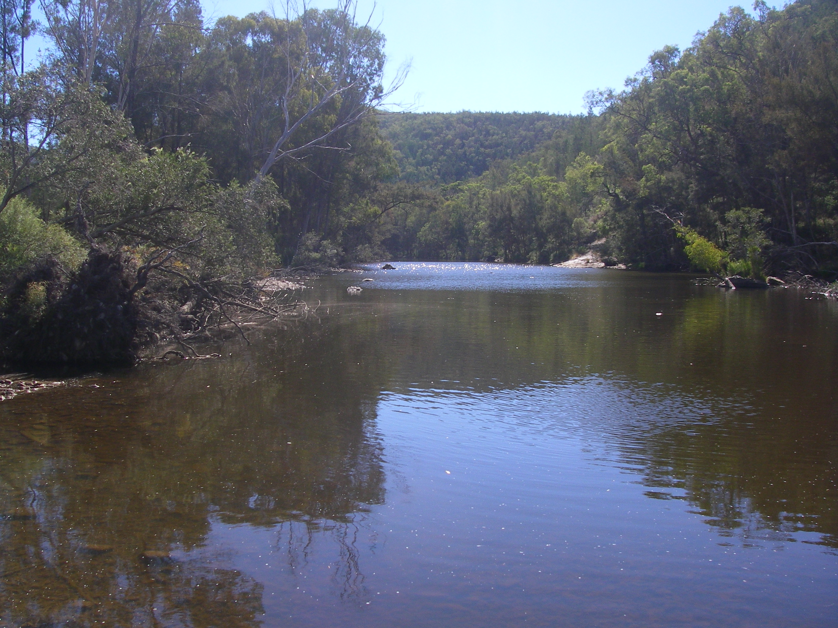
From Dead Horse Gap we engaged granny-gear for the five and a half kilometre drag up to the crest of Bobs Ridge at 1800 metres. Some 300 metres of altitude gain. The Murray River system to our right, the Thredbo- Snowy River to our left.
Thredbo River valley with Cascade Track contouring up Bobs Ridge
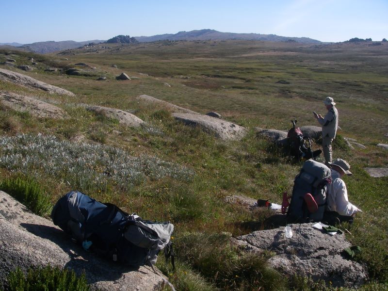
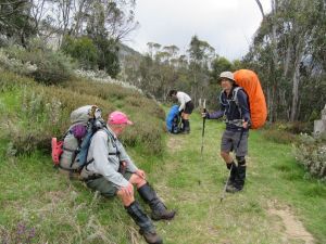
Here we settled into one of those outstanding lunch spots that leaders rave about, but rarely provide.
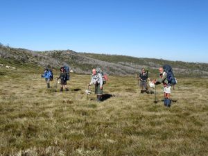
The lads loafed under the shade of gnarly old snow gums. Their bottoms comfortably settled on snow gum branches or sprawled out on the ground, padded by springy tuffs of snow grass. Best of all, none of those swarms of mini black alpine ants, the bane, one of several, of bushwalking in the high country.
Lunch break on Bobs Ridge
The Brumby Saga
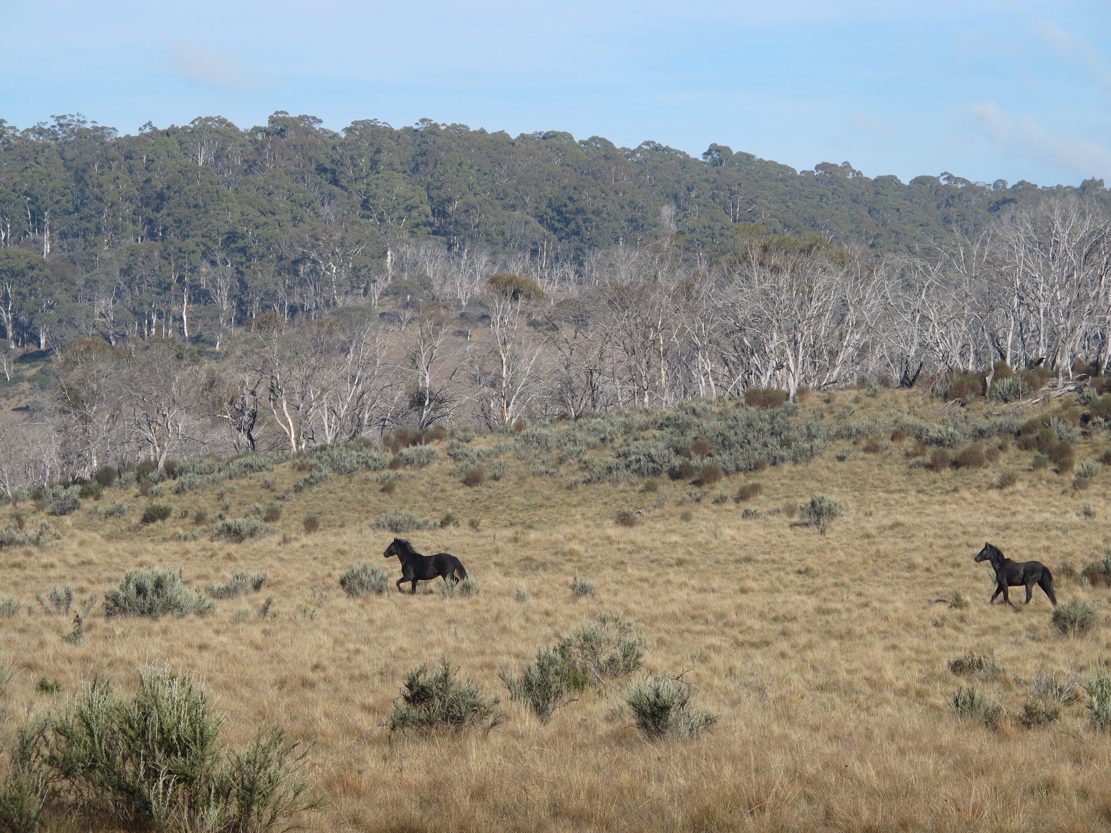
But these alpine woodlands are swarming with something on a grander scale… wild horses, brumbies, feral horses. Choose your side in the culture wars over brumbies in Australia’s high country.
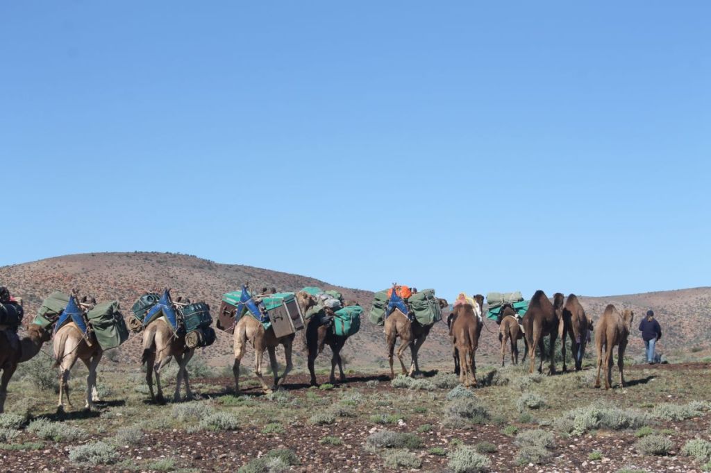
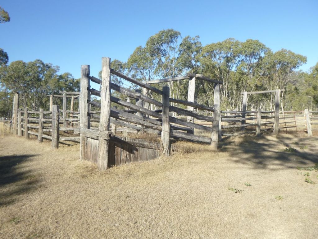
We discovered a set of portable stockyards behind our lunch site and our progress up Bobs Ridge had been marked by pyramids of horse poo of such grandeur they would do pharaoh Rameses II proud.
Brumby traps
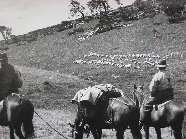
We were, of course, in the setting for Elyne Mitchell’s much loved Silver Brumby stories. The presence of brumbies in Australia’s national parks is a divisive issue.
In other states they have been culled without much of a hue and cry from horse lovers. But in the high country of New South Wales and Victoria, a different mentality prevails. Here brumbies are cultural icons, Man from the Snowy River stuff.
Notwithstanding the damage wild horses do to alpine ecosystems, in parts of Kosciuszko National Park they seem free to roam pretty much unfettered. Their hooves trashing delicate alpine bogs and watercourses. As well, the brumbies selectively chomp out the tastier plant morsels.
No one likes to see horses killed, but the sad reality is that rehoming is not reducing the numbers of horses in Kosciuszko National Park fast enough to reduce population growth.
In 2023 the Australian Government’s Threatened Species Scientific Committee warned that feral horses could be a crucial factor in the final extinction of six critically endangered animals and two critically endangered plants.
Culling of feral horses started again in October 2023, with over 5,539 killed by aerial shooting. Another 427 were removed by trapping, rehoming and ground shooting. This is the first time that more horses were removed than their annual population growth.
Their days appear to be numbered.Under NSW legislation, the government must reduce the number of feral horses in Kosciuszko to 3000 by 2027. Still too many.
Pugging caused by brumbies
The best summary of the brumby issue that I have read is Anthony Sharwood’s The Brumby Wars (2021, Hachette). This is a book about Australia’s brumbies and the intense culture wars that have erupted about their removal from Kosciuszko National Park. Highly recommended.
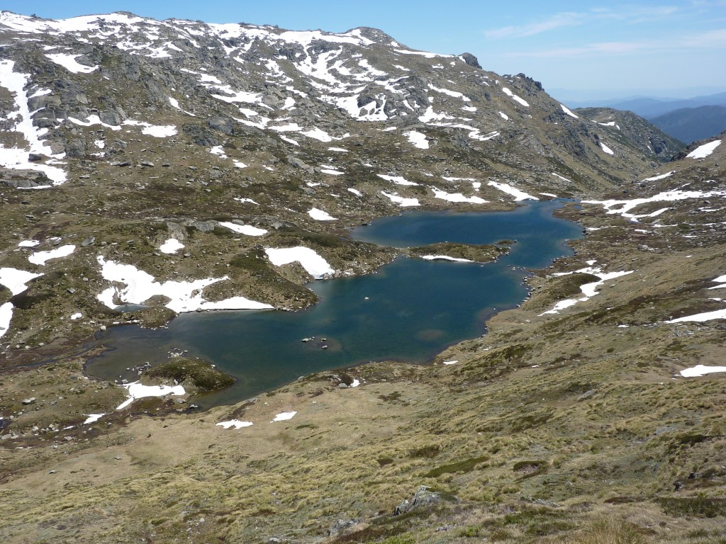
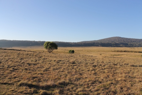
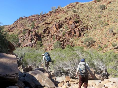
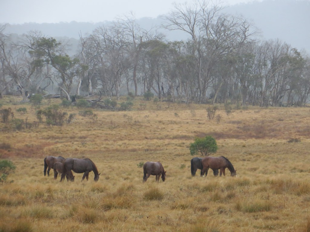
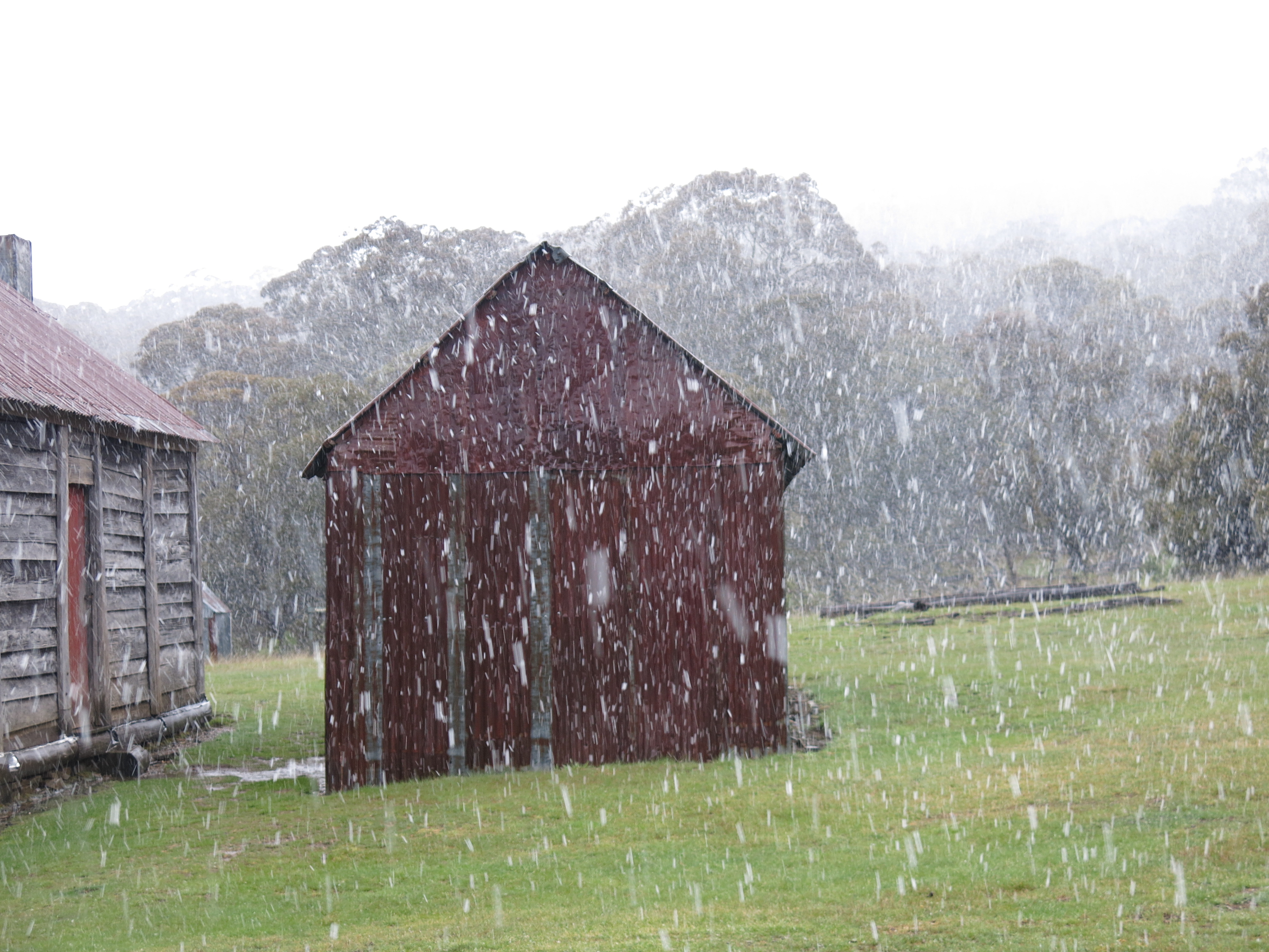
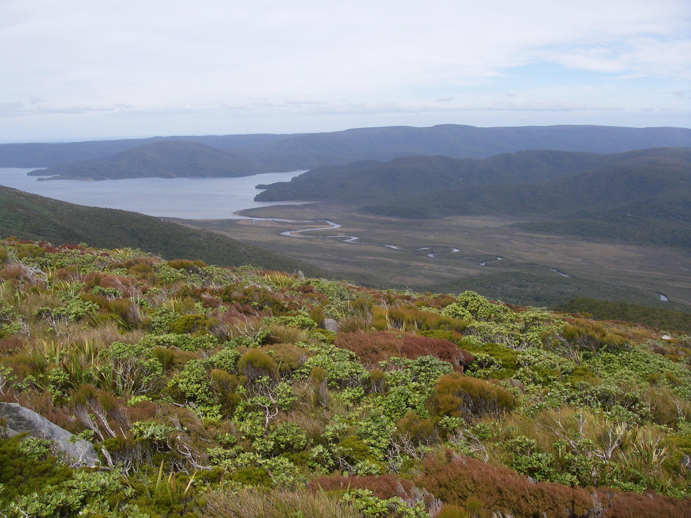
From Bob’s Ridge we descended into the open Cascade Valley, currently hosting five brumbies chowing on their favourite alpine herbs and grasses. Clearly unfazed by the five plodders wandering past.
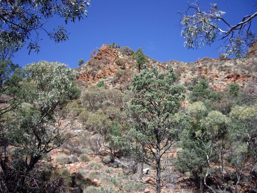
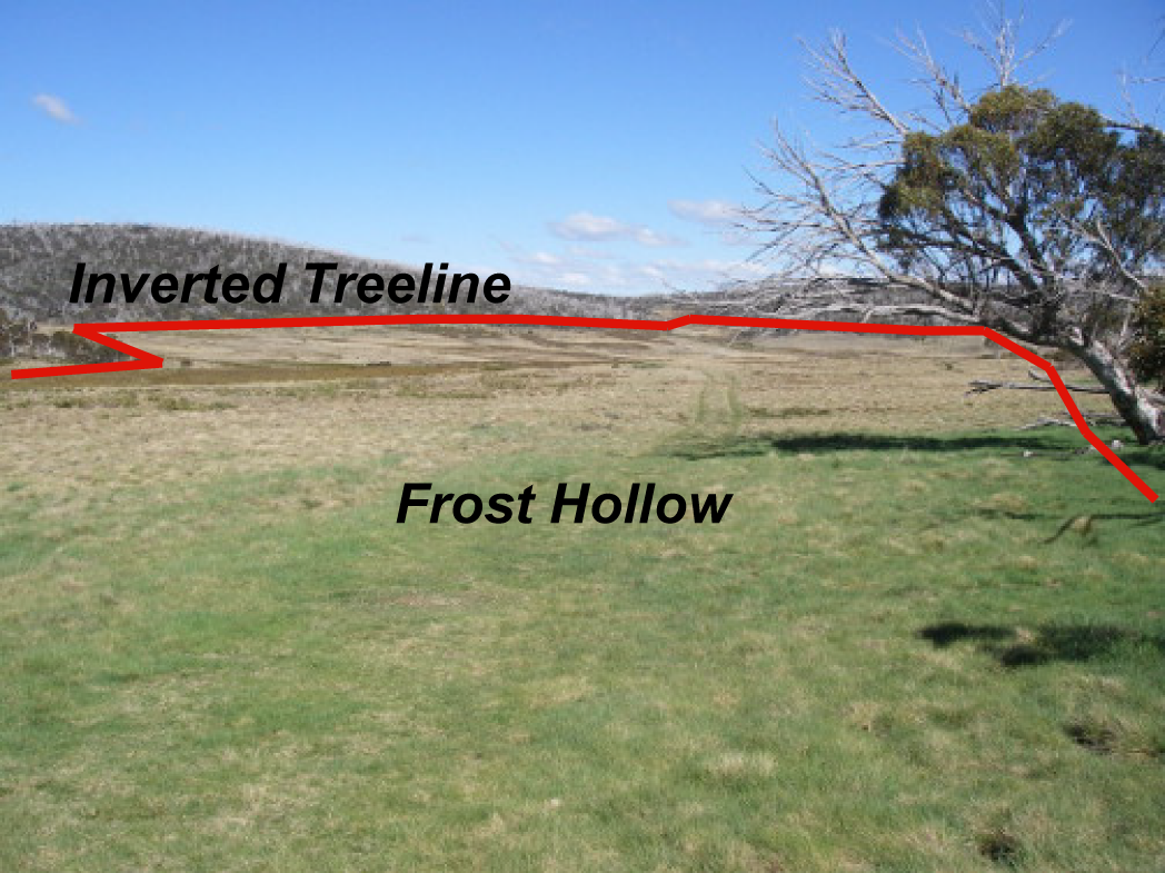
These open grassy alpine valleys are below the tree line at 1800 metres and you would expect them to be covered by snow gum woodland. Instead they are devoid of trees. A response to dense, freezing air rolling off the high tops and pooling in the lowest points of intervening valleys.Even snow gum seedlings cannot survive in these frost-hollows with their extreme swings of diurnal temperatures.
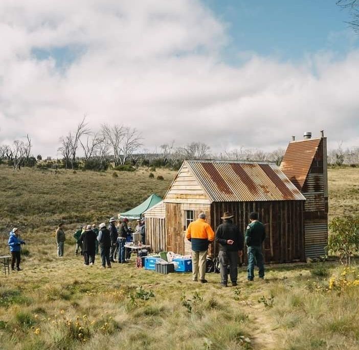
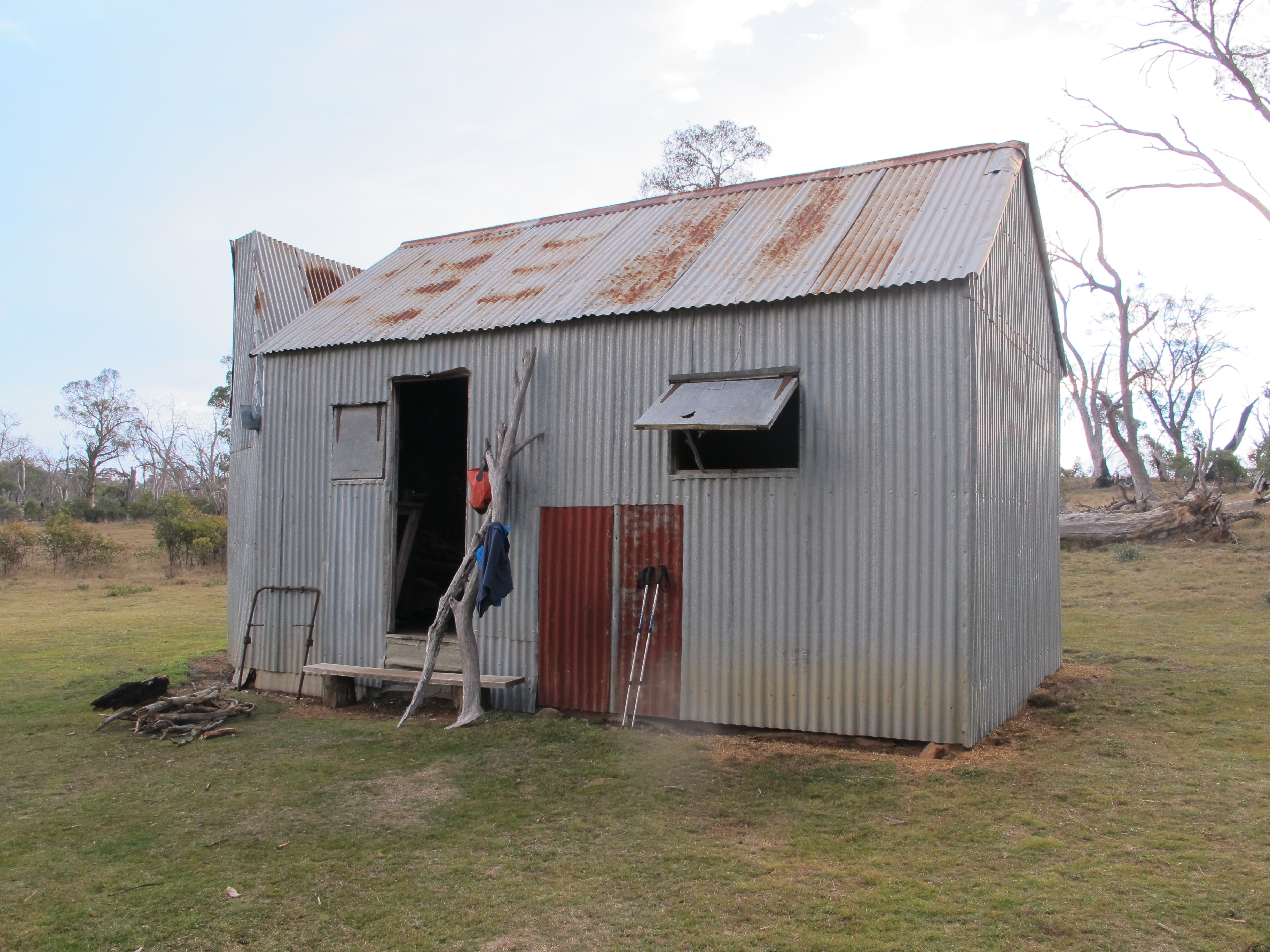
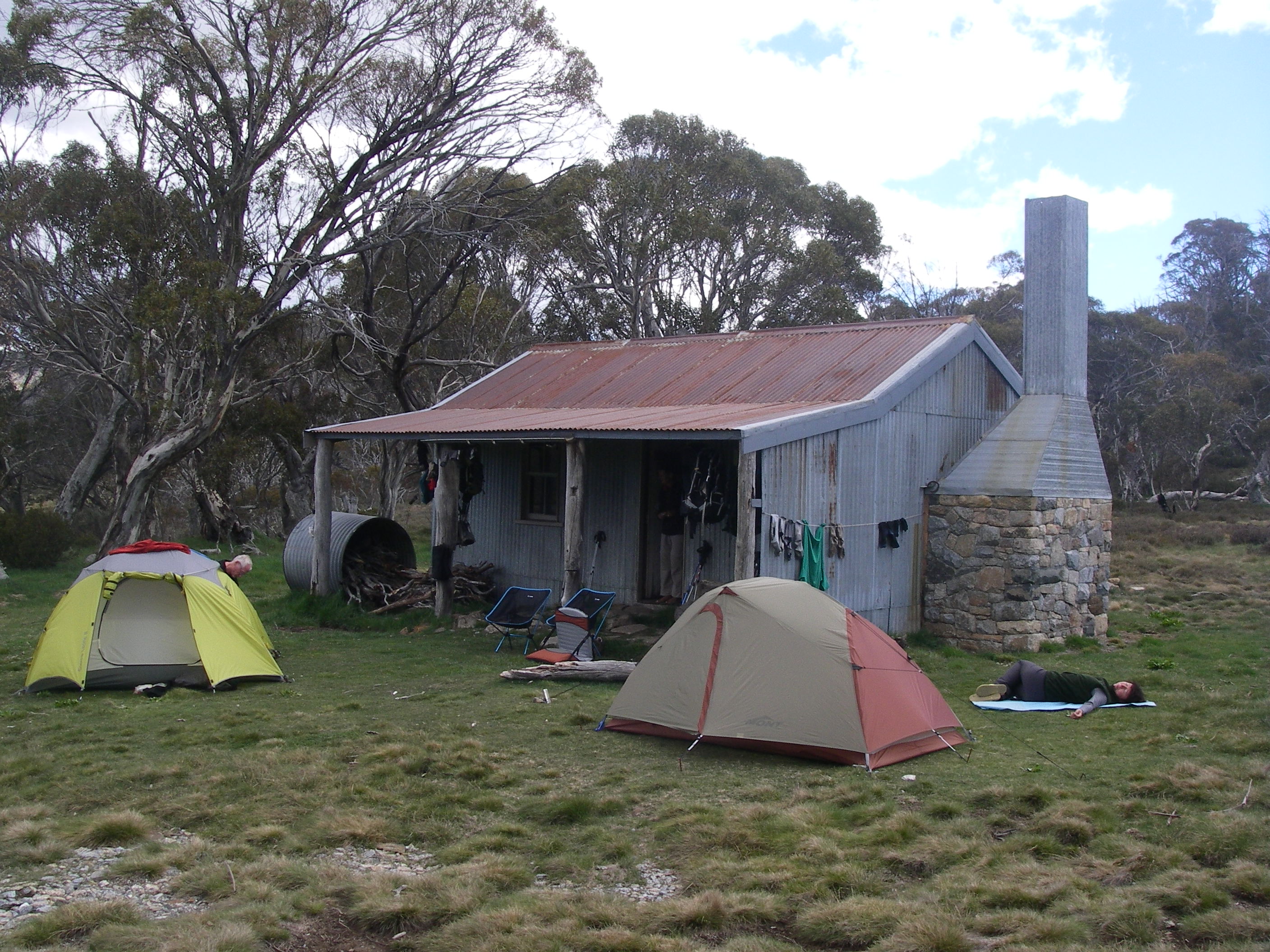
Cascade Hut
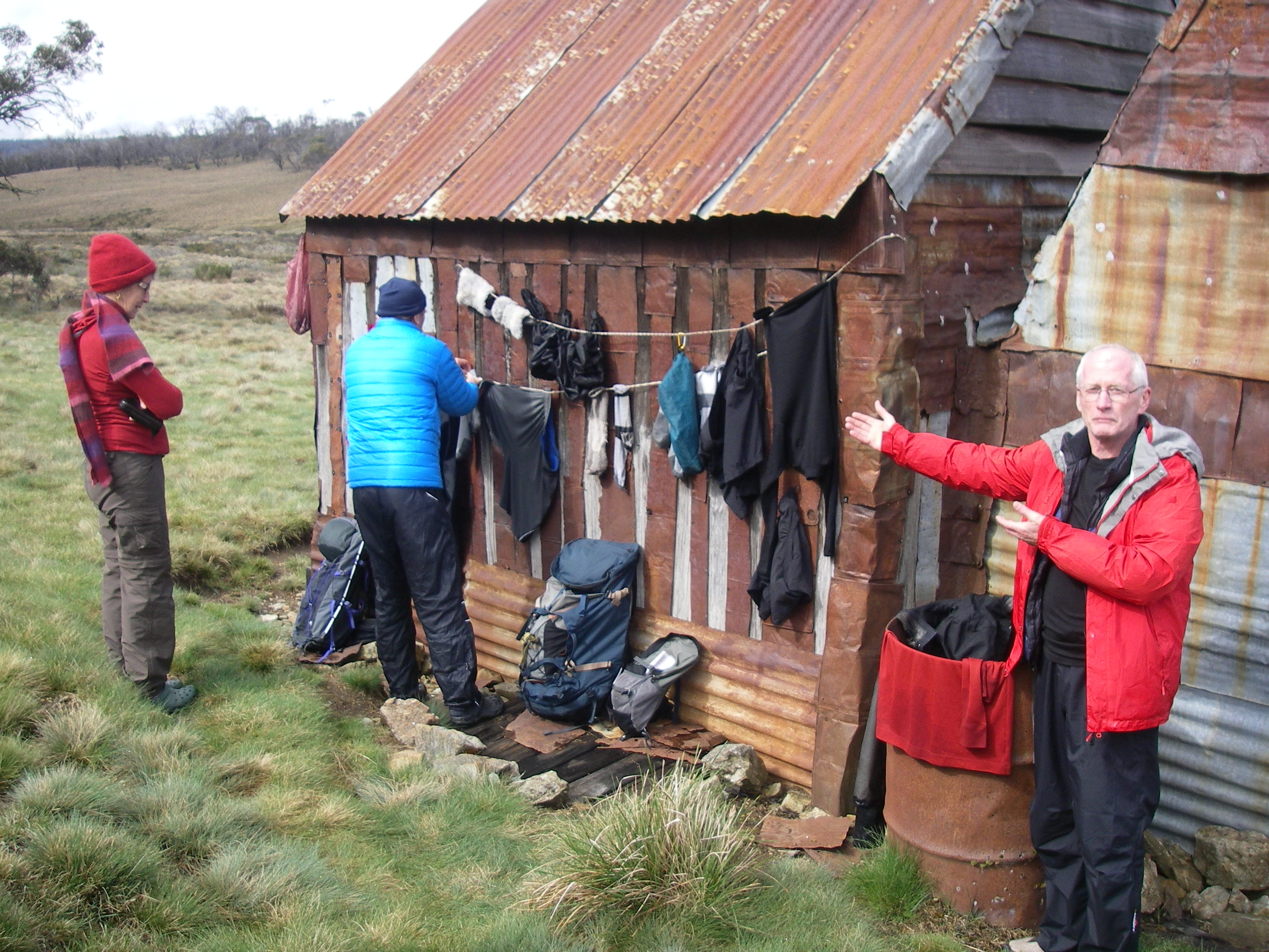
Cascade Hut, on the slopes of a ridge, is nestled in a grove of snow gums It is an old friend, a bushwalker’s and skier’s home away from home. The Nankervis family owned the snow lease at Cascades and had the hut built in 1935 with horizontal slabs and a bark roof.
Cascade Hut
The bark was later replaced by a corrugated iron roof. On one of our visits a reno job of a sheet of wildly flapping clear polycarbonate sheeting did nothing for its heritage value. This has since been rectified. The old hitching rail still stands, but these days serves only to prop up ever increasing numbers of mountain bikes.
Inside is a stone fireplace, dri-creted dirt floor, table, sleeping platform lurking under which, according to an old log book, is said to be a resident snake. This, undoubtedly, a rumour spread by its caretakers, the Illawarra Alpine Club, to deter those new-age mountain biking people and bushwalking riff-raff from sleeping in the hut.
The Illawarra Alpine Club have been Caretakers for Cascade, Tin Mines and Teddys Hut for over 40 years. A sterling effort and a job well done in maintaining these basic mountain shelters for the safety of bushwalkers, mountain bikers and skiers alike.
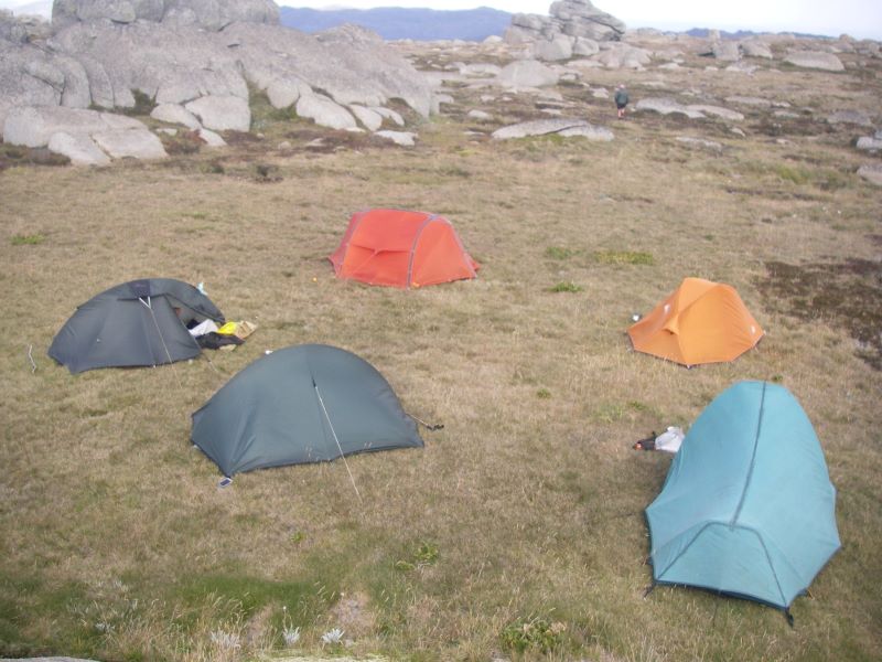
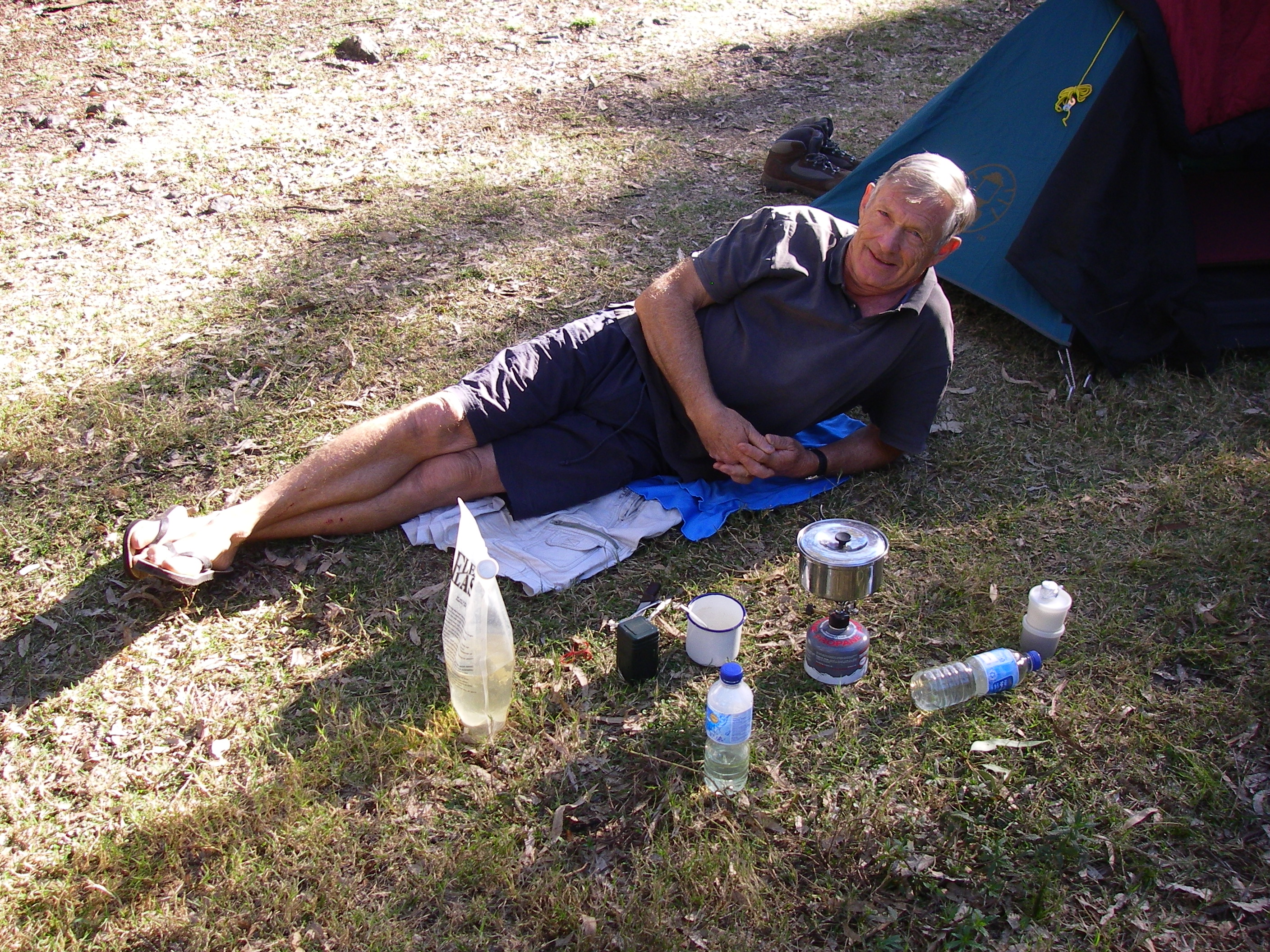
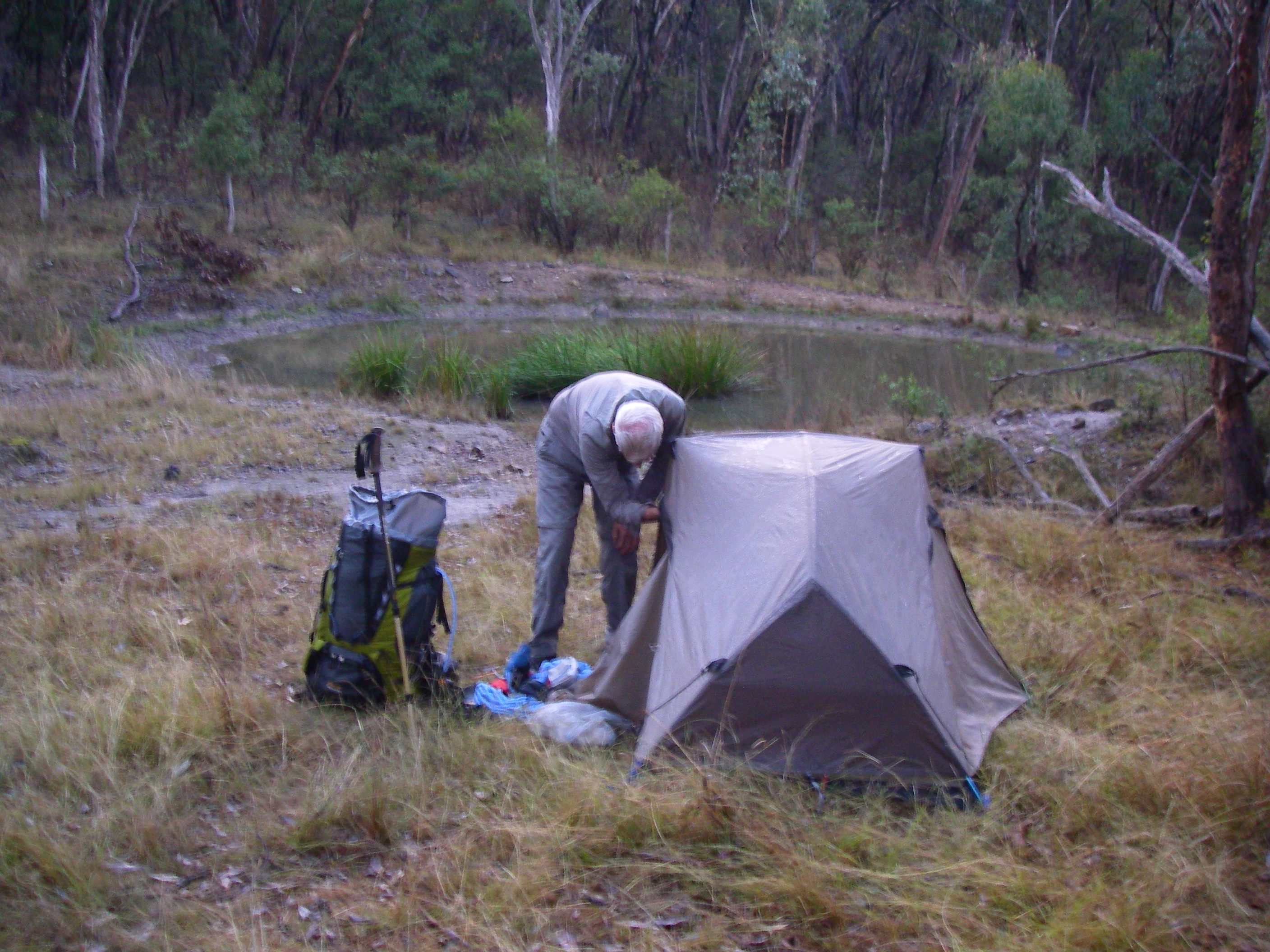
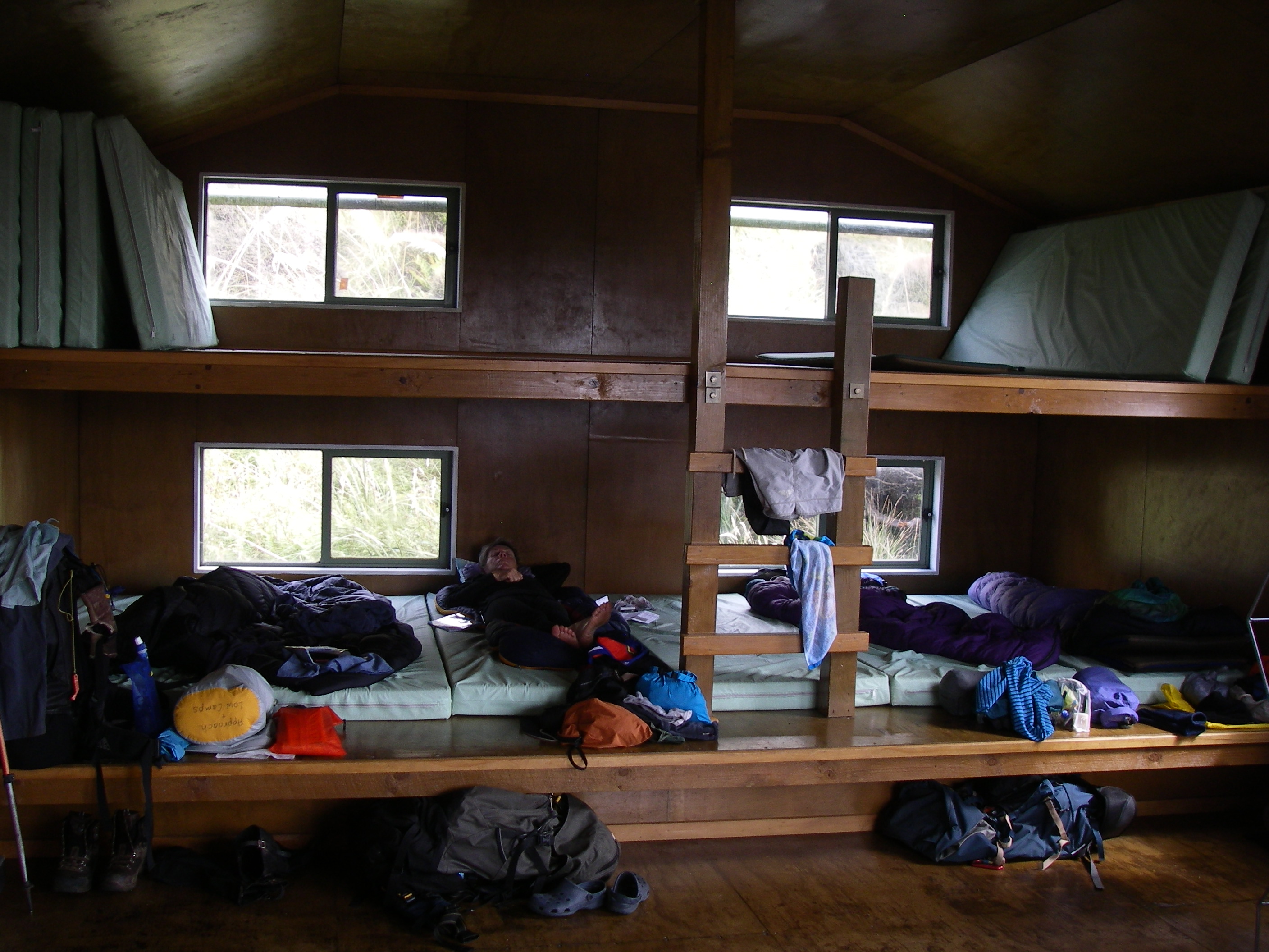
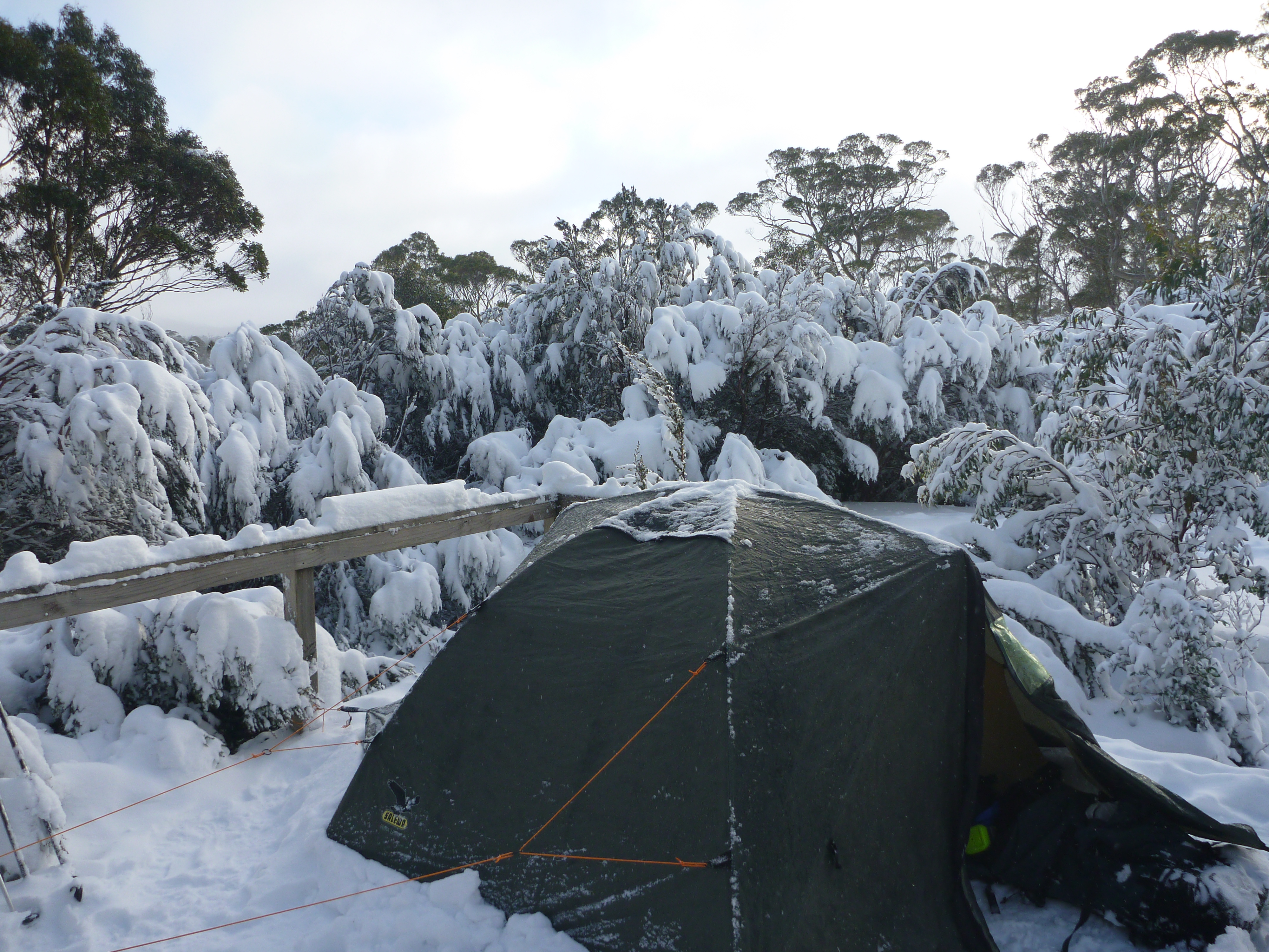
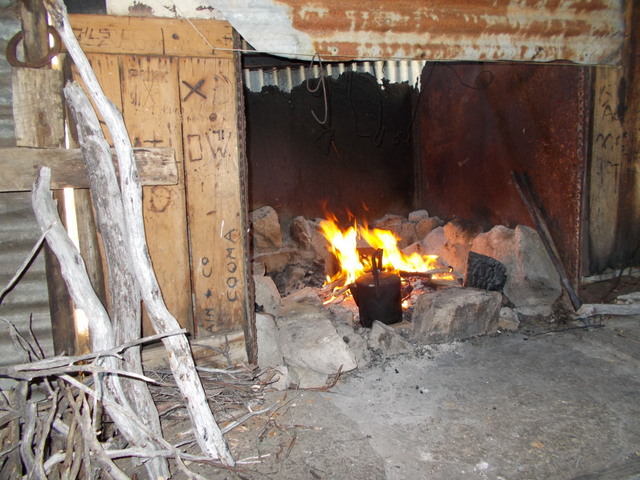
Unperturbed by the resident snake, we settled in anyway. First order of business, the peons spread out to collect water and fetch the firewood. Brian sawed the logs into useful sized billets. Just so. His favourite camp thing to do. Joe was tasked with lighting the fire. Finally, tents sprang up on the springy snow grass.
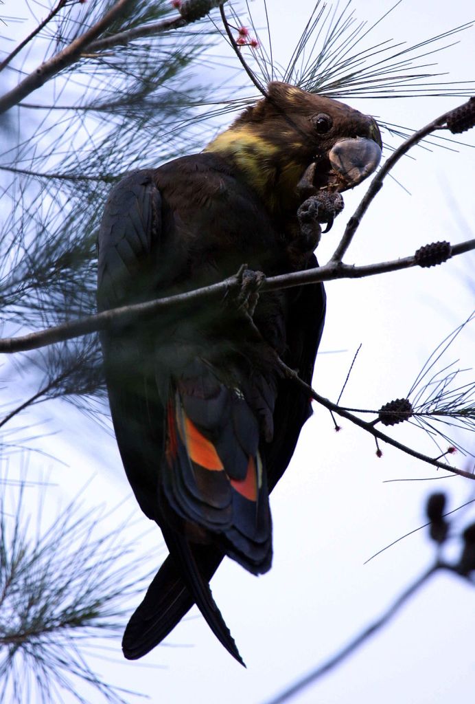
On dusk, five Gang-gang Cockatoos trailed above us, slow powerful wing beats. Impossible to mis-identify these distinctive dark grey cockatoos, the males sporting red heads and wispy red crests.
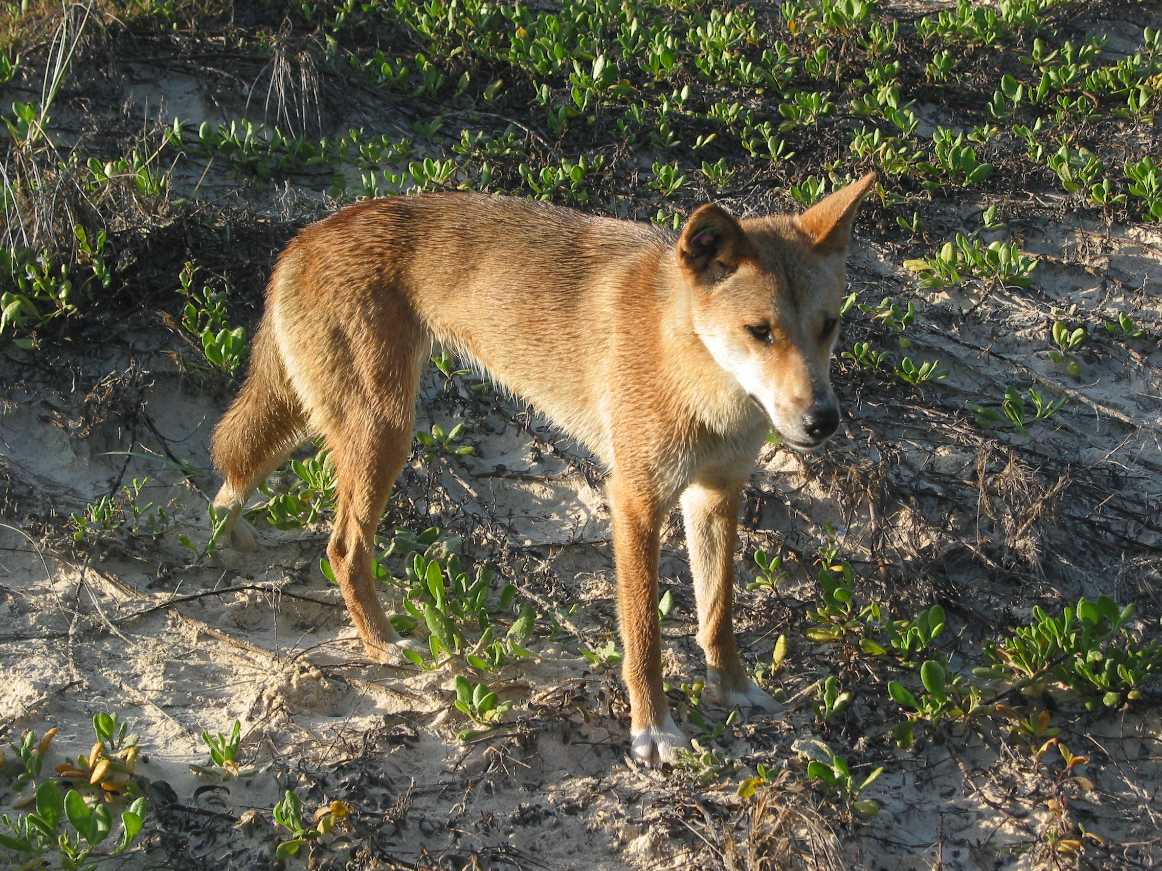
We whiled away the evening reading the log book, including a scary account of a dingo getting close up and too friendly with a solitary walker, not far from Cascade Hut. His advice: walk briskly and carry a bloody big stick.
Tuesday: Cascade Hut to Teddys Hut via The Big Boggy: 15 kms.
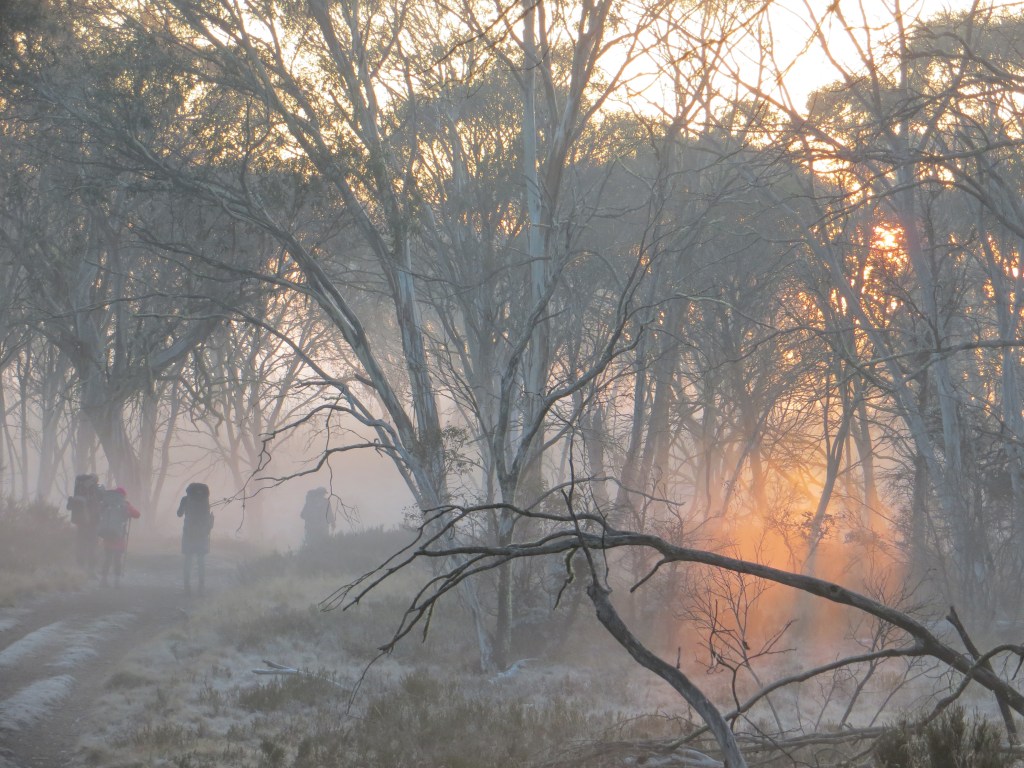
A coolish morning with bushfire haze from the Victorian fires lingering in the valley below. Our Gang-gangs flew back overhead from whence they had roosted.
Brian’s original plan was that we would go cross-country to Teddys Hut via Jerusalem Hill (1810 metres) on the spine of the Great Dividing Range. From Jerusalem, our track would follow the GDR spine north-west for several kilometres to an outcrop at 1806 metres, from which we could drop into the Big Boggy on the upper Thredbo River. But a quick perusal of the thickly wooded hillslopes in front of us and the map’s ortho image disabused us of that option.
Instead we chickened out and retreated up the Cascade Trail to Bobs Ridge. From here, we could swing off the trail and wander over the top of that un-named knoll on the Great Dividing Range (1806 m) and drop into the Thredbo River (formerly the Crackenback) at the Big Boggy (aka Boggy Plain).
The Crackenback River is said to take its name from stockmen who herded their mobs of sheep and cattle up onto the Main Range from the Crackenback (Thredbo) Valley. It was rugged, difficult country and it was said it would ‘crack-your-back’. Another version was that stockmen had to crack their whips across the backs of the stock to get them to the high tops.
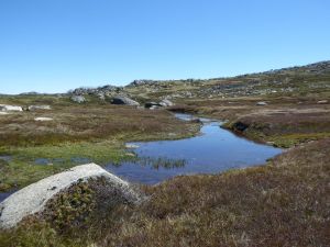
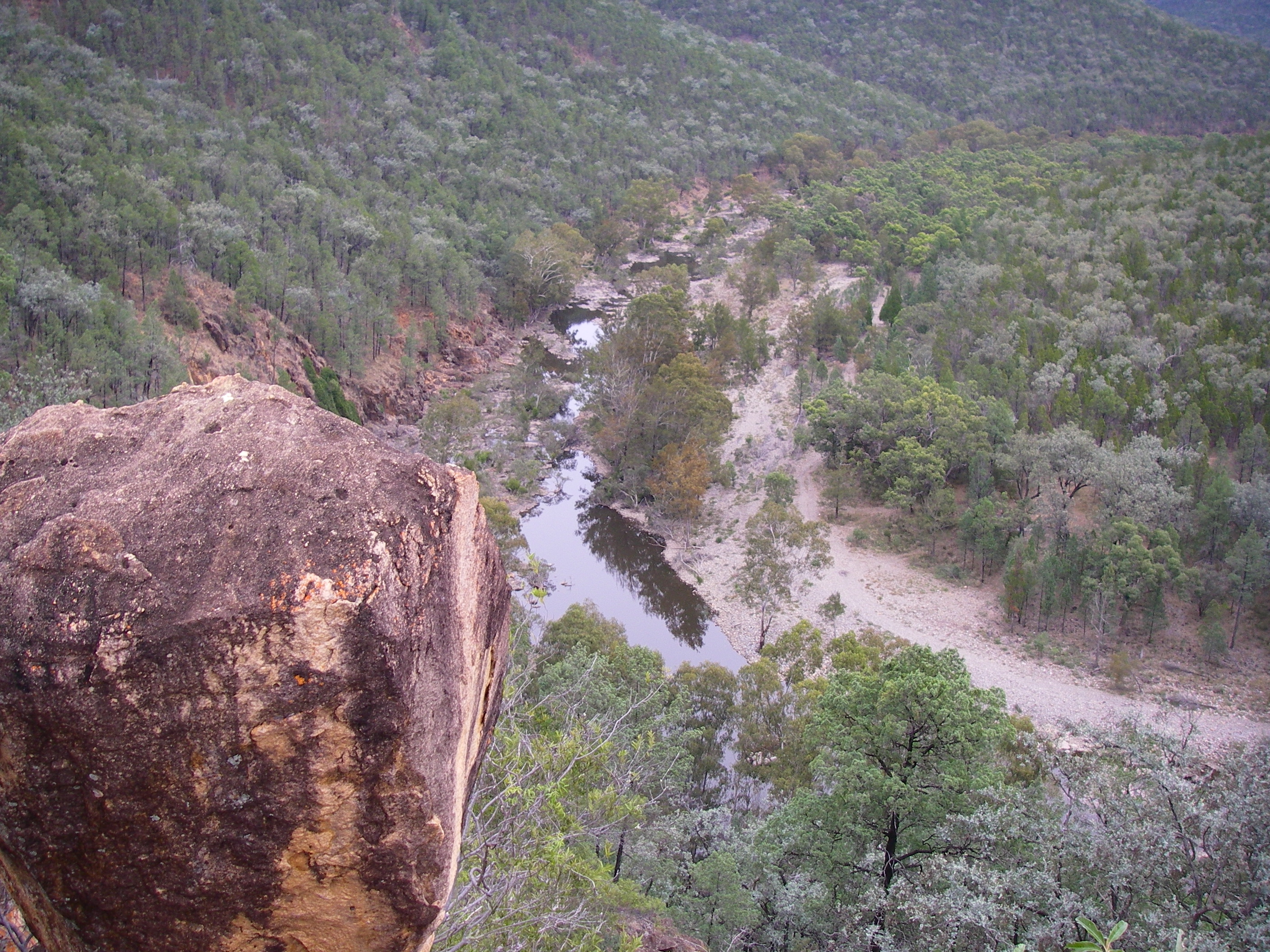
Looking down into The Big Boggy and upper Thredbo River Valley
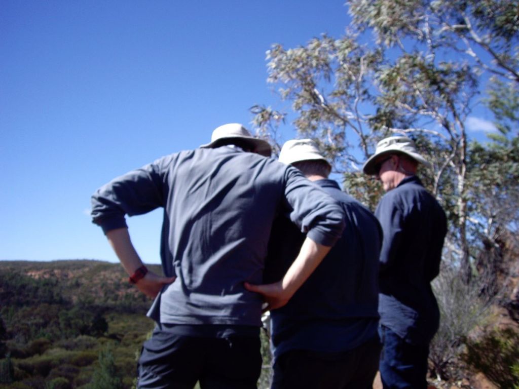
We pulled in for lunch at a clump of snow gums on the crest of the Great Dividing Range, at our prominent un-named hill. Before us were sweeping northerly views across to the Rams Head Range and the Main Range.
Lunch in snow gum woodland above The Big Boggy
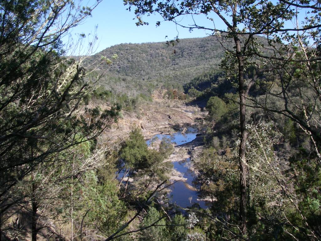
Lunch over, we began a longish bush-bash down to the sodden edge of the Big Boggy. Here we swung east, contouring along the southern edge of the Thredbo River and the Big Boggy.
The plan was to aim for the extensive grassy plain that separates the Thredbo River headwaters from the Wombat Gully-Mowamba River System. Some four kilometres upstream.
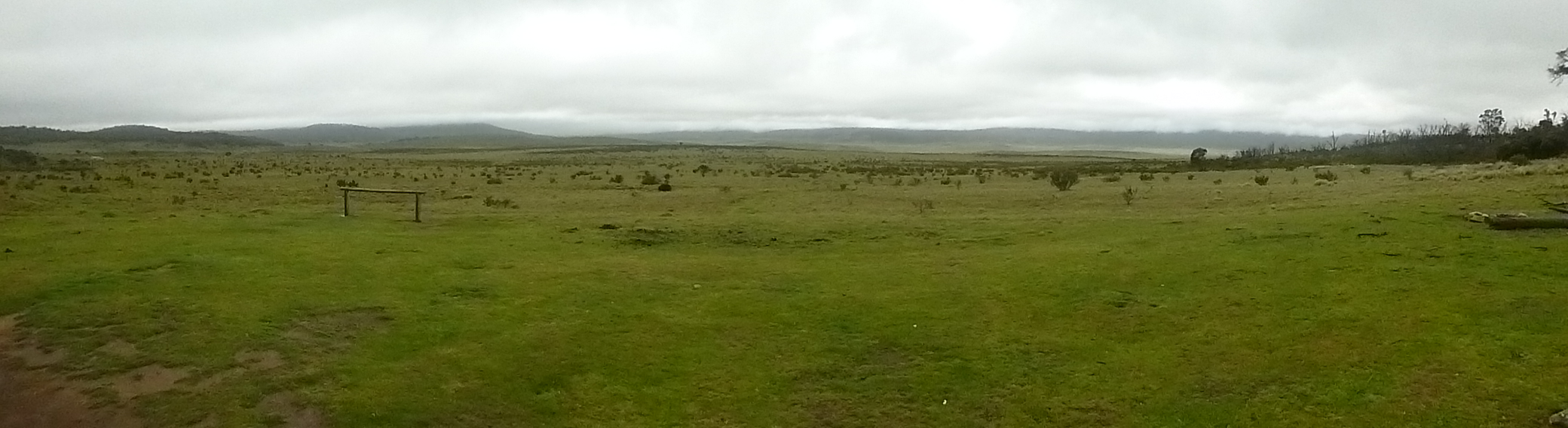
The Big Boggy is a massive alpine wetland and frost hollow which, although outstandingly scenic, made our afternoon’s upstream walk to Teddys a bit damp underfoot and pretty tedious.
Picking our way up The Big Boggy (Boggy Plain)
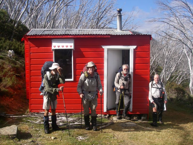
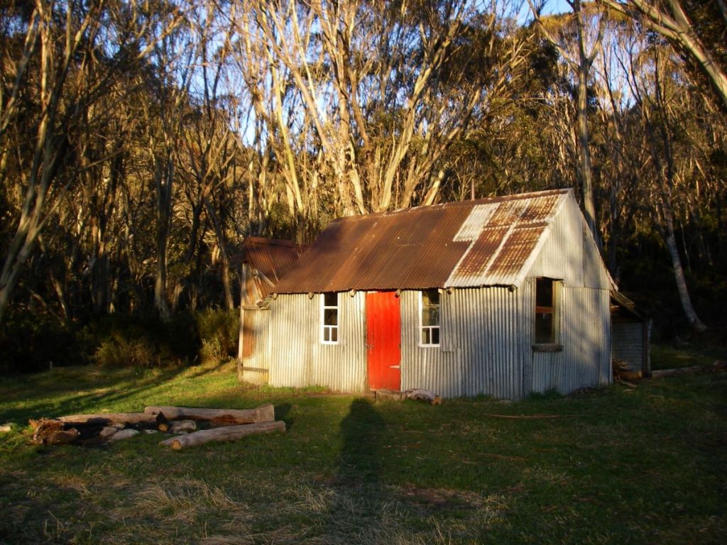
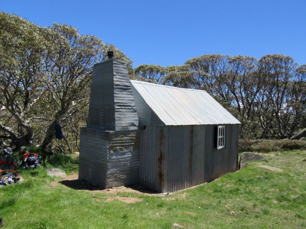
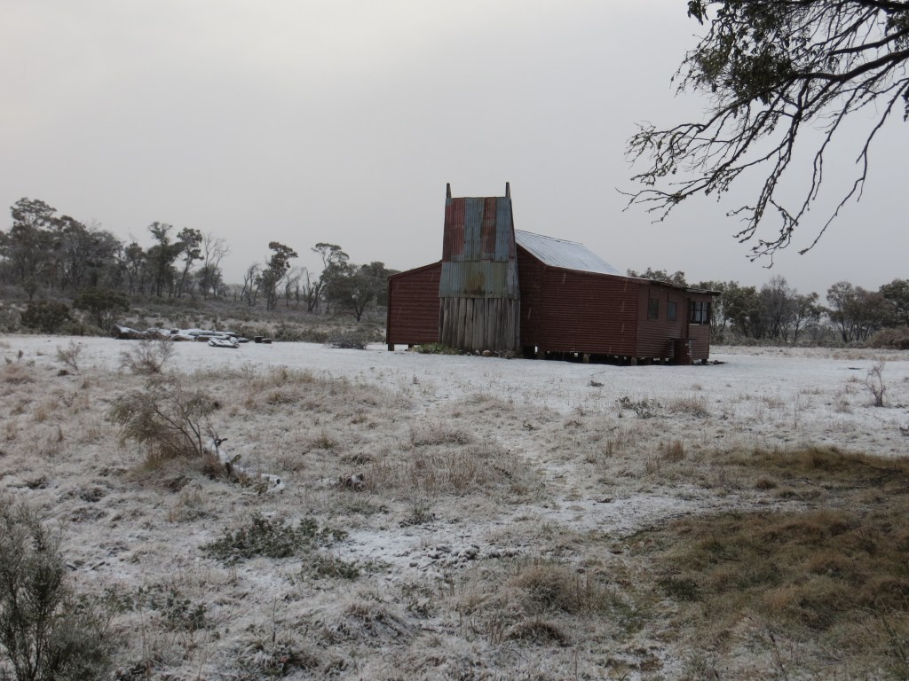
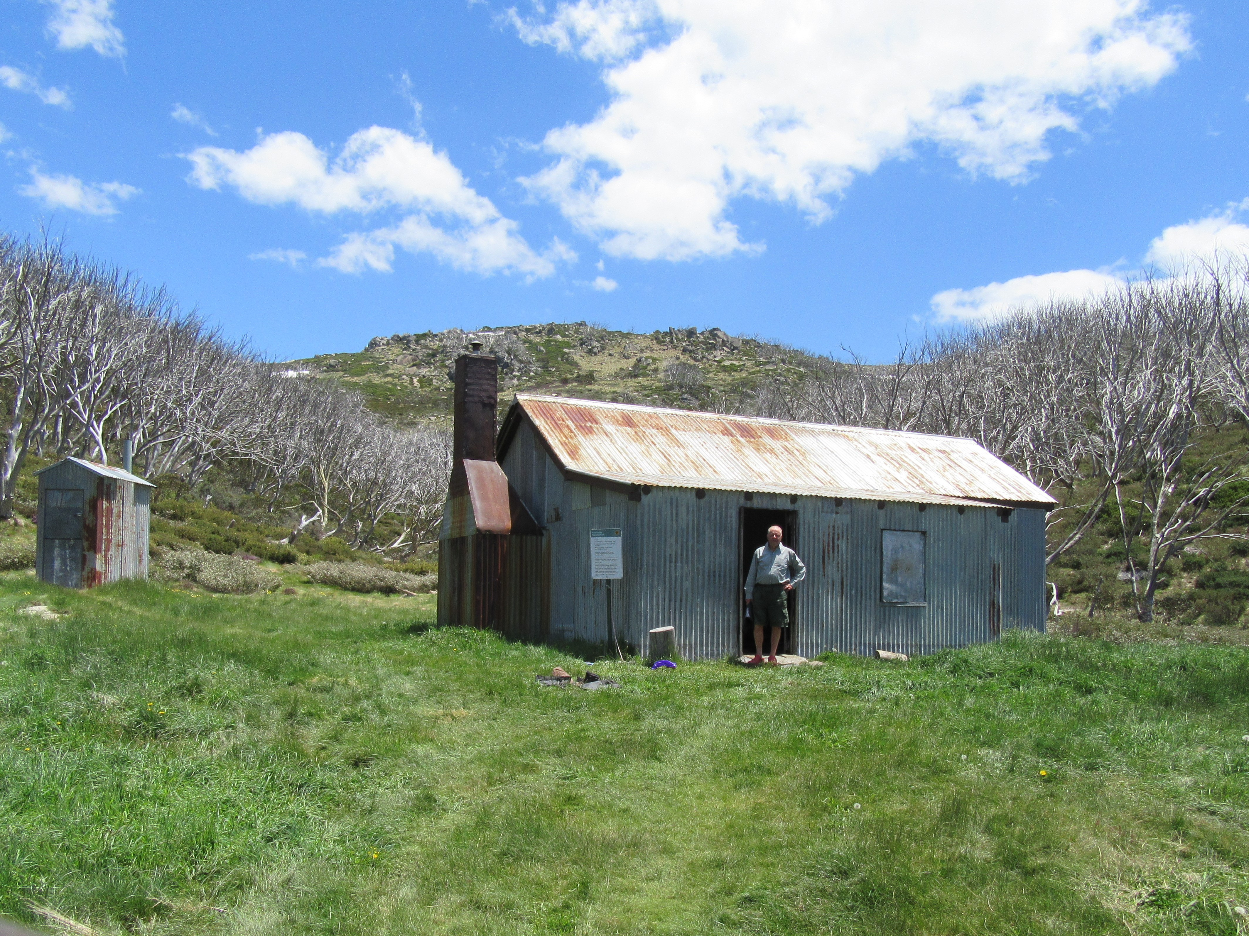
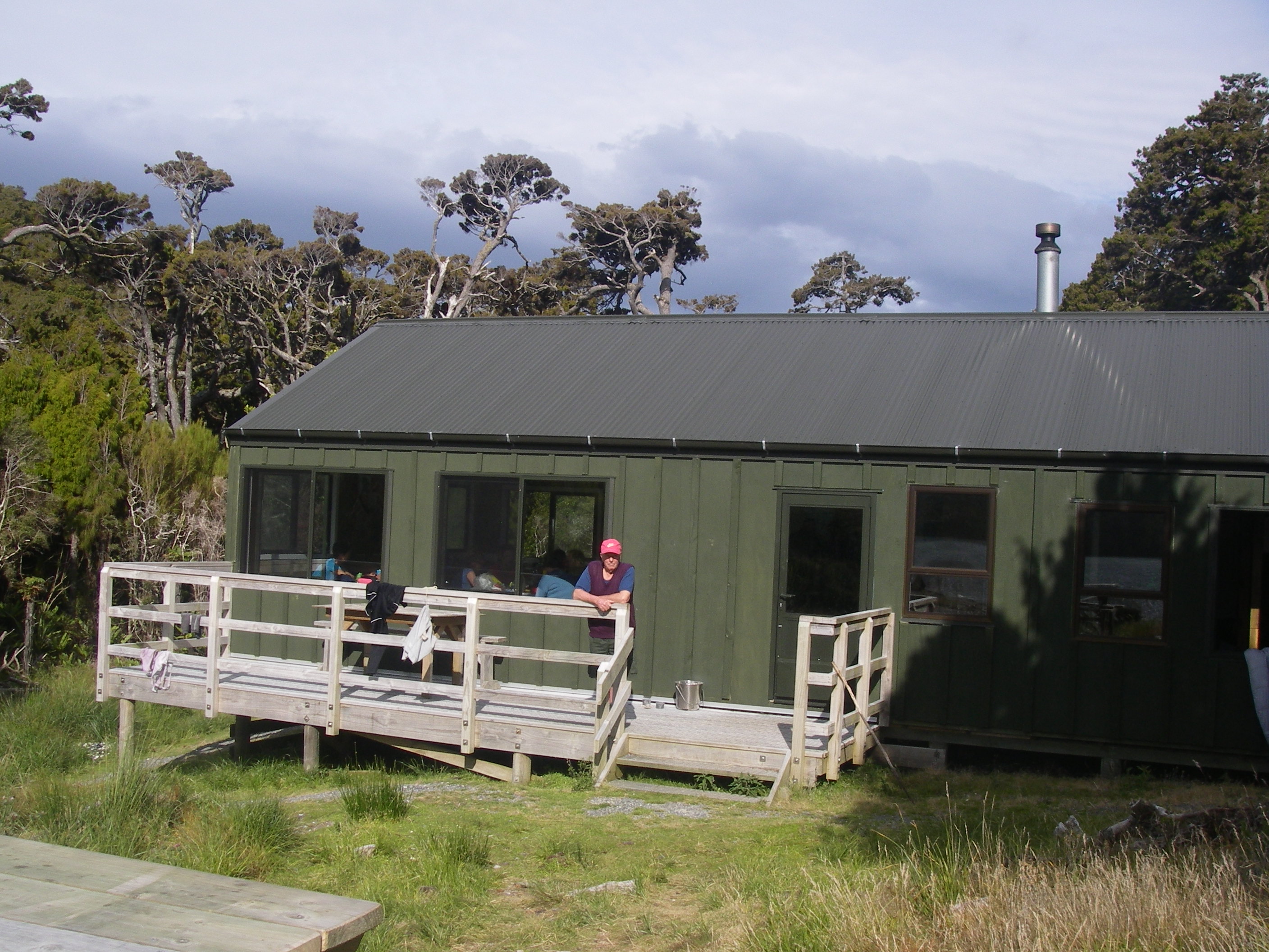
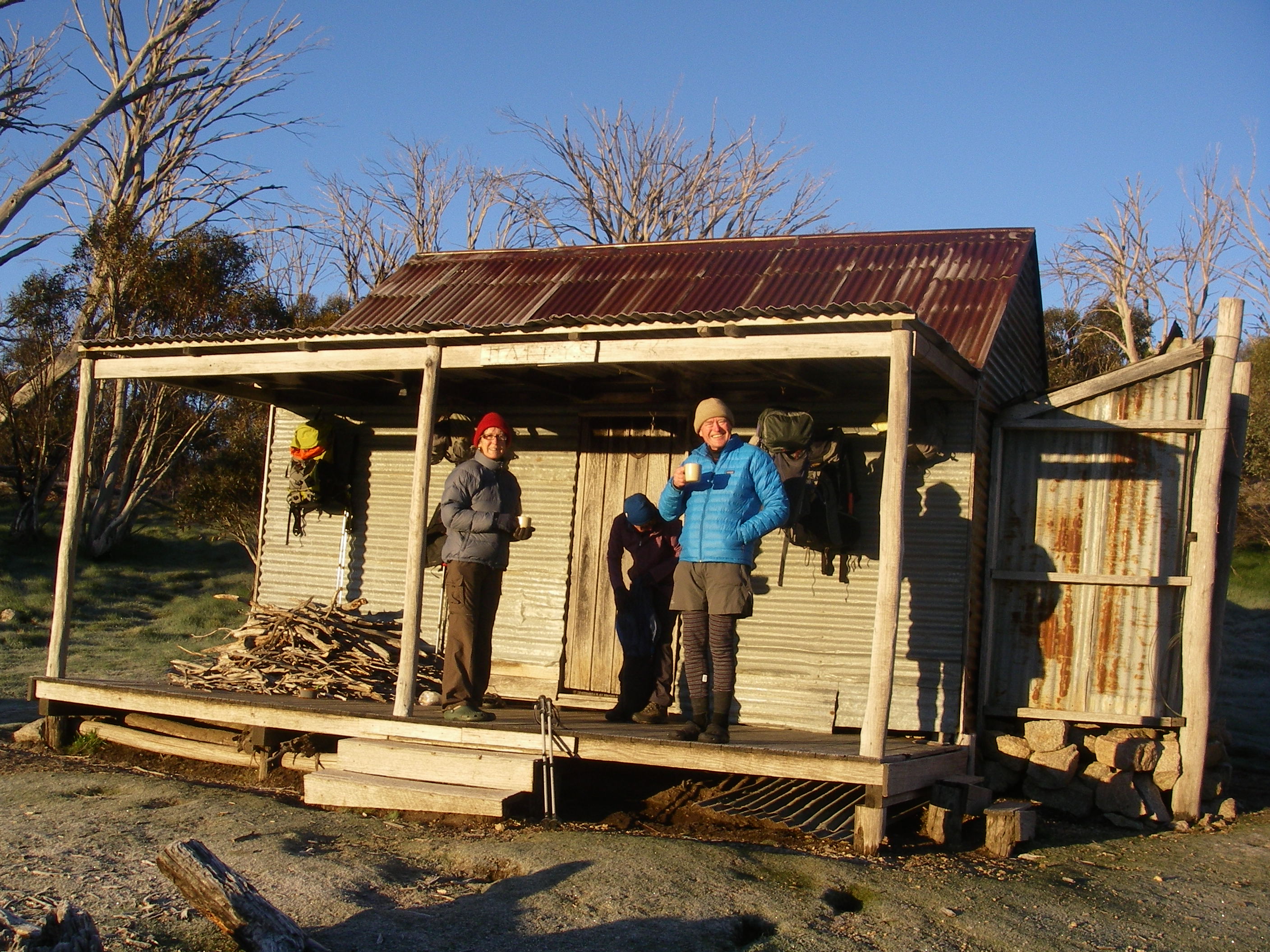
Teddys Hut
Teddys, once called My Horse Hut, served as a cattlemens’ and brumby runners’ hut and was built by Teddy McGufficke and Noel and Dave Prendergast in 1948. Teddys lies at the headwaters of the Thredbo, a tributary of the Snowy River and is the only shelter on this isolated and often snow-bound plateau.
Teddys hut with Mt Leo (1875 m) in background
According to the old timers it was on a sort of brumby motorway and clearly nothing much has changed over the decades. We watched as Serengeti-like herds of brumbies grazed peacefully on the vast snow grass plains in the vicinity of this remote hut.
Wednesday: Day Walk to The Chimneys and Chimneys Ridge: 8 kms.
For once, an easy day. In the overall scheme of Brian’s pantheon of dubious ‘rest days’ this one was brilliant. As we tucked into a leisurely breakfast even a bank of dense, damp fog hanging around Teddys rolled ever so slowly away from us, down the Mowamba River system. A promising omen of a great day’s walking.
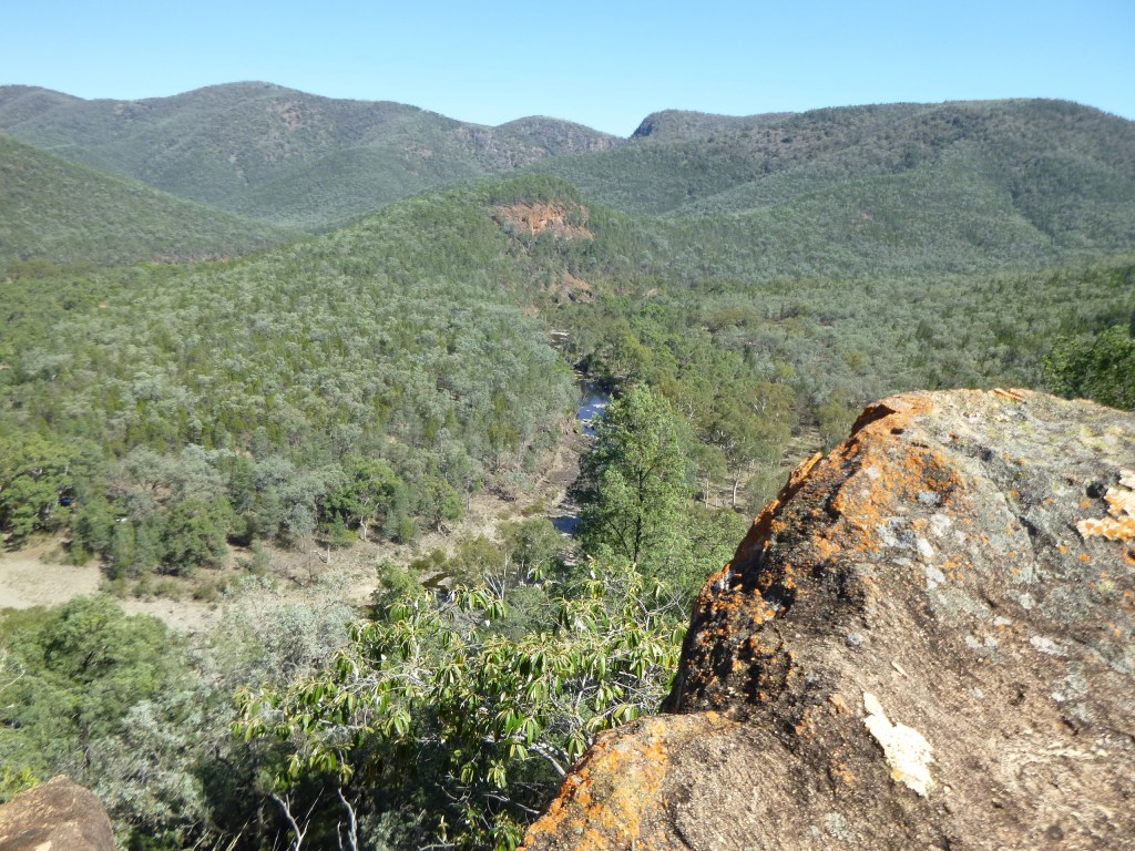
The Chimneys and Chimneys Ridge form the divide between the Thredbo River and the Jacobs River, also a Snowy River tributary.
Crossing alpine meadows of upper Thredbo River heading for The Chimneys
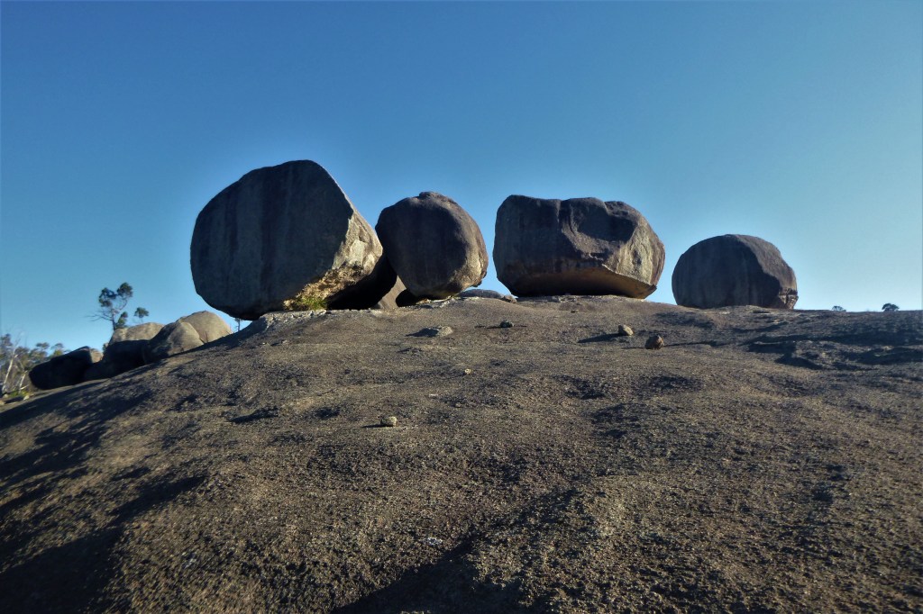
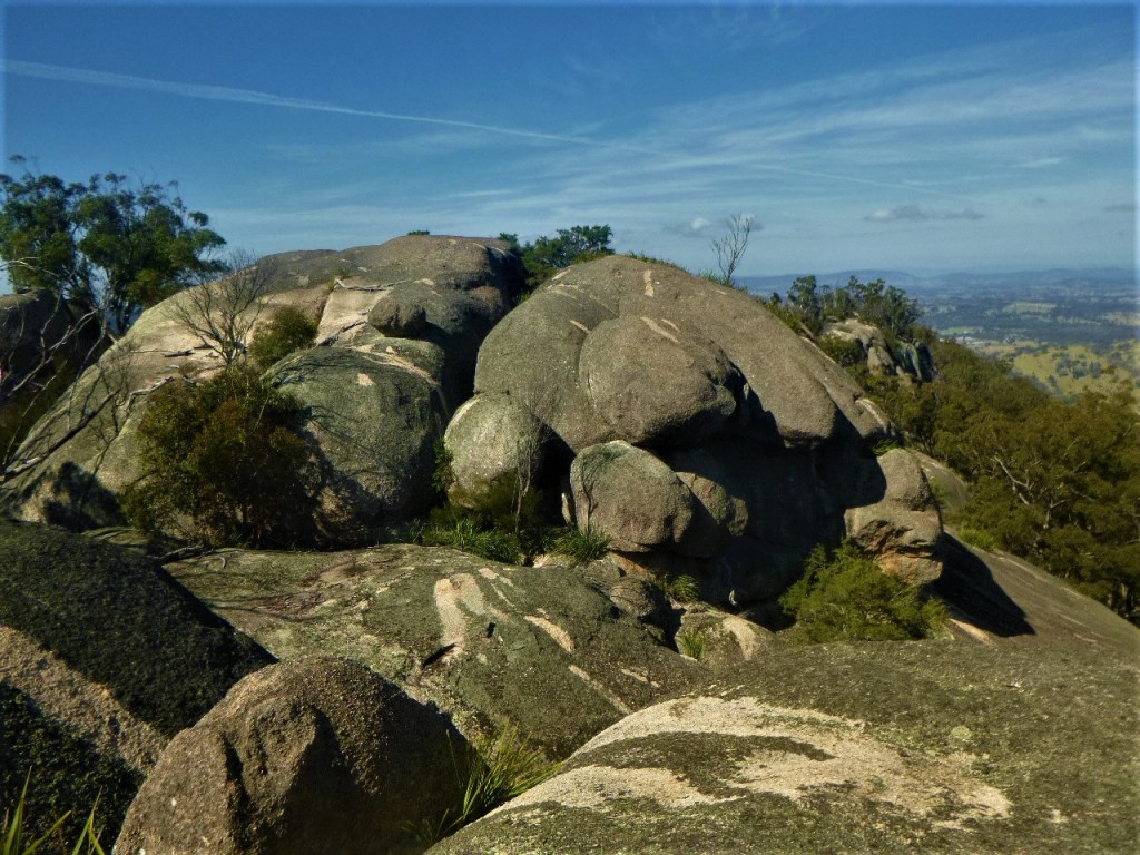
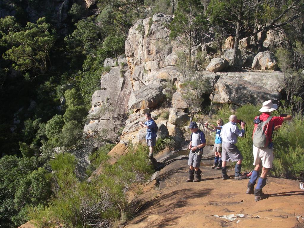
The Chimneys: 1885 m
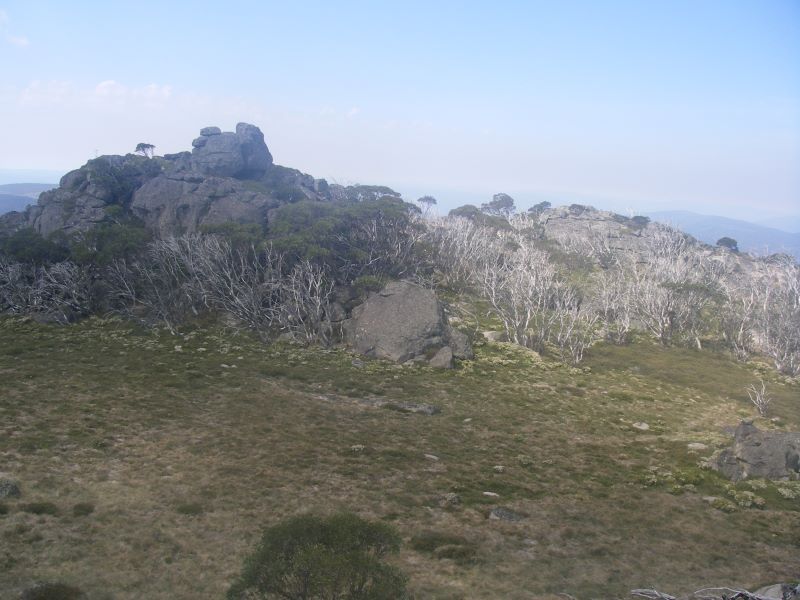
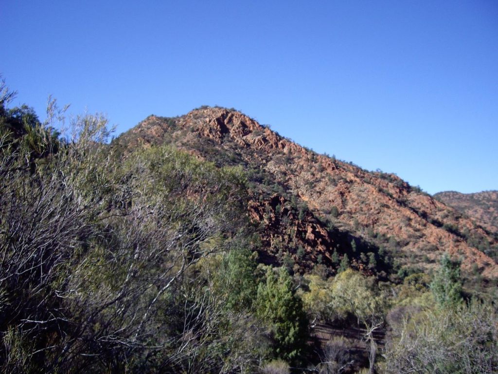
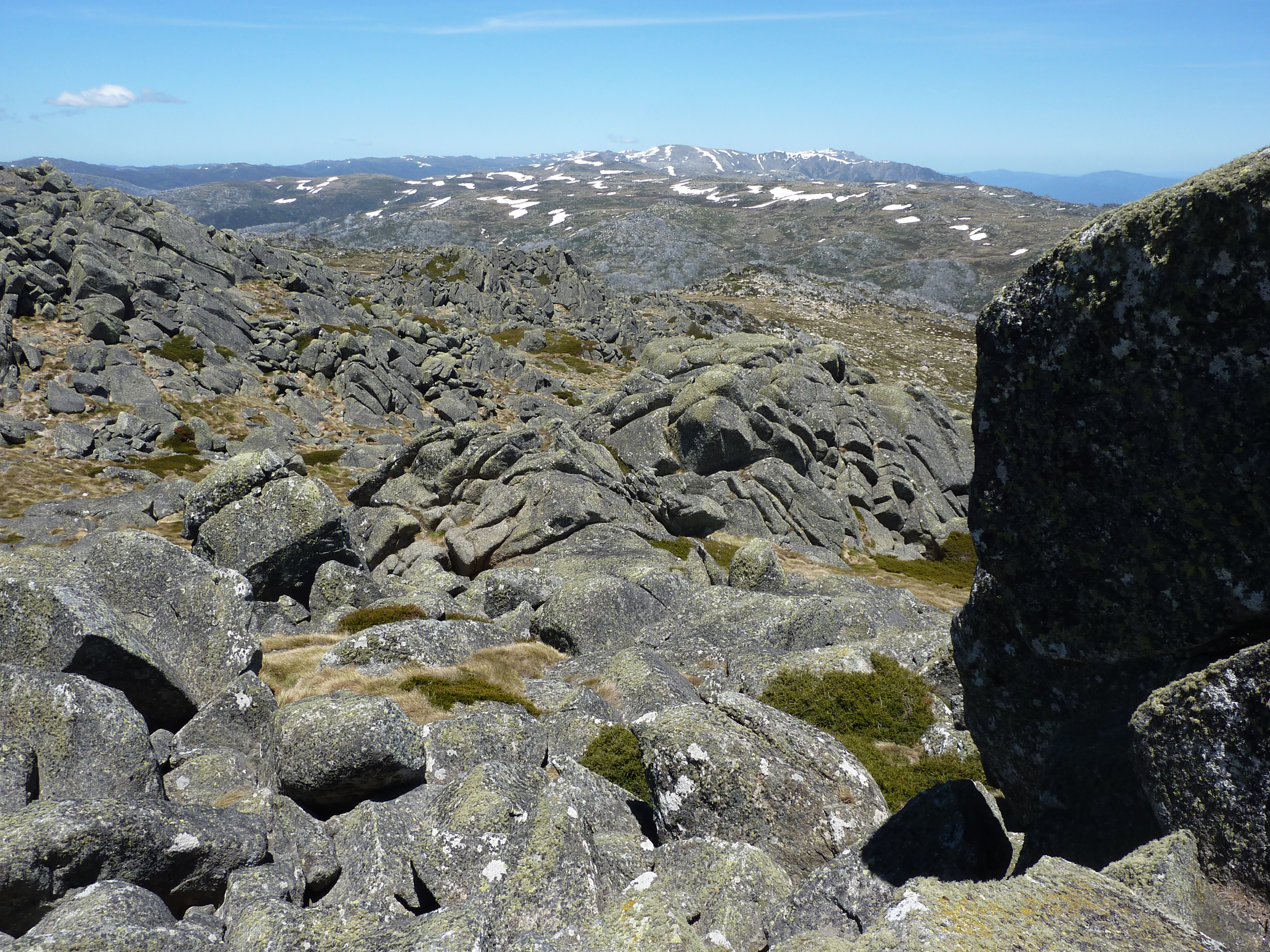
The Chimneys (1885 metres) rise, tooth like, a jumble of granitic boulders that are said, with a considerable stretch of the imagination, to resemble chimney pots on old houses. They are outcrops of Silurian Mowambah Granodiorite (age range 444 million years ago to 419 Mya). The view must be one of the finest in Kosciuszko. As a bonus, nary a backpacker, mountain biker, or tourist to clutter up our summit views.
Chimneys Ridge
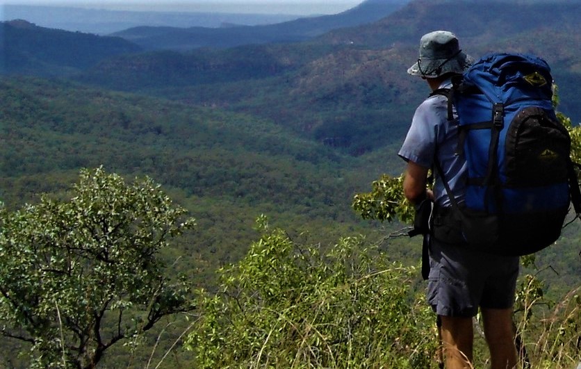
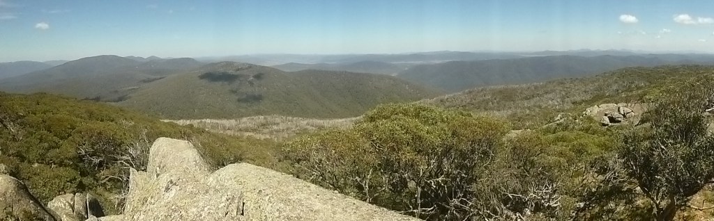
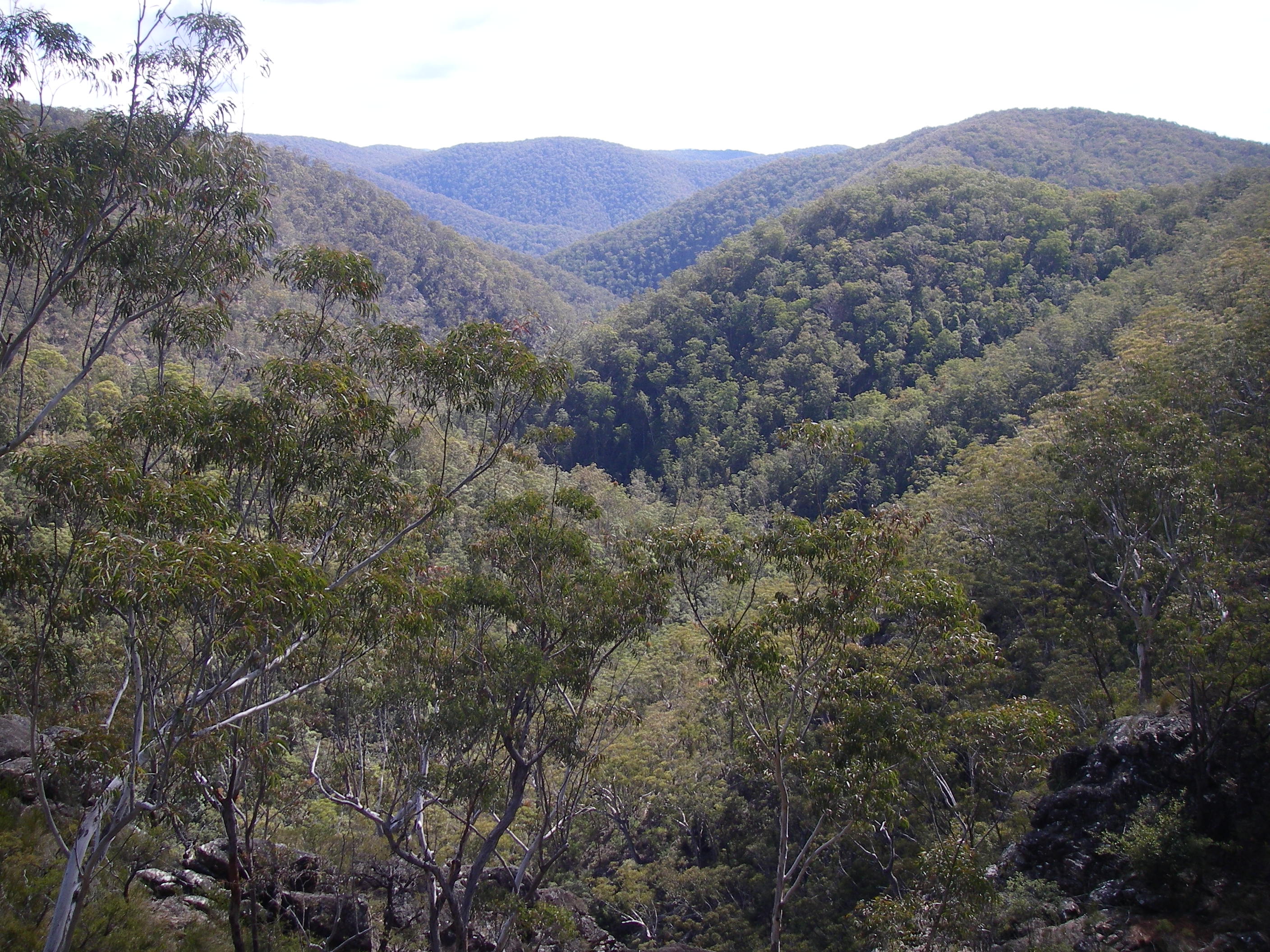
To the south was the deep valley of the Jacobs River with the Snowy River in the distance. The Pilot Wilderness area stretched out in a row of five hills: Purgatory, Jerusalem, Paradise, Wild Bullock and Stockwhip. With The Pilot (1829 m) and the Cobberas even further south.
To the north we looked to the Rams Head Range and the Main Range of Kosciuszko. Hundreds of metres below us were extensive views into the alpine grasslands, bogs and fens of the upper Thredbo valley.
The Crackenback Fault
The course of the Thredbo River presents an interesting drainage pattern when viewed on a map. It is described by geomorphologists as a rectilinear drainage pattern, where the main bends of the Thredbo River change direction at right angles. In the case of the Thredbo, it initially flows south-east, then turns south-west, then north-west and finally into the main valley which runs north-east to Lake Jindabyne.
Rectilinear drainage pattern of Thredbo River. Position & influence of Crackenback Fault.
All these changes of direction are controlled by a complex system of joint lines and faults which are both significant elements in the evolution of the Snowy Mountains landscape.
Joint lines are structures along which there has been no discernable differential movement. Large scale joints are are common feature of granitoid landscapes, like the Chimneys Ridge.
Faults, however, show clear evidence of differential earth movements. The Crackenback Fault is a 35 kilometre long south-west to north-east trending strike-slip fault between the Jindabyne Thrust Fault (at Jindabyne) and Dead Horse Gap.It is a consequence of the Tabberabberan tectonic contraction (390-380 mya).
A strike-slip fault has horizontal movement of the earth’s surface with little vertical displacement. It is along this straight fault structure that the Thredbo River flows towards Lake Jindabyne.
Looking over The Big Boggy with Main Range in background
Our return to Teddys was along the spine of the Chimneys Ridge. At nearly 1900 metres, this was a cool and pleasant ramble across snow grass meadows interspersed with outcropping granitic pillars. At Smiths Gap we propped and then looped north, descending to Teddys. One and a half kilometres away, but not visible.
No takers for Brian’s suggestion for an afternoon nip up Mt Terrible (1850m).A predictable response.Maybewe had been ambushed too many times before by Brian’s predilection for hikes to places with dodgy names like Furnace Creek, the Never-Never, the Madderhorn, Heartbreak Ridge, Perdition Plateau, Hurricane Heath, Snake Hill, Tornado Flat and Corruption Gully .
Mt Terrible (1850 m) across alpine meadows. If you peer carefully you will see a distant herd of brumbies
Mt Terrible was climbed by explorer John Lhotsky who named it Mt William IV, claiming it to be “the highest point ever reached on the Australian continent”. Historians are divided on whether he did, in fact, climb Mt Kosciuszko. The general consensus is that he probably did see Mount Kosciuszko 13 kilometres to the north-west but never climbed it. Lhotsky had better luck with his naming of the Snowy River, the placename which is still used. “I flatter myself that I am the first writer introducing this river into geography”.
It wasSir Paul Edmund Strzelecki who had the non-indigenous bagging and naming rights to Mt Kosciuszko, which he ascended (with others) in 1840. Though some historians believe he actually climbed Mt Townsend, the second highest peak in Australia.
Paul Strzelecki. Source NLA
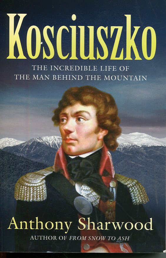
But,who was Kosciuszko? Well might you ask why is Australia’s highest mountain named after a Polish freedom fighter? Tadeusz Kosciuszko (1746 – 1817) was a Polish military engineer, freedom fighter and hero of the American War of Independence and his native Poland. He inspired George Washington and was friends with Thomas Jefferson. Short story: Tadeusz Kosciuszko was a thoroughly admirable human being.
Read about Kosciuszko and the mountain in Anthony Sharwood’s: Kosciuszko, the Incredible Life of the Man Behind the Mountain.
Anthony Sharwood: Kosciuszko, Hachette 2024.
And so to Teddys. For me, an afternoon of indolence, lying around on my Thermarest banana lounge with nought to do but eat, drink, read and watch the grazing brumbies. But the inside of the hut was a happening place.
Joe and Noel were busy indoors engaged in epic DIY projects. Like constructing temporary seating, benches and shelves. Shuffling blocks of wood and milled planks around and around and around. Or in long-winded discussions on ways for the KHA maintence volunteers to wind-proof the slab walls. Exciting stuff like that.
For me, as I lounged on the snow grass at the front of the hut, I could see that old McGufficke’s siting of this hut was a stroke of genius. The front doorstep opened out onto beautiful snow grass plains, gently sloping down to Wombat Gully. In the far distance I watched dark rain squalls sweeping over Drift Hill and hoped the weather would be fine for our last day tomorrow. Nothing is ever a certainty with high country weather.
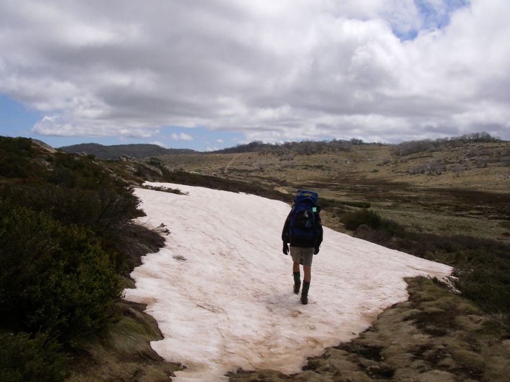
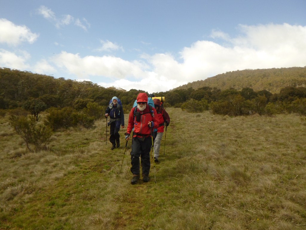
Thursday: Teddys to Thredbo via The Brindle Bull: 8 kms.
This is an outstanding alpine walk, climbing quickly through the tree line then out onto vast alpine meadows. Occasional granitic outcrops rise above the meadows.
We planned our route from Teddys to take us four kilometres west-nor’-west up into the headwaters of the Thredbo River, then across to the Brindle Bull Hill. From its summit we would swing right to the north-east for another four kilometres to drop into Thredbo village at Friday Flats. It was an immensely satisfying walk for our last day.
The navigation was straightforward enough. Follow the Thredbo River up to its source, dodging Mt Leo (1875m) to our south, keeping Adams Monument (1908m) well to our right. No problems with that.
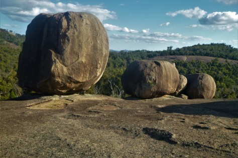
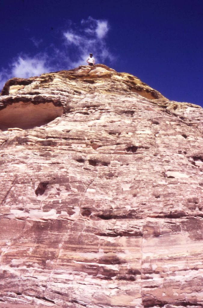
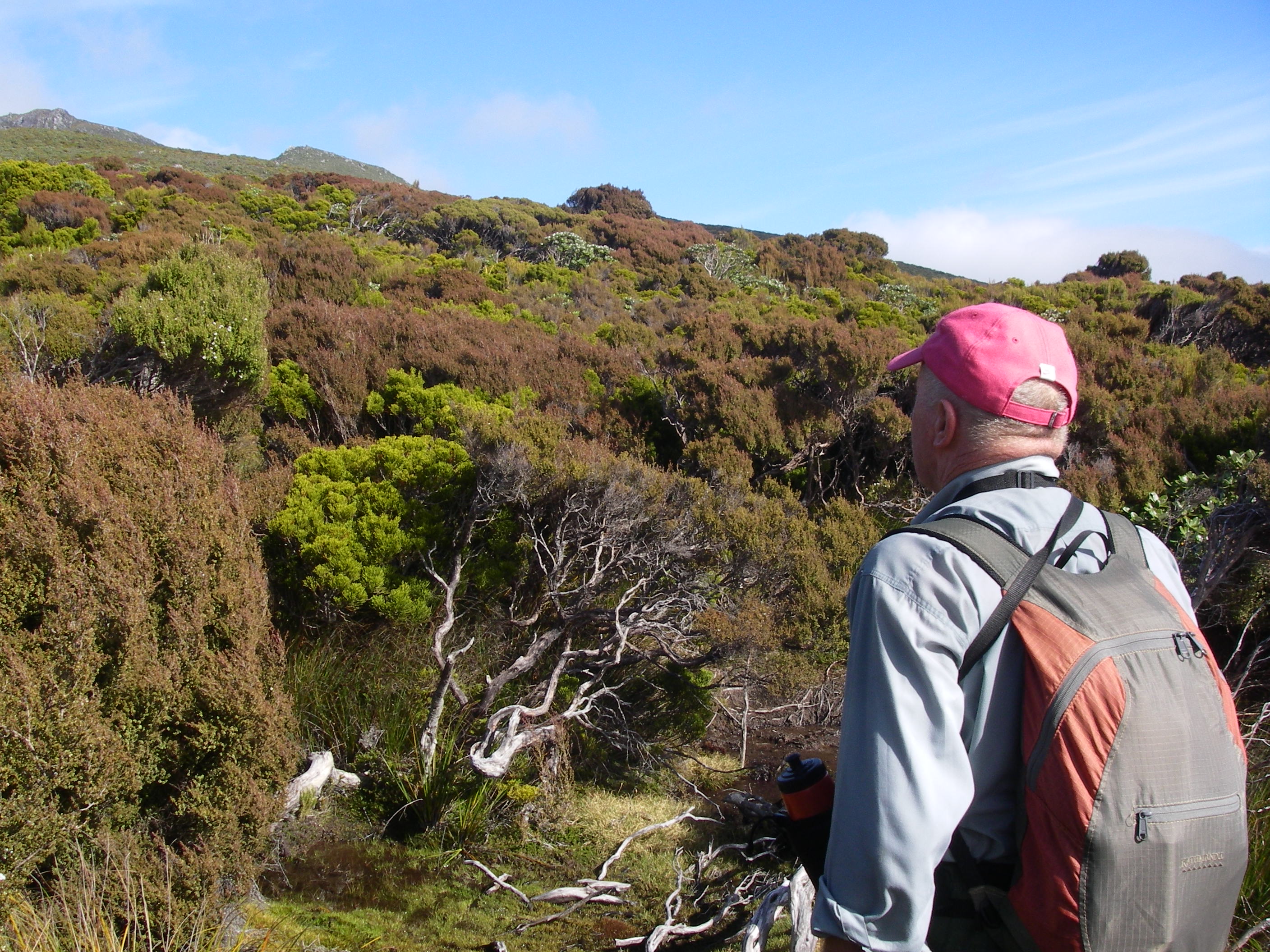
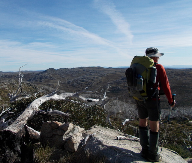
From the gap we continued beetling west, on a tour of outcrops standing at 1800 plus metres. And there ahead of us, apart from yet more brazen brumbies, was the domed form of the Brindle Bull Hill (1872m). Brian and the lads could legitimately claim another 1000 metre peak.
Brian indicated an easy route up that would have us contouring up to the summit tors. But he immediately ignored his own advice and departed posthaste up the closest vertical granite slab leading to the summit.
Clearly he has a different concept of ‘easy’ and ‘contouring’ to the rest of the hiking universe. But the herd instinct kicked in and like dumbclucks we followed anyway, somehow juggling the clutter of map cases, compasses, cameras and walking poles as we hauled ourselves up for a well-earned breather on the summit.
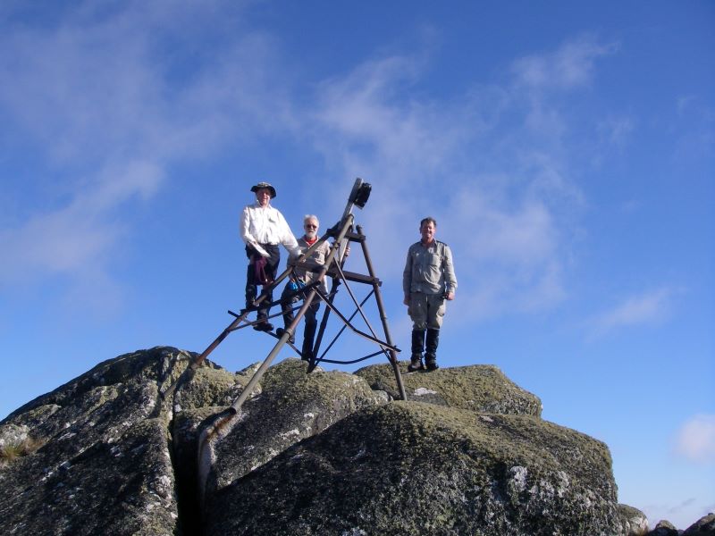
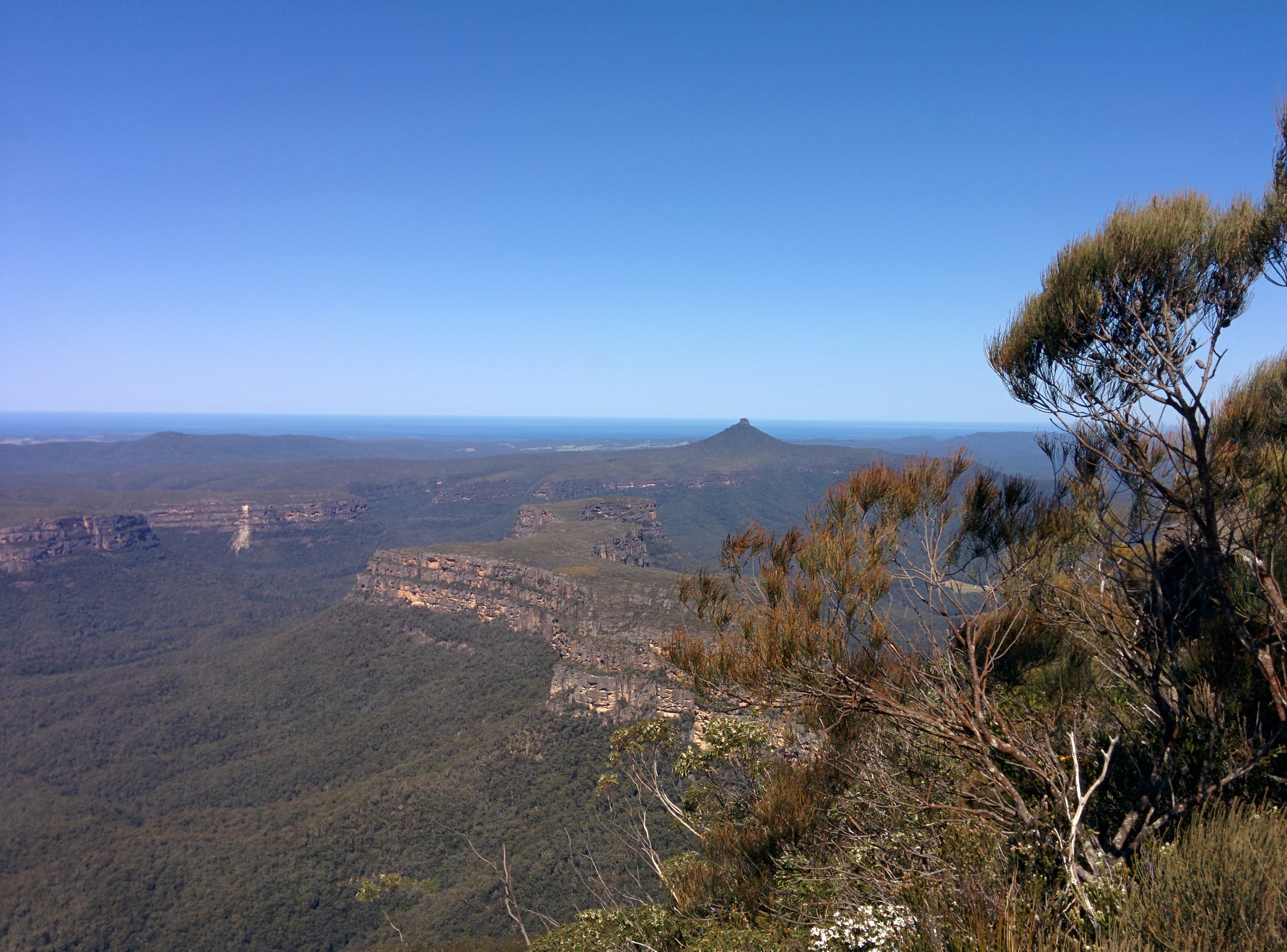
The Brindle Bull
The Brindle Bull
The treat was the expansive views south to The Chimneys and The Pilot and off to the north-east, the Rams Head Range from our previous throughwalk.
Looking towards Rams Heads and Main Range from below the Brindle Bull
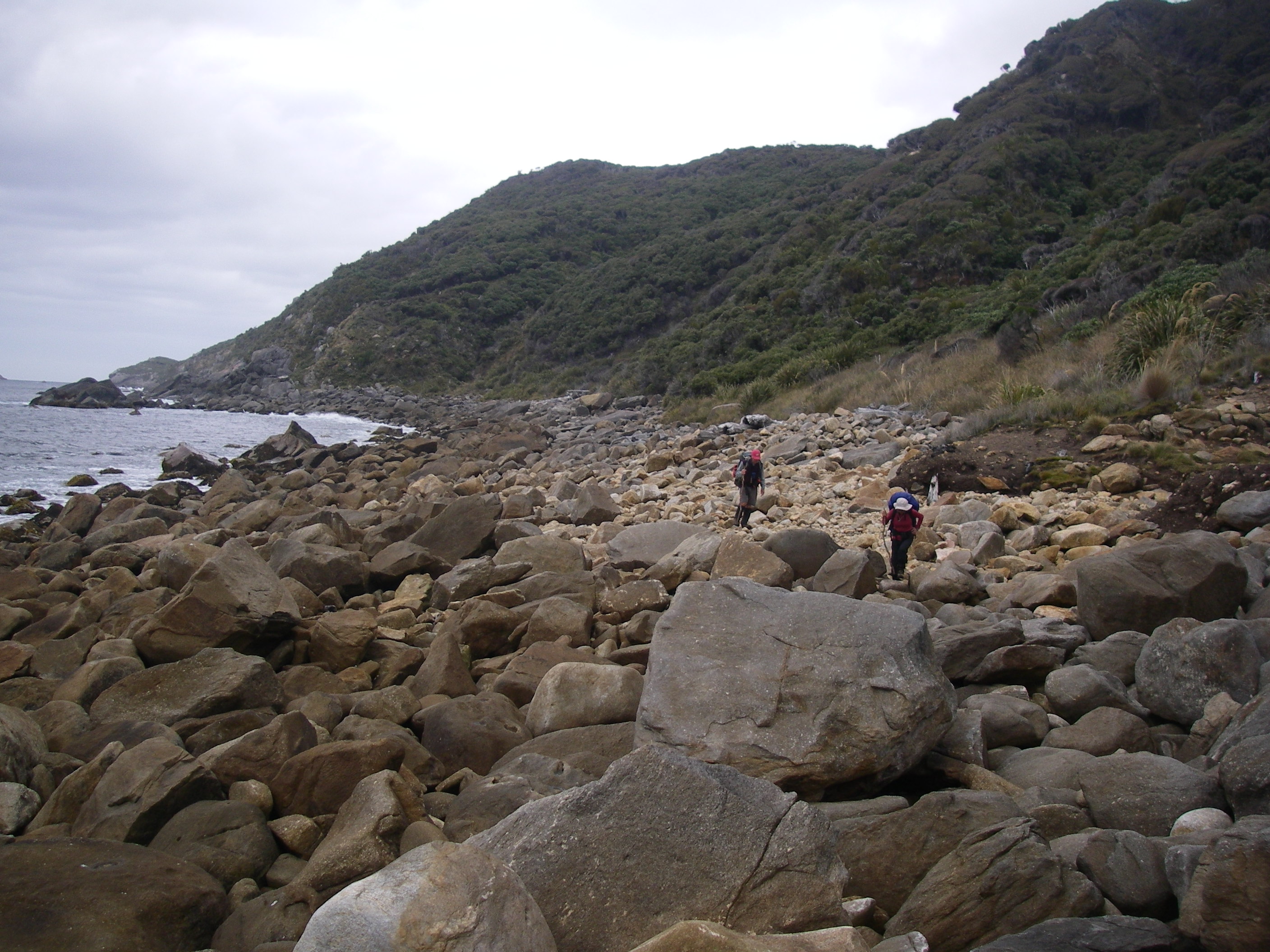
Our final leg snaked down a four kilometre ridge to the Alpine Way (1400m) just above Thredbo Village. Joe, Richard and Noel, brandishing multiple GPSs, made sure that their old-school navigators stayed on track in order to gain the correct ridge down to Friday Flat. So we confidently contoured around BB5 (Brindle Bull 5) and BB6, climbed over the top of BB7 and BB8.
This led us finally to BB9, our exit point (at 1660m). But as Brian and I had learnt from a previous experience of coming off nearby Paddy Rushs Bogong, the drop to Thredbo was never going to be plain sailing. Intelligence that we failed to share with our companions.
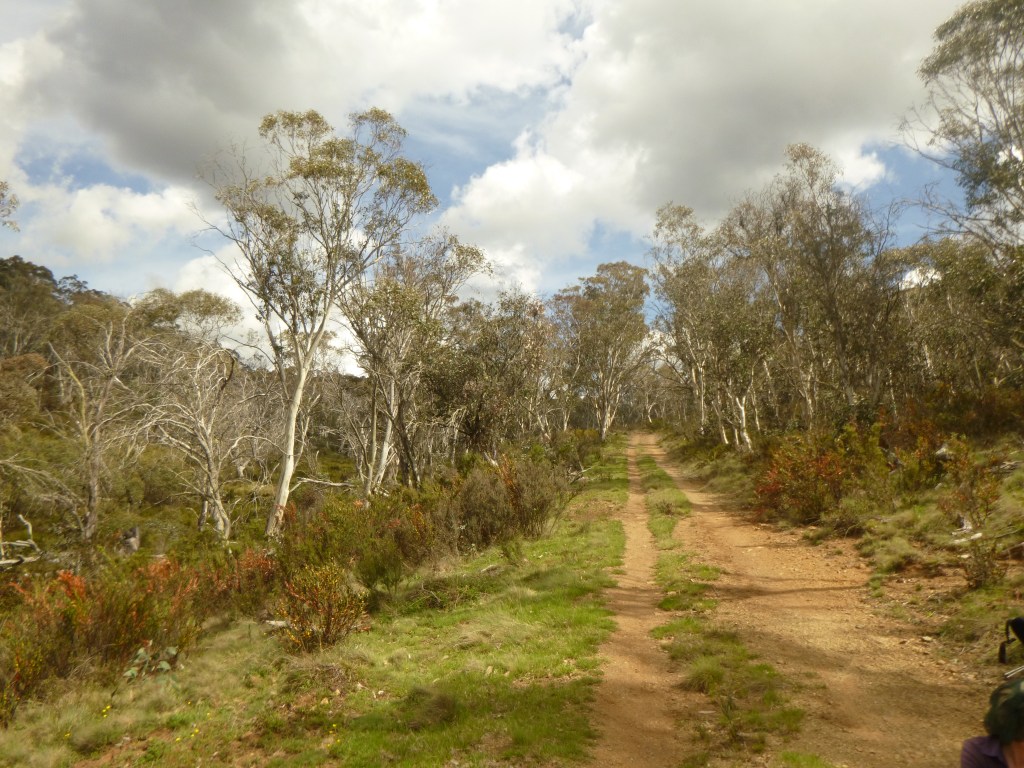
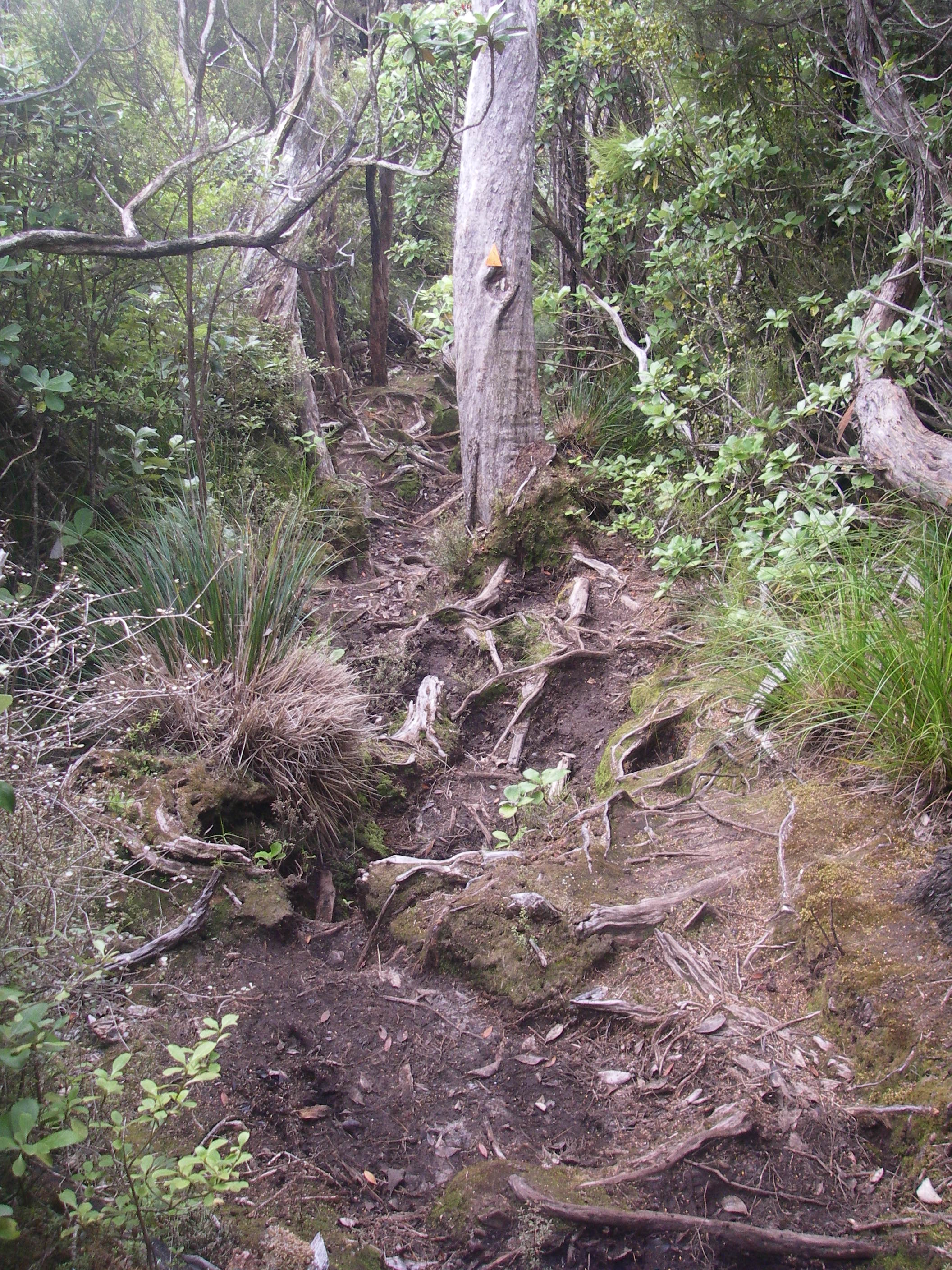
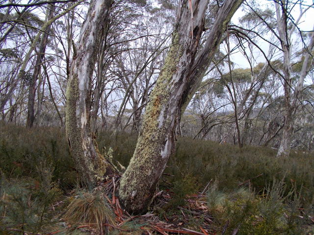
The vegetation changes from open alpine meadows to a snow gum woodland with a dense scrubby understorey of beastly spikey stuff like Bossiaea, Epacris, Hakea, Grevillea, Oxylobium, and Kunzea . Here’s where those knee-length canvas gaiter things worn by Australian bushwalkers are a brilliant piece of kit.
Dense vegetation and boulders in snow gum woodland
This undergrowth is called Tall Alpine Heath and is waist-high with tough whippy branches to withstand the weight of snow (and, hopefully, bushwalkers) without breaking. Throw in torpid highland copperheads and pit-fall traps of wombat and bunny burrows, and the Alpine Way to Thredbo couldn’t come fast enough for me.
So, a tad before 2.00 pm, five dishevelled bushwalkers burst through the thick brush and out onto the Alpine Way. Startling a young headphoned damsel who was out enjoying her daily power walk along the Alpine Way.
For us, two weeks of superb alpine walking were over. Anyone for a Kosciuszko Pale Ale?
My bushwalking friend Brian is nothing if not persistent. And so it was that we were off again to walk the length of The Kerries Ridge, said to be ‘some of the finest walking in Kosciusko National Park.’ He for a third attempt and me for a second. Our previous encounters had taught us that The Kerries ridge was not a good place to be in bad weather.
by Glenn Burns
This time we were accompanied by a surprisingly favourable weather report and that trio of venerable track dogs: Richard, Joe and his walking mate from Townsville, Noel . As an added inducement Brian had suggested that we should check out The Brindle Bull.
My initial thoughts on The Brindle Bull turned to one of Brian’s après-walk high country watering holes: a schooner of cold Kosciuszko Pale Ale or perhaps a Razorback Red Ale….. Who could resist?
Later, far too late, while poring over some Kosciuszko maps on the flight down, I discovered that The Brindle Bull was, in fact, a 1890 m peak in The Pilot wilderness. Just another peak on Brian’s interminable 1000 m ‘to do’ list.
Kerries Ridge with Mt Jagungal, 2062 m, in background
Our initial 90 kilometre circuit, big chunks of it off-track, was a grand tour of some of Australia’s highest peaks and ridges: Disappointment Ridge, Gungartan, The Kerries, The Rolling Grounds, Mt Tate, Mt Anderson, Mt Anton, Mt Twynam, Mt Carruthers, Mt Lee, Mt Townsend, Alice Rawson, The Rams Head, South Rams Head and at 2228 m, the biggest bogong of all, Mt Kosciuszko.
View of Main Range from Charlotte Pass.
The final four days would follow The Main Range, also called the Snowy Mountains, over 2000 m, well above the tree line.In fine weather this is one of Australia’s premier walks, but it is very exposed and the weather highly changeable. Storms and even sleet are not unusual in February so walkers need to be well prepared.
The Main Range from the north-western side. 1867 lithograph by Eugene von Guerard.
Part of Kosciuszko’s Main Range area. Ethridge Range 2150 m on a fine, though windy day .
Map of Hike to Kerries, Rolling Grounds and Main Range
Map showing saunter #1 over The Kerries, Rolling Grounds and Main Range.
Sunday: Munyang (Guthega) Power Station to Disappointment Ridge: 8 kms
Our people mover piloted by sons Alex and Ian discharged its cargo of old fellows at Munyang (Guthega) Power Station (1300m) soon after 9.00 am.
Munyang (Guthega) Hydro Power Station
MUNYANG (Guthega) hydro power station is the start of many of my favourite walks in Kosciuszko.
Munyang was also the start of the construction of the first major project of the Snowy Scheme in 1951. The Guthega project was awarded to a Norwegian firm Ingenior F. Selmer. A serious player in global dam and hydro construction.
Selmer were required to construct a dam (Guthega Pondage) 30 metres high and 107 metres long; a 5 km tunnel with a penstock pipeline and power station producing 60,000 Kw, the smallest output of the Snowy power stations.
Opening of Guthega Project on 23 April, 1955 by PM Robert Menzies.
The bulk of the workers were Norwegians (450, mainly labourers) from the rural areas of the Arctic Circle.
Norwegian workers on the Guthega Project.
On the 21 February 1955 , only a few weeks behind schedule, electricity flowed from Munyang. Like my fellow bushwalkers the Snowy Scheme had sprung to life.
The wordMunyang or Muniong derives from the First Nations people. When camped on the Eucumbene Valley, they would point to the snow covered Main Range and repeat the word ‘Munyang’ or ‘ Muniong’ . Said to mean ‘big’ or’ high mountain’. Also’ big white mountain’.
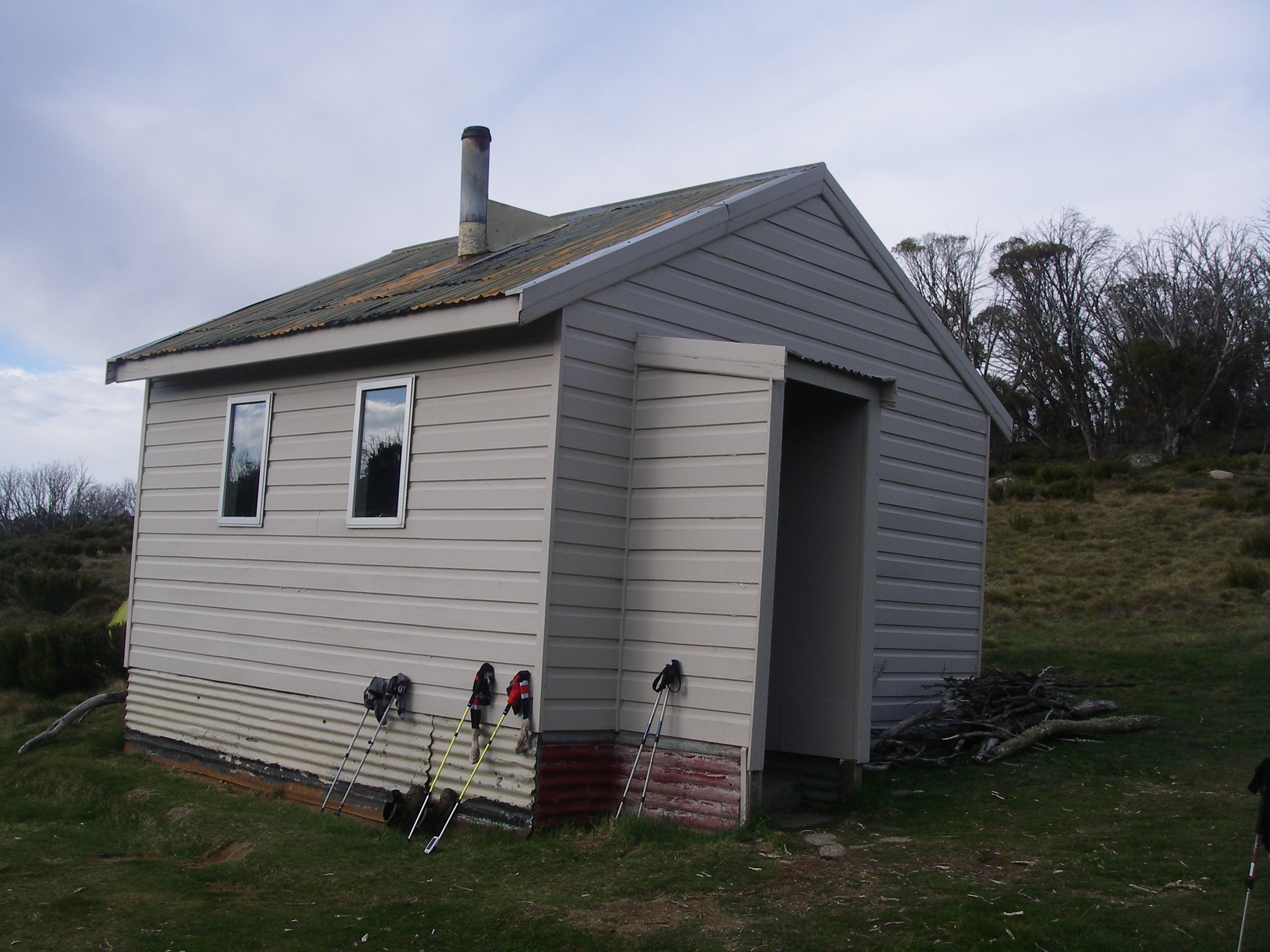
What followed was a salutatory introduction to alpine walking: hauling our backpacks, bulging with tucker for seven days and piles of warm clothing, four kilometres uphill on the Disappointment Spur fire trail to Disappointment Hut (1640 m).
Disappointment Spur Hut: Source P. Hoskins.
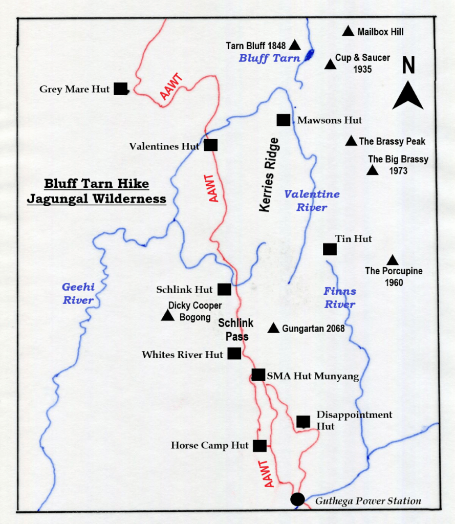
Disappointment is spiffy little four berther ex-Snowy Mountains Authority Hut set in a grove of snow gums and had been spruced up with a lick of green paint. Built as a survey hut in the 1950’s by the Snowy Mountains Authority, it is of weatherboard and iron roof construction with wooden floor. Cosy as.
Disappointment Spur is said to have been named by a group of stockmen travelling from alpine meadows near Gungartan through to Jindabyne. They followed the ridge down only to be ‘disappointed” at not being able to cross a raging Snowy River. Or so the story goes.
Any thoughts I had of settling in for a comfy overnighter in the hut were quickly scotched by our over-eager leader, ever anxious to press on. But not before tucking into a hearty al fresco lunch prepared by Joe and Noel: fresh Thredbo Bakery bread rolls packed with generous slabs of Jarlsberg cheese and slices of salami. A decent lunch time feed for a change.
The afternoon’s off-track climb onto Disappointment Spur was a fair bugger, pushing uphill through whip-stick thickets of scrubby re-growth from the 2003 fires. At 3.30 pm we hove to. Thank god Eager Beaver wasn’t at all keen on the extra three kilometres over Gungartan to Gungartan Pass.
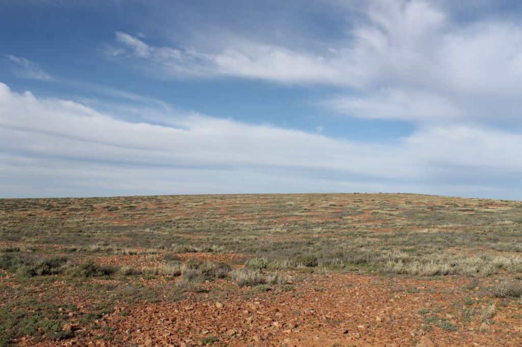
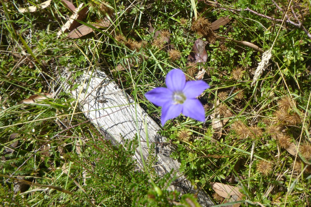
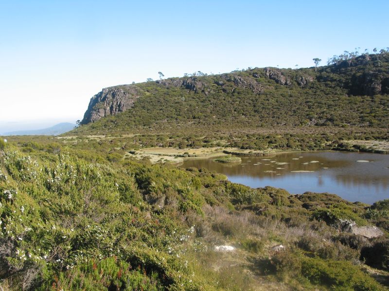
The make-do campsite at 1940 m on the picturesque alpine herbfields of Disappointment Ridge was no hardship. Tickety-boo, in fact: springy snow grass bedding, speccy views north to Gungartan and Jagungal, nodding pastures of yellow billy buttons, silver snow daisies, Australian bluebells and white gentians all topped off by the promise of fine weather for our passage across The Kerries on the morrow.
Campsite near Gungartan Pass 1940 m.
Bidgee-widgee: Acaena novae-zelandia.AAprickly nuisance that loves your socks.
Monday: Gungartan, The Kerries to Mawsons Hut: 9 kms.
Despite Brian’s daily assurances that there was ‘no hurry’ to pack up each morning, soon after 5.15am we heard the familiar zzzzzzzzip from his green hutch and Brian would, wombat like, reverse out on all fours into the crisp, crepuscular dawn.Air temperature hovering at barely 1°C according to my pack thermometer. A quick breakfast of weet-bix, muesli or maybe hot porridge, washed down with a mug of piping hot coffee or tea. Our departure was invariably before 8.00 am. No hurry.No pressure.
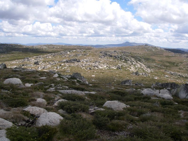
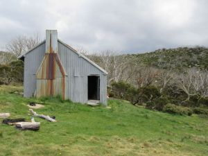
First up, Gungartan, a jumble of granitic tors and a trig station which had seen better days. At 2068 m this is the highest point north of the Main Range. Stretching away to its north was the open rolling ridge of The Kerries (2040 m). A magnificent walk across trackless wildflower meadows dotted with granite boulders, alpine bogs and mountain streams.
Trig on Gungartan, 2068 m
As with much of the Kosciuszko plateau, the Kerries Ridge has been eroded to form a small peneplain. It’s surface is capped by granitic ( granodiorite) boulders rising only a 50 to 100 metres above the general landscape. Like much of the Main Range , the underlying rock is Silurian Mowambah Granodiorite, some 430 to 400 million years old. Granodiorite, superficially similiar to granite, is also a coarse grained intrusive igneous rock. But, there are important differences in mineral composition. I generally differentiate from granite by the greater abundance of dark mineralsin granodiorite.
But this seemingly benign landscape can change dramatically in bad weather and walkers need to be competent off-track navigators to find the safety of Mawsons, Schlinks or Tin Hut in a whiteout. No such problems today: perfect weather, duelling GPSs, a twin-set of maps, a cart load of compasses and the lads keeping two wayward old-school navigators on a tight reign. Although the mushrooming cumulo-nimbus clouds suggested wet bums if we mooched around too long enjoying our sojourn on The Kerries.
Lunch on The Kerries
Mawsons Hut
The three-roomed Mawson’s Hut (1800 m) was built in five days in 1929 by Herb Mawson, manager of Bobundra Station. Not Sir Douglas Mawson, Antarctic hero, as generally supposed.It is typical of cattlemen’s summer huts built all over alpine and sub-alpine Australia: corrugated iron walls, corrugated iron roof, wooden floors and a granite fireplace.
Generally dark, dirty and dingy but a welcome refuge when the weather turns bad.As it did. Fortunately we were snugly ensconced in Mawsons with our NPWS issue ‘Ultimate 500’ cast iron stove blasting out mega BTUs of hot air once Brian and cub stove technician Joe nutted out its many irritating idiosyncrasies.
Mawsons Hut
As the rain eased, ‘Ken from Canberra,’ docked at Mawsons. A bespectacled public service mandarin type; pleasant, intelligent company and a mine of local bushwalking information.
Apparently Ken was road testing his born again status as light-weighter. A three day shake-down cruise to Mawsons Hut and The Kerries thence to Tin Hut on the Brassy Mountains with brand new Golite pack and pup tent of some new fangle dangle wafer-thin nylon stuff.
Ken joined us inside for an evening of tall story telling by those travelling troubadours, Joe and Noel… wild and woolly tales from Far North Queensland .Of the ‘now I know you don’t believe me but it really is true’ genre, and populated with characters with names like Gorilla Biscuit, Half a Cowboy, Pedal Pete, PVK…
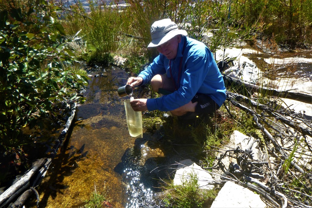
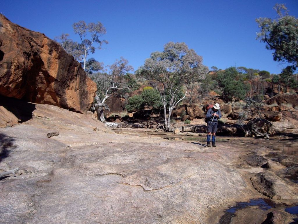
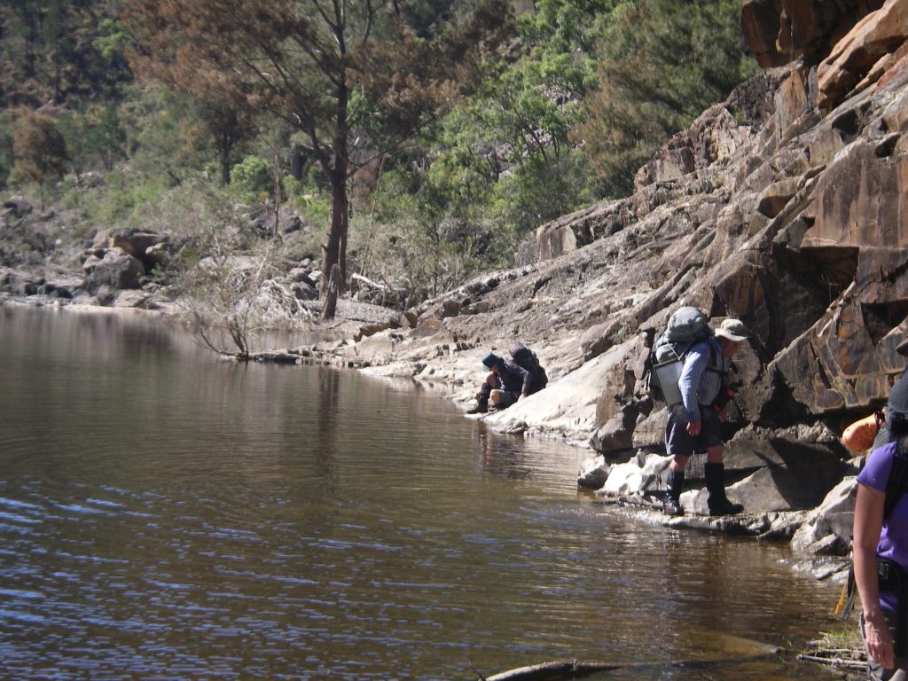
Collecting water near Mawsons. Cup and Saucer in background
Tuesday: Mawsons Hut to Whites River Hut via Valentine Hut. 13 kms.
An easy day starting with some minor off-tracking from Mawsons to Valentines Hut.
Cross country Mawsons Hut to Valentines Hut
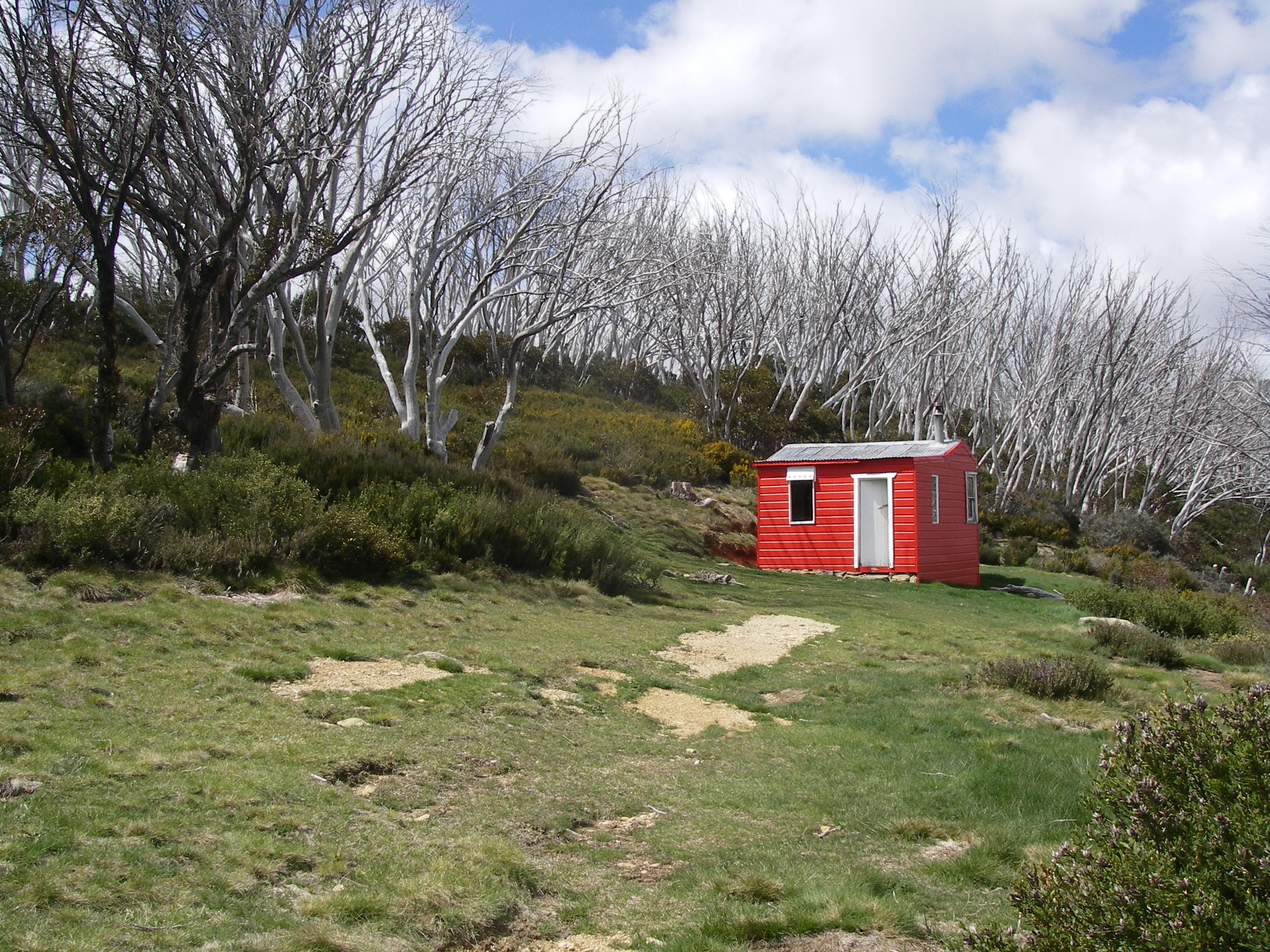
Valentines Hut
Valentines Hut has to be my all time favourite hut. A small weatherboard ex-SMAer, coated in cherry red paint and decorated with a frieze of six valentine hearts. Hence the name Valentines Hut. Cute. Maintained by the Squirrel Ski Club, it is always kept clean inside and out.
After a brief pit stop at Valentines, the rest of the morning was spent in a pleasant ramble through a tunnel of snow gums along the Valentine fire trail before finally popping out onto the Schlink trail, just in time to flag down the passing Snowy Hydro 4WD.No luck hitch-hiking here.
Valentines Hut
Meanwhile, still on the hoof, The Schlink ‘Hilton’ appeared for us soon after midday. None too soon as it was warm, windy and the high country horse flies were driving us batty. We ducked inside this fly-free nirvana for lunch.
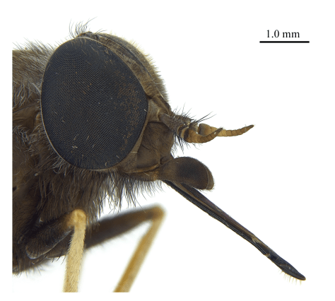
March, Horse or Vampire Flies
No horse flies, nor their sneaky little bush-fly buddies, nor any of those Lilliputian black ants that swarmed over us whenever we propped on tussocks of snow grass or rocks for a break. Horse or March flies are known by southern bushwalkers as Vampire flies.For good reasons. These bug-eyed pests lurk in piles of wet wombat and brumby poo waiting to pounce on any bushwalker foolish enough to be out and about without a full suit of body armour.
Source: CSIRO. March , Vampire or Horse fly. Family: Tabanidae.
It also behooves me to inform the reader that it is the female who bites and draws blood. She lands on a likely victim, unfurls her proboscis and silently inserts it through multiple layers of clothing, canvas gaiters or even nylon rain pants to suck out your vital juices.
Meanwhile the real heroes of this story, the male horse flies, quietly go about their business, productively spending their days zooming from flower to flower, hoovering up nectar for a feed and pollinating those pretty alpine wildflowers as a sideline.
On the Schlink Trail : Australian Alpine Walking Track near Schlinks Hut
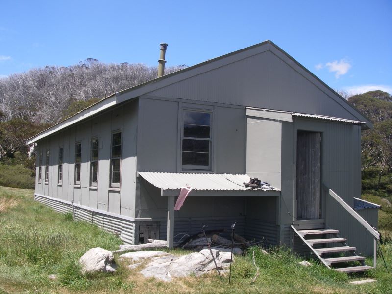
The Schlink Hilton was named after Dr Bertie H. Schlink who, in 1927, was the first to complete the 150 kilometre Kiandra to Kosciuszko ski run. Built in 1960, it is another ex-SMA hut, a massive 11 roomer maintained by The Gourmet Walkers Club.Sign me up.
Schlinks Hut
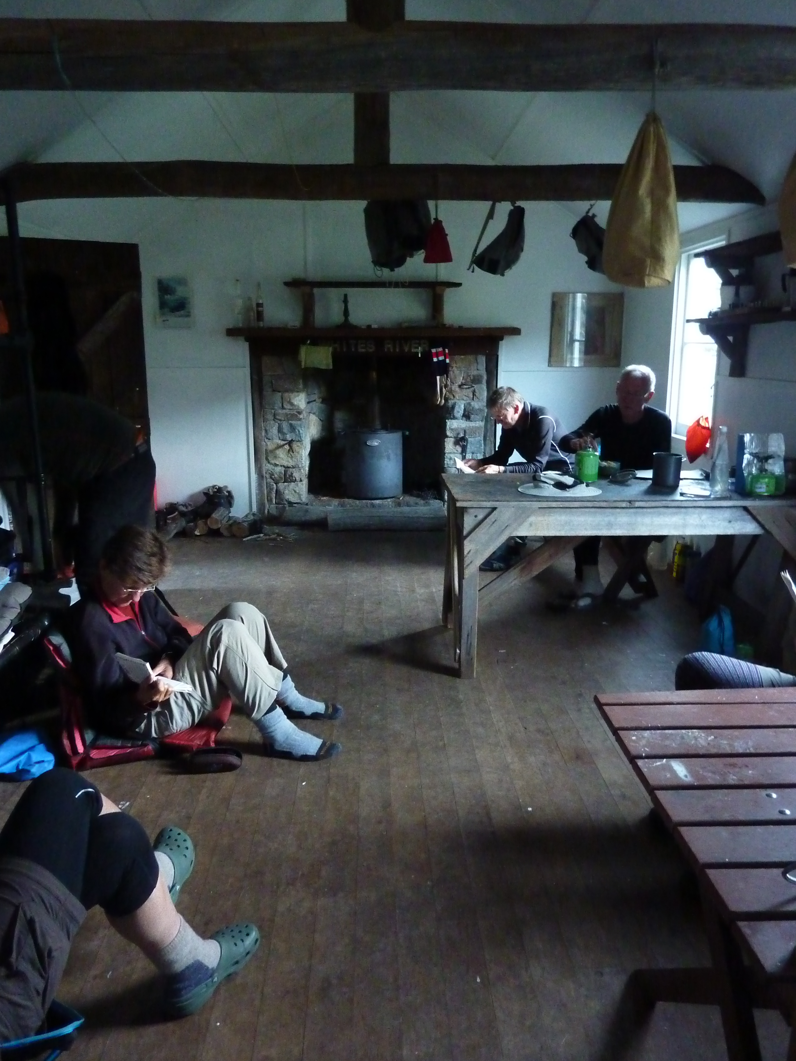
Whites River Hut
And so onto Whites River Hut, which was burnt down by some dumb-cluck skier in winter 2010.The original hut was built as summer grazing hut in 1935 by Bill Napthali and Fred Clarke. It has been rebuilt in the mountain hut heritage style and the Kelvinator, a white annex, has been removed.
Whites River Hut
Whites River is now the official summer residence of Bubbles and Bubbles Jnr, bush rats extraordinaire.The mayhem and pandemonium caused by our two furry friends is well known to anyone who has ever checked out the hut log book or tried to snatch forty winks at Whites River.
As with our previous visits we spent much of the our evening ‘Bubbles’-proofing our gear; all rucksacks and food bags were then suspended on the nails belted into the huge transverse hut beams. Which seemed effective as there were no nocturnal disturbances from the Bubbles outfit but plenty from my hut mates who seemed to spend their night streaming outside to gaze at the brilliant star show, or so they would have you believe.
Whites River Hut Logbook rendition of Bubbles.
Wednesday: Whites River to Pound Ck via Mt Tate: 11 kms.
Today would be our hardest day, a distance of only eleven kilometres and a vertical ascent of 328 m… give or take a few major ups and downs. But the most problematic part was our traverse over the Rolling Grounds, which are described in one guidebook thus: ‘Known as the Rolling Grounds…. on a fine sunny day it is best described as bleak. What it is like in a blizzard is left to the imagination. The Rolling Grounds are notorious for difficult navigation in bad weather’.
Whites River Hut with Rolling Grounds in background.
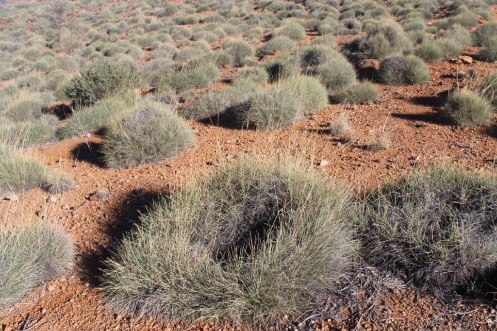
Fortunately the day was fine and clear, ideal conditions for crossing these high level alpine meadows and bogs. Just absolutely brilliant walking. It is said that The Rolling Grounds are so called because in the days of cattle grazing, stock horses would make their way up to roll in the numerous depressions between clumps of snow grass.
The Rolling Grounds
Rolling Grounds. Never truly lost. The Granites in mid-ground.
By 10.30 am we reluctantly vacated The Rolling Grounds and dropped into Consett Stephen Pass to begin the tedious haul up to Mt Tate, 2028 m and the start of the Main Range.
Descending into Consett Stephen Pass. Guthega pondage in the distance.
The lads were in seventh heaven, an orgy of peak bagging for the next four days.
Walking the Main Range
The Main Range. We were now in the Alpine Zone, well above the tree line, travelling at an average elevation of 2000 metres. Here are Australia’s highest peaks: Tate (2068 m), Carruthers (2145 m), Alice Rawson (2160 m), Ram’s Head (2188 m), Twynam (2196 m), Townsend (2210 m) and Kosciuszko at 2228 m. The Main Range is predominately granitic, an intrusive rock formed deep within the earth’s crust by the slow cooling of molten magma. The overlying rocks have been eroded away through eons of time. But a belt of older belt of Lower Ordovician sedimentaries sneakily outcrops for parts of the Main Range walk. Much of the granitic bedrock along the Main Range has been subjected to great stresses and thus has a layered appearance, and is called gneissic granite.
These highest of our mountain peaks are typically rounded humps, bearing little resemblance to the typical pyramidal alpine peaks of Europe or the Himalayas. It is possible that this rounding took place in an early stage of the Pleistocene when a large ice cap covered much of the Main Range, extending as far south as Mt Bogong.
Later glaciation was valley glaciation. Temperatures now average 10C in summer and -5C in winter, too low for tree growth and most plants require special adaptations to survive. We needed four more days of fine weather to traverse the Main Range back to Thredbo.
Mt Tate was named after Ralph Tate, Professor of Geology at the University of Adelaide. From Tate’s trig summit we looked down to Guthega Pondage near where we had started three days ago and across the valley to the confrontingly named The Paralyser and The Perisher.
View along Main Range from summit of Mt Tate, 2028 m
Onwards to Mt Anderson (1997 m) and below its southern flanks our overnight campsite in the headwaters of Pound Creek.This campsite was bereft of any cover, sunny and exposed, but we made ourselves comfortable on the snow grass and tumbled into our tents before 8.00 pm.Knackered.
Camping in upper Pound Creek.
Thursday: Pound Creek to Wilkinson Valley: 12 kms.
Brian’s original plan had been to walk through to Alice Rawson (2160 m), camping high up on the saddle between Alice Rawson and Mt Townsend. But such is the nature of high country walking that the prudent leader always has a contingency plan. For much of our trip we had been plagued by 20-30 kmh winds that showed no sign of abating. In fact, they were about to get a lot worse.So with the nor’westerlies idling along at 40 km/h and maximum gusts hitting 61 kmh it was decided that camping in the relative shelter of Wilkinson Valley under Mt Kosciuszko was our best option.
Early morning in Pound Creek looking towards Mt Anton, 2010 m
Despite the wind it was still an outstanding alpine walk along Australia’s highest points: Mt Anton (2010 m), the long crawl up Mt Twynam (2196 m), down onto the Main Range tourist track, back up to Mt Carruthers (2145 m) summit where we didn’t linger longer.
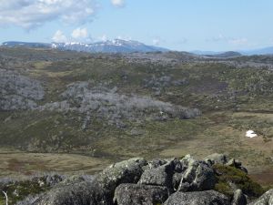
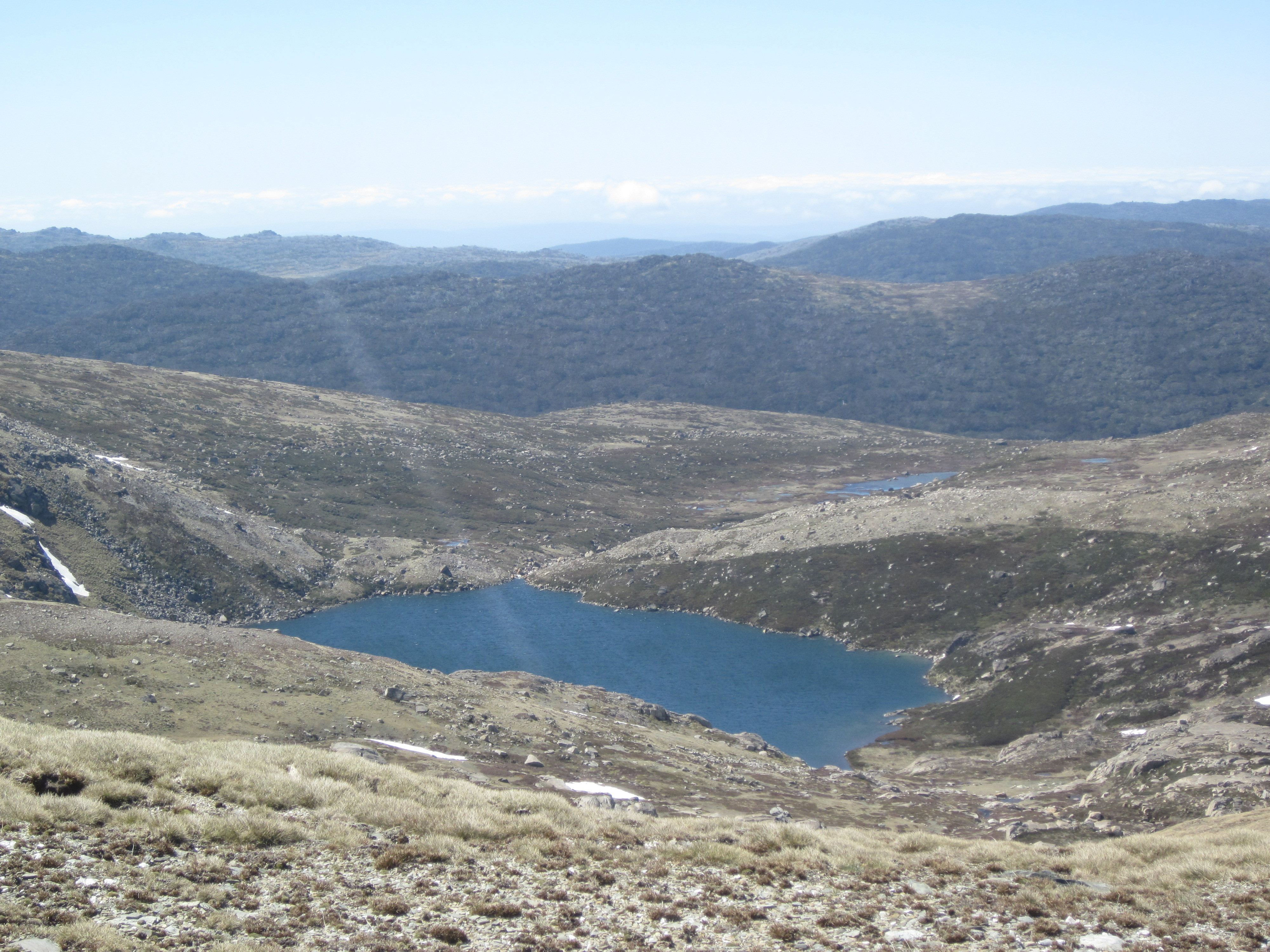
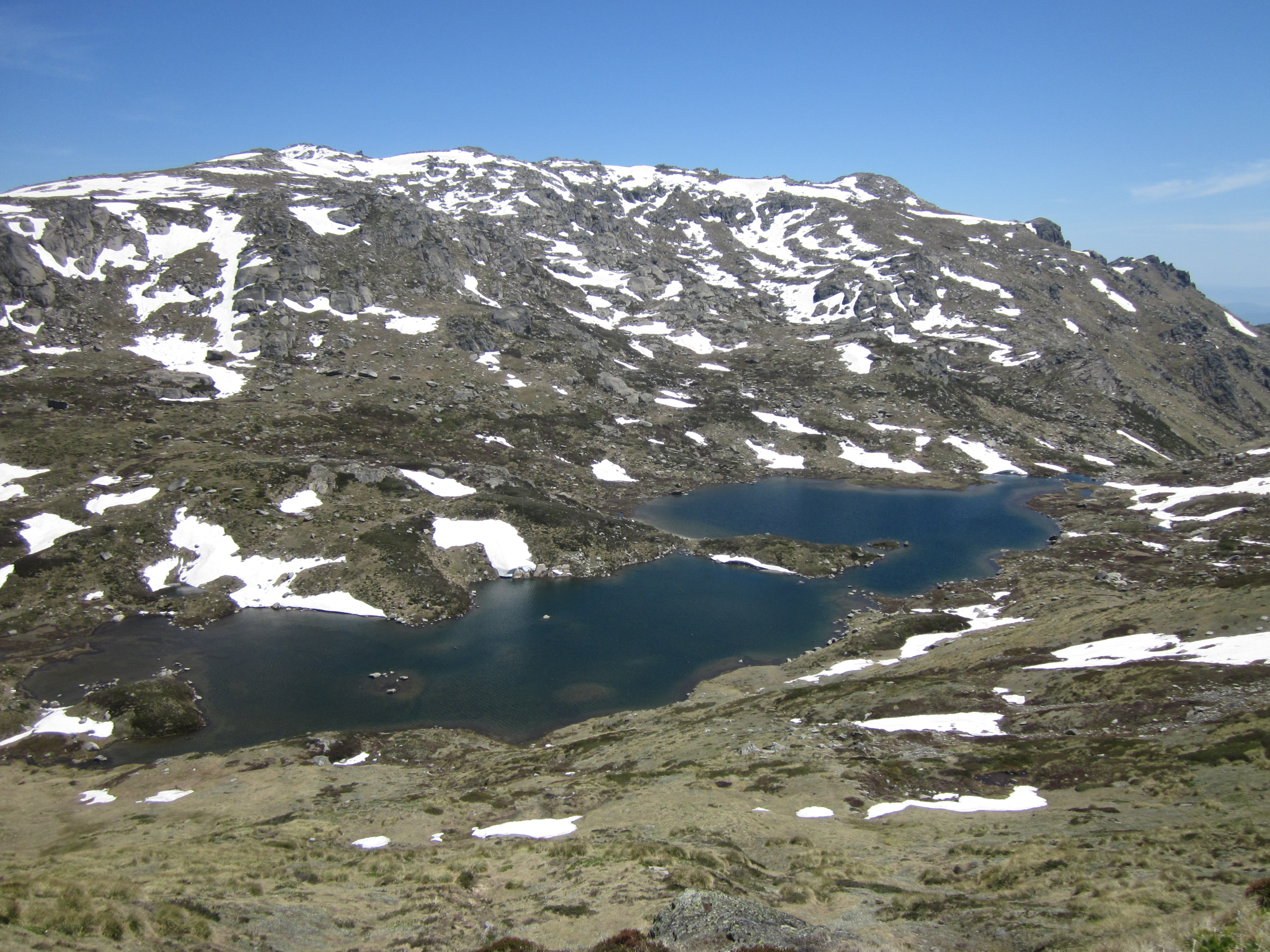
Instead we hunkered down for lunch behind a shelf of rocks overlooking Club Lake, one of the many moraine-dammed glacial lakes in Kosciuszko.
Club Lake. A moraine- dammed glacial lake.
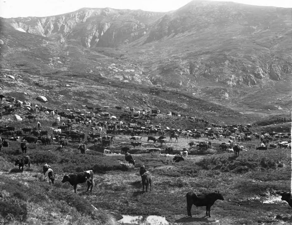
During the Pleistocene, small mountain glaciers ground their way down the valleys now occupied by glacial lakes. In recent historical times, during summer, huge flocks of sheep and later herds of cattle grazed these steep alpine slopes, fouling the pristine snow fed lakes below: Club Lake, Lake Albina, Hedley Tarn, Blue Lake and Lake Cootapatamba.Fortunately, the sheep and cattle were shown the door in 1963.
Source: NLA. Frank Hurley: Cattle grazing in the Snowies.
Mt Carruthers named after Sir Joseph Carruthers, a Premier of NSW, who instigated the construction of the Kosciuszko Road and the old Kosciuszko Hotel.
Between Mt Carruthers and Mt Lee the track dips onto a sharp exposed ridge formed when valley glaciers cut back towards each other (a col). This is windswept Feldmark, location of the rarest alpine plant community. Plants here must survive on a wind blasted ridge where the soil has been blown away, leaving only cold rocky ground. A fortuitously located info plaque allowed us to identify Alpine Sunray (Leucochrysum albicans spp alpinium), Coral Heath (Epacris gunnii), Feldmark Grass (Rytidosperma pumilum) and Feldmark Eyebright (Euphrasia collina spp lapidosa) and Feldmark cushion-plant (Colobanthus pulvinatus).
Far below was the basin of Club Lake, a moraine dammed glacial lake, the water held behind unsorted glacial debris. The track mercifully by-passed Mt Lee (2019 m) and skirted along the flanks of Mt Northcote (2131 m) and then descended into Mueller’s Pass. Descending further, we came to rest in the boulder strewn but picturesque Wilkinson’s Valley.
Blue Lake. The only cirque basin lake in Kosciuszko National Park.
Hedley Tarn. A moraine dammed lake downstream of Blue Lake.
Lake Albina. A moraine-dammed glacial lake.
Campsite in Wilkinson Valley
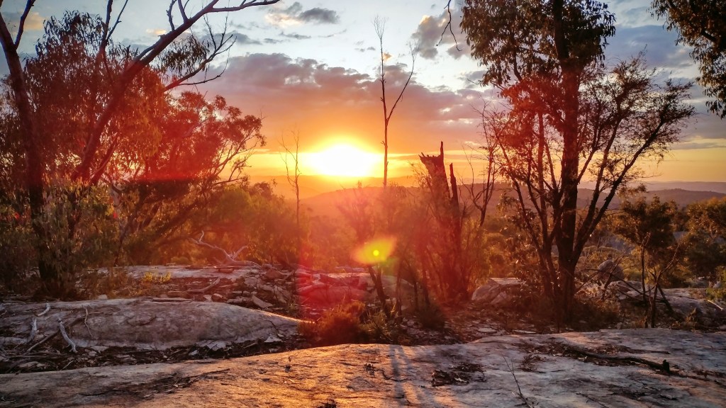
During the evening a pussy storm cell swept past accompanied by the roll of distant thunder, light rain and a lightning display of sorts.Which is just as well as I wouldn’t like to get caught out on this open valley in a bad electrical storm. But it was enough to confine the lads to their tents for half an hour before a dose of tent fever broke out and they poured out to watch the last vestiges of sunlight fade over the Abbott Range.
Storm building over Abbott Range. View from Wilkinson Valley.
A blood red sunset from smoke haze drifting from the Victorian bushfires just 80 kilometres to our south west.
Friday: The Main Range and The Rams Head Range: 9 kms.
With the tents left up to dry, Brian herded his two-legged flock up Mt Townsend (2209 m) and Alice Rawson (2160 m) as a sort of a warm-up for what was to come later in the day. Minus our packs it was too easy, a brisk 45 minute trot to Townsend summit and then a pop over to Alice Rawson which had the more interesting views: down into Lake Albina and into the very precipitous western fall of Lady Northcote Canyon.
Summit of Mt Townsend , 2209 m.
Source NLA: Frank Hurley: The Portal, Mt Townsend
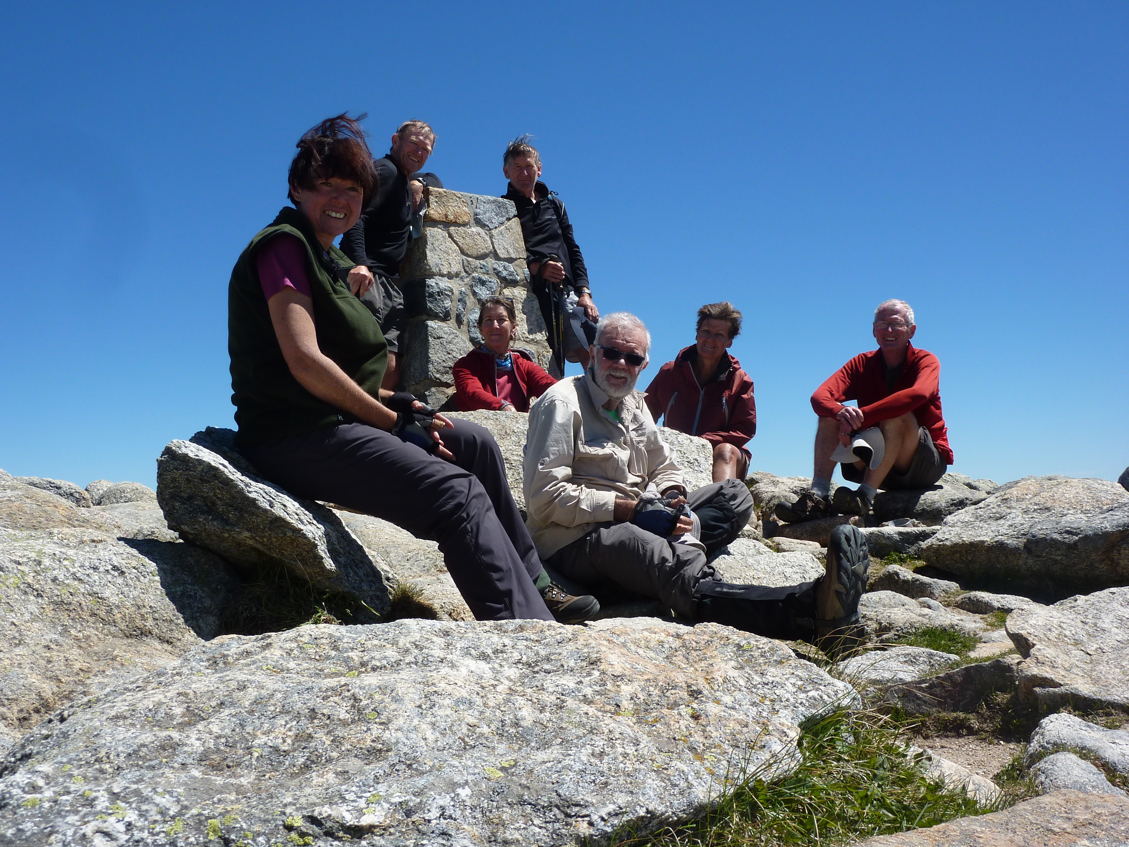
We stood on Mt Kosciuszko( 2228 m) by midday. Sharing the summit was the usual crew of day walkers, grey nomads, young international backpackers and five debonair track dogs who, with a certain degree of satisfaction and nonchalance, would point out to any unsuspecting tourist type who would listen, the mighty Gungartan, where we had stood five days prior.
Kosciuszko Summit, 2228 m
Tadeusz Kosciuszko
Mt Kosciuszko was named by the Polish explorer Count Paul Edmund de Strzelecki who spent four years travelling in Australia. In February 1840 Strzelecki climbed to the highest point of the Snowy Mountains and decided to name it after his fellow Pole, General Tadeusz Kosciuszko, who had distinguished himself in the American War of Independence and had led an uprising in 1794 against Prussian and Russian control of Poland.
Thaddaeus Kosciuszko. Source: NLA.
Strzelecki gave two reasons for using the name ‘Kosciuszko’. Strzelecki pointed out that in Australia he was “amongst a free people, who appreciate freedom” hence the name of the Polish liberation fighter was an appropriate choice. Another reason he gave was that the profile of Mt Kosciuszko resembled the memorial mound that honours Kosciuszko on the outskirts of Krakow. An interesting side line to this story is that Kosciuszko authorised the sale of all his Ohio (U.S.A.) property to buy freedom for slaves and provide them with an education.
Should you wish to read more about Tadeusz Kosciuszko, you could do no better than to have a gander at Anthony Sharwood’s tome: Kosciuszko, the Incredible Life of the Man behind the Mountain.
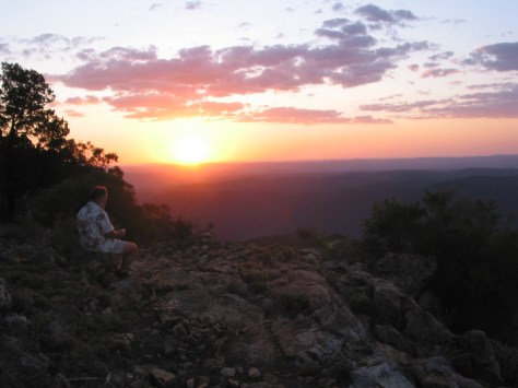
Then it was a dodder down to Rawsons Pass for lunch, hopefully sheltered from the near gale force 50 kmh wind gusts.After lunch we headed up onto the Rams Head Range but the boys were, strangely, more interested in finding a sheltered campsite than climbing North Rams Head.
The wind was now whipping across the open alpine meadows.Come 3.30 pm we called it off for the day and guyed our wildly flapping tents down behind a jumble of granite boulders.Evening showers drifted over, chasing us into our tents to cook our dinners only to re-emerge later to watch yet another red sunset.
Campsite under North Ramshead
Saturday: Rams Head Range to Thredbo. 10 kms.
Our last day on the track.We woke to a sky laced with thin wispy cirrus cloud, the harbinger of rain predicted for Sunday. Our route would take us over The Rams Head (2188 m) and South Rams Head (1931 m), descend to through snow gum woodland to Dead Horse Gap and follow the Thredbo River back to Thredbo.
Rams Head Range
As we approached South Rams Head a shaggy black swamp wallaby bounded past, closely pursued by a salivating dingo, closing fast. But this was one wily wallaby. On spotting us it saw its chance, performed a nifty u-turn, and headed back towards our group, placing us between it and the dingo. My last sighting was the swampy disappearing up into the pile of granite boulders behind us.
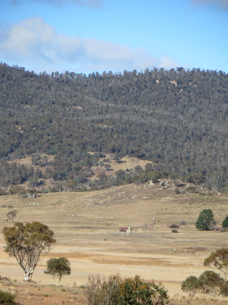
From South Rams Head trig we saw The Pilot Wilderness stretching off to the distant south: the Thredbo River Valley, Cascade Trail, The Pilot, Little Pilot, The Chimneys, Paddy Rushes Bogong and the Brindle Bull, masquerading as a mountain.These were some of the landmarks that we would visit after a rest day in Thredbo, but more of that some other time.
View from South Rams Head. Looking towards upper Thredbo River
Meanwhile, a flock of Australian Ravens cawed overhead. These fellows were chasing the Bogong Moths that hibernate in vast numbers during summer in rocky crevices on our alpine peaks.
A final bush bash led down to Dead Horse Gap (1582 m).So named because a herd of brumbies perished there when trapped in a blizzard.
Photo of old Dead Horse Gap Hut. Built in 1932 by Nankervis family. Destroyed by fire in 1972.
Then came a four kilometre dash down the Thredbo River trail, arriving at Thredbo just ahead of the first light sprinkles of rain. The first part of our summer Snowy Mountains adventure was over.It seemed to me that I had well and truly earned that schooner of Razorback Red. Which way to the Brindle Bull, Brian?
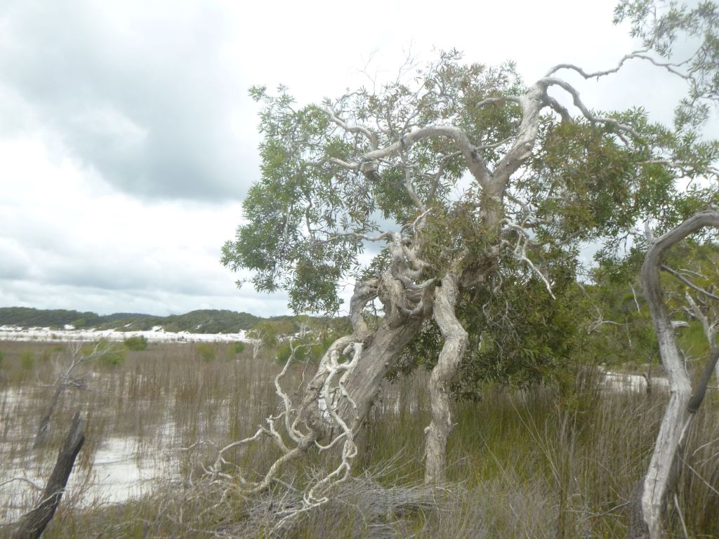
K’gari or Fraser Island, is the world’s largest sand island; a huge sandmass of 166 000 hectares in area and 123 kilometres long by 25 kilometres wide. It is a World Heritagelisted landscape of high dunes, pristine freshwater lakes, wallum heathlands, extensive active sandblows, reedyswamps, sandy ocean beaches and towering forests.
K’gari attracts nearly 300 000 visitors annually. For the bushwalker it offers an unbeatable combination of relative solitude, brilliant scenery, a great interlocking track network and excellent hikers camps tucked away from the hordes of 4X4 campers and tourbuses.
Our walk would take us on an 70 km circuit through a landscape of forested high dunes and perched lakes loosely known as the Southern Lakes District.
The traditional owners of K’gari are the Butchulla people who have occupied the island for at least 5000 years.Evidence of their occupation is found in middens, scar trees, lithic scattersand placenames of K’gari’s natural features.
Examples of Lithic Scatters on K’gari
Please leave all artefacts where you find them. Do not remove. Quote from Yolngu elder: ‘It ( sliver of quartz ) must be put back in the earth and left to grow… as all things do, men, animals, everything.’
What’s in the name: K’gari or Fraser Island ? Repatriation of a name.
K’gari is said to mean ‘paradise’ in the local Butchella language. It is pronounced ‘gurri’. Fraser Island is named after a Scottish woman , Eliza Fraser, who was shipwrecked on K’gari in 1836.
After her rescue she spread damaging and increasingly lurid accounts of her treatment by the Butchella people. Her accounts were syndicated as far as the Americas and reinforced the idea that Indigenous people were savages.
Source SLQ: Portrait of Eliza Fraser.
Source SLQ: The rescue of Eliza Fraser.
The reversion to K’gari began in 2011 when the Queensland Labor government added K’gari as an alternative name in the Queensland Place Names Register. In 2017 Fraser Island was renamed to K’gari (Fraser Island) National Park.
In 2021 , the World Heritage Committee adopted the name K’gari (Fraser Island) World Heritage Area. I believe that it is the intention to give Aboriginal names to K’gari’s natural features, while man-made features may keep current names.
Historical Photos of Butchella on K’gari.
Source SLQ: Man holding boomerang K’gari. ca 1900.
Source SLQ: Group of decorated men with shields and spears. 1870s. Pierson’s Camp. K’gari.
Source SLQ: Man showing scarification.
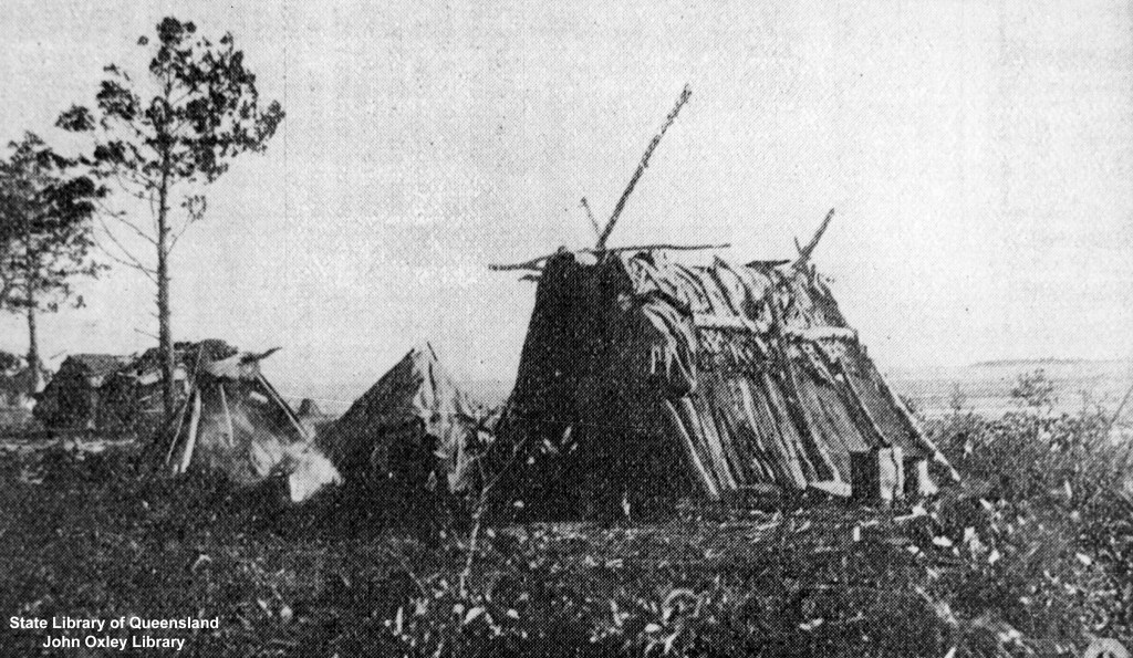
Source SLQ: Shelters at Bogimbah.
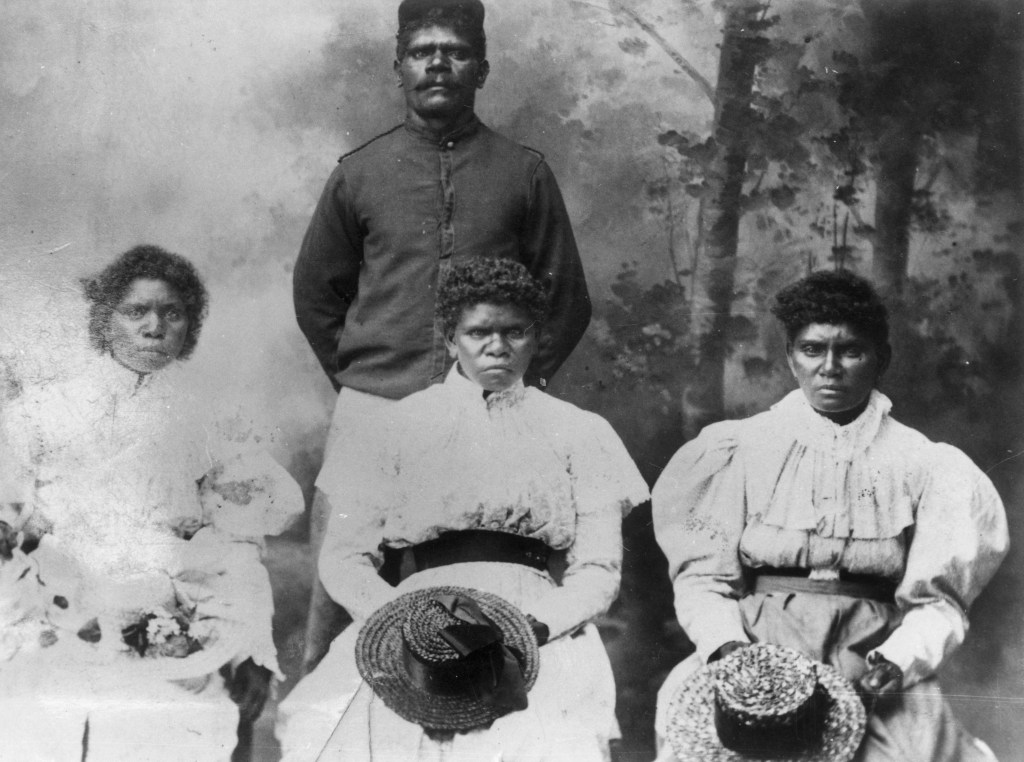
Source SLQ: Portrait of three women removed from K’gari. Note the Aboriginal tracker in the background.
P. Figgis & G. Mosley: Australia’s Wilderness Heritage. Vol 1. ACF and Weldon Publishing. 1988.
App developed by University of Sunshine Coast,
Website of Fraser Island Defenders Organisation ( FIDO ). This is easily the best and most comprehensive source of information on K’gari. https://fido.org.au/
Great Walk Map for K’gari / Fraser Island
Great Walk Fraser Island Topographic Map. Qld Parks and Wildlife Service.
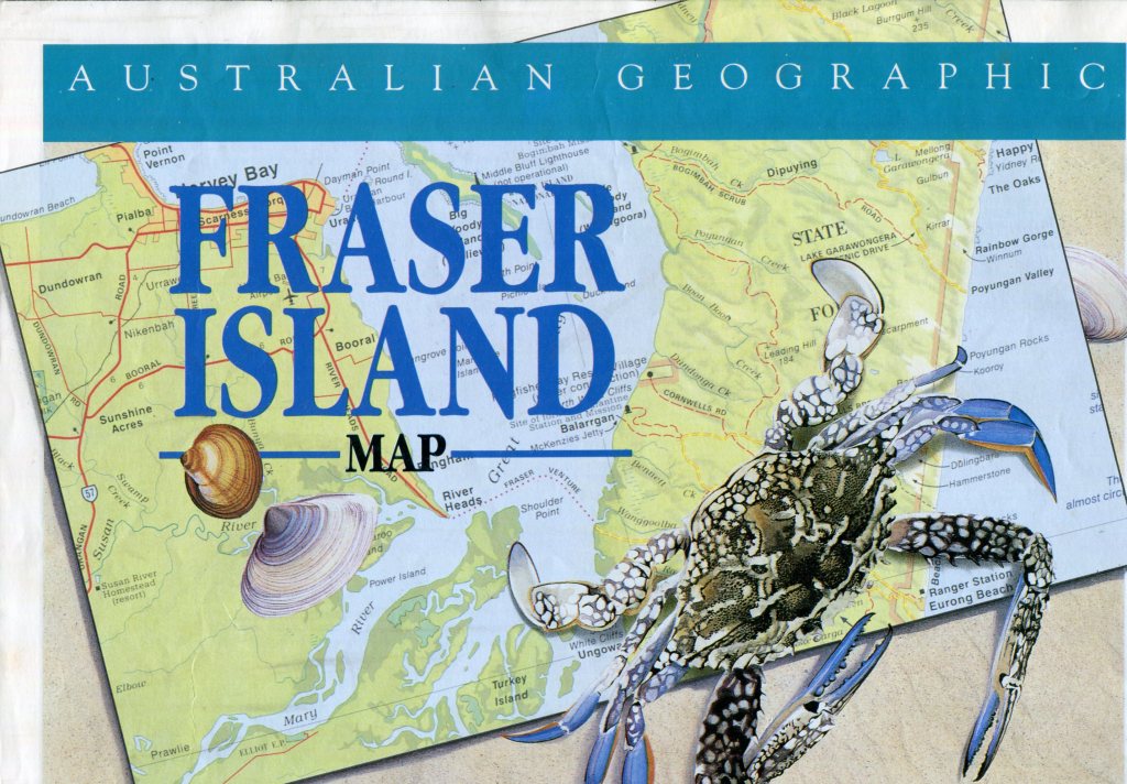
Australian Geographic Map of K’gari / Fraser Island.
Australian Geographic Map: Fraser Island: Scale 1 cm to 5 km
Location of K’gari, Fraser Island.
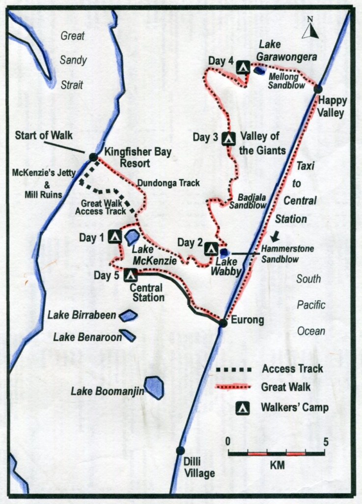
Thursday: Kingfisher Bay Resort to Lake McKenzies Walkers Camp: 8 kms.
Soon after 2.15 pm on a steamy Queensland October afternoon, theFraser Venturedecanted its cargo of 4WDs , resort guests and three ancient bushwalkers onto the wooden jetty of the eco-friendly KingfisherBay Resort. Our six day K’gari adventure was under way.My two companions were John and Joe.
Southern Lakes landscape. Lake Boomanjin.
Map of Southern Lakes Circuit: K’gari.
Southern Lakes Circuit: Kingfisher Resort> Boorangoora> Lake Benaroon> Markwells Break> Central Stn> Boorangoora> McKenzies Jetty> Kingfisher Resort
The escape from the resort compound wasn’t all that obvious. But after we had wandered aimlessly through the resort, we swallowed our pride and asked a guest for exit instructions. He pointed us in the right direction: up a sandy track and through the electrified dingo-proof fence.
This was a foretaste of the soupy and sandy conditions for the next six days: hot steamy weather, biggish hills and sandy tracks.We quickly manoeuveredinto walking formation. Joe in the lead, trundling along at his steady four kilometres per hour. John sauntering along in the rear, allowing him to indulge his obsession with birdwatching. Your scribe somewhere in the middle.
” Slow Travel is always the Best Travel “.
Fellow travellers, ever curious.
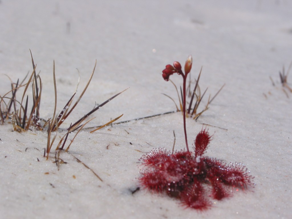
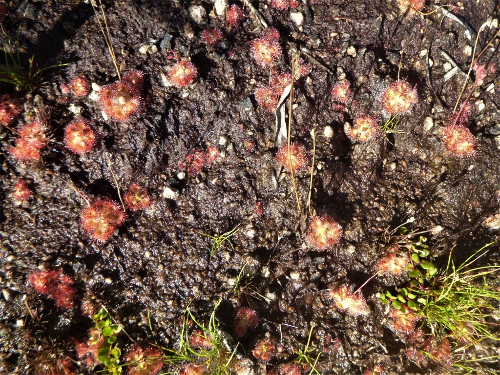
The object of our attention: Drosera sp. (Sundew). Carnivorous plants which capture and digest insects using sticky leaf surfaces. Often grow in soils with poor mineral content. This specimen found growing on sandy beach of Lake Boomanjin.
Our track headed generally south east, roughly paralleling Dundonga Creek. For much of its way the track snaked through scrubby low woodland, finally arriving at the crest of a high forested duneat 100 metres. Here we were greeted by a distant clap of thunder.
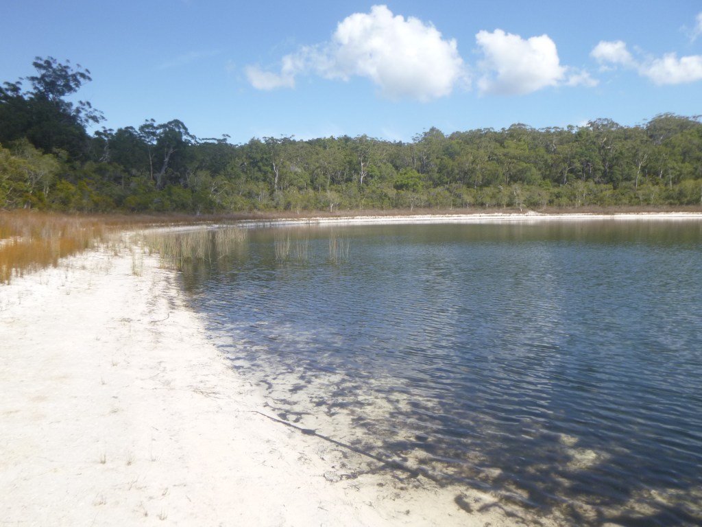
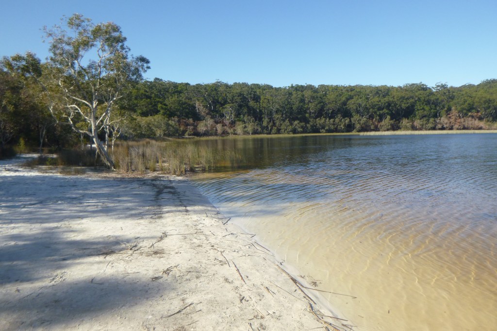
From this vantage point we looked down onto the blue waters and the wide sandy beaches of Boorangoora aka Lake McKenzie. Unusually, for a hot afternoon, the beaches were deserted. In pre-Covid times the beach would have been crawling with sunbathers touching up their tans.
Boorangoora / Lake McKenzie, K’gari.
Boorangoora / Lake McKenzie: late afternoon and no day trippers !
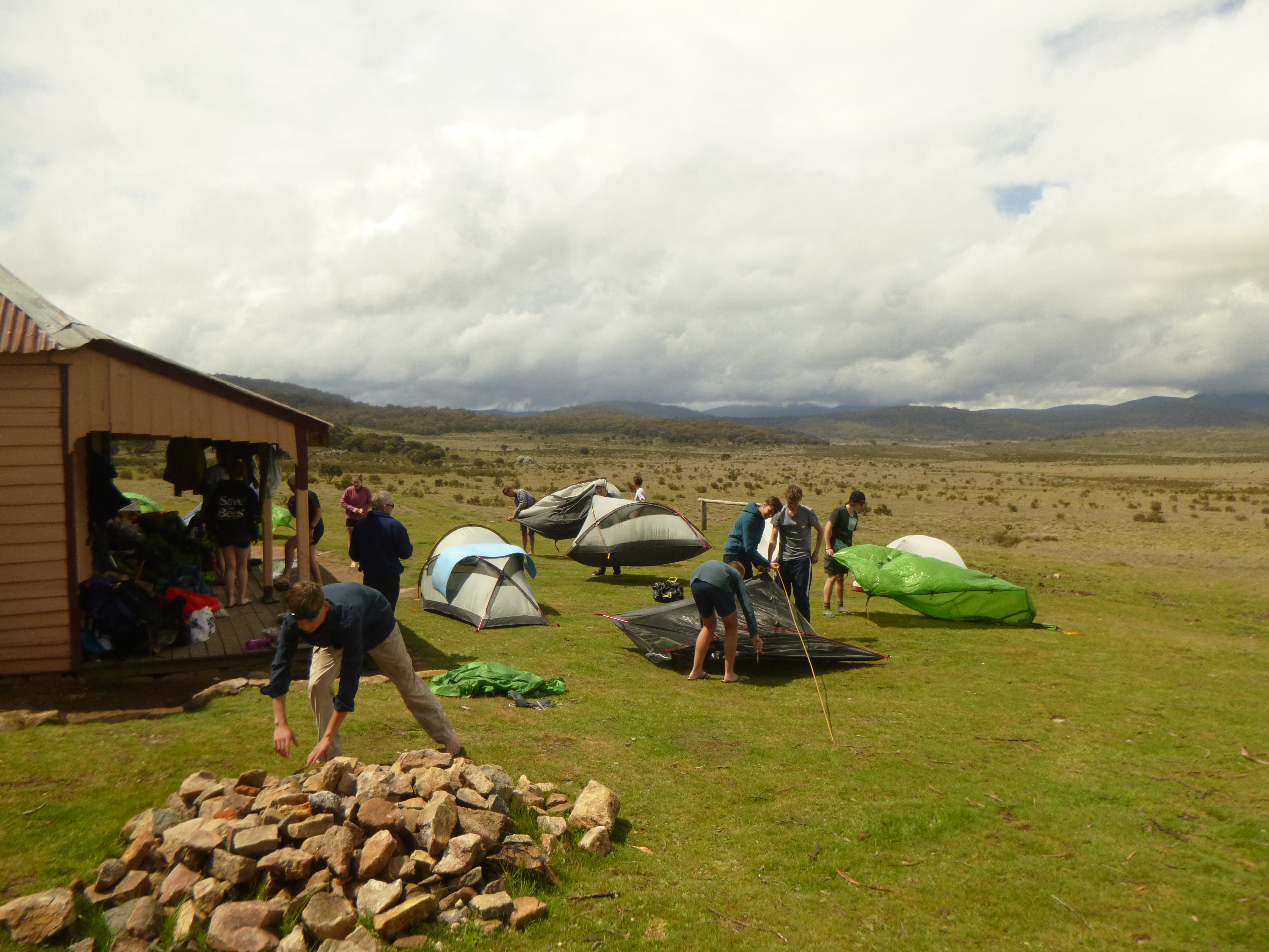
With the threat of an impending storm we picked up the pace and arrived at the Lake McKenzie Walkers Camp a mere two and a half hours after leaving Kingfisher Resort. The campground was currently home to a clutch of high schoolers, surprisingly very well behaved.
The walkers camp at Lake McKenzie is all you could wish for if hiking luxury is your thing: toilets, water, tent pads that can double up as swimming pools after a shower of rain , wooden tables , metal food/gear lockers to keep out the local fauna and the cool fresh waters of Boorangoora only a stone’s throw away. And, as a bonus, the whole campground comes without 4WDers and has its own dingo-proof fence.
Dingo proof fence at Lake McKenzie walkers camp.
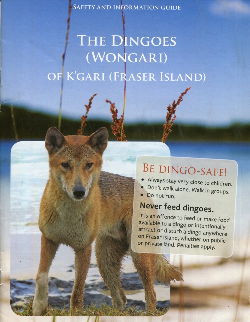
Wongari: Fraser Island Dingoes: Canis dingo.
K’gari is rightly famous for its population of pure bred dingoes and visitors are always thrilled with the sighting of a dingo in the wild. More problematic though are the direct interactions between human and dingo.
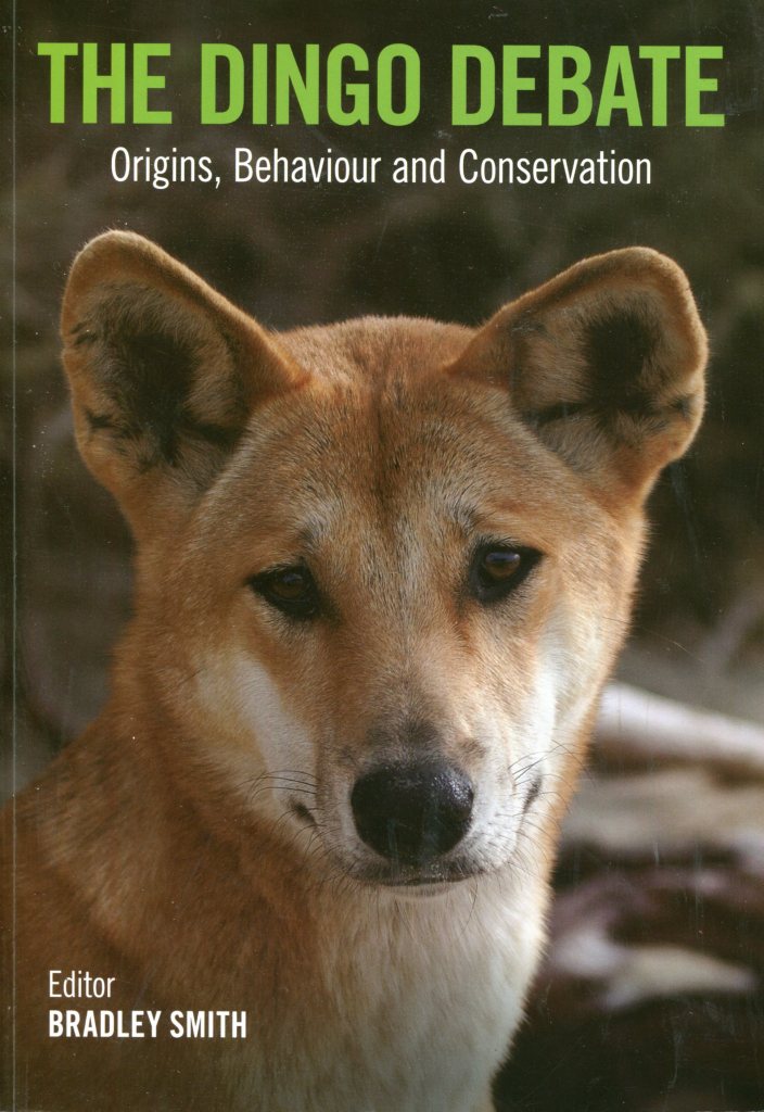
More than 20 years after the disappearance of Azaria Chamberlain from a Central Australian campground, dingoes would again hit the headlines with the death of a nine year old boy, Clinton Gage, on K’gari.Bradley Smith’s book ‘ The Dingo Debate’has an excellent chapter written by Rob Appleby which summarises the research on Fraser Island dingoes.
The Dingo Debate. Bradley Smith ( ed ). CSIRO. 2015.
The Dingo on K’gari. Wongari
K’gari has a dingo population of approximately 104 to 200 pure bred dingoes. Small mammals and marsupials as well as fish form an important constituent of their diets, not, thankfully, Homo sapiens.
The dingoes are naturally sleek animals, but they are not, as many visitors assume, hungry. The temptation to feed them, or play with them should be resisted at all costs. It is on K’gari that the most visible efforts have been made to manage the dingo-human interface.
Unfortunately, it is the dingo that comes off second best. Since 1992 the Queensland Parks Service (QPS) has culled 135 dingoes, of which only eight were sick or injured. To be fair, ‘ lethal control’ is the measure of last resort.
The QPS has developed a dingo management strategy of the ‘Three Es’: education, engineering and enforcement. Their ‘Be Dingo Safe’ campaign is considered by international experts as very innovative and world’s best practice.
The mainengineeringsolution isthe widespread use of high dingo-proof fencing around sources of food such as campgrounds and resorts: Kingfisher Bay, Eurong and Happy Valley. Enforcement usually involves the issuing of Penalty Infringement Notices(PINs).
Very few of these go to court. But in one very highly publicised case, a wildlife photographer cum dingo campaigner was fined $ 40 000 for multiple breaches.The general principle is one of visitor education.
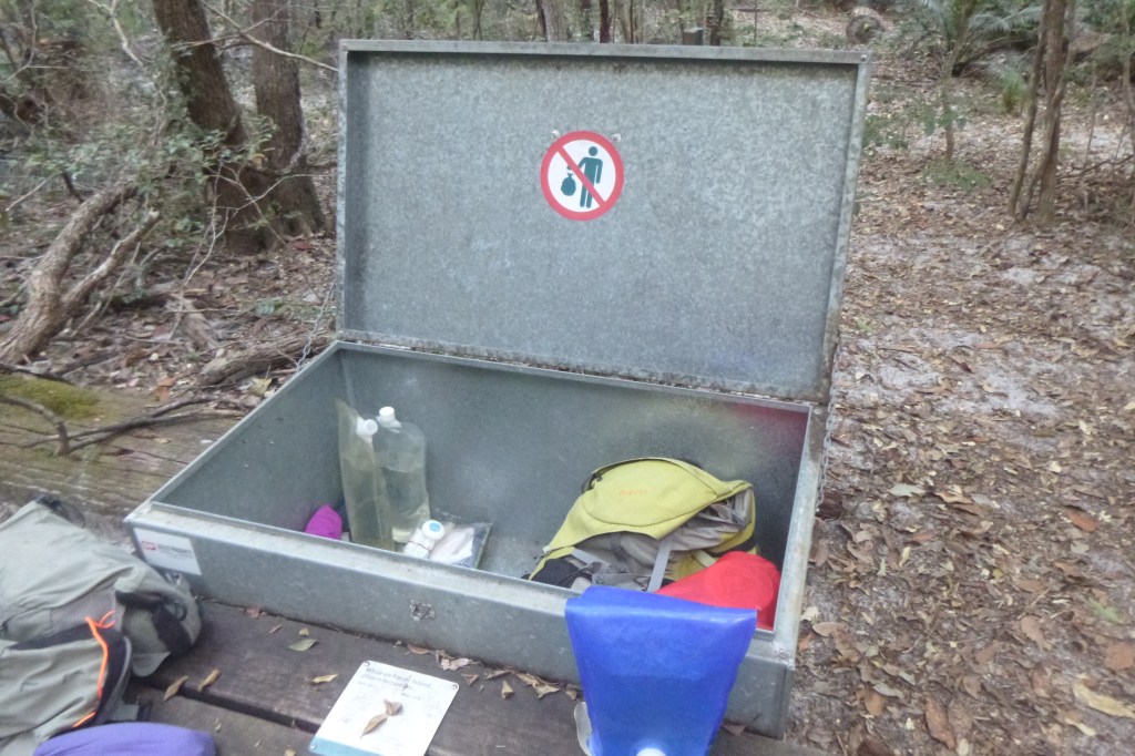
Animal proof locker in campsite.
With numerous such dingo warning signseverywhere, I deemed it politic to unearth my copy of the Queensland Parks Service brochure: ‘Be Dingo Safe! Did you know that dingoes can open tent zips and failing that, rip open tents, mesh screens, and tarpaulins.
They have been known to break into iceboxes ( eskies ) and those ubiquitous cheap plastic bins. I was further warned that dingoes will eat anything: lollies, soap, tents, toothpaste and even hikers boots.
Thus, in this era of duty of care bushwalking, the Queensland Parks Service had thoughtfully provided a two metre high dingo-proof fence as well as metal doggy and native mice proof bins to store overnight gear.
Safety and Information Guide: Qld Govt.
Meanwhile, back in the walkers camp, hysterical screaming about snakes came from a nearby tent site. This prompted me to check that I had fully closed my tent’s mesh entrance. I’ve never had a guest snake in my tent… marsupial mice, mosquitoes, leeches, ticks, March flies even a quoll, but never, thankfully, a snake.
Further inquiries revealed that it was just a modestly sized carpet python. In due course it slithered off and transferred it’s unwanted affections to the table immediately adjacent to my tent.
My reptilian mate hung around most of the night, finally scoffing down a squealing Antichineus in the early hours of Friday morning. Come daybreak it had vanished into the undergrowth.
Carpet snake wandering through Lake McKenzie’s Walkers Camp.
Friday: Boorangoora / Lake McKenzie to Lake Benaroon via Tawhan / Basin Lake : 15 kms.
Our early morning routine was immutable. A bit of preliminary in-tent packing, change back into the already putrid hiking gear and finally emerge into the crepuscular dawn. A quick brew, a bowl of porridge, a final pack and we were on our way. Usually by 6.30 am. All the better to beat the humidity.
From Boorangoora some down and up brought us to Tawhan, Basin Lake, a small nearly circular lake nestled into an amphitheatre of heavily vegetated high dunes.We waddled down to check out the lakebut given the early hour we passed on the swim bit. And so, a longish downhill canter delivered us to the relative civilisation of Central Station.
Tahwan, Basin Lake.
Central Station Day Use Area.
Central Station
Central Station is now the main camping area for southern Fraser Island, so expect heaps of tourists . Elderly hikers and campers be warned: it has a well earned reputation as backpacker party central.
That aside, walkers and 4WDers have been spoilt by the Queensland Parks Service with treated water, flushing toilets, hot showers ( $2.00 ), decent tent pads with picnic tables and a day use area with picnic shelters, information boards, phone (old style), and BBQ’s. And, you are safely corralled behind a dingo-proof fence.
Central Station Walkers Camp on a very damp day in September 2006. A sneaky low pressure cell developed over K’gari making life on the open road a tad wet. These lows are frequent enough to deserve a specific name: a Fraser Island Low.
We sprawled out for our morning tea break on the shady boardwalk of Wanggoolba Creek, flowing crystal clear under a rainforest canopy of palms, tree ferns and huge trees festooned with epiphytes, vines and orchids.
A tourist magnet judging by the number of day-trippers who waddled past. Many stopped for a chat, curious about the old fellows lurking on the boardwalk with their voluminous rucksacks proppedbeside them.
Littoral rainforest on Wanggoolba Creek, Central Station.
Interlude over, we shouldered our monkeys and headed south, back into the high dunes.Much of K’gari is a maze of vegetated razorback high dunes. When viewed from above many have a characteristic U or V shape.
These are parabolic dunes, having long trailing arms aligned parallel to the prevailing south – easterly winds; a real pain in the neck for those of us walking on a north-south trajectory. There were six episodes of parabolic dune building, with the oldest in the west ( 700,000 years old ) and the youngest in the east ( 40,000 years ago ). https://www.abc.net.au/news/science/2022-11-15/kgari-fraser-island-age-links-to-great-barrier-reef-formation/101638104 They reach their highest point at Mt Boowarrady at 214 metres.
Satellite image of heavily vegetated high dunes K’gari. Central Lakes district.
Parabolics are relicts of ancient sandblows, which, in the Great Sandy Region have been stabilised by old growth rainforests and eucalypt forests. K’gari also has a large number of non-vegetated, active sandblows: the significent ones in the Southern Lakes District include Dulingbara, Hammerstone and Wongi sandblows.
Wongi Sandblow
Often, more frequently than I would like, a day’s walk on K’gari degenerates into long, steep slogs to a dune crest then a brief respite along the dune top, followed by the eagerly anticipated descent into the next swale. Oddly, John preferred these uphill trudges while Joe and I cussed along in his wake.
A Landscape of High Dunes and Lakes: The Bogimbah Dune Land System.
Our route for the remainder of the day took us past more perched lakes: Lake Jennings, Lake Birrabeen, finally coming to roost in the Benaroon Walkers Camp.
This high dune and lake landscape is part of the Bogimbah Dune Land Systemwhich occupies a considerable part of central K’gari from Lake Bowarrady in the north southwards to the Sandy Strait. It contains the best of the lake scenery as well as the successive waves of huge Pleistocene parabolic dunes which now form the highest part of the island.
The vegetation cover is almost entirely tall forest dominated by Blackbutt (Eucalyptus pilularis), Red Mahogany (E. resinifera), Satinay (Syncarpia hillii), Tallowwood ( E. microcorys) and Brushbox(Lophostemon confertus).The Bogimbahsystem also encompasses virtually all of K’gari’s rainforest.
Photo: JB. One of the many ‘giant’ trees on K’gari. Tallowwood ( Eucalyptus microcorys ).
Eucalypt forest on K’gari’s high dune system. Great Walk Track .
The sub-tropical rainforests occupy the swales between dunes and are characterised by tall closed forests with a diversity of species and structural elements.
The canopy trees are Satinay (Syncarpia hillii), Brushbox (Lophostemon confertus), Hoop Pine (Araucaria cunninghamii), Kauri Pine ( Agathis robusta ), Strangler Figs( Ficus sp. ) and Piccabeen Palms ( Archhontophoenix cunninghamiana).
Strangler Fig.
Kauri Pine, Agathis robusta
Piccabeen Palm : Archontophoenix cunninghamiana
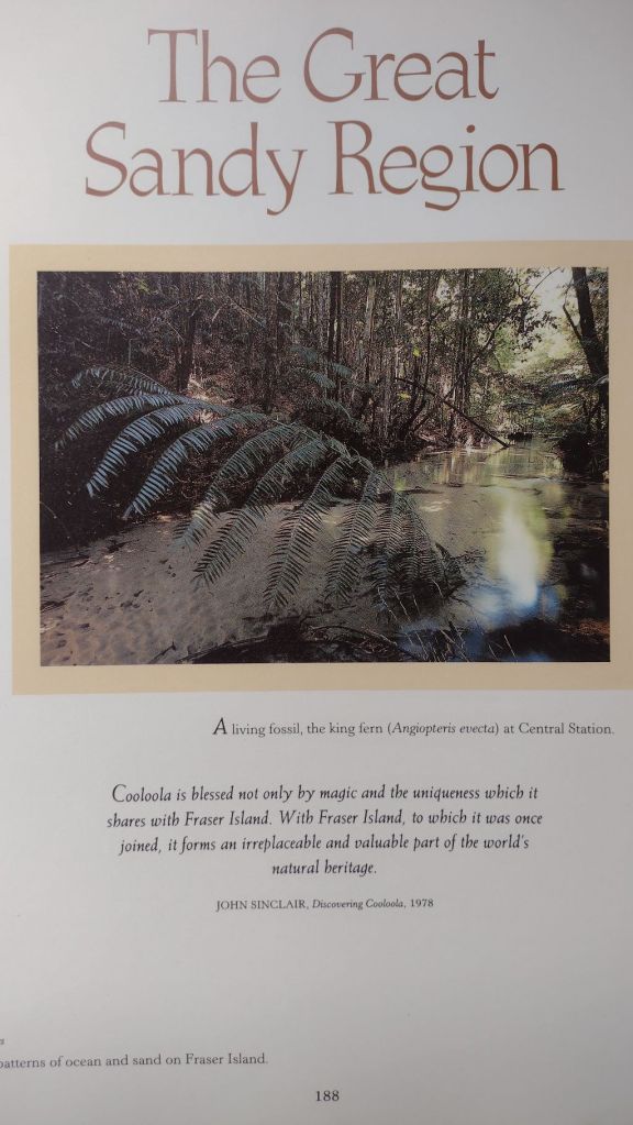
Understorey plantsinclude Tree ferns ( Cyathea sp. ), Climbing Pandanus ( Freycinetia arborea ), King Ferns( Todea barbara ) and a variety of epiphytes.One understorey plant which I was pleased to find was Giant Fern ( Angiopteris evecta ), which grows to five metres talland although uncommon in South East Queensland, it is also found in moist side gorges of Carnarvon Gorge in Central Queensland.
K’gari rainforest: Angiopteris evecta, an ancient fern with a history dating back 300 million years.
Lake Benaroon.
Benaroon Walkers Camp was deserted. No fellow walkers , no dingoes, and alarmingly, no dingo fencing. But I did find snarling dingo warning signs on the toilet door. Pretty unkind to dingoes I always think.
Tent up, I drifted off in search of my well-earned refreshing dip. The shallow tannin-stained waters of Benaroon didn’t oblige. I managed a half-hearted semi-submerged wash down but a decent swim wasn’t on offer.
Great Walk campsite at Lake Benaroon.
Lake Benaroon
With a hazy sun setting in a blood red western sky, our thoughts turned the plumes of smoke we had seen over the north of K’garion our first day. The bush fire was obviously still burning, hopefully still well to our north. It would burn uncontrolled for several more weeks.
Clouds building over Lake Benaroon on sunset.
The 2020 summer bushfire on K’gari.
A major bushfire started on the 14th of October, 2020 , when an illegal campfire torched bushland in the island’s north. It was still burning and spreading when we left K’gari .
It went on to incinerate 82,00 hectares, nearly half the island. Add to that another 13,500 hectares of bushfire damage in 2019and these wildfires have had a major impact on this World Heritage listed estate.
The 2020 fire came close to damaging major infrastructure at Cathedral Beach Campground, the village of Happy Valley and Kingfisher Bay Resort. So serious was the situation that K’gari was placed off-limits to tourists.
At its peak a massive response of 87 firefighters, 9 supporting aircraft, a large aerial tanker and 36 vehicles still were unable to get it under control. Given thedangerous cocktail inaccessible terrain, hot, dry northerlies, this was hardly surprising .
The fire was finally brought under control by an intense rain event associated with an upper air trough on the 13th of December 2020. Sixty two days after it had ignited.
Aftermath of 2020 bushfires on K’gari.
Dense regrowth after 2020 bushfire season.
Saturday: Lake Benaroon to Markwell’s Break via Lake Boomanjin: 8 kms.
Today’s walk would see us exit the Great! Walk system at the northern end of Lake Boomanjin and turn onto a fire trail known as Markwell’s Break, following it northtowards Lake Wabby.
We planned to collect water at Bridge Creek on Markwells allowing us to camp several more kilometres along the break. Placing uscloser to Wabbyfor tomorrow’s walk. But more of that plan later.
Meanwhile, the seven kilometre track to Boomanjin climbs gradually up a high dune to top out at 150 metres. From here it gently winds down the trailing arms through tall forest to reach the wide sandy beach of Lake Boomanjin.
Lake Boomanjin: the world’s largest ‘perched’ lake.
Most of the freshwater lakes south of Lake Bowarrady are examples of perched lakes. That is, the water in the lakes is held at an elevation in the dune well above the island’s general water table, often 100 metres or more above the water table.
Over time, the normally highly permeable sand has been cemented by organic material washed in by feeder creeks and swamps. Eventually the cemented sand becomes an impervious humate rock which captures any inflowing water. There are very few perched dune lakes elsewhere in the worldoutside Queensland’s Great Sandy Region, so it was a privilege to see them.
Lake Boomanjin. Storms building by mid morning.
At 200 hectares Boomanjin is reputed to be the largest perched lake in the world. Its deep brown colour comes from the organic tannins leached from the swamps on its northern and western shores. With its Melaleuca-lined shores and white sandy beaches it is easily one of the most photogenic lakes on K’gari.
Other types of lakes on K’gari are water window lakes ( most of the lakes in northern K’gari )and barrage lakes ( Lake Wabby ).
Barrage lake : Lake Wabby. An active sandblow is forming a barrier that backs up any regional water flowing into the lake. The barrage sandblow in this photo is called Dulingbara.
Lake Garawongera: a Water Window Lake. Water Window lakes form when the land surface dips below the local water table, creating a window the water table.
But to return to the sands of Boomanjin. We spent a very pleasant hour rattling around on its northern shores; John chasing birds whileJoe and I found a shady nook to enjoy morning tea and the cooling breeze wafting off the lake.
John reappeared in due course and here we peeled offthe Great!Walktrack systemand lumbered up the 100 metre altitude gain onto the high dunes of Markwells Break. Our destination was Bridge Creek , two kilometres hence, where, in theory, we would collect water for the afternoon and drag it to our overnight camp several more kilometres along Markwell Break.
Bridge Creek on Markwells Break. Alas, no water.
Naturally there was no water. John volunteered to thrash off into the manky vegetation downstream looking for the precious water. To no avail. Slow learners…Never trust depictions of perennial and non-perennial streams on Australian maps.
There was no choice but to return several kilometres to Boomanjin, collect water and climb back up onto the high dunes of Markwells Break. But not before lodging our rucksacks high up in some Allocasuarinas, safe from the predations of any passing dingoes.
Collecting water from stream feeding northern end of Lake Boomanjin.
We carted our watery cargo back up Markwells and set about pitching tents under a threatening sky. This was a great campsite; while lacking the mod cons of the walkers camps it was, by far, my favourite campsite of the trip. High in the dunes set in a Banksia and Scribbly Gum woodland.
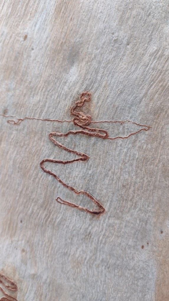
The Scribbly Gum: An Australian Icon.
For many years the scribbles on the smooth-bark Eucalypts intrigued field naturalists, writers and bushwalkers. It was thought that the scribbles were caused by the larvae of a beetle.
Scribbly Gum, K’gari.
In the 1930’s , Tom Greaves, a CSIRO entomologist, discovered the larvae of a small moth were responsible for the scribbles on Eucalypts in the Brindabella Ranges near Canberra.
Specimen moths were sent to the UK for identification and a new genus was established, Ogmograptis, and the moth was named Ogmograpthis scribula.CSIRO scientists discovered that there are more than one moth responsible for scribbles; currently the number is 14, with many more to come.
The larvae bore tunnels in the outside tissue of the tree’s trunk. The caterpillar then eats its way back along the tunnel, leaving the tree to spin a cocoon at its base where it pupates.
Bark of Scribbly Gum: Eucalyptus racemosa.
Close up of scribble made by larvae of Scribbly Gum moth: Ogmograptis sp.
John disappeared on one of his avian missions while Joe and I made short work of our ever dwindling rations. I treated myself to a Back Country pouch of roast beef, mashed potato and veg while Joe savouredone of his delectablehome-made dried concoctions: risotto, mushroom, garnished in white wine.Joe is a handy chef, both in the home kitchen and out in the bush.
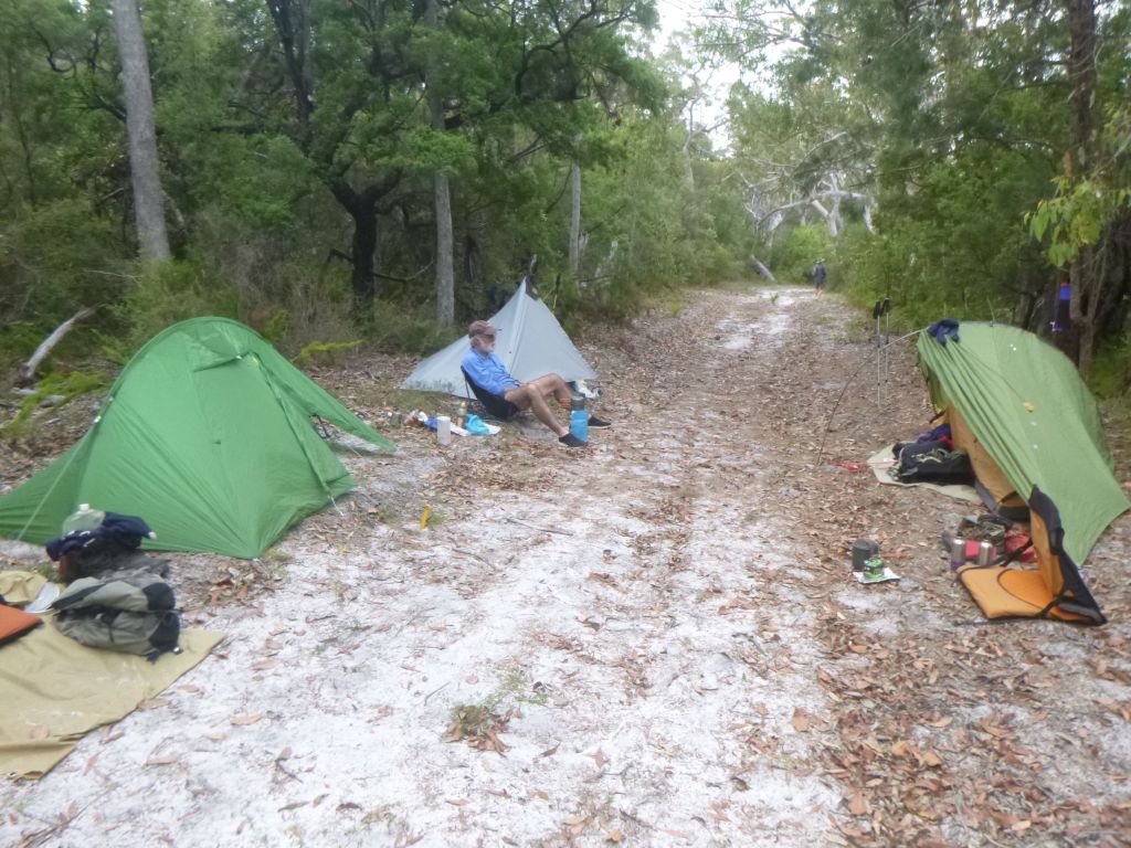
On dusk a light sprinkle of rain drove us into our tentsfor the duration.
Overnight camp on Markwells Break
Sunday: Markwells Break to Central Station: 16 kms.
Twelve sweaty hours entombed in small tents encouraged us out soon after 4.15 am . We were trackside by 6.15 am. All the better to beat the predicted heat and humidity. A very pleasant stroll follows the shaded tops of the high dunes. There are many special moments in bushwalking when lugging our monkeys around is all made worthwhile.
In this case a trackside scatter of chewed she-oak cones called orts. A good find, as orts signify the presenceof Glossy black-cockatoos, listed as a Vulnerable species under the Queensland Nature Conservation Act, 1992.Scientists regard orts as a reliable indicator of the presence of the Glossies.
They feed almost exclusively on the seeds of nine she-oak species, often restricting their diet to two species within their range. They display strong fidelity to specific feed trees, returning to these trees year after year. They are quiet and unobtrusive birds and call infrequently. Hence the fresh orts were an indication that Glossies had been feeding in this tree.
So next time you are out walking in the bush keep an eye open for orts. You never know, there might be a pair of Glossies feeding quietly in the foliage of a she-oak nearby.
Photo: CSIRO: By Aviceda -CC-BY-SA 3.0
A few kilometres on we popped out of the woodlandto the unremarkable Markwells Lookout.
Markwells Lookout on Markwells Break.
To the east were the sands of Eurong beach with the blue Pacific Ocean stretching off to the horizon. Northwards , our direction of travel, is the lower country of the Markwell Land System. It is demarced from the high dunes where we were standing by an escarpment, sand not rock. Here the Bogimbah high dunes have been eroded into sharply delineated sand cliffs by past higher sea levels.Later erosion has obscured the steep cliffline so that our descent was quite gradual.
TheMarkwell Dune System is composed of more recent sand deposits forming relatively gentle topography clothed in open forest and some swampy country.
Meanwhile, back at the lookout Joe’s Bureau of Meteorology ( known in Australia as the BOM ) app informed us that severe thunderstorms promising heavy rain, hail and lightning were heading our way, encouraging us todivert for the Central Station where we could bunker down. Lake Wabby abandoned.
We followed Markwellsnorthwards for another six kilometres across hot, flat , sandy country. By late morning the humidity was pretty unpleasant so we were happy campers when we swung back into the shady high dunes and re-connected with the Great! Walk track system.
Great Walks Signage.
The final four kilometres of our day edged gently downhill passing through Pile Valley featuring some of the best rainforest on K’gari. It is in Pile Valley that you are guaranteed to see the best specimens of K’gari’s rightly famous Satinay trees.
Vines on the edge of scrubs , Pile Valley, K’gari.
Satinay or Fraser Island Turpentine
Satinay( Syncarpia hillii )was a much prized timber extracted from K’gari’s forests in the late 1800s and early 1900s. The name satinay derives from the satine wood of French Guiana. It had multiple uses : furniture, flooring, heavy construction beams, telegraph poles and most famously as borer resistant marine jetty piles.
Its timber graces Australia’s Old Parliament house while the piles were used extensively for the wharves of London and the Suez Canal. Satinay grows to well over 40 metres in height with girths of four metres. It is easily identified by its deeply furrowed bark and fused capsules.
Satinay. K’gari
Fused capsule of Satinay; Syncarpia hilli.
A stand of Satinay with deeply furrowed bark.
With rain threatening we hastened through Pile Valley and made a bee-line for a shelter shed in the Central Station Day Use Area. And there we perched for the night only issuing forthfor a refreshing cold shower in the campground. PS: bring $ 2.00 coins if you want a hot shower.
We had avoided getting wet but the humid, still air in the backblocks of the shelter shed did seem to attract a robust population of mosquitoes and March flies, intent on driving us back out into the rain. Deet took care of the mosquitoes but the March flies are totally oblivious to layers of thick clothing and Deet. If you want a March Fly freeexperience, go in winter or September at the latest.
Central Station Day Use Shelter Shed
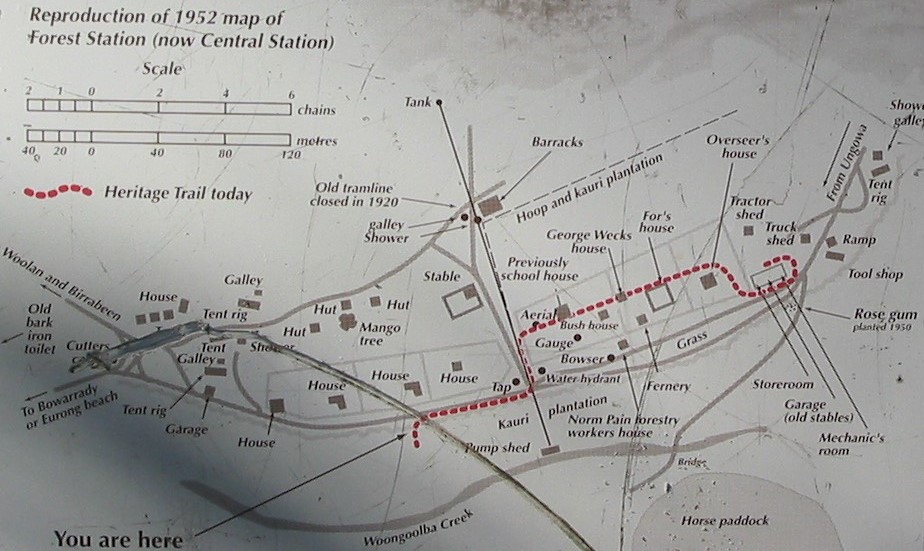
A History of Central Station.
In its heyday, Central Station was a bustling forestry station. In 1952 it boasted a school, plant nursery, machinery sheds, vegetable gardens, fruit trees, stables, fernery as well as houses, huts, barracks and tents for its considerable workforce.
Steam locos puffed through, carting logs to K’gari’s west coast for transport to Maryborough. Water was pumped from nearby Woongoolba Creek, even now probably the clearest and cleanest water in Australia.On the northern side of the station were extensive plantations of Kauri and Hoop pines.
All that remains now are the barracks built in the 1930s , two huge mango treesand the pine plantations. Rangers are currently working on a small museum to showcase the history of Central Station.
Map of Central Station. 1952.
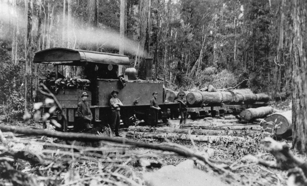
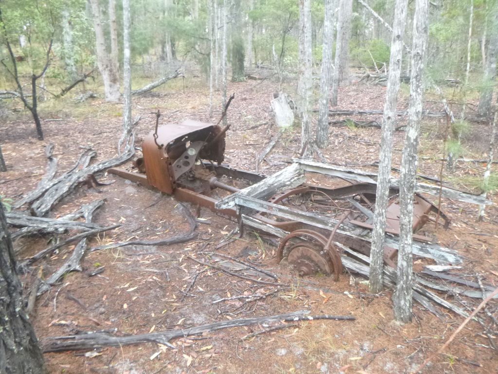
A Gallery of historical photos of timber industry on K’gari
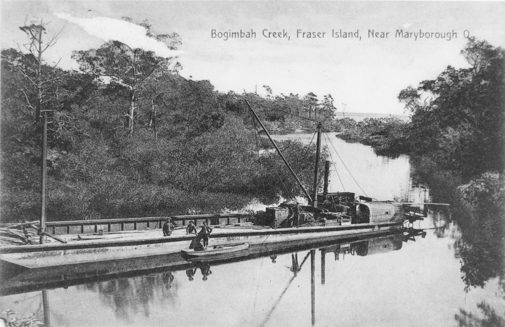
Source SLQ: Bogimbah Log Dump and tramway. These light rail networks worked from 1905 to 1935 and were eventually replaced by logging trucks. There were three main lines built. This one was 13 kilometres long with two spur lines.
Timber jinker, K’gari.
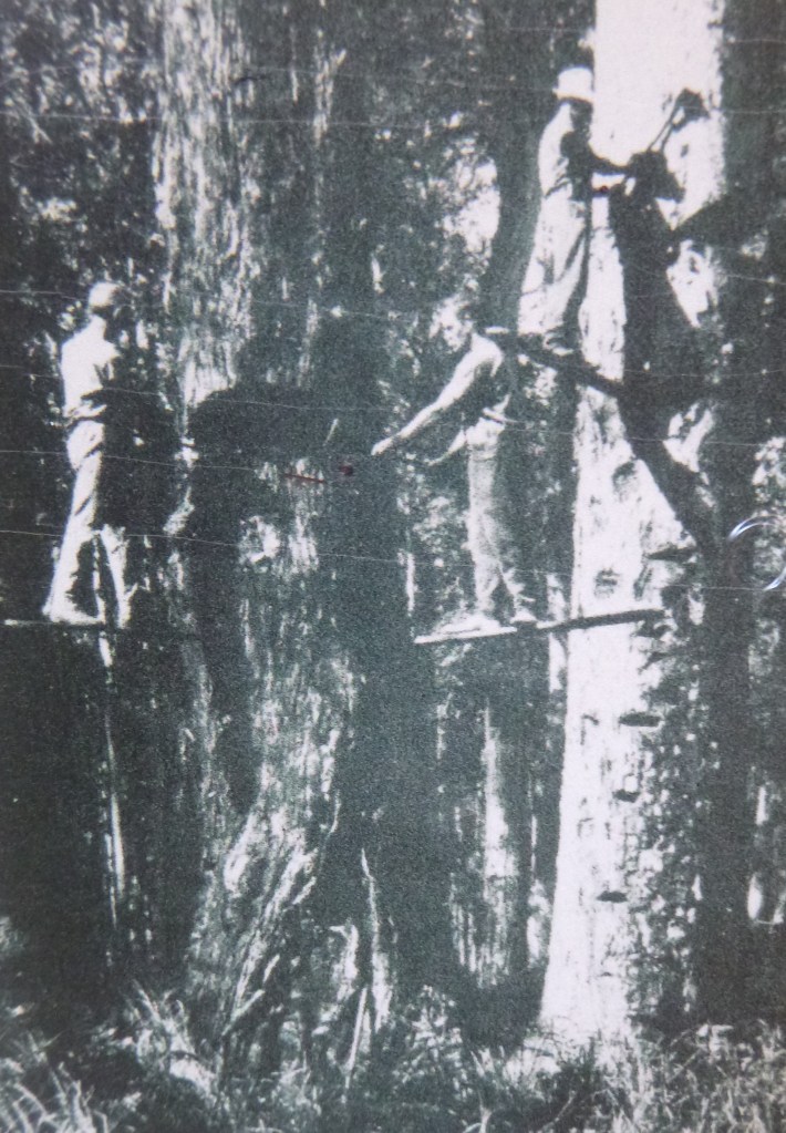
Timber Cutters on springboards, K’gari
Source: SLQ: Steam engine hauling logs in Bogimbah Scrub, K’gari.
Source: SLQ: Log punt in Bogimbah Creek. K’gari. Ca 1911.
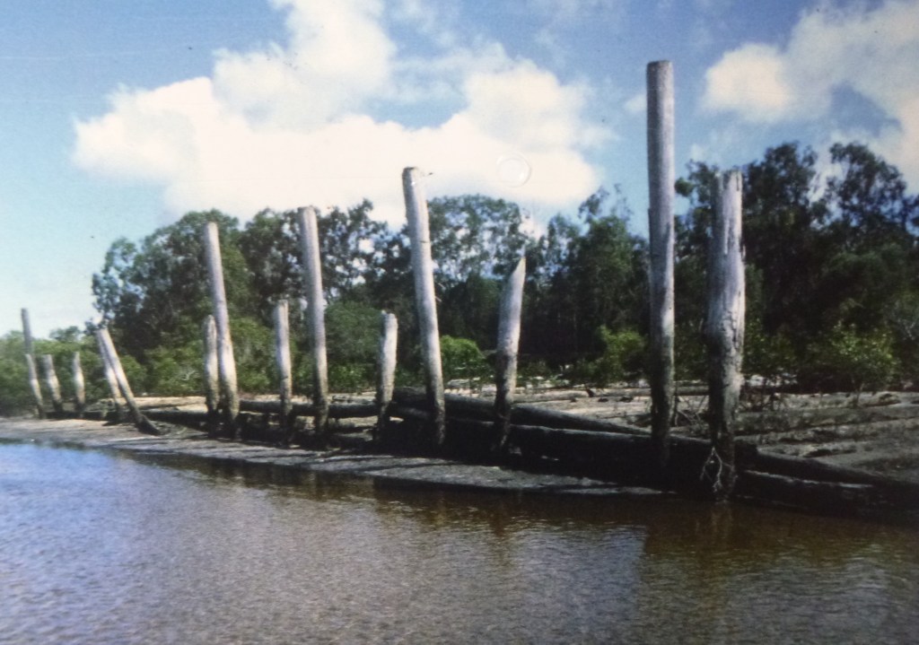
Log loading wharf on Great Sandy Strait. K’gari.
Monday: Central Station to McKenzies Jetty: 18 kms.
Out disgustingly early again, hoping to dodge any stray rangers doing their rounds. Our revised plan was to walk through to McKenzies Jetty ( ruins ) where we hoped to prop for the night, leaving only four kilometres to knock off tomorrow morning.Our map showed a perennial stream flowing out into the Sandy Strait, a potential source of water for our overnight camp. Had we learnt our lesson from the Bridge Creek debacle.?
An initial long climb took us up to Tarwan / Basin Lake . John drifted down to the lake again in the vain hope of seeing something avian. Joe and I lurked around in the shade.
And so onto Boonangoora / Lake McKenzie to retrieve a sweet treat food stash planted last Friday in a log in the campground.But first came the refreshing dip in the lake and given that it was barely 9.00 am it was, pleasantly, a tourist free zone. Though we could have done without the drone fly-over.
The stash of tinned peaches, rice cream and cream disappeared in a thrice. Fuel for the next ten kilometre stretch to McKenzies. Ten kilometresthrough low open woodland and health on a stifling humid day. Not much fun.Come midday we were keen to flop down in anything that passed as a patch of shade.Joe produced a trial batch of hommus to spread on our biscuits. This was dried stuff that he reconstituted with water. The trick is get the mixture to a thickish paste for spreading. Pretty damm scrumptious actually. Thanks Joe.
A solitary walker drifted past with a brief nod followed by a small party of day walkers who studiously ignored the old blokes flaked out on the track’s edge.Lunch over we headed west following the easement of the old timber tramwaywhich terminated at the old McKenzies sawmill site and jetty.
The present day track follows this old forestry tramline easement .
With the sky darkening and the wind picking up it was time to find water and an overnight campsite. After a quick scoot around the Mill Circuit ( don’t bother, if you want my honest opinion ), we popped out onto the beach at McKenzies.
Opposite us, on the Fraser Coast storm cells raced northwards. Out on the exposed beach it was windy and wet but no lightning and no hail. Our water resupply came from a small creek trickling across the beach. Once known as Foulmouth Creek, its aboriginal name is the melodious Yeenyargoor Creek, for which I can find no translation.
Source: SLQ: McKenzies Jetty, K’gari. The curve in the jetty is thought to be a response to location of harder rock for driving in the jetty piles.
Present day view of McKenzies Beach and old jetty. Storm cell passing over Great Sandy Strait.
Any thoughts of dossing down in the nearby day use area were torpedoed by unfriendly ‘No Camping‘ signs and a remote security camera peering down from a tree high above us. Possibly planted by the Butchellas. Thwarted, we wandered back to an adjacent headland and found a level section of track where we fussed around setting up for the night.
Campsite above McKenzies Beach.
An inspired choice for a campsite: views over the Great Sandy Strait, lightning dancing over the mainland in the distance and two dingoes padding towards us. A mother ( lime green tag in right ear ) and a very rotund and furry pup. Once aware of our presence they propped, posed for a photo opportunity, then ambled off. Not a care in their doggy world. My leather boots spent a night in the tent lest some passing dingo fancied a Dubbin flavoured boot to chew on.
Tuesday: McKenzies to Kingfisher Bay Resort: 4 kms.
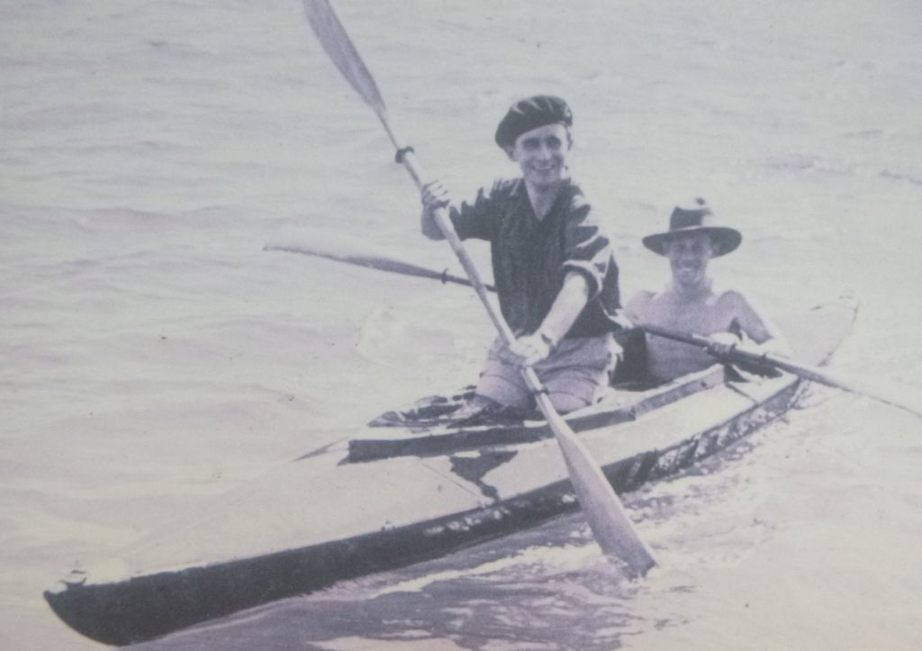
Thefinal four kilometre leg today was into Kingfisher Bay Resort to catch the ferry back to the mainland. Apart from views across the Great Sandy Strait to Woody Island and Little Woody Island this section is littered with artefacts from the World War Two training camp of Z Force. This secretive commando group trained to attack a variety of Japanese targets in South East Asia including Singapore Harbour.
Z Force, The Fraser Island Commando School.
The WW2 Fraser Island Commando School operated from this site from late 1943 to war’s end in 1945. It provided specialised training for commandos being sent behind Japanese lines in locations as diverse as Vietnam, Timor, Papua New Guinea, Indonesia and Singapore .
Commandos from Z Force, K’gari.
Fraser Island was considered a good choice as a commando base with its comparative remoteness, extensive and varied shoreline and patches of jungle. Not much is left today: a few concrete slabs, old stumps and a relief map of the local area rendered in concrete. Surprisingly few artefacts to be seen, given that at the end of the war the the camp was a village with cinema, gym, post office, workshops, ammo magazines, and a tent-bed hospital.
Artefacts left at Z Force base , K’gari.
Of particular interest to me was their training in the use of Folboats. Two person kayaks that could be assembled and disassembled as needed. In the 1970s I built a rigid canvas covered 2- person kayak modelled on the Folboat design which we used for many years.
For training, the commandos would paddle their Folboats to nearby Woody Island where they would attack the fake enemy Comunications Centre that had been set up . Unsuspecting friendly vessels had dummy limpet mines attached before the commandos silently glided away into the night. As a final exercise they paddled over to the mainland, up the Mary River to Maryborough where their ‘ targets ‘ included Walkers Shipyard and the rail yards . All undetected, of course.
Z Force commandos training in Folboats . Great Sandy Strait.
The most well known of the operations was Operation Jaywick, which struck at Japanese shipping in Singapore harbour in September 1943. A former Japanese fishing supply vessel, renamed the Krait, set out from Western Australia in early September and set up a canoe base at Panjang Island, from where six operatives in three Folboats set out and attached limpet mines to six Japanese freighters and one tanker, sinking between 37,000–39,000 tons of shipping.
The men rendezvoused with the Krait in early October, and returned safely to Western Australia. However, another attempted attack on Singapore Harbour a year later, codenamed Operation Rimau, failed with the loss of the whole party of 23 men (10 being captured and executed by the Japanese).
Soon after 8.00 am we too glided in, dropping anchor at Kingfisher Resort’s Sand Bar, dismayed to find the bar and swimming pool closed. No matter, we unearthed the resort guests’ hot showers , had a good soapy scrub down and climbed into whatever we had in the way of clean clothes.
Sand Bar. Kingfisher Island Resort. Closed !
Meanwhile, Joe, being Joe, did, as he so often does for us. He managed to scout out the only open kiosk and came back bearing gifts of fruit juice and apples. Our five day adventure was over. With grateful thanks to my two hiking mates, John and Joe.
Map of one of our previous hikes on the northern section of the K’gari / Fraser Island Great Walk.
Map of one of our hikes on northern section of K’gari / Fraser Island Great Walk.
Wallangarra Ridge is a little visited section of Girraween National Park in Queensland’s Granite Belt. It is a spectacular landscape of granite domes, extensive rock slabs and giant balancing tors. The dominant vegetation is a low Eucalypt woodland still showing the fire scars from 2019 bushfire season. As the bulk of the walk is off-track , some navigation skills are needed.
by Glenn Burns
Location of Girraween National Park. Source: Geoscience Aust.
Girraween means ‘ Place of Wildflowers ‘
The Wallangarra Ridge sits at 1100 metres, while predictably cold in winter it was still quite warm during the day. Late March, 29 degrees centigrade. The scrubby vegetation made long-sleeved shirts and trousers a wise sartorial option.
The Parks website provides this irresistible description of the Wallangarra Ridge : “… breathtaking views sweep over to the Wallangarra township and distant rolling hills. Soak up the vistas of nearby Mallee Ridge, the giant monolith known as The Turtle and Girraween’s highest peak, the majestic Mt Norman…On a hot afternoon, cool breezes waft through the lush gullies between Mallee Ridge and Wallangarra Ridge . Listen out for the rustling of bell-fruited mallee…You’ll soon forget the gruelling climb! “
View across to our campsite on Wallangarra Ridge.
Geology
The geology of Girraween is not particularly complex. The area is the remnant of a pluton of Stanthorpe Adamellite ( a quartz monzonite ), which is a major unit of the New England Batholith, intruded as a molten mass in the Early Triassic, some 225 mya.
Stanthorpe Granite
As the overlying rock was eroded the granite mass expanded setting up stress fractures forming regular rectangular joint patterns. These rectangular erosional jointlines had a strong influence on the development of Girraween’s landforms. Girraween’s domes, tors, rock slabs and rectilinear drainage pattern are typical of granitic landform assemblages throughout the world.
Panoramic view of Granite Landscapes of Girraween National Park.
Sunday
After a long five hour drive from the coast we pulled into the Park HQ on a pretty warmish afternoon. A hurried lunch and we were heading south on the Castle Rock-Mt Norman track, more uphill than I wanted.Neither my fellow hiker, John, nor I were keen to haul in water supplies for two days of walking and camping so the plan was collect some on the way to Wallangarra Ridge.
Finding said water supply proved elusive as most gulleys and creek beds were dry. Surprising given recent rains in a strong La Nina season. But a little bit of detective work and some scrub bashing unearthed a trickle hidden in a glade of ferns. Enough to provide an initial five litres each. Tomorrow we would have to replenish the supply. But our 1:25000 topo map showed nothing in the way of perennial streams in our intended camping zone. All we had to do now was to haul the additional five kilograms on the 250 m climb to the The Sphinx and then to the track terminus at The Turtle. From here it was all off-track.
L. The Turtle at track head and R. The Sphinx.
Navigationally, it was simply a matter of following our noses around the eastern cliff line of The Turtle and heading SSW along the 1100 m contour line. This involved a fair bit of bush-bashing and picking the easiest route between and around the large outcrops of granite. To avoid too much bush-bashing, we took to open rock slabs whenever the opportunity arose.
Regrowth after summer bushfires.
Easy walking on open granite slabs.
By late afternoon, our enthusiasm waning, we propped at a rare flattish patch of sand nestled between rock slabs and boulders and relatively clear of burnt out scrub. It was too late to go gallivanting around looking for the Wallangarra Ridge Remote Campzone still some one and a half kilometres toour South-West and 100 metres down in a decidedly scrubby looking valley. I’m not sure why camping down there would offer any positives.
Our camp nestled on a rare patch of level sand.
After several cups of black tea to rehydrate, we ferretted out all our warm gear, donning trousers, thermals, fleece coats and beanies and wandered out to take in a spectacular a red sunset .
Sunset from our camp on Wallangarra Ridge
Our rocky eyrie looked out over the Queensland /New South Wales township of Wallangarra, some six kilometres to the south. In the far distance was the Roberts Range, marking the boundary of Girraween’s sister park, Sundown.
The Roberts Range
The Roberts Range is a 1000 metre divide that separates the Severn River to the north from its southern neighbour, Tenterfield Creek. Both are tributaries of the Dumaresq River. It is named after Francis Edwards Roberts, the Queensland Government Surveyor who was involved in the 1863 border survey together with his New South Wales counterpart , Isaiah Rowland. There are plans afoot to expand the Protected Area Estate in the Granite Belt to include the Roberts Range area and help link Girraween and Sundown National Parks. Another concept under consideration is a Border Walking Trail along the easement of the Qld – NSW border.
NSW – Qld Border Track on Roberts Range. Sundown NP.
This easement is a well maintained 4 WD track that parallels the border fence, technically a Dog Check Fence. The walk along the fence line easement is a classic high range roller-coaster, up and down…up and down. A winter walk withoutparallel. But…believe me when I tell you that it is best avoided over summer. Read more about the Roberts Range walk at the end of this post.
Back on the Wallangarra Ridgewe had no campfire. A cold WSW wind sent us scuttling off to our tents, lulled to sleep by forgettable podcasts and the occasional hooting of Boobook owls.
Monday
5.30 am . Rolled out to another crispy Granite Belt morning. John was already up, cranking up the stove for our coffee followed by a substantial bowl of thick creamy porridge. In my case, a tried and tested mixture of rolled oats, raw muesli, sultanas, plump dried apricots, shredded coconut and lashings of powdered milk. Fuelled up,we were up and running ( walking ) by 8.00 am.
Today was off-track to reach the high point of Wallangarra Ridge SSW of our campsite, as the crow flies. If only we were crows. We had read somewhere that the summit is marked by a small rock cairn, from which we were promised extensive views across the park and down to Wallangarra township.
But first… find some water. Our thought bubble of siphoning and filtering stagnant water from shallow pits and pans ( sometimes referred to as gnammas ) in the granite didn’t appeal.
Unappealing stagnant water in a shallow pan near our campsite.
Butthe gods smiled. Several La Nina seasons meant that we stumbled across a trickle in nearby swales. No more than 500 metres downhill from our camp. Pretty unusual.
Surface running water in a swale downhill from our campsite.
The swales are clothed in ‘Gully’ open woodland which develops in sheltered run-off situations. I identified a few of the scorched dominants: Banksia spinulosa, a Callistemonsp, Eucalyptus brunnea and a dense regenerating understorey.
From the scrubby swale our line of travel took us out and up onto our morning tea vantage point where we propped in the shade at the top of a series of rock slabs stairs. A short distance to the west we could make out the highest part of Wallangarra Ridge . John scanned along its skyline with his telephoto lens until he located a mini summit cairn. Behind us and off to the north were easily the best views of The Sphinx and Turtle in the whole park.
Twenty minutes later we stood on the summit boulder at about 1140 metres. To our south was Bald Mountain ( 952 m ) and six kilometres in the distance was the border town of Wallangarra.
A windy morning on the summit of Wallangarra Ridge. Mini rock cairn. Roberts Range on horizon.
Wallangarra
Wallangarra is a small town of 500 on the border of Queensland and New South Wales. It grew up close to the site a 1859 border survey marked tree, indicating the border between Qld and NSW.
It is on Ngarabal country with Wallangarra said to mean ‘ lagoon’. I have read that wallan means water and guran means long. Long water as in billabong or lagoon.
Meanwhile, back on Wallangarra Ridge, we drifted off northwards down the toe of the ridge in search of the mythical official Wallangarra Ridge Remote Bush Camping Zone. Unsucessfully. After an hour of thrashing around in the dense regrowth in the vicinity of the GPS coordinates provided, we gave up. Anyway, there was no chance a slotting a tent in this stuff. Bit of a navigational mystery actually. According to the Parks website … ” there is no defined camp site and access is via difficult cross country walking “. We turned for home, intent on finding enough water to see us through another day.
Lucky to find a supply of fresh water.
Back at the ranch we settled in for a decidedly leisurely and late lunch, several brews of hot black sweet tea and a nanna nap in the shade. Though the latter was moveable feast as we searched for the deepest shade.
Come late afternoon, John sloped off, camera on alert. No doubt off to hunt down any unsuspecting Lyrebirds and Button Quail which he was convinced were scratching through the heaps of leaf litter. Meanwhile I wandered around checking out all the nearby rock slabs hoping for anything of geologic or botanic interest .
The Superb Lyrebird
(Menura novaehollandiae)
Lyrebird. Artwork by Sydenham Edwards ( 1802 ). NLA.
On a previous trip to Girraween we had been fortunate to see and hear Lyrebirds at nearby Mt Norman, so weren’t surprised to hear them again close to our campsite.
The Lyrebird is one of nature’s best mimics. It can imitate a variety other bird species such as cockatoos, butcherbirds and whipbirds. But it doesn’t draw the line at bird calls. It can reproduce the sound of saws, guns and engines.
One Lyrebird story I read happened at a Victorian timber mill. The mill used three blasts of a whistle to signify an accident and six blasts to notify a fatality. One day the local Lyrebird blasted out six whistles, no doubt creating considerable workplace disruption.
I have been tricked by a Lyrebird mimicking the sound of a ‘reversing’ truck. Our hikers’ camp in Sundown National Patk was hidden in scrub with a small 4 WD campround nearby. The sound of a ‘reversing’ vehicle at the 4 WD campground attracted our attention as it had persisted for well over fifteen minutes. I waddled up to check things out, thinking perhaps a 4 WD had bogged or some such problem. No vehicle in sight but the ‘reversing’ sound continued from the undergrowth. The mystery of the phantom 4 WD camper was solved. Lyrebird.
Interestingly, scientists know that some mimicry is of now extinct species, passed on from parent to chick over the generations.
Another sunset worthy of the ABC TV weather report , a decent feed, a chin wag and it was all over for today. My Macpac micro green tent beckoned.
Tuesday
5.30 am. Time to roll out into the pre-dawn twilight. My pocket thermometer hovering on 10o C with a cool Southwester riffling across our campsite. A bite to eat then we struck camp, packing our gear and leaving tents out to dry.
Our walk today was off to our east onto an unnamed adjacent ridge, aligned in the same NE/SW configuration as the Wallangarra Ridge. At 1220 metres it is nearly 100 metres higher than Wallangarra Ridge and more densely vegetated. The attraction was that from its summit we should be able to see across to the complex that makes up Mt Norman ( 1266 m ) and the Mallee Ridge ( 1230m ). Maybe our Girraween sojourn .
Summit of Wallaroo Ridge
Our line of travel took us initially over lower rock slabs then climbed into mature stringybark forest, habitat for a Wallaroo, a large furry macropod, which took off when we disturbed it. We wound in and out of huge granite boulders before fetching up on a narrow summit plateau at 1200 metres. Perched on the plateau were jumbles of huge tors topping out at over 1220 metres. Naming rights… Wallaroo Ridge.
Wallaroo aka Euro
Our Wallaroo ( Osphranter robustus ) was, as the specific name implies , sturdy ( and shaggy-coated ) . They are generally solitary and nocturnal. The Eastern Wallaroo is not on the threatened species list and has an extensive territorial range in Australia’s Great Dividing Range.
Eastern Wallaroo. Osphranter robustus
We scrambled to the top of the highest tor for morning tea. Now we had impressive clear easterly views to the domes of Mallee Ridge and Mt Norman. Mt Norman was named after Sir Henry Norman, Governor of Queensland from 1889 to 1895.
Getting to the Mallee Ridge and thence to Mt Norman from here looked like a hard slog. Maybe one for the future. Fortunately, there is an easier way, from the Mt Norman track. Although the twin domes ( 1230 m ) at the SW end of the ridge looked a tad formidable. My Hema Girraween map describes the walk as… ” easy rock slopes “. I live in hope .
Mallee Ridge in sunlight taken from Mt Norman
Bell-fruited Mallee & the Mallee Ridge
While traversing the lower rock slabs, we had spotted a line of Bell-fruited Mallees growing in a jointline which had retained a bare minimum of mulch that was enough to sustain a viable pocket of Mallees.
These were the mallee Eucalyptus codoncarpa , that also grows on the nearby Mallee Ridge, and after which it was named. In Girraween, the Bell-fruited Mallee is only found on Mt Norman and rocky outcrops to its west and south- west. Despite its somewhat restricted distribution in Girraween it is listed on the IUCN Red List of Threatened Species as being of ‘least concern.’
Bell-fruited Mallee. Eucalyptus codoncarpa
Morning tea rest over, we backtracked to our campsite where we polished off our lunch leftovers and the inevitable mug of tea. With a final check of the campsite, we hoisted up the monkeys and waddled off for a leisurely afternoon’s walk back to our overnight camp at Bald Rock Creek campground.
One of the attractions of poking around offtrack is that little surprises form part of the experience. This time we chanced on a high ledge festooned with a mass of rock orchids and then further on, an unusual find, a Bootlace Orchid.
Rock Orchid. Dendrobium sp.
The Black Bootlace Orchid
The Black Bootlace Orchid ( Erythrorchis cassythoides ) is a leafless climbing orchid. It has thin, dark brown to black stems that climb up to five metres up tree trunks. The Bootlace has displays of 10 to 30 yellow to green flowers. Surprisingly, a Bootlace popped up in my suburban native garden in SEQ, lasted several years, then died back for no reason that I could figure out.
Flowers of Bootlace Orchid
The Bootlace was first described by Richard Cunningham who sent his specimen and descriptive notes to his brother, the explorer Alan Cunningham. Alan Cunningham forwarded the description on to the the English orchidologist, John Lindley. Richard Cunningham had originally named it Dendrobium cassythoides but it was later renamed as E. cassythoides.
By 4.00 pm we were setting up for our final night in the civilised surrounds of Bald Rock Creek Campground. Although this had been a short visit to Girraween, we had explored a little visited section of this outstanding granite park which I had always been keen to investigate. Coming up next year … the Mallee Ridge.
A description of one of my walks on the Roberts Range
The walk is the classic high range roller-coaster starting at 1067 metres, dipping and rising: 973 m, 1039 m, 1030m, 1015m, 1087m and reaching 1120m at our final climb before turning off and descending to the Sundown Road.
4WD track on crest of Roberts Range on a hot day. Sundown NP
Climbing up to our first high point, Hill 1067 we passed into a special habitat, a high altitude forest, restricted to the very highest parts of Sundown and the Granite Belt.
This is open forest, dominated by Silvertop Stringybark (Eucalyptus laevopinia), Yellow Box (E. melliodora) and the best name of all, Tenterfield Woollybutt (E. banksii). Silvertop Stringybark and Tenterfield Woollybutt are interesting in that they are disjunct populations of the same species growing further east at Lamington and Mt Barney.
It is likely that they survive here on traprock because of the cooler, misty micro-climate on the highest points of the Roberts Range. Further along the range, on the summits of the highest hills at 1087 metres and 1120 metres, we passed through more small patches of high altitude forest.
As we climbed to the final high point at 1120 metres we entered a designated ‘essential’ habitat. These are areas meant for the protection of a species that is endangered or vulnerable.
In this particular case the species was the Superb Lyrebird (Menura novaehollandiae) neither seen nor heard by our party. The Superb is the King of Karaoke and is such a good mimic that the bird being copied cannot tell the difference. The male Lyrebird has a repertoire of 20-25 other bird songs as well as mimicking car engines, chain saws and even barking dogs.
When Queensland was proclaimed a separate colony on 6th June 1859, Surveyors Roberts from Queensland and Rowland from New South Wales were sent to define the boundary between Queensland and New South Wales from Point Danger to the Dumaresq River.
They started work in 1865 and worked separately using their own instruments. As their traverse lines were different the defined border appeared in different positions. Ultimately the Roberts survey was accepted and this was the line depicted on our map and that we were following today.
I was keen to find any relics of their traverses such as rock cairns or horse-shoe blazes on trees. I found one old blaze, indecipherable, so there is no evidence that it was part of the border survey. It would be interesting to do the entire Roberts Range traverse with data from Robert’s original field book.
Old Survey Blaze on Qld – NSW Border.
Roberts, an Irishman, trained as an engineer and in 1856 he became surveyor of roads for the Moreton Bay District later gaining a post as a surveyor with Queensland’s Surveyor-General’s Department in 1862.
Colonial surveyors were tough, capable bushmen able to endure considerable hardship: life under canvas, poor food, heat, flies, arduous travel and isolation. Unsurprisingly, it was a constant struggle to stay healthy.
Queensland colonial surveyors could be struck down by any number of health hazards: Barcoo Rot, Bung Blight, Sandy Blight, Dengue Fever, Malaria, snakes and crocs. Francis Roberts escaped all these only to die prematurely of sunstroke in 1867, aged 41.
Today, the border is marked by a Dog Check Fence; an outlier of the mighty 5,412 kilometre Dog Fence that runs from Jimbour in Queensland to the Great Australian Bight in South Australia. The Dog Fence is said to be two and a half times the length of the Great Wall of China and is easily visible from space. Our 1.8 metre high Dog Check Fence or Dingo Fence is a relic of an intricate maze of some 48,000 kilometres of interconnecting vermin fences built to keep dingoes and bunnies at bay. Unsuccessfully.
Other walks in Girraween National Park and nearby Sundown National Park.
Mawson Plateau lies at at the northern extremity of South Australia’s Flinders Ranges. It is a very remote , inaccessible and arid wilderness. The plateau lies between 600 and 750 metres, reaching its highest point at Freeling Heights at 944 metres. A four day hike was to take us across this granite batholith by way of the gorges, waterfalls and pools of Granite Plateau Creek which drains an otherwise dry landscape. It is said to be one of Australia’s most pristine wilderness areas.
by Glenn Burns
Mawson Plateau: looking back to Freeling Heights which we had descended hours earlier.
The genesis of this hike was in 2016 when I was part of a group on a camel trek from Mt Hopeless in the far north of South Australia to Umbaratana Station to the west of the tourist resort of Arkaroola in the northern Flinders Ranges.
Camel string heading south from Mt Hopeless. Far north of South Australia.
On the seventh day of our trek, as we travelled across desert plains, ahead of us rose a wall of mountains which I was told were called Freeling Heights, but also known as the Mawson Plateau. One of our fellow walkers, Peter, mentioned that he had been up onto the Mawson Plateau and generously offered to use his contacts to organise a future hike.
Rugged up for a bitterly cold winter’s day on our 2016 camel expedition. Silhouette of Mawson Plateau in background.
Many years ago I came across Warren Bonython’s book Walking the Flinders Ranges, the report of his epic1967-1968, 1011 kilometre trek along the Flinders Ranges from Crystal Brook in the south to Mt Hopeless in the far north. My 2016 camel trek and the later Freeling Heights/Mawson Plateau walk would cover much of the territory covered by Bonython in his final and most northerly stage (Stage 9). This section is sometimes referred to by South Australians as the Heysen Trail Extension Section 2.
Sir Douglas Mawson
Mawson Plateau isnamed after Sir Douglas Mawson, Australian geologist and Antarctic explorer. In his later academic career he researchedthe geology of the northern Flinders Ranges. The Mawson Trail, a mountain bike trail through the Flinders and Mt Lofty Ranges is also named after him.
Photo of Douglas Mawson by Frank Hurley. The photo is titled Leaning into the Wind. It shows Douglas Mawson collecting ice for cooking. The winds were blowing at a constant 160 kph.
Source: Frank Hurley. Aust. Antarctic Exped. 1911-1914.
The Geography of Mawson Plateau
There is scant information on the Mawson Plateau so here is some of its basic geography based on my personal observations and a trawl of documents available in assorted books and journals. A notation on the Australian Geographicmap The Flinders Ranges (2007)describes it thus: ‘Perched behind its rugged eastern escarpment, this little-known stronghold is a maze of weather-hewn granite crags and boulders. After rainstorms the deep trough-like waterholes along its creeks form the largest natural body of water in the Flinders – a priceless ecological haven for native fish and water plants.’
Location
Mawson Plateau, 300 6′ 38″ S and 1390 25’19” E, is part of the northern Flinders Rangescomplex on the Mt Freeling pastoral lease in South Australia. It lies adjacent to the north eastern boundary of the famous Arkaroola Sanctuary.
Source: Geoscience Australia.
Geology and Landforms
Mawson Plateau is a 70 square kilometre granitic batholith with an average elevation between 600 and 700 metres. Its southern boundary is delineated by the higher Freeling Heights which rise to 944 metres. The eastern boundary is a spectacular 250 metre fall called the Granite Escarpment, while the northern and western boundaries are bounded by Hamilton Creek.From its headwaters high up in Mawson Plateau, Hamilton Creek (intermittent) drains initially north east to Moolawatana Station then swings south east from which it finally decants (rarely) into Lake Callabonna, a dry salt lake. Interestingly, Callabonna is an important site for late Pleistocene fossils.
Satellite view of Mawson Plateau.
The plateau is a tangled landscape of sandy creek beds, sand plains, rocky ridges and vast expanses of granite, covered by a mantle of loose, shattered rock and huge granite tors. Its surface has been intricately dissected by Granite Plateau Creek and Saucepan Creek, both non-perennial tributaries of Hamilton Creek. Granite Plateau Creek has cut deeply into its bedrock to form an extensive gorge featuring dry waterfalls, pools, deep potholes and sandy beaches. It was this feature that we would use to traverse the plateauwhich is otherwise totally waterless.
Photo by John B. The Mawson Plateau: a landscape of rocky ridges, vast expanses of granite pavement, dry creek beds and deep gorges.
The highest part of the plateau, Freeling Heights, is composed of Freeling Heights Quartzite, of Mesoproterozoic origin dating back 1590 to 1580 ma.These metasediments are part of the Radium Creek Group, some of the oldest rocks in the Flinders Ranges.
The main plateau surface is a granite of Late Ordovician – Silurian age, 442 ma, intruded into the older rocks. The plateau is a major leucogranitic intrusion called British Empire Granite (BEG).BEGleucogranite is light coloured with almost no dark minerals. It is medium to coarse-grained and highly radioactive. Its radioactivity is another interesting story; too long to be recounted here. BEG also contains numerous pegmatites. Pegmatites form in the final stage of a magma’s crystallisation. Thus they contain exceptionally large crystals and minerals that are rarely found in other types of rocks. Spodumene (an ore of lithium), tourmaline, topaz and beryllium are all found with pegmatites.
British Empire Granite exposed in Granite Plateau Creek. Mawson Plateau.
Climate
The Mawson Plateau lies in one of Australia’s major arid bioclimatic regions, the Eyrean Region. The Bureau of Meteorology classifies its climateas a Desert climate characterised by hot and persistently dry seasons. For the climate afficionados among you, its Koppen climate classification is BSh, a hot semi-arid climate.The plateau nestles between the 200 and 250 mm isohyets and its rainfall displays high variability. Being caught in Granite Plateau Creek during a very rare flood event would be best avoided. That said, winter walking weather is outstanding. Expect mild sunny days, deep blue cloudless skies and cool nights all of which make for an unforgettable experience.
Temperature and Rainfall Statistics for Arkaroola SA. 318 m
August
Mean Max Temp oC
Mean Min Temp oC
Mean Rainfall mm
Mean Rain Days
19.1
4.6
14.4
2.1
Observations on fauna and plant communities
Fauna
Reptiles form a significant and the most observable part of the faunal assemblage.
Shingleback (Trahydosaurus rugosus) basking in weak winter sun.
Skinks, geckoes , and dragons were all seen, but no snakes – possibly they were in hibernation.
Some rockholeshold water permanently even in extended droughts. These are refuge sites for tadpoles, fish and frogs including an undescribed species (Crinea sp). Mammalian fauna includes Eurosand if you get very lucky, the endangeredYellow-footed Rock Wallaby.Thesespectacularmacropods are easily identified by their yellow feet and tiger- banded tails.
Yellow-footed Rock Wallabies sunning themselves on a rock shelf in northern Flinders Ranges.
By Peripitus – Own work, CC BY-SA 3.0, Yellow-footed Rock Wallaby.
Bird species recordedwere Wedge-tailed Eagle (many and obvious), Australian Raven, White-faced Heron, White-browed Babbler, Singing Honeyeater, Wood Swallow and Australian Magpie-lark. A dismaleffort if truth be told, but I can always claim that my eyes were always focused on the next foot-fall.
Granite Plateau Creek: A woodland of River Red Gum (Eucalyptuscamaldulensis) and White Cypress Pine (Callitris glaucophylla). The shrub layer was an association of Wild Rosemary (Cassinia laevis), Hopbush (Dodonaea viscosa ssp angustissima), Cassia (Senna artemisioides) and Yucca (Xanthorrea quadrangulata).
Xanthorrea quadrangulata.
Gallery forest of River Red Gums: Eucalyptus camaldulensis.
Gorge tops and open graniteterrain: The few plants I could identify: Mulga (Acacia aneura), Corkbark (Hakea ednieana), White Cypress Pine(Callitris glaucophylla), Native Orange (Capparis mitchellii) and Bell Fruit Tree or Camel Poison (Codonocarpus pyramidalis).
Aboriginal Occupation
The northern FlindersRanges were occupied at least from some 49,000 years ago. This date was obtained from a site known as the Warratyirock shelter, south of Mawson Plateau. Evidence from Warratyi shows the use of key technologies such as stone axes and ochre. The site also had evidence that humans existed alongside of, and hunted megafauna. Excavations to a depth of one metre produced 4,000 artefacts and 200 bone fragments including some from Diprotodon optatum , a giant wombat-like creature.
Diprotodon optatum
It is likely that aborigines would have camped in the Granite Plateau Creek catchment as there are a number of permanent waterholes. As the climate of inland Australia dried these waterholes would have been vital refuge sites for inland aborigines.
At the time of first European contactthe tribal groups occupying the northern Flinders Ranges were the Yardliyawara and the Wailpi. European settlement fragmented their social and economic structures so that today these tribesare known collectively as the Adnyamathanha ( hills people ). Fortunately, the Adnyamathanha have been able to maintain their cultural identity and links to the northern Flinders.
Further reading:
Map: Yudnamutana: 1:50 000.
Map: Frome: 1:250 000.
Map: Flinders Ranges: 1:550 000 (Aust. Geog.).
Bonython, W.C: Walking the Flinders Ranges (Rigby, 1971).
Barker, S et.al. eds: Explore the Flinders Ranges (RGSSA, 2014).
Mincham, H: The Storyof the Flinders Ranges (Rigby,1974).
Pledge, N: Fossils of the Flinders and Mt Lofty Ranges (SA Museum, 1985).
Cawood, M. and Langford, M: The Flinders Ranges (Aust. Geog., 2000).
Saturday : Arkaroola to Edward Springs: 50 kms
And so, on an annoyingly aberrant cool, overcast August day we were lurching and grinding over old 4WD station and mining tracks heading for our base camp at somewhere called Edward Springs (springless and definitely waterless as far as I could tell). The South Australians had very kindly organised to squeeze us into one of their off-road vehicles for the trip in. The tracks, in places, were little better than wheel rutscutting across a landscape that varied between rock, sand, sandy creek beds and clumps of spinifex. The drive in was meant to take only a few hours from Arkaroola giving a walking party time to climb Freeling Heights (944 m) and set up camp thatsame afternoon. “The best laid plans of mice and men”.
The ‘tracks’ took their toll on a Subaru’s tires, leaving a Landrover Defender and a Toyota Prado to ferry in seven walkers and five base campers. Suffice to say we couldn’t all fit into the two remaining cars. The overflow took to hoofing the rest of the way in to our base camp (wherever that was).
But I was happy enough to be out walking, even under a dark, threatening sky. The view ahead was spectacular. Across the undulating plains rose the long, flat profile of the Mawson Plateau. Later in the afternoon, at the end of a vague track, under the shadow of Freeling Heights we found the earlier arrivals. Tents were up and a camp fire going.
Base camp in Mac Donnell Ck.
Our campsite was in the dry bed of MacDonnell Creek, a major feeder of the Hamilton River ( GR: 416657 Yudnamutana 1: 50,000 AGD 84 ). Tomorrow’s access to Freeling Heights was, initially, via a small unnamed tributaryof MacDonnell Creekwhich flowed north west off Freeling Heights and into MacDonnell Creek about 500 metres north of our base camp.
The sight of a welcoming blaze somewhat improved my mood as I surveyed our setting which could,at best, be described as desolate. A far cry from myfavourite haunts in the rolling alpinemeadowsof Kosciusko National Park.
Here we were tucked up into a dry creek bed with a maze of dark glowering hills to our backs, and a thickening bank of clouds gathering overhead. Creating a level tent pad in these fields of shattered rock and clumps of spinifexproved a bit of a mission.
Darkness closed in quickly but a small community gathered around the fire to prepare dinner and work our way through trivia questions while we cooked a meal.
For some, dinner was an exotic feed prepared by Jack. My options were pretty limited, a reconstituted dried meal. But here’s the thing. Our South Australian friends catered for a cast of thousands so there were invariably seconds for everyone, myself included. No danger of impending starvation on this trip.
Some of us sported comfortablefoldingchairs while the hardier South Australian types constructed Fred Flintstone lounge chairs from the abundant sheets of quartzite living on the creek bed(pretty uncomfortable actually, but nobody was going to admit to that). Our campfire reveries were cut short by an unwelcome visitor, very light drizzle. Not predicted and certainly unexpected in this arid environment. By 8.00 pm the group had dispersed to their respective camping arrangements in preparation for our 8.00 am departure on the morrow.
Sunday: MacDonnell Ck / Edward Springs Base camp to second overnight camp at Tee Junction Waterhole: 10 kms.
My annotations of the route marked on my Yudnamutana 1: 50,000 map sheet.
Being creatures of habit, John and I emerged into the chill darkness soon after 5.30am. While Susan caught another twenty winks John tizzied up the fire and a billy was put on to boil for our tea and coffee.
By 8.00 am our hiking party of Paul , Rob , Mike and Jack (from South Australia) and Susan, John and I (Queenslanders) mustered at the start of a mining track leading south east out of the campsite; leaving the base campers to climb Freeling Heights at their leisure. The sky had cleared to a brilliant cloudless blue as only a desert sky can.
Our climb to Freeling Heights would take several hours eventhough the altitude gain was only 300 metres. It was a landscape of loose rocks, thick scrub andtangled hillsdissected by numerous dry gullies.As well, we were dragging along litres of water to see us through the day until we reached Tee Junction Waterholelate in the afternoon.
Foothills on the morning’s climb to Freeling Heights: 944 metres.Freeling Heights hidden from view.
The route, which didn’t seem at all obvious to myself or our South Australian friends, involved following up the mining track which soon petered out. As our original leader had opted out of the hike, I never quite figured out who the substitute leader was or who was doing the navigation.
But everyone chipped in and things seemed tickety boo. From here it was down into a dry creek bed, scrub bashing and scrabbling over boulders until the creek became impassable and we were forced out onto a ridge leading to the stony western rim of Freeling Heights at about 900 metres.
The stony quartzite ridge leading to the summit cairn of Freeling Heights at 944 metres.
It was clear to me by now that the group’s modus operandi was pretty laissez-faire. Walkers scattered across the landscape with the fastest walkers meeting up with whoever was leading at the time ( a moveable feast).
Then followed a chat about navigating to the next landmark. Not really a problem up here on the Freeling Heights high tops, but later on, by mid afternoon, a niggling issue for those lagging behind when we descended onto the sandplains and dense Ti-tree thickets below Freeling Heights.
The Navigators : Mawson Plateau.
A brief stop on the western rim of Freeling Heights and we tore off again to find the impressive drystone cairn marking the summit at 944 metres.
The summit cairn of Freeling Heights at 944 metres.
We propped here for morning tea and to take in the very impressive views out over the tangled ‘all slopes’ topography and out onto the waterless and featureless plains beyond.
In 1840, the explorer Edward John Eyre climbed alow ‘haycock- like’ peak on the plains just to our northand describedthe scene as ‘cheerless and hopeless’.He turned away and beat a hasty retreat to the south.
Mt Hopeless SA.
View out over plains from Mt Hopeless.
View from Freeling Heights over a tangled foothill terrain of ridges, gullies and hills. Looking towards the dry bed of the Hamilton River and featureless plains beyond.
From Freeling Heights we dropped 250 metres down a steep escarpment covered in shattered quartzite onto a sandplain forming the headwaters of the Granite Plateau Creek system. For the next three days we would follow the gorges and sandy bed of Granite Plateau Creek out to its junction with Hamilton Creek near where, hopefully, the exit base camp had been established.
Our base campers later reported that the drive from MacDonnell Creek/Edward Springs to Hamilton Creek had been long and tortuous, occupying most of the day.Apparently not something they were keen to repeat.
Mawson Plateau landscape.
As the creek bed and its fringing flood plain were choked with dense thickets of White Tea-tree (Melaleuca glomerata), we edged uphill and took to the lower hills and ridges, all the while trying to maintain a line of travel to intersect with Tee Junction Waterhole five kilometres hence. But with fellow walkers spread over the landscape it was a toss up as to who was leading and who to follow . Thelow ridges and scrub made it difficult to see other walkers. But as we were not leading the walk and the terrain was unfamiliar, I kept stummabout any thoughts I harboured that we should be keeping together. Anyway, our leadersseemed to have the navigation under control.
Photo: John B. View across sand plain to Freeling Heights.
I have done quite a bitof walking with John and Susan and I became aware that they were travelling much slower than they usually doand not keeping up with the rest of the group.
By mid-afternoon it dawned on me that Susan was hobbling along nursing a dodgy ankle or foot; apparently damaged several hours ago on Freeling Heights. When we finally dropped into GranitePlateau Creek late in the afternoon, John, Susan and I decided to take an early mark and propped at the first decent waterhole. It was agreed that the rest of the party would head downstream to Tee Junction Waterhole for the first night’s camp.
While Susan soaked the injured ankle/foot in the waterhole , John and I set up tents, collected firewood (too easy)and got the campfire going. This was a campsite par excellence: sandy tent platforms, abundant firewood and heaps of water (once purified). We would be very comfy here for the night( GR: 475678 Yudnamutana 1: 50,000 AGD 84 ).
Photo: John B. Dismounting & getting ready to set up camp two in Granite Plateau Creek. Sandy tent pad, heaps of firewood and water.
Monday: Tee Junction to third overnight camp: Granite Plateau Creek: 6.5 kms.
My annotations on the route marked on my Yudnamutana 1:50,000 mapsheet.
A very early start as we had promised the others that we would catch up with them at Tee Junction Waterhole as soon as possible. It is called Tee Junction because Saucepan Creek joins Granite Plateau Creek at an angle of 900. With Susan’s foot strapped and booted we nipped offdownstream. After one and half kilometres of creek hopping and thrice longer time wise than expected, we found Team SA about 8.30 am, waiting patiently. In a previous life and in a far away continent, Jack had workedas a paramedic and he set to and re-strapped my bodgy job on Susan’s ankle.
Near Tee Junction waterhole.
This done, we cooked up a plan to get Susan through the walk as there was no possibility of turning back. The base birds at our Edwards Springs HQ had already flown the coop. The Landrover and Pajero would, by now, have started the long drive around to Hamilton Creek via Greenhill Hut and Valley Bore. The plan was to ease Susan through the rest of the walk. Back at Tee Junction Waterhole we split into two groups. The South Australians would continue downstream at their own pace leaving John to assist Susan while I scouted ahead to find the easiest route. They would wait for us to catch up at lunchtime and we would meet again for the evening camp GR: 475678 Yudnamutana 1:50,000 AGD 84)
Today’s walk was through a spectacular part of the Mawson Plateau, Granite Plateau Creek. We inched down its deeply incised gorge with numerous dry waterfalls, deep cold pools lined with River Red Gums and picturesque sandy beaches.Our Yudnamutana 1:50,000map sheet notated this section of the creek as having: ‘Numerous Rockholes‘.
Typical waterhole in Granite Plateau Creek
An understatement. Our downstream progress dropped to a mere five kilometres for a full day’s walking as we negotiated the innumerable waterfalls, deep waterholes, slippery rocks and gorge walls.By my calculationswe were averaging about half a kilometre an hour.One of the few trip reports I later unearthed on Granite Plateau Gorge also recounted excruciatingly slow progress.
But it was well worth the effort. The gorge was superb. One never tired of the waterfalls and rock pools even though they were more often than not an obstruction. At the top of each waterfall we would survey the the route ahead and conclude it wasn’t possible to scramble downsafely. Frustrating. Instead we would scrabble up onto the open ridges of granite sheets above us and then work our way around and back down into Granite Plateau Creek. This process added hours to our travel time and heavy rucksacks didn’t help. Where was my length of climbing tape when we needed it?
The rock pools were etched deeply into a pink granite bedrock, the water retained by its impermeable granite base. Each pool guarded by jumbles of huge boulders and dry waterfalls. The granite, glass-like, highly polished, smoothed by eons of grit and running water. The polished surfaces were objects of great beauty but it was wise to be attentive when scrabbling near the lip of any waterfalls. The granite surfaces were covered by loose grus – small angular fragments of disintegrated granite common in arid and semi-arid environments. These had a disconcerting tendency to skid underfoot when crossing the granite pavements. We were a long, long way from any help. I was told that the nearest rescue helicopter was 500 kilometres away in Adelaide.
John wending his way over granite pavements in Granite Plateau Creek: Mawson Plateau.
At the downstream end of the plunge pools were massive banks of sand, idyllic and beach-like. Often shaded by the bleached, white trunks of gnarly River Red Gums. Ideal locations for a lunch stops and camp sites. In retrospect, I would have gratefully spent a few extra few nights coming through this gorge section and spending the afternoons exploring the plateau above the cliff lines.
It was at one of these pools that we finally caught up with our friends. They had already eaten and had a refreshing (read: freezing) dip; but the water was far too cold for three sub-tropical Queenslanders. During the break concern was expressed at our slow progress and that we may not reach our exit point for another two to two and a half days. Then followed more discussion about our situation and the suggestion of setting off the PLB and having Susan extracted by helicopter. A big over-reaction I thought, as did Susan and John. Susan was coping, albeit slowly and cautiously.The decision was left to Susanwho said that she was able make it out as long as she took things carefully.
We parted company again with our friends, who promised to wait for us at a suitable downstream campsite. Good as their word, they were bunkered down in a beautiful sandy and level campsite. (GR: 512696 Yudnamutana 1:50,000 AGD 84). We scampered in a tad before darkness closed over the deep gorge. An excellent choice. Heaps of room, plenty of firewood and a water supply just a short walk away. How good is this hiking life? For a third night we settled around a campfire and chewed the fat until weary bones finally sent us to our tents.
Wednesday: Camp Three in Granite Plateau Creek to final base camp near The John Waterhole: 15 kms.
My annotations of our route on my Yudnamutana 1:50,000 map sheet
Out again in pre-dawn light to jig up the campfire and boil the billy. My breakfast pickings were pretty meagre as I decided to eke out the rations just in case our exit took two more days. Our threesome were underway by 7.30 am but progress was promptly blocked some 100 metres downstream.
A difficult, long bypass, up and around, taking well over an hour. Not an encouraging start to the day. A bit deflating, in fact. John suggested that we could speed up our progress by climbing up onto the open granite plateau to our east (marked on the map as Numerous Exposed Rocks) and walking to the north east to avoid the worst of the creek’s obstructions. The plan was shelved when we had a good look at the terrain above the gorge and decided that the lack of obvious landmarks on this dry, featureless surface would make for difficult navigation. Far safer to continue plugging our way downstream, come what may.
Although we didn’t realise it at the time, we had just bypassed our last major obstruction. We had unknowingly scored a ‘get out of jail free’ pass. The going got easier with fewer and less complex obstructions. As the gradient eased Susan found the walking much easier and so the pace picked up.
Largechockstones and potholes on Granite Plateau Creek. Mawson Plateau.
We pulled up for morning tea under a massive free-standing granite tor, a photo of which I had seen in one of the few trip reports on the Mawson Plateau that I have been able to ferret out.While we lolled in the shade I dragged out our map which showed another belt of ‘Numerous Rockholes‘ ahead, which was a bit disconcerting. Perhaps the estimation of another two daysto our collection pointwas, indeed, close to the mark? Our navigationmade problematic by the fact of our collection point being off the current map sheet. The next map sheet over was a 1:250,000, which we didn’t have. As a precaution, I had annotated my ‘Yudnamutana‘ map margin with the vague instructions from one of the SA bushwalkers: ‘campsite at least 3 kmsfurther downstream‘,‘look for Mt Shanahan near junction with Hamilton R’, ‘ ruins of stone hut on W bank‘. None of this was very reassuring.
Large granite tor on the bed of Granite Plateau Creek: Mawson Plateau.
Our final belt of ‘Numerous Rockholes’ proved a fizzer. Instead we were treated to some of the best arid landscape gorge walking that I have ever done. A sandy creek bed, pools shaded by arching River red gums and red rocky cliffs lifting to the deep blue outback sky. Much more satisfying than creeping down the dark, dank creek lines of coastal Queensland. By our lunch breakat 1.00pm we knew the worst of the obstructions were now behind us. It was tempting to take an early mark at one of these magnificent campsites: sandy beaches, abundant water, large shady Eucalypts: no litter and no evidence of the imprint of man.But we were consciousthat our slow progress would be a considerable worry to the rest of the party and so we decided to plug on until 4.30 pm . Another long day of nine hours on the hoof.
Excellent campsites on sandy beaches in Granite Plateau Creek: Mawson Plateau.
From here the gorge walls dropped away, the sandy creek bed meandered in long loops, allowing us to save time by cutting corners, traversing over low stony ridge linesinstead of humping our rucksacks up and down steep rock faces.
By mid afternoon we had lost our position on the map, foxed by the numerous unmarked tributaries, the tortuous meandering of the creek and the sameness of the elevated points above us. No particular landmarks stood out and while our average speed was faster than previous days, any estimate of distance travelled downstream was a rough guess at best. We were reasonably certain that we had moved off the ‘Yudnamatana’ mapsheet and were now effectively mapless.Also GPSless . .
Soon after 4.00 pm we popped out onto a large braided creek junction. For a whilewe had been expecting to see Mt Shanahan as a guide to our position relative to the Hamilton River junction. But Mt Shanahan had completely evaded us. Unbelieveable. Was this the Hamilton River junction? We took a punt and decided that it was large enough. A quick check of the direction of flood debris suggested that we turn north. It was now a matter of ploughing on in the main river bed until we found a suitable waterhole to camp at. Alas, no more water, just a dry river bed.
Waterhole on Hamilton River after a good rainfall season.
A little while later John remarked that he could smell smoke. We wandered on, still getting the occasional whiff of Eucalyptus scented smoke. Then I heard the distant purring of a diesel engine. Station owners?
Our walk was over. Ahead was a bluff and waterhole ( now dry) that we recognised as campsite 5 from our 2016 Camel Expedition. Our friends had arrived mid-afternoon and had set up their tents, got the fire going and the billy boiling.
Hamilton River ( now dry) at our exit camp.
Above the Hamilton River are the ruins of an old hut. The only remains were crumbling dry-stone walls with the brush roof long gone.It may have been built by a shepherd or an old-time miner. Whoever occupied it the decades that followed would have been treated to one of the most picturesqueviews in the northern Flinders Ranges. Come mid- summer, though, it would have been a hell on earth.
Ruins of old shepherd’s or miner’s hut on the Hamilton River. Waterhole nearby.
My thanks to John and Susan for the road trip into Arkaroola via Camerons Corner and the Strzelecki Track. A big thanks also to our very generous South Australian bushwalking hosts, especially Cathy and Peter for the trip back to Adelaide and for putting me up overnight in their very comfortable home.
Mt Moffatt is a remote and relatively pristine section of Carnarvon National Park in Central Queensland. It occupies the headwaters of the western flowing Maranoa River; a diverse landscape of broad valleys, basalt tablelandsand isolated outcropsof Precipice sandstone.
This former beef grazing property, was purchased by the Queensland Parks and Wildlife Service in1979to add to their extensive Central Queensland Sandstone park estate.
The Looking Glass. Mt Moffatt.
Geology
Mt Moffatt is an elevated sandstone and basalt parkaveraging about 700 – 800 metres in elevation, rising to 1232 metres on the basalt-capped Consuelo Tableland in the park’s north-east. The park was named after a solitary basalt peak, Mt Moffatt (1097 metres), standing hundreds of metres above the East Branch of the Maranoa River.
The Consuelo Plateau is known as ‘The Roof of Queensland’ as it forms the headwatersof many Queensland rivers. Carnarvon Creek flows eastwards into the Comet and Dawson thence to the Fitzroy River. Draining westwards across Mt Moffatt is the Maranoa River, ultimately feeding the Murray-Darling system.
Marlong Creek, a tributary of the Maranoa River, West Branch.
Plant Communities
Mt Moffatt has a diverse plant community of open woodlands, tall Eucalypt forests and vast open grassy plains.
Open woodland dominated by Angophera sp. on sandy plains.
Unlike its near neighbour, Carnarvon Gorge, this is an open terrain of sandstone spires, arches and extensive clifflines of Precipice Sandstone.
The Mansions: an outcrop of coloured, soft Hutton sandstone.
It has a rich human history. Aboriginal stencil art is abundant and their occupation stretches back at least 19,000 years. Reminders of the area’s life as a cattle property are seen in relict stockyards and fencing. For those of you fascinated by bushrangers, Mt Moffatt was site of the grisly murders of Constable George Doyle and station manager Christian Dahlke by the notorious Kenniff brothers.
Old cattle yards, Mt Moffatt.
I have been visiting Mt Moffatt since 1988 and since then have hiked with family and friends many times across Mt Moffatt and the Consuelo; and more latterly have walked the six day Carnarvon Great Walk which incorporates Carnarvon Gorge and Mt Moffatt.
Hiking the Consuelo Plateau before the opening of The Carnarvon Great Walk. Looking into Carnarvon Gorge from Police Peak.
Photo Gallery
Dargonelly Rockholeson Marlong CreekMarlong ArchLots WifeMarlong Plain with a dense cover Queensland bluegrassFresh block of cross-bedded white Precipice SandstoneAboriginal stencil art at The ToombsOvernight Frost – 8 CThe SpyglassMt Moffatt: basalt cap over sandstoneDevils Canyon. Eroded Hutton Sandstone.Mt Moffatt NP. Descending to Merivale R and Three Sisters.
My walking companion, youngest son, had just swanned in from months of pounding the mountain trails of the Swiss Alps and Nepal. Lean and fit, he was keen for one final fling before returning to work in early November.
We tossed around the possibilities. Frenchman’s Cap, The Labyrinth, the Western Arthurs were his hot choices while Moreton Island or K’gari looked like cushy numbers for me.
The art of compromise. An 80 kilometre outing to Mt Jagungal in northern Kosciuszko National Park. The iconic Jagungal Wilderness Area is part of The Australian Alps Bioregion, the only truly alpine environment in New South Wales as well as the only part of mainland Australia to have been affected by Pleistocene glaciation.
Jugungal Wilderness: The Weather Report.
Our timing was impeccable. The Bureau of Meteorology’s Snowy Mountains Regional Forecast promised us: Wednesday: ‘snow showers’ and ‘fresh to strong southerly winds’. The clincher was the ‘minimum of -2ºC, and a maximum of 0ºC’. More of the same for Thursday with relief coming on Friday: ‘fine sunny weather, minimum -3ºC, maximum 9ºC’.
We somehow misplaced Friday’s fine sunny bit. Youngest son, outfitted with cosy thermals and multiple fleece layers, seemed relaxed about all this snow stuff, so I wasn’t overly concerned. But I wondered if my warm Queensland blood was up to the task.
A cold morning at Whites River Hut
The Provedore
Once in Canberra I was despatched to Manuka to source the all important hiking rations. Too easy: a big bag of beer nuts, no-brand cups of soup, two-serve pastas, mountain bread, ten yoghurt coated muesli bars, tang, eight Laughing Cow soft cheese wedges, twelve mini Mars bars and two knobs of pepperoni salami to placate youngest son’s carnivorous tendencies.
But, when it was too late, at the isolated Whites River Hut, he discovered that his confidence in the largesse of this provedore was sadly misplaced. There is an old saying about living on the smell of an oily rag that seems apposite. But I will return to this well chewed bone of contention later.
More Information
Map: Geehi Dam: 1:25000.
Map: Jagungal: 1:25000.
Map:Tim Lamble: Mt Jagungal and the Brassy Mountains: 1:31680.
Map: Wyborn, D., Owen, M., Wyborn, L: Geology of Kosciuszko National Park: 1;250000. ( BMR Canberra 1990 ).
Hueneke, K: Huts of the High Country (ANU Press 1982).
Johnson, D, The Geology of Australia ( Cambridge University Press 2009 ).
Tuesday: Guthega Power Station to Whites River Hut: 10 kms.
With a 5.00 pm departure we left the bluebell coloured Camry orphaned at the Guthega Power Station, the Australian Alpine Walking Track entrance. The track zig- zagged steeply uphill.
With fine cool weather and a window of three hours to cover the ten kilometres to White’s River, there was no particular hurry and apart from a 240 metre altitude gain it was a most agreeable evening’s ramble, as we beetled along in a companionable silence.
Australian Alps Walking Track: heading for Whites River Hut late afternoon.
Australia’s Sub-alpine Landscapes
We followed the winding track across a typical sub-alpine landscape of snow gum woodland interspersed with open grasslands. The sub-alpine zone in Australia is that in which snow gums are the only tree species, lying between approximately 1400 m and 1700 m. Above 1700 m to about 2000 m, on the Australian mainland, is the treeless alpine zone.
Vistas of extensive treeless grasslands unfolded along the valley floor. These grasslands are said to be the result of cold air pooling in valleys forming frost hollows, producing a microclimate inimical to the survival of trees and shrubs, even snow gums.
In the dampest parts where the water table is close to the surface, spongy bogs and fens dominate. The higher ridges are covered in snow gum woodland, the lower edge of the community terminating sharply, forming a definite tree line on a contour around each plain.
Horse Camp Hut set in the subalpine zone. Dominated by snow gum woodland.
Itwas sobering to find huge swathes of the snow gum woodland burnt out, their dead branches arching over our heads. Lines of fire-ravaged hills retreated to the far horizon, but, on an optimistic note, the dominant snow gums were now suckering vigorously from their lignotubers.
In 2003 massive fires burnt much of the park and sections of the plateau were still closed until mid 2006. Fire is, of course, part of the natural regime of Kosciuszko, with an average of 100 days annually of high to extreme fire danger.
It has the dubious distinction of being one of the most fire prone areas in the world. Fortunately, this area from Guthega to Jagungal was untouched by the massive fires of the summer of 2019-2020.
Fire damaged snow gums on Munyang Schlink Trail: Kosciuszko National Park.
We reached White’s on dusk. I wussed out, keen for a comfy bunk in the hut. Surprisingly, I met little resistance … for a change. The plummeting temperature, barely holding at 3ºC, dampened our enthusiasm for things outdoorsy: like sleeping in freezing tents, no camp fire, and fourteen hours incarcerated in a hike tent.
Whites River Hut
White’s River Hut, typical of many high country huts, was built in 1935 by sheep farmers who engaged in the transhumance of their flocks, grazing them on the high alpine meadows of the Rolling Grounds in summer, retreating to the protected Snowy River stations for winter. Summer grazing on high pastures ceased in the 1970’s.
Whites River Hut
Constructed of sheet iron, White’s is a basic, dingy hut, appreciated in cold, wet weather, but rarely used on hot summer days. Like most Kosciuszko huts it has sleeping bunks, a fireplace or woodstove, woodstore, tatty table and bench seats and an outdoor dunny.
Whites is unusual in that it once had an additional, stand-alone four person bunkhouse known as ‘The Kelvinator’, for obvious reasons. If it is not obvious to the reader then Kelvinators were a famous brand of Australian refrigerators. This was the last refuge for desperate winter skiers, no doubt thankful to escape from the malevolent Rolling Grounds but usually arriving frozen to the core only to discover there was no room left in the main inn.
Whites River Hut with “The Kelvinator” in the background.
The main hut is also the refuge of the notorious Bubbles and Bubbles Jnr, bush rats extraordinaire: legends of High Country Huts as walkers and skiers record their exploits of marsupial derring-do and innate native rat cunning at avoiding all manner of water traps and flying footwear.
On a visit in 2005, Bubbles made off with our leader’s head torch, dragging it towards his bolt hole stopping occasionally to dine on its hard plastic coating. Tonight, these pint sized bush banditos were content with keeping son in a state of high alert as they tip-ratted through hut rubbish and skittered along the wooden beam highways above our beds.
For my part I slept as well as can be expected for a Queenslander. Cold air seeped through my down sleeping bag, thermal liner bag, two thermal shirts, a polar plus jacket, beanie, gloves, woollen socks x 2, thermal long johns and over trousers. How cold could it get?
Wednesday: Whites River Hut, Schlink Hilton Hut, Valentines Hut and Grey Mare Hut: 19 kms.
We found out in the morning. All was quiet. No birds, no Bubbles, nosound of running water. Just the muffled fall of light snowflakes susurrating against the hut. Nature called and I emerged at six o’clock and applied my final layer, a thick Gore-Tex rain jacket, which seemed to do the trick. Youngest son surfaced soon after, although I have observed that he normally lies doggo until Jeeves has a fire blazing and breakfast is on the way.
Whites River Hut. Snowing outside. Toasty inside.
There is nothing like walking in a light snowfall. Cold it may be. But to be out walking on a high country trail in crisp alpine air, is an experience to be remembered. Our bodies quickly warmed up as we ascended towardsSchlink Pass at 1800 metres.
In any case our warm gear and wind proofs kept us snug and dry. All too soon we topped the pass and descended to The Schlink Hilton. This twenty bunk ex-SMA hut was named after Herbert ‘Bertie’ Schlink, who was one of a party of four who were the first to complete the Kiandra to Charlotte Pass trip in three days in July 1927.
Climbing up to Schlink Pass .
We ducked in, out of the drifting snowflakes, deposited plops of melting snow, removed several thermal layers, and then squelched off again to the start of the Valentine Fire Trail.
Valentine’s marks the start of The Jagungal Wilderness Area. Centred on Mt Jagungal (2060m), this isolated area is a bushwalking paradise: mountain peaks, snowgrass plains, high alpine passes, the massive Bogong Swamp and a derelict gold mine.
The area is closed to vehicles but numerous fire trails provide sheltered walking when bad weather closes in over The Kerries and Gungartan.
Valentines Hut
By 10.30, the snow showers clearing, we sighted Valentine’s Hut, its fire truck red livery standing out against a grey skeletal forest of dead snow gums. Valentine’s is my all time favourite high country hut. Another ex-SMA hut, this natty little four person weatherboard hut has a clean airy feel, with table, bench seats and a wood stove in its kitchen. A home away from home.
Other huts are usually dark, sooty, plastered with candle grease and graffiti and generally described as dirty and dingy. Valentine’s has been painted inside and out, has ample windows and, for added creature comfort, a newish corrugated iron dunny close by.
Valentines Hut
Youngest son, ever hungry, was keen for an early lunch in the snug comfort of Valentine’s, out of the clutches of the blustering southerlies. Two mountain bread roll-ups filled with peanut paste, salami and cheese, a mini Mars and a few handfuls of beer nuts vanished in a flash. He: “What’s next?” Well nothing.
Some grumbling about catering arrangements and we were on our way to the Grey Mare, but not before I deemed it politic to requisition a packet of cous cous from the ‘please help yourself food pile’. No self respecting bushwalker eats cous cous, not even the desperate.
The final leg would take us across Valentine’s Creek, over the mighty Geehi River (boots off for me), then up and over a 1700 metre alpine moor to Back Flat Creek with a final unwelcome crawl 60 metres up to the Grey Mare Hut for an early mark.
Grey Mare Hut
Grey Mare was a miner’s hut. Gold was discovered in the vicinity in1894 at the Bogong Lead, later called Grey Mare Reef. Initially it was worked as a pit but flooding of shafts ended the first sequence of occupance in 1903. An output of 28.3 kgs of gold in 1902 made it one of the highest yielding gold fields in New South Wales.
A second phase of mining started in 1934 with an adit blasted to get to the reef. The ruins of a hut on the creek flats below dates from this period. A final attempt to get at the gold came in 1949 when the present hut was built.
The bush around the hut is littered with all kinds of mining knick-knacks: a crusher, a steam engine, a huge flywheel weighing more than two tonnes and a shambolic tin dunny teetering over the abyss of an old mine shaft( since replaced with something safer).
Old flywheel and boiler at Grey Mare Hut.
Frosty morning at Grey Mare Mine site
The six berth hut is standard dingy but large and comfortable with a huge fireplace and the best hut views in the park. From our doorstep we had views northwards up the grassy valley of Straight Creek and peeking above Strumbo Hill, the crouching lion, Mt Jagungal, tomorrow’s destination.
Looking to the east I could see Tarn Bluff, Mailbox Hill and the Cup and Saucer which I visited in 2017.Behind us was the Grey Mare Bogong topping out at 1870 metres.
By three o’clock, the worms were biting and son was already scruffling through our rations looking hopefully for cups of soup and pasta with Nescafe caramel lattes and chocolate chasers to appease his now constantly rumbling tum.
Meanwhile, I set to with bush saw to lay in our wood supply for what was shaping up to be a windy, cold night. No problems with collecting bush timber here, the hut is set in a stand of dead snow gums. By five o’clock it was cold enough to rev up the fire.
Come dark we banked the fire and drifted to our bunks, snuggling down into warm bags. The predicted ‘windy’ conditions made for a restless night with a banging door and overhanging branches raking the corrugated iron chimney.
Grey Mare Hut.
Thursday: Grey Mare to Jagungal and return: 22 kms.
Up at six o’clock in anticipation of the long walk to Jagungal and back. Snowshowers again, a gusting tail wind catching our rucksacks and driving us sidewards off the Grey Mare Trail as we headed north. With Phar Lap out in front and old Dobbin coming at a steady gallop behind, we burned up the kilometres, hayburners from hell, past Smith’s Lookout (1748m), across the Bogong Swamp (dry), rock hopped over the Tooma River, and thence to our Jagungal access at the Tumut River campsite.
And not a single grey mare in sight. A heap of beer nuts and a yoghurt bar each and we were off again, an easy 220 metres climb onto the mist shrouded south west ridge, a sharp turn left and an even easier 160 metre ridge walk to Jagungal Summit at 2061 metres. The Roof of Australia, or near enough. The mist cleared…. how lucky was that?
On the Grey Mare Trail heading for Jagungal.
Mt Jagungal 2061 m.
Jagungal is instantly recognisable from over much of Kosciuszko. A reassuring landmark for bushwalkers and skiers alike, a beacon… an isolated black rocky peak standing above the surrounding alpine plains. It is at the headwaters of several major rivers: the Tumut, the Tooma and the Geehi.
It was known to cattlemen as The Big Bogong or Jagunal. The later spelling, Jagungal, is considered by the old timers a latter day perversion. Jagungal appears on Strzelecki’s map as Mt Coruncal, which he describes as “crowning the spur which separates the Murray and Murrumbidgee Rivers”.
The aborigines often called mountains in the alpine zone ‘bogong’, indicating a food source, the Bogong moth. Europeans applied their own nomenclature to differentiate the Bogongs: Paddy Rushs Bogong, Dicky Cooper Bogong and Grey Mare Bogong.
Mt Jagungal: 2061 m.
Unlike most of the other Bogongs whose granitic origins are revealed bytheir characteristic whaleback profiles, Jagungal’s summit is distinctively peaky. It sports a lizard like frill of vertical rock towers, some intact, other lying in jumbled heaps.
Jagungal is different because it is capped by amphibolite, a black igneous rock more dense than granite, formed by the metamorphosis of basalts, the Jagungal Volcanics. Its origins date back to 470 to 458 mya, to the Middle Ordovician. It is surrounded by the Kiandra Volcanic Field, part of a belt of volcanoes called the Molong Volcanic Arc.
During theThe Ordovician ( 485 to 444 mya), Australia was part of a single super-continent and much of Eastern Australia was covered by the sea. Chains of active volcanoes occupied parts of central New South Wales. These were mainly submarine volcanoes but some emerged to form small islands with fringing limestone reefs.The Ordovician saw the first appearance of corals and land plants.
Jagungal was ascended by Europeans in the winter of 1898 when a partyfrom the Grey Mare Mine climbed it using primitive skis called ‘Kiandra snowshoes’.
Ours was a much less adventurous walk, but we still savoured our time on the summit. Especially magnificent were the views south to the snow capped Main Range, four days away. It was so clear that we could even discern Victoria’s Mt Bogong on the far southern horizon.
But the cold wind soon drove us into a protected sunny nook just under the summit. We hunkered down, lunched, son eased into one of his regular catnaps…. no doubt dreaming of Nepal and wolfing down a huge bowl of Nepali boiled potatoes and rice; or perhaps a large slice of pizza; or even, given our now parlous food situation, a plate of succulent fried Bogong Moths.
CSIRO: Bogong Moth
Bogong Moths
I had noticed on a previous trip and again on our ascent today, huge raucous flocks of crows cawing around the steep summit cliffs. I had seen the same phenomenon on Mt Alice Rawson near Kosciuszko. Inexplicable at the time.
Recently, I came across an explanation. The ‘crows’, actually Little Ravens (Corvus mellori), were gathering to feed on Agrotis infusa, the drab little Bogong moth, found only in Australia and New Zealand. To escape the summer heat, these moths migrate altitudinally and set up summer holiday camps in the coolest places in Australia, the rock crevices of the alpine summits.
They come in millions from western New South Wales and Southern Queensland, distances in excess of 1500 kilometres, often winging in on high altitude jet streams, and settle in crevices and caves, stacked in multiple layers, 17,000 of them in a square metre, where they undergo aestivation or summer hibernation.
The migrations seem to be a mechanism to escape the heat of the inland plains and they gather in the coolest and darkest crevices on western, windward rock faces. A tasty morsel for our corvid buddies.
Aborigines and the Bogong Moths
With the ravens came the aborigines, from Yass and Braidwood, from Eden on the coast and from Omeo and Mitta Mitta in Victoria. All intent on having a good feed and a good time. Large camps formed with as many as 500 aborigines gathering for initiation, corroborees, marriage arrangements and the exchange of goods.
It is thought that advance parties would climb up to the tops, and if the moths had arrived they would send up a smoke signal to the camps below. The arrival of the moths is not a foregone conclusion. Migration numbers vary from year to year.
Some years they are blown off course and out into the Tasman Sea.1987 was a vintage year, but in 1988 the bright lights of New Parliament House in Australia’s bush capital, acted as a moth magnet, and they camped in Canberra for their summer recess, unlike our political masters.
Men caught the moths in bark nets or smoked them out of their crevices. They were generally cooked in hot ashes but it is thought that women sometimes pounded them into a paste to bake as a cake. Those keen enough to taste the Bogong moth mention a nutty taste.
Scientists say they are very rich in fat and protein; this diet sustained aborigines for months and the smoke from their fires was so thick that surveyors complained that they were unable to take bearings because the main peaks were always shrouded in smoke.
Europeans often commented on how sleek and well fed the aborigines looked after their moth diet. Edward Eyre who explored the Monaro in the 1830’s wrote: “The Blacks never looked so fat or shiny as they do during the Bougan season, and even their dogs get into condition then.” At summer’s end, with the arrival of the southerlies, the moths, aborigines and ravens all decamped and headed for the warmer lowlands. As did my travelling companion and I.
Descending Mt Jagungal. View south.
Friday: Grey Mare Hut to Horse Camp Hut: 24 kms
Of necessity, a long day’s walk ahead to put us close to our Guthega exit. Windy and cool again, and no sign of the fine sunny weather promised by our BOM friends. Which was just as well as my radiator was boiling on our way up the steep 200 metre climb out of Back Creek en route to Valentine’s.
Today we would be walking south, towards the Main Range. Here was an excellent opportunity to identify from our map the classics of Kosciuszko walking that had been shrouded in mist on our outward walk: The Kerries, Gungartan, Dicky Cooper Bogong, the Rolling Grounds, Mt Tate, Mt Twynam and the biggest Bogong of all, Targan-gil or Mt Kosciuszko.
View south towards the Main Range and Mt Kosciuszko.
Horse Camp Hut
Late in the afternoon we turned off the Schlink and found our way to Horse Camp Hut, tucked in snow gum woodland 300 metres below the Rolling Grounds, a high altitude granite plateau above the tree line at 1900+ metres, cold, windy and exposed but spectacular. It is said to be very difficult to navigate in bad weather.
I noted in the hut log book that a number of winter skiers had ‘GPSed’ their way to Horse Camp from the Rolling Grounds. It is claimed that the Rolling Grounds are so named because during the summer grazing, stock horses would enjoy a good old dust bath and roll in the many depressions that dot this high altitude plateau.
Horse Camp Hut
Horse Camp Hut, of Lilliputian dimensions, still manages a serviceable fireplace, kitchen cum lounge cum wood storage, table, a few decrepit chairs and a separate room with a wood stove and two bunks.
Apparently nine girls from SGGS Redlands and their gear were crammed into the room on a wild wet night years ago. With temperatures hovering at 2ºC I lit the fire and we polished off whatever meagre rations were left: soup, pasta, noodles and Nescafe Latte laced with some suspect Milo lifted from the hut ‘left overs’.
Interior of Horse Camp Hut.
Horse Camp Hut in the evening. Rolling Grounds in the background.
Saturday: Horse Hut Camp to Guthega Power Station. 4 kms.
Up at 6.00. Freezing and no fire or breakfast genie this morning. We set out ASAP, fully rugged up, as the sun lifted over Disappointment Ridge for our final four kilometres into Guthega, downhill. Hopefully Bluebell would be still where we left her. She was, and despite her coat of frost, she fired up and we were away. Off to Sawpit Creek for breakfast, a coffee in Cooma then a slap-up feed and a cold goldie back in Canberra. A fitting end to an outstanding alpine jaunt.
Nestled high up in Kosciuszko National Park’s Jagungal Wilderness Area at about 1850 metres is Bluff Tarn. It is a small alpine lake set in an extensive landscape of alpine ridges, swiftly flowing rivers and the vast swamps that make up the area loosely called Australia’s High Country. Robert Green in his book ‘Exploring the Jagungal Wilderness’ describes Bluff Tarn as “…one of the prettiest spots in the mountains”.
On an early November afternoon I set off with five bushwalking friends, Sam, David, Joe, Richard and Brian on a seven day, 60 kilometre cross country circuit from Guthega to Bluff Tarn on the upper Geehi, then to Tin Hut on the headwaters of the Finn River.
Our route started at Guthega Power Station and took in Whites River Hut, Gungartan (2068 m), The Kerries Ridge (2000 + m), Mawsons Hut, the Cup and Saucer (1934 m), Bluff Tarn, the Mailbox (1900 + m), the Brassy Mountains (1972 m), Tin Hut, the Porcupine (1960 m), and Horse Camp Hut via the Aqueduct Track.
Left to Right: Brian, Joe, Richard, David, Sam. On snow patch under Gungartan
THE WEATHER
The alpine forecast wasn’t quite what this leader was hoping for. Showers most days, starting with a possible thunderstorm for our first day on the track. Temperatures would be pretty friendly though: 7°C to 18° C . Apparently, our luck really would desert us on Friday, 6 days hence. A 90 % chance of 20 to 40 millimetres.
Upgraded later in the week to 100 millimetres. I was disinclined to hang around to test out that old saying that ” there is no such thing as bad weather, only unsuitable clothing”.
Novemberis my preferred alpine hiking month. The weather is starting to settle; night temperatures are bearable, day temperatures are just perfect; and even light snowfall makes for magical walking. Water is abundant and easy to find.
Wildflowers are blooming but best of all, those nuisance bush flies and their high country cousins, the biting Horse/ March/ Vampire flies have yet to descend on the unsuspecting walker.
Horse or March flies appear as adults almost unvarying in the second week of December and hang around all the way through to February. Although theyare called March flies theyare rare in alpineareas in March.
These are large members of the Family TABANIDAE (genus Scaptia). March flies, at 25 mm, are the largest of our biting dipterans. The female does the blood sucking bit, while the benign male is content to feed on nectar and pollen.
On one mid-December Kiandra to Kosciuszko trip in 2006 with my friend Brian, March fly numbers were truly appalling. There was no escape from these pests. They operated on a sunrise to sunset roster and were so bad that it was unpleasant to stop for the vitals like meal breaks, water stops and even navigation checks.
They attacked with persistence and determination, and could bite through clothing with impunity. We often tried to find huts for meal breaks, but failing that, donned fly veils, rain jackets and long trousers or rain pants to keep the blighters at bay while we ate.
As Queenslanders, our preferred hiking apparel is usually shorts and short sleeved shirts, not thick rain jackets and long trousers. On the warmish December days the rain jacket/rain pants garb was not for the faint- hearted.
The heavens about to open. Early morning at Whites River Hut
Alpine Wildflowers: Photos by Sam
Royal Grevillea: Grevillea victoriaeAlpine Hovea: Hovea montanaAlpine Marsh Marigold: Psychrophila introlabaOvate Phebalium: Phebulium ovatifoliumReddish Bog Heath: Epacris glacialisSilver Snow Daisy: Celmisia longifoliaClick on photo to enlarge view
More Information
Map: Geehi Dam: 1:25000.
Map: Jagungal: 1:25000.
Map: Tim Lamble: Mt Jagungal and The Brassy Mountains: 1:31680.
Green, K and Osborne, W: Field Guide to Wildlife of Australian Snow-Country. (New Holland 2012).
Hueneke, K : Huts of the High Country (ANU Press 1982).
Codd, P , Payne, B, Woolcock, C : The Plant Life of Kosciuszko. (Kangaroo Press 1998).
McCann, I: The Alps in Flower. (Victorian National Parks Assn 2001).
Map of Bluff Tarn: Jagungal Wilderness : Kosciuszko National Park.
Sunday: Guthega Power Station to Whites River Hut: 8 kms.
With cars stabled at the Guthega Power Station we wandered off, ever upward. Sam, David and Richard setting a pretty lively pace under a low leaden sky. There were just enough irritating spots of rain to encourage the old laggards creaking along in the rear to lift our pace.
Mid-climb, a squadron of two-wheeling weekend warriors swooped around a blind corner. Braking furiously, some nifty controlled slides, a spray of gravel, and they were off again, pedalling downhill at speed. Eat my dust, Boomer.
Our mountain biking friends also anxious to reach cover before the heavens opened. Given my weighty rucksack, I too, could be sucked into this mountain biking game.Though I’m pretty sure that I would end up pushing said mountain bike up the current 250 metre ascent.
I may curse my heavy rucksack but mostly I am grateful for the good things its contentsmake possible: a snug downysleeping bag, the protective cover of my little Macpac one-man tent, a comfy sleeping mat and a generous supply of crystallised ginger and chocolate licorice bullets.
By 3.30 pm we landed at Whites River Hut, disconcerted to find four tents moored on the creek flats below the hut. The tents belonged to a bunch of hikers from the Newcastle Ramblers Bushwalking Club, apparently intent on doing much the same circuit as we had planned.
No sweat. Plan B. They were no shirkers, these Novocastrian types. Instead of lolling around the hut for the afternoon (as I would have happily done), they struck out on a somewhat damp stroll across the tops from the Rolling Grounds to nearby Dicky Cooper Bogong (SMA 0113: 2003 m). The place name ‘Dicky Cooper Bogong’ recognises the the traditional Aboriginal custodian of this mountain, one Dicky Cooper.
Aborigines inhabited these highlands as far back as 21,000 years ago with evidence of their occupation coming from Birrigal Rock Shelter in Tidbinbilla Nature Reserve and many sites in the upper Snowy River. Small stone scatters can be found in the alpine landscapes with the highest being a collection found near the saddle of Perisher Gap (1800m).
It is well known that aborigines travelled to these highlands in the summer months to collect and eat the abundant Bogong Moths which were found sheltering in the rocky crevices of all the major outcrops in the Snowy Mountains. I have written extensively about this in my trip report Kiandra to Kosciuszko.
Aboriginal stencil art. Yankee Hat site. Namadgi National Park
Many place names in the Alps have been derivedfrom local Aboriginal languages: Jagungal, Jindabyne, Talbingo, Yarrangobilly, Suggan Buggan, Mitta Mitta and Tumut. It is not hard to find many otherexamplesfrom your maps. Apparently the Geographical Place Names Board of NSW was considering giving Mt Kosciuszko a traditional Aboriginal name (Kunama) which would sit alongside its current name. But it hasn’t happened.
White River Hut in fine weather.
On dusk the predicted showers finally arrived, as did a damp and dishevelled clutch of boys and their teachers from Bathurst. No hanging out in comfortable huts for this lot: they pitched their tents in the rain, had a quick feed then quietly settled down for the night.
Meanwhile back at the ranch, Brian’s traditional first night treat of bangers and mash seemed to have spread like some medieval contagion. Most of my fellow hikers had succumbed to this dubious culinary delight and were enthusiastically whipping up dollops of instant mash leavened with green peas, sun-dried tomatoes, and heating neatly folded alfoil cylinders containing pre-fried bangers: beef for preference but maybe lamb & rosemary for those with more delicate taste buds.
Monday: Whites River to Mawsons Hut via Gungarten and The Kerries: 11.5 kms.
Showers overnight but with the mist lifting from The Rolling Grounds and Gungartan, things were on the up and up, weather wise. As were Brian and Joe, clanking about in the dark, soon after 5.30 am. Disturbing my slumber.
Our crafty Newcastle Bushwalkers friends still got the jump on us and had drifted off by 7.30 am. A comprehensive report of their walk can be found in the Kosciuszko Huts Association Newsletter: No 178 Autumn 2018. But we were soon hot on their heels desperate not to be pegged as a bunch of idle slackers.
Today’s walk would take us to Schlink Pass thence to Gungartan, down into Gungartan Pass, up along The Kerries to Mawsons Hut, tucked in a thicket of snow gums at the northern end of The Kerries. But first, the 300 metre climb from Schlink Pass to the Main Divide through snowgum forest.
David in Schlink Pass
The Kerries Ridge (2000 m), a spur of the Great Dividing Range, offers open alpine walking at its very best… in fine weather. This trackless ridge is a landscape of huge granite outcrops and vast alpine meadows. Suffice to say by the time we were well into The Kerries traverse, we watched a succession of storm cells sliding along the high peaks to our north and west, heading our way.
Come lunchtime we hunkered down in the lee of a granite boulder, sheltering from the rain that Hughie dropped over us . I’m always a bit disconcerted to be caught out in the open alpine zone with distant lightning and thunder rolling around.
But my fellow travellers didn’t seem all that concernedas they disappeared into their rain jackets and munched contentedly on muesli bars, dry biscuits and slabs of cheese. The rain eased to light drizzle, and we moved out, heading north, following the crest.
The Kerries Ridge (2000 m) . Storms heading our way.
A further four kilometres of alpine tramping dropped us down to Mawsons Hut. Joe and Richard navigated us off the heights and down to our destination. Pretty much spot on. Being tucked into a grove of snowgums, the hut can be a tad difficult to find. Mawsons was deserted. A Novocastrian-free zone. When we last saw them ambling across Gungartan Pass, they were heading for Tin Hut on the Finn River. Another afternoon thunderstorm and hail swept through, driving us into the hut to finish drying our gear and have a feed.No fry up tonight. It was strictly dry rations for the rest of the weekfor this lot.
Mawsons Hut
Photo: Sam: View to Mt Jagungal from our front yard at Mawsons Hut.
Tuesday: Day Walk to Cup and Saucer, Bluff Tarn and The Mailbox: 7 kms.
Fine weather and an easy day walk called us to the hills on our third day. From Mawsons we would cross the Valentine River; scamper up the Cup and Saucer; cut across the grasslands of the upper Geehi to Bluff Tarn; returning to Mawsons via The Mailbox. That was the plan and for once I stuck to it.
We left Mawsons in brilliant weather. A superb day of walking beckoned. We dropped down to the Valentine which still flowing strongly from the spring thaw but we sussed out a partly exposed gravel bed. Richard, Brian and Joe volunteered to check it out. Sacrificial lambs. I am told thatthere is nothing so grumpy as a leader with wet boots this early in the day.
Valentine River with Cup and Saucer in background
The Cup is a granitic dome ( Happy Jacks Monzogranite: < 20 % quartz) sitting on its saucer, a shelf of nearly horizontal granitic rock. This Silurian granite is 444 to 419 my old and dates from a time when the Earth entered a long warm phase which continued for another 130 million years.
Oceanic life flourished and vascular plants increased in size and complexity. The supercontinent Gondwana drifted south and extended from the Equator to the South Pole. Australia was located in the Equatorial zone.
From a distance the Cup and Saucer are well named and form an unmistakable landmark for kilometres in all directions. Topping the Cup is an old Snowy Mountains Authority Trig 133 standing at 1904 metres. This was our first objective. From the top of the Cup we should be able to see a line of travel across to Bluff Tarn.
Crossing swampy ground enroute to the Cup and Saucer
It was only one and a half kilometresto the Cupbut swampy ground made our approach more circuitous than I anticipated. My original plan was to clamber up the long south western ridge to reach the Trig. But the final steep and damp and moss encrusted granite slabs thwarted all but Brian. Unsurprising really. His friends call him “Straight Line Brian”.
Contouring or backing off isn’t part of Brian’s bushwalking lexicon. But the rest of us were content to retreat and scarpered up the more accessible northern face … without any further difficulties.Where upon we settled on the rock outcrops to take in the landscapeand enjoy a leisurely morning tea.
Sam atop the Cup and Saucer
From the summit of the Cup and Saucerunfolded a vast alpine panorama. To the east rose up the high range of the The Brassy Mountains, part of Australia’s Great Dividing Range system. To oureast was the valleyof the Geehi River and its tributary, the Valentine River.
Directly to our east and just below our vantage point is the Big Bend. Here the Valentine swings off its northerly course to flow south-west another six kilometres to its junction with the Geehi. No doubtthe granitic dome of the Cup and Saucer forms a structural control over the direction of flow of the Valentine.
Photo: Sam: View south from the Cup and Saucer ( 1900 m ) .
To our north , less than a kilometre across the swampy headwaters of the upper Geehi valley was Tarn Bluff (1900 m) with Bluff Tarn tucked somewhere still out of sight.
Bluff Tarn
Bluff Tarn.
Bluff Tarn certainly met our all our expectations. It is, indeed, “one of the prettiest spots in the mountains”. But is is not, strictly speaking, a tarn. Merely a lake. My inner pedant would tell you that a tarn is “a small mountain – rimmed lake, specifically one on the floor of a cirque”. No cirque here. But quibbles over geographical precision couldn’t detract from the beauty of our surroundings.
While Bluff Tarn is a small lake, it is fed by a major headwater tributary of the Geehi, with the stream cascading through and over large rounded boulders. The lower reaches of the cascades were still covered by a thick snowbank, even though we were only a few days short of the start of summer.
I’m not sure of the origins of Bluff Tarn, but it appears to be formed as a shallow poolfed by the cascadesdropping over a shelf of harder rock. Its outlet was restricted by a prominent bank of coarse, unsorted gravels. It would have been interesting to spend more time checking out Bluff Tarn but the worms were biting and my fellow walkers had lost interest in playing in the snow and my geological musings. They were itching to move on for their lunch break.
Our lunch spotwas Mailbox Hill about a kilometre due east of Bluff Tarn … first though, one of Brian infamous uphill flat bits to raise a sweat and develop a healthy appetite for lunch. The Mailbox or Mailbox Hill, your choice, is a series of rounded outcrops standing at about 1910 metres. It was named The Mailbox because, I guess, mail was collected there by the cattlemen in the days of summer grazing.
The Kosciuszko Huts Association, my alpine bible, have researched the origin of the placename: Post was delivered to the men on the lease by a Mrs Bolton. She was engaged to deliver the mail on horseback to the Grey Mare Mine, travelling the old dray route from Snowy Plain across to Strumbo Hill. Ernie Bale recalled that on Mailbox Hill “there was a clump of rocks and they had shelves in them and sheused to leave the mail for Mawsons Hut – it was always known as the Post Office – she used to leave the mail and put a rock on top of it“.
After a leisurely lunch spent sprawled on slabs of rock well out of the reach of those pestilent little black alpine ants, we wandered off towards Mawsons keeping a weather eye on the clouds building over The Kerries. But not before some male argy bargyabout its location.
Later in the afternoon our Newcastle friends arrived from Tin Hut while the males were down at the creek having sponge-downs. We spent a very congenial evening around the campfire trading tall tales, listening to their hiking stories from far flung parts of the globe andgetting some very handy gear tips from Shayne.
Photo: Sam: Mawsons Hut on dusk.
Wednesday: Mawsons Hut to Tin Hut: 8.5 kms.
A pleasantly cool and clear high country morning. By 8.00 am we were packed and on the road. Our route would take us across to the western bank of the Valentine then a gentle 80 metre climb following an old fence line that is marked on my old Tim Lamble map.
Tim’s maps, if you can get hold of one, provide a plethora of details useful to the bushwalker and skier: rock cairns, old fence lines, posts, old yards and even magnetic bearings. Anyone interested in maps will appreciate the quality of Tim’s cartography.
An extract from Tim Lamble’s Jagungal & Brassy Mts map
We followed the fence line up to a low rocky knoll overlooking the north-south trendingBrassy Mountains (1900m), directly in front of us. Klaus Hueneke in his well researched Huts of the High Country(ANU Press 1982) gives an explanation of the naming of Brassy Mountains .. “named in the early days on account of the reflection from running water over rocks. At certain times this resembles polished brass and can be seen from up to 16 kms away.”
Brassy Mountains.
A navigation huddle soon sorted out our next moves. The Brassy Peak (1900 m) was directly in front of us while The Big Brassy (SMA Trig 1972 m) was off to our south east, directly behind The Brassy Peak. But between our eyrie and The Brassy Mountains were the swampy headwaters of Valentine River.
I had originally planned to follow the main divide of the Brassy Mountains south to Tin Hut. But an easier option was simply to cross the swamp and then contour along the western base of the Brassies keeping the thick heath just to our left but staying above the fens and bogs of the Upper Valentine to our right ... sound strategy in theory.
Crossing the upper Valentine, heading towards the Brassy Mountains
But before we trundled off towards Tin Hut there was plenty of time to clamber up to the rock cairn sitting atop The Brassy Peak. From here we looked westward over the vast network of fens and bogs of the upper Valentine to the craggy outline of the Kerries Ridge which we had traversed three days ago.
Bogs and Fens
The upper Valentine is a wide alpinevalley of impeded drainage: a fluvial landscape of bogs and fens. A fen is a specificgeomorphic and botanical entity: namely still clear, pools of standing water with ground-hugging matted plants and the easily recognisable Tufted Sedge, Carex gaudichaudiana.A number of small but showy flowering plants manage to thrive in these waterlogged conditions: the pale purple Mud Pratia (Pratia surrepens), the pale cream or white Dwarf Buttercup (Ranunculus millanii) and the white Rayless Starwort (Stellania multiflora).
Photo: Sam: Bogs and Fens of the upper Valentine River.
Bogs are areas of wet, spongy ground also found in areas of impeded drainage. Floristically bogs are dominated by Spagnum Moss (Spagnum cristatum) and associated with a variety of rushes and sedges, especially the Tufted Sedge. Bogs are associated with the decomposition of organic matter which will ultimately form peat.
These high alpine valleys are commonly underlain by peats formed by the decomposition of plant material after the last glacial period (15000 years ago). The peats are important for absorbing and regulating waterflows in alpine Australia, thus are listed as protected communities under both State and Federal legislation. (PS: tell that to the brumbies).
So with sodden boots and a sense of achievement we pulled into Tin Hut after a full morning’s hiking; just in time for another well deserved bite to eat.Always looking for the next feed. Tinhas a bit of reputation for being difficult to locate in bad weather and is hidden in a belt of snowgums. But with fine , clear skies this was no issue for us.
Tin Hut
Tin is the oldest hut in the High Country built specifically for ski touring. Its origins go back to Dr Herbert Schlink’s attempt at the first winter crossing from Kiandra to Kosciuszko. Schlink needed a staging post for his final push along The Great Divide. In the summer of 1925/1926 a bespoke hut was built on the site of an old stockmans’ camp at the head of the Finn River. As 2017 was the 90th anniversary of its construction, our visit was timely.
Tin Hut on the headwaters of the Finn River
It is called Tin Hutbecause the roof and walls are constructed of corrugated iron. Some of the timber and iron for its construction was packed in by horseback across The Snowy Plain and The Brassy Mountains. It had a wooden floor and was lined with tongue and groove with the door opening to the east. Initially it was stocked with a horse rug, 24 blankets, a stove, tools and firewood. When Schlink’s party arrived from the south, a blizzard trapped them in the hut for three days, forcing them to give up the 1926 attempt.
On 28 July 1927 Dr Schlink, Dr Eric Fisher, Dr John Laidley, Bill Gordon and Bill Hughes skied out of Kiandra to reach Farm Ridge Homestead on the first night. Excellent snow cover allowed them to reach Tin Hut by 1.00 pm on the second day. They pressed on to the Pound Creek Hut (now Illawong Hut) on the second night. They completed the first winter traverse finishing at Hotel Kosciusko on the third day.
In 1928 Tin Hut served as the base for two winter attempts to Mt Jagungal. The party led by Dr John Laidley skiing to the summit…. for just the second time in history.
In 2017 restoration work on Tin commencedwith a partnership between the Parks Service and the Kosciuszko Huts Association. Men, gear and materials were helicoptered in for the major facelift. One KHA member, Pat Edmondson, eschewed the helicopter ride and walked in from and out to Schlink Pass. Pat was over 80 years old. I can only hope that I can still climb from Schlink Pass to Gungartan when I turn 80.
Afternoon stroll: Tin Hut to The Porcupine & Return: 5.5 kms.
Brian, ever keen on filling in his (and our) afternoons, decided that we shouldn’t waste time hanging around the hut. A more productive use of our time would be a quick jaunt over to The Porcupine, a nondescript alpine ridge (SMA 0109 :1960 m) which separates theFinn River from the Burrungubugge River.
From the hut we climbed the long ridge behind the hut to a knoll from which we could look across to the Trig on The Porcupine. Unfortunately, a very steep drop into a saddle then a climb back up to the Trig separated us from our quarryon this decidedly warmishafternoon.
Brian and his co-conspirators Richard and Joe were still keen as mustard, happy to descend and climb up again onto The Porcupine Ridge. David and Sam seeing the lie of the land, sensibly returned to Tin Hut for an afternoon of leisure. The walk to Porcupine is a scenic enough walk, buton reaching The Porcupine ridge I observed that the heat was getting to them and so the lads weren’t pushing me to go any further. Bless their little hot socks.
View from The Porcupine (1960 m ) west to Kerries Ridge and Gungartan
We waddled back, avoiding the dreaded climb back up the knoll and reached Tin about 4.00 pm and set about a major rehydration, downing multiple cups of tea, soups and choc-au-laits.An evening perched around the campfire finished off a very satisfying day.
Thursday: Tin Hut to Whites River Hut : 7.5 kms
The troops about to leave Tin Hut for Whites River Hut.
The easiest route to Whites was to climb the long ridge which separates the Valentine and Finn Rivers, keeping Gungartan to our west. An ascent of a mere 200 metres vertical, but with dense knee-high heath and the odd snake or ten lurking underneath, it seemed endless.
One snake had decorously drapedits ectothermic body across the top of a heath bush, obviously hoping to warm up in the feeble sunlightand frighten the bejesus out of a passing bushwalker.
Once on top of the Great Dividing Range we bypassed Gungartan, skirting around its rocky spine until we had a view of Guthega Village.
Richard and Joe looking south down the Munyang River Valley
Time for a snack stop, perched atop huge boulders. A well tested strategy to keep out of the clutches of the maurading hordes of those little black alpine ants that swarm over any rucksack carelessly tossed on the ground. More disconcerting is their ability to overrun boots, climb up gaiters and finally ascend the thighs of any alpine rambler. Trying summer camping in Wilkinsons Valley and tell me how it goes.
Alpine Ants: Iridomyrmex sp.
The ants are probably Iridomyrmex sp, whichmy copy of Green and Osborne’s Field Guide to Wildlife of the Australian Snow-Countrytells meare ‘ a conspicious part of the fauna in a few habitats, such as herbfield and grassland…. this omnivorous ant is the only common ant species in the alpine zone.’
It nests in waterlogged areas such as bogs, fens and wet heaths, and raise their nests above the water surface by constructing a mound of plant fragments in low vegetation. They are also found in tall alpine herbfield and dry heath.”
From our rocky eyrie we were treated to superb views across this small patch of Australia’s alpine wilderness.Time alsofor a weather update from duelling smartphones. Tomorrow: (Friday): 90 % chance of 20 to 40 mm. Maybe 100 mm. No arguments about pulling out a day early.
After a good laze around we skirted Gungartanand commenced thelong descent to Schlink Pass (1800 m). Landing in the pass, a mutiny of the “are you stopping for lunch ? “ typebroke out. Ever the considerate leader (probably not) , I caved in and we propped for lunch. Whites River Hut only one tantalising kilometre downhill.
Schlink Pass (1800 m)
We reached Whites River Hut soon after 2.00 pm. No interlopers on the radar so we had the place to ourselves. Despite tomorrow’s unfriendly weather report everything here was pretty relaxed. The usual suspects weren’t badgering for an afternoon walk (unusual), the weather was warm and sunny so a lazy afternoon beckoned.
The Wash Down
We enjoyed a quick cat lick in the nearby icy snow-fed creek…. very quick, did any washing then spread clothes out to dry. The rest of the afternoon was filled with consuming cups of tea/coffee/soup; horse trading of leftover goodies, cutting wood, firing up the stove and reading whatever came to hand. Inside the hut were recycled Kosciuszko Hut Magazines and the hut log book.
Over the years the Whites River Hut log has provided us with many hours of very entertaining reading: the adventures of Bubbles the Bush Rat; the trolling of some trip leader called Robin andheaps of verywell executed drawings and cartoons. Mr Klaus Hueneke should write a book about this stuff.
Friday: Whites River Hut to Guthega Power Station via Aqueduct Track and Horse Camp Hut: 10 kms.
I peeked out. Heavy roiling clouds were brewing over Gungartan and heading our way.
Early morning view from Whites River Hut
By 8.00 am we had beetled off along the Munyang Geehi road before swinging off onto the Aquaduct track which crosses the Munyang Rivervia a weir. Nearby is an old SMA hut…locked to keep that mountain biking, skiing and bushwalking riff-raff out.Especially those dastardly mountain bikers.
The Snowy Mountains Authority Hut: Munyang Hut.
The Aquaduct trackis a gem of a walk. It winds above and parallel to the Munyang River, weaving around the hills on the 1800 metre contour.My kind of walking.
Resting on the Aquaduct Track
Mid morning we lobbed into the refurbished Horse Camp Hut for a final feed. I had been to Horse Camp before, returning froman early spring walk to Mt Jagungal with my youngest son. We got to Horse Camp just on dark. I remember how bitterly cold it was, how daggy the hut was and how our evening meal was pretty sparse, even by my standards.
Horse Camp Hut
Since then the Kosciuszko Huts Association and the Parks Service had been very busyand the hut was looking very spruce indeed. Unlike the young guy who had taken up residence in the hut. He was obviously therefor the long haulor maybe the end of the world and had somehow dragged in all manner of heavy duty camping gear.
Horse Camp Hut
Horse Camp is a two room, iron clad hut set in a belt of snow gums under The Rolling Grounds. Its construction history is a bit fuzzy but was built initially in the 1930s as a shelter for stockmen working the snow lease owned by the Clarke brothers. It has the main elements of a traditional grazing era mountain hut with a bush pole frame, steeply pitched gabled roof, clad with short sheets of corrugated iron that could be packed in on horses.
At some stage over the decades it was partitioned into two rooms – a northern bunk room with a pot belly stove and the main kitchen room. A ceiling loft was added as well as a wooden floor and nifty three panel narrow windows.Several of the modifications were done by the Snowy Mountains Authority in the early 1950s.The SMA used Horse Camp as a base for their horseback survey teams working on thefirst Snowy Mountains Project, the Guthega Dam and associated infrastructure.
Esteemed leader: Burnsie lurking in the warmth of the kitchen of Horse Camp Hut
Leavingour young prepper friend to his preparations for the Covid 19 lockdown, we drifted off. A quick descent to the Guthega Power Station to find our vehicles waiting patiently in the car park, wheels and windscreen wipers still attached, and ready to transport us back to Canberra. But not before we detoured into the Parks Visitors Centre Parc cafe in Jindabyne for a selection of their satisfyingly greasy offerings, all washed down with a decent coffee.
As always, a big thank you to my band of merry bushwalking companions: Sam, David, Joe, Richard and Brian. May we enjoy many more rambles in the back blocks of Australia’s magnificent High Country.
I dug out my old journal of our Kiandra to Canberra hike after the 2019/2020 summer fires damaged parts of the northern section of the Australian Alps Walking Track ( AAWT) . I have visited the Northern Plains many times and was fortunate to walk from Kiandra to Canberra several years ago with some friends just before the devastating fires.Here is my account of that trip.
Much of the landscape we hiked through then was relatively intact . However in the summer of 2019/2020 this all changed. The summer fires burnt out the New South Wales trail head at Kiandra including the old Kiandra Court House, Wolgal Lodgeand Matthews Cottage.
The last three days of the AAWT traverses Namadgi National Park in the Australian Capital Territory. In this section the Orroral Valley and Mt Tennant were burnt.Amazingly, the old Orroral Homestead was saved.
Through the years since the early 1970sI have wandered many a kilometre over Australia’s High Country and more than once have I peered through the grimy window of a high country hut into the pre-dawn gloom… often sleet or rain or mist swirling around outside.
Excellent… back to the sack for another forty winks. But then I hear my fellow hikers. Pesky eager beavers all. Busy rustling around, pulling on boots, donning warm stuff and getting ready their rain/snow gear. Champing at the bit , ever keen to hit the trail.
Photo Gallery
AAWT: Mosquito Ck TrailHainsworth Hut and Dip Ck.Looking back to Kiandra before the fires of 2019/2020Descending the Bullock Hill Trail to Murrumbidgee River.Crossing the Gurrangorambla Range.The AAWT From Kiandra to Canberra.
And so it was for five walkers on a late autumn, an eight day traverse of the final northern section of Australian Alpine Walking Track (AAWT), stretching 105 kilometres from Kiandra on the Snowy Mountain Highway to Namadgi Park HQ on the outskirts of Canberra.
Kiandra to Canberra on AAWT.
The complete 659.6 kilometre AAWT crosses some of Australia’s remotest and highest alpine mountains and snowgrass plains with a weather regime that can be very hot on occasions but is more often than not cold, wet and highly unpredictable.
As Alfred Wainwright, a famous English fell walker, wrote: ” There’s no such thing as bad weather, only unsuitable clothing.”
Rigged for cold weather on AAWT.
Useful Information
NSW Dept of Lands: 1: 25000 maps :Ravine, Tantangara, Rules Point, Peppercorn, Rendezous Creek, Corin Dam, Williamsdale.
NSW Rural Fire Service Brochure:Bushfire Safety for Bushwalkers.
ACT Dept of Environment: 1:20000: Namadgi Guide & Map
Day One: Saturday 11 May: Outward Bound: Kiandra to Witzes Hut: 12 kms.
Just after midday, youngest son Alex taxied our hire van to a halt outside the old Kiandra Courthouse since destroyed in the 2019/2020 summer fire season. The Old Court House was the only remaining building of the old gold mining town of Kiandra: population in 1859, 10,000; now.. zero population.
A sudden population explosion as five walkers plunged out of the warm van and into a blast of cool air: Ross , Leanda , Peter, John and last but not least, their esteemed and worthy leader, yours truly.
The race was on for the few sunny spots out of the cool blustery wind. We wolfed down our Cooma take-aways, bade Alex a fond farewell, then hit the track, the Nungar Hill Trail.
Our afternoon on the AAWT took us northward over rolling snowgrass plains at about 1450 metres, broken only by occasional alpine streams, which we forded with dry boots and socks intact: the Eucumbene River, Chance Creek, Kiandra Creek and just before Witzes Hut, Tantangara Creek.
After Chance Creek we climbed to the crest of the Great Dividing Range, known locally as the Monaro Range. A minor blip on this undulating high plains landscape.
Leaving Kiandra on the Nungar Hill Fire trail.
The seven day BOM forecast looked agreeably benign: early frosts (a mere -1° C) followed by sunny days (14° C). Perfect timing. But meteorology has a way of biting bushwalkers on the bum. In May this year maximum temperatures averaged 8.2°C while minimums hovered around a miserable 2.8°C. With a record low of minus 20°C, Kiandra is one of the coldest places on the Australian mainland.
Fortunately for this leader, my walking companions, all experienced bushwalkers, were kitted out for all eventualities. But most impressive of all was that they remained unfailingly positive and obliging under some pretty trying conditions.
Another cold day on High Plains of Kosciuszko.
The huge grassy plains are an ancient peneplaned surface. They are the almost level remains of a long eroded mountain range system that was later uplifted in a major tectonic movement of the earth’s crust known as the Kosciuszko Uplift thus forming the Kosciuszko Plateau.
The combination of cold air and flat topography created ideal conditions for natural high plain grasslands, technically referred to as the Northern Cold Air Drainage Plains. These were highly prized for summer grazing.
View across High Plains of Kosciuszko from Mt Gingera ACT.
First stop, Witzes Hut. Witzes Hut, possibly a corruption of Whites Hut, like many Kosciuszko huts is set in a picturesque shelter belt of snow gums. Built in 1882 it is a vertical slab wooden hut, single room (about 6m x 3m) with a wooden floor and open fireplace. It is just one of many huts in Kosciuszko: cultural relics from the days of summer cattle and sheep grazing on the high plains.
They are invariably basic: shelters of last resort according to the NPWS signs tacked to the doors. Our late season crossing of the AAWT became hut dependant as the weather closed in. Although we had tents, it was a irresistible temptation for these warm-blooded Queenslanders to sidle into a snug dry hut at day’s end.
“Is there room at the inn ?” Witzes Hut on Nungar Hill Fire Trail.
Witzes Hut on Nungar Hill Fire Trail.
Day Two: Sunday 12 May: Hayburners of the High Plains: Witzes to Hainsworth Hut: 23 kms.
At 23 kilometres, a longish day beckoned. As a graduate of the Brian Manuel School of Bushwalking I had slyly insinuated to my friends that there was “no hurry” to pack up in the mornings. For those who have not been on the receiving end of this daily regime, expect a rousting out of your downy nest well before sunrise. About 5.00 am is Brian’s preferred time.
Unsurprisingly, a heavy frost carpeted the grass outside. Meanwhile, inside, my scouting friends Peter and John had worked their magic with two sticks, or whatever they use these days, and had succeeded in cranking up a fire of sorts. This we kept going until the last possible moment. Hut etiquette : Always make sure to thoroughly extinguish any fire before leaving the hutand replace firewood used.
On schedule at 7.30 am we scrunched off along the Bullock Hill Trail. Ghosts in the freezing mist, frost nipping at any gloveless paws. Before long the mist dispersed, revealing a brilliant blue sky and vast frosted grassy plains. Sunny with the max creeping up to a sizzling 13°C. Even the brumbies were out picnicking in the glorious autumn sunshine.
Frosty morning on Bullock Hill trail.
By mid-morning the frost and mist had lifted. Descent to Murrumbidgee River.
Brumbies aka Wild Horses aka Feral Horses
A brumby sighting is always exciting for those misguided equinophiles we were harbouring in our midst. But brumbies are feral horses, much the same status as foxes, cats, goats, deer and pigs. And as such they have no place in these fragile alpine ecosystems.
In the ACT they are regularly culled, but in NSW, herds of these hayburners cavort over the snowgrass plains with impunity: brunching on the juiciest alpine wildflowers, carving out innumerable tracks through the scrub and trashing alpine streams and swamps with their hooves.
The Parks service does allow horse riding in Northern Kosciuszko and provides horse camps with yards , water troughs, loading ramps, hitching rails and full camping facilities. From my observations recreational horse riders act responsibly in the alpine environment by keeping to designated management tracks and horse trails . Feral horses are a different matter entirely.
Pugging at a creek crossing in the High Country.
In an attempt to manage brumbies, a 2016 draft Wild Horse Management Plan recommended reducing numbers in Kosciuszko by 90% over 20 years, primarily through culling. That would have left about 600 horses in the park.
Naturally the NSW parliament ignored the advice of its own scientific panel so there was no cull. Instead, the NSW Deputy Premier John Barilaro hatched his own plan, the now infamous: The Kosciuszko National Park Wild Horse Heritage Bill 2018.
The bill would prohibit lethal culling because of the heritage significance of brumbies. I, too, can understand the cultural imperative of maintaining a small sustainable herd of brumbies but there are still serious questions to be answered about the environmental impacts of large numbers of brumbies. The NSW Threatened Species Scientific Committee has described the damage done by brumbies as a ‘key threatening process’.
Fortunately, sanity has prevailed and by 2025 culling was well underway and brumby reproduction rates had dropped below replacement levels.
Small herd of grazing brumbies.
Update on the Kosciuszko Brumbies
” About 4000 feral horses will be removed from Kosciuszko national park in New South Wales as part of an emergency response to protect the alpine ecosystem after large areas were devastated by bushfires. ” Graham Readfearn. The Guardian . 20 Feb 2020
In February 2020 the NSW Environment Minister Matt Kern announced ” the largest removal of horses in the park’s history”. He had an agreement between ” horse lovers and National Park lovers” to remove wild horses after the unprecedented bushfire damage over the Nungar, Boggy, Kiandra and Cooleman Plains of Northern Kosciuszko.
Recent surveys estimated wild horse numbers increasing from 6000 in 2014 to 19000 in 2019. Clearly environmentally unsustainable in these burnt out landscapes. Minister Kern was reporting on the outcome of a meeting of the Kosciuszko National Park Wild Horse Community Advisory Panel.It is to be hoped that the promised action is taken quicklyto reduce horse numbers in the fragile High Plains.
The best summary of the brumby issue that I have read is Anthony Sharwood’s The Brumby Wars (2021, Hachette). This is a book about Australia’s brumbies and the intense culture wars that has erupted about their removal from Kosciuszko National Park. Highly recommended.
Our first obstacle was the mighty Murrumbidgee. We deployed a tried and tested technique, fanning out until someone discovered a likely looking rock or gravel bar. Okay for the four males, each outfitted with long spindly shanks but a big leap of faith for the resident shorty.
Crossing the Murrumbidgee River.
The climb out of the Murrumbidgee River.
Then came one of our few cross-country sections, a mere eight kilometres out to the Port Phillip Trail. For this geographically tricky bit I pressed into service my navigators. Using Peter’s trusty GPS as insurance they tracked to a line of old telegraph poles, which marched across the hills ahead, leading us inexorably towards the dusty Port Phillip Trail on Long Plain. Navigators extraordinaire.
Old Telegraph pole on descent to Port Phillip Fire Trail.
More pleasing was John’s distant sighting of the alpine dingo near the Murrumbidgee River crossing. In all my walks in the high country I have had only one previous encounter with this splendid canine, a subspecies of the gray wolf.
Today this solitary light coloured dingo stalked us from afar, surreptitiously tracking our movements from behind clumps of snowgrass. My dingo bible, Laurie Corbett’s The Dingo in Australia and Asia, says that the alpines are a distinctive subspecies, one of three in Australia.
They feast on rabbit, wallaby, wombat with the occasional brumby foal thrown in as a special treat. They are actually quite lazy hounds, rarely travelling more than two kilometres a day and their territories are comparatively small .
Hainsworth Hut
By now it was it was late in the day and with ugly dark clouds brewing we wasted no time, bypassing Millers Hut and Ghost Gully Campsite to reach Hainsworth Hut, on Dip Creek.
Millers Hut near the Port Phillip Trail.
Just in time for a quick refreshing dip before sunset. Not. Hainsworth Hut, built in 1952, is the archetypal high country hut: a windowless coffin of corrugated iron, two rooms and a large open fireplace at one end. But hugely welcome for these weary walkers. A long 23 kilometre day of up hill and down dale.
Hainsworth Hut.
Day Three: Monday 13 May: Aquabots: Hainsworth to Pockets Hut via Bill Jones Hut: 24 kms.
7.30 am. We beetled off into light drifting rain, eastwards along the Mosquito Creek Trail, up and over the Gurrangorambla Range (Gurrangorambla granophyre – a hard, fine- grained granite) and then descended onto the Silurian limestones of Cooleman Plain.
The Cooleman is similar in appearance to the other high plains we had traversed, but as it is underlain by limestone it displays the distinctive landforms of a karst landscape: subterranean creeks, caves, sink holes, stalactites, stalagmites, gorges and occasional brachiopod fossils.
When T.A. Murray first saw Cooleman in 1839 he described it as “almost treeless with grasses growing to stirrup height.”
Climbing over the Gurrangorambla Range at about 1600 metres.
Bill Jones Hut
With the cool, wet and windy conditions persisting we ducked into to Bill Jones hut for our morning tea. The hut is standard daggy and sports a dirt floor, but it was a haven for these five bedraggled walkers. Peter set to and soon had a cheery fire underway then we stood around drinking our piping hot mugs of tea and coffee. Wonderful.
Fire extinguished before we clomped offin saturated footware.
Bill Jones Hut on the edge of the Cooleman Plain.
Pockets Hut
My fellow aquabots and I seemed less than enthusiastic about doing the tent thing at Bluewater Holes limestone area so it was onward to Pockets Hut, a very comfortable wet weather bolt hole. Pockets is a large four-roomer weatherboard built in the 1930’s, originally hooked up with hot water and electricity. We settled in: a comforting fire, clothes drying in front of the fireplace, hot brews and long nana- naps snug in our warm sleeping bags.Life couldn’t be better.
Pockets Hut on a sunny day.
Day Four: Tuesday 14 May: Rest Day: Pockets Hut to Bluewater Holes via Black Mountain: 14 kms.
A tad cool this morning, -2°C. I had naively promised an easy day walk along 4WD trails back to the Bluewater Holes limestone area on Cave Creek. But as is often the way when associating with these deviant bushwalking types some genius suggested a cross-country “short cut”, contouring around the 1497 metre Black Mountain then dropping into Cave Creek.
With a clearing sky, an easy day walk ahead, things were definitely on the up and up. Or so I thought. We quickly abandoned this contouring lurk, pushed ever uphill towards the summit by massively dense stands of alpine undergrowth.
This was bush-bashing on steroids. In the days of yore when bushwalkers were proper bushwalkers, the handy machete would have swung into action to clear the way ahead. Luckily, John, who is an excellent navigator, as well as scrub-basher, and the ‘genius’ who got us into this predicament, found the rocky summit and then led us down the long northern ridge to land precisely where we needed to be in Cave Creek.
After lunch we poked our way downstream, criss-crossing Cave Creek, checking out Clarke Gorge, Barbers Cave, the Bluewater Hole and Coolaman Cave, a cursory survey at best.
Cave Creek is worthy of several days of exploration but with the sky clouding over (think: it’s going to dump snow now) and the wind rising we hoofed off on the Bluewater Holes Trail toward Pockets. But not before considerable geographical angst as the four males bickered about the location of the trail head. Attn all male leaders: when in doubt always listen carefully to the female of the species who actually bother to read the maps on the Parks information boards.
Blue Waterholes limestone area: Cave Creek.
Day Five: Wednesday 15 May: An Antipodean Christmas: Pockets to Oldfields Hut: 7 kms.
I peeked out. A white mantle of snow covered all. Snow floated down from a sullen sky. We could freeze our butts off in this stuff but the wild weather gave an exciting edge to the walk. Today’s maximum temperature barely made 3°C.
A cold morning at Pockets Hut.
The walk across the snowy plains towards Murray Gap Trail was just magic, snow carpeting the vast Tantangara Plain. After a Snowy Mountains Hydro valve house (the Goodradigbee Aqueduct) the AAWT climbs over a forested ridge before descending to fetch up at on the river flats of the Goodradigbee River. Tucked away in a stand of gnarled black sallees is Oldfields Hut.
Tantangara Plain enroute to Oldfields Hut.
Oldfields Hut
Oldfields, with slab walls and a long verandah, was constructed in 1925 and is said to have excellent views to Bimberi Peak (1913 m) and Mt Murray (1845 m) on the ACT/NSW border.
Not today; mist and dumps of sleet obscured any views to the east. Our immediate priority as always was to scrounge up a supply of firewood. Then John and Co cut the wood into useable billets.
The golden rule of the huts is to always replace any timber burnt and leave a supply of dry kindling. Which wedid in spades.
Oldfields Hut.
Day Six: Thursday 16 May: Border Hoppers: Oldfields Hut to Sawpit Ck camp: 18.7 kms.
Today we would bid farewell to the high grasslands of Kosciuszko and traverse into the forested ranges of the Bimberi Wilderness and Namadgi National Park for our final three days.
We rugged up for the perverse conditions. At Oldfields my pack thermometer read 0°C while maximum temperatures barely held at 2°C all day. Westerly winds gusted to 70 kmh. The morning’s walk would climb 245 metres into Murrays Gap and at 1600 metres we copped the full force of the bad weather coming from the west. Sleet blanketed the mountain slopes and the wind drove rain and sleet horizontally onto our backs.
But soon we descended, over the Cotter Fault line and into the Cotter River System. The weather backed off and a watery sun finally leaked a few rays through a clearing sky.
Apart from cool windy conditions the wet weather was behind us. Relieved at this change of fortunes our little party trotted on, jaunty like: past Cotter Hut (locked to keep those dodgy bushwalkers at bay), and past our turn-off to the Cotter Gap track.
The site of another male navigational misadventure and bailed out again by Leanda who had taken the time to peruse a rat-eared A4 map tacked to a post. For the rest of the day we climbed steadily 350 metres up to Cotter Gap and then descended steeply to our cramped bush campsite on Sawpit Creek.
No more days of lurking in comfortable bush huts for this slack lot. Beyond Cotter Gap a significant change in vegetation occurs; gone are the alpine species, replaced by a drier Eucalypt forest growing on the granites of the vast Murrumbidgee Batholith.
Day Seven: Friday 17 May: One small step for Man: Sawpit Ck to Honeysuckle Ck: 15.6 kms.
With Ross now in full flight mode it was a quick hop down into the grasslands of the narrow Orroral Valley and its herds of Eastern Grey Kangaroos.
We sprawled out in the grass, absorbing the warmth of the sun on our tummies for the first time in several days. Sheer bliss. Further down the Orroral Valley is the Orroral Homestead and shearing shed built in the 1860s.
It has three rooms, chimney at each end and a full length verandah on the front.
As tempting as this sounded to us, overnight stays by bushwalkers are strictly verboten.Those ACT Parks rangers are pretty toey about that sort of stuff.
Orroral Valley and Orroral Homestead
Onward and upward to the well-appointed Honeysuckle Creek camping ground, with the small matter of a 420metre ascent onto the Orroral Ridge at 1350 metres to get there.
Honeysuckle Creek Campground. ACT.
Honeysuckle is, like the Orroral Valley, the site of a former space tracking station. A series of excellent info boards informed us that it operated from 1966 to 1981 and was a vital part of communications for the Apollo moon missions, Skylab,Voyager and Pioneer deep space probes. This included The Apollo 11 mission and Neil Armstrong’s signature, “one small step for man, one giant leap for mankind.”
Day Eight: Saturday 18 May: Homeward Bound: Honeysuckle to Namadgi Park HQ: 15.4 kms.
After an all-night rolling stoush with an encampment of feral Rover Scouts we set off in another heavy frost (- 0.3°C) on our final leg of the AAWT via Booroomba Rocks.
This granite outcrop at 1372 metres afforded us speccy views across the plains to Canberra. Several hot air balloons hung in the still air above the city.
But the AAWT wasn’t quite finished with us yet. Just before lunch Ross whipped us up the 240 metres to our lunch spot near Mt Tennent (1384 m), about an hour from the trail exit. You can imagine that I was pretty taken-aback when I pulled my tent fly out for a drying in the sun, and discovered that after five hours in my pack it was still heavily encrusted with layers of ice.
Thus ended one of Australia’s best long distance walks: over high ranges, extensive snowgrass plains, swampy meadows and sinuous alpine streams.
For my money the Kiandra to Canberra section was an unforgettable bushwalking experience. Brilliant high plains scenery, historic huts, caves, gorges, dingoes, brumbies and first-rate walking companions. Who could ask for more? And who among us will ever forget the wild and woolly weather?
Huts destroyed in the 2019/2020 summer fires
Sawyers Hut, Wolgol Lodge, Kiandra Court House, Pattersons Hut, Matthews Cottage, Round Mountain Hut, Linesmans No3 Fifteen Mile Spur (1950), Linesman No 3 Fifteen Mile Spur (1980),Vickerys Hut, Delaneys Hut, Happys Hut, Brooks Hut ( badly burnt), Bradley and O’Briens, Four Mile and Demandering.
Happily, rebuilding of ten of these huts is happening at a rapid pace, thanks to herculean efforts by KHA volunteers and NSW Parks.
Four Mile Hut after restoration by KHA volunteers and Parks NSW.
With the Easter long weekend closing in, I wasn’t surprised when my bushwalking friend Brian appeared at the front door clutching one of his well-used topo maps and muttering about “getting away from the crowds over Easter.”
Here’s a thing about Brian. He’s a map-man of the old school. There’s nothing much he likes better than to spread out a map, trace a finger along ridge and river and, hey presto a walk is born. Strangely though, I have rarely seen him brandishing a compass and never a GPS.
Photo Gallery
Mt LoftySevern RiverCascadesSkirting a large waterhole on the Severn River, Sundown NP
As more and more wilderness areas fall to incursions of the Great Walk track builders, ‘tell-all’ guidebooks and those viral GPS track logs, it is becoming increasingly difficult to find a throughwalk that still has some tantalising unknowns.
But I can always rely on Brian to trawl through his map cupboard and come up with something decent; in this case an “exploratory” into northern Sundown National Park, south-west of Stanthorpe.
Some say that the name Sundown is said to come from the idea that its valleys are so deep that it’s always ‘Sundown’. Others claim that the name is in keeping with the tradition of using astronomical place names in the area, but I couldn’t find much evidence for this interpretation, apart from references to Comet Creek, Comet Mine, and Arcturus Mine.
Map of Nth Sundown NP
Sundown offers a terrain of deeply incised creeks, gorges, waterfalls and steep stony ridges rising to over 1000 metres on the Roberts Range. As well, it has an interesting cultural heritage of aboriginal occupation, pastoralism and later on, mining.
Brian had nutted out a 54 kilometre walk that had some navigational problems and, not unexpectedly, there was the obligatory physical challenge. It would also give us some respite from camping near raucous Easter 4WDers and was remote enough to be off the radar for most of the latter-day bushwalking fraternity.
4WD campsite at the Reedy Waterhole
Although only thirty kilometres from the well known Girraween National Park as the crow flies, the 12910 hectare Sundown National Park has little in common with the benign rounded tor landscapes of the Stanthorpe Granites.
Early settlers described Sundown’s rugged and rocky terrain as “traprock”, geologically incorrect, but a good descriptor all the same. Traprock is a term originally applied to basalt landscapes in the UK, while Sundown’s lithology is predominately sedimentary which has been partially altered by heat and pressure to form metasediments. These are called the Texas Beds and are of early Carboniferous origin.
What it does share with Girraween is its propensity for cold weather. This is Queensland’s coldest district; eight months have temperatures below 0° C, with -10.6 C° the lowest. Fortunately the average minimum for April is a comfortable 9.5 C°.
The Severn River, named after the Severn River in England, has incised deeply into the traprock and its course is lined with numerous deep permanent waterholes, many bordered by vertical red clifflines. No danger of going thirsty here even though the park lies predominately on the western side of The Great Dividing Range. In fact, at the end of the wettest Queensland summer in 40 years the park ranger reported to Brian that the Severn was still in moderate spate and we could expect piles of flood debris.
One of many river crossings on the Severn River.
Friday : Sundown Homestead site to Severn River via Mt Lofty: 10 kms.
My fellow walkers assembled at the old Sundown Homestead site soon after 1.00 pm, in warm humid conditions.
Old Sundown Homestead.
Peter Haselgrove, The Ranger- in – Charge of Sundown NP for many years remembers the homestead as well as a large weatherboard hay shed ( removed ) uphill from the homestead. The shearers’ quarters were further to the south of the homestead, also no longer there.
Our party was eight in total: Brian (leader), Malcolm and Jenny, Bernard (an uber-fit septuagenarian), Russell (aka Starkie) Leanda, and my fellow ailurophile, Richard. Our immediate task was to sweat up the 260m, three kilometre climb to Mt Lofty, a long whaleback feature topping out at 1067 metres.
Mt Lofty is said to have been named thus as it was the highest point on the road leading to the Sundown Mine, hence it was “Lofty”. Naturally the Law of Diminishing Returns always applies and our efforts ended in an obscure and thickly vegetated summit. View factor: pretty average, though a vast improvement on Brian’s infamous Kerries whiteout . But this didn’t stop Brian bagging it as one of his 1000 metre peaks, celebrating its capture with a wee dram of someone’s hootch.
View from Mt Lofty. 1067 metres.
Then came the descent to the Severn River; a long, roller-coasting two kilometre fire trail that rode up and down over a series of hillocks, ever decreasing in height down to the river at 600m. In fading light a meandering 4WD track carted us off towards our picturesque overnight campsite at Lowe’s Waterhole: an open grassy clearing complete with its own melancholic collection of decrepit yards, a tottering corrugated iron shack and ancient barbed wire fencing.
Lowe’s Waterhole was named for a local selector but it is also called Koinas Tanks, which doesn’t always appear on maps. Koina was a Stanthorpe plumber.
Corrugated iron shed at Lowes Waterhole.
These were relicts of bygone times when Sundown was a pastoral run. It was part of the much larger Mingoola, Nundubbermere and Ballandean Stations, all surviving as parish names on our topographic map, as well as Nundubbermere Falls and Mingoola Trig.
These three holdings were subdivided into smaller leasehold blocks in the late 1800’s and some of the newly created Sundown Run was cleared for fine wool production; hence our grassy campsite glade.
Nundubbermere Station. Painting by Sawkins in 1852. Source: SLNSW.
Bellandian Station & Severn River. Painting by Sawkins in 1852. Source: SLNSW.
Back in the 1840’s these holdings were at the far flung reaches of the Empire; conditions for the shepherds could be spartan, violent and unpredictable.
On nearby PikedaleStation when Chinese shepherds struck for higher wages, the manager was one Mr H. B. Fitz… said to be called Murdering Fitz. Fitz punched the spokesman and killed him with one blow. Fitz surrendered to a magistrate but as there were no white witnesses he was soon released. He is also said to have fed poisoned flour to the Chinese when their annual payments were due.
Meanwhile back in the 21st century our seven tents soon scattered through a lightly forested grove of cypress pines. We were perched on a low bluff overlooking the Severn where it plunged through a rocky choke; occasional camp noises drifted over the roar of the water from the 4WD camp on the northern bank. Secure in our isolation we settled in around the campfire.
Above, the clear sky showed the Milky Way to perfection and such was the clarity that I could easily pick out the dark patches of the Coal Sacks and the misty smudges of the Magellanic Clouds.
Campsite at Lowes Waterhole.
Saturday : Lowe’s Waterhole to Campsite 2: 11 kms.
Today we would track the river westerly past the junction to Nundubbermere Falls and then on a long six kilometre run to the south, stopping somewhere, as yet undetermined, but just short of Reedy Waterhole where quadzillions of 4WD riff-raff would be lurking. A veritable village of camper trailers and safari tents even though access to Reedy and Burrows Waterholes is little better than a glorified goat track. But locals call it the “Sundown Road”.
Perhaps our modern adventurers gliding along in their all-terrain wagons could spare a thought for Sydney Skertchly, a government geologist who visited Sundown in 1897. He wrote:
“ …we had horrible weather, fog, and rain, and though we stayed a day after we had eaten our last bit of food… we were obliged to return to Ballandean, as the rain showed no sign of abating. My horse drowned himself in a waterhole and one of our men had to be sent back ill…yet I never enjoyed myself more. I shall long remember our last night. Four of us had dined of less than half-a-loaf of bread and we sat around the camp fire sipping second-hand tea, while a stockman recited Gordon’s poems as a substitute for supper.”
As for our little band of wanderers, our river outing, although not as extreme, would turn out to be a tad damp, for, as the Ranger had predicted, the river was flowing strongly over a succession of rock bars, chokes and rapids. Nary a sandy beach in sight.
Speaking of survival, several shots from a .22 rifle rang out from the far bank; I glanced around at my companions; business as usual, not a whisker twitched. Men of Steel. Across the river our weekend warriors probably thought they could bag one of the wild deer that roam the park, but failing that, there are plenty of other ferals to choose from: goats, pigs, foxes, rabbits, hares and moggies.
Good riddens many would say, although one of our fellow walkers had to be weaned off a lingering attachment to “cute little deers”. Still I didn’t have heart to mention that the Parks Service conducts regular culls of deer and such like; a recent tally being 190 deer, 580 goats, 8 pigs and 5 foxes.
8.00 am found us skirting along the bluffs that paralleled the river, just upstream of the Nundubbermere Creek Junction. But with steep ridgelines and cliffs dipping into the river ahead it was pretty obvious that we would need to cross; a pattern of travel that was repeated with monotonous regularity for most of the day. Distance elapsed: a fraction under one kilometre from camp. This was shaping up to be one excruciatingly slow walk.
But slow is good. A chance to potter along, immersed in the ever changing riverscape: long stretches of pool and riffle, interspersed with short runs of rock and rapids; the riverine forests of she-oak, river red gums, tea-tree and bottle brush; skinks basking; and pied cormorants perched on logs, wings outstretched.
Looking downstream from near Lowes Waterhole.
Back on the Severn, we continued picking our way along the bluff scanning for a likely crossing point; a nice dry rocky bar would do me just fine. Brian, who gets impatient with this sort of “fraffing around,” finally blew a gasket, pulled over and announced:“We’re crossing here.”
Here, was a line of rapids shooting over a waterfall; a particularly boisterous section of the river if I may say so. Bernard and I, wily old veterans of Brian’s many anti-fraffing campaigns, held back while our safe egress across to the other bank was secured.
Safe being a relative term, but apparently a too-short length of climbing tape, no anchor points, slimy rocks, unwieldy packs, racing water and three burly blokes made it ok. And it was.
In the river bed far ahead I could make out a solitary female figure of ample frame draped decorously over a boulder. Could this be the generously proportioned Mma Precious Ramotswe, proprietor of the Number One Detective Agency.
On closer inspection we revised this to merely a lady scoutmaster who had just released a gaggle of teenage girls, now straggling off into the wild. Grossly under prepared as it turned out, but it is difficult to be overly critical when the girls were out there having a go.
We caught up with the girls soon enough having retrieved one of their cast-offs… Dad’s favourite hike tent. These kids deserved better than to be let loose with ill-fitting day packs trailing an assortment of tents, tarps and those back-breaking blue sleeping mats, known by my sons as“portable concrete”.
Here is the conundrum for all youth leaders. That fine balance between risk aversion and engendering a sense of competence and adventure. The girls had no PLB and were relying on a UHF radio which was, as they soon discovered, pretty much useless in this rugged hilly terrain. But, still, we impressed to see them out there on a fairly challenging walk and, as it turned out, succeeding.
Back on the river we worked our way downstream clocking up a fraction over one kilometre an hour. With numerous crossings and water occasionally lapping at the sporrans of the resident short-arses we quickly got over trying to keep boots and socks dry and took to the water, just like the wood ducks we kept flushing up ahead of us.
As for our three Kiwi tramping companions, all this river walking brought on a nostalgia for things they thought they had left behind in The Land of the Long Black Cloud: wet boots, soppy socks and grossed-up wrinkly feet.
Late in the afternoon, much later than expected, we called it a day and set up our tents at campsite 2, a dank grove on the western bank located between Red Rock Waterhole and Rudders Waterhole, having travelled a paltry 11 kilometres for the day.
Sunday : Campsite 2 to Pump Waterhole 1.5 kms.
As the sky lightened I woke to a muted thumping outside my tent. Two chocolate eggs in terminal meltdown were stacked neatly outside my tent flap. Richard claimed that it was just Starkie pretending to be the Easter Bunny, but you and I know better.
Fortified by a breakfast of porridge and two chocolate eggs sluiced down with lukewarm coffee, I took off on the short hop to Pump Waterhole, our campsite for the next two nights. Our first task was to find a largish, flat, grassy area.
Malcolm and Brian gamely tackled yet another river crossing, foxed up a campsite on the other bank and came back with sly grins and glowing reports of our new home. But truth will out; a poxy campsite at best… if I were feeling generous in my praise, which I wasn’t.
This previously grassy river flat that had been flood-scoured leaving trails of rounded river boulders and debris piles of uprooted she-oaks. Tent sites were in short supply and so pitching our tents required some serious high order spatial sequencing.
Docking first was Bernard’s Barnum and Bailey big-top sporting a quarter hectare footprint; next came Malcolm and Jenny’s canary yellow stately pleasure dome and finally the swarm of one-maners came to rest, wherever.
In the cool of late afternoon and when seen in the lengthening shadows, our quiet little campsite grew on me, but more of that later. I believe the name Pump Waterhole may have derived from its use as a source of water for mining or for watering stock. There are precedents forthis as the Beehive Mine, for example, used a steam pump to lift water 152 metres from a dam on Red Rock Creek.
More river crossings.
After a brief respite, Brian had determined that there would be no skiving off on his watch and directed this slack and idle crew to venture forth and use their R&R time in something productive; like, say, a three or four kilometre walk to the Rats Castle via Reedy Waterhole Campsite.
Reedy was pretty much as expected: a good place to avoid over Easter. Nearby is the much larger Burrows Waterhole campsite which was named after Fredrick James Burrows, a WW1 veteran who suicided in 1934 and his grave is said to be on the northern side of the river, but I didn’t tell Brian that. He is overly fond of chasing down stuff like that.
And so it was onward to the Rats… or should have been, except for the dumb-cluck navigators. Both Brian and I had been to the Rats before but now we were approaching from a different direction.
Our walk this time went awry when the combined efforts of Richard’s GPS, my map and compass skills and Brian’s usually intuitive bump of locality all conspired to direct us down a shady beckoning track and place us on the wrong ridgeline.
View from Rats Castle looking upstream
Rats Castle was tantalizingly close, a mere kilometre as the crow flies but could have been on the Moon as it was now 1.00 pm our final turn-around time. So we propped where we were, savoured our lunch in a cool woodland of white cypress pines perched high above the Severn River valley.
Rats is an interesting geological feature and major landmark on the Severn. It is a ridge of hard fine-grained granite which has intruded into the surrounding metasediments of the Texas Beds, weakened during a major fracturing in the Severn River Fracture Zone. Technically it is a dyke, a vertical intrusion.
Early shepherds called it Rats Castle because when it was first seen it was home to small rock wallabies, then commonly called rats. Retracing footsteps we came to the cleared paddock we had walked through several hours previously but this time stopped to enjoy panoramic views across to Mt Lofty but more importantly Red Rock Falls, tomorrow’s objective. We could even see the ridgeline that we would follow up in the morning.
Heading back to campsite at Pump waterhole
On our return to Pump Waterhole, things were on the up and up. A Sea World style slippery-dip swim, copious supplies of firewood, a now shaded campsite and a good feed and all was well in the circus.
For me at least, but not for a forlorn clutch of teenage girls, weary and sunburnt, who limped through in the fading light; one in tears. Uncle Brian took pity, showed them where they were on the map; reassured them that they were getting close to civilisation and their pick-up point and gently packed them off downstream.
As I watched their little dejected backs disappear over the promontory of rock near our tents it suddenly occurred to me that I was looking at a Rats Castle look-a-like. Closer inspection revealed it was indeed a granitic dyke intruded through the local traprock. Under our noses the whole time; how could that be? I, too, could have wept.
Monday : Pump Waterhole to Red Rock Falls: 7 kms.
An uphill sort of day; but the weather was kind, cool with light winds. Just as well for we faced a slow grind out of the Severn River Valley by way of a succession of high points: 731m, 828m, 995m, 1027m and finally reaching the high tops at 1032m, an altitude gain of 700 metres. No nav stuff-ups allowed.
Richard and I were on the yellow card. But we weren’t taking any chances with today’s route and this time had fed a truck load of waypoints into the GPS just in case the old map and compass led us astray, again.
Morning tea was on an open bald, reminiscent of the Bunya Mountains, but just an old cleared grazing paddock, but with superb views across to Mt Lofty and Red Rock Falls.
View back to the tops of Roberts Range
Our morning’s walk would traverse the Sundown Resources Reserve, a reminder of Sundown’s mining past. The mineral deposits formed where the Ruby Creek Granites contacted the overlying traprock (Texas Beds) or are found in fractures above the granite intrusion. Here there are occurrences of molybdenite, tungsten, copper, arsenic and tin, in fact the first deposit of tin in Australia was found on the Nundubbermere Run in 1854.
The Sundown Tin Mine opened in 1893 and operated until 1923 when it closed only to re-open in 1953 until 1956. It was by far the biggest lode producer in the area but other mines were Carpenters Gully, The Orient, and Beehive. Copper sulphides were worked at The Sundown Copper Mine and nearby Comet Mine. Arsenic was extracted in the early 1900s at Beecroft, Sundown Copper and The Orient mines.
Beecroft Mine
Arsenic was an important constituent in prickly pear poison, cattle dips and a hardener for the lead in bullets. Unfortunately arsenic oxide treatment has contaminated Little Sundown Creek and I have read that walkers are advised not to drink the water in Little Sundown below the mines. Fortunately small lodes, lack of water and poor access makes any further exploitation of the reserve unlikely.
After a climb of 700m over 5.5 kilometres we reached the high range country and were about to re-enter the national park. The Queensland-New South Wales border was a mere 1.5 kilometres to our south and with the lunch worms gnawing we steered to a small shady dam.
Replete we shuffled off to set up camp on Red Rock Creek, one kilometre upstream from Red Rock Falls. We had left the drier woodlands and vine scrubs far behind and our small tent city now snuggled under a tall Eucalypt forest of yellow box, brown box and Tenterfield woolybutt . The climatic conditions at 1000 metres being cooler and moister, are conducive to the growth of this taller forest.
Red Rock Falls are etched into the Ruby Creek Granites and drop vertically a massive 150 metres. Scary. But not to Bernard who teetered, camera in hand, along the rim banging off shot after shot. I decided it was better not to watch his impending demise.
The lip of Red Rock Falls
But look I did, elsewhere… scanning the precipitous clifflines for tell-tale white stains that would signal the presence of Peregine Falcons as promised in the Parks brochure. None, neither seen nor heard. So I turned my attention to the views down Red Rock Gorge to its junction with the Severn; in fact it meets the Severn very close to our campsite of Saturday night.
In the far distance, at ten kilometres to our north west was Jibbinbar Mountain (975m), our sister outcrop of Ruby Creek Granite and also the site of a government arsenic plant in the 1920s. Ruby Creek, the location for the origin descriptor of the granite that bears its name is found on the New England Tableland, close to Gibraltar Range National Park.
Looking down on Red Rock Falls
After more goofing around, we took our leave and clambered up to the tourist lookout above, and did touristy things…. more photos, admired the views anew and read the park info board about Sundown’s mining past and then it was off for our final night out on the track and hopefully a decent feed consisting of more than half-a-loaf of bread and second hand tea.
Tuesday : Red Rock Creek Campsite to Sundown Homestead site: 5 kms.
An easy morning’s downhill canter took us into the old Sundown site, sooner than we thought. By 10.00 am it was all over but the shouting… at Richard’s rascally Land Rover Defender if it refused to start. But it did and within the hour we dismounted at the Stanthorpe Bakery for some substantial victuals: a pie or two, spinach and fetta rolls, vanilla slices, cream buns and such like, all washed down with mugs of delicious hot coffee. Eat your heart out Mr Sydney Skertchly.
Northern Kosciuszko is a subdued 1400 metre landscape of rolling sub-alpine grasslands separated by low snow gum clad hills and ranges rising to a maximum of about 1600 metres.
Can I tempt you with a leisurely 50 kilometre, 6 day walk in the high country of northern Kosciuszko National Park? Nothing too taxing. Imagine stepping out along grassy 4WD tracks as they wind up through snow gum woodlands to low alpine passes then gently descend to vast open plains of swaying tussock grasses. Maybe camping overnight near historic mountain huts?
Throw in showy alpine wildflowers, perhaps a sighting of an elusive wombat, limestone caves, brilliantly coloured Flame Robins, or maybe the eerie nocturnal call of a Boobook as you lie snug in a warm sleeping bag.
With these promises in mind, on a balmy November evening, seven walkers left Ghost Gully Campground on Long Plain to enjoy six days of hiking across the high plains of northern Kosciuszko.
Photo Gallery
Mosquito Creek TrailHainsworth HutBlue Waterholes TrailMcPhersons Creek
Map of Hike Across High Plains of Nth Kosciuszko
The Weather
In the end, it was often about the weather. Our late November trip coincided with the passage of several fronts and troughs gifting us days of unsettled mountain weather. The pre-trip forecast for the week was a tad disconcerting.
Light snowfall at Coolamine Homestead. Max temperature 4.1 C & winds gusting to 91 kph.
Weather statistics from nearest SMHA Automatic Weather Station
DAY
FORECAST
MINoC
MAXoC
RAIN mm
WIND
MON
Cloudy
6.3 C
17.8 C
0 mm
30 kph
TUES
Late Storm
10.8 C
18.3 C
0 mm
57 kph
WED
Rain
10.8 C
12 C
24 mm
63 kph
THU
Snow
– 0.4 C
2.5 C
34 mm
91 kph
FRI
Snow
– 0.1 C
4.2 C
33 mm
70 kph
SAT
Sunny am
1.2 C
8.6 C
61 mm
46 kph
Hypothermia
Hypothermia is an under-estimated hazard for many walkers in Australia’s high country, even in summer. It is usually triggered by being out in cold, wet and windy conditions. Hypothermia can be easily prevented by wearing warm layers beneath wind and rain proof over-garments, by frequent consumption of carbohydrate-rich foods and by seeking shelter in a timely manner.
Our hike was marked by several days of conditions as described above, so I modified the walk accordingly: huts became the default overnight accommodation.
Fortunately for this leader, my fellow walkers, although denizens of the sub-tropics, were all well prepared for cold, wet, and windy conditions. Our party of Richard, Gary and Neralie, Joe, Larry, and Chris trucked in loads of rain jackets, rain pants, and multiple layers of thermals, fleece jackets, puffy jackets, beanies and gloves.
In fact, they seemed excessively bullish about our impending late week meteorological challenge. And this was a big plus as it was a different experience to gallivanting around in shorts and tee shirts.
Dressed for cold wet conditions on Cooleman Plain.
The Landscape
View from Old Currango Homestead across Cooleman Plain towards Bimberi Range in ACT
There are number of high plains in northern Kosciuszko mostly above 1300 metres. Known as frost hollows, frost plains or cold air drainage basins they are naturally occurring treeless plains.
The grasslands are an ecological consequence of cold heavy air draining down into the valleys of creeks and rivers. The pooling of this frosty air suppresses the growth of tree seedlings. Hence they are totally bereft of trees. Even the amazingly hardy snow gums refuse to thrive.
Instead, the snow gums (E. niphophila: Greek = snow lover) and black sallees (E. stellulata) grow on the hill tops above the valleys and the alpine grasses occupy the lower valleys. Thus the tree line here is said to be ‘inverted’.
There are about ten extensive northern frost plains lying between the Brindabellas in the ACT and Kiandra in NSW, including Tantangara, Gooandra, Boggy, Dairymans, Currango, Cooleman, Long, Wild Horse, Nungar and Gurrangorambla. All worthy of a visit.
Huts & Homesteads
The general rule is that the old grazing huts and homesteads should only be used in bad weather as a shelter and for warming up and drying out. But when the weather turns bad, as it often does, the huts become a magnet for skiers and snow-shoers in winter and bushwalkers, mountain bikers and horse trekkers in summer.
Most huts are equipped with a fireplace or stove and a modest supply of dry firewood. Although, I noticed on this trip, that the emergency wood supplies had been ratted and not replaced. Some huts are little better than ruins but those still standing are being conserved by caretaker groups affiliated with the Kosciuszko Huts Association and supported by Parks NSW rangers.
Bill Jones Hut on western edge of the Cooleman Plain.
The mountain huts of Australia’s high country form an integral part of its cultural heritage. In Kosciuszko the huts were often built as shelters on summer grazing leases using the most basic of tools: cross-cut saws, axes and adzes. Construction materials included split slabs, rough bush poles, wooden shingles for roofing, corrugated iron and stone cobbles for fireplaces.
Those of you who have walked in New Zealand, Europe or Tasmania may have misguided notions of the quality of Australia’s mountain huts.
On a fine summer’s day they are often hot and stuffy and not especially clean. Some are home to bush rats or even the occasional snake. White’s River Hut under Gungartan is said to be home to a multi-generational dynasty of pushy bush rats, the infamous “Bubbles the Bush Rat” clan whose mischief regularly features in the hut’s log book.
Personally, I haven’t been on the receiving end but fellow walkers have observed their nocturnal activities: chewing through rucksacks, raiding food bags and munching on the odd plastic torch or two. Although their noisy antics on the hut raftersare never appreciated.
Whites River Hut & Rolling Grounds in background.
The thing about these huts is their stunning locations. Sheltered from winter westerlies by copses of snow gums, close to an ample supply of running water, timber for firewood and magnificent views over grassy flats, the huts are high country gems. At sunrise, sit outside on a log or the door stoop and warming rays will soon have you thawed out.
On our trip we hoped to visit Hainsworth Hut, Old Currango Homestead, Coolamine Homestead, Cooinbil Homestead and the dirt-floored Bill Jones Hut as an emergency if we got caught out on the Cooleman Plain.
Hainsworth Hut on Mosquito Ck Trail on a clear but cold morning.
Brumbies aka Wild Horses aka Feral Horses
In Australia, non-domestic horses are known as brumbies, wild horses or feral horses. It is estimated that there about 400,000 wild horses roaming Australia. Kosciuszko has about 19,000, and they represent an ecological disaster for these fragile alpine ecosystems.
There is no doubt that horses were an important part of the cultural heritage of the high country. Today, the sighting of a herd of brumbies is very exciting, but they are feral animals with the same status as foxes, cats, goats, deer and camels.
Brumbies in campground , Kosciuszko Natinal Park.
In most states they are treated as a pest species being culled by aerial shooting or trapped then euthanaised or trapped and then broken in (rarely). In NSW the shooting of brumbies is a very contentious community issue as horse riding is a very popular recreational activity in northern Kosciuszko. Parks NSW recognises this by providing trails, horse camps, holding paddocks, water troughs and hitching rails.
In an attempt to manage brumbies, a 2016 draft Wild Horse Management Plan recommended reducing numbers in Kosciuszko by 90% over 20 years, primarily through culling.
That would have left about 600 horses in the park. Naturally theNSW parliament ignored the advice of its own scientific panel so there was be no meaningful cull. Instead, the NSW Deputy Premier John Barilaro hatched his own plan: The Kosciuszko National Park Wild Horse Heritage Bill 2018.
The bill would prohibit lethal culling because of the heritage significance of sustainable populations of brumbies. Certainly, the Fishers and Shooters Party and the Australia Brumby Alliance were pretty cock-a-hoop about the legislation but there were still serious questions to be answered about the environmental impacts of brumbies.
The NSW Threatened Species Scientific Committee has described the damage done by brumbies as a ‘key threatening process’. But hey, what would a bunch of scientists know? As a bushwalker who has visited Kosciuszko for many decades I can attest to the more obvious damage caused by brumbies: the pugging of swamps and watercourses, the myriad brumby trails criss-crossing the landscape, the fly infested dung heaps and the increasing incidence of brumby herds clomping through campgrounds at night.
More brumbies in the Bramina Wilderness on the Broken Cart Track, Nth Kosciuszko.
Stop Press: Update on Brumbies after 2019/2020 Bushfire Season
” About 4000 feral horses will be removed from Kosciuszko national park in New South Wales as part of an emergency response to protect the alpine ecosystem after large areas were devastated by bushfires. “ Graham Readfearn. The Guardian . 20 Feb 2020.
As of 2025 culling of brumbies had reduced numbers to approximately 3000 . Although exact numbers are not known. It is expected that culling would continue until numbers reached 300 to 600.
Monday: Ghost Gully Campground to Hainsworth Hut: 3.8 kilometres.
After rescuing Chris from the eerily deserted Canberra Airport, our Hilux convoy converged on Cooma for a quick feed and yet another surreptitious peek at Mr BOM. No joy there.
Then it was on to the Snowy Mountains Highway past Kiandra to Ghost Gully Campground. The old gold mining ghost town of Kiandra is reputedly one of the coldest places on the Australian mainland, coming in at minus 17.8°C, second coldest to Charlottes Pass, something that I apparently neglected to brief my fellow travellers on.
Ghost Gully Campground
According to Parks NSW Ghost Gully Campground is a “small hidden gem tucked away off the Long Plain Road… the site is sheltered and spacious and is surrounded by black sallee eucalypt trees.”
To which I can add that it is indeed as as pleasant as described and has firepits, standard issue long drop toilets and abundant water. For those horsing it in, substantial holding yards are part of the package deal. Ghost Gully is accessible by 2WD in fine weather but the road is closed in winter or any other time of snowfall.
Ghost Gully campground, Kosciuszko National Park.
With four hours until the 8.00 pm sunset we hauled on our monkeys and headed off at a brisk Nerilee ,Gary and Chris trot along the Mosquito Creek Trail aiming for Hainsworth Hut a mere hour’s walk hence. This is an easy walk contouring along the perimeter of snow gum woodland above and the grassy plains below. The weather was, thus far, obliging. We cantered along in warm sunshine, a balmy 17°C with a gentle 13 kph west-south-westerly. Ideal walking.
Departure from Ghost Gully Campground.
Arriving at Hainsworth’s soon after 5.30 pm gave us heaps of time to fan out and collect firewood and water then put up our tents. Some tents pitched with commendable speed and efficiency. Others less so. Larry’s borrowed tent required half an hour of serious male engineering conferencing before it was coaxed upright. Sort of.
With a cheery fire blazing we moved inside to cook meals and sit around listening to Gary’s tall tales but true from his Antarcticadays.
Hainsworth Hut: a typical mountain hut
Hainsworth at 1360 m is one of a string of summer grazing huts built on Long Plain. At the peak of grazing there were up to 20 huts scattered over the plain.
This hut is a simple two-roomer grazing hut with a bedroom, kitchen and open fireplace. It was built in 1951 by Hainsworth and Corkhill and is unusual in its cladding of corrugated iron with two doors and two storm hatch windows. But no pit toilet.
Hainsworth Hut.
Sixty years ago the grassy flats of Dip Creek below Hainsworth Hut would have been crawling with sheep; 3000 of them according to a log book entry by Bill Hainsworth’s daughter. Now brumbies and dingoes roam these flats unmolested.
Photo: Graham Scully Collection: Grazing of sheep in Kosciuszko.
Speaking of roaming, I realised that my hiking cook-set had roamed into my ute’s camping kitchen box now abandoned at Ghost Gully. What to do? Well, the seven kilometre return ramble was firming up as a reasonable option on such a benign spring evening.
Tuesday: Hainsworth Hut to Old Currango Homestead via the Mosquito CK Trail: 9.4 kilometres.
A clear and cool high plains morning. Just as we were about to hit the road Ranger Tom arrived for a quick inspection of the hut and its inhabitants before driving on to Old Currango to give it a lick of paint.
Fortunately, the lads and ladies were wise to this hut etiquette stuff. Hainsworth had been swept clean, the fire doused, ample dry firewood collected and stacked neatly and doors and windows closed. Five gold stars from Ranger Tom.
Our morning’s walk across to Old Currango was one of those satisfying springtime walks, passing through unburnt old growth snow gum woodland climbing gently to 1460 metres at Harry’s Gap.
From here our 4WD track took a course downhill and parallel to Mosquito Creek. After some argy-bargy about where to sit for morning tea we perched on comfy logs provided by Gary while Chris and Larry whipped out hiking chairs which they luxuriated in at every idle moment.
Stepping it out on the Mosquito Ck Trail to Old Currango Homestead.
Old Currango Homestead
With Gary’s cruise control firmly throttled back to a steady four kph we headed off on the final leg towards our overnight camp at Old Currango.
It is the oldest dwelling in Kosciuszko National Park dating back to the 1870s. Old Currango sits on an elevated site at 1275 metres, its back to the treeline but from its front verandah we had spectacular views to the north over the huge Gurrangorambla Plain.
Out to the north-east Mt Bimberi (1913 m) and Mt Murray (1846 m) rose abruptly above the rolling landscape of the high plains.
With an afternoon to spare we lolled on our verandah, taking a leisurely lunch and poking around doing nothing in particular. Around the back Ranger Tom and a contractor beavered away, trying to slap on a coat of paint ahead of the now threatening clouds.
The old girl was, in these final stages of refurbishment, being decked out in heritage pink with a chocolate trim. Old Currango had copped a flogging in a severe wind and hail storm in February 2017. Roofing iron and shingles were ripped off exposing the homestead interior to the weather.
This has since been repaired but the gums on the ridgeline behind still bear testimony to the ferocity of that storm. Tree canopies were lopped and large old growth black sallees were snapped off at ground level. A salutary lesson in the dangers of mountain weather in these parts.
Grazing began in the area in the 1830s when Dr Andrew Gibson moved stock into these high plains. The first hut on the site was a slab and bark job built by Tom O’Rourke in 1851. By the 1870s construction had started on a colonial style homestead.
The current iteration has four rooms, a central hallway and full length verandah. The posts are hand-split; the exterior walls clad in hand-worked weatherboard. The original shingle roof was covered by corrugated iron in the 1890s.
Interior walls are lined with milled Alpine ash and covered in several rooms with newspapers from the 1940s and 1950s. But best of all, the fireplace and chimney has been expertly rebuilt.
Old Currango Homestead with fresh lick of paint and rebuilt fireplace and chimney.
Meanwhile, back at the ranch, the natives were getting restless. No longer content with reading , nana-napping or teasing each other they cast around for ‘things to do’. A wood and water patrol formed up, while Joe and Larry disappeared around the back to pester Ranger Tom to give them some jobs.
On cue, late that evening a band of thunderstorms swept in, bringing lightning, rolling thunder and rain. But, of course, we were high and dry inside Old Currango.
Wednesday: Old Currango. Sitting it out at Old Currango.
As predicted, first light revealed a dank, overcast and windy dawn. Plan B. Watch the world go by from the dry cover of Old Currango’s superb verandah: rain scudding over the plains, brumbies grazing, flocks of sulphur crested cockatoos feeding in the dense grass and Larry digging ditches to drain the pooling water away from the homestead’s foundations.
A scud of rain heading our way from the Gurrangorambla Range ( about 1600 m max altitude)
And behold, from the north a ragtag gang of interlopers. Bedraggled bushwalkers: sodden clothes, soggy footwear and saturated tents. Was there room at the inn for 18 teenage travellers and their 3 minders?
Fortunately, Gary and Joe had spent the morning fussing damp firewood into a satisfying blaze. The kitchen became a makeshift drying room and sauna. All available space taken up as kids piled in to dry out and warm up.
We retreated to the outside. Our new hut companions were year 9 students and staff from the local Tumut High School and what a cheerful, polite and well behaved bunch they were.
Students from Tumut High setting up tents during a break in the weather.
By mid-afternoon the drizzle had cleared and the wind picked up allowing our little buddies to dry their tents and cook an evening feed on the verandah. A teachers’ satellite phone hook-up back to Tumut base confirmed that snow was expected on the morrow.
Thursday: Old Currango to Coolamine Homestead via the Cooleman Plain Karst Area: 14.7 kilometres.
More rain overnight with the possibility of snow today. As we had already blown a day of our itinerary it was important to push on, whatever the weather was doing.
By 8.15 am we drifted out into a fall of light sago: snow with a particle size of less than 5mm. But it didn’t last long and at the Mosquito Creek Trail junction bundles of the fleecy stuff were stripped off. From here we climbed steadily back up to 1300 metres as the trail followed a minor fault line through the Gurrangorambla Range to Blue Waters Saddle.
Morning tea at Blue Waters Saddle
The Gurrangorambla Range is an elevated block of upper Silurian (400 million years ago) granophyres topping out at 1600 metres at Tom O’Rourkes Peak. Granophyre is an igneous rock that crystallises at shallow depths and has a mineral composition similar to granite and like granite forms elevated terrain.
But for much of our walk thus far we had been mainly traversing old Devonian Volcanics (419 to 358 mya). Kelly’s Plains Porphyry underlies the muted topography of the vast grasslands of the previous two days. Porphyry is an igneous rock consisting of large-grained crystals in a groundmass of fine-grained crystals. It forms when a column of magma is cooled in two stages. The initial slow cooling creates the large crystals of more than 2mm, later rapid cooling closer to the surface creates a matrix of small crystals almost invisible to the naked eye.
Ahead lay the flat treeless Cooleman Plain composed of cavernous limestone of Upper Silurian age. The Cooleman was described by explorer/grazier Terrance Murray of Yarralumla, Canberra in 1839 as “a grazing paradise covered with Kangaroo grass stirrup high, as well as snow grass and wildflowers”.
I had planned to camp here for two nights spending time exploring the myriad caverns and gorges of Cave Creek.
Cave Creek. Cooleman Plain Karst area. Site of Blue Waterholes Campground nearby.
But deteriorating weather forced a change of plan again. The wind had kicked up (WNW@30 kph) and the freezing drizzle (0.3°C) intensified making for a wind chill factor of minus 6°C.
So I piked out of the tenting game and headed instead for the shelter of Coolamine Homestead, three kilometres to the north west. But not before a cursory viewing from the Blue Waterholes lookout. Maybe next time. I’ve missed camping at this site on a previous walk from Kiandra to Canberra, again in dodgy weather.
Blue Waterholes.
Cooleman Plain underlain by cavernous Upper Silurian limestones.
At Coolamine our first priority was, as always, firewood and get the fire going. This is what we keep Gary and Joe for. Easier said than done with the mostly saturated firewood.
But persistence pays off and soon a grand fire was banked up and we could start drying boots and socks. But best of all we could luxuriate around the warm fire as snow fell outside and the wind gusted to its maximum of 90 kph just after 6.00 pm, whistling and whining through the numerous gaps in the single skinned walls.
Coolamine Homestead
This extensive Homestead complex lies on an open grassland under the shadow of Cooleman Mountain. Four buildings survive: Southwells House circa 1885, the Cheese Hut built in 1889, Campbell House circa 1892 and a kitchen built at the rear of Southwells. Campbell House was built as a summer residence for the lessee Fredrick Campbell.
Coolamine Homestead complex. Circa 1885.
Campbells and Southwells are both constructed with drop slab walls and corrugated iron roofs. The chimneys are drop slab lined with stone and topped with corrugated iron.
Campbells has five rooms and very wide floor boards. The slab walls have been wall-papered with old newspapers which make for interesting reading. Southwells has four rooms and the same wide floor boards. The Cheese Hut is a one roomer of log construction and a dirt floor and was used for storing food.
PS: Coolamine sports a NPWS long drop toilet in the day use area several hundred metres from the homestead. A bit of a nuisance trek for us old blokes at 5.00 am on a bleak, snowy high country morning.
Friday: Coolamine Homestead to Cooinbil Homestead: 11 kilometres
As anticipated, another overcast and drizzly morning. I had hoped to hang around for a break in the weather but by 9.30 am my fellow walkers were doing the agitated ant thing.
Clearly they thought it was time to move on. And so it was out into the freezing gloom in wet weather gear. The original plan was to go cross country from Harris Hut ruins over the Cooleman Range climbing through a pass at 1560 metres before dropping down to Cooinbil Homestead on the edge of Long Plain at 1377 metres.
But navigating over the Cooleman Range in these conditions wasn’t something to be relished. I took the easier option and followed the Blue Waterholes Trail, past Cooleman Mountain Campground, then out to the Long Plain Road. No chance of navigational boo-boos this way. No unhappy campers either.
Cooleman Mountain campsite in fine weather.
As we approached the junction with the Long Plain Road a 4WD driving ranger appeared in the drizzling mist. The not so bad news was that a fresh front was heading our way. ETA: 5 pm. Estimated precipitation: 100 mm. Take cover before its arrival. Our nearest shelter was Cooinbil Homestead, now a mere five kilometres hence. Ranger’s advice: head for shelter.
The bad news was that a big posse of mountain bikers were rumoured to be closing in on the hut to take shelter. The even worse news was that some had already arrived and had moved in.
And another forty of the wheeled blighters were leaving Canberra on the morrow. We hot- footed it to Cooinbil. A fleet of mud-splattered mountain bikers trundled by, followed soon after by a convoy of Outward Bound 4WDs. All intent on heading for shelter.
I hadn’t planned on sharing a hut with this lot. Fortunately, come late afternoon several of the MTBers saw the error of their ways and used an obliging Outward Bound taxi service to return to Canberra leaving plenty of room for the more deserving bushwalking types and hard-core MTBers.
A heavily overcast afternoon at Cooinbil Hut.
Cooinbil Homestead
Cooinbil or The Retreat is a weatherboard two roomer with an external kitchen/fireplace annex and verandah. It has an iron roof and is floored with wide slabs of wood. The internal lining is of cypress pine planks. The double hearth faces into both interior rooms, a bedroom and interior kitchen. By mountain hut standards it is quite fancy and has a great view over Long Plain from its position high above the Murrumbidgee River.
Cooinbil Hut on a fine , cool day.
Cooinbil was built in 1905 for A. B. Triggs, a Yass grazier, on the site of a pre-existing 1866 hut. In 1912 the homestead and summer lease of 16.690 acres was taken over by Cooinbil Pty Ltd, a Riverina property owned by Fredrick Campbell of Yarralumla, Canberra. Confused? Campbell’s stockmen would walk mobs of 4000 sheep from the Riverina holding up onto the Snowy high country every summer.
In 1934 Ossie Lewis used slabs from Thatchers hut (2km away) to build the verandah. However, in 1987 a falling black sallee demolished the kitchen annex and part of the homestead which were both repaired by 1994. It also sports long- drop toilets as well as horse yards.
The pesky MTBers
The mountain bikers were already hunkered down in the kitchen drying out around a barely flickering fire. Wasting no time we bagged the adjoining as yet empty bedroom which also had a fireplace. Needing to dry out pronto we fanned out in the drizzle scouring the countryside for any remaining fragments of timber. No mean feat given the decades of firewood collection around this hut.
Firewood secured and sawn, we let Gary loose on wet kindling assisted by a fistful of Joe’s dinky firelighters and a container of mountain biker’s metho. Several deep puffs and the fire flared as did Gary’s eyebrows. Meanwhile other MTBers had been pretty busy too, sampling billets of our hard earned firewood from our verandah stockpile. Foolish of me to doss down in a hut with a bunch of mud-splattered Millennials who have abandoned pack and pole for the dubious pleasures of padded pants and pedals.
The only people seemingly unperturbed by doomsday weather reports were the nearby encampments of tough horse people. Adults decked out in Drizabones and battered felt hats yakked around a huge blazing fire. Kids swooped around the paddocks on their bikes and toddlers waddled around in onesies and wellies whooping it up in the rain and muddy puddles. These were tough cookies. I wandered over and had a chat about the weather and ferreted out some info on tomorrow’s route from Cooinbil to Ghost Gully Campground, though I squibbed the brumby conversation.
Saturday: Cooinbil Homestead to Ghost Gully Campground: 10.1 kilometres.
Leaving Cooinbil Hut on a dampish morning with the promise of sunny periods.
Daylight broke to a clearing sky. Our final mornings walk was a cross country effort following a handy horse trail that skirted the lower western slopes of Skaines Mt (1602 m) and dropped into the open swampy plain of McPhersons Creek. From here we would cut up to Mosquito Creek Trail and then gallop the final four kilometres to Ghost Gully Campground.
This was high plains walking at its best: our route wound through low hills wooded with snow gums. Wildflowers aplenty and sightings of brumbies, black cockatoos and wedge-tailed eagles. The weather was just so: a sunny sky, temperature 4°C and a gentle breeze coming across the plains from the south-west.
The swampy plains of McPherson’s Creek
Photo Gallery: Wildflowers in McPherson Creek.
Alpine wildflowers at McPhersons Creek swamp
Back at Ghost Gully the vehicles stood unmolested, waiting patiently to ferry us to Long Plain hut for a blowout lunch of stale hiking leftovers and celebratory ales provided by Joe from his esky (still cold). With clouds banking again we made haste onto the bitumen of the Snowy Mountain Highway just as the first spots of the next rain band fell (60 mm apparently). Next stop, Cooma. That evening the Alpine Hotel, Cooma, was the venue for our final evening’s nosh and drinks together. And many thanks to my walking companions whose good humour carried us through several days of indifferent weather.
Some more of my Hikes in Kosciuszko National Park
Useful Info
Maps:
NSW Dept of Lands: Rules Point 1:25000 & Peppercorn 1:25000
The following account is of a three day bushwalking circuit that I did with two friends in southern Sundown National Park in which we followed up McAllisters Ck, a deeply incised tributary of the Severn River. From McAllisters we ascended onto the Roberts Range at about 900 metres. After a long hot walk along the high Roberts Range we turned westwards pushing through dense undergrowth to overnight on Mt Donaldson at 1038 metres. The following day we descended back into the Severn River.
In early October, walking friends Frank , Don and I completed a three day bushwalking circuit in Sundown National Park taking in some very interesting and challenging landscapes on the way. Although only thirty kilometres from Girraween as the crow flies, Sundown has little in common with the benign rounded tor landscapes of the Stanthorpe Granites.
Rugged Sundown Landscape
Sundown offers a terrain of deeply incised creeks, gorges, waterfalls and steep stony ridges rising to 1000 metres. It is an inhospitable environment, dry and rocky. To me, a landscape reminiscent of the MacDonnell Ranges of Central Australia. Early settlers described it as“traprock”, geologically incorrect but an apt descriptor all the same. Traprock is a term applied to basalt landscapes in the UK while Sundown’s surface geology is predominately sedimentary which has been altered by heat and pressure (termed: metasedimentary).
Photo Gallery
View from Mt Donaldson to The RazorbackCampsite high on Roberts RangeSharing Water for a dry camp.Split Rock Falls on McAllisters CkRough going near Mt DonaldsonThe Broadwater… minus the water.
Our trip followed an anticlockwise circuit: from the Broadwater up the gorge-like McAllister’s Creek, to Split Rock Falls; a climb to the Roberts Range at 800 to 1000 metres; a major scrub bash to Mt Donaldson (1038 metres); a steep descent to Mount Donaldson Creek and the spectacular Donaldson Creek Falls and a return down the boulder choked Severn River to the Broadwater Campground.
Geology of Sundown National Park
Sundown’s stony terrain had its origins in the Carboniferous Period (360million – 286 million years ago). Sediments from a volcanic mountain chain on the eastern edge of the Gondwana continent were deposited on the continental shelf and later avalanched onto the deep ocean floor.
The sediments formed thick beds of sands, silts and mud. Compression and deformation of the beds resulted in the metasediments of the Texas Beds. The predominate rock types of the Texas Beds are Argillite and Greywacke. Argillite is a dark grey/black mudstone, very fine grained and extremely hard. Greywacke is a coarse grained sedimentary of mixed composition, also very hard. These were later uplifted to a mountain chain, the remnants of which form the tilted hilly ridges of Sundown.
DAY ONE
McAllister Creek Gorge
We left Broadwater mid afternoon and rock hopped up McAllister Creek to Split Rock Falls. Here the creek was deeply entrenched in a narrow red gorge, defying Frank’s GPS to find the requisite number of satellites.
Following Don’s confident lead we hung from cracks and crevices, teetered along dubious ledges, finally reaching the barely trickling “split” falls, impassable…. of course.
Our bypass was a steep scrabbly climb on the spine of a rocky ridge to our campsite in a cypress pine grove at 800 metres. One of the very few open areas in an otherwise very stony terrain.
At 6.30pm, on sunset, we downed packs and settled into our campsite, complete with its own comfortable log seats and frug of whining mosquitoes. I soon lost my desire to join the “sleep under the stars” contingent as a full moon rose and the mosquitoes settled in for the duration. Instead I retired in comfort to my insect/moonlight proof “Taj Mahal”.
McAllister Ck Gorge
DAY TWO
Roberts Range
Our traverse along the crest of Roberts Range on the second day followed one of the ancient ridges. The Roberts Range was a roller coaster of elevation gains followed by steep descents. Hot work. Incredibly, we found two small dams high up in the catchment where we could replenish our water supplies and wash. Mid afternoon we swung off the Roberts Range heading for Donaldson.
4WD track on crest of Roberts Range
Mt Donaldson
Progress faltered to about one kilometre an hour and visibility fell to ten metres as we pushed through unpleasantly dense thickets of Peach Bush (Ehretia membranifolia) and Cough Bush (Cassinia laevis). On occasion, one of our trio would disappear into a thicket failing to re-emerge after an appropriate wait. Several cooees usually provided the necessary geographic re-orientation and a bleeding bruised body would come flailing through the undergrowth, in due course.
Rough going near Mt Donaldson
On the summit of Mt Donaldson on our second evening we found some younger Permian breccias on top of the Texas beds. Breccias are sedimentaries composed of coarse, angular fragments of older rocks. My guide book implied fossil shellfish aplenty these outcrops. Even Blind Freddy should find one. The breccias wereobvious enough but the fossils weren’t. Unfortunately, my conscience wouldn’t allow me to shatter rocks to find them, tempting though the prospect was.
As the sun set we perched on rocky benches above the cliffline and took in the view. This is reputed to be the best vantage point in the park, not an exaggerated claim. A rugged landscape unfolded: Donaldson’s northern summit was fringed by massive cliffs; stretching off to the north east was the Razorback (Berchtesgadenon my map) a ridgeline of numerous 900 and 800 metre hills grading down to the Rats Castle (a granitic dyke) on the Severn River, four kilometres away. Immediately below was the Stony Creek valley, lined with numerous scree slopes of shattered boulders. My track notes advised that walkers should not be
“tempted to descend Stony Creek since it is strewnwith large boulders.”
On a distant western cliffline a trip of goats skittered along a narrow ledge, intent on finding a night bivouac in the thick brush.
DAY THREE
With the Stony Creek warning in mind, we left Mount Donaldson at 5.30am, chased off the summit by gale force winds and a suspiciously thick cloud bank building to our east over Stanthorpe. We descended steeply into Mount Donaldson Creek. Here we rewatered, dropped packs and headed downstream to inspect Donaldson Creek Falls, developed on resistant strata, with its 100m drop towards the Severn River.
The views down a red canyon to the Severn did not disappoint. Saddling up again we bypassed the falls and descended 230 vertical metres to the Severn River Flood Plain. The bed of the Severn is confined to the NNE trending Severn River Fracture Zone.
It is interesting that the river has not diverted around the harder Texas Beds but has continued to cut down into the resistant metasediments. Consequently, for such an old land surface the sinuosity of meander looping of the Severn is remarkably undeveloped. The sinuosity ratio for the Severn in Sundown is 1.04; very close to the ratio for straight, younger streams such as the Johnstone River (North Queensland) which has a ratio of 1.00.
A stream channel on a flat flood plain will often have a ratio of 3.00 or more (technically described as tortuous). Still, this was all useless palaver as we hoofed the final six long hot steamy kilometres along a rough, bouldery river bed to our final destination at Broadwater.
My thanks to Frank and Don for their invitation to join them on the Sundown trip and for some great navigation and geology.
References: Willmott, W, 2004: Rocks and Landscapes of the National Parks of Southern Queensland.
Sundown is a remote and rugged National Park a mere thirty kilometre stone’s throw to the south-west of Queensland’s very popular Girraween National Park. My bushwalking friend Brian and I have, over the years, traipsed many a kilometre along the Severn River in Sundown. This is an account of one of our many expeditions in Sundown.
Brian, ever the expedition genie, had again conjured up yet another ‘exploratory’ trip covering central and northern Sundown. This time we would venture high up onto the Roberts Range which marks the southern boundary of Sundown and forms the state border between Queensland and New South Wales. The only fly in the ointment was our intended access to the Roberts Range, over Mt Donaldson. Those who have tramped this way before will recall the swathes of dense undergrowth with a certain sense of trepidation.
The Severn River: Sundown National Park
Sundown is said have been given its name by old bushmen who thought that its valleys were so deep that it was always ‘sundown’. It is a spectacular landscape. Named after the Severn River in England, this deeply incised antipodean Severn, with its waterholes, cool side gorges and waterfalls makes for relatively benign walking.
But away from the river, Sundown can be inhospitable. Dry, stony ridges rise to well over 1000 metres, the so-called ‘traprock’ country. The highest hills are invariably smothered in tangled thickets of Peach Bush, Cough Bush, Hop Bush and other shrubby pleasures like the prickly Dead Finish: all right up there in nuisance value with wait-a-while and lantana.
View from Mt Donaldson overlooking The Razorback
The lure for me in all this was that we would be following the old Roberts Range border survey line set out in 1863 by Francis Edward Roberts, Queensland Government Surveyor and Isaiah Rowland, Robert’s counterpart from New South Wales.
Although Brian and I had walked a small section to the south-west several years ago, we could now complete another leg over the highest part connecting Mt Donaldson and the old Sundown homestead site. My fellow expeditioners, experienced throughwalkers all, were quick to sign up to four days of the rumoured slacking down the Severn, early finishes, superb high range campsites and heaps of firewood for our evening fires. Buyer Beware.
Nundubbermere Falls on the Severn River.
Wednesday 25 April: Sundown Homestead site to Red Rock Creek: 5.5 kms.
Eight bushwalkers mustered at the old Sundown Homestead site on a decidedly coolish Granite Belt afternoon: Brian (leader), Alf, Christine, Jenny, Roland, Sally, Samantha and one well rugged-up scribe. Temperatures had dropped to a nippy 14°C as a blustery 40 kph sou’westerly swept in.
Old Sundown Homestead.
Hardly unexpected, as this is Queensland’s coldest district, with eight months recording temperatures below 0°C. Sundown’s Park HQ at The Broadwater has recorded a creditable minus 8°C. Fortunately the average minimum for April is a more comfortable 9.5°C.
Walkers @ Rats Castle
But cool was cool for our five and a half kilometre uphill walk in along the old 4WD track to our Red Rock Falls campsite. For those humping in their supplies of birthday cakes, apples, sourdough rye bread, cheeses, a hogshead of red wine and a hundredweight of juicy Kalbar carrots, the track kindly winds its way ever so gently upward, a modest height gain of only 160 metres from the homestead. At the base of Hill 983 (metres) we shrugged off our well-stocked packs for the short walk into Red Rock Falls Lookout.
Map of our hike in Sundown National Park
Map of Sundown National Park: Source Geoscience Aust. 1:250,000
Geology of Sundown and Red Rock Falls
From the lookout, the full story of Sundown’s geology and topography could be read in the landscape revealed before us. This rugged terrain had its origins in the Devonian-Carboniferous Period some 370 to 290 million years ago. Sediments from a volcanic mountain chain on the eastern edge of the Gondwanan continent were deposited on the continental shelf and later avalanched into deep ocean trenches. Thick beds of sands, silts and mud were compressed, hardened and deformed, producing the very hard metasedimentaries of the Texas beds.
In a later episode of mountain building, the metasediments were uplifted, tilted and fractured to form a mountain chain, the remnants of which are the ridges and hills of Sundown. Later, during the Triassic (248 -213 million years ago) a small body of Ruby Creek Granite was intruded into the Texas Beds and now outcrops at Red Rock Gorge and Jibbinbar Mountain to the north, but also triggered major fracturing of the Texas Beds.
It was also responsible for the mineralization of the Texas Beds and the formation of Rats Castle, a granitic dyke. For a detailed explanation of the geology of Sundown NP go to Warwick Willmott’s excellent tome: ‘Rocks and Landscape of National Parks of Southern Queensland’ .
But for now, our immediate attention was drawn to the Red Rock Falls. Currently dry.
By way of compensation, there were panoramic views along the red cliff lines which plunge a good 50 metres to the Red Rock Creek gorge below. In reality the granite cliffs are sandy in colour when freshly broken, but have been stained red by lichens on undisturbed surfaces.
Red Rock Falls: Sundown National Park.
The touristy bit done, we mooched back to retrieve our packs and strode off to our first overnight campsite. A Sundown Hilton. Grassy, level tent sites, plenty of water and ample firewood. After my 5 am start and the tedious drive to Sundown, a Bex and a good lie down beckoned.
I had barely thumped in my last tent peg when Brian, whose largesse never extends to free time, rounded up the lethargic and indolent for some late afternoon exercise down Red Rock Creek to peer over the falls.
Campsite on Red Rock Creek
Thankfully the biting sou’westerly gusting up the cliff face quickly dampened any corporate enthusiasm for poking around and the natives were unusually restless. Brian did manage to steady his now pretty toey charges long enough to point out a brownish smudge on the horizon, which he insisted was the grassy knoll where we would have morning tea on the morrow.
Afternoon stroll down Red Rock Creek
Back at the campsite firewood was scrounged, the fire lit, and cups of soup, tea and coffee brewed. And as the light faded from a sailor’s delight sky, the bush chefs gathered to whip up an epicurean extravaganza. Brian resorted to an old favourite of his, bangers and mash with a side dish of green peas.
But for my money, bangers and mash or all those Backcountry Pantry roast lambs and veg didn’t compare with Jenny’s culinary coup, a Scotch Devil. A hard-boiled egg covered with crumbed sausage meat and deep fried. A meal fit for any claymore-wielding Highlander and a kilojoule king-hit capable of propelling Jenny to Jupiter and back.
The Song of Roland
Meal over, we warmed our bottoms over the crackling fire while Roland regaled us with one of his many tall tales, occasionally true. Not ‘Roland and the Midnight Koels’ this time, but ‘Close Encounters of the Dingo Kind’ set in The Valley of Giants, Fraser Island. I recall another of Roland’s dingo dingles in Central Australia when Brian, Bernard, Di Hoopert and I were due to link up with Roland at Furnace Gully near Redbank Gorge on the Larapinta Trail.
After two days of cross country travel from Mt Zeil and many ‘Cooees‘ and ‘Roowlaands‘ we finally looked down on a disconsolateRoland perched in a baking, bleak and windswept gully, the ultimate Mars landing experience. A black and tan dingo was slowly prowling the perimeter of the campsite, patiently stalking its prey in ever decreasing circles. Suffice to say Roland was mighty pleased to see us.
Back in Sundown it was off to bed for these little puppies, lulled to sleep by friendly frog calls and the distant rush of wind through the trees on the high ridges above.
Thursday 26 April: Red Rock Ck to Burrows Waterhole: 8.5 kms.
5.15 am. Birthday boy Brian was already on the move. The usual clanking of billies and mugs, stirring up the campfire and dispensing cups of tea and coffee to all and sundry. Other bleary-eyed bushwalkers gradually trickled out into a crisp Granite Belt morning, 1°C, grateful for a warming fire.
While the others hovered over the fire I waddled off to check out a small mullock heap and mine pit that Brian had found nearby. Sundown was the site of a number of mines producing molybdenite, tungsten, copper, arsenic and tin. In fact, the first tin deposit found in Australia was on the nearby Nundubbermere Run in 1854.
Mining at Sundown
TheSundown Tin Mine opened in 1893 and operated until 1923 when it closed only to re-open in 1953, finally closing in 1956. It was by far the biggest producer in the area but other mines were Carpenters Gully, The Orient, and Beehive. Copper sulphides were worked at The Sundown Copper Mine (1888 to 1908) and nearby Comet Mine. Arsenic was extracted in the early 1900s at Beecroft (1917 to 1927), Sundown Copper (1922 to 1924) and The Orient (1918) mines.
Beecroft Mine
Arsenic was an important constituent in prickly pear poison, cattle dips and a hardener for the lead in bullets. Unfortunately arsenic oxide treatment has contaminated Little Sundown Creek and I have read that walkers are advised not to drink the water in Little Sundown below the mines.
Fortunately small mineral lodes, lack of water and poor access ensured any further exploitation in Sundown Resources Reserve was temporarily off the agenda. But this could all change under any future governments. The Sundown Resources Reserve does not have the same level of protection as its surrounding national park.
In fact, during the 1980’s a mineral exploration company had been sniffing around the Severn River Fracture Zone west of the old Sundown mines and discovered bulk low-grade tin. But as Queensland’s former Premier Joh Bjelke-Petersen was apt to say to those pesky greenies, bushwalkers and press hacks: ‘Now, don’t you worry about that.‘
0r the even more confusing:‘ We’ll come to that bridge when we’ve crossed it’.
By 7.45 am the party rolled out, climbing steadily the 100 metre altitude gain to Hill 1032. Strange, this climbing bit, given that Brian had described today’s route as a ‘downhill day’. Alf, ever the agent provocateur, inquired: ‘ Is this another of your uphill flat bits, Brian?’
But after Hill 1032 we indeed dropped down a long steepish 4WD track that took us through the Sundown Resources Reserve and finally up onto Hill 731, our morning tea spot, as promised. Sally produced a delicious pineapple cake while I unearthed the ginger cake that Judy had baked for Brian’s birthday bushwalking bash.
A round of ‘Happy Birthday, Brian’ echoed through the hills while Brian huffed and puffed and finally blew out his three little candles. We wolfed down great slabs of birthday cake, sat back and took in the views back up to Red Rock Falls, three kilometres hence.
The Birthday Boy
Our final descent of the morning was the 250 metre drop to Pump Waterhole on the Severn. This proved to be slowish work, gingerly picking our way down a steep hillside mantled with loose traprock. On the way down Alf called us over to inspect a pile of bleached bones:‘ Come and have a look at these bones… hey Brian, are these walkers from your last trip?’
Pump Waterhole probably takes its name from the fact that the Severn River was the source of water pumped up to mines or to stock tanks.
Pump Waterhole
An hour later we ambled into Reedy Waterhole, lunch stop. I always take a wolfish interest in other bushwalkers’ food. Roland’s lunch today, for example, was distinctly continental: crusty sourdough rye bread, substantial slabs of cheese and several of those scrumptious carrots that he had carted in.
Burrows Waterhole Campground
After another half hour of rock hopping and two river crossings we strayed into Burrows Waterhole for an early mark. Brian’s fear that this official campground would be infested with squadrons of 4WDers was unfounded. A 2.30 pm finish.
Unprecedented in the annals of Manuelian throughwalking.Burrows, a very large waterhole, was named after Fredrick James Burrows, a WW1 veteran who suicided in 1934 and his grave is said to be on the northern side of the river.
Burrows Waterhole
A Swims all round and an afternoon of unstructured mooching stretched ahead. Ever the wily coyote, I kept stumm about Fredrick Burrow’s nearby gravesite for fear of whetting Brian’s appetite for local history and back to back afternoon rambles.
Anyway, the horses had already bolted. Jenny and Christine drifted off to check out the only other inmates of the campground; Samantha was engrossed in platypus watching; Sally sudokued; Roland brewed coffee, while Brian, predictably, kept himself busy rustling up the firewood and on matters navigational.
Sunset came with another red sky, Venus and Mars peeking above the western horizon. The dark and cold folded in around us. So like the dingoes of Central Australia, our little pack crept ever closer to the warmth of a blazing campfire.
Brian’s birthday bacchanal cranked up again, fuelled by more portions of birthday cake and washed down with a pannican of Alf’s finest vintage red wine. Or so he claimed. But by seven o’clock party pooping types headed for their snuggly sleeping bags.
So off we all tottered. Jenny for her Middlemarch fix, Brian to Agatha Christie, a turgid French novelist for Christine, travel stories for me, Alf to play cards, Sally to Sudoku, and Samantha to catalogue, classify, and coordinate her hiking kit in preparation for an early start tomorrow.
Roland relaxing at Burrows Waterhole
Friday 27 April: Burrows Waterhole to Stony Ck Junction via Rats Castle: 9 kms.
Woken at an ungodly 5 am and not by the instantly recognisable “zzzzip” of Brian’s tent. No, the guilty party was Samantha noisily rummaging around in her tent; re-reorganizing her gear so it was all ship-shape in Bristol fashion.
I crawled out. Pitch black. An hour and half later, as first light tinged the eastern sky we luxuriated in the balmy 7°C conditions; the cloud and humidity a harbinger of the predicted rain due on Saturday.
Today we were off to Stony Creek junction via Rats Castle. Stony was our jumping off point for the climb to Mt Donaldson and the Roberts Range. Rats Castle is a well known Severn River landmark that had evaded three dumb-cluck navigators on our 2011 Sundown walk. But not this time.
We approached our elusive quarry from a ridgeline leading up from Little Sundown Creek and half an hour later we scrambled up onto its jumbled red granite boulders. Legend has it that the boulders of Rats Castle have been dynamited by vandals.
Rats Castle
Rats is an interesting geological feature, a ridge of hard fine-grained Ruby Creek granite which has intruded into the surrounding metasediments of the Texas Beds, weakened during major crustal distortions in the Severn River Fracture Zone. Technically it is a dyke, a vertical intrusion.
View over Severn River from Rats Castle
Early shepherds called it Rats Castle because when first seen, it was home to small rock wallabies, then commonly called rats.The rats were probably the Brush-tailed rock wallaby, Petrogale penicillata, listed as vulnerable and now found only at Nundubbermere Falls despite extensive surveying in Sundown.
This shaggy-coated brownish wallaby has great agility on rock faces and can even scale sloping trees using its powerful legs and strong claws. It is nocturnal but cool weather will see it out basking on ledges in the sunshine. Unfortunately, it has been an easy prey for foxes, a target for shooters and the local population suffers from deleterious in-breeding.
For those bold enough to clamber onto the few summit boulders, Rats commanded great views over the Severn, 80 metres below. Ten minutes later eight pack rats were also below, having slithered and skated down over loose scree to the river bed. A smoko break.
Here we bade a fond farewell to Roland who was returning to Burrows and like the proverbial penny would reappear two days hence, at Sundown Homestead. For the rest of us it was ever onward, past a herd of goats, past a fat pig and past a succession of waterholes: The Hell Hole, Turtle, Blue, Channel and Wallaby Rocks. Six kilometres, nine river crossings, one dodgy log crossing and we lobbed into our Stony Creek campsite soon after two o’clock.
Innumerable river crossings
Stony Creek Campsite
Another excellent campsite: remote, set on a flat alluvial terrace, grassy tent sites shaded by Sheoaks, Forest Red Gums, Cypress Pines and Rough-Barked Apples, ample firewood and a waterhole nearby. Tents went up quickly as the sky had clouded over and the wind had now swung to the east, rain threatening.
With full cloud cover our maximum temperature barely reached a miserable 15°C. In fact, it was the coldest day of the month. But around the warmth of the campfire later in the evening Alf stepped up as raconteur-in-residence and entertained with travel stories from wildest Africa.
Well, about as wild as you could expect from an Alf on a swanky safari to various South African diamond mines, gold mines and De Beers HQ. Just as we were being winched deep into the bowels of yet another diamond mine, a light shower of rain cut short our virtual tour and chased us off to our tents. But who would complain? Tucked into a toasty sleeping bag, light rain pattering down and a soporific page or two of Paul Theroux: ‘Dark Star Safari‘.
Packing up on a wet morning
Saturday 28 April: Stony Ck to Roberts Range via Mt Donaldson: 6 kms.
Climbing up to Mt Donaldson
Despite light rain all night we were all packed, kitted out in wet weather gear and gaiters, and ready to make tracks by 7 o’clock. Today would be our most challenging. Off track, pushing through manky vegetation, with a stiff 200 metre climb to Mt Donaldson Falls, then a second 420 metre climb to Mt Donaldson (1036 m) and onwards to Hill 1024 and Hill 1047 before dropping to our campsite on a spur of the Roberts Range at 960 metres.
Mt Donaldson
Initially navigation would be a cinch, merely following an old rabbit or dingo fence for the one kilometre climb to our old 2008 campsite at Mt Donaldson Falls.
Light misty showers dogged us all the way along the fence line and the slimy wet traprock slabs in Mt Donaldson Creek were a disincentive for a walk down to the lip of the falls. For those who risked life and limb skating down, the views down the gorge were standard Manuelian: obscured by wreathes of misting rain.
View down Mt Donaldson Ck
Another two and a half kilometres and the 420 metre altitude gain brought us to Mt Donaldson’s western peak. But not before pushing through dense thickets of Peach and Cough Bush; troublesome stuff in that we had left the navigational safety of the rabbit fence and had to resort to the dark arts of map and compass to keep us on the straight and narrow, reaching the summit five and a half hours after leaving our Stony Creek campsite.
The view from Mt Donaldson over The Razorback.
At midday we propped for lunch on the exposed summit rocks. My invitation to check out the rocks, Permian breccias, was politely ignored. My geology book claims the breccias are rich in fossil shellfish.
Apart from a couple of two-legged ones I have yet to find these fossils. Anyway, my reluctant field assistants were more intent on hunkering down to stay warm and out of the cold blustery easterly wind than scouring the summit for my fossils. I could see showers scudding all around us but, by the grace of the Gods of Weather, we stayed dry.
Hunkering down out of the cold wind.
The summit is reputed to be the best vantage point in the park. And it is, though most of my companions couldn’t be roused from their hypothermic huddling to appreciate the scenery. The vista across Sundown’s rugged landscape was, quite simply, fantastic.
Donaldson’s northern fall is marked by massive cliff line which drops 400 metres into Stony Creek. Its valley is lined with numerous scree slopes of shattered boulders. Stretching off to the north-east was the Razorback, marked on my old Hema map as Berchtesgardaen. The Razorback, a spur of the Roberts Range, is a five kilometre ridgeline of 900 and 800 metre hills grading down to our old friend, Rats Castle on the Severn.
The afternoon’s traverse, at a mere three kilometres, was another rib-tickling episode taken from Brian’s barrel of bushwalking laughs. I had walked this section on two previous occasions and I knew what was coming.
These high western-facing slopes are covered by what botanists describe as shrubby woodlands. The tree layer is a mixture of Tumbledown Red Gum(Eucalyptus dealbata), Caley’s Ironbark (E. caleyi), Youman’s Stringybark (now E. subtilis) and Black Cypress Pine (Callitris endlicheri). So far so good. But the understorey is dominated by dense groves of Peach Bush (Ehretia membranifolia) and Cough Bush (Cassinia laevis).
The leaves of Cough Bush or Wild Rosemary were an old bush remedy. They were the active ingredient in a decoction for the treatment of respiratory ailments, hence, Cough Bush. The almost impenetrable groves of the understorey reduced our forward progress to about one kilometre per hour with visibility often less than 10 metres.
This is why we have Brian on the payroll. Not only does he collect firewood, light our fires, act as a sort of campground Tea Lady and reads maps upside down, but he’s also on call for any untoward bush bashing. As Don Burgher, another of Brian’s ancient bushwalking cronies, is fond of telling me:‘Never get between Brian and a patch of Cough Bush’.
or was that a patch of lantana? Or a pot of Toohey’s Old?
A barrel of laughs….Not
Never mind, he had done this sort of thing before. We formed up, line astern. A quick compass call and Brian would slowly reverse his rucksack into the thicket, disappearing from view as the Peach Bush wrapped around him.
Six walkers then inched forward following the spoor of blood splats, chunks of human tissue and, in deference to the ladies present, muffled curses. Crafty walkers, like Alf and I, brought up the rear, seemingly busy consulting map and compass.
And so on, until just before four o’clock when we emerged from the undergrowth onto the small dam where we would camp for the night and lick our wounds. As we prepared to put up our tents, light rain misted across. Impeccable timing. And just when I was having a few doubts about this bushwalking lark, my tent pole snapped.
Campsite high on the Roberts Range.
Sunday 29 April: Campsite to Sundown Homestead via Roberts Range: 11 kms.
Another dampish morning until the mist dissipated leaving a light cloud cover, making for very pleasant walking conditions. Our final day on the track, which would take us seven kilometres along the spine of the Roberts Range.
This 1000 metre divide separates the Severn River to the north from its southern neighbour, Tenterfield Creek; both tributaries of the Dumaresq River, named by the explorer Allan Cunningham after the Dumaresq family who were a prominent Australian colonial family.
We would be following a well-maintained 4WD track, a fire management trail that parallels the Queensland-New South Wales border fence, technically a Dog Check Fence.
4WD track on spine of Roberts Range
The walk is the classic high range roller-coaster starting at 1067 metres, dipping and rising: 973 m, 1039 m, 1030m, 1015m, 1087m and reaching 1120m at our final climb before turning off and descending to the Sundown Road.
Climbing up to our first high point, Hill 1067 we passed into a special habitat, a high altitude forest, restricted to the very highest parts of Sundown and the Granite Belt. This is open forest, dominated by Silvertop Stringybark (Eucalyptus laevopinia), Yellow Box (E. melliodora)and the best name of all, Tenterfield Woollybutt (E. banksii). Silvertop Stringybark and Tenterfield Woollybutt are interesting in that they are disjunct populations of the same species growing further east at Lamington and Mt Barney.
It is likely that they survive here on traprock because of the cooler, misty micro-climate on the highest points of the Roberts Range. Further along the range, on the summits of the highest hills at 1087 metres and 1120 metres, we passed through more small patches of high altitude forest.
Roberts Range
As we climbed to the final high point at 1120 metres we entered a designated ‘essential’ habitat. These are areas meant for the protection of a species that is endangered or vulnerable. In this particular case the species was the Superb Lyrebird (Menura novaehollandiae) neither seen nor heard by our party.
The Superb is the King of Karaoke and is such a good mimic that the bird being copied cannot tell the difference. The male Lyrebird has a repertoire of 20-25 other bird songs as well as mimicking car engines, chain saws and even barking dogs.
They started work in 1865 and worked separately using their own instruments. As their traverse lines were different the defined border appeared in different positions. Ultimately the Roberts survey was accepted and this was the line depicted on our map and that we were following today.
I was keen to find any relics of their traverses such as rock cairns or horse-shoe blazes on trees. I found one old blaze, indecipherable, so there is no evidence that it was part of the border survey. It would be interesting to do the entire Roberts Range traverse with data from Robert’s original field book.
An old survey blaze
Roberts, an Irishman, trained as an engineer and in 1856 he became surveyor of roads for the Moreton Bay District later gaining a post as a surveyor with Queensland’s Surveyor-General’s Department in 1862. Colonial surveyors were tough, capable bushmen able to endure considerable hardship: life under canvas, poor food, heat, flies, arduous travel and isolation.
Unsurprisingly, it was a constant struggle to stay healthy. Queensland colonial surveyors could be struck down by any number of health hazards: Barcoo Rot, Bung Blight, Sandy Blight, Dengue Fever, Malaria, snakes and crocs. Francis Roberts escaped all these only to die prematurely of sunstroke in 1867, aged 41.
Our 1.8 metre high Dog Check Fence or Dingo Fence is a relic of an intricate maze of some 48,000 kilometres of interconnecting vermin fences built to keep dingoes and bunnies at bay.
The Dog Check Fence
Late in the morning we came off the Roberts Range and exited onto the Sundown Road, only four kilometres from our cars at the old Sundown Homestead. At that very moment a piratical black Defender sailed around the corner and hove to.
A dark tinted window slowly descended revealing a grinning Cheshire reclining on the back seat. Bold as brass. It was that rapscallion of road and range, our old friend Roland, looking mighty pleased with himself, and why not. He had cadged a ride out from Burrows Waterhole, saving himself a twenty kilometre walk out.
A boarding party of several rucksacks and bushwalkers made for the remaining spare seat but Roland’s Samaritan was having no unwashed bushwalking riff-raff in his vehicle. He brusquely raised the gang plank and drew off, at pace, for the homestead.
Roland returned soon after in his own 4WD. But again I missed a berth for the kilometre drive to the homestead site. Resigned to solo finish I plodded on, comforted by thoughts of our traditional bushwalkers’ banquet in Stanthorpe.
A beano of bakery delights. Now what would I have ? A fetta and spinach roll or maybe a curry pie? A mug of piping hot chocolate or a flat white? A vanilla slice or cream horn? In my dreams.
Said bakery was closed and the alternative café seemed overwhelmed by our orders for a few burgers and coffees. An hour later we exited the eatery, an underwhelming Granite Belt gourmet experience it must be said. Maybe the pub next time for a ten dollar burger and quick beer.
Thirty kilometres off New Zealand’s southern coast, and separated from it by the stormy waters of the Foveaux Strait, is the island of Rakiura… Land of the Glowing Skies. You may know it as Stewart Island. In 2002 Rakiura became New Zealand’s 14th national park with 83% or 140,000 hectares of the island protected.
Rakiura’s NW Circuit is a challenging ten day, 125 kilometre track that covers some of the island’s best coastal scenery and ecosystems. The Lonely Planet’s Guide to Tramping in New Zealand describes it thus:
“This is the classic tramp on Stewart; the famous mud and bogs of the island make this track a challenge but, for trampers with time and energy, the isolated beaches and birdlife make it all worthwhile.”
Coastal Scenery on NW Circuit
While our three person team of Brian (leader), Sally and I found the ten days physically demanding, the compensations were ample: a rugged cliffed coastline, unsurpassed views from Mt Anglem and Rocky Mountain, excellent sightings of the island’s birdlife, and the green abundance of its ancient Gondwanan forests. Plus, we were pretty chuffed at our tenacity in completing the whole walk. No ignominious water taxi exits or food dumps for this trio of aged trampers.
Photo Gallery:
View from Mt Anglem
Bouldery beach. Nth end of Mason Bay
Steep climb from Waituna Beach
East Ruggedy Lookout
Paterson Inlet
Maybe you are thinking of a quick dash around the NW Circuit next tramping season? Here are some tips to get you on your way:
No snakes, spiders, ticks, leeches and not much in the way of other creepy crawlies. Notices in several of the huts informed us that earthquakes and tsunamis were a possibility, albeit long shots. Flooding of creeks and swamps are definite possibilities, while the tides wait for no man. So check your tide times if you don’t want to sit around for hours waiting for that ebbing tide. Those Kiwi midges aka sandflies are an ever present pain in the butt, like their Kiwi owners(Just kidding). The Department of Conservation (DOC) has rigged the huts with insect screens which keep the biting bumble bees in and the midges out. Deer hunters are often stalking around in the brush in their camo gear so you mightn’t see them. You might hear the report of their rifles but by then it’s probably all too late.
The Track:
The NW Circuit follows old deer stalker pads which, unfortunately, have degenerated into long sections of either boggy mud or surfaces matted with tree roots or slippery descents into the
Root bound track on NW Circuit
innumerable creek crossings. There is an awful lot of tramping up and down over country which DOC brochures describe variously as ‘undulating’…not too bad. ‘broken’… not good news. But when you read that tomorrow’s section is seven hours over track that is ‘steep and often slippery’ you have hit the Kiwi tramper’s jackpot. Here’s a tip: don’t leave home without your walking poles which are a big plus for negotiating the uneven and slippery surfaces .
Source: DOC
Walking Times vs Distances:
We quickly realised that the standard Oz three to four kilometres per hour is not a reliable estimate for this terrain. Fortunately each section has a nominal time and our experience was that these were pretty much spot on. Add another hour for lunch stops and rests on the uphill grinds. Younger and fitter walkers should bump an hour off the 6-7 hour sections.
Weather:
Rakiura has a well deserved reputation for rainy weather. It has a cool temperate climate with temperatures ameliorated by the effects of a warmish ocean current. Thus there are few extreme weather events apart from the nuisance of a near constant westerly wind drift. But it is a wet place with 1000-1600 mm of rainfall and 275 rain days per year. Thus of our eleven days on the track in March we expected seven rain days, but it only rained on three. The precautionary principle dictates a spare set of dry-bagged clothes for use in the hut at night and a good quality long rain jacket.
Huts:
We stayed in DOC huts each night, nine in total. For Australian bushwalkers used to high country cattle huts they are a culture shock: sturdy construction, draught proof, sporting uni-sex bunks, mattresses, stoves for heating, running water, tables, stainless steel sinks, toilets and insect screening. BYO sleeping gear, gas stoves, cooking utensils and earplugs. The bee’s knees.
Burnsie lurking on verandah of Long Harry Hut
Port William and Mason Bay huts were over-run by all manner of pesky types but other huts provided quiet refuges, some with views to kill for: Yankee River, Long Harry, East Ruggedy and Big Hellfire. The Tasmanian government would do well to emulate the modest design and egalitarian philosophy of these inexpensive but clean and functional tramping huts in preference to the expensive commercial abominations now visited on the Three Capes Track of the Tasman Peninsula.
Solo Walking:
I personally wouldn’t recommend going solo, though heaps of trampers and backpackers do. Conditions on the track can be treacherous, especially in wet weather. In the previous tramping season four trampers were evacuated with busted limbs. You could sit for many hours before another party came through so take advantage of the PLBs and Mountain Radios hired out by the DOC office in Oban. It is advisable for walkers to file an intentions form with AdventureSmart: ‘Safety is your responsibility. Tell someone your plans…it may save your life.’
Rakiura is a rugged forest-clad island. Walkers get to experience avariety of landscapes ranging from cool shady forests, isolated beaches, quiet inlets, high sand dunes, sub alpine peaks, glacial tarns through to immense windswept tussock lowlands. But much of the walk is spent in Podocarp and mixed hardwood forest dominated by Rimu and Kamahi with sub-dominants of Rata and Miro.
Large Fur Seal sunning on Maori Beach.
Birdlife:
Birdlife is more abundant than on the mainland and so with a little luck the observant tramper will glimpse a kiwi of the feathered variety: the large Stewart Island brown kiwi. Ample reward for many hours of slogging along Rakiura’s muddy tracks. And you are lucky to see any bird life because like Australia, NZ has an unenviable record of feral pest invasions. Try deer, rats, stoats and an uniquely Australian contribution, the possum. Fortunately DOC has an ongoing program of trapping and poisoning. Trackside cage traps are a frequent sight along the NW Circuit.
Trackside traps.
A final word:
The NW Circuit is well worth the physical demands it makes. But as one DOC publication states:
“The circuit is only suitable for well-equipped and experienced trampers who can handle the adverse weather conditions which are bound to be encountered on such a long trip”.
If you are looking for a more comfortable option then the 32 kilometre, three day Rakiura Great Walk, the so-called Rat Walk, will fit the bill as it provides a gentle introduction to the landscapes of Rakiura and can be walked year round.
Day 1: Monday: Halfmoon Bay to Port William Hut: 4 hrs.
After an unusually leisurely breakfast at our luxury Rakiura Retreat bolthole we tottered off mid-morning, out into intermittent light showers. The predicted rain hadn’t eventuated. The weather prognosis for Rakiura was unusually benign: only two days of showery weather were forecast.
The first day followed the Rakiura Great Walk track, a well constructed gravelled surface with all the accoutrements of side drains, wooden bridges, netted duckboards and… no mud. The like of which we wouldn’t see for another ten days. By and large the NW Circuit is world renowned for its mud… treacly stuff. Squelchy suck your boots off mud. Local trampers describe the mud on the NW circuit as: Ultra bog… sloppy, boggy and happy to admit your entire boot, ankle and calf. Here’s where leather boots and my knee-length Quagmire canvas gaiters were a boon.
As with many Great Walks the Rakiura walk is fitted out with an ‘Entrance Statement’ and accompanying information board. The arched entrance is a stylized anchor chain reminding visitors of the ‘links’ between Rakiura/ Stewart Island and Motu Pohue/ Bluff on the South Island.
Entrance Statement for Great Walk
Timbergetting at Maori Beach.
Old Sawmill Boiler, Maori Beach.
Our lunch stop, Maori Beach, was occupied by a massive NZ fur seal, sand-coated and in no mood to vacate its warm sunny spot. We tiptoed around the slumbering beast and headed for the nearby campground for lunch. Afterwards we checked out the remains of the old Maori Beach sawmill hidden in nearby coastal scrub. Sawmilling began in 1913 and at its peak Maori Beach sported a large wharf and network of tramways to extract the valuable Rimu or Red Pine. Rimu is a Podocarp with narrow prickly leaves which was sought after for its strength, density and straight grain. Brian recalled that his family home in Melbourne had been panelled with NZ Rimu. At the onset of The Great Depression the mill closed and with it the last of Rakiura’s sawmills.
Port William Hut.
Port William Hut
By mid-afternoon we pulled into the Port William Hut, the largest of the NW Circuit’s huts. Port William started life as Williams Bay, named after a member of the Australian shipping and trading firm: Lord, Williams and Thompson. As is often the case in NZ’s summer tramping season, the inn was full. Two large bunk rooms occupied, mainly by a commercial tour group from Ruggedy Range Adventure Tours. A local Oban business, so that’s good to see. Other inhabitants included a couple from Denmark and two Yanks. One trying to wrangle a free night out of the hut wardens and the other grazing on a tucker bag full of breakfast crispies, seemingly her sole source of sustenance for the next three days.
Port William 1867.
Port William & Australian gum trees.
But way back in 1876 things were quieter. The government, in an attempt to settle Stewart Island, opened up Port William as a ‘utopian settlement’, to be called Shetland. Fifty Scottish families were enticed over, no doubt seduced by offers of free land. But it was always a pretty grim place. It is thought that the Shetlanders lived in boat shelters dug into a bank, rocked and turfed over to make them waterproof. Only a few years later all that remained was a grove of Australian gum trees, still there today.
Day 2: Tuesday: Port William to Christmas Village Hut via Bungaree Hut: 10 hrs.
The spectre of the 10 hour walk ahead had us trackside by 7.15am and arriving at Bungaree Hut in good time… three and a half hours. My notes record the terrain as:
“undulating country in damp forest/muddy track/tree roots”.
Bungaree was occupied by a solitary backpacker confined to barracks by hooch-induced inertia and a plague of the notorious Kiwi biting midges (sandflies).
Bungaree Hut
Christmas Village Hut.
Christmas Village Hut
After a short breather at Bungaree we faced up to the six hour walk to Christmas Village. This was really hard going: up and down, up and down. Muddy tracks, creek crossings and tree roots. The tedium relieved by a short two kilometre trot along the golden sands of Murray Beach. Lonely Planet recommends a swim here but cautions against a sunbathe because of the biting midges. About three kilometres from the beach is a hunters hut, the old Christmas Village Hut. By 5.00pm we were stuffed and thought Christmas Village Hut would never appear. But appear it did. Just on 6.00pm. An eleven hour day. No village of course but a 12 bunk hut built in 1986, unoccupied except for a largish solitary orange Glad bag.
The Glad bag contained a hefty Wilderness Equipment rucksack whose owner, Louise appeared soon after, having climbed Mt Anglem. Louise, we discovered, was a late riser, rarely vacating the premises before 10.00am. But a very fit lady undeterred by her 35 kilogram burden and a regular 6 to 7 hours on those dodgy Kiwi tracks.
Day 3: Wednesday: Mt Anglem or Hananui: 980m: 6 hrs: altitude gain 800m.
Mt Anglem summit in the far distance.
Another of Brian’s faux ‘rest days’. Sally sensibly applied the description literally and treated herself to a day off. The Mt Anglem track is atrocious: deep gullies flowing with water, muddy and root bound. And this was in fine weather. What it would be like in heavy rain is best left undescribed. After several hours we stood on the highest point of Rakiura. I don’t want to offend my Kiwi tramping friends, but let’s just say that the track was a Park Ranger’s worst nightmare. But all is forgiven, the summit gave expansive views over the whole of the northern part of the island and across Foveaux Strait to the South Island. As a bonus there below was a cirque basin and a small moraine dammed tarn.
Mt Anglem was named for Captain William Andrew Anglem, whaler and son of trader William Robert Anglem and his high born Maori wife Te Anau. The accuracy of Anglem’s 1846 Foveaux Strait sailing chart made a valuable contribution to Captain John Stokes’ survey of southern coastal waters in HMS Acheron. Stokes named the mountain in honour of William Andrew Anglem.
On our return to the hut the population of Christmas Village had exploded to now include three Kiwis and three French backpackers. Fran was a local Bluff woman who was solo walking the track with an out-sized and an unmanageably heavy rucksack bulging with a set of saucepans purloined from her kitchen back home in Bluff. Not quite in the same league, fitness wise, as Louise. But like most Kiwi trampers, Fran wasn’t about to throw in the towel. Yet.
Day 3: Thursday: Christmas Village Hut to Yankee Hut: 6 hrs.
Early start from Christmas Village.
Brilliant weather today. After a steep climb to start, a surprisingly dry track heads NW through Rimu forest for five kilometres before descending onto Lucky Beach. Lucky Beach was boulder strewn and with the tide and biting midges sweeping in we didn’t linger. From Lucky’s the track climbs steeply through the bush and then trends along the 100 metre contour; ‘undulating’ terrain for about 2 hours before descending steeply to Yankee River Hut.
Yankee River Hut
Yankee River Hut
What a spot! A brilliant location at the mouth of Yankee River, though another bouldery beach. We stripped off, much to the delight of the midges, and cleaned up, washed our smelly clothes in the fresh water before finally being carried away by the midges. Yankee River was named for one Yankee Smith.
Rucksack and Fran drifted in eventually, just on dusk. She had decided to call off her walk. If I had been carrying her rucksack I’m pretty sure I would have abandoned ship several days earlier. One tough lady. Fortunately for Fran, Yankee River is one of the few locations on the NW Circuit with mobile phone reception. She contacted her husband at Bluff arranging for her extraction by boat early the next day. A sensible move on Fran’s part.
Yankee Hut estuary.
Day 4: Friday: Yankee Hut to Long Harry Hut: 5 hrs.
It was drizzling lightly as we exited the hut at 8.00am, minus rain gear as it was so humid. Another steep climb over Black Rock Point to the 200 metre contour to start the day.
Kiwis: the feathered variety.
It was here that that I spotted my first kiwi. One of my motivations for tackling the NW Circuit was the possibility of snatching a sighting of a kiwi. The kiwi or Tokoeka (I was told by a Kiwi tramper that it means a Weka with a walking stick), is New Zealand’s faunal symbol. This tubby flightless bird has defunct vestigial wings, feathers as soft as fur, is short-sighted and can sleep for up to 20 hours a day. There’s nothing else to do in NZ. My kiwi was a Stewart Island Brown kiwi (Apteryx australis lawryi), a much larger bird than I imagined. It wasn’t put off by my presence as it went about its business of hoovering up invertebrates using its long bill. Its diet also includes seeds, berries and even the occasional freshwater crayfish. By day they roost in burrows or undergrowth but the Stewart Island kiwis can sometimes be seen out foraging.
Stewart Island Brown Kiwi
Habitat destruction and predation by stoats, ferrets, dogs and cats means that the kiwi is under threat over much of its NZ range; except for Rakiura where its population is estimated to be 20,000 and stable.
As we descended towards Long Harry Hut we glimpsed the first of many great vistas along a steeply cliffed coastline with lines of swell rolling in to crash against cliff and boulder beach. Over the next three days we would be treated to many such views. Our early afternoon arrival gave time for washing, beachcombing followed by a nana nap.
Cliffed coastline near Long Harry Hut
Long Harry Hut
Interior of Long Harry Hut
Long Harry, a twelve bunker replaced in 2002, is perched on a headland overlooking the wild waters of the Foveaux Strait. It was named after Henry Woodman aka Long Harry, an early settler on Smoky Beach. After dark we watched the 12 second flash of Bluff Lighthouse across the Foveaux Strait to the north. The only other occupant for the night was Louise. Our guidebook said that Long Harry is the best spot to see penguins: Fiordland crested and Yellow-eyed Penguins. Not that we saw any after a desultory search along the beach.
Saturday: Day 5: Long Harry Hut to East Ruggedy Hut: 6 hrs
Beach walking Kiwi style.
Up at 5.30am to heavy cloud cover and trackside by 7.30am leaving Louise still comatose in her bunk. Another day of brilliant views, the experience tempered by those 200 metre ascents. A top lookout, one of the few on the circuit that gave uninterrupted views westward across the Inner Passage to Rugged Islands with the appropriately named Ruggedy Range off to our south. The Ruggedy Range, a saw-toothed line of mountains, rises abruptly from the coastline to 500 metres. Below was East Ruggedy Beach and the extensive sandy estuary of the Ruggedy Stream. A welcome change from the boulder beaches thus far. A helicopter buzzed around looking for a likely drop-off zone. We found out later that two DOC officers had been dropped off to cut the track back to Long Harry. Long overdue in my opinion.
Ruggedy Stream
East Ruggedy Hut
The Ritz. East Rugged Hut.
East Ruggedy, also known as The Ritz, is eminently comfortable. It had a large verandah facing west to soak up the afternoon sun, ideal for drying our washing.
The Hunters
Just on dusk a hunter decked out in serious camo gear stalked in. A bloke all the way from Perth WA, here for a few weeks of hunting and currently holed up in a rock bivvy with a few mates on West Ruggedy Beach. Overnighting in a rock bivvy is a Kiwi speciality, something that all rugged Kiwi trampers and hunters have to do to earn their stripes.
Sunday: Day 6: East Ruggedy Hut to Hellfire Hut: 7 hrs.
Another early start in ideal walking conditions: cloudy cool. An easy walk through the scrub to West Ruggedy Beach and with the tide just right we scooted around the rock promontory which at high tide forces walkers to leave the beach and take to the inland route. The beach is one of the most scenic on the NW Circuit, framed by the jagged peaks of Ruggedy Range to the south and The Ruggedy Islands off-shore.
Rugged Islands
But the euphoria of beach cruising ended all too soon. At the end of the beach the track goes feral. A climb and sidle around Red Head Peak (510 m), and then another steep climb into Ruggedy Pass before dropping again to another Kiwi speciality, the boulder-strewn beach… Waituna Beach. From the beach we had good views of Whenua Hou, Codfish Island. The entire island is protected as Whenua Hou Nature Reserve. It is famous for its feral animal eradication program and as a breeding refuge for the threatened Stewart Island kakapo population.
Waituna Beach
The final section of the Hellfire day is another 200 metre climb up through the brush. A muddy tramp as the track sidles inexorably up the three kilometres to Hellfire Pass Hut. Seven and a half hours on the hop.
And here’s a surprise. Hellfire is set on a 200 metre high sand dune with outstanding views over Rakiura’s swampy interior, our destination two days hence. Hellfire is said to be named for the heavy seas which pound Little Hellfire Beach south of tonight’s hut.
View from Big Hellfire looking inland
Hellfire Hut
Big Hellfire Hut
Our fellow inhabitants that night were a young Czech couple fruit picking their way around NZ. The next hutee to arrive was a gumbooted Kiwi, Danny. Although very quiet, Danny was a fount of information about Rakiura, Oban, the NW Circuit and NZ history. And last but not least, Louise drifted in, fashionably late in the dark but, as always, unperturbed.
Ambergris
Danny showed us a chunk of soft rock. This he explained was ambergris which he had found on a beach. The word ambergris comes from Old French or middle ages Old English, “Ambre Gris” or “Grey Amber”. Ambergris is a secretion of the gut of the sperm whale and can be found floating upon the sea, or lying on the coast. Because the beaks of squid have been found embedded within lumps of ambergris, scientists have theorized that the substance is produced by the whale’s gastrointestinal tract to ease the passage of hard, sharp objects that the whale might have eaten. The sperm whale usually vomits these, but if one travels further down the gut, it will be covered in ambergris.
Ambergris, much like musk, is known for its use in creating perfume and fragrance. Perfumes are still manufactured with ambergris. Ancient Egyptians burned ambergris as incense, while in modern Egypt ambergris is used for scenting cigarettes. During the Black Death in Europe, people believed that carrying a ball of ambergris could help prevent them from getting the plague. This was because the fragrance covered the smell of the air which was believed to be a cause of plague.
In the USA the possession and trading of ambergris is illegal, while in Australia its export and import is banned. New Zealand, home of the open marketeers, has, of course, a freewheeling attitude toward the collection and trading of ambergris. Possibly $NZ 15.00 a gram. A 1.1 kg piece of ambergris found on a beach in Wales UK was sold for £11,000 at an auction on 25 September 2015 to a French buyer.
Monday: Day 7: Hellfire Hut to Mason Bay Hut: 7 hrs.
Another coolish start with the inevitable climb, a 100 metres ascent onto a 300 metre ridgeline which provided excellent views over Little Hellfire Beach and in the distance, Mason Bay. Mason Beach materialized some five hours later and so did a startled and exceedingly plump Kiwi moggie. Right where we hunkered down out of the wind for our lunch break. Where’s the hunting fraternity when you need them?
Little Hellfire Beach
Mason Beach.
Mason Beach
Mason Beach is touted as,
“one of the most scenic on the island”.
Having read this sort of beat-up many times before I was initially sceptical. But it was truly a great ramble, especially with the ebbing tide exposing a wide, hard, sandy beach; easily a match for the great surf beaches of South-East Queensland minus the hordes of tourists. It is the largest of Rakiura’s beaches, a twelve kilometre sweep of sand extending from Mason Head in the north to Ernest Islands in the south. Mason Bay contains one of the most extensive inland dune systems in the Southern Hemisphere, with dunes extending inland for nearly three kilometres and reaching over 200 metres in height. This is one of New Zealand’s last untouched transgressive dune systems (also known as mobile or migratory dunes and sand drifts). It is backed by the Mason Bay Duneland, a dunefield of national conservation significance principally because of the presence of threatened plant species such as Austrofestuca littoralis, a sand tussock, and the rare creeping herb Gunnera hamiltonii.
For me it was an avian paradise, crawling with shore birds: pied cormorants, plump pacific gulls, herds of sooty oystercatchers, but no pied oystercatchers which usually can be found striding up and down sandy beaches in SE Queensland. But best of all was a sighting of a pair of Stewart Island shags, replete with their distinctive orange legs and feet.
Mason Bay Hut
After an hour on the beach our marker to turn inland appeared at the mouth of Duck Creek. No ducks, but a bevy of sun bathing backpackers braving a watery NZ sky and a sneaky little breeze. Mason Bay Hut (20 inmates) is at the junction of two main track systems – the Northwest Circuit and the Southern Circuit – both nationally and internationally important for their remote nature. But Mason Bay is becoming increasingly popular with slackers who access the area using the Freshwater water taxis and the Mason Bay-Freshwater track. Well–heeled tourists arrive by aircraft, landing on the beach and walk the few kilometres to the hut. The Mason Bay-Freshwater track is a difficult track to maintain as it is through a wetland. Encounters with other visitors are common, especially in the Duck Creek–Island Hill area. In the summer months overcrowding has been experienced at the Mason Bay tramping hut. This DOC hut was upgraded in November 2005 to mitigate some of these concerns.
In 2006 visitor monitoring was undertaken to help determine the future management of recreational opportunities in the Mason Bay area. One of the outcomes of this monitoring work was a limit on concessionaire use of the Mason Bay hut and the track system between Mason Bay and Freshwater. The walk from the ferry landing at Freshwater Landing hut to Mason Bay hut is only three hours, a tempting prospect for the summer flood of visitors, many of whom come to Mason Bay to see a Stewart Island brown kiwi in the wild. Just on dusk squads of braying visitors head off into the brush clutching torches all hoping to flush out a tame kiwi or two. Good luck with that one. Danny and Louise drifted in after dark.
Huts are sociable places in the main, but Mason Hut was one of my all time least favourites. It could generously be described as restless on the night of our stay. Overcrowded bunk rooms, young backpackers determined to party well into the wee hours of the morning and an odious loud yachtie and his daughter parking their bums on the kitchen preparation benches proved too much after the solitude of the huts thus far. It was one of those times when my one man Macpac tent would have been hiking heaven. Bring on tomorrow.
Tuesday: Day 8: Mason Bay Hut to Freshwater Landing Hut: 3 hrs
Up early and out to the kitchen for breakfast and to pack. I’m sure the overflow of hutees sleeping in the kitchen weren’t impressed with our crepuscular departure. It was all too much for Danny and he had already fled in the moonlight intending to walk the final 38 kilometres back to Oban.
Fifteen minutes eastwards along an old tractor track is the DOC office. This collection of re-purposed farm buildings was previously the old Island Hill homestead, a lowland sheep run operating from the 1880s. The two pastoral leases in the Mason Bay area were Kilbride and Island Hill, both established on the red tussock grassland and shrublands of the Freshwater River lowlands.
DOC Office
The Island Hill Run
The first run holder was William Walker (1879 to 1893) who ran up to 1600 sheep and worked hard on improvements like drainage ditches and fencing. The last holder was Tim Te Aika who held the run from 1966 to 1986. Tim survived by mixing farming with hunting and possum trapping. His wife Ngaire managed the family chores without electricity, home-schooled two children and had to order stores a couple of months in advance. The last of the sheep were removed in 1987 when DOC took over.
Making do on Island Hill Run
Shearing Shed
The logistics of viable sheep farming in this remote corner of the world were daunting. The shearing shed, built in 1953, was made from scavenged beach timbers, mostly dunnage. That is, planks used to hold a ship’s cargo in place. Fencing was virtually non-existent. Sheep roamed free over the grasslands until mustering time. Then improvised fencing of old fish nets and cut brush were used to hold the sheep. At shearing time in summer up to 1600 sheep were shorn by four shearers. By 1966 the hand shears had been replaced by electric shears powered by the tractor and later by an 8 KW generator. No such electric luxury for Ngaire in the homestead.
After the shearing the wool clip had to be transported to Bluff or Invercargill. This was the really hard part of the sheep grazing industry on Rakiura. Early on, the wool was carted to Freshwater Inlet where it was stored in sheds waiting for favourable weather to get it across Paterson Inlet to Oban on Halfmoon Bay. Tim Aika, ever the innovator, tried using a small plane which landed first on the beach and later on a 600 metre airstrip cut into the tussock grassland. Tim’s son-in-law flew the wool packs out returning with bags of superphosphate.
Today was our easiest walk thus far: a mere three hours and fifteen kilometres over the flat swampy terrain of the Freshwater River valley. At 75 sq km Freshwater is the most extensive lowland on Rakiura, occupying a faulted depression which dips gently to the east. Freshwater’s headwaters lie in the Ruggedy Ranges and it flows SW for 25 kilometres across wetlands of peat bogs, ponds, sand ridges, shrubland and tussock grasslands. It formed about 14,000 years ago, after the last ice age. Water flooded Foveaux Strait and Patersons Inlet and created the Freshwater wetland. The track follows the line of an old 16 kilometre government road and drainage system built in the 1930s to link Freshwater Landing with Mason Bay. Deep drains were dug and the spoil thrown up and used for the carriageway embankment. This was topped off with piles of Manuka to make a corduroy road.
Boardwalk over Freshwater wetlands.
We landed at Freshwater Hut in time for midday lunch and time enough for another of Brian’s infernal peak bagging escapades. Freshwater is the site of a swing bridge across the Freshwater River and a landing for the water taxis. It is a pokey little hut with a bunk room, kitchen benches and a table. A tight squeeze for its thirteen overnight inhabitants. But much better than beating off the midges.
Swing bridge over Freshwater Creek
Freshwater Hut
Rocky Mountain
View from Rocky Mountain over Paterson Inlet
After lunch Brian and I took off on the one and a half hour climb to the alpine summit of Rocky Mountain at 549 metres. From here we had magnificent views back along the spine of our walk over the past few days: Ruggedy Mountains, Hellfire Pass and Mason Bay. To our north, about twelve kilometres hence, rose Mt Anglem, the highest point on Rakiura. Off to the south east were the waterways of Patersons Inlet and Whaka a Te Wera and the largest island, Ulva Island. We visited Ulva after we completed the NW Circuit.
Ulva Island: Te Wharawhara.
Ulva Island
Ulva Island is yet another NZ conservation success story. After rats were eliminated by 1996 it was designated as an ‘open sanctuary’, or as DOC describes it, “a zoo without bars”. Here the bird life is now as prolific as it must have been in the primeval New Zealand forest. Expect to see Stewart Island wekas (flightless) and a number of re-introduced birds: South Island saddleback, Stewart Island robin, the Rifleman, Tui, Stewart Island brown kiwi, New Zealand wood pigeon and Yellowhead. This is far from a complete bird list and competent birdwatchers would be very pleased with their time in this avian paradise.
Wednesday: Day 9: Freshwater Landing Hut to North Arm Hut: 8 hrs:
The young backpackers cleared out in the dark, hoping to do the 12 hour walk to Oban in order to catch the 6pm ferry. We left at first light, just on 7.00 am. It was another cloudy morning with the potential for showers or rain. This section of the NW Circuit has a well deserved reputation for being steep and slippery as it passes over Thompson Ridge to the North Arm of Paterson Inlet. Creeks in this section can become impassable after heavy rain, so we didn’t dawdle.
This was a hard day: steep climbs, mud, roots. The track was in atrocious condition. Brian tripped near the top of Thompsons Ridge and required first aid to stem the bleeding. But there was no option but to soldier on. A long tricky descent followed which eventually emerged at Patersons Inlet. But our pain wasn’t over yet. The track then contours around the inlet for several kilometres before releasing exhausted walkers at the picturesque North Arm Hut.
North Arm Hut
North Arm Hut
North Arm Hut is one of the three swanky huts built for the Rakiura Great Walk and as such it costs extra to stay there. This is a newish 24 bunk hut with a large open kitchen and dining area overlooking Patersons Inlet. The hut was full on our night there but one certainly couldn’t whinge about the other inmates. These were older walkers: international backpackers tend to avoid the hut as it costs a few dollars more than standard huts.
Thursday: Day 10: North Arm Hut to Oban: 5 hrs.
Departed in cloudy threatening conditions. Nothing unusual about that but with only 12 kilometres left we weren’t concerned about getting our tails wet. The Great Walks standard track made for quick and easy walking. By midday we were on the outskirts of Oban making a beeline for the pleasures of the South Sea Hotel. Our challenging 125 kilometre adventure was over, celebrated by a schooner of Montheith’s dark ale and a Works Burger.Thanks to my cheerful walking companions Brian and Sally. and to Brian for leading and organising the walk.
Squeezed into a narrow corridor between the waters of Bass Strait and Victoria’s Great Ocean Road is one of Australia’s best known and most picturesque long distance walks: the 104 kilometre Great Ocean Walk. Here is an account of the walk done by one of my bushwalking friends, Sam Rowe, as part of a fund raising challenge for Diabetes Queensland.
Text and Photos by Sam Rowe.
The Great Ocean Walk (GOW) is an unforgettable eight day, one direction long distance walk. It commences in the small Victorian coastal village of Apollo Bay around three hours west of Melbourne and finishes at the iconic Twelve Apostles.
History of the walk:
The idea to create the Great Ocean Walk was originally rejected in 1974. It was, however, rumoured to have been resurrected by local accommodation providers in the early 1990s, with planning actually beginning in 1994. Development did not begin until 2001; with the trail finally opening in January 2006. Parks Victoria provided an initial investment of $2.3 million for a 91 kilometre trail between Apollo Bay and the Glenample Homestead, near the Twelve Apostles. In 2009, extra funding was allocated to build 10 kilometres of additional walking track from Moonlight Head to the Twelve Apostles Visitor Centre, as well as a viewing point for the Twelve Apostles.
View along Great Ocean coastline.
Fund raising challenge for Diabetes Queensland:
This trip in May 2015 was a fund raising challenge for Diabetes Queensland. The challenge was to walk the 100 kilometres in five days from a base camp at Cape Otway.
Joining me on the walk was Vanessa (leader), Cassie, Nicky, Julie and Graham. None of my fellow walkers had diabetes, but all were wanting to walk and raise money for others who do have diabetes. I was diagnosed with Type 1 Diabetes in May 2009.
The Crew
Day 1: Apollo Bay to Blanket Bay: 22 kms:
After all the obligatory photos were taken at the start of the track, we were off walking along the esplanade of Apollo Bay and finally onto the trail itself. Showers came and went as we walked along the coastline and into Shelley Beach. From here the track headed inland through the Otway National Park and along old logging tracks to our highest point of the track, Parker Ridge at 250 metres elevation.
Great Ocean Walk track in the Otway Ranges.
Whilst the gums were prolific the koala watch was unsuccessful until closer to Blanket Bay when we came across both koalas and wallabies.
Day 2: Blanket Bay to Aire River: 23 kms:
More rain showers to start the day but the coastal forest had nice coastal flora and scrub birds – Wrens, White-breasted Robin, Currawongs ,Crimson Rosellas. We reached Lewis Lookout to view back where we had walked for the first hour and it also had phone reception which made some of the walking party happy. Mobile phone coverage is limited along this coastline. Further along the track great views of the coastline ahead were seen as we made our way down to Parker Inlet. We had been advised to leave the official track here and with the tide right walked the rocky platforms and layered sedimentary cliffs to Point Franklin where we caught our first sight of the Cape Otway Lighthouse.
Cliffs of Point Franklin
Cape Otway Lighthouse:
We arrived there to enjoy a late morning tea in the cafe (whilst more showers came in). You do have to pay to enjoy this facility and it does have day trippers which you don’t have on the track, but it is iconic. Pre-paying also gives a saving.
Cape Otway Lighthouse is a lighthouse on Cape Otway in southern Victoria. It is Australia’s oldest working lighthouse. The light was first lit in 1848 using a first order Fresnel lens; it was the second lighthouse completed on mainland Australia and it remains the oldest surviving lighthouse in mainland Australia.It was decommissioned in January 1994 after being the longest continuous operating light on the Australian mainland. It is a great climb up to the tower and of course a 360 degree view.
Cape Otway Lighthouse
After filling up on the carbs of yummy cakes it was back on the track where the closest koala I have ever seen was on the track sitting in a tree “posing” for photos. I thought Parks Victoria had to plant it here for any tourist, she was just that cute.
Blinky Bill lounging next to track.
Finished this day of walking in the dunes and beaches to Aire River.
Aire River bridge.
Day 3 : Aire River to Johanna Beach: 14 kms:
Best weather day of our hike so far. Clear, sunny day which was perfect for our beach walk. As usual the track where we commenced wound up and around the coastline to a great morning tea spot, with a spectacular view before you reach Castle Cove (and the day trippers). The track continued on a ridge until it descended to Johanna Beach and the two kilometre walk along it.
Johanna Beach on a fine sunny day.
Perfect – sunny, little wind and evenHooded Plovers scampering on the beach. We even had time to sit, relax and enjoy this beach.
Hooded Plover: Status is vulnerable.
Day 4 : Johanna Beach to Moonlight Head: 21.5 kms:
This was the toughest walking day for the trip and is written in the guidebooks as such. Where we started the track climbed through farmers fields, through gates and along forest trails. The track in this area was not very well signposted to confirm you were going the right way.
The boxing kangaroo:
A big kangaroo eyeballed me over one gate. I was on the side it wanted to be on, and it was on the side I wanted. It had themost impressive abs across its chest. Thankfully it decided in one leap to go over the fence and I quickly scampered through the gate. Also Wrens and Yellow-breasted Robins keep you company along the walk.
The section includes the Milanesia track down to a lovely beach and family owned cottage. The mornings walk had six north – south trending spurs and valleys with steep steps and once we reached Ryan’s Den shelter shed we appreciated the shelter shed’s seats and cover to have a rest in.
Rugged coastline between Milanesia Beach and Ryans Den
Ryan’s Den has a great 180 degree view at the top of it, with two seats perched looking both ways, and a loo with a superb view. Unfortunately the weather was coming in and the gale force winds meant little time at the top to admire. The rest of the up and down hills for the afternoon were made more difficult with the gale winds wanting to take you off the track and several cold fronts coming through. We made it through to Moonlight Head pretty cold and wet and glad to see the transport.
Day 5 : Wreck Bay to Twelve Apostles: 20.5 kms:
Rain, sleet, leaches and trees down along the track was what we had to contend with before lunch. 38 mm of rain fell overnight and due to the conditions we stayed with the high tide trail to Devils Kitchen. With the trees down we had to walk off track and unfortunately I picked up a leach that was one of the largest I have ever had the pleasure of.
Rain, wind and hail:
Rain turned to hail as we walked down to the Gellibrand River and further into Princetown where we enjoyed the warmth and dryness of the cafe to have lunch and a hot drink. Back onto the track and the end was close. The wind tried to stop us reaching our final destination but we would not be stopped.
We reached Brown Hill to look at the view of Apostles and this was where the GOW sign was two years ago when I was last here. I am unsure where it has been relocated to as I couldn’t find it which was disappointing. The final stretch was to the Twelve Apostles and the hundreds of tourists. Even here no one could escape the gale force winds and the circuit walk was very quick, but we had done it. We had walked from Apollo Bay to the Twelve Apostles, raised over $10,000 as a group and introduced another five people to the joys of long distance walking.
I will be returning to do the GOW again in 2016. This time I’ve been asked to be the group leader for Diabetes Queensland. See you there!
The Castle is a spectacular and challenging peak in The Budawangs, New South Wales. The views from its summit are said to be outstanding. Although the walk can be done in a day, those wishing to visit Monolith Valley as well as The Castle should organise for an overnight camp at Cooyoyo Creek Campground. Hikers need a reasonable level of fitness and the final rock scrambles onto The Castle require a good head for heights. Here is an account of a walk to Monolith Valley and The Castle done by Alex B. in early spring.
Text and Photos by Alex B.
Day One:
The walk up to The Castle is one of the most rewarding in South Eastern Australia. Beginning at Long Gully (a couple of hours drive from Canberra), the track crosses Yadboro River before climbing out of the creek bed and onto a ridgeline.
Cool waters of the Yadboro River
It passes around the side of The Castle on some fairly steep, rough ground and then ascends towards the saddle at Castle Gap. We covered this over a couple of hours on a hot September afternoon – a couple of litres of water is recommended. There are some excellent views back down the valley on the climb up.
Clifflines of conglomerates and sandstones.
Our campsite was a few hundred metres below the saddle at Cooyoyo Creek campground, arriving on dusk (albeit with a fairly late start), just in time to see a stunning sunset over the massive clifflines of the Morton and Budawang National Parks.
Sunset over the Budawangs.
Day Two:
Before climbing The Castle the following day we spent a few hours in Monolith Valley, which is accessed from the saddle. An unexpected delight, it features outstanding rock formations , cool forested gorges, and a natural arch. It’s a great side trip and well worth the effort. There is a small section of scrambling required early on but chains are bolted to the rocks to help those who require it.
Photo Gallery: Monolith Valley:
Monolith Valley. Budawangs.
Monolith Valley. Budawangs.
Monolith Valley. Budawangs.
Monolith Valley. Budawangs.
We ate lunch in the sunshine above the gorge before returning to the saddle to climb the castle in the afternoon.
It’s mostly scrambling with some exposed sections and a bit of squeeze through a narrow crack in the rock, however all the steepest sections have fixed ropes that can be used (most of which looked solid..) to gain the summit. However, those with a serious fear of heights may want to give it a miss.
Rock scrambles on The Castle.
Photo Gallery: views from The Castle:
View from the Castle
View from The Castle
View from The Castle
View from The Castle
The upper sections have brilliant views across the south coast, with the Pigeon House prominent. The total climb is around 800 metres vertically, which for coastal areas in Australia is quite a lot, and allows for some of the best views in New South Wales – personally I thought more spectacular than the Blue Mountains, which feature similar terrain.
Views east across the Budawangs to The Pigeon House
We descended after a few glorious hours on the summit, and spent another night below the saddle, before returning to the car park the next morning. A quick (and quite cold) swim was had in Yadboro creek before we headed back to the ACT.
The names are drawn from the Old Testament: Lake Salome, the Pool of Bethesda, The Pool of Siloam, Wailing Wall, Mt Jerusalem, and Herods Gate. Irresistible place names to whet the bushwalker’s appetite.
The Walls of Jerusalem, originally called China Walls, are located on Tasmania’s Central Plateau, east of, but contiguous to, the famed Cradle Mountain-Lake St Clair National Park; both form part of the Tasmanian Wilderness Heritage Area. Access is on foot over a steep, rough track to an alpine plateau at 1200 metres. Unpredictable weather conditions are the norm.
A cold, windy day in the Walls of Jerusalem
An Overview of Walls Of Jerusalem National Park
The Walls of Jerusalem National Park features dolerite peaks, glacial lakes, moraine dumps as well as alpine plant communities including rare pencil pine forests and cushion plants. It is an extremely interesting area for experienced walkers as there are many possible multiday trips in the area.
I passed through the Walls of Jerusalem in 2010, enroute to the Overland Track via Mestons Hut and the Never Never. We set up a base camp at Dixons Kingdom Hut and spent four days exploring before overlanding the two days to Windy Ridge on the Overland Track.
Conditions in the Walls were superb. Unlike our current winter walk. Then we enjoyed cool walking weather and clear blue skies. Naturally the weather deteriorated as we headed off towards the Overland Track.
Walls of Jerusalem in late summer. Lake Salome and Herods Gate.
But long before the incursions of the modern day bushwalker, aborigines made seasonal visits to the area as evidenced by artifact scatters found in the national park.
The first Europeans to visit The Walls were shepherds with their flocks of sheep in the period from 1820s through to 1920s. Surveyor James Scott explored The Walls in December 1848 and January 1849 and produced the first comprehensive map.
On the map are named Wild Dog Creek, Lake Adelaide, Lake Ball (now Lake Salome) and The Walls of Jerusalem. Then came the trappers who hunted pademelons, wallabies and possums for their fur in the 1920’s. Finally bushwalkers discovered the area. Members of the Launceston Walking Club did much to explore the area and one of their members, Reg Hall, named many of the geographic features: among them Dasmascus Gate, Herods Gate, Jaffa Gate, and Solomons Jewels.
Walls of Jerusalem: Glenn Burns
At the start of winter youngest son rang asking me to join him on a quick snowshoeing trip into The Walls of Jerusalem National Park. And so it came to pass that on an overcast blustery Sunday afternoon in June my Virgin Australia flight crabbed down the runway at Hobart’s airport, straightened and thankfully delivered me safely to the terminal building.
Alex was already waiting, sporting a massive Wilderness Equipment rucksack and an even bigger cargo bag of snowshoes and other mysterious snow hiking do-dahs.
A muffled- up Alex.
Alex the Providore
Then it was off to Hobart CBD to stock up. Alex took command of this vital operation, apparently having had some issues with childhood experiences of my hiking menus built around pasta, porridge, packets of wheatmeal biscuits and peanut paste.
But ours was to be more substantial and varied fare. Enough to see us through several Tassie blizzards: multiple blocks of chocolate, a brick-sized chunk of cheese, cheesy biscuits, a bag of nuts, bags of Mars bars, rolled oats for hot porridge, a bag of muesli, a tube of sweetened condensed milk, packets of dried soups, tubes of drinking chocolate, and a flat-pack of some hippy spinach and herb mountain bread that Alex lusted after.
Photo Gallery: by Alex Burns
Solomons JewelsOn the track to Trappers HutCrossing Wild Dog CreekSnow gumsSnow laden branches
Weather reports I’d rather not have
Onward to Deloraine for a night in comfortable digs at the local motel. I must say that this was an opportune choice given the deteriorating weather. On my last extended snow trip with Alex things were quite different. It was tenting at The Diggings in Kosciuszko National Park before issuing forth to hiking on the Main Range in balmy temperatures and brilliantly sunny skies.
This time we drove to Deloraine under threatening skies then finally rain. The TV weather report that night showed a dense cloud band sweeping across Tasmania.
A nuisance breakout from something called the Antarctic Vortex, otherwise known as a vigorous low pressure cell and associated cold front. For our neck of the woods: 95% chance of rain, wind gusts to 100 kph, sheep graziers’ weather alert and a strong wind warning.
The Tassie Parks service has this warning about winter trips to the high country:“Winter days are cold, but can often be crisp and clear, especially in the morning. In the highlands, expect snow. You’ll need all your warm, windproof and waterproof gear. The days are short and deep snow can make walking difficult. Be prepared to be holed up during blizzards, sometimes for days.”
Useful video from Tasmanian Parks Service
Come Monday morning I peeked through the curtains. Not good. Alex who is on top of this highland weather stuff sensibly delayed our entry to The Walls for the day. A day of reading and telly watching interspersed with visits to Deloraine’s cafes for hot chocolates and coffees… perhaps? Unfortunately, Alex isn’t much for sitting around. An outing to Cradle Mountain beckoned.
Monday at Cradle Mountain
We trudged through Cradle’s freezing rain and gale force winds (gusting to 80 kph) for the day but my enthusiasm for this alpine outing was quicklydampened. I was relieved that we hadn’t set out to The Walls in this weather.
Bad weather at Cradle Mountain
I’m not sure what the two bedraggled, shivering and unfit middle-aged ‘overland trackers’ made of the conditions. Apparently they were out in all weathers because they were ‘on a schedule’. I guess they made it to Waterfall Hut with a bit of a struggle.
But it was back to the delights of Deloraine in a warm car for Alex and me. Hopefully for an early start tomorrow. The evening TV weather report was mildly off-putting for this warm-blooded denizen of the subtropics: sheep graziers’ weather alert, road alert for snow and ice, maximum 0°C, minimum -2°C, snow to 400 metres, 12-20 cm of snowfall, winds to 40 kph and a bushwalker alert. But in Alex’s book it was all systems go.
Tuesday: into The Walls Of Jerusalem
Tuesday, pre-dawn. Alex was up and packing. Although we had already lost a day we opted for an ‘overnighter’, a lightning swoop on The Walls of Jerusalem. Given his work commitments. By mid-morning we had bumped our way into The Walls car park where a lonely signboard informed us that: ‘Thieves are active in this area‘. I stepped out into snow and gusting wind but was reassured by Alex’s assessment that conditions were‘pretty benign’. I don’t know why I never learn.
Walls of Jerusalem car park. I stepped out into the to light snowfall.
Trappers Hut
We wandered off uphill, still able to pick the general line of the track even under the deepening snow cover. About an hour later we arrived at Trappers Hut, dived inside out of wind and snow, wolfed down a feed of chocolate then paused to examine our surroundings.
Trappers Hut, built by Boy Miles, a Changi POW, and Dick and Alistair Walters in 1946, is a two bunker with vertical slab construction with a shingle and corrugated iron roof. The gable at one end, covered with chook wire, was open to the elements, with a light dusting of snow covering the bunk below.
Trappers Hut
The hut is a reminder that in bygone days these high alpine zones were exploited for grazing, mining and trapping. Possum trappers built huts, called badger boxes, around the edge of the Central Plateau especially during the Great Depression of the 1930s. They were keen to get the furry winter pelts of the mountain dwelling brush-tailed possums, pademelons and Bennett’s wallabies for which they received about the equivalent of two dollars fifty a skin.
Trappers hut in late summer
Detailed history of Walls of Jerusalem. Parks Tasmania.
Summary provided by Tasmanian Parks and Wildlife Service:
‘Tasmanian Aboriginal people have had, and continue to have, a connection to the country where the Walls of Jerusalem is found. At the time of European arrival, this park was part of the territory of the Big River nation. Aboriginal people used a range of strategies to flourish in this sub-alpine and alpine environment, such as building shelters, using fire to manipulate the landscape, and sustainably managing the finite resources. Aboriginal heritage sites are present throughout the park, and today’s community continue to connect with this cultural landscape.
Europeans first arrive in the area in the early 1800s, with the Central Highlands being used as a hiding place for bushrangers. By 1819, grazing licences were awarded and the high country became the domain of stock keepers. Just a decade later, the thousands-of-years-long peaceful occupation of this Country by Aboriginal people was destroyed, with remaining Tasmanian Aboriginal people driven from their homelands by the ever-expanding settlements of farming, industry, and towns as part of British colonisation.
From the mid 1850s, the region was used during summer for cattle grazing, with bush huts and stockyards being built. Hunters and trappers roamed the plateau in winter, with the winter pelts of possum and wallaby superior to that from the lower regions. Trapper Reg Dixon built Dixons Kingdom Hut from local pencil pine in the 1930s. He and wife Elsie lived there from 1946, tending cattle that grazed in the walls.
The name Walls of Jerusalem was first found on an early plan by James Scott, based on his survey of the area in the mid 1800s. From the 1930s-1960s, Reg Hall, a Launceston barrister, made numerous visits to the area, awarding him the title in bushwalking circles as ‘The Weindorfer of the Walls’. Reg named more than a dozen features to continue the biblical theme started by Scott. (Halls Island on Lake Malbena is named for him.) Dick Reed, who helped build the huts at Lake Meston and Junction Lake, also spent considerable time in the area, promoting it’s beauty to others.
The Walls of Jerusalem National Park was proclaimed in 1981 and in 1982 it became part of the Tasmanian Wilderness World Heritage Area.
Ten minutes on we were cooling rapidly so it was time to throw on the monkeys and trundle off, wombat-like, into the deepening drifts. Slow going.
Snowshoeing
The snow was not always deep enough for consistent snowshoeing but was deep enough to obliterate the track and obscure boulders and scrub. Underfoot was becoming hazardous.
I have read that a walker in boots and loaded with rucksack at a combined weight of 80 kgs exerts a surface pressure on the snow of 470 g/cm². You can expect to sink about 20-25 cm into the snow. But if you have strapped on your on skis or snowshoes the ground pressure falls to about 67 g/cm². You should sink only a centimetre or two. We were definitely out of luck in this regard. Our snowshoes sometimes remained strapped to our rucksacks.
Lake Loane. Somewhere.
MSR Snowshoes.
After Trappers we breasted the lower plateau at 1100 metres and located the junction of The Walls track and Lake Adelaide track by way of new and very garish sign. Even under a blanket of snow, in poor visibility, the scenery did not disappoint. A monochrome landscape of lakes, massive dolerite cliffs, pencil pine forests and clumps of snow gums. Definitely worth the discomfort of being out in these conditions.
New signage at Walls of Jerusalem
Geology Of Walls of Jerusalem
The Central Plateau and the Walls of Jerusalem is a surface of horizontal flows of dolerite, some 300 metres thick, formed during the Jurassic. Dolerite is a dark heavy rock, crystallizing as magma cooled beneath the earth’s surface. The present landscape is the result of a small Pleistocene ice-cap scouring this dolerite surface.
Glaciated landscape looking towards King David Peak.Summer view.
Thus, the innumerable lakes of the Central Plateau are depressions left by either glacial erosion or deposition of glacial moraine.
Glacial lakes covering the surface of Walls Of Jerusalem and Central Plateau. Source: Geoscience Aust.
By and large the ice cap rode over most of the plateau except where it thinned and flowed around high points, gouging steep sided walls like The West Wall and The Wailing Wall.
The West Wall
Summary of Geology from the Royal Society of Tasmania:
The Walls of Jerusalem, in Tasmania’s Central Plateau, is marked by several dolerite escarpments, or walls, enclosing sheltered grassy valleys with Pencil Pine forests. Geologically, the area is a structurally raised block between two faults, with the peaks and plateaus being 100 m or so higher than the surrounding plateau. The valleys and escarpments may be mainly due to intense faulting and shattering of the dolerite by cross-faults, and removal of this material by glaciers. The higher peaks and plateaus have all been abraded by ice, except for an extraordinary patch at Solomons Throne, which retains irregular scree piles coloured red with lichen.
Virtually all the valley floors are covered by glacial till, which probably relates to the younger glacial episodes. It consists mostly of dolerite boulders and clay, and shows subdued morainal forms in most places, with a few matrix-free boulder deposits probably representing lag after meltwater washing. Bedded clay deposits formed in lakes and meltwater streams as the ice retreated are extensive within the drift deposits, reflecting the confined nature of the two glacier lobes which entered the valleys from north and south.
Dolerite screes along the scarps appear to post-date most of the morainal deposits, but some older screes may also be present. The Temple eminence within the centre of the Walls consists of fragmented dolerite overlying Triassic sandstone, almost completely covered by periglacial and glacial deposits, including superb examples of solifluction flows. There are many unanswered questions concerning the glacial deposits, but the lack of any dates means it is not yet possible to establish a comprehensive glacial chronology.
Source: K. Corbett . Royal Soc of Tas. Vol 155. and Geoscience Aust.
Plants
The vegetation highlights of The Walls include magnificent stands of the ancient Pencil Pines, the cushion plants and Tassie’s own snow gum, Eucalyptus coccifera. The very slow growing Pencil Pines (Athrotaxis cupressoides) prefer wet soils, and are characteristically found on flat ground at the edge of tarns, lakes and watercourses.
Clump of snowgums. E. coccifera.
Athrotaxis usually grows as an isolated plant, hence the extensive copses near Lake Salome, Pool of Siloam and in Jaffa Vale are very unusual. Unfortunately, it is highly susceptible to fire and may be under threat if the climate continues to warm.
Stand of Pencil Pines
Stand of Pencil Pines: Summer
Cushion plants are alpine species that develop dense, ground-hugging forms. In Tasmania all but one is endemic. They form narrow ‘rivers’ along drainage lines or be scattered through alpine heath or sedgeland. They are at their most spectacular where they form extensive sheets on thin soils on rocky alpine plateaux like the Walls Of Jerusalem.
Cushion Plant: Walls of Jerusalem
After the junction sign, a minor hick-up ensued as we puzzled over our forward direction. We quickly sorted this with that good old stand-by, a map and compass: Mr Magellan rendered inarticulate under the heavy sky.
No track to follow.
Alex confidently led off SW towards Herods Gate, breaking ground in the fresh snow. A human track logger. Our line of travel approximating the summer track, I think, and our ongoing progress confirmed by an occasional marker, so faded and tatty as to be nearly invisible.
Heading for Herods Gate
Ahead were Solomons Jewels, a myriad of small lakes, but a mere handful of the 4000 or so lakes that dot the Central Plateau.
Solomons Jewels on the way to Wild Dog Creek.
Highland Lakes Country
Sometimes called the Lake Country or the Highland Lakes Country, this landscape is a legacy of the Pleistocene Glaciation when a 65 kilometre wide ice cap covered much of the Plateau. This was the only known Pleistocene ice cap in Australia.
Glacial ice gouged and scraped numerous rock depressions and dumped piles of moraine. As the ice retreated 10,000 years ago, sheets of water filled the depressions to form the lakes that we see today.
Pool of Bethesda: Summer view
Clothing
By early afternoon the winds had ratcheted up and a coating of snow flurries now permanently covered our jackets and rucksacks. The wind chill temperature stood at about -8°C.
Daggy as I may have looked, my old Queensland bushwalking clobber kept me amazingly snug: old woollen balaclava, possum fur gloves from NZ, outer ski gloves, thermal top and pants, Dry Gear long sleeved shirt, heavy duty windproof polar fleece coat, long gortex rain jacket, a pair of cheapskate nylon rain pants and Quagmire gaiters to complete my ensemble.
Rigged for the cold windy weather
Tucked away in a dry bag were a duplicate set of après ski clothes including down jacket and ski pants. And if you were an Alex, a pair of hut booties would be de rigeur for evening wear.
Unable to deploy the snowshoes our forward progress was pretty ordinary. Sinking into snowdrifts was hard yakka. By 2.00 pm we were still short of Wild Dog Creek and our ambitious plan to overnight at Dixons Kingdom Hut had all but evaporated.
Hard slow work in the soft snow
Dixons is only a few hours from Trappers in summer conditions. But we weren’t in the race, so working on the precautionary principle, a night under canvas at Wild Dog Creek was our safest option.
Dixons Kingdom Hut in late summer
Wildlife
Nary a wild dog in sight, but instead a resident clutch of Tasmanian Bennett’s Wallabies (Macropus rufogriseus) sheltering forlornly under tree branches near the tent platforms. You have to be pretty impressed by the survival these furry little fellows.
A number of factors are in play to ensure their survival in the snow. The snow cover in Tassie is pretty short lived, so food scarcity is only temporary. High country mammals become torpid in cold conditions when food is scarce. They survive by reducing their metabolic rates by 5-30 percent of their normal basal rate.
Finally, the Wild Dog campsite is, no doubt, a favourable feeding site with an abundance of hand-outs. But one lives in hope that there are not too many walkers feeding the local wildlife.
Bennett’s Wallaby
Wild Dog Campsite
Parks Tassie has done a sterling job at Wild Dog: wooden tent platforms, outstanding views even in the snow, water taps (currently frozen), a composting toilet (door frozen shut) and our own backyard Australia Zoo. But best of all we found a tent platform that was sheltered from the wind.
Our tent platform: Wild Dog Creek.
We downed rucksacks and extracted my ever faithful two man Salewa Sierra Leone. Wrangling the tubby Salewa on the snow covered platform called for some advanced engineering know-how. Alex’s, not mine. All the same, a great tent with ample space inside and two large annexes.
The snow hadn’t packed down so our ice pegs were useless. Instead we resorted to a spider’s web of spare emergency cordage to guy out our little abode.
Our Salewa Sierra Leone. Stabilised by spare cordage.
A Long Night
Then it was into the tent, followed by a long-winded process of changing into warm dry clothes and finally submerging into a snuggly sleeping bag. A long night stretched ahead: 15 hours as sunrise was north of 7.20am.
Cooking a meal in the tent annex is never an option that I particularly relish. It is far safer to fire up the stove outside. But with a bit of care we managed in the annex.
An entrée of Dutch curry and rice soup; for mains Back Country Cuisine’s Spaghetti Bolognese fattened up with Deb Instant Mash; a dessert of Rum and Raisin chocolate finished off with Choc Orange drinking choc fortified with sweetened condensed milk.
The night was interminable, spiced up by discussions on things technological and exits to shake snow from the fly sheet and deal with the unwanted attentions of a marauding common brush-tail possum ( Trichosurus vulpecula). It is with good reason that their species name is derived from the latin meaning ‘ little fox ‘.
Come 7 am, still in darkness, snow still drifting down, I was drawn out of the Salewa and up to the little house on the hill, the composting toilet: its latch and door frame firmly sealed by ice. Tighter than the zip on a Scotsman’s wallet. Having left the blow torch at home I resorted to desperate pecking with my pocket knife. By a dent of sheer persistence I burst in. A close run thing.
Back at camp we brewed up substantial bowls of porridge laced with handfuls of muesli and swimming in condensed milk and then considered the situation. Outside the wind had eased to 60 kph gusts but had swung to the WSW bringing colder temperatures, -2°C, but lighter snowfall.
We opted to leave the tent erected with our gear still dry inside and check out the inner Walls above Herods Gate. Once through Herods Gate at 1200 metres the prospect was, bluntly put, bleak but also beautiful in a monochromatic sort of way.
An iced-up Lake Salome was visible. To our right King Davids Peak and the West Wall were intermittently visible but Damascus Gate and The Temple (1446 m), a mere two kilometres away, were shrouded in cloud and snow.
Lake Salome and The Temple
After poking around for the morning in pretty cold conditions, and a wind chill of -8.5°C, it was time to re-trace our route, retrieve the tent and gear at Wild Dog and bump out. We had run out of time as usual, needing to be in Hobart on the morrow to collect my better half.
Descending from Herods Gate
By 3 pm at the car park the wind had eased back to a lazy 20 kph and the temperature had racked up to a balmy 2°C. Murphy’s Law. But for all the minor discomforts I wouldn’t trade my winter walks with Alex for anything.
Then it was off to collect Judy from Hobart and onward to Adventure Bay on Bruny Island. A chance to check out an epicentre of Australia’s early maritime history: Abel Tasman (1642), Tobias Furneaux (1773), Captain Cook (1777) and William Bligh with Matthew Flinders in 1792.
Proposed developments in the Walls of Jerusalem
There are rumours of an upgrading to facilities at Wild Dog Creek campsite, Dixons Kingdom Hut and the consolidation of the track system. But , fortunately, no talk yet on building private lodges in the main part of the park. Capping of numbers over summer would be a good move by Parks Tasmania.
The Tasmanian National Parks Association (TNPA) confirms the rumours in a report that:
The Parks and Wildlife Service (PWS) has recently called for public comment on a Reserve Activity Assessment (RAA) for the construction of several public infrastructure proposals for walkers within the Walls of Jerusalem. The three key proposals are:
Construction of a major new campsite with tent platforms and toilets located around 300m south-east of Dixons Kingdom hut to replace the current camping in this area.
Consolidation of the multiple braided ‘tracks’ down Jaffa Vale from Dixons Kingdom to Lake Ball into a single hardened track.
Additional capacity (tent platforms) at Wild Dog Creek campsite.
More Reading:
Green, K and Osborne, W: Field Guide to Wildlife of Australia’s snow-country. Reed New Holland1994.
Tasmanian Parks Service: Welcome to Wilderness: Bushwalking Trip Planner.
Map: Walls of Jerusalem 1:25000. Land Info Service.
Phil Collier : Alpine Wildflowers of TasmaniaSoc. Growing Aust. Plants 1989.
Carol Booth: Chill Strategies Wildlife Australia Winter 2015 Vol 52 No 2.
One of my favourite places in Australia’s high country is Long Plain in Kosciuszko National Park. The subdued topography of this open grassy plain in Northern Kosciuszko presents a marked contrast to the 2000 metre whaleback mountains and alpine ridges of Southern Kosciuszko.
by Glenn Burns
On a recent trip to Northern Kosciuszko we camped at the Long Plain Hut and also hiked in to Hainsworth Hut, an old grazing hut, via the Mosquito Creek Trail.
Long Plain in autumn: headwaters of the Murrumbidgee River
Long Plain: A High Plains Landscape
Long Plain, in Kosciuszko NP, is one of the many high frost plains between the Brindabellas and Kiandra, all mostly above 1300 metres. These are called frost hollows or cold air drainage basins and are naturally occurring treeless plains formed when cold heavy air drains into depressions along the valleys of creeks and rivers.
The pooling of frosty air suppresses the growth of tree seedlings and consequently the plains are bereft of trees, even the amazingly hardy snowgums. Instead, the snowgums and black sallees grow on the ridges above the valleys: thus an inverted treeline.
Inverted Treeline: Northern Kosciuszko
Long Plain is, as its name implies, a long plain. About 30 kilometres in length between Peppercorn Hill in the north and Bullocks Hill to the south. This is an immense open grassland drained by the upper reaches of the Murrumbidgee River or Murrumbeeja.
Its European discoverer was Charles Throsby Smith who, in March 1821, followed the Molonglo River to its junction with the Murrumbidgee, close to the present site of Canberra.
Seventy kilometres south-west of Canberra, the Murrumbidgee rises on Long Plain in an amphitheatre formed by the apex of the Fiery Range and the Gurrangorambla Range, near Peppercorn Hill.
From here it initially flows south-south-west following the line of the Long Plain Fault, a major structural feature extending from about 25 kilometres north of Brindabella, through Kiandra to just west of Mt Kosciuszko.
The plain is bounded by the Fiery Range to the west and, a few kilometres to the east, a line of 1600 metre peaks: Mt Nattung 1618m, Whites Hill 1597m, and Skaines Mountain 1601m.
Source: Dept. National Dev. Long Plain Geology
Long Plain’s open grassland vistas, a cultural heritage of grazing huts, interesting bird sightings and the possibility of spotting wombats, dingoes and brumbies make for a great walking and camping experience.
Any time between October and May is a good time to visit but access gates are locked in winter as snowfalls blanket these high plains. Other northern frost plains worth investigating include Coolamon, Tantangara, Gooandra, Boggy, Dairymans and Currango.
Long Plain: 1: 250K
An Overnight Hike into Hainsworth Hut
Friday
We had fine warm days and a coolish night for our March overnight trip into Hainsworth Hut. It is an easy walk following the Mosquito Creek Trail which obligingly contours along the lower edge of the sub-alpine woodland for most of the way. The woodland was typical snowgum-black sallee dominant with an understorey of shrubs and snowgrass.
Mosquito Creek Fire Trail
Conveniently placed logs provided opportunities to perch and spy on the local birds. The usual high country customers appeared in due course: Wedgetails, Red Wattlebirds, Crimson Rosellas, Ravens and Flame Robins among the more obvious.
Flame Robin
Although horse riding and mountain bike riding are permitted on the Mosquito Creek Trail we weren’t bothered by either. But the pyramids of horse poo, hoof marks and tributary brumby pads attested to the presence of horses, wild or otherwise. This was borne out in the number of entries in the hut log book mentioning brumby sightings and horse riders clip-clopping in from Ghost Gully or Cooinbil Hut.
Photo Gallery
Australian Alps Walking Trail marker.
Sunrays
Mosquito Ck Trail
Evening clouds over Long Plain.
Hainsworth Hut and Salewa tent
Treeline on Long Plain
The vast majority of visitors come in summer. I found my old entry from a Kiandra to Canberra trip in May years ago. This was the onset of winter and virtually no-one came through after our party until five months later, the spring thaw in October.
But our current trip was in early autumn and the weather was brilliantly fine but leavened with a sneaky alpine breeze. We pitched our two-man Salewa on the cropped grass and had a very comfortable night under canvas.
The general rule is that huts should only be used for emergencies in bad weather.
Hainsworth Hut on Dip Creek
Hainsworth Hut on Dip Creek
Hainsworth was one of a string of grazing huts built along Long Plain. Others included Long Plain Hut, Millers Hut, Jannets(ruin), Cooinbil, Peppercorn (ruin), Little Peppercorn(ruin) and Pethers (ruin).
Klaus Hueneke in his well researched and interesting reference book Huts of the High Country estimates that there could have been up to 20 huts across the plain at the peak of grazing. For the mountain hut afficionados among you I can recommend books or articles written by Klaus Hueneke and the Kosciuszko Huts Association website.
Hainsworth or Landrover Hut is a simple two-roomer, a bedroom and a kitchen. It was built in about 1951 by Hainsworth and Corkhill as a summer grazing hut. The hut is clad in corrugated iron, has two doors and two hatch windows, an open fireplace and solid wooden floor.
Like most of the high country huts it is well sited: sheltered from westerly winds, close to a supply of water and timber, with magnificent views over grassy flats and a morning sun aspect allowing the hut’s inhabitants to thaw out. Hainsworth Hut has an excellent location overlooking the grassy flats of Dip Creek.
Dip Creek below Hainsworth Hut
Miles Franklin: The Author.
Miles Franklin’sChildhood at Brindabella is recommended reading for all high country enthusiasts like myself. Stella (Miles) Franklin was born at Lampe Homestead, a grazing property at Talbingo near Tumut in 1897. She went on to write 21 Australian books. Miles Franklin spent the first ten years of her life at Brindabella only 50 kilometres to the north east from Hainsworth Hut. Childhood at Brindabellais an excellent snapshot of the life and the landscapes of Northern Kosciuszko and the nearby Brindabella Ranges at the turn of the 20th century.
Miles Franklin Memorial, Talbingo, NSW
Sixty years ago the creek flats below us would have been alive with grazing sheep. A record in the log book by Bill Hainsworth’s daughter noted that up to 3000 sheep would graze around the hut and its environs. But we had to content ourselves with the lone fat and prosperous dingo that cruised along the treeline opposite our vantage point in the doorway of the hut.
The Alpine Dingo
We watched for quite a while as it went about its doggy business scoping out various burrows and tunnels. Judging by the prevalence of rabbit burrows, our dingo would have no difficulty in getting a decent feed for tonight.
In all my walks in the high country I have had only two previous encounters with this splendid apex predator, a subspecies of the grey wolf. My dingo bible, Laurie Corbett’s The Dingo in Australia and Asia, says that the alpine dingoes are a distinct subspecies, one of three in Australia.
They feast on rabbit, wallaby, wombat with the occasional brumby foal thrown in as a special treat. They are actually quite lazy hounds, rarely travelling more than two kilometres a day and their territories are small ellipsoids, with the long axis only twelve kilometres in length.
Pure bred Dingo.
On dusk just as we were drifting off to sleep I heard an ever so light drumming of hooves outside the tent. I peered out through the Salewa’s nifty little plastic window. Below, on the creek’s edge, a mere hundred metres away, a solitary brumby drank from Dip Creek.
Brumbies
In Australia, non-domestic horses are generally known as either brumbies or wild horses or feral horses. The term brumby is attributed to James Brumby, who released his horses to run free on his land in NSW when he was transferred to Tasmania in the 1830’s.
There is no doubt that horses have played an important part in Australia’s recent history as they have been involved in exploration, mining, racing, transportation, grazing and droving, and as part of the mounted police and Australian Light Horse Regiments.
Photo: Peter Fowler:Brumbies in Northern Kosciuszko
So for most people a brumby sighting is always exciting. Australians have a great emotional attachment to horses, and I can relate to this. But the hard reality is that brumbies are feral horses, with the same status as foxes, cats, goats, deer and pigs.
Thus, ecologically, they have no place in these fragile alpine ecosystems. In the Australian Capital Territory, Western Australia, Northern Territory and Queensland they are culled, usually shot from helicopters, but in New South Wales and Victoria herds of these hayburners from hell cavort over the snowgrass plains with seeming impunity: brunching on the juiciest wildflowers, carving out innumerable tracks through the scrub and pugging alpine streams and swamps with their hooves. Numbers in Kosciuszko are have been well over 19,000, and were escalating each year.
In 2023 the Australian Government’s Threatened Species Scientific Committee warned that feral horses could be a crucial factor in the final extinction of six critically endangered animals and two critically endangered plants.
A recent approach adopted by the NSW Parks Service has been trapping the brumbies then removal from the park. Not all that effective as I have observed from my extensive walks in Kosciuszko.
Culling of feral horses started again in October 2023, with over 5,539 killed by aerial shooting. Another 427 were removed by trapping, rehoming and ground shooting. This is the first time that more horses were removed than their annual population growth.
Superfically, it seems to me that trapping is a reasonable solution, in that it balances conservation of alpine ecosystems and the desire on the part of horse lovers to maintain their high country grazing heritage. However, numbers removed by trapping are very modest. Insufficient to keep up with natural increase of brumby populations. A great read about all these issues can be found in Australian Geographic Vol 130.
Brumby Trap on Cascade Trail
Saturday
Saturday dawned fine and cool. Ideal conditions to putter back along the Mosquito Creek Trail to our ute, still standing unmolested under a grove of shady snowgums at Ghost Gully. After a gourmet meal of crusty bread, cheese, cheesy Ched biscuits and lemon barley cordial we made tracks for the Long Plain Campground.
Long Plain Hut
The Long Plain Hut and Campground
The hut occupies a beautiful spot in a stand of gnarled old snow gums and sallees, overlooking Long Plain.
It is accessible by 2WDs and has a day use area and two very pleasant low key campgrounds; one for car camping and one for horse camping. The spacious horse camp, on a small knoll, has its own set of horse yards with a stream nearby. This is where we camp.
Campsite at Long Plain Hut
Unregulated grazing started on Long Plain as early as 1830 and by 1900 there were 22 large snow leases in the high country. In 1909 Arthur Triggs of Yass leased a big chunk of the plain, about 28,300 hectares.
Later, when the lease was subdivided, a Dr Albert Campbell of Ellerslie Station, Adelong obtained several thousand hectares of the old Long Plain Lease. In 1916 he had this sturdy weatherboard grazing homestead built by Bobby Joyce. The timber was milled at Jack Dunn’s sawmill at nearby Cumberland Mountain and drayed to the site by Peter Quinn of Kiandra.
Like nearby Coolamine Homestead, Pockets Hut and Old Currango, Long Plain is a far more substantial structure than most of the pokey summer grazing huts.
It is a massive 13 metre x 7 metre building consisting of a central hall, four large rooms clad with tongue and groove, four windows, a partly-enclosed back verandah and two fireplaces. During its first winter the shingles on the roof split and were eventually replaced by corrugated iron.
It was variously known as Campbell’s, Dr Campbell’s, Oddy’s and Ibbotson’s, depending on who occupied the hut. The final occupants were Jessie and Fred Bridle, fencing workers who lived in the hut in the 1960’s.
Long Plain: Rabbit Trapping and Gold Mining
Long Plain was also the focus for rabbit trapping and shooting as well as gold mining. Rabbit trappers lived in the Long Plain hut during the depression years of the 1930s when rabbits had reached plague proportions across much of Australia. Rabbiting provided a source of income during the depression.
Source: Phyllis Dowling Collection. Rabbit skins drying on verandah of Long Plain hut. Circa 1939.
Another activity on Long Plain was gold mining. Joseph York worked a small mine just to the north of Long Plain hut until his death in 1898.
Later operators of the mine were Tom Williams ( in the early 1900s), Tom Taylor and Bill Harris in the 1930s. These pioneers are remembered in the naming if two creeks just north of the hut: Yorkies Creek and Taylors Creek.
Reading:
Australian Alps Liaison Committee: Explore the Australian Alps. 2007
Green, K and Osborne, W: Field Guide to Wildlife of Australia’s snow-country.
Hueneke, Klaus: Closer to Heaven: Aust. Geog.93.
Smith, B:Dingo relationships:Wildlife in Australia.Spring 2009.
The 130 kilometre, 10 day, Kiandra to Kosciuszko walk is the premier alpine walk of mainland Australia. It traverses the highest and most scenic of our subalpine and alpine landscapes, all of it above 1500 metres.
While it is, for the most part, a thoroughly enjoyable walk, it is very exposed. Summer conditions are generally benign but even a beautiful summer’s day can change, with storms, sleet and snow sweeping over in the space of a few hours. Being caught out in a summer thunderstorm on the Main Range is an experience I recommend you avoid.
Map of our hike from Kiandra to Mt Kosciuszko on the Australian Alps Walking Track.
Kiandra to Kosciuszko was originally conceived as a ski touring route in July 1927 between the Kiandra gold fields and Perisher Valley’s Kosciuszko Hotel built in 1909. This was accomplished in three days by four members of the Ski Club of Australia.
The modern bushwalking route which we followed was, with some off-track variations, basically along the line of the Australian Alps Walking Track (AAWT) and included climbs of some of Australia’s highest peaks:
Jagungal: 2061 m
Gungartan: 2068m
Anderson: 1997 m
Anton: 2010 m
Twynam: 2196 m
Carruthers: 2145 m
Townsend: 2209 m
Mt Lee: 2106 m
and the highest of all, Kosciuszko: 2228 m.
As well, it traverses the very scenic and open alpine ridges of the Kerries and the Rolling Grounds. My long suffering and ever helpful companions on this high country adventure were Sam, John, Lyn, Joe, Ross and Linda.
They may have been disconcerted at the cold, wet and windy conditions at our Kiandra trail head, but if they had any thoughts of abandoning ship and returning to Canberra with my son Alex, they kept quiet and wandered off disconsolately into the damp gloom.
A cold and wet start from Kiandra.
Photo Gallery: A selection of photos taken by fellow walker Lyn Hewitt:
The Weather: Kiandra to Kosciuszko Hike
Overall enjoyment of this extended 10 day walk was always going to depend on the vagaries of the weather. Happily for this leader, we got very lucky. While planning the walk a check of Snowy Mountains online climate statistics suggested eight rain days for November, with average falls up to 150 mm along the Main Range.
Anticipated average temperatures on the Main Range were maximums of 12°C and minimums of 2.6°C. Perfect temperatures for hiking.
As it turned out the only difficult day was our first. A salutary awakening for our high country new chums.
As we popped out of a cosy people mover at Kiandra, freezing drizzle (6°C) whipped into our faces, propelled along by 40 kph wind gusts. By my reckoning a wind chill temperature of about -8°C.
Welcome to high country bushwalking. But hey, no swarms of those infernal biting horse flies, aka Vampire flies aka March flies that have plagued us on previous high country walks.
Still friends.. on the Grey Mare Trail
By way of a total contrast, in early December 2006 on an earlier trip, we started at the same Kiandra trail head with temperatures hovering in the low thirties, gusting northerlies and an enveloping smoke haze from bushfires raging south of Kosciuszko. The area has about 100 days annually of high to extreme fire danger and is one of the most fire prone areas in the world.
Vast swathes of Kosciuszko’s sub alpine zone had been burnt out in 2003. Since then the dominant snow gums (Eucalyptus pauciflora spp.niphophila) have been suckering vigorously from their lignotubers forming a dense woodland community that is sometimes difficult to push through.
This time frosts greeted us most mornings followed by superb walking conditions with very pleasant rambling temperatures averaging out at 12°C. A surprising number of large snow banks persisted as we climbed onto the high Kerries Ridge, the Rolling Grounds and Main Range. But these presented no real difficulties to our passage as the surface ice had usually softened by mid morning and was safe to walk over.
Early morning frost on our tent.
Our penultimate day along the crest of the Main Range was a tad problematic. Although conditions were fine and clear, blustery westerlies ripped over the tops gusting up to 75 kph (severe gale). Nowhere to hide in this lot and certainly no possibility of erecting tents.
Surprising as it may seem, I had a plan. A drop into Wilkinson Valley for our overnight camp or as a last resort, a long detour to Seamans Hut. The decision made easier for me by four young throughwalkers who claimed that conditions were infinitely calmer in the Wilkinson. Not quite, but reasonable enough behind some granite boulders.
Clothing Requirements & Hypothermia : Kiandra to Kosciuszko Hike
I was conscious of the reality that even in summer there have been cases of hypothermia or exposure in Australia’s high country. I was hiking with Queenslanders, a little inexperienced in high country weather conditions. Just in case you think that talk about hypothermia is a bit overblown, read this comment from the Bushwalking Australia website about a ‘summer’ experience:
“I was caught out the first time I camped up on the Main Range (just under the Abbotts, on the Wilkinson Ck side – Christmas morning I woke up to strong winds, thick cloud and heavy snow. By the time I crossed the creek the stuff was six inches deep. By the time I reached Rawson Pass, more than half the walkway was hidden by a foot of snow; much deeper in places. It was snowing on and off all day, even in Thredbo, but even while I was walking out and down, there were people going up on the chairlifts in shorts and t shirts.”
Still not convinced? How about this Manly Sea Eagles summer boot camp at Thredbo one month after our trip when a 25 kilometre hike ended with a trainer being shipped off Mt Kosciuszko with a serious dose of hypothermia. A storm generating a wind chill of -10°C swept in and the hike was called off after only seven kilometres. To quote one player:
“If we didn’t leave we would have got smashed and there is no way we would have survived”.
Apparently even designer Manly Sea Eagle footy shorts, socks, skins, caps and rain jackets weren’t up to this job. Perhaps the final word should go to one player who described the experience as“…6 hours of hell.”
Hypothermia is entirely preventable, needing appropriate food and clothing. Members of our party ferried along boat loads of clothing for layering: typically thermal undergarments, fleece coats, rain jackets, rain pants, beanies and gloves.
To my mind the jury is out on non-proofed down jackets: I prefer a thick windproof polar fleece jacket if conditions are going to be cold wet rather than cold dry. Add to this a good quality -5°C sleeping bag and you will sleep snug. Mostly.
For several nights I bunked down in my sleeping bag with four top layers, a beanie, thermal longs and rain pants to stay snug. But when caught out in the wet cold stuff, my advice is: head for the nearest hut.
Well rugged up walkers on Gungartan
Huts: Kiandra to Kosciuszko Hike
Given the potential for bouts of foul weather I arranged overnighters near old grazing/mining huts each night, until the Main Range, where there are only two shelters. Neither of these Main Range huts were on our line of travel .
Mountain huts in Australia are dingy and basic but all provide a fireplace or cast iron stove and firewood; great bolt holes in an emergency. We always cut our own firewood using bush saws and Joe stepped up as chief stoker to ensure a toasty fire every ‘hut’ night. Remember to retreat to your tents outside unless weather is abyssmal.
Gathering firewood was a group imperative and everyone fanned out from the huts bringing back cart loads of firewood. John even clambered up into dead snow gums, bush saw in free hand to harvest the larger limbs.
On some evenings, meals over, fire banked, we settled in for some reading or an evening of TED on the Trail presented by Sammy and Lyn. Health lectures on creepy diseases that you wouldn’t wish on your worst enemy.
On our north-south traverse we pulled into Four Mile Hut, Happys Hut, Brooks Hut, Mackeys Hut, O’Keefes Hut, Derschkos Hut, Grey Mare Hut, Valentines Hut, Mawsons Hut and Whites River Hut.
Much of the upkeep and restoration of these huts is done by various ski clubs and the Kosciuszko Huts Association whose website has a wealth of information about high country huts. Well done to all these volunteers.
Whites River Hut
Navigation on Kiandra to Kosciuszko Hike
Sections of the walk follow marked fire trails (Tabletop, Grey Mare, Valentines and Schlinks) where one would be hard pressed to get lost as long as you have a decent map and a modicum of spatial awareness.
Going off track, in poor visibility, is a different proposition. Thus walkers venturing out in mist or sleet/snow must be proficient navigators.
A map and compass is a must have and a GPS with pre-loaded maps and waypoints is invaluable in such conditions. It is worth knowing that your GPS batteries could fail in the cold.
In 2006 we got caught out on the Kerries Ridge in dense cold mist. My journal of the time records:
“Unfortunately the mist closed in again and our afternoon was spent slowly compassing in a pea soup mist from rock to rock…Brian and Andy fossicked ahead while Di and I bellowed directions to keep us on our compass bearing before they vanished from view…By 3.00 pm a GPS check located us still a disappointing two kilometres short of our objective, Gungartan. Brian made the sensible, inevitable decision to abandon ship and we exited downhill to the Schlink Hilton.”
Snow banks on The Kerries
For this trip, as leader, I hauled along ten laminated strip maps at 1:25000 scale as well as a 1:50000 Rooftop Map covering the whole of Kosciuszko.
My photocopied notes from the excellent Chapman guidebook:“Australian Alps Walking Track” while being the go-to guidebook, it reads south to north. As this took reverse deciphering I only dipped into the notes for the historical information and occasional navigation issues.
Ross and Joe had GPSs with hut locations as waypoints and, ever cautious, I had my Android phone pre-loaded with georeferenced and detailed 1:25000 map files.
All massive overkill.Having done the walk several times, a good set of maps and a compass should suffice.
Butfor the GPS geeks among us, help is at hand. Every square centimetre, every pixel of the AAWT has been waypointed, track logged, geocached, and route marked to within a whisker of its digital life and a number of apps and bushwalking websites provide this data free.
To reiterate: A good set of maps and compass and one GPS with spare batteries will suffice.
Geeking
River crossing on Kiandra to Kosciuszko Hike
As anticipated, the spring thaw peak flows had waned by early November. By my reckoning only the Tumut, Tooma and Geehi Rivers and maybe Valentines and Back Creeks would be a challenge. But all the crossings proved a doddle.
On arriving at a river Ross, John and Joe would wander thither and yon, upstream and downstream until a potential crossing was located. Then we would scuttle across, one after the other, leaping from boulder to boulder. Hopefully arriving at the opposite bank in mostly dry boots and socks.
Forward scout Joe negotiates the Valentine.
The Alpine Landscapes of Kosciuszko National Park
Our traverse of the Kosciuszko Plateau took in a major chunk of the Australian Alps Bioregion, the only truly alpine environment in NSW as well as the only part of the Australian mainland to have experienced Pleistocene glaciations.
Over our 10 days we started off by crossing the subalpine woodland landscapes of Kiandra, Happy Jacks Plain and the Jagungal Wilderness and then climbed onto the exposed alpine ridges of the Kerries, the Rolling Grounds and finally the Main Range.
The ‘alpine’ landscapes of the Australian Alps are obviously quite different to those of the Himalayas or New Zealand’s Southern Alps in that they are much lower, flatter, rounded and far more benign.
Kosciusko National Park is predominately a rolling plateau surface, the remnants of a low mountain chain resulting from the splitting of the Australian plate from Gondwana and Zealandia. Splitting is a much more muted tectonic force than the crustal collisions that are, as we speak, thrusting up the Himalayas and the Southern Alps.
The lack of significant alpine peaks is also attributable to the small extent of the Kosciuszko ice caps and valley glaciers at glacial maximums during the Pleistocene. That said, the winter snow fields of Australia cover an area of 11,500 square kilometres, said to be greater than the combined snowfields of the European Alps. A myth actually. But that applies to only a few months of the year.
Main Range landscape in summer.
Our first four days took us across subalpine woodland interspersed with open grasslands. This zone has a continuous snow cover for one to four months and minimum temperatures below freezing for six months. Typically it lies in a tight zone between 1450 metres and 1850 metres.
Here the mainly basaltic ridgelines and slopes are dominated by snow gum re-growth with a dense understorey of prickly shrubs. The snow gums are usually stunted, multi-stemmed and gnarled close to the alpine zone but are taller and straighter lower down where they form an association with another hardy eucalypt, the black sally.
Snowgum woodland
But the most striking feature of the subalpine landscape is the extensive treeless grasslands found in the valley floors. Immense treeless plains form because of the pooling of cold air which rolls off the high ridgelines and ponds in the valleys on cold frosty nights. These low points are known as frost hollows. Even the hardy snowgums can’t grow on these grasslands.
The valley floors often are also areas of impeded drainage hence can be wet and decidedly boggy. Camping there anytime but high summer is not recommended.
Happy Jacks Plain
The Alpine Zone : Kosciuszko National Park
The second half of our walk was truly alpine in the zone above the treeline, found above 1850 metres. A landscape of frost shattered granite boulders and alpine meadows, technically, tall alpine herbfields.
Where special conditions apply there are also small pockets of heath, bog and the windswept feldmarks. The tall alpine herbfields are botanically very rich, rivalling in diversity and showiness similar communities in the European Alps, Southern Alps and Rocky Mountains.
It was one of the great pleasures of this walk to amble through vast herbfields of Silver Snow Daisies, Yellow Everlastings, Snow Grass, glossy Yellow Buttercups and the conspicuous Australian Gentians.
Alpine flora: Pale Everlastings.
Over the last few days I was able to check out the glacial landforms of the Main Range. These are relics of the Pleistocene glaciations when an ice cap and valley glaciers covered a small area of the Main Range of about 20 sq km to a depth of maybe 100 metres.
In the area between Mt Twynam and Mt Kosciuszko it wasn’t difficult to identify obvious landforms like cirques, lateral and terminal moraines, hummocky moraine dumps, U-shaped valleys and glacial lakes.
But with the wind flapping our ears around there was no temptation to chase down the more cryptic features like glacial striations, polished rock surfaces, roches moutonnes and boulder erratics.
Saturday, November 1: Kiandra to Four Mile Hut: 6 kms.
Son Alex deposited us onto a vast treeless snow grass plain at Kiandra, our starting point for the 10 day walk, the Tabletop fire trail. All in all a desperate place on a wet and windy afternoon like this. Alex, returning to Canberra in the people mover, seemed positively chirpy about our predicament.
But my fellow walkers, although somewhat nonplussed by the cold and wet, are a keen lot and we were soon beetling on our way, following the Tabletop Trail as it wiggled its way up and over Dunns Hill.
A dark and stormy summer afternoon
Our first stop and overnighter was Four Mile Hut, several hours away. The Four Mile or Hughes Hut was our introduction to high country huts on this trip.
I’m guessing if you are visualizing huts from your diverse wanderings along The Overland Track or perhaps New Zealand or even those swanky mountain refuges of Europe, you would be badly let down.
Four Mile is a ‘one man’ hut built by Bob Hughes in 1937, the last active miner in Kosciuszko. Bob had been manager of the nearby Elaine Mine and when it closed he salvaged alpine ash tunnel timbers and flattened ten gallon drums to build himself a fossicking and rabbiting hut on Four Mile Creek.
The Four Mile Hut is Lilliputian, with a stove, a table, a wooden floor and room to sleep two at a pinch. Until 1981 it even boasted a box of gelignite under the bunk bed. But given conditions outside on our night at Four Mile, it proved attractive enough for Sam, Joe and Lyn to commandeer. Ordinary ranks… outside under the wildly cracking canvas.
Four Mile was burnt down in the 2019/2020 summer bushfire season. It has since been rebuilt 2024 by NPWS and Kosciuszko Huts Association volunteers. It was re-opened in 2024. Well done to all.
Drying at clothes at old Four Mile
Our arrival coincided with the drizzle lifting but dark clouds banked aloft and gusts of wind swept over the open plains of the Four Mile. We took advantage of the pause in the drizzle and put our wet clothes, socks and boots out in the brisk wind to dry.
Meanwhile Joe fired up the stove and soon had the hut warm and toasty to finish drying our clothes and defrosting numb fingers, toes and noses.
Sunday 2 November: Four Mile Hut to Happy Jacks Plain via Mt Tabletop: 15 kms.
A sub zero but clearing morning greeted us. The route from Kiandra to Mt Tabletop (1784m) along the Tabletop Trail is one of the oldest pathways in Kosciuszko National Park.
I know nothing of its use by the aborigines but it was followed in the 1860s by gold miners and since then by generations of cattlemen, skiers, bushwalkers and now the rumbling diesels of the Park’s service 4WDs.
It generally follows high basalt ridges at 1600 metres, part of Australia’s Great Dividing Range. Along its spine is an old fence line dividing the two old grazing leases, Nine Mile to the west and Broken Dam to the east.
Soon after Four Mile we crossed the headwaters of Nine Mile Creek. Both Four Mile and Nine Mile abounded in relics of gold mining. In the 1860s the Nine Mile was home to over 1400 miners, six stores, two bakeries, three butcheries, a jail, a blacksmith and, of course, four hotels.
Nearly 10,000 miners swarmed to the Kiandra Goldfields in 1859 to endure severe winter blizzards hunkered down in canvas tents. Some miners even constructed primitive shelters of sod, rocks and branches. The rush was short-lived, the shallow alluvial deposits worked out and attempts to find the main reef proved fruitless.
After the 1860 winter only 150 miners hung on. Even with down jackets, four season sleeping bags and tents, staying warm in the 21st century was still an issue.
Kiandra 1898
A kilometre on, we passed the headwaters of Scotch Creek where hydraulic sluicing from about 1860 to the 1920s had scoured the hillside in a final search for gold. Head races or water races collected water from the range and fed it into pipes fitted with nozzles. The hillside scar is still there, a 700 metres long, 100 metres wide and 15 metres deep.
Interestingly, I could see beds of lignite in the exposures. There are about 200 kilometres of water races to be seen all over this part of the country; faithfully following their own gently dipping contours to the sluice site. They were cut, not by pick and shovel wielding Chinese labourers but by bullock powered ploughs.
Onwards to Mt Tabletop or Tackingal. The name Cabramurra was given to the actual trig point on top, borrowed from the tribal area of Cabramurra from nearby Eucumbene River.
The track to Tabletop follows the line of an old race line which fed water down to the Nine Mile sluicing. Tabletop is a flat topped basalt mesa rising 150 metres in local relief, the remnants of a Tertiary volcano.
Tabletop and nearby Round Mountain are the likely sources of the lava that covered much of this part of Northern Kosciusko. Tabletop’s summit is just above the tree line and is a mass of wildflowers like Billy Buttons (Craspedia leucantha) and the ubiquitous Silver Snow Daisy ( Celmisia spp.) which we would see all across the alpine zone.
Billy Buttons
The view from the summit was fabulous: the Monaro Plains to the south east, Mt Jagungal (tomorrow) to the west and the snow capped northern Main Range to our south and a shimmering Lake Eucumbene off to the east.
The 25 kilometre long finger of Lake Eucumbene is part of Australia’s huge post World War Two Snowy Mountains Scheme designed to provide hydro power and to divert water for irrigation into the westward flowing Murray and Murrumbidgee Rivers.
The town of Cooma has a must see display of the construction phase of the scheme at the Snowy Hydro building. This all sounds hunky dory but the Snowy Scheme came at some considerable environmental cost to the eastward flowing Snowy River.
A little after three kilometres from Tabletop we swung off the trail and plunged downhill through dense snow gum woodland heading on a southerly bearing for Happys Hut, which has a reputation of being difficult to find.
Fortunately not this time, for after about one kilometre of scrub bashing, compass glued to my paw, I sighted the hut in a stand of snow gums on the edge of Happy Jacks Plain.
Happys, also known as The Dip, Montagues or Boots was built by in 1931 by W. Montague as a grazing hut. It has a verandah, corrugated iron walls and roof, a wooden floor, stone hearth and iron flue.
A cold morning at Happys Hut
Monday 3 November: Happys Hut to Mackeys Hut via the Grey Mare Trail: 17 kms.
Up at first light. Another frosty morning with a thick coating of ice on the tent. My little pack thermometer showing -2°C at sunrise. No surprise there.
I had on full rigging of thermals, shirt, long trousers, polar fleece coat, beanie and gloves. Fortunately Joe too had been forced out early and had conjured up a fire in the hut. With all this ice around our two middle aged delinquents, John and Ross, were soon engaged in an iceball free-for-all.
With tents down and hut cleaning supervised by the eagle-eyed hut commandant Sam, we were on the frog and toad by 8.30am; walking in brilliant sunshine and a pleasant but nippy wind.
Our heading was vaguely south east for three kilometres, across the hummocky snow grass of Happy Jacks Plain. Navigation was easy enough: keep Arsenic Ridge to the starboard and Arsenic Creek on the port and simply contour along the tree line until a crossing of Arsenic Creek is made just short of Brooks Hut.
The Brooks Hut or V Hut was torched in the 2003 fires but rebuilt in 2007.
The original hut was built by Cliff and Bill Brooks in 1945 as yet another mountain grazing hut. It stands at the edge of Arsenic Ridge overlooking the extensive Happy Jacks Plain, a much favoured summer cattle and sheep grazing area in days of yore.
New Brooks Hut
After a quick snoop inside we loped off on an old 4WD track towards Happy Jacks Road (2WD accessible). The angst of crossing Happy Jacks Creek by way of a ‘fallen power pole’ didn’t eventuate.
Instead we strode jauntily across by way of an impressive culvert. Too easy. At Happy Jacks Road we pulled in for a morning tea stop; notable for its lack of privacy for those needing a comfort stop on the these vast grasslands. But hey… none of those maddening horse flies to bite vast acres of naked flesh.
After a good feed and the pit stop it was simply a matter of following the Grey Mare Trail for the next two days, first to overnight at Mackeys Hut and then on Tuesday into the Jagungal Wilderness and Mt Jagungal.
Not a grey mare in sight, nor any brumbies. But first there was the small matter of a few piddling creek crossings at Barneys, McKeahnies and Tibeando Creeks. Good practice for the Geehi River and Valentines Creek crossings later in the trip.
Mackeys, Tibeando or Mackays was built in 1944-5 by Norm and Sam Mackay for their grazing lease. It is a classic mountain hut, a two-roomer with verandah, corrugated iron walls and roof with a timber floor.
The stone hearth was always a bit of a smoker but since the NPWS rebuilt the chimney in 2010 it draws much better. All grazing leases in Kosciuszko National Park have been revoked; the Mackeys lease in 1958.
In the days of the transhumance of sheep and cattle from lowland properties to the high summer pasture there were usually two musters. One at the beginning of autumn and a few weeks later a mop up of the strays still munching away in some hidden valley. Everyone chipped in to help with the final sorting of stock; usually finished on the lowlands.
All the mustering was done with horse and dog. The cattlemen have gone, the high plains now the province of the skier and the bushwalker and occasional Parks rangers. The ‘Man from the Snowy River’ way of life is no longer. But the spirit lives on in the resistance to brumby culls in Kosciuszko National Park.
Mackeys Hut
Tuesday 4 November: Mackeys Hut to Derschkos Hut via Jagungal: 18 kms.
A change of plan. With rain predicted on the morrow I decided to squeeze in the climb of Mt Jagungal today on our way to Derschkos Hut.
I have noticed that all this lot were very efficient packers: Lyn, Ross and Linda in particular, so it was an early 7.30 am start heading south on the Grey Mare on yet another fine morning.
Across a strongly flowing Doubtful Creek thence up to Farm Ridge. Nothing much is left of this alpine farm but the information board recorded the basics:
“Part of a substantial alpine grazing lease, Farm Ridge was constructed in the 1890s by A J Rial. At its peak the homestead formed the central focus point amid outbuildings and a set of sheep and cattle yards. There was a telephone connected to Adaminaby. Grazing ceased during the 1960s.”
Several kilometres on we ducked into the re-built O’Keefes or Bogong Hut, the original burnt down in the 2003 bushfires, but not before its masonite ceiling had been vaporized by a megafaunal resident possum.
The original hut was built by A.S. O’Keefe in 1934 as …yes, you guessed it…another summer grazing hut. As O’Keefe had materials carted in from Old Adaminaby (expensive) he cheapskated on roofing iron, so the old hut had minimalist eaves and a inconvenient tendency to allow snow to waft in during blizzards.
The new O’keefes Hut
But I was a man with a mission now. A demon bushwalker of the worst kind, a peak bagger. Jagungal or bust. J agungal is best accessed from its south west ridge, a 220 metres climb to Jagungal Summit at 2062 metres.
The Roof of Australia, not quite, but near enough for this neck of the woods. But my companions engaged in a gender based insurrection and while the males shuffled wearily off towards the summit the female of the species headed off at brisk trot for the luxury of Derschkos Hut some two kilometres to the north west on the Round Mountain Trail.
Jagungal is instantly recognisable from over much of Kosciusko. A reassuring landmark for bushwalkers and skiers alike. A beacon…. an isolated black rocky peak standing above the surrounding alpine plains.
It is Australia’s most northerly and easterly mountain above 2000 metres in height. Jagungal forms the headwaters of several major rivers: the Tumut, the Tooma and the Geehi. It was known to cattlemen as The Big Bogong but appears on Strzelecki’s map as ‘Mt Coruncal’, which he describes as ‘crowning the spur which separates the Murray and Murrumbidgee Rivers’.
The aborigines often called mountains in the alpine zone Bogong, indicating a food source, the Bogong moth. Europeans applied their own nomenclature to differentiate the ‘Bogongs’: Rocky Bogong, Dicky Cooper Bogong and Grey Mare Bogong.
Mt Jagungal
Unlike most of the other Bogongs whose granitic origins are revealed by their characteristic whaleback profiles, Jagungal’s summit is distinctively peaky. It sports a reptilian frill of vertical rock towers, some intact, other lying in jumbled heaps.
Jagungal is different because it is capped by amphibolite, a black igneous rock more dense than granite, formed by the metamorphosis of basalts. The basalts, on cooling, crystallise into massive hexagonal pillars creating the black rocky spine on which we were now standing.
Jagungal was ascended by Europeans in the winter of 1898 when a party from the Grey Mare Mine climbed it using primitive skis called ‘Kiandra Snowshoes’. Ours was a much less adventurous walk, but we still savoured our time on the summit.
Especially magnificent were the views south to the snow capped Main Range, four days away. Away to our north was Mt Tabletop and far, far away, the Brindabella Range in the Australian Capital Territory. It was so clear that we could even discern Victoria’s Mt Bogong on the far southern horizon.
I had noticed on a previous trip and again on our ascent today, huge raucous flocks of Little Ravens cawing around the steep summit cliffs. I had seen the same phenomenon on Mt Alice Rawson near Kosciuszko. Inexplicable at the time.
Recently, I came across an explanation. The Little Ravens gather to feed on Agrotis infusa, the drab little Bogong moth, found only in Australia and New Zealand. To escape the summer heat, Bogongs migrate altitudinally and set up summer holiday camps in the coolest places in Australia, the rock crevices of the alpine summits.
They come in millions from western New South Wales and Southern Queensland, distances in excess of 1500 kilometres, often winging in on high altitude jetstreams.
The Bogongs settle in crevices and caves, stacked in multiple layers, 17000 of them in a square metre, where they undergo aestivation ( pronounced east-ivating) or summer hibernation. The migrations seem to be a mechanism to escape the heat of the inland plains and they gather in the coolest and darkest crevices on western, windward rock faces. A tasty morsel for our corvid buddies.
With the ravens came the aborigines, from Yass and Braidwood, from Eden on the coast and from Omeo and Mitta Mitta in Victoria. All intent on having a good feed and a good time. Large camps formed with as many as 500 aborigines gathering for initiation, corroborees, marriage arrangements and the exchange of goods.
It is thought that advance parties would climb up to the tops, and if the moths had arrived they would send up smoke signals to the camps below. The arrival of the moths is not a foregone conclusion. Migration numbers vary from year to year. Some years they are blown off course and out into the Tasman Sea.
1987 was a vintage year, but in 1988 the bright lights of New Parliament House acted as a moth magnet, and the Bogongs camped in Canberra for their summer recess.Bogong Moth numbers appear to be declining rapidly. No-one knows why.
Aboriginal men caught the moths in bark nets or smoked them out of their crevices. The moths were generally cooked in hot ashes but it is thought that women sometimes pounded them into a paste to bake as a cake.
Those keen enough to taste the Bogong moth mention a nutty taste. Scientists say they are very rich in fat and protein; this diet sustained aborigines for months and the smoke from their fires was so thick that surveyors complained that they were unable to take bearings because the main peaks were always shrouded in smoke.
Europeans often commented on how sleek and well fed the aborigines looked after their moth diet. Edward Eyre who explored the Monaro in the 1830’s wrote:
“The Blacks never looked so fat or shiny as they do during the Bougan season, and even their dogs get into condition then.”
At summer’s end, with the arrival of the southerlies, moths, aborigines and Little Ravens all decamped and headed for the warmer lowlands.
As did Joe, Ross, John and I. Except that we headed to Derschkos where the girls had not been idle, as I had suspected they might have been. Neatly stacked outside was an immense heap of firewood. Derschkos is one of the best maintained and cleanest of the huts.
It was built by the Snowy Mountains Authority in the 1950s and occupied by Derschko, a SMA hydrologist. It sports double glazed windows, a pot-bellied stove, a living room and two bunk rooms. An irresistable lure for all but the hardiest of campers among us.
Derschkos Hut
Wednesday: 5 November: Derschkos Hut to Grey Mare Hut: 16.7 kms.
An easy day, goofing along the Grey Mare in cool, cloudy conditions. None of the predicted rain yet. As we cut through the Strumbo Range with only a few kilometres to the Grey Mare Hut a massive bank of mammatus clouds hung suspended above us.
The name is derived from the Latin: breastlike. Were we in for a heavy drenching? No, as it turned out. Mammatus appear more threatening than they actually are. They typically form on the rear side of a storm and associated cumulonimbus clouds and appear as the storm is weakening.
So our afternoon was beautifully fine. Plenty of time for an extended feed, collecting firewood, washing clothes and selves at the old cast iron outlet pipe from the gold mining days.
Mammatus cloud.
Grey Mare was a miner’s hut. Gold was discovered in the vicinity in 1894, but flooding of shafts ended the first sequence of occupance in 1903. A second phase of mining started in 1934 with an adit blasted to get to the reef. The ruins of a hut on the creek flats below dates from this period.
A final attempt to get at the gold came in 1949 when the present hut was built and the gold crushing plant was brought in. The bush around the hut is littered with all kinds of mining knick-knackery: a crusher, a steam engine, a huge flywheel weighing more than two tonnes and a shambolic tin dunny teetering over the abyss of an old mine shaft.
John, on one of his late afternoon strolls found even more mining bits and bobs strewn across the nearby landscape.
Old boiler at Grey Mare Hut
The six berth hut is of the high country hut vernacular but large and comfortable with a huge fireplace and the best hut views in the park.
From our doorstep we had views up the grassy valley of Straight Creek and peeking above Strumbo Hill, the crouching lion, Mt Jagungal. The original hut was built in 1934 but re-built in 1949 by Jack and Jim Bolton using some of the original materials. It is famous (or infamous) for its murals of nudes drawn by Rufus Morris in 1954-1955, now badly faded. Some say scrubbed out by wowser skiers and bushwalkers.
Grey Mare Hut
Thursday 6 November: Grey Mare Hut to Mawsons Hut via Valentines Hut: 10.8 kms.
Woke to heavy cloud banks in Back and Straight Creeks, but these had dispersed before we wandered off, at 8.00am. Today we would follow the Valentine Fire Trail for the eight kilometres to Valentines Hut. The flies in the ointment were a suspicious build up of rain clouds and the creek crossings of Back Creek, the Geehi River and Valentines Creek, all flowing strongly.
The crossings were slow going, what with spying out crossing points, then getting seven walkers across, teetering from boulder to boulder. But it all ended well… dry boots all round. Happy hikers.
Valentines Hut is decked out in a fire truck red livery which stands out against a grey skeletal forest of dead snow gums. Valentine’s is my all time favourite high country hut, decorated with a frieze of six valentine hearts. Hence the name Valentines Hut, but I’m not sold on this theory.
Another ex-SMA hut, this natty little four person weatherboard hut, maintained by a Ski Club, has a clean airy feel, with table, bench seats and a wood stove in its kitchen. A home away from home. Valentine’s has been painted inside and out, has ample windows and, for added creature comfort, a newish corrugated iron dunny close by.
Valentines Hut
From Valentines our line of travel was cross country over snow grass plains heading for Mawsons Hut, our next overnight stop and starting point for tomorrow’s walk across the Kerries Ridge, weather permitting.
My strategy of contouring around intervening hills was a mite slow and drawn out but I resisted pressure from the GPS brigade to go up and over.
The three-roomed Mawson’s Hut (1800m) was built in five days in 1929 by Herb Mawson, manager of Bobundra Station, not Sir Douglas Mawson, Antarctic hero, as generally supposed
Again it is typical of cattlemen’s summer huts built all over alpine and sub-alpine Australia: corrugated iron walls, corrugated iron roof, wooden floors and a granite fireplace. Mawsons now boasts a NPWS issue ‘Ultimate 500’ cast iron stove blasting out mega BTUs of hot air as Joe had already got its measure and had nutted out its many irritating idiosyncrasies.
Mawsons Hut
The view from the hut is pretty impressive. Across the valley to our west was Cup and Saucer Hill named for…its resemblance to an upturned cup placed on a saucer. To the north, Jagungal.
John drifted off for his usual twilight ramble and returned excited by his exploration of the snow grass plains and small waterfalls on the upper reaches of Valentine Creek as well as a sighting of those rabbits of the ranges… a herd of brumbies.
The Australian Geographic magazine Vol 130 has a comprehensive article by Amanda Burdon on the Australian brumby. Well worth chasing up if you are a member or can access a hard copy. In the same issue are photos by Jason Edwards.
Brumbies on Kosciuszko High Plains.
Friday: November 7: Mawsons Hut to Whites River Hut via the Kerries Ridge: 12 kms.
The Kerries Ridge is an outstanding alpine walk all above 1900 metres; we needed three days of fine weather to complete our traverse of the alpine zone of the Kerries Ridge, the Rolling Grounds and the Main Range.
And so it came to pass. Friday dawned fine and cool. I could shelve the wet weather plan. John led us up the access ridge that he had ferretted out the previous evening.
Kerries Ridge.
Stretching away to the south was the open rolling ridge of The Kerries. A magnificent walk across trackless wildflower meadows dotted with frost shattered granite boulders, alpine bogs, mountain streams and lingering banks of snow.
But this seemingly benign landscape can change dramatically in bad weather and walkers need to be reasonable navigators to find the safety of Mawsons, Schlinks or Tin Hut in a whiteout.
No such problems today: perfect weather, a happy crew, not too difficult navigation, plenty of rests and snowballs to throw at each other. We mooched along for several hours just enjoying the walking.
Ahead, Gungartan, a nunatak-like jumble of granite boulders and a trig station which had seen better days. At 2068m this is the highest point north of the Main Range.
Here we propped for lunch and enjoyed speccy views to Guthega, the Brindabellas in far off ACT, the Bogong High Plains in Victoria and directly opposite, The Granites and the Rolling Grounds; tomorrow’s objective. Weather permitting.
From Gungartan looking south to The Main Range.
We descended steeply onto the Schlink Trail and followed it for half a kilometre or so to Whites River Hut, for yet another night of throughwalking luxury.
White’s River was built in 1935 by sheep farmers Bill Napthali and Fred Clarke who grazed their flocks on the high alpine meadows of the Rolling Grounds in summer, retreating to protected Snowy River stations for winter.
Constructed of sheet iron, Whites has sleeping bunks, another NPWS ‘Ultimate 500’ cast iron stove, a wood store, a tatty table, bench seats and an outdoor dunny.
The hut is also the summer residence of the notorious Bubbles, and Bubbles Jnr, bush rats extraordinaire: legends of High Country Huts as walkers and skiers record their exploits of marsupial derring-do and innate native rat cunning at avoiding all manner of water traps and flying footwear.
As with our previous visits we spent much of the our evening ‘Bubbles’-proofing our gear; all rucksacks and food bags were then suspended on the nails belted into the huge transverse hut beams. Which seemed effective as there were no nocturnal disturbances from the Bubbles outfit according to my hut hugging companions.
Photo: Sam Rowe:Whites R. Hut.
Whites River was memorable for reasons other than rat attacks. Notably, it was our first sighting of other walkers. In the distance, late afternoon and heading north on the Schlink Trail, were five bushwalkers, probably heading for the Schlink Hilton to doss down for the night.
As our Kerries Ridge traverse had been such an outstanding day of alpine walking John produced a wee dram for a toast to “The Kerries”.
And finally, after many trips to the high country I was able to confirm that Little Ravens, after feeding all day on Bogong moths, don’t roost among the granite peaks and cliffs as I once supposed, but leave the high peaks just on dusk and fly down to the snow gum woodlands for their night’s kip.
Saturday 8 November: Whites River to Mt Anderson Saddle via the Rolling Grounds: 12 kms.
As always the troops were up early, bright-eyed and bushy-tailed and trackside by 7.00 am. Today would be our hard day, a distance of only twelve kilometres and a vertical ascent of about 328m… but give or take a few pretty major ups and downs.
And the wind was picking up. But the most problematic part was our traverse over the Rolling Grounds, which are described in the Chapman and Siseman guidebook thus:
“Known as the Rolling Ground it is a featureless region of huge granite tors and little vegetation. On a fine sunny day, this part of the Great Dividing Range is best described as bleak. What it is like in a blizzard is left to the imagination. The Rolling Grounds are notorious for difficult navigation in bad weather.”
Fortunately the day was fine and clear, but quite windy. By mid- morning near gale force westerly winds were gusting at around 50 kph. Still, in the scheme of Main Range walking, even these conditions were pretty much ideal for crossing these high level alpine meadows and bogs.
I thought our traverse over the Rolling Grounds was absolutely brilliant walking. The Rolling Grounds is a high altitude plateau above the tree line at 1900 plus metres, cold, exposed but spectacular. But a modicum of navigational care is needed to find Consett Stephen Pass, our access onto the Main Range.
It is said that The Rolling Grounds are so called because in the days of cattle grazing, stock horses would make their way up to roll in the numerous depressions between clumps of snow grass.
The Rolling Grounds
We exited The Rolling Grounds at Consett Stephen and began the tedious haul up to Mt Tate, 2028 metres and the start of the Main Range.
Our final leg of the Kiandra to Kossie walk was underway. But another three days of fine weather would be a bonus. Mt Tate was named after Ralph Tate, Professor of geology at the University of Adelaide.
From Tate’s trig summit we looked down to Guthega Pondage, Guthega Village and across the valley to the confrontingly named The Paralyser, The Perisher , Back Perisher and the oddly named Blue Cow Mountain.
Mt Perisher was named by an early pastoralist, James Spencer, who, while chasing lost cattle with his stockman, climbed to the top of the 2054 metre peak for a better view. On the summit he was met by scuds of snow and an icy blasting wind, upon which he commented: “This is a bloody perisher.” Later they climbed the adjacent peak and the stockman remarked,“Well, if that was a perisher, then this is a paralyser.
Onwards to Mt Anderson (1997m) and below its eastern flanks our overnight campsite in the Anderson saddle. A beautiful alpine meadow but bereft of any cover; sunny and exposed to the wind, but we made ourselves comfortable on our springy snow grass pads.
From Anderson summit we had unrivalled views over the tangled western fall of the Main Range; a good place to steer clear of. Just as Snowball Sam sensibly steered clear of John, Joe and I for the remainder of the day after initiating a sneaky underhanded snowball attack as we sat in quiet contemplation of the glorious view over our little campsite far below.
The Snowy Mountains are notorious for turbulent wind conditions, caused by air masses sweeping out of the Great Australian Bight, across the vast flat lands of southern Australia, and then uplifted over the western ramparts, rising 2000 metres in short order to wreak havoc on any harebrained bushwalkers who stray onto the range on a windy day. Fortunately Anderson saddle was relatively speaking, ‘protected’ and the tents stayed up.
Mt Anderson Saddle.
Sunday 9 November: Mt Anderson to Wilkinson Valley: 14 kms.
Woke to another fine day but a massive bank of cloud had gathered off to our east. I knew thunderstorms were predicted later but it was still fine and windy aloft on the Main Range and with this wind blowing the chances were that it should stay fine.
The walking pad, such as it was, disappeared intermittently under snow banks. So it was a matter of picking our way around the snow or punching steps across where it was soft enough to be safe. By 7.30 am the wind was really gusting and most of us were still swaddled in beanies, thermals and coats.
I had on two thermal layers and my windproof rain jacket. Meanwhile 14 kilometres to the south the Automatic Weather Station (AWS) at Thredbo Top Station recorded a maximum gust of 74 kph, but generally the wind trundled along at an annoying 30 + kph.
An old soil conservation track from the 1960s or 1970s can be followed from Mt Anderson saddle all the way to the Main Range tourist track.
Despite the wind it was still an outstanding alpine walk along Australia’s highest points: Mt Anton (2010 m), the long crawl up Mt Twynam (2196 m), then down onto the Main Range tourist track, back up to Mt Carruthers summit (2145 m).
Mt Carruthers was named after Sir Joseph Carruthers, a Premier of NSW, who instigated the construction of the Kosciuszko Road and the old Kosciuszko Hotel. We hunkered down for lunch behind a shelf of rocks overlooking Club Lake, one of the many moraine-dammed glacial lakes in Kosciuszko.
Ahead were Mt Townsend and Mt Kosciuszko, our final peaks. During the Pleistocene, small mountain glaciers ground their way down the valleys now occupied by glacial lakes. In recent historical times, during summer, huge flocks of sheep and later herds of cattle grazed these steep alpine slopes, fouling the pristine snow fed lakes below: Club Lake, Lake Albina, Hedley Tarn, Blue Lake and Lake Cootapatamba. The sheep and cattle were shown the door in 1963. Good riddens.
Lunch over we slapped on another gallon of sunscreen, a meteorological trigger, just like the butterfly flapping its wings in the Amazonian jungle, for as surely as day follows night the wind ratcheted up another cog.
Walking was now redolent of pacing the decks of Wild Oats11 on a bad day in Bass Strait… one was never quite sure where the feet would land.
The tourist track by-passes first Mt Lee then Mt Northcote (2131 metres). Between them is Northcote Pass, an area of windswept feldmark growing on shattered Silurian sedimentaries. This very specialised plant community covers only 28 hectares in the whole of Kosciuszko, hence is the rarest of its plant communities.
Somehow it survives on this cold wind blasted rocky ground. An information board allows interested walkers to identify feldmark plants: Alpine Sunray (Leucochrysum albicans spp alpinium), Coral Heath (Epacris gunnii), Feldmark Grass (Rytidosperma pumilum) and Feldmark Eyebright (Euphrasia collina spp lapidosa). But given the relentless wind no one wanted to play botanist.
Feldmark zone overlooking the Western Fall and The Sentinel.
Instead we pushed on, sidling along a narrow defile on the western flanks of Mt Northcote from which we had unparalleled views into Lake Albina, another moraine dammed lake. This was a popular destination for skiers and bushwalkers, but with the removal of the Albina Hut by the Parks service in the early 1980s together with several other Soil Conservation Huts, few of our latter-day trail-bound walkers bother to descend to Lake Albina.
Lake Albina. Moraine dammed lake
My original plan had been to leave the tourist track at Muellers Pass and climb over Muellers Peak thence for a highlight camp on the snow grass meadows around Alice Rawson Peak (2160 metres). But the wind put paid to this plan as there was little chance of tents withstanding the blast.
And so, acting on information given by four young hikers we dropped into Wilkinson Valley for our last night on the trail. Here we could shelter behind massive granite boulders which lined the edge of the former cirque valley.
Camping in Wilkinsons Valley.
Monday 10 November: Wilkinson Valley to Mt Kosciuszko via Mt Townsend: 14 kms.
An early 6.30 am start, rugged up but packless, to climb Mt Townsend, at 2209 metres, Australia’s second highest peak. After a bit of pussy-footing around with snow banks we scrambled up to the summit trig station.
Mt Townsend, named after a Surveyor General of NSW, has a very rugged skyline profile, suggesting that its glacial erosion processes were somewhat different to the more rounded whaleback Main Range peaks, like Kosciuszko.
I am reminded of the nunataks of Antarctica, those craggy peaks projecting above the Antarctic ice cap.
For my money Townsend is a far more spectacular mountain than Kosciuszko with a summit ridge of huge shattered boulders and its tailing spine of the Abbott Range drifting off to the south west.
Below, with 1600 metres of fall, and to our north was the Geehi River which we had crossed days ago at its headwaters. Over to the north east were the almost perpendicular walls of The Sentinel and Watsons Crags. Out to the south west the precipitious Western Fall Wilderness dropping abruptly 1500 metres to the Swampy Plains River. And there, across Wilkinson’s Valley, was Mt Koscuiszko, our final ascent.
Mt Townsend
Back in the Wilkinson Valley, a hasty pack up of tents and gear and we were off to Mt Kosciuszko, across more devilish snow banks just for good measure.
Mt Kosciuszko was named by the Polish explorer Count Paul Edmund de Strzelecki who spent four years travelling in Australia. In February 1840 Strzelecki climbed to the highest point of the Snowy Mountains and decided to name it after his fellow Pole, General Tadeusz Kosciuszko, who had distinguished himself in the American War of Independence and had led an uprising in 1794 against Prussian and Russian control of Poland.
Strzelecki gave two reasons for using the name ‘Kosciuszko’. Strzelecki pointed out that in Australia he was “amongst a free people, who appreciate freedom” hence the name of the Polish liberation fighter was an appropriate choice. Another reason he gave was that the profile of Mt Kosciuszko resembled the memorial mound that honours Kosciuszko on the outskirts of Krakow.
An interesting side line to this story is that Kosciuszko authorised the sale of all his Ohio (U.S.A.) property to buy freedom for slaves and provide them with an education.
Here we were then, perched on The Roof of Australia, one of Australia’s outstanding wilderness areas. The weather was fine and what could be more picturesque than the snow draped peaks of the Main Range under a clear blue sky? A megapixel and mobile phone heaven.
Mt Kosciuszko Summit.
Remember Clement Wragge? Back in 1897 a snow covered Kosciuszko summit was the scene of another great alpine adventure. Clement Lindley Wragge, meterologist to the colonial Queensland Government, convinced the pollies that the best place to investigate upper atmospheric disturbances in Australia was from an observatory on the summit of Mt Kosciuszko. Accordingly, Wragge and three offsiders stepped onto the summit on 1 December, 1897.
But Wragge’s bullock dray of alpine kit failed to appear, so our intrepid field party spent their first few days in an arctic purgatory. With no sleeping bags, no primus stoves and a thin calico tent they piled on all their clothes.
Eventually, days later, the bullocks hove into view and up went the arctic tent and the Observatory opened for business on Wednesday 8 December, 1897. On 11 December the wily ‘Inclement’ Wragge decamped, heading for the warmer climes of coastal Merimbula, leaving behind a Captain Iliff in charge of B. de Burgh Newth, Bernard Ingleby and Zoroaster, Ingleby’s pooch, a well-fed and rascally St Bernard .
It is claimed that the always sleek Zoroaster dug a secret tunnel to the expedition’s meat cache and his master was considerably exasperated and finally perplexed by Zoroaster’s reluctance to wolf down his daily ration of dog biscuits.
Clement Wragge’s Observatory 1897: Mt Kosciuszko. Graham Scully Collection
Two months later a howling gale flattened the arctic tent, blew most of the gear off the mountain, and forced our weather observers to crawl back to the safety of the Crackenback River. Wragge, ever the entrepreneur, weaseled £400 out of the Premier of New South Wales to construct a sturdy summit hut, which was duly completed in May, 1898.
Summit life was never dull. Despite the hardships of their location the observers reported enjoying the experience immensely. A stampede of visitors poured in on clip-clop style tours, on foot and even on bicycles. Our obliging observers greeted visitors, gave conducted tours, and demonstrated downhill snowshoeing (skiing).
But this was still a tough gig and the observers were as hard as nails. These were proper mountain men, not like the new age active wear bushwalking and MTB specimens who waddle up Kosciuszko these days.
Wragge’s previous berth had been as weather observer on Scotland’s Ben Nevis, the UK’s highest mountain. Every day for five months he would climb this 1344 metre peak to take readings, whatever the weather.
Wragge nearly lost his life on Ben Nevis when he tried to climb it during the worst gale of the 19th century. Not to be outdone, our Antipodean meterologists contended with 160 kph blizzards that rocked the hut.
Low clouds, charged with electricity, sent flames flying from the teeth of a cross-cut saw; freezing clouds settled over the summit for 26 days straight in June 1898; and the winds were so fierce that observers had to be tethered by a safety rope to save being blown down into the Geehi.
Eventually, in 1914, lightning stuck the hut and it burnt down, never to be rebuilt. An entertaining description of Observatory life was written by H.I. Jensen, who over-wintered in 1898.
And so on a windy Monday afternoon, 10 days since leaving Kiandra, seven malodorous walkers swung onto the Kosciuszko ski lift for the ride down to Thredbo, followed quickly by a priority Kosciuszko Pale Ale and hot potato wedges.
But the AAWT wasn’t finished with us yet. Just for good measure the final 500 metres took us up three banks of steep steps to the Thredbo YHA for hot showers, a soft bed and warm digs.
Thanks to my easy going and ever helpful fellow walkers. It was a pleasure to share with you the delights of Australia’s highest places.
Some of my other walks in Kosciuszko National Park
If asked to name some of Australia’s World Heritage sites, most of us could probably stump up the Great Barrier Reef, Ningaloo, Fraser Island, the Blue Mountains, Kakadu, Shark Bay and the Sydney Opera House. One less well known site is the Washpool-Gibraltar Range World Heritage area, which is part of the World Heritage listed Gondwana Rainforests of Australia. Washpool-Gibraltar protects the largest area of unlogged coachwood (Ceratopetalum apetalum) forest in the world.
The Washpool-Gibraltar World Heritage Walk offers an easy four to five day, 45 kilometre wilderness hike through this magnificent landscape. The walk follows a network of 4WD tracks, roads and walking trails. Radiating from the main circuit walk are any number of varied side trips, a handy additional 20 kilometres for walk leaders who need to keep those eager beavers happily engaged.
And so, two vehicles bulging with eight bushwalkers and their assorted clutter docked at Mulligan’s Campground on a blustery Sunday afternoon in late August. My hardy and experienced walking companions were Chris, Sally, Eva, Leanda, Brian, Bernard and Peter. And they needed to be hardy given the unseasonable late winter weather.
The Landscape:
Gibraltar Range National Park is predominately a typical granite landscape ( Dandahra granites), the exposed tops of the New England Batholith, a massive granite intrusion that stretches 400 kilometres from Tamworth to Stanthorpe. Gibraltar averages about 900 metres in altitude and displays a mosaic of rainforest, dry sclerophyll forest and interesting sub-alpine swamps.
Gibraltar Range Landscape
Washpool National Park, on the other hand, is made up of basalt and metamorphics. It is clothed in rainforest and wet sclerophyll forest where Coombadjha Creek and Washpool Creek have incised deep gorges into the eastern escarpment of the Great Divide. Washpool contains some of the world’s best remaining stands of Gondawanan rainforests and was the site of significant conflict between loggers and conservationists in the late 1970s.
Perhaps the best description of the walk comes from an out of print NSW National Parks and Wildlife Service brochure: A Walk on the Edge of Wilderness:
” Dramatic and diverse changes in the landscape are typical along the walk. Dry sclerophyll forests, set amidst a broken collection of ridges and granite tors, surround a mosaic of sub-alpine swamps. In more dense country, lush rainforests safeguard the largest area of coachwood in the world. Within these ancient pockets of wilderness, waterfalls plummet from a lacework of streams and wild rivers. They offer refuge to a rich variety of wildlife including many rare and endangered species. In spring and summer the heathlands, swamps and open woodlands erupt in a colour display of wildflowers.
Against such a magnificent array of wilderness landscapes the Gibraltar-Washpool World Heritage Walk is an experience not to be missed.”
Camping Facilities:
Our first and last nights were spent at Mulligan’s Campground, very comfortable. It is decked out with a clean tiled amenities block, gas BBQs, a cavernous kitchen/picnic shelter sporting stainless benches, picnic tables, tap water, and ample pre-split firewood. Did I mention the cold showers? Not that anyone displayed any enthusiasm for showers with minimum overnight temperatures hovering between 0°C and 3°C.
The Shelter @ Mulligans
Washpool’s Bellbird Campground was similarly well appointed, lacking only the tiled amenities block, so no cold showers and flushing toilets. But if you are particularly well insulated you could duck off to have a swim in one of the many pools in nearby Coombadjha Creek. A word to the wise: remember to pack your food away every night. Even Bernard’s bombproof Bear Bag wasn’t up to the predations of the local nocturnals. Although the bag wasn’t ripped open, our furry friends mulched his cereals and nuts through the bag’s fabric. The kitchen shelters at Mulligan’s and Washpool were a godsend, dry refuges from unseasonal evening drizzle.
Shelter Shed @ Grassy Ck.
Grassy Creek is a wilderness camp but has the luxury of a picnic table, a fireplace and ample water from nearby Grassy Creek. Ten kilometres to the south, Boundary Falls Campground is more than adequate for hikers: picnic tables, long-drop toilets, fireplaces and firewood provided. Just be prepared to share it with four score and twenty Winnebagos.
Grassy Ck Campsite
When to go:
Much of the Washpool-Gibraltar walk is on high range and plateau terrain with an elevation of over 950 metres, consequently expect some cold wet weather. I was impressed with my walking crew: even the -11°C temperatures recorded earlier in winter or the rain bucketing down on the day before our departure had not deterred them. But reality gripped on the first day of hiking with westerly winds gusting up to 74 kph and the maximum temperature creeping up to a miserable 8°C. Maximums on the rest of the walk struggled to reach 15°C. Late August is typically dry and sunny with cold nights but we experienced the full gamut of weather conditions: sun, drizzle, wind and frost. Fortunately it stayed dry during the day’s walking and we had fires every night for warmth. No real hardship for this lot. Early September, wildflower season, is a good time to go.
Maps and other references:
Visitors Guide: Washpool & Gibraltar Range. (NSW National Parks and Wildlife Service).
J. Cavanaugh: Waratahs and World Heritage. (Wild Magazine, no.71, 1999).
DVD: Best of Australia: World Heritage rainforests of northern NSW. ( Aust. Geog.)
Q. Chester: Early warning. (Aust. Geog. Vol 91. 2008).
C. Twidale: Structural Landforms. ( ANU Press. 1971).
Map: Walks in Washpool & Gibraltar Range National Parks. 1:50,000. GDA94. This is an excellent PDF map available from Glen Innes office.
Map: World Heritage Rainforests of Nth NSW. 1: 850, 000. (Aust. Geog. Vol 91. 2008) .
The Walk:
Our walk was in an anti-clockwise direction beginning and ending at Mulligans Hut Campground.
Monday: Mulligans to Bellbird Campground via The Needles and Granite Lookout: 12 kms.
Reality gripped early Monday morning with the gusting westerlies and the daily maximum temperature creeping up to a miserable 8°C. Fortunately help was on hand, for, just on daybreak, Brian was already rattling around, stirring up our camp fire and dispensing mugs of steaming hot tea. Soon after 8.00 am we toddled off on our little adventure, pulling up a mere five minutes later at Mulligan’s Hut, a slab construction on the banks of Little Dandahra Creek. The building that remains is actually a set of stables with the original hut wiped out in the bushfires of 1964. Bill Mulligan was a business man who proposed a hydro-electric scheme in the Dandahra catchment in the 1920s. He hoped to use the hydro-electricity to power a copper mining operation at the base of the escarpment. Perhaps that says something about the rainfall regime of this area.
The climatic regime is influenced by the position of the two parks on the eastern fall of the Great Escarpment with some areas receiving 1200 to 1300 millimetres annually. Afternoon wind flows are often from the east coast, laden with moisture so that afternoon and evening drizzle/rain and thunderstorms are a feature of spring-summer weather patterns.
In the same area as Mulligan’s Hut was a memorial bench seat to Roly Paine. I first came across his name as co-author with Margaret Hodgson in our family copy of Field guide to Australian Orchids. Roly served for many years as Superintendent of Gibraltar Range National Park and later as a Publicity Officer for NSW Parks. He also became well known for his wildlife photos.
Our first major stop was at The Needles, six granite pinnacles rising to about 80 metres above the valley sides. Initially the track follows the original stock route used from the 1860s to the 1970s. It then joins an old logging track that accessed stands of valuable temperate rainforest. Softwoods from these stands were logged and sent down the range to ply mills at Grafton. The stock route was revoked on the declaration of the national park and the logging ceased at the same time. An aboriginal legend suggested that The Needles were six sisters who were turned to stone by the curse of an unsuccessful pursuer. An oft repeated theme in aboriginal mythology.
The rest of the morning’s ramble took us through rainforests and out to the Gwydir Highway thence to the Granite Lookout (1065m) for spectacular views of Mt Warning(1156m) nearly 150 kilometres NNE. Mt Warning or Wollumbin in the aboriginal language of the Bundjalung people, is the plug of the massive Tweed Shield Volcano, thought to have risen two kilometres above sea level and have had a diameter of 100 kilometres. It was named Mt Warning by Captain James Cook when he sailed along the northern NSW coast on 16 May 1770. But much, much closer to us I could see The Haystack (1160 m), which we would climb two days hence.
After a leisurely lunch hunkered down in the shelter shed out of the wind, we backtracked to Coachwood Drive and wound steeply down to our campsite in the Bellbird Camping area. Another five star home away from home, set deep in the rainforests of Washpool National Park.
Washpool National Park was declared a wilderness in 1985 but it had a long history of logging dating back to the 1800s when red cedars(Toona ciliata var. australis) attracted timbercutters with their axes, cross-cut saws and bullock teams. The late 1970s saw protest action from conservation groups to protect the Viper and Willowie Scrub, by then under pressure from a now highly mechanized forestry industry. Willowie being the largest undisturbed rainforest in N.S.W. as well as having the largest stand of unlogged coachwood in the world.
Tuesday: Bellbird Campground to Grassy Ck Campsite via O’Haras Gap: 10 kms and The Washpool Walk: 8.5 kms.
Another shortish day. After getting myself tangled up in some argy-bargy with the troops about the early starts we agreed on a civilised departure time of 8.30am for the remainder of the walk. But first, a not to be missed side trip on the 8.5 kilometre Washpool Walk. This is definitely the showcase walk for Washpool. It starts in warm temperate rainforest at about 800 metres and climbs through subtropical rainforest, wet sclerophyll forest before topping out in dry sclerophyll forest at about 900 metres.
This walkis a great introduction to the Gondwana Rainforests of Australia. When the Australian continent finally broke away from Gondwana about 50 million years ago, it had on board plant families and fauna that it shared with other southern continents of Asia, Africa and South America. Today, remnants of this Gondwanan Ark can be found in the rainforests of Tasmania, NSW and Queensland.
As a Queenslander familiar with subtropical rainforest, I was keen to see Washpool’s warm temperate rainforest. Typically it grows on poor soils and is characterized by relatively few canopy species with slender trunks lacking buttressing ( coachwood and sassafras). Large vines and epiphytes are present but not abundant. Large palms and stranglers are rare but small palms and ferns are a common feature of the understorey. The warm temperate rainforest usually occurs at altitudes of 450 metres to 1200 metres under a higher rainfall regime.
Another interesting find of this walk was remnant stand (about 10 trees) of the towering red cedars, untouched by logging operations. They had been found by Athol McKinnin and Don Running from the nearby Boundary Creek Sawmill in the late 1960s. These cedars were left because of the high royalties payable on them and the lack of volume market for red cedar.
We walked this circuit track in a little under three hours, taking in waterfalls and stands of red cedar but I would recommend spending at least half a day or more on this walk and staying an extra night at Bellbird.
Waterfall on Washpool Walk
Bellbirds aside, the star of the avain world for us was the Superb lyrebird (Menura novaehollandiae). Several were sighted and certainly their scratchings easily found. The lyrebird is known to most Australians by reputation. Few have seen them in the wild. But all Australians know that this bard of the bush can mimic a range of sounds including other birds, mobile phone ring tones, camera shutters, axes, chainsaws and motorbikes.
Noisy but much rarer, and a declared vulnerable species, is the Rufous scrub-bird (Atrichornis rufescens). which we did not see. Its range has been significantly reduced by logging, clearing and burning of habitat. Washpool-Gibraltar Range World Heritage area protects habitat for this elusive mountain dweller.
The Moogem Trail
The reminder of the day is spent winding up through rainforests and sclerophyll forest on the Moogem and North West Trails to O’Haras Rocks and O’Haras Gap (1002 m), an altitude gain of only 200 metres, but it seemed an eternity. O’Haras Rocks were a tad disappointing. This jumble of small granite tors was not the lair of some 19th century bushranger but merely a campsite for grazier John O’Hara who camped there with his cattle in 1873. O’Hara was looking for an easy droving route across Gibraltar Range to the east coast. Peter made full use of O’Haras Rocks for some impromptu bouldering.
Lunch at O’Haras Rocks
With showers threatening we raced on to the old gold mining area of Grassy Creek, possibly known as Deannes Prospect which operated as shafts and shallow pits from 1899 to 1902. Tents up, Peter and I went for a sniff around and found an abandoned shaft and other mining knick-knacks. Apparently there is an old stamping battery and boiler from tin-mining operations in the 1870s. I couldn’t find them but now, on reflection, I wished that I had tried harder. Grassy Creek would be brilliant in sunny weather but was a tad bleak in the inevitable drizzle that rolled in late afternoon.
What am I ? Found next to a small mine shaft.
Wednesday: Grassy Creek to Boundary Falls Campground via The Haystack and Duffer Falls: 12 kms.
A sunny start to the day as we continued along the North West Trail passing several sub-alpine swamps. These swamps or bogs are areas of impeded drainage where vast slabs of granite form an impervious layer, restricting the downwards flow of water. The bogs have comparatively few species, principally Baeckea omissa, Epacaris obtusifolia and Leptospermum arachnoides, all of which are highly restricted to these high altitude wetlands.
Sub-alpine swamp on NW Trail
After three kilometres we dumped packs and clambered up onto The Haystack (1160m), an inselberg from which we had views over the granite landscapes of Gibraltar Range to Old Mans Hat (1085m), off to the south east.
The Haystack on NW Trail
Our lunch stop was Duffer Falls. Possibly a reference to cattle duffing? Not to the three elderly gents seen creaking down the goat track to the base of the falls.
An old duffer ?
But my real reason for checking out Duffer Falls is that its western fall gives clear views of the Demon Fault. For you earth science buffs, I discovered from my favourite earth science blogger, that Demon is a transverse fault with a movement of about 17 kilometres in this vicinity, the eastern block moving south relative to the western block.
Demon Fault
And onwards to Boundary Falls Campground just in time for our evening dose of light drizzle. Fortunately Brian was able to work his old pyromaniacal magic and kept our camp fire ticking over. Boundary Falls Campground is the site of the old Ben Wade and Sons sawmill.
Our campsite @ Boundary Falls
Thursday: Boundary Falls Campground to Mulligans Campground: 17 kms.
Our final day on the track. Clear skies again. An easy walk through Gibraltar’s granite terrain following Tin Ore Creek Trail out of camp, across the Gwydir Highway, thence to the swampy Surveyors Trail and finishing along the Little Dandahra Creek Trail. The highlight of the day for me was the sighting of several platypuses frolicking in Little Dandahra Creek while we spent our lunchtime watching them and getting heaps of photos.
Yes, there is a platypus here. Somewhere.
By early afternoon we swung into Mulligans Campground. Our walking trip through this little known World Heritage site was over. But the drizzle wasn’t. Thank goodness for shelter sheds.