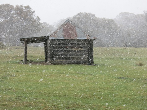
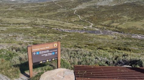
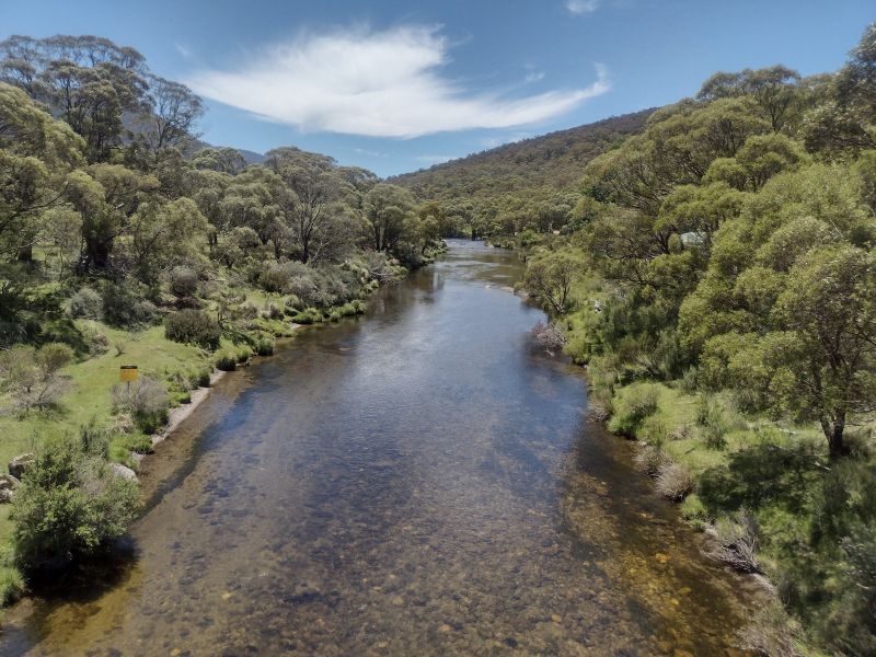
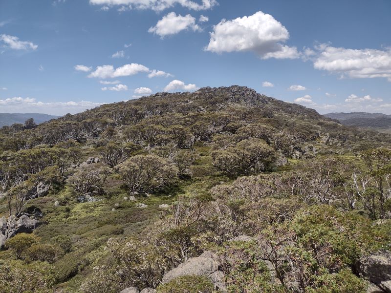
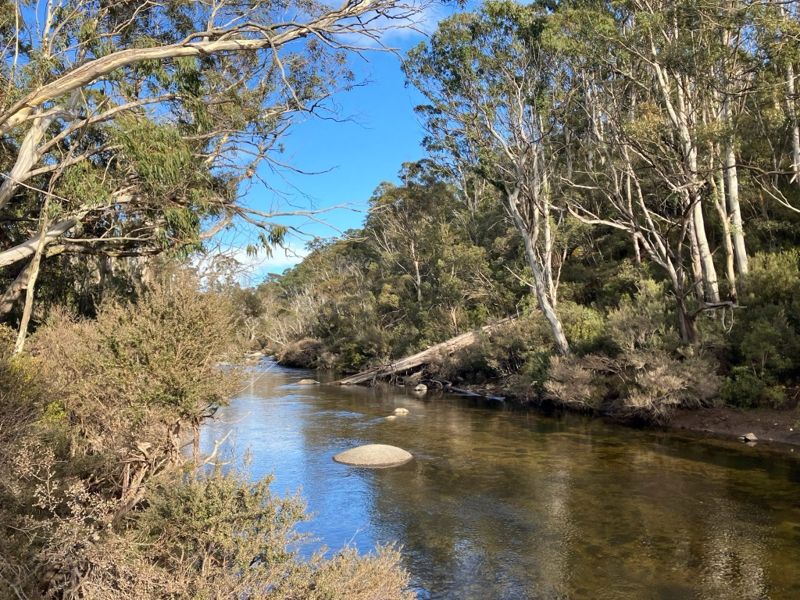
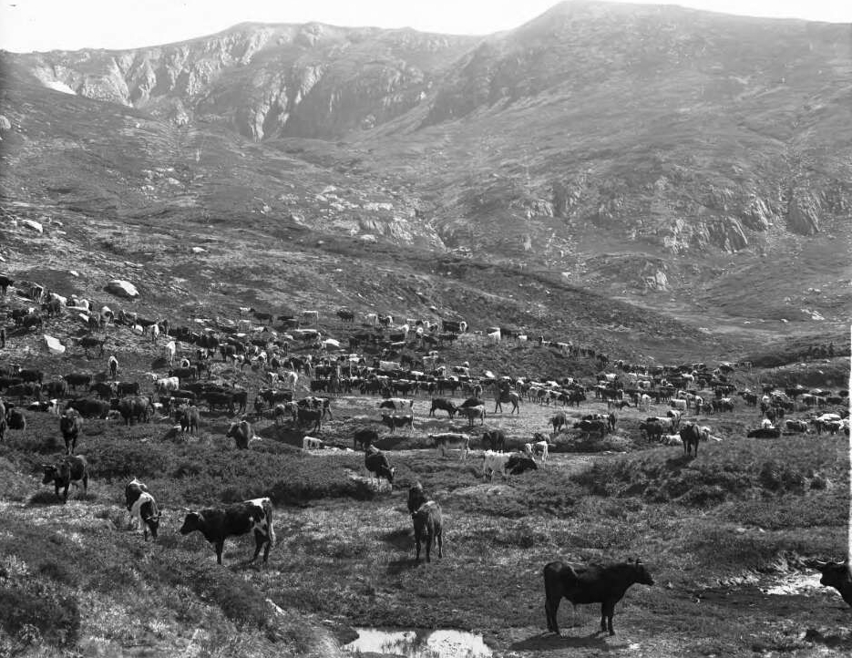
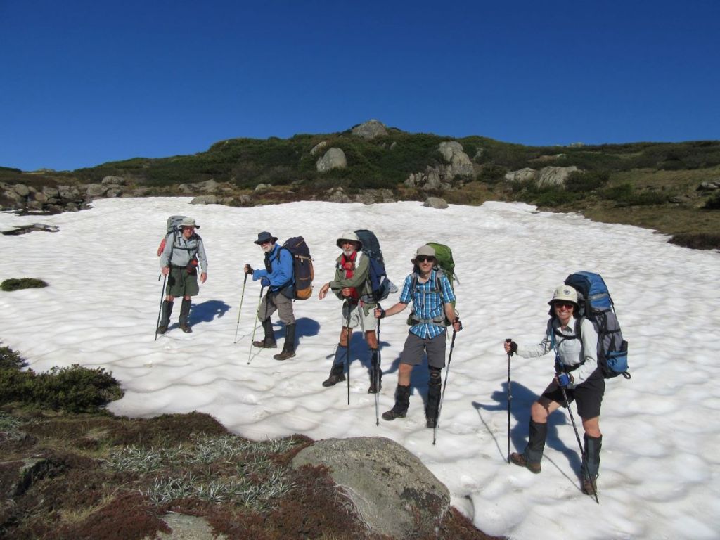
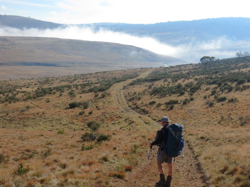
The Pipers Creek Track in Kosciuszko National Park is a little known management track that provides access to an aqueduct system feeding Guthega Pondage, part of the Snowy Mountains Hydro Scheme.
by Glenn Burns
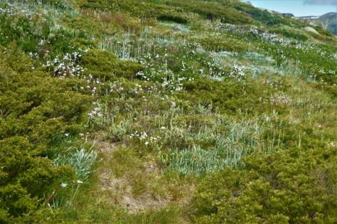
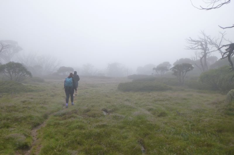
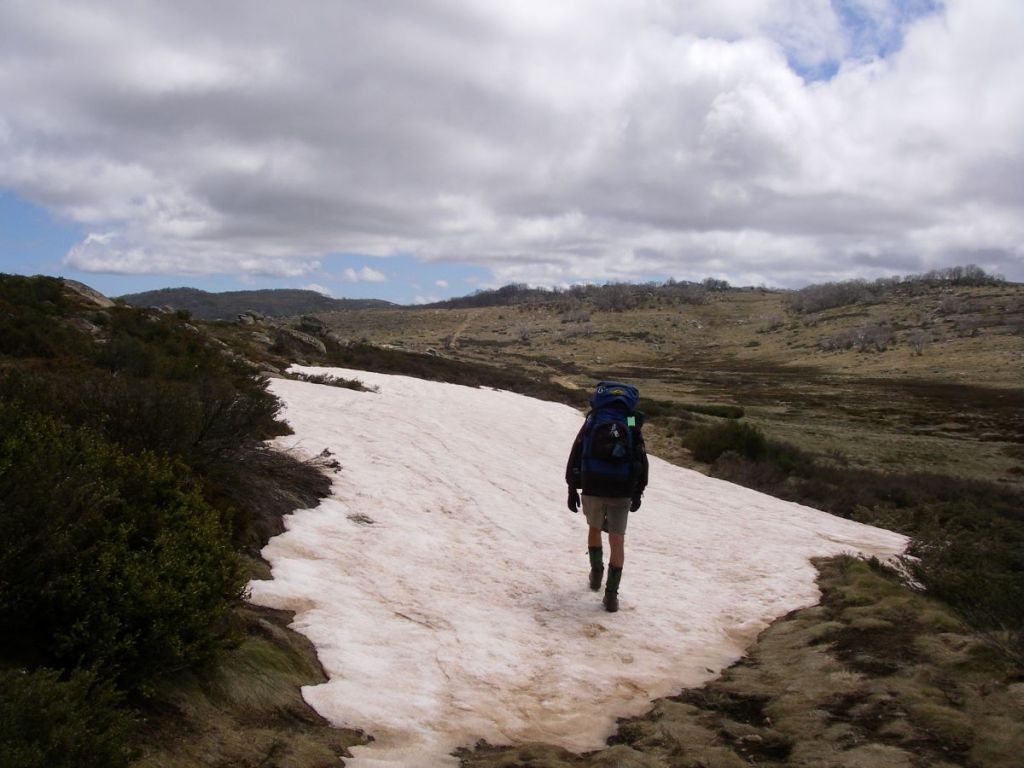
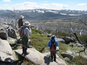
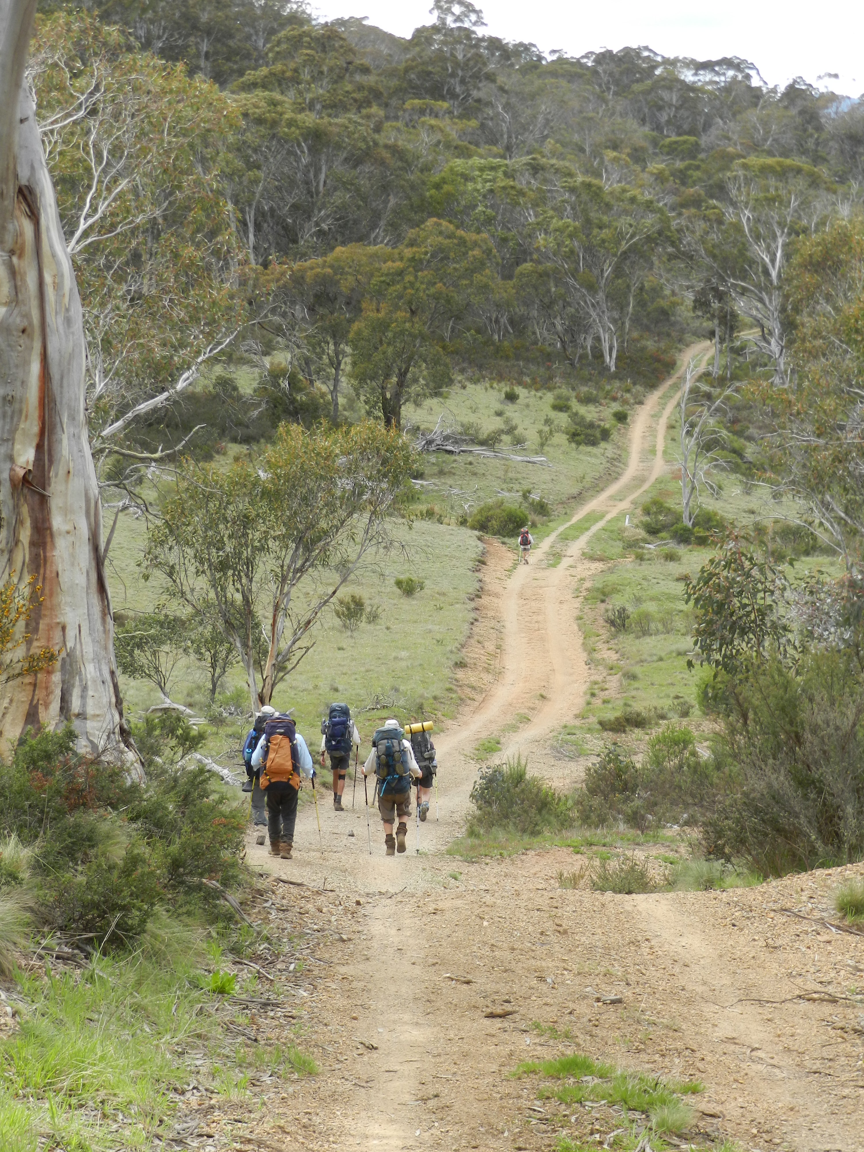
It is also an easy and very pleasant seven-and-a-half-kilometre ramble that winds in and out of patches of snow gum woodland and alpine grasslands, providing vistas across the Snowy River valley to the Rolling Grounds and the peaks of the Main Range.Nothing strenuous and ideal for families.As a bonus, it isaway from the hustle and bustle of the Snowies Alpine Walk and the Kosciuszko Summit Track.
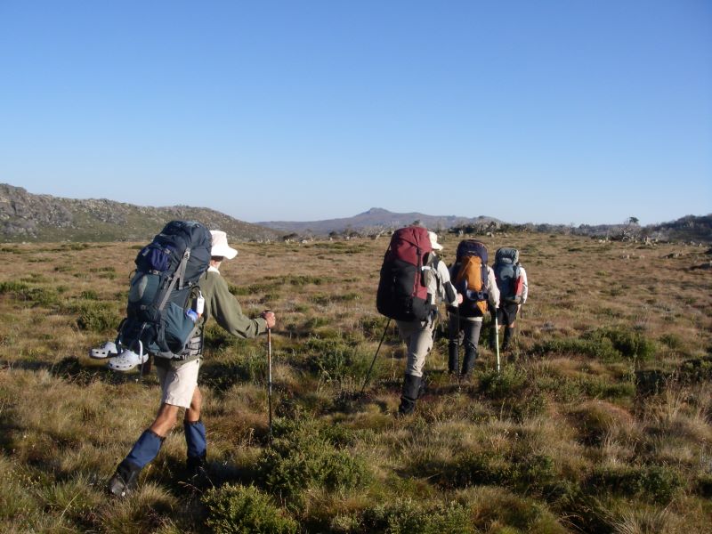
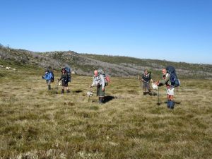
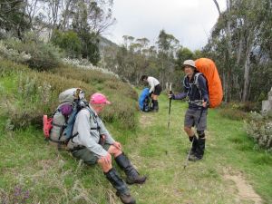
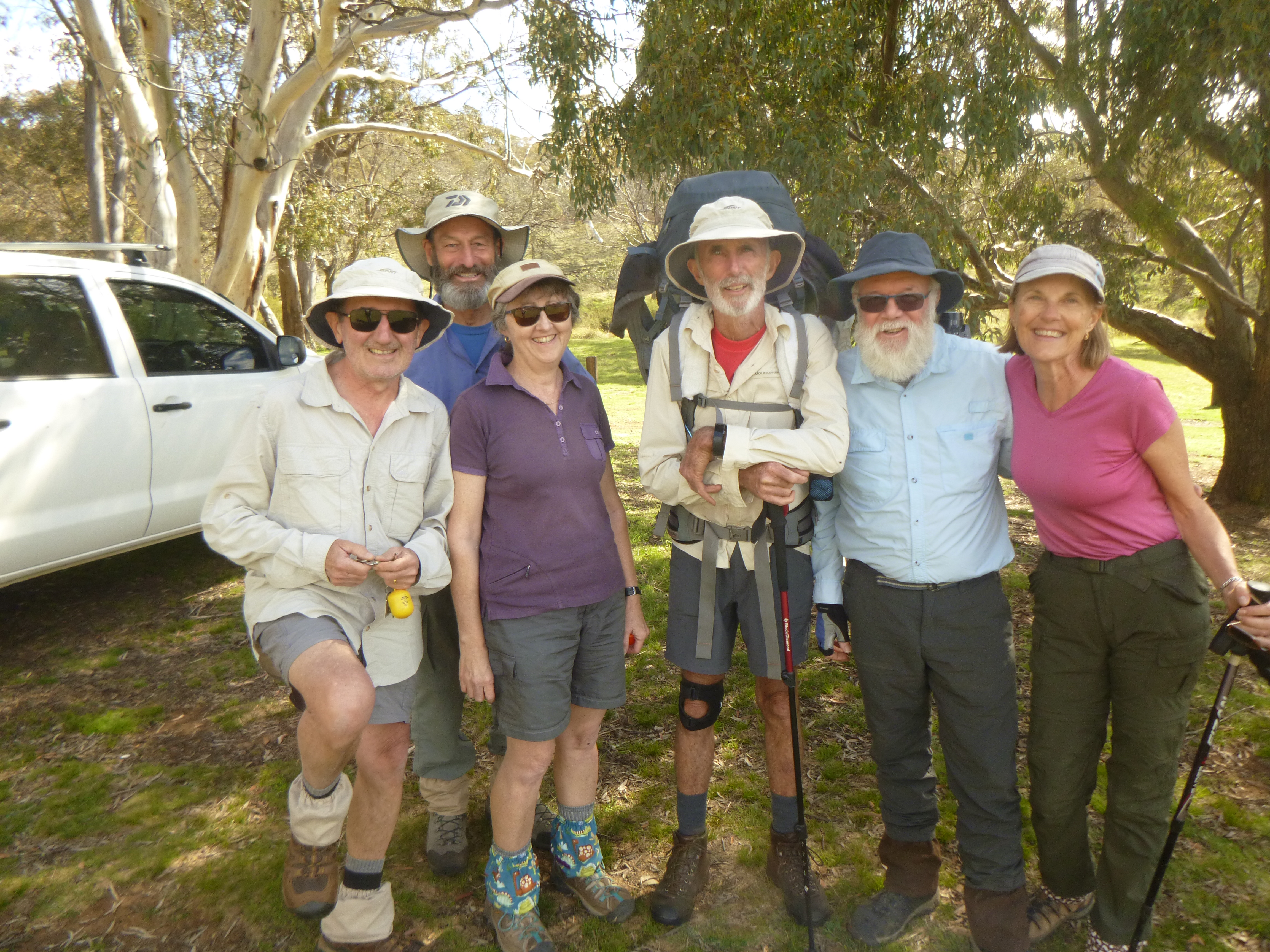
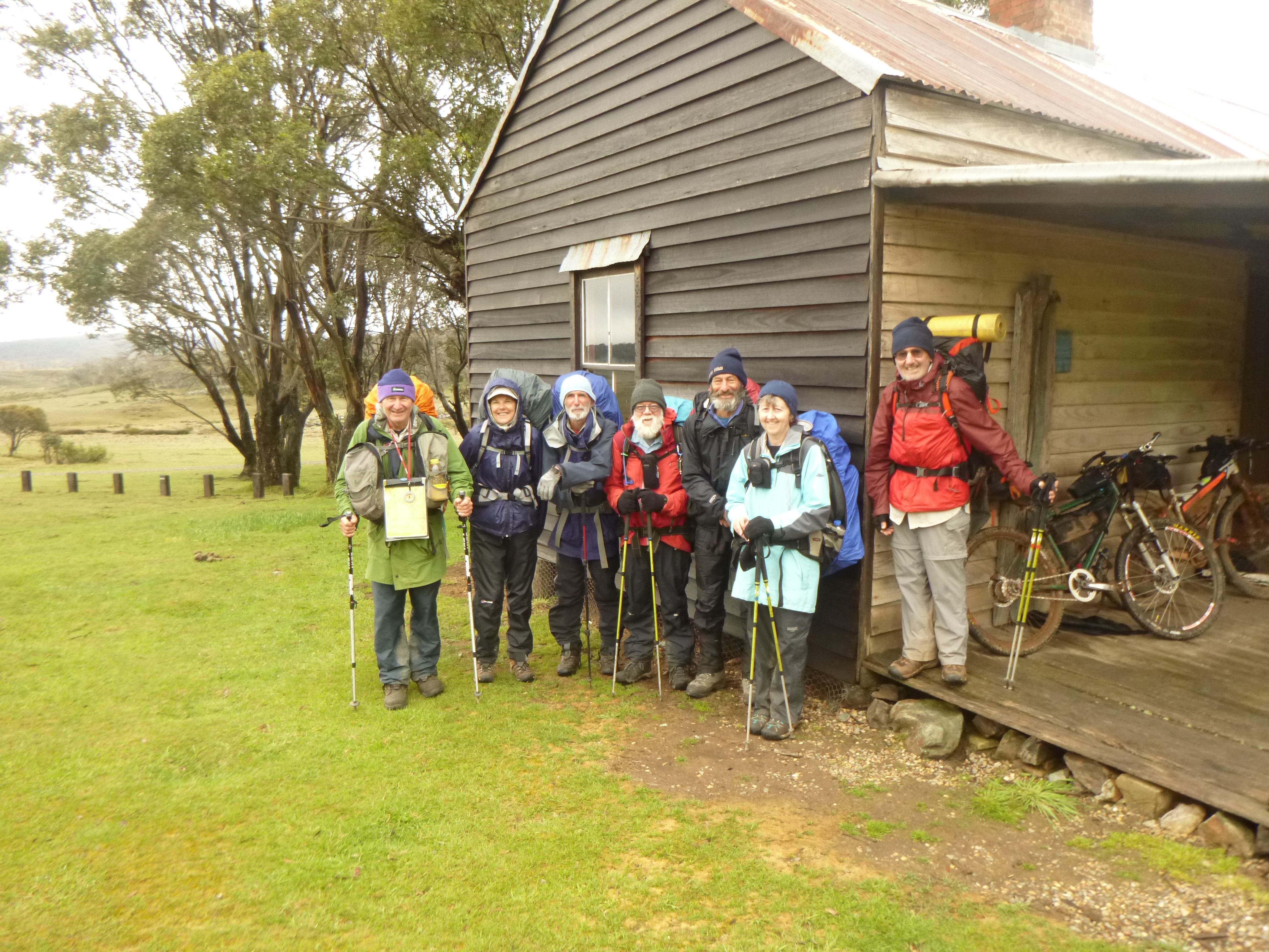
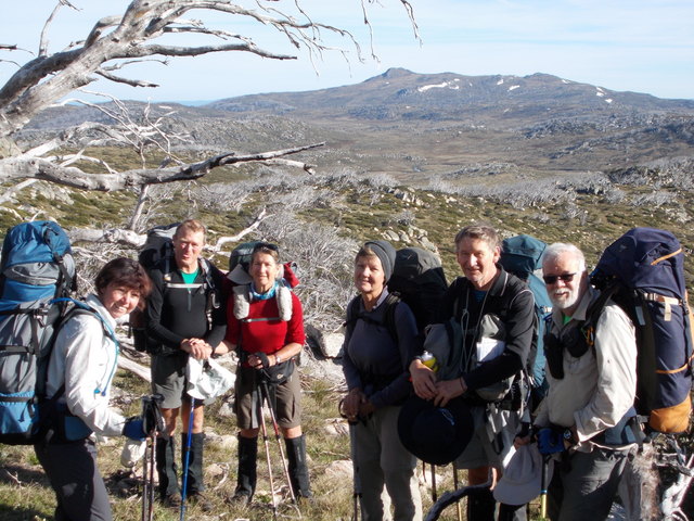
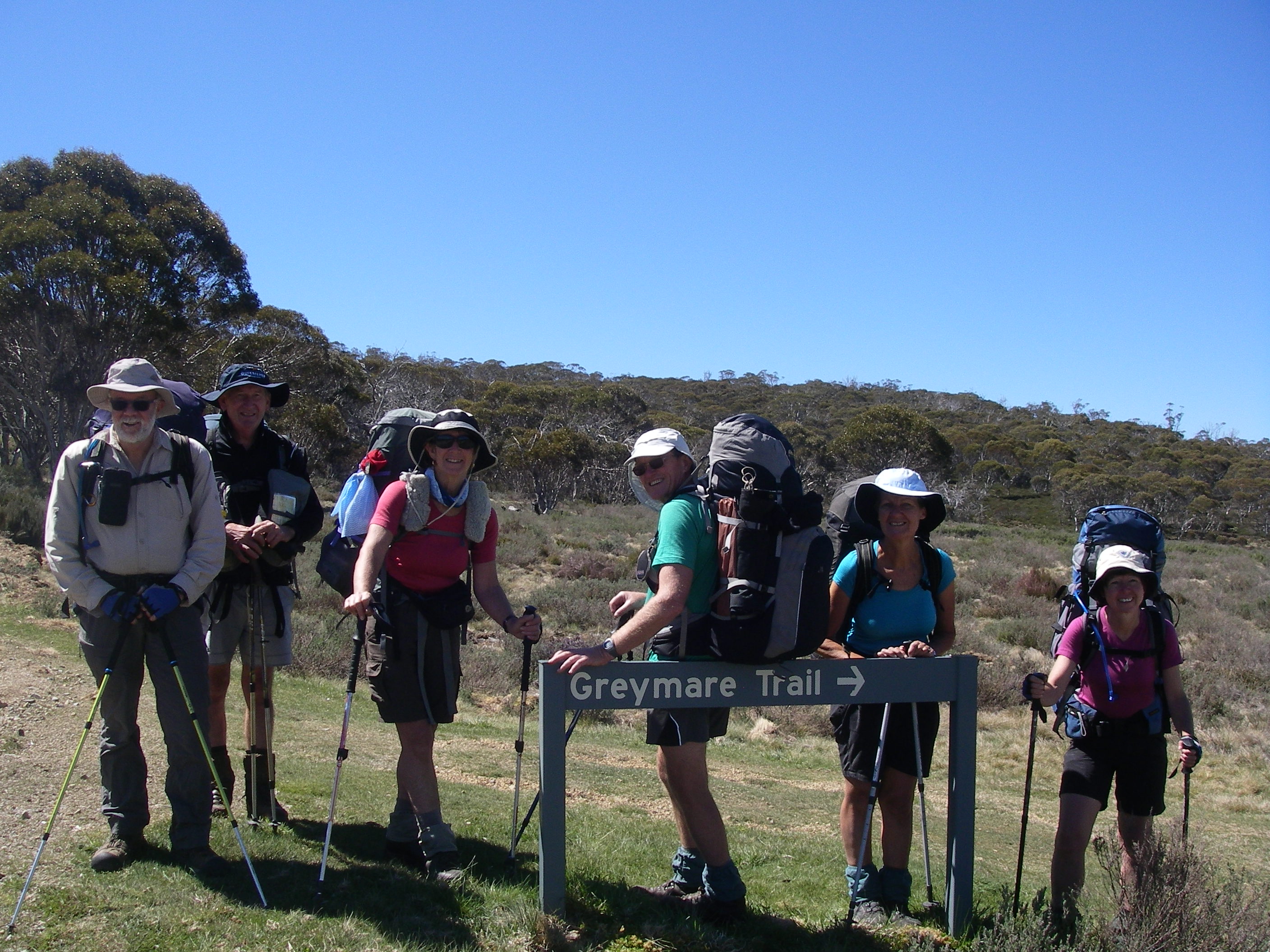
Although it is not on the radar of most bushwalkers, I have hiked it a number of times with family and friends and I never tire of this walk. My most recent walk was a summer trip with friends Joe, Chris, Garry and Neralie.
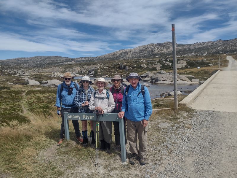
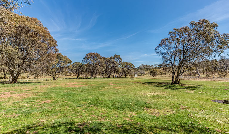
We started at a very civilised 8.30 am after depositing Garry’s ute on the Guthega Road for transport back to our starting point later in the morning. The walk starts about three kilometres north-east of Smiggins Hole where Dainers Creek and Wragges Creek join Pipers Creek. There is a smallish car park on the Kosciuszko Road where you can safely tuck a car.
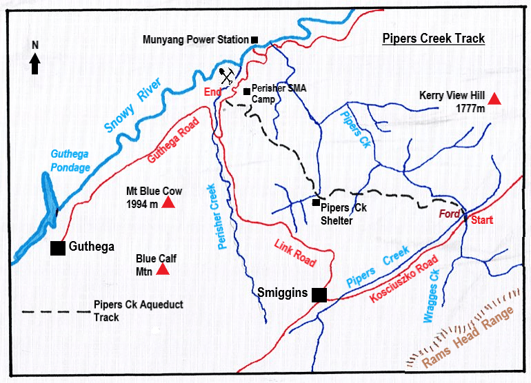
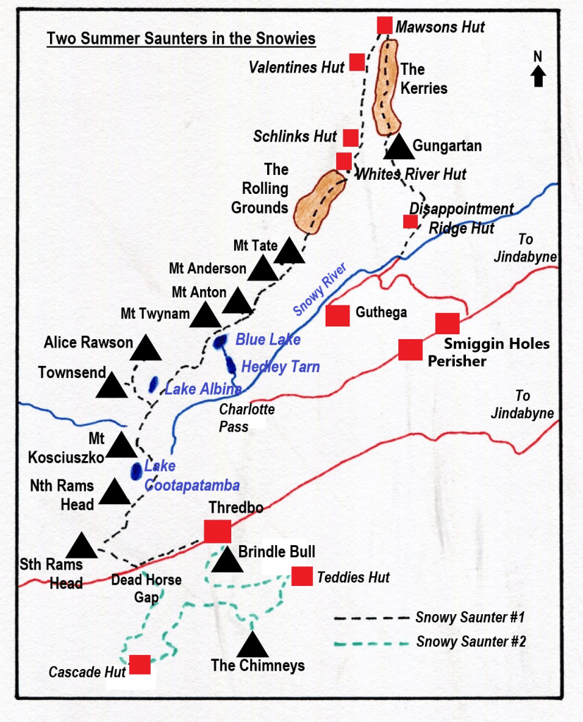
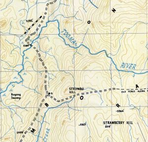
Map of Pipers Creek walk. Source: Kosciuszko Alpine Area map. 1:50,000
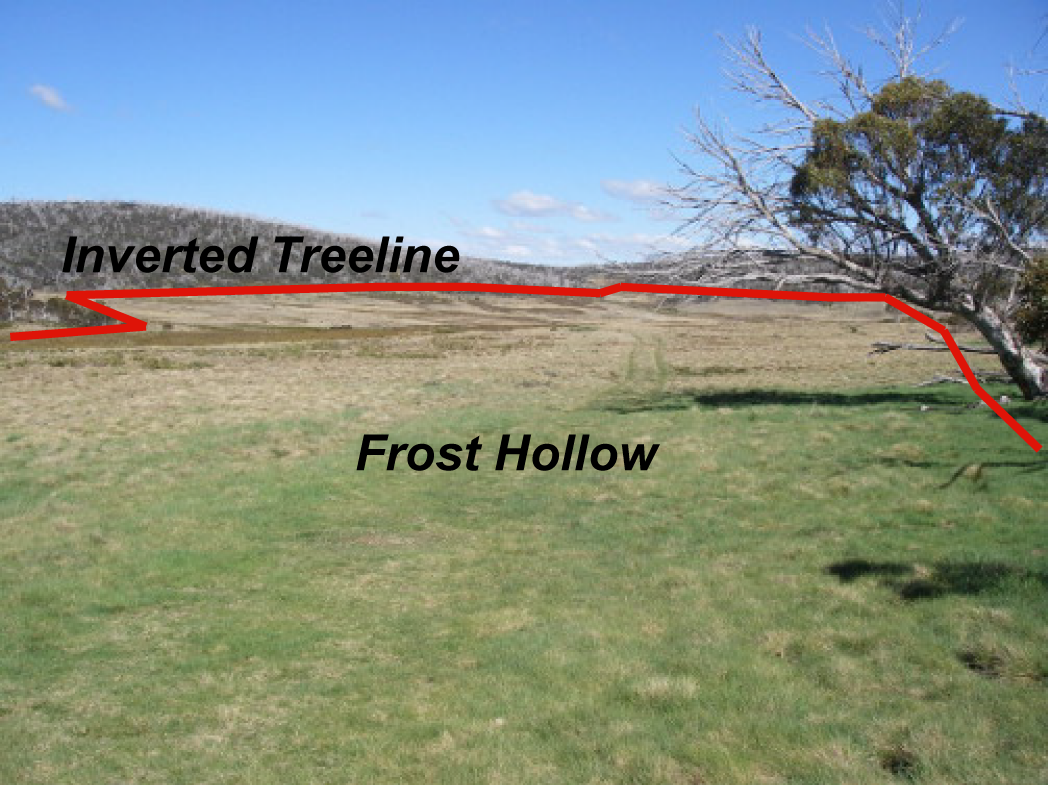
Pipers Creek. Who was Piper?
Who was Piper? Here is the origin of the name according to Klaus Hueneke in his book ‘Huts of the High Country’:
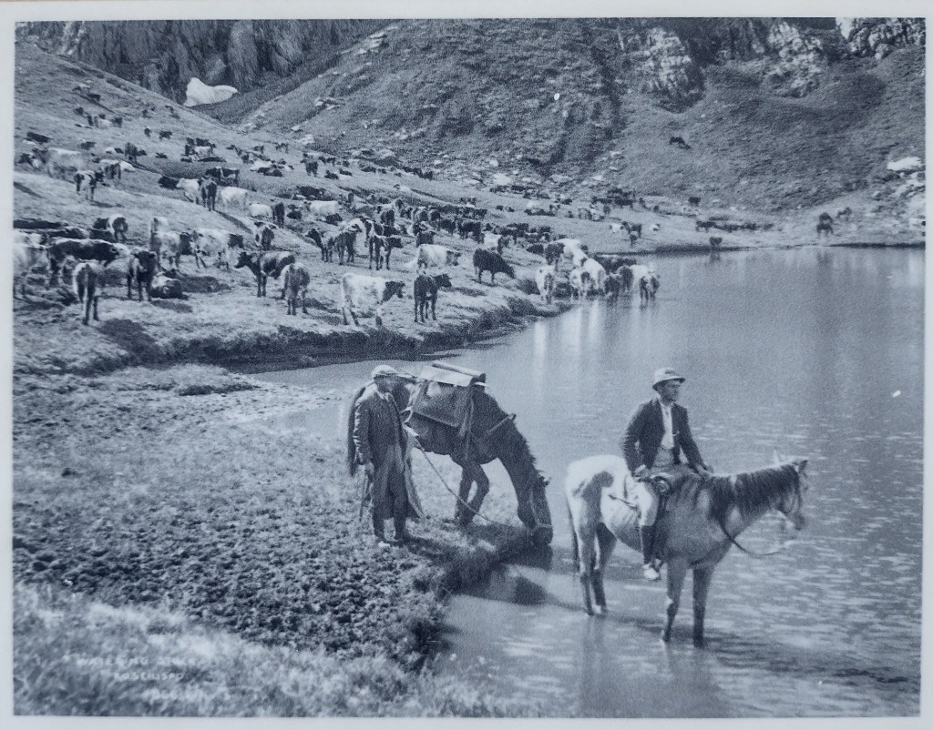
‘James Spencer, when taking his cattle up to summer pastures, used to take a bullock team. The lead bullock called Piper was particularly powerful and at night would often break loose. He would be found next morning down the creek, hence Pipers Creek.’
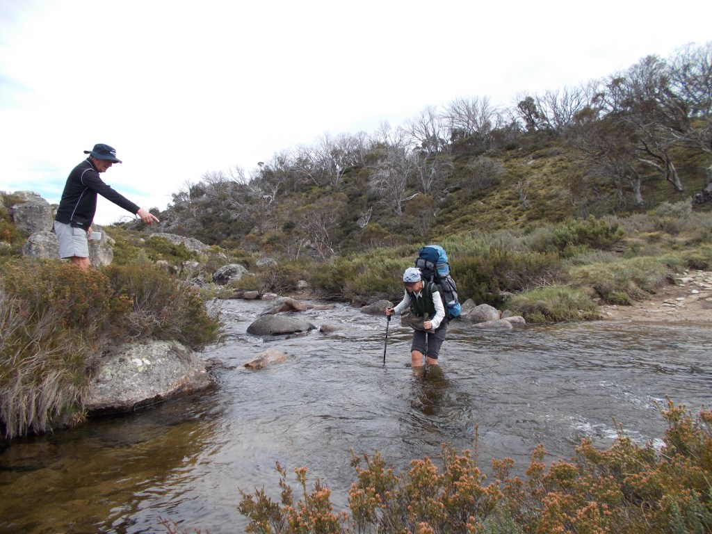
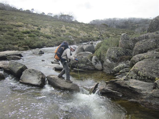
From the road a short descent takes you to an easily crossable ford on Pipers Creek where it executes a tight ninety-degree turn to flow north west. A reflection of the rectilinear drainage common in this section of Kosciuszko National Park.
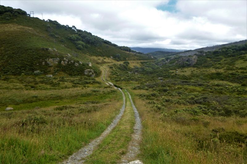
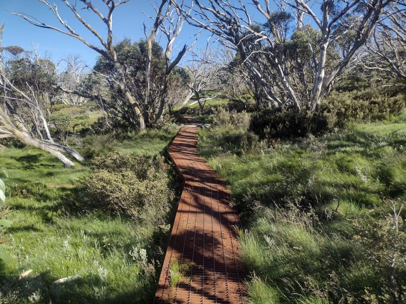
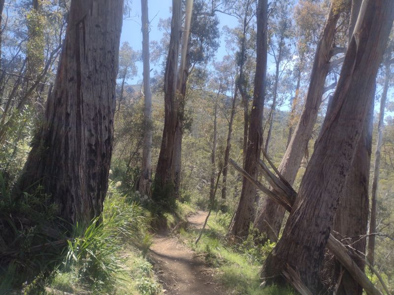
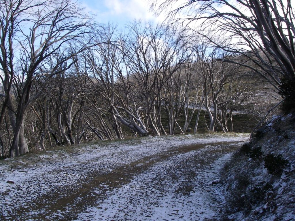
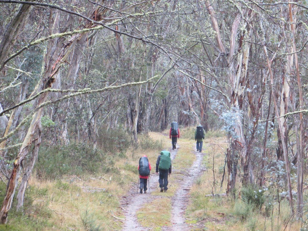
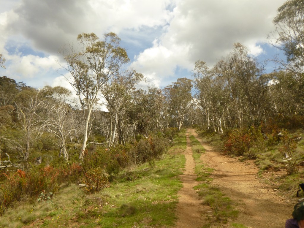
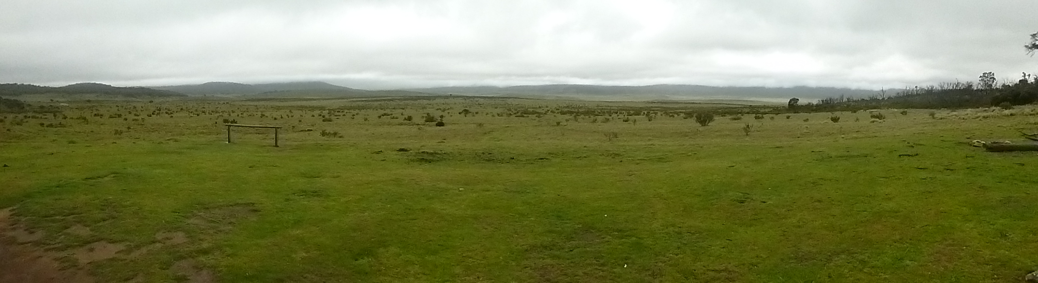
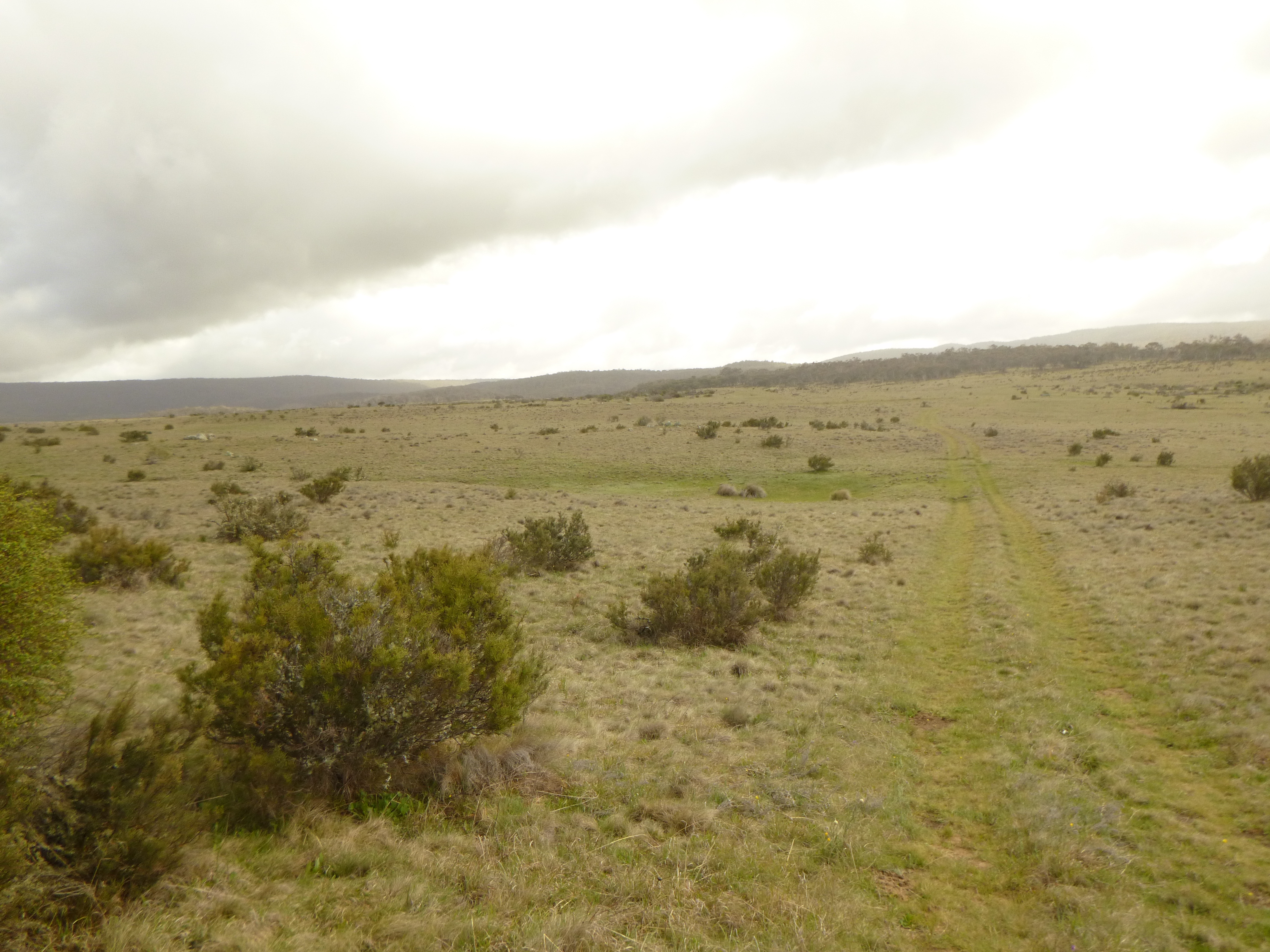
The path we followed is a very obvious 4WD management track. It commences in the valley of Pipers Creek on grassy flats called ‘frost hollows’. These are grassy plains which are the result of dense cold air draining from high tops and pooling on creek flats below. Usually totally devoid of shrubs or trees. The otherwise ubiquitous snow gums are unable to thrive in these freezing conditions but are found higher up on the nearby hillsides.
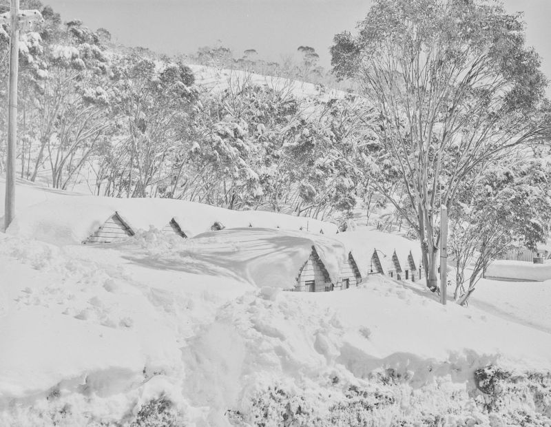
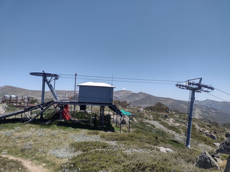
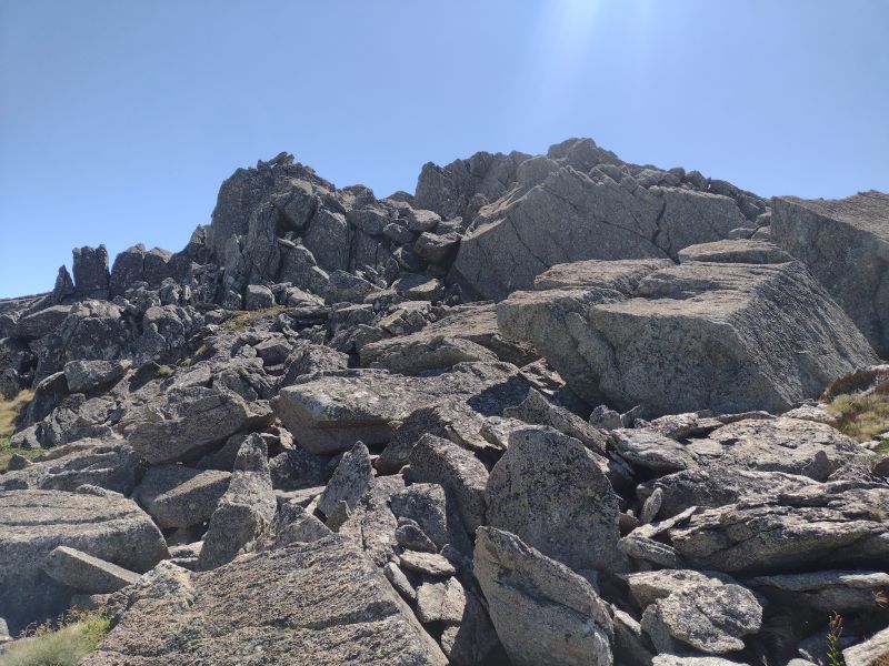
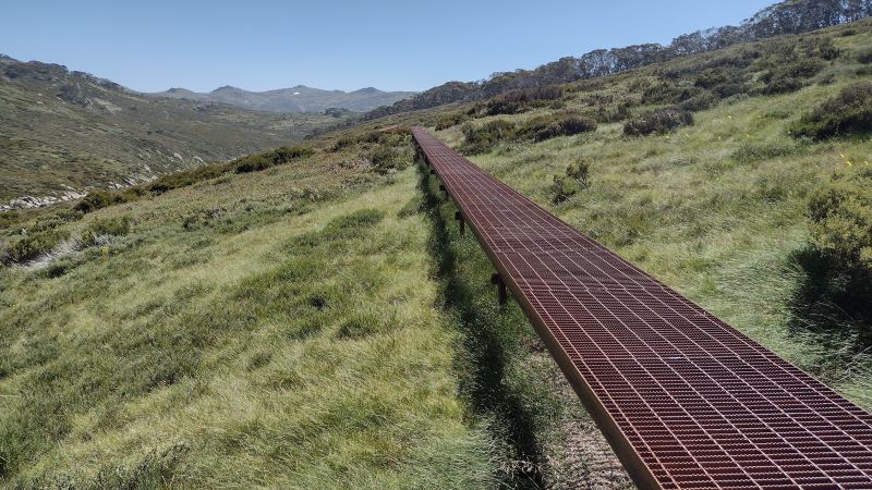
Pipers Ck Management Track
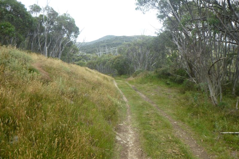
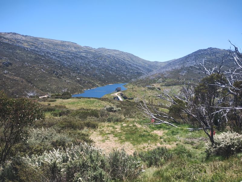
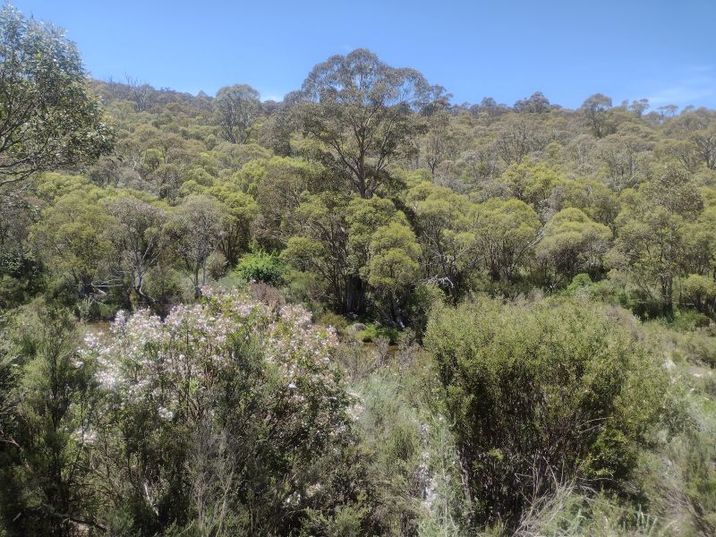
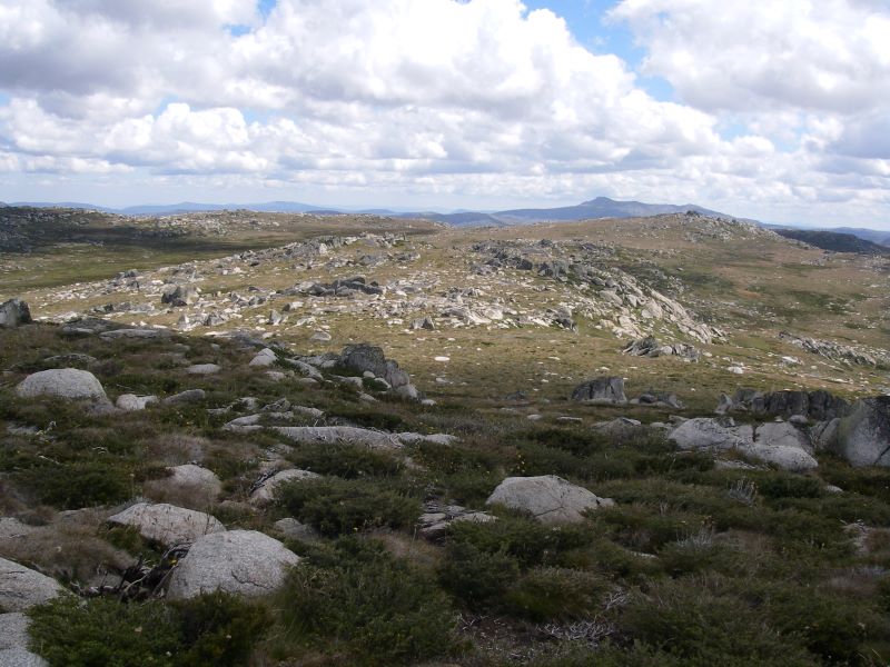
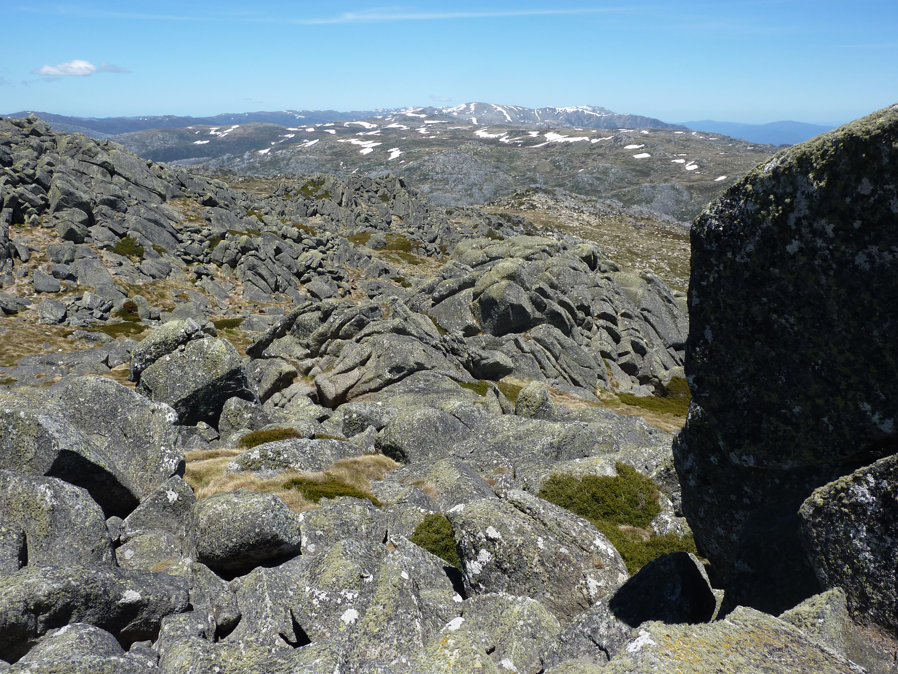
Our path dipped through this grassy plain before climbing steadily to the 1600 metre contour. After a kilometre we entered the first of several patches of snow gum woodland. At each gap in the woodland we had superb views out to the north, over Guthega Pondage in the Snowy River and the Main Range in the far background.
Belts of snow gum woodland.
Aqueducts in Kosciuszko National Park
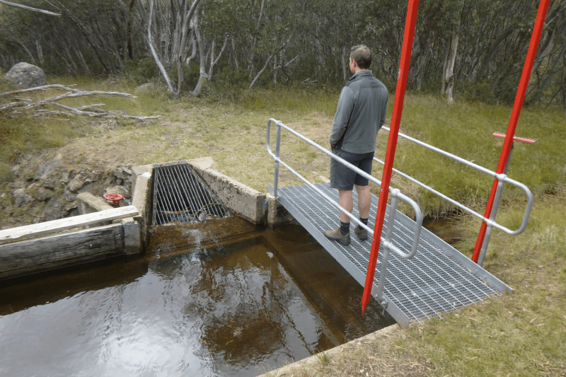
Following the 1600 metre contour line our track paralleled the Guthega Pondage aqueduct. The track providing the necessary access for maintenance purposes. It wasn’t long before Garry and Joe discovered the various sluices, channels and pipes that make up the aqueduct infrastructure. Their favourite engineering activity was to lift the sluice gate and allow any built-up sediment to flow downslope in a small rush of water, thereby flushing out any silt.
Aqueduct channel near Pipers Creek Aqueduct Shelter.
Aqueducts are but a minor part of the engineering masterpiece that is the Snowy Mountains Scheme. The Pipers Creek aqueduct intercepts and collects water from tributaries that might otherwise bypass the Guthega Dam. Even though the aqueducts and earthen diversion channels were constructed from 1953 to 1956, they still appear to be well maintained and functioning as intended. With some help from passing bushwalkers.
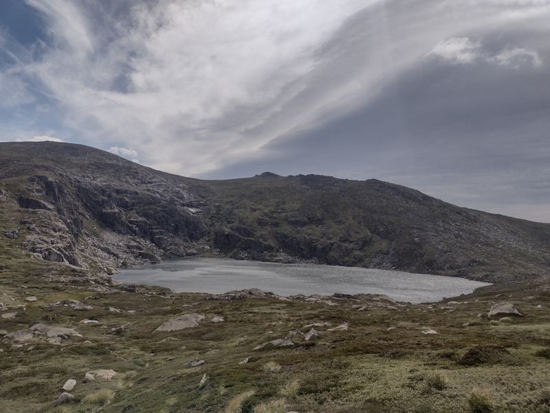
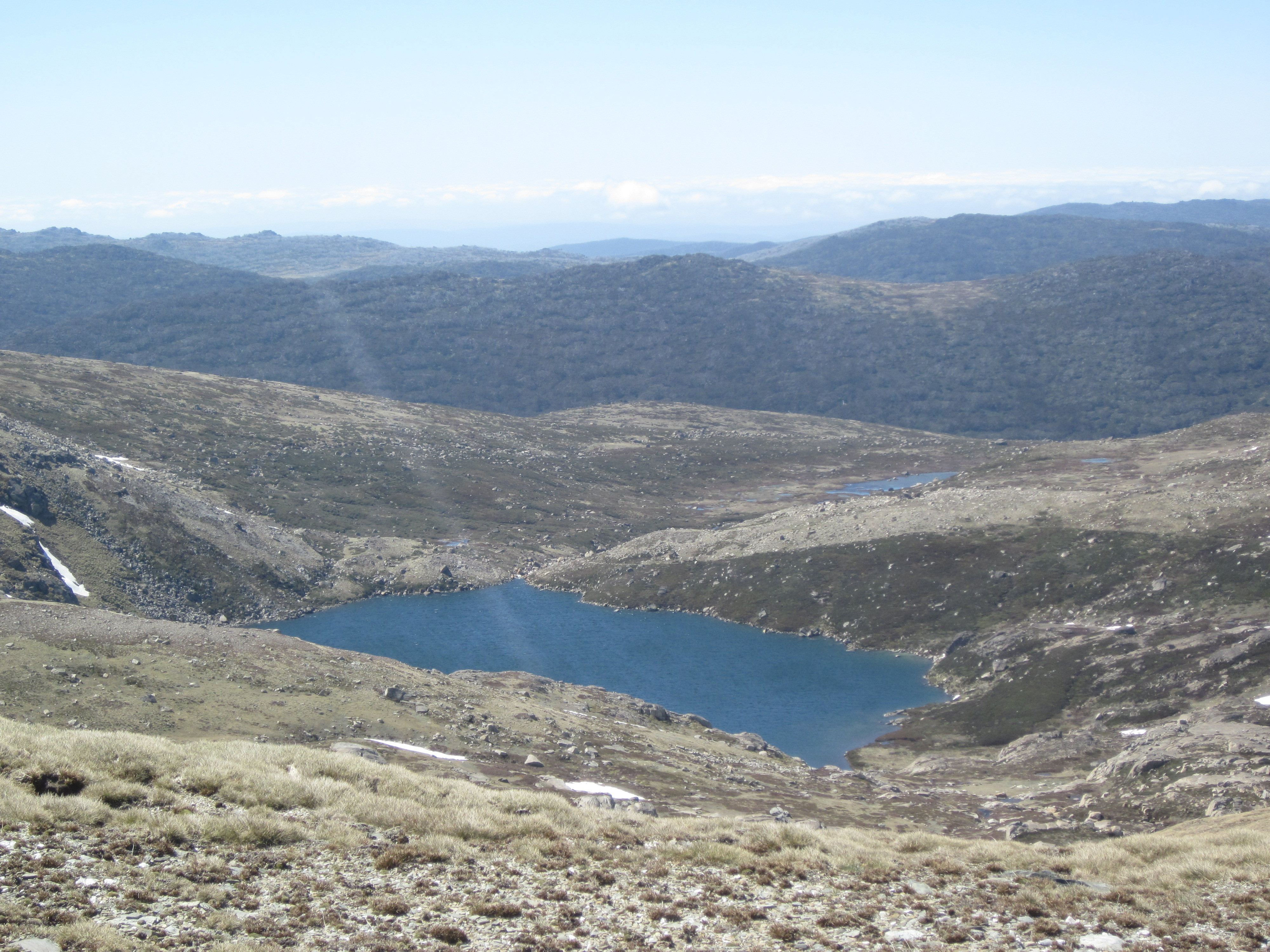
Guthega Pondage.
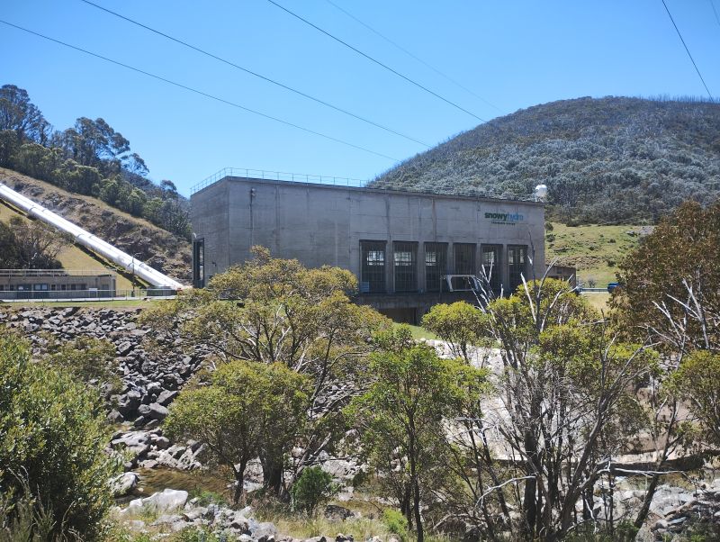
Snowy Hydro’s Munyang Power Station fed by Guthega Pondage.
I have come across other aqueducts before on my journeys across the Kosciuszko landscape. A few years ago, I followed another aqueduct track, the Munyang -Guthega Aqueduct track, to get from Whites River Hut to Horse Camp Hut thence to Munyang Power Station on the final day of a hike out of Bluff Tarn. It was an unexpected find and great alternative to the ups and downs of trudging back along the Munyang-Geehi road aka Schlink Highway.
Snowy Hydro Hut on Munyang River
More on Racelines aka Water Races aka Head Races
On one of my Kiandra to Kosciuszko hikes in 2007 we crossed the headwaters of Nine Mile Creek about three kilometres after the Four Mile Hut turnoff and climbed towards Tabletop Mountain. We were following the Tabletop Fire Trail on the Australian Alps Walking Track (AAWT).
In the 1800’s earthen racelines were built to collect water from the flanks of Mt Tabletop and direct the flow to a sluicing header dam for the Empress gold operations.
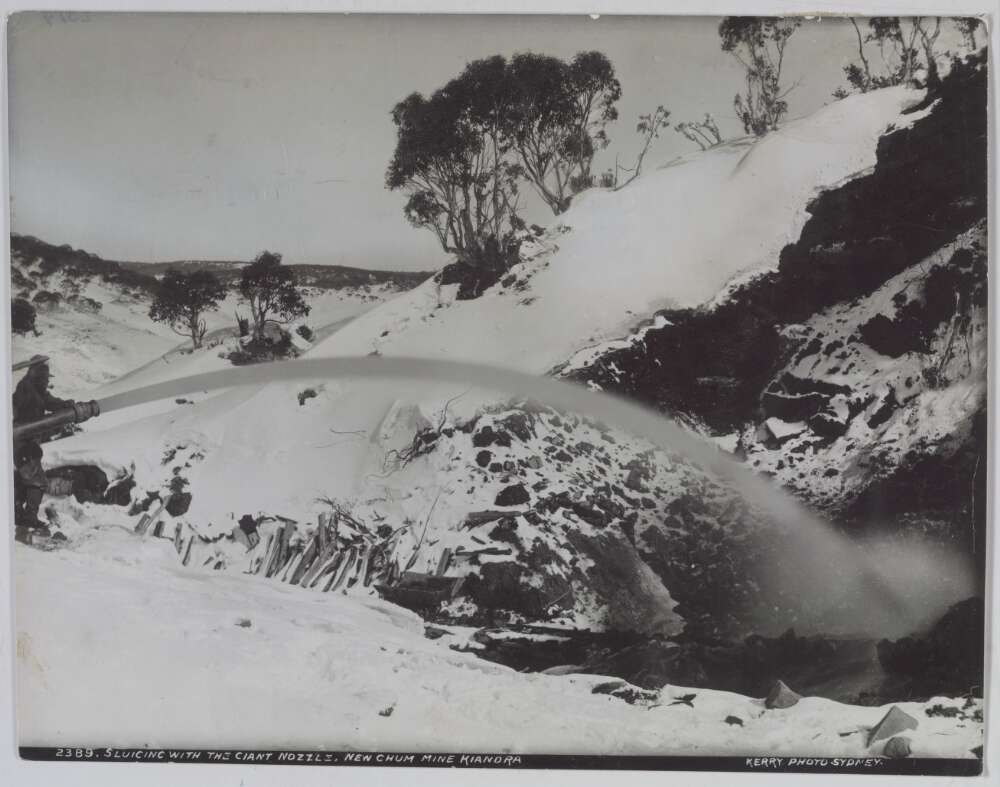
The current AAWT track follows the line of these racelines. Soon after Nine Mile Creek the AAWT ascends steadily to the headwaters of Scotch Creek where hydraulic sluicing from about 1860 to the 1920’s had scoured the hillside in a final search for gold. The head races, water races or racelines collected water from the high range and fed it into pipes fitted with nozzles of decreasing diameter to increase the pressure. Here is a description provided in 1887 by the Government Geologic Surveyor of how a Kiandra raceline worked:
Hydraulic sluicing. New Chum Mine Kiandra.1895. Charles Kerry. nla-obj 141601148.
‘With average rainfall sluicing operations can be carried on at this claim almost all the year round. A constant supply of water is obtained from a dam which the Company has made in the Three Mile Creek. The water is conveyed in a race for a distance of three miles to the workings. The race comes in on the top of the face and the water is conveyed from it, first in 22-inch pipes, and then in 15-inch pipes to the bottom of the cutting, where the pipes are reduced to 13 inches. This size pipe carries the water to the nozzle, which has a diameter of five and a half inches. The pressure of the water at the nozzle head is 120 lbs to the square inch. The system is capable of throwing a stream of water for a distance of 150 feet. The system is duplicated and there are two sets of pipes from the race outlet to the bottom of the workings. In 1885 the amount of gold obtained from these workings was 1,100 oz.‘
The hillside scar was still there, 150 years later, 700 metre long, 100 metres wide and 15 metres deep.
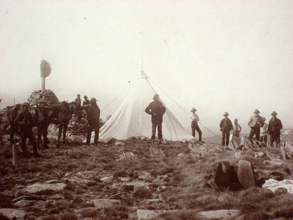
Nearly 10,000 miners swarmed to the Kiandra Goldfields in 1859, enduring severe winter blizzards hunkered down in canvas tents. Some miners even constructed primitive shelters of sod, rocks and branches. Not much different to the tented work camps of the Snowy Mountains Scheme in the 1950’s.
The Kiandra gold rush was short-lived, the shallow alluvial deposits worked out and attempts to find the main reef proving fruitless.
After the 1860 winter only 150 miners hung on. For these modern day pampered bushwalkers passing through the Nine Mile with our down jackets, four season sleeping bags and tents, staying warm in the 21st century was still a tad difficult.
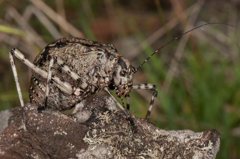
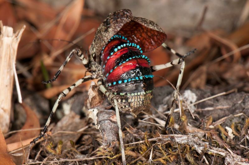
The Caped Crusader, a Mountain Katydid
Meanwhile, back at a summery Pipers Creek the day had warmed up. Now swarming grasshoppers and katydids had appeared on the grassy verges, especially in the snow gum woodlands. Two species seem prevalent.One, a chunky squat katydid, had a distinctive startle warning, making it easy to identify. Except it looks like a beetle if its wing covers are closed. Don’t be fooled.
Normally this species is a nondescript mottled grey-brown colour. But, if disturbed, it raises its wing covers, arches its abdomen and reveals shiny crimson and blue bands. I identified it as the Mountain Katydid (Acripeza reticulata).The female can’t fly but it feeds on fireweed and other plants that may make it distasteful to predators.
They are called katydids because the male makes a sound like it is saying “katy-did’.
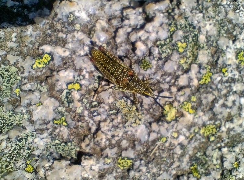
The Spotted Mountain-grasshopper (Monistria concinna) is another alpine insect that is easy to identify. It is large, flightless with a body that is usually olive-brown with a dense splatter of yellow or cream spots. It is very cold-tolerant, hence its ability to survive in our high alpine areas. It is said to have its own version of an anti-freeze.
Its bright colours may serve as warning to any passing lizard/bird that its body contains noxious chemicals. It is possible that the chemicals are derived from its main forage plant, the alpine mint bush (Prostanthera sp).
To me, the aqueduct trackappears like a reptilian heaven. With long weeping grass, clumps of tussocky snow grass and warm sunny nooks for a sunbathing snake or three, I am evervigilant. Logic and experience tell me that snakes, dragons and skinks aren’t well suited to these cold conditions and there are only two species of snakes that hang out at this altitude. I reflect on this, but at the last minute I always pull on my trusty gaiters… just in case.
The two snakes are the venomous copperhead and the mildly venomous white-lipped snake. Both feed on frogs and skinks. The docile copperhead grows to respectable 1.7 metre while the slim white-lipped can only manage a paltry 45 centimetres in length.
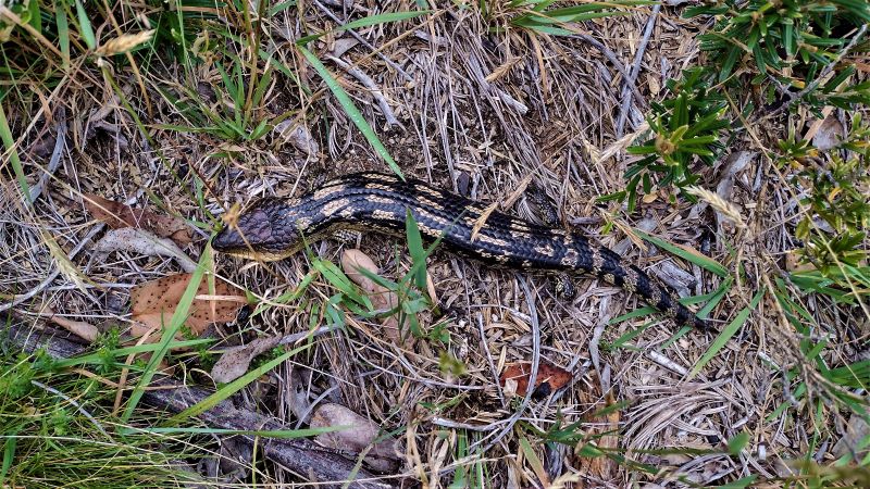
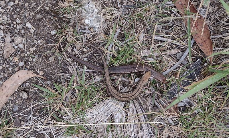
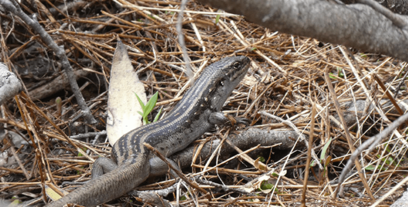
Withno snakes to disturb my equilibrium,I was lucky to see an excellent specimen of a Blotched Blue Tongue lizard (Tiliqua nigrolutea)which quite likes these tussocky grasslands. They emerge from their overnight accommodation in rocky crevices or deep litter for an early morning sun bake before heading off to forage onthe odd beetle or caterpillar that passes by.
Blotched Blue Tongue Lizard trackside.
Further on I sprung two nondescript Skinks cavorting in the undergrowth. The most likely ID is the Mountain Log Skink (Pseudemonia entrecasteauxii), the most abundant reptile in alpine areas where it occurs at all altitudes. Their skin was not glossy which helps distinguish them from the Southern Tussock Skink , (Pseudemonia pagenstecheri), a close relative.
Mountain Log Skinks.
But the real prize would have been a sighting of the endangered Guthega Skink (Liapholis guthega). This is the highest occurring skink in Australia, found only in Kosciuszko National Park and the Victorian Alps above 1600 metres up to about 2100 metres. Its habitat is rocky outcrops, tussock grasslands and damp heath.But no luck today.
Guthega Skink. Source: NSW Parks. Bec Byrnes.
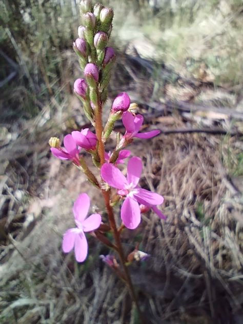
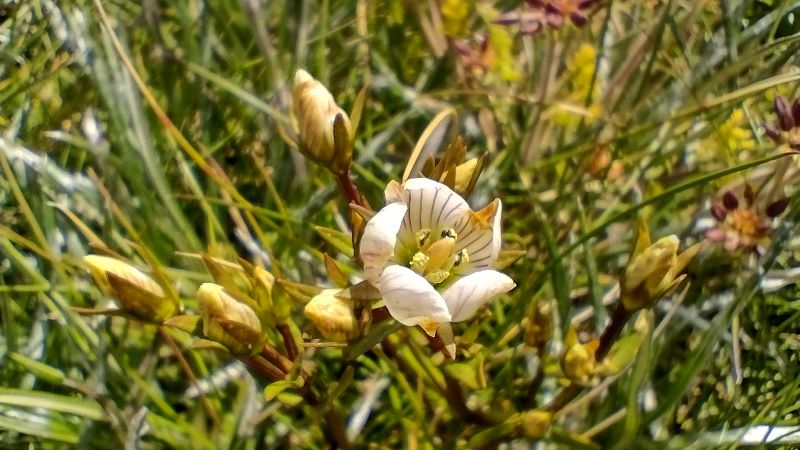
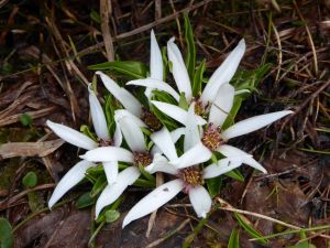
Wildflowers
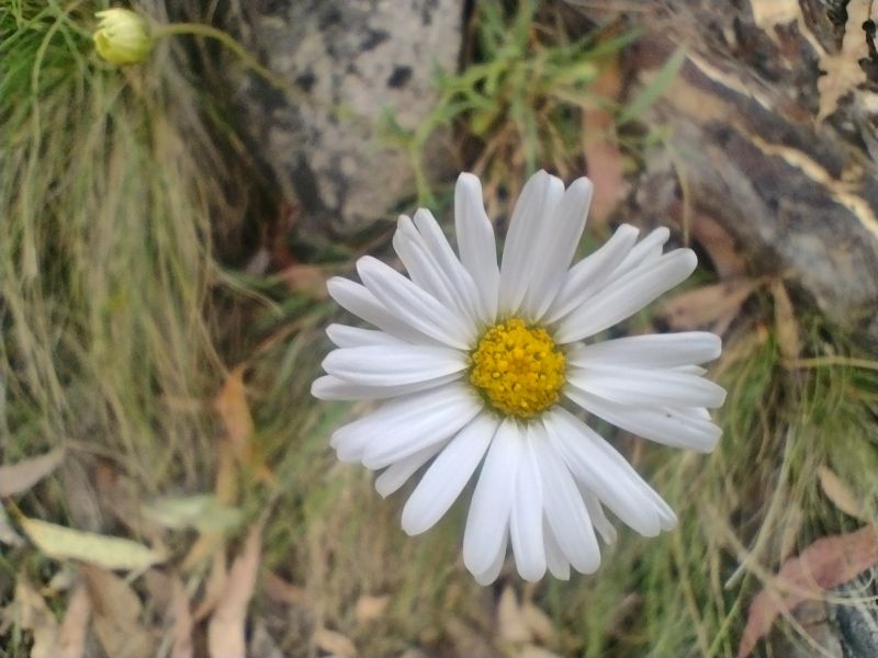
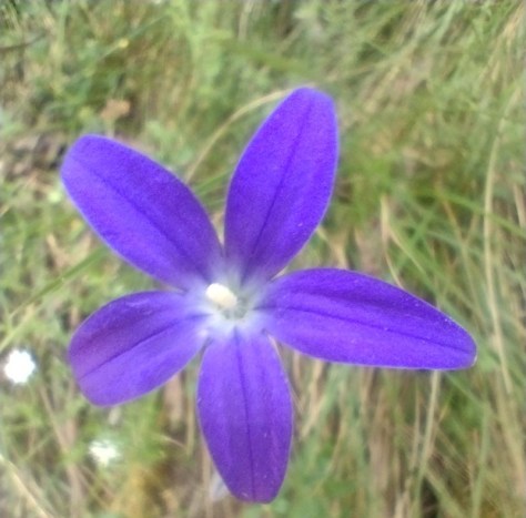
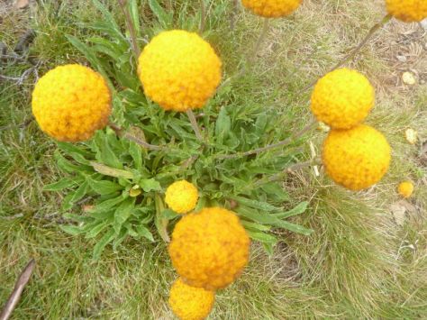
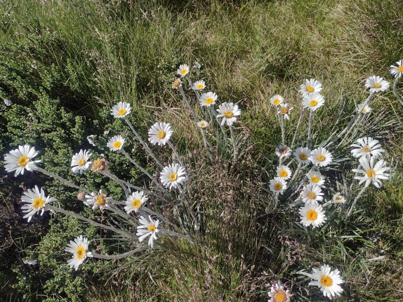
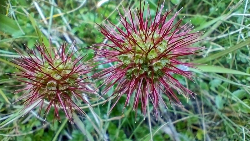
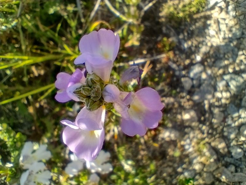
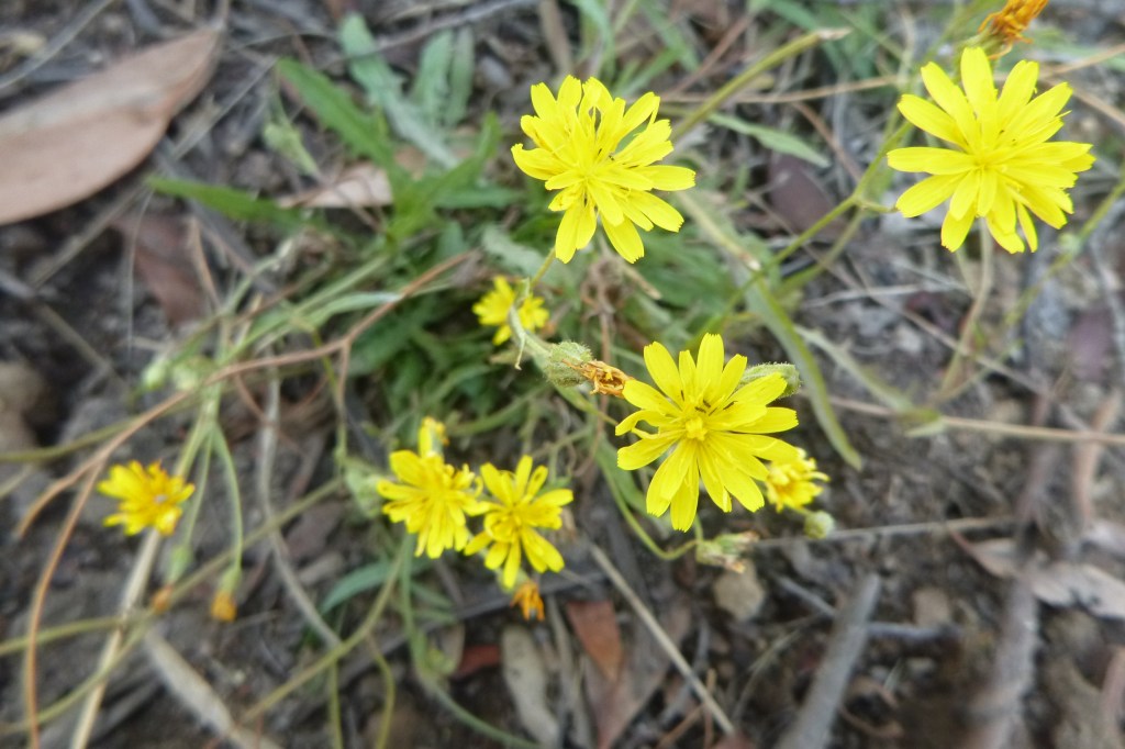
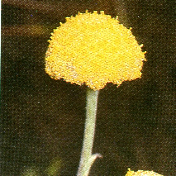
It was well past peak wildflower season but I was still able to find few specimens to satisfy my botanical itches: a Sunray (Leucochrysum sp) Australian bluebells (Wahlenbergia sp), bidgee widgee (Acaena anserinifolia) andbilly buttons (Craspedia uniflora), amongst others.
Sunray. Leucochrysum sp.
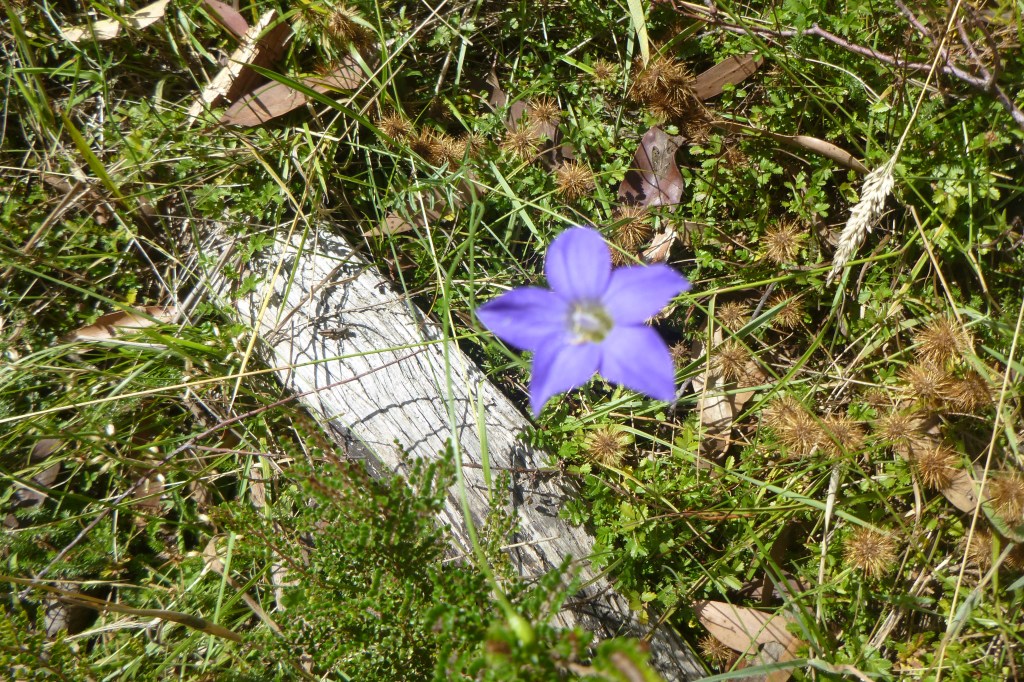
Australian bluebell. Wahlenbergia sp.
Bidgee widgee. A nuisance plant with spines that love your socks.
Billy buttons. Craspedia lamicola.
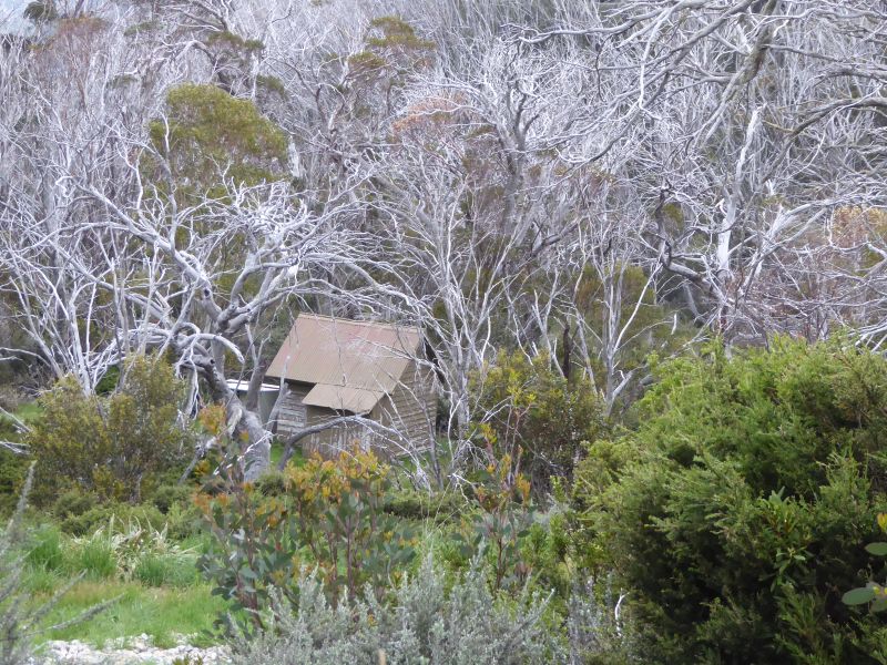
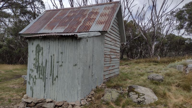
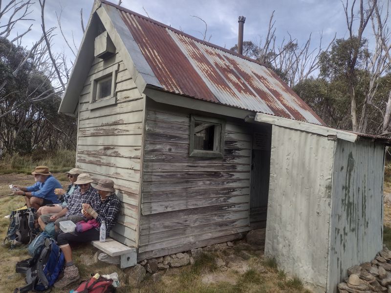
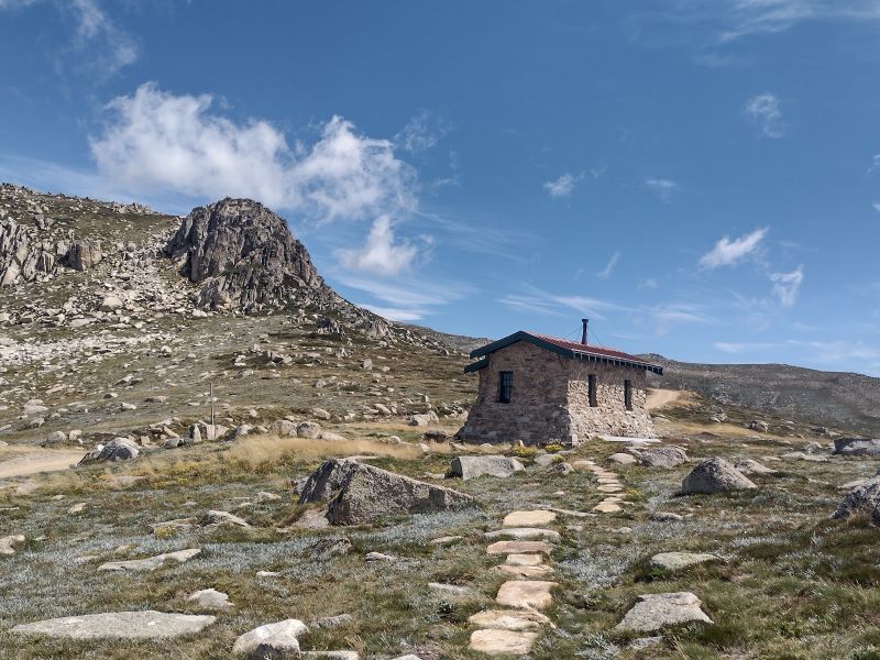
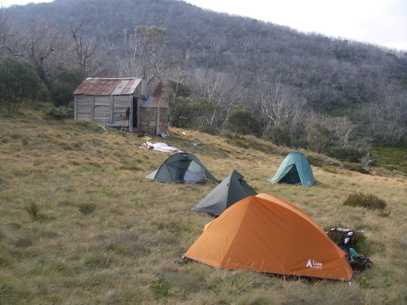
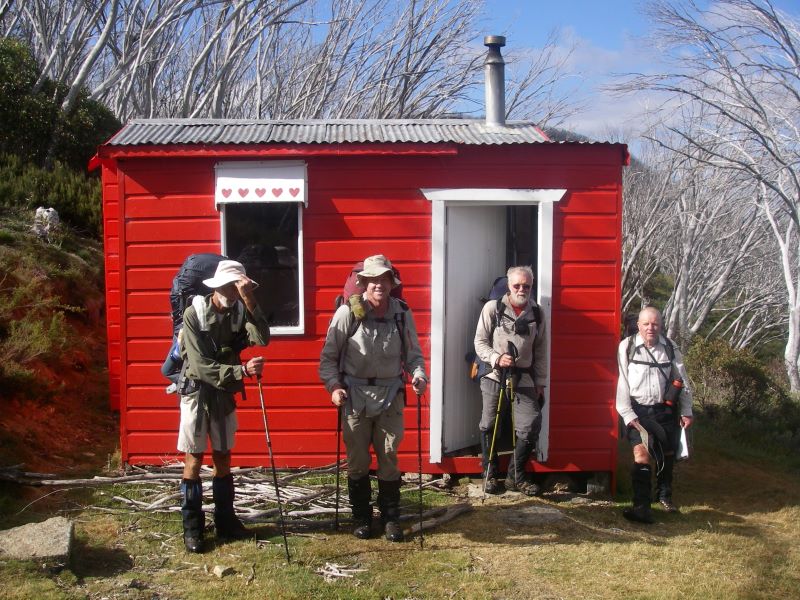
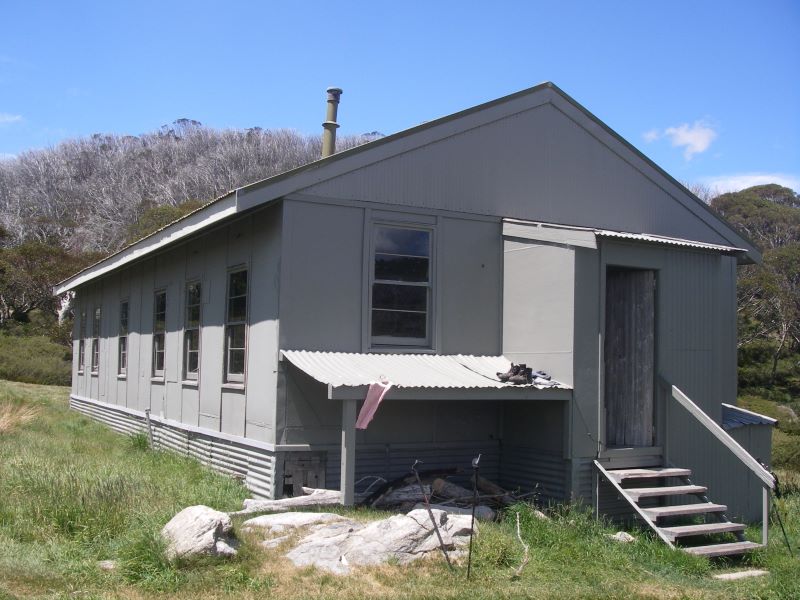
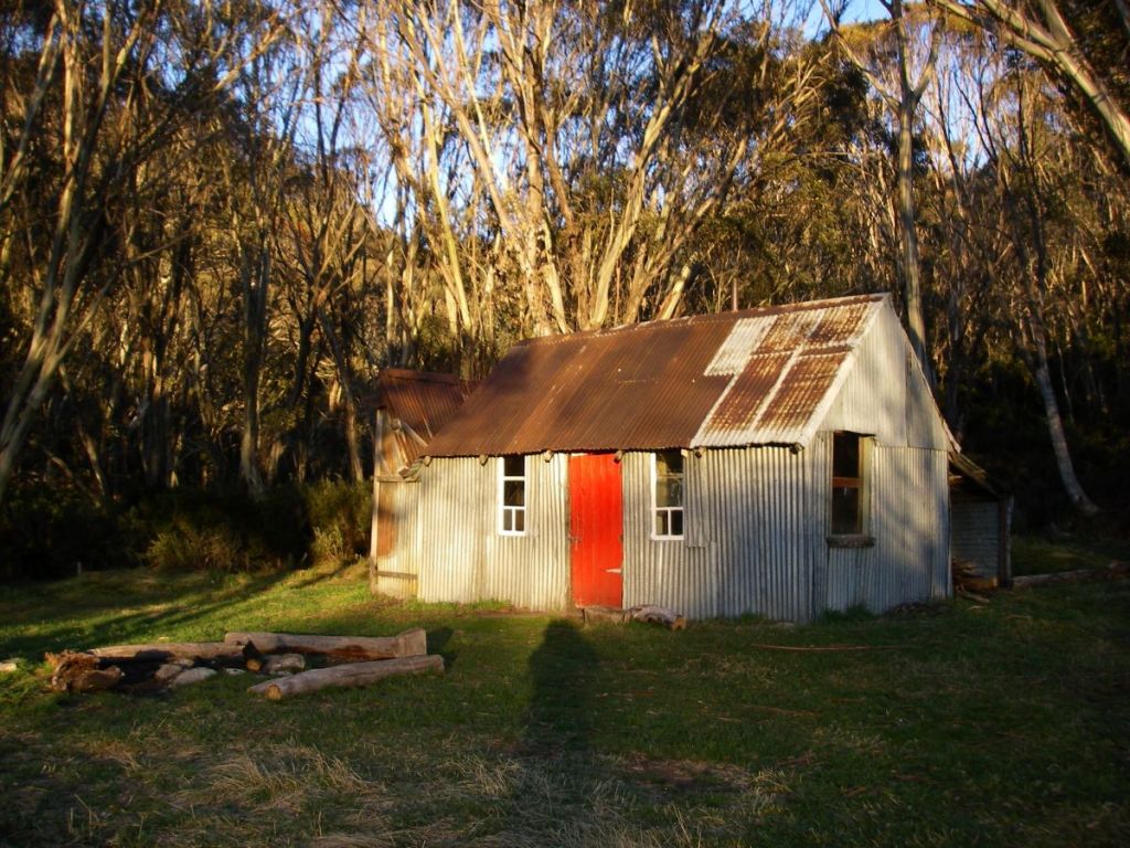
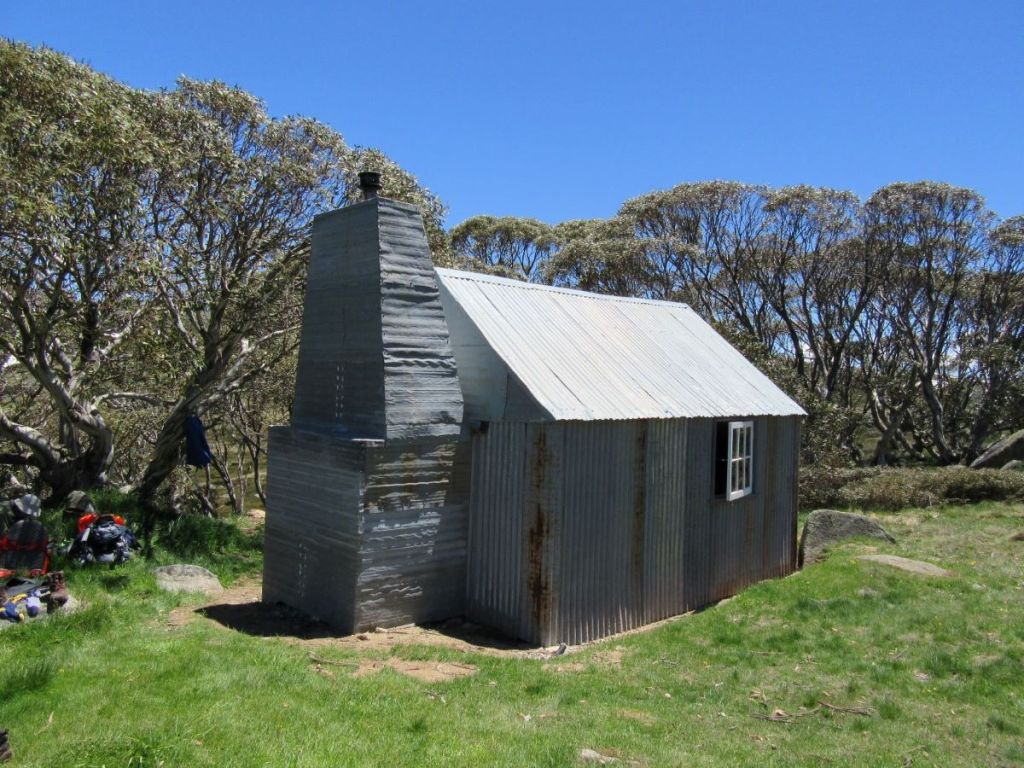
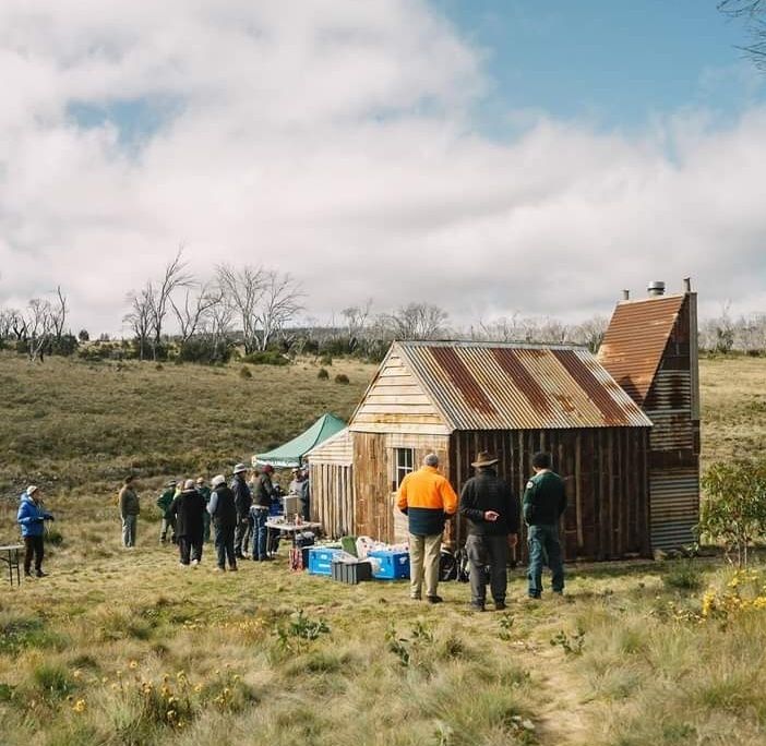
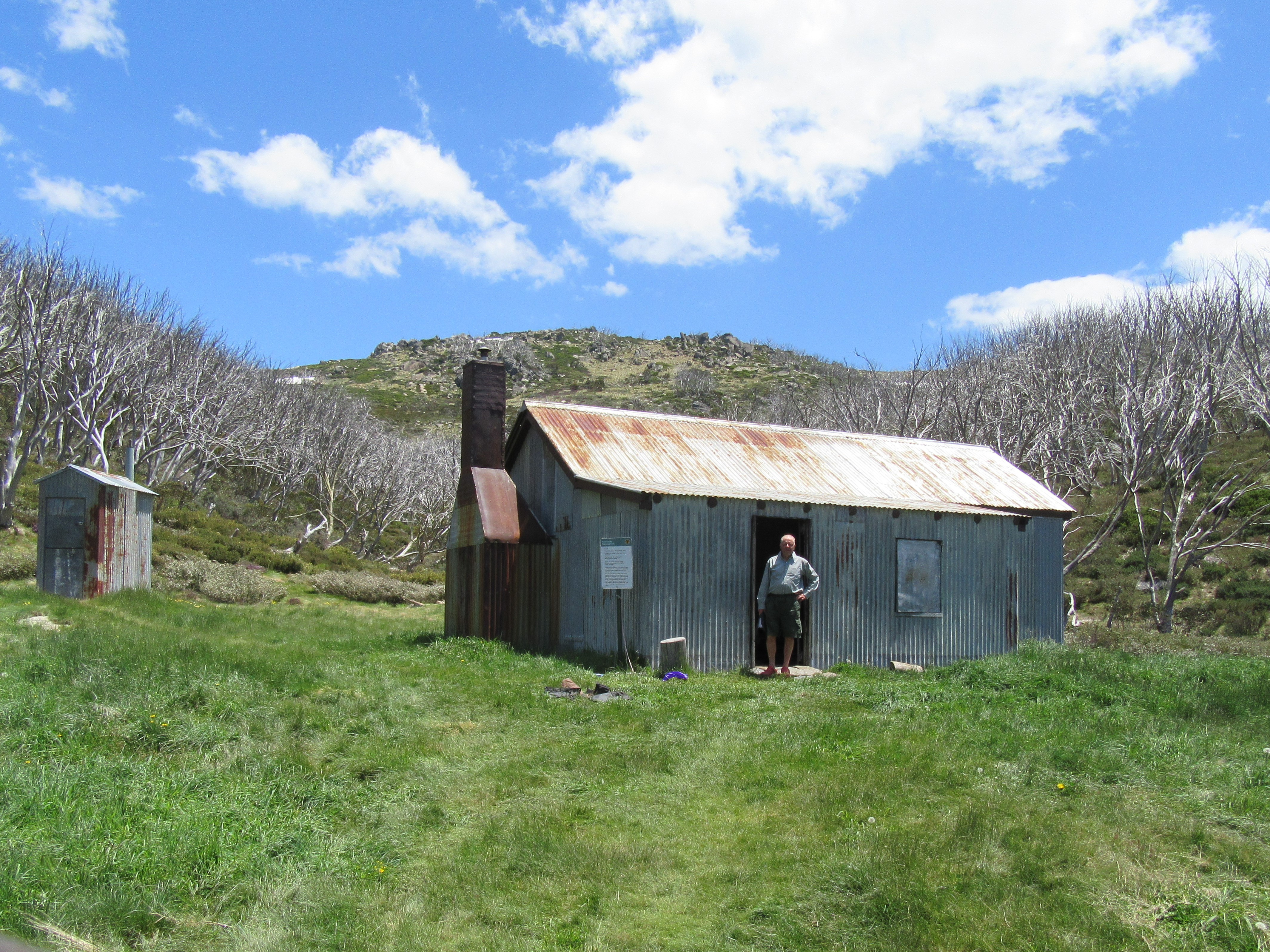
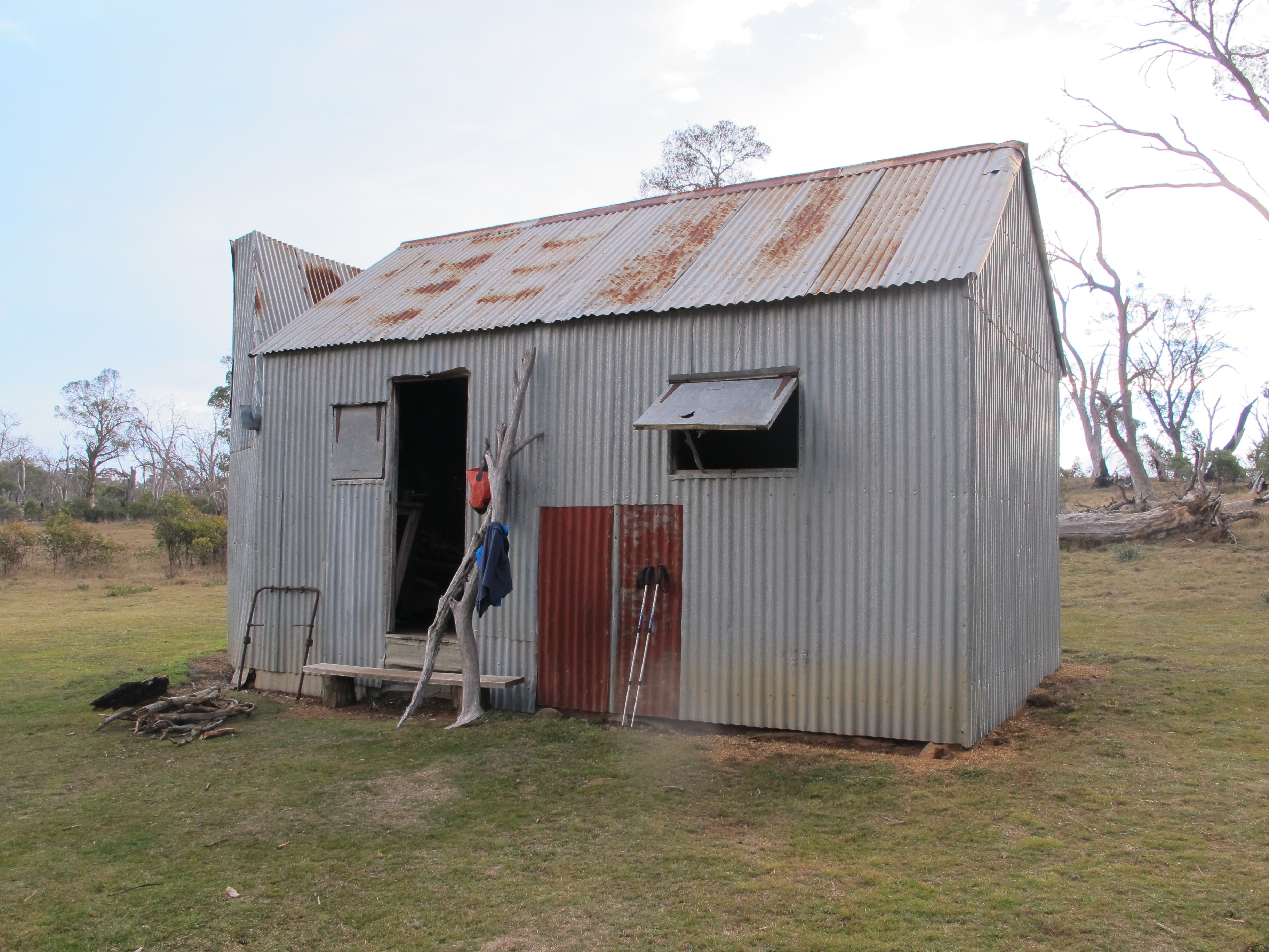
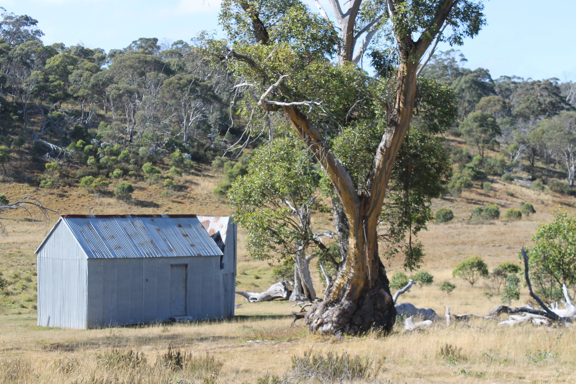
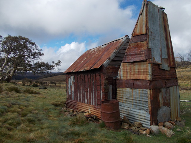
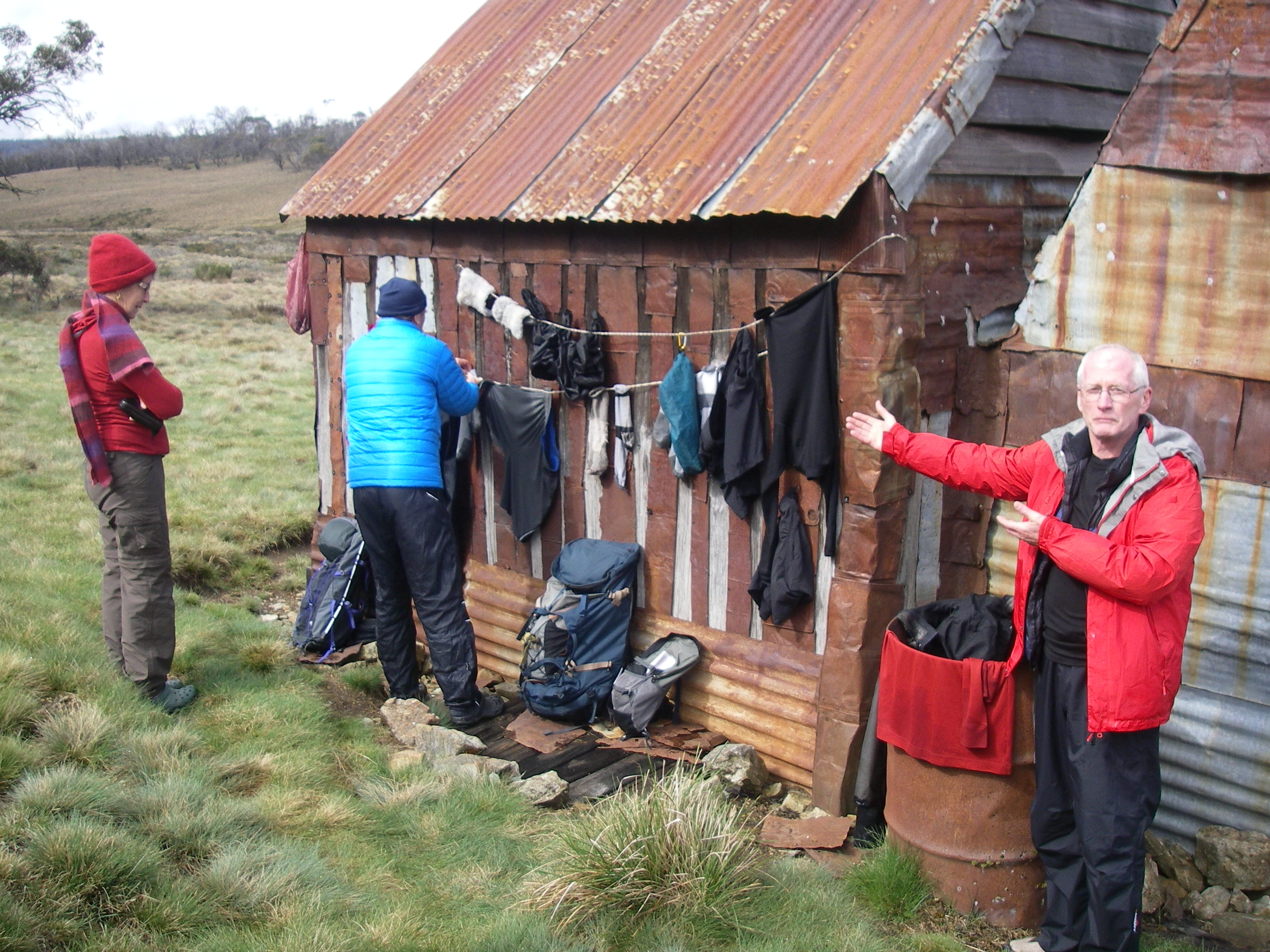
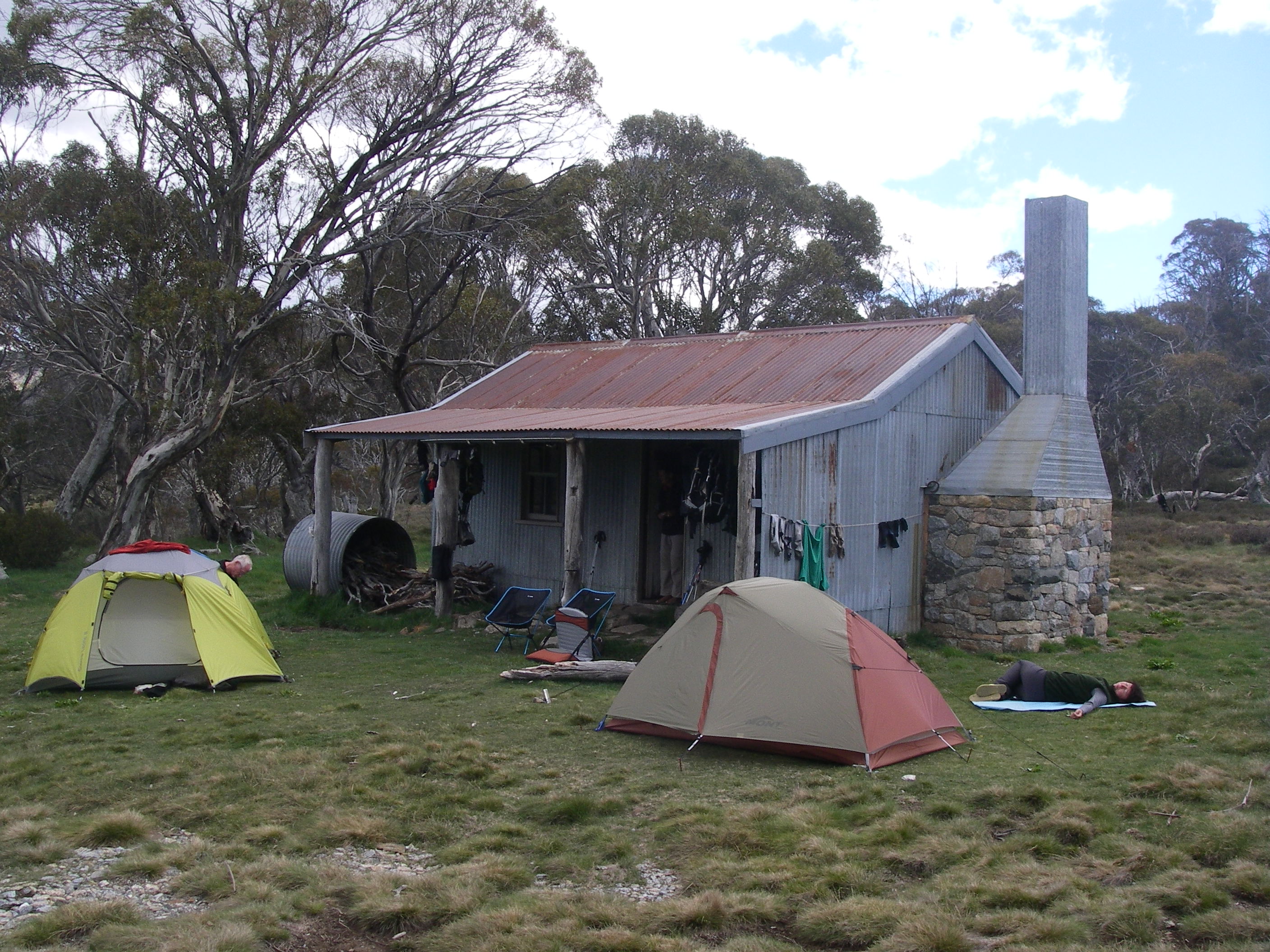
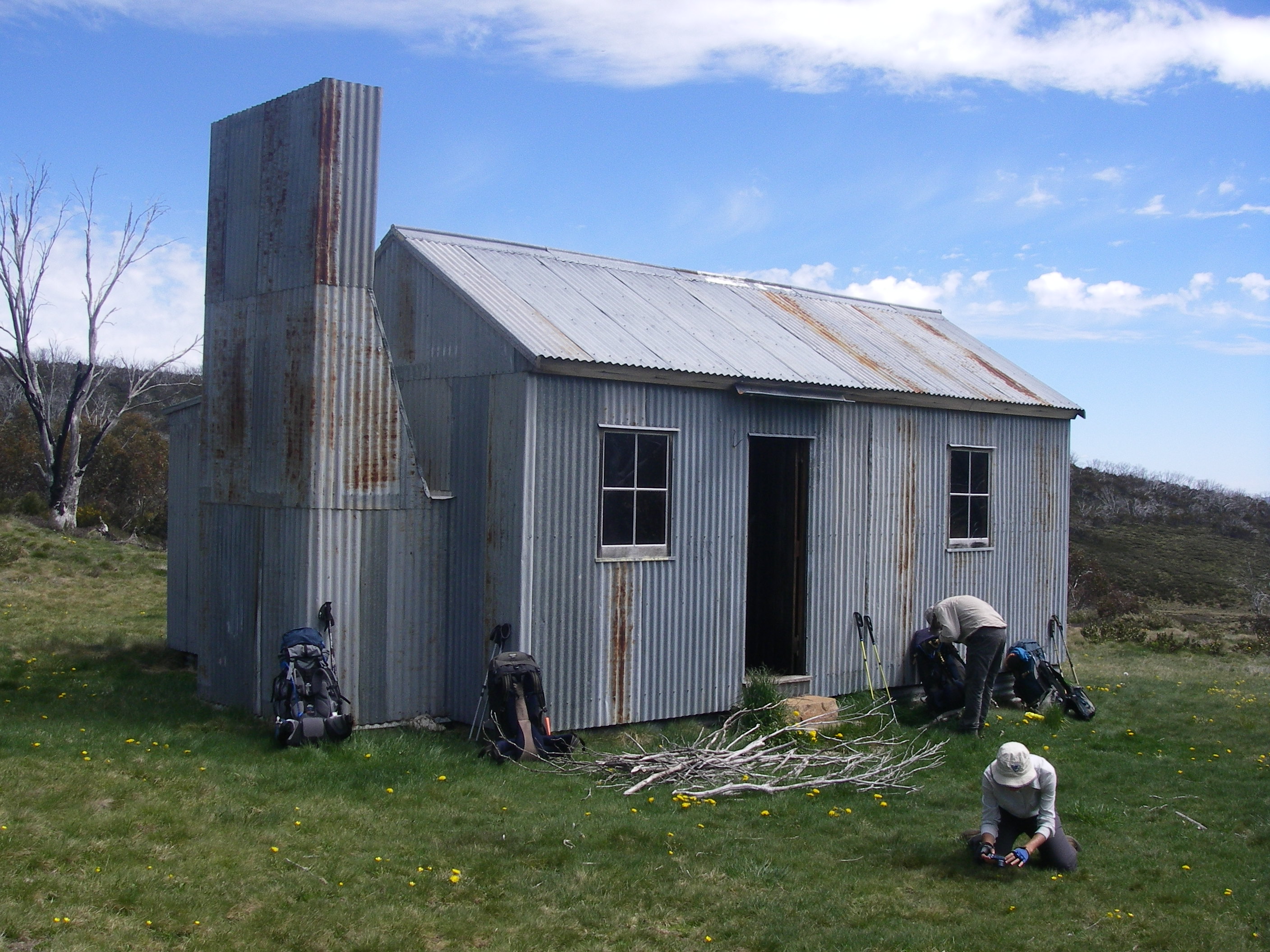
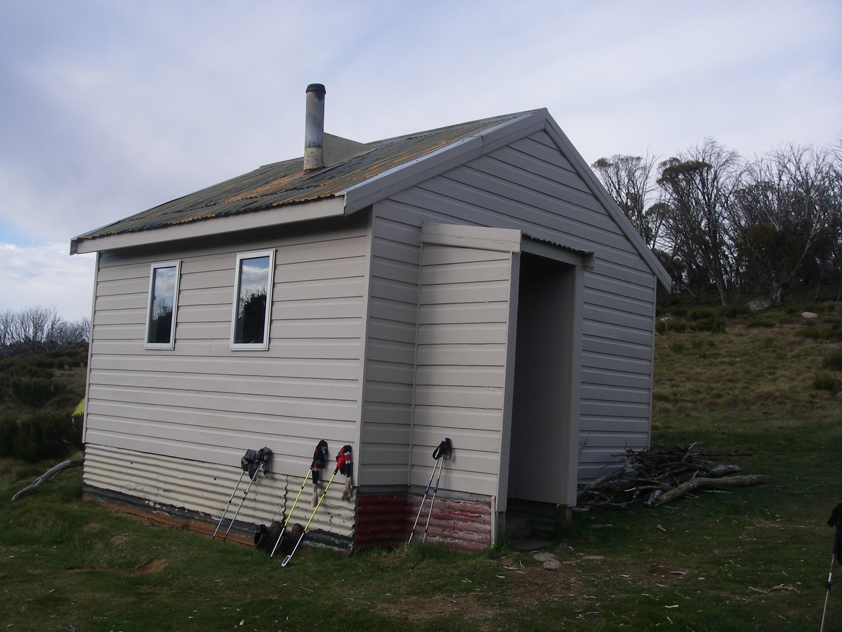
Pipers Creek Aqueduct Shelter
Some three kilometres into our Pipers Creek walk the track descends to ford an unnamed creek. Below the ford the creek drops over a small waterfall that is worth a photo or two. But if you head upstream a little you should be able to find the Pipers Creek Aqueduct Shelter, a still operational Snowy Hydro hut. It is hidden in a patch of snow gums above the creek. Look carefully for a barely discernible pad on your left, 200 metres upstream from the ford.
Pipers Ck Shelter.
The shelter was built in the 1950’s by the Snowy Mountains Authority (SMA) for aqueduct maintenance. It is still used by Snowy Hydro, which explains why it is locked to keep out any of thosebushwalkingorskiing riff-raff who swing by.Or worse still those dastardly E- mountain bikers.
It is a smallish wooden hut with a corrugated iron roof, vertical slab wooden walls and wooden floor. The whole structure sits on huge wooden sleds. I imagine that it had been dragged into position by a bulldozer.
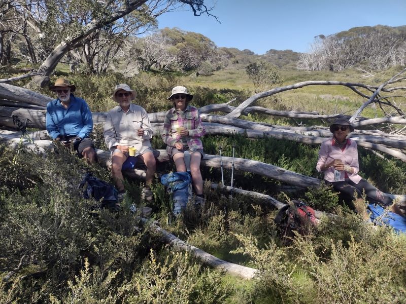
Here is an ideal morning tea spot, equipped as it was with a huge wooden bench along the entire length of its sunny eastern wall. A bonus was the hut’s wall providing a comfortable back rest. The nearby aqueduct infrastructure an added incentive to linger, giving the lads some final moments of delectation.
An ideal spot for morning tea.
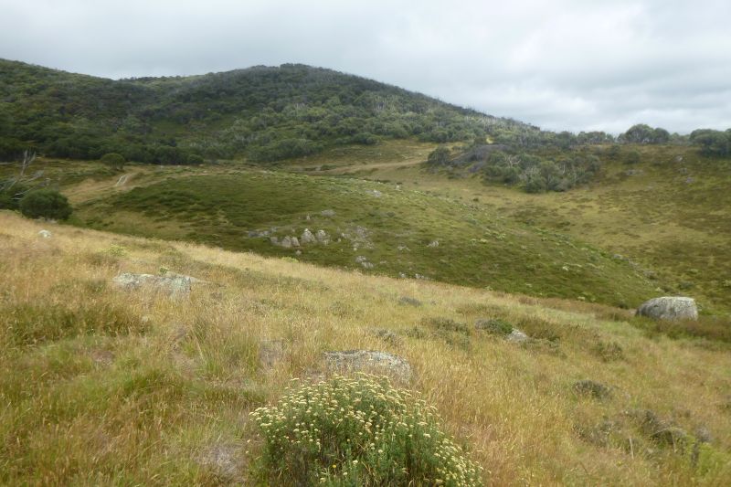
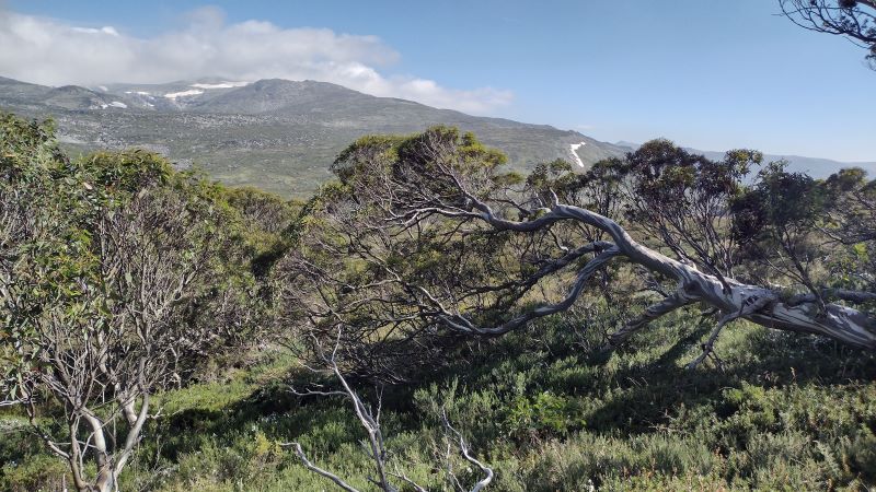
A good feed, some more sparkling engineering chit-chat about sluices and channels and we waddled off back downhill to the ford. From here the track climbs again to the 1600 m contour. The next section provided even better views out to the north-east over the extensive snow grass plains of Pipers Creek valley. Aptly named on my map as the ‘Plains of Heaven’.
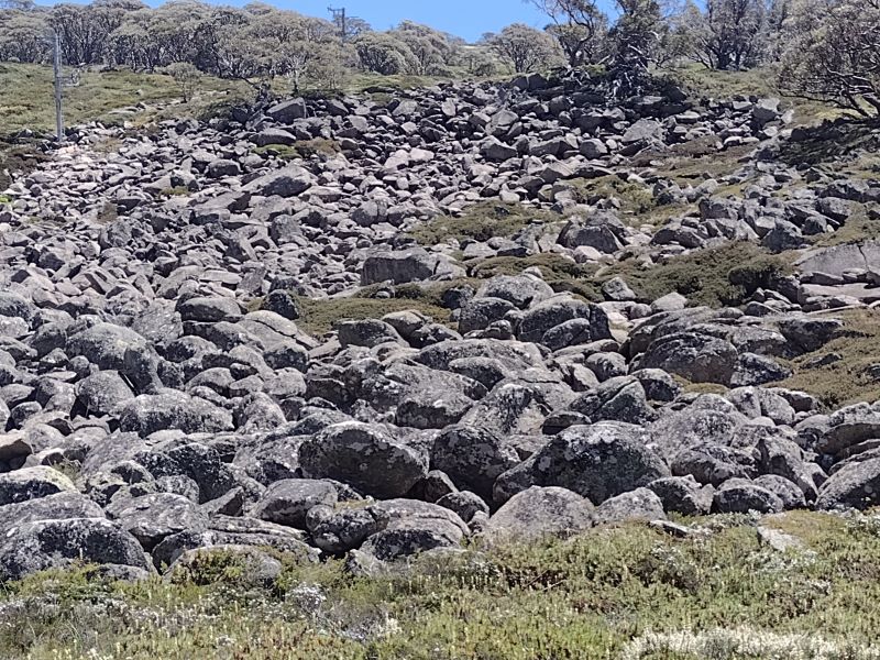
Snow grass plains on Pipers Ck Track.
We soldiered on, contouring around to a point on my map marked as ‘Perisher Camp’, some 2.5 kilometres from the ford. No remnants of a work camp though, much to my disappointment.
SMA Work Camps
The SMA had some 100 work camps scattered across Kosciuszko. I haven’t been able to find any information relating to this one. Although there was a Perisher Camp, but to add to my confusion, it is marked at various locations on other maps. During the construction period of the Snowy Scheme, the SMA managed over 100 camps and 8 towns, housing 100,000 workers, many of them migrants from Europe.
Early camps were rows of canvas tents with mess halls for communal dining, recreation and basic washing/toilet buildings. Initially there was no electricity or running water. Not much fun in winter I would think. Here’s a description of winter living conditions for SMA workers that I found in Brad Collis’s ‘Snowy. The Making of Modern Australia’:
‘The winters in the primitive conditions of the Snowy camps and towns imposed a harsh existence…. Little attempt was made to modify the style of housing for the conditions. Prefabricated weatherboard cottages, which would have served perfectly well in Central Australia, were simply transplanted into the mountains… the most precious household resource in winter was water. Pipes often froze and burst, leaving the house without water for cooking or washing. Mothers with babies had a terrible time… Nappies and sick babies and no water made life very hard… frozen washing outside in two metres of snow meant an or so of digging to get the snow away from a clothesline.’
SMA Survey Camp. Source: National Archives Australia.
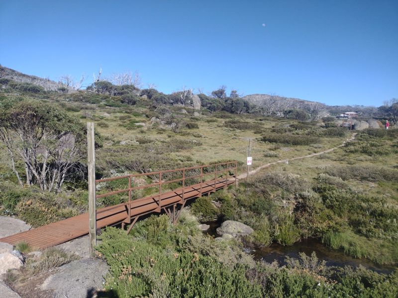
Back in summer land we reached a junction. Here the track bifurcates. Be sure to check your map… I’m assuming you carry one. Follow the track which bears north and descends steeply through woodland and exits out onto the Guthega road.Otherwise you will be carted off and exit with a long dreary walk back to your car.
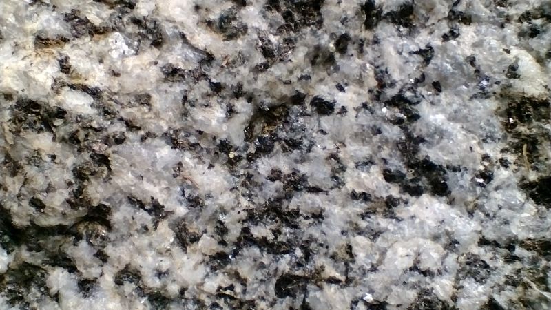
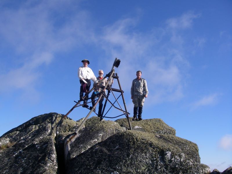
Some three hours after we started we were reunited with Garry’s jalopy which had been stashed near the old SMA quarrywhere I purloined a good hand sample of Mowambah granodioriteof Silurian age (443.8 to 419.2 Ma).
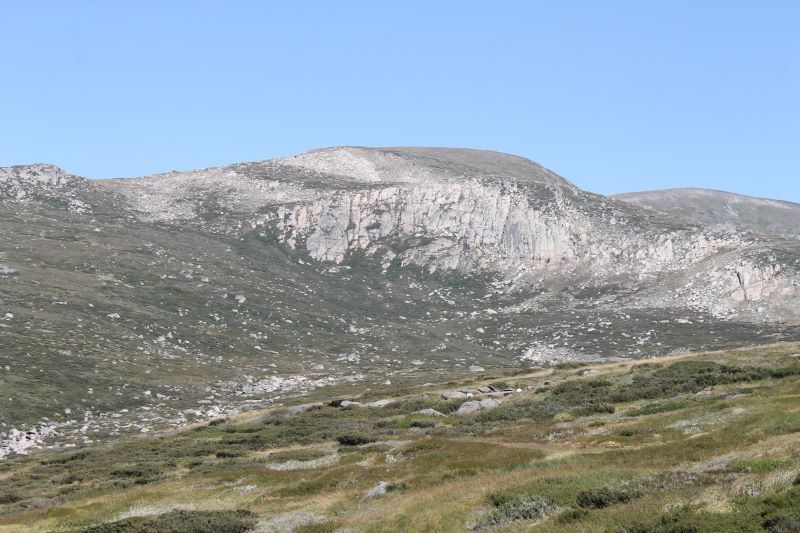
Mowambah Granodiorite
Like granite, granodiorite is a plutonic igneous rock with large crystals visible to the naked eye. I use the cue of its ‘salt and pepper’ appearance to differentiate it from granite. The dominant mineral crystals are quartz (white) and biotite (dark).It outcrops extensively over much of Kosciuszko National Parkand was a source of road base and construction material for the Snowy Mountains Scheme.
Mowambah granodiorite was formed in a deep pluton, part of the Kosciuszko Batholith during the Early Silurian.A batholith is large igneous intrusion with a surface area of over 100 square kilometres.
Garry’s ute was waiting patiently for our return. Windscreen wipers, aerial and wheels still attached, ready to transport us back to our starting point.
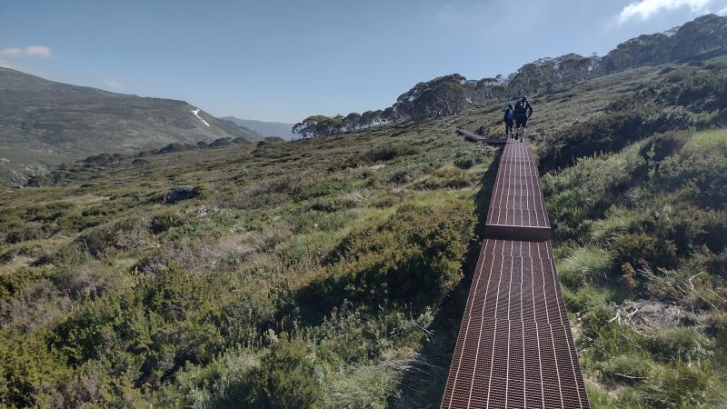
In 2018 construction started on the 55 kilometre Snowies Alpine Walk. The NSW Government boasted it would deliver ‘ a world-class, multi-day walk across the alpine roof of Australia in Kosciuszko National Park.’ The twelve kilometre hike from Perisher to Bullocks Flat is the final section of this longer walk. The hike traverses Kosciuszko National Park’s high alpine zone before descending hundreds of metres through snow gum woodland and dense eucalypt forest to the Thredbo Valley.
Snowies Alpine Walk near Snowy River
In its entirety, the Snowies Alpine Walk (SAW) connects Charlotte Pass, the Main Range, Guthega, Perisher and Bullocks Flat. The Perisher to Bullocks Flat section was the last part of the Snowies Alpine Walk to be constructed and was opened in the summer of 2024. Just in time for me to test drive it. And I was impressed.
It starts in the village of Perisher and finishes at the Thredbo River near Bullocks Flat. The track takes walkers from the alpine zone to a lookout high above the Thredbo River valley before a steep descent of the Crackenback Fall to reach the swiftly flowing waters of the river. From here the track follows the Thredbo upstream to Bullocks Flat, a popular day use area.
Board walk track climbing up to highest point at 1800 metres on the Perisher – Bullocks Flat track.
Perisher Village, my starting point, Is a small alpine village. In winter it is a picture perfect mountain village with architecturally interesting ski lodges, manicured snow runs, lifts and surrounded by snow-capped mountains. It takes its name from from one of these mountains, Mt Perisher.
Winter ski slopes at Perisher
Mt Perisher was named by an early pastoralist, James Spencer, who, while chasing lost cattle with his stockman, climbed to the top of the 2054 metre peak for a better view. On the summit he was met by scuds of snow and an icy blasting wind, upon which he commented: “This is a bloody perisher.” Later they climbed the adjacent peak, The Paralyser and the stockman remarked,“Well, if that was a perisher, then this is a paralyser.
Perisher, in summer, is a less attractive proposition. Yet another man-made blot on an otherwise outstanding alpine landscape. Its development as a ski resort took off at the time of the Snowy Mountains Scheme.The Snowy Mountains project provided access roads, work camps including one at Perisher and an influx of skiing mad European migrants to work on the scheme. Perisher was born.
As my erstwhile walking companions, sons and grandchildren, had already deserted for greener pastures, I was on my lonesome for this section. My wife provided the vital taxi service connecting my drop off point at Perisher Village with Bullocks Flat. A road trip of some 50 kilometres. Otherwise, it is a return hike to and from Perisher of some 24 kilometres and 740 metres of altitude gain.
Source: NSW Parks and Wildlife.
I had the track basically to myself. There were two other walkers that day, young women who had walked the Charlotte Pass to Perisher section the previous day. And this was peak summer walking: great walking weather, wildflowers galore and school holidays. In my experience, the other sections of the SAW were always busy in summer. But, today, not the Perisher to Bullocks Flat track.
I started early, about 8.00 am. Blue skies and a very pleasant 8oC greeted me, without the blustery winds of previous days. It is an ideal half day walk winding through a magnificent landscape of alpine heath meadows, snow gum woodland, and a montane Eucalypt forest including stands of alpine ash. The track weaves in and out of huge granite tors before descending to reach the pristine waters of the Thredbo River. As a bonus there is the Thredbo lookout perched some 600 metres above the valley floor.
Alpine heath along the Perisher to Bullocks Flat walk.
The walk starts at the Perisher village track-head sharing the Charlotte Pass/ Porcupine Rocks track. After a few hundred metres my path cleaved south east following Rocky Creek.
Bridge over Rocky Creek at Perisher track head.
The track then climbs steadily through Snow gum woodland with occasional patches of alpine heath. As I crossed the last of the heath, my map showed the line of the Ski Tube tunnel … under my boots, but some hundreds of metres below.
Steady climb through snow gum woodland
Ski Tube
The Ski Tube is a Swiss designed electric rack railway that connects Bullocks Flat and Blue Cow via Perisher village. It departs from the Bullocks Flat terminal (1134 m) before entering the Bilson tunnel that ascends to Perisher Villager (1720 m), with another tunnel connection to Blue Cow (1910 m). The 5.9 kilometre section from Bullocks Flat to Perisher was opened in 1987, while the 2.3 kilometre Blue Cow section opened in 1988.
From a high point at 1800 metres the track begins its long descent, initially through snow gum woodland, towards the Thredbo River. Some 3.5 kilometres from Perisher is the Thredbo Valley Lookout. This vantage point gives extensive views into the Thredbo Valley some 700 metres below with the Monaro Plain off to the east. Klaus Hueneke in his excellent tome “Huts of the High Country” gives this derivation of Monaro: ‘ Aboriginal for gently rounded woman’s breasts like the undulating country around Cooma. Also spelt Monaroo,Miniera Maneiro, Meneru and Monera’
View from Thredbo Lookout east to Monaro Plain
It was here that I came across the two young women again who were lounging on the lookout deck having a bite to eat. They didn’t seem in any hurry to leave and not wanting to intrude, I wandered off to find a sunny morning tea spot of my own. A nearby elevated slab of granodiorite at 1700 metres with equally spectacular views fitted the bill. Perfect.
View up the Thredbo River valley from my morning tea spot.
From here the track descended gently north east for 2.5 kilometres to the 1500 metres contour before switch-backing south west to drop steeply for 3.5 kilometres to the Thredbo River at 1100 metres. This was more in the category of a bushwalker’s pad rather than the heavily engineered tracks found on other sections of the SAW. The descent from the lookout takes you over the Crackenback Fall, a major geological feature of Kosciuszko National Park.
Crackenback Fall
From the lookout the Crackenback Fall drops 700 metres to the Thredbo River valley. This spectacular fall can be explained by a combination of tectonic uplift (called the Kosciuszko Uplift) during the Tertiary (66 to 2.6 mya) and the rapid downcutting of the Thredbo River into the shattered bedrock along the straight line of the Crackenback Fault. The Crackenback Fault dates back to a major tectonic contraction during the Lachlan orogeny some 390 to 380 mya.
View over Crackenback Fall to Thredbo Valley.
Klaus Hueneke in : “Huts of the High Country” writes: “stockmen who brought cattle and sheep on to the main range from the Thredbo valley over difficult terrain often said ‘it would Crack-your-back.’ Others said you had to crack the whip across their backs to get them up there.” The name was applied to the river, the Crackenback River which was later changed to the Thredbo River.
Position of Crackenback Fall
Map showing the Crackenback Fall, the Crackenback Fault and the rectilinear drainage pattern of the Thredbo River.
Vegetation Zones of the Crackenback Fall
As you descend the Crackenback Fall the vegetation changes from tall alpine herbfields on the high tops through a belt of snow gum woodland, thence to mixed Eucalypt forest before finally reaching a riparian shrub zone on the banks of the Thredbo River.
Tall Alpine Herbfield
The tall alpine herbfields are the most extensive of all Kosciuszko’s alpine plant communities and are found on well-drained and deeper soils. They are found on Kosciuszko’s highest peaks, plateaus and ridges, in conjunction with swathes of grassland, low heathland and bogs. These apparently delicate plants must withstand freezing rain, sleet, blanketing snow, howling winds, as well as heat and extreme UV radiation. Maybe not so delicate.
This plant community is the most diverse of all the high alpine vegetation types in terms of number of species. Showy wildflowers grow in a matrix dominated by the genera Celmisia (daisies) and Poa (snow grasses).
Tall alpine herbfield.
Wildflowers which I recognised included: silver snow daisy (Celmisia astelifolia), Australian bluebells (Wahlenbergia spp), star buttercups (Ranunculusspp), bidgee widgee (Acaena anserinifolia), Australian gentians (Gentiana spp), eyebrights (Euphrasia spp),billy buttons (Craspedia uniflora), andviolets(Viola betonicifolia).
Australian bluebell. Wahlenbergia sp.
Snow Gum Woodland
The low growing snow gum woodland is found above 1500 metres, the winter snowline. It is dominated by snow gums or white sallee (Eucalyptus pauciflora). Its growth habit is low, twisted, stunted and bent away from the prevailing winds. Snow gum woodland is invariably clothed in a dense scrubby understorey of beastly spikey plants like Bossiaea, Epacris, Hakea, Grevillea, Oxylobium, and Kunzea. These are usually waist high with tough whippy branches. This, presumably, an adaptation to withstand the weight of snow or overly rotund bushwalkers without breaking.
Snow gum woodland with dense scrubby understorey.
Mixed Eucalypt Forest
Below the tree line zone which is dominated by pure stands of snow gums, comes a mixed Eucalypt forest of snow gum, mountain gum (E. dalrympleana), Tingiringi gum (E. glaucescens), candlebark (E. rubida), manna gum (E. viminalis), and alpine ash (E. delegatensis).
Mixed Eucalypt Forest with a stand of Alpine Ash on Perisher to Bullocks Flat Track.
On your descent through the zone of Eucalypts you will encounter some nearly pure stands of alpine ash. This species is typically found between 1200 to 1350 metres on wetter south and south-easterly facing aspects. It is an unusual Eucalypt in that it does not have any specialised fire survival techniques (such as epicormic growth) and regenerates from seed after fire has destroyed surrounding heavy leaf litter which usually inhibits seed germination.
Ferny understorey in mixed Eucalypt forest
Riparian Shrubland
A diverse plant community of mainly shrubs occupies a narrow a strip alongside the Thredbo River. The main canopy species is an olive-green trunked gum called black sallee (E. stellulata). Occasional pockets of mountain gum and black sallee grow together. But the main botanical action is in the shrub layer which provides a profusion of wildflower displays in early summer.
Dense thickets of shrubs in riparian zone along the Thredbo River
Along the track as you work your upstream towards Bullocks Flat, here are a few to look out for: poison rice-bush (Pimelea pauciflora) with small slender leaves, creamy flowers and orange fruit; mountain tea-tree (Leptospermum grandifolium) with 5 petalled white flowers, forming dense thickets along the banks, and close to the river, alpine bottlebrush (Callistemon pityoides) with its distinctive brush flowers.
Alpine bottlebrush. Callistemon pityoides.
Useful reference book on plants in the Thredbo Valley
This handy little guide to plants in the Thredbo Valley won’t take up too much space in your rucksack(15 cm x 21 cm).
Thredbo River aka Crackenback River
On reaching the Thredbo River, the track closely parallels the river for a further one kilometre to Bullocks Flat, which is accessed by the Ski Tube bridge over the Thredbo River near the Ski Tube carpark. An eyesore of monumental proportions. How the Parks service gave planning approval for this hideous monstrosity is a mystery. Or maybe not. The slimy hands of NSW politicians would be at play in boosting ski tourism in the national park. A pattern of pandering to the ski industry that is repeated across most of Australia’s alpine ski fields.
But moving on from this well-ventilated gripe of mine. If you look upstream and downstream from an opening onto the river bank you will see how straight the course of the Thredbo River is. In fact, it flows in a reasonably straight line from Dead Horse Gap to Lake Jindabyne. A consequence of the structural control exerted by the Crackenback Fault.
Straight course of Thredbo River looking upstream towards Bullocks Flat
The course of the Thredbo River presents an interesting drainage pattern when viewed on a map. It is described by geomorphologists as a rectilinear drainage pattern, where the main bends of the Thredbo River change direction at right angles. In the case of the Thredbo, it initially flows south-east, then turns south-west, then north-west and finally into the main Thredbo valley which runs in a straight line north-east to Lake Jindabyne.
Faults show clear evidence of differential earth movements. The Crackenback Fault is a 35 kilometre long, south-west to north-east trending strike-slip fault between the Jindabyne Thrust Fault (at Jindabyne) and Dead Horse Gap.
Rectilinear drainage pattern of Thredbo River and position of strike-slip fault, the Crackenback Fault
A strike-slip fault has horizontal movement of the earth’s surface with little vertical displacement. It is along this straight fault structure that the Thredbo River flows towards Lake Jindabyne.
Other well-known strike-slip faults include New Zealand’s Alpine Fault, the Dead Sea, and the San Andreas fault in North America.
Strike-slip or horizontal fault. Source: Longwall & Flint: Introduction to Physical Geology.
Enter the World of Willie the Wombat
The walk upstream is an opportunity to keep your eyes open for signs of those bulldozers of bush and plain, wombats. You have to be lucky to chance upon a trundling wombat during the day, but their massive burrows, or their very distinctive cuboid poos are easily spotted. The common wombat (Vombatis ursinus: bear- like) is of tank-like stature: about 100 cm long, 30 kilograms in weight, short stubby legs and thickset body. The fur is coarse and of a grey, black or brown colour.
Wombat grazing
They are herbivores grazing on grasses, roots and fungi. Their teeth grow continuously to accommodate their gnawing on rough herbage and roots. In summer they leave their 10 to 15 metre long burrows on dusk and graze through the early part of the night. On one trip to Kosciuszko we spent quite a long time at dusk in the nearby Thredbo Diggings area hoping to spot a wombat for our little boys. A futile venture as it turned out. Plenty of fresh poo and burrows, but alas no Willie Wombat.
Distinctive cubes of wombat poo.
The preferred habitat for wombats is woodland or grassland but they can be found foraging above the tree-line. One was spotted ascending Mt Townsend at 2209 metres, Australia’s second highest peak.
Prime wombat territory on Thredbo River flats.
Bullocks Flat and Bullocks Hut
Bullocks Hut is on the banks the Thredbo River near that ugly Ski Tube car park. Quite a contrast. This is an enticing site of grassy flats and the picturesque fast flowing Thredbo River. Bullocks Hut was built in 1934 for Dr Bullock as a fishing lodge and used by the family until about 1950. A kitchen was added in 1938 and a garage and stables in 1947. The hut was resumed by the NPWS in 1969 and renovated in the 1990’s.
It is described in various publications as ‘built like a fortress’. As it is. The walls are constructed of cement blocks with the floor of tiles over a cement base. The original roof was constructed of shingles cut by a Snowy Mountains local identity, Bill Prendergast. The roof was later covered by sheets of iron. The chimney is made of cement. The use of cement has resulted in the hut being fenced off & declared out of bounds. Due to an OHS issue… silica dust contamination.
Bullocks Hut
The Crackenback Gold Rush
Bullocks Flats was just one of the many river flatsand river banks (like the nearby Thredbo Diggings campground) that were dug and sluiced for gold. The Crackenback gold rush took off in the 1870’s when small tributary streams were worked over by gold miners. The diggings were so remote that it took two months for bullock teams and drays to bring supplies from Sydney.
The last remaining miner was Alf Tissot who worked the area until the late 1930’s. Like many miners, he preferred to walk rather than ride the 20 kilometres into Jindabyne to get his supplies.
Look carefully and you will see flecks of gold and silver in the sandy riverine deposits. Unfortunately for you, this is merely ‘Fools’ Gold’, aka Pyrite or Chalcopyrite or Mica.
Iron Pyrite (Iron sulphide) looks like gold but is a pale brassy colour and isn’t malleable. Also pyrite forms perfect cubic crystals and if you scrape pyrite down a scratch plate it leaves a geenish-black powder rather than flakes of gold. Pyrite gets its name from the Greek ‘pyr‘ meaning fire, because it emits a spark when struck by iron.
Pyrite aka Fool’s Gold
Chalcopyrite (Copper pyrite) is a bright, brassy-yellow mineral, which tarnishes to a dull gold colour. Unlike gold it is brittle and breaks easily.
Mica is very common in the Thredbo River. and is derived from the local granitic bedrock. Any gold sparkles are the first two, but the silvery or yellowy-brown sparkles are most likely mica.
It is easily identified. You won’t be fooled for long. When split, mica cleaves into thin sheets or laminae which sparkle silvery or vaguely gold in sunlight. It has a wide variety of uses including in the manufacture of electronics, paints, plastics and cosmetics.
Platy flakes of mica
In the 1910’s and 1920’s Ned Irwin’s sawmill operated on the opposite bank from Bullocks to source the towering hardwood eucalypts, especially the alpine ash. Bullock teams dragged the timber into nearby towns for housing materials. There is supposed to be an old steam engine and flywheel in the area, but I didn’t see them.
Rutledges Hut
Several kilometres upstream from Bullocks Flat is the site of Rutledges Hut, now removed, another fisherman’s lodge. This was built in 1935 by a Colonel Rutledge and his fellow fishers Mr McKeown, Brigadier Broadbent and a Mr Burns. It was a long hut constructed of sheet iron and had a wooden floor. It was removed by the NPWS in the 1980’s, deemed unsafe. The NPWS was pretty keen on removing huts for a while.
Rutledges Hut 1982. Source: B. Powell. KHA.
In 1979 the NPWS issued a draft huts policy which created a huge, well-deserved backlash. They recommended removal of all huts in the summit area (except Seamans) and in the Whites River corridor (except Disappointment and Whites River Huts). In addition, the demolition of O’Keefes, Grey Hill Café and Tantangara were pencilled in. They were forced to back off, but removed Albina and Rawsons, the sacrificial lambs.
Fortunately, times have changed and the NPWS together with the Kosciuszko Huts Association is now heavily invested in conserving these heritage shelters for the use of bushwalkers and skiers needing a place of sanctuary in the oft changeable alpine weather.
Fishing on the Thredbo River
Fishing has a long history in the Snowy Mountains, especially fly fishing. The quarry was not the native mountain trout (Galaxis olidus) which struggles to reach to 10 cms in length, but the introduced North American Rainbow trout (Oncorhyncus mykiss) and the European brown trout (Salmo trutta). These were introduced in the 1890’s and are restocked regularly from the Gaden Trout Hatchery further downstream. An unfortunate outcome of these introductions has been a profound change in the local aquatic ecosystems with Galaxias missing from streams inhabited by trout. They are now confined to a few high alpine streams and lakes.
Native mountain trout: Galaxis sp.
By midday, my walk on this final section of the Snowies Alpine Walk was over. I found a bench seat in a sunny spot near Bullocks Hut and waited for the wife taxi and accompanying lunch supplies to arrive. A pleasant warm spot for us to eat, chat and, ever the inveterate cartography nerds, check off the landmarks from our map: the Rams Head Range, The Porcupine at 1921 metres, the Thredbo Lookout and the entrance to the Bilson Tunnel.
Sketch of Rams Head Range from Thredbo River Valley.
Aboriginal Occupation Of Thredbo Valley
Long before the unthinking predations of gold miners, loggers, fishermen, and cattlemen the Thredbo River valley was traversed by aborigines. Lithic scatters have been found near Bullocks Flat and other sites in the along the Thredbo. These scatters including stone hammers, scrapers and flakes. Waste lithic material accumulated in favourite campsites and these can be found if you are alert. Though they must be left in-situ.
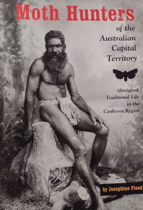
During summer the Wogal tribe gathered in the valley, along with other tribal groups to feast on the bogong moth. Moth feasts were a great occasions for gatherings of friendly tribes. They were summons by message sticks to join the feasting, corroborees, trade, settling of disputes and marriage arrangements.
The gatherings took place at the foot of the mountains.The aborigines came from Yass and Braidwood, from Eden on the coast and from Omeo and Mitta Mitta in Victoria. All intent on having a good feed and a good time. Large camps formed with as many as 500 aborigines .
It is thought that advance parties would climb up to the tops, and if the moths had arrived they would send up a smoke signal to the camps below. The arrival of the moths is not a foregone conclusion. Migration numbers vary from year to year.
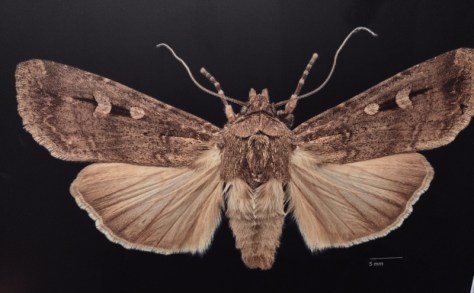
A tasty morsel. the Bogong Moth.
Some years they are blown off course and out into the Tasman Sea.1987 was a vintage year, but in 1988 the bright lights of New Parliament House in Australia’s bush capital, acted as a moth magnet, and they camped in Canberra for their summer recess, unlike our political masters.
Men caught the moths in bark nets or smoked them out of their crevices. They were generally cooked in hot ashes but it is thought that women sometimes pounded them into a paste to bake as a cake. Those keen enough to taste the Bogong moth mention a nutty taste.
Scientists say they are very rich in fat and protein; this diet sustained aborigines for months and the smoke from their fires was so thick that surveyors complained that they were unable to take bearings because the main peaks were always shrouded in smoke.
Europeans often commented on how sleek and well fed the aborigines looked after their moth diet. Edward Eyre who explored the Monaro in the 1830’s wrote: “The Blacks never looked so fat or shiny as they do during the Bougan season, and even their dogs get into condition then.” At summer’s end, with the arrival of the southerlies, the moths and aborigines all decamped and headed for the warmer lowlands. As did I. Back to the the heat and humidity of Queensland.
Should you want to read more about aboriginal moth hunters , then you should delve into Josephine Flood’s ‘Moth Hunters‘.
For me, it wasanother brilliant walk in Australia’s high country done and dusted.
Mt Stilwell (2054 m) is, for me, probably one of the best short walks in Kosciuszko National Park. At only 1.8 kilometres from Charlotte Pass, on a clear day, it gives unsurpassed views of the Snowy River valley, the peaks of the Main Range and in season, brilliant wildflower displays.
A bonus of the Stilwell hike is that it is ignored by most of the walking fraternity. Out of the summer school holiday period you will have this part of the park to yourself. It’s Kossie or bust for most hikers, trail runners and, in recent years, flocks of mountain bikers, all heading for Rawsons Passand Mt Kosciuszko.
But for those of us with more modest ambitions and time to spare, one can have a thoroughly enjoyable ramble to the top of Stilwell. And, should you have time, you can explore the extensive alpine meadows of upper Wrights Creek and Merritts Creek, duck across to nearby Little Stilwell, check out the ruins of the Stilwell Restaurant (aka the Ramshead Restaurant) or maybe head off along Kangaroo Ridge. Endless possibilitiesfor the enterprising bushwalker.
Boulders and meadows on Kangaroo Ridge
Our fifteen kilometre summer ramble would take us to Stilwell Trig, thence off-track, contouring along the eastern flanks of Kangaroo Ridge. Followed by a gentle overland descent towards the Merritts Creek crossing on the Summit Walk from Charlotte Pass to Mt Kosciuszko. From here it’s a short hop over the Snowy River then uphill to Seamans Hut. The return trip is downhill along the Summit Walk to Charlotte Pass.
Map showing Mt Stilwell to Seamans Hut hike
Based on map: Perisher 1: 25 000
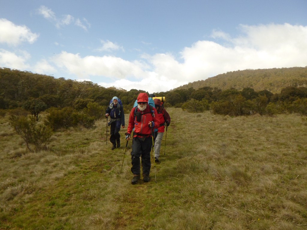
And so, soon after 9 am on a blustery summer’s day, I set off with my ever keen walking companions, Neralie, Chris, Garry and Joe. Stilwell bound. Another cool 10O C but with the monotonously regular north-westerly idling along. Ideal walking conditions in my book.
From Charlotte Pass the track climbs through a belt of snow gum woodland to the rusting relics of Australia’s first mechanical ski ‘hoist’.
Snow gum woodland at start of Mt Stilwell walk
The Pulpit Ski Hoist
In 1938, the New South Wales Government Tourist Board (NSWGTB) built Australia’s first long ski tow from Charlotte Village to Kangaroo Ridge. It resembled a modern T-bar with steel cables suspended from wooden posts.
Way back in 1937-1938 it was a difficult build. The long poles for seven A frame towers were cut in Wilsons Valley and had to be carted and then assembled on a very steep slope. The wooden towers supported the heavy steel cable to which were attached non-OHS compliant J-bars for the skiers to hang on to.
But it was a very welcome addition to Australia’s skiing scene. Although it had a few issues. Rick Walkom in his wonderful book ‘Skiing off The Roof’ has this description:
‘Skiers experienced plenty of lengthy stoppages. The hangers travelled at no more than walking pace, and the build up of ice often caused derailments. Sometimes the J-bars would get caught up in the rocks or, worse still, the heavy hangers would fall off the cable.A veritable army of skiers was needed to lift the cable back onto the pulleys.’ All part of the fun.
Relics of old Pulpit Chairlift. Kangaroo Ridge. The NPWS removed the roof and cladding.
Some 600 metres further on is the Charlotte Village to Kangaroo Ridge Triple Chairlift, which does not operate in summer. Here, at 1920 metres, is a Cortan steel lookout with unimpeded views to the Main Range and Mt Stilwell, capped by its trig tower. An information board acknowledges indigenous links to Kosciuszko:
Triple Lift from Charlotte Pass Village to Kangaroo Ridge
‘The local rainmaker, Dyilligamberra, represents all the rain, snow and water from these mountains to the sea. His relatives make wind and cloud. They are very powerful, so we show our respect by going quietly in the mountains.’ Rod Mason. Aboriginal Education Officer.
The lookout platform provides a brilliant skyline view of the Main Range. On a clear day like this, all the high peaks are visible and you can identify them from the labelled panorama on the information board. From east to west (L to R): North Rams Head, Mt Kosciuszko, Mt Clarke, Mt Townsend, Mt Lee, Carruthers Peak, Mt Twynam, Mt Anton and Mt Tate. A Who’s Who of Australia’s highest peaks.
Main Range panorama
But the Stilwell summit beckoned. We were now in Australia’s true alpine zone. In Kosciuszko this equates to about 1850 metres ASL. Here the average summer temperatures are less than 10 C, too cold for even hardy snow gums to survive. Hence snow gum woodland is replaced by tall alpine herbfield.
Tall alpine herbfield
The tall alpine herbfields are the most extensive of all Kosciuszko’s alpine plant communities and are found on well-drained and deeper soils. These herbfields occur on a variety of bedrock types, suggesting that lithology has a negligible influence on location. Here, the bedrock is Mowambah granodiorite which erodes to form sandy and well-drained soils. Obviously perfect for wildflower meadows.
Crossing tall alpine herbfields under Mt Stilwell
This plant community is the most diverse of all the alpine vegetation types in terms of number of species. Showy wildflowers grow in a matrix of snow grasses (Poa caespitosa) and sedges (Carex sp). Technically, it is an association dominated by the genera Celmisia (daisies) and Poa.
As we were walking in late summer the wildflowers were well past their prime. Later the same year in mid-December the display was spectacular.
Meadow of silver snow daisies (Celmisia astelifolia). Mt Stilwell.
Here is my mid-December list: silver snow daisy (Celmisia astelifolia), Australian bluebells (Wahlenbergia spp), star buttercups (Ranunculus spp), bidgee widgee (Acaena anserinifolia), Australian gentians (Gentiana spp), eyebrights (Euphrasia collina spp), billy buttons (Craspedia uniflora), spoon daisy (Brachyscome sp), yellow Kunzea (Kunzea muelleri), tall rice-flower (Pimelea ligustrina), alpine mint-bush (Prostanthera sp), alpine Stackhousia (Stackhousia pulvinaris), mountain celery (Aciphylla glacialis) trigger plant (Stylidium montanum), purple alpine Hovea (Hovea montana), and violets (Viola betonicifolia).
Silver snow daisy. Celmisia astelifolia.
Bidgee widgee. Acaena anserinifolia. A pesky prickly plant if it attaches to your socks.
Gentianella muelleriana spp alpestris. An endemic to Kosciuszko.
Mountain celery. Aciphylla glacialis.Recovering well from overgrazing.
Eyebright. Euphrasia collina spp glacialis. Endemic to Kosciuszko.
Alpine trigger plant. Stylidium montanum. The trigger is a hammer shaped column which springs closed on the backs of foraging insects.
Alpine wildflower guide for your rucksack
Alpine wildflower guide. Small enough to go in your day pack. 15 cm x 21 cm.
A bushwalkers’ pad climbs up through these meadows and is very exposed. It was windy, the UV index was off the scale but the walking was brilliant. We crossed meadows, seepages and weaved in and out of the outcropping granodiorite boulders.
Seepages and boulders on the old bushwalkers’ pad to summit of Mt Stilwell.
Xenoliths
If you keep your eyes open, you will see large patches of foreign rock or minerals embedded in the granodiorite. These are Xenoliths. There is some argumentation over the origins of Xenoliths (Foreign Rock). At its simplest, it is thought they are fragments of existing country rock caught in the molten magma as it cools.
Xenolith in Mowambah granodiorite. Mt Stilwell
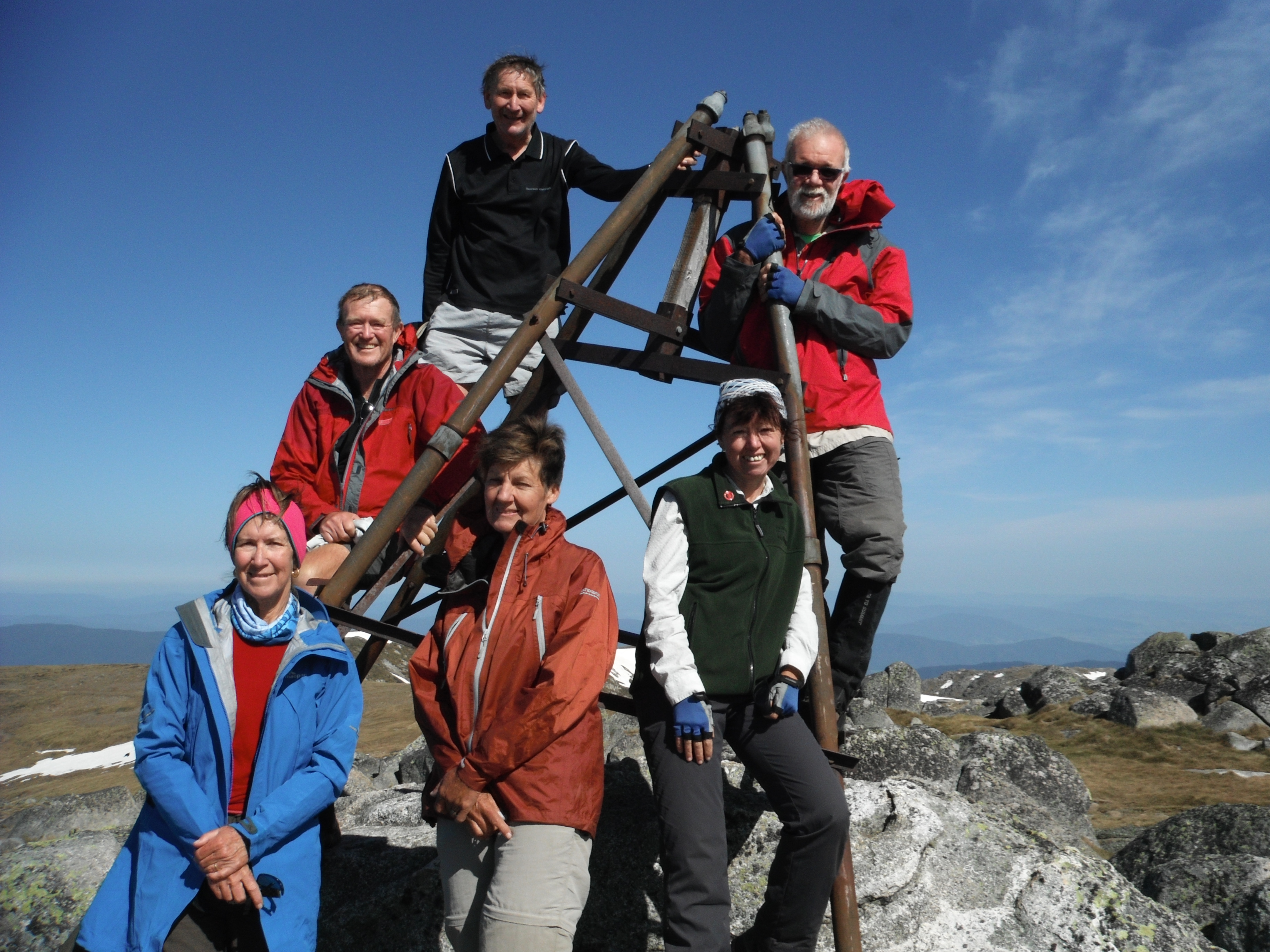
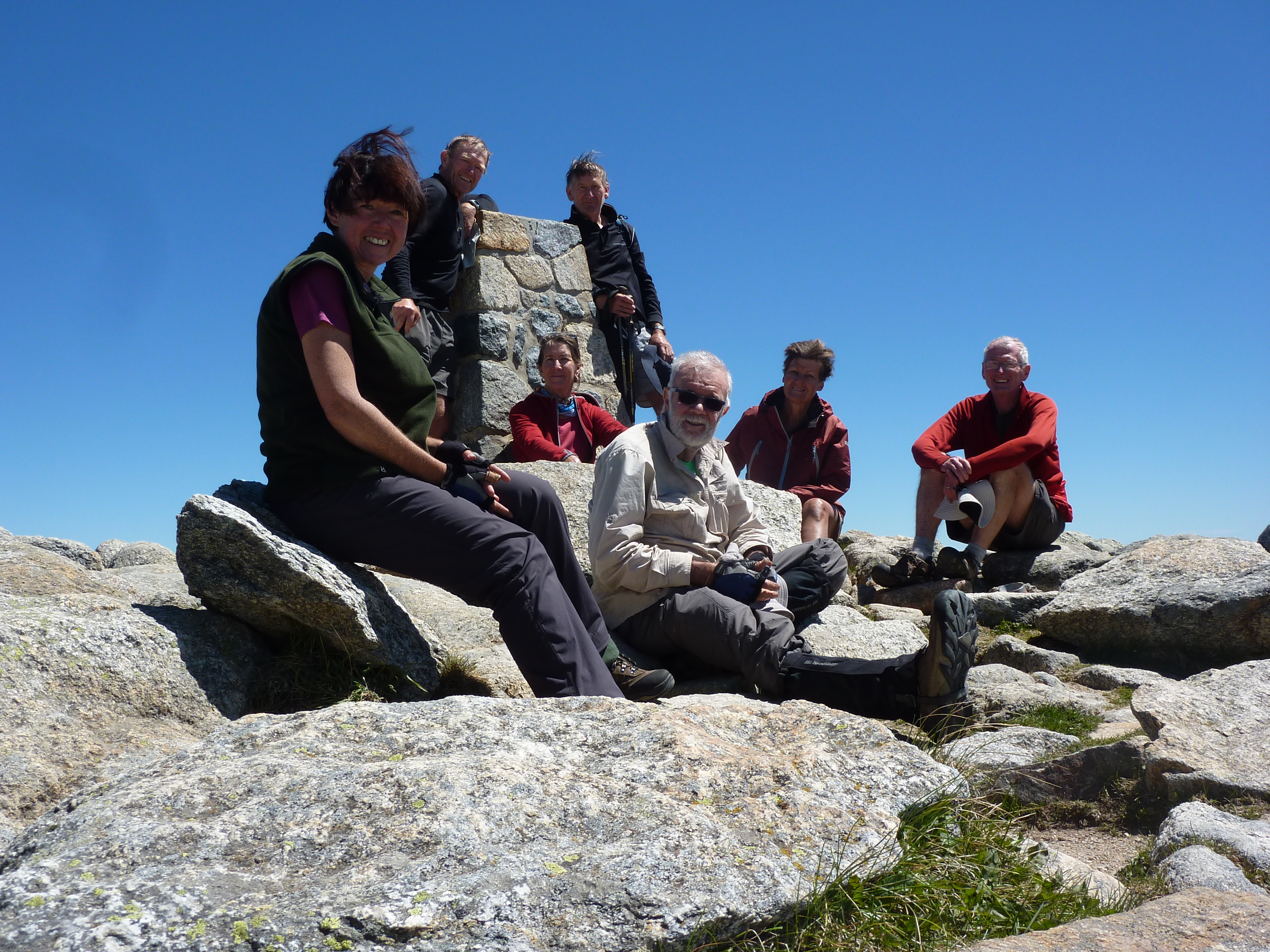
As usual, I couldn’t gee up much interest in Xenolith spotting, so we pushed on to the summit. It is topped by a trig tower atop a spine of heavily frost-shattered rock. With the summit photo shoot completed, we retreated to the lee of the summit. To a pleasant sunny spot that Garry and Neralie had secured for our morning tea, out of the wind.
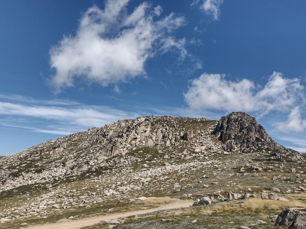
Summit trig station. Mt Stilwell
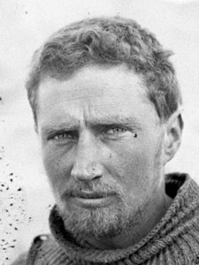
Frank Leslie Stillwell
It is likely that Mt Stilwell was named after Frank Leslie Stillwell (1888 – 1963).
Stillwell (note spelling shift) was an Australian geologist and Antarctic Expeditioner (1911-1914). He served under the famous Douglas Mawson. Stillwell’s later career took him to the mining provinces of Broken Hill and Kalgoorlie.
Frank Leslie Stillwell. Antarctic Expeditioner & Geologist.
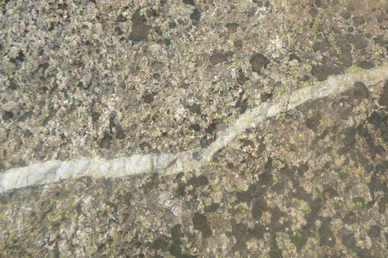
On the eastern side of Mt Stilwell, just below the summit, if you look carefully you should be able to find a massive vein of milky quartz embedded in a boulder of Mowambah granodiorite. Milky quartz is a very common mineral. I have sat here many times for morning tea, but 2024 was the first time I clocked this huge outcrop.
Sill of milky quartz. Mt Stilwell
Also nearby, if you peer hard enough off to the south east, there are the ruins of Top Station or Ramshead Restaurant. It is located near a biggish outcrop on the Rams Head range about 1.5 kilometres across the marshy valley of Wrights Creek.
Ramshead Restaurant looking across Wrights Creek. Restaurant to left of main outcrop
The World’s Longest Chairlift
A restaurant and lift transfer station were built at the highest point on the line of the Thredbo valley to Charlotte Village chairlift. Purportedly, the ‘World’s Longest Chairlift’. It was built in 1964-1965 at the junction of the two chairlifts. One from the Thredbo valley and the other from Charlotte Village.
The old terminal station at Charlotte village. Now accomodation for village workers.
Building the chairlift was a major engineering feat. Work started in 1963 on a ‘Sedan’ style chairlift moving 350 skiers per hour in both directions. The sedan seat was enclosed by a fibreglass cupola.
There were high hopes for the popularity of the chairlift which was to glide five kilometres over the freezing roof of Australia. As a bonus, punters could drop in for a feed at the Stilwell/Ramshead Restaurant. At 2057 metres touted to be the highest in Australia.
Rick Walkon in ‘Skiing off the Roof’ has this description of the chairlift’s history:
‘The chairlift was a disaster from the start.
The Snow gods wasted no time in showing disdain for the sea level engineers. With the first snow falls in 1964, a variety of design faults became glaringly obvious… Incessant strong winds on an extremely exposed plateau hit the chairs at right angles, causing them to swing violently and nearly collide with towers.
More often than not, a busload of sightseers complete with high-heeled shoes, cameras and bags ended up dangling in icy winds awaiting rescue. Inevitably a few passengers fell out of the chairs’.
Apparently, a blizzard started in July 1964 and lasted 31 days. At the time wind gauges registered 180 kph and eventually blew away. Chairs were ripped from the cables and towers buckled. More blizzards followed.
Ramshead Restaurant.
Understandably,rumours of frozen corpses arriving at the Top Station did not engender confidence in a ride on the World’s Longest Chairlift. Suffice to say, the chairlift closed after only two seasons.
For those of you keen about skiing and the history of skiing in Australia and Charlotte Pass in particular, look no further. Rick Walkom’s ‘Skiing off The Roof‘ is jammed packed with facts, anecdotes and hundreds of historical photographs. This book is a treasure.
Rick Walkom ‘Skiing off The Roof.’ 4th edition 2022. Broadcast Books.
But we were on a different mission. After a bite to eat, we headed off, travelling south west, paralleling the summit skyline of Kangaroo Ridge on the 2050 metre contour. What followed was an outstanding alpine walk. Our route had us crossing alpine meadows and ducking in and out of fields of granodiorite boulders.
Kangaroo Ridge
Several kilometres along we intersected the soggy headwaters of Merritts Creek. From here we swung north west, staying high but paralleling Merritts to where it crosses the Summit Track. This is a section of the Australian Alps Walking Track (AAWT) that joins Rawsons Pass (below Mt Kosciuszko) to Charlotte Pass.
On the Summit Track. Part of the Australian Alps Walking Track
We had stepped through into a parallel universe. From the solitude of Kangaroo Ridge we hit the teeming AAWT. Swarms of hikers and mountain bikers bustling along. All intent on summitting Mt Kosciuszko, at 2029 metres Australia’s highest mountain.
A short trot took us across Merritts and then the mighty Snowy River. We stood a mere two kilometres from its topmost seepages.
Snowy River crossing on Summit Track. Australian Alpine Walking Track
Headwaters of Snowy River above the Australian Alps Walking Tack crossing
Seamans Hut
From the Snowy, the AAWT climbs up a steep pinch onto Etheridge Ridge and Seamans Hut.
Seamans Hut with Etheridge Ridge in background.
Seamans is a nifty stone shelter on the Summit Trail below Rawsons Pass. The 7m X 3m granite stone hut was originally named the Laurie Seaman Memorial Chalet. A bit of a mouthful, so now is universally known as Seamans.
Seamans Hut
It was constructed in 1929 to commemorate W. Laurie Seaman who perished in a blizzard with his fellow skier, Evan Hayes. Seaman’s body was found leaning against a rock near the present site of the hut.
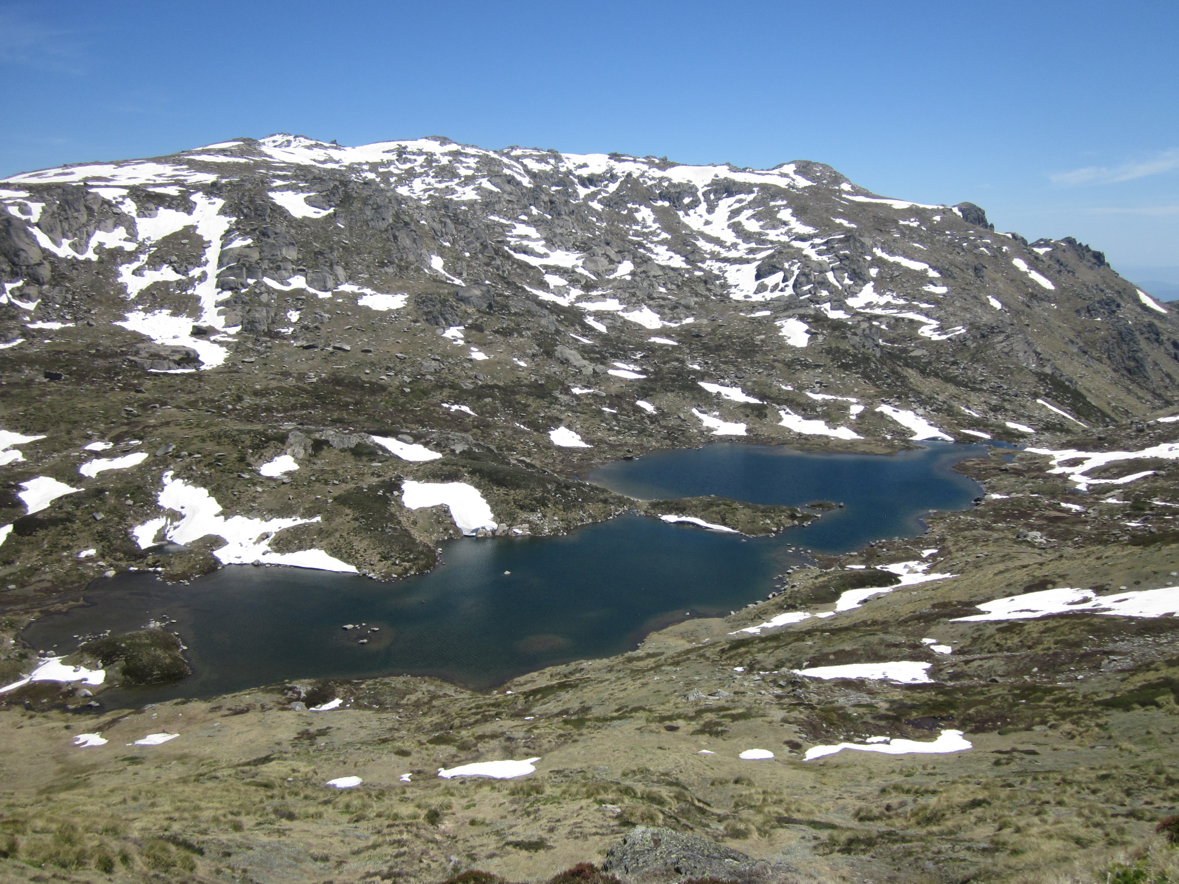
The two skiers had departed under blue skies but got caught in an afternoon blizzard while skiing off the summit of Kosciuszko. The men separated and Hayes’ body was found above Lake Cootapatamba. Lying on his skis. A cairn of stones marks the spot. He was found about one kilometre north of the hut on the side of Mt Kosciuszko.
Lake Cootapatamba. A benign summer’s day.
An emergency shelter was built near Lake Cootapatamba c 1952 as an emergency hut for Snowy Mountains Authority Hydrologists on Cootapatamba Creek for a proposed diversion of its waters via aqueducts and tunnels to the Kosciuszko Reservoir on Spencers Creek. The Koscuiszko Reservoir proposal was abandoned in about 1965.
Cootapatamba emergency hut. Mid winter. The ‘chimney’ is to allow entry into the hut during winter.
Seaman’s camera was retrieved and the processed photographs showed them standing next to Kosciuszko’s summit cairn.
Laurie’s parents travelled from the USA to visit the site where their son was found. They contributed 150 pounds to build a memorial shelter. The full story of the tragedy can be read in Nick Brodie’s ‘Kosciuszko’.
The hut now serves as an emergency shelter for skiers and bushwalkers caught out in Kosciuszko’s fickle alpine weather.
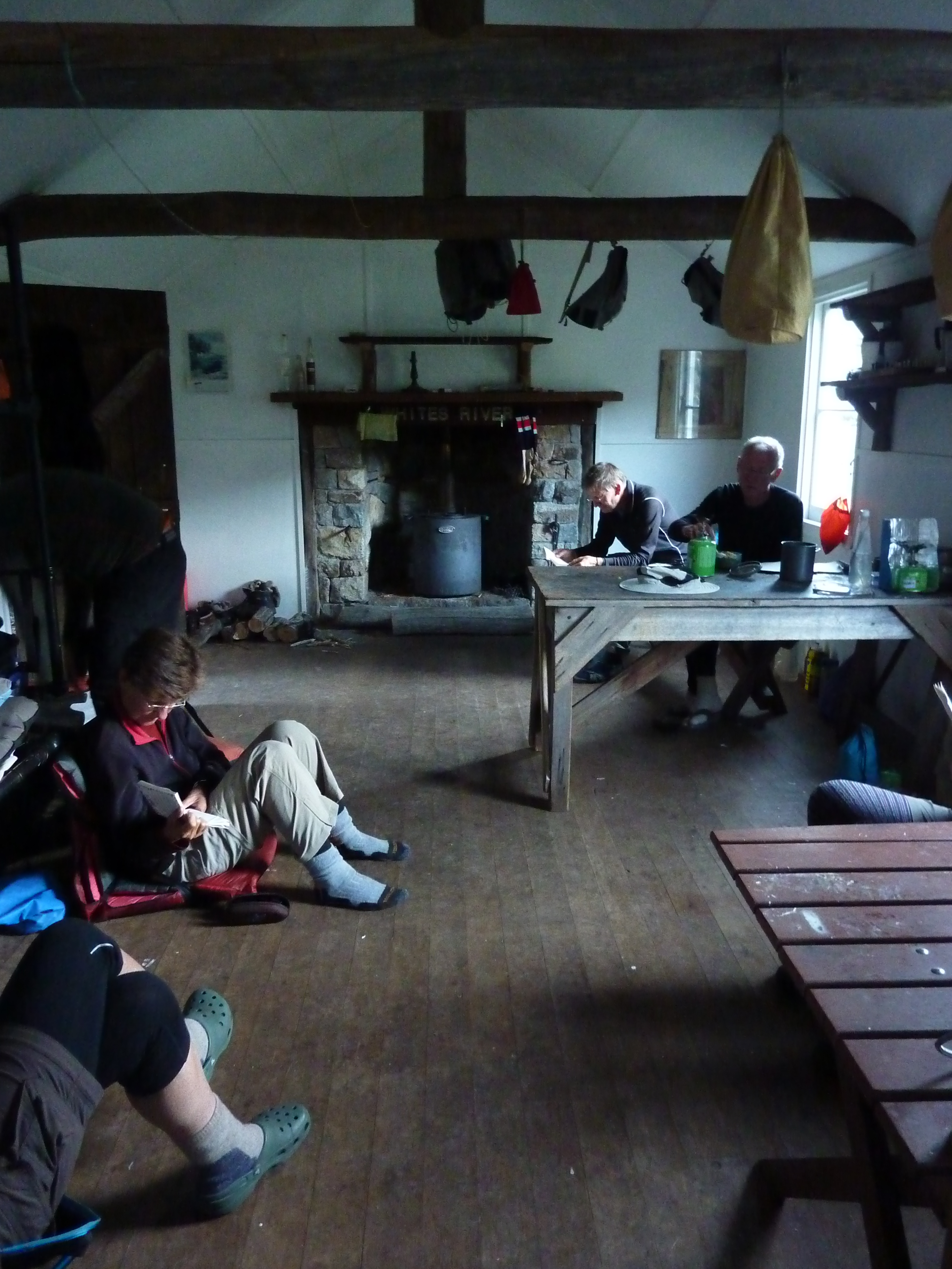
We ducked into Seamans for lunch and to dodge the westerlies that had been plaguing us all week. A quick bite, a gander at the hut’s log book and info board and we were off again. With the whiff of the finish line in the air, Chris, Neralie and Garry loped off, leaving Joe and I to wend our way back, at a pace more suitable for elderly gentlemen. A mere six kilometres downhill.
We fell in with happy throngs of summiteers. These ranged from two young turks who had just completed a 10 peaks challenge to a very stylish hiking couple. The latter, still to summit, were heading uphill at 2.30 pm, untrammeled by the weight of the basics like waterbottles, backpacks, rain gear and spare warm gear. Just Hokas, sunnies and light-weight outdoor apparel to speed them on their way to a sunset viewing from Kosciuszko summit.See photo below.
Storm clouds brewing over the Main Range late afternoon
The Ten Peaks Challenge
I hadn’t heard about this 10 peaks lark, but I discovered later that it is a 64 plus kilometre peak bagging ‘challenge’ involving ascents of the highest Main Range peaks over a 24 hour period.
Mt Kosciuszko 2228 m
Mt Townsend 2209 m
Mt Twynam 2195 m
Rams Head 2190 m
Etheridge Ridge Peak 2180 m
Rams Head North 2177 m
Alice Rawson 2160 m
Abbot Peak 2159 m
Abbot Peak East 2145 m
Carruthers Peak 2145 m
All of which I had climbed with bushwalking companions over the decades, but certainly not in 24 hours. Commmercial operators offer two/three/four day packages if you are not confident about this alpine stuff. Our two young friends being made of sterner stuff, had completed the feat over a weekend.
Joe and I gladly soaked up the easier downhill pace and the enjoyment of extensive views down the Snowy River Valley far below us.
So ended another brilliant day out and about in Australia’s Snowy Mountains with my fellow Kosciuszkians Joe, Neralie, Garry and Chris.Mt Stilwell is a short walk but if you look around, there is much to interest even the casual hiker.
After our previous day’s walking on the Snowies Alpine Walk from Charlotte Pass Village to Perisher via Porcupine Rocks, we were keen to check out another new section. This time we settled on the new nine kilometre walk from Charlotte Pass to Guthega village. A top day beckoned. Clear skies, maximums hovering around 21o C and an alpine ramble with my walking friends Joe, Chris, Neralie and Garry.
by Glenn Burns
Snowy River. Downstream of Charlotte Pass.
The BOM had issued a heatwave warning in its Snowy Mountains forecast. But for this quintet of Queenslanders the threatened 21o C maximum was just so. Not too hot, not too cold.
Snowies Alpine Walk
In 2018 construction started on the Snowies Alpine Walk. The NSW Government boasted it would deliver ‘ a world-class, multi-day walk across the alpine roof of Australia in Kosciuszko National Park.’
This 55 kilometre, 4 day walk, on Ngarigo Country, connects the existing Mt Kosciuszko-Main Range walk with three new sections. Namely, Charlotte Pass to Guthega Village; Charlotte Pass Village to Perisher Village via Porcupine Rocks and, as of 2024, the still incomplete section from Perisher Village to Bullocks Flat in the Thredbo River Valley.
Snowy River from the Snowies Alpine Walk track.
After a top day of alpine walking yesterday from Charlotte Pass to Perisher, life on the track was on the up and up. An uneventful drive, with Joe at the wheel, from our digs at Sawpit Creek, delivered us to Charlotte Pass (1840 m).
Bang into an unexpectedly biting wind. Someone had neglected to clock the forecasted 50 kph wind gusts. So with the wind chill effect, the ambient temperature was pretty cold. And this was mid-summer, Australia. As my old walking pal Brian was apt to say: ‘strong enough to blow a brown dog off its chain’. We pulled on an extra layer.
Charlotte Pass on a windy day
Pleistocene Glaciation in Kosciuszko National Park
If you had been standing at this very spot some 60,000 years ago, in the frozen depths of the last Pleistocene ice age, the scene in front of you would have been vastly different.
You would have gazed across a panorama of snow and ice. Rivers of ice poured out from ice-filled glacial bowls on the south east flanks of Mt Lee, Mt Clarke, Carruthers Peak, and Mt Twynam. The current valleys of Club Lake Creek, Blue Lake Creek, Twynam Creek would be brimming with glacial ice grinding bedrock to a pulp on its way to join the major valley glacier in the Snowy River.
In fact, it is possible that your perch at Charlotte Pass would have been covered by a mass of abrading Snowy River glacial ice pushing over this interfluve into the neighbouring Spencers Creek valley. Or so some geologists hypothesise.
Back then temperatures would have been much colder. The minimum temperature today was 12o C. 17,000 years ago it would have been at least 5 to 8o C lower.
In Kosciuszko there is evidence of at least two distinct glaciations. The Early and Late Kosciuszko glaciations. The Early Kosciuszko Glaciation consisted of a single major advance at approximately 60, 000 years ago called the Snowy River Advance. This was the most extensive advance with later advances less extensive.
Geologists tell us that the Snowy River glacier probably extended as far downstream as Illawong Hut. Possibly further. There is evidence of glacial debris downsteam at Island Bend, discovered during surveys for the Snowy Mountain Scheme.
The Late Kosciuszko glaciation consisted of three smaller glacier advances, starting about 32,00 years ago: Hedley Tarn Advance (32,000 years ago), Blue Lake Advance (19,000 years ago) and Mt Twynam Advance (17,000 years ago).
Blue Lake cirque under Mt Twynam.
The systematic search for evidence of glaciation in Kosciuszko got seriously under way in 1901. A scientific party of Professor T.W. Edgeworth David (geologist), Richard Helms (zoologist and botanist), E.F. Pittman , and F.B. Guthrie (Professor of Chemistry) found incontrovertible evidence of the action of glacial erosion and deposition:
striated rocks and boulders
erratics
terminal and lateral moraines
roches moutonnees
cirques
tarns
glacial polishing of rock surfaces
truncated spurs
U-shaped valleys
abraded interfluves
Early Geology Map of Kosciuszko’s Main Range by T.W.Edgeworth David.
Club Lake. A moraine dammed lake.
The Kosciuszko Plateau has been now been free of of glaciers for about 15,000 years. In addition to the glacial landforms mentioned above, the observant bushwalker can find ample evidence of periglacial landforms over much of the higher country. Some easily identified of these landforms include blockstreams, solifluction terraces and thermokarst ponds.
Meanwhile, back in the Anthropocene, the Snowies Alpine Walk (SAW) from Charlotte Pass initially heads downhill on the paved NPWS vehicular track towards the Snowy River. Some 500 metres of descent will deliver you to a junction and noticeboard trumpeting the start of the walk to Guthega village. We executed a hard right onto the SAW path.
SAW signage at junction to Guthega. Track over Snowy River to Main Range in background.
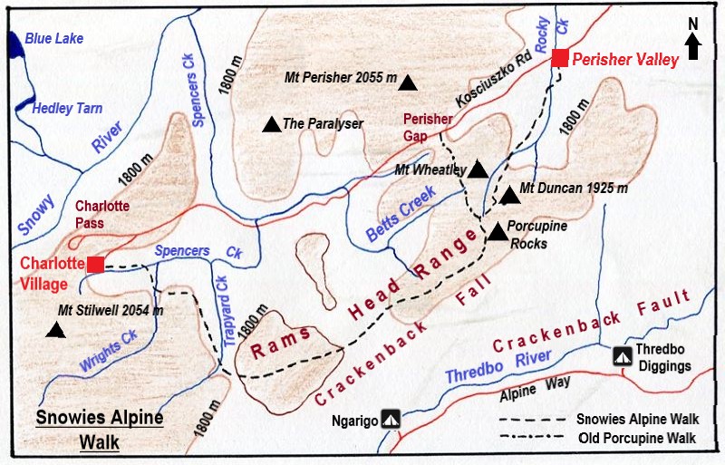
Map of Snowies Alpine Walk: Charlotte Pass to Guthega Village.
Here the SAW parallels the Snowy River on its eastern bank, winding around Guthrie Ridge on the 1700 m contour before dropping to Spencers Creek and the Snowy River at Illawong Hut. The final part of the day’s walk picks up the old Illawong-Guthega bushwalker’s pad to fetch up at Guthega Village, some nine kilometres from Charlotte Pass.
Back in the Day… 2009… Guthrie Ridge.
But, back in the day, in 2009, a 17 kilometre walk from our camp on Strzelecki Creek under The Sentinel to Charlotte Pass thence to Illawong Hut via Guthrie Ridge was more of a challenge. We set off with a brilliant off-track alpine ramble from Strzelecki Creek to Charlotte Pass via Carruthers Peak, Mt Northcote, Mt Clarke and the Snowy River Crossing.
Mt Clarke and Snowy River Valley.
Once at Charlotte Pass we swung off-track again to climb Mt Guthrie (1920 m). The usual suspect had cooked up this feral route that followed the spine of Guthrie Ridge (1900 m) and then descended to an overnight bivvi at the junction of Twynam Creek and the Snowy River. Close to Illawong Hut.
Mt Guthrie and Guthrie Ridge
Mt Guthrie and Guthrie Ridge were named by Richard Helms for his friend F.B. Guthrie, Professor of Chemistry.
My peak bagging companion had hinted at another exceptional alpine stroll to cap off what had been, so far, a matchless day of hiking. A mere two and a half kilometres or a one hour leisurely amble along the spine of Guthrie Ridge would deliver us to our campsite on the junction of Snowy River and Twynam Creek. Fun times.
Mid afternoon, on a steep mountainside, high above the valley floor three beleaguered peak baggers pushed wearily through the tangle of granite boulders and scratchy mountain peppers, Kunzeas, Epacris and snow gums that lay between them and the day’s end. Route wise, a bad call.
Tangle of boulders and vegetation. Guthrie Ridge.
But I was resigned to this stuff. Situation normal when walking with my bush-bashing, peak bagging buddy Brian. He claimed it was just the price we had to pay for a very satisfying and bludgy morning’s walk. Finally, we staggered in just on dusk. The campsite made it all worthwhile. We set up on a springy snow grass ledge… lulled to sleep by the riffling Snowy River. All was well in my little slice of bushwalking paradiseand all is forgiven Brian.
The new Snowies Alpine Walk.
After mulling over this previous cross country experience I gave thanks for the newly minted super SAW highway. Cortan steel elevated boardwalks, rock-armoured track surfaces and dry boots compliments of a high suspension bridge over Spencers Creek. A speedier passage than taking that infernal high road along Guthrie Ridge. But nowhere near as interesting.
The track took us initially over another of those eyesore Cortan steel boardwalks much favoured in Kosciuszko National Park. But I admit they do an excellent job of protecting the low heath and snow grasses below.
Snowies Alpine Walk. Cortan steel boardwalk over low heath.
Eventually the track leaves the low heath and climbs on its granite pavement ever upward through snow gum woodland. As did Garry. Left us, that is. We found him, as I expected, propped on a log in a bower of snow gums. The ideal morning tea stop.
Morning tea stop. Snow gum woodland
Snow gum woodland, invariably, is clothed in a dense scrubby understorey of beastly spikey undergrowth like Bossiaea, Epacris, Hakea, Grevillea, Oxylobium, and Kunzea . Here’s where those weird knee-length canvas gaiter things worn by Australian bushwalkers are a brilliant piece of kit.
The low growing snow gum woodland is found above 1500 metres and is dominated by snow gums or white sallee ( Eucalyptus pauciflora).
Snow gums (Eucalyptus pauciflora). Gnarled and wind shorn.
The snow gum zone is found extending down to the lower levels of winter snowfall and is the only tree to grow above 1500 metres. Above this woodland zone the landscape transitions suddenly into the true alpine zone of heathland, grassland and bogs.
Snow gum woodland with scrubby understorey of Bossiaea, Kunzea, Hakea, Oxylobium.
The undergrowth is called heath and can be waist-high with tough whippy branches to withstand the weight of snow (and, hopefully, bushwalkers) without breaking. Throw in the odd torpid highland copperhead and pit-fall traps of wombat and bunny burrows and hiking through this scrub quickly losses its appeal.
Fortunately, the new super SAW highway saved us from having to thrash through that stuff.
Much of the SAW walk parallels the Snowy River which flows NNE downstream towards Guthega Pondage. It is joined on its western bank by the south east flowing drainage lines of Blue Lake Creek, Twynams Creek and Pounds Creek.
These creeks have their headwaters along the highest parts of Australia’s Great Dividing Range: Carruthers Peak (2010 m), Mt Twynam (2196 m), Mt Anton ( 2010 m) and Mt Anderson (1997 m). The Main Range peaks all visible from this section of the SAW.
Today’s walk provided expansive and unimpeded views down the nearly straight Snowy River Valley. Its side slopes planed back by late Pleistocene valley glaciers. Glacial valleys all over the world typically exhibit these truncated spurs and U shaped valleys.
Glacially abraded valley slopes. Snowy River.
Some 4.5 kilometres after the track entrance our path left the snow gum woodland and descended across low heath covering a gently rounded spur at the intersection of the Snowy River and Spencers Creek. An abraded spur, ground down during the Pleistocene by the Snowy River and Spencers Creek valley glaciers.
Snow gum woodland on the Snowies Alpine Track.
Joe and I caught up Chris and Neralie just short of the Spencers Creek suspension bridge. They were magging with two walkers travelling in the reverse direction. Uphill to Charlotte Pass. I’m not sure of the rationale for doing this section uphill, but many people do. Meanwhile, Garry was last seen as a distant speck beetling toward Illawong Hut.
The SAW track builders had thoughtfully provided a nifty suspension bridge consisting of a steel mesh plank and handrails to usher walkers safely across Spencers Creek. Built in 2021 it is said to be, in terms of its location, at 1627 metres of altitude, the highest suspension bridge in Australia .
Suspension Bridge over Spencers Creek
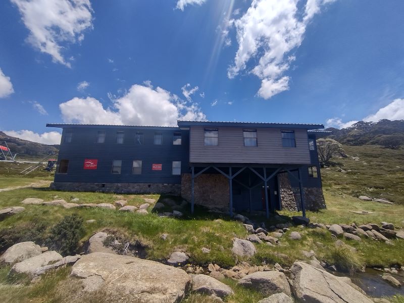
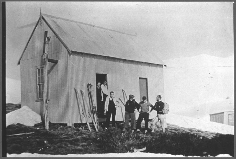
Meanwhile Garry had escaped the wind by taking refuge at the side of the hut. Just don’t turn up here in a serious blizzard. You will find the inn door locked, as we did. An unusual arrangement for high country shelters. But this is because Illawong is the only private lodge outside the main ski resorts.
Illawong Hut.
But, to be fair, the illustrous Illawong Ski Tourers have thoughtfully provided a sealed crawl space for midgets under the hut for just such an emergency. And, they have thrown in as a goodwill gesture, a snow shovel to dig yourself out or in. Once out of your blizzard, don’t try to sit up. The upside is that you are safe and don’t have to share the under floor space with assorted snakes, wombatsand other creepy-crawlies.
Emergency Shelter at Illawong Hut.
Illawong Hut
Illawong, also known as Pounds Creek Hut and Tin Hut No1, was constructed in the summer of 1926-1927 as a shelter hut. Illawong is said to mean ‘view of the water’. A basic two roomer/four bunks, it was built by the NSW Tourist Board to assist Dr Herbert Schlink in his first Kiandra to Kosciuszko ski crossing during the winter of 1927.
Pounds Creek Hut ( now Illawong Lodge) in 1940s. Source: NLA: obj-147481686
After construction it was used for early ski touring, summer bushwalking and by mountain cattlemen. At the time only two other buildings existed in the high country: Betts Camp and Kosciusko Hotel.
In 1955, John Turner of the Ski Tourers Association brewed up a plan to convert Pounds Creek Hut into a ski lodge. A year later, in 1956, the Kosciuszko State Trust gave permission for the hut to be extended to become a private ski lodge managed by Illawong Ski Tourers.
The conversion was a bit of mission for lodge members. No helicopter lifts in those days. All materials and food supplies had to carried in. Though some ingenious work-arounds were dreamt up. Klaus Hueneke in his first-rate tome: Huts of the High Country provides this description:
” Over the next two years members, friends and passersby spent endless summer days and occasional premature wintry ones carrying, rowing, pushing and dragging materials to site. “
And this:
” Rowing the materials up Guthega Dam was a new twist to mountain transportation and not without incident… boat trips took on ice floes, wind driven sleet and polar wombats! The final leg was considerably aided by a sled and the muscle power of Mick, a horse from the Chalet. Unfortunately he had only two speeds – stop and run like hell. “
Those enterprising Illawongians weren’t finished yet. Over the years the Lodge was spruced up with a septic tank, electric lighting, a gas cooker, a refrigerator, a hot water service, decent mattresses, carpets and a phone. A veritable home away from home. My membership application is in the mail.
Members also designed and built the flying fox over Farm Creek and the suspension bridge over the often raging Snowy River. For this latter feat all skiers and bushwalkers wanting to access the Main Range should give them fulsome thanks. Two earlier bridges had been swept away before a decent one was installed in 1971. The final version was designed and built by one Tim Lamble and assembled with the help of the NPWS helicopter.
Tim, incidently, is also the author of my favourite piece of cartographic art: the Mt Jagungal and The Brassy Mountains 1:31680 map.
Extract from Tim Lamble’s map Mt Jagungal and The Brassy Mountains. 1:31680.
Illawong Hut has been placed on the National Heritage Register, the National Trust (NSW) Register and NPWS Historic Places Register. Its NPWS citation reads:
” Illawong Hut is one of the most historically significant huts in the park, being a rare remnant of early 20th century NSW Government Tourist Bureau efforts to promote alpine tourist recreational activities.”
For good measure the Farm Creek flying fox and the Snowy River suspension bridge are also on the register.
Snowy River suspension bridge accessing The Main Range.
With little over two kilometres to Guthega my friends had scarpered in a cloud of dust. The upgraded SAW track follows the old bushwalking pad between Illawong and Guthega. It skirts around the southern bank of Guthega Pondage. This pondage, a tunnel and Guthega (Munyang) hydro power station were built as part of the Snowy Mountains Scheme in the early 1950s.
Munyang (Guthega) Hydro Power Project
ThisMunyang (Guthega) project area is the start of many of my favourite walks in Kosciuszko.
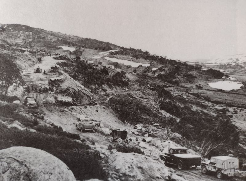
And it is also the start of the first major project of the Snowy Mountains Scheme in 1951. The tender was awarded to a Norwegian firm, Ingenior F. Selmer. A serious player in global dam and hydro construction. The bulk of the workers were Norwegians (450, mainly labourers) from the rural areas of the Arctic Circle.
Norwegians working on Snowy Mountains Scheme.
On the 21 February 1955 , only a few weeks behind schedule, electricity flowed from Munyang.
Munyang (Guthega) Power Station under construction. Circa 1950.
The wordMunyang or Muniong derives from local aboriginal people. When camped on the Eucumbene Valley, they would point to the snow covered Main Range and repeat the word ‘Munyang’ or ‘Muniong’ . Said to mean ‘big’ or ‘high mountain’. Also ‘big white mountain’.
If you want to read more about the fascinating people and places of the Snowy Mountains Scheme, I can highly recommend Siobhan McHugh’s: ‘The Snowy, a History.‘
Siobhan McHugh: The Snowy, a History. Anniversary Edition. NewSouth Publishing. 2019.
Nearing the end of our walk, the SAW crosses Farm Creek via a metal bridge then climbs to Guthega Village. No need to risk life and limb on the the rusty old flying fox still there. Fortunately, it has been padlocked by some kill-joy to discourage thrill seekers like my walking companions.
Farm Creek bridge on SAW.
At the still to be completed track exit, rangers were busy fiddling around sorting out signage. Here we had views over the waters of Guthega Pondage, the dam wall and the intake for the tunnel to the top of the Munyang penstocks.
Approaching Guthega Pondage along SAW track.
Final construction work at lookout on track exit at Guthega.
Guthega Ski Village or Little Norway
Guthega village did not exist before 1950. The only building in the area was our old friend Illawong Hut. In 1951 when the Norwegian company Selmer started construction on the first major project of the Snowy Mountains Scheme , their construction camp became known as ‘Little Norway’ as it housed the largest number of Norwegians living outside of Norway at the time.
Road to Guthega still under construction 1950.
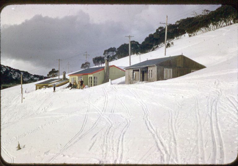
When Selmer returned to Norway in 1954, at the end of their contract, they took most of their construction camp with them, leaving just three huts. These huts kick-started the modern day Guthega Ski Resort.
Huts left by Selmer at Guthega. Source: Perisher Museum.
The huts were scooped up for peanuts in 1955 by SMA Cooma Ski Club, YMCA Canberra Ski Club and Sydney University Ski Club. The village now sports private lodges, a restaurant and bar, commercial resort accommodation and various tow knick-knacks to ferry skiers to the top of their runs.
Guthega serves as a winter base for downhill skiing, cross country skiers, snow-shoers and snow-boarders. The alpha adventurers head for Blue Lake to try out their ice climbing skills. But in summer, Guthega is pretty much dead. A ghost resort. Hopefully, this will change given the number of walkers I saw on the track.
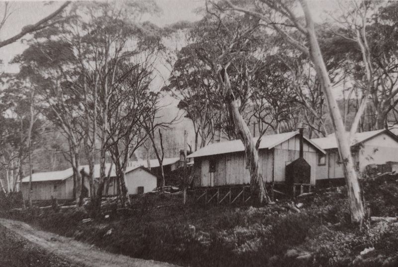
It was now two hours past our lunch hour. A familiar pattern developing here, much to the chagrin of my fellow walkers. We found Garry’s vehicle, wheels still attached, piled in and headed for nearby Island Bend Campground on the Snowy River for a belated feed.
The campground was once the site of a construction village for the Snowy Mountains Scheme.
Island Bend Barracks. Snowy Mountains Scheme.
We ducked into a pleasant little nook with a picnic table and some soft grass for a post-prandial kip. All in all, a top day of alpine hiking with my walking companions, Joe, Chris, Neralie and Garry.
Happy Hikers.
I had many more days of alpine adventures for my fellow Kosciuszkians. God bless their little walking boots.Maybe not so little.
Up ahead, our path crossed its first cascade, then sidled up through stands of snow gum woodland, threading in and out of huge granite boulders before descending to a vast alpine grassland. With alpine scenery like this, and on a benign summer’s day, who could resist the opportunity to hike the new Snowy Alpine Walk?
by Glenn Burns
Certainly not me. Nor my walking friends Joe, Neralie, Chris and Garry. Surprising actually. Given the foul weather on our last foray together into the high plains of Northern Kosciuszko. Fortunately, my walking companions had remained undaunted by the cold wet weather over those six days. This time, however, a beneficent weather god smiled down on us. We luxuriated in sunny, pleasantly coolish, if somewhat windy days. Glorious alpine weather. Mr BOM promising a maximum of 17o C and a minimum of 8o C. But windy.
Brilliant blue sky and coolish a breeze. A glorious day of alpine walking.
The Snowies Alpine Walk
In 2018 construction started on the Snowies Alpine Walk. The NSW Government boasted it would deliver ‘ a world-class, multi-day walk across the alpine roof of Australia in Kosciuszko National Park.’
This is a 55 kilometre, 4 day walk connecting the existing Mt Kosciuszko-Main Range walks with three new sections. Namely, Charlotte Pass to Guthega Village; Charlotte Pass Village to Perisher Village via Porcupine Rocks and, as of 2024, the still incomplete section from Perisher Village to Bullocks Flat in the Thredbo River Valley.
Map: Perisher: 1:25000: Geoscience Australia.
Map of Snowies Alpine Walk: Charlotte Pass Village to Perisher Village via Porcupine Rocks.
Tuesday: Charlotte Pass Village to Perisher Village via the Porcupine Rocks: 13 kms.
An uneventful 25 minute drive took us from our Sawpit Creek digs to the start of of the day’s walk at Charlotte Pass Village. The corflute announcing ‘Cafe’ was duly noted by our resident caffeine addicts for future attention.
Charlotte Pass Village from Kangaroo Ridge
A Brief History of Charlotte Pass Village.
The first building at Charlotte Pass was the Charlotte Pass Chalet built in 1930 by the NSW Tourist Board ( NSWTB ). The NSWTB was prodded into action by the Seaman/Hayes tragedy in 1928 when both men perished in a blizzard on a skiing trip to Kosciuszko. It was thought that a much more efficient search could have been mounted from a site near Charlotte Pass.
The original Charlotte Pass Chalet.
The Chalet was burnt down in 1938 but was rebuilt for the 1939 season. For the next 30 years Charlotte Pass Chalet was the major centre of skiing in NSW. Since supplanted by the ski resorts of Perisher, Smiggins Holes, Guthega and Thredbo.
In 1962 the NSWTB leased the Chalet to a private company. A small alpine village sprung up, consisting of a hotel, private lodges, ski clubs, chairlifts, T-bars and Poma lifts.
Charlotte Pass was named after Charlotte Adams who, in 1881, was the first European woman to climb Mt Kosciuszko. Her father, Philip Francis Adams was Surveyor General of NSW from 1868 to 1887.
But we were on a different mission. A short stroll from the village took us to the track head.
Initially,the track heads over the boggy headwaters of Spencers Creek via a Cortan steel boardwalk. These boardwalks have spread like a rash over many sections of Kosciuszko’s alpine walks. But, dubious ambience aside, they do effectively minimise damage to fragile alpine ecosystems.
Bogs are areas of wet, spongy ground usually found in areas of impeded drainage. Floristically bogs are dominated by spagnum moss (Spagnum cristatum) and associated with a variety of rushes and sedges, especially the tufted sedge (Carex gaudichaudiana) and the Australian cord rush (Restio australis). Bogs are formed by the decomposition of organic matter which will ultimately become peat.
Bogs and fens of upper Spencers Creek.
From this point, at about 1770 metres, Spencers Creek wends its way downstream into the Snowy River some seven kilometres away.But for us, it was ever uphill to 1900 metres and the alpine grasslands and swamps that feed Spencers Creek and its major tributary, Betts Creek.
James Spencer
Spencers Creek was named after James Spencer, one of the first stockmen to take up a lease (Excelsior Run in 1880) and to graze his livestock on the ‘Tops’, including Mt Kosciuszko. The run extended over an area of 12,000 hectares.
Spencers Creek.
The story goes that he fell off his horse attempting to drive his stock across a swollen alpine creek. That creek now bears his name, Spencers Creek. Spencer also named the nearby peaks of The Paralyser (1942 m) and Mt Perisher (2054 m).
His homestead was built lower down at the junction of the Snowy and Thredbo Rivers. That location, West Point, now Waste Point, was a favoured camping area for aborigines travelling to the high country to feast on Bogong moths. But more on mothing later.
The Spencer Family. Waste Point. 1912.
Spencer’s other sideline was to act as a guide for visitors wishing to climb Mt Kosciuszko and explore other parts of the Main Range. Notables whom he led into the high alpine peaks included Thomas Townsend (surveyor), Baron von Mueller, Surveyor-General Adams and Dr von Lenderfeld.
Once on the southern bank of Spencers Creek the track rambles ever upwards through snowgum woodland to the 1800 metre mark, before thankfully, levelling off and contouring to the south-east. Wrights Creek, a tributary of Spencers Creek, is crossed as the track curves around a major SW-NE trending spur of the Rams Head Range.
Climbing up through snowgum woodland towards Rams Head Range.
Soon after the start of the climb onto the Rams Heads we met a bunch of older walkers perched trackside taking a quick breather. The first of many groups of hikers. The newly minted SAW tracks are obviously a big hit with summer visitors, and must be making the New South Wales Parks people very happy with their investment.
By now Garry had disappeared from my radar. But, having walked with him before, I knew there was no need to be concerned. He is a super fit, experienced walker. Soon enough we would find him waiting patiently at the next track junction or even, on occasion, having a catnap in a patch of springy snowgrass. And I could rely on him to suss out the best spots for our morning tea and lunch breaks.
This timewe found him idling in a pleasant glade with its own steel bridge spanning a gently cascading stream. Just the spot for morning tea. This was Trapyard Creek, a tributary of Spencers Creek. Upstream were falls and cascades, while downstream was Johnnies Plain on the southern bank of Spencers. The plain below is strewn with striated boulders providing evidence of the Pleistocene glaciation in the Kosciuszko area.
Johnnies Plain and the Kosciuszko Reservoir
At the start of the Snowy Mountains Scheme in the early 1950s, Johnnies Plain came within a whisker of being flooded. The background to this was that the wily SMA Commissioner, William Hudson, had to get a couple of projects on the go quickly to placate his political masters , some of whom were pretty twitchy about the whole scheme.
One of the projects on Hudson’s early bird list was a high altitude reservoir on Spencers Creek, to be completed about 1954. The Kosciuszko Reservoir.
At 1780 metres above sea level, the reservoir would have inundated Johnnies Plain and lapped up to the back door of the Chalet in Charlotte Village.
It was to be fed by Betts and Spencers Creeks and 150 kilometres of water races and aquaducts including one contouring along the western face of Mt Kosciuszko. Like the proponents of the the Lake Pedder debacle in Tasmania, these people had little sense of environmental stewardship. But, to be fair, in later phases of the scheme, the SMA’s work on soil conservation and landscape restoration was world-class.
Fortunately, test drilling revealed that the footings for the dam wall would be in moraine rubble and not solid rock. The engineers proposed a number of hare-brained work-arounds including some process to freeze the unconsolidated moraine.
Also the SMA feared a PR thrashing if it attempted to flood a pristine alpine environment. The project finally stalled when the Kosciuszko State Park Trust declared the Kosciuszko Primitive Area to be closed to road and engineering works, buildings and commercial activities. Vale the Kosciuszko Reservoir.
Of course, within a few short years equally damaging commercial ski developments took place around the periphery of the Kosciuszko Primitive Area. By and large, all blights on the landscape, if you want my opinion.
Extent of Kosciuszko Reservoir. Source: SMA.
Back on the track, our supplies of chocolate bullets, nuts and crystallised ginger dispatched, we puffed our way up onto the 1900 metre summit spine of the Rams Heads. Here were jagged outcrops of granodiorite, their outlines cutting a perfectly blue and cloudless skyline. Hence, I imagine, the derivation of the name Rams Head Range.
Jagged outcrops of granodiorite marking the crest of the Rams Head Range.
Then followed a gentle 150 metre descent into a vast grassy alpine saddle separating the north flowing Betts Creek headwaters from the Thredbo River system off to our south. The ‘grassland’ was a typical Tall Alpine Herbfield found over much of Kosciuszko’s terrain above 1800 metres.
Descending towards the saddle separating Betts Ck and Thredbo River systems.
Tall Alpine Herbfield and Tussock Grassland
Tall Alpine Herbfield dominated by silver snow daisy: Celmisia longifolia.
The Tall Alpine Herbfields are the most extensive of all Kosciuszko’s alpine plant communities and are found on well-drained and deeper soils. These herbfields occur on a variety of bedrock types , suggesting that lithology has a negligible influence on location.
This plant community is the most diverse of all the alpine vegetation types in terms of number of species. Showy wildflowers grow in a matrix of snowgrasses (Poa caespitosa) and sedges (Carex sp). Technically, it is an association dominated by the genera Celmisia and Poa.
Wildflowers which I recognised included: silver snow daisy (Celmisia astelifolia), Australian bluebells (Wahlenbergia spp), star buttercups (Ranunculusspp), bidgee widgee (Acaena anserinifolia), Australian gentians (Gentiana spp), eyebrights (Euphrasia spp),billy buttons (Craspedia uniflora), andviolets(Viola betonicifolia).
Silver snow daisy (Celmisia asteliifolia).
Australian gentians (Gentiana sp).
Billy buttons (Craspedia uniflora).
Bidgee widgee (Acaena anserinifolia). This sock- piercing prickly nuisance is the bane of high country walkers.
These summer wildflower displays are invariably spectacular, matched only, in the Australian context, by the wildflowers of the south-west of Western Australia.
During the era of extensive sheep and cattle grazing across Australia’s high country, some of the more palatable plant species were pushed to the edge of extinction as sheep and cattle munched away at their preferred herbage.
Summer grazing. Kosciuszko National Park.
Fortunately, small pockets survived in ‘refuges’ in rocky outcrops. Thankfully, sheep and cattle were given their marching orders with the declaration of Kosciuszko National Park in 1969. In the decades since, the threatened species have been re-colonising their earlier habitats.
The Crackenback Fault
From our vantage point in the saddle we peered over into the 600 metre Crackenback Fall to the Thredbo River Valley far below.
Steep drop over Crackenback Fall to Thredbo River valley.
This spectacular fall can be explained by a combination of tectonic uplift (called the Kosciuszko Uplift) during the Tertiary (66 to 2.6 mya) and the rapid downcutting of the Thredbo River into the shattered bedrock along the Crackenback Fault. The Crackenback Fault dates back to the Tabberabberan tectonic contraction of the Lachlan orogeny some 390 to 380 mya.
Thus, the Thredbo flows in a reasonably straight line from Dead Horse Gap to Lake Jindabyne. A consequence of the structural control exerted by the Crackenback Fault.
Snowy River.
The course of the Thredbo River presents an interesting drainage pattern when viewed on a map. It is described by geomorphologists as a rectilinear drainage pattern, where the main bends of the Thredbo River change direction at right angles. In the case of the Thredbo, it initially flows south-east, then turns south-west, then north-west and finally into the main Thredbo valley which runs north-east to Lake Jindabyne.
Map showing rectilinear drainage pattern of Thredbo River and the influence of Crackenback Fault
Map showing rectilinear drainage pattern of Thredbo River and position and influence of Crackenback Fault.
Joint lines are structures along which there has been no discernable differential movement. Large scale joints are are common feature of granitoid landscapes, like the Rams Heads.
Faults, however, show clear evidence of differential earth movements. The Crackenback Fault is a 35 kilometre long, south-west to north-east trending strike-slip fault between the Jindabyne Thrust Fault (at Jindabyne) and Dead Horse Gap.
A strike-slip fault has horizontal movement of the earth’s surface with little vertical displacement. It is along this straight fault structure that the Thredbo River flows towards Lake Jindabyne.
Other well-known strike-slip faults include New Zealand’s Alpine Fault, the Dead Sea, and the San Andreas fault in North America.
San Andreas Fault. North America.
San Andreas Fault. Pacific plate moving NW. North America plate SW. Plates slide approx 30 mm per year as an average along the 1200 km length of the fault.
Aerial view of San Andreas Fault.
Meanwhile, high above the Thredbo River,the saddle gave way to another climb, another group of elderly hikers and further on, Garry, bunked down in a grove of snow gums.
By now my fellow walkers had lost interest in Crackenback faults, Crackenback falls and such like geological POIs and were insinuating that lunchtime was long overdue. Our lunch spot should preferably be sheltered from the wind. North-westerlies were idling along at about 30 kph. Somewhere sunny, with a view would be nice. My advance scouts came up trumps. A spectacular eyrie on a jumble of boulders looking down the steep Crackenback Fall to the Thredbo River far below.
Lunch spot. Looking down the Crackenback fall to Thredbo River Valley.
This was an ideal lunch nook. Grand views, a pool of warm sunlight, and a chance to keep tabs on the passing elderly bushwalker caravanserai plodding its weary way along the path below. Wafting up to my rocky perch were bleats of dismay as the final steep climb to Porcupine Rocks hove into their view.My turn would come.
Porcupine Rocks
Half an hour later I too was obliged to struggle up said ridge and clambered onto the bouldery outcrops known as Porcupine Rocks. Their appearance explains the name. Piles of shattered, pointy boulders on the crest of the Rams Head Range extend for 25 kilometres in a SW to NE axis. The highest point is Mt Duncan trig at 1926 metres.
Porcupine Rocks.
These are outcrops of Silurian Mowambah granodiorite (443 to 419 mya). Granodiorite is a coarse-grained intrusive rock similar to granite.
Mowambah granodiorite with vein of quartz.
The spine of tooth-like boulders is a consequence of the tendency of granitic tors to weather in sheets. Then severe freeze-thaw action further breaks down the edges of boulders to give the characteristic jagged appearance of granitoids in cold alpine climates.
Looking back along the jagged spine of the Porcupine Rocks.
You can climb any of the boulders easily for fine views 800 metres down into the Thredbo Valley extending from Dead Horse Gap to Lake Jindabyne.
I have been here a number of times before and mused that we were standing at a crossroads in time. Present, early National Park days, grazing era and the distant past.
Pathways through Time
Kosciuszko’s most recent path is the freshly minted Snowies Alpine Walk. Built to entice visitors to the Snowy Mountains during the summer downtime. Walkers can now easily access previously lesser known parts of the Main Range.
New, also, in techniques of path construction. This was no rough bushwalker’s pad through the scrub. It is a wide, heavily engineered path.
Surfaces have been hardened by the placement of massive stepping stones of granite retrieved from the old Snowy adit rock pile. The interstices filled with compacted granite. Fragile bog and fen areas and creeks are bridged by boardwalks of Cortan steel.
Hardened track surface. Snowies Alpine Walk.
Given the hordes using the track today, I can well understand Parks thinking on the use of hardened track surfaces.
If visitor useage is a measure of success, the push for summer tourism has succeeded. The place was awash with active oldsters and legions of pint-sized trampers out in the fresh air on school excursions to the Snowy Mountains.
This onlooker was impressed by their youthful energy and boisterous enthusiasm. They were still going hammer and tongs after having already trekked the 12 kilometres from Charlotte Pass. Their principal less so. A recumbent figure sprawled trackside.
The old bushwalking pad and ski trail to Porcupine Rocks
Pre-dating the SAW are my earlier strolls to the Porcupines. These began at Perisher Gap. From the Perisher Gap car park a rough bushwalker’s pad and ski pole line contoured around Mt Wheatley (1900 metres).
The old bushwalkers’ pad from Perisher Gap to The Porcupines. A damp day out.
I often gave Mt Wheatley a miss as it is a pile of boulders overgrown with snowgums and an understorey of whippy, prickly shrubs. But if you persist and don’t mind a scratch or three, it does give an excellent view of much of the highest parts of the Kosciuszko Plateau. Between Wheatley and Porcupine Rocks the terrain is much more open as you leave the snowgum woodland and cut onto the high alpine meadows and bogs of upper Betts Creek. Wet boots always guaranteed. It was rare to see any other walkers.
Swampy ground in upper Betts Creek.
Old Kosciuszko Road
Older still, in the grazing era, was the Old Kosciuszko Road which passed by the Porcupine Rocks on its way to summer pastures and Mt Kosciuszko.
The Old Kosciuszko Road (circa 1870 to 1898) started on river flats near Old Jindabyne and passed near The Creel before ascending a spur east of Sawpit Creek. From there it went through Wilson’s Valley, Boggy Plain, Pretty Point and ascended to pass by the Porcupine Rocks. Then it edged south-west, paralleling the spine of the Rams Head Range to Rawsons Pass.
The Old Kosciuszko Road near the Porcupine Rocks shown in red. Source: Snowy Mts Walks. 4th edition. Geehi Club.
It was used mainly by graziers bringing stock up to high summer pastures.
A later Kosciuszko Road (1908) avoided the Rams Heads and followed valleys through through Smiggins Holes, Perisher and The Chalet before ascending to Rawsons Pass. Essentially the same route taken today.
Aboriginal Pathways
Aborigines ranged over Kosciuszko’s high alpine country during the summer months. Their stone tools have been found nearby at Perisher Gap as well as Mt Guthrie, Mt Carruthers, Little Twynam and the Rams Head Range.
It is likely that they followed ancient pathways to the high tops of the Ram Heads and the Main Range in search of a major food source, the Bogong moth (Agrotis infusa).
Bogong moth (Agrotis infusa)
The Bogong moths migrate from the hot inland plains of New South Wales and southern Queensland to hibernate in the cool rocky crevices and caves of Kosciuszko’s granitoid landscapes.
The aborigines, too, migrated to the high tops to feast on the moths. They came from far and wide. From Yass and Braidwood, from Eden on the coast, and from Omeo and Mitta Mitta in Victoria.
Europeans often commented on how sleek and well fed the aborigines looked after their moth diet. Edward Eyre who explored the Monaro in the 1830’s wrote: “The Blacks never looked so fat or shiny as they do during the Bougan season, and even their dogs get into condition then.”
At summer’s end, with the arrival of the cold southerlies, the moths and aborigines decamped and headed for lower altitudes. As did my walking companions.
Tempting as it was for me join our still recumbent principal for a quick kip, my companions had already galloped off. A final descent of 3.5 kilometres to Perisher village followed, where Garry had stashed his ute. The new SAW track follows the old bushwalking pad downstream along Rocky Creek to Perisher Village.
The walk exit at Perisher was still a work in progress. Rangers had set up a diversion around the final section of track. Here Joe and I caught up with Neralie and Chris chatting with two young track builders. Extracting useful information as is their wont. Apparently the rangers were experimenting with another system of hardening track surfaces in preparation for the final Perisher to Bullocks Flat section.
And so, after six hours and 14 kilometres, a most satisfying day of alpine walking was over. Garry’s ute waited patiently at The Man from Snowy River pub to ferry its passengers back to Charlotte Village where we retrieved the Joemobile.
Who could ask for a better bunch of walking companions? Thanks to Neralie, Garry, Chris and Joe for sharing the day with me. And I still had many more days of alpine adventures up my fleecy sleeves for their delectation.
Accommodation
I chose to hike sections of the SAW as day walks. We overnighted in a heritage-listed chalet at Kosciuszko Tourist Park, Sawpit Creek. Our abode was a little shabby on the outside but clean and refurbished inside. Entirely satisfactory for our purposes.
Still more walks in Kosciuszko National Park to whet your hiking appetite.
And so to the Brindle Bull. You may have read my previous account of our seven day saunter #1 along Kosciuszko’s highest peaks and ridgelines on The Kerries, Rolling Grounds and The Main Range. Our follow-up foray was into The Pilot Wilderness, south of Thredbo.
by Glenn Burns
But first, as it was Sunday, a day of rest, we parked ourselves in Thredbo. Along with hundreds of mountain bikers competing in the National Downhill Championships.
By Mondaymorning the drizzle eased, the BOM forecast was propitious so we set out again. This time on a shorter, forty kilometre circuit, at slightly lower altitudes but still over spectacular alpine terrain.
Our circuit started at Thredbo. Thence to Dead Horse Gap, the Cascade Trail, Bobs Ridge, Cascade Hut, the Big Boggy, Teddys Hut, The Chimneys, arriving back at Thredbo via the Brindle Bull Hill. A place name that Brian, our leader, seemed particularly smitten with and was determined to check out.My other companions on the Brindle Bull trip were Richard, Joe and Noel.
Map of Hike to Cascade Hut, Big Boggy, Teddys Hut, The Chimneys and the Brindle Bull
Monday : Thredbo to Cascade Hut: 12 kms.
With the mist lifting, Richard loped off, at a disconcertingly eager pace after our lethargic day of rest. The morning’s walk took us up the four kilometre Thredbo River tourist track to Dead Horse Gap, the trail head for the Cascade Trail.From here we would climb the Cascade Trail to the crest of Bob’s Ridge (1800 metres), a major south-west spur of the Great Dividing Range.
It is said that Dead Horse Gap takes its name from a herd of twenty or so unfortunate brumbies caught out in a blizzard. But today, the gap was merely a tame car park with an info board telling me that this was once the site of the Dead Horse Gap Hut, a summer grazing hut, built in 1932 by the Nankervis family of Tom Groggin Station.
Old Dead Horse Gap Hut
This type of shelter hut, one of nearly 230 built in the Kosciuszko area, was an integral part of the transhumance practice of herding cattle and sheep up to the high summer pastures or snow leases as they were called. Other huts were built by miners and the Snowy Mountains Authority. But, as with many high country shelters, Dead Horse was lost to fire.
From Dead Horse Gap we engaged granny-gear for the five and a half kilometre drag up to the crest of Bobs Ridge at 1800 metres. Some 300 metres of altitude gain. The Murray River system to our right, the Thredbo- Snowy River to our left.
Thredbo River valley with Cascade Track contouring up Bobs Ridge
Here we settled into one of those outstanding lunch spots that leaders rave about, but rarely provide.
The lads loafed under the shade of gnarly old snow gums. Their bottoms comfortably settled on snow gum branches or sprawled out on the ground, padded by springy tuffs of snow grass. Best of all, none of those swarms of mini black alpine ants, the bane, one of several, of bushwalking in the high country.
Lunch break on Bobs Ridge
The Brumby Saga
But these alpine woodlands are swarming with something on a grander scale… wild horses, brumbies, feral horses. Choose your side in the culture wars over brumbies in Australia’s high country.
We discovered a set of portable stockyards behind our lunch site and our progress up Bobs Ridge had been marked by pyramids of horse poo of such grandeur they would do pharaoh Rameses II proud.
Brumby traps
We were, of course, in the setting for Elyne Mitchell’s much loved Silver Brumby stories. The presence of brumbies in Australia’s national parks is a divisive issue.
In other states they have been culled without much of a hue and cry from horse lovers. But in the high country of New South Wales and Victoria, a different mentality prevails. Here brumbies are cultural icons, Man from the Snowy River stuff.
Notwithstanding the damage wild horses do to alpine ecosystems, in parts of Kosciuszko National Park they seem free to roam pretty much unfettered. Their hooves trashing delicate alpine bogs and watercourses. As well, the brumbies selectively chomp out the tastier plant morsels.
No one likes to see horses killed, but the sad reality is that rehoming is not reducing the numbers of horses in Kosciuszko National Park fast enough to reduce population growth.
In 2023 the Australian Government’s Threatened Species Scientific Committee warned that feral horses could be a crucial factor in the final extinction of six critically endangered animals and two critically endangered plants.
Culling of feral horses started again in October 2023, with over 5,539 killed by aerial shooting. Another 427 were removed by trapping, rehoming and ground shooting. This is the first time that more horses were removed than their annual population growth.
Their days appear to be numbered.Under NSW legislation, the government must reduce the number of feral horses in Kosciuszko to 3000 by 2027. Still too many.
Pugging caused by brumbies
The best summary of the brumby issue that I have read is Anthony Sharwood’s The Brumby Wars (2021, Hachette). This is a book about Australia’s brumbies and the intense culture wars that have erupted about their removal from Kosciuszko National Park. Highly recommended.
From Bob’s Ridge we descended into the open Cascade Valley, currently hosting five brumbies chowing on their favourite alpine herbs and grasses. Clearly unfazed by the five plodders wandering past.
These open grassy alpine valleys are below the tree line at 1800 metres and you would expect them to be covered by snow gum woodland. Instead they are devoid of trees. A response to dense, freezing air rolling off the high tops and pooling in the lowest points of intervening valleys.Even snow gum seedlings cannot survive in these frost-hollows with their extreme swings of diurnal temperatures.
Cascade Hut
Cascade Hut, on the slopes of a ridge, is nestled in a grove of snow gums It is an old friend, a bushwalker’s and skier’s home away from home. The Nankervis family owned the snow lease at Cascades and had the hut built in 1935 with horizontal slabs and a bark roof.
Cascade Hut
The bark was later replaced by a corrugated iron roof. On one of our visits a reno job of a sheet of wildly flapping clear polycarbonate sheeting did nothing for its heritage value. This has since been rectified. The old hitching rail still stands, but these days serves only to prop up ever increasing numbers of mountain bikes.
Inside is a stone fireplace, dri-creted dirt floor, table, sleeping platform lurking under which, according to an old log book, is said to be a resident snake. This, undoubtedly, a rumour spread by its caretakers, the Illawarra Alpine Club, to deter those new-age mountain biking people and bushwalking riff-raff from sleeping in the hut.
The Illawarra Alpine Club have been Caretakers for Cascade, Tin Mines and Teddys Hut for over 40 years. A sterling effort and a job well done in maintaining these basic mountain shelters for the safety of bushwalkers, mountain bikers and skiers alike.
Unperturbed by the resident snake, we settled in anyway. First order of business, the peons spread out to collect water and fetch the firewood. Brian sawed the logs into useful sized billets. Just so. His favourite camp thing to do. Joe was tasked with lighting the fire. Finally, tents sprang up on the springy snow grass.
On dusk, five Gang-gang Cockatoos trailed above us, slow powerful wing beats. Impossible to mis-identify these distinctive dark grey cockatoos, the males sporting red heads and wispy red crests.
We whiled away the evening reading the log book, including a scary account of a dingo getting close up and too friendly with a solitary walker, not far from Cascade Hut. His advice: walk briskly and carry a bloody big stick.
Tuesday: Cascade Hut to Teddys Hut via The Big Boggy: 15 kms.
A coolish morning with bushfire haze from the Victorian fires lingering in the valley below. Our Gang-gangs flew back overhead from whence they had roosted.
Brian’s original plan was that we would go cross-country to Teddys Hut via Jerusalem Hill (1810 metres) on the spine of the Great Dividing Range. From Jerusalem, our track would follow the GDR spine north-west for several kilometres to an outcrop at 1806 metres, from which we could drop into the Big Boggy on the upper Thredbo River. But a quick perusal of the thickly wooded hillslopes in front of us and the map’s ortho image disabused us of that option.
Instead we chickened out and retreated up the Cascade Trail to Bobs Ridge. From here, we could swing off the trail and wander over the top of that un-named knoll on the Great Dividing Range (1806 m) and drop into the Thredbo River (formerly the Crackenback) at the Big Boggy (aka Boggy Plain).
The Crackenback River is said to take its name from stockmen who herded their mobs of sheep and cattle up onto the Main Range from the Crackenback (Thredbo) Valley. It was rugged, difficult country and it was said it would ‘crack-your-back’. Another version was that stockmen had to crack their whips across the backs of the stock to get them to the high tops.
Looking down into The Big Boggy and upper Thredbo River Valley
We pulled in for lunch at a clump of snow gums on the crest of the Great Dividing Range, at our prominent un-named hill. Before us were sweeping northerly views across to the Rams Head Range and the Main Range.
Lunch in snow gum woodland above The Big Boggy
Lunch over, we began a longish bush-bash down to the sodden edge of the Big Boggy. Here we swung east, contouring along the southern edge of the Thredbo River and the Big Boggy.
The plan was to aim for the extensive grassy plain that separates the Thredbo River headwaters from the Wombat Gully-Mowamba River System. Some four kilometres upstream.
The Big Boggy is a massive alpine wetland and frost hollow which, although outstandingly scenic, made our afternoon’s upstream walk to Teddys a bit damp underfoot and pretty tedious.
Picking our way up The Big Boggy (Boggy Plain)
Teddys Hut
Teddys, once called My Horse Hut, served as a cattlemens’ and brumby runners’ hut and was built by Teddy McGufficke and Noel and Dave Prendergast in 1948. Teddys lies at the headwaters of the Thredbo, a tributary of the Snowy River and is the only shelter on this isolated and often snow-bound plateau.
Teddys hut with Mt Leo (1875 m) in background
According to the old timers it was on a sort of brumby motorway and clearly nothing much has changed over the decades. We watched as Serengeti-like herds of brumbies grazed peacefully on the vast snow grass plains in the vicinity of this remote hut.
Wednesday: Day Walk to The Chimneys and Chimneys Ridge: 8 kms.
For once, an easy day. In the overall scheme of Brian’s pantheon of dubious ‘rest days’ this one was brilliant. As we tucked into a leisurely breakfast even a bank of dense, damp fog hanging around Teddys rolled ever so slowly away from us, down the Mowamba River system. A promising omen of a great day’s walking.
The Chimneys and Chimneys Ridge form the divide between the Thredbo River and the Jacobs River, also a Snowy River tributary.
Crossing alpine meadows of upper Thredbo River heading for The Chimneys
The Chimneys: 1885 m
The Chimneys (1885 metres) rise, tooth like, a jumble of granitic boulders that are said, with a considerable stretch of the imagination, to resemble chimney pots on old houses. They are outcrops of Silurian Mowambah Granodiorite (age range 444 million years ago to 419 Mya). The view must be one of the finest in Kosciuszko. As a bonus, nary a backpacker, mountain biker, or tourist to clutter up our summit views.
Chimneys Ridge
To the south was the deep valley of the Jacobs River with the Snowy River in the distance. The Pilot Wilderness area stretched out in a row of five hills: Purgatory, Jerusalem, Paradise, Wild Bullock and Stockwhip. With The Pilot (1829 m) and the Cobberas even further south.
To the north we looked to the Rams Head Range and the Main Range of Kosciuszko. Hundreds of metres below us were extensive views into the alpine grasslands, bogs and fens of the upper Thredbo valley.
The Crackenback Fault
The course of the Thredbo River presents an interesting drainage pattern when viewed on a map. It is described by geomorphologists as a rectilinear drainage pattern, where the main bends of the Thredbo River change direction at right angles. In the case of the Thredbo, it initially flows south-east, then turns south-west, then north-west and finally into the main valley which runs north-east to Lake Jindabyne.
Rectilinear drainage pattern of Thredbo River. Position & influence of Crackenback Fault.
All these changes of direction are controlled by a complex system of joint lines and faults which are both significant elements in the evolution of the Snowy Mountains landscape.
Joint lines are structures along which there has been no discernable differential movement. Large scale joints are are common feature of granitoid landscapes, like the Chimneys Ridge.
Faults, however, show clear evidence of differential earth movements. The Crackenback Fault is a 35 kilometre long south-west to north-east trending strike-slip fault between the Jindabyne Thrust Fault (at Jindabyne) and Dead Horse Gap.It is a consequence of the Tabberabberan tectonic contraction (390-380 mya).
A strike-slip fault has horizontal movement of the earth’s surface with little vertical displacement. It is along this straight fault structure that the Thredbo River flows towards Lake Jindabyne.
Looking over The Big Boggy with Main Range in background
Our return to Teddys was along the spine of the Chimneys Ridge. At nearly 1900 metres, this was a cool and pleasant ramble across snow grass meadows interspersed with outcropping granitic pillars. At Smiths Gap we propped and then looped north, descending to Teddys. One and a half kilometres away, but not visible.
No takers for Brian’s suggestion for an afternoon nip up Mt Terrible (1850m).A predictable response.Maybewe had been ambushed too many times before by Brian’s predilection for hikes to places with dodgy names like Furnace Creek, the Never-Never, the Madderhorn, Heartbreak Ridge, Perdition Plateau, Hurricane Heath, Snake Hill, Tornado Flat and Corruption Gully .
Mt Terrible (1850 m) across alpine meadows. If you peer carefully you will see a distant herd of brumbies
Mt Terrible was climbed by explorer John Lhotsky who named it Mt William IV, claiming it to be “the highest point ever reached on the Australian continent”. Historians are divided on whether he did, in fact, climb Mt Kosciuszko. The general consensus is that he probably did see Mount Kosciuszko 13 kilometres to the north-west but never climbed it. Lhotsky had better luck with his naming of the Snowy River, the placename which is still used. “I flatter myself that I am the first writer introducing this river into geography”.
It wasSir Paul Edmund Strzelecki who had the non-indigenous bagging and naming rights to Mt Kosciuszko, which he ascended (with others) in 1840. Though some historians believe he actually climbed Mt Townsend, the second highest peak in Australia.
Paul Strzelecki. Source NLA
But,who was Kosciuszko? Well might you ask why is Australia’s highest mountain named after a Polish freedom fighter? Tadeusz Kosciuszko (1746 – 1817) was a Polish military engineer, freedom fighter and hero of the American War of Independence and his native Poland. He inspired George Washington and was friends with Thomas Jefferson. Short story: Tadeusz Kosciuszko was a thoroughly admirable human being.
Read about Kosciuszko and the mountain in Anthony Sharwood’s: Kosciuszko, the Incredible Life of the Man Behind the Mountain.
Anthony Sharwood: Kosciuszko, Hachette 2024.
And so to Teddys. For me, an afternoon of indolence, lying around on my Thermarest banana lounge with nought to do but eat, drink, read and watch the grazing brumbies. But the inside of the hut was a happening place.
Joe and Noel were busy indoors engaged in epic DIY projects. Like constructing temporary seating, benches and shelves. Shuffling blocks of wood and milled planks around and around and around. Or in long-winded discussions on ways for the KHA maintence volunteers to wind-proof the slab walls. Exciting stuff like that.
For me, as I lounged on the snow grass at the front of the hut, I could see that old McGufficke’s siting of this hut was a stroke of genius. The front doorstep opened out onto beautiful snow grass plains, gently sloping down to Wombat Gully. In the far distance I watched dark rain squalls sweeping over Drift Hill and hoped the weather would be fine for our last day tomorrow. Nothing is ever a certainty with high country weather.
Thursday: Teddys to Thredbo via The Brindle Bull: 8 kms.
This is an outstanding alpine walk, climbing quickly through the tree line then out onto vast alpine meadows. Occasional granitic outcrops rise above the meadows.
We planned our route from Teddys to take us four kilometres west-nor’-west up into the headwaters of the Thredbo River, then across to the Brindle Bull Hill. From its summit we would swing right to the north-east for another four kilometres to drop into Thredbo village at Friday Flats. It was an immensely satisfying walk for our last day.
The navigation was straightforward enough. Follow the Thredbo River up to its source, dodging Mt Leo (1875m) to our south, keeping Adams Monument (1908m) well to our right. No problems with that.
From the gap we continued beetling west, on a tour of outcrops standing at 1800 plus metres. And there ahead of us, apart from yet more brazen brumbies, was the domed form of the Brindle Bull Hill (1872m). Brian and the lads could legitimately claim another 1000 metre peak.
Brian indicated an easy route up that would have us contouring up to the summit tors. But he immediately ignored his own advice and departed posthaste up the closest vertical granite slab leading to the summit.
Clearly he has a different concept of ‘easy’ and ‘contouring’ to the rest of the hiking universe. But the herd instinct kicked in and like dumbclucks we followed anyway, somehow juggling the clutter of map cases, compasses, cameras and walking poles as we hauled ourselves up for a well-earned breather on the summit.
The Brindle Bull
The Brindle Bull
The treat was the expansive views south to The Chimneys and The Pilot and off to the north-east, the Rams Head Range from our previous throughwalk.
Looking towards Rams Heads and Main Range from below the Brindle Bull
Our final leg snaked down a four kilometre ridge to the Alpine Way (1400m) just above Thredbo Village. Joe, Richard and Noel, brandishing multiple GPSs, made sure that their old-school navigators stayed on track in order to gain the correct ridge down to Friday Flat. So we confidently contoured around BB5 (Brindle Bull 5) and BB6, climbed over the top of BB7 and BB8.
This led us finally to BB9, our exit point (at 1660m). But as Brian and I had learnt from a previous experience of coming off nearby Paddy Rushs Bogong, the drop to Thredbo was never going to be plain sailing. Intelligence that we failed to share with our companions.
The vegetation changes from open alpine meadows to a snow gum woodland with a dense scrubby understorey of beastly spikey stuff like Bossiaea, Epacris, Hakea, Grevillea, Oxylobium, and Kunzea . Here’s where those knee-length canvas gaiter things worn by Australian bushwalkers are a brilliant piece of kit.
Dense vegetation and boulders in snow gum woodland
This undergrowth is called Tall Alpine Heath and is waist-high with tough whippy branches to withstand the weight of snow (and, hopefully, bushwalkers) without breaking. Throw in torpid highland copperheads and pit-fall traps of wombat and bunny burrows, and the Alpine Way to Thredbo couldn’t come fast enough for me.
So, a tad before 2.00 pm, five dishevelled bushwalkers burst through the thick brush and out onto the Alpine Way. Startling a young headphoned damsel who was out enjoying her daily power walk along the Alpine Way.
For us, two weeks of superb alpine walking were over. Anyone for a Kosciuszko Pale Ale?
My bushwalking friend Brian is nothing if not persistent. And so it was that we were off again to walk the length of The Kerries Ridge, said to be ‘some of the finest walking in Kosciusko National Park.’ He for a third attempt and me for a second. Our previous encounters had taught us that The Kerries ridge was not a good place to be in bad weather.
by Glenn Burns
This time we were accompanied by a surprisingly favourable weather report and that trio of venerable track dogs: Richard, Joe and his walking mate from Townsville, Noel . As an added inducement Brian had suggested that we should check out The Brindle Bull.
My initial thoughts on The Brindle Bull turned to one of Brian’s après-walk high country watering holes: a schooner of cold Kosciuszko Pale Ale or perhaps a Razorback Red Ale….. Who could resist?
Later, far too late, while poring over some Kosciuszko maps on the flight down, I discovered that The Brindle Bull was, in fact, a 1890 m peak in The Pilot wilderness. Just another peak on Brian’s interminable 1000 m ‘to do’ list.
Kerries Ridge with Mt Jagungal, 2062 m, in background
Our initial 90 kilometre circuit, big chunks of it off-track, was a grand tour of some of Australia’s highest peaks and ridges: Disappointment Ridge, Gungartan, The Kerries, The Rolling Grounds, Mt Tate, Mt Anderson, Mt Anton, Mt Twynam, Mt Carruthers, Mt Lee, Mt Townsend, Alice Rawson, The Rams Head, South Rams Head and at 2228 m, the biggest bogong of all, Mt Kosciuszko.
View of Main Range from Charlotte Pass.
The final four days would follow The Main Range, also called the Snowy Mountains, over 2000 m, well above the tree line.In fine weather this is one of Australia’s premier walks, but it is very exposed and the weather highly changeable. Storms and even sleet are not unusual in February so walkers need to be well prepared.
The Main Range from the north-western side. 1867 lithograph by Eugene von Guerard.
Part of Kosciuszko’s Main Range area. Ethridge Range 2150 m on a fine, though windy day .
Map of Hike to Kerries, Rolling Grounds and Main Range
Map showing saunter #1 over The Kerries, Rolling Grounds and Main Range.
Sunday: Munyang (Guthega) Power Station to Disappointment Ridge: 8 kms
Our people mover piloted by sons Alex and Ian discharged its cargo of old fellows at Munyang (Guthega) Power Station (1300m) soon after 9.00 am.
Munyang (Guthega) Hydro Power Station
MUNYANG (Guthega) hydro power station is the start of many of my favourite walks in Kosciuszko.
Munyang was also the start of the construction of the first major project of the Snowy Scheme in 1951. The Guthega project was awarded to a Norwegian firm Ingenior F. Selmer. A serious player in global dam and hydro construction.
Selmer were required to construct a dam (Guthega Pondage) 30 metres high and 107 metres long; a 5 km tunnel with a penstock pipeline and power station producing 60,000 Kw, the smallest output of the Snowy power stations.
Opening of Guthega Project on 23 April, 1955 by PM Robert Menzies.
The bulk of the workers were Norwegians (450, mainly labourers) from the rural areas of the Arctic Circle.
Norwegian workers on the Guthega Project.
On the 21 February 1955 , only a few weeks behind schedule, electricity flowed from Munyang. Like my fellow bushwalkers the Snowy Scheme had sprung to life.
The wordMunyang or Muniong derives from the First Nations people. When camped on the Eucumbene Valley, they would point to the snow covered Main Range and repeat the word ‘Munyang’ or ‘ Muniong’ . Said to mean ‘big’ or’ high mountain’. Also’ big white mountain’.
What followed was a salutatory introduction to alpine walking: hauling our backpacks, bulging with tucker for seven days and piles of warm clothing, four kilometres uphill on the Disappointment Spur fire trail to Disappointment Hut (1640 m).
Disappointment Spur Hut: Source P. Hoskins.
Disappointment is spiffy little four berther ex-Snowy Mountains Authority Hut set in a grove of snow gums and had been spruced up with a lick of green paint. Built as a survey hut in the 1950’s by the Snowy Mountains Authority, it is of weatherboard and iron roof construction with wooden floor. Cosy as.
Disappointment Spur is said to have been named by a group of stockmen travelling from alpine meadows near Gungartan through to Jindabyne. They followed the ridge down only to be ‘disappointed” at not being able to cross a raging Snowy River. Or so the story goes.
Any thoughts I had of settling in for a comfy overnighter in the hut were quickly scotched by our over-eager leader, ever anxious to press on. But not before tucking into a hearty al fresco lunch prepared by Joe and Noel: fresh Thredbo Bakery bread rolls packed with generous slabs of Jarlsberg cheese and slices of salami. A decent lunch time feed for a change.
The afternoon’s off-track climb onto Disappointment Spur was a fair bugger, pushing uphill through whip-stick thickets of scrubby re-growth from the 2003 fires. At 3.30 pm we hove to. Thank god Eager Beaver wasn’t at all keen on the extra three kilometres over Gungartan to Gungartan Pass.
The make-do campsite at 1940 m on the picturesque alpine herbfields of Disappointment Ridge was no hardship. Tickety-boo, in fact: springy snow grass bedding, speccy views north to Gungartan and Jagungal, nodding pastures of yellow billy buttons, silver snow daisies, Australian bluebells and white gentians all topped off by the promise of fine weather for our passage across The Kerries on the morrow.
Campsite near Gungartan Pass 1940 m.
Bidgee-widgee: Acaena novae-zelandia.AAprickly nuisance that loves your socks.
Monday: Gungartan, The Kerries to Mawsons Hut: 9 kms.
Despite Brian’s daily assurances that there was ‘no hurry’ to pack up each morning, soon after 5.15am we heard the familiar zzzzzzzzip from his green hutch and Brian would, wombat like, reverse out on all fours into the crisp, crepuscular dawn.Air temperature hovering at barely 1°C according to my pack thermometer. A quick breakfast of weet-bix, muesli or maybe hot porridge, washed down with a mug of piping hot coffee or tea. Our departure was invariably before 8.00 am. No hurry.No pressure.
First up, Gungartan, a jumble of granitic tors and a trig station which had seen better days. At 2068 m this is the highest point north of the Main Range. Stretching away to its north was the open rolling ridge of The Kerries (2040 m). A magnificent walk across trackless wildflower meadows dotted with granite boulders, alpine bogs and mountain streams.
Trig on Gungartan, 2068 m
As with much of the Kosciuszko plateau, the Kerries Ridge has been eroded to form a small peneplain. It’s surface is capped by granitic ( granodiorite) boulders rising only a 50 to 100 metres above the general landscape. Like much of the Main Range , the underlying rock is Silurian Mowambah Granodiorite, some 430 to 400 million years old. Granodiorite, superficially similiar to granite, is also a coarse grained intrusive igneous rock. But, there are important differences in mineral composition. I generally differentiate from granite by the greater abundance of dark mineralsin granodiorite.
But this seemingly benign landscape can change dramatically in bad weather and walkers need to be competent off-track navigators to find the safety of Mawsons, Schlinks or Tin Hut in a whiteout. No such problems today: perfect weather, duelling GPSs, a twin-set of maps, a cart load of compasses and the lads keeping two wayward old-school navigators on a tight reign. Although the mushrooming cumulo-nimbus clouds suggested wet bums if we mooched around too long enjoying our sojourn on The Kerries.
Lunch on The Kerries
Mawsons Hut
The three-roomed Mawson’s Hut (1800 m) was built in five days in 1929 by Herb Mawson, manager of Bobundra Station. Not Sir Douglas Mawson, Antarctic hero, as generally supposed.It is typical of cattlemen’s summer huts built all over alpine and sub-alpine Australia: corrugated iron walls, corrugated iron roof, wooden floors and a granite fireplace.
Generally dark, dirty and dingy but a welcome refuge when the weather turns bad.As it did. Fortunately we were snugly ensconced in Mawsons with our NPWS issue ‘Ultimate 500’ cast iron stove blasting out mega BTUs of hot air once Brian and cub stove technician Joe nutted out its many irritating idiosyncrasies.
Mawsons Hut
As the rain eased, ‘Ken from Canberra,’ docked at Mawsons. A bespectacled public service mandarin type; pleasant, intelligent company and a mine of local bushwalking information.
Apparently Ken was road testing his born again status as light-weighter. A three day shake-down cruise to Mawsons Hut and The Kerries thence to Tin Hut on the Brassy Mountains with brand new Golite pack and pup tent of some new fangle dangle wafer-thin nylon stuff.
Ken joined us inside for an evening of tall story telling by those travelling troubadours, Joe and Noel… wild and woolly tales from Far North Queensland .Of the ‘now I know you don’t believe me but it really is true’ genre, and populated with characters with names like Gorilla Biscuit, Half a Cowboy, Pedal Pete, PVK…
Collecting water near Mawsons. Cup and Saucer in background
Tuesday: Mawsons Hut to Whites River Hut via Valentine Hut. 13 kms.
An easy day starting with some minor off-tracking from Mawsons to Valentines Hut.
Cross country Mawsons Hut to Valentines Hut
Valentines Hut
Valentines Hut has to be my all time favourite hut. A small weatherboard ex-SMAer, coated in cherry red paint and decorated with a frieze of six valentine hearts. Hence the name Valentines Hut. Cute. Maintained by the Squirrel Ski Club, it is always kept clean inside and out.
After a brief pit stop at Valentines, the rest of the morning was spent in a pleasant ramble through a tunnel of snow gums along the Valentine fire trail before finally popping out onto the Schlink trail, just in time to flag down the passing Snowy Hydro 4WD.No luck hitch-hiking here.
Valentines Hut
Meanwhile, still on the hoof, The Schlink ‘Hilton’ appeared for us soon after midday. None too soon as it was warm, windy and the high country horse flies were driving us batty. We ducked inside this fly-free nirvana for lunch.
March, Horse or Vampire Flies
No horse flies, nor their sneaky little bush-fly buddies, nor any of those Lilliputian black ants that swarmed over us whenever we propped on tussocks of snow grass or rocks for a break. Horse or March flies are known by southern bushwalkers as Vampire flies.For good reasons. These bug-eyed pests lurk in piles of wet wombat and brumby poo waiting to pounce on any bushwalker foolish enough to be out and about without a full suit of body armour.
Source: CSIRO. March , Vampire or Horse fly. Family: Tabanidae.
It also behooves me to inform the reader that it is the female who bites and draws blood. She lands on a likely victim, unfurls her proboscis and silently inserts it through multiple layers of clothing, canvas gaiters or even nylon rain pants to suck out your vital juices.
Meanwhile the real heroes of this story, the male horse flies, quietly go about their business, productively spending their days zooming from flower to flower, hoovering up nectar for a feed and pollinating those pretty alpine wildflowers as a sideline.
On the Schlink Trail : Australian Alpine Walking Track near Schlinks Hut
The Schlink Hilton was named after Dr Bertie H. Schlink who, in 1927, was the first to complete the 150 kilometre Kiandra to Kosciuszko ski run. Built in 1960, it is another ex-SMA hut, a massive 11 roomer maintained by The Gourmet Walkers Club.Sign me up.
Schlinks Hut
Whites River Hut
And so onto Whites River Hut, which was burnt down by some dumb-cluck skier in winter 2010.The original hut was built as summer grazing hut in 1935 by Bill Napthali and Fred Clarke. It has been rebuilt in the mountain hut heritage style and the Kelvinator, a white annex, has been removed.
Whites River Hut
Whites River is now the official summer residence of Bubbles and Bubbles Jnr, bush rats extraordinaire.The mayhem and pandemonium caused by our two furry friends is well known to anyone who has ever checked out the hut log book or tried to snatch forty winks at Whites River.
As with our previous visits we spent much of the our evening ‘Bubbles’-proofing our gear; all rucksacks and food bags were then suspended on the nails belted into the huge transverse hut beams. Which seemed effective as there were no nocturnal disturbances from the Bubbles outfit but plenty from my hut mates who seemed to spend their night streaming outside to gaze at the brilliant star show, or so they would have you believe.
Whites River Hut Logbook rendition of Bubbles.
Wednesday: Whites River to Pound Ck via Mt Tate: 11 kms.
Today would be our hardest day, a distance of only eleven kilometres and a vertical ascent of 328 m… give or take a few major ups and downs. But the most problematic part was our traverse over the Rolling Grounds, which are described in one guidebook thus: ‘Known as the Rolling Grounds…. on a fine sunny day it is best described as bleak. What it is like in a blizzard is left to the imagination. The Rolling Grounds are notorious for difficult navigation in bad weather’.
Whites River Hut with Rolling Grounds in background.
Fortunately the day was fine and clear, ideal conditions for crossing these high level alpine meadows and bogs. Just absolutely brilliant walking. It is said that The Rolling Grounds are so called because in the days of cattle grazing, stock horses would make their way up to roll in the numerous depressions between clumps of snow grass.
The Rolling Grounds
Rolling Grounds. Never truly lost. The Granites in mid-ground.
By 10.30 am we reluctantly vacated The Rolling Grounds and dropped into Consett Stephen Pass to begin the tedious haul up to Mt Tate, 2028 m and the start of the Main Range.
Descending into Consett Stephen Pass. Guthega pondage in the distance.
The lads were in seventh heaven, an orgy of peak bagging for the next four days.
Walking the Main Range
The Main Range. We were now in the Alpine Zone, well above the tree line, travelling at an average elevation of 2000 metres. Here are Australia’s highest peaks: Tate (2068 m), Carruthers (2145 m), Alice Rawson (2160 m), Ram’s Head (2188 m), Twynam (2196 m), Townsend (2210 m) and Kosciuszko at 2228 m. The Main Range is predominately granitic, an intrusive rock formed deep within the earth’s crust by the slow cooling of molten magma. The overlying rocks have been eroded away through eons of time. But a belt of older belt of Lower Ordovician sedimentaries sneakily outcrops for parts of the Main Range walk. Much of the granitic bedrock along the Main Range has been subjected to great stresses and thus has a layered appearance, and is called gneissic granite.
These highest of our mountain peaks are typically rounded humps, bearing little resemblance to the typical pyramidal alpine peaks of Europe or the Himalayas. It is possible that this rounding took place in an early stage of the Pleistocene when a large ice cap covered much of the Main Range, extending as far south as Mt Bogong.
Later glaciation was valley glaciation. Temperatures now average 10C in summer and -5C in winter, too low for tree growth and most plants require special adaptations to survive. We needed four more days of fine weather to traverse the Main Range back to Thredbo.
Mt Tate was named after Ralph Tate, Professor of Geology at the University of Adelaide. From Tate’s trig summit we looked down to Guthega Pondage near where we had started three days ago and across the valley to the confrontingly named The Paralyser and The Perisher.
View along Main Range from summit of Mt Tate, 2028 m
Onwards to Mt Anderson (1997 m) and below its southern flanks our overnight campsite in the headwaters of Pound Creek.This campsite was bereft of any cover, sunny and exposed, but we made ourselves comfortable on the snow grass and tumbled into our tents before 8.00 pm.Knackered.
Camping in upper Pound Creek.
Thursday: Pound Creek to Wilkinson Valley: 12 kms.
Brian’s original plan had been to walk through to Alice Rawson (2160 m), camping high up on the saddle between Alice Rawson and Mt Townsend. But such is the nature of high country walking that the prudent leader always has a contingency plan. For much of our trip we had been plagued by 20-30 kmh winds that showed no sign of abating. In fact, they were about to get a lot worse.So with the nor’westerlies idling along at 40 km/h and maximum gusts hitting 61 kmh it was decided that camping in the relative shelter of Wilkinson Valley under Mt Kosciuszko was our best option.
Early morning in Pound Creek looking towards Mt Anton, 2010 m
Despite the wind it was still an outstanding alpine walk along Australia’s highest points: Mt Anton (2010 m), the long crawl up Mt Twynam (2196 m), down onto the Main Range tourist track, back up to Mt Carruthers (2145 m) summit where we didn’t linger longer.
Instead we hunkered down for lunch behind a shelf of rocks overlooking Club Lake, one of the many moraine-dammed glacial lakes in Kosciuszko.
Club Lake. A moraine- dammed glacial lake.
During the Pleistocene, small mountain glaciers ground their way down the valleys now occupied by glacial lakes. In recent historical times, during summer, huge flocks of sheep and later herds of cattle grazed these steep alpine slopes, fouling the pristine snow fed lakes below: Club Lake, Lake Albina, Hedley Tarn, Blue Lake and Lake Cootapatamba.Fortunately, the sheep and cattle were shown the door in 1963.
Source: NLA. Frank Hurley: Cattle grazing in the Snowies.
Mt Carruthers named after Sir Joseph Carruthers, a Premier of NSW, who instigated the construction of the Kosciuszko Road and the old Kosciuszko Hotel.
Between Mt Carruthers and Mt Lee the track dips onto a sharp exposed ridge formed when valley glaciers cut back towards each other (a col). This is windswept Feldmark, location of the rarest alpine plant community. Plants here must survive on a wind blasted ridge where the soil has been blown away, leaving only cold rocky ground. A fortuitously located info plaque allowed us to identify Alpine Sunray (Leucochrysum albicans spp alpinium), Coral Heath (Epacris gunnii), Feldmark Grass (Rytidosperma pumilum) and Feldmark Eyebright (Euphrasia collina spp lapidosa) and Feldmark cushion-plant (Colobanthus pulvinatus).
Far below was the basin of Club Lake, a moraine dammed glacial lake, the water held behind unsorted glacial debris. The track mercifully by-passed Mt Lee (2019 m) and skirted along the flanks of Mt Northcote (2131 m) and then descended into Mueller’s Pass. Descending further, we came to rest in the boulder strewn but picturesque Wilkinson’s Valley.
Blue Lake. The only cirque basin lake in Kosciuszko National Park.
Hedley Tarn. A moraine dammed lake downstream of Blue Lake.
Lake Albina. A moraine-dammed glacial lake.
Campsite in Wilkinson Valley
During the evening a pussy storm cell swept past accompanied by the roll of distant thunder, light rain and a lightning display of sorts.Which is just as well as I wouldn’t like to get caught out on this open valley in a bad electrical storm. But it was enough to confine the lads to their tents for half an hour before a dose of tent fever broke out and they poured out to watch the last vestiges of sunlight fade over the Abbott Range.
Storm building over Abbott Range. View from Wilkinson Valley.
A blood red sunset from smoke haze drifting from the Victorian bushfires just 80 kilometres to our south west.
Friday: The Main Range and The Rams Head Range: 9 kms.
With the tents left up to dry, Brian herded his two-legged flock up Mt Townsend (2209 m) and Alice Rawson (2160 m) as a sort of a warm-up for what was to come later in the day. Minus our packs it was too easy, a brisk 45 minute trot to Townsend summit and then a pop over to Alice Rawson which had the more interesting views: down into Lake Albina and into the very precipitous western fall of Lady Northcote Canyon.
Summit of Mt Townsend , 2209 m.
Source NLA: Frank Hurley: The Portal, Mt Townsend
We stood on Mt Kosciuszko( 2228 m) by midday. Sharing the summit was the usual crew of day walkers, grey nomads, young international backpackers and five debonair track dogs who, with a certain degree of satisfaction and nonchalance, would point out to any unsuspecting tourist type who would listen, the mighty Gungartan, where we had stood five days prior.
Kosciuszko Summit, 2228 m
Tadeusz Kosciuszko
Mt Kosciuszko was named by the Polish explorer Count Paul Edmund de Strzelecki who spent four years travelling in Australia. In February 1840 Strzelecki climbed to the highest point of the Snowy Mountains and decided to name it after his fellow Pole, General Tadeusz Kosciuszko, who had distinguished himself in the American War of Independence and had led an uprising in 1794 against Prussian and Russian control of Poland.
Thaddaeus Kosciuszko. Source: NLA.
Strzelecki gave two reasons for using the name ‘Kosciuszko’. Strzelecki pointed out that in Australia he was “amongst a free people, who appreciate freedom” hence the name of the Polish liberation fighter was an appropriate choice. Another reason he gave was that the profile of Mt Kosciuszko resembled the memorial mound that honours Kosciuszko on the outskirts of Krakow. An interesting side line to this story is that Kosciuszko authorised the sale of all his Ohio (U.S.A.) property to buy freedom for slaves and provide them with an education.
Should you wish to read more about Tadeusz Kosciuszko, you could do no better than to have a gander at Anthony Sharwood’s tome: Kosciuszko, the Incredible Life of the Man behind the Mountain.
Then it was a dodder down to Rawsons Pass for lunch, hopefully sheltered from the near gale force 50 kmh wind gusts.After lunch we headed up onto the Rams Head Range but the boys were, strangely, more interested in finding a sheltered campsite than climbing North Rams Head.
The wind was now whipping across the open alpine meadows.Come 3.30 pm we called it off for the day and guyed our wildly flapping tents down behind a jumble of granite boulders.Evening showers drifted over, chasing us into our tents to cook our dinners only to re-emerge later to watch yet another red sunset.
Campsite under North Ramshead
Saturday: Rams Head Range to Thredbo. 10 kms.
Our last day on the track.We woke to a sky laced with thin wispy cirrus cloud, the harbinger of rain predicted for Sunday. Our route would take us over The Rams Head (2188 m) and South Rams Head (1931 m), descend to through snow gum woodland to Dead Horse Gap and follow the Thredbo River back to Thredbo.
Rams Head Range
As we approached South Rams Head a shaggy black swamp wallaby bounded past, closely pursued by a salivating dingo, closing fast. But this was one wily wallaby. On spotting us it saw its chance, performed a nifty u-turn, and headed back towards our group, placing us between it and the dingo. My last sighting was the swampy disappearing up into the pile of granite boulders behind us.
From South Rams Head trig we saw The Pilot Wilderness stretching off to the distant south: the Thredbo River Valley, Cascade Trail, The Pilot, Little Pilot, The Chimneys, Paddy Rushes Bogong and the Brindle Bull, masquerading as a mountain.These were some of the landmarks that we would visit after a rest day in Thredbo, but more of that some other time.
View from South Rams Head. Looking towards upper Thredbo River
Meanwhile, a flock of Australian Ravens cawed overhead. These fellows were chasing the Bogong Moths that hibernate in vast numbers during summer in rocky crevices on our alpine peaks.
A final bush bash led down to Dead Horse Gap (1582 m).So named because a herd of brumbies perished there when trapped in a blizzard.
Photo of old Dead Horse Gap Hut. Built in 1932 by Nankervis family. Destroyed by fire in 1972.
Then came a four kilometre dash down the Thredbo River trail, arriving at Thredbo just ahead of the first light sprinkles of rain. The first part of our summer Snowy Mountains adventure was over.It seemed to me that I had well and truly earned that schooner of Razorback Red. Which way to the Brindle Bull, Brian?
My walking companion, youngest son, had just swanned in from months of pounding the mountain trails of the Swiss Alps and Nepal. Lean and fit, he was keen for one final fling before returning to work in early November.
We tossed around the possibilities. Frenchman’s Cap, The Labyrinth, the Western Arthurs were his hot choices while Moreton Island or K’gari looked like cushy numbers for me.
The art of compromise. An 80 kilometre outing to Mt Jagungal in northern Kosciuszko National Park. The iconic Jagungal Wilderness Area is part of The Australian Alps Bioregion, the only truly alpine environment in New South Wales as well as the only part of mainland Australia to have been affected by Pleistocene glaciation.
Jugungal Wilderness: The Weather Report.
Our timing was impeccable. The Bureau of Meteorology’s Snowy Mountains Regional Forecast promised us: Wednesday: ‘snow showers’ and ‘fresh to strong southerly winds’. The clincher was the ‘minimum of -2ºC, and a maximum of 0ºC’. More of the same for Thursday with relief coming on Friday: ‘fine sunny weather, minimum -3ºC, maximum 9ºC’.
We somehow misplaced Friday’s fine sunny bit. Youngest son, outfitted with cosy thermals and multiple fleece layers, seemed relaxed about all this snow stuff, so I wasn’t overly concerned. But I wondered if my warm Queensland blood was up to the task.
A cold morning at Whites River Hut
The Provedore
Once in Canberra I was despatched to Manuka to source the all important hiking rations. Too easy: a big bag of beer nuts, no-brand cups of soup, two-serve pastas, mountain bread, ten yoghurt coated muesli bars, tang, eight Laughing Cow soft cheese wedges, twelve mini Mars bars and two knobs of pepperoni salami to placate youngest son’s carnivorous tendencies.
But, when it was too late, at the isolated Whites River Hut, he discovered that his confidence in the largesse of this provedore was sadly misplaced. There is an old saying about living on the smell of an oily rag that seems apposite. But I will return to this well chewed bone of contention later.
More Information
Map: Geehi Dam: 1:25000.
Map: Jagungal: 1:25000.
Map:Tim Lamble: Mt Jagungal and the Brassy Mountains: 1:31680.
Map: Wyborn, D., Owen, M., Wyborn, L: Geology of Kosciuszko National Park: 1;250000. ( BMR Canberra 1990 ).
Hueneke, K: Huts of the High Country (ANU Press 1982).
Johnson, D, The Geology of Australia ( Cambridge University Press 2009 ).
Tuesday: Guthega Power Station to Whites River Hut: 10 kms.
With a 5.00 pm departure we left the bluebell coloured Camry orphaned at the Guthega Power Station, the Australian Alpine Walking Track entrance. The track zig- zagged steeply uphill.
With fine cool weather and a window of three hours to cover the ten kilometres to White’s River, there was no particular hurry and apart from a 240 metre altitude gain it was a most agreeable evening’s ramble, as we beetled along in a companionable silence.
Australian Alps Walking Track: heading for Whites River Hut late afternoon.
Australia’s Sub-alpine Landscapes
We followed the winding track across a typical sub-alpine landscape of snow gum woodland interspersed with open grasslands. The sub-alpine zone in Australia is that in which snow gums are the only tree species, lying between approximately 1400 m and 1700 m. Above 1700 m to about 2000 m, on the Australian mainland, is the treeless alpine zone.
Vistas of extensive treeless grasslands unfolded along the valley floor. These grasslands are said to be the result of cold air pooling in valleys forming frost hollows, producing a microclimate inimical to the survival of trees and shrubs, even snow gums.
In the dampest parts where the water table is close to the surface, spongy bogs and fens dominate. The higher ridges are covered in snow gum woodland, the lower edge of the community terminating sharply, forming a definite tree line on a contour around each plain.
Horse Camp Hut set in the subalpine zone. Dominated by snow gum woodland.
Itwas sobering to find huge swathes of the snow gum woodland burnt out, their dead branches arching over our heads. Lines of fire-ravaged hills retreated to the far horizon, but, on an optimistic note, the dominant snow gums were now suckering vigorously from their lignotubers.
In 2003 massive fires burnt much of the park and sections of the plateau were still closed until mid 2006. Fire is, of course, part of the natural regime of Kosciuszko, with an average of 100 days annually of high to extreme fire danger.
It has the dubious distinction of being one of the most fire prone areas in the world. Fortunately, this area from Guthega to Jagungal was untouched by the massive fires of the summer of 2019-2020.
Fire damaged snow gums on Munyang Schlink Trail: Kosciuszko National Park.
We reached White’s on dusk. I wussed out, keen for a comfy bunk in the hut. Surprisingly, I met little resistance … for a change. The plummeting temperature, barely holding at 3ºC, dampened our enthusiasm for things outdoorsy: like sleeping in freezing tents, no camp fire, and fourteen hours incarcerated in a hike tent.
Whites River Hut
White’s River Hut, typical of many high country huts, was built in 1935 by sheep farmers who engaged in the transhumance of their flocks, grazing them on the high alpine meadows of the Rolling Grounds in summer, retreating to the protected Snowy River stations for winter. Summer grazing on high pastures ceased in the 1970’s.
Whites River Hut
Constructed of sheet iron, White’s is a basic, dingy hut, appreciated in cold, wet weather, but rarely used on hot summer days. Like most Kosciuszko huts it has sleeping bunks, a fireplace or woodstove, woodstore, tatty table and bench seats and an outdoor dunny.
Whites is unusual in that it once had an additional, stand-alone four person bunkhouse known as ‘The Kelvinator’, for obvious reasons. If it is not obvious to the reader then Kelvinators were a famous brand of Australian refrigerators. This was the last refuge for desperate winter skiers, no doubt thankful to escape from the malevolent Rolling Grounds but usually arriving frozen to the core only to discover there was no room left in the main inn.
Whites River Hut with “The Kelvinator” in the background.
The main hut is also the refuge of the notorious Bubbles and Bubbles Jnr, bush rats extraordinaire: legends of High Country Huts as walkers and skiers record their exploits of marsupial derring-do and innate native rat cunning at avoiding all manner of water traps and flying footwear.
On a visit in 2005, Bubbles made off with our leader’s head torch, dragging it towards his bolt hole stopping occasionally to dine on its hard plastic coating. Tonight, these pint sized bush banditos were content with keeping son in a state of high alert as they tip-ratted through hut rubbish and skittered along the wooden beam highways above our beds.
For my part I slept as well as can be expected for a Queenslander. Cold air seeped through my down sleeping bag, thermal liner bag, two thermal shirts, a polar plus jacket, beanie, gloves, woollen socks x 2, thermal long johns and over trousers. How cold could it get?
Wednesday: Whites River Hut, Schlink Hilton Hut, Valentines Hut and Grey Mare Hut: 19 kms.
We found out in the morning. All was quiet. No birds, no Bubbles, nosound of running water. Just the muffled fall of light snowflakes susurrating against the hut. Nature called and I emerged at six o’clock and applied my final layer, a thick Gore-Tex rain jacket, which seemed to do the trick. Youngest son surfaced soon after, although I have observed that he normally lies doggo until Jeeves has a fire blazing and breakfast is on the way.
Whites River Hut. Snowing outside. Toasty inside.
There is nothing like walking in a light snowfall. Cold it may be. But to be out walking on a high country trail in crisp alpine air, is an experience to be remembered. Our bodies quickly warmed up as we ascended towardsSchlink Pass at 1800 metres.
In any case our warm gear and wind proofs kept us snug and dry. All too soon we topped the pass and descended to The Schlink Hilton. This twenty bunk ex-SMA hut was named after Herbert ‘Bertie’ Schlink, who was one of a party of four who were the first to complete the Kiandra to Charlotte Pass trip in three days in July 1927.
Climbing up to Schlink Pass .
We ducked in, out of the drifting snowflakes, deposited plops of melting snow, removed several thermal layers, and then squelched off again to the start of the Valentine Fire Trail.
Valentine’s marks the start of The Jagungal Wilderness Area. Centred on Mt Jagungal (2060m), this isolated area is a bushwalking paradise: mountain peaks, snowgrass plains, high alpine passes, the massive Bogong Swamp and a derelict gold mine.
The area is closed to vehicles but numerous fire trails provide sheltered walking when bad weather closes in over The Kerries and Gungartan.
Valentines Hut
By 10.30, the snow showers clearing, we sighted Valentine’s Hut, its fire truck red livery standing out against a grey skeletal forest of dead snow gums. Valentine’s is my all time favourite high country hut. Another ex-SMA hut, this natty little four person weatherboard hut has a clean airy feel, with table, bench seats and a wood stove in its kitchen. A home away from home.
Other huts are usually dark, sooty, plastered with candle grease and graffiti and generally described as dirty and dingy. Valentine’s has been painted inside and out, has ample windows and, for added creature comfort, a newish corrugated iron dunny close by.
Valentines Hut
Youngest son, ever hungry, was keen for an early lunch in the snug comfort of Valentine’s, out of the clutches of the blustering southerlies. Two mountain bread roll-ups filled with peanut paste, salami and cheese, a mini Mars and a few handfuls of beer nuts vanished in a flash. He: “What’s next?” Well nothing.
Some grumbling about catering arrangements and we were on our way to the Grey Mare, but not before I deemed it politic to requisition a packet of cous cous from the ‘please help yourself food pile’. No self respecting bushwalker eats cous cous, not even the desperate.
The final leg would take us across Valentine’s Creek, over the mighty Geehi River (boots off for me), then up and over a 1700 metre alpine moor to Back Flat Creek with a final unwelcome crawl 60 metres up to the Grey Mare Hut for an early mark.
Grey Mare Hut
Grey Mare was a miner’s hut. Gold was discovered in the vicinity in1894 at the Bogong Lead, later called Grey Mare Reef. Initially it was worked as a pit but flooding of shafts ended the first sequence of occupance in 1903. An output of 28.3 kgs of gold in 1902 made it one of the highest yielding gold fields in New South Wales.
A second phase of mining started in 1934 with an adit blasted to get to the reef. The ruins of a hut on the creek flats below dates from this period. A final attempt to get at the gold came in 1949 when the present hut was built.
The bush around the hut is littered with all kinds of mining knick-knacks: a crusher, a steam engine, a huge flywheel weighing more than two tonnes and a shambolic tin dunny teetering over the abyss of an old mine shaft( since replaced with something safer).
Old flywheel and boiler at Grey Mare Hut.
Frosty morning at Grey Mare Mine site
The six berth hut is standard dingy but large and comfortable with a huge fireplace and the best hut views in the park. From our doorstep we had views northwards up the grassy valley of Straight Creek and peeking above Strumbo Hill, the crouching lion, Mt Jagungal, tomorrow’s destination.
Looking to the east I could see Tarn Bluff, Mailbox Hill and the Cup and Saucer which I visited in 2017.Behind us was the Grey Mare Bogong topping out at 1870 metres.
By three o’clock, the worms were biting and son was already scruffling through our rations looking hopefully for cups of soup and pasta with Nescafe caramel lattes and chocolate chasers to appease his now constantly rumbling tum.
Meanwhile, I set to with bush saw to lay in our wood supply for what was shaping up to be a windy, cold night. No problems with collecting bush timber here, the hut is set in a stand of dead snow gums. By five o’clock it was cold enough to rev up the fire.
Come dark we banked the fire and drifted to our bunks, snuggling down into warm bags. The predicted ‘windy’ conditions made for a restless night with a banging door and overhanging branches raking the corrugated iron chimney.
Grey Mare Hut.
Thursday: Grey Mare to Jagungal and return: 22 kms.
Up at six o’clock in anticipation of the long walk to Jagungal and back. Snowshowers again, a gusting tail wind catching our rucksacks and driving us sidewards off the Grey Mare Trail as we headed north. With Phar Lap out in front and old Dobbin coming at a steady gallop behind, we burned up the kilometres, hayburners from hell, past Smith’s Lookout (1748m), across the Bogong Swamp (dry), rock hopped over the Tooma River, and thence to our Jagungal access at the Tumut River campsite.
And not a single grey mare in sight. A heap of beer nuts and a yoghurt bar each and we were off again, an easy 220 metres climb onto the mist shrouded south west ridge, a sharp turn left and an even easier 160 metre ridge walk to Jagungal Summit at 2061 metres. The Roof of Australia, or near enough. The mist cleared…. how lucky was that?
On the Grey Mare Trail heading for Jagungal.
Mt Jagungal 2061 m.
Jagungal is instantly recognisable from over much of Kosciuszko. A reassuring landmark for bushwalkers and skiers alike, a beacon… an isolated black rocky peak standing above the surrounding alpine plains. It is at the headwaters of several major rivers: the Tumut, the Tooma and the Geehi.
It was known to cattlemen as The Big Bogong or Jagunal. The later spelling, Jagungal, is considered by the old timers a latter day perversion. Jagungal appears on Strzelecki’s map as Mt Coruncal, which he describes as “crowning the spur which separates the Murray and Murrumbidgee Rivers”.
The aborigines often called mountains in the alpine zone ‘bogong’, indicating a food source, the Bogong moth. Europeans applied their own nomenclature to differentiate the Bogongs: Paddy Rushs Bogong, Dicky Cooper Bogong and Grey Mare Bogong.
Mt Jagungal: 2061 m.
Unlike most of the other Bogongs whose granitic origins are revealed bytheir characteristic whaleback profiles, Jagungal’s summit is distinctively peaky. It sports a lizard like frill of vertical rock towers, some intact, other lying in jumbled heaps.
Jagungal is different because it is capped by amphibolite, a black igneous rock more dense than granite, formed by the metamorphosis of basalts, the Jagungal Volcanics. Its origins date back to 470 to 458 mya, to the Middle Ordovician. It is surrounded by the Kiandra Volcanic Field, part of a belt of volcanoes called the Molong Volcanic Arc.
During theThe Ordovician ( 485 to 444 mya), Australia was part of a single super-continent and much of Eastern Australia was covered by the sea. Chains of active volcanoes occupied parts of central New South Wales. These were mainly submarine volcanoes but some emerged to form small islands with fringing limestone reefs.The Ordovician saw the first appearance of corals and land plants.
Jagungal was ascended by Europeans in the winter of 1898 when a partyfrom the Grey Mare Mine climbed it using primitive skis called ‘Kiandra snowshoes’.
Ours was a much less adventurous walk, but we still savoured our time on the summit. Especially magnificent were the views south to the snow capped Main Range, four days away. It was so clear that we could even discern Victoria’s Mt Bogong on the far southern horizon.
But the cold wind soon drove us into a protected sunny nook just under the summit. We hunkered down, lunched, son eased into one of his regular catnaps…. no doubt dreaming of Nepal and wolfing down a huge bowl of Nepali boiled potatoes and rice; or perhaps a large slice of pizza; or even, given our now parlous food situation, a plate of succulent fried Bogong Moths.
CSIRO: Bogong Moth
Bogong Moths
I had noticed on a previous trip and again on our ascent today, huge raucous flocks of crows cawing around the steep summit cliffs. I had seen the same phenomenon on Mt Alice Rawson near Kosciuszko. Inexplicable at the time.
Recently, I came across an explanation. The ‘crows’, actually Little Ravens (Corvus mellori), were gathering to feed on Agrotis infusa, the drab little Bogong moth, found only in Australia and New Zealand. To escape the summer heat, these moths migrate altitudinally and set up summer holiday camps in the coolest places in Australia, the rock crevices of the alpine summits.
They come in millions from western New South Wales and Southern Queensland, distances in excess of 1500 kilometres, often winging in on high altitude jet streams, and settle in crevices and caves, stacked in multiple layers, 17,000 of them in a square metre, where they undergo aestivation or summer hibernation.
The migrations seem to be a mechanism to escape the heat of the inland plains and they gather in the coolest and darkest crevices on western, windward rock faces. A tasty morsel for our corvid buddies.
Aborigines and the Bogong Moths
With the ravens came the aborigines, from Yass and Braidwood, from Eden on the coast and from Omeo and Mitta Mitta in Victoria. All intent on having a good feed and a good time. Large camps formed with as many as 500 aborigines gathering for initiation, corroborees, marriage arrangements and the exchange of goods.
It is thought that advance parties would climb up to the tops, and if the moths had arrived they would send up a smoke signal to the camps below. The arrival of the moths is not a foregone conclusion. Migration numbers vary from year to year.
Some years they are blown off course and out into the Tasman Sea.1987 was a vintage year, but in 1988 the bright lights of New Parliament House in Australia’s bush capital, acted as a moth magnet, and they camped in Canberra for their summer recess, unlike our political masters.
Men caught the moths in bark nets or smoked them out of their crevices. They were generally cooked in hot ashes but it is thought that women sometimes pounded them into a paste to bake as a cake. Those keen enough to taste the Bogong moth mention a nutty taste.
Scientists say they are very rich in fat and protein; this diet sustained aborigines for months and the smoke from their fires was so thick that surveyors complained that they were unable to take bearings because the main peaks were always shrouded in smoke.
Europeans often commented on how sleek and well fed the aborigines looked after their moth diet. Edward Eyre who explored the Monaro in the 1830’s wrote: “The Blacks never looked so fat or shiny as they do during the Bougan season, and even their dogs get into condition then.” At summer’s end, with the arrival of the southerlies, the moths, aborigines and ravens all decamped and headed for the warmer lowlands. As did my travelling companion and I.
Descending Mt Jagungal. View south.
Friday: Grey Mare Hut to Horse Camp Hut: 24 kms
Of necessity, a long day’s walk ahead to put us close to our Guthega exit. Windy and cool again, and no sign of the fine sunny weather promised by our BOM friends. Which was just as well as my radiator was boiling on our way up the steep 200 metre climb out of Back Creek en route to Valentine’s.
Today we would be walking south, towards the Main Range. Here was an excellent opportunity to identify from our map the classics of Kosciuszko walking that had been shrouded in mist on our outward walk: The Kerries, Gungartan, Dicky Cooper Bogong, the Rolling Grounds, Mt Tate, Mt Twynam and the biggest Bogong of all, Targan-gil or Mt Kosciuszko.
View south towards the Main Range and Mt Kosciuszko.
Horse Camp Hut
Late in the afternoon we turned off the Schlink and found our way to Horse Camp Hut, tucked in snow gum woodland 300 metres below the Rolling Grounds, a high altitude granite plateau above the tree line at 1900+ metres, cold, windy and exposed but spectacular. It is said to be very difficult to navigate in bad weather.
I noted in the hut log book that a number of winter skiers had ‘GPSed’ their way to Horse Camp from the Rolling Grounds. It is claimed that the Rolling Grounds are so named because during the summer grazing, stock horses would enjoy a good old dust bath and roll in the many depressions that dot this high altitude plateau.
Horse Camp Hut
Horse Camp Hut, of Lilliputian dimensions, still manages a serviceable fireplace, kitchen cum lounge cum wood storage, table, a few decrepit chairs and a separate room with a wood stove and two bunks.
Apparently nine girls from SGGS Redlands and their gear were crammed into the room on a wild wet night years ago. With temperatures hovering at 2ºC I lit the fire and we polished off whatever meagre rations were left: soup, pasta, noodles and Nescafe Latte laced with some suspect Milo lifted from the hut ‘left overs’.
Interior of Horse Camp Hut.
Horse Camp Hut in the evening. Rolling Grounds in the background.
Saturday: Horse Hut Camp to Guthega Power Station. 4 kms.
Up at 6.00. Freezing and no fire or breakfast genie this morning. We set out ASAP, fully rugged up, as the sun lifted over Disappointment Ridge for our final four kilometres into Guthega, downhill. Hopefully Bluebell would be still where we left her. She was, and despite her coat of frost, she fired up and we were away. Off to Sawpit Creek for breakfast, a coffee in Cooma then a slap-up feed and a cold goldie back in Canberra. A fitting end to an outstanding alpine jaunt.
Nestled high up in Kosciuszko National Park’s Jagungal Wilderness Area at about 1850 metres is Bluff Tarn. It is a small alpine lake set in an extensive landscape of alpine ridges, swiftly flowing rivers and the vast swamps that make up the area loosely called Australia’s High Country. Robert Green in his book ‘Exploring the Jagungal Wilderness’ describes Bluff Tarn as “…one of the prettiest spots in the mountains”.
On an early November afternoon I set off with five bushwalking friends, Sam, David, Joe, Richard and Brian on a seven day, 60 kilometre cross country circuit from Guthega to Bluff Tarn on the upper Geehi, then to Tin Hut on the headwaters of the Finn River.
Our route started at Guthega Power Station and took in Whites River Hut, Gungartan (2068 m), The Kerries Ridge (2000 + m), Mawsons Hut, the Cup and Saucer (1934 m), Bluff Tarn, the Mailbox (1900 + m), the Brassy Mountains (1972 m), Tin Hut, the Porcupine (1960 m), and Horse Camp Hut via the Aqueduct Track.
Left to Right: Brian, Joe, Richard, David, Sam. On snow patch under Gungartan
THE WEATHER
The alpine forecast wasn’t quite what this leader was hoping for. Showers most days, starting with a possible thunderstorm for our first day on the track. Temperatures would be pretty friendly though: 7°C to 18° C . Apparently, our luck really would desert us on Friday, 6 days hence. A 90 % chance of 20 to 40 millimetres.
Upgraded later in the week to 100 millimetres. I was disinclined to hang around to test out that old saying that ” there is no such thing as bad weather, only unsuitable clothing”.
Novemberis my preferred alpine hiking month. The weather is starting to settle; night temperatures are bearable, day temperatures are just perfect; and even light snowfall makes for magical walking. Water is abundant and easy to find.
Wildflowers are blooming but best of all, those nuisance bush flies and their high country cousins, the biting Horse/ March/ Vampire flies have yet to descend on the unsuspecting walker.
Horse or March flies appear as adults almost unvarying in the second week of December and hang around all the way through to February. Although theyare called March flies theyare rare in alpineareas in March.
These are large members of the Family TABANIDAE (genus Scaptia). March flies, at 25 mm, are the largest of our biting dipterans. The female does the blood sucking bit, while the benign male is content to feed on nectar and pollen.
On one mid-December Kiandra to Kosciuszko trip in 2006 with my friend Brian, March fly numbers were truly appalling. There was no escape from these pests. They operated on a sunrise to sunset roster and were so bad that it was unpleasant to stop for the vitals like meal breaks, water stops and even navigation checks.
They attacked with persistence and determination, and could bite through clothing with impunity. We often tried to find huts for meal breaks, but failing that, donned fly veils, rain jackets and long trousers or rain pants to keep the blighters at bay while we ate.
As Queenslanders, our preferred hiking apparel is usually shorts and short sleeved shirts, not thick rain jackets and long trousers. On the warmish December days the rain jacket/rain pants garb was not for the faint- hearted.
The heavens about to open. Early morning at Whites River Hut
Alpine Wildflowers: Photos by Sam
Royal Grevillea: Grevillea victoriaeAlpine Hovea: Hovea montanaAlpine Marsh Marigold: Psychrophila introlabaOvate Phebalium: Phebulium ovatifoliumReddish Bog Heath: Epacris glacialisSilver Snow Daisy: Celmisia longifoliaClick on photo to enlarge view
More Information
Map: Geehi Dam: 1:25000.
Map: Jagungal: 1:25000.
Map: Tim Lamble: Mt Jagungal and The Brassy Mountains: 1:31680.
Green, K and Osborne, W: Field Guide to Wildlife of Australian Snow-Country. (New Holland 2012).
Hueneke, K : Huts of the High Country (ANU Press 1982).
Codd, P , Payne, B, Woolcock, C : The Plant Life of Kosciuszko. (Kangaroo Press 1998).
McCann, I: The Alps in Flower. (Victorian National Parks Assn 2001).
Map of Bluff Tarn: Jagungal Wilderness : Kosciuszko National Park.
Sunday: Guthega Power Station to Whites River Hut: 8 kms.
With cars stabled at the Guthega Power Station we wandered off, ever upward. Sam, David and Richard setting a pretty lively pace under a low leaden sky. There were just enough irritating spots of rain to encourage the old laggards creaking along in the rear to lift our pace.
Mid-climb, a squadron of two-wheeling weekend warriors swooped around a blind corner. Braking furiously, some nifty controlled slides, a spray of gravel, and they were off again, pedalling downhill at speed. Eat my dust, Boomer.
Our mountain biking friends also anxious to reach cover before the heavens opened. Given my weighty rucksack, I too, could be sucked into this mountain biking game.Though I’m pretty sure that I would end up pushing said mountain bike up the current 250 metre ascent.
I may curse my heavy rucksack but mostly I am grateful for the good things its contentsmake possible: a snug downysleeping bag, the protective cover of my little Macpac one-man tent, a comfy sleeping mat and a generous supply of crystallised ginger and chocolate licorice bullets.
By 3.30 pm we landed at Whites River Hut, disconcerted to find four tents moored on the creek flats below the hut. The tents belonged to a bunch of hikers from the Newcastle Ramblers Bushwalking Club, apparently intent on doing much the same circuit as we had planned.
No sweat. Plan B. They were no shirkers, these Novocastrian types. Instead of lolling around the hut for the afternoon (as I would have happily done), they struck out on a somewhat damp stroll across the tops from the Rolling Grounds to nearby Dicky Cooper Bogong (SMA 0113: 2003 m). The place name ‘Dicky Cooper Bogong’ recognises the the traditional Aboriginal custodian of this mountain, one Dicky Cooper.
Aborigines inhabited these highlands as far back as 21,000 years ago with evidence of their occupation coming from Birrigal Rock Shelter in Tidbinbilla Nature Reserve and many sites in the upper Snowy River. Small stone scatters can be found in the alpine landscapes with the highest being a collection found near the saddle of Perisher Gap (1800m).
It is well known that aborigines travelled to these highlands in the summer months to collect and eat the abundant Bogong Moths which were found sheltering in the rocky crevices of all the major outcrops in the Snowy Mountains. I have written extensively about this in my trip report Kiandra to Kosciuszko.
Aboriginal stencil art. Yankee Hat site. Namadgi National Park
Many place names in the Alps have been derivedfrom local Aboriginal languages: Jagungal, Jindabyne, Talbingo, Yarrangobilly, Suggan Buggan, Mitta Mitta and Tumut. It is not hard to find many otherexamplesfrom your maps. Apparently the Geographical Place Names Board of NSW was considering giving Mt Kosciuszko a traditional Aboriginal name (Kunama) which would sit alongside its current name. But it hasn’t happened.
White River Hut in fine weather.
On dusk the predicted showers finally arrived, as did a damp and dishevelled clutch of boys and their teachers from Bathurst. No hanging out in comfortable huts for this lot: they pitched their tents in the rain, had a quick feed then quietly settled down for the night.
Meanwhile back at the ranch, Brian’s traditional first night treat of bangers and mash seemed to have spread like some medieval contagion. Most of my fellow hikers had succumbed to this dubious culinary delight and were enthusiastically whipping up dollops of instant mash leavened with green peas, sun-dried tomatoes, and heating neatly folded alfoil cylinders containing pre-fried bangers: beef for preference but maybe lamb & rosemary for those with more delicate taste buds.
Monday: Whites River to Mawsons Hut via Gungarten and The Kerries: 11.5 kms.
Showers overnight but with the mist lifting from The Rolling Grounds and Gungartan, things were on the up and up, weather wise. As were Brian and Joe, clanking about in the dark, soon after 5.30 am. Disturbing my slumber.
Our crafty Newcastle Bushwalkers friends still got the jump on us and had drifted off by 7.30 am. A comprehensive report of their walk can be found in the Kosciuszko Huts Association Newsletter: No 178 Autumn 2018. But we were soon hot on their heels desperate not to be pegged as a bunch of idle slackers.
Today’s walk would take us to Schlink Pass thence to Gungartan, down into Gungartan Pass, up along The Kerries to Mawsons Hut, tucked in a thicket of snow gums at the northern end of The Kerries. But first, the 300 metre climb from Schlink Pass to the Main Divide through snowgum forest.
David in Schlink Pass
The Kerries Ridge (2000 m), a spur of the Great Dividing Range, offers open alpine walking at its very best… in fine weather. This trackless ridge is a landscape of huge granite outcrops and vast alpine meadows. Suffice to say by the time we were well into The Kerries traverse, we watched a succession of storm cells sliding along the high peaks to our north and west, heading our way.
Come lunchtime we hunkered down in the lee of a granite boulder, sheltering from the rain that Hughie dropped over us . I’m always a bit disconcerted to be caught out in the open alpine zone with distant lightning and thunder rolling around.
But my fellow travellers didn’t seem all that concernedas they disappeared into their rain jackets and munched contentedly on muesli bars, dry biscuits and slabs of cheese. The rain eased to light drizzle, and we moved out, heading north, following the crest.
The Kerries Ridge (2000 m) . Storms heading our way.
A further four kilometres of alpine tramping dropped us down to Mawsons Hut. Joe and Richard navigated us off the heights and down to our destination. Pretty much spot on. Being tucked into a grove of snowgums, the hut can be a tad difficult to find. Mawsons was deserted. A Novocastrian-free zone. When we last saw them ambling across Gungartan Pass, they were heading for Tin Hut on the Finn River. Another afternoon thunderstorm and hail swept through, driving us into the hut to finish drying our gear and have a feed.No fry up tonight. It was strictly dry rations for the rest of the weekfor this lot.
Mawsons Hut
Photo: Sam: View to Mt Jagungal from our front yard at Mawsons Hut.
Tuesday: Day Walk to Cup and Saucer, Bluff Tarn and The Mailbox: 7 kms.
Fine weather and an easy day walk called us to the hills on our third day. From Mawsons we would cross the Valentine River; scamper up the Cup and Saucer; cut across the grasslands of the upper Geehi to Bluff Tarn; returning to Mawsons via The Mailbox. That was the plan and for once I stuck to it.
We left Mawsons in brilliant weather. A superb day of walking beckoned. We dropped down to the Valentine which still flowing strongly from the spring thaw but we sussed out a partly exposed gravel bed. Richard, Brian and Joe volunteered to check it out. Sacrificial lambs. I am told thatthere is nothing so grumpy as a leader with wet boots this early in the day.
Valentine River with Cup and Saucer in background
The Cup is a granitic dome ( Happy Jacks Monzogranite: < 20 % quartz) sitting on its saucer, a shelf of nearly horizontal granitic rock. This Silurian granite is 444 to 419 my old and dates from a time when the Earth entered a long warm phase which continued for another 130 million years.
Oceanic life flourished and vascular plants increased in size and complexity. The supercontinent Gondwana drifted south and extended from the Equator to the South Pole. Australia was located in the Equatorial zone.
From a distance the Cup and Saucer are well named and form an unmistakable landmark for kilometres in all directions. Topping the Cup is an old Snowy Mountains Authority Trig 133 standing at 1904 metres. This was our first objective. From the top of the Cup we should be able to see a line of travel across to Bluff Tarn.
Crossing swampy ground enroute to the Cup and Saucer
It was only one and a half kilometresto the Cupbut swampy ground made our approach more circuitous than I anticipated. My original plan was to clamber up the long south western ridge to reach the Trig. But the final steep and damp and moss encrusted granite slabs thwarted all but Brian. Unsurprising really. His friends call him “Straight Line Brian”.
Contouring or backing off isn’t part of Brian’s bushwalking lexicon. But the rest of us were content to retreat and scarpered up the more accessible northern face … without any further difficulties.Where upon we settled on the rock outcrops to take in the landscapeand enjoy a leisurely morning tea.
Sam atop the Cup and Saucer
From the summit of the Cup and Saucerunfolded a vast alpine panorama. To the east rose up the high range of the The Brassy Mountains, part of Australia’s Great Dividing Range system. To oureast was the valleyof the Geehi River and its tributary, the Valentine River.
Directly to our east and just below our vantage point is the Big Bend. Here the Valentine swings off its northerly course to flow south-west another six kilometres to its junction with the Geehi. No doubtthe granitic dome of the Cup and Saucer forms a structural control over the direction of flow of the Valentine.
Photo: Sam: View south from the Cup and Saucer ( 1900 m ) .
To our north , less than a kilometre across the swampy headwaters of the upper Geehi valley was Tarn Bluff (1900 m) with Bluff Tarn tucked somewhere still out of sight.
Bluff Tarn
Bluff Tarn.
Bluff Tarn certainly met our all our expectations. It is, indeed, “one of the prettiest spots in the mountains”. But is is not, strictly speaking, a tarn. Merely a lake. My inner pedant would tell you that a tarn is “a small mountain – rimmed lake, specifically one on the floor of a cirque”. No cirque here. But quibbles over geographical precision couldn’t detract from the beauty of our surroundings.
While Bluff Tarn is a small lake, it is fed by a major headwater tributary of the Geehi, with the stream cascading through and over large rounded boulders. The lower reaches of the cascades were still covered by a thick snowbank, even though we were only a few days short of the start of summer.
I’m not sure of the origins of Bluff Tarn, but it appears to be formed as a shallow poolfed by the cascadesdropping over a shelf of harder rock. Its outlet was restricted by a prominent bank of coarse, unsorted gravels. It would have been interesting to spend more time checking out Bluff Tarn but the worms were biting and my fellow walkers had lost interest in playing in the snow and my geological musings. They were itching to move on for their lunch break.
Our lunch spotwas Mailbox Hill about a kilometre due east of Bluff Tarn … first though, one of Brian infamous uphill flat bits to raise a sweat and develop a healthy appetite for lunch. The Mailbox or Mailbox Hill, your choice, is a series of rounded outcrops standing at about 1910 metres. It was named The Mailbox because, I guess, mail was collected there by the cattlemen in the days of summer grazing.
The Kosciuszko Huts Association, my alpine bible, have researched the origin of the placename: Post was delivered to the men on the lease by a Mrs Bolton. She was engaged to deliver the mail on horseback to the Grey Mare Mine, travelling the old dray route from Snowy Plain across to Strumbo Hill. Ernie Bale recalled that on Mailbox Hill “there was a clump of rocks and they had shelves in them and sheused to leave the mail for Mawsons Hut – it was always known as the Post Office – she used to leave the mail and put a rock on top of it“.
After a leisurely lunch spent sprawled on slabs of rock well out of the reach of those pestilent little black alpine ants, we wandered off towards Mawsons keeping a weather eye on the clouds building over The Kerries. But not before some male argy bargyabout its location.
Later in the afternoon our Newcastle friends arrived from Tin Hut while the males were down at the creek having sponge-downs. We spent a very congenial evening around the campfire trading tall tales, listening to their hiking stories from far flung parts of the globe andgetting some very handy gear tips from Shayne.
Photo: Sam: Mawsons Hut on dusk.
Wednesday: Mawsons Hut to Tin Hut: 8.5 kms.
A pleasantly cool and clear high country morning. By 8.00 am we were packed and on the road. Our route would take us across to the western bank of the Valentine then a gentle 80 metre climb following an old fence line that is marked on my old Tim Lamble map.
Tim’s maps, if you can get hold of one, provide a plethora of details useful to the bushwalker and skier: rock cairns, old fence lines, posts, old yards and even magnetic bearings. Anyone interested in maps will appreciate the quality of Tim’s cartography.
An extract from Tim Lamble’s Jagungal & Brassy Mts map
We followed the fence line up to a low rocky knoll overlooking the north-south trendingBrassy Mountains (1900m), directly in front of us. Klaus Hueneke in his well researched Huts of the High Country(ANU Press 1982) gives an explanation of the naming of Brassy Mountains .. “named in the early days on account of the reflection from running water over rocks. At certain times this resembles polished brass and can be seen from up to 16 kms away.”
Brassy Mountains.
A navigation huddle soon sorted out our next moves. The Brassy Peak (1900 m) was directly in front of us while The Big Brassy (SMA Trig 1972 m) was off to our south east, directly behind The Brassy Peak. But between our eyrie and The Brassy Mountains were the swampy headwaters of Valentine River.
I had originally planned to follow the main divide of the Brassy Mountains south to Tin Hut. But an easier option was simply to cross the swamp and then contour along the western base of the Brassies keeping the thick heath just to our left but staying above the fens and bogs of the Upper Valentine to our right ... sound strategy in theory.
Crossing the upper Valentine, heading towards the Brassy Mountains
But before we trundled off towards Tin Hut there was plenty of time to clamber up to the rock cairn sitting atop The Brassy Peak. From here we looked westward over the vast network of fens and bogs of the upper Valentine to the craggy outline of the Kerries Ridge which we had traversed three days ago.
Bogs and Fens
The upper Valentine is a wide alpinevalley of impeded drainage: a fluvial landscape of bogs and fens. A fen is a specificgeomorphic and botanical entity: namely still clear, pools of standing water with ground-hugging matted plants and the easily recognisable Tufted Sedge, Carex gaudichaudiana.A number of small but showy flowering plants manage to thrive in these waterlogged conditions: the pale purple Mud Pratia (Pratia surrepens), the pale cream or white Dwarf Buttercup (Ranunculus millanii) and the white Rayless Starwort (Stellania multiflora).
Photo: Sam: Bogs and Fens of the upper Valentine River.
Bogs are areas of wet, spongy ground also found in areas of impeded drainage. Floristically bogs are dominated by Spagnum Moss (Spagnum cristatum) and associated with a variety of rushes and sedges, especially the Tufted Sedge. Bogs are associated with the decomposition of organic matter which will ultimately form peat.
These high alpine valleys are commonly underlain by peats formed by the decomposition of plant material after the last glacial period (15000 years ago). The peats are important for absorbing and regulating waterflows in alpine Australia, thus are listed as protected communities under both State and Federal legislation. (PS: tell that to the brumbies).
So with sodden boots and a sense of achievement we pulled into Tin Hut after a full morning’s hiking; just in time for another well deserved bite to eat.Always looking for the next feed. Tinhas a bit of reputation for being difficult to locate in bad weather and is hidden in a belt of snowgums. But with fine , clear skies this was no issue for us.
Tin Hut
Tin is the oldest hut in the High Country built specifically for ski touring. Its origins go back to Dr Herbert Schlink’s attempt at the first winter crossing from Kiandra to Kosciuszko. Schlink needed a staging post for his final push along The Great Divide. In the summer of 1925/1926 a bespoke hut was built on the site of an old stockmans’ camp at the head of the Finn River. As 2017 was the 90th anniversary of its construction, our visit was timely.
Tin Hut on the headwaters of the Finn River
It is called Tin Hutbecause the roof and walls are constructed of corrugated iron. Some of the timber and iron for its construction was packed in by horseback across The Snowy Plain and The Brassy Mountains. It had a wooden floor and was lined with tongue and groove with the door opening to the east. Initially it was stocked with a horse rug, 24 blankets, a stove, tools and firewood. When Schlink’s party arrived from the south, a blizzard trapped them in the hut for three days, forcing them to give up the 1926 attempt.
On 28 July 1927 Dr Schlink, Dr Eric Fisher, Dr John Laidley, Bill Gordon and Bill Hughes skied out of Kiandra to reach Farm Ridge Homestead on the first night. Excellent snow cover allowed them to reach Tin Hut by 1.00 pm on the second day. They pressed on to the Pound Creek Hut (now Illawong Hut) on the second night. They completed the first winter traverse finishing at Hotel Kosciusko on the third day.
In 1928 Tin Hut served as the base for two winter attempts to Mt Jagungal. The party led by Dr John Laidley skiing to the summit…. for just the second time in history.
In 2017 restoration work on Tin commencedwith a partnership between the Parks Service and the Kosciuszko Huts Association. Men, gear and materials were helicoptered in for the major facelift. One KHA member, Pat Edmondson, eschewed the helicopter ride and walked in from and out to Schlink Pass. Pat was over 80 years old. I can only hope that I can still climb from Schlink Pass to Gungartan when I turn 80.
Afternoon stroll: Tin Hut to The Porcupine & Return: 5.5 kms.
Brian, ever keen on filling in his (and our) afternoons, decided that we shouldn’t waste time hanging around the hut. A more productive use of our time would be a quick jaunt over to The Porcupine, a nondescript alpine ridge (SMA 0109 :1960 m) which separates theFinn River from the Burrungubugge River.
From the hut we climbed the long ridge behind the hut to a knoll from which we could look across to the Trig on The Porcupine. Unfortunately, a very steep drop into a saddle then a climb back up to the Trig separated us from our quarryon this decidedly warmishafternoon.
Brian and his co-conspirators Richard and Joe were still keen as mustard, happy to descend and climb up again onto The Porcupine Ridge. David and Sam seeing the lie of the land, sensibly returned to Tin Hut for an afternoon of leisure. The walk to Porcupine is a scenic enough walk, buton reaching The Porcupine ridge I observed that the heat was getting to them and so the lads weren’t pushing me to go any further. Bless their little hot socks.
View from The Porcupine (1960 m ) west to Kerries Ridge and Gungartan
We waddled back, avoiding the dreaded climb back up the knoll and reached Tin about 4.00 pm and set about a major rehydration, downing multiple cups of tea, soups and choc-au-laits.An evening perched around the campfire finished off a very satisfying day.
Thursday: Tin Hut to Whites River Hut : 7.5 kms
The troops about to leave Tin Hut for Whites River Hut.
The easiest route to Whites was to climb the long ridge which separates the Valentine and Finn Rivers, keeping Gungartan to our west. An ascent of a mere 200 metres vertical, but with dense knee-high heath and the odd snake or ten lurking underneath, it seemed endless.
One snake had decorously drapedits ectothermic body across the top of a heath bush, obviously hoping to warm up in the feeble sunlightand frighten the bejesus out of a passing bushwalker.
Once on top of the Great Dividing Range we bypassed Gungartan, skirting around its rocky spine until we had a view of Guthega Village.
Richard and Joe looking south down the Munyang River Valley
Time for a snack stop, perched atop huge boulders. A well tested strategy to keep out of the clutches of the maurading hordes of those little black alpine ants that swarm over any rucksack carelessly tossed on the ground. More disconcerting is their ability to overrun boots, climb up gaiters and finally ascend the thighs of any alpine rambler. Trying summer camping in Wilkinsons Valley and tell me how it goes.
Alpine Ants: Iridomyrmex sp.
The ants are probably Iridomyrmex sp, whichmy copy of Green and Osborne’s Field Guide to Wildlife of the Australian Snow-Countrytells meare ‘ a conspicious part of the fauna in a few habitats, such as herbfield and grassland…. this omnivorous ant is the only common ant species in the alpine zone.’
It nests in waterlogged areas such as bogs, fens and wet heaths, and raise their nests above the water surface by constructing a mound of plant fragments in low vegetation. They are also found in tall alpine herbfield and dry heath.”
From our rocky eyrie we were treated to superb views across this small patch of Australia’s alpine wilderness.Time alsofor a weather update from duelling smartphones. Tomorrow: (Friday): 90 % chance of 20 to 40 mm. Maybe 100 mm. No arguments about pulling out a day early.
After a good laze around we skirted Gungartanand commenced thelong descent to Schlink Pass (1800 m). Landing in the pass, a mutiny of the “are you stopping for lunch ? “ typebroke out. Ever the considerate leader (probably not) , I caved in and we propped for lunch. Whites River Hut only one tantalising kilometre downhill.
Schlink Pass (1800 m)
We reached Whites River Hut soon after 2.00 pm. No interlopers on the radar so we had the place to ourselves. Despite tomorrow’s unfriendly weather report everything here was pretty relaxed. The usual suspects weren’t badgering for an afternoon walk (unusual), the weather was warm and sunny so a lazy afternoon beckoned.
The Wash Down
We enjoyed a quick cat lick in the nearby icy snow-fed creek…. very quick, did any washing then spread clothes out to dry. The rest of the afternoon was filled with consuming cups of tea/coffee/soup; horse trading of leftover goodies, cutting wood, firing up the stove and reading whatever came to hand. Inside the hut were recycled Kosciuszko Hut Magazines and the hut log book.
Over the years the Whites River Hut log has provided us with many hours of very entertaining reading: the adventures of Bubbles the Bush Rat; the trolling of some trip leader called Robin andheaps of verywell executed drawings and cartoons. Mr Klaus Hueneke should write a book about this stuff.
Friday: Whites River Hut to Guthega Power Station via Aqueduct Track and Horse Camp Hut: 10 kms.
I peeked out. Heavy roiling clouds were brewing over Gungartan and heading our way.
Early morning view from Whites River Hut
By 8.00 am we had beetled off along the Munyang Geehi road before swinging off onto the Aquaduct track which crosses the Munyang Rivervia a weir. Nearby is an old SMA hut…locked to keep that mountain biking, skiing and bushwalking riff-raff out.Especially those dastardly mountain bikers.
The Snowy Mountains Authority Hut: Munyang Hut.
The Aquaduct trackis a gem of a walk. It winds above and parallel to the Munyang River, weaving around the hills on the 1800 metre contour.My kind of walking.
Resting on the Aquaduct Track
Mid morning we lobbed into the refurbished Horse Camp Hut for a final feed. I had been to Horse Camp before, returning froman early spring walk to Mt Jagungal with my youngest son. We got to Horse Camp just on dark. I remember how bitterly cold it was, how daggy the hut was and how our evening meal was pretty sparse, even by my standards.
Horse Camp Hut
Since then the Kosciuszko Huts Association and the Parks Service had been very busyand the hut was looking very spruce indeed. Unlike the young guy who had taken up residence in the hut. He was obviously therefor the long haulor maybe the end of the world and had somehow dragged in all manner of heavy duty camping gear.
Horse Camp Hut
Horse Camp is a two room, iron clad hut set in a belt of snow gums under The Rolling Grounds. Its construction history is a bit fuzzy but was built initially in the 1930s as a shelter for stockmen working the snow lease owned by the Clarke brothers. It has the main elements of a traditional grazing era mountain hut with a bush pole frame, steeply pitched gabled roof, clad with short sheets of corrugated iron that could be packed in on horses.
At some stage over the decades it was partitioned into two rooms – a northern bunk room with a pot belly stove and the main kitchen room. A ceiling loft was added as well as a wooden floor and nifty three panel narrow windows.Several of the modifications were done by the Snowy Mountains Authority in the early 1950s.The SMA used Horse Camp as a base for their horseback survey teams working on thefirst Snowy Mountains Project, the Guthega Dam and associated infrastructure.
Esteemed leader: Burnsie lurking in the warmth of the kitchen of Horse Camp Hut
Leavingour young prepper friend to his preparations for the Covid 19 lockdown, we drifted off. A quick descent to the Guthega Power Station to find our vehicles waiting patiently in the car park, wheels and windscreen wipers still attached, and ready to transport us back to Canberra. But not before we detoured into the Parks Visitors Centre Parc cafe in Jindabyne for a selection of their satisfyingly greasy offerings, all washed down with a decent coffee.
As always, a big thank you to my band of merry bushwalking companions: Sam, David, Joe, Richard and Brian. May we enjoy many more rambles in the back blocks of Australia’s magnificent High Country.
I dug out my old journal of our Kiandra to Canberra hike after the 2019/2020 summer fires damaged parts of the northern section of the Australian Alps Walking Track ( AAWT) . I have visited the Northern Plains many times and was fortunate to walk from Kiandra to Canberra several years ago with some friends just before the devastating fires.Here is my account of that trip.
Much of the landscape we hiked through then was relatively intact . However in the summer of 2019/2020 this all changed. The summer fires burnt out the New South Wales trail head at Kiandra including the old Kiandra Court House, Wolgal Lodgeand Matthews Cottage.
The last three days of the AAWT traverses Namadgi National Park in the Australian Capital Territory. In this section the Orroral Valley and Mt Tennant were burnt.Amazingly, the old Orroral Homestead was saved.
Through the years since the early 1970sI have wandered many a kilometre over Australia’s High Country and more than once have I peered through the grimy window of a high country hut into the pre-dawn gloom… often sleet or rain or mist swirling around outside.
Excellent… back to the sack for another forty winks. But then I hear my fellow hikers. Pesky eager beavers all. Busy rustling around, pulling on boots, donning warm stuff and getting ready their rain/snow gear. Champing at the bit , ever keen to hit the trail.
Photo Gallery
AAWT: Mosquito Ck TrailHainsworth Hut and Dip Ck.Looking back to Kiandra before the fires of 2019/2020Descending the Bullock Hill Trail to Murrumbidgee River.Crossing the Gurrangorambla Range.The AAWT From Kiandra to Canberra.
And so it was for five walkers on a late autumn, an eight day traverse of the final northern section of Australian Alpine Walking Track (AAWT), stretching 105 kilometres from Kiandra on the Snowy Mountain Highway to Namadgi Park HQ on the outskirts of Canberra.
Kiandra to Canberra on AAWT.
The complete 659.6 kilometre AAWT crosses some of Australia’s remotest and highest alpine mountains and snowgrass plains with a weather regime that can be very hot on occasions but is more often than not cold, wet and highly unpredictable.
As Alfred Wainwright, a famous English fell walker, wrote: ” There’s no such thing as bad weather, only unsuitable clothing.”
Rigged for cold weather on AAWT.
Useful Information
NSW Dept of Lands: 1: 25000 maps :Ravine, Tantangara, Rules Point, Peppercorn, Rendezous Creek, Corin Dam, Williamsdale.
NSW Rural Fire Service Brochure:Bushfire Safety for Bushwalkers.
ACT Dept of Environment: 1:20000: Namadgi Guide & Map
Day One: Saturday 11 May: Outward Bound: Kiandra to Witzes Hut: 12 kms.
Just after midday, youngest son Alex taxied our hire van to a halt outside the old Kiandra Courthouse since destroyed in the 2019/2020 summer fire season. The Old Court House was the only remaining building of the old gold mining town of Kiandra: population in 1859, 10,000; now.. zero population.
A sudden population explosion as five walkers plunged out of the warm van and into a blast of cool air: Ross , Leanda , Peter, John and last but not least, their esteemed and worthy leader, yours truly.
The race was on for the few sunny spots out of the cool blustery wind. We wolfed down our Cooma take-aways, bade Alex a fond farewell, then hit the track, the Nungar Hill Trail.
Our afternoon on the AAWT took us northward over rolling snowgrass plains at about 1450 metres, broken only by occasional alpine streams, which we forded with dry boots and socks intact: the Eucumbene River, Chance Creek, Kiandra Creek and just before Witzes Hut, Tantangara Creek.
After Chance Creek we climbed to the crest of the Great Dividing Range, known locally as the Monaro Range. A minor blip on this undulating high plains landscape.
Leaving Kiandra on the Nungar Hill Fire trail.
The seven day BOM forecast looked agreeably benign: early frosts (a mere -1° C) followed by sunny days (14° C). Perfect timing. But meteorology has a way of biting bushwalkers on the bum. In May this year maximum temperatures averaged 8.2°C while minimums hovered around a miserable 2.8°C. With a record low of minus 20°C, Kiandra is one of the coldest places on the Australian mainland.
Fortunately for this leader, my walking companions, all experienced bushwalkers, were kitted out for all eventualities. But most impressive of all was that they remained unfailingly positive and obliging under some pretty trying conditions.
Another cold day on High Plains of Kosciuszko.
The huge grassy plains are an ancient peneplaned surface. They are the almost level remains of a long eroded mountain range system that was later uplifted in a major tectonic movement of the earth’s crust known as the Kosciuszko Uplift thus forming the Kosciuszko Plateau.
The combination of cold air and flat topography created ideal conditions for natural high plain grasslands, technically referred to as the Northern Cold Air Drainage Plains. These were highly prized for summer grazing.
View across High Plains of Kosciuszko from Mt Gingera ACT.
First stop, Witzes Hut. Witzes Hut, possibly a corruption of Whites Hut, like many Kosciuszko huts is set in a picturesque shelter belt of snow gums. Built in 1882 it is a vertical slab wooden hut, single room (about 6m x 3m) with a wooden floor and open fireplace. It is just one of many huts in Kosciuszko: cultural relics from the days of summer cattle and sheep grazing on the high plains.
They are invariably basic: shelters of last resort according to the NPWS signs tacked to the doors. Our late season crossing of the AAWT became hut dependant as the weather closed in. Although we had tents, it was a irresistible temptation for these warm-blooded Queenslanders to sidle into a snug dry hut at day’s end.
“Is there room at the inn ?” Witzes Hut on Nungar Hill Fire Trail.
Witzes Hut on Nungar Hill Fire Trail.
Day Two: Sunday 12 May: Hayburners of the High Plains: Witzes to Hainsworth Hut: 23 kms.
At 23 kilometres, a longish day beckoned. As a graduate of the Brian Manuel School of Bushwalking I had slyly insinuated to my friends that there was “no hurry” to pack up in the mornings. For those who have not been on the receiving end of this daily regime, expect a rousting out of your downy nest well before sunrise. About 5.00 am is Brian’s preferred time.
Unsurprisingly, a heavy frost carpeted the grass outside. Meanwhile, inside, my scouting friends Peter and John had worked their magic with two sticks, or whatever they use these days, and had succeeded in cranking up a fire of sorts. This we kept going until the last possible moment. Hut etiquette : Always make sure to thoroughly extinguish any fire before leaving the hutand replace firewood used.
On schedule at 7.30 am we scrunched off along the Bullock Hill Trail. Ghosts in the freezing mist, frost nipping at any gloveless paws. Before long the mist dispersed, revealing a brilliant blue sky and vast frosted grassy plains. Sunny with the max creeping up to a sizzling 13°C. Even the brumbies were out picnicking in the glorious autumn sunshine.
Frosty morning on Bullock Hill trail.
By mid-morning the frost and mist had lifted. Descent to Murrumbidgee River.
Brumbies aka Wild Horses aka Feral Horses
A brumby sighting is always exciting for those misguided equinophiles we were harbouring in our midst. But brumbies are feral horses, much the same status as foxes, cats, goats, deer and pigs. And as such they have no place in these fragile alpine ecosystems.
In the ACT they are regularly culled, but in NSW, herds of these hayburners cavort over the snowgrass plains with impunity: brunching on the juiciest alpine wildflowers, carving out innumerable tracks through the scrub and trashing alpine streams and swamps with their hooves.
The Parks service does allow horse riding in Northern Kosciuszko and provides horse camps with yards , water troughs, loading ramps, hitching rails and full camping facilities. From my observations recreational horse riders act responsibly in the alpine environment by keeping to designated management tracks and horse trails . Feral horses are a different matter entirely.
Pugging at a creek crossing in the High Country.
In an attempt to manage brumbies, a 2016 draft Wild Horse Management Plan recommended reducing numbers in Kosciuszko by 90% over 20 years, primarily through culling. That would have left about 600 horses in the park.
Naturally the NSW parliament ignored the advice of its own scientific panel so there was no cull. Instead, the NSW Deputy Premier John Barilaro hatched his own plan, the now infamous: The Kosciuszko National Park Wild Horse Heritage Bill 2018.
The bill would prohibit lethal culling because of the heritage significance of brumbies. I, too, can understand the cultural imperative of maintaining a small sustainable herd of brumbies but there are still serious questions to be answered about the environmental impacts of large numbers of brumbies. The NSW Threatened Species Scientific Committee has described the damage done by brumbies as a ‘key threatening process’.
Fortunately, sanity has prevailed and by 2025 culling was well underway and brumby reproduction rates had dropped below replacement levels.
Small herd of grazing brumbies.
Update on the Kosciuszko Brumbies
” About 4000 feral horses will be removed from Kosciuszko national park in New South Wales as part of an emergency response to protect the alpine ecosystem after large areas were devastated by bushfires. ” Graham Readfearn. The Guardian . 20 Feb 2020
In February 2020 the NSW Environment Minister Matt Kern announced ” the largest removal of horses in the park’s history”. He had an agreement between ” horse lovers and National Park lovers” to remove wild horses after the unprecedented bushfire damage over the Nungar, Boggy, Kiandra and Cooleman Plains of Northern Kosciuszko.
Recent surveys estimated wild horse numbers increasing from 6000 in 2014 to 19000 in 2019. Clearly environmentally unsustainable in these burnt out landscapes. Minister Kern was reporting on the outcome of a meeting of the Kosciuszko National Park Wild Horse Community Advisory Panel.It is to be hoped that the promised action is taken quicklyto reduce horse numbers in the fragile High Plains.
The best summary of the brumby issue that I have read is Anthony Sharwood’s The Brumby Wars (2021, Hachette). This is a book about Australia’s brumbies and the intense culture wars that has erupted about their removal from Kosciuszko National Park. Highly recommended.
Our first obstacle was the mighty Murrumbidgee. We deployed a tried and tested technique, fanning out until someone discovered a likely looking rock or gravel bar. Okay for the four males, each outfitted with long spindly shanks but a big leap of faith for the resident shorty.
Crossing the Murrumbidgee River.
The climb out of the Murrumbidgee River.
Then came one of our few cross-country sections, a mere eight kilometres out to the Port Phillip Trail. For this geographically tricky bit I pressed into service my navigators. Using Peter’s trusty GPS as insurance they tracked to a line of old telegraph poles, which marched across the hills ahead, leading us inexorably towards the dusty Port Phillip Trail on Long Plain. Navigators extraordinaire.
Old Telegraph pole on descent to Port Phillip Fire Trail.
More pleasing was John’s distant sighting of the alpine dingo near the Murrumbidgee River crossing. In all my walks in the high country I have had only one previous encounter with this splendid canine, a subspecies of the gray wolf.
Today this solitary light coloured dingo stalked us from afar, surreptitiously tracking our movements from behind clumps of snowgrass. My dingo bible, Laurie Corbett’s The Dingo in Australia and Asia, says that the alpines are a distinctive subspecies, one of three in Australia.
They feast on rabbit, wallaby, wombat with the occasional brumby foal thrown in as a special treat. They are actually quite lazy hounds, rarely travelling more than two kilometres a day and their territories are comparatively small .
Hainsworth Hut
By now it was it was late in the day and with ugly dark clouds brewing we wasted no time, bypassing Millers Hut and Ghost Gully Campsite to reach Hainsworth Hut, on Dip Creek.
Millers Hut near the Port Phillip Trail.
Just in time for a quick refreshing dip before sunset. Not. Hainsworth Hut, built in 1952, is the archetypal high country hut: a windowless coffin of corrugated iron, two rooms and a large open fireplace at one end. But hugely welcome for these weary walkers. A long 23 kilometre day of up hill and down dale.
Hainsworth Hut.
Day Three: Monday 13 May: Aquabots: Hainsworth to Pockets Hut via Bill Jones Hut: 24 kms.
7.30 am. We beetled off into light drifting rain, eastwards along the Mosquito Creek Trail, up and over the Gurrangorambla Range (Gurrangorambla granophyre – a hard, fine- grained granite) and then descended onto the Silurian limestones of Cooleman Plain.
The Cooleman is similar in appearance to the other high plains we had traversed, but as it is underlain by limestone it displays the distinctive landforms of a karst landscape: subterranean creeks, caves, sink holes, stalactites, stalagmites, gorges and occasional brachiopod fossils.
When T.A. Murray first saw Cooleman in 1839 he described it as “almost treeless with grasses growing to stirrup height.”
Climbing over the Gurrangorambla Range at about 1600 metres.
Bill Jones Hut
With the cool, wet and windy conditions persisting we ducked into to Bill Jones hut for our morning tea. The hut is standard daggy and sports a dirt floor, but it was a haven for these five bedraggled walkers. Peter set to and soon had a cheery fire underway then we stood around drinking our piping hot mugs of tea and coffee. Wonderful.
Fire extinguished before we clomped offin saturated footware.
Bill Jones Hut on the edge of the Cooleman Plain.
Pockets Hut
My fellow aquabots and I seemed less than enthusiastic about doing the tent thing at Bluewater Holes limestone area so it was onward to Pockets Hut, a very comfortable wet weather bolt hole. Pockets is a large four-roomer weatherboard built in the 1930’s, originally hooked up with hot water and electricity. We settled in: a comforting fire, clothes drying in front of the fireplace, hot brews and long nana- naps snug in our warm sleeping bags.Life couldn’t be better.
Pockets Hut on a sunny day.
Day Four: Tuesday 14 May: Rest Day: Pockets Hut to Bluewater Holes via Black Mountain: 14 kms.
A tad cool this morning, -2°C. I had naively promised an easy day walk along 4WD trails back to the Bluewater Holes limestone area on Cave Creek. But as is often the way when associating with these deviant bushwalking types some genius suggested a cross-country “short cut”, contouring around the 1497 metre Black Mountain then dropping into Cave Creek.
With a clearing sky, an easy day walk ahead, things were definitely on the up and up. Or so I thought. We quickly abandoned this contouring lurk, pushed ever uphill towards the summit by massively dense stands of alpine undergrowth.
This was bush-bashing on steroids. In the days of yore when bushwalkers were proper bushwalkers, the handy machete would have swung into action to clear the way ahead. Luckily, John, who is an excellent navigator, as well as scrub-basher, and the ‘genius’ who got us into this predicament, found the rocky summit and then led us down the long northern ridge to land precisely where we needed to be in Cave Creek.
After lunch we poked our way downstream, criss-crossing Cave Creek, checking out Clarke Gorge, Barbers Cave, the Bluewater Hole and Coolaman Cave, a cursory survey at best.
Cave Creek is worthy of several days of exploration but with the sky clouding over (think: it’s going to dump snow now) and the wind rising we hoofed off on the Bluewater Holes Trail toward Pockets. But not before considerable geographical angst as the four males bickered about the location of the trail head. Attn all male leaders: when in doubt always listen carefully to the female of the species who actually bother to read the maps on the Parks information boards.
Blue Waterholes limestone area: Cave Creek.
Day Five: Wednesday 15 May: An Antipodean Christmas: Pockets to Oldfields Hut: 7 kms.
I peeked out. A white mantle of snow covered all. Snow floated down from a sullen sky. We could freeze our butts off in this stuff but the wild weather gave an exciting edge to the walk. Today’s maximum temperature barely made 3°C.
A cold morning at Pockets Hut.
The walk across the snowy plains towards Murray Gap Trail was just magic, snow carpeting the vast Tantangara Plain. After a Snowy Mountains Hydro valve house (the Goodradigbee Aqueduct) the AAWT climbs over a forested ridge before descending to fetch up at on the river flats of the Goodradigbee River. Tucked away in a stand of gnarled black sallees is Oldfields Hut.
Tantangara Plain enroute to Oldfields Hut.
Oldfields Hut
Oldfields, with slab walls and a long verandah, was constructed in 1925 and is said to have excellent views to Bimberi Peak (1913 m) and Mt Murray (1845 m) on the ACT/NSW border.
Not today; mist and dumps of sleet obscured any views to the east. Our immediate priority as always was to scrounge up a supply of firewood. Then John and Co cut the wood into useable billets.
The golden rule of the huts is to always replace any timber burnt and leave a supply of dry kindling. Which wedid in spades.
Oldfields Hut.
Day Six: Thursday 16 May: Border Hoppers: Oldfields Hut to Sawpit Ck camp: 18.7 kms.
Today we would bid farewell to the high grasslands of Kosciuszko and traverse into the forested ranges of the Bimberi Wilderness and Namadgi National Park for our final three days.
We rugged up for the perverse conditions. At Oldfields my pack thermometer read 0°C while maximum temperatures barely held at 2°C all day. Westerly winds gusted to 70 kmh. The morning’s walk would climb 245 metres into Murrays Gap and at 1600 metres we copped the full force of the bad weather coming from the west. Sleet blanketed the mountain slopes and the wind drove rain and sleet horizontally onto our backs.
But soon we descended, over the Cotter Fault line and into the Cotter River System. The weather backed off and a watery sun finally leaked a few rays through a clearing sky.
Apart from cool windy conditions the wet weather was behind us. Relieved at this change of fortunes our little party trotted on, jaunty like: past Cotter Hut (locked to keep those dodgy bushwalkers at bay), and past our turn-off to the Cotter Gap track.
The site of another male navigational misadventure and bailed out again by Leanda who had taken the time to peruse a rat-eared A4 map tacked to a post. For the rest of the day we climbed steadily 350 metres up to Cotter Gap and then descended steeply to our cramped bush campsite on Sawpit Creek.
No more days of lurking in comfortable bush huts for this slack lot. Beyond Cotter Gap a significant change in vegetation occurs; gone are the alpine species, replaced by a drier Eucalypt forest growing on the granites of the vast Murrumbidgee Batholith.
Day Seven: Friday 17 May: One small step for Man: Sawpit Ck to Honeysuckle Ck: 15.6 kms.
With Ross now in full flight mode it was a quick hop down into the grasslands of the narrow Orroral Valley and its herds of Eastern Grey Kangaroos.
We sprawled out in the grass, absorbing the warmth of the sun on our tummies for the first time in several days. Sheer bliss. Further down the Orroral Valley is the Orroral Homestead and shearing shed built in the 1860s.
It has three rooms, chimney at each end and a full length verandah on the front.
As tempting as this sounded to us, overnight stays by bushwalkers are strictly verboten.Those ACT Parks rangers are pretty toey about that sort of stuff.
Orroral Valley and Orroral Homestead
Onward and upward to the well-appointed Honeysuckle Creek camping ground, with the small matter of a 420metre ascent onto the Orroral Ridge at 1350 metres to get there.
Honeysuckle Creek Campground. ACT.
Honeysuckle is, like the Orroral Valley, the site of a former space tracking station. A series of excellent info boards informed us that it operated from 1966 to 1981 and was a vital part of communications for the Apollo moon missions, Skylab,Voyager and Pioneer deep space probes. This included The Apollo 11 mission and Neil Armstrong’s signature, “one small step for man, one giant leap for mankind.”
Day Eight: Saturday 18 May: Homeward Bound: Honeysuckle to Namadgi Park HQ: 15.4 kms.
After an all-night rolling stoush with an encampment of feral Rover Scouts we set off in another heavy frost (- 0.3°C) on our final leg of the AAWT via Booroomba Rocks.
This granite outcrop at 1372 metres afforded us speccy views across the plains to Canberra. Several hot air balloons hung in the still air above the city.
But the AAWT wasn’t quite finished with us yet. Just before lunch Ross whipped us up the 240 metres to our lunch spot near Mt Tennent (1384 m), about an hour from the trail exit. You can imagine that I was pretty taken-aback when I pulled my tent fly out for a drying in the sun, and discovered that after five hours in my pack it was still heavily encrusted with layers of ice.
Thus ended one of Australia’s best long distance walks: over high ranges, extensive snowgrass plains, swampy meadows and sinuous alpine streams.
For my money the Kiandra to Canberra section was an unforgettable bushwalking experience. Brilliant high plains scenery, historic huts, caves, gorges, dingoes, brumbies and first-rate walking companions. Who could ask for more? And who among us will ever forget the wild and woolly weather?
Huts destroyed in the 2019/2020 summer fires
Sawyers Hut, Wolgol Lodge, Kiandra Court House, Pattersons Hut, Matthews Cottage, Round Mountain Hut, Linesmans No3 Fifteen Mile Spur (1950), Linesman No 3 Fifteen Mile Spur (1980),Vickerys Hut, Delaneys Hut, Happys Hut, Brooks Hut ( badly burnt), Bradley and O’Briens, Four Mile and Demandering.
Happily, rebuilding of ten of these huts is happening at a rapid pace, thanks to herculean efforts by KHA volunteers and NSW Parks.
Four Mile Hut after restoration by KHA volunteers and Parks NSW.
Northern Kosciuszko is a subdued 1400 metre landscape of rolling sub-alpine grasslands separated by low snow gum clad hills and ranges rising to a maximum of about 1600 metres.
Can I tempt you with a leisurely 50 kilometre, 6 day walk in the high country of northern Kosciuszko National Park? Nothing too taxing. Imagine stepping out along grassy 4WD tracks as they wind up through snow gum woodlands to low alpine passes then gently descend to vast open plains of swaying tussock grasses. Maybe camping overnight near historic mountain huts?
Throw in showy alpine wildflowers, perhaps a sighting of an elusive wombat, limestone caves, brilliantly coloured Flame Robins, or maybe the eerie nocturnal call of a Boobook as you lie snug in a warm sleeping bag.
With these promises in mind, on a balmy November evening, seven walkers left Ghost Gully Campground on Long Plain to enjoy six days of hiking across the high plains of northern Kosciuszko.
Photo Gallery
Mosquito Creek TrailHainsworth HutBlue Waterholes TrailMcPhersons Creek
Map of Hike Across High Plains of Nth Kosciuszko
The Weather
In the end, it was often about the weather. Our late November trip coincided with the passage of several fronts and troughs gifting us days of unsettled mountain weather. The pre-trip forecast for the week was a tad disconcerting.
Light snowfall at Coolamine Homestead. Max temperature 4.1 C & winds gusting to 91 kph.
Weather statistics from nearest SMHA Automatic Weather Station
DAY
FORECAST
MINoC
MAXoC
RAIN mm
WIND
MON
Cloudy
6.3 C
17.8 C
0 mm
30 kph
TUES
Late Storm
10.8 C
18.3 C
0 mm
57 kph
WED
Rain
10.8 C
12 C
24 mm
63 kph
THU
Snow
– 0.4 C
2.5 C
34 mm
91 kph
FRI
Snow
– 0.1 C
4.2 C
33 mm
70 kph
SAT
Sunny am
1.2 C
8.6 C
61 mm
46 kph
Hypothermia
Hypothermia is an under-estimated hazard for many walkers in Australia’s high country, even in summer. It is usually triggered by being out in cold, wet and windy conditions. Hypothermia can be easily prevented by wearing warm layers beneath wind and rain proof over-garments, by frequent consumption of carbohydrate-rich foods and by seeking shelter in a timely manner.
Our hike was marked by several days of conditions as described above, so I modified the walk accordingly: huts became the default overnight accommodation.
Fortunately for this leader, my fellow walkers, although denizens of the sub-tropics, were all well prepared for cold, wet, and windy conditions. Our party of Richard, Gary and Neralie, Joe, Larry, and Chris trucked in loads of rain jackets, rain pants, and multiple layers of thermals, fleece jackets, puffy jackets, beanies and gloves.
In fact, they seemed excessively bullish about our impending late week meteorological challenge. And this was a big plus as it was a different experience to gallivanting around in shorts and tee shirts.
Dressed for cold wet conditions on Cooleman Plain.
The Landscape
View from Old Currango Homestead across Cooleman Plain towards Bimberi Range in ACT
There are number of high plains in northern Kosciuszko mostly above 1300 metres. Known as frost hollows, frost plains or cold air drainage basins they are naturally occurring treeless plains.
The grasslands are an ecological consequence of cold heavy air draining down into the valleys of creeks and rivers. The pooling of this frosty air suppresses the growth of tree seedlings. Hence they are totally bereft of trees. Even the amazingly hardy snow gums refuse to thrive.
Instead, the snow gums (E. niphophila: Greek = snow lover) and black sallees (E. stellulata) grow on the hill tops above the valleys and the alpine grasses occupy the lower valleys. Thus the tree line here is said to be ‘inverted’.
There are about ten extensive northern frost plains lying between the Brindabellas in the ACT and Kiandra in NSW, including Tantangara, Gooandra, Boggy, Dairymans, Currango, Cooleman, Long, Wild Horse, Nungar and Gurrangorambla. All worthy of a visit.
Huts & Homesteads
The general rule is that the old grazing huts and homesteads should only be used in bad weather as a shelter and for warming up and drying out. But when the weather turns bad, as it often does, the huts become a magnet for skiers and snow-shoers in winter and bushwalkers, mountain bikers and horse trekkers in summer.
Most huts are equipped with a fireplace or stove and a modest supply of dry firewood. Although, I noticed on this trip, that the emergency wood supplies had been ratted and not replaced. Some huts are little better than ruins but those still standing are being conserved by caretaker groups affiliated with the Kosciuszko Huts Association and supported by Parks NSW rangers.
Bill Jones Hut on western edge of the Cooleman Plain.
The mountain huts of Australia’s high country form an integral part of its cultural heritage. In Kosciuszko the huts were often built as shelters on summer grazing leases using the most basic of tools: cross-cut saws, axes and adzes. Construction materials included split slabs, rough bush poles, wooden shingles for roofing, corrugated iron and stone cobbles for fireplaces.
Those of you who have walked in New Zealand, Europe or Tasmania may have misguided notions of the quality of Australia’s mountain huts.
On a fine summer’s day they are often hot and stuffy and not especially clean. Some are home to bush rats or even the occasional snake. White’s River Hut under Gungartan is said to be home to a multi-generational dynasty of pushy bush rats, the infamous “Bubbles the Bush Rat” clan whose mischief regularly features in the hut’s log book.
Personally, I haven’t been on the receiving end but fellow walkers have observed their nocturnal activities: chewing through rucksacks, raiding food bags and munching on the odd plastic torch or two. Although their noisy antics on the hut raftersare never appreciated.
Whites River Hut & Rolling Grounds in background.
The thing about these huts is their stunning locations. Sheltered from winter westerlies by copses of snow gums, close to an ample supply of running water, timber for firewood and magnificent views over grassy flats, the huts are high country gems. At sunrise, sit outside on a log or the door stoop and warming rays will soon have you thawed out.
On our trip we hoped to visit Hainsworth Hut, Old Currango Homestead, Coolamine Homestead, Cooinbil Homestead and the dirt-floored Bill Jones Hut as an emergency if we got caught out on the Cooleman Plain.
Hainsworth Hut on Mosquito Ck Trail on a clear but cold morning.
Brumbies aka Wild Horses aka Feral Horses
In Australia, non-domestic horses are known as brumbies, wild horses or feral horses. It is estimated that there about 400,000 wild horses roaming Australia. Kosciuszko has about 19,000, and they represent an ecological disaster for these fragile alpine ecosystems.
There is no doubt that horses were an important part of the cultural heritage of the high country. Today, the sighting of a herd of brumbies is very exciting, but they are feral animals with the same status as foxes, cats, goats, deer and camels.
Brumbies in campground , Kosciuszko Natinal Park.
In most states they are treated as a pest species being culled by aerial shooting or trapped then euthanaised or trapped and then broken in (rarely). In NSW the shooting of brumbies is a very contentious community issue as horse riding is a very popular recreational activity in northern Kosciuszko. Parks NSW recognises this by providing trails, horse camps, holding paddocks, water troughs and hitching rails.
In an attempt to manage brumbies, a 2016 draft Wild Horse Management Plan recommended reducing numbers in Kosciuszko by 90% over 20 years, primarily through culling.
That would have left about 600 horses in the park. Naturally theNSW parliament ignored the advice of its own scientific panel so there was be no meaningful cull. Instead, the NSW Deputy Premier John Barilaro hatched his own plan: The Kosciuszko National Park Wild Horse Heritage Bill 2018.
The bill would prohibit lethal culling because of the heritage significance of sustainable populations of brumbies. Certainly, the Fishers and Shooters Party and the Australia Brumby Alliance were pretty cock-a-hoop about the legislation but there were still serious questions to be answered about the environmental impacts of brumbies.
The NSW Threatened Species Scientific Committee has described the damage done by brumbies as a ‘key threatening process’. But hey, what would a bunch of scientists know? As a bushwalker who has visited Kosciuszko for many decades I can attest to the more obvious damage caused by brumbies: the pugging of swamps and watercourses, the myriad brumby trails criss-crossing the landscape, the fly infested dung heaps and the increasing incidence of brumby herds clomping through campgrounds at night.
More brumbies in the Bramina Wilderness on the Broken Cart Track, Nth Kosciuszko.
Stop Press: Update on Brumbies after 2019/2020 Bushfire Season
” About 4000 feral horses will be removed from Kosciuszko national park in New South Wales as part of an emergency response to protect the alpine ecosystem after large areas were devastated by bushfires. “ Graham Readfearn. The Guardian . 20 Feb 2020.
As of 2025 culling of brumbies had reduced numbers to approximately 3000 . Although exact numbers are not known. It is expected that culling would continue until numbers reached 300 to 600.
Monday: Ghost Gully Campground to Hainsworth Hut: 3.8 kilometres.
After rescuing Chris from the eerily deserted Canberra Airport, our Hilux convoy converged on Cooma for a quick feed and yet another surreptitious peek at Mr BOM. No joy there.
Then it was on to the Snowy Mountains Highway past Kiandra to Ghost Gully Campground. The old gold mining ghost town of Kiandra is reputedly one of the coldest places on the Australian mainland, coming in at minus 17.8°C, second coldest to Charlottes Pass, something that I apparently neglected to brief my fellow travellers on.
Ghost Gully Campground
According to Parks NSW Ghost Gully Campground is a “small hidden gem tucked away off the Long Plain Road… the site is sheltered and spacious and is surrounded by black sallee eucalypt trees.”
To which I can add that it is indeed as as pleasant as described and has firepits, standard issue long drop toilets and abundant water. For those horsing it in, substantial holding yards are part of the package deal. Ghost Gully is accessible by 2WD in fine weather but the road is closed in winter or any other time of snowfall.
Ghost Gully campground, Kosciuszko National Park.
With four hours until the 8.00 pm sunset we hauled on our monkeys and headed off at a brisk Nerilee ,Gary and Chris trot along the Mosquito Creek Trail aiming for Hainsworth Hut a mere hour’s walk hence. This is an easy walk contouring along the perimeter of snow gum woodland above and the grassy plains below. The weather was, thus far, obliging. We cantered along in warm sunshine, a balmy 17°C with a gentle 13 kph west-south-westerly. Ideal walking.
Departure from Ghost Gully Campground.
Arriving at Hainsworth’s soon after 5.30 pm gave us heaps of time to fan out and collect firewood and water then put up our tents. Some tents pitched with commendable speed and efficiency. Others less so. Larry’s borrowed tent required half an hour of serious male engineering conferencing before it was coaxed upright. Sort of.
With a cheery fire blazing we moved inside to cook meals and sit around listening to Gary’s tall tales but true from his Antarcticadays.
Hainsworth Hut: a typical mountain hut
Hainsworth at 1360 m is one of a string of summer grazing huts built on Long Plain. At the peak of grazing there were up to 20 huts scattered over the plain.
This hut is a simple two-roomer grazing hut with a bedroom, kitchen and open fireplace. It was built in 1951 by Hainsworth and Corkhill and is unusual in its cladding of corrugated iron with two doors and two storm hatch windows. But no pit toilet.
Hainsworth Hut.
Sixty years ago the grassy flats of Dip Creek below Hainsworth Hut would have been crawling with sheep; 3000 of them according to a log book entry by Bill Hainsworth’s daughter. Now brumbies and dingoes roam these flats unmolested.
Photo: Graham Scully Collection: Grazing of sheep in Kosciuszko.
Speaking of roaming, I realised that my hiking cook-set had roamed into my ute’s camping kitchen box now abandoned at Ghost Gully. What to do? Well, the seven kilometre return ramble was firming up as a reasonable option on such a benign spring evening.
Tuesday: Hainsworth Hut to Old Currango Homestead via the Mosquito CK Trail: 9.4 kilometres.
A clear and cool high plains morning. Just as we were about to hit the road Ranger Tom arrived for a quick inspection of the hut and its inhabitants before driving on to Old Currango to give it a lick of paint.
Fortunately, the lads and ladies were wise to this hut etiquette stuff. Hainsworth had been swept clean, the fire doused, ample dry firewood collected and stacked neatly and doors and windows closed. Five gold stars from Ranger Tom.
Our morning’s walk across to Old Currango was one of those satisfying springtime walks, passing through unburnt old growth snow gum woodland climbing gently to 1460 metres at Harry’s Gap.
From here our 4WD track took a course downhill and parallel to Mosquito Creek. After some argy-bargy about where to sit for morning tea we perched on comfy logs provided by Gary while Chris and Larry whipped out hiking chairs which they luxuriated in at every idle moment.
Stepping it out on the Mosquito Ck Trail to Old Currango Homestead.
Old Currango Homestead
With Gary’s cruise control firmly throttled back to a steady four kph we headed off on the final leg towards our overnight camp at Old Currango.
It is the oldest dwelling in Kosciuszko National Park dating back to the 1870s. Old Currango sits on an elevated site at 1275 metres, its back to the treeline but from its front verandah we had spectacular views to the north over the huge Gurrangorambla Plain.
Out to the north-east Mt Bimberi (1913 m) and Mt Murray (1846 m) rose abruptly above the rolling landscape of the high plains.
With an afternoon to spare we lolled on our verandah, taking a leisurely lunch and poking around doing nothing in particular. Around the back Ranger Tom and a contractor beavered away, trying to slap on a coat of paint ahead of the now threatening clouds.
The old girl was, in these final stages of refurbishment, being decked out in heritage pink with a chocolate trim. Old Currango had copped a flogging in a severe wind and hail storm in February 2017. Roofing iron and shingles were ripped off exposing the homestead interior to the weather.
This has since been repaired but the gums on the ridgeline behind still bear testimony to the ferocity of that storm. Tree canopies were lopped and large old growth black sallees were snapped off at ground level. A salutary lesson in the dangers of mountain weather in these parts.
Grazing began in the area in the 1830s when Dr Andrew Gibson moved stock into these high plains. The first hut on the site was a slab and bark job built by Tom O’Rourke in 1851. By the 1870s construction had started on a colonial style homestead.
The current iteration has four rooms, a central hallway and full length verandah. The posts are hand-split; the exterior walls clad in hand-worked weatherboard. The original shingle roof was covered by corrugated iron in the 1890s.
Interior walls are lined with milled Alpine ash and covered in several rooms with newspapers from the 1940s and 1950s. But best of all, the fireplace and chimney has been expertly rebuilt.
Old Currango Homestead with fresh lick of paint and rebuilt fireplace and chimney.
Meanwhile, back at the ranch, the natives were getting restless. No longer content with reading , nana-napping or teasing each other they cast around for ‘things to do’. A wood and water patrol formed up, while Joe and Larry disappeared around the back to pester Ranger Tom to give them some jobs.
On cue, late that evening a band of thunderstorms swept in, bringing lightning, rolling thunder and rain. But, of course, we were high and dry inside Old Currango.
Wednesday: Old Currango. Sitting it out at Old Currango.
As predicted, first light revealed a dank, overcast and windy dawn. Plan B. Watch the world go by from the dry cover of Old Currango’s superb verandah: rain scudding over the plains, brumbies grazing, flocks of sulphur crested cockatoos feeding in the dense grass and Larry digging ditches to drain the pooling water away from the homestead’s foundations.
A scud of rain heading our way from the Gurrangorambla Range ( about 1600 m max altitude)
And behold, from the north a ragtag gang of interlopers. Bedraggled bushwalkers: sodden clothes, soggy footwear and saturated tents. Was there room at the inn for 18 teenage travellers and their 3 minders?
Fortunately, Gary and Joe had spent the morning fussing damp firewood into a satisfying blaze. The kitchen became a makeshift drying room and sauna. All available space taken up as kids piled in to dry out and warm up.
We retreated to the outside. Our new hut companions were year 9 students and staff from the local Tumut High School and what a cheerful, polite and well behaved bunch they were.
Students from Tumut High setting up tents during a break in the weather.
By mid-afternoon the drizzle had cleared and the wind picked up allowing our little buddies to dry their tents and cook an evening feed on the verandah. A teachers’ satellite phone hook-up back to Tumut base confirmed that snow was expected on the morrow.
Thursday: Old Currango to Coolamine Homestead via the Cooleman Plain Karst Area: 14.7 kilometres.
More rain overnight with the possibility of snow today. As we had already blown a day of our itinerary it was important to push on, whatever the weather was doing.
By 8.15 am we drifted out into a fall of light sago: snow with a particle size of less than 5mm. But it didn’t last long and at the Mosquito Creek Trail junction bundles of the fleecy stuff were stripped off. From here we climbed steadily back up to 1300 metres as the trail followed a minor fault line through the Gurrangorambla Range to Blue Waters Saddle.
Morning tea at Blue Waters Saddle
The Gurrangorambla Range is an elevated block of upper Silurian (400 million years ago) granophyres topping out at 1600 metres at Tom O’Rourkes Peak. Granophyre is an igneous rock that crystallises at shallow depths and has a mineral composition similar to granite and like granite forms elevated terrain.
But for much of our walk thus far we had been mainly traversing old Devonian Volcanics (419 to 358 mya). Kelly’s Plains Porphyry underlies the muted topography of the vast grasslands of the previous two days. Porphyry is an igneous rock consisting of large-grained crystals in a groundmass of fine-grained crystals. It forms when a column of magma is cooled in two stages. The initial slow cooling creates the large crystals of more than 2mm, later rapid cooling closer to the surface creates a matrix of small crystals almost invisible to the naked eye.
Ahead lay the flat treeless Cooleman Plain composed of cavernous limestone of Upper Silurian age. The Cooleman was described by explorer/grazier Terrance Murray of Yarralumla, Canberra in 1839 as “a grazing paradise covered with Kangaroo grass stirrup high, as well as snow grass and wildflowers”.
I had planned to camp here for two nights spending time exploring the myriad caverns and gorges of Cave Creek.
Cave Creek. Cooleman Plain Karst area. Site of Blue Waterholes Campground nearby.
But deteriorating weather forced a change of plan again. The wind had kicked up (WNW@30 kph) and the freezing drizzle (0.3°C) intensified making for a wind chill factor of minus 6°C.
So I piked out of the tenting game and headed instead for the shelter of Coolamine Homestead, three kilometres to the north west. But not before a cursory viewing from the Blue Waterholes lookout. Maybe next time. I’ve missed camping at this site on a previous walk from Kiandra to Canberra, again in dodgy weather.
Blue Waterholes.
Cooleman Plain underlain by cavernous Upper Silurian limestones.
At Coolamine our first priority was, as always, firewood and get the fire going. This is what we keep Gary and Joe for. Easier said than done with the mostly saturated firewood.
But persistence pays off and soon a grand fire was banked up and we could start drying boots and socks. But best of all we could luxuriate around the warm fire as snow fell outside and the wind gusted to its maximum of 90 kph just after 6.00 pm, whistling and whining through the numerous gaps in the single skinned walls.
Coolamine Homestead
This extensive Homestead complex lies on an open grassland under the shadow of Cooleman Mountain. Four buildings survive: Southwells House circa 1885, the Cheese Hut built in 1889, Campbell House circa 1892 and a kitchen built at the rear of Southwells. Campbell House was built as a summer residence for the lessee Fredrick Campbell.
Coolamine Homestead complex. Circa 1885.
Campbells and Southwells are both constructed with drop slab walls and corrugated iron roofs. The chimneys are drop slab lined with stone and topped with corrugated iron.
Campbells has five rooms and very wide floor boards. The slab walls have been wall-papered with old newspapers which make for interesting reading. Southwells has four rooms and the same wide floor boards. The Cheese Hut is a one roomer of log construction and a dirt floor and was used for storing food.
PS: Coolamine sports a NPWS long drop toilet in the day use area several hundred metres from the homestead. A bit of a nuisance trek for us old blokes at 5.00 am on a bleak, snowy high country morning.
Friday: Coolamine Homestead to Cooinbil Homestead: 11 kilometres
As anticipated, another overcast and drizzly morning. I had hoped to hang around for a break in the weather but by 9.30 am my fellow walkers were doing the agitated ant thing.
Clearly they thought it was time to move on. And so it was out into the freezing gloom in wet weather gear. The original plan was to go cross country from Harris Hut ruins over the Cooleman Range climbing through a pass at 1560 metres before dropping down to Cooinbil Homestead on the edge of Long Plain at 1377 metres.
But navigating over the Cooleman Range in these conditions wasn’t something to be relished. I took the easier option and followed the Blue Waterholes Trail, past Cooleman Mountain Campground, then out to the Long Plain Road. No chance of navigational boo-boos this way. No unhappy campers either.
Cooleman Mountain campsite in fine weather.
As we approached the junction with the Long Plain Road a 4WD driving ranger appeared in the drizzling mist. The not so bad news was that a fresh front was heading our way. ETA: 5 pm. Estimated precipitation: 100 mm. Take cover before its arrival. Our nearest shelter was Cooinbil Homestead, now a mere five kilometres hence. Ranger’s advice: head for shelter.
The bad news was that a big posse of mountain bikers were rumoured to be closing in on the hut to take shelter. The even worse news was that some had already arrived and had moved in.
And another forty of the wheeled blighters were leaving Canberra on the morrow. We hot- footed it to Cooinbil. A fleet of mud-splattered mountain bikers trundled by, followed soon after by a convoy of Outward Bound 4WDs. All intent on heading for shelter.
I hadn’t planned on sharing a hut with this lot. Fortunately, come late afternoon several of the MTBers saw the error of their ways and used an obliging Outward Bound taxi service to return to Canberra leaving plenty of room for the more deserving bushwalking types and hard-core MTBers.
A heavily overcast afternoon at Cooinbil Hut.
Cooinbil Homestead
Cooinbil or The Retreat is a weatherboard two roomer with an external kitchen/fireplace annex and verandah. It has an iron roof and is floored with wide slabs of wood. The internal lining is of cypress pine planks. The double hearth faces into both interior rooms, a bedroom and interior kitchen. By mountain hut standards it is quite fancy and has a great view over Long Plain from its position high above the Murrumbidgee River.
Cooinbil Hut on a fine , cool day.
Cooinbil was built in 1905 for A. B. Triggs, a Yass grazier, on the site of a pre-existing 1866 hut. In 1912 the homestead and summer lease of 16.690 acres was taken over by Cooinbil Pty Ltd, a Riverina property owned by Fredrick Campbell of Yarralumla, Canberra. Confused? Campbell’s stockmen would walk mobs of 4000 sheep from the Riverina holding up onto the Snowy high country every summer.
In 1934 Ossie Lewis used slabs from Thatchers hut (2km away) to build the verandah. However, in 1987 a falling black sallee demolished the kitchen annex and part of the homestead which were both repaired by 1994. It also sports long- drop toilets as well as horse yards.
The pesky MTBers
The mountain bikers were already hunkered down in the kitchen drying out around a barely flickering fire. Wasting no time we bagged the adjoining as yet empty bedroom which also had a fireplace. Needing to dry out pronto we fanned out in the drizzle scouring the countryside for any remaining fragments of timber. No mean feat given the decades of firewood collection around this hut.
Firewood secured and sawn, we let Gary loose on wet kindling assisted by a fistful of Joe’s dinky firelighters and a container of mountain biker’s metho. Several deep puffs and the fire flared as did Gary’s eyebrows. Meanwhile other MTBers had been pretty busy too, sampling billets of our hard earned firewood from our verandah stockpile. Foolish of me to doss down in a hut with a bunch of mud-splattered Millennials who have abandoned pack and pole for the dubious pleasures of padded pants and pedals.
The only people seemingly unperturbed by doomsday weather reports were the nearby encampments of tough horse people. Adults decked out in Drizabones and battered felt hats yakked around a huge blazing fire. Kids swooped around the paddocks on their bikes and toddlers waddled around in onesies and wellies whooping it up in the rain and muddy puddles. These were tough cookies. I wandered over and had a chat about the weather and ferreted out some info on tomorrow’s route from Cooinbil to Ghost Gully Campground, though I squibbed the brumby conversation.
Saturday: Cooinbil Homestead to Ghost Gully Campground: 10.1 kilometres.
Leaving Cooinbil Hut on a dampish morning with the promise of sunny periods.
Daylight broke to a clearing sky. Our final mornings walk was a cross country effort following a handy horse trail that skirted the lower western slopes of Skaines Mt (1602 m) and dropped into the open swampy plain of McPhersons Creek. From here we would cut up to Mosquito Creek Trail and then gallop the final four kilometres to Ghost Gully Campground.
This was high plains walking at its best: our route wound through low hills wooded with snow gums. Wildflowers aplenty and sightings of brumbies, black cockatoos and wedge-tailed eagles. The weather was just so: a sunny sky, temperature 4°C and a gentle breeze coming across the plains from the south-west.
The swampy plains of McPherson’s Creek
Photo Gallery: Wildflowers in McPherson Creek.
Alpine wildflowers at McPhersons Creek swamp
Back at Ghost Gully the vehicles stood unmolested, waiting patiently to ferry us to Long Plain hut for a blowout lunch of stale hiking leftovers and celebratory ales provided by Joe from his esky (still cold). With clouds banking again we made haste onto the bitumen of the Snowy Mountain Highway just as the first spots of the next rain band fell (60 mm apparently). Next stop, Cooma. That evening the Alpine Hotel, Cooma, was the venue for our final evening’s nosh and drinks together. And many thanks to my walking companions whose good humour carried us through several days of indifferent weather.
Some more of my Hikes in Kosciuszko National Park
Useful Info
Maps:
NSW Dept of Lands: Rules Point 1:25000 & Peppercorn 1:25000
One of my favourite places in Australia’s high country is Long Plain in Kosciuszko National Park. The subdued topography of this open grassy plain in Northern Kosciuszko presents a marked contrast to the 2000 metre whaleback mountains and alpine ridges of Southern Kosciuszko.
by Glenn Burns
On a recent trip to Northern Kosciuszko we camped at the Long Plain Hut and also hiked in to Hainsworth Hut, an old grazing hut, via the Mosquito Creek Trail.
Long Plain in autumn: headwaters of the Murrumbidgee River
Long Plain: A High Plains Landscape
Long Plain, in Kosciuszko NP, is one of the many high frost plains between the Brindabellas and Kiandra, all mostly above 1300 metres. These are called frost hollows or cold air drainage basins and are naturally occurring treeless plains formed when cold heavy air drains into depressions along the valleys of creeks and rivers.
The pooling of frosty air suppresses the growth of tree seedlings and consequently the plains are bereft of trees, even the amazingly hardy snowgums. Instead, the snowgums and black sallees grow on the ridges above the valleys: thus an inverted treeline.
Inverted Treeline: Northern Kosciuszko
Long Plain is, as its name implies, a long plain. About 30 kilometres in length between Peppercorn Hill in the north and Bullocks Hill to the south. This is an immense open grassland drained by the upper reaches of the Murrumbidgee River or Murrumbeeja.
Its European discoverer was Charles Throsby Smith who, in March 1821, followed the Molonglo River to its junction with the Murrumbidgee, close to the present site of Canberra.
Seventy kilometres south-west of Canberra, the Murrumbidgee rises on Long Plain in an amphitheatre formed by the apex of the Fiery Range and the Gurrangorambla Range, near Peppercorn Hill.
From here it initially flows south-south-west following the line of the Long Plain Fault, a major structural feature extending from about 25 kilometres north of Brindabella, through Kiandra to just west of Mt Kosciuszko.
The plain is bounded by the Fiery Range to the west and, a few kilometres to the east, a line of 1600 metre peaks: Mt Nattung 1618m, Whites Hill 1597m, and Skaines Mountain 1601m.
Source: Dept. National Dev. Long Plain Geology
Long Plain’s open grassland vistas, a cultural heritage of grazing huts, interesting bird sightings and the possibility of spotting wombats, dingoes and brumbies make for a great walking and camping experience.
Any time between October and May is a good time to visit but access gates are locked in winter as snowfalls blanket these high plains. Other northern frost plains worth investigating include Coolamon, Tantangara, Gooandra, Boggy, Dairymans and Currango.
Long Plain: 1: 250K
An Overnight Hike into Hainsworth Hut
Friday
We had fine warm days and a coolish night for our March overnight trip into Hainsworth Hut. It is an easy walk following the Mosquito Creek Trail which obligingly contours along the lower edge of the sub-alpine woodland for most of the way. The woodland was typical snowgum-black sallee dominant with an understorey of shrubs and snowgrass.
Mosquito Creek Fire Trail
Conveniently placed logs provided opportunities to perch and spy on the local birds. The usual high country customers appeared in due course: Wedgetails, Red Wattlebirds, Crimson Rosellas, Ravens and Flame Robins among the more obvious.
Flame Robin
Although horse riding and mountain bike riding are permitted on the Mosquito Creek Trail we weren’t bothered by either. But the pyramids of horse poo, hoof marks and tributary brumby pads attested to the presence of horses, wild or otherwise. This was borne out in the number of entries in the hut log book mentioning brumby sightings and horse riders clip-clopping in from Ghost Gully or Cooinbil Hut.
Photo Gallery
Australian Alps Walking Trail marker.
Sunrays
Mosquito Ck Trail
Evening clouds over Long Plain.
Hainsworth Hut and Salewa tent
Treeline on Long Plain
The vast majority of visitors come in summer. I found my old entry from a Kiandra to Canberra trip in May years ago. This was the onset of winter and virtually no-one came through after our party until five months later, the spring thaw in October.
But our current trip was in early autumn and the weather was brilliantly fine but leavened with a sneaky alpine breeze. We pitched our two-man Salewa on the cropped grass and had a very comfortable night under canvas.
The general rule is that huts should only be used for emergencies in bad weather.
Hainsworth Hut on Dip Creek
Hainsworth Hut on Dip Creek
Hainsworth was one of a string of grazing huts built along Long Plain. Others included Long Plain Hut, Millers Hut, Jannets(ruin), Cooinbil, Peppercorn (ruin), Little Peppercorn(ruin) and Pethers (ruin).
Klaus Hueneke in his well researched and interesting reference book Huts of the High Country estimates that there could have been up to 20 huts across the plain at the peak of grazing. For the mountain hut afficionados among you I can recommend books or articles written by Klaus Hueneke and the Kosciuszko Huts Association website.
Hainsworth or Landrover Hut is a simple two-roomer, a bedroom and a kitchen. It was built in about 1951 by Hainsworth and Corkhill as a summer grazing hut. The hut is clad in corrugated iron, has two doors and two hatch windows, an open fireplace and solid wooden floor.
Like most of the high country huts it is well sited: sheltered from westerly winds, close to a supply of water and timber, with magnificent views over grassy flats and a morning sun aspect allowing the hut’s inhabitants to thaw out. Hainsworth Hut has an excellent location overlooking the grassy flats of Dip Creek.
Dip Creek below Hainsworth Hut
Miles Franklin: The Author.
Miles Franklin’sChildhood at Brindabella is recommended reading for all high country enthusiasts like myself. Stella (Miles) Franklin was born at Lampe Homestead, a grazing property at Talbingo near Tumut in 1897. She went on to write 21 Australian books. Miles Franklin spent the first ten years of her life at Brindabella only 50 kilometres to the north east from Hainsworth Hut. Childhood at Brindabellais an excellent snapshot of the life and the landscapes of Northern Kosciuszko and the nearby Brindabella Ranges at the turn of the 20th century.
Miles Franklin Memorial, Talbingo, NSW
Sixty years ago the creek flats below us would have been alive with grazing sheep. A record in the log book by Bill Hainsworth’s daughter noted that up to 3000 sheep would graze around the hut and its environs. But we had to content ourselves with the lone fat and prosperous dingo that cruised along the treeline opposite our vantage point in the doorway of the hut.
The Alpine Dingo
We watched for quite a while as it went about its doggy business scoping out various burrows and tunnels. Judging by the prevalence of rabbit burrows, our dingo would have no difficulty in getting a decent feed for tonight.
In all my walks in the high country I have had only two previous encounters with this splendid apex predator, a subspecies of the grey wolf. My dingo bible, Laurie Corbett’s The Dingo in Australia and Asia, says that the alpine dingoes are a distinct subspecies, one of three in Australia.
They feast on rabbit, wallaby, wombat with the occasional brumby foal thrown in as a special treat. They are actually quite lazy hounds, rarely travelling more than two kilometres a day and their territories are small ellipsoids, with the long axis only twelve kilometres in length.
Pure bred Dingo.
On dusk just as we were drifting off to sleep I heard an ever so light drumming of hooves outside the tent. I peered out through the Salewa’s nifty little plastic window. Below, on the creek’s edge, a mere hundred metres away, a solitary brumby drank from Dip Creek.
Brumbies
In Australia, non-domestic horses are generally known as either brumbies or wild horses or feral horses. The term brumby is attributed to James Brumby, who released his horses to run free on his land in NSW when he was transferred to Tasmania in the 1830’s.
There is no doubt that horses have played an important part in Australia’s recent history as they have been involved in exploration, mining, racing, transportation, grazing and droving, and as part of the mounted police and Australian Light Horse Regiments.
Photo: Peter Fowler:Brumbies in Northern Kosciuszko
So for most people a brumby sighting is always exciting. Australians have a great emotional attachment to horses, and I can relate to this. But the hard reality is that brumbies are feral horses, with the same status as foxes, cats, goats, deer and pigs.
Thus, ecologically, they have no place in these fragile alpine ecosystems. In the Australian Capital Territory, Western Australia, Northern Territory and Queensland they are culled, usually shot from helicopters, but in New South Wales and Victoria herds of these hayburners from hell cavort over the snowgrass plains with seeming impunity: brunching on the juiciest wildflowers, carving out innumerable tracks through the scrub and pugging alpine streams and swamps with their hooves. Numbers in Kosciuszko are have been well over 19,000, and were escalating each year.
In 2023 the Australian Government’s Threatened Species Scientific Committee warned that feral horses could be a crucial factor in the final extinction of six critically endangered animals and two critically endangered plants.
A recent approach adopted by the NSW Parks Service has been trapping the brumbies then removal from the park. Not all that effective as I have observed from my extensive walks in Kosciuszko.
Culling of feral horses started again in October 2023, with over 5,539 killed by aerial shooting. Another 427 were removed by trapping, rehoming and ground shooting. This is the first time that more horses were removed than their annual population growth.
Superfically, it seems to me that trapping is a reasonable solution, in that it balances conservation of alpine ecosystems and the desire on the part of horse lovers to maintain their high country grazing heritage. However, numbers removed by trapping are very modest. Insufficient to keep up with natural increase of brumby populations. A great read about all these issues can be found in Australian Geographic Vol 130.
Brumby Trap on Cascade Trail
Saturday
Saturday dawned fine and cool. Ideal conditions to putter back along the Mosquito Creek Trail to our ute, still standing unmolested under a grove of shady snowgums at Ghost Gully. After a gourmet meal of crusty bread, cheese, cheesy Ched biscuits and lemon barley cordial we made tracks for the Long Plain Campground.
Long Plain Hut
The Long Plain Hut and Campground
The hut occupies a beautiful spot in a stand of gnarled old snow gums and sallees, overlooking Long Plain.
It is accessible by 2WDs and has a day use area and two very pleasant low key campgrounds; one for car camping and one for horse camping. The spacious horse camp, on a small knoll, has its own set of horse yards with a stream nearby. This is where we camp.
Campsite at Long Plain Hut
Unregulated grazing started on Long Plain as early as 1830 and by 1900 there were 22 large snow leases in the high country. In 1909 Arthur Triggs of Yass leased a big chunk of the plain, about 28,300 hectares.
Later, when the lease was subdivided, a Dr Albert Campbell of Ellerslie Station, Adelong obtained several thousand hectares of the old Long Plain Lease. In 1916 he had this sturdy weatherboard grazing homestead built by Bobby Joyce. The timber was milled at Jack Dunn’s sawmill at nearby Cumberland Mountain and drayed to the site by Peter Quinn of Kiandra.
Like nearby Coolamine Homestead, Pockets Hut and Old Currango, Long Plain is a far more substantial structure than most of the pokey summer grazing huts.
It is a massive 13 metre x 7 metre building consisting of a central hall, four large rooms clad with tongue and groove, four windows, a partly-enclosed back verandah and two fireplaces. During its first winter the shingles on the roof split and were eventually replaced by corrugated iron.
It was variously known as Campbell’s, Dr Campbell’s, Oddy’s and Ibbotson’s, depending on who occupied the hut. The final occupants were Jessie and Fred Bridle, fencing workers who lived in the hut in the 1960’s.
Long Plain: Rabbit Trapping and Gold Mining
Long Plain was also the focus for rabbit trapping and shooting as well as gold mining. Rabbit trappers lived in the Long Plain hut during the depression years of the 1930s when rabbits had reached plague proportions across much of Australia. Rabbiting provided a source of income during the depression.
Source: Phyllis Dowling Collection. Rabbit skins drying on verandah of Long Plain hut. Circa 1939.
Another activity on Long Plain was gold mining. Joseph York worked a small mine just to the north of Long Plain hut until his death in 1898.
Later operators of the mine were Tom Williams ( in the early 1900s), Tom Taylor and Bill Harris in the 1930s. These pioneers are remembered in the naming if two creeks just north of the hut: Yorkies Creek and Taylors Creek.
Reading:
Australian Alps Liaison Committee: Explore the Australian Alps. 2007
Green, K and Osborne, W: Field Guide to Wildlife of Australia’s snow-country.
Hueneke, Klaus: Closer to Heaven: Aust. Geog.93.
Smith, B:Dingo relationships:Wildlife in Australia.Spring 2009.
The 130 kilometre, 10 day, Kiandra to Kosciuszko walk is the premier alpine walk of mainland Australia. It traverses the highest and most scenic of our subalpine and alpine landscapes, all of it above 1500 metres.
While it is, for the most part, a thoroughly enjoyable walk, it is very exposed. Summer conditions are generally benign but even a beautiful summer’s day can change, with storms, sleet and snow sweeping over in the space of a few hours. Being caught out in a summer thunderstorm on the Main Range is an experience I recommend you avoid.
Map of our hike from Kiandra to Mt Kosciuszko on the Australian Alps Walking Track.
Kiandra to Kosciuszko was originally conceived as a ski touring route in July 1927 between the Kiandra gold fields and Perisher Valley’s Kosciuszko Hotel built in 1909. This was accomplished in three days by four members of the Ski Club of Australia.
The modern bushwalking route which we followed was, with some off-track variations, basically along the line of the Australian Alps Walking Track (AAWT) and included climbs of some of Australia’s highest peaks:
Jagungal: 2061 m
Gungartan: 2068m
Anderson: 1997 m
Anton: 2010 m
Twynam: 2196 m
Carruthers: 2145 m
Townsend: 2209 m
Mt Lee: 2106 m
and the highest of all, Kosciuszko: 2228 m.
As well, it traverses the very scenic and open alpine ridges of the Kerries and the Rolling Grounds. My long suffering and ever helpful companions on this high country adventure were Sam, John, Lyn, Joe, Ross and Linda.
They may have been disconcerted at the cold, wet and windy conditions at our Kiandra trail head, but if they had any thoughts of abandoning ship and returning to Canberra with my son Alex, they kept quiet and wandered off disconsolately into the damp gloom.
A cold and wet start from Kiandra.
Photo Gallery: A selection of photos taken by fellow walker Lyn Hewitt:
The Weather: Kiandra to Kosciuszko Hike
Overall enjoyment of this extended 10 day walk was always going to depend on the vagaries of the weather. Happily for this leader, we got very lucky. While planning the walk a check of Snowy Mountains online climate statistics suggested eight rain days for November, with average falls up to 150 mm along the Main Range.
Anticipated average temperatures on the Main Range were maximums of 12°C and minimums of 2.6°C. Perfect temperatures for hiking.
As it turned out the only difficult day was our first. A salutary awakening for our high country new chums.
As we popped out of a cosy people mover at Kiandra, freezing drizzle (6°C) whipped into our faces, propelled along by 40 kph wind gusts. By my reckoning a wind chill temperature of about -8°C.
Welcome to high country bushwalking. But hey, no swarms of those infernal biting horse flies, aka Vampire flies aka March flies that have plagued us on previous high country walks.
Still friends.. on the Grey Mare Trail
By way of a total contrast, in early December 2006 on an earlier trip, we started at the same Kiandra trail head with temperatures hovering in the low thirties, gusting northerlies and an enveloping smoke haze from bushfires raging south of Kosciuszko. The area has about 100 days annually of high to extreme fire danger and is one of the most fire prone areas in the world.
Vast swathes of Kosciuszko’s sub alpine zone had been burnt out in 2003. Since then the dominant snow gums (Eucalyptus pauciflora spp.niphophila) have been suckering vigorously from their lignotubers forming a dense woodland community that is sometimes difficult to push through.
This time frosts greeted us most mornings followed by superb walking conditions with very pleasant rambling temperatures averaging out at 12°C. A surprising number of large snow banks persisted as we climbed onto the high Kerries Ridge, the Rolling Grounds and Main Range. But these presented no real difficulties to our passage as the surface ice had usually softened by mid morning and was safe to walk over.
Early morning frost on our tent.
Our penultimate day along the crest of the Main Range was a tad problematic. Although conditions were fine and clear, blustery westerlies ripped over the tops gusting up to 75 kph (severe gale). Nowhere to hide in this lot and certainly no possibility of erecting tents.
Surprising as it may seem, I had a plan. A drop into Wilkinson Valley for our overnight camp or as a last resort, a long detour to Seamans Hut. The decision made easier for me by four young throughwalkers who claimed that conditions were infinitely calmer in the Wilkinson. Not quite, but reasonable enough behind some granite boulders.
Clothing Requirements & Hypothermia : Kiandra to Kosciuszko Hike
I was conscious of the reality that even in summer there have been cases of hypothermia or exposure in Australia’s high country. I was hiking with Queenslanders, a little inexperienced in high country weather conditions. Just in case you think that talk about hypothermia is a bit overblown, read this comment from the Bushwalking Australia website about a ‘summer’ experience:
“I was caught out the first time I camped up on the Main Range (just under the Abbotts, on the Wilkinson Ck side – Christmas morning I woke up to strong winds, thick cloud and heavy snow. By the time I crossed the creek the stuff was six inches deep. By the time I reached Rawson Pass, more than half the walkway was hidden by a foot of snow; much deeper in places. It was snowing on and off all day, even in Thredbo, but even while I was walking out and down, there were people going up on the chairlifts in shorts and t shirts.”
Still not convinced? How about this Manly Sea Eagles summer boot camp at Thredbo one month after our trip when a 25 kilometre hike ended with a trainer being shipped off Mt Kosciuszko with a serious dose of hypothermia. A storm generating a wind chill of -10°C swept in and the hike was called off after only seven kilometres. To quote one player:
“If we didn’t leave we would have got smashed and there is no way we would have survived”.
Apparently even designer Manly Sea Eagle footy shorts, socks, skins, caps and rain jackets weren’t up to this job. Perhaps the final word should go to one player who described the experience as“…6 hours of hell.”
Hypothermia is entirely preventable, needing appropriate food and clothing. Members of our party ferried along boat loads of clothing for layering: typically thermal undergarments, fleece coats, rain jackets, rain pants, beanies and gloves.
To my mind the jury is out on non-proofed down jackets: I prefer a thick windproof polar fleece jacket if conditions are going to be cold wet rather than cold dry. Add to this a good quality -5°C sleeping bag and you will sleep snug. Mostly.
For several nights I bunked down in my sleeping bag with four top layers, a beanie, thermal longs and rain pants to stay snug. But when caught out in the wet cold stuff, my advice is: head for the nearest hut.
Well rugged up walkers on Gungartan
Huts: Kiandra to Kosciuszko Hike
Given the potential for bouts of foul weather I arranged overnighters near old grazing/mining huts each night, until the Main Range, where there are only two shelters. Neither of these Main Range huts were on our line of travel .
Mountain huts in Australia are dingy and basic but all provide a fireplace or cast iron stove and firewood; great bolt holes in an emergency. We always cut our own firewood using bush saws and Joe stepped up as chief stoker to ensure a toasty fire every ‘hut’ night. Remember to retreat to your tents outside unless weather is abyssmal.
Gathering firewood was a group imperative and everyone fanned out from the huts bringing back cart loads of firewood. John even clambered up into dead snow gums, bush saw in free hand to harvest the larger limbs.
On some evenings, meals over, fire banked, we settled in for some reading or an evening of TED on the Trail presented by Sammy and Lyn. Health lectures on creepy diseases that you wouldn’t wish on your worst enemy.
On our north-south traverse we pulled into Four Mile Hut, Happys Hut, Brooks Hut, Mackeys Hut, O’Keefes Hut, Derschkos Hut, Grey Mare Hut, Valentines Hut, Mawsons Hut and Whites River Hut.
Much of the upkeep and restoration of these huts is done by various ski clubs and the Kosciuszko Huts Association whose website has a wealth of information about high country huts. Well done to all these volunteers.
Whites River Hut
Navigation on Kiandra to Kosciuszko Hike
Sections of the walk follow marked fire trails (Tabletop, Grey Mare, Valentines and Schlinks) where one would be hard pressed to get lost as long as you have a decent map and a modicum of spatial awareness.
Going off track, in poor visibility, is a different proposition. Thus walkers venturing out in mist or sleet/snow must be proficient navigators.
A map and compass is a must have and a GPS with pre-loaded maps and waypoints is invaluable in such conditions. It is worth knowing that your GPS batteries could fail in the cold.
In 2006 we got caught out on the Kerries Ridge in dense cold mist. My journal of the time records:
“Unfortunately the mist closed in again and our afternoon was spent slowly compassing in a pea soup mist from rock to rock…Brian and Andy fossicked ahead while Di and I bellowed directions to keep us on our compass bearing before they vanished from view…By 3.00 pm a GPS check located us still a disappointing two kilometres short of our objective, Gungartan. Brian made the sensible, inevitable decision to abandon ship and we exited downhill to the Schlink Hilton.”
Snow banks on The Kerries
For this trip, as leader, I hauled along ten laminated strip maps at 1:25000 scale as well as a 1:50000 Rooftop Map covering the whole of Kosciuszko.
My photocopied notes from the excellent Chapman guidebook:“Australian Alps Walking Track” while being the go-to guidebook, it reads south to north. As this took reverse deciphering I only dipped into the notes for the historical information and occasional navigation issues.
Ross and Joe had GPSs with hut locations as waypoints and, ever cautious, I had my Android phone pre-loaded with georeferenced and detailed 1:25000 map files.
All massive overkill.Having done the walk several times, a good set of maps and a compass should suffice.
Butfor the GPS geeks among us, help is at hand. Every square centimetre, every pixel of the AAWT has been waypointed, track logged, geocached, and route marked to within a whisker of its digital life and a number of apps and bushwalking websites provide this data free.
To reiterate: A good set of maps and compass and one GPS with spare batteries will suffice.
Geeking
River crossing on Kiandra to Kosciuszko Hike
As anticipated, the spring thaw peak flows had waned by early November. By my reckoning only the Tumut, Tooma and Geehi Rivers and maybe Valentines and Back Creeks would be a challenge. But all the crossings proved a doddle.
On arriving at a river Ross, John and Joe would wander thither and yon, upstream and downstream until a potential crossing was located. Then we would scuttle across, one after the other, leaping from boulder to boulder. Hopefully arriving at the opposite bank in mostly dry boots and socks.
Forward scout Joe negotiates the Valentine.
The Alpine Landscapes of Kosciuszko National Park
Our traverse of the Kosciuszko Plateau took in a major chunk of the Australian Alps Bioregion, the only truly alpine environment in NSW as well as the only part of the Australian mainland to have experienced Pleistocene glaciations.
Over our 10 days we started off by crossing the subalpine woodland landscapes of Kiandra, Happy Jacks Plain and the Jagungal Wilderness and then climbed onto the exposed alpine ridges of the Kerries, the Rolling Grounds and finally the Main Range.
The ‘alpine’ landscapes of the Australian Alps are obviously quite different to those of the Himalayas or New Zealand’s Southern Alps in that they are much lower, flatter, rounded and far more benign.
Kosciusko National Park is predominately a rolling plateau surface, the remnants of a low mountain chain resulting from the splitting of the Australian plate from Gondwana and Zealandia. Splitting is a much more muted tectonic force than the crustal collisions that are, as we speak, thrusting up the Himalayas and the Southern Alps.
The lack of significant alpine peaks is also attributable to the small extent of the Kosciuszko ice caps and valley glaciers at glacial maximums during the Pleistocene. That said, the winter snow fields of Australia cover an area of 11,500 square kilometres, said to be greater than the combined snowfields of the European Alps. A myth actually. But that applies to only a few months of the year.
Main Range landscape in summer.
Our first four days took us across subalpine woodland interspersed with open grasslands. This zone has a continuous snow cover for one to four months and minimum temperatures below freezing for six months. Typically it lies in a tight zone between 1450 metres and 1850 metres.
Here the mainly basaltic ridgelines and slopes are dominated by snow gum re-growth with a dense understorey of prickly shrubs. The snow gums are usually stunted, multi-stemmed and gnarled close to the alpine zone but are taller and straighter lower down where they form an association with another hardy eucalypt, the black sally.
Snowgum woodland
But the most striking feature of the subalpine landscape is the extensive treeless grasslands found in the valley floors. Immense treeless plains form because of the pooling of cold air which rolls off the high ridgelines and ponds in the valleys on cold frosty nights. These low points are known as frost hollows. Even the hardy snowgums can’t grow on these grasslands.
The valley floors often are also areas of impeded drainage hence can be wet and decidedly boggy. Camping there anytime but high summer is not recommended.
Happy Jacks Plain
The Alpine Zone : Kosciuszko National Park
The second half of our walk was truly alpine in the zone above the treeline, found above 1850 metres. A landscape of frost shattered granite boulders and alpine meadows, technically, tall alpine herbfields.
Where special conditions apply there are also small pockets of heath, bog and the windswept feldmarks. The tall alpine herbfields are botanically very rich, rivalling in diversity and showiness similar communities in the European Alps, Southern Alps and Rocky Mountains.
It was one of the great pleasures of this walk to amble through vast herbfields of Silver Snow Daisies, Yellow Everlastings, Snow Grass, glossy Yellow Buttercups and the conspicuous Australian Gentians.
Alpine flora: Pale Everlastings.
Over the last few days I was able to check out the glacial landforms of the Main Range. These are relics of the Pleistocene glaciations when an ice cap and valley glaciers covered a small area of the Main Range of about 20 sq km to a depth of maybe 100 metres.
In the area between Mt Twynam and Mt Kosciuszko it wasn’t difficult to identify obvious landforms like cirques, lateral and terminal moraines, hummocky moraine dumps, U-shaped valleys and glacial lakes.
But with the wind flapping our ears around there was no temptation to chase down the more cryptic features like glacial striations, polished rock surfaces, roches moutonnes and boulder erratics.
Saturday, November 1: Kiandra to Four Mile Hut: 6 kms.
Son Alex deposited us onto a vast treeless snow grass plain at Kiandra, our starting point for the 10 day walk, the Tabletop fire trail. All in all a desperate place on a wet and windy afternoon like this. Alex, returning to Canberra in the people mover, seemed positively chirpy about our predicament.
But my fellow walkers, although somewhat nonplussed by the cold and wet, are a keen lot and we were soon beetling on our way, following the Tabletop Trail as it wiggled its way up and over Dunns Hill.
A dark and stormy summer afternoon
Our first stop and overnighter was Four Mile Hut, several hours away. The Four Mile or Hughes Hut was our introduction to high country huts on this trip.
I’m guessing if you are visualizing huts from your diverse wanderings along The Overland Track or perhaps New Zealand or even those swanky mountain refuges of Europe, you would be badly let down.
Four Mile is a ‘one man’ hut built by Bob Hughes in 1937, the last active miner in Kosciuszko. Bob had been manager of the nearby Elaine Mine and when it closed he salvaged alpine ash tunnel timbers and flattened ten gallon drums to build himself a fossicking and rabbiting hut on Four Mile Creek.
The Four Mile Hut is Lilliputian, with a stove, a table, a wooden floor and room to sleep two at a pinch. Until 1981 it even boasted a box of gelignite under the bunk bed. But given conditions outside on our night at Four Mile, it proved attractive enough for Sam, Joe and Lyn to commandeer. Ordinary ranks… outside under the wildly cracking canvas.
Four Mile was burnt down in the 2019/2020 summer bushfire season. It has since been rebuilt 2024 by NPWS and Kosciuszko Huts Association volunteers. It was re-opened in 2024. Well done to all.
Drying at clothes at old Four Mile
Our arrival coincided with the drizzle lifting but dark clouds banked aloft and gusts of wind swept over the open plains of the Four Mile. We took advantage of the pause in the drizzle and put our wet clothes, socks and boots out in the brisk wind to dry.
Meanwhile Joe fired up the stove and soon had the hut warm and toasty to finish drying our clothes and defrosting numb fingers, toes and noses.
Sunday 2 November: Four Mile Hut to Happy Jacks Plain via Mt Tabletop: 15 kms.
A sub zero but clearing morning greeted us. The route from Kiandra to Mt Tabletop (1784m) along the Tabletop Trail is one of the oldest pathways in Kosciuszko National Park.
I know nothing of its use by the aborigines but it was followed in the 1860s by gold miners and since then by generations of cattlemen, skiers, bushwalkers and now the rumbling diesels of the Park’s service 4WDs.
It generally follows high basalt ridges at 1600 metres, part of Australia’s Great Dividing Range. Along its spine is an old fence line dividing the two old grazing leases, Nine Mile to the west and Broken Dam to the east.
Soon after Four Mile we crossed the headwaters of Nine Mile Creek. Both Four Mile and Nine Mile abounded in relics of gold mining. In the 1860s the Nine Mile was home to over 1400 miners, six stores, two bakeries, three butcheries, a jail, a blacksmith and, of course, four hotels.
Nearly 10,000 miners swarmed to the Kiandra Goldfields in 1859 to endure severe winter blizzards hunkered down in canvas tents. Some miners even constructed primitive shelters of sod, rocks and branches. The rush was short-lived, the shallow alluvial deposits worked out and attempts to find the main reef proved fruitless.
After the 1860 winter only 150 miners hung on. Even with down jackets, four season sleeping bags and tents, staying warm in the 21st century was still an issue.
Kiandra 1898
A kilometre on, we passed the headwaters of Scotch Creek where hydraulic sluicing from about 1860 to the 1920s had scoured the hillside in a final search for gold. Head races or water races collected water from the range and fed it into pipes fitted with nozzles. The hillside scar is still there, a 700 metres long, 100 metres wide and 15 metres deep.
Interestingly, I could see beds of lignite in the exposures. There are about 200 kilometres of water races to be seen all over this part of the country; faithfully following their own gently dipping contours to the sluice site. They were cut, not by pick and shovel wielding Chinese labourers but by bullock powered ploughs.
Onwards to Mt Tabletop or Tackingal. The name Cabramurra was given to the actual trig point on top, borrowed from the tribal area of Cabramurra from nearby Eucumbene River.
The track to Tabletop follows the line of an old race line which fed water down to the Nine Mile sluicing. Tabletop is a flat topped basalt mesa rising 150 metres in local relief, the remnants of a Tertiary volcano.
Tabletop and nearby Round Mountain are the likely sources of the lava that covered much of this part of Northern Kosciusko. Tabletop’s summit is just above the tree line and is a mass of wildflowers like Billy Buttons (Craspedia leucantha) and the ubiquitous Silver Snow Daisy ( Celmisia spp.) which we would see all across the alpine zone.
Billy Buttons
The view from the summit was fabulous: the Monaro Plains to the south east, Mt Jagungal (tomorrow) to the west and the snow capped northern Main Range to our south and a shimmering Lake Eucumbene off to the east.
The 25 kilometre long finger of Lake Eucumbene is part of Australia’s huge post World War Two Snowy Mountains Scheme designed to provide hydro power and to divert water for irrigation into the westward flowing Murray and Murrumbidgee Rivers.
The town of Cooma has a must see display of the construction phase of the scheme at the Snowy Hydro building. This all sounds hunky dory but the Snowy Scheme came at some considerable environmental cost to the eastward flowing Snowy River.
A little after three kilometres from Tabletop we swung off the trail and plunged downhill through dense snow gum woodland heading on a southerly bearing for Happys Hut, which has a reputation of being difficult to find.
Fortunately not this time, for after about one kilometre of scrub bashing, compass glued to my paw, I sighted the hut in a stand of snow gums on the edge of Happy Jacks Plain.
Happys, also known as The Dip, Montagues or Boots was built by in 1931 by W. Montague as a grazing hut. It has a verandah, corrugated iron walls and roof, a wooden floor, stone hearth and iron flue.
A cold morning at Happys Hut
Monday 3 November: Happys Hut to Mackeys Hut via the Grey Mare Trail: 17 kms.
Up at first light. Another frosty morning with a thick coating of ice on the tent. My little pack thermometer showing -2°C at sunrise. No surprise there.
I had on full rigging of thermals, shirt, long trousers, polar fleece coat, beanie and gloves. Fortunately Joe too had been forced out early and had conjured up a fire in the hut. With all this ice around our two middle aged delinquents, John and Ross, were soon engaged in an iceball free-for-all.
With tents down and hut cleaning supervised by the eagle-eyed hut commandant Sam, we were on the frog and toad by 8.30am; walking in brilliant sunshine and a pleasant but nippy wind.
Our heading was vaguely south east for three kilometres, across the hummocky snow grass of Happy Jacks Plain. Navigation was easy enough: keep Arsenic Ridge to the starboard and Arsenic Creek on the port and simply contour along the tree line until a crossing of Arsenic Creek is made just short of Brooks Hut.
The Brooks Hut or V Hut was torched in the 2003 fires but rebuilt in 2007.
The original hut was built by Cliff and Bill Brooks in 1945 as yet another mountain grazing hut. It stands at the edge of Arsenic Ridge overlooking the extensive Happy Jacks Plain, a much favoured summer cattle and sheep grazing area in days of yore.
New Brooks Hut
After a quick snoop inside we loped off on an old 4WD track towards Happy Jacks Road (2WD accessible). The angst of crossing Happy Jacks Creek by way of a ‘fallen power pole’ didn’t eventuate.
Instead we strode jauntily across by way of an impressive culvert. Too easy. At Happy Jacks Road we pulled in for a morning tea stop; notable for its lack of privacy for those needing a comfort stop on the these vast grasslands. But hey… none of those maddening horse flies to bite vast acres of naked flesh.
After a good feed and the pit stop it was simply a matter of following the Grey Mare Trail for the next two days, first to overnight at Mackeys Hut and then on Tuesday into the Jagungal Wilderness and Mt Jagungal.
Not a grey mare in sight, nor any brumbies. But first there was the small matter of a few piddling creek crossings at Barneys, McKeahnies and Tibeando Creeks. Good practice for the Geehi River and Valentines Creek crossings later in the trip.
Mackeys, Tibeando or Mackays was built in 1944-5 by Norm and Sam Mackay for their grazing lease. It is a classic mountain hut, a two-roomer with verandah, corrugated iron walls and roof with a timber floor.
The stone hearth was always a bit of a smoker but since the NPWS rebuilt the chimney in 2010 it draws much better. All grazing leases in Kosciuszko National Park have been revoked; the Mackeys lease in 1958.
In the days of the transhumance of sheep and cattle from lowland properties to the high summer pasture there were usually two musters. One at the beginning of autumn and a few weeks later a mop up of the strays still munching away in some hidden valley. Everyone chipped in to help with the final sorting of stock; usually finished on the lowlands.
All the mustering was done with horse and dog. The cattlemen have gone, the high plains now the province of the skier and the bushwalker and occasional Parks rangers. The ‘Man from the Snowy River’ way of life is no longer. But the spirit lives on in the resistance to brumby culls in Kosciuszko National Park.
Mackeys Hut
Tuesday 4 November: Mackeys Hut to Derschkos Hut via Jagungal: 18 kms.
A change of plan. With rain predicted on the morrow I decided to squeeze in the climb of Mt Jagungal today on our way to Derschkos Hut.
I have noticed that all this lot were very efficient packers: Lyn, Ross and Linda in particular, so it was an early 7.30 am start heading south on the Grey Mare on yet another fine morning.
Across a strongly flowing Doubtful Creek thence up to Farm Ridge. Nothing much is left of this alpine farm but the information board recorded the basics:
“Part of a substantial alpine grazing lease, Farm Ridge was constructed in the 1890s by A J Rial. At its peak the homestead formed the central focus point amid outbuildings and a set of sheep and cattle yards. There was a telephone connected to Adaminaby. Grazing ceased during the 1960s.”
Several kilometres on we ducked into the re-built O’Keefes or Bogong Hut, the original burnt down in the 2003 bushfires, but not before its masonite ceiling had been vaporized by a megafaunal resident possum.
The original hut was built by A.S. O’Keefe in 1934 as …yes, you guessed it…another summer grazing hut. As O’Keefe had materials carted in from Old Adaminaby (expensive) he cheapskated on roofing iron, so the old hut had minimalist eaves and a inconvenient tendency to allow snow to waft in during blizzards.
The new O’keefes Hut
But I was a man with a mission now. A demon bushwalker of the worst kind, a peak bagger. Jagungal or bust. J agungal is best accessed from its south west ridge, a 220 metres climb to Jagungal Summit at 2062 metres.
The Roof of Australia, not quite, but near enough for this neck of the woods. But my companions engaged in a gender based insurrection and while the males shuffled wearily off towards the summit the female of the species headed off at brisk trot for the luxury of Derschkos Hut some two kilometres to the north west on the Round Mountain Trail.
Jagungal is instantly recognisable from over much of Kosciusko. A reassuring landmark for bushwalkers and skiers alike. A beacon…. an isolated black rocky peak standing above the surrounding alpine plains.
It is Australia’s most northerly and easterly mountain above 2000 metres in height. Jagungal forms the headwaters of several major rivers: the Tumut, the Tooma and the Geehi. It was known to cattlemen as The Big Bogong but appears on Strzelecki’s map as ‘Mt Coruncal’, which he describes as ‘crowning the spur which separates the Murray and Murrumbidgee Rivers’.
The aborigines often called mountains in the alpine zone Bogong, indicating a food source, the Bogong moth. Europeans applied their own nomenclature to differentiate the ‘Bogongs’: Rocky Bogong, Dicky Cooper Bogong and Grey Mare Bogong.
Mt Jagungal
Unlike most of the other Bogongs whose granitic origins are revealed by their characteristic whaleback profiles, Jagungal’s summit is distinctively peaky. It sports a reptilian frill of vertical rock towers, some intact, other lying in jumbled heaps.
Jagungal is different because it is capped by amphibolite, a black igneous rock more dense than granite, formed by the metamorphosis of basalts. The basalts, on cooling, crystallise into massive hexagonal pillars creating the black rocky spine on which we were now standing.
Jagungal was ascended by Europeans in the winter of 1898 when a party from the Grey Mare Mine climbed it using primitive skis called ‘Kiandra Snowshoes’. Ours was a much less adventurous walk, but we still savoured our time on the summit.
Especially magnificent were the views south to the snow capped Main Range, four days away. Away to our north was Mt Tabletop and far, far away, the Brindabella Range in the Australian Capital Territory. It was so clear that we could even discern Victoria’s Mt Bogong on the far southern horizon.
I had noticed on a previous trip and again on our ascent today, huge raucous flocks of Little Ravens cawing around the steep summit cliffs. I had seen the same phenomenon on Mt Alice Rawson near Kosciuszko. Inexplicable at the time.
Recently, I came across an explanation. The Little Ravens gather to feed on Agrotis infusa, the drab little Bogong moth, found only in Australia and New Zealand. To escape the summer heat, Bogongs migrate altitudinally and set up summer holiday camps in the coolest places in Australia, the rock crevices of the alpine summits.
They come in millions from western New South Wales and Southern Queensland, distances in excess of 1500 kilometres, often winging in on high altitude jetstreams.
The Bogongs settle in crevices and caves, stacked in multiple layers, 17000 of them in a square metre, where they undergo aestivation ( pronounced east-ivating) or summer hibernation. The migrations seem to be a mechanism to escape the heat of the inland plains and they gather in the coolest and darkest crevices on western, windward rock faces. A tasty morsel for our corvid buddies.
With the ravens came the aborigines, from Yass and Braidwood, from Eden on the coast and from Omeo and Mitta Mitta in Victoria. All intent on having a good feed and a good time. Large camps formed with as many as 500 aborigines gathering for initiation, corroborees, marriage arrangements and the exchange of goods.
It is thought that advance parties would climb up to the tops, and if the moths had arrived they would send up smoke signals to the camps below. The arrival of the moths is not a foregone conclusion. Migration numbers vary from year to year. Some years they are blown off course and out into the Tasman Sea.
1987 was a vintage year, but in 1988 the bright lights of New Parliament House acted as a moth magnet, and the Bogongs camped in Canberra for their summer recess.Bogong Moth numbers appear to be declining rapidly. No-one knows why.
Aboriginal men caught the moths in bark nets or smoked them out of their crevices. The moths were generally cooked in hot ashes but it is thought that women sometimes pounded them into a paste to bake as a cake.
Those keen enough to taste the Bogong moth mention a nutty taste. Scientists say they are very rich in fat and protein; this diet sustained aborigines for months and the smoke from their fires was so thick that surveyors complained that they were unable to take bearings because the main peaks were always shrouded in smoke.
Europeans often commented on how sleek and well fed the aborigines looked after their moth diet. Edward Eyre who explored the Monaro in the 1830’s wrote:
“The Blacks never looked so fat or shiny as they do during the Bougan season, and even their dogs get into condition then.”
At summer’s end, with the arrival of the southerlies, moths, aborigines and Little Ravens all decamped and headed for the warmer lowlands.
As did Joe, Ross, John and I. Except that we headed to Derschkos where the girls had not been idle, as I had suspected they might have been. Neatly stacked outside was an immense heap of firewood. Derschkos is one of the best maintained and cleanest of the huts.
It was built by the Snowy Mountains Authority in the 1950s and occupied by Derschko, a SMA hydrologist. It sports double glazed windows, a pot-bellied stove, a living room and two bunk rooms. An irresistable lure for all but the hardiest of campers among us.
Derschkos Hut
Wednesday: 5 November: Derschkos Hut to Grey Mare Hut: 16.7 kms.
An easy day, goofing along the Grey Mare in cool, cloudy conditions. None of the predicted rain yet. As we cut through the Strumbo Range with only a few kilometres to the Grey Mare Hut a massive bank of mammatus clouds hung suspended above us.
The name is derived from the Latin: breastlike. Were we in for a heavy drenching? No, as it turned out. Mammatus appear more threatening than they actually are. They typically form on the rear side of a storm and associated cumulonimbus clouds and appear as the storm is weakening.
So our afternoon was beautifully fine. Plenty of time for an extended feed, collecting firewood, washing clothes and selves at the old cast iron outlet pipe from the gold mining days.
Mammatus cloud.
Grey Mare was a miner’s hut. Gold was discovered in the vicinity in 1894, but flooding of shafts ended the first sequence of occupance in 1903. A second phase of mining started in 1934 with an adit blasted to get to the reef. The ruins of a hut on the creek flats below dates from this period.
A final attempt to get at the gold came in 1949 when the present hut was built and the gold crushing plant was brought in. The bush around the hut is littered with all kinds of mining knick-knackery: a crusher, a steam engine, a huge flywheel weighing more than two tonnes and a shambolic tin dunny teetering over the abyss of an old mine shaft.
John, on one of his late afternoon strolls found even more mining bits and bobs strewn across the nearby landscape.
Old boiler at Grey Mare Hut
The six berth hut is of the high country hut vernacular but large and comfortable with a huge fireplace and the best hut views in the park.
From our doorstep we had views up the grassy valley of Straight Creek and peeking above Strumbo Hill, the crouching lion, Mt Jagungal. The original hut was built in 1934 but re-built in 1949 by Jack and Jim Bolton using some of the original materials. It is famous (or infamous) for its murals of nudes drawn by Rufus Morris in 1954-1955, now badly faded. Some say scrubbed out by wowser skiers and bushwalkers.
Grey Mare Hut
Thursday 6 November: Grey Mare Hut to Mawsons Hut via Valentines Hut: 10.8 kms.
Woke to heavy cloud banks in Back and Straight Creeks, but these had dispersed before we wandered off, at 8.00am. Today we would follow the Valentine Fire Trail for the eight kilometres to Valentines Hut. The flies in the ointment were a suspicious build up of rain clouds and the creek crossings of Back Creek, the Geehi River and Valentines Creek, all flowing strongly.
The crossings were slow going, what with spying out crossing points, then getting seven walkers across, teetering from boulder to boulder. But it all ended well… dry boots all round. Happy hikers.
Valentines Hut is decked out in a fire truck red livery which stands out against a grey skeletal forest of dead snow gums. Valentine’s is my all time favourite high country hut, decorated with a frieze of six valentine hearts. Hence the name Valentines Hut, but I’m not sold on this theory.
Another ex-SMA hut, this natty little four person weatherboard hut, maintained by a Ski Club, has a clean airy feel, with table, bench seats and a wood stove in its kitchen. A home away from home. Valentine’s has been painted inside and out, has ample windows and, for added creature comfort, a newish corrugated iron dunny close by.
Valentines Hut
From Valentines our line of travel was cross country over snow grass plains heading for Mawsons Hut, our next overnight stop and starting point for tomorrow’s walk across the Kerries Ridge, weather permitting.
My strategy of contouring around intervening hills was a mite slow and drawn out but I resisted pressure from the GPS brigade to go up and over.
The three-roomed Mawson’s Hut (1800m) was built in five days in 1929 by Herb Mawson, manager of Bobundra Station, not Sir Douglas Mawson, Antarctic hero, as generally supposed
Again it is typical of cattlemen’s summer huts built all over alpine and sub-alpine Australia: corrugated iron walls, corrugated iron roof, wooden floors and a granite fireplace. Mawsons now boasts a NPWS issue ‘Ultimate 500’ cast iron stove blasting out mega BTUs of hot air as Joe had already got its measure and had nutted out its many irritating idiosyncrasies.
Mawsons Hut
The view from the hut is pretty impressive. Across the valley to our west was Cup and Saucer Hill named for…its resemblance to an upturned cup placed on a saucer. To the north, Jagungal.
John drifted off for his usual twilight ramble and returned excited by his exploration of the snow grass plains and small waterfalls on the upper reaches of Valentine Creek as well as a sighting of those rabbits of the ranges… a herd of brumbies.
The Australian Geographic magazine Vol 130 has a comprehensive article by Amanda Burdon on the Australian brumby. Well worth chasing up if you are a member or can access a hard copy. In the same issue are photos by Jason Edwards.
Brumbies on Kosciuszko High Plains.
Friday: November 7: Mawsons Hut to Whites River Hut via the Kerries Ridge: 12 kms.
The Kerries Ridge is an outstanding alpine walk all above 1900 metres; we needed three days of fine weather to complete our traverse of the alpine zone of the Kerries Ridge, the Rolling Grounds and the Main Range.
And so it came to pass. Friday dawned fine and cool. I could shelve the wet weather plan. John led us up the access ridge that he had ferretted out the previous evening.
Kerries Ridge.
Stretching away to the south was the open rolling ridge of The Kerries. A magnificent walk across trackless wildflower meadows dotted with frost shattered granite boulders, alpine bogs, mountain streams and lingering banks of snow.
But this seemingly benign landscape can change dramatically in bad weather and walkers need to be reasonable navigators to find the safety of Mawsons, Schlinks or Tin Hut in a whiteout.
No such problems today: perfect weather, a happy crew, not too difficult navigation, plenty of rests and snowballs to throw at each other. We mooched along for several hours just enjoying the walking.
Ahead, Gungartan, a nunatak-like jumble of granite boulders and a trig station which had seen better days. At 2068m this is the highest point north of the Main Range.
Here we propped for lunch and enjoyed speccy views to Guthega, the Brindabellas in far off ACT, the Bogong High Plains in Victoria and directly opposite, The Granites and the Rolling Grounds; tomorrow’s objective. Weather permitting.
From Gungartan looking south to The Main Range.
We descended steeply onto the Schlink Trail and followed it for half a kilometre or so to Whites River Hut, for yet another night of throughwalking luxury.
White’s River was built in 1935 by sheep farmers Bill Napthali and Fred Clarke who grazed their flocks on the high alpine meadows of the Rolling Grounds in summer, retreating to protected Snowy River stations for winter.
Constructed of sheet iron, Whites has sleeping bunks, another NPWS ‘Ultimate 500’ cast iron stove, a wood store, a tatty table, bench seats and an outdoor dunny.
The hut is also the summer residence of the notorious Bubbles, and Bubbles Jnr, bush rats extraordinaire: legends of High Country Huts as walkers and skiers record their exploits of marsupial derring-do and innate native rat cunning at avoiding all manner of water traps and flying footwear.
As with our previous visits we spent much of the our evening ‘Bubbles’-proofing our gear; all rucksacks and food bags were then suspended on the nails belted into the huge transverse hut beams. Which seemed effective as there were no nocturnal disturbances from the Bubbles outfit according to my hut hugging companions.
Photo: Sam Rowe:Whites R. Hut.
Whites River was memorable for reasons other than rat attacks. Notably, it was our first sighting of other walkers. In the distance, late afternoon and heading north on the Schlink Trail, were five bushwalkers, probably heading for the Schlink Hilton to doss down for the night.
As our Kerries Ridge traverse had been such an outstanding day of alpine walking John produced a wee dram for a toast to “The Kerries”.
And finally, after many trips to the high country I was able to confirm that Little Ravens, after feeding all day on Bogong moths, don’t roost among the granite peaks and cliffs as I once supposed, but leave the high peaks just on dusk and fly down to the snow gum woodlands for their night’s kip.
Saturday 8 November: Whites River to Mt Anderson Saddle via the Rolling Grounds: 12 kms.
As always the troops were up early, bright-eyed and bushy-tailed and trackside by 7.00 am. Today would be our hard day, a distance of only twelve kilometres and a vertical ascent of about 328m… but give or take a few pretty major ups and downs.
And the wind was picking up. But the most problematic part was our traverse over the Rolling Grounds, which are described in the Chapman and Siseman guidebook thus:
“Known as the Rolling Ground it is a featureless region of huge granite tors and little vegetation. On a fine sunny day, this part of the Great Dividing Range is best described as bleak. What it is like in a blizzard is left to the imagination. The Rolling Grounds are notorious for difficult navigation in bad weather.”
Fortunately the day was fine and clear, but quite windy. By mid- morning near gale force westerly winds were gusting at around 50 kph. Still, in the scheme of Main Range walking, even these conditions were pretty much ideal for crossing these high level alpine meadows and bogs.
I thought our traverse over the Rolling Grounds was absolutely brilliant walking. The Rolling Grounds is a high altitude plateau above the tree line at 1900 plus metres, cold, exposed but spectacular. But a modicum of navigational care is needed to find Consett Stephen Pass, our access onto the Main Range.
It is said that The Rolling Grounds are so called because in the days of cattle grazing, stock horses would make their way up to roll in the numerous depressions between clumps of snow grass.
The Rolling Grounds
We exited The Rolling Grounds at Consett Stephen and began the tedious haul up to Mt Tate, 2028 metres and the start of the Main Range.
Our final leg of the Kiandra to Kossie walk was underway. But another three days of fine weather would be a bonus. Mt Tate was named after Ralph Tate, Professor of geology at the University of Adelaide.
From Tate’s trig summit we looked down to Guthega Pondage, Guthega Village and across the valley to the confrontingly named The Paralyser, The Perisher , Back Perisher and the oddly named Blue Cow Mountain.
Mt Perisher was named by an early pastoralist, James Spencer, who, while chasing lost cattle with his stockman, climbed to the top of the 2054 metre peak for a better view. On the summit he was met by scuds of snow and an icy blasting wind, upon which he commented: “This is a bloody perisher.” Later they climbed the adjacent peak and the stockman remarked,“Well, if that was a perisher, then this is a paralyser.
Onwards to Mt Anderson (1997m) and below its eastern flanks our overnight campsite in the Anderson saddle. A beautiful alpine meadow but bereft of any cover; sunny and exposed to the wind, but we made ourselves comfortable on our springy snow grass pads.
From Anderson summit we had unrivalled views over the tangled western fall of the Main Range; a good place to steer clear of. Just as Snowball Sam sensibly steered clear of John, Joe and I for the remainder of the day after initiating a sneaky underhanded snowball attack as we sat in quiet contemplation of the glorious view over our little campsite far below.
The Snowy Mountains are notorious for turbulent wind conditions, caused by air masses sweeping out of the Great Australian Bight, across the vast flat lands of southern Australia, and then uplifted over the western ramparts, rising 2000 metres in short order to wreak havoc on any harebrained bushwalkers who stray onto the range on a windy day. Fortunately Anderson saddle was relatively speaking, ‘protected’ and the tents stayed up.
Mt Anderson Saddle.
Sunday 9 November: Mt Anderson to Wilkinson Valley: 14 kms.
Woke to another fine day but a massive bank of cloud had gathered off to our east. I knew thunderstorms were predicted later but it was still fine and windy aloft on the Main Range and with this wind blowing the chances were that it should stay fine.
The walking pad, such as it was, disappeared intermittently under snow banks. So it was a matter of picking our way around the snow or punching steps across where it was soft enough to be safe. By 7.30 am the wind was really gusting and most of us were still swaddled in beanies, thermals and coats.
I had on two thermal layers and my windproof rain jacket. Meanwhile 14 kilometres to the south the Automatic Weather Station (AWS) at Thredbo Top Station recorded a maximum gust of 74 kph, but generally the wind trundled along at an annoying 30 + kph.
An old soil conservation track from the 1960s or 1970s can be followed from Mt Anderson saddle all the way to the Main Range tourist track.
Despite the wind it was still an outstanding alpine walk along Australia’s highest points: Mt Anton (2010 m), the long crawl up Mt Twynam (2196 m), then down onto the Main Range tourist track, back up to Mt Carruthers summit (2145 m).
Mt Carruthers was named after Sir Joseph Carruthers, a Premier of NSW, who instigated the construction of the Kosciuszko Road and the old Kosciuszko Hotel. We hunkered down for lunch behind a shelf of rocks overlooking Club Lake, one of the many moraine-dammed glacial lakes in Kosciuszko.
Ahead were Mt Townsend and Mt Kosciuszko, our final peaks. During the Pleistocene, small mountain glaciers ground their way down the valleys now occupied by glacial lakes. In recent historical times, during summer, huge flocks of sheep and later herds of cattle grazed these steep alpine slopes, fouling the pristine snow fed lakes below: Club Lake, Lake Albina, Hedley Tarn, Blue Lake and Lake Cootapatamba. The sheep and cattle were shown the door in 1963. Good riddens.
Lunch over we slapped on another gallon of sunscreen, a meteorological trigger, just like the butterfly flapping its wings in the Amazonian jungle, for as surely as day follows night the wind ratcheted up another cog.
Walking was now redolent of pacing the decks of Wild Oats11 on a bad day in Bass Strait… one was never quite sure where the feet would land.
The tourist track by-passes first Mt Lee then Mt Northcote (2131 metres). Between them is Northcote Pass, an area of windswept feldmark growing on shattered Silurian sedimentaries. This very specialised plant community covers only 28 hectares in the whole of Kosciuszko, hence is the rarest of its plant communities.
Somehow it survives on this cold wind blasted rocky ground. An information board allows interested walkers to identify feldmark plants: Alpine Sunray (Leucochrysum albicans spp alpinium), Coral Heath (Epacris gunnii), Feldmark Grass (Rytidosperma pumilum) and Feldmark Eyebright (Euphrasia collina spp lapidosa). But given the relentless wind no one wanted to play botanist.
Feldmark zone overlooking the Western Fall and The Sentinel.
Instead we pushed on, sidling along a narrow defile on the western flanks of Mt Northcote from which we had unparalleled views into Lake Albina, another moraine dammed lake. This was a popular destination for skiers and bushwalkers, but with the removal of the Albina Hut by the Parks service in the early 1980s together with several other Soil Conservation Huts, few of our latter-day trail-bound walkers bother to descend to Lake Albina.
Lake Albina. Moraine dammed lake
My original plan had been to leave the tourist track at Muellers Pass and climb over Muellers Peak thence for a highlight camp on the snow grass meadows around Alice Rawson Peak (2160 metres). But the wind put paid to this plan as there was little chance of tents withstanding the blast.
And so, acting on information given by four young hikers we dropped into Wilkinson Valley for our last night on the trail. Here we could shelter behind massive granite boulders which lined the edge of the former cirque valley.
Camping in Wilkinsons Valley.
Monday 10 November: Wilkinson Valley to Mt Kosciuszko via Mt Townsend: 14 kms.
An early 6.30 am start, rugged up but packless, to climb Mt Townsend, at 2209 metres, Australia’s second highest peak. After a bit of pussy-footing around with snow banks we scrambled up to the summit trig station.
Mt Townsend, named after a Surveyor General of NSW, has a very rugged skyline profile, suggesting that its glacial erosion processes were somewhat different to the more rounded whaleback Main Range peaks, like Kosciuszko.
I am reminded of the nunataks of Antarctica, those craggy peaks projecting above the Antarctic ice cap.
For my money Townsend is a far more spectacular mountain than Kosciuszko with a summit ridge of huge shattered boulders and its tailing spine of the Abbott Range drifting off to the south west.
Below, with 1600 metres of fall, and to our north was the Geehi River which we had crossed days ago at its headwaters. Over to the north east were the almost perpendicular walls of The Sentinel and Watsons Crags. Out to the south west the precipitious Western Fall Wilderness dropping abruptly 1500 metres to the Swampy Plains River. And there, across Wilkinson’s Valley, was Mt Koscuiszko, our final ascent.
Mt Townsend
Back in the Wilkinson Valley, a hasty pack up of tents and gear and we were off to Mt Kosciuszko, across more devilish snow banks just for good measure.
Mt Kosciuszko was named by the Polish explorer Count Paul Edmund de Strzelecki who spent four years travelling in Australia. In February 1840 Strzelecki climbed to the highest point of the Snowy Mountains and decided to name it after his fellow Pole, General Tadeusz Kosciuszko, who had distinguished himself in the American War of Independence and had led an uprising in 1794 against Prussian and Russian control of Poland.
Strzelecki gave two reasons for using the name ‘Kosciuszko’. Strzelecki pointed out that in Australia he was “amongst a free people, who appreciate freedom” hence the name of the Polish liberation fighter was an appropriate choice. Another reason he gave was that the profile of Mt Kosciuszko resembled the memorial mound that honours Kosciuszko on the outskirts of Krakow.
An interesting side line to this story is that Kosciuszko authorised the sale of all his Ohio (U.S.A.) property to buy freedom for slaves and provide them with an education.
Here we were then, perched on The Roof of Australia, one of Australia’s outstanding wilderness areas. The weather was fine and what could be more picturesque than the snow draped peaks of the Main Range under a clear blue sky? A megapixel and mobile phone heaven.
Mt Kosciuszko Summit.
Remember Clement Wragge? Back in 1897 a snow covered Kosciuszko summit was the scene of another great alpine adventure. Clement Lindley Wragge, meterologist to the colonial Queensland Government, convinced the pollies that the best place to investigate upper atmospheric disturbances in Australia was from an observatory on the summit of Mt Kosciuszko. Accordingly, Wragge and three offsiders stepped onto the summit on 1 December, 1897.
But Wragge’s bullock dray of alpine kit failed to appear, so our intrepid field party spent their first few days in an arctic purgatory. With no sleeping bags, no primus stoves and a thin calico tent they piled on all their clothes.
Eventually, days later, the bullocks hove into view and up went the arctic tent and the Observatory opened for business on Wednesday 8 December, 1897. On 11 December the wily ‘Inclement’ Wragge decamped, heading for the warmer climes of coastal Merimbula, leaving behind a Captain Iliff in charge of B. de Burgh Newth, Bernard Ingleby and Zoroaster, Ingleby’s pooch, a well-fed and rascally St Bernard .
It is claimed that the always sleek Zoroaster dug a secret tunnel to the expedition’s meat cache and his master was considerably exasperated and finally perplexed by Zoroaster’s reluctance to wolf down his daily ration of dog biscuits.
Clement Wragge’s Observatory 1897: Mt Kosciuszko. Graham Scully Collection
Two months later a howling gale flattened the arctic tent, blew most of the gear off the mountain, and forced our weather observers to crawl back to the safety of the Crackenback River. Wragge, ever the entrepreneur, weaseled £400 out of the Premier of New South Wales to construct a sturdy summit hut, which was duly completed in May, 1898.
Summit life was never dull. Despite the hardships of their location the observers reported enjoying the experience immensely. A stampede of visitors poured in on clip-clop style tours, on foot and even on bicycles. Our obliging observers greeted visitors, gave conducted tours, and demonstrated downhill snowshoeing (skiing).
But this was still a tough gig and the observers were as hard as nails. These were proper mountain men, not like the new age active wear bushwalking and MTB specimens who waddle up Kosciuszko these days.
Wragge’s previous berth had been as weather observer on Scotland’s Ben Nevis, the UK’s highest mountain. Every day for five months he would climb this 1344 metre peak to take readings, whatever the weather.
Wragge nearly lost his life on Ben Nevis when he tried to climb it during the worst gale of the 19th century. Not to be outdone, our Antipodean meterologists contended with 160 kph blizzards that rocked the hut.
Low clouds, charged with electricity, sent flames flying from the teeth of a cross-cut saw; freezing clouds settled over the summit for 26 days straight in June 1898; and the winds were so fierce that observers had to be tethered by a safety rope to save being blown down into the Geehi.
Eventually, in 1914, lightning stuck the hut and it burnt down, never to be rebuilt. An entertaining description of Observatory life was written by H.I. Jensen, who over-wintered in 1898.
And so on a windy Monday afternoon, 10 days since leaving Kiandra, seven malodorous walkers swung onto the Kosciuszko ski lift for the ride down to Thredbo, followed quickly by a priority Kosciuszko Pale Ale and hot potato wedges.
But the AAWT wasn’t finished with us yet. Just for good measure the final 500 metres took us up three banks of steep steps to the Thredbo YHA for hot showers, a soft bed and warm digs.
Thanks to my easy going and ever helpful fellow walkers. It was a pleasure to share with you the delights of Australia’s highest places.
Some of my other walks in Kosciuszko National Park