Exploring Australia’s High Country.
by Glenn Burns
Nestled high up in Kosciuszko National Park’s Jagungal Wilderness Area at about 1850 metres is Bluff Tarn. It is a small alpine lake set in an extensive landscape of alpine ridges, swiftly flowing rivers and the vast swamps that make up the area loosely called Australia’s High Country. Robert Green in his book ‘Exploring the Jagungal Wilderness’ describes Bluff Tarn as “…one of the prettiest spots in the mountains”.
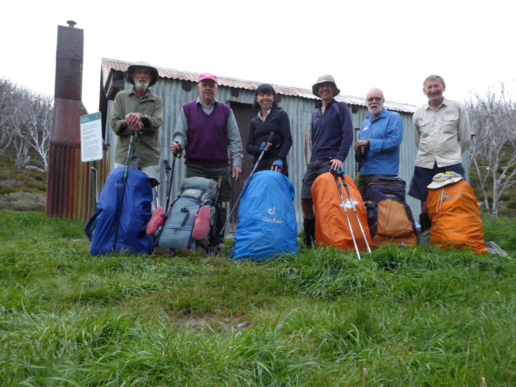
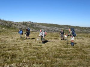
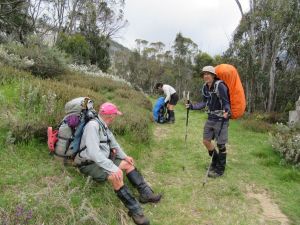
On an early November afternoon I set off with five bushwalking friends, Sam, David, Joe, Richard and Brian on a seven day, 60 kilometre cross country circuit from Guthega to Bluff Tarn on the upper Geehi, then to Tin Hut on the headwaters of the Finn River.
Our route started at Guthega Power Station and took in Whites River Hut, Gungartan (2068 m), The Kerries Ridge (2000 + m), Mawsons Hut, the Cup and Saucer (1934 m), Bluff Tarn, the Mailbox (1900 + m), the Brassy Mountains (1972 m), Tin Hut, the Porcupine (1960 m), and Horse Camp Hut via the Aqueduct Track.
THE WEATHER
The alpine forecast wasn’t quite what this leader was hoping for. Showers most days, starting with a possible thunderstorm for our first day on the track. Temperatures would be pretty friendly though: 7°C to 18° C . Apparently, our luck really would desert us on Friday, 6 days hence. A 90 % chance of 20 to 40 millimetres.
Upgraded later in the week to 100 millimetres. I was disinclined to hang around to test out that old saying that ” there is no such thing as bad weather, only unsuitable clothing”.
November is my preferred alpine hiking month. The weather is starting to settle; night temperatures are bearable, day temperatures are just perfect; and even light snowfall makes for magical walking. Water is abundant and easy to find.
Wildflowers are blooming but best of all, those nuisance bush flies and their high country cousins, the biting Horse/ March/ Vampire flies have yet to descend on the unsuspecting walker.
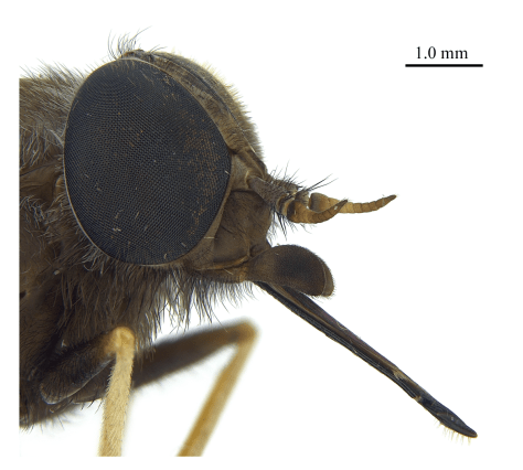
Horse or March flies appear as adults almost unvarying in the second week of December and hang around all the way through to February. Although they are called March flies they are rare in alpine areas in March.
These are large members of the Family TABANIDAE (genus Scaptia). March flies, at 25 mm, are the largest of our biting dipterans. The female does the blood sucking bit, while the benign male is content to feed on nectar and pollen.
On one mid-December Kiandra to Kosciuszko trip in 2006 with my friend Brian, March fly numbers were truly appalling. There was no escape from these pests. They operated on a sunrise to sunset roster and were so bad that it was unpleasant to stop for the vitals like meal breaks, water stops and even navigation checks.
They attacked with persistence and determination, and could bite through clothing with impunity. We often tried to find huts for meal breaks, but failing that, donned fly veils, rain jackets and long trousers or rain pants to keep the blighters at bay while we ate.
As Queenslanders, our preferred hiking apparel is usually shorts and short sleeved shirts, not thick rain jackets and long trousers. On the warmish December days the rain jacket/rain pants garb was not for the faint- hearted.

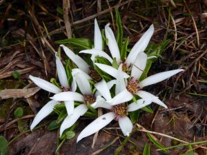
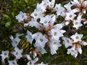
Alpine Wildflowers: Photos by Sam


More Information
Map: Geehi Dam: 1:25000.
Map: Jagungal: 1:25000.
Map: Tim Lamble: Mt Jagungal and The Brassy Mountains: 1:31680.
Green, K and Osborne, W: Field Guide to Wildlife of Australian Snow-Country. (New Holland 2012).
Hueneke, K : Huts of the High Country (ANU Press 1982).
Codd, P , Payne, B, Woolcock, C : The Plant Life of Kosciuszko. (Kangaroo Press 1998).
McCann, I: The Alps in Flower. (Victorian National Parks Assn 2001).
Slattery, D : Australian Alps. (CSIRO 2015).
Kosciuszko Huts Association: Website
Map of Bluff Tarn: Jagungal Wilderness : Kosciuszko National Park.
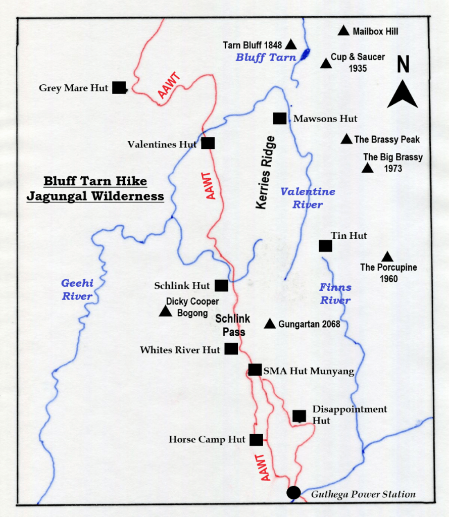
Sunday: Guthega Power Station to Whites River Hut: 8 kms.
With cars stabled at the Guthega Power Station we wandered off, ever upward. Sam, David and Richard setting a pretty lively pace under a low leaden sky. There were just enough irritating spots of rain to encourage the old laggards creaking along in the rear to lift our pace.
Mid-climb, a squadron of two-wheeling weekend warriors swooped around a blind corner. Braking furiously, some nifty controlled slides, a spray of gravel, and they were off again, pedalling downhill at speed. Eat my dust, Boomer.
Our mountain biking friends also anxious to reach cover before the heavens opened. Given my weighty rucksack, I too, could be sucked into this mountain biking game. Though I’m pretty sure that I would end up pushing said mountain bike up the current 250 metre ascent.
I may curse my heavy rucksack but mostly I am grateful for the good things its contents make possible: a snug downy sleeping bag, the protective cover of my little Macpac one-man tent, a comfy sleeping mat and a generous supply of crystallised ginger and chocolate licorice bullets.
By 3.30 pm we landed at Whites River Hut, disconcerted to find four tents moored on the creek flats below the hut. The tents belonged to a bunch of hikers from the Newcastle Ramblers Bushwalking Club, apparently intent on doing much the same circuit as we had planned.
No sweat. Plan B. They were no shirkers, these Novocastrian types. Instead of lolling around the hut for the afternoon (as I would have happily done), they struck out on a somewhat damp stroll across the tops from the Rolling Grounds to nearby Dicky Cooper Bogong (SMA 0113: 2003 m). The place name ‘Dicky Cooper Bogong’ recognises the the traditional Aboriginal custodian of this mountain, one Dicky Cooper.
Aborigines inhabited these highlands as far back as 21,000 years ago with evidence of their occupation coming from Birrigal Rock Shelter in Tidbinbilla Nature Reserve and many sites in the upper Snowy River. Small stone scatters can be found in the alpine landscapes with the highest being a collection found near the saddle of Perisher Gap (1800m).
It is well known that aborigines travelled to these highlands in the summer months to collect and eat the abundant Bogong Moths which were found sheltering in the rocky crevices of all the major outcrops in the Snowy Mountains. I have written extensively about this in my trip report Kiandra to Kosciuszko.

Many place names in the Alps have been derived from local Aboriginal languages: Jagungal, Jindabyne, Talbingo, Yarrangobilly, Suggan Buggan, Mitta Mitta and Tumut. It is not hard to find many other examples from your maps. Apparently the Geographical Place Names Board of NSW was considering giving Mt Kosciuszko a traditional Aboriginal name (Kunama) which would sit alongside its current name. But it hasn’t happened.

On dusk the predicted showers finally arrived, as did a damp and dishevelled clutch of boys and their teachers from Bathurst. No hanging out in comfortable huts for this lot: they pitched their tents in the rain, had a quick feed then quietly settled down for the night.
Meanwhile back at the ranch, Brian’s traditional first night treat of bangers and mash seemed to have spread like some medieval contagion. Most of my fellow hikers had succumbed to this dubious culinary delight and were enthusiastically whipping up dollops of instant mash leavened with green peas, sun-dried tomatoes, and heating neatly folded alfoil cylinders containing pre-fried bangers: beef for preference but maybe lamb & rosemary for those with more delicate taste buds.
Monday: Whites River to Mawsons Hut via Gungarten and The Kerries: 11.5 kms.
Showers overnight but with the mist lifting from The Rolling Grounds and Gungartan, things were on the up and up, weather wise. As were Brian and Joe, clanking about in the dark, soon after 5.30 am. Disturbing my slumber.
Our crafty Newcastle Bushwalkers friends still got the jump on us and had drifted off by 7.30 am. A comprehensive report of their walk can be found in the Kosciuszko Huts Association Newsletter: No 178 Autumn 2018. But we were soon hot on their heels desperate not to be pegged as a bunch of idle slackers.
Today’s walk would take us to Schlink Pass thence to Gungartan, down into Gungartan Pass, up along The Kerries to Mawsons Hut, tucked in a thicket of snow gums at the northern end of The Kerries. But first, the 300 metre climb from Schlink Pass to the Main Divide through snowgum forest.

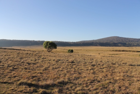
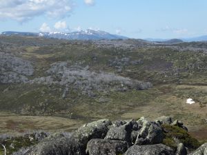
The Kerries Ridge (2000 m), a spur of the Great Dividing Range, offers open alpine walking at its very best… in fine weather. This trackless ridge is a landscape of huge granite outcrops and vast alpine meadows. Suffice to say by the time we were well into The Kerries traverse, we watched a succession of storm cells sliding along the high peaks to our north and west, heading our way.
Come lunchtime we hunkered down in the lee of a granite boulder, sheltering from the rain that Hughie dropped over us . I’m always a bit disconcerted to be caught out in the open alpine zone with distant lightning and thunder rolling around.
But my fellow travellers didn’t seem all that concerned as they disappeared into their rain jackets and munched contentedly on muesli bars, dry biscuits and slabs of cheese. The rain eased to light drizzle, and we moved out, heading north, following the crest.

A further four kilometres of alpine tramping dropped us down to Mawsons Hut. Joe and Richard navigated us off the heights and down to our destination. Pretty much spot on. Being tucked into a grove of snowgums, the hut can be a tad difficult to find. Mawsons was deserted. A Novocastrian-free zone. When we last saw them ambling across Gungartan Pass, they were heading for Tin Hut on the Finn River. Another afternoon thunderstorm and hail swept through, driving us into the hut to finish drying our gear and have a feed. No fry up tonight. It was strictly dry rations for the rest of the week for this lot.

Tuesday: Day Walk to Cup and Saucer, Bluff Tarn and The Mailbox: 7 kms.
Fine weather and an easy day walk called us to the hills on our third day. From Mawsons we would cross the Valentine River; scamper up the Cup and Saucer; cut across the grasslands of the upper Geehi to Bluff Tarn; returning to Mawsons via The Mailbox. That was the plan and for once I stuck to it.
We left Mawsons in brilliant weather. A superb day of walking beckoned. We dropped down to the Valentine which still flowing strongly from the spring thaw but we sussed out a partly exposed gravel bed. Richard, Brian and Joe volunteered to check it out. Sacrificial lambs. I am told that there is nothing so grumpy as a leader with wet boots this early in the day.

The Cup is a granitic dome ( Happy Jacks Monzogranite: < 20 % quartz) sitting on its saucer, a shelf of nearly horizontal granitic rock. This Silurian granite is 444 to 419 my old and dates from a time when the Earth entered a long warm phase which continued for another 130 million years.
Oceanic life flourished and vascular plants increased in size and complexity. The supercontinent Gondwana drifted south and extended from the Equator to the South Pole. Australia was located in the Equatorial zone.
From a distance the Cup and Saucer are well named and form an unmistakable landmark for kilometres in all directions. Topping the Cup is an old Snowy Mountains Authority Trig 133 standing at 1904 metres. This was our first objective. From the top of the Cup we should be able to see a line of travel across to Bluff Tarn.

It was only one and a half kilometres to the Cup but swampy ground made our approach more circuitous than I anticipated. My original plan was to clamber up the long south western ridge to reach the Trig. But the final steep and damp and moss encrusted granite slabs thwarted all but Brian. Unsurprising really. His friends call him “Straight Line Brian”.
Contouring or backing off isn’t part of Brian’s bushwalking lexicon. But the rest of us were content to retreat and scarpered up the more accessible northern face … without any further difficulties. Where upon we settled on the rock outcrops to take in the landscape and enjoy a leisurely morning tea.

From the summit of the Cup and Saucer unfolded a vast alpine panorama. To the east rose up the high range of the The Brassy Mountains, part of Australia’s Great Dividing Range system. To our east was the valley of the Geehi River and its tributary, the Valentine River.
Directly to our east and just below our vantage point is the Big Bend. Here the Valentine swings off its northerly course to flow south-west another six kilometres to its junction with the Geehi. No doubt the granitic dome of the Cup and Saucer forms a structural control over the direction of flow of the Valentine.
To our north , less than a kilometre across the swampy headwaters of the upper Geehi valley was Tarn Bluff (1900 m) with Bluff Tarn tucked somewhere still out of sight.
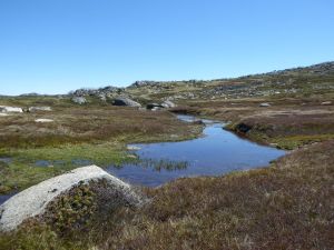
Bluff Tarn
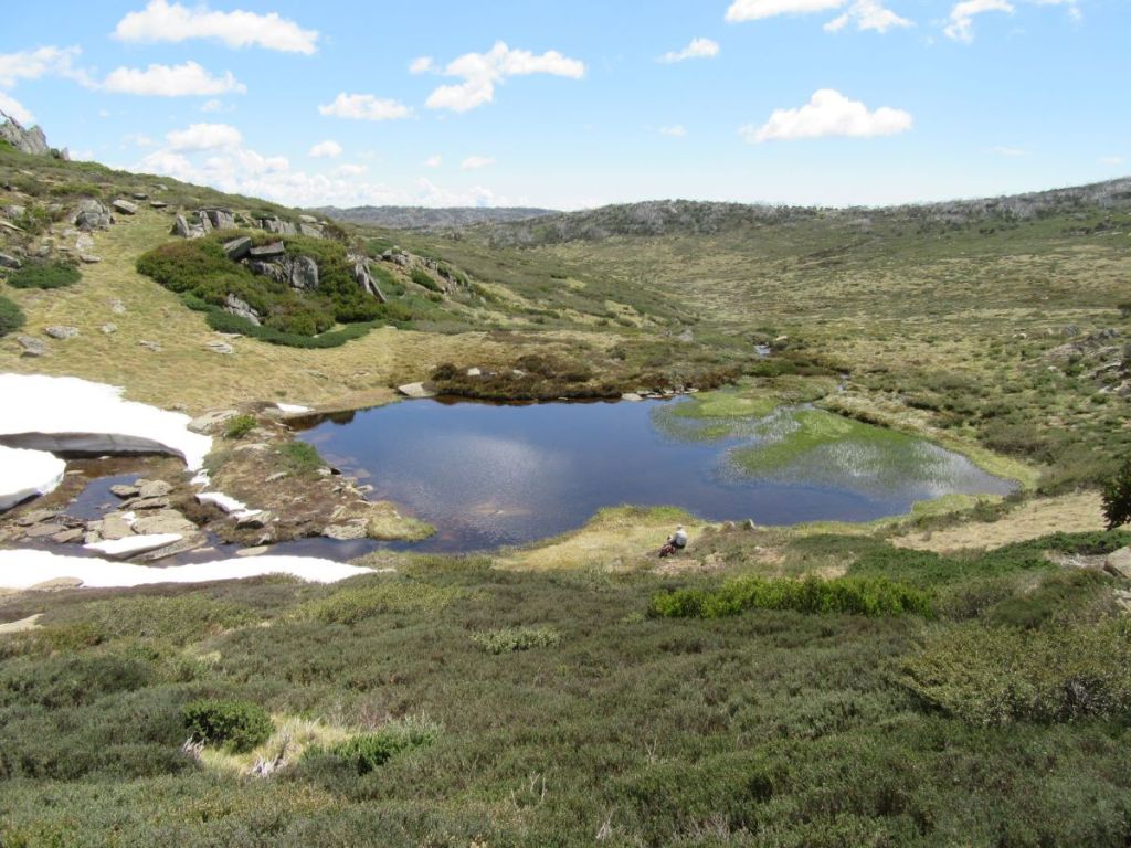
Bluff Tarn certainly met our all our expectations. It is, indeed, “one of the prettiest spots in the mountains”. But is is not, strictly speaking, a tarn. Merely a lake. My inner pedant would tell you that a tarn is “a small mountain – rimmed lake, specifically one on the floor of a cirque”. No cirque here. But quibbles over geographical precision couldn’t detract from the beauty of our surroundings.
While Bluff Tarn is a small lake, it is fed by a major headwater tributary of the Geehi, with the stream cascading through and over large rounded boulders. The lower reaches of the cascades were still covered by a thick snowbank, even though we were only a few days short of the start of summer.
I’m not sure of the origins of Bluff Tarn, but it appears to be formed as a shallow pool fed by the cascades dropping over a shelf of harder rock. Its outlet was restricted by a prominent bank of coarse, unsorted gravels. It would have been interesting to spend more time checking out Bluff Tarn but the worms were biting and my fellow walkers had lost interest in playing in the snow and my geological musings. They were itching to move on for their lunch break.
Our lunch spot was Mailbox Hill about a kilometre due east of Bluff Tarn … first though, one of Brian infamous uphill flat bits to raise a sweat and develop a healthy appetite for lunch. The Mailbox or Mailbox Hill, your choice, is a series of rounded outcrops standing at about 1910 metres. It was named The Mailbox because, I guess, mail was collected there by the cattlemen in the days of summer grazing.
The Kosciuszko Huts Association, my alpine bible, have researched the origin of the placename: Post was delivered to the men on the lease by a Mrs Bolton. She was engaged to deliver the mail on horseback to the Grey Mare Mine, travelling the old dray route from Snowy Plain across to Strumbo Hill. Ernie Bale recalled that on Mailbox Hill “there was a clump of rocks and they had shelves in them and she used to leave the mail for Mawsons Hut – it was always known as the Post Office – she used to leave the mail and put a rock on top of it“.
After a leisurely lunch spent sprawled on slabs of rock well out of the reach of those pestilent little black alpine ants, we wandered off towards Mawsons keeping a weather eye on the clouds building over The Kerries. But not before some male argy bargy about its location.
Later in the afternoon our Newcastle friends arrived from Tin Hut while the males were down at the creek having sponge-downs. We spent a very congenial evening around the campfire trading tall tales, listening to their hiking stories from far flung parts of the globe and getting some very handy gear tips from Shayne.

Wednesday: Mawsons Hut to Tin Hut: 8.5 kms.
A pleasantly cool and clear high country morning. By 8.00 am we were packed and on the road. Our route would take us across to the western bank of the Valentine then a gentle 80 metre climb following an old fence line that is marked on my old Tim Lamble map.
Tim’s maps, if you can get hold of one, provide a plethora of details useful to the bushwalker and skier: rock cairns, old fence lines, posts, old yards and even magnetic bearings. Anyone interested in maps will appreciate the quality of Tim’s cartography.
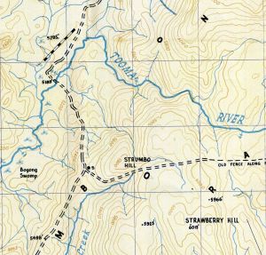
We followed the fence line up to a low rocky knoll overlooking the north-south trending Brassy Mountains (1900m), directly in front of us. Klaus Hueneke in his well researched Huts of the High Country (ANU Press 1982) gives an explanation of the naming of Brassy Mountains .. “named in the early days on account of the reflection from running water over rocks. At certain times this resembles polished brass and can be seen from up to 16 kms away.”
A navigation huddle soon sorted out our next moves. The Brassy Peak (1900 m) was directly in front of us while The Big Brassy (SMA Trig 1972 m) was off to our south east, directly behind The Brassy Peak. But between our eyrie and The Brassy Mountains were the swampy headwaters of Valentine River.
I had originally planned to follow the main divide of the Brassy Mountains south to Tin Hut. But an easier option was simply to cross the swamp and then contour along the western base of the Brassies keeping the thick heath just to our left but staying above the fens and bogs of the Upper Valentine to our right ... sound strategy in theory.

But before we trundled off towards Tin Hut there was plenty of time to clamber up to the rock cairn sitting atop The Brassy Peak. From here we looked westward over the vast network of fens and bogs of the upper Valentine to the craggy outline of the Kerries Ridge which we had traversed three days ago.
Bogs and Fens
The upper Valentine is a wide alpine valley of impeded drainage: a fluvial landscape of bogs and fens. A fen is a specific geomorphic and botanical entity: namely still clear, pools of standing water with ground-hugging matted plants and the easily recognisable Tufted Sedge, Carex gaudichaudiana. A number of small but showy flowering plants manage to thrive in these waterlogged conditions: the pale purple Mud Pratia (Pratia surrepens), the pale cream or white Dwarf Buttercup (Ranunculus millanii) and the white Rayless Starwort (Stellania multiflora).
Bogs are areas of wet, spongy ground also found in areas of impeded drainage. Floristically bogs are dominated by Spagnum Moss (Spagnum cristatum) and associated with a variety of rushes and sedges, especially the Tufted Sedge. Bogs are associated with the decomposition of organic matter which will ultimately form peat.
These high alpine valleys are commonly underlain by peats formed by the decomposition of plant material after the last glacial period (15000 years ago). The peats are important for absorbing and regulating waterflows in alpine Australia, thus are listed as protected communities under both State and Federal legislation. (PS: tell that to the brumbies).
So with sodden boots and a sense of achievement we pulled into Tin Hut after a full morning’s hiking; just in time for another well deserved bite to eat. Always looking for the next feed. Tin has a bit of reputation for being difficult to locate in bad weather and is hidden in a belt of snowgums. But with fine , clear skies this was no issue for us.
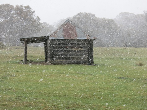
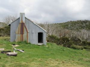
Tin Hut
Tin is the oldest hut in the High Country built specifically for ski touring. Its origins go back to Dr Herbert Schlink’s attempt at the first winter crossing from Kiandra to Kosciuszko. Schlink needed a staging post for his final push along The Great Divide. In the summer of 1925/1926 a bespoke hut was built on the site of an old stockmans’ camp at the head of the Finn River. As 2017 was the 90th anniversary of its construction, our visit was timely.
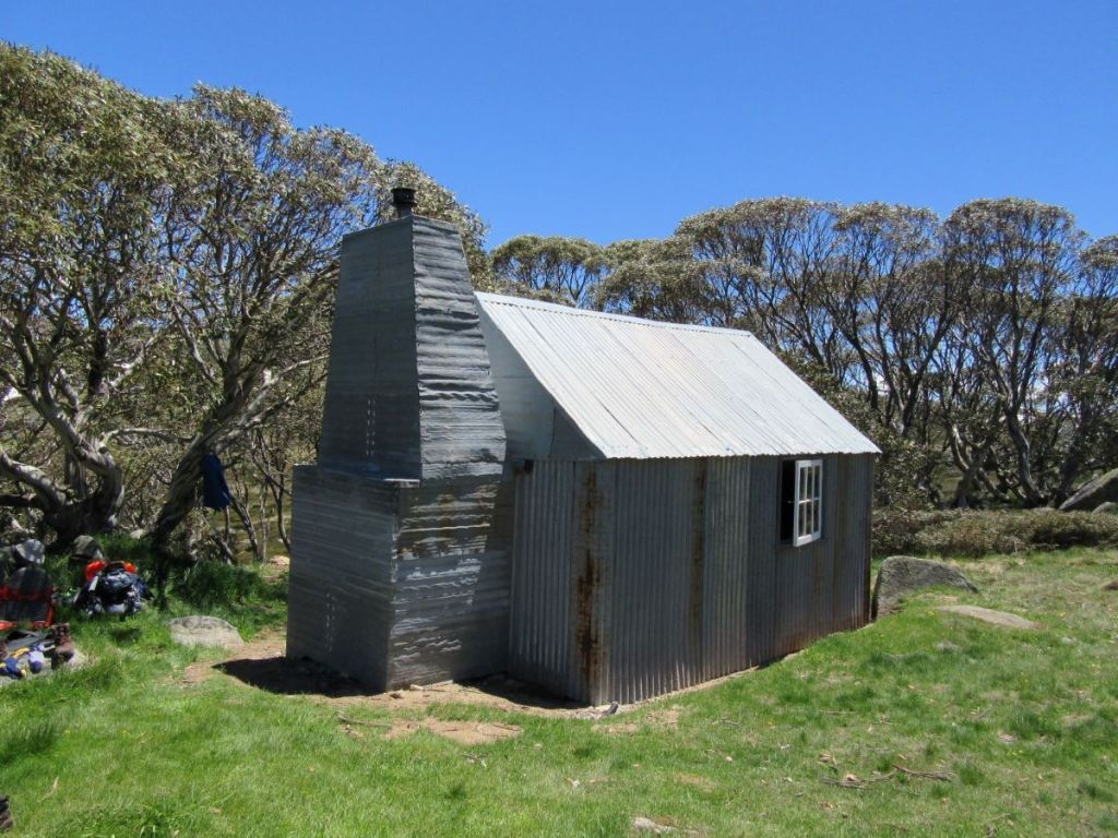
It is called Tin Hut because the roof and walls are constructed of corrugated iron. Some of the timber and iron for its construction was packed in by horseback across The Snowy Plain and The Brassy Mountains. It had a wooden floor and was lined with tongue and groove with the door opening to the east. Initially it was stocked with a horse rug, 24 blankets, a stove, tools and firewood. When Schlink’s party arrived from the south, a blizzard trapped them in the hut for three days, forcing them to give up the 1926 attempt.
On 28 July 1927 Dr Schlink, Dr Eric Fisher, Dr John Laidley, Bill Gordon and Bill Hughes skied out of Kiandra to reach Farm Ridge Homestead on the first night. Excellent snow cover allowed them to reach Tin Hut by 1.00 pm on the second day. They pressed on to the Pound Creek Hut (now Illawong Hut) on the second night. They completed the first winter traverse finishing at Hotel Kosciusko on the third day.
In 1928 Tin Hut served as the base for two winter attempts to Mt Jagungal. The party led by Dr John Laidley skiing to the summit…. for just the second time in history.
In 2017 restoration work on Tin commenced with a partnership between the Parks Service and the Kosciuszko Huts Association. Men, gear and materials were helicoptered in for the major facelift. One KHA member, Pat Edmondson, eschewed the helicopter ride and walked in from and out to Schlink Pass. Pat was over 80 years old. I can only hope that I can still climb from Schlink Pass to Gungartan when I turn 80.
Afternoon stroll: Tin Hut to The Porcupine & Return: 5.5 kms.
Brian, ever keen on filling in his (and our) afternoons, decided that we shouldn’t waste time hanging around the hut. A more productive use of our time would be a quick jaunt over to The Porcupine, a nondescript alpine ridge (SMA 0109 :1960 m) which separates the Finn River from the Burrungubugge River.
From the hut we climbed the long ridge behind the hut to a knoll from which we could look across to the Trig on The Porcupine. Unfortunately, a very steep drop into a saddle then a climb back up to the Trig separated us from our quarry on this decidedly warmish afternoon.
Brian and his co-conspirators Richard and Joe were still keen as mustard, happy to descend and climb up again onto The Porcupine Ridge. David and Sam seeing the lie of the land, sensibly returned to Tin Hut for an afternoon of leisure. The walk to Porcupine is a scenic enough walk, but on reaching The Porcupine ridge I observed that the heat was getting to them and so the lads weren’t pushing me to go any further. Bless their little hot socks.
We waddled back, avoiding the dreaded climb back up the knoll and reached Tin about 4.00 pm and set about a major rehydration, downing multiple cups of tea, soups and choc-au-laits. An evening perched around the campfire finished off a very satisfying day.
Thursday: Tin Hut to Whites River Hut : 7.5 kms

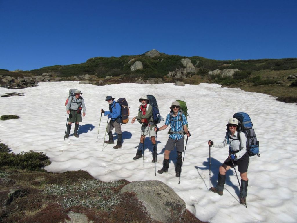
The easiest route to Whites was to climb the long ridge which separates the Valentine and Finn Rivers, keeping Gungartan to our west. An ascent of a mere 200 metres vertical, but with dense knee-high heath and the odd snake or ten lurking underneath, it seemed endless.
One snake had decorously draped its ectothermic body across the top of a heath bush, obviously hoping to warm up in the feeble sunlight and frighten the bejesus out of a passing bushwalker.
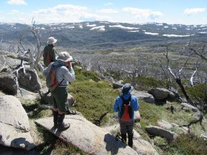
Once on top of the Great Dividing Range we bypassed Gungartan, skirting around its rocky spine until we had a view of Guthega Village.

Time for a snack stop, perched atop huge boulders. A well tested strategy to keep out of the clutches of the maurading hordes of those little black alpine ants that swarm over any rucksack carelessly tossed on the ground. More disconcerting is their ability to overrun boots, climb up gaiters and finally ascend the thighs of any alpine rambler. Trying summer camping in Wilkinsons Valley and tell me how it goes.
Alpine Ants: Iridomyrmex sp.
The ants are probably Iridomyrmex sp, which my copy of Green and Osborne’s Field Guide to Wildlife of the Australian Snow-Country tells me are ‘ a conspicious part of the fauna in a few habitats, such as herbfield and grassland…. this omnivorous ant is the only common ant species in the alpine zone.’
It nests in waterlogged areas such as bogs, fens and wet heaths, and raise their nests above the water surface by constructing a mound of plant fragments in low vegetation. They are also found in tall alpine herbfield and dry heath.”
From our rocky eyrie we were treated to superb views across this small patch of Australia’s alpine wilderness. Time also for a weather update from duelling smartphones. Tomorrow: (Friday): 90 % chance of 20 to 40 mm. Maybe 100 mm. No arguments about pulling out a day early.
After a good laze around we skirted Gungartan and commenced the long descent to Schlink Pass (1800 m). Landing in the pass, a mutiny of the “are you stopping for lunch ? “ type broke out. Ever the considerate leader (probably not) , I caved in and we propped for lunch. Whites River Hut only one tantalising kilometre downhill.

We reached Whites River Hut soon after 2.00 pm. No interlopers on the radar so we had the place to ourselves. Despite tomorrow’s unfriendly weather report everything here was pretty relaxed. The usual suspects weren’t badgering for an afternoon walk (unusual), the weather was warm and sunny so a lazy afternoon beckoned.

We enjoyed a quick cat lick in the nearby icy snow-fed creek…. very quick, did any washing then spread clothes out to dry. The rest of the afternoon was filled with consuming cups of tea/coffee/soup; horse trading of leftover goodies, cutting wood, firing up the stove and reading whatever came to hand. Inside the hut were recycled Kosciuszko Hut Magazines and the hut log book.
Over the years the Whites River Hut log has provided us with many hours of very entertaining reading: the adventures of Bubbles the Bush Rat; the trolling of some trip leader called Robin and heaps of very well executed drawings and cartoons. Mr Klaus Hueneke should write a book about this stuff.
Friday: Whites River Hut to Guthega Power Station via Aqueduct Track and Horse Camp Hut: 10 kms.
I peeked out. Heavy roiling clouds were brewing over Gungartan and heading our way.

By 8.00 am we had beetled off along the Munyang Geehi road before swinging off onto the Aquaduct track which crosses the Munyang River via a weir. Nearby is an old SMA hut…locked to keep that mountain biking, skiing and bushwalking riff-raff out. Especially those dastardly mountain bikers.

The Aquaduct track is a gem of a walk. It winds above and parallel to the Munyang River, weaving around the hills on the 1800 metre contour. My kind of walking.
Mid morning we lobbed into the refurbished Horse Camp Hut for a final feed. I had been to Horse Camp before, returning from an early spring walk to Mt Jagungal with my youngest son. We got to Horse Camp just on dark. I remember how bitterly cold it was, how daggy the hut was and how our evening meal was pretty sparse, even by my standards.

Since then the Kosciuszko Huts Association and the Parks Service had been very busy and the hut was looking very spruce indeed. Unlike the young guy who had taken up residence in the hut. He was obviously there for the long haul or maybe the end of the world and had somehow dragged in all manner of heavy duty camping gear.
Horse Camp Hut
Horse Camp is a two room, iron clad hut set in a belt of snow gums under The Rolling Grounds. Its construction history is a bit fuzzy but was built initially in the 1930s as a shelter for stockmen working the snow lease owned by the Clarke brothers. It has the main elements of a traditional grazing era mountain hut with a bush pole frame, steeply pitched gabled roof, clad with short sheets of corrugated iron that could be packed in on horses.
At some stage over the decades it was partitioned into two rooms – a northern bunk room with a pot belly stove and the main kitchen room. A ceiling loft was added as well as a wooden floor and nifty three panel narrow windows. Several of the modifications were done by the Snowy Mountains Authority in the early 1950s. The SMA used Horse Camp as a base for their horseback survey teams working on the first Snowy Mountains Project, the Guthega Dam and associated infrastructure.

Leaving our young prepper friend to his preparations for the Covid 19 lockdown, we drifted off. A quick descent to the Guthega Power Station to find our vehicles waiting patiently in the car park, wheels and windscreen wipers still attached, and ready to transport us back to Canberra. But not before we detoured into the Parks Visitors Centre Parc cafe in Jindabyne for a selection of their satisfyingly greasy offerings, all washed down with a decent coffee.
As always, a big thank you to my band of merry bushwalking companions: Sam, David, Joe, Richard and Brian. May we enjoy many more rambles in the back blocks of Australia’s magnificent High Country.