By Glenn Burns
Sundown is a remote and rugged National Park a mere thirty kilometre stone’s throw to the south-west of Queensland’s very popular Girraween National Park. My bushwalking friend Brian and I have, over the years, traipsed many a kilometre along the Severn River in Sundown. This is an account of one of our many expeditions in Sundown.
Brian, ever the expedition genie, had again conjured up yet another ‘exploratory’ trip covering central and northern Sundown. This time we would venture high up onto the Roberts Range which marks the southern boundary of Sundown and forms the state border between Queensland and New South Wales. The only fly in the ointment was our intended access to the Roberts Range, over Mt Donaldson. Those who have tramped this way before will recall the swathes of dense undergrowth with a certain sense of trepidation.
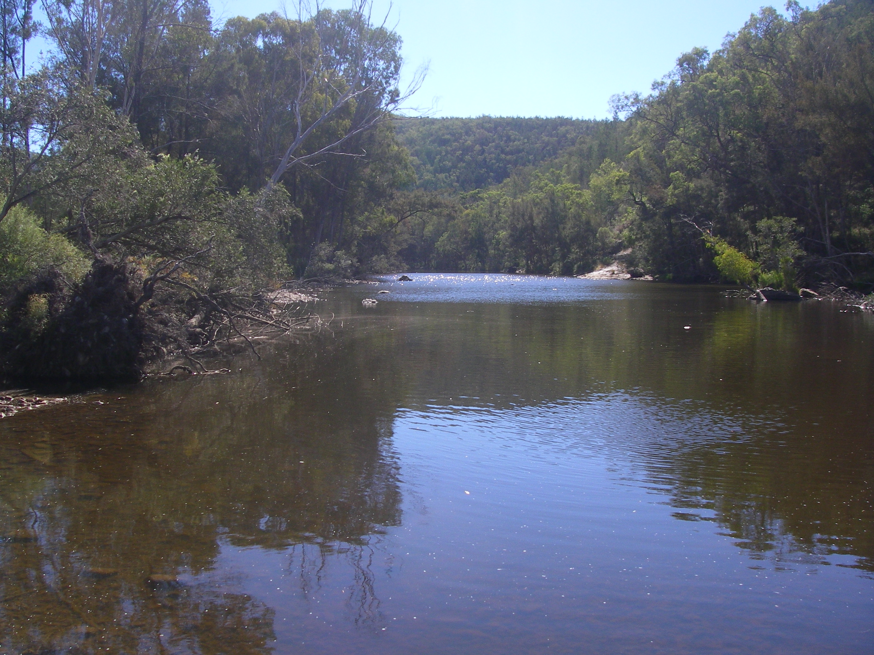
Sundown is said have been given its name by old bushmen who thought that its valleys were so deep that it was always ‘sundown’. It is a spectacular landscape. Named after the Severn River in England, this deeply incised antipodean Severn, with its waterholes, cool side gorges and waterfalls makes for relatively benign walking.
But away from the river, Sundown can be inhospitable. Dry, stony ridges rise to well over 1000 metres, the so-called ‘traprock’ country. The highest hills are invariably smothered in tangled thickets of Peach Bush, Cough Bush, Hop Bush and other shrubby pleasures like the prickly Dead Finish: all right up there in nuisance value with wait-a-while and lantana.

The lure for me in all this was that we would be following the old Roberts Range border survey line set out in 1863 by Francis Edward Roberts, Queensland Government Surveyor and Isaiah Rowland, Robert’s counterpart from New South Wales.
Although Brian and I had walked a small section to the south-west several years ago, we could now complete another leg over the highest part connecting Mt Donaldson and the old Sundown homestead site. My fellow expeditioners, experienced throughwalkers all, were quick to sign up to four days of the rumoured slacking down the Severn, early finishes, superb high range campsites and heaps of firewood for our evening fires. Buyer Beware.
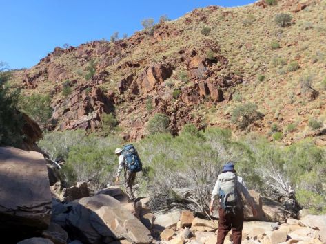
Wednesday 25 April: Sundown Homestead site to Red Rock Creek: 5.5 kms.
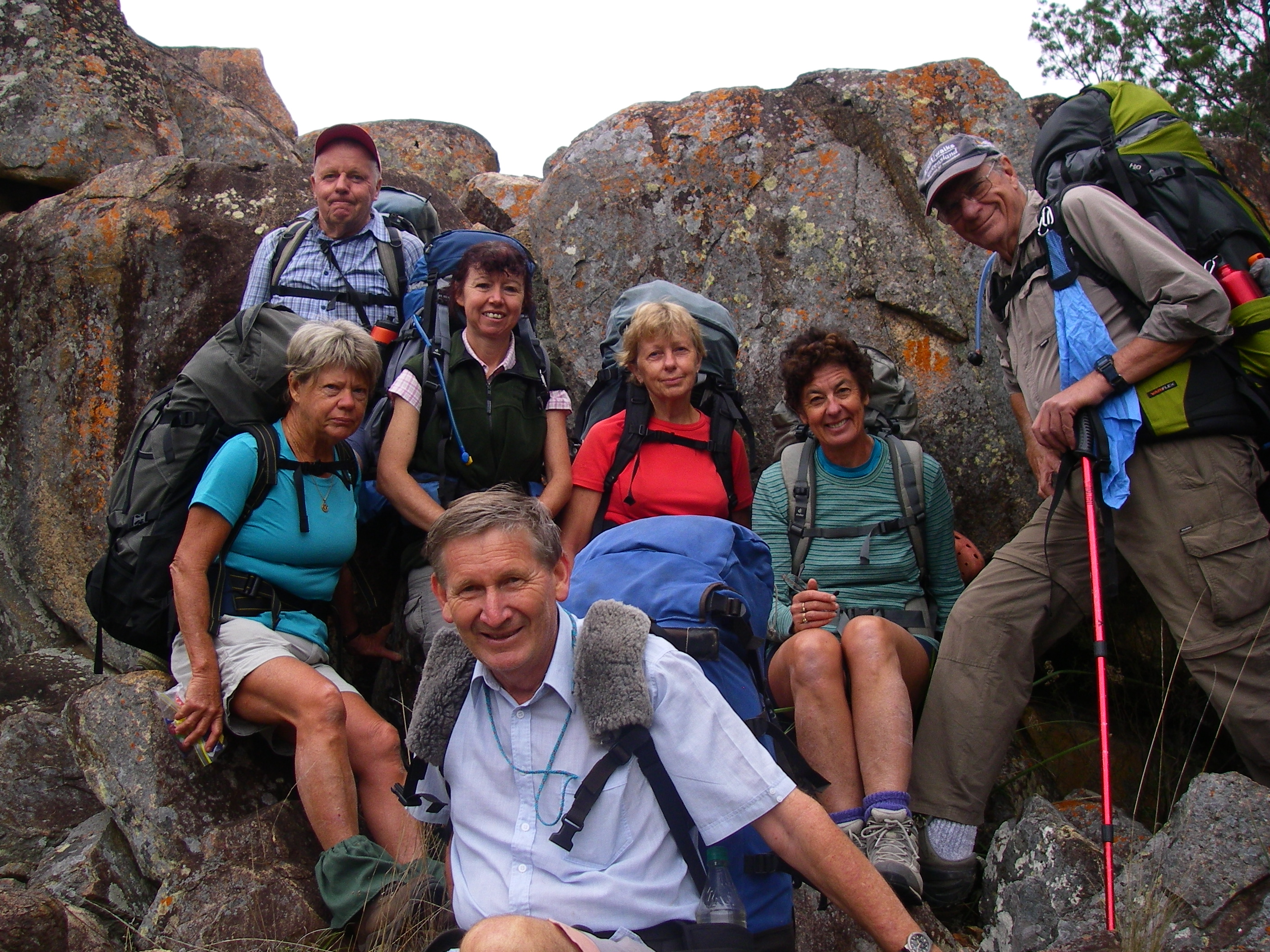
Eight bushwalkers mustered at the old Sundown Homestead site on a decidedly coolish Granite Belt afternoon: Brian (leader), Alf, Christine, Jenny, Roland, Sally, Samantha and one well rugged-up scribe. Temperatures had dropped to a nippy 14°C as a blustery 40 kph sou’westerly swept in.
Hardly unexpected, as this is Queensland’s coldest district, with eight months recording temperatures below 0°C. Sundown’s Park HQ at The Broadwater has recorded a creditable minus 8°C. Fortunately the average minimum for April is a more comfortable 9.5°C.
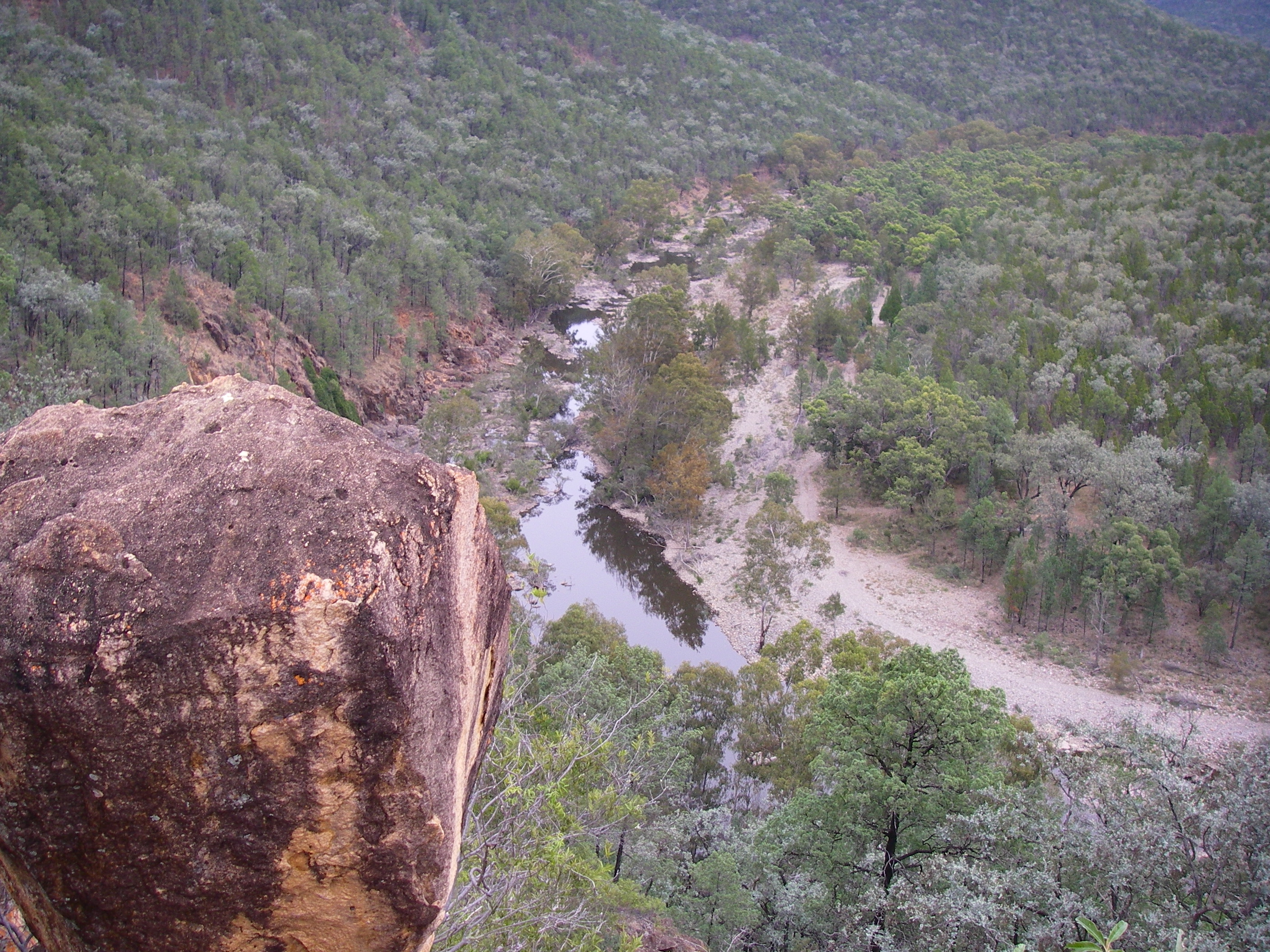
But cool was cool for our five and a half kilometre uphill walk in along the old 4WD track to our Red Rock Falls campsite. For those humping in their supplies of birthday cakes, apples, sourdough rye bread, cheeses, a hogshead of red wine and a hundredweight of juicy Kalbar carrots, the track kindly winds its way ever so gently upward, a modest height gain of only 160 metres from the homestead. At the base of Hill 983 (metres) we shrugged off our well-stocked packs for the short walk into Red Rock Falls Lookout.
Map of our hike in Sundown National Park

Map of Sundown National Park: Source Geoscience Aust. 1:250,000
Geology of Sundown and Red Rock Falls
From the lookout, the full story of Sundown’s geology and topography could be read in the landscape revealed before us. This rugged terrain had its origins in the Devonian-Carboniferous Period some 370 to 290 million years ago. Sediments from a volcanic mountain chain on the eastern edge of the Gondwanan continent were deposited on the continental shelf and later avalanched into deep ocean trenches. Thick beds of sands, silts and mud were compressed, hardened and deformed, producing the very hard metasedimentaries of the Texas beds.
In a later episode of mountain building, the metasediments were uplifted, tilted and fractured to form a mountain chain, the remnants of which are the ridges and hills of Sundown. Later, during the Triassic (248 -213 million years ago) a small body of Ruby Creek Granite was intruded into the Texas Beds and now outcrops at Red Rock Gorge and Jibbinbar Mountain to the north, but also triggered major fracturing of the Texas Beds.
It was also responsible for the mineralization of the Texas Beds and the formation of Rats Castle, a granitic dyke. For a detailed explanation of the geology of Sundown NP go to Warwick Willmott’s excellent tome: ‘Rocks and Landscape of National Parks of Southern Queensland’ .
But for now, our immediate attention was drawn to the Red Rock Falls. Currently dry.
By way of compensation, there were panoramic views along the red cliff lines which plunge a good 50 metres to the Red Rock Creek gorge below. In reality the granite cliffs are sandy in colour when freshly broken, but have been stained red by lichens on undisturbed surfaces.

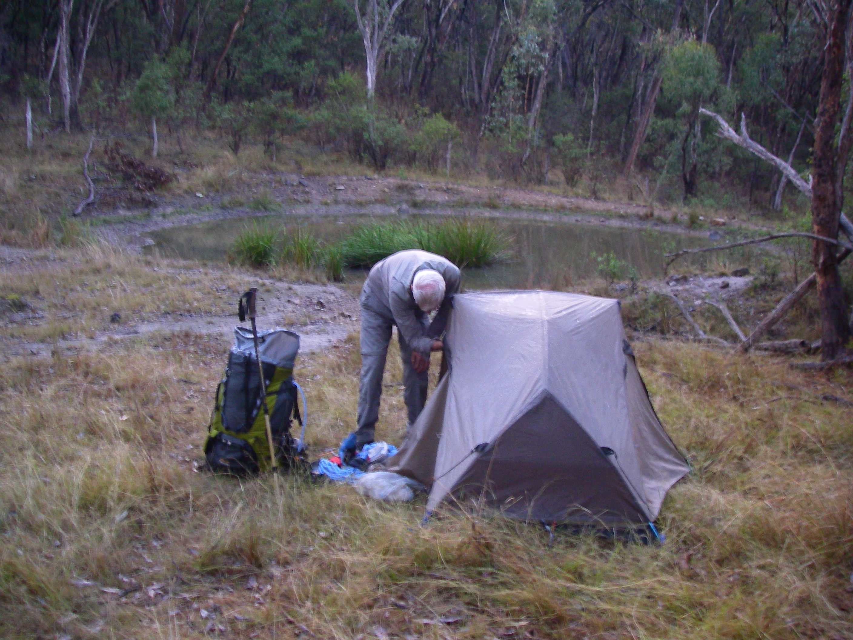
The touristy bit done, we mooched back to retrieve our packs and strode off to our first overnight campsite. A Sundown Hilton. Grassy, level tent sites, plenty of water and ample firewood. After my 5 am start and the tedious drive to Sundown, a Bex and a good lie down beckoned.
I had barely thumped in my last tent peg when Brian, whose largesse never extends to free time, rounded up the lethargic and indolent for some late afternoon exercise down Red Rock Creek to peer over the falls.

Thankfully the biting sou’westerly gusting up the cliff face quickly dampened any corporate enthusiasm for poking around and the natives were unusually restless. Brian did manage to steady his now pretty toey charges long enough to point out a brownish smudge on the horizon, which he insisted was the grassy knoll where we would have morning tea on the morrow.

Back at the campsite firewood was scrounged, the fire lit, and cups of soup, tea and coffee brewed. And as the light faded from a sailor’s delight sky, the bush chefs gathered to whip up an epicurean extravaganza. Brian resorted to an old favourite of his, bangers and mash with a side dish of green peas.
But for my money, bangers and mash or all those Backcountry Pantry roast lambs and veg didn’t compare with Jenny’s culinary coup, a Scotch Devil. A hard-boiled egg covered with crumbed sausage meat and deep fried. A meal fit for any claymore-wielding Highlander and a kilojoule king-hit capable of propelling Jenny to Jupiter and back.
The Song of Roland
Meal over, we warmed our bottoms over the crackling fire while Roland regaled us with one of his many tall tales, occasionally true. Not ‘Roland and the Midnight Koels’ this time, but ‘Close Encounters of the Dingo Kind’ set in The Valley of Giants, Fraser Island. I recall another of Roland’s dingo dingles in Central Australia when Brian, Bernard, Di Hoopert and I were due to link up with Roland at Furnace Gully near Redbank Gorge on the Larapinta Trail.
After two days of cross country travel from Mt Zeil and many ‘Cooees‘ and ‘Roowlaands‘ we finally looked down on a disconsolate Roland perched in a baking, bleak and windswept gully, the ultimate Mars landing experience. A black and tan dingo was slowly prowling the perimeter of the campsite, patiently stalking its prey in ever decreasing circles. Suffice to say Roland was mighty pleased to see us.
Back in Sundown it was off to bed for these little puppies, lulled to sleep by friendly frog calls and the distant rush of wind through the trees on the high ridges above.
Thursday 26 April: Red Rock Ck to Burrows Waterhole: 8.5 kms.
5.15 am. Birthday boy Brian was already on the move. The usual clanking of billies and mugs, stirring up the campfire and dispensing cups of tea and coffee to all and sundry. Other bleary-eyed bushwalkers gradually trickled out into a crisp Granite Belt morning, 1°C, grateful for a warming fire.
While the others hovered over the fire I waddled off to check out a small mullock heap and mine pit that Brian had found nearby. Sundown was the site of a number of mines producing molybdenite, tungsten, copper, arsenic and tin. In fact, the first tin deposit found in Australia was on the nearby Nundubbermere Run in 1854.
Mining at Sundown
The Sundown Tin Mine opened in 1893 and operated until 1923 when it closed only to re-open in 1953, finally closing in 1956. It was by far the biggest producer in the area but other mines were Carpenters Gully, The Orient, and Beehive. Copper sulphides were worked at The Sundown Copper Mine (1888 to 1908) and nearby Comet Mine. Arsenic was extracted in the early 1900s at Beecroft (1917 to 1927), Sundown Copper (1922 to 1924) and The Orient (1918) mines.

Arsenic was an important constituent in prickly pear poison, cattle dips and a hardener for the lead in bullets. Unfortunately arsenic oxide treatment has contaminated Little Sundown Creek and I have read that walkers are advised not to drink the water in Little Sundown below the mines.
Fortunately small mineral lodes, lack of water and poor access ensured any further exploitation in Sundown Resources Reserve was temporarily off the agenda. But this could all change under any future governments. The Sundown Resources Reserve does not have the same level of protection as its surrounding national park.
In fact, during the 1980’s a mineral exploration company had been sniffing around the Severn River Fracture Zone west of the old Sundown mines and discovered bulk low-grade tin. But as Queensland’s former Premier Joh Bjelke-Petersen was apt to say to those pesky greenies, bushwalkers and press hacks: ‘Now, don’t you worry about that.‘
0r the even more confusing: ‘ We’ll come to that bridge when we’ve crossed it’.
By 7.45 am the party rolled out, climbing steadily the 100 metre altitude gain to Hill 1032. Strange, this climbing bit, given that Brian had described today’s route as a ‘downhill day’. Alf, ever the agent provocateur, inquired: ‘ Is this another of your uphill flat bits, Brian?’
But after Hill 1032 we indeed dropped down a long steepish 4WD track that took us through the Sundown Resources Reserve and finally up onto Hill 731, our morning tea spot, as promised. Sally produced a delicious pineapple cake while I unearthed the ginger cake that Judy had baked for Brian’s birthday bushwalking bash.
A round of ‘Happy Birthday, Brian’ echoed through the hills while Brian huffed and puffed and finally blew out his three little candles. We wolfed down great slabs of birthday cake, sat back and took in the views back up to Red Rock Falls, three kilometres hence.

Our final descent of the morning was the 250 metre drop to Pump Waterhole on the Severn. This proved to be slowish work, gingerly picking our way down a steep hillside mantled with loose traprock. On the way down Alf called us over to inspect a pile of bleached bones: ‘ Come and have a look at these bones… hey Brian, are these walkers from your last trip?’
Pump Waterhole probably takes its name from the fact that the Severn River was the source of water pumped up to mines or to stock tanks.
An hour later we ambled into Reedy Waterhole, lunch stop. I always take a wolfish interest in other bushwalkers’ food. Roland’s lunch today, for example, was distinctly continental: crusty sourdough rye bread, substantial slabs of cheese and several of those scrumptious carrots that he had carted in.
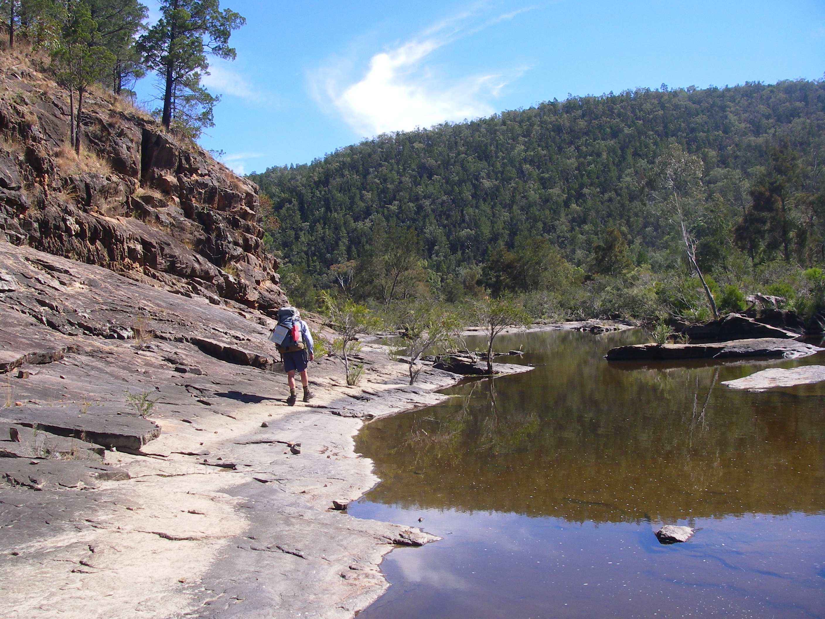
Burrows Waterhole Campground
After another half hour of rock hopping and two river crossings we strayed into Burrows Waterhole for an early mark. Brian’s fear that this official campground would be infested with squadrons of 4WDers was unfounded. A 2.30 pm finish.
Unprecedented in the annals of Manuelian throughwalking. Burrows, a very large waterhole, was named after Fredrick James Burrows, a WW1 veteran who suicided in 1934 and his grave is said to be on the northern side of the river.

A Swims all round and an afternoon of unstructured mooching stretched ahead. Ever the wily coyote, I kept stumm about Fredrick Burrow’s nearby gravesite for fear of whetting Brian’s appetite for local history and back to back afternoon rambles.
Anyway, the horses had already bolted. Jenny and Christine drifted off to check out the only other inmates of the campground; Samantha was engrossed in platypus watching; Sally sudokued; Roland brewed coffee, while Brian, predictably, kept himself busy rustling up the firewood and on matters navigational.
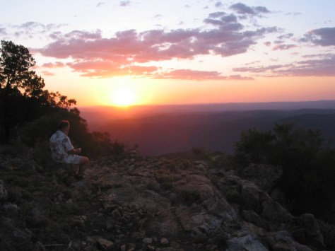
Sunset came with another red sky, Venus and Mars peeking above the western horizon. The dark and cold folded in around us. So like the dingoes of Central Australia, our little pack crept ever closer to the warmth of a blazing campfire.
Brian’s birthday bacchanal cranked up again, fuelled by more portions of birthday cake and washed down with a pannican of Alf’s finest vintage red wine. Or so he claimed. But by seven o’clock party pooping types headed for their snuggly sleeping bags.
So off we all tottered. Jenny for her Middlemarch fix, Brian to Agatha Christie, a turgid French novelist for Christine, travel stories for me, Alf to play cards, Sally to Sudoku, and Samantha to catalogue, classify, and coordinate her hiking kit in preparation for an early start tomorrow.
Friday 27 April: Burrows Waterhole to Stony Ck Junction via Rats Castle: 9 kms.
Woken at an ungodly 5 am and not by the instantly recognisable “zzzzip” of Brian’s tent. No, the guilty party was Samantha noisily rummaging around in her tent; re-reorganizing her gear so it was all ship-shape in Bristol fashion.
I crawled out. Pitch black. An hour and half later, as first light tinged the eastern sky we luxuriated in the balmy 7°C conditions; the cloud and humidity a harbinger of the predicted rain due on Saturday.
Today we were off to Stony Creek junction via Rats Castle. Stony was our jumping off point for the climb to Mt Donaldson and the Roberts Range. Rats Castle is a well known Severn River landmark that had evaded three dumb-cluck navigators on our 2011 Sundown walk. But not this time.
We approached our elusive quarry from a ridgeline leading up from Little Sundown Creek and half an hour later we scrambled up onto its jumbled red granite boulders. Legend has it that the boulders of Rats Castle have been dynamited by vandals.
Rats Castle
Rats is an interesting geological feature, a ridge of hard fine-grained Ruby Creek granite which has intruded into the surrounding metasediments of the Texas Beds, weakened during major crustal distortions in the Severn River Fracture Zone. Technically it is a dyke, a vertical intrusion.
Early shepherds called it Rats Castle because when first seen, it was home to small rock wallabies, then commonly called rats.The rats were probably the Brush-tailed rock wallaby, Petrogale penicillata, listed as vulnerable and now found only at Nundubbermere Falls despite extensive surveying in Sundown.
This shaggy-coated brownish wallaby has great agility on rock faces and can even scale sloping trees using its powerful legs and strong claws. It is nocturnal but cool weather will see it out basking on ledges in the sunshine. Unfortunately, it has been an easy prey for foxes, a target for shooters and the local population suffers from deleterious in-breeding.
For those bold enough to clamber onto the few summit boulders, Rats commanded great views over the Severn, 80 metres below. Ten minutes later eight pack rats were also below, having slithered and skated down over loose scree to the river bed. A smoko break.
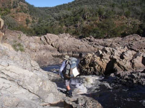
Here we bade a fond farewell to Roland who was returning to Burrows and like the proverbial penny would reappear two days hence, at Sundown Homestead. For the rest of us it was ever onward, past a herd of goats, past a fat pig and past a succession of waterholes: The Hell Hole, Turtle, Blue, Channel and Wallaby Rocks. Six kilometres, nine river crossings, one dodgy log crossing and we lobbed into our Stony Creek campsite soon after two o’clock.

Stony Creek Campsite
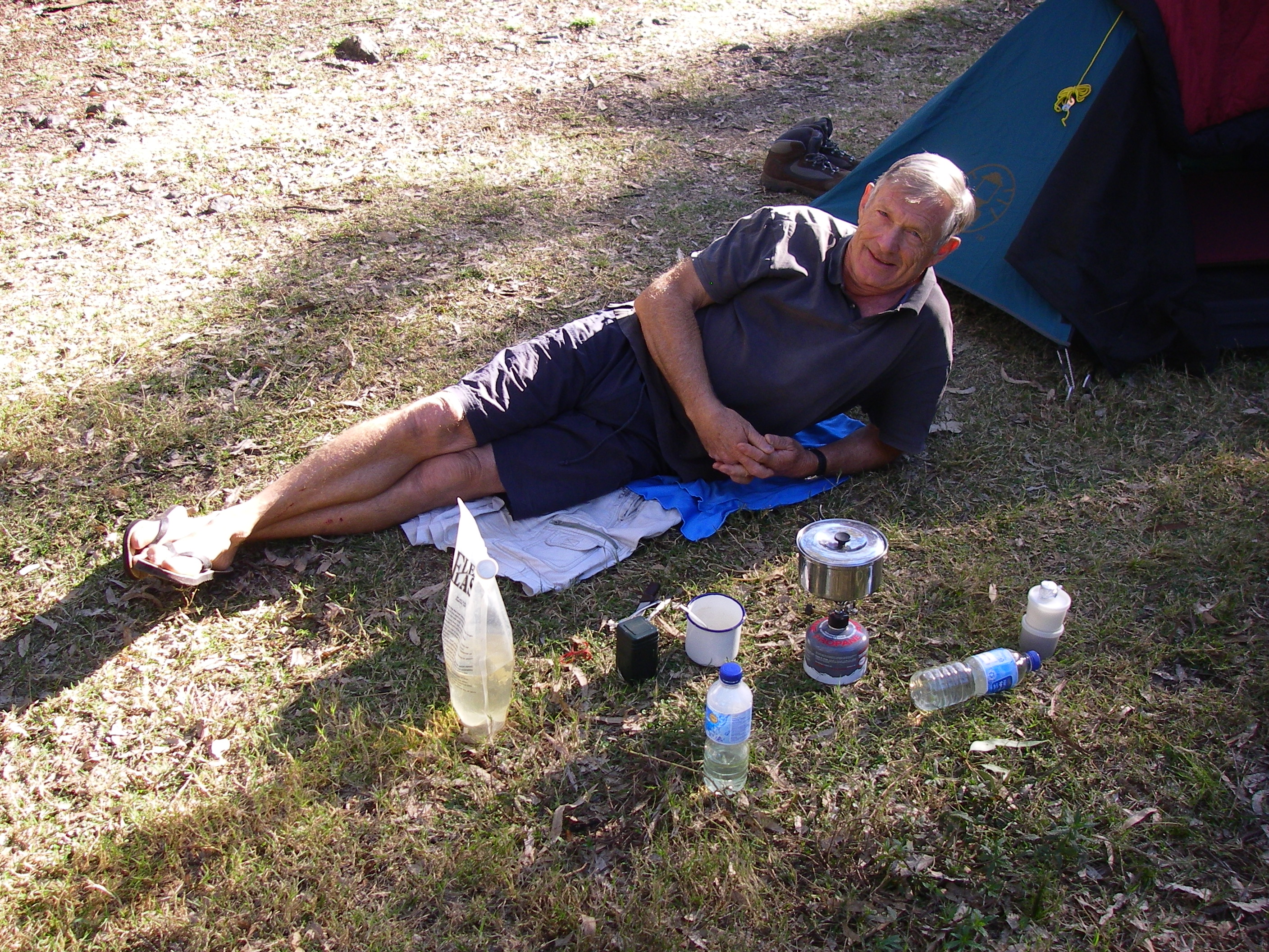
Another excellent campsite: remote, set on a flat alluvial terrace, grassy tent sites shaded by Sheoaks, Forest Red Gums, Cypress Pines and Rough-Barked Apples, ample firewood and a waterhole nearby. Tents went up quickly as the sky had clouded over and the wind had now swung to the east, rain threatening.
With full cloud cover our maximum temperature barely reached a miserable 15°C. In fact, it was the coldest day of the month. But around the warmth of the campfire later in the evening Alf stepped up as raconteur-in-residence and entertained with travel stories from wildest Africa.
Well, about as wild as you could expect from an Alf on a swanky safari to various South African diamond mines, gold mines and De Beers HQ. Just as we were being winched deep into the bowels of yet another diamond mine, a light shower of rain cut short our virtual tour and chased us off to our tents. But who would complain? Tucked into a toasty sleeping bag, light rain pattering down and a soporific page or two of Paul Theroux: ‘Dark Star Safari‘.
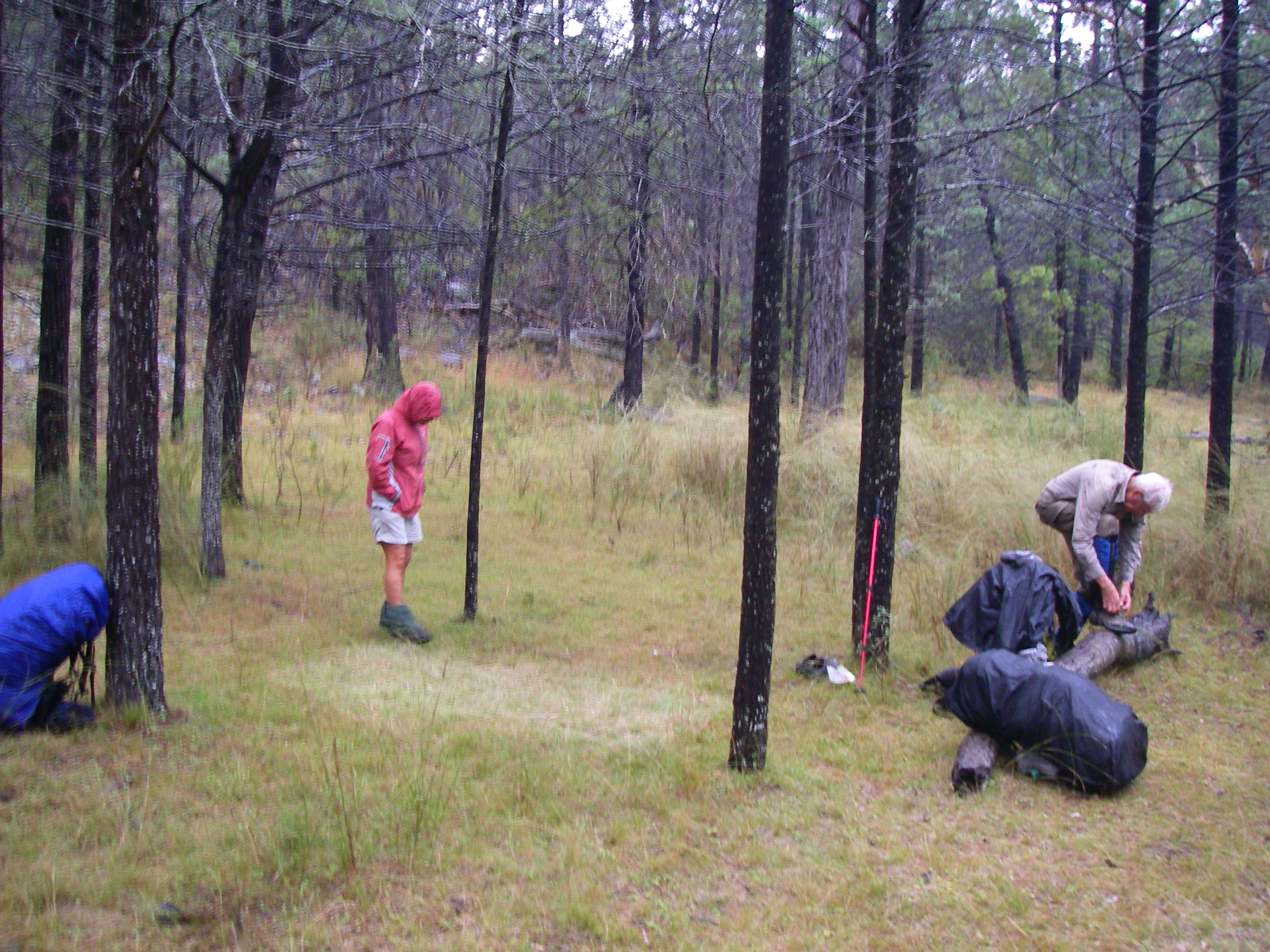
Saturday 28 April: Stony Ck to Roberts Range via Mt Donaldson: 6 kms.

Despite light rain all night we were all packed, kitted out in wet weather gear and gaiters, and ready to make tracks by 7 o’clock. Today would be our most challenging. Off track, pushing through manky vegetation, with a stiff 200 metre climb to Mt Donaldson Falls, then a second 420 metre climb to Mt Donaldson (1036 m) and onwards to Hill 1024 and Hill 1047 before dropping to our campsite on a spur of the Roberts Range at 960 metres.
Mt Donaldson
Initially navigation would be a cinch, merely following an old rabbit or dingo fence for the one kilometre climb to our old 2008 campsite at Mt Donaldson Falls.
Light misty showers dogged us all the way along the fence line and the slimy wet traprock slabs in Mt Donaldson Creek were a disincentive for a walk down to the lip of the falls. For those who risked life and limb skating down, the views down the gorge were standard Manuelian: obscured by wreathes of misting rain.
Another two and a half kilometres and the 420 metre altitude gain brought us to Mt Donaldson’s western peak. But not before pushing through dense thickets of Peach and Cough Bush; troublesome stuff in that we had left the navigational safety of the rabbit fence and had to resort to the dark arts of map and compass to keep us on the straight and narrow, reaching the summit five and a half hours after leaving our Stony Creek campsite.

At midday we propped for lunch on the exposed summit rocks. My invitation to check out the rocks, Permian breccias, was politely ignored. My geology book claims the breccias are rich in fossil shellfish.
Apart from a couple of two-legged ones I have yet to find these fossils. Anyway, my reluctant field assistants were more intent on hunkering down to stay warm and out of the cold blustery easterly wind than scouring the summit for my fossils. I could see showers scudding all around us but, by the grace of the Gods of Weather, we stayed dry.

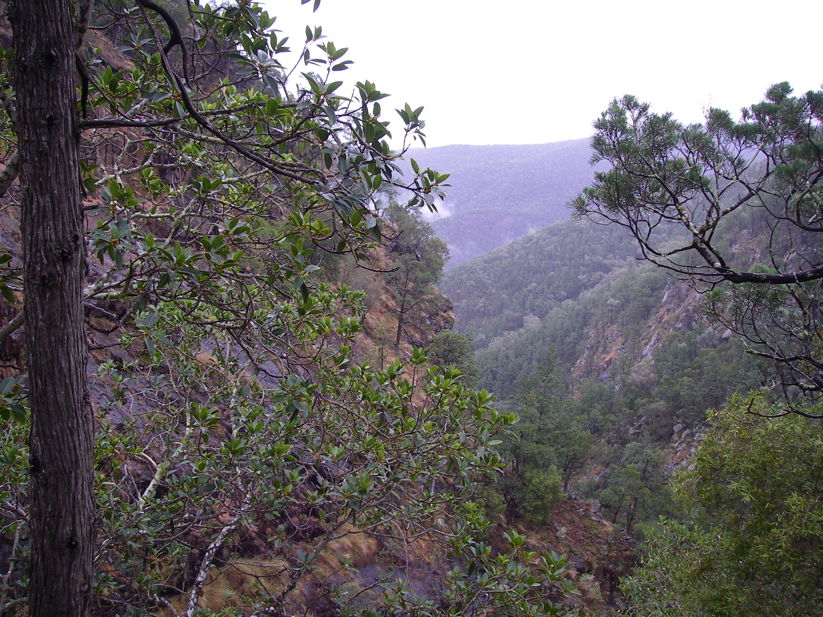
The summit is reputed to be the best vantage point in the park. And it is, though most of my companions couldn’t be roused from their hypothermic huddling to appreciate the scenery. The vista across Sundown’s rugged landscape was, quite simply, fantastic.
Donaldson’s northern fall is marked by massive cliff line which drops 400 metres into Stony Creek. Its valley is lined with numerous scree slopes of shattered boulders. Stretching off to the north-east was the Razorback, marked on my old Hema map as Berchtesgardaen. The Razorback, a spur of the Roberts Range, is a five kilometre ridgeline of 900 and 800 metre hills grading down to our old friend, Rats Castle on the Severn.
The afternoon’s traverse, at a mere three kilometres, was another rib-tickling episode taken from Brian’s barrel of bushwalking laughs. I had walked this section on two previous occasions and I knew what was coming.
These high western-facing slopes are covered by what botanists describe as shrubby woodlands. The tree layer is a mixture of Tumbledown Red Gum(Eucalyptus dealbata), Caley’s Ironbark (E. caleyi), Youman’s Stringybark (now E. subtilis) and Black Cypress Pine (Callitris endlicheri). So far so good. But the understorey is dominated by dense groves of Peach Bush (Ehretia membranifolia) and Cough Bush (Cassinia laevis).
The leaves of Cough Bush or Wild Rosemary were an old bush remedy. They were the active ingredient in a decoction for the treatment of respiratory ailments, hence, Cough Bush. The almost impenetrable groves of the understorey reduced our forward progress to about one kilometre per hour with visibility often less than 10 metres.
This is why we have Brian on the payroll. Not only does he collect firewood, light our fires, act as a sort of campground Tea Lady and reads maps upside down, but he’s also on call for any untoward bush bashing. As Don Burgher, another of Brian’s ancient bushwalking cronies, is fond of telling me: ‘Never get between Brian and a patch of Cough Bush’.
or was that a patch of lantana? Or a pot of Toohey’s Old?
Never mind, he had done this sort of thing before. We formed up, line astern. A quick compass call and Brian would slowly reverse his rucksack into the thicket, disappearing from view as the Peach Bush wrapped around him.
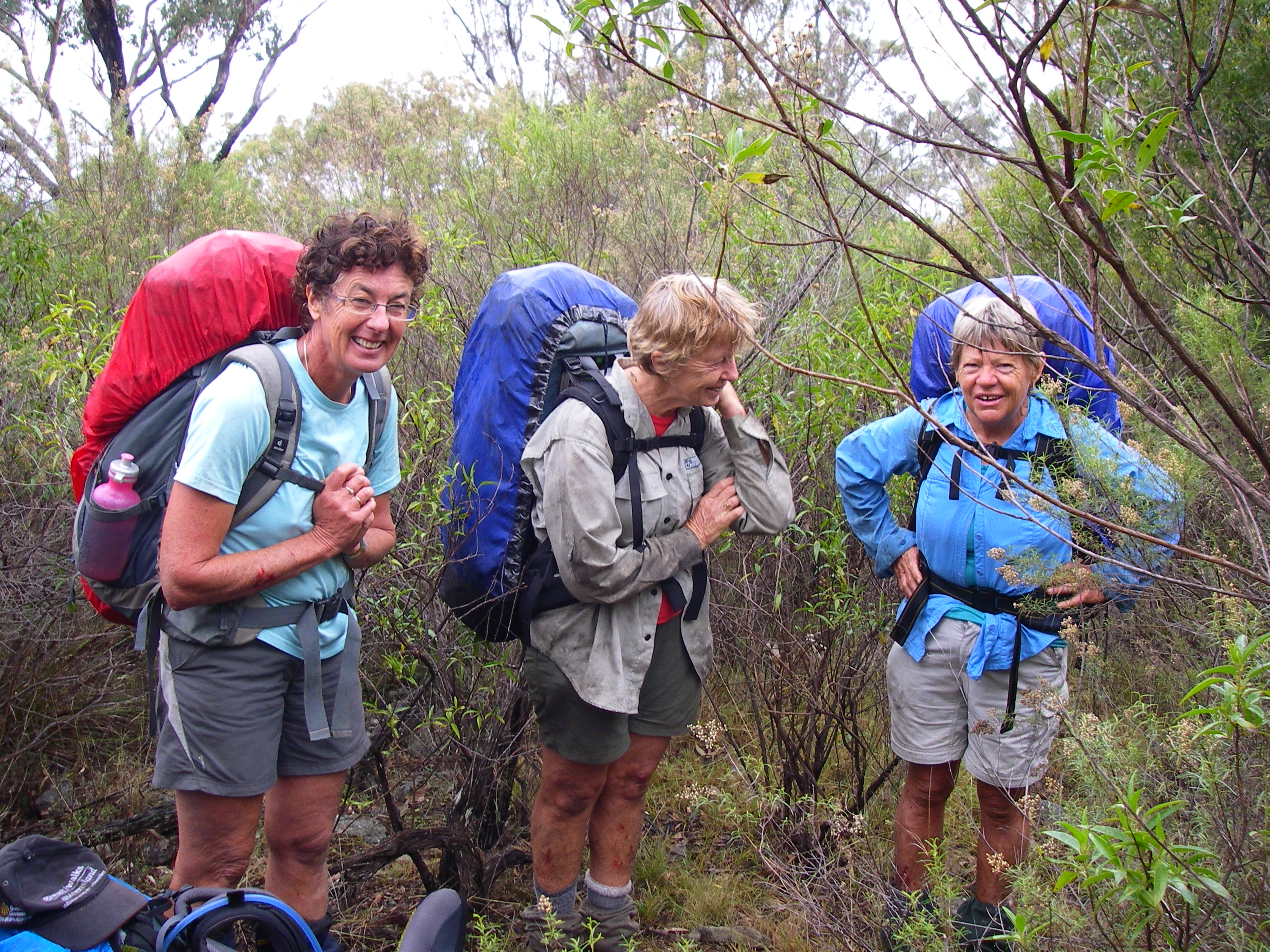
Six walkers then inched forward following the spoor of blood splats, chunks of human tissue and, in deference to the ladies present, muffled curses. Crafty walkers, like Alf and I, brought up the rear, seemingly busy consulting map and compass.
And so on, until just before four o’clock when we emerged from the undergrowth onto the small dam where we would camp for the night and lick our wounds. As we prepared to put up our tents, light rain misted across. Impeccable timing. And just when I was having a few doubts about this bushwalking lark, my tent pole snapped.
Sunday 29 April: Campsite to Sundown Homestead via Roberts Range: 11 kms.
Another dampish morning until the mist dissipated leaving a light cloud cover, making for very pleasant walking conditions. Our final day on the track, which would take us seven kilometres along the spine of the Roberts Range.
This 1000 metre divide separates the Severn River to the north from its southern neighbour, Tenterfield Creek; both tributaries of the Dumaresq River, named by the explorer Allan Cunningham after the Dumaresq family who were a prominent Australian colonial family.
We would be following a well-maintained 4WD track, a fire management trail that parallels the Queensland-New South Wales border fence, technically a Dog Check Fence.

The walk is the classic high range roller-coaster starting at 1067 metres, dipping and rising: 973 m, 1039 m, 1030m, 1015m, 1087m and reaching 1120m at our final climb before turning off and descending to the Sundown Road.
Climbing up to our first high point, Hill 1067 we passed into a special habitat, a high altitude forest, restricted to the very highest parts of Sundown and the Granite Belt. This is open forest, dominated by Silvertop Stringybark (Eucalyptus laevopinia), Yellow Box (E. melliodora) and the best name of all, Tenterfield Woollybutt (E. banksii). Silvertop Stringybark and Tenterfield Woollybutt are interesting in that they are disjunct populations of the same species growing further east at Lamington and Mt Barney.
It is likely that they survive here on traprock because of the cooler, misty micro-climate on the highest points of the Roberts Range. Further along the range, on the summits of the highest hills at 1087 metres and 1120 metres, we passed through more small patches of high altitude forest.

As we climbed to the final high point at 1120 metres we entered a designated ‘essential’ habitat. These are areas meant for the protection of a species that is endangered or vulnerable. In this particular case the species was the Superb Lyrebird (Menura novaehollandiae) neither seen nor heard by our party.
The Superb is the King of Karaoke and is such a good mimic that the bird being copied cannot tell the difference. The male Lyrebird has a repertoire of 20-25 other bird songs as well as mimicking car engines, chain saws and even barking dogs.
The Border Survey 1865
When Queensland was proclaimed a separate colony on 6th June 1859, Surveyors Roberts from Queensland and Rowland from New South Wales were sent to define the boundary between Queensland and New South Wales from Point Danger to the Dumaresq River.
They started work in 1865 and worked separately using their own instruments. As their traverse lines were different the defined border appeared in different positions. Ultimately the Roberts survey was accepted and this was the line depicted on our map and that we were following today.
I was keen to find any relics of their traverses such as rock cairns or horse-shoe blazes on trees. I found one old blaze, indecipherable, so there is no evidence that it was part of the border survey. It would be interesting to do the entire Roberts Range traverse with data from Robert’s original field book.
Roberts, an Irishman, trained as an engineer and in 1856 he became surveyor of roads for the Moreton Bay District later gaining a post as a surveyor with Queensland’s Surveyor-General’s Department in 1862. Colonial surveyors were tough, capable bushmen able to endure considerable hardship: life under canvas, poor food, heat, flies, arduous travel and isolation.
Unsurprisingly, it was a constant struggle to stay healthy. Queensland colonial surveyors could be struck down by any number of health hazards: Barcoo Rot, Bung Blight, Sandy Blight, Dengue Fever, Malaria, snakes and crocs. Francis Roberts escaped all these only to die prematurely of sunstroke in 1867, aged 41.
The Dog Check Fence
Today, the Border is marked by a Dog Check Fence; an outlier of the mighty 5,412 kilometre Dog Fence that runs from Jimbour in Queensland to the Great Australian Bight in South Australia. The Dog Fence is said to be two and a half times the length of the Great Wall of China and is easily visible from space.
Our 1.8 metre high Dog Check Fence or Dingo Fence is a relic of an intricate maze of some 48,000 kilometres of interconnecting vermin fences built to keep dingoes and bunnies at bay.

Late in the morning we came off the Roberts Range and exited onto the Sundown Road, only four kilometres from our cars at the old Sundown Homestead. At that very moment a piratical black Defender sailed around the corner and hove to.
A dark tinted window slowly descended revealing a grinning Cheshire reclining on the back seat. Bold as brass. It was that rapscallion of road and range, our old friend Roland, looking mighty pleased with himself, and why not. He had cadged a ride out from Burrows Waterhole, saving himself a twenty kilometre walk out.
A boarding party of several rucksacks and bushwalkers made for the remaining spare seat but Roland’s Samaritan was having no unwashed bushwalking riff-raff in his vehicle. He brusquely raised the gang plank and drew off, at pace, for the homestead.
Roland returned soon after in his own 4WD. But again I missed a berth for the kilometre drive to the homestead site. Resigned to solo finish I plodded on, comforted by thoughts of our traditional bushwalkers’ banquet in Stanthorpe.
A beano of bakery delights. Now what would I have ? A fetta and spinach roll or maybe a curry pie? A mug of piping hot chocolate or a flat white? A vanilla slice or cream horn? In my dreams.
Said bakery was closed and the alternative café seemed overwhelmed by our orders for a few burgers and coffees. An hour later we exited the eatery, an underwhelming Granite Belt gourmet experience it must be said. Maybe the pub next time for a ten dollar burger and quick beer.