By Glenn Burns
The 130 kilometre, 10 day, Kiandra to Kosciuszko walk is the premier alpine walk of mainland Australia. It traverses the highest and most scenic of our subalpine and alpine landscapes, all of it above 1500 metres.
While it is, for the most part, a thoroughly enjoyable walk, it is very exposed. Summer conditions are generally benign but even a beautiful summer’s day can change, with storms, sleet and snow sweeping over in the space of a few hours. Being caught out in a summer thunderstorm on the Main Range is an experience I recommend you avoid.
Map of our hike from Kiandra to Mt Kosciuszko on the Australian Alps Walking Track.

Kiandra to Kosciuszko was originally conceived as a ski touring route in July 1927 between the Kiandra gold fields and Perisher Valley’s Kosciuszko Hotel built in 1909. This was accomplished in three days by four members of the Ski Club of Australia.
The modern bushwalking route which we followed was, with some off-track variations, basically along the line of the Australian Alps Walking Track (AAWT) and included climbs of some of Australia’s highest peaks:
- Jagungal: 2061 m
- Gungartan: 2068 m
- Anderson: 1997 m
- Anton: 2010 m
- Twynam: 2196 m
- Carruthers: 2145 m
- Townsend: 2209 m
- Mt Lee: 2106 m
- and the highest of all, Kosciuszko: 2228 m.
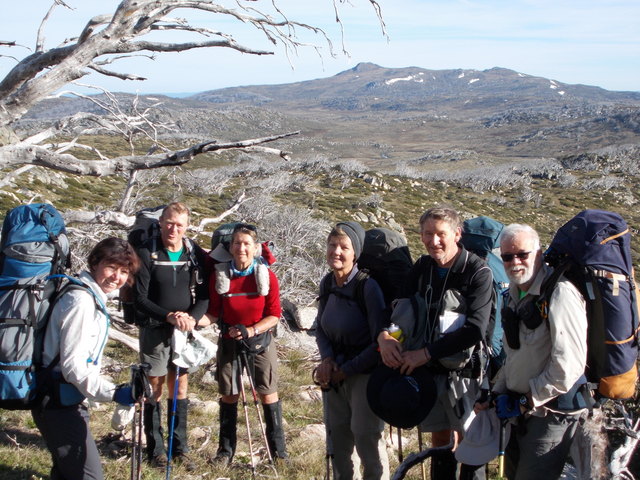
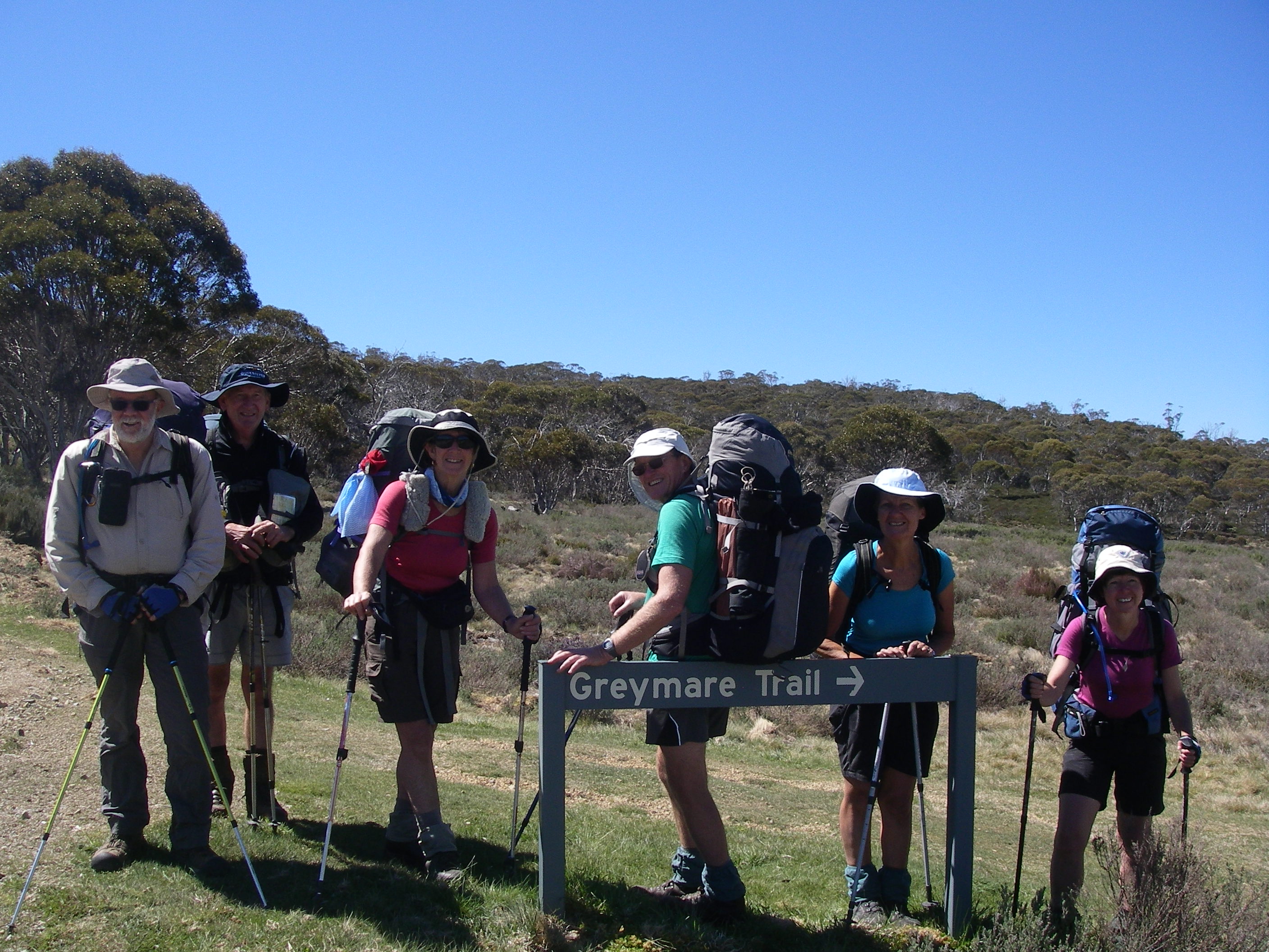
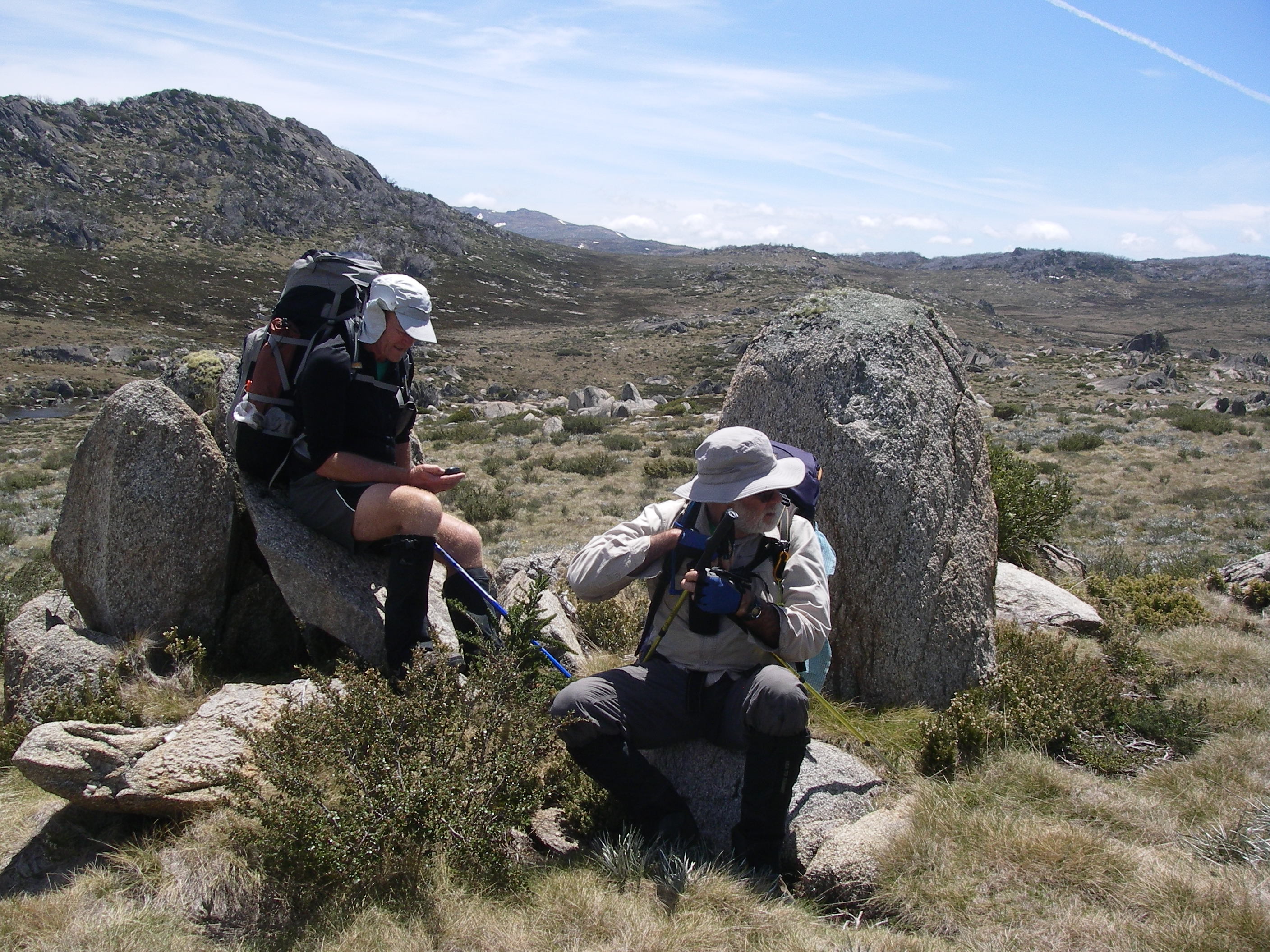
As well, it traverses the very scenic and open alpine ridges of the Kerries and the Rolling Grounds. My long suffering and ever helpful companions on this high country adventure were Sam, John, Lyn, Joe, Ross and Linda.
They may have been disconcerted at the cold, wet and windy conditions at our Kiandra trail head, but if they had any thoughts of abandoning ship and returning to Canberra with my son Alex, they kept quiet and wandered off disconsolately into the damp gloom.

Photo Gallery: A selection of photos taken by fellow walker Lyn Hewitt:


The Weather: Kiandra to Kosciuszko Hike
Overall enjoyment of this extended 10 day walk was always going to depend on the vagaries of the weather. Happily for this leader, we got very lucky. While planning the walk a check of Snowy Mountains online climate statistics suggested eight rain days for November, with average falls up to 150 mm along the Main Range.
Anticipated average temperatures on the Main Range were maximums of 12°C and minimums of 2.6°C. Perfect temperatures for hiking.
As it turned out the only difficult day was our first. A salutary awakening for our high country new chums.
As we popped out of a cosy people mover at Kiandra, freezing drizzle (6°C) whipped into our faces, propelled along by 40 kph wind gusts. By my reckoning a wind chill temperature of about -8°C.
Welcome to high country bushwalking. But hey, no swarms of those infernal biting horse flies, aka Vampire flies aka March flies that have plagued us on previous high country walks.
By way of a total contrast, in early December 2006 on an earlier trip, we started at the same Kiandra trail head with temperatures hovering in the low thirties, gusting northerlies and an enveloping smoke haze from bushfires raging south of Kosciuszko. The area has about 100 days annually of high to extreme fire danger and is one of the most fire prone areas in the world.
Vast swathes of Kosciuszko’s sub alpine zone had been burnt out in 2003. Since then the dominant snow gums (Eucalyptus pauciflora spp. niphophila) have been suckering vigorously from their lignotubers forming a dense woodland community that is sometimes difficult to push through.
This time frosts greeted us most mornings followed by superb walking conditions with very pleasant rambling temperatures averaging out at 12°C. A surprising number of large snow banks persisted as we climbed onto the high Kerries Ridge, the Rolling Grounds and Main Range. But these presented no real difficulties to our passage as the surface ice had usually softened by mid morning and was safe to walk over.
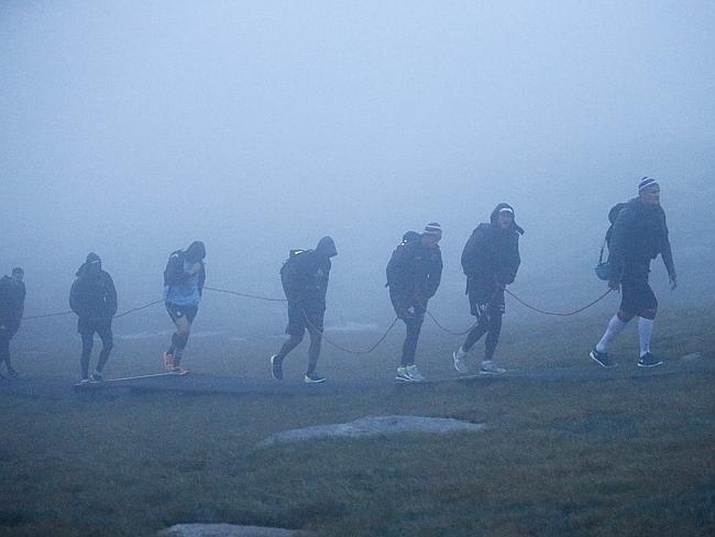
Our penultimate day along the crest of the Main Range was a tad problematic. Although conditions were fine and clear, blustery westerlies ripped over the tops gusting up to 75 kph (severe gale). Nowhere to hide in this lot and certainly no possibility of erecting tents.
Surprising as it may seem, I had a plan. A drop into Wilkinson Valley for our overnight camp or as a last resort, a long detour to Seamans Hut. The decision made easier for me by four young throughwalkers who claimed that conditions were infinitely calmer in the Wilkinson. Not quite, but reasonable enough behind some granite boulders.
Clothing Requirements & Hypothermia : Kiandra to Kosciuszko Hike
I was conscious of the reality that even in summer there have been cases of hypothermia or exposure in Australia’s high country. I was hiking with Queenslanders, a little inexperienced in high country weather conditions. Just in case you think that talk about hypothermia is a bit overblown, read this comment from the Bushwalking Australia website about a ‘summer’ experience:
“I was caught out the first time I camped up on the Main Range (just under the Abbotts, on the Wilkinson Ck side – Christmas morning I woke up to strong winds, thick cloud and heavy snow. By the time I crossed the creek the stuff was six inches deep. By the time I reached Rawson Pass, more than half the walkway was hidden by a foot of snow; much deeper in places. It was snowing on and off all day, even in Thredbo, but even while I was walking out and down, there were people going up on the chairlifts in shorts and t shirts.”
Still not convinced? How about this Manly Sea Eagles summer boot camp at Thredbo one month after our trip when a 25 kilometre hike ended with a trainer being shipped off Mt Kosciuszko with a serious dose of hypothermia. A storm generating a wind chill of -10°C swept in and the hike was called off after only seven kilometres. To quote one player:
“If we didn’t leave we would have got smashed and there is no way we would have survived”.
Apparently even designer Manly Sea Eagle footy shorts, socks, skins, caps and rain jackets weren’t up to this job. Perhaps the final word should go to one player who described the experience as “…6 hours of hell.”
Hypothermia is entirely preventable, needing appropriate food and clothing. Members of our party ferried along boat loads of clothing for layering: typically thermal undergarments, fleece coats, rain jackets, rain pants, beanies and gloves.
To my mind the jury is out on non-proofed down jackets: I prefer a thick windproof polar fleece jacket if conditions are going to be cold wet rather than cold dry. Add to this a good quality -5°C sleeping bag and you will sleep snug. Mostly.
For several nights I bunked down in my sleeping bag with four top layers, a beanie, thermal longs and rain pants to stay snug. But when caught out in the wet cold stuff, my advice is: head for the nearest hut.
Huts: Kiandra to Kosciuszko Hike
Given the potential for bouts of foul weather I arranged overnighters near old grazing/mining huts each night, until the Main Range, where there are only two shelters. Neither of these Main Range huts were on our line of travel .
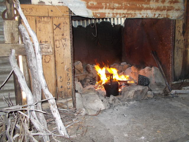
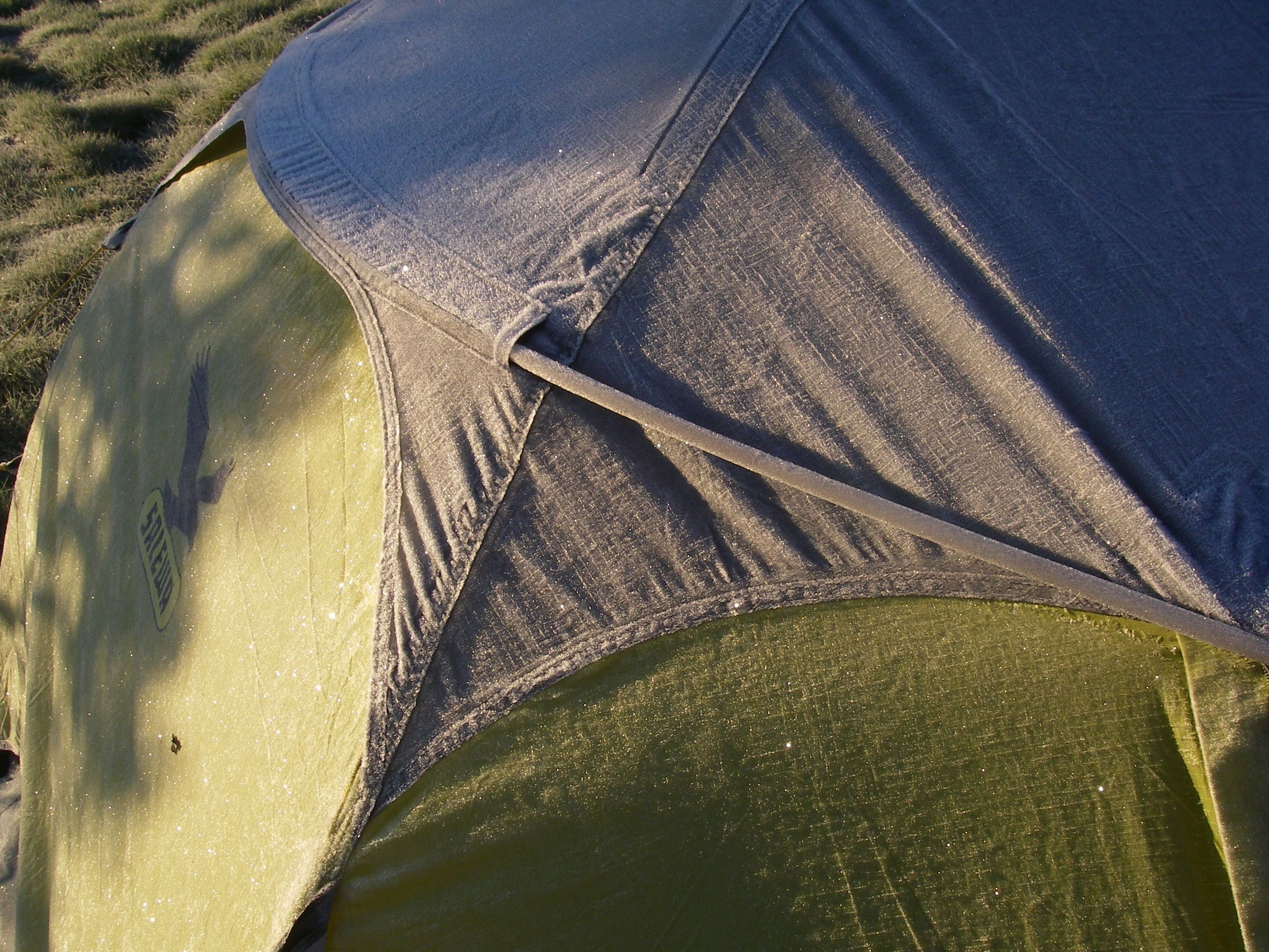
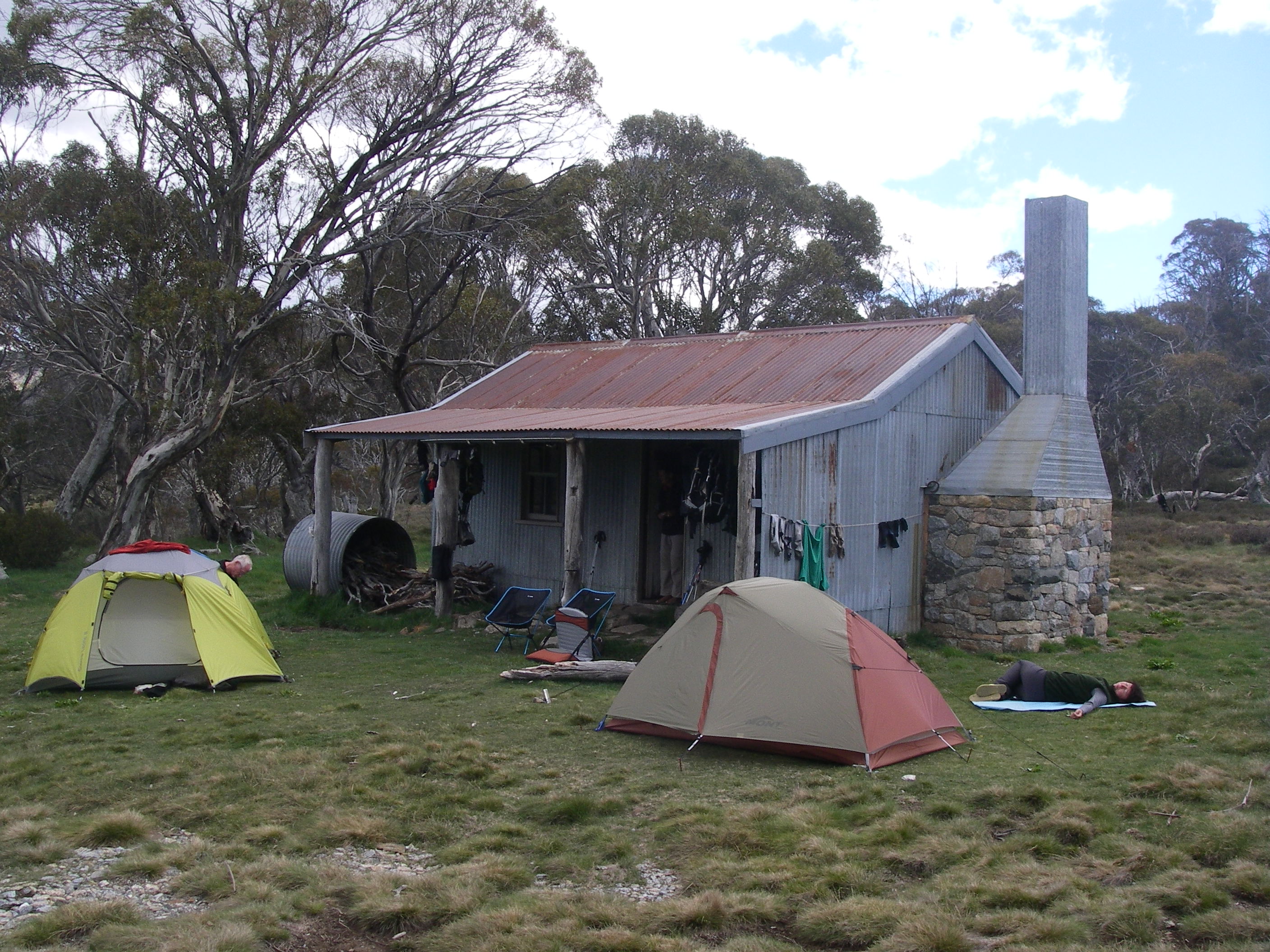
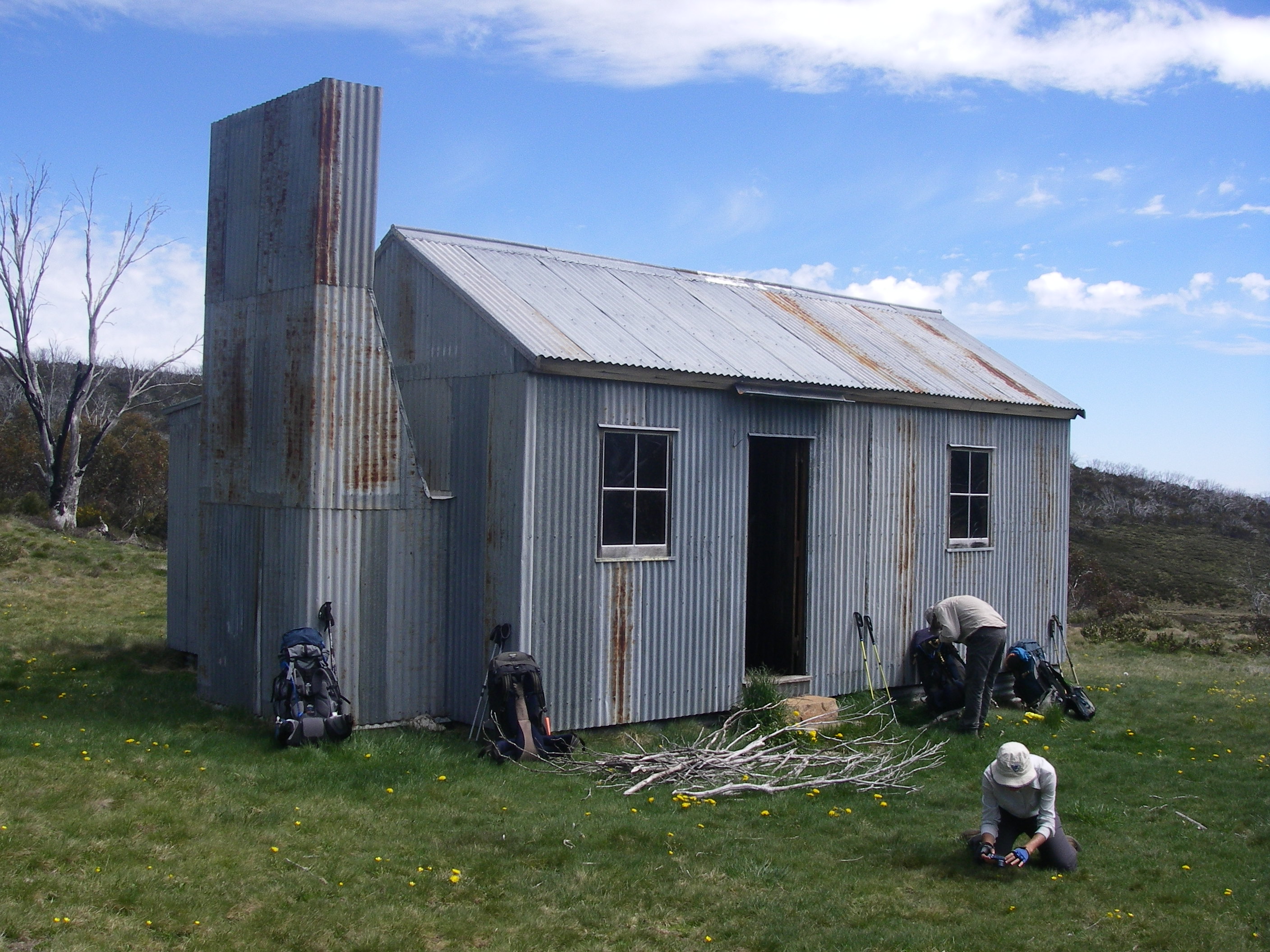
Mountain huts in Australia are dingy and basic but all provide a fireplace or cast iron stove and firewood; great bolt holes in an emergency. We always cut our own firewood using bush saws and Joe stepped up as chief stoker to ensure a toasty fire every ‘hut’ night. Remember to retreat to your tents outside unless weather is abyssmal.
Gathering firewood was a group imperative and everyone fanned out from the huts bringing back cart loads of firewood. John even clambered up into dead snow gums, bush saw in free hand to harvest the larger limbs.
On some evenings, meals over, fire banked, we settled in for some reading or an evening of TED on the Trail presented by Sammy and Lyn. Health lectures on creepy diseases that you wouldn’t wish on your worst enemy.
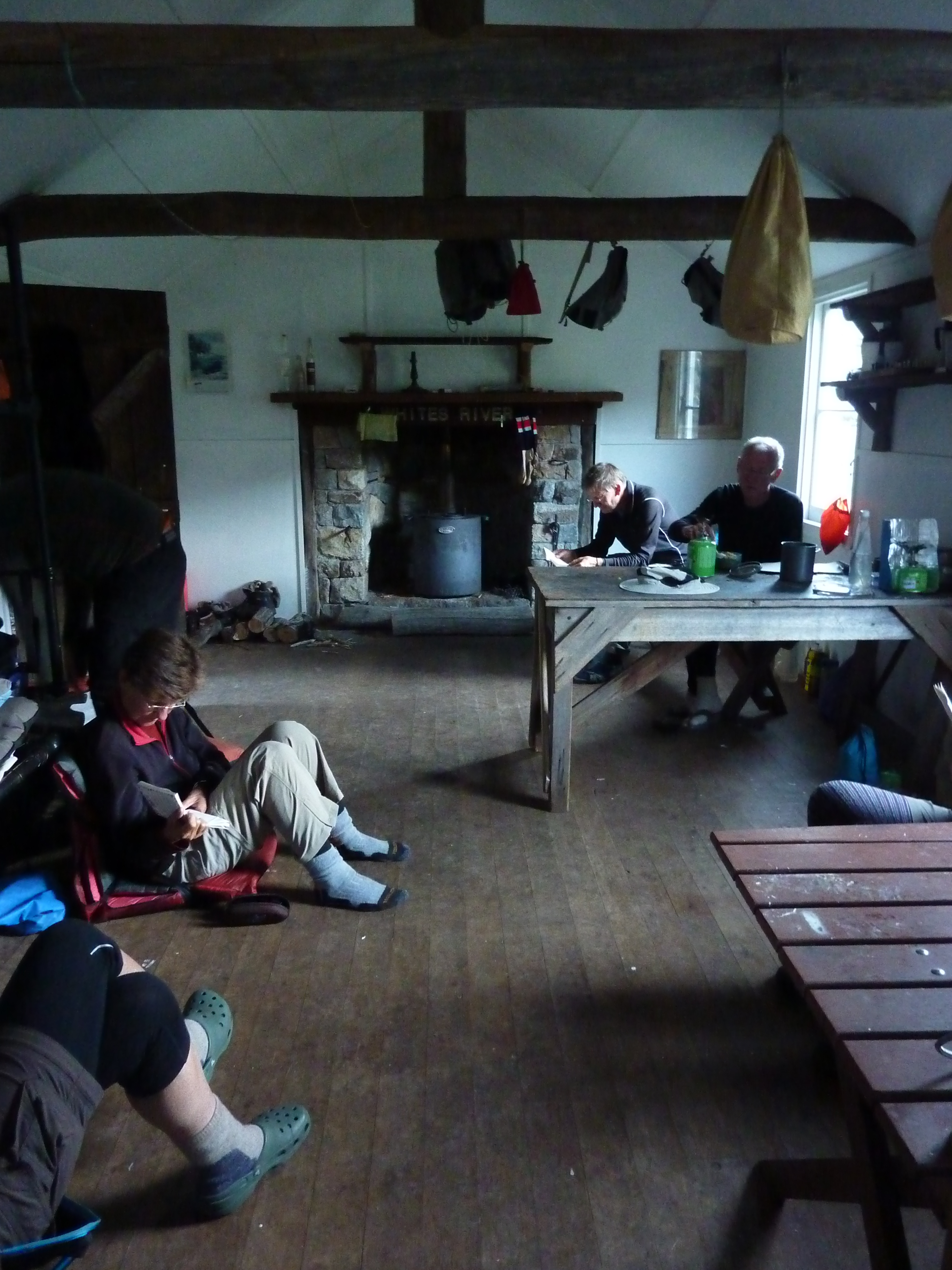
On our north-south traverse we pulled into Four Mile Hut, Happys Hut, Brooks Hut, Mackeys Hut, O’Keefes Hut, Derschkos Hut, Grey Mare Hut, Valentines Hut, Mawsons Hut and Whites River Hut.
Much of the upkeep and restoration of these huts is done by various ski clubs and the Kosciuszko Huts Association whose website has a wealth of information about high country huts. Well done to all these volunteers.

Navigation on Kiandra to Kosciuszko Hike
Sections of the walk follow marked fire trails (Tabletop, Grey Mare, Valentines and Schlinks) where one would be hard pressed to get lost as long as you have a decent map and a modicum of spatial awareness.
Going off track, in poor visibility, is a different proposition. Thus walkers venturing out in mist or sleet/snow must be proficient navigators.
A map and compass is a must have and a GPS with pre-loaded maps and waypoints is invaluable in such conditions. It is worth knowing that your GPS batteries could fail in the cold.
In 2006 we got caught out on the Kerries Ridge in dense cold mist. My journal of the time records:
“Unfortunately the mist closed in again and our afternoon was spent slowly compassing in a pea soup mist from rock to rock…Brian and Andy fossicked ahead while Di and I bellowed directions to keep us on our compass bearing before they vanished from view…By 3.00 pm a GPS check located us still a disappointing two kilometres short of our objective, Gungartan. Brian made the sensible, inevitable decision to abandon ship and we exited downhill to the Schlink Hilton.”
For this trip, as leader, I hauled along ten laminated strip maps at 1:25000 scale as well as a 1:50000 Rooftop Map covering the whole of Kosciuszko.
My photocopied notes from the excellent Chapman guidebook: “Australian Alps Walking Track” while being the go-to guidebook, it reads south to north. As this took reverse deciphering I only dipped into the notes for the historical information and occasional navigation issues.
Ross and Joe had GPSs with hut locations as waypoints and, ever cautious, I had my Android phone pre-loaded with georeferenced and detailed 1:25000 map files.
All massive overkill. Having done the walk several times, a good set of maps and a compass should suffice.
But for the GPS geeks among us, help is at hand. Every square centimetre, every pixel of the AAWT has been waypointed, track logged, geocached, and route marked to within a whisker of its digital life and a number of apps and bushwalking websites provide this data free.
To reiterate: A good set of maps and compass and one GPS with spare batteries will suffice.
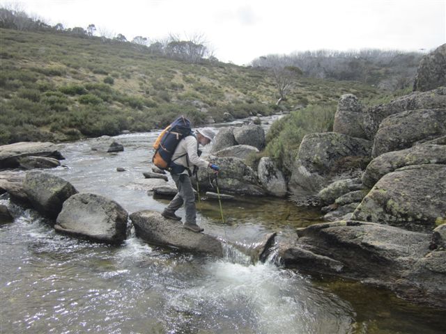
River crossing on Kiandra to Kosciuszko Hike
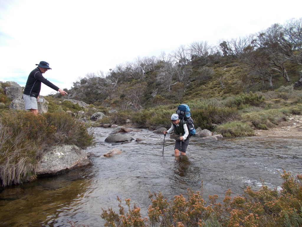
As anticipated, the spring thaw peak flows had waned by early November. By my reckoning only the Tumut, Tooma and Geehi Rivers and maybe Valentines and Back Creeks would be a challenge. But all the crossings proved a doddle.
On arriving at a river Ross, John and Joe would wander thither and yon, upstream and downstream until a potential crossing was located. Then we would scuttle across, one after the other, leaping from boulder to boulder. Hopefully arriving at the opposite bank in mostly dry boots and socks.
The Alpine Landscapes of Kosciuszko National Park
Our traverse of the Kosciuszko Plateau took in a major chunk of the Australian Alps Bioregion, the only truly alpine environment in NSW as well as the only part of the Australian mainland to have experienced Pleistocene glaciations.
Over our 10 days we started off by crossing the subalpine woodland landscapes of Kiandra, Happy Jacks Plain and the Jagungal Wilderness and then climbed onto the exposed alpine ridges of the Kerries, the Rolling Grounds and finally the Main Range.
The ‘alpine’ landscapes of the Australian Alps are obviously quite different to those of the Himalayas or New Zealand’s Southern Alps in that they are much lower, flatter, rounded and far more benign.
Kosciusko National Park is predominately a rolling plateau surface, the remnants of a low mountain chain resulting from the splitting of the Australian plate from Gondwana and Zealandia. Splitting is a much more muted tectonic force than the crustal collisions that are, as we speak, thrusting up the Himalayas and the Southern Alps.
The lack of significant alpine peaks is also attributable to the small extent of the Kosciuszko ice caps and valley glaciers at glacial maximums during the Pleistocene. That said, the winter snow fields of Australia cover an area of 11,500 square kilometres, said to be greater than the combined snowfields of the European Alps. A myth actually. But that applies to only a few months of the year.

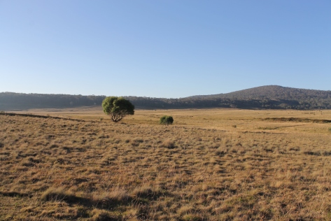
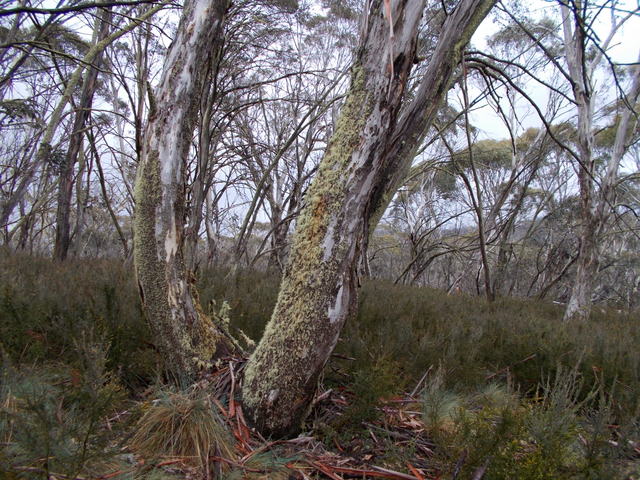
Our first four days took us across subalpine woodland interspersed with open grasslands. This zone has a continuous snow cover for one to four months and minimum temperatures below freezing for six months. Typically it lies in a tight zone between 1450 metres and 1850 metres.
Here the mainly basaltic ridgelines and slopes are dominated by snow gum re-growth with a dense understorey of prickly shrubs. The snow gums are usually stunted, multi-stemmed and gnarled close to the alpine zone but are taller and straighter lower down where they form an association with another hardy eucalypt, the black sally.
But the most striking feature of the subalpine landscape is the extensive treeless grasslands found in the valley floors. Immense treeless plains form because of the pooling of cold air which rolls off the high ridgelines and ponds in the valleys on cold frosty nights. These low points are known as frost hollows. Even the hardy snowgums can’t grow on these grasslands.
The valley floors often are also areas of impeded drainage hence can be wet and decidedly boggy. Camping there anytime but high summer is not recommended.

The Alpine Zone : Kosciuszko National Park
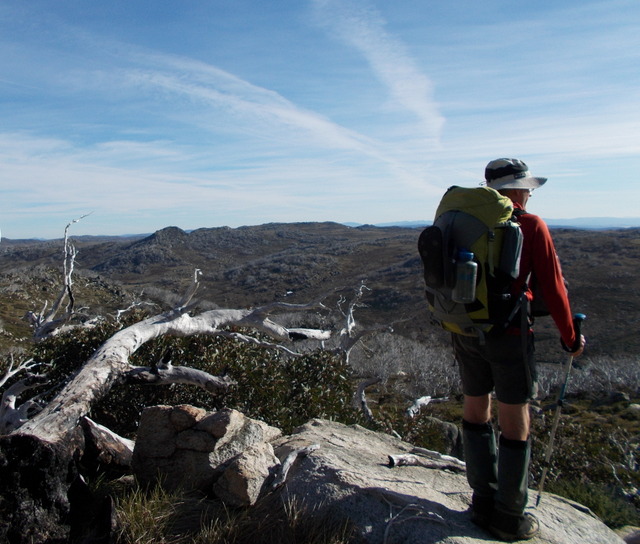
The second half of our walk was truly alpine in the zone above the treeline, found above 1850 metres. A landscape of frost shattered granite boulders and alpine meadows, technically, tall alpine herbfields.
Where special conditions apply there are also small pockets of heath, bog and the windswept feldmarks. The tall alpine herbfields are botanically very rich, rivalling in diversity and showiness similar communities in the European Alps, Southern Alps and Rocky Mountains.
It was one of the great pleasures of this walk to amble through vast herbfields of Silver Snow Daisies, Yellow Everlastings, Snow Grass, glossy Yellow Buttercups and the conspicuous Australian Gentians.

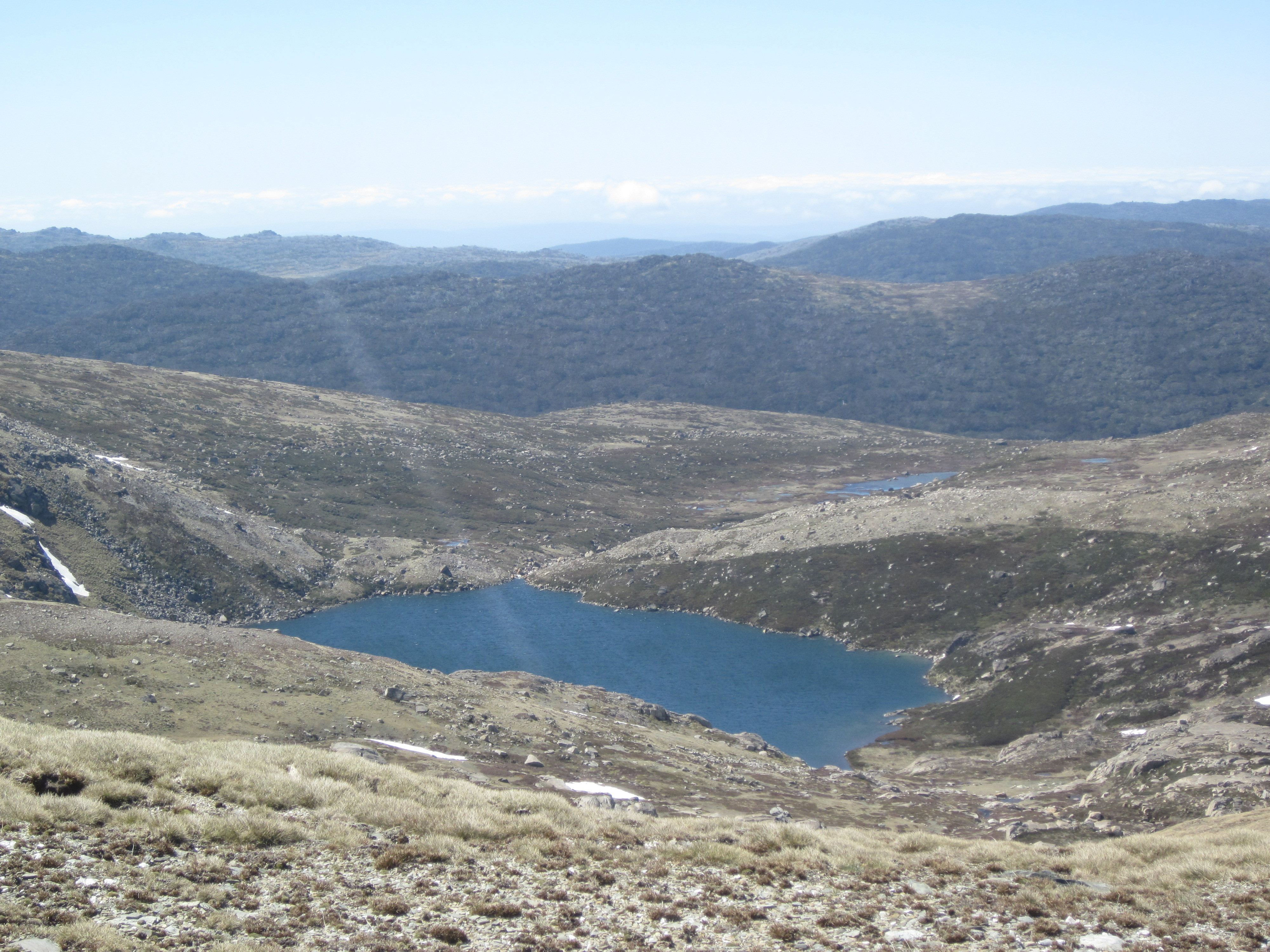
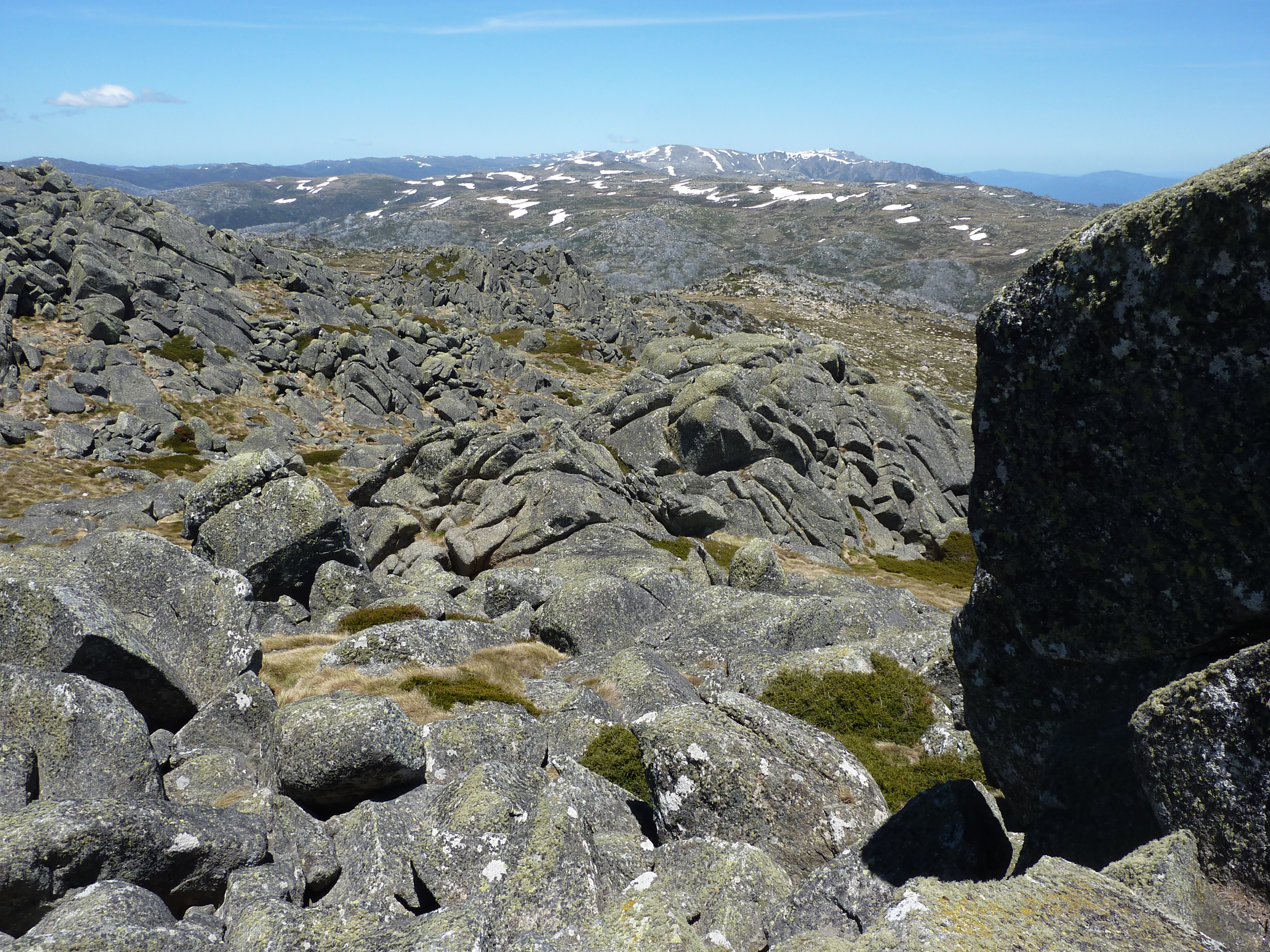
Over the last few days I was able to check out the glacial landforms of the Main Range. These are relics of the Pleistocene glaciations when an ice cap and valley glaciers covered a small area of the Main Range of about 20 sq km to a depth of maybe 100 metres.
In the area between Mt Twynam and Mt Kosciuszko it wasn’t difficult to identify obvious landforms like cirques, lateral and terminal moraines, hummocky moraine dumps, U-shaped valleys and glacial lakes.
But with the wind flapping our ears around there was no temptation to chase down the more cryptic features like glacial striations, polished rock surfaces, roches moutonnes and boulder erratics.
Useful Info
Maps:
CMA: 1:25000: Cabramurra, Denison, Tantangara, Toolong Range, Jagungal, Geehi Dam, Perisher Valley.
Rooftop Maps: 1:50000: Kosciuszko National Park.
Books and Articles:
J. Chapman et el: Australian Alps Walking Track (Chapman 2009).
Geehi Bushwalking Club: Snowy Mountains Walks (GBC 2001).
J. Child: Australian Alpine Life (Landsowne Press, 1969).
K Hueneke: Kiandra to Kosciuszko (Tabletop Press, 1989). A great resource!!
K. Hueneke: Closer to Heaven (Aust. Geog. Jan-Mar, 2009).
A. Jamieson: Adventure in the Alps (Aust. Geog. May-June 2015).
D.G. Moye (ed): Historic Kiandra ( the Cooma-Monaro Historical Soc., 1959).
J.L.Davies: Landforms of Cold Climates (ANU Press, 1969).
K. Green and W. Osborne: Field Guide to Wildlife of the Australian Snow-Country (Reed New Holland, 2012).
C. Warner: Bushwalking in Kosciusko NP ( Envirobook 1989).
Website:
Kosciusko Huts Association:
http://www.khuts.org/index.php?option=com_content&view=featured&Itemid=182
Saturday, November 1: Kiandra to Four Mile Hut: 6 kms.
Son Alex deposited us onto a vast treeless snow grass plain at Kiandra, our starting point for the 10 day walk, the Tabletop fire trail. All in all a desperate place on a wet and windy afternoon like this. Alex, returning to Canberra in the people mover, seemed positively chirpy about our predicament.
But my fellow walkers, although somewhat nonplussed by the cold and wet, are a keen lot and we were soon beetling on our way, following the Tabletop Trail as it wiggled its way up and over Dunns Hill.

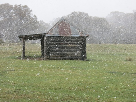
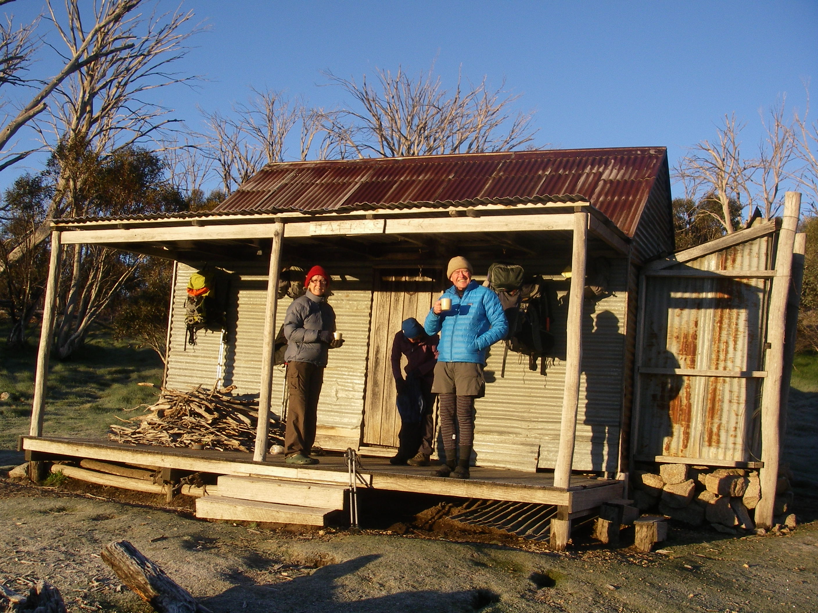
Our first stop and overnighter was Four Mile Hut, several hours away. The Four Mile or Hughes Hut was our introduction to high country huts on this trip.
I’m guessing if you are visualizing huts from your diverse wanderings along The Overland Track or perhaps New Zealand or even those swanky mountain refuges of Europe, you would be badly let down.
Four Mile is a ‘one man’ hut built by Bob Hughes in 1937, the last active miner in Kosciuszko. Bob had been manager of the nearby Elaine Mine and when it closed he salvaged alpine ash tunnel timbers and flattened ten gallon drums to build himself a fossicking and rabbiting hut on Four Mile Creek.
The Four Mile Hut is Lilliputian, with a stove, a table, a wooden floor and room to sleep two at a pinch. Until 1981 it even boasted a box of gelignite under the bunk bed. But given conditions outside on our night at Four Mile, it proved attractive enough for Sam, Joe and Lyn to commandeer. Ordinary ranks… outside under the wildly cracking canvas.
Four Mile was burnt down in the 2019/2020 summer bushfire season. It has since been rebuilt 2024 by NPWS and Kosciuszko Huts Association volunteers. It was re-opened in 2024. Well done to all.
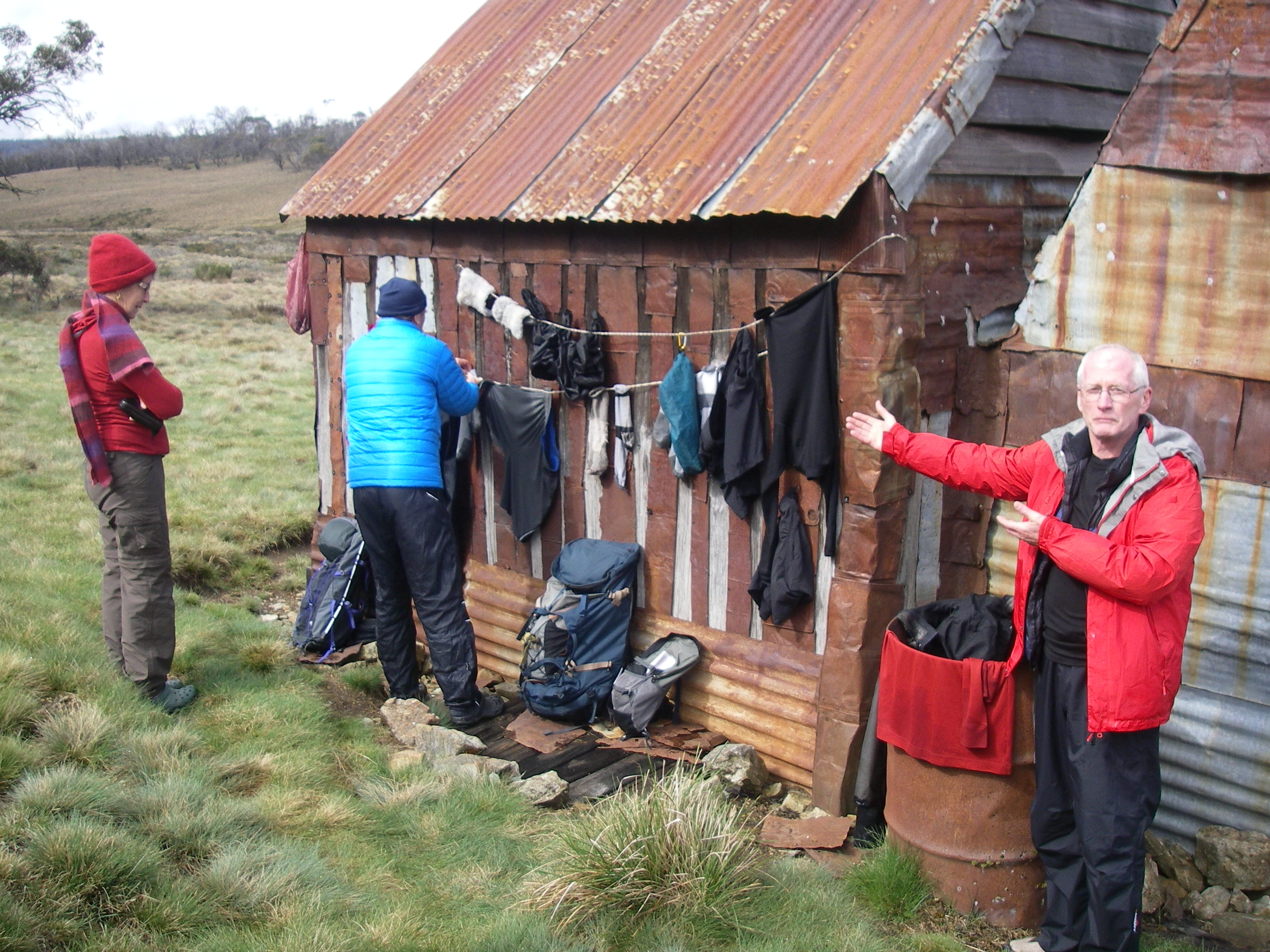
Our arrival coincided with the drizzle lifting but dark clouds banked aloft and gusts of wind swept over the open plains of the Four Mile. We took advantage of the pause in the drizzle and put our wet clothes, socks and boots out in the brisk wind to dry.
Meanwhile Joe fired up the stove and soon had the hut warm and toasty to finish drying our clothes and defrosting numb fingers, toes and noses.
Sunday 2 November: Four Mile Hut to Happy Jacks Plain via Mt Tabletop: 15 kms.
A sub zero but clearing morning greeted us. The route from Kiandra to Mt Tabletop (1784m) along the Tabletop Trail is one of the oldest pathways in Kosciuszko National Park.
I know nothing of its use by the aborigines but it was followed in the 1860s by gold miners and since then by generations of cattlemen, skiers, bushwalkers and now the rumbling diesels of the Park’s service 4WDs.
It generally follows high basalt ridges at 1600 metres, part of Australia’s Great Dividing Range. Along its spine is an old fence line dividing the two old grazing leases, Nine Mile to the west and Broken Dam to the east.
Soon after Four Mile we crossed the headwaters of Nine Mile Creek. Both Four Mile and Nine Mile abounded in relics of gold mining. In the 1860s the Nine Mile was home to over 1400 miners, six stores, two bakeries, three butcheries, a jail, a blacksmith and, of course, four hotels.
Nearly 10,000 miners swarmed to the Kiandra Goldfields in 1859 to endure severe winter blizzards hunkered down in canvas tents. Some miners even constructed primitive shelters of sod, rocks and branches. The rush was short-lived, the shallow alluvial deposits worked out and attempts to find the main reef proved fruitless.
After the 1860 winter only 150 miners hung on. Even with down jackets, four season sleeping bags and tents, staying warm in the 21st century was still an issue.

A kilometre on, we passed the headwaters of Scotch Creek where hydraulic sluicing from about 1860 to the 1920s had scoured the hillside in a final search for gold. Head races or water races collected water from the range and fed it into pipes fitted with nozzles. The hillside scar is still there, a 700 metres long, 100 metres wide and 15 metres deep.
Interestingly, I could see beds of lignite in the exposures. There are about 200 kilometres of water races to be seen all over this part of the country; faithfully following their own gently dipping contours to the sluice site. They were cut, not by pick and shovel wielding Chinese labourers but by bullock powered ploughs.
Onwards to Mt Tabletop or Tackingal. The name Cabramurra was given to the actual trig point on top, borrowed from the tribal area of Cabramurra from nearby Eucumbene River.
The track to Tabletop follows the line of an old race line which fed water down to the Nine Mile sluicing. Tabletop is a flat topped basalt mesa rising 150 metres in local relief, the remnants of a Tertiary volcano.
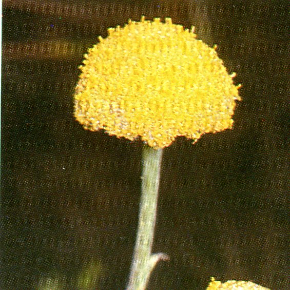
Tabletop and nearby Round Mountain are the likely sources of the lava that covered much of this part of Northern Kosciusko. Tabletop’s summit is just above the tree line and is a mass of wildflowers like Billy Buttons (Craspedia leucantha) and the ubiquitous Silver Snow Daisy ( Celmisia spp.) which we would see all across the alpine zone.
The view from the summit was fabulous: the Monaro Plains to the south east, Mt Jagungal (tomorrow) to the west and the snow capped northern Main Range to our south and a shimmering Lake Eucumbene off to the east.
The 25 kilometre long finger of Lake Eucumbene is part of Australia’s huge post World War Two Snowy Mountains Scheme designed to provide hydro power and to divert water for irrigation into the westward flowing Murray and Murrumbidgee Rivers.
The town of Cooma has a must see display of the construction phase of the scheme at the Snowy Hydro building. This all sounds hunky dory but the Snowy Scheme came at some considerable environmental cost to the eastward flowing Snowy River.
A little after three kilometres from Tabletop we swung off the trail and plunged downhill through dense snow gum woodland heading on a southerly bearing for Happys Hut, which has a reputation of being difficult to find.
Fortunately not this time, for after about one kilometre of scrub bashing, compass glued to my paw, I sighted the hut in a stand of snow gums on the edge of Happy Jacks Plain.
Happys, also known as The Dip, Montagues or Boots was built by in 1931 by W. Montague as a grazing hut. It has a verandah, corrugated iron walls and roof, a wooden floor, stone hearth and iron flue.
Monday 3 November: Happys Hut to Mackeys Hut via the Grey Mare Trail: 17 kms.
Up at first light. Another frosty morning with a thick coating of ice on the tent. My little pack thermometer showing -2°C at sunrise. No surprise there.
I had on full rigging of thermals, shirt, long trousers, polar fleece coat, beanie and gloves. Fortunately Joe too had been forced out early and had conjured up a fire in the hut. With all this ice around our two middle aged delinquents, John and Ross, were soon engaged in an iceball free-for-all.
With tents down and hut cleaning supervised by the eagle-eyed hut commandant Sam, we were on the frog and toad by 8.30am; walking in brilliant sunshine and a pleasant but nippy wind.
Our heading was vaguely south east for three kilometres, across the hummocky snow grass of Happy Jacks Plain. Navigation was easy enough: keep Arsenic Ridge to the starboard and Arsenic Creek on the port and simply contour along the tree line until a crossing of Arsenic Creek is made just short of Brooks Hut.
The Brooks Hut or V Hut was torched in the 2003 fires but rebuilt in 2007.
The original hut was built by Cliff and Bill Brooks in 1945 as yet another mountain grazing hut. It stands at the edge of Arsenic Ridge overlooking the extensive Happy Jacks Plain, a much favoured summer cattle and sheep grazing area in days of yore.

After a quick snoop inside we loped off on an old 4WD track towards Happy Jacks Road (2WD accessible). The angst of crossing Happy Jacks Creek by way of a ‘fallen power pole’ didn’t eventuate.
Instead we strode jauntily across by way of an impressive culvert. Too easy. At Happy Jacks Road we pulled in for a morning tea stop; notable for its lack of privacy for those needing a comfort stop on the these vast grasslands. But hey… none of those maddening horse flies to bite vast acres of naked flesh.

After a good feed and the pit stop it was simply a matter of following the Grey Mare Trail for the next two days, first to overnight at Mackeys Hut and then on Tuesday into the Jagungal Wilderness and Mt Jagungal.
Not a grey mare in sight, nor any brumbies. But first there was the small matter of a few piddling creek crossings at Barneys, McKeahnies and Tibeando Creeks. Good practice for the Geehi River and Valentines Creek crossings later in the trip.
Mackeys, Tibeando or Mackays was built in 1944-5 by Norm and Sam Mackay for their grazing lease. It is a classic mountain hut, a two-roomer with verandah, corrugated iron walls and roof with a timber floor.
The stone hearth was always a bit of a smoker but since the NPWS rebuilt the chimney in 2010 it draws much better. All grazing leases in Kosciuszko National Park have been revoked; the Mackeys lease in 1958.
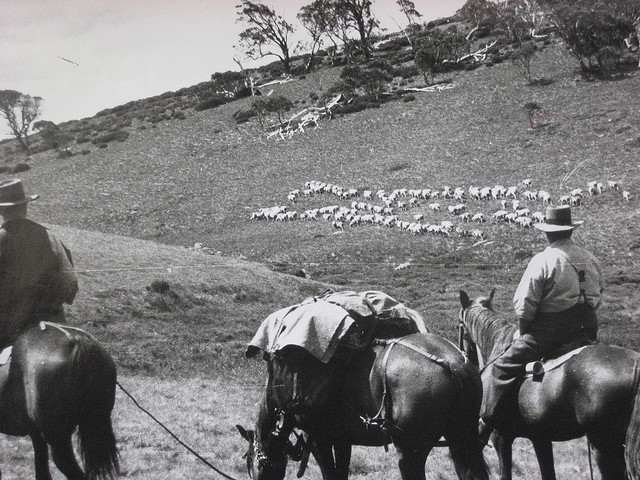
In the days of the transhumance of sheep and cattle from lowland properties to the high summer pasture there were usually two musters. One at the beginning of autumn and a few weeks later a mop up of the strays still munching away in some hidden valley. Everyone chipped in to help with the final sorting of stock; usually finished on the lowlands.
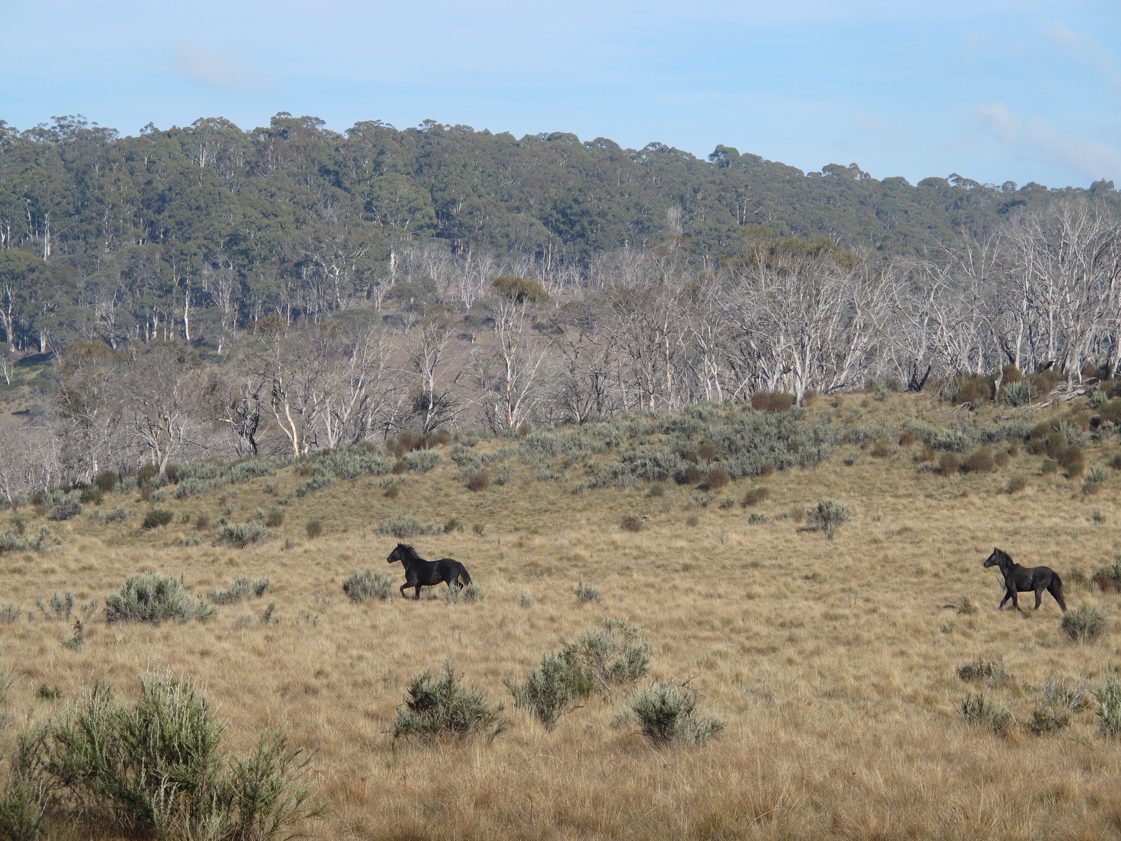
All the mustering was done with horse and dog. The cattlemen have gone, the high plains now the province of the skier and the bushwalker and occasional Parks rangers. The ‘Man from the Snowy River’ way of life is no longer. But the spirit lives on in the resistance to brumby culls in Kosciuszko National Park.
Tuesday 4 November: Mackeys Hut to Derschkos Hut via Jagungal: 18 kms.
A change of plan. With rain predicted on the morrow I decided to squeeze in the climb of Mt Jagungal today on our way to Derschkos Hut.
I have noticed that all this lot were very efficient packers: Lyn, Ross and Linda in particular, so it was an early 7.30 am start heading south on the Grey Mare on yet another fine morning.
Across a strongly flowing Doubtful Creek thence up to Farm Ridge. Nothing much is left of this alpine farm but the information board recorded the basics:
“Part of a substantial alpine grazing lease, Farm Ridge was constructed in the 1890s by A J Rial. At its peak the homestead formed the central focus point amid outbuildings and a set of sheep and cattle yards. There was a telephone connected to Adaminaby. Grazing ceased during the 1960s.”


Several kilometres on we ducked into the re-built O’Keefes or Bogong Hut, the original burnt down in the 2003 bushfires, but not before its masonite ceiling had been vaporized by a megafaunal resident possum.
The original hut was built by A.S. O’Keefe in 1934 as …yes, you guessed it…another summer grazing hut. As O’Keefe had materials carted in from Old Adaminaby (expensive) he cheapskated on roofing iron, so the old hut had minimalist eaves and a inconvenient tendency to allow snow to waft in during blizzards.
But I was a man with a mission now. A demon bushwalker of the worst kind, a peak bagger. Jagungal or bust. J agungal is best accessed from its south west ridge, a 220 metres climb to Jagungal Summit at 2062 metres.
The Roof of Australia, not quite, but near enough for this neck of the woods. But my companions engaged in a gender based insurrection and while the males shuffled wearily off towards the summit the female of the species headed off at brisk trot for the luxury of Derschkos Hut some two kilometres to the north west on the Round Mountain Trail.
Jagungal is instantly recognisable from over much of Kosciusko. A reassuring landmark for bushwalkers and skiers alike. A beacon…. an isolated black rocky peak standing above the surrounding alpine plains.
It is Australia’s most northerly and easterly mountain above 2000 metres in height. Jagungal forms the headwaters of several major rivers: the Tumut, the Tooma and the Geehi. It was known to cattlemen as The Big Bogong but appears on Strzelecki’s map as ‘Mt Coruncal’, which he describes as ‘crowning the spur which separates the Murray and Murrumbidgee Rivers’.
The aborigines often called mountains in the alpine zone Bogong, indicating a food source, the Bogong moth. Europeans applied their own nomenclature to differentiate the ‘Bogongs’: Rocky Bogong, Dicky Cooper Bogong and Grey Mare Bogong.
Unlike most of the other Bogongs whose granitic origins are revealed by their characteristic whaleback profiles, Jagungal’s summit is distinctively peaky. It sports a reptilian frill of vertical rock towers, some intact, other lying in jumbled heaps.
Jagungal is different because it is capped by amphibolite, a black igneous rock more dense than granite, formed by the metamorphosis of basalts. The basalts, on cooling, crystallise into massive hexagonal pillars creating the black rocky spine on which we were now standing.
Jagungal was ascended by Europeans in the winter of 1898 when a party from the Grey Mare Mine climbed it using primitive skis called ‘Kiandra Snowshoes’. Ours was a much less adventurous walk, but we still savoured our time on the summit.
Especially magnificent were the views south to the snow capped Main Range, four days away. Away to our north was Mt Tabletop and far, far away, the Brindabella Range in the Australian Capital Territory. It was so clear that we could even discern Victoria’s Mt Bogong on the far southern horizon.
I had noticed on a previous trip and again on our ascent today, huge raucous flocks of Little Ravens cawing around the steep summit cliffs. I had seen the same phenomenon on Mt Alice Rawson near Kosciuszko. Inexplicable at the time.
Recently, I came across an explanation. The Little Ravens gather to feed on Agrotis infusa, the drab little Bogong moth, found only in Australia and New Zealand. To escape the summer heat, Bogongs migrate altitudinally and set up summer holiday camps in the coolest places in Australia, the rock crevices of the alpine summits.
They come in millions from western New South Wales and Southern Queensland, distances in excess of 1500 kilometres, often winging in on high altitude jetstreams.
The Bogongs settle in crevices and caves, stacked in multiple layers, 17000 of them in a square metre, where they undergo aestivation ( pronounced east-ivating) or summer hibernation. The migrations seem to be a mechanism to escape the heat of the inland plains and they gather in the coolest and darkest crevices on western, windward rock faces. A tasty morsel for our corvid buddies.

With the ravens came the aborigines, from Yass and Braidwood, from Eden on the coast and from Omeo and Mitta Mitta in Victoria. All intent on having a good feed and a good time. Large camps formed with as many as 500 aborigines gathering for initiation, corroborees, marriage arrangements and the exchange of goods.
It is thought that advance parties would climb up to the tops, and if the moths had arrived they would send up smoke signals to the camps below. The arrival of the moths is not a foregone conclusion. Migration numbers vary from year to year. Some years they are blown off course and out into the Tasman Sea.
1987 was a vintage year, but in 1988 the bright lights of New Parliament House acted as a moth magnet, and the Bogongs camped in Canberra for their summer recess. Bogong Moth numbers appear to be declining rapidly. No-one knows why.
Aboriginal men caught the moths in bark nets or smoked them out of their crevices. The moths were generally cooked in hot ashes but it is thought that women sometimes pounded them into a paste to bake as a cake.
Those keen enough to taste the Bogong moth mention a nutty taste. Scientists say they are very rich in fat and protein; this diet sustained aborigines for months and the smoke from their fires was so thick that surveyors complained that they were unable to take bearings because the main peaks were always shrouded in smoke.
Europeans often commented on how sleek and well fed the aborigines looked after their moth diet. Edward Eyre who explored the Monaro in the 1830’s wrote:
“The Blacks never looked so fat or shiny as they do during the Bougan season, and even their dogs get into condition then.”
At summer’s end, with the arrival of the southerlies, moths, aborigines and Little Ravens all decamped and headed for the warmer lowlands.
As did Joe, Ross, John and I. Except that we headed to Derschkos where the girls had not been idle, as I had suspected they might have been. Neatly stacked outside was an immense heap of firewood. Derschkos is one of the best maintained and cleanest of the huts.
It was built by the Snowy Mountains Authority in the 1950s and occupied by Derschko, a SMA hydrologist. It sports double glazed windows, a pot-bellied stove, a living room and two bunk rooms. An irresistable lure for all but the hardiest of campers among us.
Wednesday: 5 November: Derschkos Hut to Grey Mare Hut: 16.7 kms.
An easy day, goofing along the Grey Mare in cool, cloudy conditions. None of the predicted rain yet. As we cut through the Strumbo Range with only a few kilometres to the Grey Mare Hut a massive bank of mammatus clouds hung suspended above us.
The name is derived from the Latin: breastlike. Were we in for a heavy drenching? No, as it turned out. Mammatus appear more threatening than they actually are. They typically form on the rear side of a storm and associated cumulonimbus clouds and appear as the storm is weakening.
So our afternoon was beautifully fine. Plenty of time for an extended feed, collecting firewood, washing clothes and selves at the old cast iron outlet pipe from the gold mining days.

Grey Mare was a miner’s hut. Gold was discovered in the vicinity in 1894, but flooding of shafts ended the first sequence of occupance in 1903. A second phase of mining started in 1934 with an adit blasted to get to the reef. The ruins of a hut on the creek flats below dates from this period.
A final attempt to get at the gold came in 1949 when the present hut was built and the gold crushing plant was brought in. The bush around the hut is littered with all kinds of mining knick-knackery: a crusher, a steam engine, a huge flywheel weighing more than two tonnes and a shambolic tin dunny teetering over the abyss of an old mine shaft.
John, on one of his late afternoon strolls found even more mining bits and bobs strewn across the nearby landscape.

The six berth hut is of the high country hut vernacular but large and comfortable with a huge fireplace and the best hut views in the park.
From our doorstep we had views up the grassy valley of Straight Creek and peeking above Strumbo Hill, the crouching lion, Mt Jagungal. The original hut was built in 1934 but re-built in 1949 by Jack and Jim Bolton using some of the original materials. It is famous (or infamous) for its murals of nudes drawn by Rufus Morris in 1954-1955, now badly faded. Some say scrubbed out by wowser skiers and bushwalkers.

Thursday 6 November: Grey Mare Hut to Mawsons Hut via Valentines Hut: 10.8 kms.
Woke to heavy cloud banks in Back and Straight Creeks, but these had dispersed before we wandered off, at 8.00am. Today we would follow the Valentine Fire Trail for the eight kilometres to Valentines Hut. The flies in the ointment were a suspicious build up of rain clouds and the creek crossings of Back Creek, the Geehi River and Valentines Creek, all flowing strongly.
The crossings were slow going, what with spying out crossing points, then getting seven walkers across, teetering from boulder to boulder. But it all ended well… dry boots all round. Happy hikers.
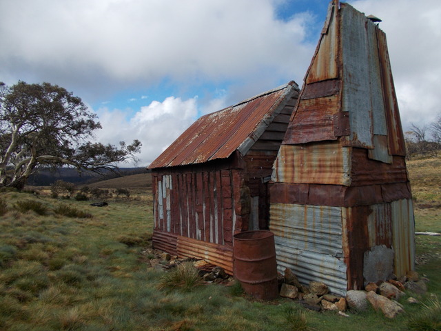
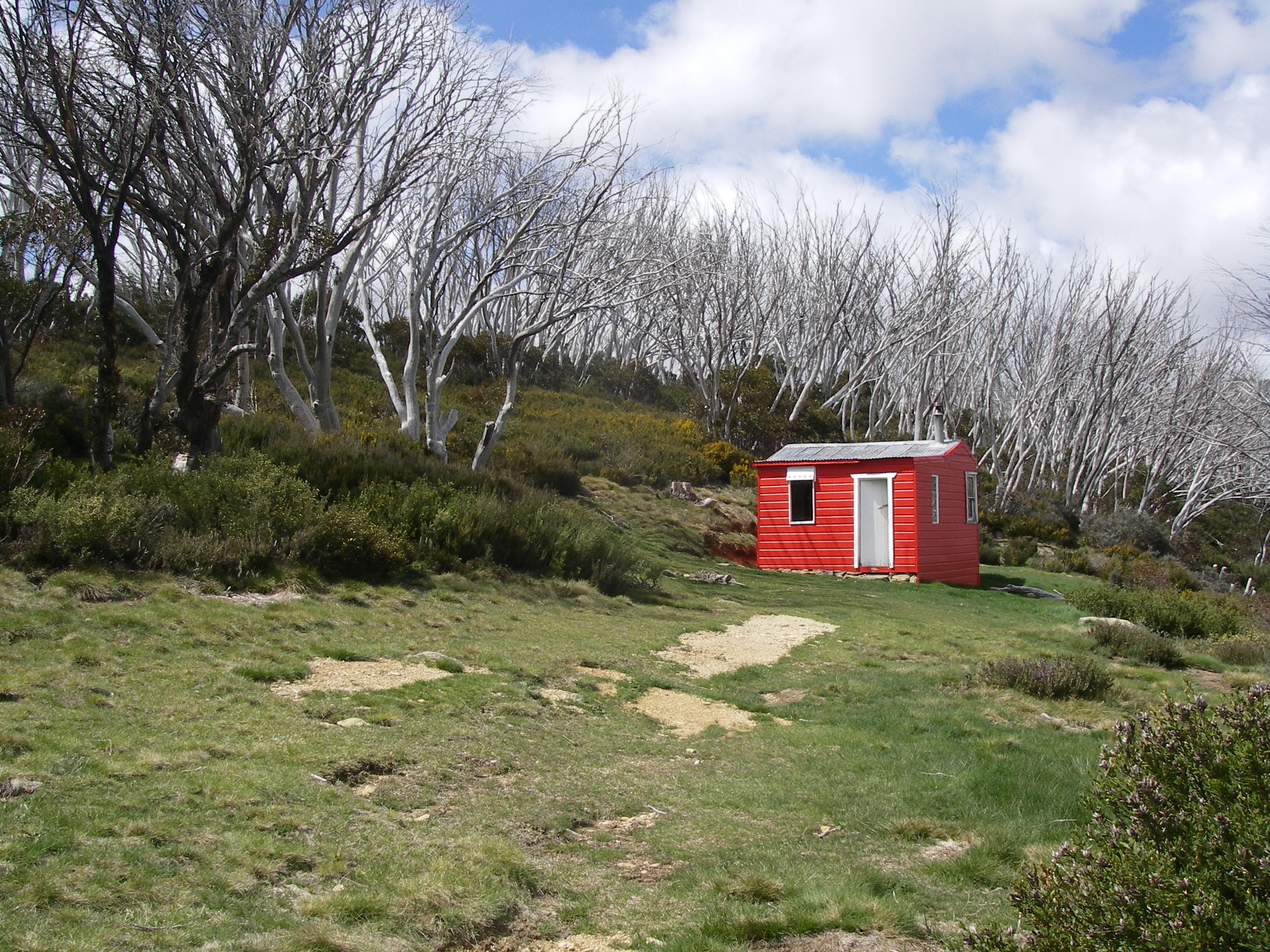
Valentines Hut is decked out in a fire truck red livery which stands out against a grey skeletal forest of dead snow gums. Valentine’s is my all time favourite high country hut, decorated with a frieze of six valentine hearts. Hence the name Valentines Hut, but I’m not sold on this theory.
Another ex-SMA hut, this natty little four person weatherboard hut, maintained by a Ski Club, has a clean airy feel, with table, bench seats and a wood stove in its kitchen. A home away from home. Valentine’s has been painted inside and out, has ample windows and, for added creature comfort, a newish corrugated iron dunny close by.
From Valentines our line of travel was cross country over snow grass plains heading for Mawsons Hut, our next overnight stop and starting point for tomorrow’s walk across the Kerries Ridge, weather permitting.
My strategy of contouring around intervening hills was a mite slow and drawn out but I resisted pressure from the GPS brigade to go up and over.
The three-roomed Mawson’s Hut (1800m) was built in five days in 1929 by Herb Mawson, manager of Bobundra Station, not Sir Douglas Mawson, Antarctic hero, as generally supposed
Again it is typical of cattlemen’s summer huts built all over alpine and sub-alpine Australia: corrugated iron walls, corrugated iron roof, wooden floors and a granite fireplace. Mawsons now boasts a NPWS issue ‘Ultimate 500’ cast iron stove blasting out mega BTUs of hot air as Joe had already got its measure and had nutted out its many irritating idiosyncrasies.
The view from the hut is pretty impressive. Across the valley to our west was Cup and Saucer Hill named for…its resemblance to an upturned cup placed on a saucer. To the north, Jagungal.
John drifted off for his usual twilight ramble and returned excited by his exploration of the snow grass plains and small waterfalls on the upper reaches of Valentine Creek as well as a sighting of those rabbits of the ranges… a herd of brumbies.
The Australian Geographic magazine Vol 130 has a comprehensive article by Amanda Burdon on the Australian brumby. Well worth chasing up if you are a member or can access a hard copy. In the same issue are photos by Jason Edwards.
Friday: November 7: Mawsons Hut to Whites River Hut via the Kerries Ridge: 12 kms.
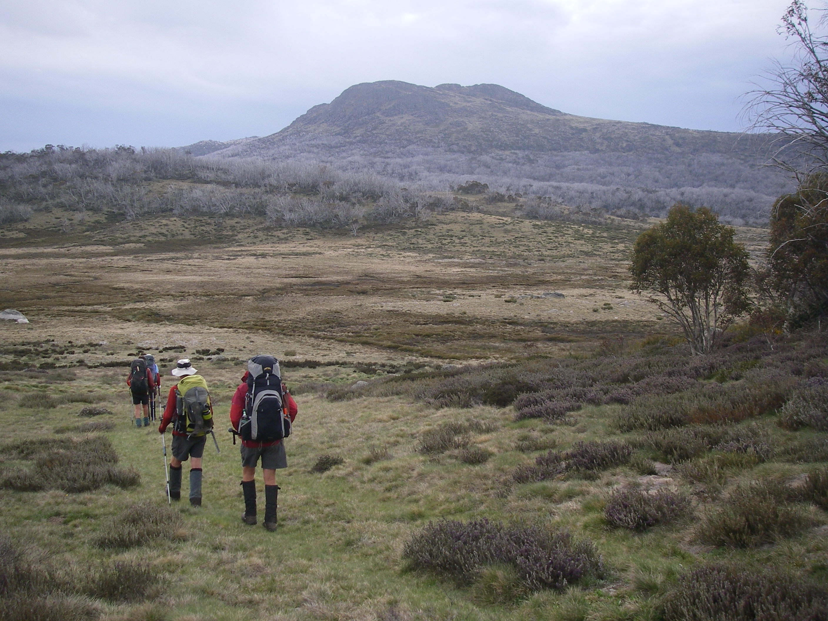
The Kerries Ridge is an outstanding alpine walk all above 1900 metres; we needed three days of fine weather to complete our traverse of the alpine zone of the Kerries Ridge, the Rolling Grounds and the Main Range.
And so it came to pass. Friday dawned fine and cool. I could shelve the wet weather plan. John led us up the access ridge that he had ferretted out the previous evening.

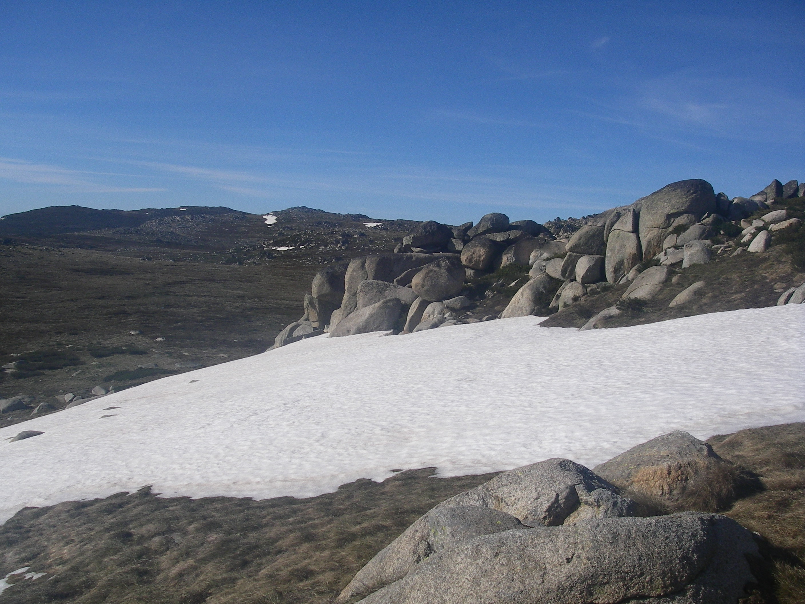
Stretching away to the south was the open rolling ridge of The Kerries. A magnificent walk across trackless wildflower meadows dotted with frost shattered granite boulders, alpine bogs, mountain streams and lingering banks of snow.
But this seemingly benign landscape can change dramatically in bad weather and walkers need to be reasonable navigators to find the safety of Mawsons, Schlinks or Tin Hut in a whiteout.
No such problems today: perfect weather, a happy crew, not too difficult navigation, plenty of rests and snowballs to throw at each other. We mooched along for several hours just enjoying the walking.
Ahead, Gungartan, a nunatak-like jumble of granite boulders and a trig station which had seen better days. At 2068m this is the highest point north of the Main Range.
Here we propped for lunch and enjoyed speccy views to Guthega, the Brindabellas in far off ACT, the Bogong High Plains in Victoria and directly opposite, The Granites and the Rolling Grounds; tomorrow’s objective. Weather permitting.
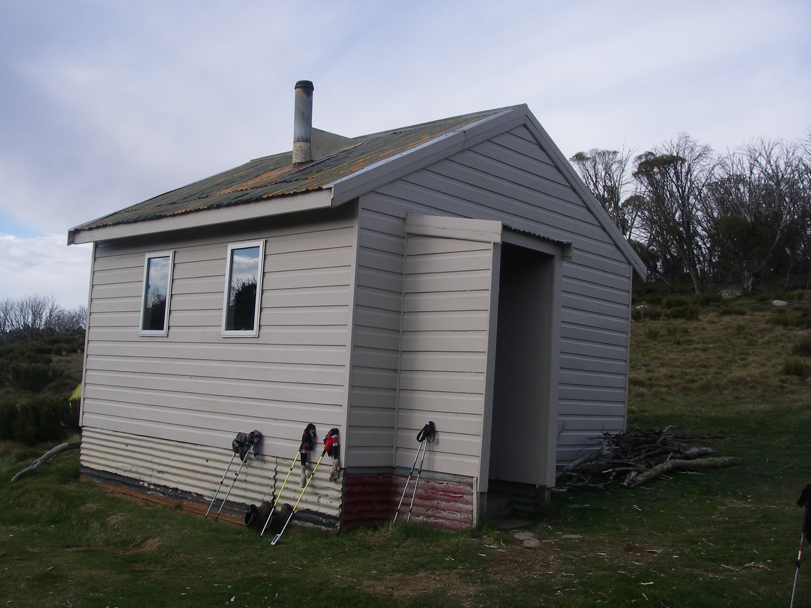
We descended steeply onto the Schlink Trail and followed it for half a kilometre or so to Whites River Hut, for yet another night of throughwalking luxury.
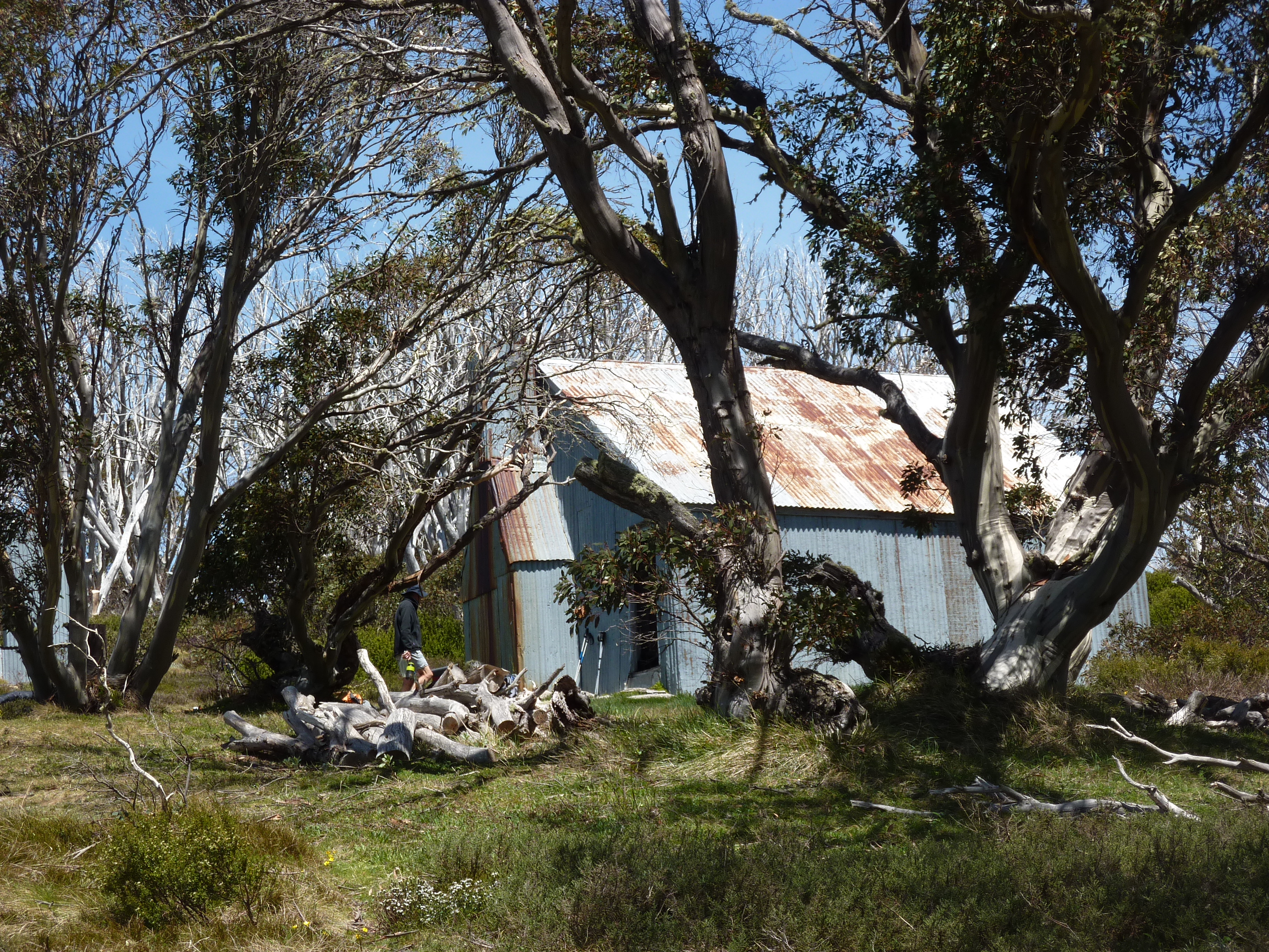
White’s River was built in 1935 by sheep farmers Bill Napthali and Fred Clarke who grazed their flocks on the high alpine meadows of the Rolling Grounds in summer, retreating to protected Snowy River stations for winter.
Constructed of sheet iron, Whites has sleeping bunks, another NPWS ‘Ultimate 500’ cast iron stove, a wood store, a tatty table, bench seats and an outdoor dunny.
The hut is also the summer residence of the notorious Bubbles, and Bubbles Jnr, bush rats extraordinaire: legends of High Country Huts as walkers and skiers record their exploits of marsupial derring-do and innate native rat cunning at avoiding all manner of water traps and flying footwear.
As with our previous visits we spent much of the our evening ‘Bubbles’-proofing our gear; all rucksacks and food bags were then suspended on the nails belted into the huge transverse hut beams. Which seemed effective as there were no nocturnal disturbances from the Bubbles outfit according to my hut hugging companions.
Whites River was memorable for reasons other than rat attacks. Notably, it was our first sighting of other walkers. In the distance, late afternoon and heading north on the Schlink Trail, were five bushwalkers, probably heading for the Schlink Hilton to doss down for the night.
As our Kerries Ridge traverse had been such an outstanding day of alpine walking John produced a wee dram for a toast to “The Kerries”.
And finally, after many trips to the high country I was able to confirm that Little Ravens, after feeding all day on Bogong moths, don’t roost among the granite peaks and cliffs as I once supposed, but leave the high peaks just on dusk and fly down to the snow gum woodlands for their night’s kip.
Saturday 8 November: Whites River to Mt Anderson Saddle via the Rolling Grounds: 12 kms.
As always the troops were up early, bright-eyed and bushy-tailed and trackside by 7.00 am. Today would be our hard day, a distance of only twelve kilometres and a vertical ascent of about 328m… but give or take a few pretty major ups and downs.
And the wind was picking up. But the most problematic part was our traverse over the Rolling Grounds, which are described in the Chapman and Siseman guidebook thus:
“Known as the Rolling Ground it is a featureless region of huge granite tors and little vegetation. On a fine sunny day, this part of the Great Dividing Range is best described as bleak. What it is like in a blizzard is left to the imagination. The Rolling Grounds are notorious for difficult navigation in bad weather.”
Fortunately the day was fine and clear, but quite windy. By mid- morning near gale force westerly winds were gusting at around 50 kph. Still, in the scheme of Main Range walking, even these conditions were pretty much ideal for crossing these high level alpine meadows and bogs.
I thought our traverse over the Rolling Grounds was absolutely brilliant walking. The Rolling Grounds is a high altitude plateau above the tree line at 1900 plus metres, cold, exposed but spectacular. But a modicum of navigational care is needed to find Consett Stephen Pass, our access onto the Main Range.
It is said that The Rolling Grounds are so called because in the days of cattle grazing, stock horses would make their way up to roll in the numerous depressions between clumps of snow grass.

We exited The Rolling Grounds at Consett Stephen and began the tedious haul up to Mt Tate, 2028 metres and the start of the Main Range.
Our final leg of the Kiandra to Kossie walk was underway. But another three days of fine weather would be a bonus. Mt Tate was named after Ralph Tate, Professor of geology at the University of Adelaide.
From Tate’s trig summit we looked down to Guthega Pondage, Guthega Village and across the valley to the confrontingly named The Paralyser, The Perisher , Back Perisher and the oddly named Blue Cow Mountain.
Mt Perisher was named by an early pastoralist, James Spencer, who, while chasing lost cattle with his stockman, climbed to the top of the 2054 metre peak for a better view. On the summit he was met by scuds of snow and an icy blasting wind, upon which he commented: “This is a bloody perisher.” Later they climbed the adjacent peak and the stockman remarked, “Well, if that was a perisher, then this is a paralyser.
Onwards to Mt Anderson (1997m) and below its eastern flanks our overnight campsite in the Anderson saddle. A beautiful alpine meadow but bereft of any cover; sunny and exposed to the wind, but we made ourselves comfortable on our springy snow grass pads.
From Anderson summit we had unrivalled views over the tangled western fall of the Main Range; a good place to steer clear of. Just as Snowball Sam sensibly steered clear of John, Joe and I for the remainder of the day after initiating a sneaky underhanded snowball attack as we sat in quiet contemplation of the glorious view over our little campsite far below.
The Snowy Mountains are notorious for turbulent wind conditions, caused by air masses sweeping out of the Great Australian Bight, across the vast flat lands of southern Australia, and then uplifted over the western ramparts, rising 2000 metres in short order to wreak havoc on any harebrained bushwalkers who stray onto the range on a windy day. Fortunately Anderson saddle was relatively speaking, ‘protected’ and the tents stayed up.

Sunday 9 November: Mt Anderson to Wilkinson Valley: 14 kms.
Woke to another fine day but a massive bank of cloud had gathered off to our east. I knew thunderstorms were predicted later but it was still fine and windy aloft on the Main Range and with this wind blowing the chances were that it should stay fine.
The walking pad, such as it was, disappeared intermittently under snow banks. So it was a matter of picking our way around the snow or punching steps across where it was soft enough to be safe. By 7.30 am the wind was really gusting and most of us were still swaddled in beanies, thermals and coats.
I had on two thermal layers and my windproof rain jacket. Meanwhile 14 kilometres to the south the Automatic Weather Station (AWS) at Thredbo Top Station recorded a maximum gust of 74 kph, but generally the wind trundled along at an annoying 30 + kph.
An old soil conservation track from the 1960s or 1970s can be followed from Mt Anderson saddle all the way to the Main Range tourist track.
Despite the wind it was still an outstanding alpine walk along Australia’s highest points: Mt Anton (2010 m), the long crawl up Mt Twynam (2196 m), then down onto the Main Range tourist track, back up to Mt Carruthers summit (2145 m).
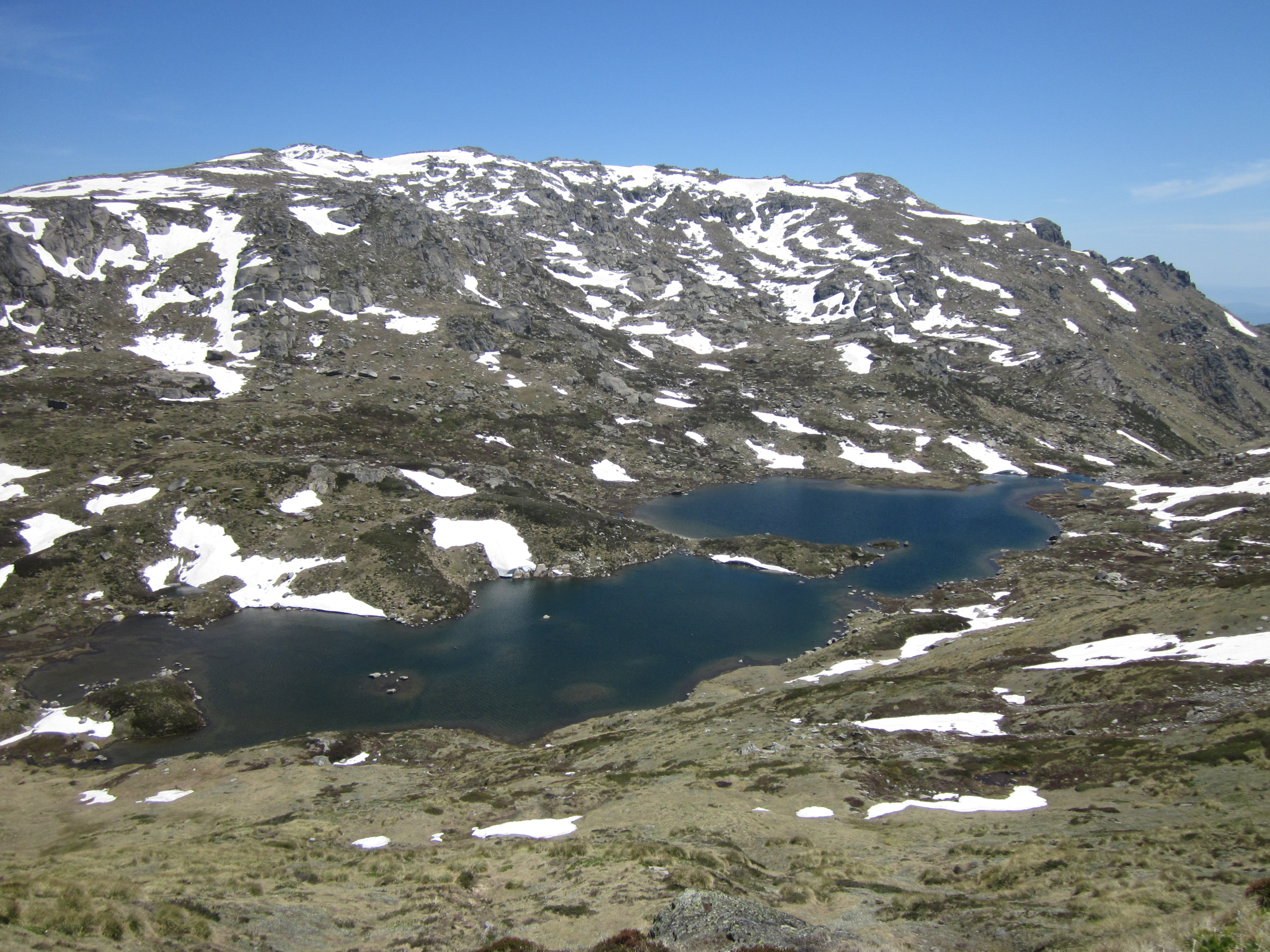
Mt Carruthers was named after Sir Joseph Carruthers, a Premier of NSW, who instigated the construction of the Kosciuszko Road and the old Kosciuszko Hotel. We hunkered down for lunch behind a shelf of rocks overlooking Club Lake, one of the many moraine-dammed glacial lakes in Kosciuszko.
Ahead were Mt Townsend and Mt Kosciuszko, our final peaks. During the Pleistocene, small mountain glaciers ground their way down the valleys now occupied by glacial lakes. In recent historical times, during summer, huge flocks of sheep and later herds of cattle grazed these steep alpine slopes, fouling the pristine snow fed lakes below: Club Lake, Lake Albina, Hedley Tarn, Blue Lake and Lake Cootapatamba. The sheep and cattle were shown the door in 1963. Good riddens.
Lunch over we slapped on another gallon of sunscreen, a meteorological trigger, just like the butterfly flapping its wings in the Amazonian jungle, for as surely as day follows night the wind ratcheted up another cog.
Walking was now redolent of pacing the decks of Wild Oats 11 on a bad day in Bass Strait… one was never quite sure where the feet would land.
The tourist track by-passes first Mt Lee then Mt Northcote (2131 metres). Between them is Northcote Pass, an area of windswept feldmark growing on shattered Silurian sedimentaries. This very specialised plant community covers only 28 hectares in the whole of Kosciuszko, hence is the rarest of its plant communities.
Somehow it survives on this cold wind blasted rocky ground. An information board allows interested walkers to identify feldmark plants: Alpine Sunray (Leucochrysum albicans spp alpinium), Coral Heath (Epacris gunnii), Feldmark Grass (Rytidosperma pumilum) and Feldmark Eyebright (Euphrasia collina spp lapidosa). But given the relentless wind no one wanted to play botanist.

Instead we pushed on, sidling along a narrow defile on the western flanks of Mt Northcote from which we had unparalleled views into Lake Albina, another moraine dammed lake. This was a popular destination for skiers and bushwalkers, but with the removal of the Albina Hut by the Parks service in the early 1980s together with several other Soil Conservation Huts, few of our latter-day trail-bound walkers bother to descend to Lake Albina.
My original plan had been to leave the tourist track at Muellers Pass and climb over Muellers Peak thence for a highlight camp on the snow grass meadows around Alice Rawson Peak (2160 metres). But the wind put paid to this plan as there was little chance of tents withstanding the blast.
And so, acting on information given by four young hikers we dropped into Wilkinson Valley for our last night on the trail. Here we could shelter behind massive granite boulders which lined the edge of the former cirque valley.

Monday 10 November: Wilkinson Valley to Mt Kosciuszko via Mt Townsend: 14 kms.
An early 6.30 am start, rugged up but packless, to climb Mt Townsend, at 2209 metres, Australia’s second highest peak. After a bit of pussy-footing around with snow banks we scrambled up to the summit trig station.
Mt Townsend, named after a Surveyor General of NSW, has a very rugged skyline profile, suggesting that its glacial erosion processes were somewhat different to the more rounded whaleback Main Range peaks, like Kosciuszko.
I am reminded of the nunataks of Antarctica, those craggy peaks projecting above the Antarctic ice cap.
For my money Townsend is a far more spectacular mountain than Kosciuszko with a summit ridge of huge shattered boulders and its tailing spine of the Abbott Range drifting off to the south west.
Below, with 1600 metres of fall, and to our north was the Geehi River which we had crossed days ago at its headwaters. Over to the north east were the almost perpendicular walls of The Sentinel and Watsons Crags. Out to the south west the precipitious Western Fall Wilderness dropping abruptly 1500 metres to the Swampy Plains River. And there, across Wilkinson’s Valley, was Mt Koscuiszko, our final ascent.

Back in the Wilkinson Valley, a hasty pack up of tents and gear and we were off to Mt Kosciuszko, across more devilish snow banks just for good measure.
Mt Kosciuszko was named by the Polish explorer Count Paul Edmund de Strzelecki who spent four years travelling in Australia. In February 1840 Strzelecki climbed to the highest point of the Snowy Mountains and decided to name it after his fellow Pole, General Tadeusz Kosciuszko, who had distinguished himself in the American War of Independence and had led an uprising in 1794 against Prussian and Russian control of Poland.
Strzelecki gave two reasons for using the name ‘Kosciuszko’. Strzelecki pointed out that in Australia he was “amongst a free people, who appreciate freedom” hence the name of the Polish liberation fighter was an appropriate choice. Another reason he gave was that the profile of Mt Kosciuszko resembled the memorial mound that honours Kosciuszko on the outskirts of Krakow.
An interesting side line to this story is that Kosciuszko authorised the sale of all his Ohio (U.S.A.) property to buy freedom for slaves and provide them with an education.
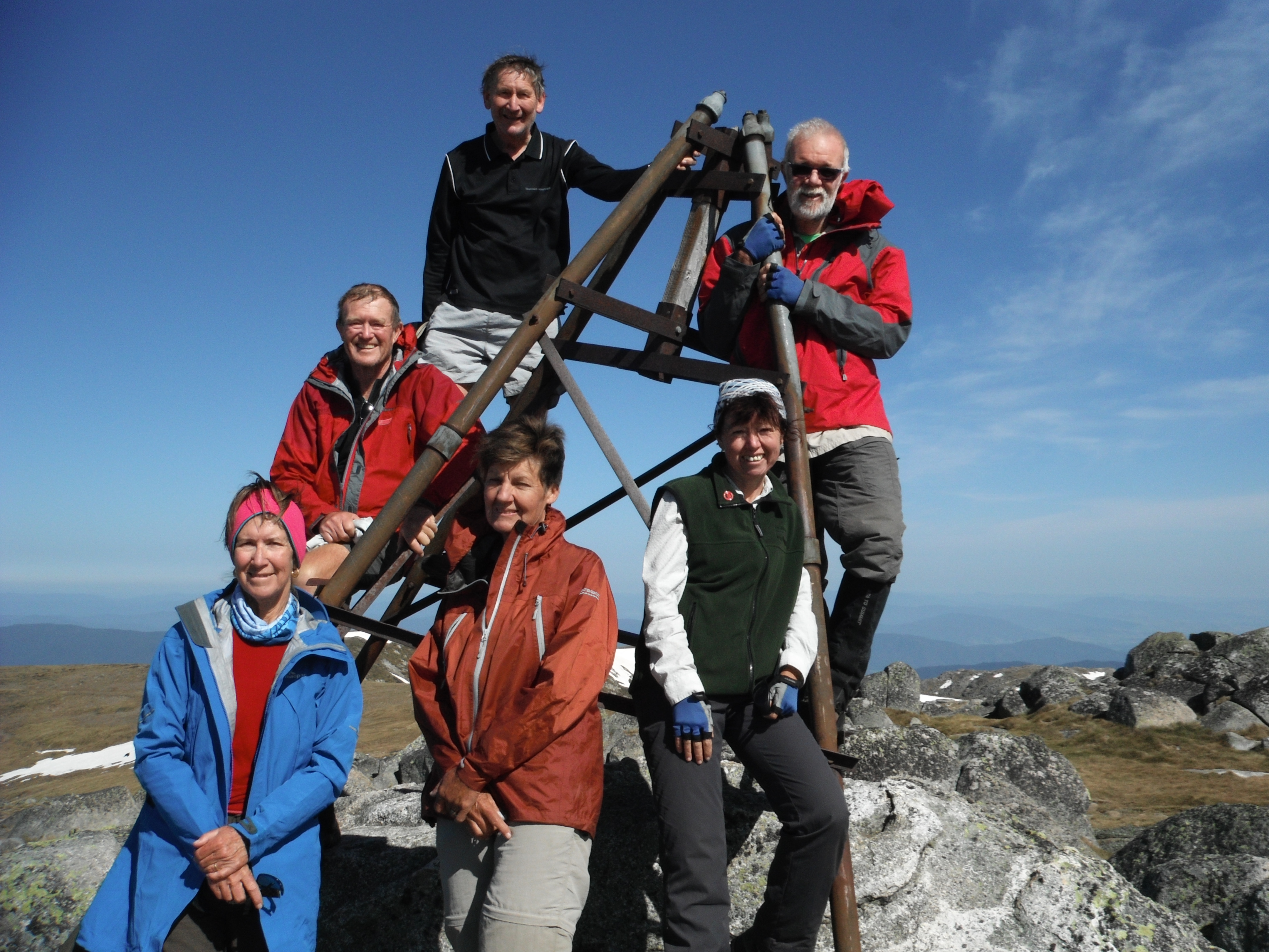
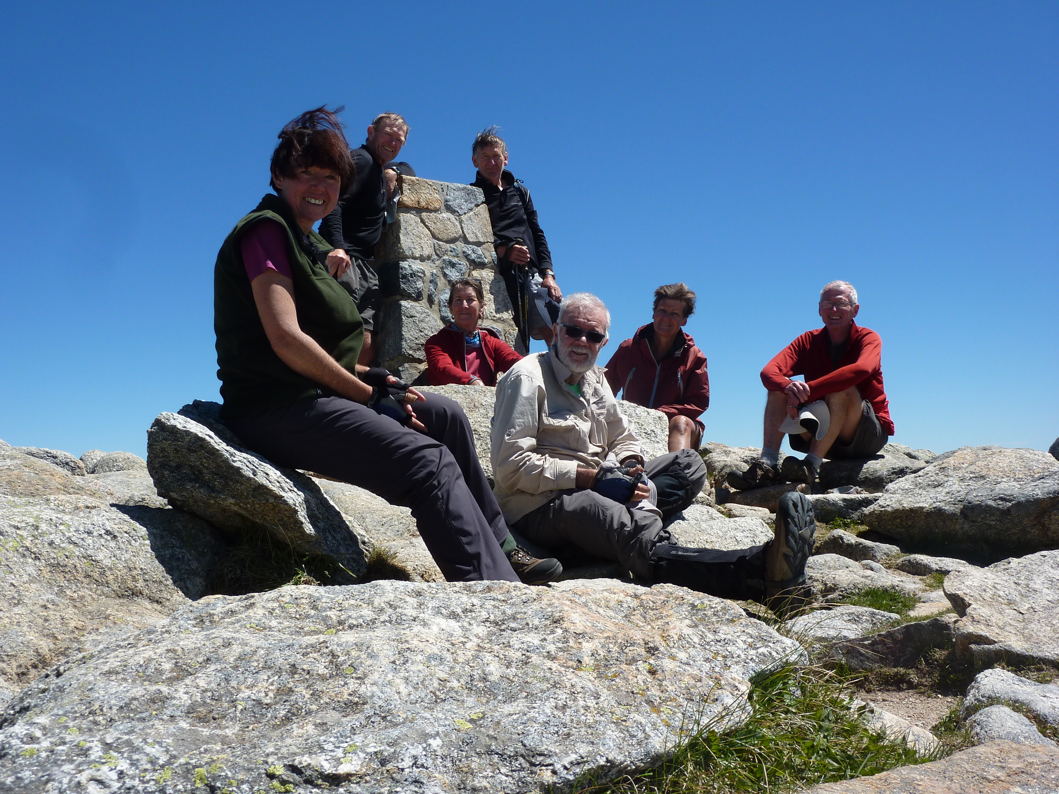
Here we were then, perched on The Roof of Australia, one of Australia’s outstanding wilderness areas. The weather was fine and what could be more picturesque than the snow draped peaks of the Main Range under a clear blue sky? A megapixel and mobile phone heaven.
Remember Clement Wragge? Back in 1897 a snow covered Kosciuszko summit was the scene of another great alpine adventure. Clement Lindley Wragge, meterologist to the colonial Queensland Government, convinced the pollies that the best place to investigate upper atmospheric disturbances in Australia was from an observatory on the summit of Mt Kosciuszko. Accordingly, Wragge and three offsiders stepped onto the summit on 1 December, 1897.
But Wragge’s bullock dray of alpine kit failed to appear, so our intrepid field party spent their first few days in an arctic purgatory. With no sleeping bags, no primus stoves and a thin calico tent they piled on all their clothes.
Eventually, days later, the bullocks hove into view and up went the arctic tent and the Observatory opened for business on Wednesday 8 December, 1897. On 11 December the wily ‘Inclement’ Wragge decamped, heading for the warmer climes of coastal Merimbula, leaving behind a Captain Iliff in charge of B. de Burgh Newth, Bernard Ingleby and Zoroaster, Ingleby’s pooch, a well-fed and rascally St Bernard .
It is claimed that the always sleek Zoroaster dug a secret tunnel to the expedition’s meat cache and his master was considerably exasperated and finally perplexed by Zoroaster’s reluctance to wolf down his daily ration of dog biscuits.
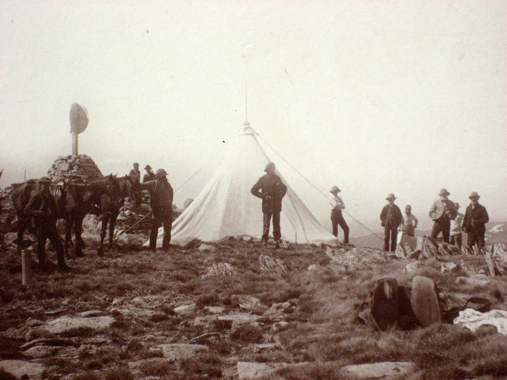
Two months later a howling gale flattened the arctic tent, blew most of the gear off the mountain, and forced our weather observers to crawl back to the safety of the Crackenback River. Wragge, ever the entrepreneur, weaseled £400 out of the Premier of New South Wales to construct a sturdy summit hut, which was duly completed in May, 1898.
Summit life was never dull. Despite the hardships of their location the observers reported enjoying the experience immensely. A stampede of visitors poured in on clip-clop style tours, on foot and even on bicycles. Our obliging observers greeted visitors, gave conducted tours, and demonstrated downhill snowshoeing (skiing).
But this was still a tough gig and the observers were as hard as nails. These were proper mountain men, not like the new age active wear bushwalking and MTB specimens who waddle up Kosciuszko these days.
Wragge’s previous berth had been as weather observer on Scotland’s Ben Nevis, the UK’s highest mountain. Every day for five months he would climb this 1344 metre peak to take readings, whatever the weather.
Wragge nearly lost his life on Ben Nevis when he tried to climb it during the worst gale of the 19th century. Not to be outdone, our Antipodean meterologists contended with 160 kph blizzards that rocked the hut.
Low clouds, charged with electricity, sent flames flying from the teeth of a cross-cut saw; freezing clouds settled over the summit for 26 days straight in June 1898; and the winds were so fierce that observers had to be tethered by a safety rope to save being blown down into the Geehi.
Eventually, in 1914, lightning stuck the hut and it burnt down, never to be rebuilt. An entertaining description of Observatory life was written by H.I. Jensen, who over-wintered in 1898.
And so on a windy Monday afternoon, 10 days since leaving Kiandra, seven malodorous walkers swung onto the Kosciuszko ski lift for the ride down to Thredbo, followed quickly by a priority Kosciuszko Pale Ale and hot potato wedges.
But the AAWT wasn’t finished with us yet. Just for good measure the final 500 metres took us up three banks of steep steps to the Thredbo YHA for hot showers, a soft bed and warm digs.
Thanks to my easy going and ever helpful fellow walkers. It was a pleasure to share with you the delights of Australia’s highest places.