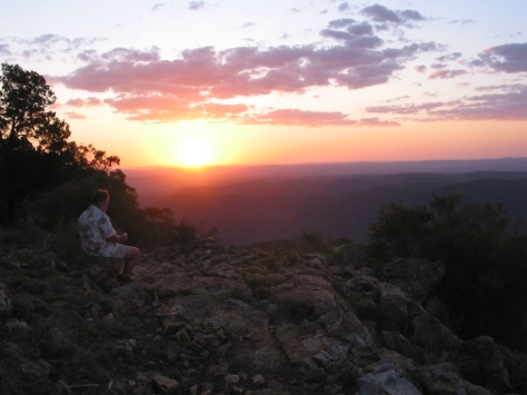
Mawson Plateau lies at at the northern extremity of South Australia’s Flinders Ranges. It is a very remote , inaccessible and arid wilderness. The plateau lies between 600 and 750 metres, reaching its highest point at Freeling Heights at 944 metres. A four day hike was to take us across this granite batholith by way of the gorges, waterfalls and pools of Granite Plateau Creek which drains an otherwise dry landscape. It is said to be one of Australia’s most pristine wilderness areas.
by Glenn Burns

The genesis of this hike was in 2016 when I was part of a group on a camel trek from Mt Hopeless in the far north of South Australia to Umbaratana Station to the west of the tourist resort of Arkaroola in the northern Flinders Ranges.

On the seventh day of our trek, as we travelled across desert plains, ahead of us rose a wall of mountains which I was told were called Freeling Heights, but also known as the Mawson Plateau. One of our fellow walkers, Peter, mentioned that he had been up onto the Mawson Plateau and generously offered to use his contacts to organise a future hike.
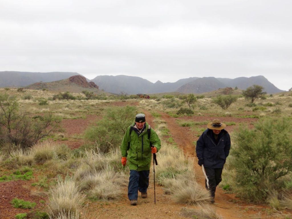
Many years ago I came across Warren Bonython’s book Walking the Flinders Ranges, the report of his epic 1967-1968, 1011 kilometre trek along the Flinders Ranges from Crystal Brook in the south to Mt Hopeless in the far north. My 2016 camel trek and the later Freeling Heights/Mawson Plateau walk would cover much of the territory covered by Bonython in his final and most northerly stage (Stage 9). This section is sometimes referred to by South Australians as the Heysen Trail Extension Section 2.
Sir Douglas Mawson
Mawson Plateau is named after Sir Douglas Mawson, Australian geologist and Antarctic explorer. In his later academic career he researched the geology of the northern Flinders Ranges. The Mawson Trail, a mountain bike trail through the Flinders and Mt Lofty Ranges is also named after him.

Photo of Douglas Mawson by Frank Hurley. The photo is titled Leaning into the Wind. It shows Douglas Mawson collecting ice for cooking. The winds were blowing at a constant 160 kph.
Source: Frank Hurley. Aust. Antarctic Exped. 1911-1914.
The Geography of Mawson Plateau
There is scant information on the Mawson Plateau so here is some of its basic geography based on my personal observations and a trawl of documents available in assorted books and journals. A notation on the Australian Geographic map The Flinders Ranges (2007) describes it thus: ‘Perched behind its rugged eastern escarpment, this little-known stronghold is a maze of weather-hewn granite crags and boulders. After rainstorms the deep trough-like waterholes along its creeks form the largest natural body of water in the Flinders – a priceless ecological haven for native fish and water plants.’
Location
Mawson Plateau, 300 6′ 38″ S and 1390 25’19” E, is part of the northern Flinders Ranges complex on the Mt Freeling pastoral lease in South Australia. It lies adjacent to the north eastern boundary of the famous Arkaroola Sanctuary.

Geology and Landforms
Mawson Plateau is a 70 square kilometre granitic batholith with an average elevation between 600 and 700 metres. Its southern boundary is delineated by the higher Freeling Heights which rise to 944 metres. The eastern boundary is a spectacular 250 metre fall called the Granite Escarpment, while the northern and western boundaries are bounded by Hamilton Creek. From its headwaters high up in Mawson Plateau, Hamilton Creek (intermittent) drains initially north east to Moolawatana Station then swings south east from which it finally decants (rarely) into Lake Callabonna, a dry salt lake. Interestingly, Callabonna is an important site for late Pleistocene fossils.

The plateau is a tangled landscape of sandy creek beds, sand plains, rocky ridges and vast expanses of granite, covered by a mantle of loose, shattered rock and huge granite tors. Its surface has been intricately dissected by Granite Plateau Creek and Saucepan Creek, both non-perennial tributaries of Hamilton Creek. Granite Plateau Creek has cut deeply into its bedrock to form an extensive gorge featuring dry waterfalls, pools, deep potholes and sandy beaches. It was this feature that we would use to traverse the plateau which is otherwise totally waterless.

The highest part of the plateau, Freeling Heights, is composed of Freeling Heights Quartzite, of Mesoproterozoic origin dating back 1590 to 1580 ma. These metasediments are part of the Radium Creek Group, some of the oldest rocks in the Flinders Ranges.
The main plateau surface is a granite of Late Ordovician – Silurian age, 442 ma, intruded into the older rocks. The plateau is a major leucogranitic intrusion called British Empire Granite (BEG). BEG leucogranite is light coloured with almost no dark minerals. It is medium to coarse-grained and highly radioactive. Its radioactivity is another interesting story; too long to be recounted here. BEG also contains numerous pegmatites. Pegmatites form in the final stage of a magma’s crystallisation. Thus they contain exceptionally large crystals and minerals that are rarely found in other types of rocks. Spodumene (an ore of lithium), tourmaline, topaz and beryllium are all found with pegmatites.

Climate
The Mawson Plateau lies in one of Australia’s major arid bioclimatic regions, the Eyrean Region. The Bureau of Meteorology classifies its climate as a Desert climate characterised by hot and persistently dry seasons. For the climate afficionados among you, its Koppen climate classification is BSh, a hot semi-arid climate. The plateau nestles between the 200 and 250 mm isohyets and its rainfall displays high variability. Being caught in Granite Plateau Creek during a very rare flood event would be best avoided. That said, winter walking weather is outstanding. Expect mild sunny days, deep blue cloudless skies and cool nights all of which make for an unforgettable experience.
Temperature and Rainfall Statistics for Arkaroola SA. 318 m
August
| Mean Max Temp oC | Mean Min Temp oC | Mean Rainfall mm | Mean Rain Days |
| 19.1 | 4.6 | 14.4 | 2.1 |
Observations on fauna and plant communities
Fauna
Reptiles form a significant and the most observable part of the faunal assemblage.
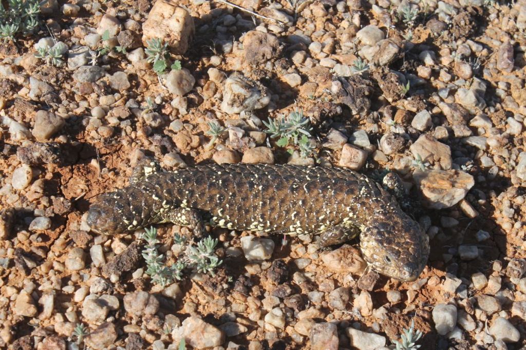
Skinks, geckoes , and dragons were all seen, but no snakes – possibly they were in hibernation.
Some rockholes hold water permanently even in extended droughts. These are refuge sites for tadpoles, fish and frogs including an undescribed species (Crinea sp). Mammalian fauna includes Euros and if you get very lucky, the endangered Yellow-footed Rock Wallaby. These spectacular macropods are easily identified by their yellow feet and tiger banded tails.


Bird species recorded were Wedge-tailed Eagle (many and obvious), Australian Raven, White-faced Heron, White-browed Babbler, Singing Honeyeater, Wood Swallow and Australian Magpie-lark. A dismal effort if truth be told, but I can always claim that my eyes were always focused on the next foot-fall.
Plant communities
Freeling Heights: a hill-top heath community of Porcupine Grass (Triodia irritans), Broombush (Melaleuca uncinata), Fringe Myrtle (Calytrix tetragona), Wax Flower (Eriostemon sp) and Spidery Wattle (Acacia araneosa).

Granite Plateau Creek: A woodland of River Red Gum (Eucalyptus camaldulensis) and White Cypress Pine (Callitris glaucophylla). The shrub layer was an association of Wild Rosemary (Cassinia laevis), Hopbush (Dodonaea viscosa ssp angustissima), Cassia (Senna artemisioides) and Yucca ( Xanthorrea quadrangulata).

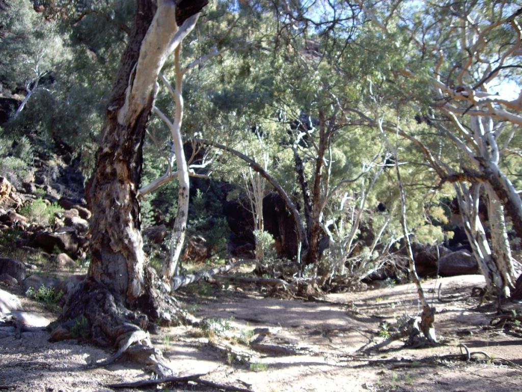
Gorge tops and open granite terrain: The few plants I could identify: Mulga (Acacia aneura), Corkbark (Hakea ednieana), White Cypress Pine (Callitris glaucophylla), Native Orange (Capparis mitchellii) and Bell Fruit Tree or Camel Poison (Codonocarpus pyramidalis).
Aboriginal Occupation
The northern Flinders Ranges were occupied at least from some 49,000 years ago. This date was obtained from a site known as the Warratyi rock shelter, south of Mawson Plateau. Evidence from Warratyi shows the use of key technologies such as stone axes and ochre. The site also had evidence that humans existed alongside of, and hunted megafauna. Excavations to a depth of one metre produced 4,000 artefacts and 200 bone fragments including some from Diprotodon optatum , a giant wombat-like creature.

It is likely that aborigines would have camped in the Granite Plateau Creek catchment as there are a number of permanent waterholes. As the climate of inland Australia dried these waterholes would have been vital refuge sites for inland aborigines.
At the time of first European contact the tribal groups occupying the northern Flinders Ranges were the Yardliyawara and the Wailpi. European settlement fragmented their social and economic structures so that today these tribes are known collectively as the Adnyamathanha ( hills people ). Fortunately, the Adnyamathanha have been able to maintain their cultural identity and links to the northern Flinders.
Further reading:
Map: Yudnamutana: 1:50 000.
Map: Frome: 1:250 000.
Map: Flinders Ranges: 1:550 000 (Aust. Geog.).
Bonython, W.C: Walking the Flinders Ranges (Rigby, 1971).
Barker, S et.al. eds: Explore the Flinders Ranges (RGSSA, 2014).
Mincham, H: The Story of the Flinders Ranges (Rigby,1974).
Pledge, N: Fossils of the Flinders and Mt Lofty Ranges (SA Museum, 1985).
Cawood, M. and Langford, M: The Flinders Ranges (Aust. Geog., 2000).
Saturday : Arkaroola to Edward Springs: 50 kms
And so, on an annoyingly aberrant cool, overcast August day we were lurching and grinding over old 4WD station and mining tracks heading for our base camp at somewhere called Edward Springs (springless and definitely waterless as far as I could tell). The South Australians had very kindly organised to squeeze us into one of their off-road vehicles for the trip in. The tracks, in places, were little better than wheel ruts cutting across a landscape that varied between rock, sand, sandy creek beds and clumps of spinifex. The drive in was meant to take only a few hours from Arkaroola giving a walking party time to climb Freeling Heights (944 m) and set up camp that same afternoon. “The best laid plans of mice and men”.
The ‘tracks’ took their toll on a Subaru’s tires, leaving a Landrover Defender and a Toyota Prado to ferry in seven walkers and five base campers. Suffice to say we couldn’t all fit into the two remaining cars. The overflow took to hoofing the rest of the way in to our base camp (wherever that was). But I was happy enough to be out walking, even under a dark, threatening sky. The view ahead was spectacular. Across the undulating plains rose the long, flat profile of the Mawson Plateau. Later in the afternoon, at the end of a vague track, under the shadow of Freeling Heights we found the earlier arrivals. Tents were up and a camp fire going.

Our campsite was in the dry bed of MacDonnell Creek, a major feeder of the Hamilton River ( GR: 416657 Yudnamutana 1: 50,000 AGD 84 ). Tomorrow’s access to Freeling Heights was, initially, via a small unnamed tributary of MacDonnell Creek which flowed north west off Freeling Heights and into MacDonnell Creek about 500 metres north of our base camp.
The sight of a welcoming blaze somewhat improved my mood as I surveyed our setting which could, at best, be described as desolate. A far cry from my favourite haunts in the rolling alpine meadows of Kosciusko National Park. Here we were tucked up into a dry creek bed with a maze of dark glowering hills to our backs, and a thickening bank of clouds gathering overhead. Creating a level tent pad in these fields of shattered rock and clumps of spinifex proved a bit of a mission.
Darkness closed in quickly but a small community gathered around the fire to prepare dinner and work our way through trivia questions while we cooked a meal. For some, dinner was an exotic feed prepared by Jack. My options were pretty limited, a reconstituted dried meal. But here’s the thing. Our South Australian friends catered for a cast of thousands so there were invariably seconds for everyone, myself included. No danger of impending starvation on this trip.
Some of us sported comfortable folding chairs while the hardier South Australian types constructed Fred Flintstone lounge chairs from the abundant sheets of quartzite living on the creek bed (pretty uncomfortable actually, but nobody was going to admit to that). Our campfire reveries were cut short by an unwelcome visitor, very light drizzle. Not predicted and certainly unexpected in this arid environment. By 8.00 pm the group had dispersed to their respective camping arrangements in preparation for our 8.00 am departure on the morrow.
Sunday: MacDonnell Ck/ Edward Springs Base camp to second overnight camp at Tee Junction Waterhole: 10 kms.

Being creatures of habit, John and I emerged into the chill darkness soon after 5.30am. While Susan caught another twenty winks John tizzied up the fire and a billy was put on to boil for our tea and coffee. By 8.00 am our hiking party of Paul , Rob , Mike and Jack (from South Australia) and Susan, John and I (Queenslanders) mustered at the start of a mining track leading south east out of the campsite; leaving the base campers to climb Freeling Heights at their leisure. The sky had cleared to a brilliant cloudless blue as only a desert sky can.
Our climb to Freeling Heights would take several hours even though the altitude gain was only 300 metres. It was a landscape of loose rocks, thick scrub and tangled hills dissected by numerous dry gullies. As well, we were dragging along litres of water to see us through the day until we reached Tee Junction Waterhole late in the afternoon.

The route, which didn’t seem at all obvious to myself or our South Australian friends, involved following up the mining track which soon petered out. As our original leader had opted out of the hike, I never quite figured out who the substitute leader was or who was doing the navigation. But everyone chipped in and things seemed tickety boo. From here it was down into a dry creek bed, scrub bashing and scrabbling over boulders until the creek became impassable and we were forced out onto a ridge leading to the stony western rim of Freeling Heights at about 900 metres.

It was clear to me by now that the group’s modus operandi was pretty laissez-faire. Walkers scattered across the landscape with the fastest walkers meeting up with whoever was leading at the time ( a moveable feast). Then followed a chat about navigating to the next landmark. Not really a problem up here on the Freeling Heights high tops, but later on, by mid afternoon, a niggling issue for those lagging behind when we descended onto the sandplains and dense Ti-tree thickets below Freeling Heights.

A brief stop on the western rim of Freeling Heights and we tore off again to find the impressive drystone cairn marking the summit at 944 metres.

We propped here for morning tea and to take in the very impressive views out over the tangled ‘all slopes’ topography and out onto the waterless and featureless plains beyond. In 1840, the explorer Edward John Eyre climbed a low ‘haycock- like’ peak on the plains just to our north and described the scene as ‘cheerless and hopeless’. He turned away and beat a hasty retreat to the south.


From Freeling Heights we dropped 250 metres down a steep escarpment covered in shattered quartzite onto a sandplain forming the headwaters of the Granite Plateau Creek system. For the next three days we would follow the gorges and sandy bed of Granite Plateau Creek out to its junction with Hamilton Creek near where, hopefully, the exit base camp had been established. Our base campers later reported that the drive from MacDonnell Creek/Edward Springs to Hamilton Creek had been long and tortuous, occupying most of the day. Apparently not something they were keen to repeat.

As the creek bed and its fringing flood plain were choked with dense thickets of White Tea-tree (Melaleuca glomerata), we edged uphill and took to the lower hills and ridges, all the while trying to maintain a line of travel to intersect with Tee Junction Waterhole five kilometres hence. But with fellow walkers spread over the landscape it was a toss up as to who was leading and who to follow . The low ridges and scrub made it difficult to see other walkers. But as we were not leading the walk and the terrain was unfamiliar, I kept stumm about any thoughts I harboured that we should be keeping together. Anyway, our leaders seemed to have the navigation under control.
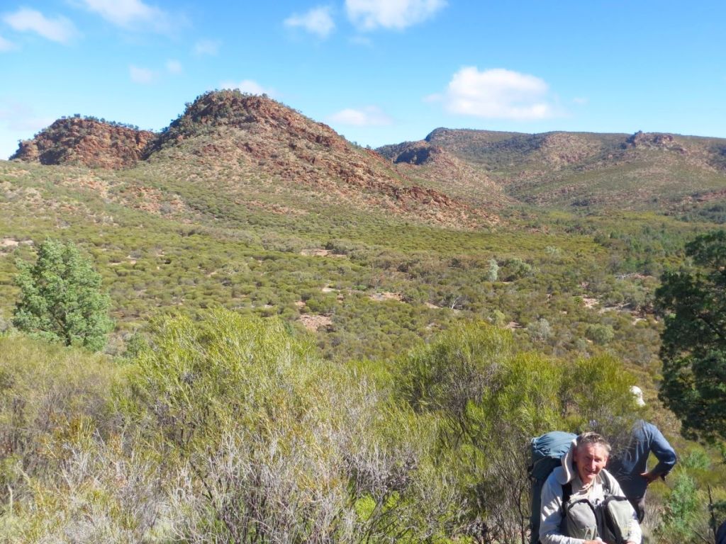
I have done quite a bit of walking with John and Susan and I became aware that they were travelling much slower than they usually do and not keeping up with the rest of the group.
By mid-afternoon it dawned on me that Susan was hobbling along nursing a dodgy ankle or foot; apparently damaged several hours ago on Freeling Heights. When we finally dropped into Granite Plateau Creek late in the afternoon, John, Susan and I decided to take an early mark and propped at the first decent waterhole. It was agreed that the rest of the party would head downstream to Tee Junction Waterhole for the first night’s camp.
While Susan soaked the injured ankle/foot in the waterhole , John and I set up tents, collected firewood (too easy) and got the campfire going. This was a campsite par excellence: sandy tent platforms, abundant firewood and heaps of water (once purified). We would be very comfy here for the night ( GR: 475678 Yudnamutana 1: 50,000 AGD 84 ).

Monday: Tee Junction to third overnight camp: Granite Plateau Creek: 6.5 kms.

A very early start as we had promised the others that we would catch up with them at Tee Junction Waterhole as soon as possible. It is called Tee Junction because Saucepan Creek joins Granite Plateau Creek at an angle of 900. With Susan’s foot strapped and booted we nipped off downstream. After one and half kilometres of creek hopping and thrice longer time wise than expected, we found Team SA about 8.30 am, waiting patiently. In a previous life and in a far away continent, Jack had worked as a paramedic and he set to and re-strapped my bodgy job on Susan’s ankle.

This done, we cooked up a plan to get Susan through the walk as there was no possibility of turning back. The base birds at our Edwards Springs HQ had already flown the coop. The Landrover and Pajero would, by now, have started the long drive around to Hamilton Creek via Greenhill Hut and Valley Bore. The plan was to ease Susan through the rest of the walk. Back at Tee Junction Waterhole we split into two groups. The South Australians would continue downstream at their own pace leaving John to assist Susan while I scouted ahead to find the easiest route. They would wait for us to catch up at lunchtime and we would meet again for the evening camp GR: 475678 Yudnamutana 1:50,000 AGD 84)
Today’s walk was through a spectacular part of the Mawson Plateau, Granite Plateau Creek. We inched down its deeply incised gorge with numerous dry waterfalls, deep cold pools lined with River Red Gums and picturesque sandy beaches. Our Yudnamutana 1:50,000 map sheet notated this section of the creek as having: ‘Numerous Rockholes‘.

An understatement. Our downstream progress dropped to a mere five kilometres for a full day’s walking as we negotiated the innumerable waterfalls, deep waterholes, slippery rocks and gorge walls. By my calculations we were averaging about half a kilometre an hour. One of the few trip reports I later unearthed on Granite Plateau Gorge also recounted excruciatingly slow progress.
But it was well worth the effort. The gorge was superb. One never tired of the waterfalls and rock pools even though they were more often than not an obstruction. At the top of each waterfall we would survey the the route ahead and conclude it wasn’t possible to scramble down safely. Frustrating. Instead we would scrabble up onto the open ridges of granite sheets above us and then work our way around and back down into Granite Plateau Creek. This process added hours to our travel time and heavy rucksacks didn’t help. Where was my length of climbing tape when we needed it?
The rock pools were etched deeply into a pink granite bedrock, the water retained by its impermeable granite base. Each pool guarded by jumbles of huge boulders and dry waterfalls. The granite, glass-like, highly polished, smoothed by eons of grit and running water. The polished surfaces were objects of great beauty but it was wise to be attentive when scrabbling near the lip of any waterfalls. The granite surfaces were covered by loose grus – small angular fragments of disintegrated granite common in arid and semi-arid environments. These had a disconcerting tendency to skid underfoot when crossing the granite pavements. We were a long, long way from any help. I was told that the nearest rescue helicopter was 500 kilometres away in Adelaide.

At the downstream end of the plunge pools were massive banks of sand, idyllic and beach-like. Often shaded by the bleached, white trunks of gnarly River Red Gums. Ideal locations for a lunch stops and camp sites. In retrospect, I would have gratefully spent a few extra few nights coming through this gorge section and spending the afternoons exploring the plateau above the cliff lines.
It was at one of these pools that we finally caught up with our friends. They had already eaten and had a refreshing (read: freezing) dip; but the water was far too cold for three sub-tropical Queenslanders. During the break concern was expressed at our slow progress and that we may not reach our exit point for another two to two and a half days. Then followed more discussion about our situation and the suggestion of setting off the PLB and having Susan extracted by helicopter. A big over-reaction I thought, as did Susan and John. Susan was coping, albeit slowly and cautiously. The decision was left to Susan who said that she was able make it out as long as she took things carefully.
We parted company again with our friends, who promised to wait for us at a suitable downstream campsite. Good as their word, they were bunkered down in a beautiful sandy and level campsite. (GR: 512696 Yudnamutana 1:50,000 AGD 84). We scampered in a tad before darkness closed over the deep gorge. An excellent choice. Heaps of room, plenty of firewood and a water supply just a short walk away. How good is this hiking life? For a third night we settled around a campfire and chewed the fat until weary bones finally sent us to our tents.
Wednesday: Camp Three in Granite Plateau Creek to final base camp near The John Waterhole: 15 kms.

Out again in pre-dawn light to jig up the campfire and boil the billy. My breakfast pickings were pretty meagre as I decided to eke out the rations just in case our exit took two more days. Our threesome were underway by 7.30 am but progress was promptly blocked some 100 metres downstream.
A difficult, long bypass, up and around, taking well over an hour. Not an encouraging start to the day. A bit deflating, in fact. John suggested that we could speed up our progress by climbing up onto the open granite plateau to our east (marked on the map as Numerous Exposed Rocks) and walking to the north east to avoid the worst of the creek’s obstructions. The plan was shelved when we had a good look at the terrain above the gorge and decided that the lack of obvious landmarks on this dry, featureless surface would make for difficult navigation. Far safer to continue plugging our way downstream, come what may.
Although we didn’t realise it at the time, we had just bypassed our last major obstruction. We had unknowingly scored a ‘get out of jail free’ pass. The going got easier with fewer and less complex obstructions. As the gradient eased Susan found the walking much easier and so the pace picked up.

We pulled up for morning tea under a massive free-standing granite tor, a photo of which I had seen in one of the few trip reports on the Mawson Plateau that I have been able to ferret out. While we lolled in the shade I dragged out our map which showed another belt of ‘Numerous Rockholes‘ ahead, which was a bit disconcerting. Perhaps the estimation of another two days to our collection point was, indeed, close to the mark? Our navigation made problematic by the fact of our collection point being off the current map sheet. The next map sheet over was a 1:250,000, which we didn’t have. As a precaution, I had annotated my ‘Yudnamutana‘ map margin with the vague instructions from one of the SA bushwalkers: ‘campsite at least 3 kms further downstream‘, ‘look for Mt Shanahan near junction with Hamilton R’, ‘ ruins of stone hut on W bank‘. None of this was very reassuring.

Our final belt of ‘Numerous Rockholes’ proved a fizzer. Instead we were treated to some of the best arid landscape gorge walking that I have ever done. A sandy creek bed, pools shaded by arching River red gums and red rocky cliffs lifting to the deep blue outback sky. Much more satisfying than creeping down the dark, dank creek lines of coastal Queensland. By our lunch break at 1.00pm we knew the worst of the obstructions were now behind us. It was tempting to take an early mark at one of these magnificent campsites: sandy beaches, abundant water, large shady Eucalypts: no litter and no evidence of the imprint of man. But we were conscious that our slow progress would be a considerable worry to the rest of the party and so we decided to plug on until 4.30 pm . Another long day of nine hours on the hoof.

From here the gorge walls dropped away, the sandy creek bed meandered in long loops, allowing us to save time by cutting corners, traversing over low stony ridge lines instead of humping our rucksacks up and down steep rock faces.
By mid afternoon we had lost our position on the map, foxed by the numerous unmarked tributaries, the tortuous meandering of the creek and the sameness of the elevated points above us. No particular landmarks stood out and while our average speed was faster than previous days, any estimate of distance travelled downstream was a rough guess at best. We were reasonably certain that we had moved off the ‘Yudnamatana’ mapsheet and were now effectively mapless. Also GPSless . .
Soon after 4.00 pm we popped out onto a large braided creek junction. For a while we had been expecting to see Mt Shanahan as a guide to our position relative to the Hamilton River junction. But Mt Shanahan had completely evaded us. Unbelieveable. Was this the Hamilton River junction? We took a punt and decided that it was large enough. A quick check of the direction of flood debris suggested that we turn north. It was now a matter of ploughing on in the main river bed until we found a suitable waterhole to camp at. Alas, no more water, just a dry river bed.

A little while later John remarked that he could smell smoke. We wandered on, still getting the occasional whiff of Eucalyptus scented smoke. Then I heard the distant purring of a diesel engine. Station owners?
Our walk was over. Ahead was a bluff and waterhole ( now dry) that we recognised as campsite 5 from our 2016 Camel Expedition. Our friends had arrived mid-afternoon and had set up their tents, got the fire going and the billy boiling.

Above the Hamilton River are the ruins of an old hut. The only remains were crumbling dry-stone walls with the brush roof long gone. It may have been built by a shepherd or an old-time miner. Whoever occupied it the decades that followed would have been treated to one of the most picturesque views in the northern Flinders Ranges. Come mid- summer, though, it would have been a hell on earth.

My thanks to John and Susan for the road trip into Arkaroola via Camerons Corner and the Strzelecki Track. A big thanks also to our very generous South Australian bushwalking hosts, especially Cathy and Peter for the trip back to Adelaide and for putting me up overnight in their very comfortable home.


