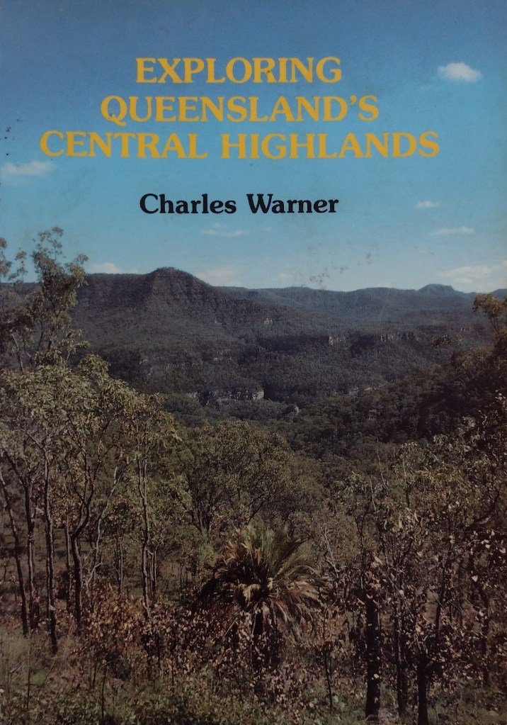
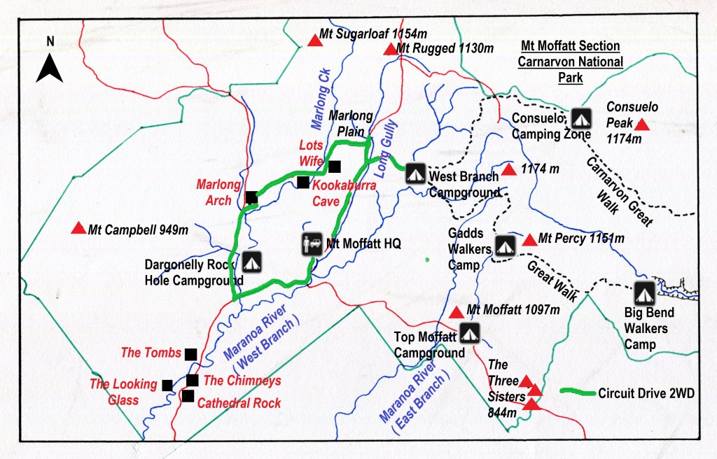
The Mount Moffatt section of Carnarvon National Park is a remote and relatively pristine landscape occupying the headwaters of the Maranoa River. It features broad sandy valleys, basalt tablelands and outcrops of sculpted sandstone rising abruptly from the plains.
I first visited Mt Moffatt National Park on a 10 day natural history campout in 1988 and have returned a number of times , drawn back for exploratory hikes to Mt Moffatt’s high country on Consuelo Tableland , the upper Carnarvon Creek gorge and more recently the Carnarvon Great Walk. The report that follows is the first of the many accounts that I have written covering Mt Moffatt National Park.

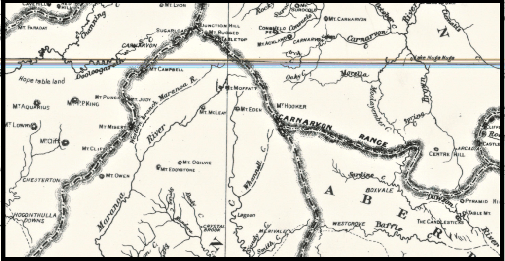
Location of Mt Moffatt Section

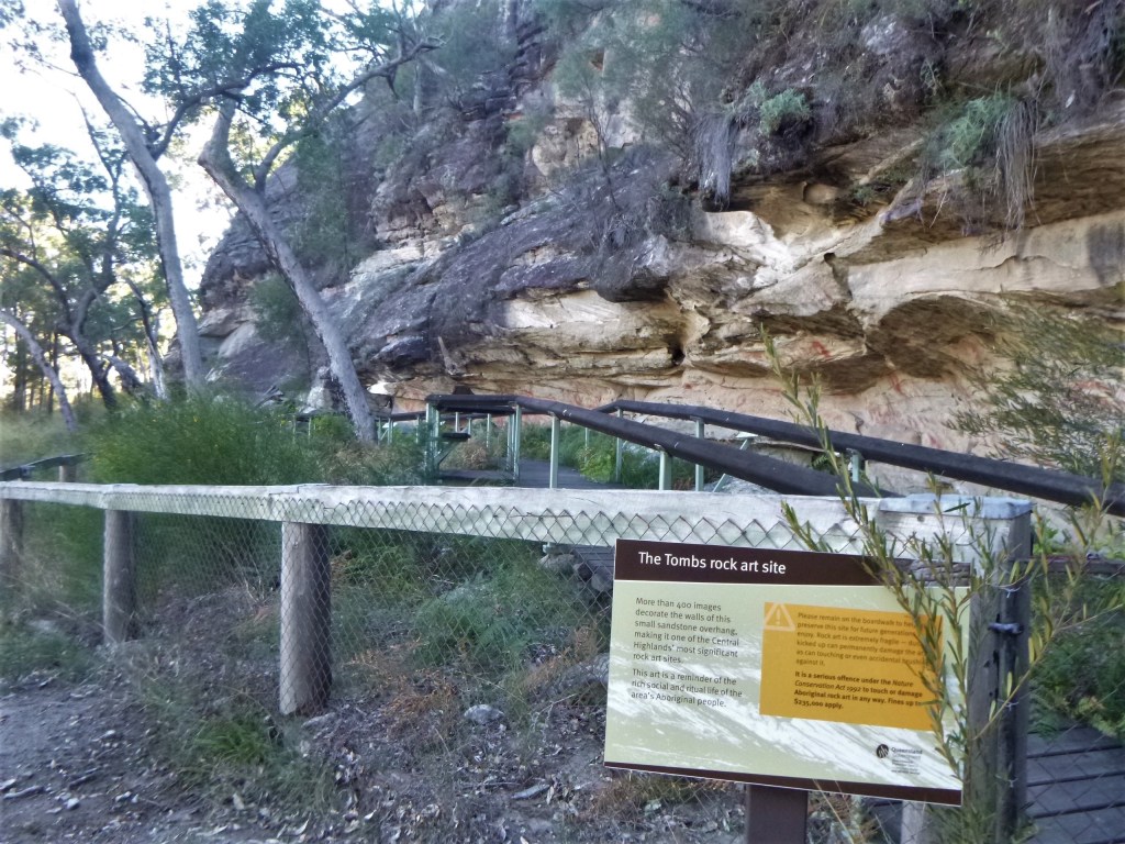
Mount Moffatt has a rich human history. Aboriginal art is abundant as the Bidjara and Nuri occupation of the Carnarvon Ranges stretches back at least 19,000 years. Excavations were carried out in the 1960s by Professor John Mulvaney at Kenniffs Cave and the Tombs.
At Kenniffs he found the remains of campfires extending three metres below the floor of the cave. Mulvaney used the new technology of radiocarbon dating to dial back the story of Aboriginal occupation of Australia 19,500 years. The Bidjara and Nuri had lived through the Pleistocene Ice Age.
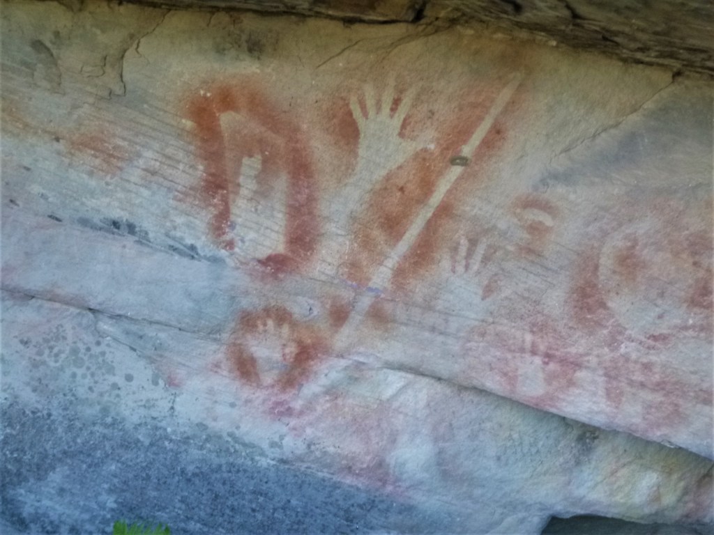
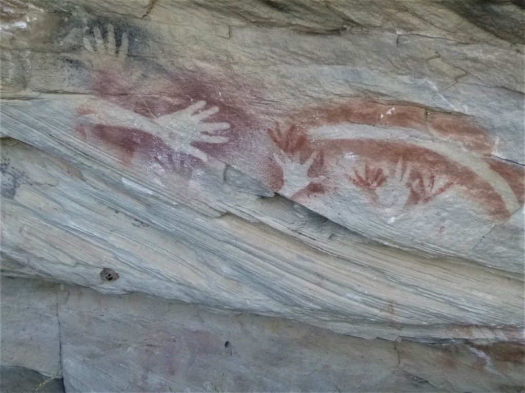
Aboriginal Stencil Art: Mt Moffatt.


European Occupation of the Upper Maranoa District. The Mountain Cattle Runs.
The first European to pass through the area was the explorer Thomas Mitchell who, in June 1846, travelled along the Chesterton Range, Mt Moffatt’s western boundary, looking to extend the colony’s pastoral frontier northwards.
The ever optimistic Mitchell wrote glowingly of ‘ excellent open forest land’ and a landscape that ‘was park-like and most inviting’. Land hungry squatters soon followed his tracks and studied his sketch maps , with pastoralism in the Carnarvon Ranges commencing in the 1860s .
The Mt Moffatt run was originally made up of five blocks cut from the Mt Ogilvie run, blocks three through to seven. These were first taken up under licence by George Fullerton in 1867.
Fullerton visited the upper Maranoa when he went out on an exploratory expedition in 1861 ( towards the Womblebank andTooloombilla runs ) with his brother-in-law , a Mr Moffatt. Moffatt was the nephew of Mr Thomas De Lacy Moffatt, later to become Queensland’s Colonial Treasurer.
The Queensland Lands Department described the run as‘ rough and mountainous but generally well-grassed…fairly good pastoral country and very suitable for breeding cattle ‘. The rough country made it difficult country to work and its ownership changed hands a number of times.
The Waldron family took up the run in 1939 and built a family homestead that is now used by park rangers. In 1979 Mt Moffatt was purchased from the Vincent family and converted to national park status. Reminders of the area’s life as a cattle property are to be found in the homestead, old stockyards and fencing.
The De Lacy Moffatts
The name Mt Moffatt is likely connected to the De Lacy Moffatt family (or Moffat ). Queensland’s Geographic Placenames Board can shed no light on the matter, but I think it is named after the De Lacy Moffatt family .
Thomas De Lacy Moffatt ( 1824-1864) was a Queensland politician and Queensland’s second Colonial Treasurer, serving from 1862 to 1864. He was a squatter and established the run Callandoon on the Darling Downs. He was elected to the first Legislative Assembly of Queensland in April 1860 for the District of the Western Downs. My guess is that the Mt Moffatt run was probably named for Thomas de Lacy Moffatt by his son or his nephew.

The Mt Moffatt Circuit Drive.
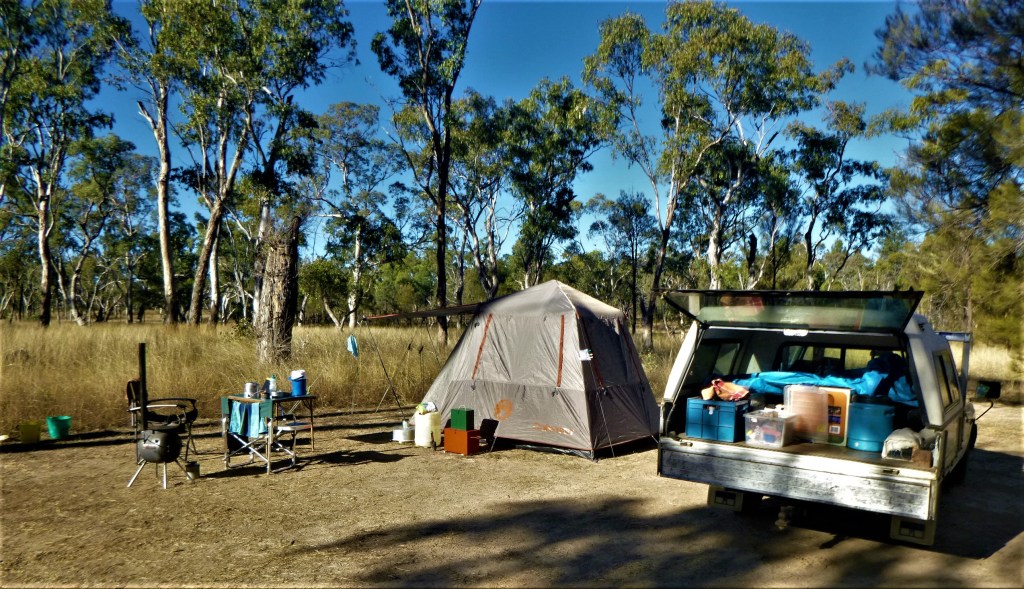
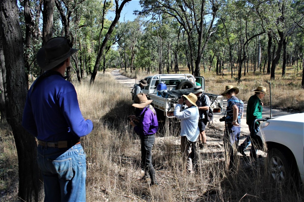
Our little 4WD convoy piloted by my friends Frank and Julie left the Dargonelly Rock Holes Campsite just shy of an unusually tardy 8.45am. Come the following morning, our leader Frank had whipped us into shape and earlier departures ruled.
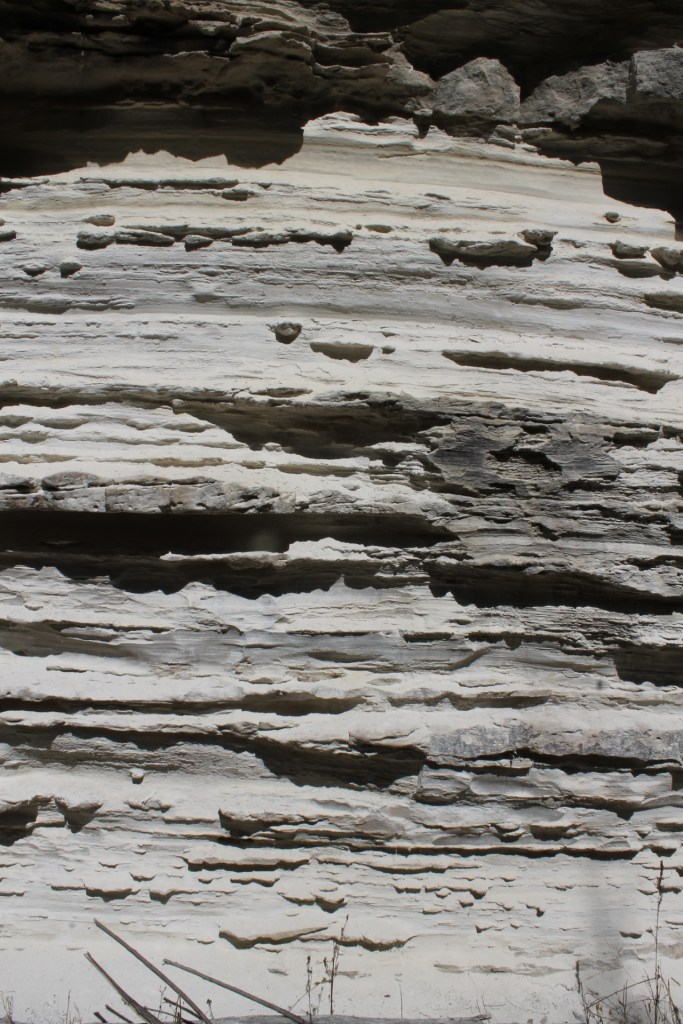
Today we would traverse sandplains at 700-800 metres, derived predominantly from Jurassic Precipice sandstones. These sandstones are the bottom stratum of the Surat Basin, deposited 200 – 186 million years ago.
Map of Mt Moffatt National Park: Circuit Drive

The Surat Basin sediments had their origins in a depositional phase after the momentous tectonic activity of the Triassic Period (250 – 201 million years ago). Sedimentation in the ensuing Jurassic Period was restricted to the Great Artesian Basin and its component basins: Surat, Nambour, Clarence-Moreton, Laura and Carpentaria. The landscapes of many of Central Queensland’s highly scenic National Parks, including Mount Moffatt, date from this period.
The component layers of the Surat Basin from oldest to youngest are: Precipice sandstone, Evergreen sandstones, its distinctive Boxvale and Westgrove Members , and Hutton sandstones.


Some three kilometres north along the Circuit Drive was our first stop, Marlong Arch. As we glided into the car park, two Eastern Grey roos and a joey took flight, one adult collecting a barrier post in its haste to decamp. But no harm done.

Marlong Arch is an arch of Precipice sandstone standing 50 metres or so above the surrounding plain. It is probably the most photographed feature in Mount Moffatt. Even the famous Australian Antarctic photographer Frank Hurley came to Mount Moffatt (in October 1949) and photographed Marlong Arch.
The photo, which shows Brenda Vincent on her pony Cupie under the arch, appears in his book Queensland, a Camera Study. Brenda Vincent had lived and worked on Mount Moffatt when it was a remote highland cattle property.

Frank Hurley, famous Australian Photographer visits Mt Moffatt
The photograph above was one of many taken by one of Australia’s most well known photographers, Frank Hurley ( b. 1885 ). Hurley was the photographer for Ernest Shackleton’s 1914 Antarctic expedition.
He recorded the demise of their ship Endurance as it was slowly destroyed by pack – ice. All the crew survived the ordeal and Hurley returned home to then become an Official War photographer for the AIF serving in the trenches with another famous Australian, Hubert Wilkins.
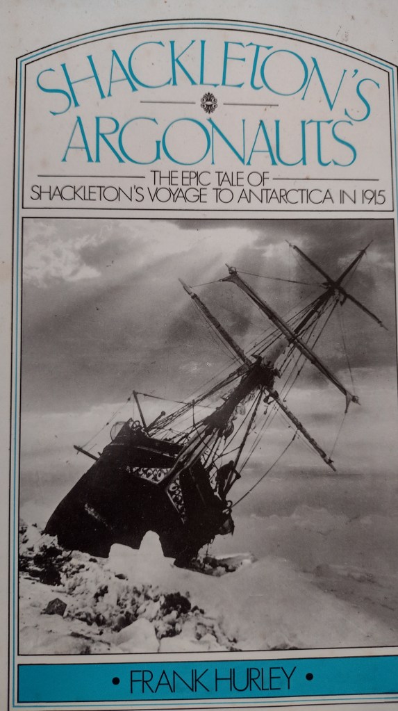
An excellent write – up of Hurley’s visit to the Carnarvons ( Tracks in the Sand – Frank Hurley and the Carnarvon Ranges ) can be found on Robert Ashdown’s blogsite.
Galley of images taken by Frank Hurley on his visit to Mt Moffatt Station in 1949.
The Tombs, Aboriginal rock art site, Mt Moffatt, qld, 1949. 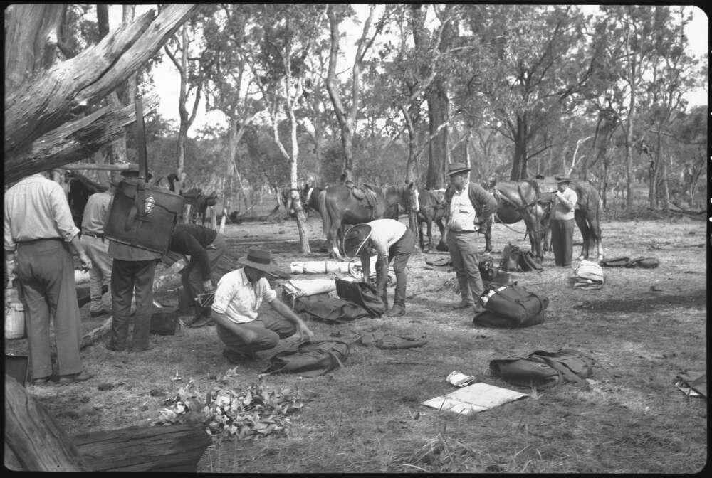
Racecourse Campsite, Consuelo Tableland, Mt Moffatt, Qld 1949. 
Mountains and Cliff faces, Consuelo Tableland, Qld,1949 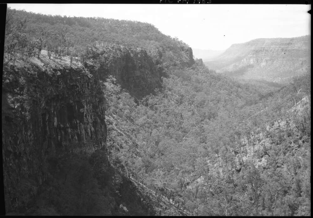
Trees in a valley, Consuelo Tableland, Qld , !949. 
Booringa Shire Clerk, Arthur Donnelly leading a pack of horses, Mt Moffatt Station, Qld, 1949. 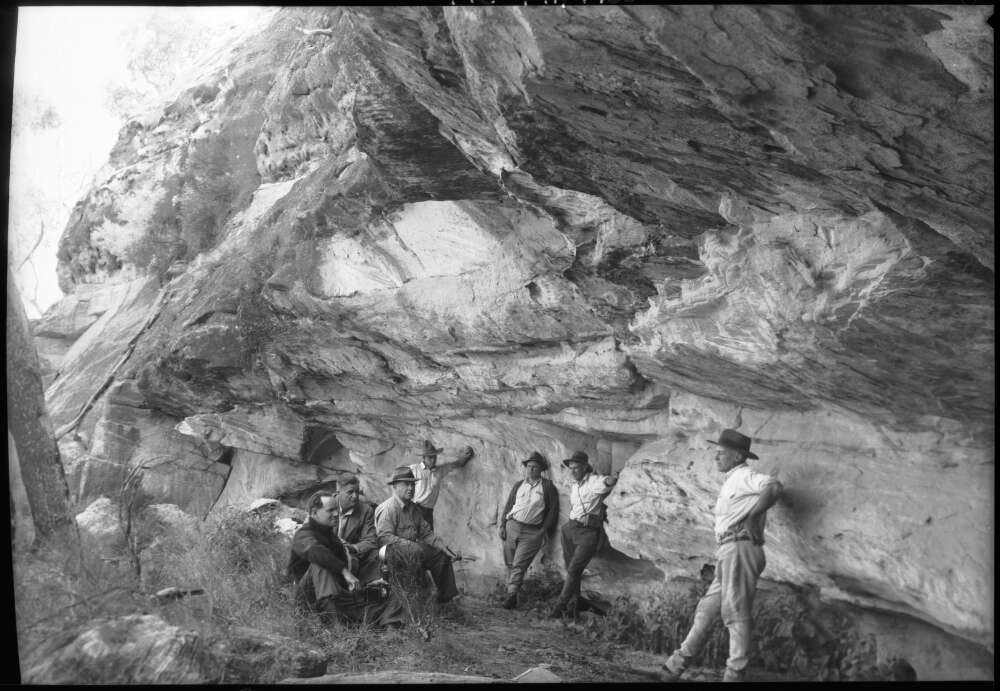
The Tombs, Aboriginal rock art site, Mt Moffatt, Qld, 1949. 
Four men sitting at the head of a canyon, Consuelo Tableland, Mt Moffatt Station, qld. 
Booringa Shire employees in their Blitz wagon on a log bridge, Mt Moffatt Station, Qld 1949. 
Five men riding with pack horses, Carnarvon Range, Qld, 1949. 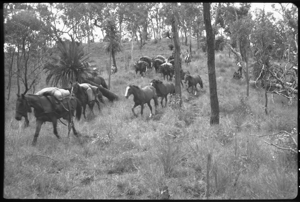
Pack Horses, Consuelo Tableland, Mt Moffatt, Qld 
Men and Horses at a logoon, Jimmy’s Shelf above Carnarvon Gorge, Mt Moffatt, Qld, 1949.
Marlong Arch formed in a narrow, elongated outcrop of Precipice sandstone. A capping of harder sandstone remains intact while softer layers below have been eroded away, leaving the arch of rock. Around the base of the outcrop are caves, overhangs and tunnels, a number of which we investigated, finding stencil art, and roo and bat scats.
Open grassy woodlands clothe the surrounding plains, part of a diverse flora of more than 750 species in the national park. The dominant canopy species here are smooth-barked apple (Angophera leiocarpa), white cypress pine (Callitris glaucophylla), bull oak (Allocasuarina luehmannii), and budgeroo (Lysicarpus angustifolius).
The shrub layer was more diverse but getting past its prime wildflower display. That said, Calytrix longiflora still provided brilliant massed displays of its pink star flowers. This was the case over much of the park.


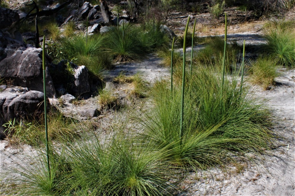
Other components of the shrub layer that we identified (thanks Frank) included Xanthorrea johnsonii, Boronia bipinnata, thread-leafed hopbush (Dodonea filifolia), wild rosemary (Cassinia sp.), slender rice flower (Pimelea linifolia) and beard heath (Leucopogon biflorus).
The ground cover was dominated by swathes of buck spinifex (Triodia mitchelli), but there was still a significant assemblage of other ground covers: kangaroo grass (Themeda triandra), fake sarsaparilla (Hardenbergia violacea), Chloanthes parviflora and Lomandras.

After morning tea at the arch, we drove on to Kookaburra cave. In a couple of the trees at the car park we saw babbler nests, and on cue two grey-crowned babblers appeared. Kookaburra cave is a shallow elongated overhang at the southern base of a bluff of Precipice sandstone.
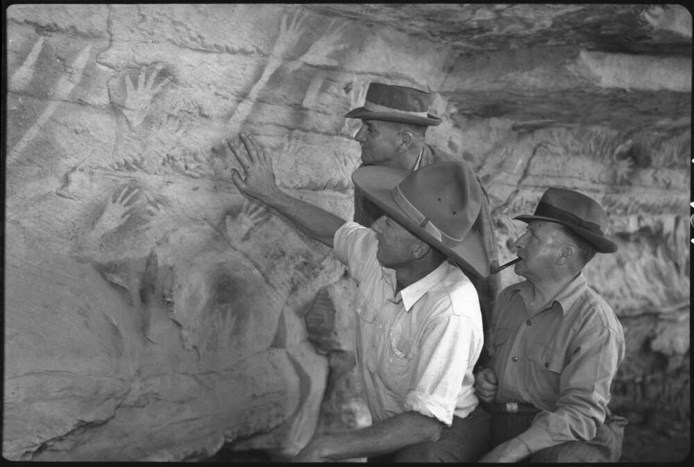
The cave takes its name from a hand stencil which resembles a kookaburra with its beak open. As an art gallery it is nowhere near as spectacular as the Tombs, but it does have art work which includes stencils, abrasions and peckings.

On checking my reference book Visions of the Past by Michael Morwood, it would seem that this assemblage of Aboriginal art is typical of what he classifies as Central Queensland Phase 2 artwork dating from 5,000 to 36 years BP. Some of the other information from his Central Queensland Highlands research includes:
- Hand stencils in Central Queensland sites are frequently associated with rocky outcrops which served as mortuaries, as found at The Tombs in Mt Moffatt.
- Many of the varied hand stencils at Central Queensland correspond to hand signals reported by Walter Roth for the Mt Isa area of NW Queensland. It is thought that some of these were used when hunting and on other occasions of enforced silence. Kookaburra cave has several examples of distorted hand stencils.
- Stencils are very useful to archaeologists as they provide evidence of Aboriginal material culture before the time of European contact: boomerangs, axes, spears, clubs, nets and pendants.

The open woodland around Kookaburra cave was slightly different from what we had seen at Marlong Arch. Here we found a dense stand of budgeroo, as well as mature woody pears (Xylomelum cunninghamianum). Also in the canopy mix were a grey gum and a stringybark.
Under the canopy we identified (and photographed!) bush iris (Patersonia sericea), sandstone boronia (Boronia glabra), box-leaf wattle (Acacia buxifolia), spreading flax-lily (Dianella revoluta) and the alien-looking hair plant (Astrotricha cordata).


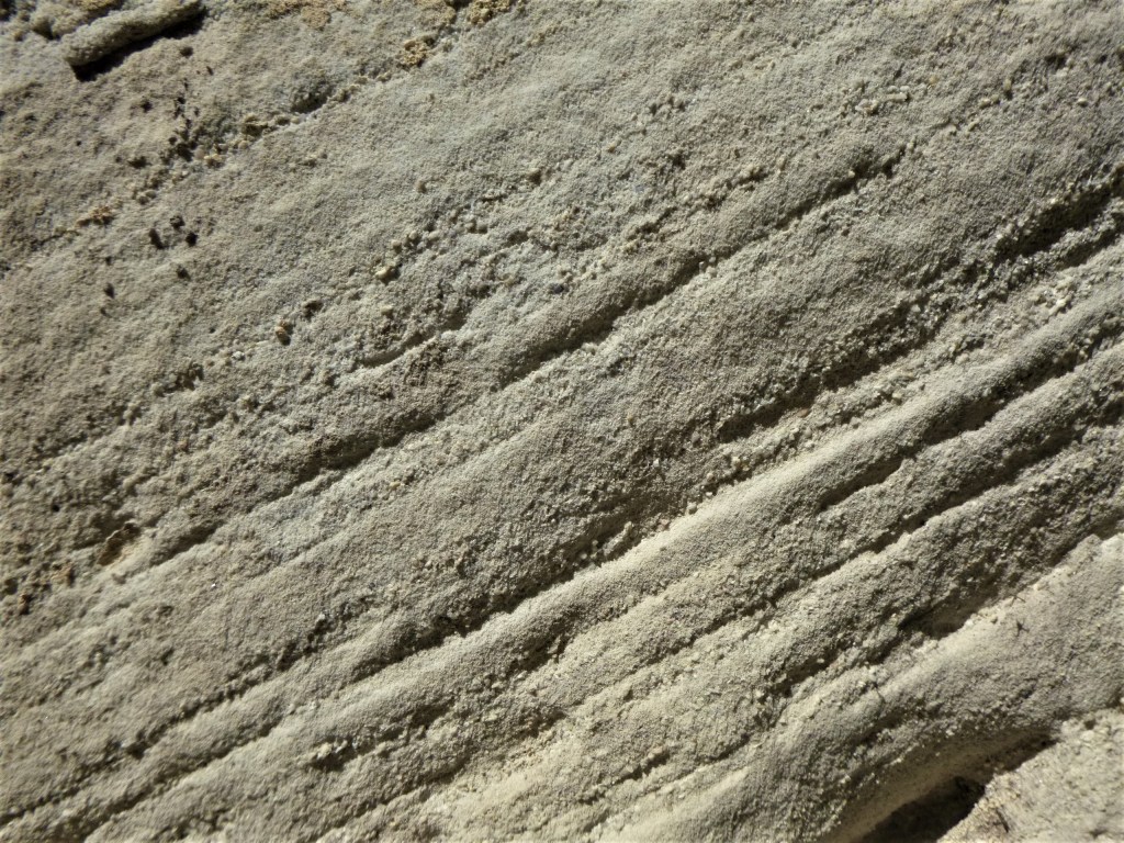
Always on the hunt for things geological, I spied on the steps leading up to the cave some trace fossils. These were probably the grazing trails of molluscs and worms. They were on a slab of the reddish-brown Boxvale Sandstone (an upper member of the Evergreen Formation).

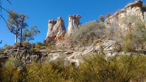
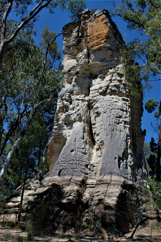
Next stop, Lot’s Wife, is a pillar of white Precipice sandstone, the solitary remnant of a bluff that extended across the area. These outcrops are known as ‘Hoodoos’ in North America but share a similar mode of formation as Lots Wife. Warwick Wilmot, in his book Rocks and Landscapes of the National Parks of Central Queensland, mentions the localised anomalous geology of Lot’s Wife.
Sixty metres to the east is the parent bluff. But this is an outcropping of Boxvales at the same elevation as Lot’s Wife. The Boxvale sequence should be higher altitudinally, suggesting a minor localised fault between the two outcrops: with the Boxvale layer down to the east and the Precipice sandstones raised to the west.

On our walk back to the cars, Judy pointed out stands of kurrajong (Brachychiton populnea) on a high ridge to the west of Lot’s Wife. Kurrajongs, frequently associated with Vine Scrub/Thicket were also found in a soft-wood scrub south west of Gee Gee Gap that we visited on the next day.
On our 1988 Mount Moffatt trip when we visited Gee Gee Gap, Rodney Tait, a keen botanist and fungi expert reported bottle trees and many seemingly “out of place plants, including a valley of many rainforest or softwood scrub species”. These are growing in soils derived from the basalt that caps the highest parts of the tableland.
Departing Lot’s Wife and its apostrophe-deficient signpost, we headed for Marlong Plain for lunch. The side track to the plain winds through a woodland of silver-leafed ironbark (Eucalyptus melanophloia) before fetching up at the southern edge of Marlong Plain. This is a vast, near-flat expanse composed of shallow Holocene alluviums derived from nearby basalts and sandstones.

Ecologically, Marlong Plain is a very special place. It is a treeless plain dominated by a bluegrass (Dicanthium sericeum). This is an endangered regional ecosystem (11.3.21) with less than 10% remaining in this province (Brigalow Belt 24: Carnarvon) and only 10 – 30% remaining in all of Queensland.


Overall Marlong Plain protects rare and threatened flora which is why the stand of willows in the lower end of the plain is somewhat puzzling. I saw these willows on our 1988 trip and they are still flourishing in 2021. The weedy wheels of the Queensland Parks Service move ever so slowly.
Our lunch break was enlivened by a passing nankeen kestrel checking out the plain for its own lunch.
Leaving our shady lunch spot on the edge of the plain, we continued on round the circuit drive and took the side track to West Branch camping area. A far quieter area than caravan central at Dargonelly Rock Holes.

West Branch is also a pleasant overnight campsite for hikers walking the 87 kilometre Carnarvon Great Walk – a circuit walk starting and finishing at the Carnarvon Gorge section of the park. The walk’s West Branch ‘entrance statement’ is an excellent information board and a rather expensive suspension bridge over the usually dry bed of the west branch of the Maranoa river.
Frank and I were aware that an old map of Mount Moffatt showed an ochre mine and dance ring at the southern end of the campsite. We poked around and did find an outcrop of soft white clay in a small cliff face on the eastern bank of the river, but whether this was the ochre mine I cannot be sure.
Onward through woodlands of poplar box (E. populnea) and narrow-leafed ironbark (E. crebra) to the Mount Moffatt Park HQ and its first-rate information centre next to the old cattle yards. Hours could be spent looking at the display boards which cover Aboriginal occupation, grazing history, natural history and the unsavoury saga of the Kenniff brothers. A stop not to be missed.
Photos from Booringa Shire Heritage Library: Waldron Family Collection.
Life on Mt Moffatt Station 1930s to 1950s.

Mt Moffatt Homestead. 1950s. 
‘Grizzlin Annie’. Bush shed houses old station truck called ‘Grizzlin Annie’. Note camp stretcher. 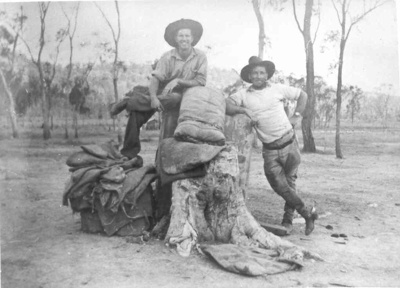
Written on the back of the photo: ” Stockmen at Mt Moffatt before leaving for mustering camp,1940s. 
Aboriginal stockman. Fred Stockman at Kenniffs Lookout. 
Mail Truck from Mitchell. 
Ringers in cattle yard . Mt Moffatt Station. 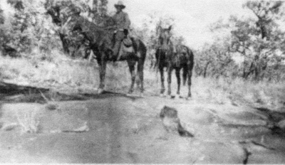
Incineration Rock. 1920. Rock slab where the bones of Albert Dahlke and Constable George Doyle were burnt after they were shot by cattle duffers, the Kenniff Brothers. 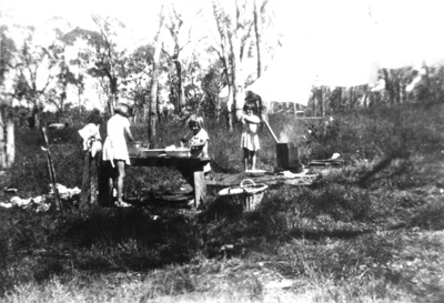
Waldron girls on wash day. Mt Moffatt Station.
But the pre-dinner nibblies clock was ticking and so we turned to our home at Dargonelly Rock Holes. But not before the squatter pigeons obliged by squatting by the side of the track. Probably not the best survival strategy.
These birds respond to disturbance by either ‘freezing’ or by darting erratically through grass tussocks. Occasionally if pursued too closely they will burst into flight, heading for trees or nearby ground cover.
A black snake added to the excitement of our return journey. This fellow was propped mid-track and made it obvious that he/she was not in the mood to move on. Denise’s efforts to take a photograph produced a head-up pose and then thankfully both Denise and the reptile retreated.
After the obligatory showers, bucket baths and clean clothes, we gathered around Julie’s nifty EZYQ collapsible firepit to enjoy drinks, nibbles and companionable chit chat.
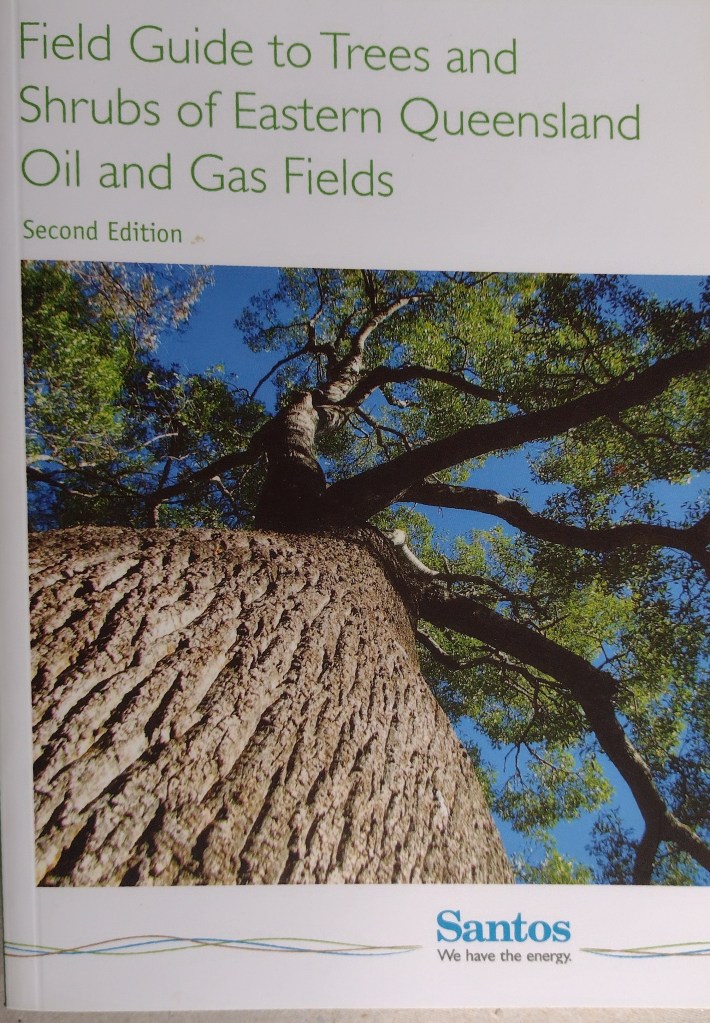
Just on dusk, our expected ‘Boobookians’ arrived: Craig, Michael and Eamon. Boobook is an ecological consultancy based in Roma and established by Craig and Meryl Eddie in 2000. They have since branched out and offer small group tours and adventure trips in SW Queensland.
Craig is the author of several field guides; his ‘Field Guide to Trees and Shrubs of Eastern Queensland Oil and Gas Fields’ is a widely used reference book. And he has discovered 50 new species of land snails and 6 new plants.
We would have the benefit of the expertise of Craig, Michael (also an ecologist) and Eamon (scorpion expert) for tomorrow’s field outings and evening excursion.
While our three ecologists headed out to do some night field work down at the rock holes (finding cane toads but no frogs), the rest of us headed for bed, signing off on a very satisfactory day on the sand plains of Mount Moffatt National Park.