Mt Moffatt is a remote and relatively pristine section of Carnarvon National Park in Central Queensland. It occupies the headwaters of the western flowing Maranoa River; a diverse landscape of broad valleys, basalt tablelandsand isolated outcropsof Precipice sandstone.
This former beef grazing property, was purchased by the Queensland Parks and Wildlife Service in1979to add to their extensive Central Queensland Sandstone park estate.
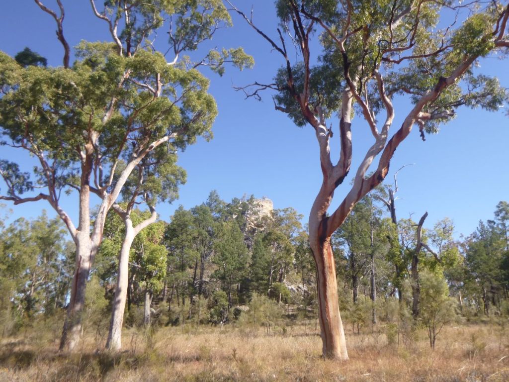
The Looking Glass. Mt Moffatt.
Geology
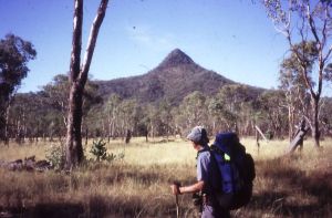
Mt Moffatt is an elevated sandstone and basalt parkaveraging about 700 – 800 metres in elevation, rising to 1232 metres on the basalt-capped Consuelo Tableland in the park’s north-east. The park was named after a solitary basalt peak, Mt Moffatt (1097 metres), standing hundreds of metres above the East Branch of the Maranoa River.
The Consuelo Plateau is known as ‘The Roof of Queensland’ as it forms the headwatersof many Queensland rivers. Carnarvon Creek flows eastwards into the Comet and Dawson thence to the Fitzroy River. Draining westwards across Mt Moffatt is the Maranoa River, ultimately feeding the Murray-Darling system.
Marlong Creek, a tributary of the Maranoa River, West Branch.
Plant Communities
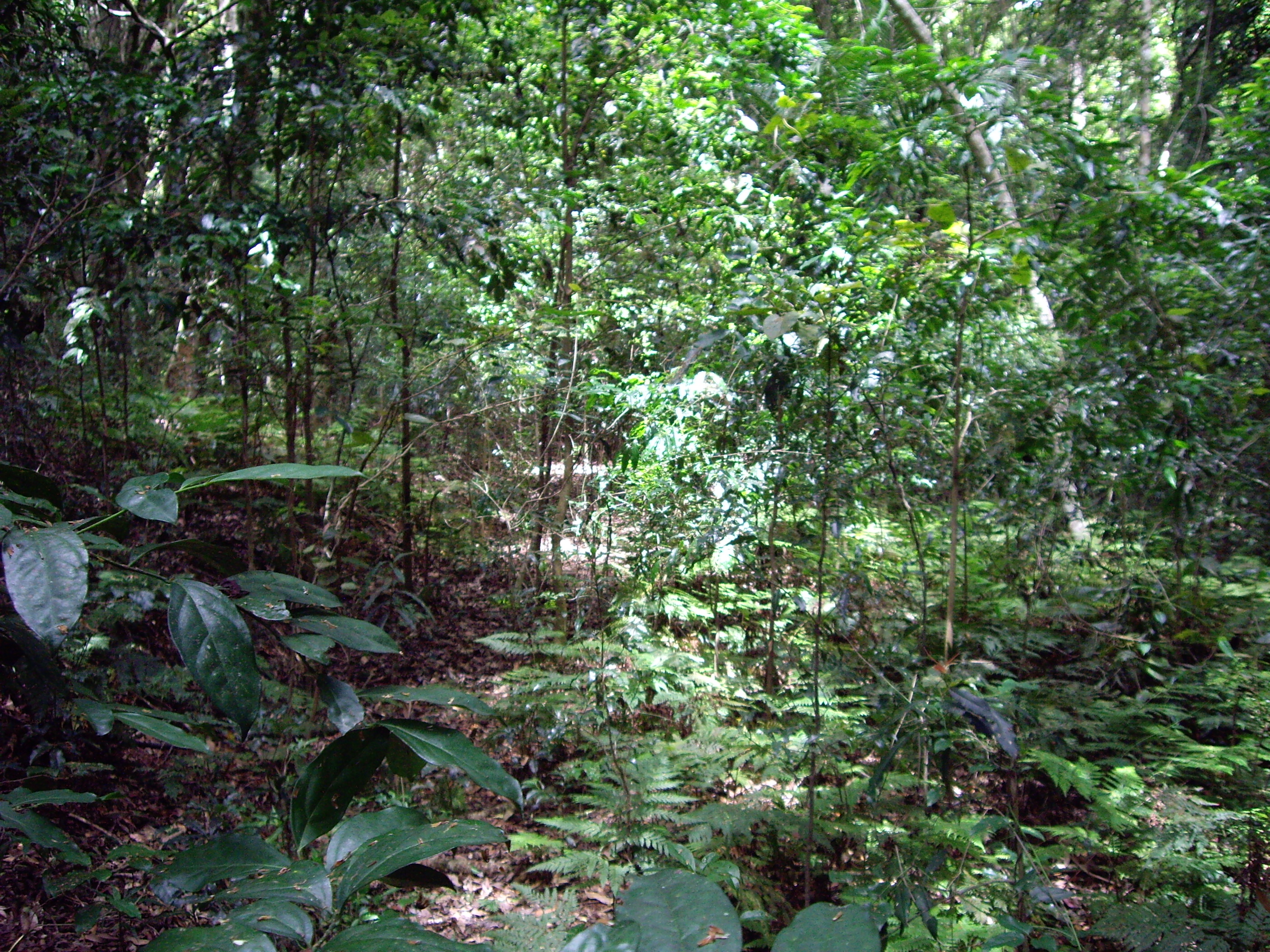
Mt Moffatt has a diverse plant community of open woodlands, tall Eucalypt forests and vast open grassy plains.
Open woodland dominated by Angophera sp. on sandy plains.
Unlike its near neighbour, Carnarvon Gorge, this is an open terrain of sandstone spires, arches and extensive clifflines of Precipice Sandstone.
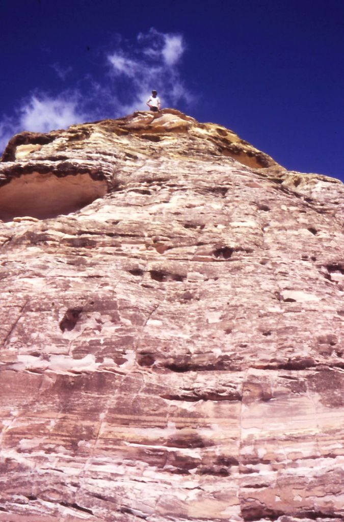
The Mansions: an outcrop of coloured, soft Hutton sandstone.
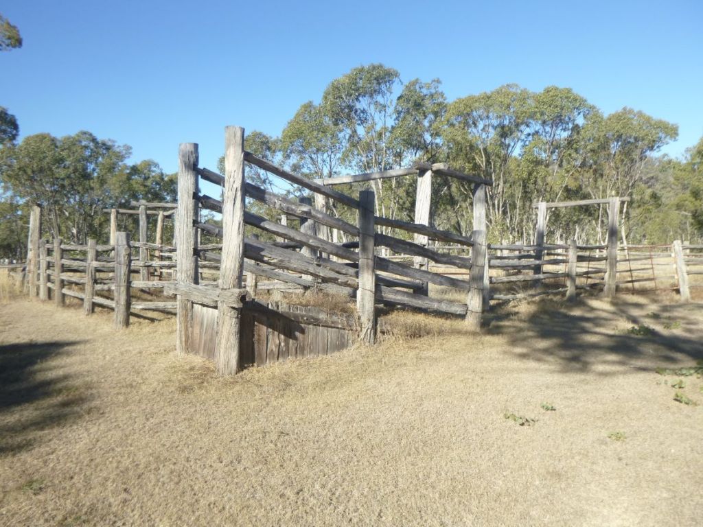
It has a rich human history. Aboriginal stencil art is abundant and their occupation stretches back at least 19,000 years. Reminders of the area’s life as a cattle property are seen in relict stockyards and fencing. For those of you fascinated by bushrangers, Mt Moffatt was site of the grisly murders of Constable George Doyle and station manager Christian Dahlke by the notorious Kenniff brothers.
Old cattle yards, Mt Moffatt.
I have been visiting Mt Moffatt since 1988 and since then have hiked with family and friends many times across Mt Moffatt and the Consuelo; and more latterly have walked the six day Carnarvon Great Walk which incorporates Carnarvon Gorge and Mt Moffatt.
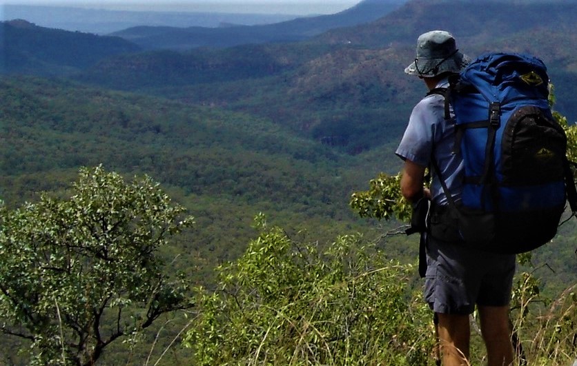
Hiking the Consuelo Plateau before the opening of The Carnarvon Great Walk. Looking into Carnarvon Gorge from Police Peak.
Photo Gallery
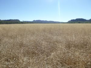
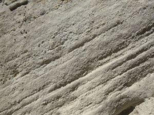
Dargonelly Rockholeson Marlong CreekMarlong ArchLots WifeMarlong Plain with a dense cover Queensland bluegrassFresh block of cross-bedded white Precipice SandstoneAboriginal stencil art at The ToombsOvernight Frost – 8 CThe SpyglassMt Moffatt: basalt cap over sandstoneDevils Canyon. Eroded Hutton Sandstone.Mt Moffatt NP. Descending to Merivale R and Three Sisters.
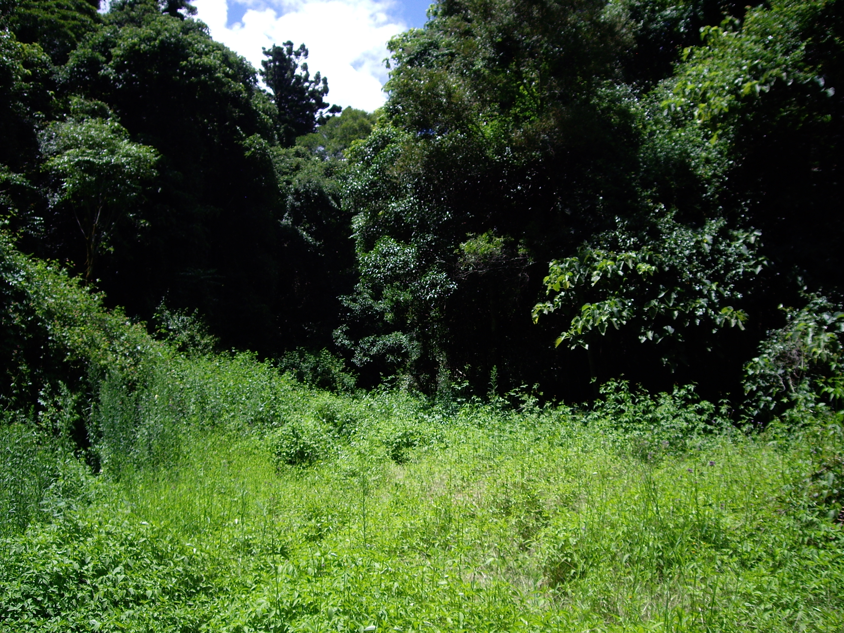
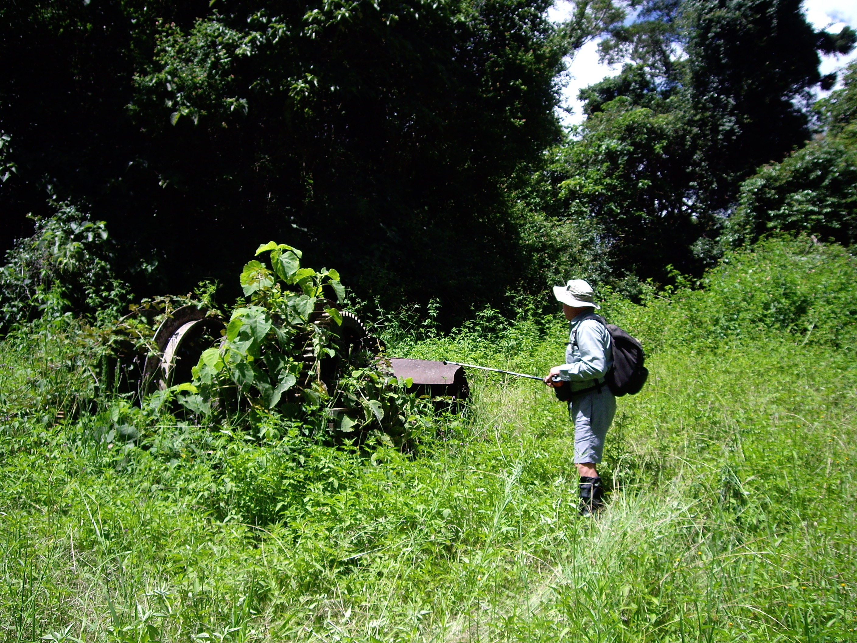
Our access point was an old winch and timber chute at the end of the of Winder Track. Soon after setting out from the car park it struck us that the Winder was going to be pretty snaky: sunny and overgrown with lanky weeds and long grass. Snake heaven.
Snake Heaven
Having tangled with an antsy Eastern Brown a few weeks earlier in the Bunya Mountains I came prepared with leather boots, long canvas gaiters, compression bandages and my Leki walking pole to brush aside any long grass. Ditto Brian. Long trousers would have a good after-thought.
Winch at end of the Winder Track
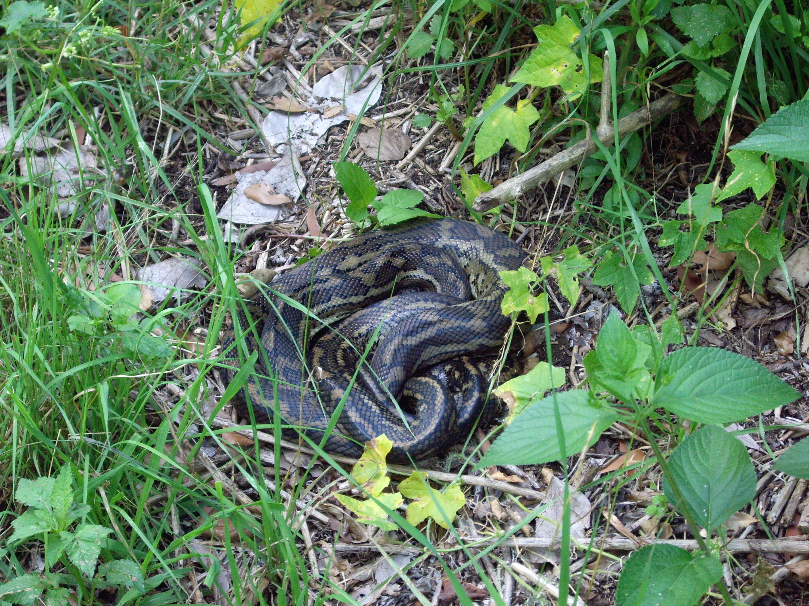
Sure enough, only 300 metres into our walk a grand-daddy Python lay comatose in the sun, stomach bulging with recent prey. We stepped around, took a few photos and walked on. The Python barely raised an eyebrow.
Small Carpet Python on Winder Track
By the end of our 16 kilometre recce the snake score was:
4 Pythons
3 Red-bellied Black snakes
1 Eastern Brown snake
At least I thought it was an Eastern Brown. One of my bushwalking friends from my youth was a bit of an amateur herpetologist and he would have grabbed it by the tail for a closer look. With the wisdom of years I realize this is definitely not wise. Unsurprisingly, he came to an untimely death, aged 39. Not from snake bite but in a downed F/A18 Hornet in the Northern Territory.
Making a lot of noise and sweeping the long grass generally does the trick. That said, I came close to standing on a curled up Red-bellied Black, my right boot hovering momentarily over the reptile. But some fancy footwork and an adrenaline rush saw me safely leap over our somnambulant friend.
But that’s not all. Later that afternoon as we drove down into the picnic area, a cute little bunny came bounding across the track, hotly pursued by a huge slavering goanna…fading fast. I’ll put my money on the bunny.
Maybe this snake danger thing is a tad overblown? Definitely when put in the context of other hazards we face every day. But while writing this report, a six year old girl from Walgett died from the bite of Brown snake. The Eastern Brown is the second most venomous terrestrial snake in the world. Over the past summer the Queensland Ambulance Service has averaged two snake-bite call-outs every day. Eleven call-outs in one 24 hour period.
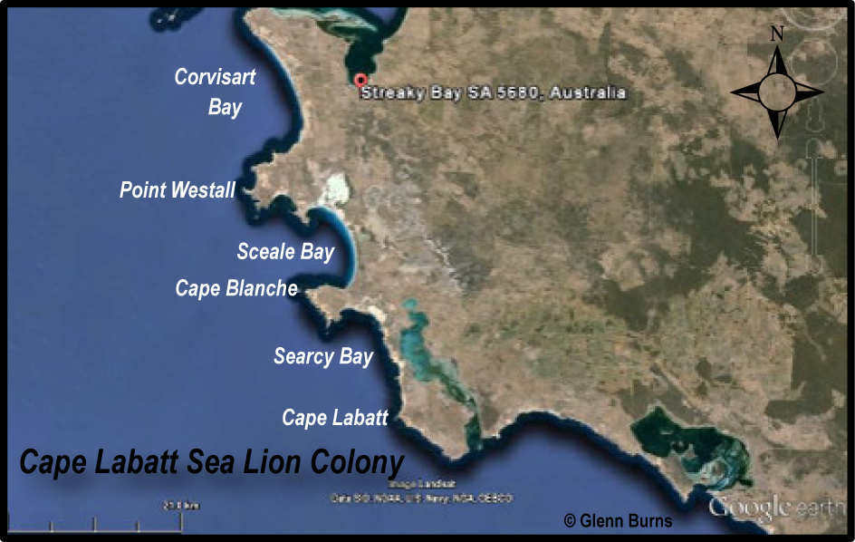
On a recent 15,000 kilometre road trip around Australia, Judy and I discovered the Ark on Eyre project on South Australia’s Eyre Peninsula. Eyre Peninsula has 1318 plant species, 107 reptiles and 40 mammal species. Many of these species are found only on Eyre Peninsula, making it a modern day “Noah’s Ark”. Unfortunately, 23% of mammal species have become extinct since the beginning of European settlement. At Cape Labatt, about 50 kilometres south of the village of Streaky Bay is a colony of the now rare Australian sea lion.
The Australian sea lion ( Neophoca cinerea )is one of the world’s rarest seal species and is Australia’s most endangered marine animal. It is also one of the cutest, having a face like a Labrador dog, floppy dog-like ears and hair rather than fur. Sea lions are endemic to Australia’s southern and western shores, living in small colonies in remote and mainly inaccessible areas, like Cape Labatt.
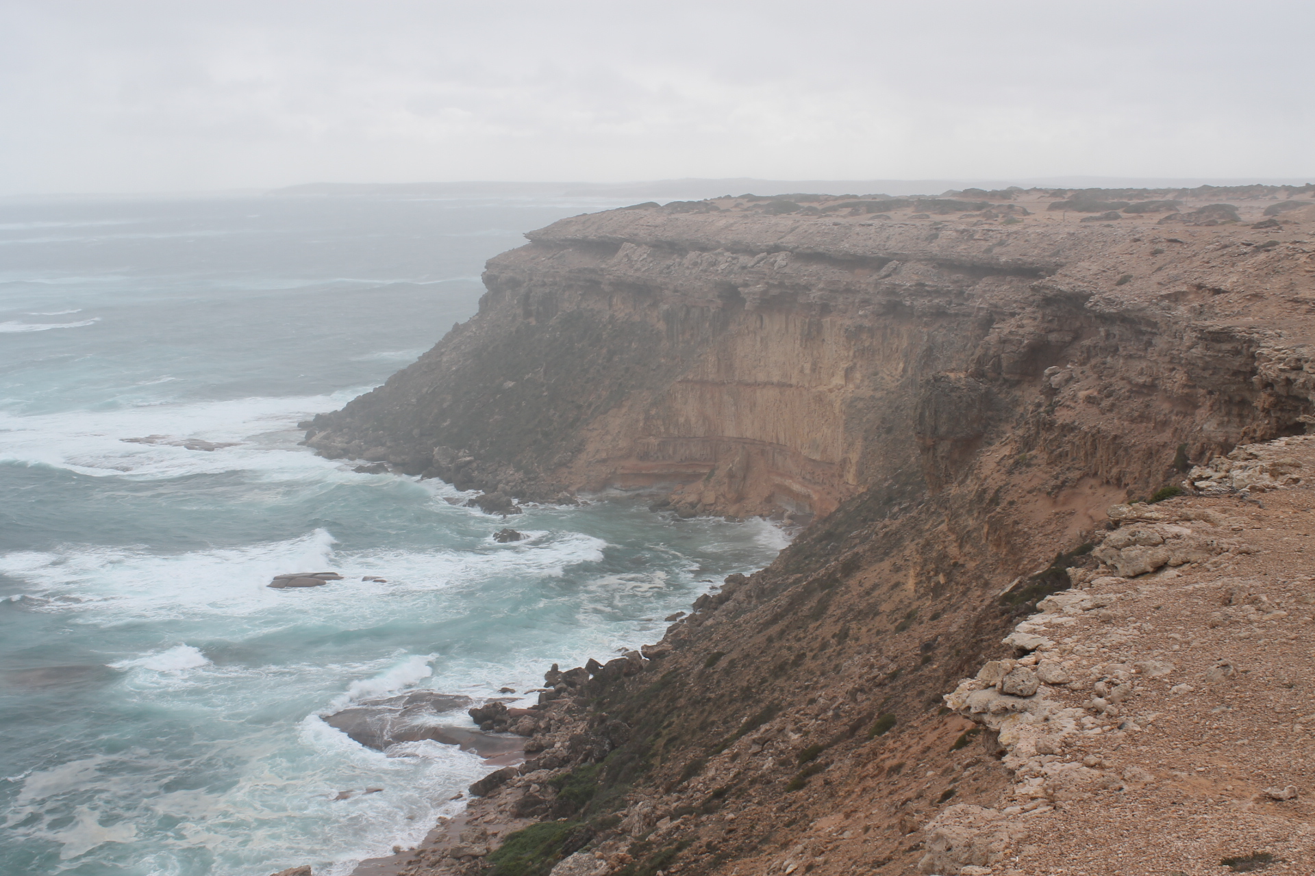
Cape Labatt is part of a rugged cliffed coastline, predominately limestone, rising to about 50 metres above the wild swells of the Great Southern Ocean. It is subject to a succession of cold fronts sweeping across the Great Australian Bight. We visited the colony on an overcast and squally winter’s day: so windy and exposed that our heavy ute rocked with each gust. Cape Labatt’s remoteness and exposure probably offers some protection to the sea lion colony and certainly deters camera toting visitors from getting too close and friendly. Fortunately Parks SA has built a viewing platform that provides excellent views down onto the colony removing any temptation to scramble down the cliffs onto the beach for that closer view.
Cape Labatt.
Directly below us, on a wind and surf swept outcrop of pink granite were about twenty sea lions. And further out in the breaking swells were another four, surfing and frolicking in the heavy conditions. Although ungainly on the land, in the ocean sea lions are excellent swimmers and divers. They feed close to the sea bed, at times diving to a depth of 300 metres. Their diet includes fish, squid, octopus and lobster. But, in turn, the young pups and weak sea lions are predated on by sharks, like the Great White Shark. So swimming near sea lion colonies is never an intelligent move.
Cape Labatt sea lion colony
The name sea lion originated with early mariners who saw the light-coloured “mane” of the mature males, the bulls. The bulls have brown hair with paler hair on their backs and necks. The smaller females are a silvery-grey colour with a creamy tummy. Sea lions have hair, similar to a dog, and don’t have the dense, soft fur of other seals. Thus sea lions were hunted for meat and leather rather than fur, so much so that by 1836 they were close to extinction. Even now the total world population may be only 10,000 and possibly just stable.
Australian sea lion
Population recovery has been hindered by deaths from entanglement in gillnets set for shark fishing. Fortunately, the Australian Fisheries Management Authority (AFMA) stepped in to save the sea lion. Gillnetting has been banned around breeding colonies and AFMA imposes closures in other areas when a defined number of sea lions have been killed there. Before the bans some 300 or more were killed each breeding cycle. Another factor in the population dynamics is the slow reproduction rate: 18 months to produce one pup. The pups are then still partly dependent on the mother’s milk for another twelve months.
It was a great privilege to see these animals in the wild. Parks and Wildlife SA and AFMA are to be commended for their management of this endangered species, hopefully pulling it back from the brink of extinction.
And as for Cape Labatt, it wasn’t named after any of the French sailors on the Baudin expedition of 1801 as I initially expected. A little bit of research revealed a more prosaic derivation: J.H. Labatt was the Assistant Engineer of the Harbours’ Board of South Australia.
Chesterton Range National Park lies in south-western Queensland’ssemi-arid grazing zone, approximately 27 kilometres northeast of Morven as the crow flies. Its 31,200 hectares were dedicated in 1992, primarily to conserve a number of vegetation communities which are representative of the southern parts of the Brigalow Belt biogeographical region.
As well as its botanical values, Chesterton has high scenic amenity: a landscape of low rocky mesas, gorges and extensive cliff lines separated by wide sandy swales makes for a rugged contrast to the surrounding undulating downs and plains.
Cultural features include some evidence of Aboriginal occupation, the old Mount Mobil homestead and the more recent vermin fence. But, generally speaking, the history of European grazing occupation is limited, possibly due to the lack of permanent water over most of the park and the rugged topography in the central part of the park. There are some plants and animals of conservation significance but many of these are also found elsewhere in Brigalow landscapes.
Chesterton Range 250K: Source: Geoscience Australia.
Topography
The park straddles the southern extremity of the Chesterton Range which is a major topographic feature two hundred kilometres in length, a southwest – northeast trending spur of the Great Dividing Range. It extends from the Morven District in the south to the Carnarvon National Park in the north and is the watershed for the headwaters of the Maranoa to the east and the Warrego system to the west.
The highest elevations are at its junction with the Great Dividing Range where it rises to over 900 metres, falling to 600 metres at Chesterton Range National Park. Much of the park is dissected range topography, with several emergent hills rising to over 650 metres. The highest point, four kilometres northwest of the old Mount Mobil homestead, is 693 metres, and though unnamed on the maps that I consulted, is perhaps Mount Mobil.
Geology
At the macro geological level, the park is located in the Surat Basin, an extensive sedimentary basin formed from the early Jurassic to early Cretaceous times 190 to 100 million years ago. The sediments, deposited on extensive riverine flood plains and in shallow lacustrine environments, accumulated from the erosion of the New England Fold belt to the east and the ancient crustal block to the west.
In Chesterton Range National Park the predominant surface lithology is the Upper Jurassic Hooray Sandstone, described in geological literature as a crossbedded quartzose sandstone, sometimes pebbly, with some siltstones and claystones. Its older Jurassic cousins, the Hutton, Evergreen and Precipice sandstones form more rugged gorge country to the north of Chesterton Range National Park.
The park is bisected by the north–south trending Maranoa anticline, a major geological structure: an arch-like fold resulting from the compression of the earth’s crust. The axis of the Maranoa anticline marks the drainage divide between the Maranoa and Warrego systems in Chesterton Range National Park.
Landforms
Significant landforms in the park include dissected ranges, mesas and buttes, often with a relative relief of 50 metres or more from valley floor to range summit. Erosion in the headwaters of Murray, Meston and Angellala creeks has developed a gorge and escarpment topography particularly in the flat bedded Hooray sandstones. Although not as scenic as the erosional landforms on Precipice and Hutton sandstones in Carnarvon National Park, the cliffed topography of Chesterton Range National Park is still spectacular.
Mesa and Butte landscape in Jurassic sandstones.
Climate
Climatically, the park lies in the semi arid zone. Technically it has a sub-tropical continental climate, characterised by low annual rainfall, high rainfall variability, high evaporation, a distinct summer rainfall regime and temperatures which have large seasonal and diurnal fluctuations.
Climate statistics for sixty seven years from the nearest Bureau of Meteorology station at nearby Charleville aerodrome illustrate a number of these features. Mean annual rainfall is 487mm; but this annual rainfall varies tremendously from a maximum of 1025mm in 1950 to a minimum of 206 mm in 1946; average annual evaporation rates were 2297mm, in theory four times the average annual rainfall. Nearly 70% of rainfall falls in the summermonths of October to March, which coincides with the period of highest temperatures and evaporation.
January is the hottest month with a mean average maximum of 35°C while there are on average 63 days per annum with temperatures above 35°C. The highest temperature ever recorded was 46.4°C in January 1973 while the lowest was -5°C in June 1951. Interestingly, despite its inland location, two cyclonic depressions have passed within 50 kilometres of Charleville (Althea 1950, Cliff 1981). This low rainfall climatic regime is a major determinant of the structural features of Chesterton’s plant communities, dominated primarily by woodlands and shrublands.
Dry creek bed, mid winter.
Plant Communities
Chesterton boasts an interesting mosaic of plant communities, as well as a number of vulnerable or rare plant species. Ten regional ecosystems are represented in the park, two of these are reserved only in Chesterton National Park and a third ecosystem is reserved only in Tregole and Chesterton National Parks and has a conservation status “of concern”.
Regional Ecosystem 11.10.11 is reserved only in Chesterton and is a shrubby woodland dominated by Eucalyptus melanophloia and Callitris glaucophylla. Other species which are often present include Acacia excelsa, Angophera leiocarpa, Allocasuarina luehmannii, Eucalyptus populnea, Corymbia trachyphloia and Eucalyptus crebra. It typically grows on the sandstone range and scarp country. Its conservation status is “not of any concern at present”.
Regional Ecosystem 11.7.2 is the second ecosystem reserved only in Chesterton, also of “no concern at present”. This ecosystem is found on hill slopes and scarp retreat zones associated with laterised mesas, low rises and cliff lines. It presentsas monospecific stands of Acacia woodland. Occasional emergent eucalypt species such as Eucalyptus thozetiana may be present.
The third ecosystem, 11.9.11 has only 10-30% of its pre-clearing extent remaining. Not surprisingly its conservation status is “of concern”. This is reserved only in Tregole and Chesterton Range National Parks. The plant community is a tall shrubland dominated by Acacia harpophylla with occasional Eucalyptus spp emergents, usually growing on the lowlands.
Also of interest to the botanist is the shrub Bertya calycina, listed as a vulnerable species and found on sandstone outcrops in the Orkadilla State Forest adjacent to Chesterton Range National Park. The only known population is 20 to 30 individuals growing in ironbark-bloodwood woodlands along the lower slopes and gullies of a sandstone plateau. EPA’s Online Wildlife Extract for Chesterton National Park lists five plant species as rare: Shonia carinata, Homoranthus zeteticorum, Grevillea cyranostigma, Boronia eriantha and Lomandra teres.
Fauna
The park has a significant faunal array: amphibians 11, birds 148, reptiles 58 and mammals 46. This is a reflection of its diversity of ecosystems and the rugged topography resulting in a relative lack of damage from grazing, pest species invasion and tree clearing.
Many rare and threatened animals have been recorded in the park. Birds of conservation significance include the red goshawk (Endangered), Major Mitchell’s cockatoo (Vulnerable), glossy black cockatoo (V), squatter pigeon (V) and grey falcon (Rare). Noteworthy reptilian fauna are the woma (R), brigalow scaly-foot (V), and yakka skink (V). Mammals of significance are the eastern long-eared bat (V) and little pied bat (R).
Cultural Heritage
Cave excavations have shown that Aboriginal occupation in the upper Maranoa dates back at least 20,000 years and the Chesterton Ranges were part of the territory of the Nguri people who roamed through the sandstone ranges of Chesterton. Evidence of Aboriginal cave art, artefacts, mummified bodies and burial sites is widespread to the north, the Carnarvon and Chesterton Ranges being a particular focus for the stencil art form and burial sites.
European occupation quickly followed Major Thomas Mitchell’s exploration of the Maranoa River in 1845-46 and Edmund B. Kennedy’s southward traverse of the Warrego in 1847. Mitchell trekked along the Chesterton Range area west of Mount Moffatt in June 1846. Both explorers commented favourably on the grazing potential of their discoveries and so pastoralists and surveyors followed hot on their heels.
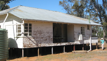
The park derives its name from the Chesterton pastoral run taken up by Charles and Henry Tom in 1863. It is named for their home town of Chesterton, Staffordshire, England. The old Mount Mobil homestead in the south-east of the park is a more recent link with Chesterton’s grazing history.
The Homestead: Chesterton Pastoral Run
Vermin Proof Fence or Dingo Fence
The other feature of interest is the ‘vermin proof fence’ that forms parts of the park’s boundary lines, especially the ten kilometre stretch along the southern boundary.
This 1.8 metre high fence is part of the 5,412 kilometre dog or dingo fence that runs from Jimbour in Queensland to the Great Australian Bight, reputedly the longest fence in the world and two and a half times the length of The Great Wall of China. It was established as a single barrier in 1946.
Prior to this there had been an intricate maze of 48,000 kilometresof interconnecting vermin fences built by individual property owners anxious to keep dingoes at bay. The fence was constructed to protect the sheep grazing areas south of the fence from wild dog predation. A hut used by staff patrolling the dog fence is part of the cultural heritage of the park.
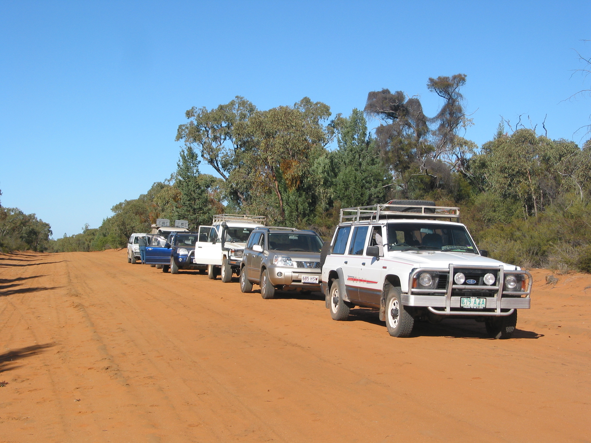
Convoy of 4WDs on park track
The park invites further investigation; my trip to Chesterton Range National Park whetted my appetite for a far more extensive exploration of this little known outlier of Queensland’s sandstone belt.
Good References:
Bureau of Mineral Resources: 1:250K Geological Series: Mitchell, Qld.
On an overcast and coolish spring day, wife Judy and I headed for Mapleton Falls National Park in the Blackall Ranges of Queensland’s Sunshine Coast for a spot of birdwatching. This pocket handkerchief sized national park( 25.9 hectares) is a mixture of complex notophyll rainforest(vineforest) and tall open forest dominated by Eucalyptus saligna (Sydney Blue Gum) and E. grandis (Flooded Gum).
Mapleton Falls NP
Obi Obi Valley from the falls.
Cartography Glenn Burns
Our timing was perfect. As Judy nosed the Corolla into its parking bay we were witness to an explosion of winged insects pouring from the chambers of a domed earthen mound. These were the winged reproductives of termites.
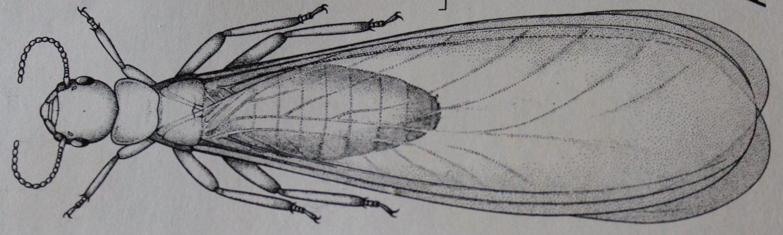
Termites are a soft-bodied, ancient order of insects, the Isoptera, errorously called “white ants”. But ,in fact, they are little more than modified cockroaches. Termites are social insects as are bees and ants and live together in colonies which contain different castes: workers, soldiers and the reproductives: a king and queen. Winged reproductives are called alates.
Winged Reproductive of Termites: Alate. CSIRO
There are approximately 2000 species of termites world-wide, 145 of these described in Australia. Colony founding starts with the release of large numbers of the four-winged alates. The releases are typically synchronised by time of year and time of day. In Australia, there are two main flight periods, late spring-early summer and autumn. It is not uncommon for all nests of a particular species in a district to release alates at the same time. So we weren’t surprised to find another nearby mound colony also releasing alates.
The alates are weak fliers and their flight is typically short in duration and time, unless assisted by wind. The wings are shed after alighting. De-alated females then attract the males. Pairs of males and females form tandems for reproduction, seeking out sites to form a new colony.
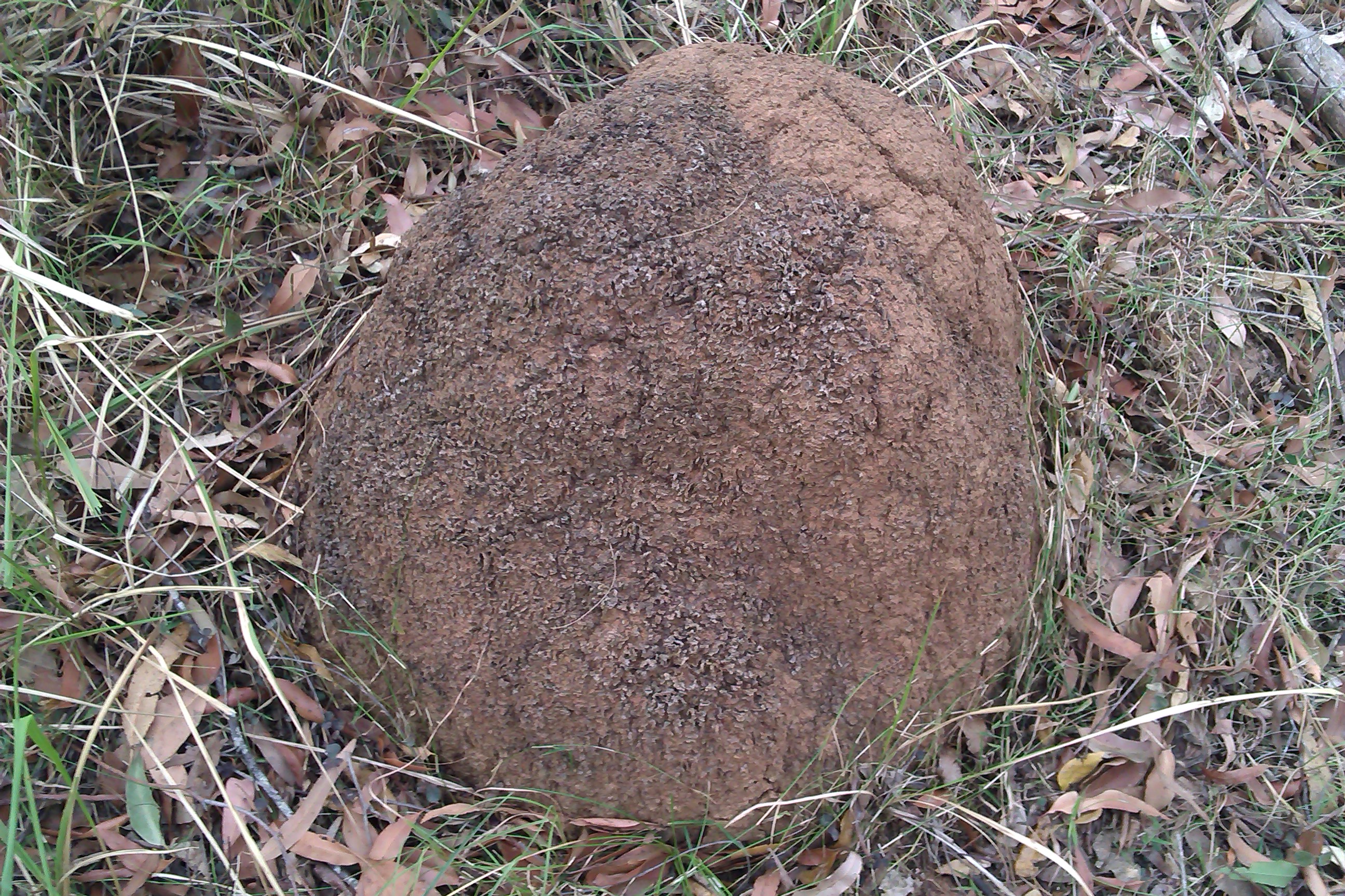
Termite mounds at Mapleton Falls were either arboreal or mounds. Our alates were being released from domed earthen mounds.
Termite Mound – Domed
Termites feed on wood, grass, fungi, dead leaves, bark, humus, herbivore dung and your house. They harvest this cellulose which is converted to food by a rich gut fauna of Protozoa. The mound building species can reach their food sources by a network of underground galleries and covered runways. One colony can harvest food over an area as extensive as one hectare. Temperatures in the termitarium are much more stable than the outside, temperature variations are damped down to a few degrees. The relative humidity is held close to saturation. An ideal combination for the rearing of brood stock.
And so, on our return to our high-set abode, a Queensland ” house on stilts,” it was again time to check the solid wooden stumps and bearers for those tell-tale earthern galleries indicating that the termites had bypassed the protective metal “ant caps” and were busily munching their way through the tough hardwood bearers of our house.
And what of the birdwatching? Well Judy, my resident birdwatcher, quickly wrangled up a list of 25 birds including Eastern Yellow Robins, Eastern Whipbirds, Green Catbirds, Satin Bowerbird, a Black-faced Monarch and the call of a Pacific Baza. Not bad for two hours of birdwatching. The Blackall Range system has upward of 110 recorded bird species including the Australian peregine falcon which can be seen soaring along the walls of the 120m high Mapleton Falls, the vulnerable glossy black cockatoo and the endangered Coxen’s fig-parrot.
Good Reference: CSIRO The Insects of Australia Melb Uni Press 1979