Tag Archives: Hiking the Australian Alpine Walking track

Mt Jagungal: Kosciuszko National Park

My walking companion, youngest son, had just swanned in from months of pounding the mountain trails of the Swiss Alps and Nepal.  Lean and fit, he was keen for one final fling before returning to work in early November.  We tossed around the possibilities. Frenchman’s Cap, The Labyrinth, the Western Arthurs were his hot choices while Moreton Island or Fraser Island looked like cushy numbers for me. The art of compromise, a 80 kilometre outing to Mt Jagungal in northern Kosciuszko National Park.  The iconic Jagungal Wilderness Area is part of The Australian Alps Bioregion, the only truly alpine environment in New South Wales as well as the only part of mainland Australia to have been affected by Pleistocene glaciation.

Over the Alps: To Jagungal on Foot and Fire Trail.

Our timing was impeccable. The Bureau of Meteorology’s Snowy Mountains Regional Forecast promised us: Wednesday: ‘snow showers’ and ‘fresh to strong southerly winds’.  The clincher was the ‘minimum of -2ºC, and a maximum of 0ºC’.  More of the same for Thursday with relief coming on Friday: ‘fine sunny weather, minimum -3ºC, maximum 9ºC’.  We somehow misplaced the fine sunny bit.  Youngest son, outfitted with cosy thermals and multiple polapluses, seemed relaxed about all this snow stuff, so I wasn’t overly concerned but wondered if my warm Queensland blood was up to the task.

A cold morning at Whites River Hut in Kosciuszko National Park.
A cold morning at Whites River Hut
The Provedore

Once in Canberra I was despatched to Manuka to source the all important hiking rations.  Too easy: a big bag of beer nuts, no-brand cups of soup, two-serve pastas, mountain bread, ten yoghurt coated muesli bars, tang, eight Laughing Cow soft cheese wedges, twelve mini Mars bars and two knobs of pepperoni salami to placate youngest son’s carnivorous tendencies.  But, when it was too late, at the isolated Whites River hut, he discovered that his confidence in the largesse of this provedore was sadly misplaced.  There is an old saying about living on the smell of an oily rag that seems apposite. But I will return to this well chewed bone of contention later.

More Information:

Map: Geehi Dam: 1:25000.

Map: Jagungal: 1:25000.

Map: Tim Lamble: Mt Jagungal and the Brassy Mountains: 1:31680.

Map: Wyborn, D., Owen, M., Wyborn, L: Geology of Kosciuszko National Park: 1;250000. ( BMR Canberra 1990 ).

Hueneke, K: Huts of the High Country (ANU Press 1982).

Johnson, D, The Geology of Australia ( Cambridge University Press 2009 ).

Flood, J : Moth Hunters of the ACT: ( 1984 ).

Kosciuszko Huts Association: https://khuts.org
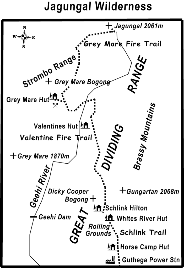
Some recent Kosciuszko trip reports.
Map of  walk to Mt Jagungal. Kosciuszko National Park.
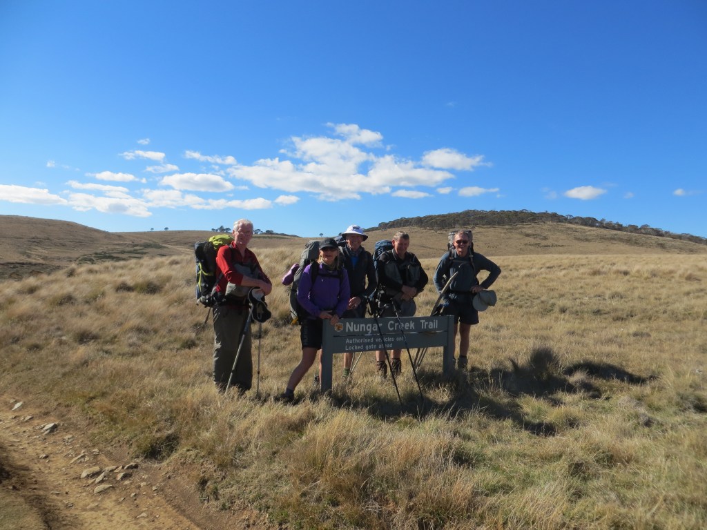
Tuesday: Guthega Power Station to Whites River Hut: 10 kms.

With a 5.00pm departure we left the bluebell coloured Camry orphaned at the Guthega Power Station, the Australian Alpine Walking Track entrance. The track zig- zagged steeply uphill.  With fine cool weather and a window of three hours to cover the ten kilometres to White’s River, there was no particular hurry and apart from a 240 metre altitude gain it was a most agreeable evening’s ramble, as we beetled along in a companionable silence.

Heading for Whites River Hut late afternoon on Australian Alps Walking Track
Australian Alps Walking Track: heading for Whites River Hut late afternoon.
Australia’s Subalpine Landscapes

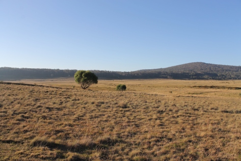
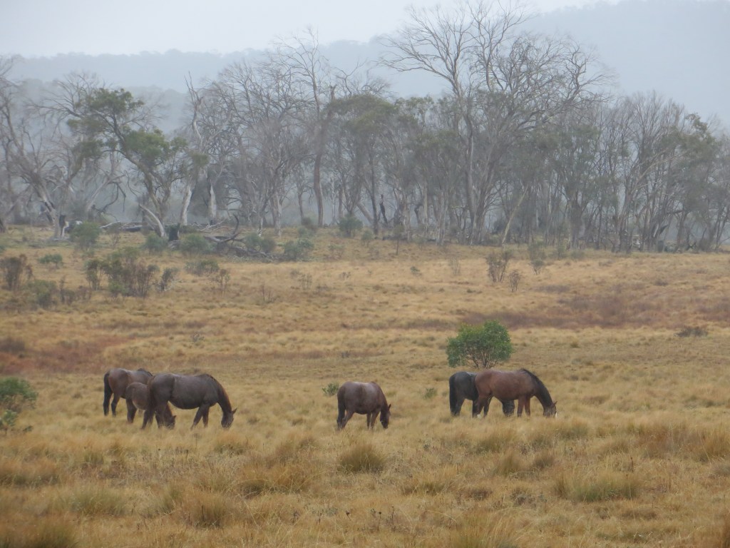
We followed the winding track across a typical subalpine landscape of snow gum woodland interspersed with open grasslands. The subalpine zone in Australia is that in which snow gums are the only tree species, lying between approximately 1400 m and 1700 m. Above 1700 m to about 2000 m, on the Australian mainland, is the treeless alpine zone.

Vistas of extensive treeless grasslands unfolded along the valley floor. These grasslands are said to be the result of cold air pooling in valleys forming frost hollows, producing a microclimate inimical to the survival of trees and shrubs. In the dampest parts where the water table is close to the surface, spongy bogs and fens dominate. The higher ridges are covered in snow gum woodland, the lower edge of the community terminating sharply, forming a definite tree line on a contour around each plain.

Horse Camp Hut in subalpine zone dominated by snow gum woodland
Horse Camp Hut set in the subalpine zone. Dominated by snow gum woodland.

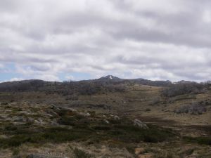
It was sobering to find huge swathes of the snow gum woodland burnt out, their dead branches arching over our heads.  Lines of fire-ravaged hills retreated to the far horizon, but, on an optimistic note, the dominant snow gums were now suckering vigorously from their lignotubers.  In 2003 massive fires burnt much of the park and sections of the plateau were still closed until mid 2006. Fire is, of course, part of the natural regime of Kosciuszko, with an average of 100 days annually of high to extreme fire danger. It has the dubious distinction of being one of the most fire prone areas in the world.  Fortunately, this area from Guthega to Jagungal was untouched by the massive fires of the summer of 2019-2020.

Fire damaged snow gums: Kosciuszko National Park
Fire damaged snow gums on Munyang Schlink Trail: Kosciuszko National Park.

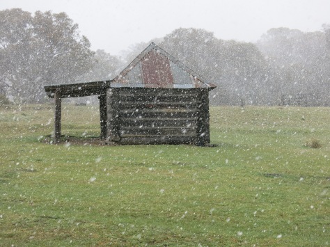
We reached White’s on dusk. I wussed out, keen for a comfy bunk in the hut. Surprisingly, I met little resistance … for a change. The plummeting temperature, barely holding at 3ºC, dampened our enthusiasm for things outdoorsy: like sleeping in freezing tents, no camp fire, and fourteen hours incarcerated in a hike tent.
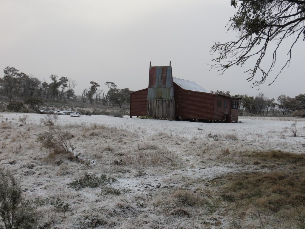
Whites River Hut

White’s River Hut, typical of many high country huts, was built in1935 by sheep farmers who engaged in the transhumance of their flocks, grazing them on the high alpine meadows of the Rolling Grounds in summer, retreating to the protected Snowy River stations for winter.  Summer grazing on high pastures ceased in the 1970’s.

Whites River Hut in Kosciuszko National Park.
Whites River Hut

Constructed of sheet iron, White’s is a basic, dingy hut, appreciated in cold, wet weather, but rarely used on hot summer days. Like most Kosciuszko huts it has sleeping bunks, a fireplace or woodstove, wood store, tatty table and bench seats and an outdoor dunny.  Whites is unusual in that it had an additional, stand-alone four person bunkhouse (since burnt down accidentally), known as ‘The Kelvinator’, for obvious reasons. If it is not obvious to the reader then Kelvinators were a famous brand of Australian refrigerators. This was the last refuge for desperate winter skiers, no doubt thankful to escape from the malevolent Rolling Grounds but usually arriving frozen to the core only to discover there was no room left in the inn.

Image of Whites River Hut before The Kelvinator was removed.
Whites River Hut with “The Kelvinator” in the background.

The main hut is also the refuge of the notorious Bubbles and Bubbles Jnr, bush rats extraordinaire: legends of High Country Huts as walkers and skiers record their exploits of marsupial derring-do and innate native rat cunning at avoiding all manner of water traps and flying footwear.  On a visit in 2005, Bubbles made off with our leader’s head torch, dragging it towards his bolt hole stopping occasionally to dine on its hard plastic coating.  Tonight, these pint sized bush banditos were content with keeping son in a state of high alert as they tip-ratted through hut rubbish and skittered along the wooden beam highways above our beds. For my part I slept as well as can be expected for a Queenslander. Cold air seeped through my down sleeping bag, thermal liner bag, two thermal shirts, a polar plus jacket, beanie, gloves, woollen socks x2, thermal long johns and over trousers. How cold could it be?

Wednesday: Whites River Hut, Schlink Hilton Hut, Valentines Hut and Grey Mare Hut: 19 kms.

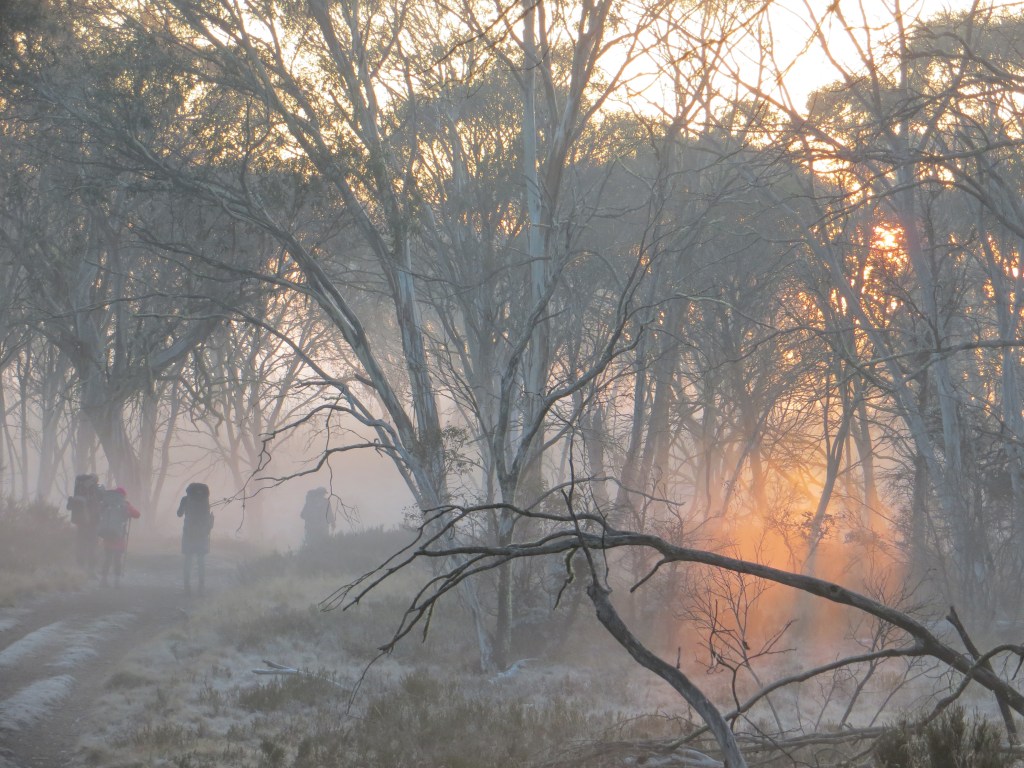
We found out in the morning.  All was quiet.  No birds, no Bubbles, no sound of running water.  Just the muffled fall of light snowflakes susurrating against the hut. Nature called and I emerged at six o’clock and applied my final layer, a thick Gore-Tex rain jacket, which seemed to do the trick. Youngest son surfaced soon after, although I have observed that he normally lies doggo until Jeeves has a fire blazing and breakfast is on the way.

A cold morning in Whites River Hut
Whites River Hut. Snowing outside. Toasty inside.

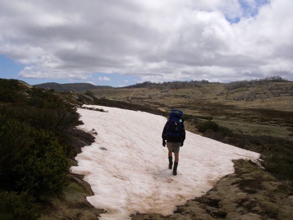
There is nothing like walking in a light snowfall. Cold it may be, but to be out walking on a high country trail in crisp alpine air, is an experience to be remembered. Our bodies quickly warmed up as we ascended towards Schlink Pass at 1800 metres. In any case our warm gear and wind proofs kept us snug and dry.  All too soon we topped the pass and descended to The Schlink Hilton. This twenty bunk ex-SMA hut was named after Herbert ‘Bertie’ Schlink, who was one of a party of four who were the first to complete the Kiandra to Charlottes Pass trip in three days in July 1927.

Climbing up to Schlink Pass. Kosciuszko National Park.
Climbing up to Schlink Pass.

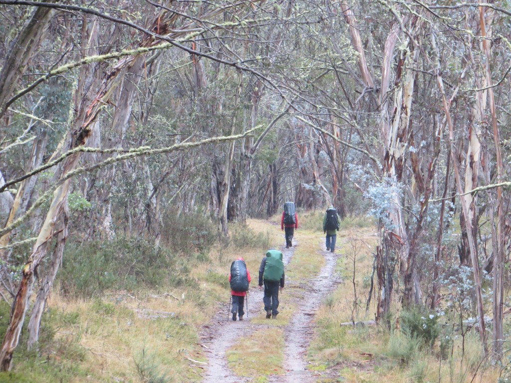
We ducked in, out of the drifting snowflakes, deposited plops of melting snow, removed several thermal layers, and then squelched off again to the start of the Valentine Fire Trail. Valentine’s marks the start of The Jagungal Wilderness Area.  Centred on Mt Jagungal (2060m), this isolated area is a bushwalking paradise: mountain peaks, snowgrass plains, high alpine passes, the massive Bogong Swamp and a derelict gold mine. The area is closed to vehicles but numerous fire trails provide sheltered walking when bad weather closes in over The Kerries and Gungartan.
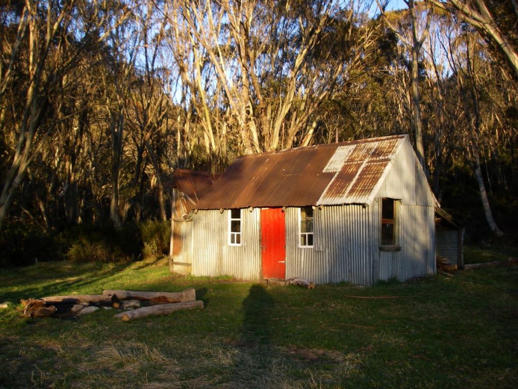
Valentines Hut

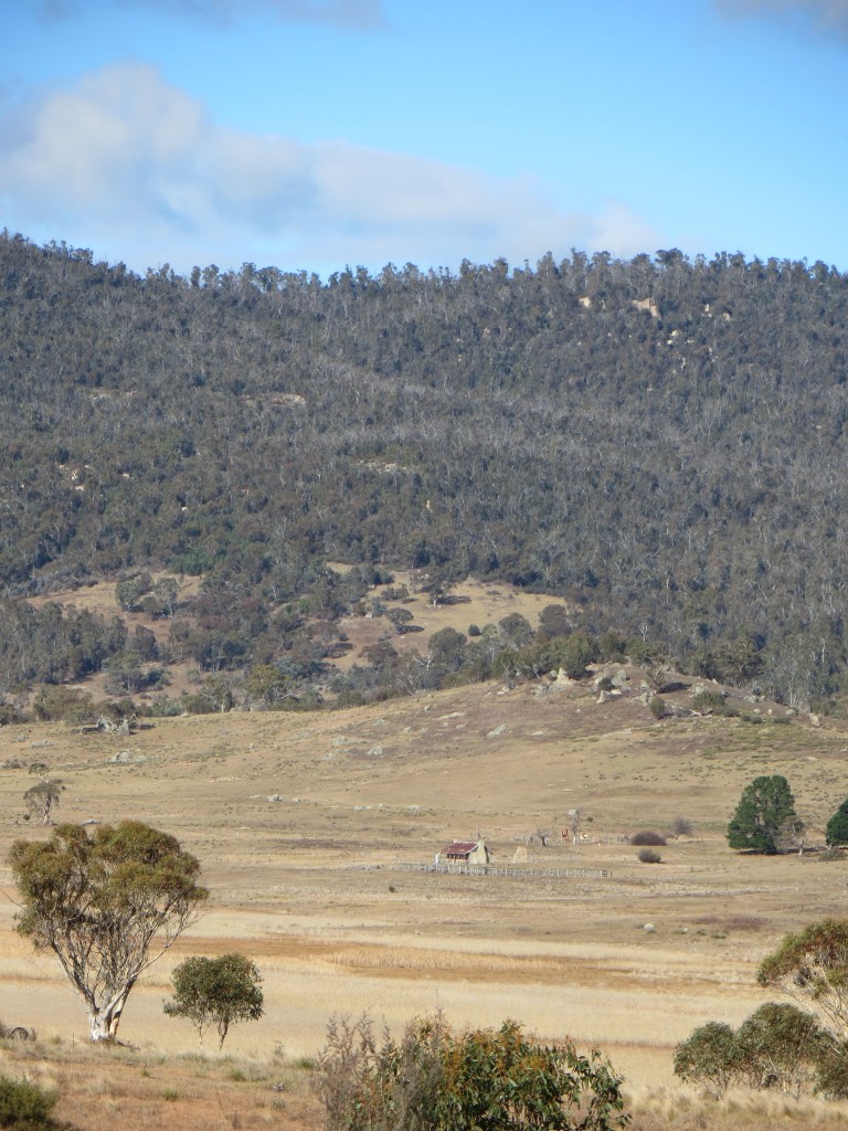
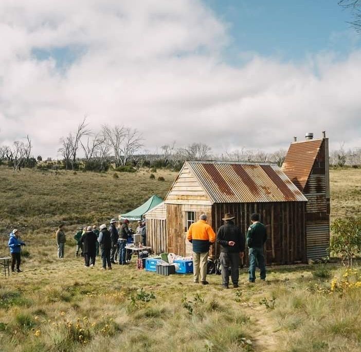
By 10.30, the snow showers clearing, we sighted Valentine’s Hut, its fire truck red livery standing out against a grey skeletal forest of dead snow gums.  Valentine’s is my all time favourite high country hut.  Another ex-SMA hut, this natty little four person weatherboard hut has a clean airy feel, with table, bench seats and a wood stove in its kitchen.  A home away from home. Other huts are usually dark, sooty, plastered with candle grease and graffiti and generally described as dirty and dingy. Valentine’s has been painted inside and out, has ample windows and, for added creature comfort, a newish corrugated iron dunny close by.

Valentines Hut
Valentines Hut

Youngest son, ever hungry, was keen for an early lunch in the snug comfort of Valentine’s, out of the clutches of the blustering southerlies.  Two mountain bread roll-ups filled with peanut paste, salami and cheese, a mini Mars and a few handfuls of beer nuts vanished in a flash. He: “What’s next?”  Well nothing.  Some grumbling about catering arrangements and we were on our way to the Grey Mare, but not before I deemed it politic to requisition a packet of cous cous and pasta from the ‘please help yourself food pile’.  The final leg would take us across Valentine’s Creek, over the Geehi (boots off for me), then up and over a 1700 metre alpine moor to Back Flat Creek with a final unwelcome crawl 60 metres up to the Grey Mare Hut for an early mark.

Grey Mare Hut

Grey Mare was a miner’s hut. Gold was discovered in the vicinity in 1894 at the Bogong Lead, later called Grey Mare Reef. Initially it was worked as a pit but flooding of shafts ended the first sequence of occupance in 1903.  An output of 28.3 kgs of gold in 1902 made it one of the highest yielding gold fields in New South Wales. A second phase of mining started in 1934 with an adit blasted to get to the reef.  The ruins of a hut on the creek flats below dates from this period.  A final attempt to get at the gold came in 1949 when the present hut was built.  The bush around the hut is littered with all kinds of mining knick-knacks: a crusher, a steam engine, a huge flywheel weighing more than two tonnes and a shambolic tin dunny teetering over the abyss of an old mine shaft ( since replaced with something safer).

Mining equipment: Grey Mare Hut.
Old flywheel and boiler at Grey Mare Hut.
Frosty morning at Grey Mare Mine site.
Frosty morning at Grey Mare Mine site

The six berth hut is standard dingy but large and comfortable with a huge fireplace and the best hut views in the park.  From our doorstep we had views northwards up the grassy valley of Straight Creek and peeking above Strumbo Hill, the crouching lion, Mt Jagungal, tomorrow’s destination. Looking to the east I could see Tarn Bluff, Mailbox Hill and the Cup and Saucer which I visited in 2017. Behind us was the Grey Mare Bogong topping out at 1870 metres.

 By three o’clock, the worms were biting and son was already scruffling through the rations looking hopefully for cups of soup and pasta with Nescafe caramel lattes and chocolate chasers to appease his now constantly rumbling tum.  Meanwhile, I set to with bush saw to lay in our wood supply for what was shaping up to be a windy, cold night.  No problems with collecting bush timber here, the hut is set in a stand of dead snowgums.  By five o’clock it was cold enough to rev up the fire.  Come dark we banked the fire and drifted to our bunks, snuggling down into warm bags.  The predicted ‘windy’ conditions made for a restless night with a banging door and overhanging branches raking the corrugated iron chimney.

Grey Mare Hut
Grey Mare Hut.
Thursday: Grey Mare to Jagungal and return: 22 kms.

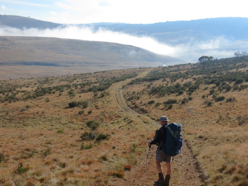
Up at six o’clock in anticipation of the long walk to Jagungal and back.  Snow showers again, a gusting tail wind catching our rucksacks and driving us sidewards off the Grey Mare Trail as we headed north.  With Phar Lap out in front and Dobbin coming at a steady gallop behind, we burned up the kilometres, hayburners from hell, past Smith’s Lookout (1748m), across the Bogong Swamp (dry), rock hopped over the Tooma River, and thence to our Jagungal access at the Tumut River campsite.  And not a single grey mare in sight.  A heap of beer nuts and a yoghurt bar each and we were off again, a 220 metres climb onto the mist shrouded south west ridge, a sharp turn left and an easier 160 metre ridge walk to Jagungal Summit at 2062 metres. The Roof of Australia, or near enough. The mist cleared…. how lucky was that?

On the Grey Mare Trail heading for Jagungal
On the Grey Mare Trail heading for Jagungal.
Mt Jagungal 2061 m.

Jagungal is instantly recognisable from over much of Kosciuszko. A reassuring landmark for bushwalkers and skiers alike, a beacon… an isolated black rocky peak standing above the surrounding alpine plains.  It is at the headwaters of several major rivers: the Tumut, the Tooma and the Geehi.  It was known to cattlemen as The Big Bogong or Jagunal. The later spelling, Jagungal, is considered by the old timers a latter day perversion. Jagungal appears on Strzelecki’s map as Mt Coruncal, which he describes as “crowning the spur which separates the Murray and Murrumbidgee Rivers”.  The aborigines often called mountains in the alpine zone Bogong, indicating a food source, the Bogong moth.  Europeans applied their own nomenclature to differentiate the Bogongs: Paddy Rushs Bogong, Dicky Cooper Bogong and Grey Mare Bogong.

Mt Jagungal: Kosciuszko National Park.
Mt Jagungal: 2061 m.

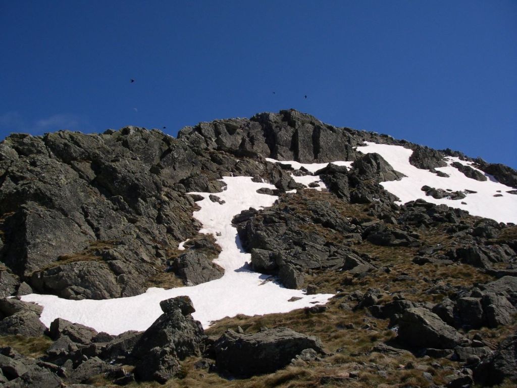
Unlike most of the other Bogongs whose granitic origins are revealed by their characteristic whaleback profiles, Jagungal’s summit is distinctively peaky. It sports a lizard like frill of vertical rock towers, some intact, other lying in jumbled heaps. Jagungal is different because it is capped by amphibolite, a black igneous rock more dense than granite, formed by the metamorphosis of basalts, the Jagungal Volcanics. Its origins date back to 470 to 458 Ma, to the Middle Ordovician. It is surrounded by the Kiandra Volcanic Field, part of a belt of volcanoes called the Molong Volcanic Arc.

During the The Ordovician ( 485 to 444 Ma), Australia was part of a single super-continent and much of Eastern Australia was covered by the sea. Chains of active volcanoes occupied parts of central New South Wales. These were mainly submarine volcanoes but some emerged to form small islands with fringing limestone reefs. The Ordovician saw the first appearance of corals and land plants.

Jagungal was ascended by Europeans in the winter of 1898 when a party from the Grey Mare Mine climbed it using primitive skis called ‘Kiandra snowshoes’.  
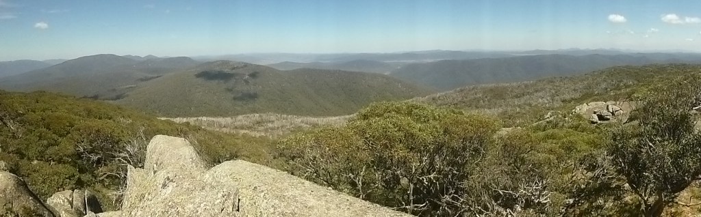
Ours was a much less adventurous walk, but we still savoured our time on the summit.  Especially magnificent were the views south to the snow capped Main Range, four days away.  It was so clear that we could even discern Victoria’s Mt Bogong on the far southern horizon.  But the cold wind soon drove us into a protected sunny nook just under the summit.  We hunkered down, lunched, son eased into one of his regular catnaps…. no doubt dreaming of Nepal and wolfing down a huge bowl of Nepali boiled potatoes and rice; or perhaps a large slice of pizza; or even, given our now parlous food situation, a plate of succulent fried Bogong Moths.

Bogong Moth
CSIRO: Bogong Moth
Bogong Moths

I had noticed on a previous trip and again on our ascent today, huge raucous flocks of crows cawing around the steep summit cliffs. I had seen the same phenomenon on Mt Alice Rawson near Kosciuszko.  Inexplicable at the time. Recently, I came across an explanation.  The ‘crows’, actually Little Ravens (Corvus mellori), were gathering to feed on Agrotis infusa, the drab little Bogong moth, found only in Australia and New Zealand. To escape the summer heat, these moths migrate altitudinally and set up summer holiday camps in the coolest places in Australia, the rock crevices of the alpine summits.  They come in millions from western New South Wales and Southern Queensland, distances in excess of 1500 kilometres, often winging in on high altitude jet streams, and settle in crevices and caves, stacked in multiple layers, 17,000 of them in a square metre, where they undergo aestivation or summer hibernation.  The migrations seem to be a mechanism to escape the heat of the inland plains and they gather in the coolest and darkest crevices on western, windward rock faces. A tasty morsel for our corvid buddies.

Aborigines and the Bogong Moths

With the ravens came the aborigines, from Yass and Braidwood, from Eden on the coast and from Omeo and Mitta Mitta in Victoria. All intent on having a good feed and a good time.  Large camps formed with as many as 500 aborigines gathering for initiation, corroborees, marriage arrangements and the exchange of goods.  It is thought that advance parties would climb up to the tops, and if the moths had arrived they would send up a smoke signal to the camps below. The arrival of the moths is not a foregone conclusion. Migration numbers vary from year to year. Some years they are blown off course and out into the Tasman Sea.  1987 was a vintage year, but in 1988 the bright lights of New Parliament House in Australia’s bush capital, acted as a moth magnet, and they camped in Canberra for their summer recess, unlike our political masters.

  Men caught the moths in bark nets or smoked them out of their crevices. They were generally cooked in hot ashes but it is thought that women sometimes pounded them into a paste to bake as a cake. Those keen enough to taste the Bogong moth mention a nutty taste. Scientists say they are very rich in fat and protein; this diet sustained aborigines for months and the smoke from their fires was so thick that surveyors complained that they were unable to take bearings because the main peaks were always shrouded in smoke.  Europeans often commented on how sleek and well fed the aborigines looked after their moth diet. Edward Eyre who explored the Monaro in the 1830’s wrote: “The Blacks never looked so fat or shiny as they do during the Bougan season, and even their dogs get into condition then.” At summer’s end, with the arrival of the southerlies the moths, aborigines and ravens all decamped and headed for the warmer lowlands.  As did my travelling companion and I.

Descending Mt Jagungal
Descending Mt Jagungal. View south.
Friday: Grey Mare Hut to Horse Camp Hut: 24 kms

Of necessity, a long day’s walk ahead to put us close to our Guthega exit.  Windy and cool again, and no sign of the fine sunny weather promised by our BOM friends. Which was just as well as my radiator was boiling on our way up the steep 200 metre climb out of Back Creek en route to Valentine’s.  Today we would be walking south, towards the Main Range.  Here was an excellent opportunity to identify from our map the classics of Kosciuszko walking that had been shrouded in mist on our outward walk: The Kerries, Gungartan, Dicky Cooper Bogong, the Rolling Grounds, Mt Tate, Twynam and the biggest Bogong of all, Targan-gil or Mt Kosciuszko.

View southwards towards the Main Range and Mt Kosciuszko.
View south towards the Main Range and Mt Kosciuszko.
Horse Camp Hut

Late in the afternoon we turned off the Schlink and found our way to Horse Camp Hut, tucked in snow gum woodland 300 metres below the Rolling Grounds, a high altitude granite plateau above the tree line at 1900+ metres, cold, windy and exposed but spectacular. It is said to be very difficult to navigate in bad weather.  I noted in the hut log book that a number of winter skiers had ‘GPSed’ their way to Horse Camp from the Rolling Grounds.  It is claimed that the Rolling Grounds are so named because during the summer grazing, stock horses would enjoy a good old dust bath and roll in the many depressions that dot this high altitude plateau.

Horse Camp Hut
Horse Camp Hut

Horse Camp Hut, of Lilliputian dimensions, still manages a serviceable fireplace, kitchen cum lounge cum wood storage, table, a few decrepit chairs and a separate room with a wood stove and two bunks. Apparently nine girls from SGGS Redlands and their gear were crammed into the room on a wild wet night earlier this year. With temperatures hovering at 2ºC I lit the fire and we polished off whatever meagre rations were left: soup, pasta, noodles and Nescafe Latte laced with Milo lifted from the hut ‘left overs’.

Interior of Horse Camp Hut
Interior of Horse Camp Hut.
Horse Camp Hut in the evening. Rolling Grounds in the background.
Saturday: Horse Hut Camp to Guthega Power Station. 4 kms.

Up at 6.00.  Freezing and no fire or breakfast genie this morning.  We set out ASAP, fully rugged up, as the sun lifted over Disappointment Ridge for our final four kilometres into Guthega, downhill.  Hopefully Bluebell would be still where we left her. She was, and despite her coat of frost, she fired up and we were away.  Off to Sawpit Creek for breakfast, a coffee in Cooma then a slap-up feed and a cold goldie back in Canberra.  A fitting end to an outstanding alpine sojourn.

Latest trip reports and posts

Kiandra to Canberra on the Australian Alps Walking Track

A Late Autumn Hike from Kiandra to Canberra on the Australian Alps Walking Track

by Glenn Burns

I decided to publish my old journal of our Kiandra to Canberra hike on this website after the 2019/2020 summer fires damaged parts of the northern section of the Australian Alps Walking Track ( AAWT) . I have visited the Northern Plains many times and was fortunate to walk from Kiandra to Canberra several years ago with some friends; before the devastating fires. Much of the landscape we hiked through then was relatively intact . However in the summer of 2019/2020 this all changed. The summer fires burnt out the New South Wales trail head at Kiandra including the old Kiandra Court House, Wolgal Lodge and Matthews Cottage. The last three days of the AAWT traverses Namadgi National Park in the Australian Capital Territory. In this section the Orroral Valley and Mt Tennant were burnt. Amazingly, the old Orroral Homestead was saved.

Through the years since the early 1970s I have wandered many a kilometre over Australia’s High Country and more than once have I peered through the grimy window of a high country hut into the pre-dawn gloom… often sleet or rain or mist swirling around outside. Excellent… back to the sack for another forty winks. But then I hear my fellow hikers. Pesky eager beavers all. Busy rustling around, pulling on boots, donning warm stuff and getting ready their rain gear. Champing at the bit , ever keen to hit the trail.

Map of northern section of Aust Alpine Walking Track

Photo Gallery:

And so it was for five walkers on a late autumn, eight day traverse of the final northern section of Australian Alpine Walking Track (AAWT), stretching 105 kilometres from Kiandra on the Snowy Mountain Highway to Namadgi Park HQ on the outskirts of Canberra. The complete 659.6 kilometre AAWT crosses some of Australia’s remotest and highest alpine mountains and snowgrass plains with a weather regime that can be very hot on occasions but is more often than not cold, wet and highly unpredictable. As Alfred Wainwright, a famous English fell walker, wrote: ” There’s no such thing as bad weather, only unsuitable clothing.”

Signage on Aust Alps Walking Track

Useful Information:

NSW Dept of Lands: 1: 25000 maps : Ravine, Tantangara, Rules Point, Peppercorn, Rendezous Creek, Corin Dam, Williamsdale.

NSW Rural Fire Service Brochure: Bushfire Safety for Bushwalkers.

Chapman, J Chapman, M & Siseman J: Australian Alps Walking Track (2009)

ACT Dept of Environment: 1:20000: Namadgi Guide & Map

Day One: Saturday 11 May: Outward Bound: Kiandra to Witzes Hut: 12 kms.

Just after midday, youngest son Alex taxied our hire van to a halt outside the old Kiandra Courthouse since destroyed in the 2019/2020 summer fire season. The Old Court House was the only remaining building of the old gold mining town of Kiandra: population in 1859, 10,000; now.. zero population. A sudden population explosion as five walkers plunged out of the warm van and into a blast of cool air:  Ross , Leanda , Peter, John and last but not least, their esteemed and worthy leader, yours truly. The race was on for the few sunny spots out of the cool blustery wind. We wolfed down our Cooma take-aways, bade Alex a fond farewell, then hit the track, the Nungar Hill Trail. Our afternoon on the AAWT took us northward over rolling snowgrass plains at about 1450 metres, broken only by occasional alpine streams, which we forded with dry boots and socks intact: the Eucumbene River, Chance Creek, Kiandra Creek and just before Witzes Hut, Tantangara Creek. After Chance Creek we climbed to the crest of the Great Dividing Range, known locally as the Monaro Range. A minor blip on this undulating high plains landscape.

Start of Nungar Hill Fire Trail near Kiandra
Leaving Kiandra on the Nungar Hill Fire trail.

The seven day BOM forecast looked agreeably benign: early frosts (a mere -1° C) followed by sunny days (14° C). Perfect timing. But meteorology has a way of biting bushwalkers on the bum. In May this year maximum temperatures averaged 8.2°C while minimums hovered around a miserable 2.8°C. With a record low of minus 20°C, Kiandra is one of the coldest places on the Australian mainland. Fortunately for this leader, my walking companions, all experienced bushwalkers, were kitted out for all eventualities. But most impressive of all was that they remained unfailingly positive and obliging under some pretty trying conditions.

Australian Alps Walking Track near Pockets Hut
A cold day on High Plains of Kosciuszko.

The huge grassy plains are an ancient peneplaned surface. They are the almost level remains of a long eroded mountain range system that was later uplifted in a major tectonic movement of the earth’s crust known as the Kosciuszko Uplift thus forming the Kosciuszko Plateau. The combination of cold air and flat topography created ideal conditions for natural high plain grasslands, technically referred to as the Northern Cold Air Drainage Plains. These were highly prized for summer grazing.

View across High Plains of Kosciuszko National Park from Mt Gingera.
View across High Plains of Kosciuszko from Mt Gingera ACT.

Witzes Hut, possibly a corruption of Whites Hut, like many Kosciuszko huts is set in a picturesque shelter belt of snow gums. Built in 1882 it is a vertical slab wooden hut, single room (about 6m x 3m) with a wooden floor and open fireplace. It is just one of many huts in Kosciuszko: cultural relics from the days of summer cattle and sheep grazing on the high plains. They are invariably basic: shelters of last resort according to the NPWS signs tacked to the doors. Our late season crossing of the AAWT became hut dependant as the weather closed in. Although we had tents, it was a irresistable temptation for these warm-blooded Queenslanders to sidle into a snug dry hut at day’s end.

Witzes Hut Kosciuszko National Park
“Is there room at the inn ?” Witzes Hut on Nungar Hill Fire Trail.
Witzes Hut. Kosciuszko National Park.
Witzes Hut on Nungar Hill Fire Trail.

Day Two: Sunday 12 May: Hayburners of the High Plains:  Witzes to Hainsworth Hut: 23 kms.

At 23 kilometres, a longish day beckoned. As a graduate of the Brian Manuel School of Bushwalking I had slyly insinuated to my friends that there was “No hurry” to pack up in the mornings. For those who have not been on the receiving end of this daily regime, expect a rousting out of your downy nest well before sunrise, about 5.00am is Brian’s preferred time. Unsurprisingly, a heavy frost carpeted the grass outside. Meanwhile, inside, my scouting friends Peter and John had worked their magic with two sticks, or whatever they use these days, and had succeeded in cranking up a fire of sorts, which we kept going until the last possible moment. Hut etiquette : Always make sure to thoroughly extinguish any fire before leaving the hut.

On schedule at 7.30 we scrunched off along the Bullock Hill Trail. Ghosts in the freezing mist, frost nipping at any gloveless paws. Before long the mist dispersed, revealing a brilliant blue sky and vast frosted grassy plains. Sunny with the max creeping up to a sizzling 13°C. Even the brumbies were out picnicking in the glorious autumn sunshine.

Cold morning on Bullock Hill Trail
Frosty morning on Bullock Hill trail.

Brumbies aka Wild Horses aka Feral Horses

A brumby sighting is always exciting for those misguided equinophiles we were harbouring in our midst. But brumbies are feral horses, much the same status as foxes, cats, goats, deer and pigs. And as such they have no place in these fragile alpine ecosystems. In the ACT they are regularly culled, but in NSW herds of these hayburners cavort over the snowgrass plains with impunity: brunching on the juiciest alpine wildflowers, carving out innumerable tracks through the scrub and trashing alpine streams and swamps with their hooves.

The Parks service does allow horse riding in Northern Kosciuszko and provides horse camps with yards , water troughs, loading ramps, hitching rails and full camping facilities. From my observations recreational horse riders act responsibly in the alpine environment by keeping to designated management tracks and horse trails . Feral horses are a different matter entirely.

Brumby damage. Kosciuszko National Park
Pugging at a creek crossing in the High Country.

In an attempt to manage brumbies, a 2016 draft Wild Horse Management Plan recommended reducing numbers in Kosciuszko by 90% over 20 years, primarily through culling. That would have left about 600 horses in the park. Naturally the NSW parliament ignored the advice of its own scientific panel so there was no cull. Instead, the NSW Deputy Premier John Barilaro hatched his own plan: The Kosciuszko National Park Wild Horse Heritage Bill 2018. The bill would prohibit lethal culling because of the heritage significance of brumbies. I, too, can understand the cultural imperative of maintaining a small sustainable herd of brumbies but there are still serious questions to be answered about the environmental impacts of large numbers of brumbies. The NSW Threatened Species Scientific Committee has described the damage done by brumbies as a ‘key threatening process’.

Brumbies. Kosciuszko National Park
Small herd of grazing brumbies.

Stop Press: 2020 Update on the Brumbies

” About 4000 feral horses will be removed from Kosciuszko national park in New South Wales as part of an emergency response to protect the alpine ecosystem after large areas were devastated by bushfires. ” Graham Readfearn. The Guardian . 20 Feb 2020

In February 2020 the NSW Environment Minister Matt Kern announced ” the largest removal of horses in the park’s history”. He had an agreement between ” horse lovers and National Park lovers” to remove wild horses after the unprecedented bushfire damage over the Nungar, Boggy, Kiandra and Cooleman Plains of Northern Kosciuszko.

Recent surveys estimated wild horse numbers increasing from 6000 in 2014 to 19000 in 2019. Clearly environmentally unsustainable in these burnt out landscapes. Minister Kern was reporting on the outcome of a meeting of the Kosciuszko National Park Wild Horse Community Advisory Panel. It is to be hoped that the promised action is taken quickly to reduce horse numbers in the fragile High Plains.

Our first obstacle was the mighty Murrumbidgee. We deployed a tried and tested technique, fanning out until someone discovered a likely looking rock or gravel bar. Okay for the four males, each outfitted with long spindly shanks but a big leap of faith for the resident shorty. Then came one of our few cross-country sections, a mere eight kilometres out to the Port Phillip Trail. For this geographically tricky bit I pressed into service my navigators. Using Peter’s trusty GPS as insurance they tracked to a line of old telegraph poles, which marched across the hills ahead, leading us inexorably towards the dusty Port Phillip Trail on Long Plain. Navigators extraordinaire.

Murrumbidgee River. Kosciuszko National Park.
The climb out of the Murrumbidgee River.

More pleasing was John’s distant sighting of the alpine dingo near the Murrumbidgee River crossing. In all my walks in the high country I have had only one previous encounter with this splendid canine, a subspecies of the grey wolf. Today this solitary light coloured dingo stalked us from afar, surreptitiously tracking our movements from behind clumps of snowgrass. My dingo bible, Laurie Corbett’s The Dingo in Australia and Asia, says that the alpines are a distinctive subspecies, one of three in Australia. They feast on rabbit, wallaby, wombat with the occasional brumby foal thrown in as a special treat. They are actually quite lazy hounds, rarely travelling more than two kilometres a day and their territories are comparatively small .

By now it was it was late in the day and with ugly dark clouds brewing we wasted no time, bypassing Millers Hut and Ghost Gully Campsite to reach Hainsworth Hut, on Dip Creek.

Millers Hut. Kosciuszko National Park.
Millers Hut near the Port Phillip Trail.

Just in time for a quick refreshing dip before sunset. Not. Hainsworth Hut, built in 1952, is the archetypal high country hut: a windowless coffin of corrugated iron, two rooms and a large open fireplace at one end. But hugely welcome for these weary walkers. A long 23 kilometre day of up hill and down dale.

Hainsworth Hut. Kosciuszko National Park.
Hainsworth Hut.

Day Three: Monday 13 May: Aquabatics: Hainsworth to Pockets Hut via Bill Jones Hut: 24 kms.

7.30. We beetled off into light drifting rain, eastwards along the Mosquito Creek Trail, up and over the Gurrangorambla Range (Gurrangorambla granophyre – a hard, fine- grained granite) and then descended onto the Silurian limestones of Cooleman Plain. The Cooleman is similar in appearance to the other high plains we had traversed, but as it is underlain by limestone it displays the distinctive landforms of a karst landscape: subterranean creeks, caves, sink holes, stalactites, stalagmites, gorges and occasional brachiopod fossils. When T.A. Murray first saw Cooleman in 1839 he described it as “almost treeless with grasses growing to stirrup height.”

Gurrangorambla Range. Kosciuszko National Park
Climbing over the Gurrangorambla Range at about 1600 metres.

With the cool, wet and windy conditions persisting we ducked into to Bill Jones hut for our morning tea. The hut is standard daggy and sports a dirt floor, but it was a haven for these five bedraggled walkers. Peter set to and soon had a cheery fire underway then we stood around drinking our piping hot mugs of tea and coffee. Wonderful.

Bill Jones Hut. Kosciuszko National Park.
Bill Jones Hut on the edge of the Cooleman Plain.

My fellow aquabots and I seemed less than enthusiastic about doing the tent thing at Bluewater Holes limestone area so it was onward to Pockets Hut, a very comfortable wet weather bolt hole. Pockets is a large four-roomer weatherboard built in the 1930’s, originally hooked up with hot water and electricity. We settled in: a comforting fire, clothes drying in front of the fireplace, hot brews and long nana- naps snug in our warm sleeping bags. Life couldn’t be better.

Pockets Hut.

Day Four: Tuesday 14 May: Pockets Hut to Bluewater Holes via Black Mountain: 14 kms.

A tad cool this morning, -2°C. I had naively promised an easy day walk along 4WD trails back to the Bluewater Holes limestone area on Cave Creek. But as is often the way when associating with these deviant bushwalking types some genius suggested a cross-country “short cut”, contouring around the 1497 metre Black Mountain then dropping into Cave Creek. With a clearing sky, an easy day walk ahead, things were definitely on the up and up. Or so I thought. We quickly abandoned this contouring lurk, pushed ever uphill towards the summit by massively dense stands of alpine undergrowth. This was bush-bashing on steroids. In the good old days the handy machete would have swung into action to clear the way ahead. Luckily, John, who is an excellent navigator, as well as scrub-basher, and the ‘genius’ who got us into this predicament, found the rocky summit and then led us down the long northern ridge to land precisely where we needed to be in Cave Creek.

After lunch we poked our way downstream, criss-crossing Cave Creek, checking out Clarke Gorge, Barbers Cave, the Bluewater Hole and Coolaman Cave, a cursory survey at best. Cave Creek is worthy of several days of exploration but with the sky clouding over (think: it’s going to dump snow now) and the wind rising we hoofed off on the Bluewater Holes Trail toward Pockets. But not before considerable geographical angst as the four males bickered about the location of the trail head. Attn all male leaders: when in doubt always listen carefully to the female of the species who actually bother to read the maps on the Parks information boards.

Blue Waterholes on Cave Creek. Kosciuszko National Park.
Blue Waterholes limestone area: Cave Creek.

Day Five: Wednesday 15 May: An Antipodean Christmas: Pockets to Oldfields Hut: 7 kms.

I peeked out. A white mantle of snow covered all. Sleet floated down from a sullen sky. We could freeze our butts off in this stuff but the wild weather gave an exciting edge to the walk. Today’s maximum temperature barely made 3°C.

Pockets Hut. Kosciuszko National Park.
A cold morning at Pockets Hut.

The walk across the snowy plains towards Murray Gap Trail was just magic, snow carpetting the vast Tantangara Plain.  After a Snowy Mountains Hydro valve house (the Goodradigbee Aqueduct) the AAWT climbs over a forested ridge before descending to fetch up at on the river flats of the Goodradigbee River. Tucked away in a stand of gnarled black sallees is Oldfields Hut.

Tantangara Plain. Kosciuszko National Park.
Tantangara Plain enroute to Oldfields Hut.

Oldfields, with slab walls and a long verandah, was constructed in 1925 and is said to have excellent views to Bimberi Peak (1913 m) and Mt Murray (1845 m) on the ACT/NSW border. Not today; mist and dumps of sleet obscured any views to the east. Our immediate priority as always was to scrounge up a supply of firewood. Then John and Co cut the wood into useable billets. The golden rule of the huts is to always replace any timber burnt and leave a supply of dry kindling. Which we did in spades.

Oldfields Hut. Kosciuszko National Park.
Oldfields Hut.

Day Six: Thursday 16 May: Border Hoppers: Oldfields Hut to Sawpit Ck camp: 18.7 kms.

Today we would bid farewell to the high grasslands of Kosciuszko and traverse into the forested ranges of the Bimberi Wilderness and Namadgi National Park for our final three days. We rugged up for the perverse conditions; at Oldfields my pack thermometer read 0°C while maximum temperatures barely held at 2°C all day. Westerly winds gusted to 70 km/h. The morning’s walk would climb 245 metres into Murrays Gap and at 1600 metres we copped the full force of the bad weather coming from the west. Sleet blanketed the mountain slopes and the wind drove rain and sleet horizontally onto our backs.

But soon we descended, over the Cotter Fault line and into the Cotter River System. The weather backed off and a watery sun finally leaked a few rays through a clearing sky. Apart from cool windy conditions the wet weather was behind us. Relieved at this change of fortunes our little party trotted on, jaunty like: past Cotter Hut (locked to keep those dodgy bushwalkers at bay), and past our turn-off to the Cotter Gap track. The site of another male navigational misadventure and bailed out again by Leanda who had taken the time to peruse a rat-eared A4 map tacked to a post. For the rest of the day we climbed steadily 350 metres up to Cotter Gap and then descended steeply to our cramped bush campsite on Sawpit Creek. No more days of lurking in comfortable bush huts for this lot. Beyond Cotter Gap a significant change in vegetation occurs; gone are the alpine species, replaced by a drier Eucalypt forest growing on the granites of the vast Murrumbidgee Batholith.

Day Seven: Friday 17 May: One small step for Man: Sawpit Ck to Honeysuckle Ck: 15.6 kms.

With Ross now in full flight mode it was a quick hop down into the grasslands of the narrow Orroral Valley and its herds of Eastern Grey Kangaroos. We sprawled out in the grass, absorbing the warmth of the sun on our tummies for the first time in several days. Sheer bliss. Further down the Orroral Valley is the Orroral Homestead and shearing shed built in the 1860s. It has three rooms, chimney at each end and a full length verandah on the front. As tempting as this sounded to us, overnight stays by bushwalkers are strictly verboten.

Orroral Valley and Orroral Homestead. ACT.
Orroral Valley and Orroral Homestead

Onward and upward to the well appointed Honeysuckle Creek camping ground, with the small matter of a 420 metre ascent onto the Orroral Ridge at 1350 metres to get there. Honeysuckle is, like the Orroral Valley, the site of a former space tracking station. A series of excellent info boards informed us that it operated from 1966 to 1981 and was a vital part of communications for the Apollo moon missions, Skylab, Voyager and Pioneer deep space probes. This included The Apollo 11 mission and Neil Armstrong’s signature, “one small step for man, one giant leap for mankind.”

Day Eight: Saturday 18 May: Homeward Bound: Honeysuckle to Namadgi Park HQ: 15.4 kms.

After an all-night rolling stoush with an encampment of feral Rover Scouts we set off in another heavy frost (- 0.3°C) on our final leg of the AAWT via Booroomba Rocks. This granite outcrop at 1372 metres afforded us speccy views across the plains to Canberra. Several hot air balloons hung in the still air above the city. But the AAWT wasn’t quite finished with us yet. Just before lunch Ross whipped us up the 240 metres to our lunch spot near Mt Tennent (1384 m), about an hour from the trail exit. You can imagine that I was pretty taken-aback when I pulled my tent fly out for a drying in the sun, and discovered that after five hours in my pack it was still heavily encrusted with layers of ice.

Thus ended one of Australia’s best long distance walks: over high ranges, extensive snowgrass plains, swampy meadows and sinuous alpine streams. For my money the Kiandra to Canberra section was an unforgettable bushwalking experience. Brilliant high plains scenery, historic huts, caves, gorges, dingoes, brumbies and first-rate walking companions. Who could ask for more? And who among us will ever forget the wild and woolly weather?

Huts destroyed in the 2019/2020 summer fires

Sawyers Hut, Wolgol Lodge, Kiandra Court House, Pattersons Hut, Matthews Cottage, Round Mountain Hut, Linesmans No3 Fifteen Mile Spur (1950), Linesman No 3 Fifteen Mile Spur (1980),Vickerys Hut, Delaneys Hut, Happys Hut, Brooks Hut ( badly burnt), Bradley and O’Briens, Four Mile and Demandering.