

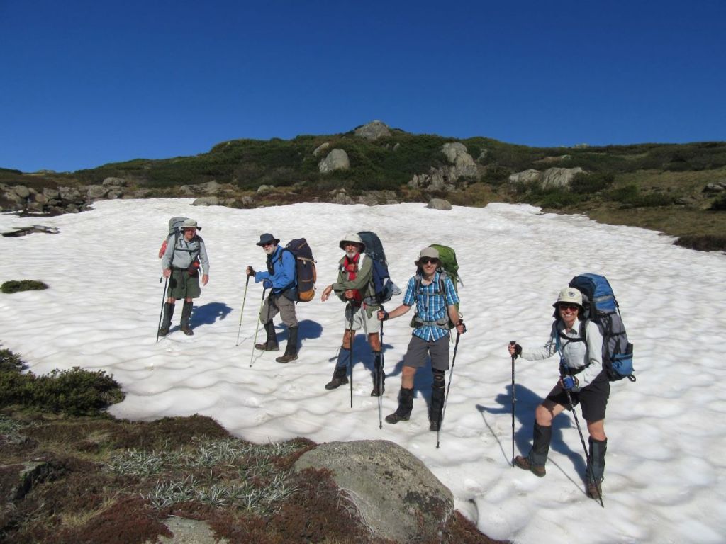
After our previous day’s walking on the Snowies Alpine Walk from Charlotte Pass Village to Perisher via Porcupine Rocks, we were keen to check out another new section. This time we settled on the new nine kilometre walk from Charlotte Pass to Guthega village. A top day beckoned. Clear skies, maximums hovering around 21o C and an alpine ramble with my walking friends Joe, Chris, Neralie and Garry.
by Glenn Burns

The BOM had issued a heatwave warning in its Snowy Mountains forecast. But for this quintet of Queenslanders the threatened 21o C maximum was just so. Not too hot, not too cold.
Snowies Alpine Walk
In 2018 construction started on the Snowies Alpine Walk. The NSW Government boasted it would deliver ‘ a world-class, multi-day walk across the alpine roof of Australia in Kosciuszko National Park.’
This 55 kilometre, 4 day walk, on Ngarigo Country, connects the existing Mt Kosciuszko-Main Range walk with three new sections. Namely, Charlotte Pass to Guthega Village; Charlotte Pass Village to Perisher Village via Porcupine Rocks and, as of 2024, the still incomplete section from Perisher Village to Bullocks Flat in the Thredbo River Valley.

After a top day of alpine walking yesterday from Charlotte Pass to Perisher, life on the track was on the up and up. An uneventful drive, with Joe at the wheel, from our digs at Sawpit Creek, delivered us to Charlotte Pass (1840 m).
Bang into an unexpectedly biting wind. Someone had neglected to clock the forecasted 50 kph wind gusts. So with the wind chill effect, the ambient temperature was pretty cold. And this was mid-summer, Australia. As my old walking pal Brian was apt to say: ‘strong enough to blow a brown dog off its chain’. We pulled on an extra layer.
Pleistocene Glaciation in Kosciuszko National Park
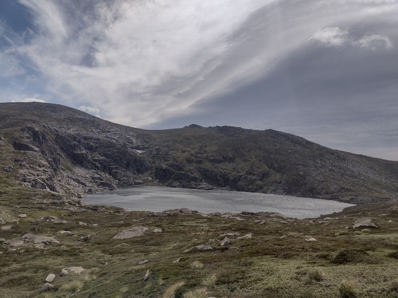
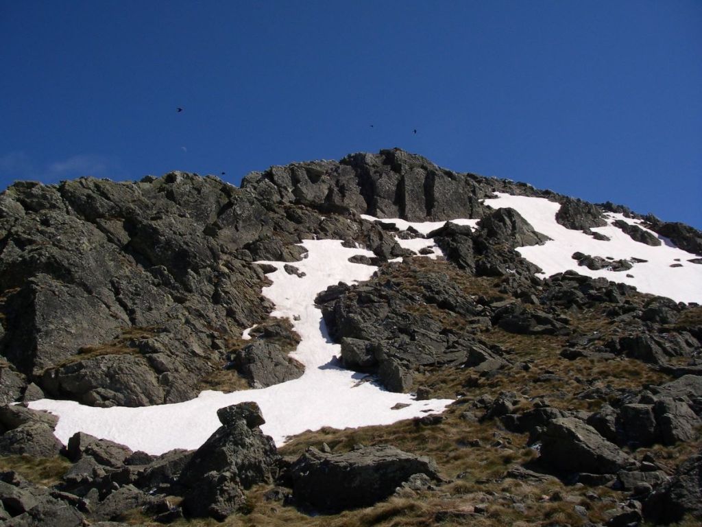
If you had been standing at this very spot some 60,000 years ago, in the frozen depths of the last Pleistocene ice age, the scene in front of you would have been vastly different.
You would have gazed across a panorama of snow and ice. Rivers of ice poured out from ice-filled glacial bowls on the south east flanks of Mt Lee, Mt Clarke, Carruthers Peak, and Mt Twynam. The current valleys of Club Lake Creek, Blue Lake Creek, Twynam Creek would be brimming with glacial ice grinding bedrock to a pulp on its way to join the major valley glacier in the Snowy River.
In fact, it is possible that your perch at Charlotte Pass would have been covered by a mass of abrading Snowy River glacial ice pushing over this interfluve into the neighbouring Spencers Creek valley. Or so some geologists hypothesise.
Back then temperatures would have been much colder. The minimum temperature today was 12o C. 17,000 years ago it would have been at least 5 to 8o C lower.
In Kosciuszko there is evidence of at least two distinct glaciations. The Early and Late Kosciuszko glaciations. The Early Kosciuszko Glaciation consisted of a single major advance at approximately 60, 000 years ago called the Snowy River Advance. This was the most extensive advance with later advances less extensive.
Geologists tell us that the Snowy River glacier probably extended as far downstream as Illawong Hut. Possibly further. There is evidence of glacial debris downsteam at Island Bend, discovered during surveys for the Snowy Mountain Scheme.
The Late Kosciuszko glaciation consisted of three smaller glacier advances, starting about 32,00 years ago: Hedley Tarn Advance (32,000 years ago), Blue Lake Advance (19,000 years ago) and Mt Twynam Advance (17,000 years ago).
The systematic search for evidence of glaciation in Kosciuszko got seriously under way in 1901. A scientific party of Professor T.W. Edgeworth David (geologist), Richard Helms (zoologist and botanist), E.F. Pittman , and F.B. Guthrie (Professor of Chemistry) found incontrovertible evidence of the action of glacial erosion and deposition:
- striated rocks and boulders
- erratics
- terminal and lateral moraines
- roches moutonnees
- cirques
- tarns
- glacial polishing of rock surfaces
- truncated spurs
- U-shaped valleys
- abraded interfluves


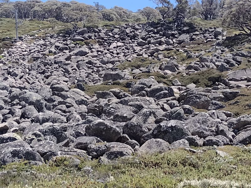
The Kosciuszko Plateau has been now been free of of glaciers for about 15,000 years. In addition to the glacial landforms mentioned above, the observant bushwalker can find ample evidence of periglacial landforms over much of the higher country. Some easily identified of these landforms include blockstreams, solifluction terraces and thermokarst ponds.
Meanwhile, back in the Anthropocene, the Snowies Alpine Walk (SAW) from Charlotte Pass initially heads downhill on the paved NPWS vehicular track towards the Snowy River. Some 500 metres of descent will deliver you to a junction and noticeboard trumpeting the start of the walk to Guthega village. We executed a hard right onto the SAW path.

Map of Snowies Alpine Walk: Charlotte Pass to Guthega Village.

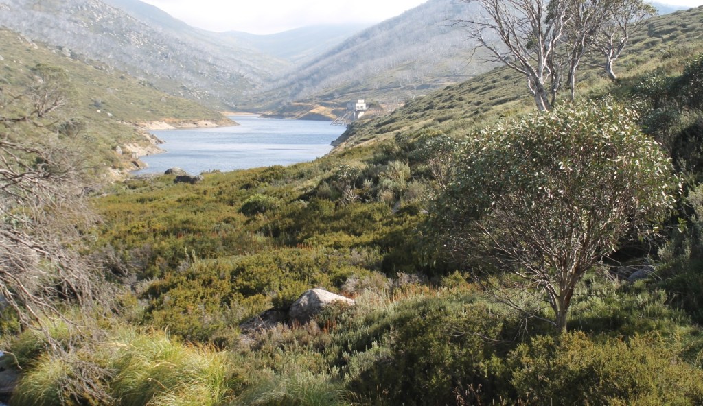
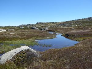
Here the SAW parallels the Snowy River on its eastern bank, winding around Guthrie Ridge on the 1700 m contour before dropping to Spencers Creek and the Snowy River at Illawong Hut. The final part of the day’s walk picks up the old Illawong-Guthega bushwalker’s pad to fetch up at Guthega Village, some nine kilometres from Charlotte Pass.
Back in the Day… 2009… Guthrie Ridge.
But, back in the day, in 2009, a 17 kilometre walk from our camp on Strzelecki Creek under The Sentinel to Charlotte Pass thence to Illawong Hut via Guthrie Ridge was more of a challenge. We set off with a brilliant off-track alpine ramble from Strzelecki Creek to Charlotte Pass via Carruthers Peak, Mt Northcote, Mt Clarke and the Snowy River Crossing.
Once at Charlotte Pass we swung off-track again to climb Mt Guthrie (1920 m). The usual suspect had cooked up this feral route that followed the spine of Guthrie Ridge (1900 m) and then descended to an overnight bivvi at the junction of Twynam Creek and the Snowy River. Close to Illawong Hut.
Mt Guthrie and Guthrie Ridge were named by Richard Helms for his friend F.B. Guthrie, Professor of Chemistry.
My peak bagging companion had hinted at another exceptional alpine stroll to cap off what had been, so far, a matchless day of hiking. A mere two and a half kilometres or a one hour leisurely amble along the spine of Guthrie Ridge would deliver us to our campsite on the junction of Snowy River and Twynam Creek. Fun times.
Mid afternoon, on a steep mountainside, high above the valley floor three beleaguered peak baggers pushed wearily through the tangle of granite boulders and scratchy mountain peppers, Kunzeas, Epacris and snow gums that lay between them and the day’s end. Route wise, a bad call.

But I was resigned to this stuff. Situation normal when walking with my bush-bashing, peak bagging buddy Brian. He claimed it was just the price we had to pay for a very satisfying and bludgy morning’s walk. Finally, we staggered in just on dusk. The campsite made it all worthwhile. We set up on a springy snow grass ledge… lulled to sleep by the riffling Snowy River. All was well in my little slice of bushwalking paradise and all is forgiven Brian.
The new Snowies Alpine Walk.
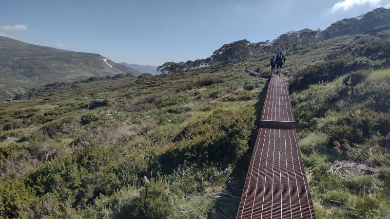
After mulling over this previous cross country experience I gave thanks for the newly minted super SAW highway. Cortan steel elevated boardwalks, rock-armoured track surfaces and dry boots compliments of a high suspension bridge over Spencers Creek. A speedier passage than taking that infernal high road along Guthrie Ridge. But nowhere near as interesting.
The track took us initially over another of those eyesore Cortan steel boardwalks much favoured in Kosciuszko National Park. But I admit they do an excellent job of protecting the low heath and snow grasses below.
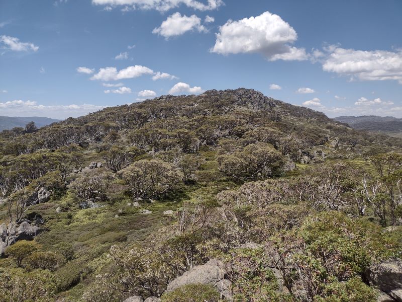
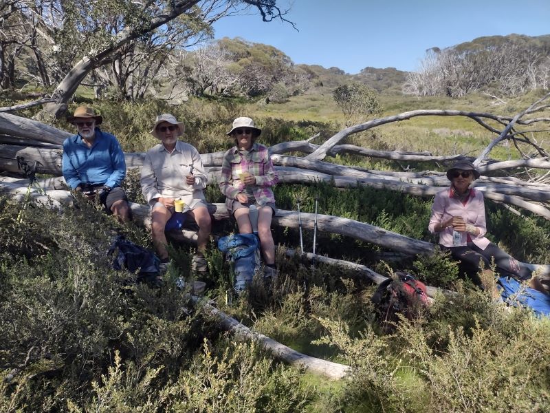
Eventually the track leaves the low heath and climbs on its granite pavement ever upward through snow gum woodland. As did Garry. Left us, that is. We found him, as I expected, propped on a log in a bower of snow gums. The ideal morning tea stop.
Snow gum woodland, invariably, is clothed in a dense scrubby understorey of beastly spikey undergrowth like Bossiaea, Epacris, Hakea, Grevillea, Oxylobium, and Kunzea . Here’s where those weird knee-length canvas gaiter things worn by Australian bushwalkers are a brilliant piece of kit.
The low growing snow gum woodland is found above 1500 metres and is dominated by snow gums or white sallee ( Eucalyptus pauciflora).

The snow gum zone is found extending down to the lower levels of winter snowfall and is the only tree to grow above 1500 metres. Above this woodland zone the landscape transitions suddenly into the true alpine zone of heathland, grassland and bogs.
The undergrowth is called heath and can be waist-high with tough whippy branches to withstand the weight of snow (and, hopefully, bushwalkers) without breaking. Throw in the odd torpid highland copperhead and pit-fall traps of wombat and bunny burrows and hiking through this scrub quickly losses its appeal.
Fortunately, the new super SAW highway saved us from having to thrash through that stuff.
Much of the SAW walk parallels the Snowy River which flows NNE downstream towards Guthega Pondage. It is joined on its western bank by the south east flowing drainage lines of Blue Lake Creek, Twynams Creek and Pounds Creek.
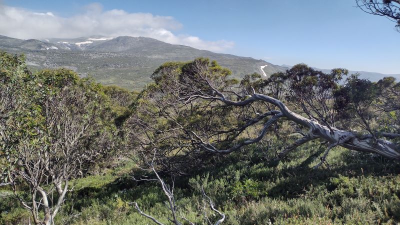
These creeks have their headwaters along the highest parts of Australia’s Great Dividing Range: Carruthers Peak (2010 m), Mt Twynam (2196 m), Mt Anton ( 2010 m) and Mt Anderson (1997 m). The Main Range peaks all visible from this section of the SAW.
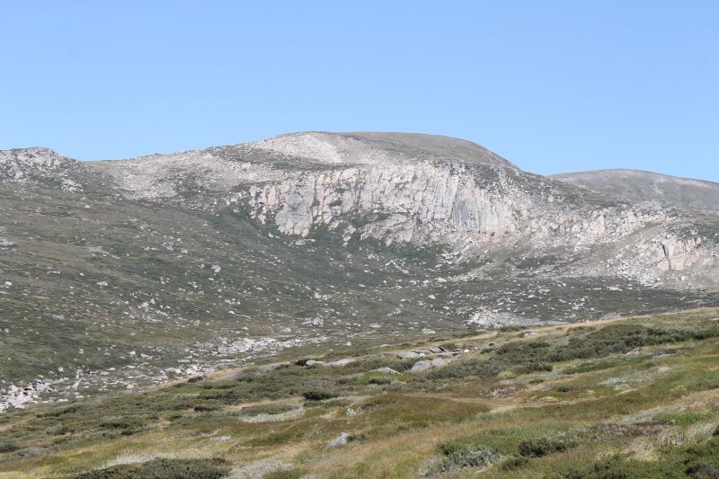
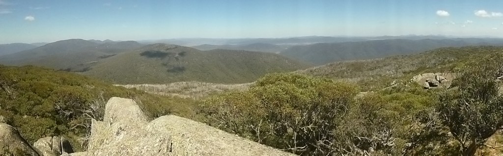
Today’s walk provided expansive and unimpeded views down the nearly straight Snowy River Valley. Its side slopes planed back by late Pleistocene valley glaciers. Glacial valleys all over the world typically exhibit these truncated spurs and U shaped valleys.

Some 4.5 kilometres after the track entrance our path left the snow gum woodland and descended across low heath covering a gently rounded spur at the intersection of the Snowy River and Spencers Creek. An abraded spur, ground down during the Pleistocene by the Snowy River and Spencers Creek valley glaciers.

Joe and I caught up Chris and Neralie just short of the Spencers Creek suspension bridge. They were magging with two walkers travelling in the reverse direction. Uphill to Charlotte Pass. I’m not sure of the rationale for doing this section uphill, but many people do. Meanwhile, Garry was last seen as a distant speck beetling toward Illawong Hut.
The SAW track builders had thoughtfully provided a nifty suspension bridge consisting of a steel mesh plank and handrails to usher walkers safely across Spencers Creek. Built in 2021 it is said to be, in terms of its location, at 1627 metres of altitude, the highest suspension bridge in Australia .

Meanwhile Garry had escaped the wind by taking refuge at the side of the hut. Just don’t turn up here in a serious blizzard. You will find the inn door locked, as we did. An unusual arrangement for high country shelters. But this is because Illawong is the only private lodge outside the main ski resorts.

But, to be fair, the illustrous Illawong Ski Tourers have thoughtfully provided a sealed crawl space for midgets under the hut for just such an emergency. And, they have thrown in as a goodwill gesture, a snow shovel to dig yourself out or in. Once out of your blizzard, don’t try to sit up. The upside is that you are safe and don’t have to share the under floor space with assorted snakes, wombats and other creepy-crawlies.

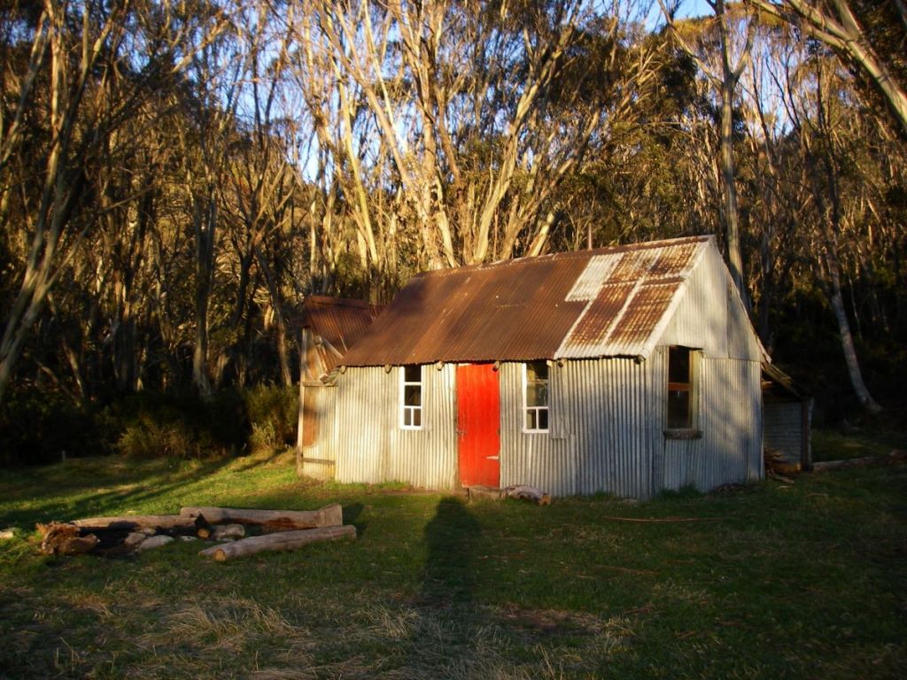
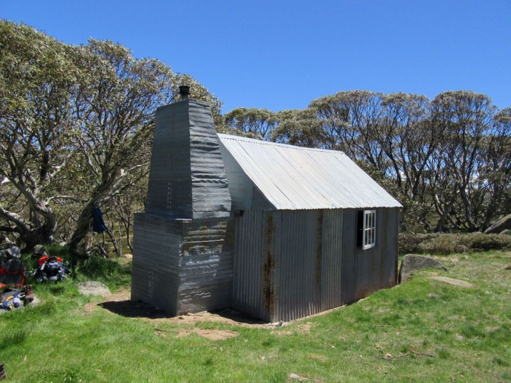
Illawong Hut
Illawong, also known as Pounds Creek Hut and Tin Hut No1, was constructed in the summer of 1926-1927 as a shelter hut. Illawong is said to mean ‘view of the water’. A basic two roomer/four bunks, it was built by the NSW Tourist Board to assist Dr Herbert Schlink in his first Kiandra to Kosciuszko ski crossing during the winter of 1927.
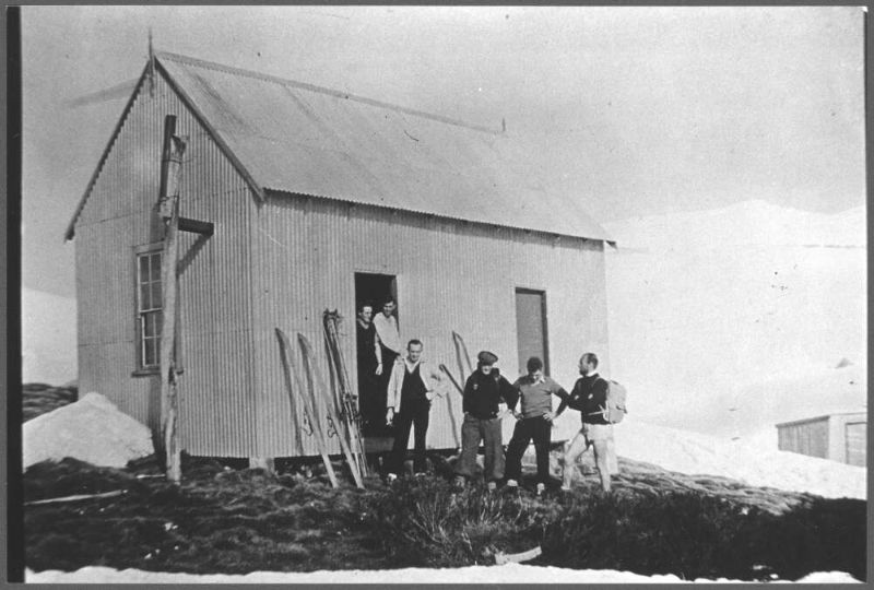
After construction it was used for early ski touring, summer bushwalking and by mountain cattlemen. At the time only two other buildings existed in the high country: Betts Camp and Kosciusko Hotel.
In 1955, John Turner of the Ski Tourers Association brewed up a plan to convert Pounds Creek Hut into a ski lodge. A year later, in 1956, the Kosciuszko State Trust gave permission for the hut to be extended to become a private ski lodge managed by Illawong Ski Tourers.
The conversion was a bit of mission for lodge members. No helicopter lifts in those days. All materials and food supplies had to carried in. Though some ingenious work-arounds were dreamt up. Klaus Hueneke in his first-rate tome: Huts of the High Country provides this description:
” Over the next two years members, friends and passersby spent endless summer days and occasional premature wintry ones carrying, rowing, pushing and dragging materials to site. “
And this:
” Rowing the materials up Guthega Dam was a new twist to mountain transportation and not without incident… boat trips took on ice floes, wind driven sleet and polar wombats! The final leg was considerably aided by a sled and the muscle power of Mick, a horse from the Chalet. Unfortunately he had only two speeds – stop and run like hell. “
Those enterprising Illawongians weren’t finished yet. Over the years the Lodge was spruced up with a septic tank, electric lighting, a gas cooker, a refrigerator, a hot water service, decent mattresses, carpets and a phone. A veritable home away from home. My membership application is in the mail.
Members also designed and built the flying fox over Farm Creek and the suspension bridge over the often raging Snowy River. For this latter feat all skiers and bushwalkers wanting to access the Main Range should give them fulsome thanks. Two earlier bridges had been swept away before a decent one was installed in 1971. The final version was designed and built by one Tim Lamble and assembled with the help of the NPWS helicopter.
Tim, incidently, is also the author of my favourite piece of cartographic art: the Mt Jagungal and The Brassy Mountains 1:31680 map.

Illawong Hut has been placed on the National Heritage Register, the National Trust (NSW) Register and NPWS Historic Places Register. Its NPWS citation reads:
” Illawong Hut is one of the most historically significant huts in the park, being a rare remnant of early 20th century NSW Government Tourist Bureau efforts to promote alpine tourist recreational activities.”
For good measure the Farm Creek flying fox and the Snowy River suspension bridge are also on the register.

With little over two kilometres to Guthega my friends had scarpered in a cloud of dust. The upgraded SAW track follows the old bushwalking pad between Illawong and Guthega. It skirts around the southern bank of Guthega Pondage. This pondage, a tunnel and Guthega (Munyang) hydro power station were built as part of the Snowy Mountains Scheme in the early 1950s.
Munyang (Guthega) Hydro Power Project
This Munyang (Guthega) project area is the start of many of my favourite walks in Kosciuszko.
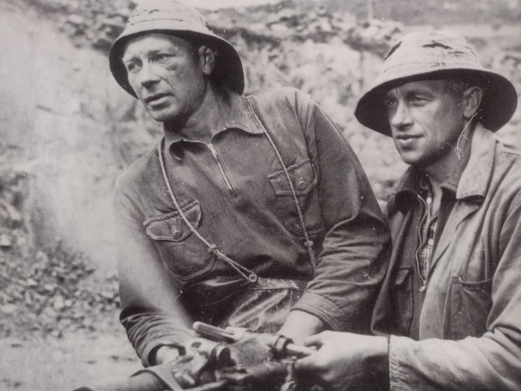
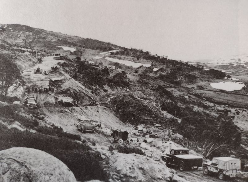
And it is also the start of the first major project of the Snowy Mountains Scheme in 1951. The tender was awarded to a Norwegian firm, Ingenior F. Selmer. A serious player in global dam and hydro construction. The bulk of the workers were Norwegians (450, mainly labourers) from the rural areas of the Arctic Circle.
On the 21 February 1955 , only a few weeks behind schedule, electricity flowed from Munyang.

The word Munyang or Muniong derives from local aboriginal people. When camped on the Eucumbene Valley, they would point to the snow covered Main Range and repeat the word ‘Munyang’ or ‘Muniong’ . Said to mean ‘big’ or ‘high mountain’. Also ‘big white mountain’.
If you want to read more about the fascinating people and places of the Snowy Mountains Scheme, I can highly recommend Siobhan McHugh’s: ‘The Snowy, a History.‘

Nearing the end of our walk, the SAW crosses Farm Creek via a metal bridge then climbs to Guthega Village. No need to risk life and limb on the the rusty old flying fox still there. Fortunately, it has been padlocked by some kill-joy to discourage thrill seekers like my walking companions.

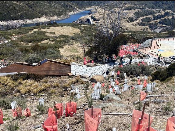
At the still to be completed track exit, rangers were busy fiddling around sorting out signage. Here we had views over the waters of Guthega Pondage, the dam wall and the intake for the tunnel to the top of the Munyang penstocks.
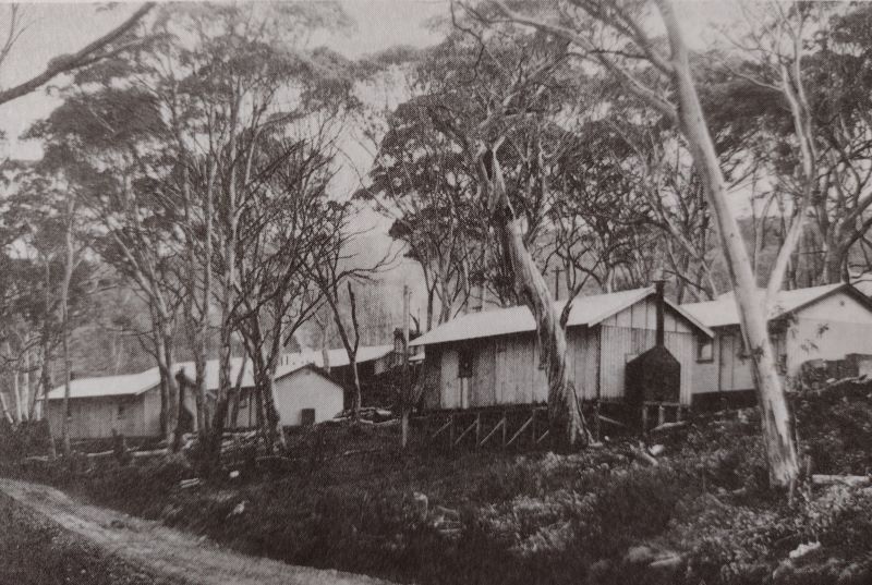
Guthega Ski Village or Little Norway
Guthega village did not exist before 1950. The only building in the area was our old friend Illawong Hut. In 1951 when the Norwegian company Selmer started construction on the first major project of the Snowy Mountains Scheme , their construction camp became known as ‘Little Norway’ as it housed the largest number of Norwegians living outside of Norway at the time.
When Selmer returned to Norway in 1954, at the end of their contract, they took most of their construction camp with them, leaving just three huts. These huts kick-started the modern day Guthega Ski Resort.
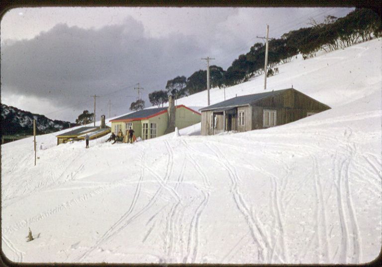
The huts were scooped up for peanuts in 1955 by SMA Cooma Ski Club, YMCA Canberra Ski Club and Sydney University Ski Club. The village now sports private lodges, a restaurant and bar, commercial resort accommodation and various tow knick-knacks to ferry skiers to the top of their runs.
Guthega serves as a winter base for downhill skiing, cross country skiers, snow-shoers and snow-boarders. The alpha adventurers head for Blue Lake to try out their ice climbing skills. But in summer, Guthega is pretty much dead. A ghost resort. Hopefully, this will change given the number of walkers I saw on the track.
It was now two hours past our lunch hour. A familiar pattern developing here, much to the chagrin of my fellow walkers. We found Garry’s vehicle, wheels still attached, piled in and headed for nearby Island Bend Campground on the Snowy River for a belated feed.
The campground was once the site of a construction village for the Snowy Mountains Scheme.
We ducked into a pleasant little nook with a picnic table and some soft grass for a post-prandial kip. All in all, a top day of alpine hiking with my walking companions, Joe, Chris, Neralie and Garry.

I had many more days of alpine adventures for my fellow Kosciuszkians. God bless their little walking boots. Maybe not so little.
Check out these Kosciuszko walks.

Pipers Creek Track: A little gem in Kosciuszko National Park

Snowies Alpine Walk: Perisher to Bullocks Flat.


Mt Jagungal: Kosciuszko National Park
My walking companion, youngest son, had just swanned in from months of pounding the mountain trails of the Swiss Alps and Nepal. Lean and fit, he was keen for one final fling before returning to work in early November.
We tossed around the possibilities. Frenchman’s Cap, The Labyrinth, the Western Arthurs were his hot choices while Moreton Island or K’gari looked like cushy numbers for me.
The art of compromise. An 80 kilometre outing to Mt Jagungal in northern Kosciuszko National Park. The iconic Jagungal Wilderness Area is part of The Australian Alps Bioregion, the only truly alpine environment in New South Wales as well as the only part of mainland Australia to have been affected by Pleistocene glaciation.
Jugungal Wilderness: The Weather Report.
Our timing was impeccable. The Bureau of Meteorology’s Snowy Mountains Regional Forecast promised us: Wednesday: ‘snow showers’ and ‘fresh to strong southerly winds’. The clincher was the ‘minimum of -2ºC, and a maximum of 0ºC’. More of the same for Thursday with relief coming on Friday: ‘fine sunny weather, minimum -3ºC, maximum 9ºC’.
We somehow misplaced Friday’s fine sunny bit. Youngest son, outfitted with cosy thermals and multiple fleece layers, seemed relaxed about all this snow stuff, so I wasn’t overly concerned. But I wondered if my warm Queensland blood was up to the task.

The Provedore
Once in Canberra I was despatched to Manuka to source the all important hiking rations. Too easy: a big bag of beer nuts, no-brand cups of soup, two-serve pastas, mountain bread, ten yoghurt coated muesli bars, tang, eight Laughing Cow soft cheese wedges, twelve mini Mars bars and two knobs of pepperoni salami to placate youngest son’s carnivorous tendencies.
But, when it was too late, at the isolated Whites River Hut, he discovered that his confidence in the largesse of this provedore was sadly misplaced. There is an old saying about living on the smell of an oily rag that seems apposite. But I will return to this well chewed bone of contention later.
More Information
Map: Geehi Dam: 1:25000.
Map: Jagungal: 1:25000.
Map: Tim Lamble: Mt Jagungal and the Brassy Mountains: 1:31680.
Map: Wyborn, D., Owen, M., Wyborn, L: Geology of Kosciuszko National Park: 1;250000. ( BMR Canberra 1990 ).
Hueneke, K: Huts of the High Country (ANU Press 1982).
Johnson, D, The Geology of Australia ( Cambridge University Press 2009 ).
Flood, J : Moth Hunters of the ACT: ( 1984 ).
Kosciuszko Huts Association: https://khuts.org
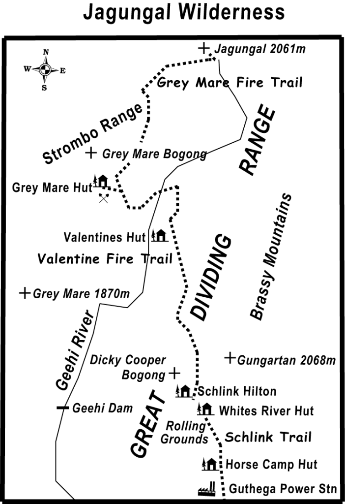
Photo Gallery: Jagungal Wilderness


Tuesday: Guthega Power Station to Whites River Hut: 10 kms.
With a 5.00 pm departure we left the bluebell coloured Camry orphaned at the Guthega Power Station, the Australian Alpine Walking Track entrance. The track zig- zagged steeply uphill.
With fine cool weather and a window of three hours to cover the ten kilometres to White’s River, there was no particular hurry and apart from a 240 metre altitude gain it was a most agreeable evening’s ramble, as we beetled along in a companionable silence.

Australia’s Sub-alpine Landscapes
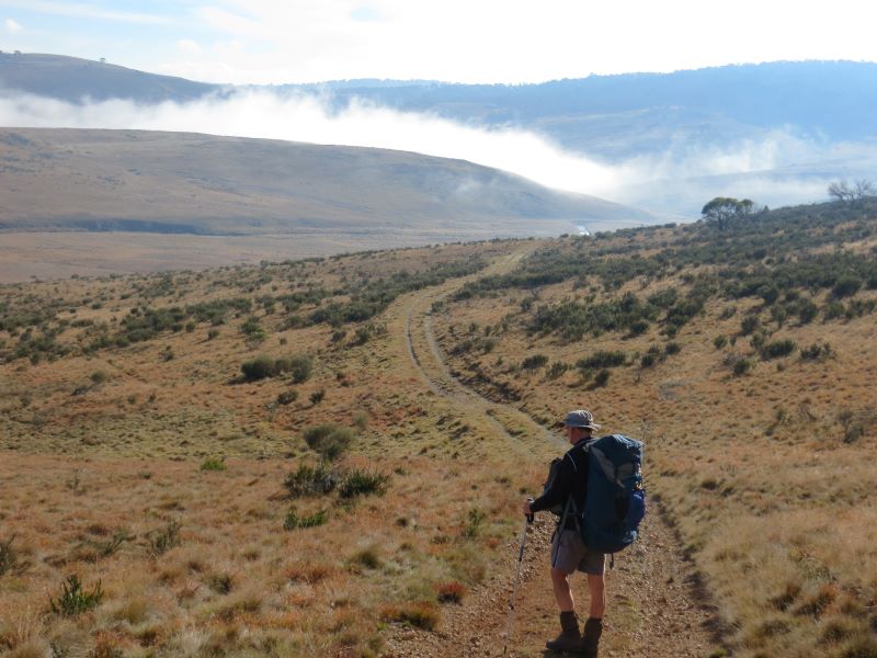
We followed the winding track across a typical sub-alpine landscape of snow gum woodland interspersed with open grasslands. The sub-alpine zone in Australia is that in which snow gums are the only tree species, lying between approximately 1400 m and 1700 m. Above 1700 m to about 2000 m, on the Australian mainland, is the treeless alpine zone.
Vistas of extensive treeless grasslands unfolded along the valley floor. These grasslands are said to be the result of cold air pooling in valleys forming frost hollows, producing a microclimate inimical to the survival of trees and shrubs, even snow gums.
In the dampest parts where the water table is close to the surface, spongy bogs and fens dominate. The higher ridges are covered in snow gum woodland, the lower edge of the community terminating sharply, forming a definite tree line on a contour around each plain.

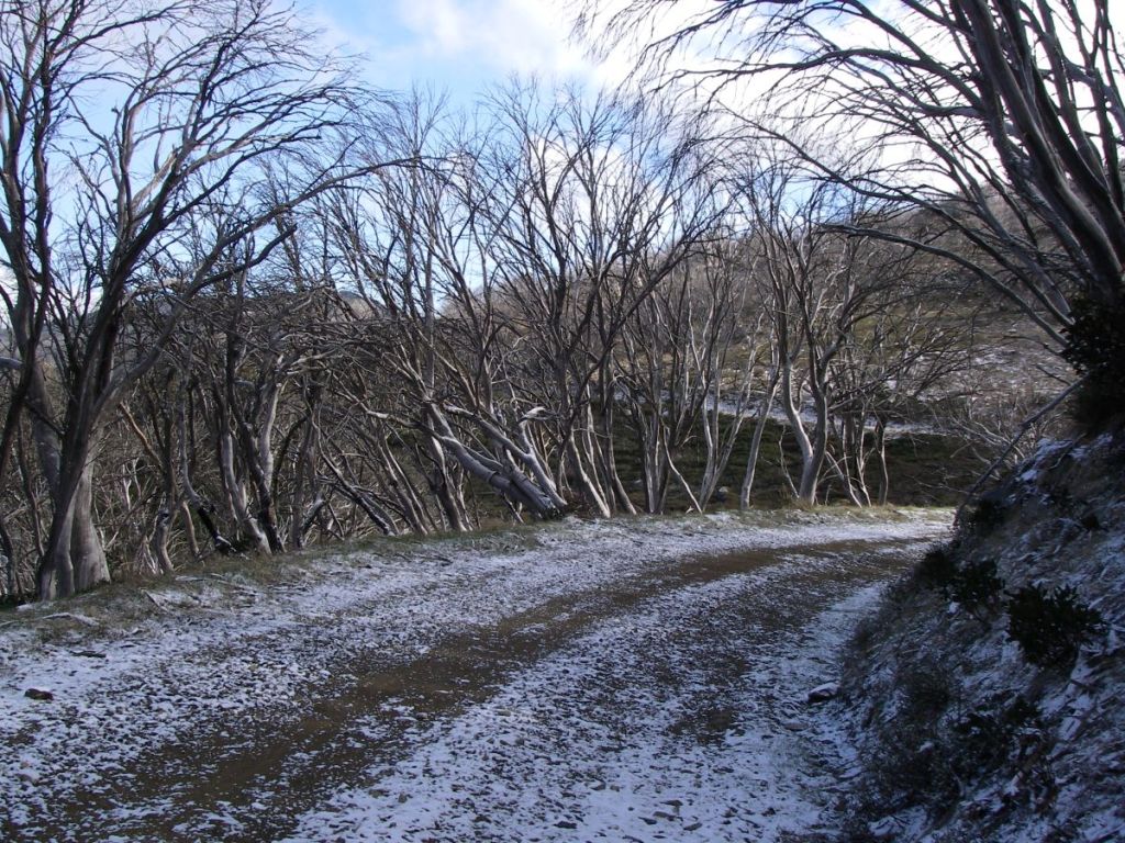
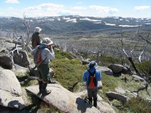
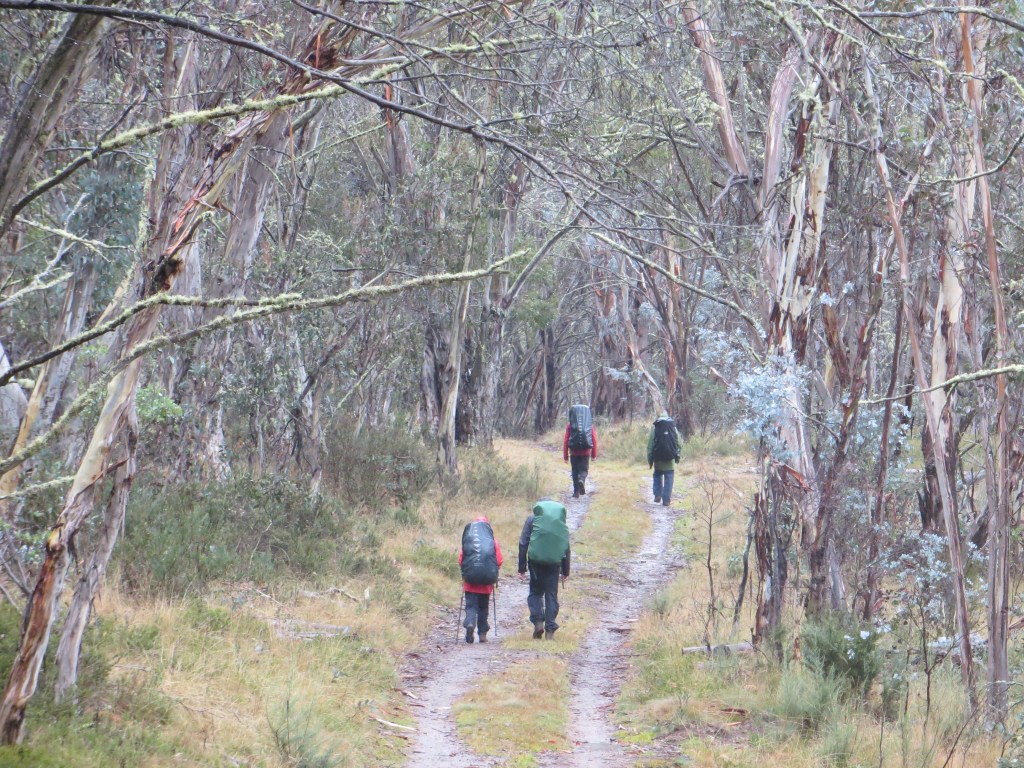
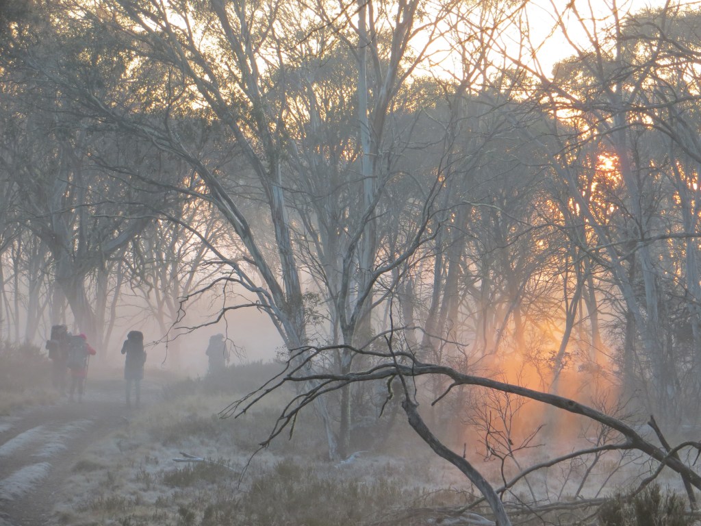
It was sobering to find huge swathes of the snow gum woodland burnt out, their dead branches arching over our heads. Lines of fire-ravaged hills retreated to the far horizon, but, on an optimistic note, the dominant snow gums were now suckering vigorously from their lignotubers.
In 2003 massive fires burnt much of the park and sections of the plateau were still closed until mid 2006. Fire is, of course, part of the natural regime of Kosciuszko, with an average of 100 days annually of high to extreme fire danger.
It has the dubious distinction of being one of the most fire prone areas in the world. Fortunately, this area from Guthega to Jagungal was untouched by the massive fires of the summer of 2019-2020.

We reached White’s on dusk. I wussed out, keen for a comfy bunk in the hut. Surprisingly, I met little resistance … for a change. The plummeting temperature, barely holding at 3ºC, dampened our enthusiasm for things outdoorsy: like sleeping in freezing tents, no camp fire, and fourteen hours incarcerated in a hike tent.
Whites River Hut
White’s River Hut, typical of many high country huts, was built in 1935 by sheep farmers who engaged in the transhumance of their flocks, grazing them on the high alpine meadows of the Rolling Grounds in summer, retreating to the protected Snowy River stations for winter. Summer grazing on high pastures ceased in the 1970’s.

Constructed of sheet iron, White’s is a basic, dingy hut, appreciated in cold, wet weather, but rarely used on hot summer days. Like most Kosciuszko huts it has sleeping bunks, a fireplace or woodstove, wood store, tatty table and bench seats and an outdoor dunny.
Whites is unusual in that it once had an additional, stand-alone four person bunkhouse known as ‘The Kelvinator’, for obvious reasons. If it is not obvious to the reader then Kelvinators were a famous brand of Australian refrigerators. This was the last refuge for desperate winter skiers, no doubt thankful to escape from the malevolent Rolling Grounds but usually arriving frozen to the core only to discover there was no room left in the main inn.

The main hut is also the refuge of the notorious Bubbles and Bubbles Jnr, bush rats extraordinaire: legends of High Country Huts as walkers and skiers record their exploits of marsupial derring-do and innate native rat cunning at avoiding all manner of water traps and flying footwear.
On a visit in 2005, Bubbles made off with our leader’s head torch, dragging it towards his bolt hole stopping occasionally to dine on its hard plastic coating. Tonight, these pint sized bush banditos were content with keeping son in a state of high alert as they tip-ratted through hut rubbish and skittered along the wooden beam highways above our beds.
For my part I slept as well as can be expected for a Queenslander. Cold air seeped through my down sleeping bag, thermal liner bag, two thermal shirts, a polar plus jacket, beanie, gloves, woollen socks x 2, thermal long johns and over trousers. How cold could it get?
Wednesday: Whites River Hut, Schlink Hilton Hut, Valentines Hut and Grey Mare Hut: 19 kms.
We found out in the morning. All was quiet. No birds, no Bubbles, no sound of running water. Just the muffled fall of light snowflakes susurrating against the hut. Nature called and I emerged at six o’clock and applied my final layer, a thick Gore-Tex rain jacket, which seemed to do the trick. Youngest son surfaced soon after, although I have observed that he normally lies doggo until Jeeves has a fire blazing and breakfast is on the way.

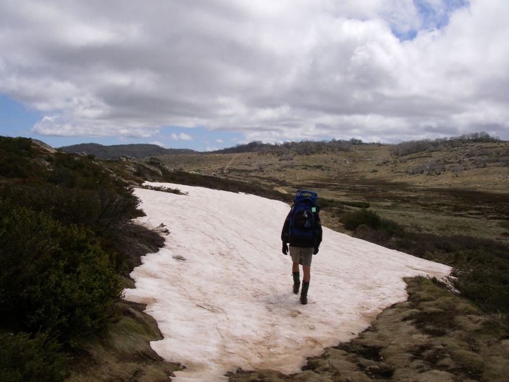
There is nothing like walking in a light snowfall. Cold it may be. But to be out walking on a high country trail in crisp alpine air, is an experience to be remembered. Our bodies quickly warmed up as we ascended towards Schlink Pass at 1800 metres.
In any case our warm gear and wind proofs kept us snug and dry. All too soon we topped the pass and descended to The Schlink Hilton. This twenty bunk ex-SMA hut was named after Herbert ‘Bertie’ Schlink, who was one of a party of four who were the first to complete the Kiandra to Charlotte Pass trip in three days in July 1927.
We ducked in, out of the drifting snowflakes, deposited plops of melting snow, removed several thermal layers, and then squelched off again to the start of the Valentine Fire Trail.
Valentine’s marks the start of The Jagungal Wilderness Area. Centred on Mt Jagungal (2060m), this isolated area is a bushwalking paradise: mountain peaks, snowgrass plains, high alpine passes, the massive Bogong Swamp and a derelict gold mine.
The area is closed to vehicles but numerous fire trails provide sheltered walking when bad weather closes in over The Kerries and Gungartan.
Valentines Hut
By 10.30, the snow showers clearing, we sighted Valentine’s Hut, its fire truck red livery standing out against a grey skeletal forest of dead snow gums. Valentine’s is my all time favourite high country hut. Another ex-SMA hut, this natty little four person weatherboard hut has a clean airy feel, with table, bench seats and a wood stove in its kitchen. A home away from home.
Other huts are usually dark, sooty, plastered with candle grease and graffiti and generally described as dirty and dingy. Valentine’s has been painted inside and out, has ample windows and, for added creature comfort, a newish corrugated iron dunny close by.

Youngest son, ever hungry, was keen for an early lunch in the snug comfort of Valentine’s, out of the clutches of the blustering southerlies. Two mountain bread roll-ups filled with peanut paste, salami and cheese, a mini Mars and a few handfuls of beer nuts vanished in a flash. He: “What’s next?” Well nothing.
Some grumbling about catering arrangements and we were on our way to the Grey Mare, but not before I deemed it politic to requisition a packet of cous cous from the ‘please help yourself food pile’. No self respecting bushwalker eats cous cous, not even the desperate.
The final leg would take us across Valentine’s Creek, over the mighty Geehi River (boots off for me), then up and over a 1700 metre alpine moor to Back Flat Creek with a final unwelcome crawl 60 metres up to the Grey Mare Hut for an early mark.
Grey Mare Hut
Grey Mare was a miner’s hut. Gold was discovered in the vicinity in 1894 at the Bogong Lead, later called Grey Mare Reef. Initially it was worked as a pit but flooding of shafts ended the first sequence of occupance in 1903. An output of 28.3 kgs of gold in 1902 made it one of the highest yielding gold fields in New South Wales.
A second phase of mining started in 1934 with an adit blasted to get to the reef. The ruins of a hut on the creek flats below dates from this period. A final attempt to get at the gold came in 1949 when the present hut was built.
The bush around the hut is littered with all kinds of mining knick-knacks: a crusher, a steam engine, a huge flywheel weighing more than two tonnes and a shambolic tin dunny teetering over the abyss of an old mine shaft ( since replaced with something safer).


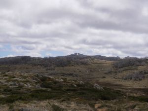
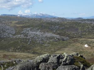
The six berth hut is standard dingy but large and comfortable with a huge fireplace and the best hut views in the park. From our doorstep we had views northwards up the grassy valley of Straight Creek and peeking above Strumbo Hill, the crouching lion, Mt Jagungal, tomorrow’s destination.
Looking to the east I could see Tarn Bluff, Mailbox Hill and the Cup and Saucer which I visited in 2017. Behind us was the Grey Mare Bogong topping out at 1870 metres.
By three o’clock, the worms were biting and son was already scruffling through our rations looking hopefully for cups of soup and pasta with Nescafe caramel lattes and chocolate chasers to appease his now constantly rumbling tum.
Meanwhile, I set to with bush saw to lay in our wood supply for what was shaping up to be a windy, cold night. No problems with collecting bush timber here, the hut is set in a stand of dead snow gums. By five o’clock it was cold enough to rev up the fire.
Come dark we banked the fire and drifted to our bunks, snuggling down into warm bags. The predicted ‘windy’ conditions made for a restless night with a banging door and overhanging branches raking the corrugated iron chimney.

Thursday: Grey Mare to Jagungal and return: 22 kms.
Up at six o’clock in anticipation of the long walk to Jagungal and back. Snow showers again, a gusting tail wind catching our rucksacks and driving us sidewards off the Grey Mare Trail as we headed north. With Phar Lap out in front and old Dobbin coming at a steady gallop behind, we burned up the kilometres, hayburners from hell, past Smith’s Lookout (1748m), across the Bogong Swamp (dry), rock hopped over the Tooma River, and thence to our Jagungal access at the Tumut River campsite.
And not a single grey mare in sight. A heap of beer nuts and a yoghurt bar each and we were off again, an easy 220 metres climb onto the mist shrouded south west ridge, a sharp turn left and an even easier 160 metre ridge walk to Jagungal Summit at 2061 metres. The Roof of Australia, or near enough. The mist cleared…. how lucky was that?
Mt Jagungal 2061 m.
Jagungal is instantly recognisable from over much of Kosciuszko. A reassuring landmark for bushwalkers and skiers alike, a beacon… an isolated black rocky peak standing above the surrounding alpine plains. It is at the headwaters of several major rivers: the Tumut, the Tooma and the Geehi.
It was known to cattlemen as The Big Bogong or Jagunal. The later spelling, Jagungal, is considered by the old timers a latter day perversion. Jagungal appears on Strzelecki’s map as Mt Coruncal, which he describes as “crowning the spur which separates the Murray and Murrumbidgee Rivers”.
The aborigines often called mountains in the alpine zone ‘bogong’, indicating a food source, the Bogong moth. Europeans applied their own nomenclature to differentiate the Bogongs: Paddy Rushs Bogong, Dicky Cooper Bogong and Grey Mare Bogong.
Unlike most of the other Bogongs whose granitic origins are revealed by their characteristic whaleback profiles, Jagungal’s summit is distinctively peaky. It sports a lizard like frill of vertical rock towers, some intact, other lying in jumbled heaps.
Jagungal is different because it is capped by amphibolite, a black igneous rock more dense than granite, formed by the metamorphosis of basalts, the Jagungal Volcanics. Its origins date back to 470 to 458 mya, to the Middle Ordovician. It is surrounded by the Kiandra Volcanic Field, part of a belt of volcanoes called the Molong Volcanic Arc.
During the The Ordovician ( 485 to 444 mya), Australia was part of a single super-continent and much of Eastern Australia was covered by the sea. Chains of active volcanoes occupied parts of central New South Wales. These were mainly submarine volcanoes but some emerged to form small islands with fringing limestone reefs. The Ordovician saw the first appearance of corals and land plants.
Jagungal was ascended by Europeans in the winter of 1898 when a party from the Grey Mare Mine climbed it using primitive skis called ‘Kiandra snowshoes’.
Ours was a much less adventurous walk, but we still savoured our time on the summit. Especially magnificent were the views south to the snow capped Main Range, four days away. It was so clear that we could even discern Victoria’s Mt Bogong on the far southern horizon.
But the cold wind soon drove us into a protected sunny nook just under the summit. We hunkered down, lunched, son eased into one of his regular catnaps…. no doubt dreaming of Nepal and wolfing down a huge bowl of Nepali boiled potatoes and rice; or perhaps a large slice of pizza; or even, given our now parlous food situation, a plate of succulent fried Bogong Moths.

Bogong Moths
I had noticed on a previous trip and again on our ascent today, huge raucous flocks of crows cawing around the steep summit cliffs. I had seen the same phenomenon on Mt Alice Rawson near Kosciuszko. Inexplicable at the time.
Recently, I came across an explanation. The ‘crows’, actually Little Ravens (Corvus mellori), were gathering to feed on Agrotis infusa, the drab little Bogong moth, found only in Australia and New Zealand. To escape the summer heat, these moths migrate altitudinally and set up summer holiday camps in the coolest places in Australia, the rock crevices of the alpine summits.
They come in millions from western New South Wales and Southern Queensland, distances in excess of 1500 kilometres, often winging in on high altitude jet streams, and settle in crevices and caves, stacked in multiple layers, 17,000 of them in a square metre, where they undergo aestivation or summer hibernation.
The migrations seem to be a mechanism to escape the heat of the inland plains and they gather in the coolest and darkest crevices on western, windward rock faces. A tasty morsel for our corvid buddies.
Aborigines and the Bogong Moths
With the ravens came the aborigines, from Yass and Braidwood, from Eden on the coast and from Omeo and Mitta Mitta in Victoria. All intent on having a good feed and a good time. Large camps formed with as many as 500 aborigines gathering for initiation, corroborees, marriage arrangements and the exchange of goods.
It is thought that advance parties would climb up to the tops, and if the moths had arrived they would send up a smoke signal to the camps below. The arrival of the moths is not a foregone conclusion. Migration numbers vary from year to year.
Some years they are blown off course and out into the Tasman Sea. 1987 was a vintage year, but in 1988 the bright lights of New Parliament House in Australia’s bush capital, acted as a moth magnet, and they camped in Canberra for their summer recess, unlike our political masters.
Men caught the moths in bark nets or smoked them out of their crevices. They were generally cooked in hot ashes but it is thought that women sometimes pounded them into a paste to bake as a cake. Those keen enough to taste the Bogong moth mention a nutty taste.
Scientists say they are very rich in fat and protein; this diet sustained aborigines for months and the smoke from their fires was so thick that surveyors complained that they were unable to take bearings because the main peaks were always shrouded in smoke.
Europeans often commented on how sleek and well fed the aborigines looked after their moth diet. Edward Eyre who explored the Monaro in the 1830’s wrote: “The Blacks never looked so fat or shiny as they do during the Bougan season, and even their dogs get into condition then.” At summer’s end, with the arrival of the southerlies, the moths, aborigines and ravens all decamped and headed for the warmer lowlands. As did my travelling companion and I.

Friday: Grey Mare Hut to Horse Camp Hut: 24 kms
Of necessity, a long day’s walk ahead to put us close to our Guthega exit. Windy and cool again, and no sign of the fine sunny weather promised by our BOM friends. Which was just as well as my radiator was boiling on our way up the steep 200 metre climb out of Back Creek en route to Valentine’s.
Today we would be walking south, towards the Main Range. Here was an excellent opportunity to identify from our map the classics of Kosciuszko walking that had been shrouded in mist on our outward walk: The Kerries, Gungartan, Dicky Cooper Bogong, the Rolling Grounds, Mt Tate, Mt Twynam and the biggest Bogong of all, Targan-gil or Mt Kosciuszko.

Horse Camp Hut
Late in the afternoon we turned off the Schlink and found our way to Horse Camp Hut, tucked in snow gum woodland 300 metres below the Rolling Grounds, a high altitude granite plateau above the tree line at 1900+ metres, cold, windy and exposed but spectacular. It is said to be very difficult to navigate in bad weather.
I noted in the hut log book that a number of winter skiers had ‘GPSed’ their way to Horse Camp from the Rolling Grounds. It is claimed that the Rolling Grounds are so named because during the summer grazing, stock horses would enjoy a good old dust bath and roll in the many depressions that dot this high altitude plateau.
Horse Camp Hut, of Lilliputian dimensions, still manages a serviceable fireplace, kitchen cum lounge cum wood storage, table, a few decrepit chairs and a separate room with a wood stove and two bunks.
Apparently nine girls from SGGS Redlands and their gear were crammed into the room on a wild wet night years ago. With temperatures hovering at 2ºC I lit the fire and we polished off whatever meagre rations were left: soup, pasta, noodles and Nescafe Latte laced with some suspect Milo lifted from the hut ‘left overs’.


Saturday: Horse Hut Camp to Guthega Power Station. 4 kms.
Up at 6.00. Freezing and no fire or breakfast genie this morning. We set out ASAP, fully rugged up, as the sun lifted over Disappointment Ridge for our final four kilometres into Guthega, downhill. Hopefully Bluebell would be still where we left her. She was, and despite her coat of frost, she fired up and we were away. Off to Sawpit Creek for breakfast, a coffee in Cooma then a slap-up feed and a cold goldie back in Canberra. A fitting end to an outstanding alpine jaunt.
Other Kossie Trips.

A Hike to Bluff Tarn and The Brassy Mountains in Kosciuszko National Park
Exploring Australia’s High Country.
by Glenn Burns
Nestled high up in Kosciuszko National Park’s Jagungal Wilderness Area at about 1850 metres is Bluff Tarn. It is a small alpine lake set in an extensive landscape of alpine ridges, swiftly flowing rivers and the vast swamps that make up the area loosely called Australia’s High Country. Robert Green in his book ‘Exploring the Jagungal Wilderness’ describes Bluff Tarn as “…one of the prettiest spots in the mountains”.
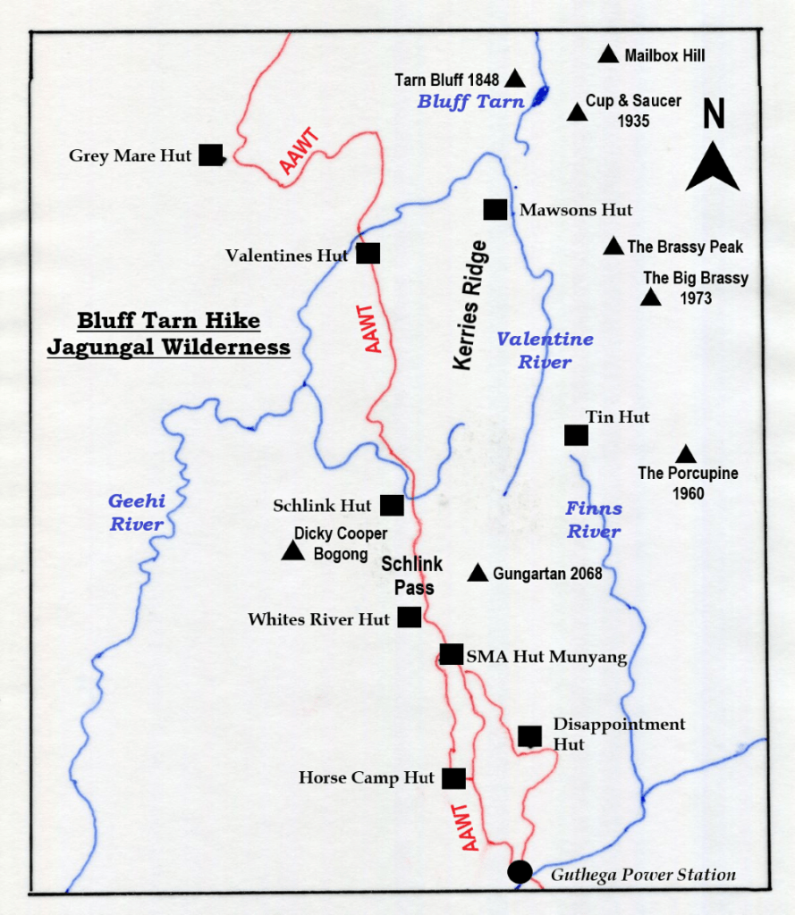
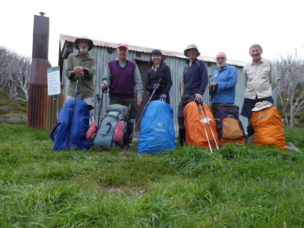
On an early November afternoon I set off with five bushwalking friends, Sam, David, Joe, Richard and Brian on a seven day, 60 kilometre cross country circuit from Guthega to Bluff Tarn on the upper Geehi, then to Tin Hut on the headwaters of the Finn River.
Our route started at Guthega Power Station and took in Whites River Hut, Gungartan (2068 m), The Kerries Ridge (2000 + m), Mawsons Hut, the Cup and Saucer (1934 m), Bluff Tarn, the Mailbox (1900 + m), the Brassy Mountains (1972 m), Tin Hut, the Porcupine (1960 m), and Horse Camp Hut via the Aqueduct Track.
THE WEATHER
The alpine forecast wasn’t quite what this leader was hoping for. Showers most days, starting with a possible thunderstorm for our first day on the track. Temperatures would be pretty friendly though: 7°C to 18° C . Apparently, our luck really would desert us on Friday, 6 days hence. A 90 % chance of 20 to 40 millimetres.
Upgraded later in the week to 100 millimetres. I was disinclined to hang around to test out that old saying that ” there is no such thing as bad weather, only unsuitable clothing”.
November is my preferred alpine hiking month. The weather is starting to settle; night temperatures are bearable, day temperatures are just perfect; and even light snowfall makes for magical walking. Water is abundant and easy to find.
Wildflowers are blooming but best of all, those nuisance bush flies and their high country cousins, the biting Horse/ March/ Vampire flies have yet to descend on the unsuspecting walker.
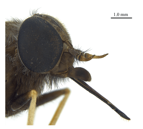
Horse or March flies appear as adults almost unvarying in the second week of December and hang around all the way through to February. Although they are called March flies they are rare in alpine areas in March.
These are large members of the Family TABANIDAE (genus Scaptia). March flies, at 25 mm, are the largest of our biting dipterans. The female does the blood sucking bit, while the benign male is content to feed on nectar and pollen.
On one mid-December Kiandra to Kosciuszko trip in 2006 with my friend Brian, March fly numbers were truly appalling. There was no escape from these pests. They operated on a sunrise to sunset roster and were so bad that it was unpleasant to stop for the vitals like meal breaks, water stops and even navigation checks.
They attacked with persistence and determination, and could bite through clothing with impunity. We often tried to find huts for meal breaks, but failing that, donned fly veils, rain jackets and long trousers or rain pants to keep the blighters at bay while we ate.
As Queenslanders, our preferred hiking apparel is usually shorts and short sleeved shirts, not thick rain jackets and long trousers. On the warmish December days the rain jacket/rain pants garb was not for the faint- hearted.

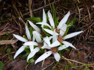
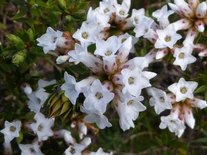
Alpine Wildflowers: Photos by Sam


More Information
Map: Geehi Dam: 1:25000.
Map: Jagungal: 1:25000.
Map: Tim Lamble: Mt Jagungal and The Brassy Mountains: 1:31680.
Green, K and Osborne, W: Field Guide to Wildlife of Australian Snow-Country. (New Holland 2012).
Hueneke, K : Huts of the High Country (ANU Press 1982).
Codd, P , Payne, B, Woolcock, C : The Plant Life of Kosciuszko. (Kangaroo Press 1998).
McCann, I: The Alps in Flower. (Victorian National Parks Assn 2001).
Slattery, D : Australian Alps. (CSIRO 2015).
Kosciuszko Huts Association: Website
Map of Bluff Tarn: Jagungal Wilderness : Kosciuszko National Park.
Sunday: Guthega Power Station to Whites River Hut: 8 kms.
With cars stabled at the Guthega Power Station we wandered off, ever upward. Sam, David and Richard setting a pretty lively pace under a low leaden sky. There were just enough irritating spots of rain to encourage the old laggards creaking along in the rear to lift our pace.
Mid-climb, a squadron of two-wheeling weekend warriors swooped around a blind corner. Braking furiously, some nifty controlled slides, a spray of gravel, and they were off again, pedalling downhill at speed. Eat my dust, Boomer.
Our mountain biking friends also anxious to reach cover before the heavens opened. Given my weighty rucksack, I too, could be sucked into this mountain biking game. Though I’m pretty sure that I would end up pushing said mountain bike up the current 250 metre ascent.
I may curse my heavy rucksack but mostly I am grateful for the good things its contents make possible: a snug downy sleeping bag, the protective cover of my little Macpac one-man tent, a comfy sleeping mat and a generous supply of crystallised ginger and chocolate licorice bullets.
By 3.30 pm we landed at Whites River Hut, disconcerted to find four tents moored on the creek flats below the hut. The tents belonged to a bunch of hikers from the Newcastle Ramblers Bushwalking Club, apparently intent on doing much the same circuit as we had planned.
No sweat. Plan B. They were no shirkers, these Novocastrian types. Instead of lolling around the hut for the afternoon (as I would have happily done), they struck out on a somewhat damp stroll across the tops from the Rolling Grounds to nearby Dicky Cooper Bogong (SMA 0113: 2003 m). The place name ‘Dicky Cooper Bogong’ recognises the the traditional Aboriginal custodian of this mountain, one Dicky Cooper.
Aborigines inhabited these highlands as far back as 21,000 years ago with evidence of their occupation coming from Birrigal Rock Shelter in Tidbinbilla Nature Reserve and many sites in the upper Snowy River. Small stone scatters can be found in the alpine landscapes with the highest being a collection found near the saddle of Perisher Gap (1800m).
It is well known that aborigines travelled to these highlands in the summer months to collect and eat the abundant Bogong Moths which were found sheltering in the rocky crevices of all the major outcrops in the Snowy Mountains. I have written extensively about this in my trip report Kiandra to Kosciuszko.

Many place names in the Alps have been derived from local Aboriginal languages: Jagungal, Jindabyne, Talbingo, Yarrangobilly, Suggan Buggan, Mitta Mitta and Tumut. It is not hard to find many other examples from your maps. Apparently the Geographical Place Names Board of NSW was considering giving Mt Kosciuszko a traditional Aboriginal name (Kunama) which would sit alongside its current name. But it hasn’t happened.

On dusk the predicted showers finally arrived, as did a damp and dishevelled clutch of boys and their teachers from Bathurst. No hanging out in comfortable huts for this lot: they pitched their tents in the rain, had a quick feed then quietly settled down for the night.
Meanwhile back at the ranch, Brian’s traditional first night treat of bangers and mash seemed to have spread like some medieval contagion. Most of my fellow hikers had succumbed to this dubious culinary delight and were enthusiastically whipping up dollops of instant mash leavened with green peas, sun-dried tomatoes, and heating neatly folded alfoil cylinders containing pre-fried bangers: beef for preference but maybe lamb & rosemary for those with more delicate taste buds.
Monday: Whites River to Mawsons Hut via Gungarten and The Kerries: 11.5 kms.
Showers overnight but with the mist lifting from The Rolling Grounds and Gungartan, things were on the up and up, weather wise. As were Brian and Joe, clanking about in the dark, soon after 5.30 am. Disturbing my slumber.
Our crafty Newcastle Bushwalkers friends still got the jump on us and had drifted off by 7.30 am. A comprehensive report of their walk can be found in the Kosciuszko Huts Association Newsletter: No 178 Autumn 2018. But we were soon hot on their heels desperate not to be pegged as a bunch of idle slackers.
Today’s walk would take us to Schlink Pass thence to Gungartan, down into Gungartan Pass, up along The Kerries to Mawsons Hut, tucked in a thicket of snow gums at the northern end of The Kerries. But first, the 300 metre climb from Schlink Pass to the Main Divide through snowgum forest.

The Kerries Ridge (2000 m), a spur of the Great Dividing Range, offers open alpine walking at its very best… in fine weather. This trackless ridge is a landscape of huge granite outcrops and vast alpine meadows. Suffice to say by the time we were well into The Kerries traverse, we watched a succession of storm cells sliding along the high peaks to our north and west, heading our way.
Come lunchtime we hunkered down in the lee of a granite boulder, sheltering from the rain that Hughie dropped over us . I’m always a bit disconcerted to be caught out in the open alpine zone with distant lightning and thunder rolling around.
But my fellow travellers didn’t seem all that concerned as they disappeared into their rain jackets and munched contentedly on muesli bars, dry biscuits and slabs of cheese. The rain eased to light drizzle, and we moved out, heading north, following the crest.

A further four kilometres of alpine tramping dropped us down to Mawsons Hut. Joe and Richard navigated us off the heights and down to our destination. Pretty much spot on. Being tucked into a grove of snowgums, the hut can be a tad difficult to find. Mawsons was deserted. A Novocastrian-free zone. When we last saw them ambling across Gungartan Pass, they were heading for Tin Hut on the Finn River. Another afternoon thunderstorm and hail swept through, driving us into the hut to finish drying our gear and have a feed. No fry up tonight. It was strictly dry rations for the rest of the week for this lot.

Tuesday: Day Walk to Cup and Saucer, Bluff Tarn and The Mailbox: 7 kms.
Fine weather and an easy day walk called us to the hills on our third day. From Mawsons we would cross the Valentine River; scamper up the Cup and Saucer; cut across the grasslands of the upper Geehi to Bluff Tarn; returning to Mawsons via The Mailbox. That was the plan and for once I stuck to it.
We left Mawsons in brilliant weather. A superb day of walking beckoned. We dropped down to the Valentine which still flowing strongly from the spring thaw but we sussed out a partly exposed gravel bed. Richard, Brian and Joe volunteered to check it out. Sacrificial lambs. I am told that there is nothing so grumpy as a leader with wet boots this early in the day.

The Cup is a granitic dome ( Happy Jacks Monzogranite: < 20 % quartz) sitting on its saucer, a shelf of nearly horizontal granitic rock. This Silurian granite is 444 to 419 my old and dates from a time when the Earth entered a long warm phase which continued for another 130 million years.
Oceanic life flourished and vascular plants increased in size and complexity. The supercontinent Gondwana drifted south and extended from the Equator to the South Pole. Australia was located in the Equatorial zone.
From a distance the Cup and Saucer are well named and form an unmistakable landmark for kilometres in all directions. Topping the Cup is an old Snowy Mountains Authority Trig 133 standing at 1904 metres. This was our first objective. From the top of the Cup we should be able to see a line of travel across to Bluff Tarn.

It was only one and a half kilometres to the Cup but swampy ground made our approach more circuitous than I anticipated. My original plan was to clamber up the long south western ridge to reach the Trig. But the final steep and damp and moss encrusted granite slabs thwarted all but Brian. Unsurprising really. His friends call him “Straight Line Brian”.
Contouring or backing off isn’t part of Brian’s bushwalking lexicon. But the rest of us were content to retreat and scarpered up the more accessible northern face … without any further difficulties. Where upon we settled on the rock outcrops to take in the landscape and enjoy a leisurely morning tea.

From the summit of the Cup and Saucer unfolded a vast alpine panorama. To the east rose up the high range of the The Brassy Mountains, part of Australia’s Great Dividing Range system. To our east was the valley of the Geehi River and its tributary, the Valentine River.
Directly to our east and just below our vantage point is the Big Bend. Here the Valentine swings off its northerly course to flow south-west another six kilometres to its junction with the Geehi. No doubt the granitic dome of the Cup and Saucer forms a structural control over the direction of flow of the Valentine.
To our north , less than a kilometre across the swampy headwaters of the upper Geehi valley was Tarn Bluff (1900 m) with Bluff Tarn tucked somewhere still out of sight.
Bluff Tarn
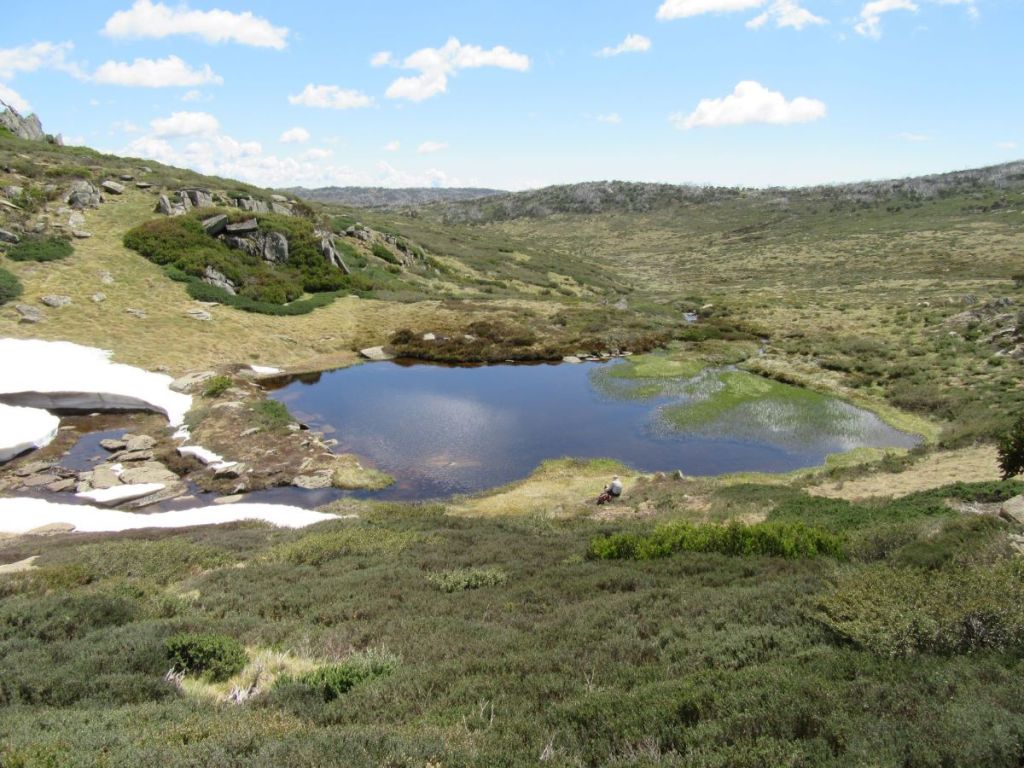
Bluff Tarn certainly met our all our expectations. It is, indeed, “one of the prettiest spots in the mountains”. But is is not, strictly speaking, a tarn. Merely a lake. My inner pedant would tell you that a tarn is “a small mountain – rimmed lake, specifically one on the floor of a cirque”. No cirque here. But quibbles over geographical precision couldn’t detract from the beauty of our surroundings.
While Bluff Tarn is a small lake, it is fed by a major headwater tributary of the Geehi, with the stream cascading through and over large rounded boulders. The lower reaches of the cascades were still covered by a thick snowbank, even though we were only a few days short of the start of summer.
I’m not sure of the origins of Bluff Tarn, but it appears to be formed as a shallow pool fed by the cascades dropping over a shelf of harder rock. Its outlet was restricted by a prominent bank of coarse, unsorted gravels. It would have been interesting to spend more time checking out Bluff Tarn but the worms were biting and my fellow walkers had lost interest in playing in the snow and my geological musings. They were itching to move on for their lunch break.
Our lunch spot was Mailbox Hill about a kilometre due east of Bluff Tarn … first though, one of Brian infamous uphill flat bits to raise a sweat and develop a healthy appetite for lunch. The Mailbox or Mailbox Hill, your choice, is a series of rounded outcrops standing at about 1910 metres. It was named The Mailbox because, I guess, mail was collected there by the cattlemen in the days of summer grazing.
The Kosciuszko Huts Association, my alpine bible, have researched the origin of the placename: Post was delivered to the men on the lease by a Mrs Bolton. She was engaged to deliver the mail on horseback to the Grey Mare Mine, travelling the old dray route from Snowy Plain across to Strumbo Hill. Ernie Bale recalled that on Mailbox Hill “there was a clump of rocks and they had shelves in them and she used to leave the mail for Mawsons Hut – it was always known as the Post Office – she used to leave the mail and put a rock on top of it“.
After a leisurely lunch spent sprawled on slabs of rock well out of the reach of those pestilent little black alpine ants, we wandered off towards Mawsons keeping a weather eye on the clouds building over The Kerries. But not before some male argy bargy about its location.
Later in the afternoon our Newcastle friends arrived from Tin Hut while the males were down at the creek having sponge-downs. We spent a very congenial evening around the campfire trading tall tales, listening to their hiking stories from far flung parts of the globe and getting some very handy gear tips from Shayne.

Wednesday: Mawsons Hut to Tin Hut: 8.5 kms.
A pleasantly cool and clear high country morning. By 8.00 am we were packed and on the road. Our route would take us across to the western bank of the Valentine then a gentle 80 metre climb following an old fence line that is marked on my old Tim Lamble map.
Tim’s maps, if you can get hold of one, provide a plethora of details useful to the bushwalker and skier: rock cairns, old fence lines, posts, old yards and even magnetic bearings. Anyone interested in maps will appreciate the quality of Tim’s cartography.
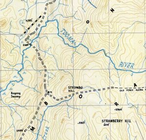
We followed the fence line up to a low rocky knoll overlooking the north-south trending Brassy Mountains (1900m), directly in front of us. Klaus Hueneke in his well researched Huts of the High Country (ANU Press 1982) gives an explanation of the naming of Brassy Mountains .. “named in the early days on account of the reflection from running water over rocks. At certain times this resembles polished brass and can be seen from up to 16 kms away.”
A navigation huddle soon sorted out our next moves. The Brassy Peak (1900 m) was directly in front of us while The Big Brassy (SMA Trig 1972 m) was off to our south east, directly behind The Brassy Peak. But between our eyrie and The Brassy Mountains were the swampy headwaters of Valentine River.
I had originally planned to follow the main divide of the Brassy Mountains south to Tin Hut. But an easier option was simply to cross the swamp and then contour along the western base of the Brassies keeping the thick heath just to our left but staying above the fens and bogs of the Upper Valentine to our right ... sound strategy in theory.

But before we trundled off towards Tin Hut there was plenty of time to clamber up to the rock cairn sitting atop The Brassy Peak. From here we looked westward over the vast network of fens and bogs of the upper Valentine to the craggy outline of the Kerries Ridge which we had traversed three days ago.
Bogs and Fens
The upper Valentine is a wide alpine valley of impeded drainage: a fluvial landscape of bogs and fens. A fen is a specific geomorphic and botanical entity: namely still clear, pools of standing water with ground-hugging matted plants and the easily recognisable Tufted Sedge, Carex gaudichaudiana. A number of small but showy flowering plants manage to thrive in these waterlogged conditions: the pale purple Mud Pratia (Pratia surrepens), the pale cream or white Dwarf Buttercup (Ranunculus millanii) and the white Rayless Starwort (Stellania multiflora).
Bogs are areas of wet, spongy ground also found in areas of impeded drainage. Floristically bogs are dominated by Spagnum Moss (Spagnum cristatum) and associated with a variety of rushes and sedges, especially the Tufted Sedge. Bogs are associated with the decomposition of organic matter which will ultimately form peat.
These high alpine valleys are commonly underlain by peats formed by the decomposition of plant material after the last glacial period (15000 years ago). The peats are important for absorbing and regulating waterflows in alpine Australia, thus are listed as protected communities under both State and Federal legislation. (PS: tell that to the brumbies).
So with sodden boots and a sense of achievement we pulled into Tin Hut after a full morning’s hiking; just in time for another well deserved bite to eat. Always looking for the next feed. Tin has a bit of reputation for being difficult to locate in bad weather and is hidden in a belt of snowgums. But with fine , clear skies this was no issue for us.
Tin Hut
Tin is the oldest hut in the High Country built specifically for ski touring. Its origins go back to Dr Herbert Schlink’s attempt at the first winter crossing from Kiandra to Kosciuszko. Schlink needed a staging post for his final push along The Great Divide. In the summer of 1925/1926 a bespoke hut was built on the site of an old stockmans’ camp at the head of the Finn River. As 2017 was the 90th anniversary of its construction, our visit was timely.
It is called Tin Hut because the roof and walls are constructed of corrugated iron. Some of the timber and iron for its construction was packed in by horseback across The Snowy Plain and The Brassy Mountains. It had a wooden floor and was lined with tongue and groove with the door opening to the east. Initially it was stocked with a horse rug, 24 blankets, a stove, tools and firewood. When Schlink’s party arrived from the south, a blizzard trapped them in the hut for three days, forcing them to give up the 1926 attempt.
On 28 July 1927 Dr Schlink, Dr Eric Fisher, Dr John Laidley, Bill Gordon and Bill Hughes skied out of Kiandra to reach Farm Ridge Homestead on the first night. Excellent snow cover allowed them to reach Tin Hut by 1.00 pm on the second day. They pressed on to the Pound Creek Hut (now Illawong Hut) on the second night. They completed the first winter traverse finishing at Hotel Kosciusko on the third day.
In 1928 Tin Hut served as the base for two winter attempts to Mt Jagungal. The party led by Dr John Laidley skiing to the summit…. for just the second time in history.
In 2017 restoration work on Tin commenced with a partnership between the Parks Service and the Kosciuszko Huts Association. Men, gear and materials were helicoptered in for the major facelift. One KHA member, Pat Edmondson, eschewed the helicopter ride and walked in from and out to Schlink Pass. Pat was over 80 years old. I can only hope that I can still climb from Schlink Pass to Gungartan when I turn 80.
Afternoon stroll: Tin Hut to The Porcupine & Return: 5.5 kms.
Brian, ever keen on filling in his (and our) afternoons, decided that we shouldn’t waste time hanging around the hut. A more productive use of our time would be a quick jaunt over to The Porcupine, a nondescript alpine ridge (SMA 0109 :1960 m) which separates the Finn River from the Burrungubugge River.
From the hut we climbed the long ridge behind the hut to a knoll from which we could look across to the Trig on The Porcupine. Unfortunately, a very steep drop into a saddle then a climb back up to the Trig separated us from our quarry on this decidedly warmish afternoon.
Brian and his co-conspirators Richard and Joe were still keen as mustard, happy to descend and climb up again onto The Porcupine Ridge. David and Sam seeing the lie of the land, sensibly returned to Tin Hut for an afternoon of leisure. The walk to Porcupine is a scenic enough walk, but on reaching The Porcupine ridge I observed that the heat was getting to them and so the lads weren’t pushing me to go any further. Bless their little hot socks.
We waddled back, avoiding the dreaded climb back up the knoll and reached Tin about 4.00 pm and set about a major rehydration, downing multiple cups of tea, soups and choc-au-laits. An evening perched around the campfire finished off a very satisfying day.
Thursday: Tin Hut to Whites River Hut : 7.5 kms

The easiest route to Whites was to climb the long ridge which separates the Valentine and Finn Rivers, keeping Gungartan to our west. An ascent of a mere 200 metres vertical, but with dense knee-high heath and the odd snake or ten lurking underneath, it seemed endless.
One snake had decorously draped its ectothermic body across the top of a heath bush, obviously hoping to warm up in the feeble sunlight and frighten the bejesus out of a passing bushwalker.
Once on top of the Great Dividing Range we bypassed Gungartan, skirting around its rocky spine until we had a view of Guthega Village.

Time for a snack stop, perched atop huge boulders. A well tested strategy to keep out of the clutches of the maurading hordes of those little black alpine ants that swarm over any rucksack carelessly tossed on the ground. More disconcerting is their ability to overrun boots, climb up gaiters and finally ascend the thighs of any alpine rambler. Trying summer camping in Wilkinsons Valley and tell me how it goes.
Alpine Ants: Iridomyrmex sp.
The ants are probably Iridomyrmex sp, which my copy of Green and Osborne’s Field Guide to Wildlife of the Australian Snow-Country tells me are ‘ a conspicious part of the fauna in a few habitats, such as herbfield and grassland…. this omnivorous ant is the only common ant species in the alpine zone.’
It nests in waterlogged areas such as bogs, fens and wet heaths, and raise their nests above the water surface by constructing a mound of plant fragments in low vegetation. They are also found in tall alpine herbfield and dry heath.”
From our rocky eyrie we were treated to superb views across this small patch of Australia’s alpine wilderness. Time also for a weather update from duelling smartphones. Tomorrow: (Friday): 90 % chance of 20 to 40 mm. Maybe 100 mm. No arguments about pulling out a day early.
After a good laze around we skirted Gungartan and commenced the long descent to Schlink Pass (1800 m). Landing in the pass, a mutiny of the “are you stopping for lunch ? “ type broke out. Ever the considerate leader (probably not) , I caved in and we propped for lunch. Whites River Hut only one tantalising kilometre downhill.

We reached Whites River Hut soon after 2.00 pm. No interlopers on the radar so we had the place to ourselves. Despite tomorrow’s unfriendly weather report everything here was pretty relaxed. The usual suspects weren’t badgering for an afternoon walk (unusual), the weather was warm and sunny so a lazy afternoon beckoned.

We enjoyed a quick cat lick in the nearby icy snow-fed creek…. very quick, did any washing then spread clothes out to dry. The rest of the afternoon was filled with consuming cups of tea/coffee/soup; horse trading of leftover goodies, cutting wood, firing up the stove and reading whatever came to hand. Inside the hut were recycled Kosciuszko Hut Magazines and the hut log book.
Over the years the Whites River Hut log has provided us with many hours of very entertaining reading: the adventures of Bubbles the Bush Rat; the trolling of some trip leader called Robin and heaps of very well executed drawings and cartoons. Mr Klaus Hueneke should write a book about this stuff.
Friday: Whites River Hut to Guthega Power Station via Aqueduct Track and Horse Camp Hut: 10 kms.
I peeked out. Heavy roiling clouds were brewing over Gungartan and heading our way.

By 8.00 am we had beetled off along the Munyang Geehi road before swinging off onto the Aquaduct track which crosses the Munyang River via a weir. Nearby is an old SMA hut…locked to keep that mountain biking, skiing and bushwalking riff-raff out. Especially those dastardly mountain bikers.

The Aquaduct track is a gem of a walk. It winds above and parallel to the Munyang River, weaving around the hills on the 1800 metre contour. My kind of walking.
Mid morning we lobbed into the refurbished Horse Camp Hut for a final feed. I had been to Horse Camp before, returning from an early spring walk to Mt Jagungal with my youngest son. We got to Horse Camp just on dark. I remember how bitterly cold it was, how daggy the hut was and how our evening meal was pretty sparse, even by my standards.

Since then the Kosciuszko Huts Association and the Parks Service had been very busy and the hut was looking very spruce indeed. Unlike the young guy who had taken up residence in the hut. He was obviously there for the long haul or maybe the end of the world and had somehow dragged in all manner of heavy duty camping gear.
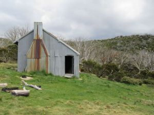
Horse Camp Hut
Horse Camp is a two room, iron clad hut set in a belt of snow gums under The Rolling Grounds. Its construction history is a bit fuzzy but was built initially in the 1930s as a shelter for stockmen working the snow lease owned by the Clarke brothers. It has the main elements of a traditional grazing era mountain hut with a bush pole frame, steeply pitched gabled roof, clad with short sheets of corrugated iron that could be packed in on horses.
At some stage over the decades it was partitioned into two rooms – a northern bunk room with a pot belly stove and the main kitchen room. A ceiling loft was added as well as a wooden floor and nifty three panel narrow windows. Several of the modifications were done by the Snowy Mountains Authority in the early 1950s. The SMA used Horse Camp as a base for their horseback survey teams working on the first Snowy Mountains Project, the Guthega Dam and associated infrastructure.

Leaving our young prepper friend to his preparations for the Covid 19 lockdown, we drifted off. A quick descent to the Guthega Power Station to find our vehicles waiting patiently in the car park, wheels and windscreen wipers still attached, and ready to transport us back to Canberra. But not before we detoured into the Parks Visitors Centre Parc cafe in Jindabyne for a selection of their satisfyingly greasy offerings, all washed down with a decent coffee.
As always, a big thank you to my band of merry bushwalking companions: Sam, David, Joe, Richard and Brian. May we enjoy many more rambles in the back blocks of Australia’s magnificent High Country.
More Hikes in Kosciuszko National Park.

Kiandra to Canberra Hike on the AAWT. A Late Autumn Traverse.
by Glenn Burns
I dug out my old journal of our Kiandra to Canberra hike after the 2019/2020 summer fires damaged parts of the northern section of the Australian Alps Walking Track ( AAWT) . I have visited the Northern Plains many times and was fortunate to walk from Kiandra to Canberra several years ago with some friends just before the devastating fires. Here is my account of that trip.
Much of the landscape we hiked through then was relatively intact . However in the summer of 2019/2020 this all changed. The summer fires burnt out the New South Wales trail head at Kiandra including the old Kiandra Court House, Wolgal Lodge and Matthews Cottage.
The last three days of the AAWT traverses Namadgi National Park in the Australian Capital Territory. In this section the Orroral Valley and Mt Tennant were burnt. Amazingly, the old Orroral Homestead was saved.
Through the years since the early 1970s I have wandered many a kilometre over Australia’s High Country and more than once have I peered through the grimy window of a high country hut into the pre-dawn gloom… often sleet or rain or mist swirling around outside.
Excellent… back to the sack for another forty winks. But then I hear my fellow hikers. Pesky eager beavers all. Busy rustling around, pulling on boots, donning warm stuff and getting ready their rain/snow gear. Champing at the bit , ever keen to hit the trail.
Photo Gallery


And so it was for five walkers on a late autumn, an eight day traverse of the final northern section of Australian Alpine Walking Track (AAWT), stretching 105 kilometres from Kiandra on the Snowy Mountain Highway to Namadgi Park HQ on the outskirts of Canberra.

The complete 659.6 kilometre AAWT crosses some of Australia’s remotest and highest alpine mountains and snowgrass plains with a weather regime that can be very hot on occasions but is more often than not cold, wet and highly unpredictable.

As Alfred Wainwright, a famous English fell walker, wrote: ” There’s no such thing as bad weather, only unsuitable clothing.”

Useful Information
NSW Dept of Lands: 1: 25000 maps : Ravine, Tantangara, Rules Point, Peppercorn, Rendezous Creek, Corin Dam, Williamsdale.
NSW Rural Fire Service Brochure: Bushfire Safety for Bushwalkers.
Chapman, J Chapman, M & Siseman J: Australian Alps Walking Track (2009)
ACT Dept of Environment: 1:20000: Namadgi Guide & Map
Day One: Saturday 11 May: Outward Bound: Kiandra to Witzes Hut: 12 kms.
Just after midday, youngest son Alex taxied our hire van to a halt outside the old Kiandra Courthouse since destroyed in the 2019/2020 summer fire season. The Old Court House was the only remaining building of the old gold mining town of Kiandra: population in 1859, 10,000; now.. zero population.
A sudden population explosion as five walkers plunged out of the warm van and into a blast of cool air: Ross , Leanda , Peter, John and last but not least, their esteemed and worthy leader, yours truly.
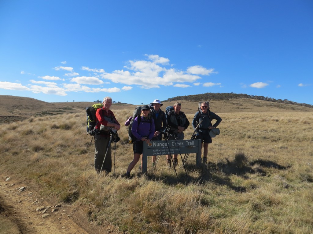
The race was on for the few sunny spots out of the cool blustery wind. We wolfed down our Cooma take-aways, bade Alex a fond farewell, then hit the track, the Nungar Hill Trail.
Our afternoon on the AAWT took us northward over rolling snowgrass plains at about 1450 metres, broken only by occasional alpine streams, which we forded with dry boots and socks intact: the Eucumbene River, Chance Creek, Kiandra Creek and just before Witzes Hut, Tantangara Creek.
After Chance Creek we climbed to the crest of the Great Dividing Range, known locally as the Monaro Range. A minor blip on this undulating high plains landscape.
The seven day BOM forecast looked agreeably benign: early frosts (a mere -1° C) followed by sunny days (14° C). Perfect timing. But meteorology has a way of biting bushwalkers on the bum. In May this year maximum temperatures averaged 8.2°C while minimums hovered around a miserable 2.8°C. With a record low of minus 20°C, Kiandra is one of the coldest places on the Australian mainland.
Fortunately for this leader, my walking companions, all experienced bushwalkers, were kitted out for all eventualities. But most impressive of all was that they remained unfailingly positive and obliging under some pretty trying conditions.

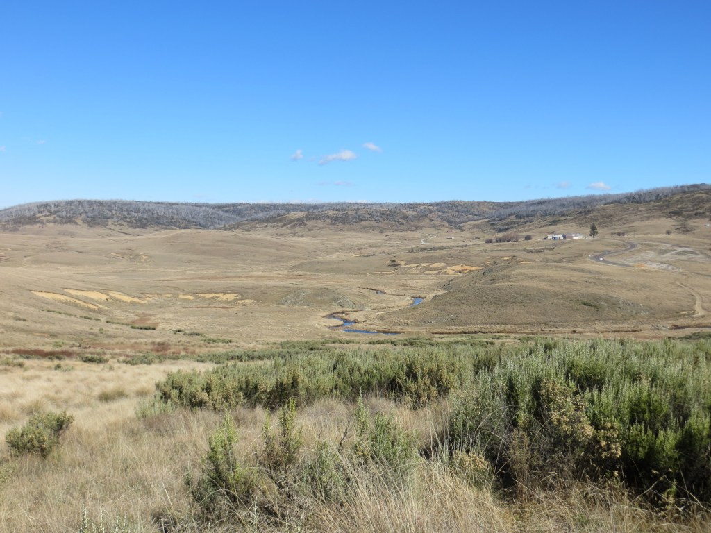
The huge grassy plains are an ancient peneplaned surface. They are the almost level remains of a long eroded mountain range system that was later uplifted in a major tectonic movement of the earth’s crust known as the Kosciuszko Uplift thus forming the Kosciuszko Plateau.
The combination of cold air and flat topography created ideal conditions for natural high plain grasslands, technically referred to as the Northern Cold Air Drainage Plains. These were highly prized for summer grazing.
First stop, Witzes Hut. Witzes Hut, possibly a corruption of Whites Hut, like many Kosciuszko huts is set in a picturesque shelter belt of snow gums. Built in 1882 it is a vertical slab wooden hut, single room (about 6m x 3m) with a wooden floor and open fireplace. It is just one of many huts in Kosciuszko: cultural relics from the days of summer cattle and sheep grazing on the high plains.
They are invariably basic: shelters of last resort according to the NPWS signs tacked to the doors. Our late season crossing of the AAWT became hut dependant as the weather closed in. Although we had tents, it was a irresistible temptation for these warm-blooded Queenslanders to sidle into a snug dry hut at day’s end.


Day Two: Sunday 12 May: Hayburners of the High Plains: Witzes to Hainsworth Hut: 23 kms.
At 23 kilometres, a longish day beckoned. As a graduate of the Brian Manuel School of Bushwalking I had slyly insinuated to my friends that there was “no hurry” to pack up in the mornings. For those who have not been on the receiving end of this daily regime, expect a rousting out of your downy nest well before sunrise. About 5.00 am is Brian’s preferred time.
Unsurprisingly, a heavy frost carpeted the grass outside. Meanwhile, inside, my scouting friends Peter and John had worked their magic with two sticks, or whatever they use these days, and had succeeded in cranking up a fire of sorts. This we kept going until the last possible moment. Hut etiquette : Always make sure to thoroughly extinguish any fire before leaving the hut and replace firewood used.
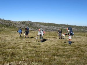
On schedule at 7.30 am we scrunched off along the Bullock Hill Trail. Ghosts in the freezing mist, frost nipping at any gloveless paws. Before long the mist dispersed, revealing a brilliant blue sky and vast frosted grassy plains. Sunny with the max creeping up to a sizzling 13°C. Even the brumbies were out picnicking in the glorious autumn sunshine.
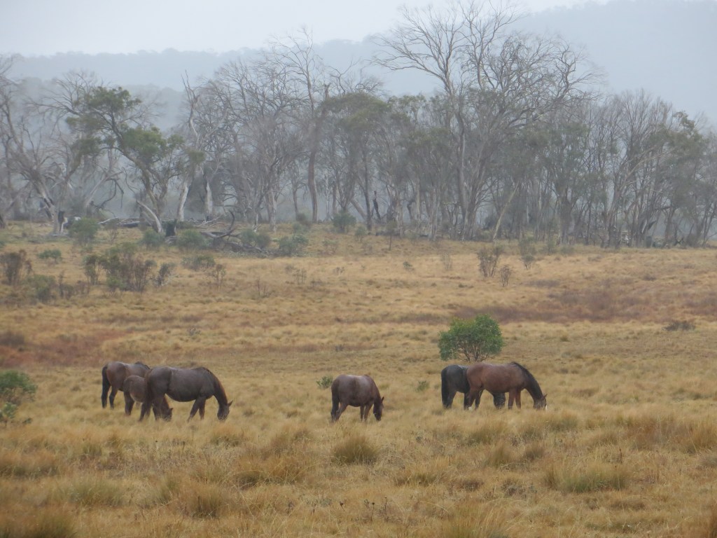
Brumbies aka Wild Horses aka Feral Horses
A brumby sighting is always exciting for those misguided equinophiles we were harbouring in our midst. But brumbies are feral horses, much the same status as foxes, cats, goats, deer and pigs. And as such they have no place in these fragile alpine ecosystems.
In the ACT they are regularly culled, but in NSW, herds of these hayburners cavort over the snowgrass plains with impunity: brunching on the juiciest alpine wildflowers, carving out innumerable tracks through the scrub and trashing alpine streams and swamps with their hooves.
The Parks service does allow horse riding in Northern Kosciuszko and provides horse camps with yards , water troughs, loading ramps, hitching rails and full camping facilities. From my observations recreational horse riders act responsibly in the alpine environment by keeping to designated management tracks and horse trails . Feral horses are a different matter entirely.

In an attempt to manage brumbies, a 2016 draft Wild Horse Management Plan recommended reducing numbers in Kosciuszko by 90% over 20 years, primarily through culling. That would have left about 600 horses in the park.
Naturally the NSW parliament ignored the advice of its own scientific panel so there was no cull. Instead, the NSW Deputy Premier John Barilaro hatched his own plan, the now infamous: The Kosciuszko National Park Wild Horse Heritage Bill 2018.
The bill would prohibit lethal culling because of the heritage significance of brumbies. I, too, can understand the cultural imperative of maintaining a small sustainable herd of brumbies but there are still serious questions to be answered about the environmental impacts of large numbers of brumbies. The NSW Threatened Species Scientific Committee has described the damage done by brumbies as a ‘key threatening process’.
Fortunately, sanity has prevailed and by 2025 culling was well underway and brumby reproduction rates had dropped below replacement levels.
Update on the Kosciuszko Brumbies
” About 4000 feral horses will be removed from Kosciuszko national park in New South Wales as part of an emergency response to protect the alpine ecosystem after large areas were devastated by bushfires. ” Graham Readfearn. The Guardian . 20 Feb 2020
In February 2020 the NSW Environment Minister Matt Kern announced ” the largest removal of horses in the park’s history”. He had an agreement between ” horse lovers and National Park lovers” to remove wild horses after the unprecedented bushfire damage over the Nungar, Boggy, Kiandra and Cooleman Plains of Northern Kosciuszko.
Recent surveys estimated wild horse numbers increasing from 6000 in 2014 to 19000 in 2019. Clearly environmentally unsustainable in these burnt out landscapes. Minister Kern was reporting on the outcome of a meeting of the Kosciuszko National Park Wild Horse Community Advisory Panel. It is to be hoped that the promised action is taken quickly to reduce horse numbers in the fragile High Plains.
By 2025 culling was underway with the fragile alpine ecosystems on the long road to recovery.
The best summary of the brumby issue that I have read is Anthony Sharwood’s The Brumby Wars (2021, Hachette). This is a book about Australia’s brumbies and the intense culture wars that has erupted about their removal from Kosciuszko National Park. Highly recommended.

Our first obstacle was the mighty Murrumbidgee. We deployed a tried and tested technique, fanning out until someone discovered a likely looking rock or gravel bar. Okay for the four males, each outfitted with long spindly shanks but a big leap of faith for the resident shorty.


Then came one of our few cross-country sections, a mere eight kilometres out to the Port Phillip Trail. For this geographically tricky bit I pressed into service my navigators. Using Peter’s trusty GPS as insurance they tracked to a line of old telegraph poles, which marched across the hills ahead, leading us inexorably towards the dusty Port Phillip Trail on Long Plain. Navigators extraordinaire.

More pleasing was John’s distant sighting of the alpine dingo near the Murrumbidgee River crossing. In all my walks in the high country I have had only one previous encounter with this splendid canine, a subspecies of the gray wolf.
Today this solitary light coloured dingo stalked us from afar, surreptitiously tracking our movements from behind clumps of snowgrass. My dingo bible, Laurie Corbett’s The Dingo in Australia and Asia, says that the alpines are a distinctive subspecies, one of three in Australia.
They feast on rabbit, wallaby, wombat with the occasional brumby foal thrown in as a special treat. They are actually quite lazy hounds, rarely travelling more than two kilometres a day and their territories are comparatively small .
Hainsworth Hut
By now it was it was late in the day and with ugly dark clouds brewing we wasted no time, bypassing Millers Hut and Ghost Gully Campsite to reach Hainsworth Hut, on Dip Creek.

Just in time for a quick refreshing dip before sunset. Not. Hainsworth Hut, built in 1952, is the archetypal high country hut: a windowless coffin of corrugated iron, two rooms and a large open fireplace at one end. But hugely welcome for these weary walkers. A long 23 kilometre day of up hill and down dale.

Day Three: Monday 13 May: Aquabots: Hainsworth to Pockets Hut via Bill Jones Hut: 24 kms.
7.30 am. We beetled off into light drifting rain, eastwards along the Mosquito Creek Trail, up and over the Gurrangorambla Range (Gurrangorambla granophyre – a hard, fine- grained granite) and then descended onto the Silurian limestones of Cooleman Plain.
The Cooleman is similar in appearance to the other high plains we had traversed, but as it is underlain by limestone it displays the distinctive landforms of a karst landscape: subterranean creeks, caves, sink holes, stalactites, stalagmites, gorges and occasional brachiopod fossils.
When T.A. Murray first saw Cooleman in 1839 he described it as “almost treeless with grasses growing to stirrup height.”

Bill Jones Hut
With the cool, wet and windy conditions persisting we ducked into to Bill Jones hut for our morning tea. The hut is standard daggy and sports a dirt floor, but it was a haven for these five bedraggled walkers. Peter set to and soon had a cheery fire underway then we stood around drinking our piping hot mugs of tea and coffee. Wonderful.
Fire extinguished before we clomped off in saturated footware.

Pockets Hut
My fellow aquabots and I seemed less than enthusiastic about doing the tent thing at Bluewater Holes limestone area so it was onward to Pockets Hut, a very comfortable wet weather bolt hole. Pockets is a large four-roomer weatherboard built in the 1930’s, originally hooked up with hot water and electricity. We settled in: a comforting fire, clothes drying in front of the fireplace, hot brews and long nana- naps snug in our warm sleeping bags. Life couldn’t be better.

Day Four: Tuesday 14 May: Rest Day: Pockets Hut to Bluewater Holes via Black Mountain: 14 kms.
A tad cool this morning, -2°C. I had naively promised an easy day walk along 4WD trails back to the Bluewater Holes limestone area on Cave Creek. But as is often the way when associating with these deviant bushwalking types some genius suggested a cross-country “short cut”, contouring around the 1497 metre Black Mountain then dropping into Cave Creek.
With a clearing sky, an easy day walk ahead, things were definitely on the up and up. Or so I thought. We quickly abandoned this contouring lurk, pushed ever uphill towards the summit by massively dense stands of alpine undergrowth.
This was bush-bashing on steroids. In the days of yore when bushwalkers were proper bushwalkers, the handy machete would have swung into action to clear the way ahead. Luckily, John, who is an excellent navigator, as well as scrub-basher, and the ‘genius’ who got us into this predicament, found the rocky summit and then led us down the long northern ridge to land precisely where we needed to be in Cave Creek.
After lunch we poked our way downstream, criss-crossing Cave Creek, checking out Clarke Gorge, Barbers Cave, the Bluewater Hole and Coolaman Cave, a cursory survey at best.
Cave Creek is worthy of several days of exploration but with the sky clouding over (think: it’s going to dump snow now) and the wind rising we hoofed off on the Bluewater Holes Trail toward Pockets. But not before considerable geographical angst as the four males bickered about the location of the trail head. Attn all male leaders: when in doubt always listen carefully to the female of the species who actually bother to read the maps on the Parks information boards.

Day Five: Wednesday 15 May: An Antipodean Christmas: Pockets to Oldfields Hut: 7 kms.
I peeked out. A white mantle of snow covered all. Snow floated down from a sullen sky. We could freeze our butts off in this stuff but the wild weather gave an exciting edge to the walk. Today’s maximum temperature barely made 3°C.
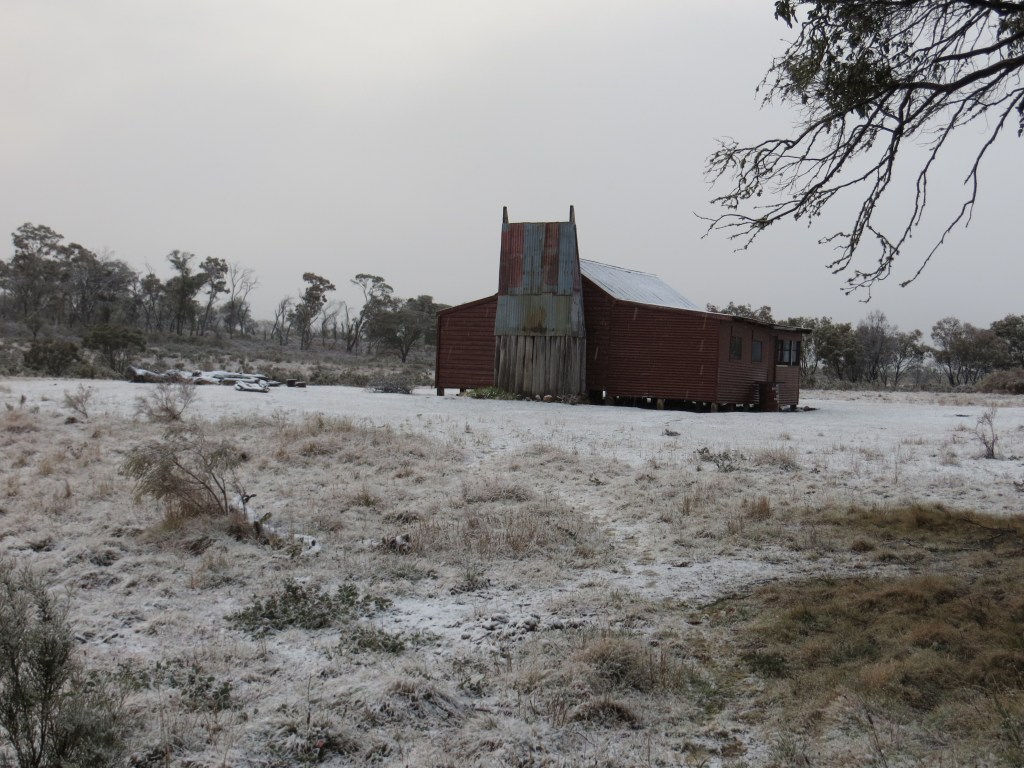
The walk across the snowy plains towards Murray Gap Trail was just magic, snow carpeting the vast Tantangara Plain. After a Snowy Mountains Hydro valve house (the Goodradigbee Aqueduct) the AAWT climbs over a forested ridge before descending to fetch up at on the river flats of the Goodradigbee River. Tucked away in a stand of gnarled black sallees is Oldfields Hut.

Oldfields Hut
Oldfields, with slab walls and a long verandah, was constructed in 1925 and is said to have excellent views to Bimberi Peak (1913 m) and Mt Murray (1845 m) on the ACT/NSW border.
Not today; mist and dumps of sleet obscured any views to the east. Our immediate priority as always was to scrounge up a supply of firewood. Then John and Co cut the wood into useable billets.
The golden rule of the huts is to always replace any timber burnt and leave a supply of dry kindling. Which we did in spades.

Day Six: Thursday 16 May: Border Hoppers: Oldfields Hut to Sawpit Ck camp: 18.7 kms.
Today we would bid farewell to the high grasslands of Kosciuszko and traverse into the forested ranges of the Bimberi Wilderness and Namadgi National Park for our final three days.
We rugged up for the perverse conditions. At Oldfields my pack thermometer read 0°C while maximum temperatures barely held at 2°C all day. Westerly winds gusted to 70 kmh. The morning’s walk would climb 245 metres into Murrays Gap and at 1600 metres we copped the full force of the bad weather coming from the west. Sleet blanketed the mountain slopes and the wind drove rain and sleet horizontally onto our backs.
But soon we descended, over the Cotter Fault line and into the Cotter River System. The weather backed off and a watery sun finally leaked a few rays through a clearing sky.
Apart from cool windy conditions the wet weather was behind us. Relieved at this change of fortunes our little party trotted on, jaunty like: past Cotter Hut (locked to keep those dodgy bushwalkers at bay), and past our turn-off to the Cotter Gap track.
The site of another male navigational misadventure and bailed out again by Leanda who had taken the time to peruse a rat-eared A4 map tacked to a post. For the rest of the day we climbed steadily 350 metres up to Cotter Gap and then descended steeply to our cramped bush campsite on Sawpit Creek.
No more days of lurking in comfortable bush huts for this slack lot. Beyond Cotter Gap a significant change in vegetation occurs; gone are the alpine species, replaced by a drier Eucalypt forest growing on the granites of the vast Murrumbidgee Batholith.
Day Seven: Friday 17 May: One small step for Man: Sawpit Ck to Honeysuckle Ck: 15.6 kms.
With Ross now in full flight mode it was a quick hop down into the grasslands of the narrow Orroral Valley and its herds of Eastern Grey Kangaroos.
We sprawled out in the grass, absorbing the warmth of the sun on our tummies for the first time in several days. Sheer bliss.
Further down the Orroral Valley is the Orroral Homestead and shearing shed built in the 1860s.
It has three rooms, chimney at each end and a full length verandah on the front.
As tempting as this sounded to us, overnight stays by bushwalkers are strictly verboten. Those ACT Parks rangers are pretty toey about that sort of stuff.
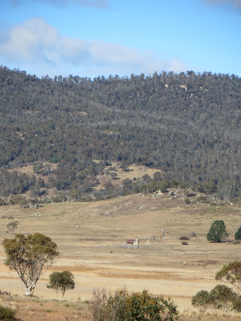
Onward and upward to the well-appointed Honeysuckle Creek camping ground, with the small matter of a 420metre ascent onto the Orroral Ridge at 1350 metres to get there.

Honeysuckle is, like the Orroral Valley, the site of a former space tracking station. A series of excellent info boards informed us that it operated from 1966 to 1981 and was a vital part of communications for the Apollo moon missions, Skylab,Voyager and Pioneer deep space probes. This included The Apollo 11 mission and Neil Armstrong’s signature, “one small step for man, one giant leap for mankind.”
Day Eight: Saturday 18 May: Homeward Bound: Honeysuckle to Namadgi Park HQ: 15.4 kms.
After an all-night rolling stoush with an encampment of feral Rover Scouts we set off in another heavy frost (- 0.3°C) on our final leg of the AAWT via Booroomba Rocks.
This granite outcrop at 1372 metres afforded us speccy views across the plains to Canberra. Several hot air balloons hung in the still air above the city.
But the AAWT wasn’t quite finished with us yet. Just before lunch Ross whipped us up the 240 metres to our lunch spot near Mt Tennent (1384 m), about an hour from the trail exit. You can imagine that I was pretty taken-aback when I pulled my tent fly out for a drying in the sun, and discovered that after five hours in my pack it was still heavily encrusted with layers of ice.
Thus ended one of Australia’s best long distance walks: over high ranges, extensive snowgrass plains, swampy meadows and sinuous alpine streams.
For my money the Kiandra to Canberra section was an unforgettable bushwalking experience. Brilliant high plains scenery, historic huts, caves, gorges, dingoes, brumbies and first-rate walking companions. Who could ask for more? And who among us will ever forget the wild and woolly weather?
Huts destroyed in the 2019/2020 summer fires
Sawyers Hut, Wolgol Lodge, Kiandra Court House, Pattersons Hut, Matthews Cottage, Round Mountain Hut, Linesmans No3 Fifteen Mile Spur (1950), Linesman No 3 Fifteen Mile Spur (1980),Vickerys Hut, Delaneys Hut, Happys Hut, Brooks Hut ( badly burnt), Bradley and O’Briens, Four Mile and Demandering.
Happily, rebuilding of ten of these huts is happening at a rapid pace, thanks to herculean efforts by KHA volunteers and NSW Parks.
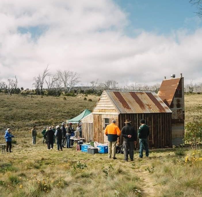
Some previous hikes in Kosciuszko National Park

Northern Sundown National Park.
By Glenn Burns
With the Easter long weekend closing in, I wasn’t surprised when my bushwalking friend Brian appeared at the front door clutching one of his well-used topo maps and muttering about “getting away from the crowds over Easter.”
Here’s a thing about Brian. He’s a map-man of the old school. There’s nothing much he likes better than to spread out a map, trace a finger along ridge and river and, hey presto a walk is born. Strangely though, I have rarely seen him brandishing a compass and never a GPS.
Photo Gallery


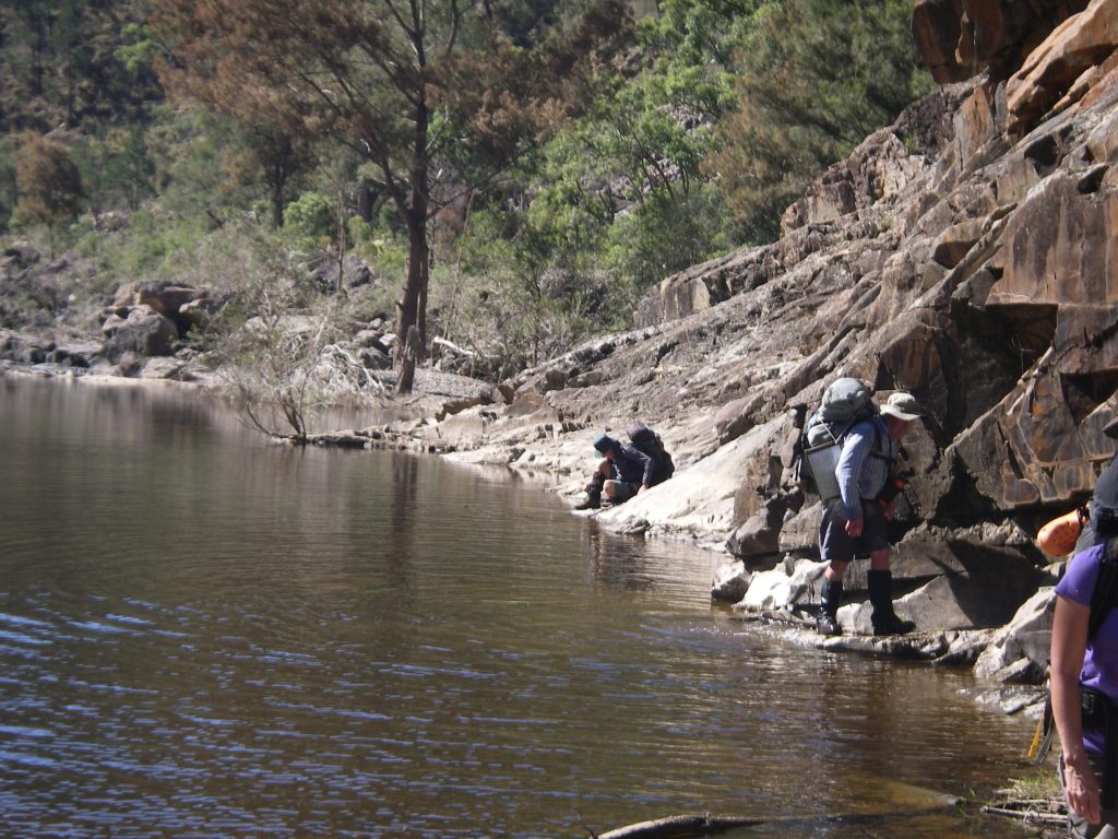
As more and more wilderness areas fall to incursions of the Great Walk track builders, ‘tell-all’ guidebooks and those viral GPS track logs, it is becoming increasingly difficult to find a throughwalk that still has some tantalising unknowns.
But I can always rely on Brian to trawl through his map cupboard and come up with something decent; in this case an “exploratory” into northern Sundown National Park, south-west of Stanthorpe.
Some say that the name Sundown is said to come from the idea that its valleys are so deep that it’s always ‘Sundown’. Others claim that the name is in keeping with the tradition of using astronomical place names in the area, but I couldn’t find much evidence for this interpretation, apart from references to Comet Creek, Comet Mine, and Arcturus Mine.

Sundown offers a terrain of deeply incised creeks, gorges, waterfalls and steep stony ridges rising to over 1000 metres on the Roberts Range. As well, it has an interesting cultural heritage of aboriginal occupation, pastoralism and later on, mining.
Brian had nutted out a 54 kilometre walk that had some navigational problems and, not unexpectedly, there was the obligatory physical challenge. It would also give us some respite from camping near raucous Easter 4WDers and was remote enough to be off the radar for most of the latter-day bushwalking fraternity.
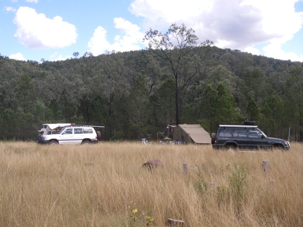
Although only thirty kilometres from the well known Girraween National Park as the crow flies, the 12910 hectare Sundown National Park has little in common with the benign rounded tor landscapes of the Stanthorpe Granites.
Early settlers described Sundown’s rugged and rocky terrain as “traprock”, geologically incorrect, but a good descriptor all the same. Traprock is a term originally applied to basalt landscapes in the UK, while Sundown’s lithology is predominately sedimentary which has been partially altered by heat and pressure to form metasediments. These are called the Texas Beds and are of early Carboniferous origin.
What it does share with Girraween is its propensity for cold weather. This is Queensland’s coldest district; eight months have temperatures below 0° C, with -10.6 C° the lowest. Fortunately the average minimum for April is a comfortable 9.5 C°.
The Severn River, named after the Severn River in England, has incised deeply into the traprock and its course is lined with numerous deep permanent waterholes, many bordered by vertical red clifflines. No danger of going thirsty here even though the park lies predominately on the western side of The Great Dividing Range. In fact, at the end of the wettest Queensland summer in 40 years the park ranger reported to Brian that the Severn was still in moderate spate and we could expect piles of flood debris.

Friday : Sundown Homestead site to Severn River via Mt Lofty: 10 kms.
My fellow walkers assembled at the old Sundown Homestead site soon after 1.00 pm, in warm humid conditions.
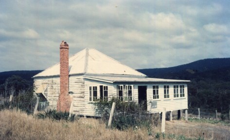
Peter Haselgrove, The Ranger- in – Charge of Sundown NP for many years remembers the homestead as well as a large weatherboard hay shed ( removed ) uphill from the homestead. The shearers’ quarters were further to the south of the homestead, also no longer there.
Our party was eight in total: Brian (leader), Malcolm and Jenny, Bernard (an uber-fit septuagenarian), Russell (aka Starkie) Leanda, and my fellow ailurophile, Richard. Our immediate task was to sweat up the 260m, three kilometre climb to Mt Lofty, a long whaleback feature topping out at 1067 metres.
Mt Lofty is said to have been named thus as it was the highest point on the road leading to the Sundown Mine, hence it was “Lofty”. Naturally the Law of Diminishing Returns always applies and our efforts ended in an obscure and thickly vegetated summit. View factor: pretty average, though a vast improvement on Brian’s infamous Kerries whiteout . But this didn’t stop Brian bagging it as one of his 1000 metre peaks, celebrating its capture with a wee dram of someone’s hootch.
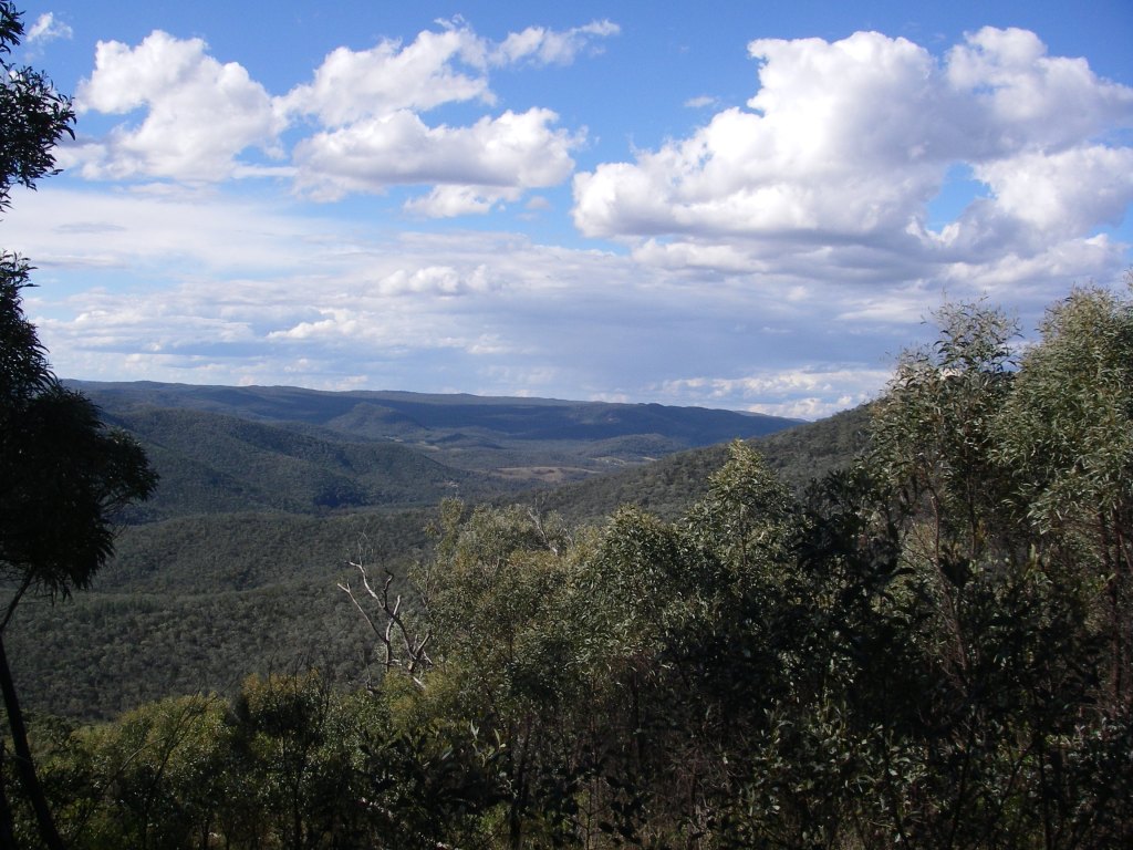
Then came the descent to the Severn River; a long, roller-coasting two kilometre fire trail that rode up and down over a series of hillocks, ever decreasing in height down to the river at 600m. In fading light a meandering 4WD track carted us off towards our picturesque overnight campsite at Lowe’s Waterhole: an open grassy clearing complete with its own melancholic collection of decrepit yards, a tottering corrugated iron shack and ancient barbed wire fencing.
Lowe’s Waterhole was named for a local selector but it is also called Koinas Tanks, which doesn’t always appear on maps. Koina was a Stanthorpe plumber.

These were relicts of bygone times when Sundown was a pastoral run. It was part of the much larger Mingoola, Nundubbermere and Ballandean Stations, all surviving as parish names on our topographic map, as well as Nundubbermere Falls and Mingoola Trig.
These three holdings were subdivided into smaller leasehold blocks in the late 1800’s and some of the newly created Sundown Run was cleared for fine wool production; hence our grassy campsite glade.
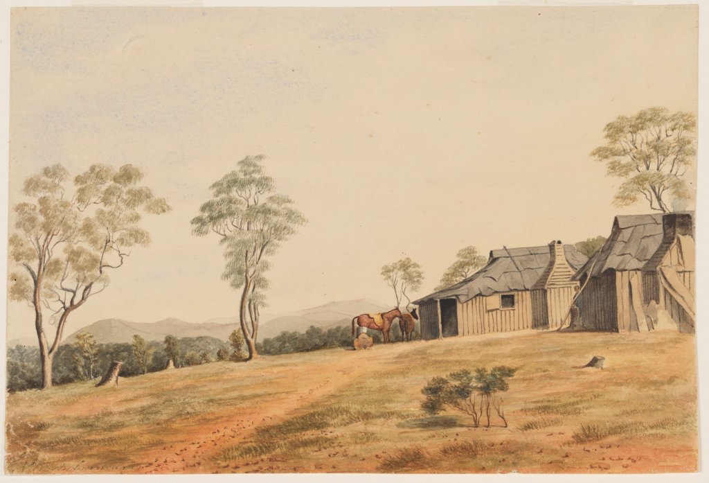

Back in the 1840’s these holdings were at the far flung reaches of the Empire; conditions for the shepherds could be spartan, violent and unpredictable.
On nearby Pikedale Station when Chinese shepherds struck for higher wages, the manager was one Mr H. B. Fitz… said to be called Murdering Fitz. Fitz punched the spokesman and killed him with one blow. Fitz surrendered to a magistrate but as there were no white witnesses he was soon released. He is also said to have fed poisoned flour to the Chinese when their annual payments were due.
Meanwhile back in the 21st century our seven tents soon scattered through a lightly forested grove of cypress pines. We were perched on a low bluff overlooking the Severn where it plunged through a rocky choke; occasional camp noises drifted over the roar of the water from the 4WD camp on the northern bank. Secure in our isolation we settled in around the campfire.
Above, the clear sky showed the Milky Way to perfection and such was the clarity that I could easily pick out the dark patches of the Coal Sacks and the misty smudges of the Magellanic Clouds.

Saturday : Lowe’s Waterhole to Campsite 2: 11 kms.
Today we would track the river westerly past the junction to Nundubbermere Falls and then on a long six kilometre run to the south, stopping somewhere, as yet undetermined, but just short of Reedy Waterhole where quadzillions of 4WD riff-raff would be lurking. A veritable village of camper trailers and safari tents even though access to Reedy and Burrows Waterholes is little better than a glorified goat track. But locals call it the “Sundown Road”.
Perhaps our modern adventurers gliding along in their all-terrain wagons could spare a thought for Sydney Skertchly, a government geologist who visited Sundown in 1897. He wrote:
“ …we had horrible weather, fog, and rain, and though we stayed a day after we had eaten our last bit of food… we were obliged to return to Ballandean, as the rain showed no sign of abating. My horse drowned himself in a waterhole and one of our men had to be sent back ill…yet I never enjoyed myself more. I shall long remember our last night. Four of us had dined of less than half-a-loaf of bread and we sat around the camp fire sipping second-hand tea, while a stockman recited Gordon’s poems as a substitute for supper.”
As for our little band of wanderers, our river outing, although not as extreme, would turn out to be a tad damp, for, as the Ranger had predicted, the river was flowing strongly over a succession of rock bars, chokes and rapids. Nary a sandy beach in sight.
Speaking of survival, several shots from a .22 rifle rang out from the far bank; I glanced around at my companions; business as usual, not a whisker twitched. Men of Steel. Across the river our weekend warriors probably thought they could bag one of the wild deer that roam the park, but failing that, there are plenty of other ferals to choose from: goats, pigs, foxes, rabbits, hares and moggies.
Good riddens many would say, although one of our fellow walkers had to be weaned off a lingering attachment to “cute little deers”. Still I didn’t have heart to mention that the Parks Service conducts regular culls of deer and such like; a recent tally being 190 deer, 580 goats, 8 pigs and 5 foxes.
8.00 am found us skirting along the bluffs that paralleled the river, just upstream of the Nundubbermere Creek Junction. But with steep ridgelines and cliffs dipping into the river ahead it was pretty obvious that we would need to cross; a pattern of travel that was repeated with monotonous regularity for most of the day. Distance elapsed: a fraction under one kilometre from camp. This was shaping up to be one excruciatingly slow walk.
But slow is good. A chance to potter along, immersed in the ever changing riverscape: long stretches of pool and riffle, interspersed with short runs of rock and rapids; the riverine forests of she-oak, river red gums, tea-tree and bottle brush; skinks basking; and pied cormorants perched on logs, wings outstretched.
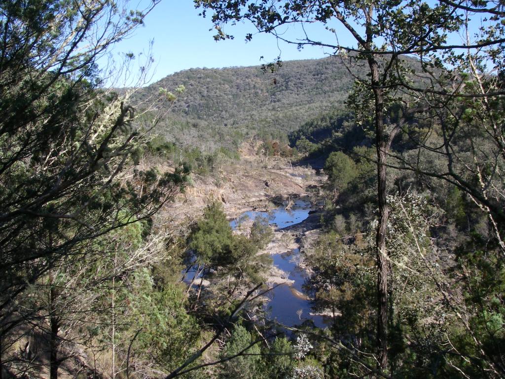
Back on the Severn, we continued picking our way along the bluff scanning for a likely crossing point; a nice dry rocky bar would do me just fine. Brian, who gets impatient with this sort of “fraffing around,” finally blew a gasket, pulled over and announced: “We’re crossing here.”
Here, was a line of rapids shooting over a waterfall; a particularly boisterous section of the river if I may say so. Bernard and I, wily old veterans of Brian’s many anti-fraffing campaigns, held back while our safe egress across to the other bank was secured.
Safe being a relative term, but apparently a too-short length of climbing tape, no anchor points, slimy rocks, unwieldy packs, racing water and three burly blokes made it ok. And it was.
In the river bed far ahead I could make out a solitary female figure of ample frame draped decorously over a boulder. Could this be the generously proportioned Mma Precious Ramotswe, proprietor of the Number One Detective Agency.
On closer inspection we revised this to merely a lady scoutmaster who had just released a gaggle of teenage girls, now straggling off into the wild. Grossly under prepared as it turned out, but it is difficult to be overly critical when the girls were out there having a go.
We caught up with the girls soon enough having retrieved one of their cast-offs… Dad’s favourite hike tent. These kids deserved better than to be let loose with ill-fitting day packs trailing an assortment of tents, tarps and those back-breaking blue sleeping mats, known by my sons as“portable concrete”.
Here is the conundrum for all youth leaders. That fine balance between risk aversion and engendering a sense of competence and adventure. The girls had no PLB and were relying on a UHF radio which was, as they soon discovered, pretty much useless in this rugged hilly terrain. But, still, we impressed to see them out there on a fairly challenging walk and, as it turned out, succeeding.
Back on the river we worked our way downstream clocking up a fraction over one kilometre an hour. With numerous crossings and water occasionally lapping at the sporrans of the resident short-arses we quickly got over trying to keep boots and socks dry and took to the water, just like the wood ducks we kept flushing up ahead of us.
As for our three Kiwi tramping companions, all this river walking brought on a nostalgia for things they thought they had left behind in The Land of the Long Black Cloud: wet boots, soppy socks and grossed-up wrinkly feet.
Late in the afternoon, much later than expected, we called it a day and set up our tents at campsite 2, a dank grove on the western bank located between Red Rock Waterhole and Rudders Waterhole, having travelled a paltry 11 kilometres for the day.

Sunday : Campsite 2 to Pump Waterhole 1.5 kms.
As the sky lightened I woke to a muted thumping outside my tent. Two chocolate eggs in terminal meltdown were stacked neatly outside my tent flap. Richard claimed that it was just Starkie pretending to be the Easter Bunny, but you and I know better.
Fortified by a breakfast of porridge and two chocolate eggs sluiced down with lukewarm coffee, I took off on the short hop to Pump Waterhole, our campsite for the next two nights. Our first task was to find a largish, flat, grassy area.
Malcolm and Brian gamely tackled yet another river crossing, foxed up a campsite on the other bank and came back with sly grins and glowing reports of our new home. But truth will out; a poxy campsite at best… if I were feeling generous in my praise, which I wasn’t.
This previously grassy river flat that had been flood-scoured leaving trails of rounded river boulders and debris piles of uprooted she-oaks. Tent sites were in short supply and so pitching our tents required some serious high order spatial sequencing.
Docking first was Bernard’s Barnum and Bailey big-top sporting a quarter hectare footprint; next came Malcolm and Jenny’s canary yellow stately pleasure dome and finally the swarm of one-maners came to rest, wherever.
In the cool of late afternoon and when seen in the lengthening shadows, our quiet little campsite grew on me, but more of that later. I believe the name Pump Waterhole may have derived from its use as a source of water for mining or for watering stock. There are precedents for this as the Beehive Mine, for example, used a steam pump to lift water 152 metres from a dam on Red Rock Creek.

After a brief respite, Brian had determined that there would be no skiving off on his watch and directed this slack and idle crew to venture forth and use their R&R time in something productive; like, say, a three or four kilometre walk to the Rats Castle via Reedy Waterhole Campsite.
Reedy was pretty much as expected: a good place to avoid over Easter. Nearby is the much larger Burrows Waterhole campsite which was named after Fredrick James Burrows, a WW1 veteran who suicided in 1934 and his grave is said to be on the northern side of the river, but I didn’t tell Brian that. He is overly fond of chasing down stuff like that.
And so it was onward to the Rats… or should have been, except for the dumb-cluck navigators. Both Brian and I had been to the Rats before but now we were approaching from a different direction.
Our walk this time went awry when the combined efforts of Richard’s GPS, my map and compass skills and Brian’s usually intuitive bump of locality all conspired to direct us down a shady beckoning track and place us on the wrong ridgeline.
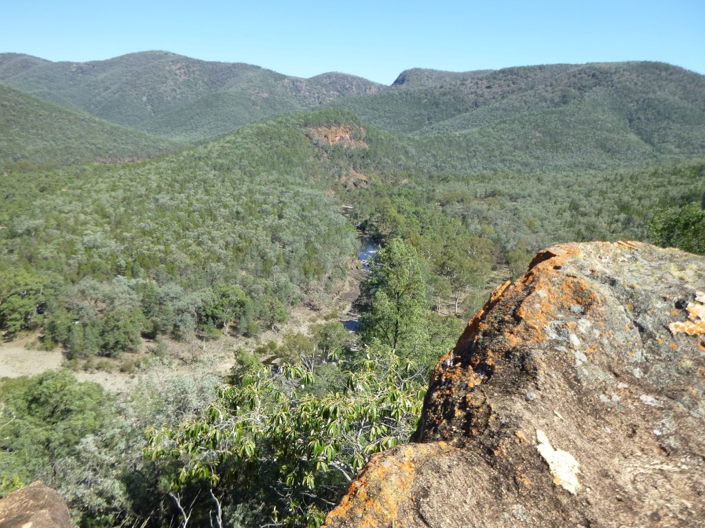
Rats Castle was tantalizingly close, a mere kilometre as the crow flies but could have been on the Moon as it was now 1.00 pm our final turn-around time. So we propped where we were, savoured our lunch in a cool woodland of white cypress pines perched high above the Severn River valley.
Rats is an interesting geological feature and major landmark on the Severn. It is a ridge of hard fine-grained granite which has intruded into the surrounding metasediments of the Texas Beds, weakened during a major fracturing in the Severn River Fracture Zone. Technically it is a dyke, a vertical intrusion.
Early shepherds called it Rats Castle because when it was first seen it was home to small rock wallabies, then commonly called rats. Retracing footsteps we came to the cleared paddock we had walked through several hours previously but this time stopped to enjoy panoramic views across to Mt Lofty but more importantly Red Rock Falls, tomorrow’s objective. We could even see the ridgeline that we would follow up in the morning.

On our return to Pump Waterhole, things were on the up and up. A Sea World style slippery-dip swim, copious supplies of firewood, a now shaded campsite and a good feed and all was well in the circus.
For me at least, but not for a forlorn clutch of teenage girls, weary and sunburnt, who limped through in the fading light; one in tears. Uncle Brian took pity, showed them where they were on the map; reassured them that they were getting close to civilisation and their pick-up point and gently packed them off downstream.
As I watched their little dejected backs disappear over the promontory of rock near our tents it suddenly occurred to me that I was looking at a Rats Castle look-a-like. Closer inspection revealed it was indeed a granitic dyke intruded through the local traprock. Under our noses the whole time; how could that be? I, too, could have wept.
Monday : Pump Waterhole to Red Rock Falls: 7 kms.
An uphill sort of day; but the weather was kind, cool with light winds. Just as well for we faced a slow grind out of the Severn River Valley by way of a succession of high points: 731m, 828m, 995m, 1027m and finally reaching the high tops at 1032m, an altitude gain of 700 metres. No nav stuff-ups allowed.
Richard and I were on the yellow card. But we weren’t taking any chances with today’s route and this time had fed a truck load of waypoints into the GPS just in case the old map and compass led us astray, again.
Morning tea was on an open bald, reminiscent of the Bunya Mountains, but just an old cleared grazing paddock, but with superb views across to Mt Lofty and Red Rock Falls.
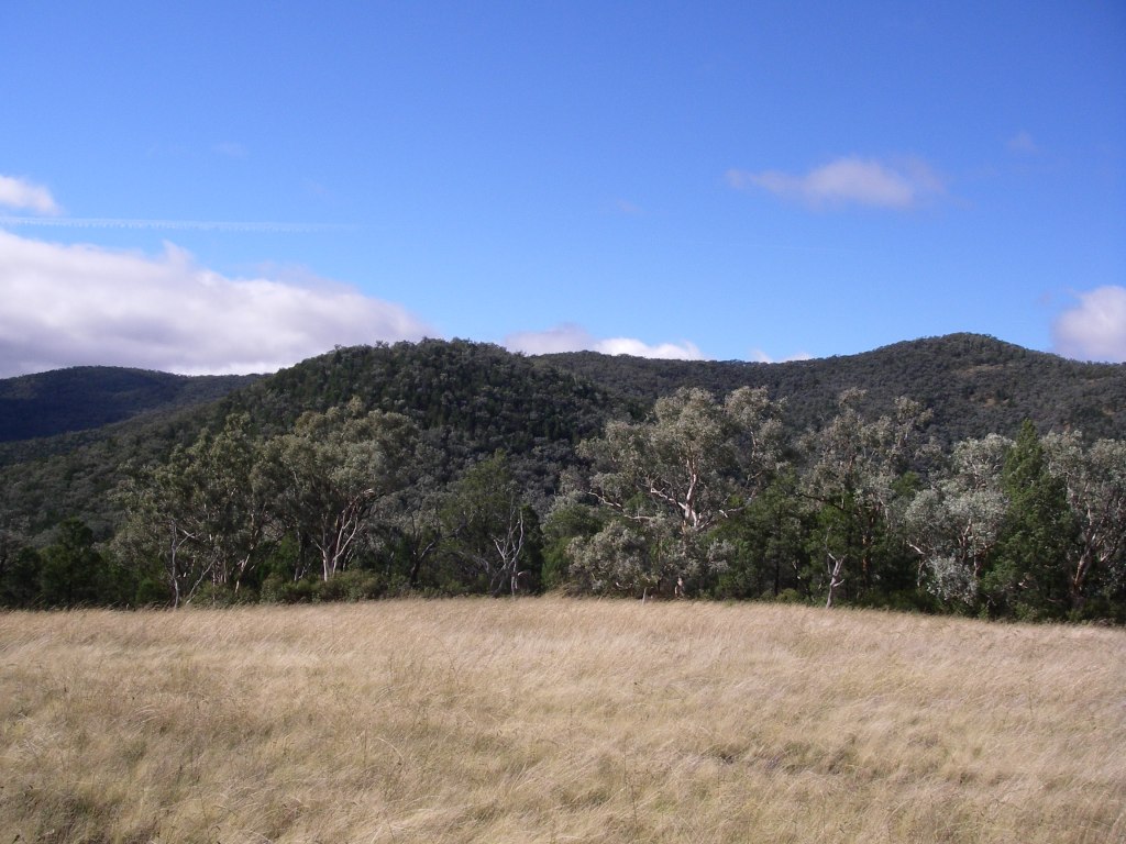
Our morning’s walk would traverse the Sundown Resources Reserve, a reminder of Sundown’s mining past. The mineral deposits formed where the Ruby Creek Granites contacted the overlying traprock (Texas Beds) or are found in fractures above the granite intrusion. Here there are occurrences of molybdenite, tungsten, copper, arsenic and tin, in fact the first deposit of tin in Australia was found on the Nundubbermere Run in 1854.
The Sundown Tin Mine opened in 1893 and operated until 1923 when it closed only to re-open in 1953 until 1956. It was by far the biggest lode producer in the area but other mines were Carpenters Gully, The Orient, and Beehive. Copper sulphides were worked at The Sundown Copper Mine and nearby Comet Mine. Arsenic was extracted in the early 1900s at Beecroft, Sundown Copper and The Orient mines.

Arsenic was an important constituent in prickly pear poison, cattle dips and a hardener for the lead in bullets. Unfortunately arsenic oxide treatment has contaminated Little Sundown Creek and I have read that walkers are advised not to drink the water in Little Sundown below the mines. Fortunately small lodes, lack of water and poor access makes any further exploitation of the reserve unlikely.
After a climb of 700m over 5.5 kilometres we reached the high range country and were about to re-enter the national park. The Queensland-New South Wales border was a mere 1.5 kilometres to our south and with the lunch worms gnawing we steered to a small shady dam.
Replete we shuffled off to set up camp on Red Rock Creek, one kilometre upstream from Red Rock Falls. We had left the drier woodlands and vine scrubs far behind and our small tent city now snuggled under a tall Eucalypt forest of yellow box, brown box and Tenterfield woolybutt . The climatic conditions at 1000 metres being cooler and moister, are conducive to the growth of this taller forest.
Red Rock Falls are etched into the Ruby Creek Granites and drop vertically a massive 150 metres. Scary. But not to Bernard who teetered, camera in hand, along the rim banging off shot after shot. I decided it was better not to watch his impending demise.
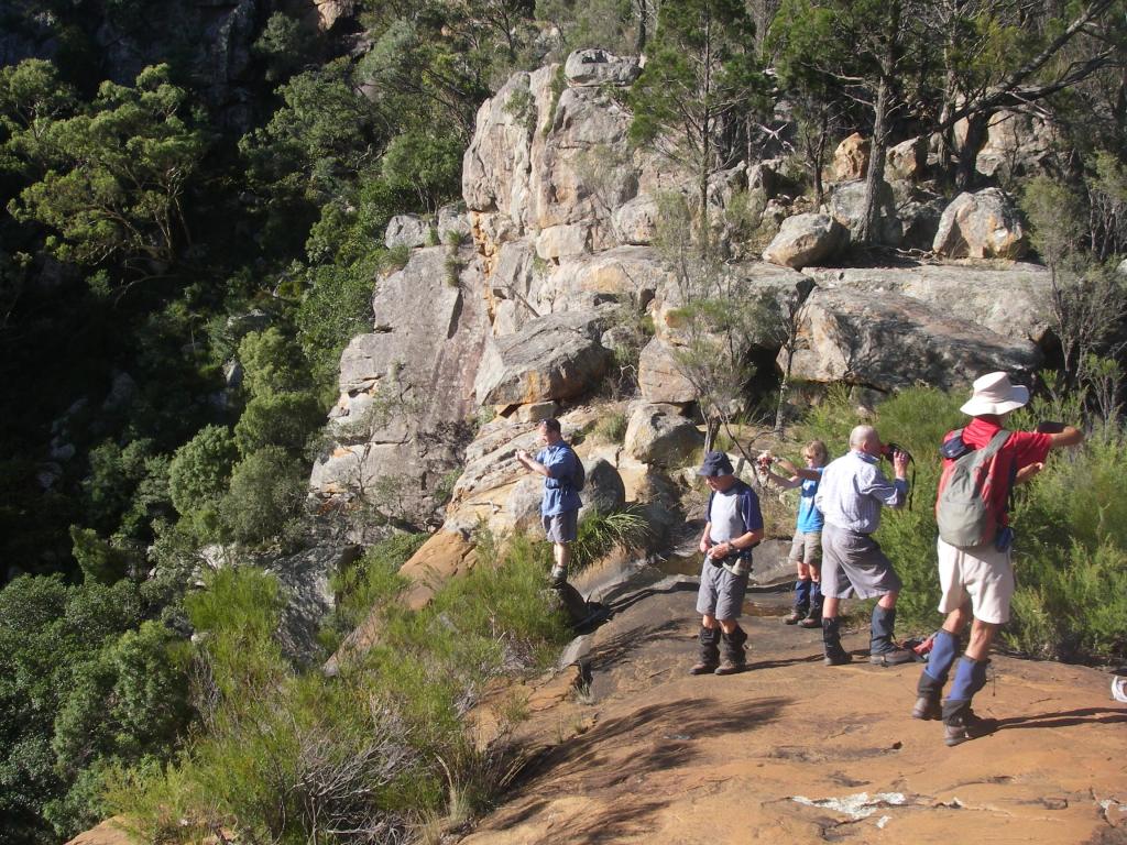
But look I did, elsewhere… scanning the precipitous clifflines for tell-tale white stains that would signal the presence of Peregine Falcons as promised in the Parks brochure. None, neither seen nor heard. So I turned my attention to the views down Red Rock Gorge to its junction with the Severn; in fact it meets the Severn very close to our campsite of Saturday night.
In the far distance, at ten kilometres to our north west was Jibbinbar Mountain (975m), our sister outcrop of Ruby Creek Granite and also the site of a government arsenic plant in the 1920s. Ruby Creek, the location for the origin descriptor of the granite that bears its name is found on the New England Tableland, close to Gibraltar Range National Park.

After more goofing around, we took our leave and clambered up to the tourist lookout above, and did touristy things…. more photos, admired the views anew and read the park info board about Sundown’s mining past and then it was off for our final night out on the track and hopefully a decent feed consisting of more than half-a-loaf of bread and second hand tea.
Tuesday : Red Rock Creek Campsite to Sundown Homestead site: 5 kms.
An easy morning’s downhill canter took us into the old Sundown site, sooner than we thought. By 10.00 am it was all over but the shouting… at Richard’s rascally Land Rover Defender if it refused to start. But it did and within the hour we dismounted at the Stanthorpe Bakery for some substantial victuals: a pie or two, spinach and fetta rolls, vanilla slices, cream buns and such like, all washed down with mugs of delicious hot coffee. Eat your heart out Mr Sydney Skertchly.
Read about some more of my gorge walks
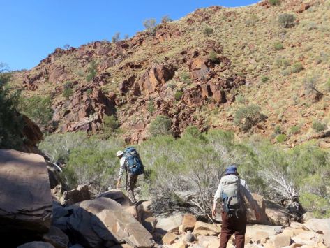
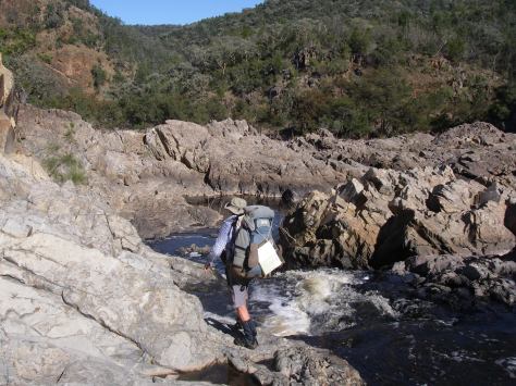
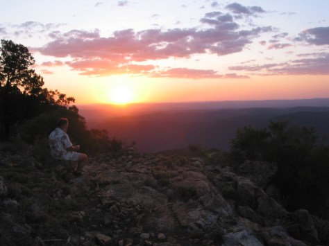


Hiking the High Plains of Northern Kosciuszko
by Glenn Burns
Northern Kosciuszko is a subdued 1400 metre landscape of rolling sub-alpine grasslands separated by low snow gum clad hills and ranges rising to a maximum of about 1600 metres.
This vast upland has a different feel to the landscapes of southern Kosciuszko where 2000 metre whaleback mountains and steep ridges predominate. With its open vistas, network of mountain huts and more benign weather, northern Kosciuszko offers its own easier but distinctive walking opportunities.
A Hike in Australia’s High Country
Can I tempt you with a leisurely 50 kilometre, 6 day walk in the high country of northern Kosciuszko National Park? Nothing too taxing. Imagine stepping out along grassy 4WD tracks as they wind up through snow gum woodlands to low alpine passes then gently descend to vast open plains of swaying tussock grasses. Maybe camping overnight near historic mountain huts?
Throw in showy alpine wildflowers, perhaps a sighting of an elusive wombat, limestone caves, brilliantly coloured Flame Robins, or maybe the eerie nocturnal call of a Boobook as you lie snug in a warm sleeping bag.
With these promises in mind, on a balmy November evening, seven walkers left Ghost Gully Campground on Long Plain to enjoy six days of hiking across the high plains of northern Kosciuszko.
Photo Gallery
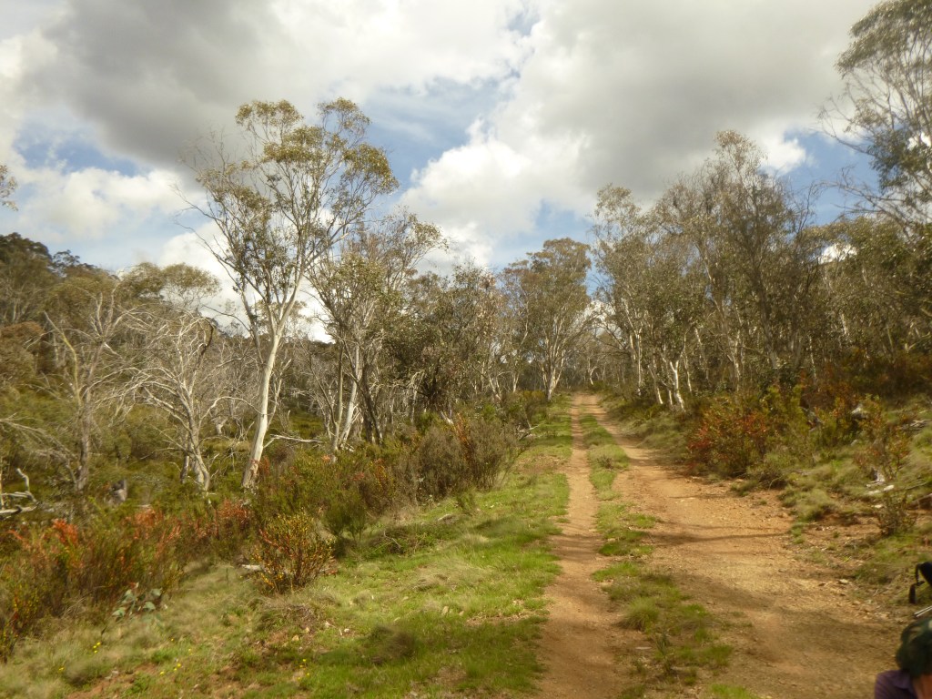

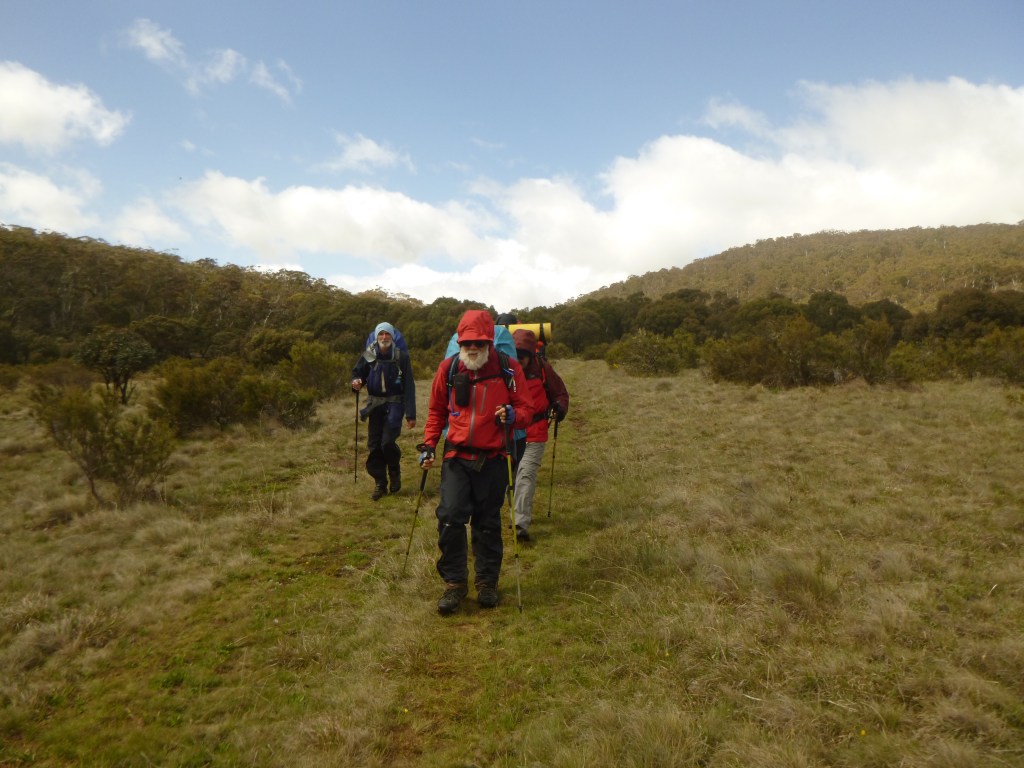

Map of Hike Across High Plains of Nth Kosciuszko

The Weather
In the end, it was often about the weather. Our late November trip coincided with the passage of several fronts and troughs gifting us days of unsettled mountain weather. The pre-trip forecast for the week was a tad disconcerting.
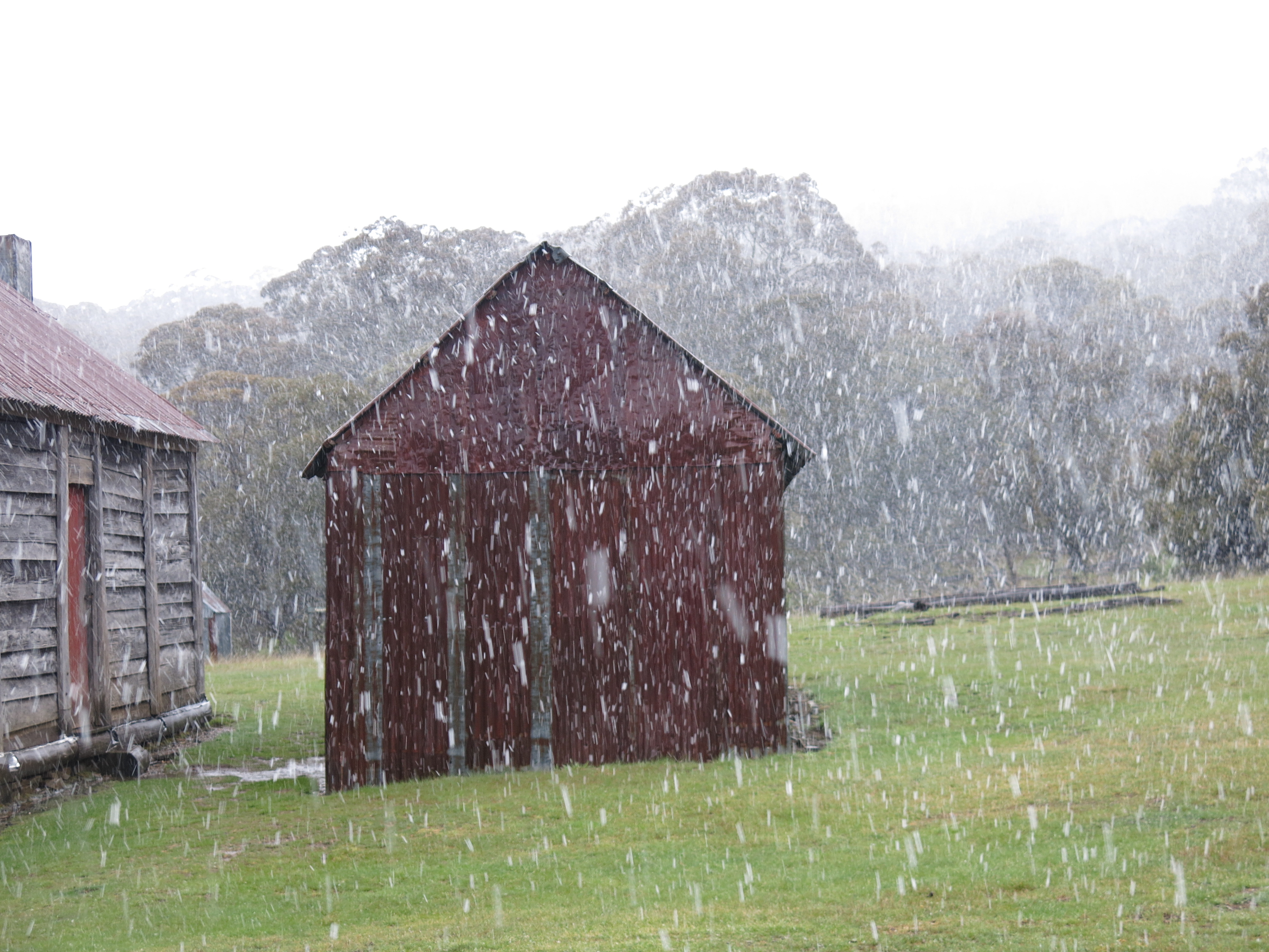
Weather statistics from nearest SMHA Automatic Weather Station
| DAY | FORECAST | MIN oC | MAX oC | RAIN mm | WIND |
| MON | Cloudy | 6.3 C | 17.8 C | 0 mm | 30 kph |
| TUES | Late Storm | 10.8 C | 18.3 C | 0 mm | 57 kph |
| WED | Rain | 10.8 C | 12 C | 24 mm | 63 kph |
| THU | Snow | – 0.4 C | 2.5 C | 34 mm | 91 kph |
| FRI | Snow | – 0.1 C | 4.2 C | 33 mm | 70 kph |
| SAT | Sunny am | 1.2 C | 8.6 C | 61 mm | 46 kph |
Hypothermia
Hypothermia is an under-estimated hazard for many walkers in Australia’s high country, even in summer. It is usually triggered by being out in cold, wet and windy conditions. Hypothermia can be easily prevented by wearing warm layers beneath wind and rain proof over-garments, by frequent consumption of carbohydrate-rich foods and by seeking shelter in a timely manner.
Video on Hypothermia
Our hike was marked by several days of conditions as described above, so I modified the walk accordingly: huts became the default overnight accommodation.
Fortunately for this leader, my fellow walkers, although denizens of the sub-tropics, were all well prepared for cold, wet, and windy conditions. Our party of Richard, Gary and Neralie, Joe, Larry, and Chris trucked in loads of rain jackets, rain pants, and multiple layers of thermals, fleece jackets, puffy jackets, beanies and gloves.
In fact, they seemed excessively bullish about our impending late week meteorological challenge. And this was a big plus as it was a different experience to gallivanting around in shorts and tee shirts.

The Landscape
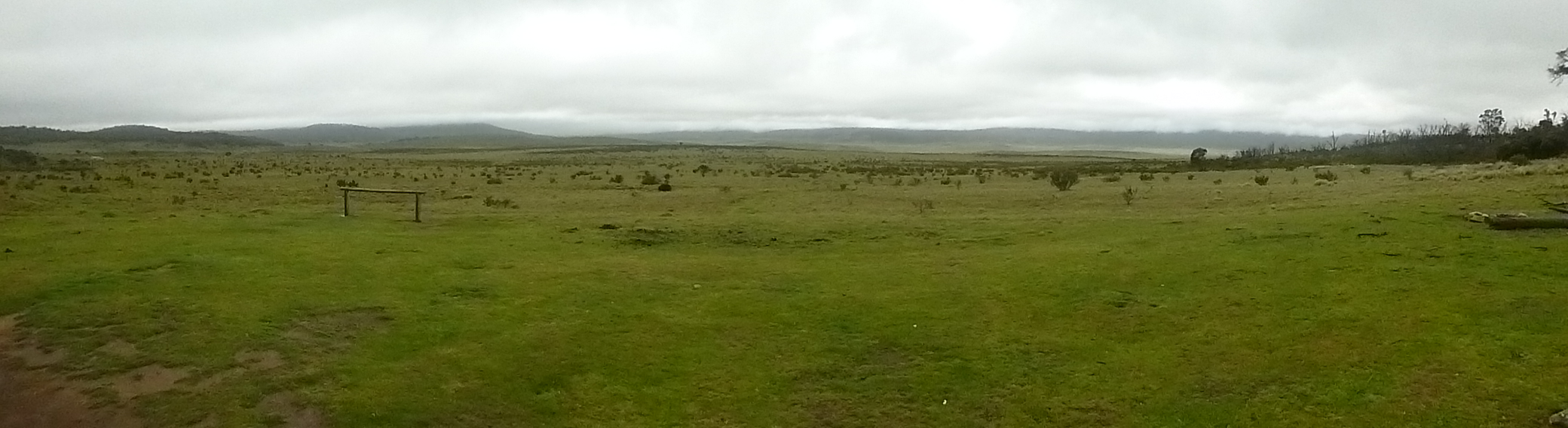
There are number of high plains in northern Kosciuszko mostly above 1300 metres. Known as frost hollows, frost plains or cold air drainage basins they are naturally occurring treeless plains.
The grasslands are an ecological consequence of cold heavy air draining down into the valleys of creeks and rivers. The pooling of this frosty air suppresses the growth of tree seedlings. Hence they are totally bereft of trees. Even the amazingly hardy snow gums refuse to thrive.
Instead, the snow gums (E. niphophila: Greek = snow lover) and black sallees (E. stellulata) grow on the hill tops above the valleys and the alpine grasses occupy the lower valleys. Thus the tree line here is said to be ‘inverted’.
There are about ten extensive northern frost plains lying between the Brindabellas in the ACT and Kiandra in NSW, including Tantangara, Gooandra, Boggy, Dairymans, Currango, Cooleman, Long, Wild Horse, Nungar and Gurrangorambla. All worthy of a visit.
Huts & Homesteads
The general rule is that the old grazing huts and homesteads should only be used in bad weather as a shelter and for warming up and drying out. But when the weather turns bad, as it often does, the huts become a magnet for skiers and snow-shoers in winter and bushwalkers, mountain bikers and horse trekkers in summer.
Most huts are equipped with a fireplace or stove and a modest supply of dry firewood. Although, I noticed on this trip, that the emergency wood supplies had been ratted and not replaced. Some huts are little better than ruins but those still standing are being conserved by caretaker groups affiliated with the Kosciuszko Huts Association and supported by Parks NSW rangers.

The mountain huts of Australia’s high country form an integral part of its cultural heritage. In Kosciuszko the huts were often built as shelters on summer grazing leases using the most basic of tools: cross-cut saws, axes and adzes. Construction materials included split slabs, rough bush poles, wooden shingles for roofing, corrugated iron and stone cobbles for fireplaces.
Those of you who have walked in New Zealand, Europe or Tasmania may have misguided notions of the quality of Australia’s mountain huts.
On a fine summer’s day they are often hot and stuffy and not especially clean. Some are home to bush rats or even the occasional snake. White’s River Hut under Gungartan is said to be home to a multi-generational dynasty of pushy bush rats, the infamous “Bubbles the Bush Rat” clan whose mischief regularly features in the hut’s log book.
Personally, I haven’t been on the receiving end but fellow walkers have observed their nocturnal activities: chewing through rucksacks, raiding food bags and munching on the odd plastic torch or two. Although their noisy antics on the hut rafters are never appreciated.
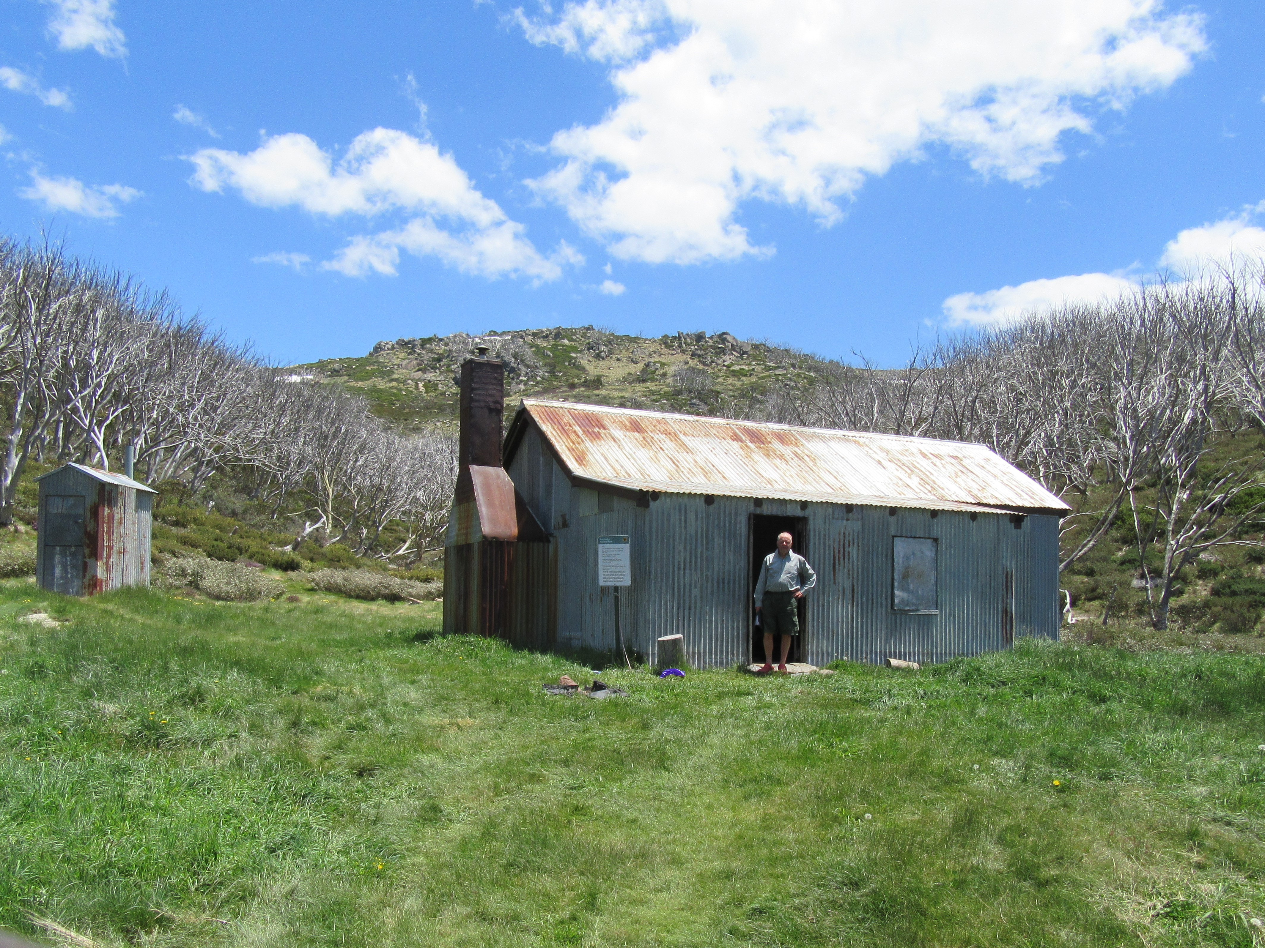
The thing about these huts is their stunning locations. Sheltered from winter westerlies by copses of snow gums, close to an ample supply of running water, timber for firewood and magnificent views over grassy flats, the huts are high country gems. At sunrise, sit outside on a log or the door stoop and warming rays will soon have you thawed out.
On our trip we hoped to visit Hainsworth Hut, Old Currango Homestead, Coolamine Homestead, Cooinbil Homestead and the dirt-floored Bill Jones Hut as an emergency if we got caught out on the Cooleman Plain.

Brumbies aka Wild Horses aka Feral Horses
In Australia, non-domestic horses are known as brumbies, wild horses or feral horses. It is estimated that there about 400,000 wild horses roaming Australia. Kosciuszko has about 19,000, and they represent an ecological disaster for these fragile alpine ecosystems.
There is no doubt that horses were an important part of the cultural heritage of the high country. Today, the sighting of a herd of brumbies is very exciting, but they are feral animals with the same status as foxes, cats, goats, deer and camels.

In most states they are treated as a pest species being culled by aerial shooting or trapped then euthanaised or trapped and then broken in (rarely). In NSW the shooting of brumbies is a very contentious community issue as horse riding is a very popular recreational activity in northern Kosciuszko. Parks NSW recognises this by providing trails, horse camps, holding paddocks, water troughs and hitching rails.
In an attempt to manage brumbies, a 2016 draft Wild Horse Management Plan recommended reducing numbers in Kosciuszko by 90% over 20 years, primarily through culling.
That would have left about 600 horses in the park. Naturally the NSW parliament ignored the advice of its own scientific panel so there was be no meaningful cull. Instead, the NSW Deputy Premier John Barilaro hatched his own plan: The Kosciuszko National Park Wild Horse Heritage Bill 2018.
The bill would prohibit lethal culling because of the heritage significance of sustainable populations of brumbies. Certainly, the Fishers and Shooters Party and the Australia Brumby Alliance were pretty cock-a-hoop about the legislation but there were still serious questions to be answered about the environmental impacts of brumbies.
The NSW Threatened Species Scientific Committee has described the damage done by brumbies as a ‘key threatening process’. But hey, what would a bunch of scientists know? As a bushwalker who has visited Kosciuszko for many decades I can attest to the more obvious damage caused by brumbies: the pugging of swamps and watercourses, the myriad brumby trails criss-crossing the landscape, the fly infested dung heaps and the increasing incidence of brumby herds clomping through campgrounds at night.

Stop Press: Update on Brumbies after 2019/2020 Bushfire Season
” About 4000 feral horses will be removed from Kosciuszko national park in New South Wales as part of an emergency response to protect the alpine ecosystem after large areas were devastated by bushfires. “ Graham Readfearn. The Guardian . 20 Feb 2020.
As of 2025 culling of brumbies had reduced numbers to approximately 3000 . Although exact numbers are not known. It is expected that culling would continue until numbers reached 300 to 600.
In some very welcome news it has been reported that fragile alpine ecosystems are already showing signs of recovery.
Monday: Ghost Gully Campground to Hainsworth Hut: 3.8 kilometres.
After rescuing Chris from the eerily deserted Canberra Airport, our Hilux convoy converged on Cooma for a quick feed and yet another surreptitious peek at Mr BOM. No joy there.
Then it was on to the Snowy Mountains Highway past Kiandra to Ghost Gully Campground. The old gold mining ghost town of Kiandra is reputedly one of the coldest places on the Australian mainland, coming in at minus 17.8°C, second coldest to Charlottes Pass, something that I apparently neglected to brief my fellow travellers on.
Ghost Gully Campground
According to Parks NSW Ghost Gully Campground is a “small hidden gem tucked away off the Long Plain Road… the site is sheltered and spacious and is surrounded by black sallee eucalypt trees.”
To which I can add that it is indeed as as pleasant as described and has firepits, standard issue long drop toilets and abundant water. For those horsing it in, substantial holding yards are part of the package deal. Ghost Gully is accessible by 2WD in fine weather but the road is closed in winter or any other time of snowfall.
With four hours until the 8.00 pm sunset we hauled on our monkeys and headed off at a brisk Nerilee ,Gary and Chris trot along the Mosquito Creek Trail aiming for Hainsworth Hut a mere hour’s walk hence. This is an easy walk contouring along the perimeter of snow gum woodland above and the grassy plains below. The weather was, thus far, obliging. We cantered along in warm sunshine, a balmy 17°C with a gentle 13 kph west-south-westerly. Ideal walking.
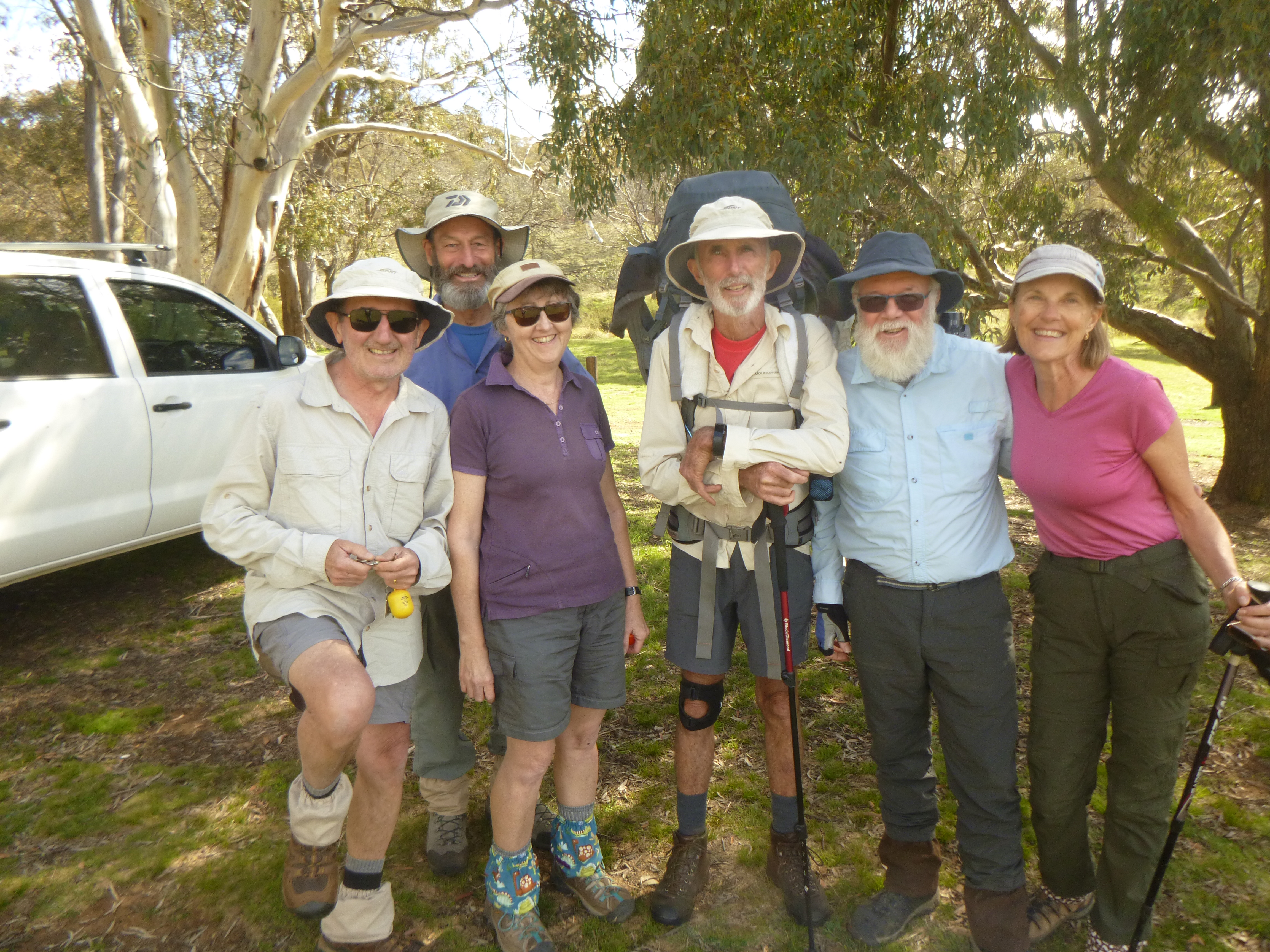
Arriving at Hainsworth’s soon after 5.30 pm gave us heaps of time to fan out and collect firewood and water then put up our tents. Some tents pitched with commendable speed and efficiency. Others less so. Larry’s borrowed tent required half an hour of serious male engineering conferencing before it was coaxed upright. Sort of.
With a cheery fire blazing we moved inside to cook meals and sit around listening to Gary’s tall tales but true from his Antarctica days.
Hainsworth Hut: a typical mountain hut
Hainsworth at 1360 m is one of a string of summer grazing huts built on Long Plain. At the peak of grazing there were up to 20 huts scattered over the plain.
This hut is a simple two-roomer grazing hut with a bedroom, kitchen and open fireplace. It was built in 1951 by Hainsworth and Corkhill and is unusual in its cladding of corrugated iron with two doors and two storm hatch windows. But no pit toilet.
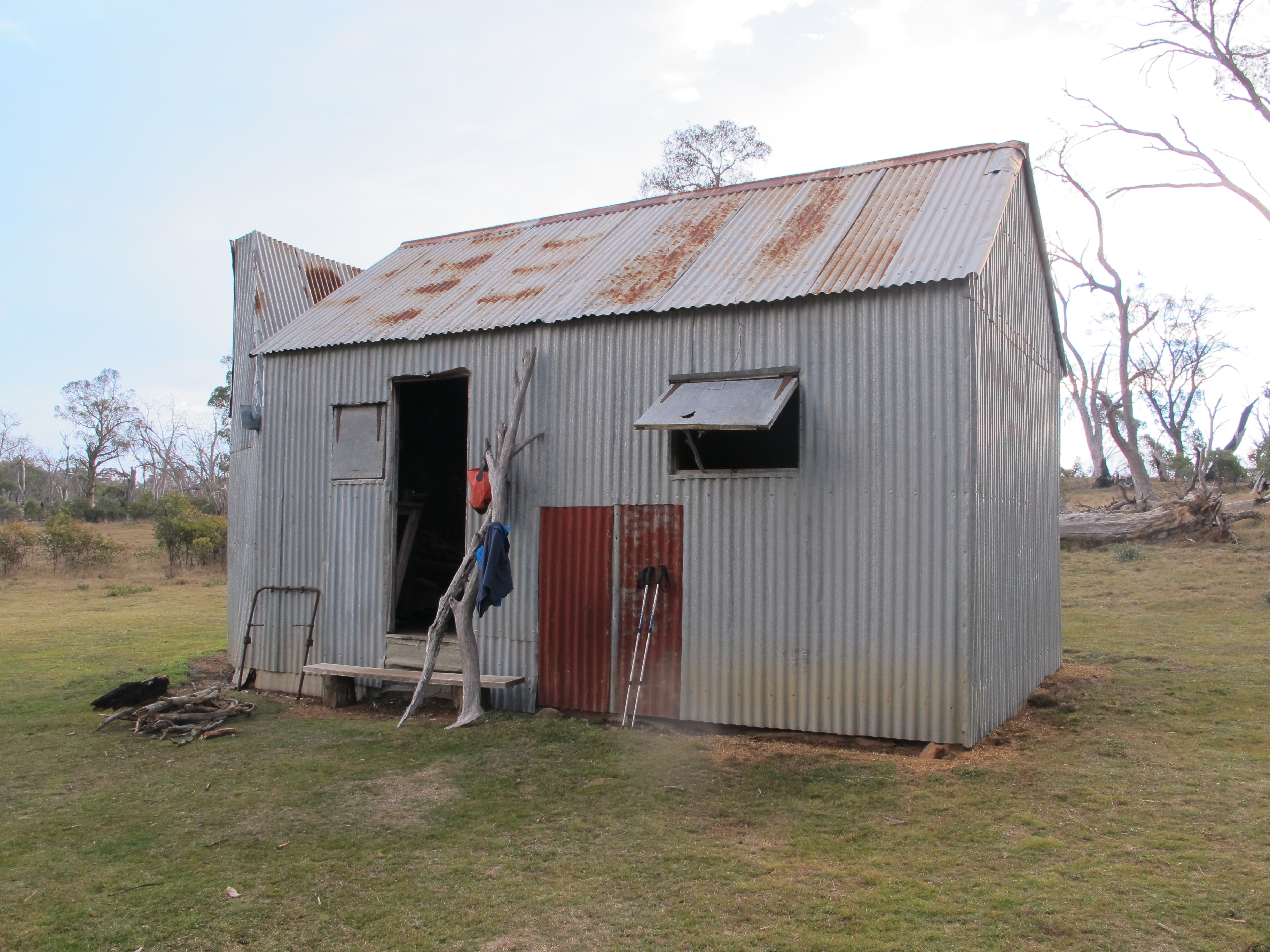
Sixty years ago the grassy flats of Dip Creek below Hainsworth Hut would have been crawling with sheep; 3000 of them according to a log book entry by Bill Hainsworth’s daughter. Now brumbies and dingoes roam these flats unmolested.

Speaking of roaming, I realised that my hiking cook-set had roamed into my ute’s camping kitchen box now abandoned at Ghost Gully. What to do? Well, the seven kilometre return ramble was firming up as a reasonable option on such a benign spring evening.
Tuesday: Hainsworth Hut to Old Currango Homestead via the Mosquito CK Trail: 9.4 kilometres.
A clear and cool high plains morning. Just as we were about to hit the road Ranger Tom arrived for a quick inspection of the hut and its inhabitants before driving on to Old Currango to give it a lick of paint.
Fortunately, the lads and ladies were wise to this hut etiquette stuff. Hainsworth had been swept clean, the fire doused, ample dry firewood collected and stacked neatly and doors and windows closed. Five gold stars from Ranger Tom.
Our morning’s walk across to Old Currango was one of those satisfying springtime walks, passing through unburnt old growth snow gum woodland climbing gently to 1460 metres at Harry’s Gap.
From here our 4WD track took a course downhill and parallel to Mosquito Creek. After some argy-bargy about where to sit for morning tea we perched on comfy logs provided by Gary while Chris and Larry whipped out hiking chairs which they luxuriated in at every idle moment.
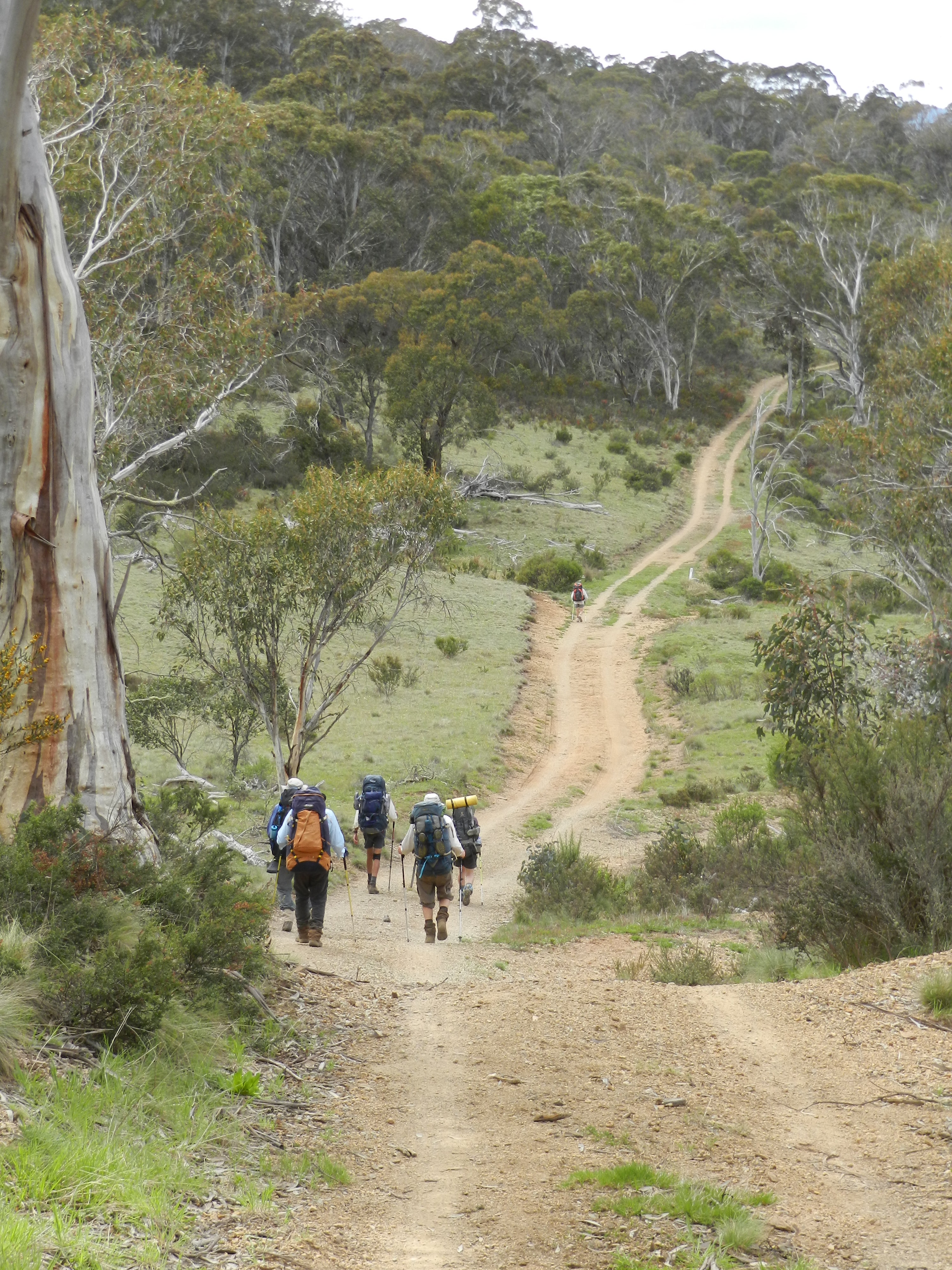
Old Currango Homestead
With Gary’s cruise control firmly throttled back to a steady four kph we headed off on the final leg towards our overnight camp at Old Currango.
It is the oldest dwelling in Kosciuszko National Park dating back to the 1870s. Old Currango sits on an elevated site at 1275 metres, its back to the treeline but from its front verandah we had spectacular views to the north over the huge Gurrangorambla Plain.
Out to the north-east Mt Bimberi (1913 m) and Mt Murray (1846 m) rose abruptly above the rolling landscape of the high plains.
With an afternoon to spare we lolled on our verandah, taking a leisurely lunch and poking around doing nothing in particular. Around the back Ranger Tom and a contractor beavered away, trying to slap on a coat of paint ahead of the now threatening clouds.
The old girl was, in these final stages of refurbishment, being decked out in heritage pink with a chocolate trim. Old Currango had copped a flogging in a severe wind and hail storm in February 2017. Roofing iron and shingles were ripped off exposing the homestead interior to the weather.
This has since been repaired but the gums on the ridgeline behind still bear testimony to the ferocity of that storm. Tree canopies were lopped and large old growth black sallees were snapped off at ground level. A salutary lesson in the dangers of mountain weather in these parts.
Grazing began in the area in the 1830s when Dr Andrew Gibson moved stock into these high plains. The first hut on the site was a slab and bark job built by Tom O’Rourke in 1851. By the 1870s construction had started on a colonial style homestead.
The current iteration has four rooms, a central hallway and full length verandah. The posts are hand-split; the exterior walls clad in hand-worked weatherboard. The original shingle roof was covered by corrugated iron in the 1890s.
Interior walls are lined with milled Alpine ash and covered in several rooms with newspapers from the 1940s and 1950s. But best of all, the fireplace and chimney has been expertly rebuilt.

Meanwhile, back at the ranch, the natives were getting restless. No longer content with reading , nana-napping or teasing each other they cast around for ‘things to do’. A wood and water patrol formed up, while Joe and Larry disappeared around the back to pester Ranger Tom to give them some jobs.
On cue, late that evening a band of thunderstorms swept in, bringing lightning, rolling thunder and rain. But, of course, we were high and dry inside Old Currango.
Wednesday: Old Currango. Sitting it out at Old Currango.
As predicted, first light revealed a dank, overcast and windy dawn. Plan B. Watch the world go by from the dry cover of Old Currango’s superb verandah: rain scudding over the plains, brumbies grazing, flocks of sulphur crested cockatoos feeding in the dense grass and Larry digging ditches to drain the pooling water away from the homestead’s foundations.

And behold, from the north a ragtag gang of interlopers. Bedraggled bushwalkers: sodden clothes, soggy footwear and saturated tents. Was there room at the inn for 18 teenage travellers and their 3 minders?
Fortunately, Gary and Joe had spent the morning fussing damp firewood into a satisfying blaze. The kitchen became a makeshift drying room and sauna. All available space taken up as kids piled in to dry out and warm up.
We retreated to the outside. Our new hut companions were year 9 students and staff from the local Tumut High School and what a cheerful, polite and well behaved bunch they were.
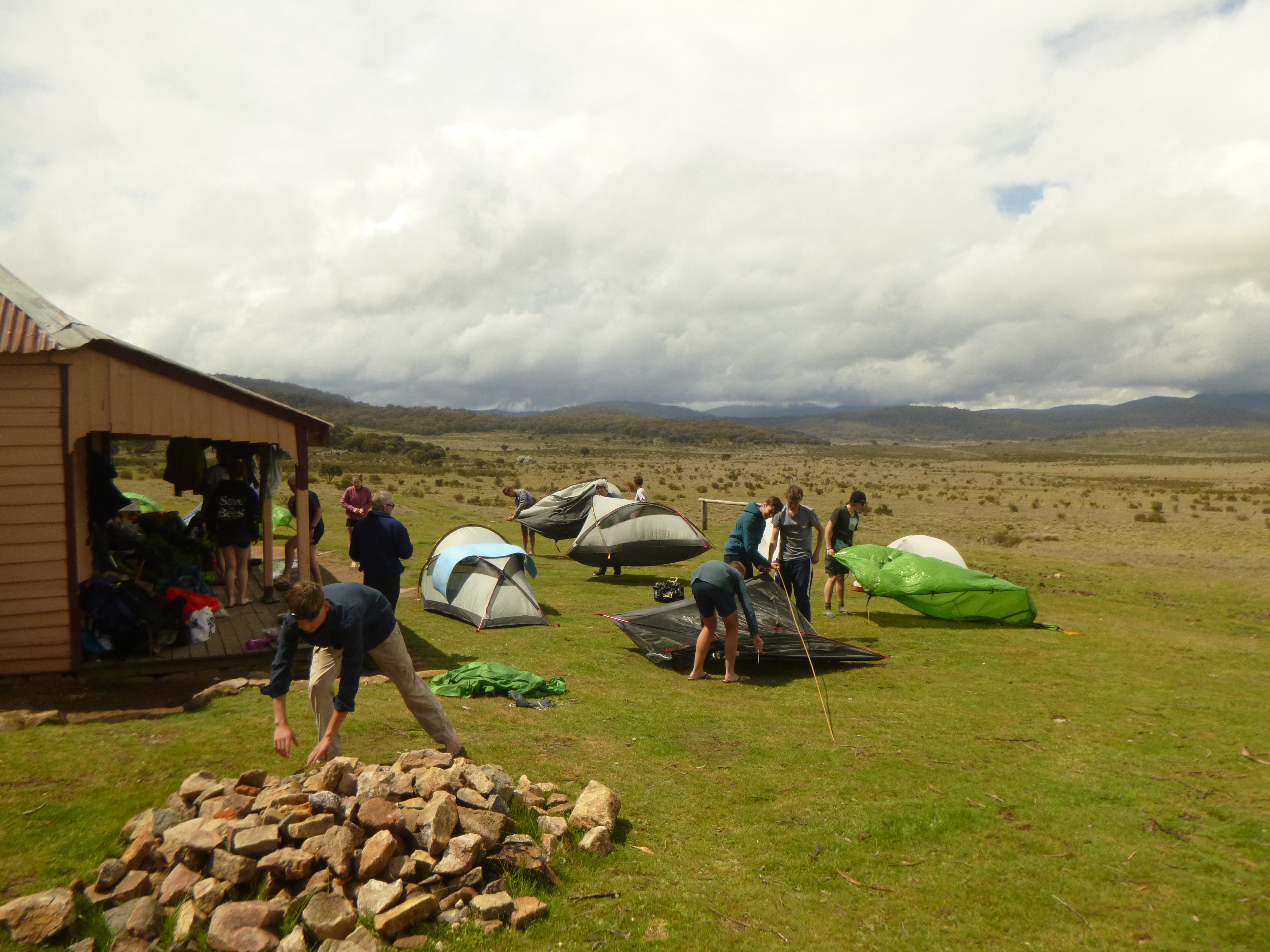
By mid-afternoon the drizzle had cleared and the wind picked up allowing our little buddies to dry their tents and cook an evening feed on the verandah. A teachers’ satellite phone hook-up back to Tumut base confirmed that snow was expected on the morrow.
Thursday: Old Currango to Coolamine Homestead via the Cooleman Plain Karst Area: 14.7 kilometres.
More rain overnight with the possibility of snow today. As we had already blown a day of our itinerary it was important to push on, whatever the weather was doing.
By 8.15 am we drifted out into a fall of light sago: snow with a particle size of less than 5mm. But it didn’t last long and at the Mosquito Creek Trail junction bundles of the fleecy stuff were stripped off. From here we climbed steadily back up to 1300 metres as the trail followed a minor fault line through the Gurrangorambla Range to Blue Waters Saddle.

The Gurrangorambla Range is an elevated block of upper Silurian (400 million years ago) granophyres topping out at 1600 metres at Tom O’Rourkes Peak. Granophyre is an igneous rock that crystallises at shallow depths and has a mineral composition similar to granite and like granite forms elevated terrain.
But for much of our walk thus far we had been mainly traversing old Devonian Volcanics (419 to 358 mya). Kelly’s Plains Porphyry underlies the muted topography of the vast grasslands of the previous two days. Porphyry is an igneous rock consisting of large-grained crystals in a groundmass of fine-grained crystals. It forms when a column of magma is cooled in two stages. The initial slow cooling creates the large crystals of more than 2mm, later rapid cooling closer to the surface creates a matrix of small crystals almost invisible to the naked eye.
Ahead lay the flat treeless Cooleman Plain composed of cavernous limestone of Upper Silurian age. The Cooleman was described by explorer/grazier Terrance Murray of Yarralumla, Canberra in 1839 as “a grazing paradise covered with Kangaroo grass stirrup high, as well as snow grass and wildflowers”.
I had planned to camp here for two nights spending time exploring the myriad caverns and gorges of Cave Creek.

But deteriorating weather forced a change of plan again. The wind had kicked up (WNW@30 kph) and the freezing drizzle (0.3°C) intensified making for a wind chill factor of minus 6°C.
So I piked out of the tenting game and headed instead for the shelter of Coolamine Homestead, three kilometres to the north west. But not before a cursory viewing from the Blue Waterholes lookout. Maybe next time. I’ve missed camping at this site on a previous walk from Kiandra to Canberra, again in dodgy weather.
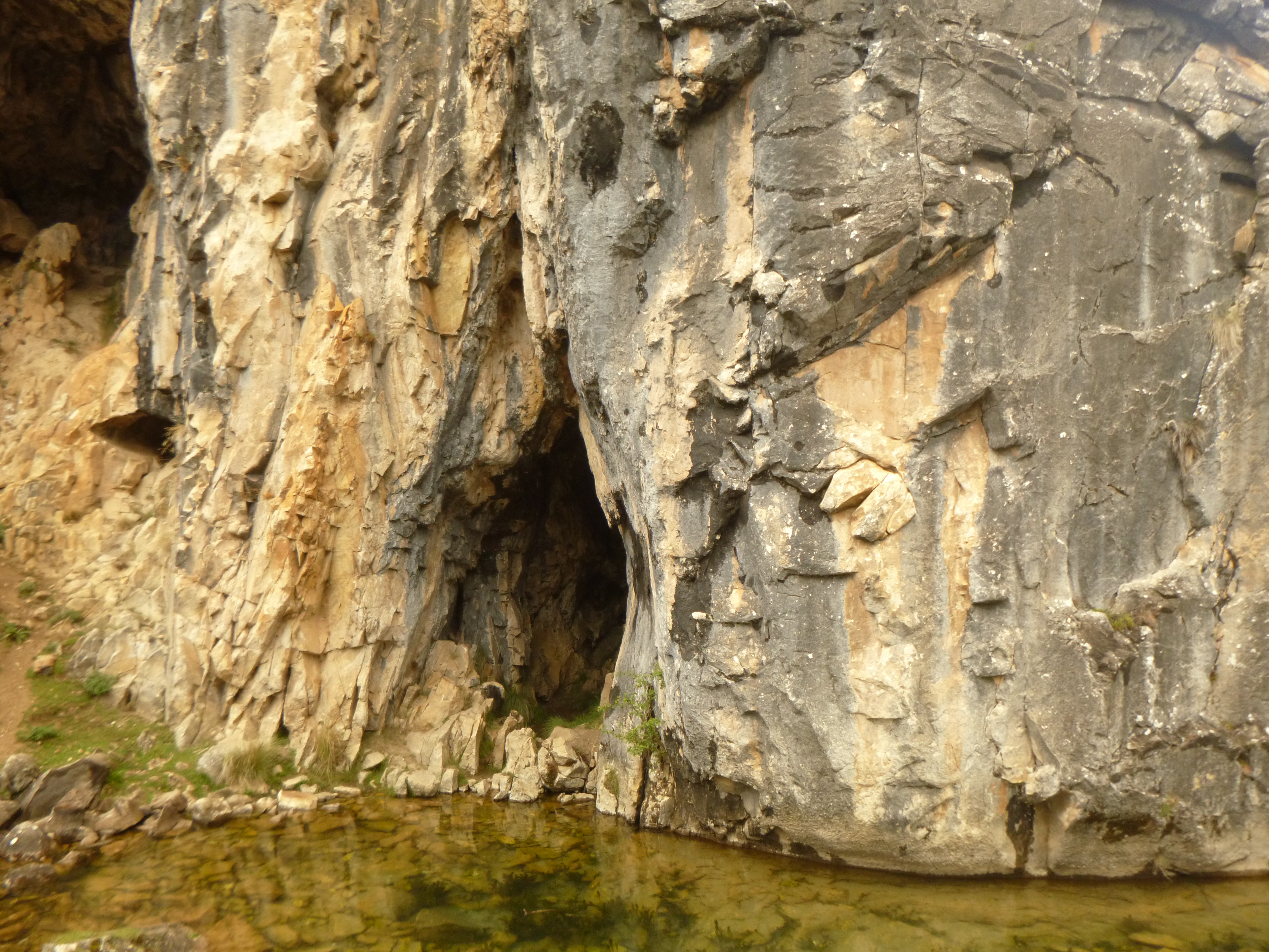
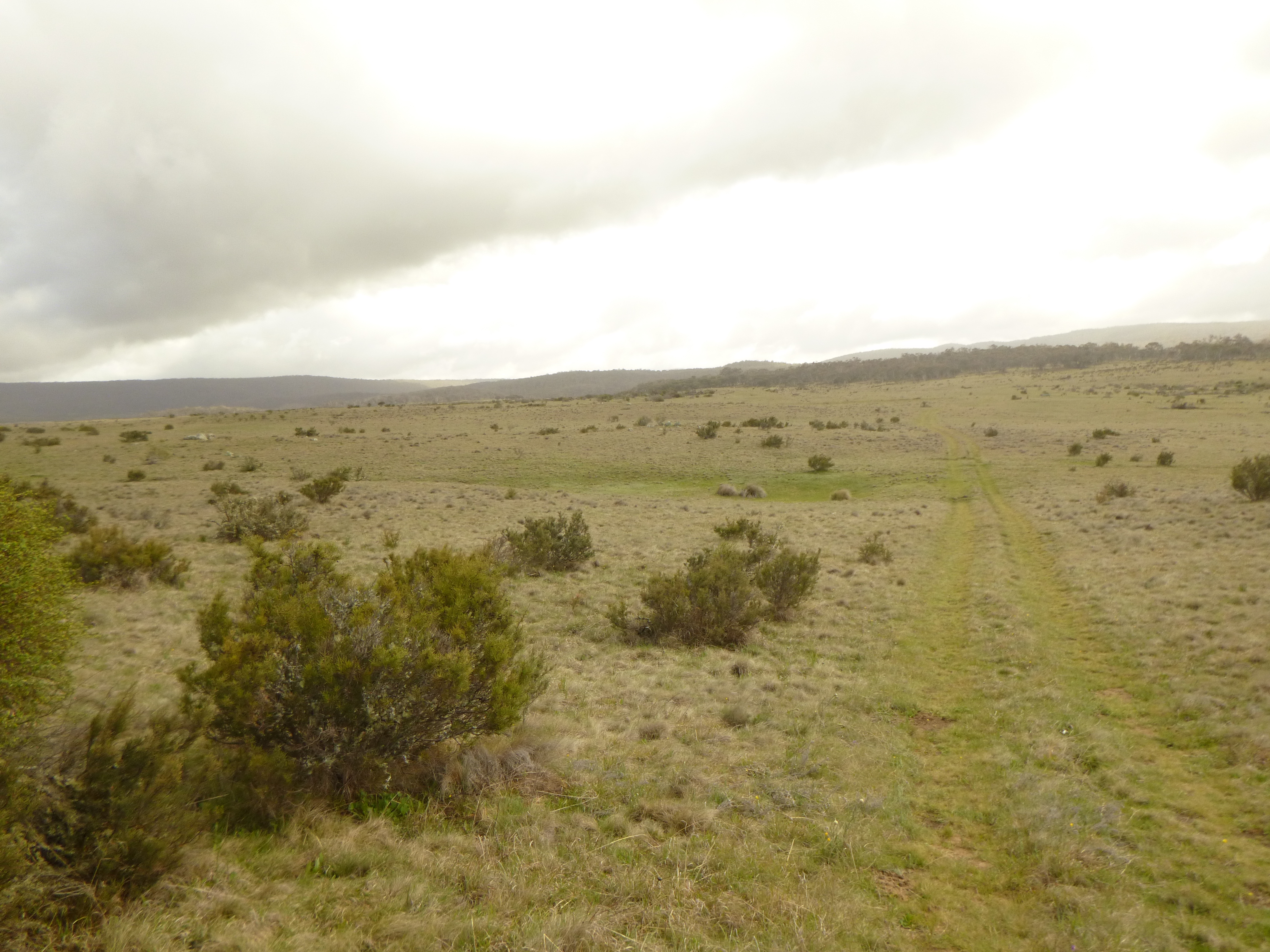
At Coolamine our first priority was, as always, firewood and get the fire going. This is what we keep Gary and Joe for. Easier said than done with the mostly saturated firewood.
But persistence pays off and soon a grand fire was banked up and we could start drying boots and socks. But best of all we could luxuriate around the warm fire as snow fell outside and the wind gusted to its maximum of 90 kph just after 6.00 pm, whistling and whining through the numerous gaps in the single skinned walls.
Coolamine Homestead
This extensive Homestead complex lies on an open grassland under the shadow of Cooleman Mountain. Four buildings survive: Southwells House circa 1885, the Cheese Hut built in 1889, Campbell House circa 1892 and a kitchen built at the rear of Southwells. Campbell House was built as a summer residence for the lessee Fredrick Campbell.

Campbells and Southwells are both constructed with drop slab walls and corrugated iron roofs. The chimneys are drop slab lined with stone and topped with corrugated iron.
Campbells has five rooms and very wide floor boards. The slab walls have been wall-papered with old newspapers which make for interesting reading. Southwells has four rooms and the same wide floor boards. The Cheese Hut is a one roomer of log construction and a dirt floor and was used for storing food.
PS: Coolamine sports a NPWS long drop toilet in the day use area several hundred metres from the homestead. A bit of a nuisance trek for us old blokes at 5.00 am on a bleak, snowy high country morning.
Friday: Coolamine Homestead to Cooinbil Homestead: 11 kilometres
As anticipated, another overcast and drizzly morning. I had hoped to hang around for a break in the weather but by 9.30 am my fellow walkers were doing the agitated ant thing.
Clearly they thought it was time to move on. And so it was out into the freezing gloom in wet weather gear. The original plan was to go cross country from Harris Hut ruins over the Cooleman Range climbing through a pass at 1560 metres before dropping down to Cooinbil Homestead on the edge of Long Plain at 1377 metres.
But navigating over the Cooleman Range in these conditions wasn’t something to be relished. I took the easier option and followed the Blue Waterholes Trail, past Cooleman Mountain Campground, then out to the Long Plain Road. No chance of navigational boo-boos this way. No unhappy campers either.

As we approached the junction with the Long Plain Road a 4WD driving ranger appeared in the drizzling mist. The not so bad news was that a fresh front was heading our way. ETA: 5 pm. Estimated precipitation: 100 mm. Take cover before its arrival. Our nearest shelter was Cooinbil Homestead, now a mere five kilometres hence. Ranger’s advice: head for shelter.
The bad news was that a big posse of mountain bikers were rumoured to be closing in on the hut to take shelter. The even worse news was that some had already arrived and had moved in.
And another forty of the wheeled blighters were leaving Canberra on the morrow. We hot- footed it to Cooinbil. A fleet of mud-splattered mountain bikers trundled by, followed soon after by a convoy of Outward Bound 4WDs. All intent on heading for shelter.
I hadn’t planned on sharing a hut with this lot. Fortunately, come late afternoon several of the MTBers saw the error of their ways and used an obliging Outward Bound taxi service to return to Canberra leaving plenty of room for the more deserving bushwalking types and hard-core MTBers.

Cooinbil Homestead
Cooinbil or The Retreat is a weatherboard two roomer with an external kitchen/fireplace annex and verandah. It has an iron roof and is floored with wide slabs of wood. The internal lining is of cypress pine planks. The double hearth faces into both interior rooms, a bedroom and interior kitchen. By mountain hut standards it is quite fancy and has a great view over Long Plain from its position high above the Murrumbidgee River.

Cooinbil was built in 1905 for A. B. Triggs, a Yass grazier, on the site of a pre-existing 1866 hut. In 1912 the homestead and summer lease of 16.690 acres was taken over by Cooinbil Pty Ltd, a Riverina property owned by Fredrick Campbell of Yarralumla, Canberra. Confused? Campbell’s stockmen would walk mobs of 4000 sheep from the Riverina holding up onto the Snowy high country every summer.
In 1934 Ossie Lewis used slabs from Thatchers hut (2km away) to build the verandah. However, in 1987 a falling black sallee demolished the kitchen annex and part of the homestead which were both repaired by 1994. It also sports long- drop toilets as well as horse yards.
The pesky MTBers
The mountain bikers were already hunkered down in the kitchen drying out around a barely flickering fire. Wasting no time we bagged the adjoining as yet empty bedroom which also had a fireplace. Needing to dry out pronto we fanned out in the drizzle scouring the countryside for any remaining fragments of timber. No mean feat given the decades of firewood collection around this hut.
Firewood secured and sawn, we let Gary loose on wet kindling assisted by a fistful of Joe’s dinky firelighters and a container of mountain biker’s metho. Several deep puffs and the fire flared as did Gary’s eyebrows. Meanwhile other MTBers had been pretty busy too, sampling billets of our hard earned firewood from our verandah stockpile. Foolish of me to doss down in a hut with a bunch of mud-splattered Millennials who have abandoned pack and pole for the dubious pleasures of padded pants and pedals.
The only people seemingly unperturbed by doomsday weather reports were the nearby encampments of tough horse people. Adults decked out in Drizabones and battered felt hats yakked around a huge blazing fire. Kids swooped around the paddocks on their bikes and toddlers waddled around in onesies and wellies whooping it up in the rain and muddy puddles. These were tough cookies. I wandered over and had a chat about the weather and ferreted out some info on tomorrow’s route from Cooinbil to Ghost Gully Campground, though I squibbed the brumby conversation.
Saturday: Cooinbil Homestead to Ghost Gully Campground: 10.1 kilometres.
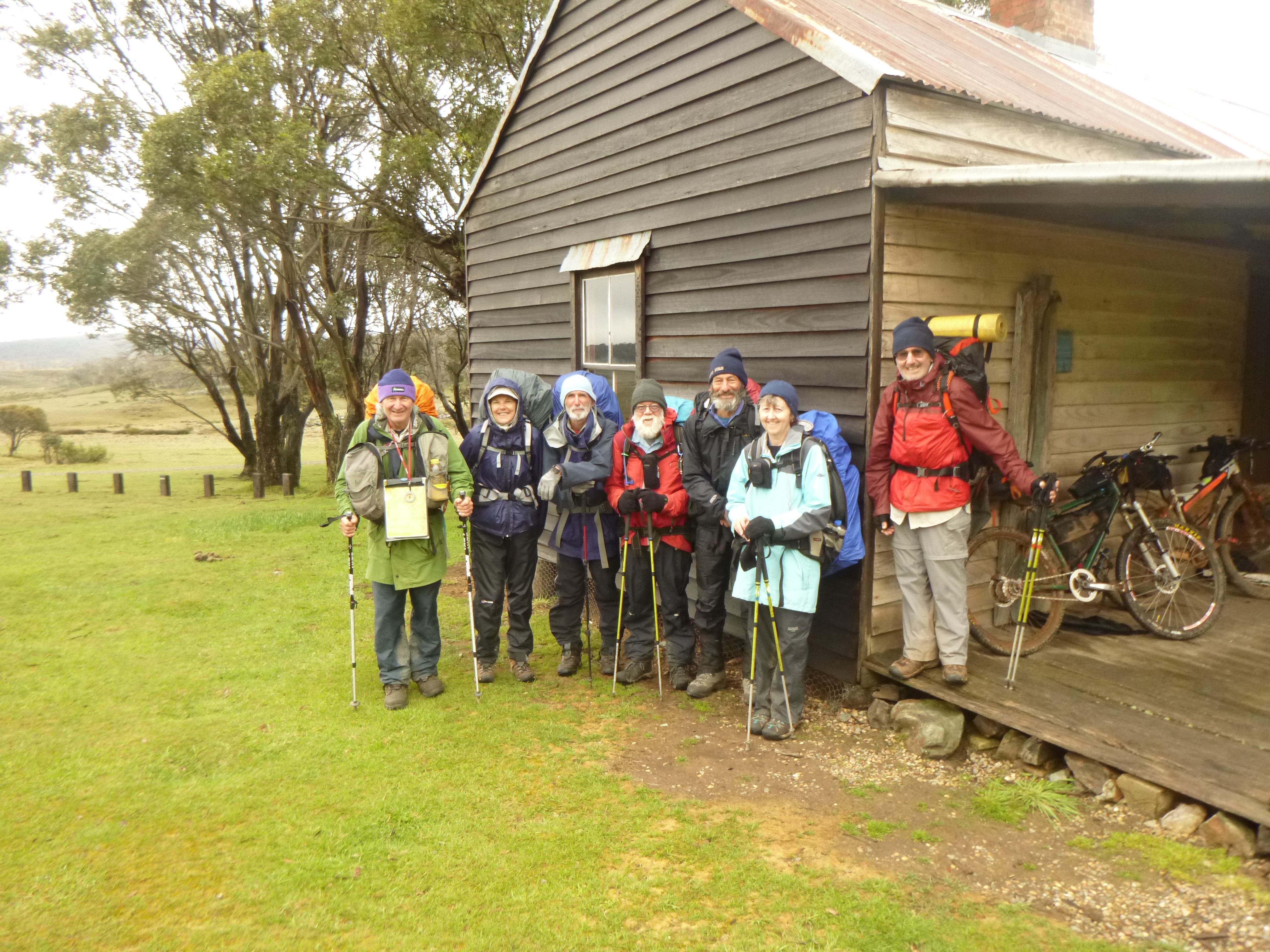
Daylight broke to a clearing sky. Our final mornings walk was a cross country effort following a handy horse trail that skirted the lower western slopes of Skaines Mt (1602 m) and dropped into the open swampy plain of McPhersons Creek. From here we would cut up to Mosquito Creek Trail and then gallop the final four kilometres to Ghost Gully Campground.
This was high plains walking at its best: our route wound through low hills wooded with snow gums. Wildflowers aplenty and sightings of brumbies, black cockatoos and wedge-tailed eagles. The weather was just so: a sunny sky, temperature 4°C and a gentle breeze coming across the plains from the south-west.

Photo Gallery: Wildflowers in McPherson Creek.


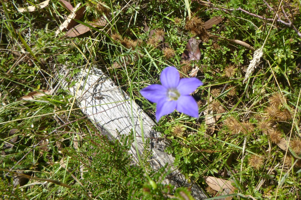
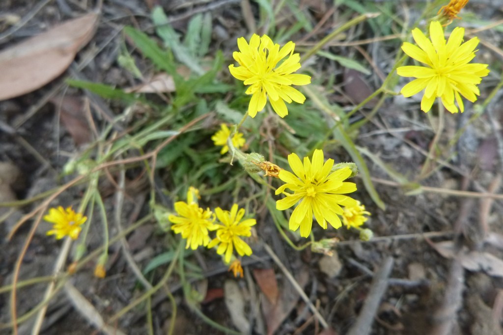
Back at Ghost Gully the vehicles stood unmolested, waiting patiently to ferry us to Long Plain hut for a blowout lunch of stale hiking leftovers and celebratory ales provided by Joe from his esky (still cold). With clouds banking again we made haste onto the bitumen of the Snowy Mountain Highway just as the first spots of the next rain band fell (60 mm apparently). Next stop, Cooma. That evening the Alpine Hotel, Cooma, was the venue for our final evening’s nosh and drinks together. And many thanks to my walking companions whose good humour carried us through several days of indifferent weather.
Some more of my Hikes in Kosciuszko National Park
Useful Info
Maps:
NSW Dept of Lands: Rules Point 1:25000 & Peppercorn 1:25000
Rooftop Maps: Kosciuszko Northern Activities Map 1:50000
Books:
C. Lewis & C. Savage: High Country Huts & Homesteads ( Boiling Billy Publications).
P. Codd, B. Payne & C. Woolcock: The Plant Life of Kosciuszko ( Kangaroo Press 1998).
K. Green & W. Osbourne: Field guide to Wildlife of the Australian Snow-Country (Reed New Holland 2012).
D. Slattery: Australian Alps (CSIRO 2015).
