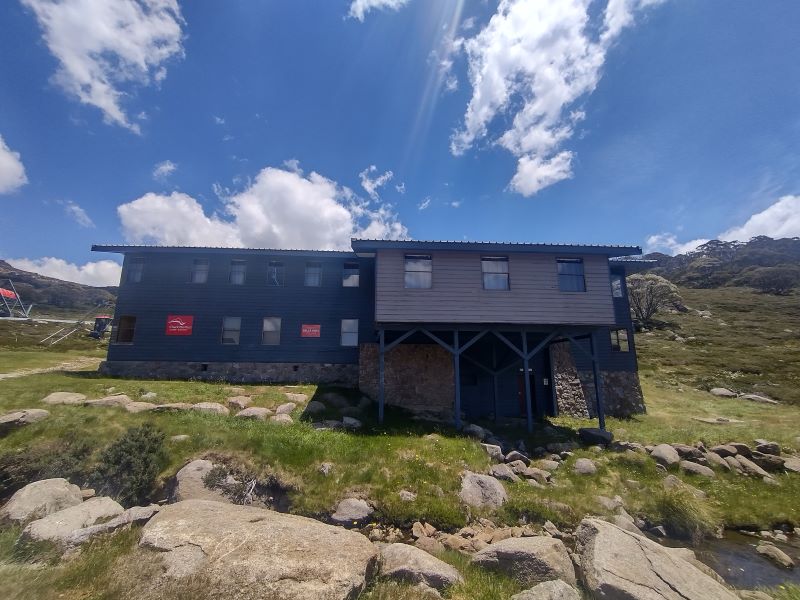
The Pipers Creek Track in Kosciuszko National Park is a little known management track that provides access to an aqueduct system feeding Guthega Pondage, part of the Snowy Mountains Hydro Scheme.
by Glenn Burns
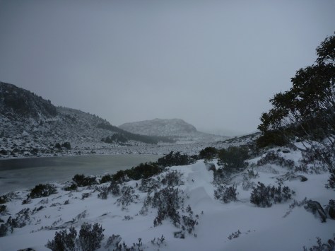
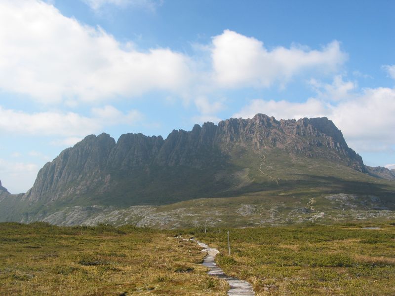
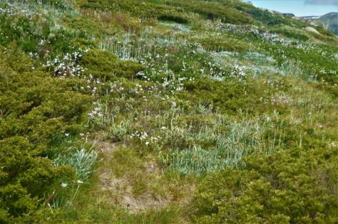
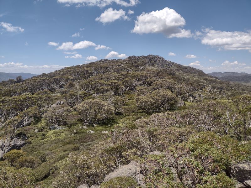
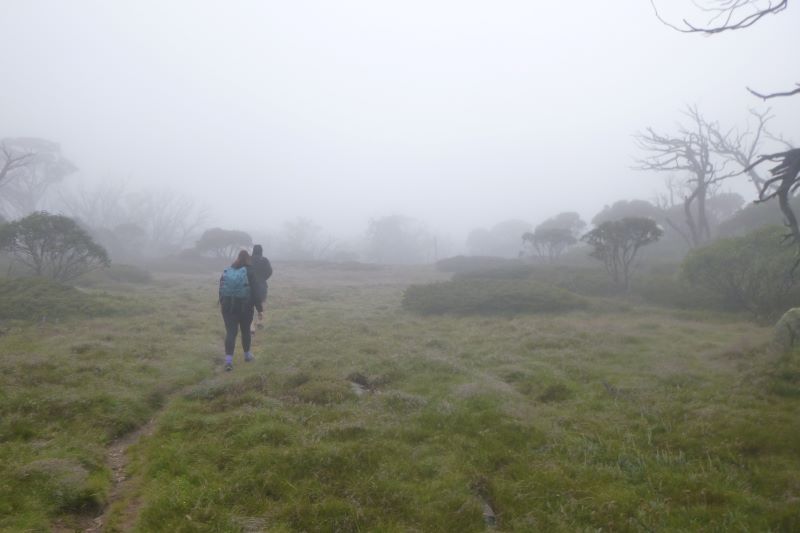
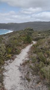
It is also an easy and very pleasant seven and a half kilometre ramble that winds in and out of patches of snow gum woodland and alpine grasslands providing vistas across the Snowy River valley to Rolling Grounds and the peaks of the Main Range.Nothing strenuous and ideal for families; as a bonus it isaway from the hustle and bustle of the Snowies Alpine Walk and the Kosciuszko Summit Track.
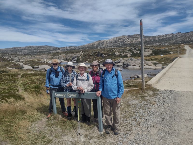
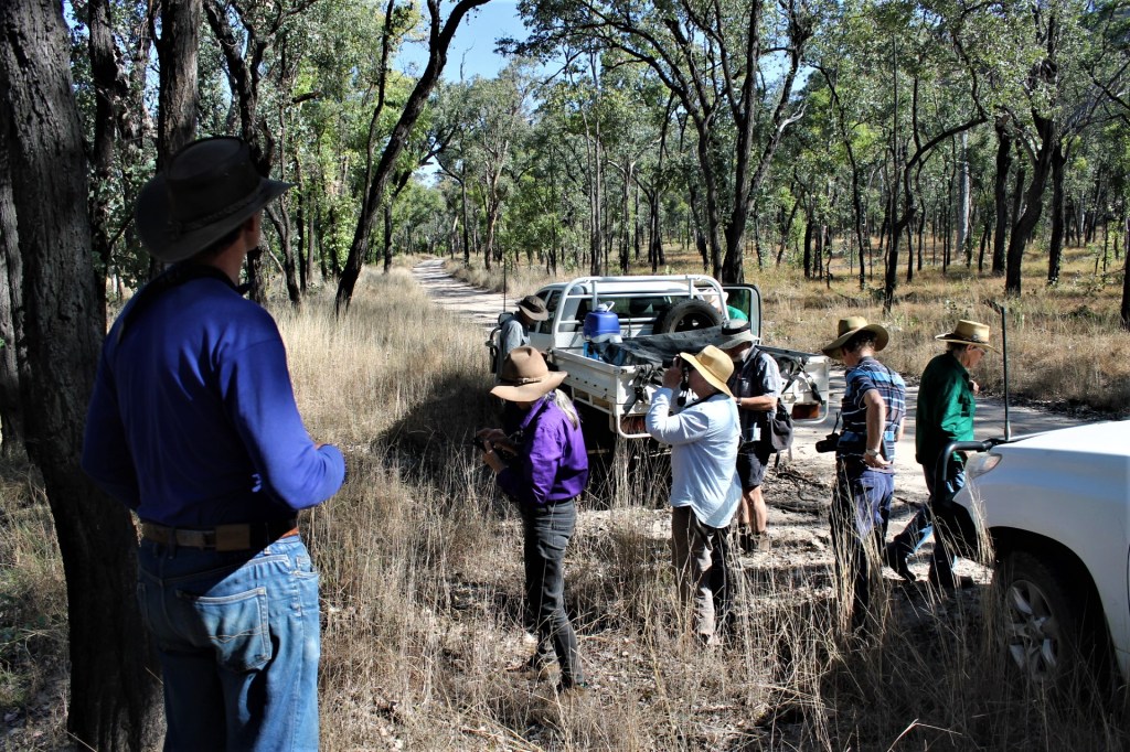
Although it is not on the radar of most bushwalkers, I have hiked it a number of times with family and friends and I never tire of this walk. My most recent walk was a summer trip with friends Joe, Chris, Garry and Neralie.
We started at a very civilised 8.30 am after depositing Garry’s ute on the Guthega Road for transport back to our starting point later in the morning. The walk starts about three kilometres north-east of Smiggins Hole where Dainers Creek and Wragges Creek join Pipers Creek. There is a smallish car park on the Kosciuszko Road where you can safely tuck a car.
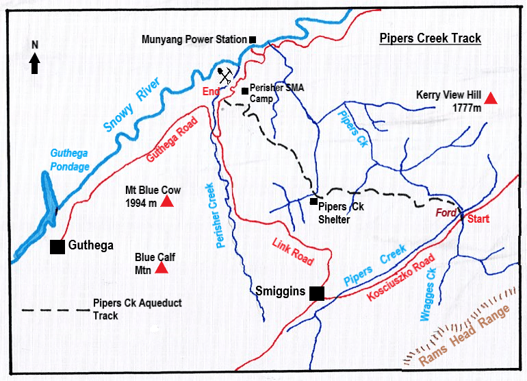
Map of Pipers Creek walk. Source: Kosciuszko Alpine Area map. 1:50,000
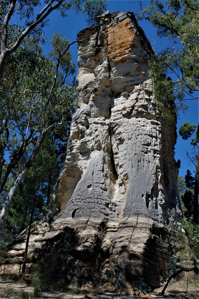
Pipers Creek. Who was Piper?
Who was Piper? Here is the origin of the name according to Klaus Hueneke in his book ‘Huts of the High Country’:
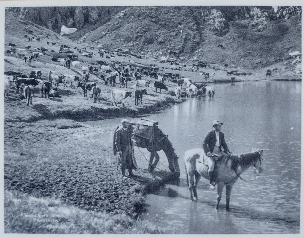
‘James Spencer, when taking his cattle up to summer pastures, used to take a bullock team. The lead bullock called Piper was particularly powerful and at night would often break loose. He would be found next morning down the creek, hence Pipers Creek.’
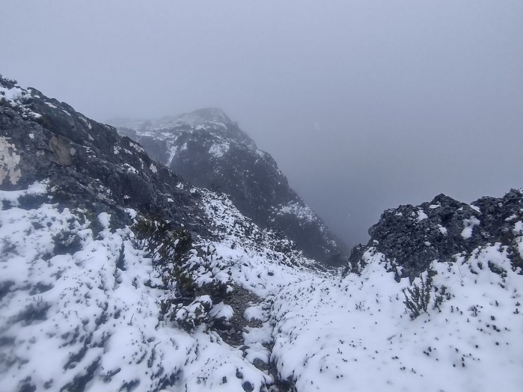
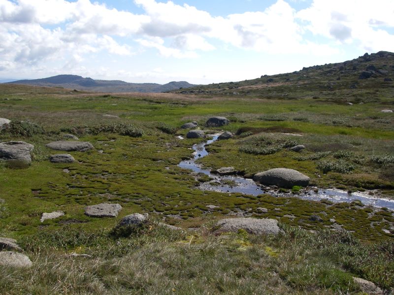
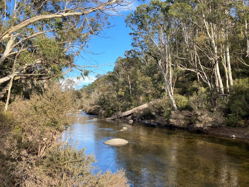
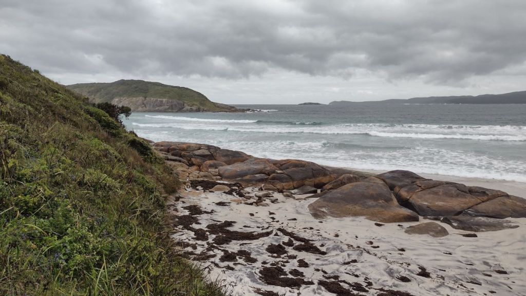
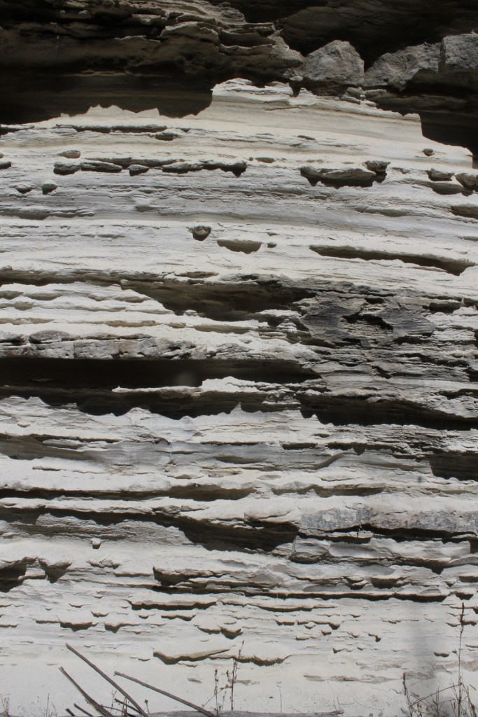
From the road a short descent takes you to an easily crossable ford on Pipers Creek where it executes a tight ninety-degree turn to flow north west. A reflection of the rectilinear drainage common in this section of Kosciuszko National Park.
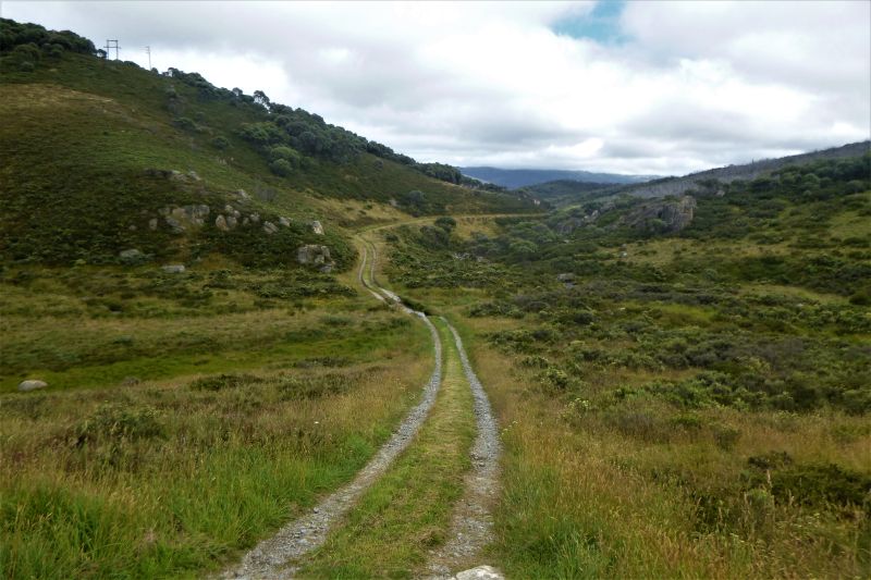
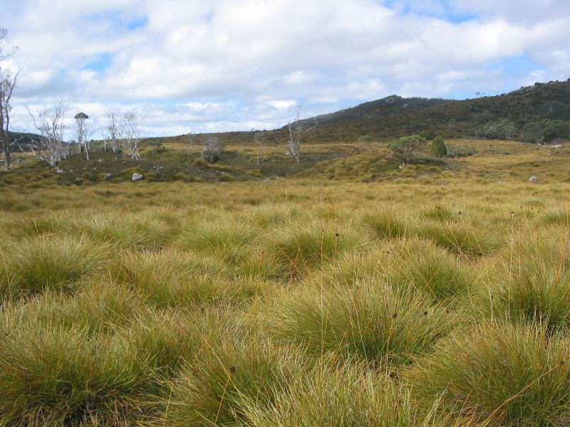
The path we followed is a very obvious 4WD management track. It commences in the valley of Pipers Creek on grassy flats called ‘frost hollows’. These are grassy plains which are the result of dense cold air draining from high tops and pooling on creek flats below. Usually totally devoid of shrubs or trees. The otherwise ubiquitous snow gums are unable to thrive in these freezing conditions but are found higher up on the nearby hillsides.
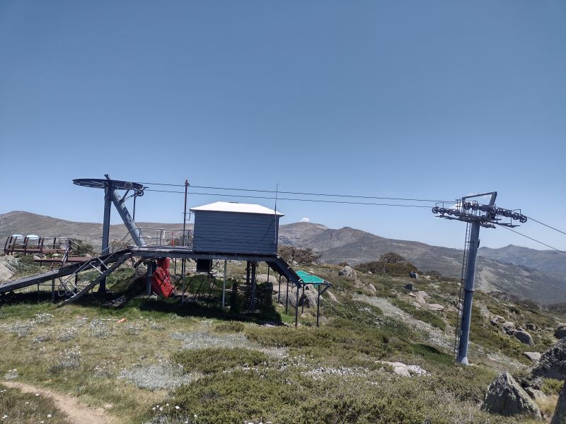
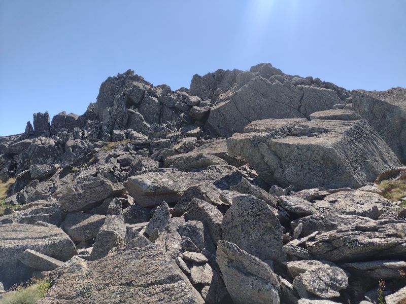
Pipers Ck Management Track
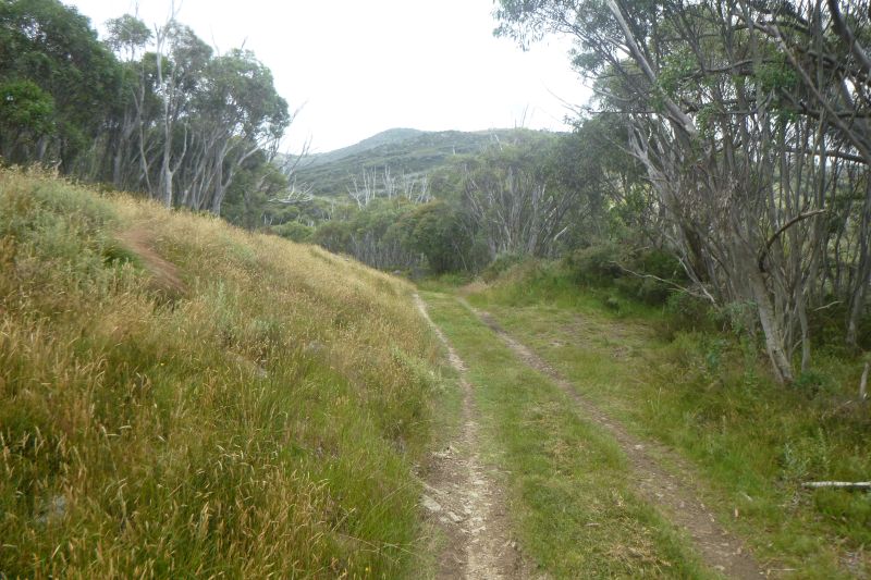
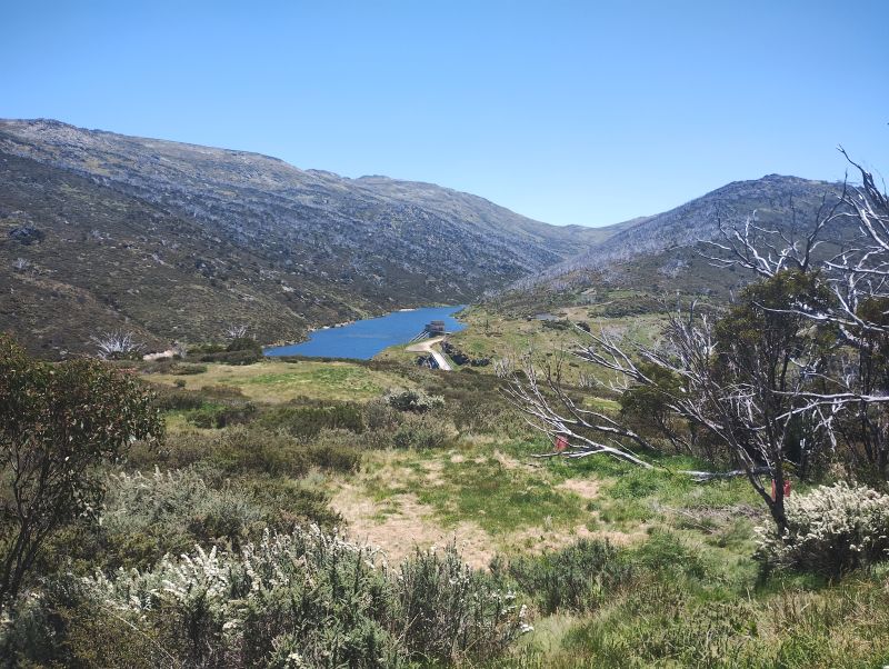
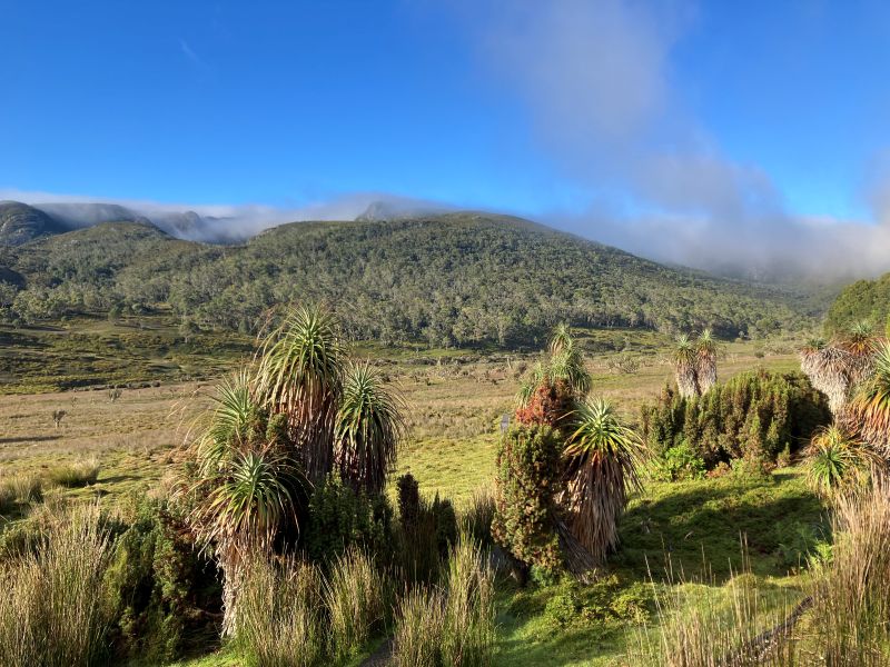
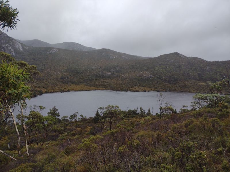
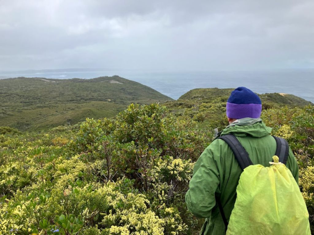
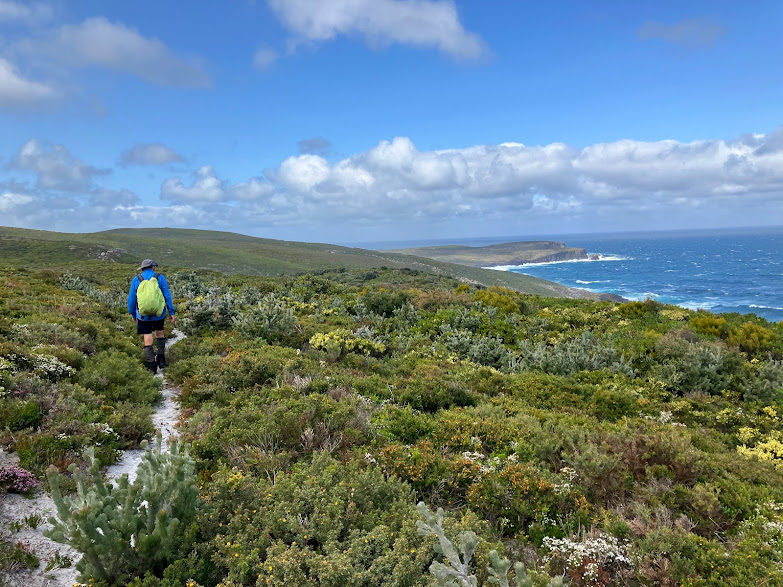
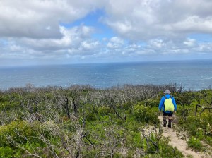
Our path dipped through this grassy plain before climbing steadily to the 1600 metre contour. After a kilometre we entered the first of several patches of snow gum woodland. At each gap in the woodland we had superb views out to the north, over Guthega Pondage in the Snowy River and the Main Range in the far background.
Belts of snow gum woodland.
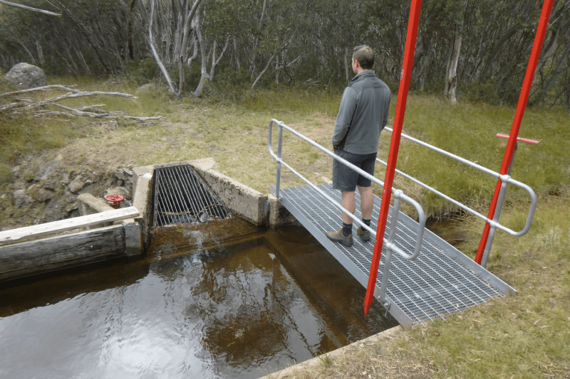
Aqueducts in Kosciuszko National Park
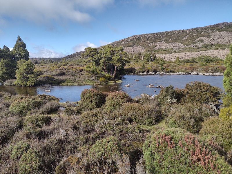
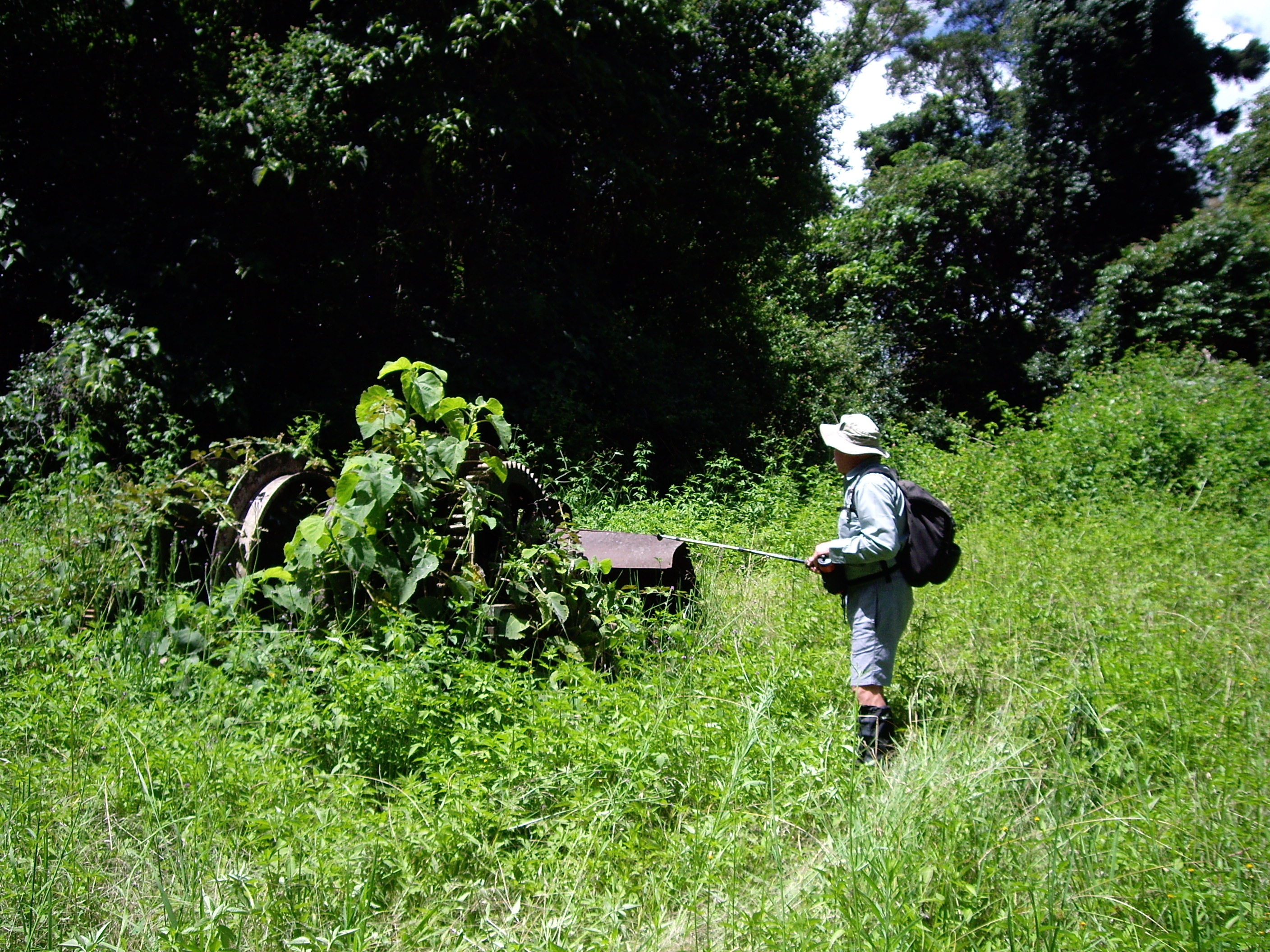
Following the 1600 metre contour line our track paralleled the Guthega Pondage aqueduct. The track providing the necessary access for maintenance purposes. It wasn’t long before Garry and Joe discovered the various sluices, channels and pipes that make up the aqueduct infrastructure. Their favourite engineering activity was to lift the sluice gate and allow any built-up sediment to flow downslope in a small rush of water, thereby flushing out any silt.
Aqueduct channel near Pipers Creek Aqueduct Shelter.
Aqueducts are but a minor part of the engineering masterpiece that is the Snowy Mountains Scheme. The Pipers Creek aqueduct intercepts and collects water from tributaries that might otherwise bypass the Guthega Dam. Even though the aqueducts and earthen diversion channels were constructed from 1953 to 1956, they still appear to be well maintained and functioning as intended. With some help from passing bushwalkers.
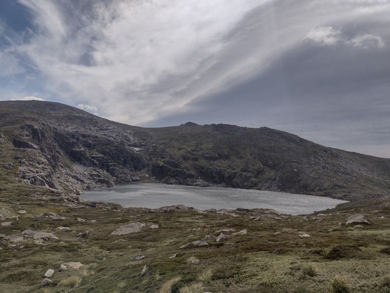
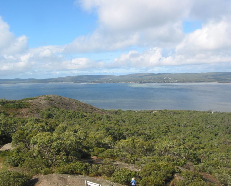
Guthega Pondage.
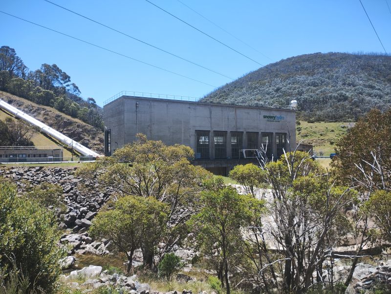
Snowy Hydro’s Munyang Power Station fed by Guthega Pondage.
I have come across other aqueducts before on my journeys across the Kosciuszko landscape. A few years ago, I followed another aqueduct track, the Munyang -Guthega Aqueduct track, to get from Whites River Hut to Horse Camp Hut thence to Munyang Power Station on the final day of a hike out of Bluff Tarn. It was an unexpected find and great alternative to the ups and downs of trudging back along the Munyang-Geehi road aka Schlink Highway.
Snowy Hydro Hut on Munyang River
More on Racelines aka Water Races aka Head Races
On one of my Kiandra to Kosciuszko hikes in 2007 we crossed the headwaters of Nine Mile Creek about three kilometres after the Four Mile Hut turnoff and climbed towards Tabletop Mountain. We were following the Tabletop Fire Trail on the Australian Alps Walking Track (AAWT).
In the 1800’s earthen racelines were built to collect water from the flanks of Mt Tabletop and direct the flow to a sluicing header dam for the Empress gold operations.
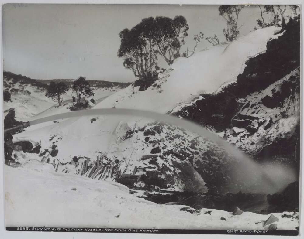
The current AAWT track follows the line of these racelines. Soon after Nine Mile Creek the AAWT ascends steadily to the headwaters of Scotch Creek where hydraulic sluicing from about 1860 to the 1920’s had scoured the hillside in a final search for gold. The head races, water races or racelines collected water from the high range and fed it into pipes fitted with nozzles of decreasing diameter to increase the pressure. Here is a description provided in 1887 by the Government Geologic Surveyor of how a Kiandra raceline worked:
Hydraulic sluicing. New Chum Mine Kiandra.1895. Charles Kerry. nla-obj 141601148.
‘With average rainfall sluicing operations can be carried on at this claim almost all the year round. A constant supply of water is obtained from a dam which the Company has made in the Three Mile Creek. The water is conveyed in a race for a distance of three miles to the workings. The race comes in on the top of the face and the water is conveyed from it, first in 22-inch pipes, and then in 15-inch pipes to the bottom of the cutting, where the pipes are reduced to 13 inches. This size pipe carries the water to the nozzle, which has a diameter of five and a half inches. The pressure of the water at the nozzle head is 120 lbs to the square inch. The system is capable of throwing a stream of water for a distance of 150 feet. The system is duplicated and there are two sets of pipes from the race outlet to the bottom of the workings. In 1885 the amount of gold obtained from these workings was 1,100 oz.‘
The hillside scar was still there, 150 years later, 700 metre long, 100 metres wide and 15 metres deep.
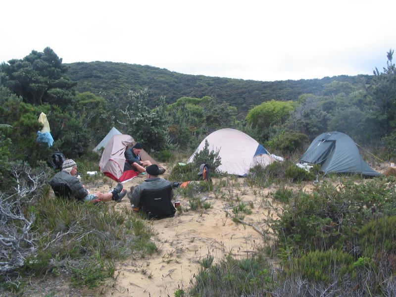
Nearly 10,000 miners swarmed to the Kiandra Goldfields in 1859, enduring severe winter blizzards hunkered down in canvas tents. Some miners even constructed primitive shelters of sod, rocks and branches. Not much different to the tented work camps of the Snowy Mountains Scheme in the 1950’s.
The Kiandra gold rush was short-lived, the shallow alluvial deposits worked out and attempts to find the main reef proving fruitless.
After the 1860 winter only 150 miners hung on. For these modern day pampered bushwalkers passing through the Nine Mile with our down jackets, four season sleeping bags and tents, staying warm in the 21st century was still a tad difficult.
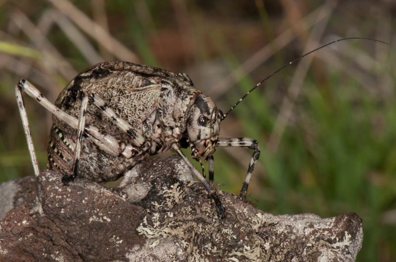
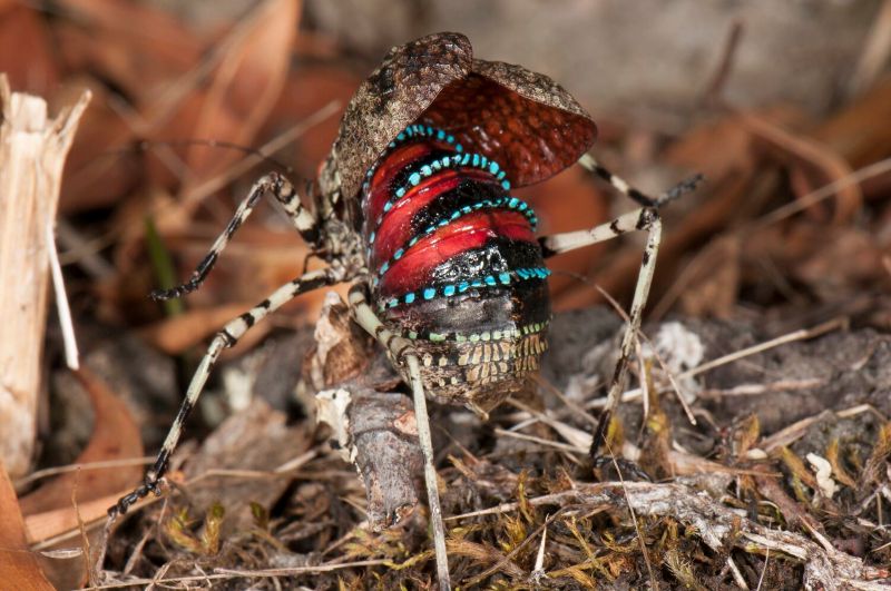
The Caped Crusader, a Mountain Katydid
Meanwhile, back at a summery Pipers Creek the day had warmed up. Now swarming grasshoppers and katydids had appeared on the grassy verges, especially in the snow gum woodlands. Two species seem prevalent.One, a chunky squat katydid, had a distinctive startle warning, making it easy to identify. Except it looks like a beetle if its wing covers are closed. Don’t be fooled.
Normally this species is a nondescript mottled grey-brown colour. But, if disturbed, it raises its wing covers, arches its abdomen and reveals shiny crimson and blue bands. I identified it as the Mountain Katydid (Acripeza reticulata).The female can’t fly but it feeds on fireweed and other plants that may make it distasteful to predators.
They are called katydids because the male makes a sound like it is saying “katy-did’.
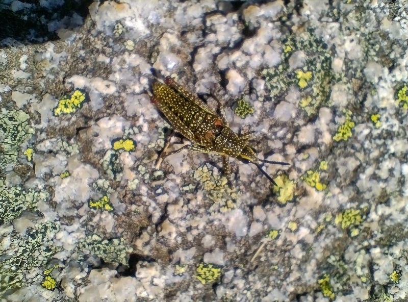
The Spotted Mountain-grasshopper (Monistria concinna) is another alpine insect that is easy to identify. It is large, flightless with a body that is usually olive-brown with a dense splatter of yellow or cream spots. It is very cold-tolerant, hence its ability to survive in our high alpine areas. It is said to have its own version of an anti-freeze.
Its bright colours may serve as warning to any passing lizard/bird that its body contains noxious chemicals. It is possible that the chemicals are derived from its main forage plant, the alpine mint bush (Prostanthera sp).
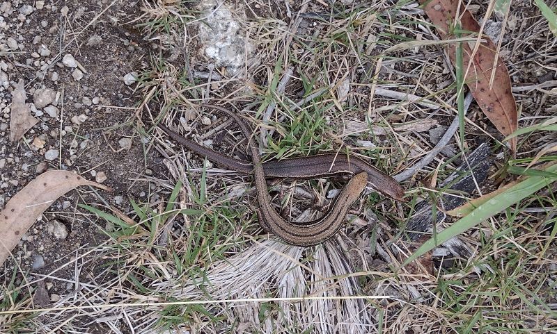
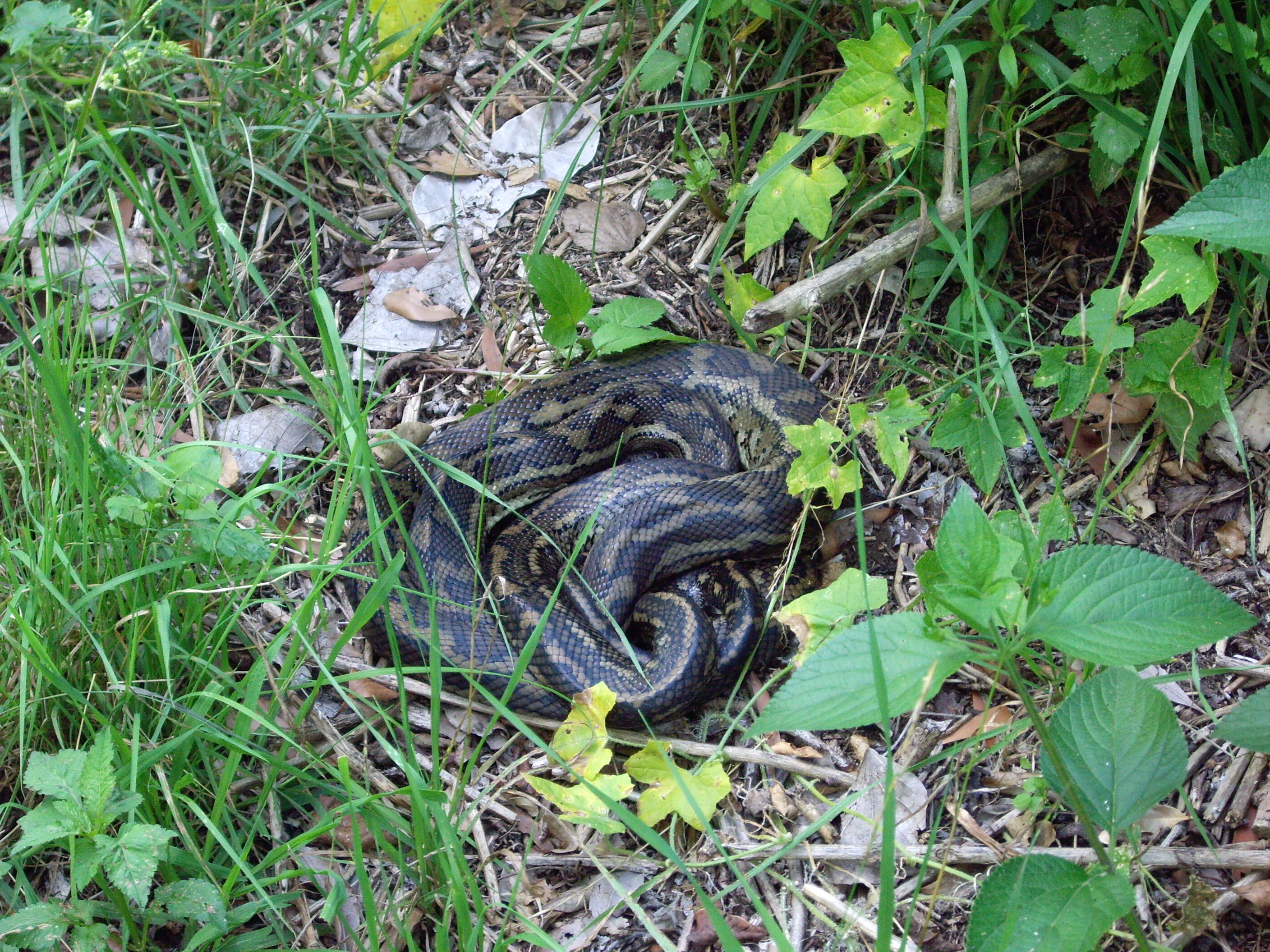
To me, the aqueduct trackappears like a reptilian heaven. With long weeping grass, clumps of tussocky snow grass and warm sunny nooks for a sunbathing snake or three, I am evervigilant. Logic and experience tell me that snakes, dragons and skinks aren’t well suited to these cold conditions and there are only two species of snakes that hang out at this altitude. I reflect on this, but at the last minute I always pull on my trusty gaiters… just in case.
The two snakes are the venomous copperhead and the mildly venomous white-lipped snake. Both feed on frogs and skinks. The docile copperhead grows to respectable 1.7 metre while the slim white-lipped can only manage a paltry 45 centimetres in length.
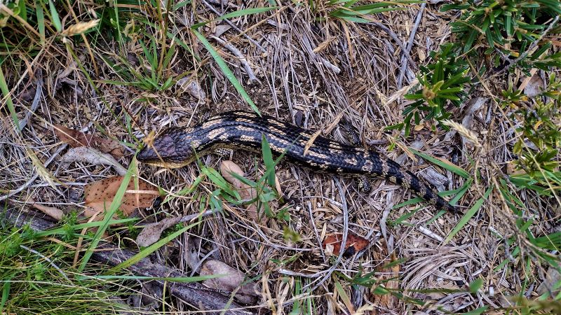
Withno snakes to disturb my equilibrium,I was lucky to see an excellent specimen of a Blotched Blue Tongue lizard (Tiliqua nigrolutea)which quite likes these tussocky grasslands. They emerge from their overnight accommodation in rocky crevices or deep litter for an early morning sun bake before heading off to forage onthe odd beetle or caterpillar that passes by.
Blotched Blue Tongue Lizard trackside.
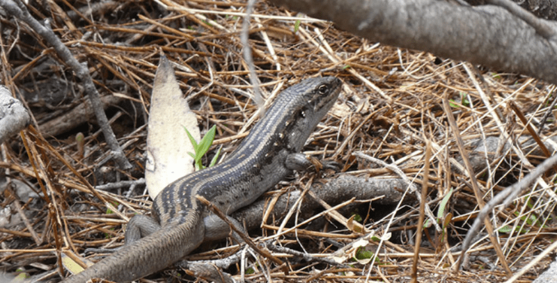
Further on I sprung two nondescript Skinks cavorting in the undergrowth. The most likely ID is the Mountain Log Skink (Pseudemonia entrecasteauxii), the most abundant reptile in alpine areas where it occurs at all altitudes. Their skin was not glossy which helps distinguish them from the Southern Tussock Skink , (Pseudemonia pagenstecheri), a close relative.
Mountain Log Skinks.
But the real prize would have been a sighting of the endangered Guthega Skink (Liapholis guthega). This is the highest occurring skink in Australia, found only in Kosciuszko National Park and the Victorian Alps above 1600 metres up to about 2100 metres. Its habitat is rocky outcrops, tussock grasslands and damp heath.But no luck today.
Guthega Skink. Source: NSW Parks. Bec Byrnes.
Wildflowers
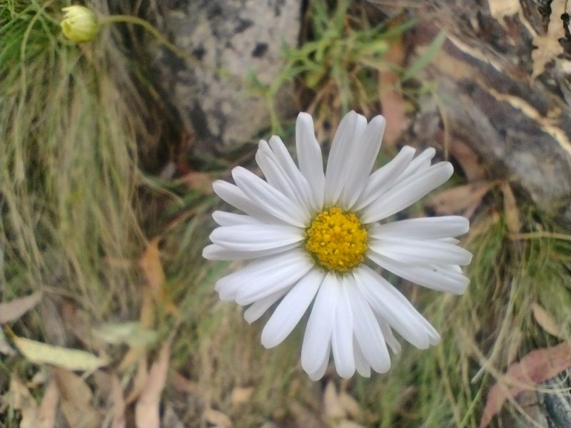
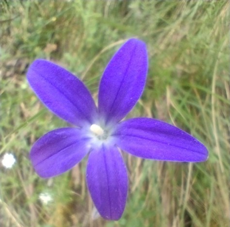
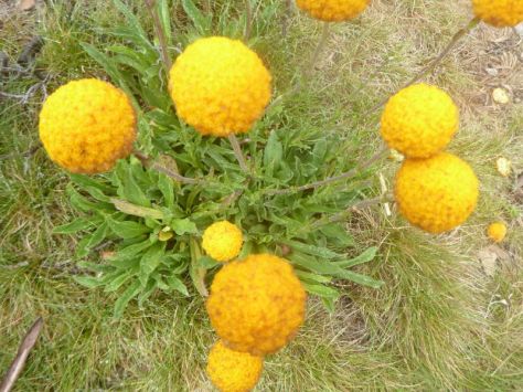
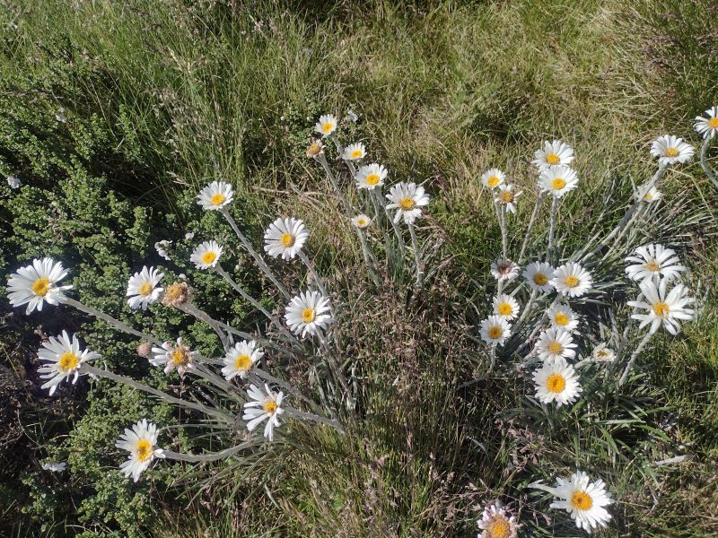
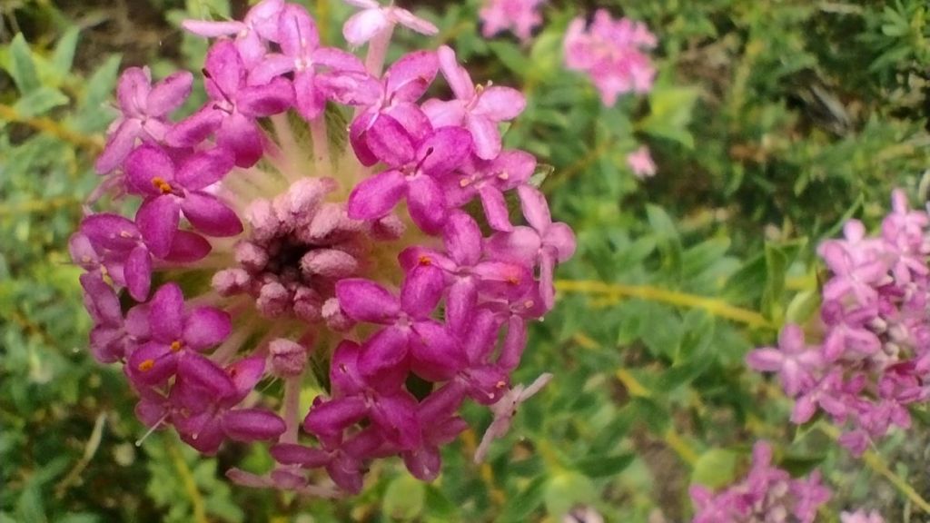
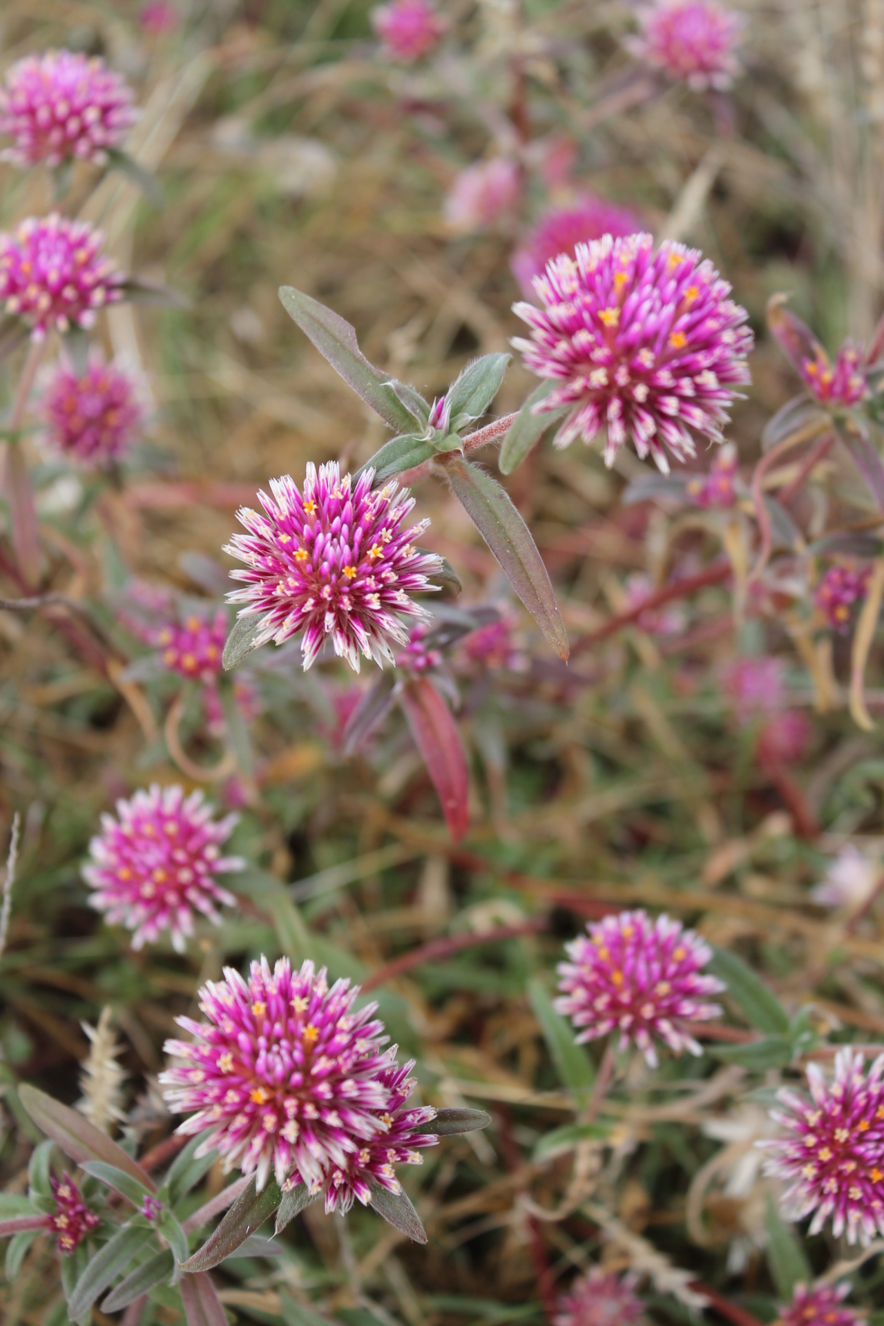
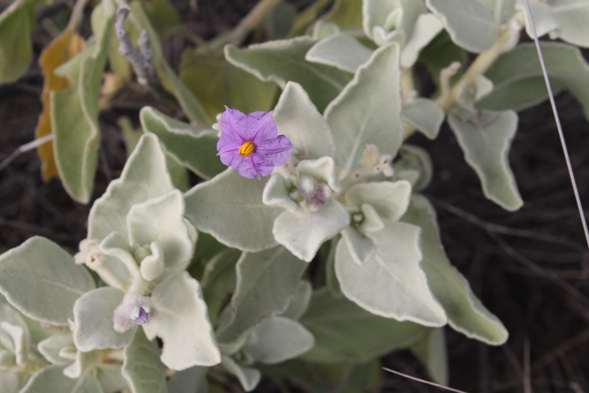
It was well past peak wildflower season but I was still able to find few specimens to satisfy my botanical itches: a Sunray (Leucochrysum sp) Australian bluebells (Wahlenbergia sp), bidgee widgee (Acaena anserinifolia) andbilly buttons (Craspedia uniflora), amongst others.
Sunray. Leucochrysum sp.
Australian bluebell. Wahlenbergia sp.
Bidgee widgee. A nuisance plant with spines that love your socks.
Billy buttons. Craspedia lamicola.
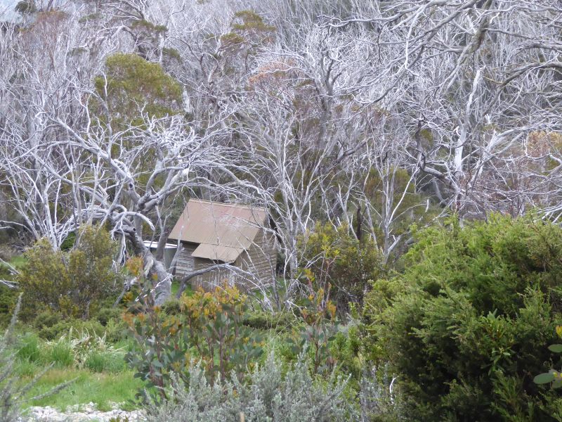
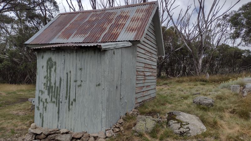
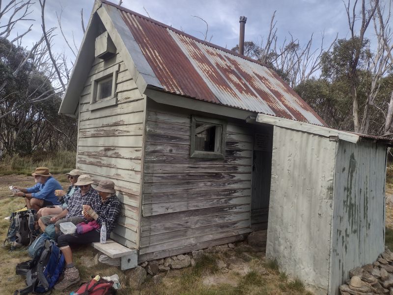
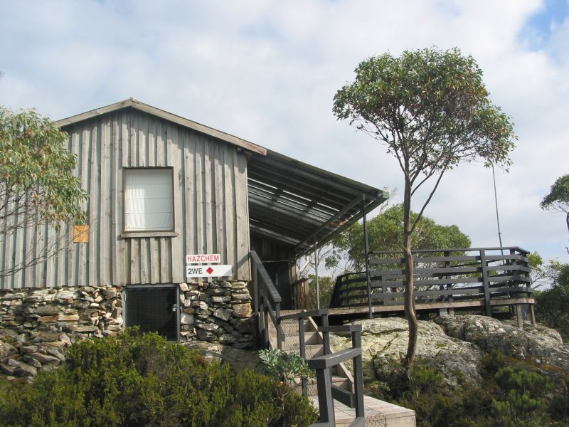
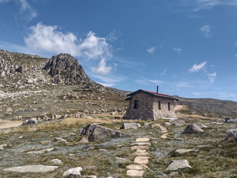
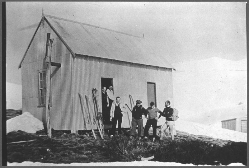
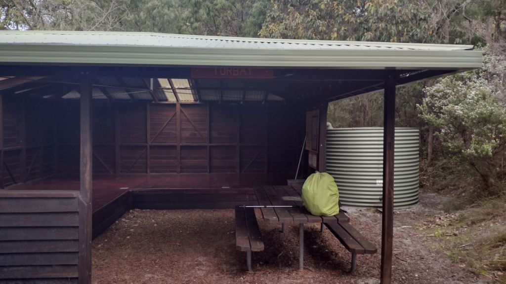
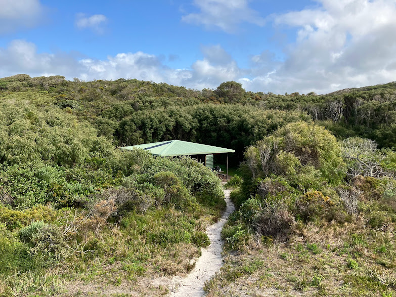
Pipers Creek Aqueduct Shelter
Some three kilometres into our Pipers Creek walk the track descends to ford an unnamed creek. Below the ford the creek drops over a small waterfall that is worth a photo or two. But if you head upstream a little you should be able to find the Pipers Creek Aqueduct Shelter, a still operational Snowy Hydro hut. It is hidden in a patch of snow gums above the creek. Look carefully for a barely discernible pad on your left, 200 metres upstream from the ford.
Pipers Ck Shelter.
The shelter was built in the 1950’s by the Snowy Mountains Authority (SMA) for aqueduct maintenance. It is still used by Snowy Hydro, which explains why it is locked to keep out any of thosebushwalkingorskiing riff-raff who swing by.Or worse still those dastardly E- mountain bikers.
It is a smallish wooden hut with a corrugated iron roof, vertical slab wooden walls and wooden floor. The whole structure sits on huge wooden sleds. I imagine that it had been dragged into position by a bulldozer.
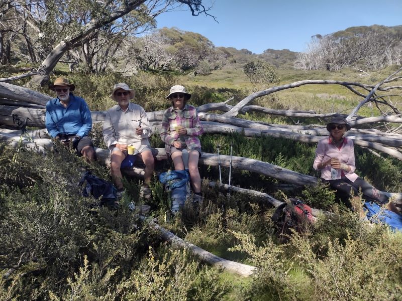
Here is an ideal morning tea spot, equipped as it was with a huge wooden bench along the entire length of its sunny eastern wall. A bonus was the hut’s wall providing a comfortable back rest. The nearby aqueduct infrastructure an added incentive to linger, giving the lads some final moments of delectation.
An ideal spot for morning tea.
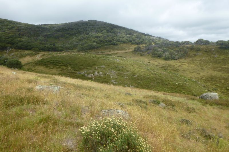
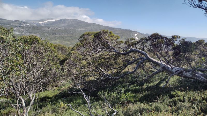
A good feed, some more sparkling engineering chit-chat about sluices and channels and we waddled off back downhill to the ford. From here the track climbs again to the 1600 m contour. The next section provided even better views out to the north-east over the extensive snow grass plains of Pipers Creek valley. Aptly named on my map as the ‘Plains of Heaven’.
Snow grass plains on Pipers Ck Track.
We soldiered on, contouring around to a point on my map marked as ‘Perisher Camp’, some 2.5 kilometres from the ford. No remnants of a work camp though, much to my disappointment.
SMA Work Camps
The SMA had some 100 work camps scattered across Kosciuszko. I haven’t been able to find any information relating to this one. Although there was a Perisher Camp, but to add to my confusion, it is marked at various locations on other maps. During the construction period of the Snowy Scheme, the SMA managed over 100 camps and 8 towns, housing 100,000 workers, many of them migrants from Europe.
Early camps were rows of canvas tents with mess halls for communal dining, recreation and basic washing/toilet buildings. Initially there was no electricity or running water. Not much fun in winter I would think. Here’s a description of winter living conditions for SMA workers that I found in Brad Collis’s ‘Snowy. The Making of Modern Australia’:
‘The winters in the primitive conditions of the Snowy camps and towns imposed a harsh existence…. Little attempt was made to modify the style of housing for the conditions. Prefabricated weatherboard cottages, which would have served perfectly well in Central Australia, were simply transplanted into the mountains… the most precious household resource in winter was water. Pipes often froze and burst, leaving the house without water for cooking or washing. Mothers with babies had a terrible time… Nappies and sick babies and no water made life very hard… frozen washing outside in two metres of snow meant an or so of digging to get the snow away from a clothesline.’
SMA Survey Camp. Source: National Archives Australia.
Back in summer land we reached a junction. Here the track bifurcates. Be sure to check your map… I’m assuming you carry one. Follow the track which bears north and descends steeply through woodland and exits out onto the Guthega road.Otherwise you will be carted off and exit with a long dreary walk back to your car.
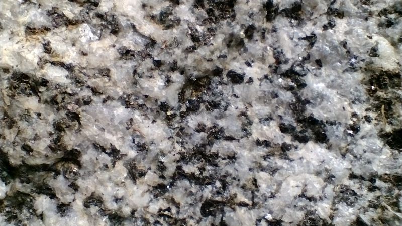
Some three hours after we started we were reunited with Garry’s jalopy which had been stashed near the old SMA quarrywhere I purloined a good hand sample of Mowambah granodioriteof Silurian age (443.8 to 419.2 Ma).
Mowambah Granodiorite
Like granite, granodiorite is a plutonic igneous rock with large crystals visible to the naked eye. I use the cue of its ‘salt and pepper’ appearance to differentiate it from granite. The dominant mineral crystals are quartz (white) and biotite (dark).It outcrops extensively over much of Kosciuszko National Parkand was a source of road base and construction material for the Snowy Mountains Scheme.
Mowambah granodiorite was formed in a deep pluton, part of the Kosciuszko Batholith during the Early Silurian.A batholith is large igneous intrusion with a surface area of over 100 square kilometres.
Garry’s ute was waiting patiently for our return. Windscreen wipers, aerial and wheels still attached, ready to transport us back to our starting point.
With one son about to depart overseas for several years, a nostalgia outing to Tassie seemed in order. However, the planned ascent of Frenchmans Cap was thwarted by an unexpected health issue in the old codger. Undeterred, we settled for the benign and familiar pastures of Cradle Mountain and Cape Raoul.
Our grown-up children have dispersed across the continent and overseas. We have bushwalked, camped and canoed with these sons since they were babies; first carrying them in baby backpacks before eventually gifting them their own packs and gear. Holidays meant bushwalking, camping and canoeing. This is what our family did and they accepted it…. mostly.
Thorsborne Trail. Hinchinbrook Island. Circa 1990.32 km multi-day walk.
Easter multiday hike to South Bald Rock. The Stone gate. Girraween National Park.
As a young family and adults we were fortunate to roam far and wide over Tasmania’s wild landscapes, enjoying some of Australia’s best bushwalking. So what better place for a farewell walk and catch-up.
Ben Lomond 1990s.
Out for an evening stroll. Overland Track 1990s.
Saturday
And so, on a soft gray Tassie Saturday afternoon in March, three lads and I met at Hobart Domestic Terminal and piled into our hire car. Wife had opted out of this boys-own expedition. Mid afternoon we swung onto the A1 and headed north for Deloraine, overnight. Thence to Cradle Mountain for a few days of hiking.
With the youngster at the helm, we headed off on his preferred ‘scenic’ route over the Central Plateau, the Great Western Tiers, thence to Deloraine. And it was all very scenic. But also windy, cold and misty.
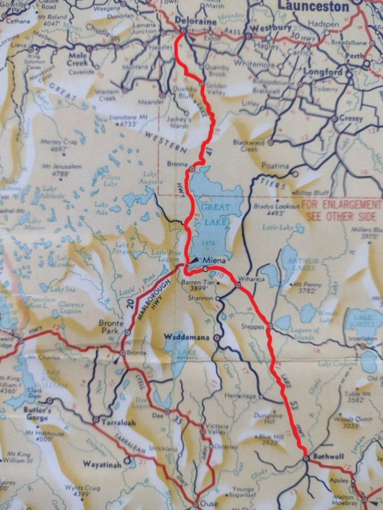
Lakes highway from Bothwell to Deloraine across the Central Plateau.
Central Plateau and Highland Lakes Road
An hour later we exited the A1 at Bothwell and headed NW along a very tortuous A5, aka the Highlands Lakes Road, climbing up to the alpine Central Plateau at 1000 metres. Today, under a leaden sky these windswept plains were pretty dismal. But, as I tried to impress on the offspring, very interesting geologically. Though I sensed some resistance to matters geological. At best, mild enthusiasm, of the ‘let’s humour the old dad’ kind for these recently glaciated 183 million year old Tasmanian dolerite and basalt outcrops.
Section of geology map west of the Great Lake, along the Lakes Hwy. Dominated by glaciated dolerite and basalt bedrock. Source: Geoscience Australia.
But the good news was that I would get another chance to harangue them with more geologic gems when we returned to the Central Plateau to check out Little Pine Lake on the morrow.
The Central Plateau is a landscape dominated by glacial lakes. The A5 skirts the Great Lake on its western side. The lake is vast. Thirty kilometres on its long north-south axis and eleven kilometres east-west. I read somewhere there are 4000 lakes on this plateau and looking at my topo map I wouldn’t be surprised by this claim.
Highland Lakes District. Central Plateau. Source: Geoscience Aust. 1:250,000
Strung along the shoreline are a series of little villages: Miena, Liawenee, Reynolds Neck, Brandum, Breona and Doctors Point. All of a type: mainly ‘huntin’ n ‘fishin’ style cabins and lodges. Preppers according to son two.
Miena. Central Plateau.
The nearby Murderers Hill, Stony Plain and Wild Dog Plains suggestive of the frontier landscape that it once was. Throw in a long freezing Tassie winter and it would have been, indeed, a tough life. And probably still is.
A freezing Tassie winter hike on the Central Plateau. The Walls of Jerusalem National Park.
Our arrival at the Deloraine Motel was heralded by the first spits of the predicted three days of rain/sleet/snow. As we extracted ourselves from the hire car I spotted two bikies lurking on the verandah. No doubt checking out the mainland blow-ins piling out of their townie hire car. Deloraine (pop 3000) is a typical Tassie rural service centre: a bit daggy but having all the accoutrements for locals and any passing tourist trade heading for Cradle Mountain: a few pubs, a bakery, cafes, motels, Woolies supermarket, riverside walk and a service station.
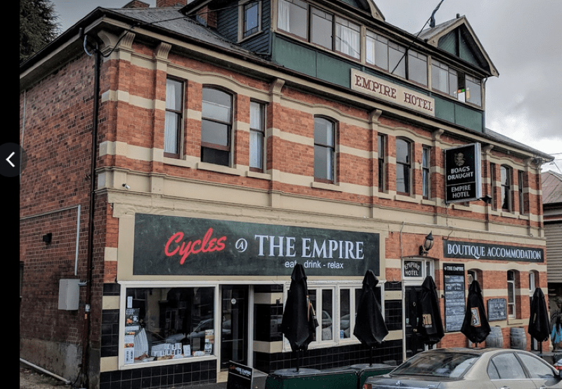
First order of business, a decent feed and a few Boags at ye olde worlde Empire Hotel. Not bad tucker actually. I wolfed down a generous serving of Westbury gourmet sausages served with creamy mashed potatoes, grilled broccolini in a red wine jus. Just a fancy pants bangers and mash with a price to match. The lads tucked into their predictable pub grub: pizzas, parmies, burgers and Boags.
The Empire hotel
Before retiring for the night there was the small matter of provisions for the next few days. On reaching the supermarket, the food list which I had sweated over for hours and emailed out, was promptly discarded. As had been, I should mention, my detailed gear list. The lads scattered to the four corners of the store carting back armfuls of their favourite travel/hiking foods. It was pretty obvious that my suggested Back Country freeze dry Spag Bol and wheatmeal biscuits wouldn’t cut it.
Sunday
Rain drummed down most of the night and daylight brought a damp, overcast and cool morning. Not the best weather for hiking at Cradle. The official BOM forecast was not encouraging so dossing down in a Waldheim bunkhouse at Cradle now appeared a more palatable option than three days of tenting trackside in rain and sleet on Frenchmans.
Today, Sunday, was a benign 9oC to 14oC with 25 mm of showers. Reasonable. Monday was all downhill: 2oC to 7oC with more showers and sleet and snow at altitude. Things picked up for our final day at Cradle: 4oC to 11oC with occasional showers.
A quick feed of weetbix, sliced banana, my cheapskate muesli, a coffee and we hit the road. But not to Cradle. First, we backtracked to the Central Plateau to have a gander at Little Pine Lake. One of the 4000 glacial lakes found there.
Little Pine Lake
This gem of a lake is set high up on the Central Plateau at 1200 metres. Tasmania Parks have provided a boardwalk from the car park to lake’s edge. A matter of walking only 500 metres. Close enough to tempt the passing tourist trade.
Little Pine Lake. Central Plateau.
It is a little slice of Central Plateau alpine landscape: moorland, bogs, glacial lakes, dolerite ridges, massive talus slopes and clumps of those ice age survivors, pencil pines. The landscape is largely the product of the last phase of Pleistocene glaciation some 20,000 to 10,000 years ago.
Shattered dolerite talus slope. Freeze-thaw effect from Pleistocene glaciations.
The Pencil Pine: a Tasmanian Paleo-endemic
Paleo means ancient and endemic means found only locally. That is, the Pencil Pine is an ancient tree found only in Tasmania.
The very slow growing Pencil Pine (Athrotaxis cupressoides) prefers wet soils, hence is characteristically found on flat ground at the edge of tarns, lakes and watercourses. It is the most frost resistant of Tasmanian trees and can tolerate temperatures that kill other trees. Hence it survives up here in the high alpine zone.
Pencil Pine. Athrotaxis cupressoides.
Athrotaxis usually grows as an isolated plant or in small clumps. It reproduces from cones which only release seed every ten years or so. Apart from this slow reproductive rate, it is also highly susceptible to fire and will be under threat if the climate continues to warm.
The Pleistocene Ice Age comes to the Central Plateau
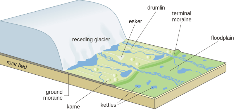
It is thought that an ice cap 65 kilometre across covered much of the Central Plateau. Its legacy preserved in The Walls of Jerusalem National Park and the Central Plateau Conservation Area. The latter somewhat of a misnomer given the loggers are still busy plundering the forests here. The ice cap covered most of the plateau, even peaks standing over 1500 metres today (like Mt Jerusalem at 1459 metres). But towards the limits of the ice cap the ice thinned and flowed around the highest peaks leaving them as rocky outcrops known as nunataks. A landform still found in the Antarctic today.
The erosive power of moving glacial ice cut depressions into the bedrock which later filled with water, forming some of the myriad of glacial lakes we see today.
Glacial lake formed by glacial scouring during the Pleistocene . Pool of Bethesda. Walls of Jerusalem National Park. Summer view.
As well, the retreating ice front (snout) dumped piles of moraine which banked up fluvioglacial streams to create even more lakes. Little Pine Lake is fed by Little Pine River, a tributary of the Nive River. It rises nearby in the Great Western Tiers.
Receding ice front dumps piles of moraine leaving behind a landscape of lakes and depositional features like drumlins, eskers and hummocky ground. Source: USGS
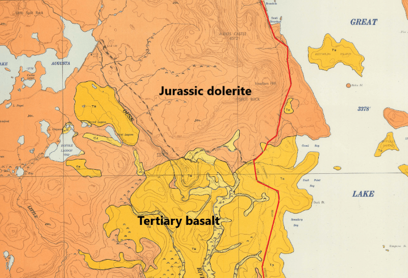
Having exhausted the Pleistocene geology of the Central Plateau, it was time to tootle off to Cradle Mountain. But not before a further excursion into Tasmania’s ancient geological history. All visible from the comfort of our warm hire car. The bedrock of the Central Plateau is predominately capped by basalt (younger) and dolerite (older). These basalt and dolerite surfaces have been scoured by the geologically more recent Pleistocene ice caps and valley glaciers, creating much of the scenery we see today.
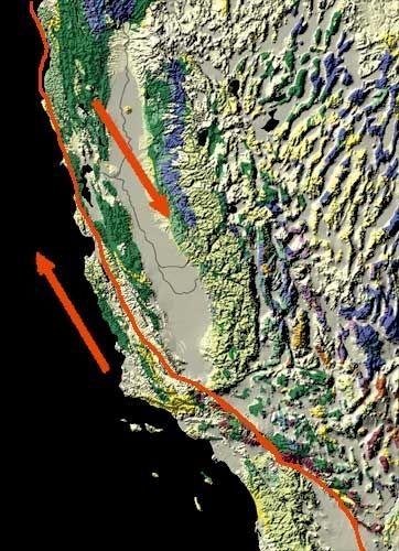
Gondwana tears asunder
About 65 million years ago as Australia and Antarctica finally pulled apart, massive quantities of basaltic magma poured from fissures in the earth’s crust and covered swathes of the landscape of the Central Plateau. This period, known as the Tertiary, saw widespread volcanism across eastern Australia, and indeed, on a global scale. Extensive flows occurred on the Central Plateau with lava also filling ancestral valleys of the Derwent and Tamar Rivers whose headwaters are to be found on the Central Plateau.
The Older Dolerites
Capping the Central Plateau and the Great Western Tiers are spectacular columns of 185 million year old Jurassic Tasmanian Dolerite, displaying the typical ‘organ pipes’ effect. These polygonal columns formed by the cooling of magma contracting under and in (sills and dykes) the overlying beds of sedimentary rocks. This occurred at the breakup of the super continent Gondwana, when Australia and Antarctica were finally separating.
As the sedimentaries eroded away, vast swathes of Tasmania revealed a capping of hard dolerite. Dolerite outcrops are invariably fringed by massive talus slopes of frost shattered dolerite. Tasmanian Dolerite covers about 40 percent of Tasmania, said to be the largest province of dolerite on the earth and is a rarity globally.
Dolerite cliffs on the Central Plateau with a skirting of shattered talus.
Ancient Marine Sediments
Leaving the plateau, the A5 zig-zags down the 500 metre escarpment of the Great Western Tiers to more geological delights. Here, outcropping in road cuttings are the oldest rocks. Ancient quartzites and schists date back some 1100 million years ago, before life had begun on land (Proterozoic). ‘Tasmania’ was at the edge of Gondwana.
Thick layers of sand and mud washed off this land mass and were deposited in a vast area from what is now Rocky Cape in the north through Cradle Mountain, the Central Plateau, and Frenchmans Cap to the south coast.
The sediments compacted to sandstone and mudstone, with later earth movements metamorphosing the sandstone to become quartzite and the mudstone to schists and phyllites. The quartzite, being very hard, forms some of Tassie’s most spectacular mountains.
View of Frenchmans Cap from Lake Tahune Hut. A quartzite mountain landscape. By User:Bourgeois – Own work, CC BY-SA 3.0,
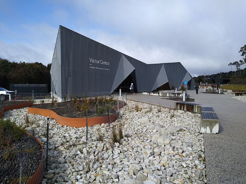
Cradle Mountain World Heritage Visitors Centre
We pulled into the vast car park of the Cradle Mountain Visitors Centre. Pretty much chockers even on this cold, windy and drizzly day. Not having been to Tassie for a number of years, I was taken aback by the sheer numbers of tourists, appropriately clad in outdoorsy clobber: hiking pants, puffer jackets, beanies and rain jackets.
Visitor Centre. Cradle Mountain.
Inside the warm Visitors Centre number three son sorted out our passes and cabin keys. The rest of us had a waddle around. Disappointing, comes to mind. For a World Heritage Area building, presenting the Cradle Mountain Wilderness Area and Overland Track to the world, it could be anywhere on the international tourist trail.
A busy Covid central café; check–in lanes for park and shuttle bus passes; a high-end tourist gee-jaw trap with $200.00 soft toy wombats or $16.00 fridge magnets. No sign of a cost-of-living crisis here. Overall, depressingly commercial but enticingly warm. A well appointed airport terminal comes to mind.
Made of sterner stuff than I, the lads forsook my suggestion that we check out the heated cosy café and its epicurean delights and, instead, ducked off to the outside ‘shelter’ shed (in name only), for a bite to eat. Cheds, chunks of bread, slabs of cheese served up with the cold reality of foul weather for a few days.
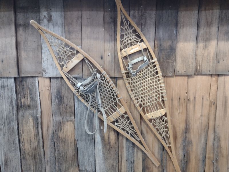
Then onward to the freezer-box aka the Interpretative Centre. It had seen better days. I swear the exhibits were much the same as I had seen some years ago. Still sporting photos, tat and piles of display folders. But the folders had heaps of useful natural history stuff. I was taken in by a pair of ancient tennis racket snowshoes tacked to a display wall. Canadian Mountie style. The troops, by now needing to thaw out, stalked off to the start of the Enchanted Forest Walk.
The Enchanted Forest Walk
This easy 1.1 kilometre circuit gives visitors a quick taste of Tassie’s subalpine wilderness. It starts and ends at the Pencil Pine Creek bridge and the hardened path makes it suitable for all comers. As the track heads upstream on Pencil Pine Creek it passes through button grass moorland.
Enchanted Forest Walk. Source: Tasmanian Parks & Wildlife.
Button grass (Gymnoschoenus sphaerocephalus) is a sedge that grows in large clumps or tussocks and dominates the flatter boggier terrain around Cradle Mountain. It is unmistakable with hard, dark button-like seed heads and long slender green-gold leaves.
Leaving the button grass moorland, the track then ducks into cool temperate forest which lines the banks of the creek. The three trees which I could identify were myrtle beech (Nothofagus cunninghamii), deciduous beech (Nothofagus gunnii) which is the only winter deciduous tree in southern Australia, and pencil pine (Athrotaxis cupressoides).
Cool temperate forest lining Pencil Pine Creek.
The circuit exits the forest at Peppers Cradle Mountain Lodge which fortuitously houses a public restaurant and boozery. A cursory glance inside revealed the clientele enjoying a tankard or three and tricked out for their next adventure when the misty rain cleared. Again, surprisingly, the offspring passed on a schooner of Boags with Gen Boomer and hot-footed it off to our digs in a cabin at Waldheim. Apparently, we were here to do a lot of hiking.
Peppers. Cradle Mountain.
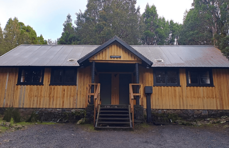
Waldheim Cabins
Not in the same class as Peppers , ourrustic bunkhouse sported two bedrooms with two double bunk beds each, a small but functional kitchen/dining area with all mod-cons. Heaters kept the rooms at a toasty 13oC. Very cosy. The freezing midnight trip to the outside ablutions block a less attractive proposition. But a big bonus of the Walheim Cabins is their proximity to the start of the Cradle Valley/Mountain walking tracks and our isolation from the hordes at the ritzy Peppers or Cradle Big 4.
Karana Bunkhouse. Waldheim. Source: Tasmanian Parks and Wildlife Service
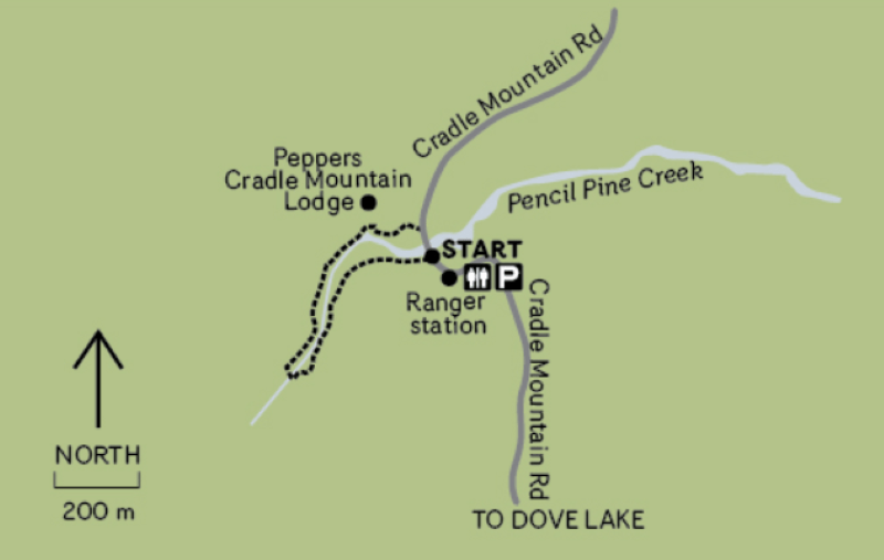
Map of our walks in Cradle Valley
I quickly got a message that slacking around in the comparative warmth of cosy Karana was not on this afternoon’s agenda. Donning our WW2 Atlantic Convoy Kit we ventured out into the elements. As befitting born and bred Queenslanders, we had made the incongruous decision to step out in shorts rather than long trousers and rain pants. They breed them tough and stupid north of the border.
Wet weather gear for a cold wet day . Cradle Mountain.
Middle child, having more experience of living through miserable cold wet winters, was suitably togged in long trousers and Hi-viz fleece. The latter, he announced, so we could find him in the snow tomorrow.
Hi-viz fleece outfit on Ronny Creek boardwalk. Cradle Mountain National Park.
After several hours of slogging along in the wind and freezing rain I swear my bare legs were borderline frostbitten and discoloured with great red blotches. My ancient foxed and furred Tyrone T. Thomas Tassie tome advised that:‘Warm, waterproof clothing is essential’. His italics for emphasis. Lesson learned.
Damp afternoon. Cradle Mountain.
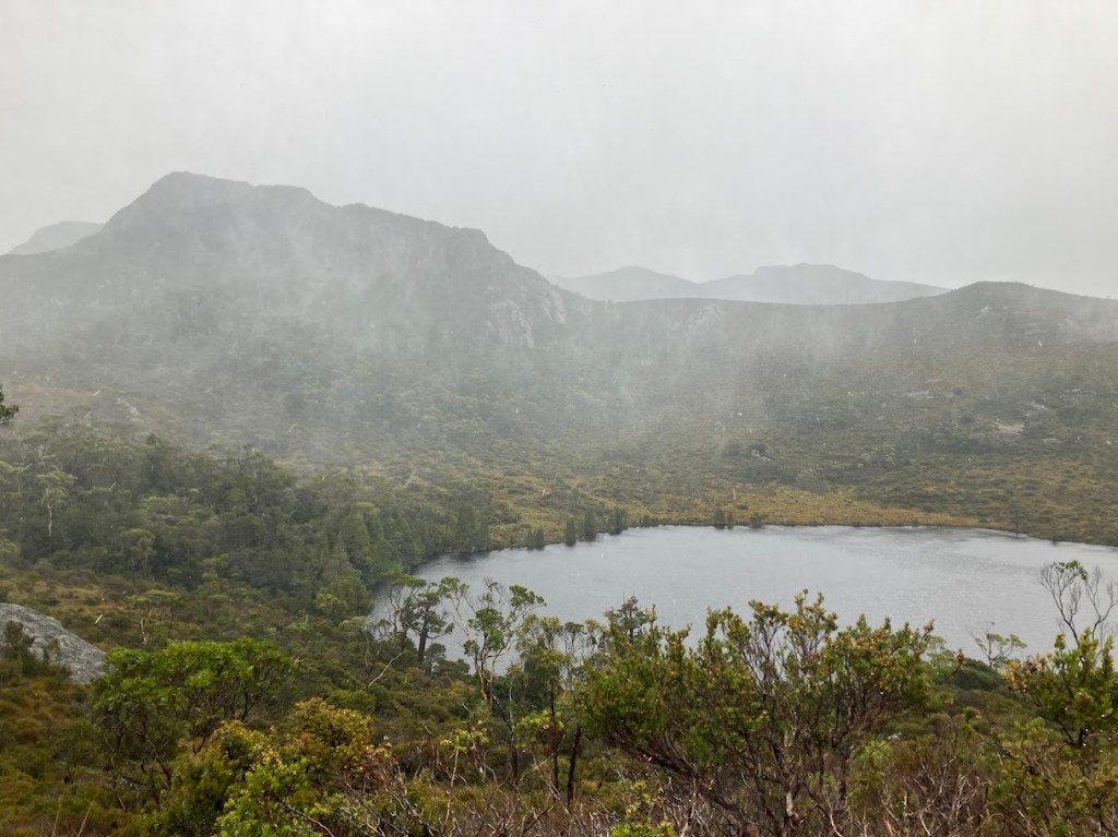
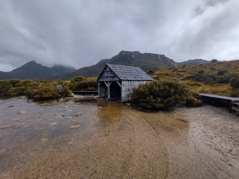
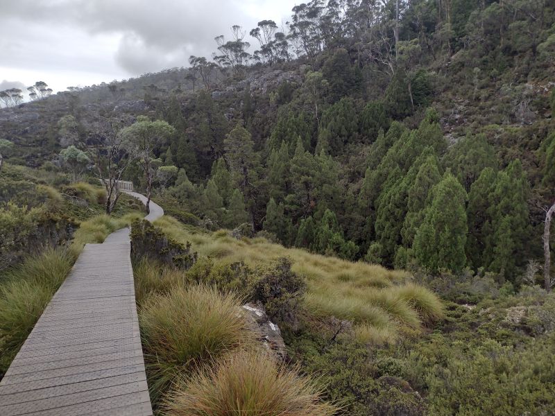
The afternoon’s plan was to nip over to Dove Lake and the Boat Shed. Which was a good choice given that the surrounding tops were shrouded in mist and rain. As, indeed, was our lowland option. Wind, rain, and mist. This is an easy six kilometre return walk via Lake Lilla, all on boardwalks and tracks.
Lake Lilla.
The Boatshed
The boatshed was built by the area’s first Ranger, Lionel Connell in the 1940s. The shed was constructed mostly of King Billy Pine. Some restoration work was done in 1983 but the shed is mostly original. The now vacant structure was commonly used until the 1960s. Huon Pine boats ferried passengers around the lake in the 1930s. The boatshed provides the reference point for photos of the stunning mountain scenery.
The Boatshed on Lake Dove. Cradle Mountain National Park.
We made it back to Waldheim, drowned ship rats; changed into warm gear, hovered over the wall heaters and rigged up our wet kit to dry overnight. My chefs got busy with a pasta extravaganza, having rejected my offer of sachets of freeze-dry Back Country Beef Teriyaki or Spag Bol.
Monday
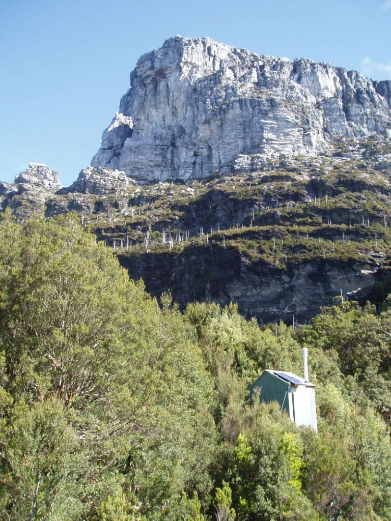
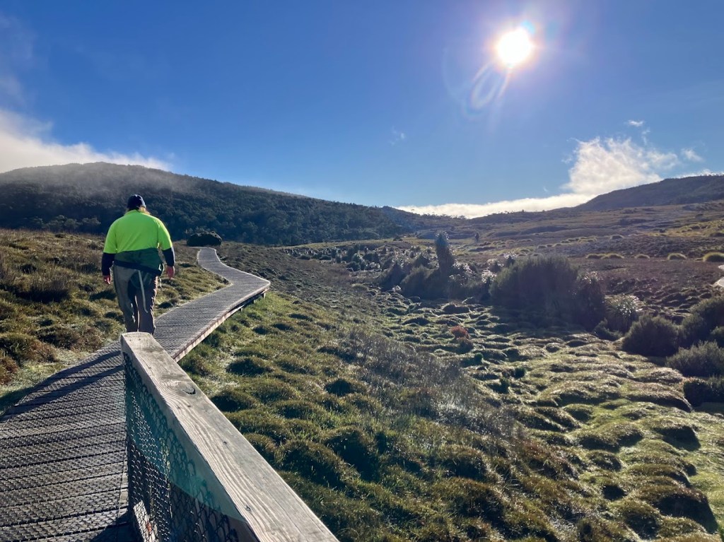
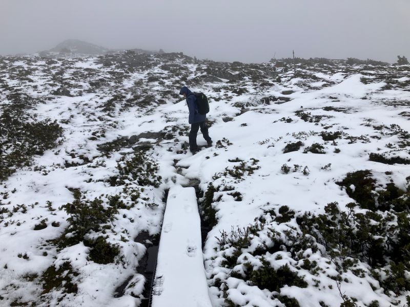
And so to the day of our main walk in Cradle Mountain. I peeked out. The high tops were dusted in snow with cloud building quickly. Showers and mist drifted over the moors below our cabin. The BOM promised a 2oC minimum and 70C maximum for Cradle Valley. And that’s a forecast somewhere 600 metres lower than the high tops.
Snow clouds gathering over the high tops. Cradle Mountain National Park.
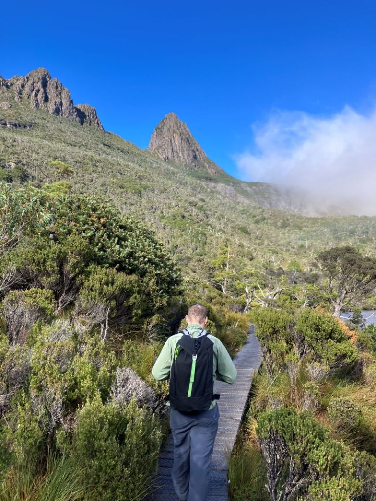
The Horse Track
Our planned walk was to nip out of our front door, cross Ronny Creek, turn right, take the Horse Track to Crater Peak, tootle along the exposed Cradle Plateau, swing down to Marions Lookout and head back to Waldheim. An easy day walk.
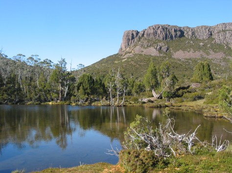
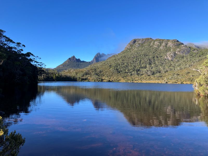
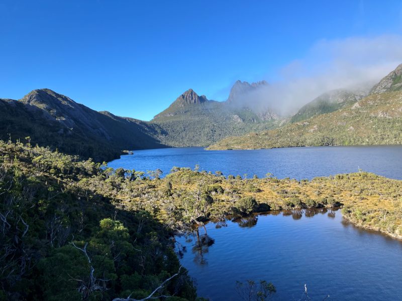
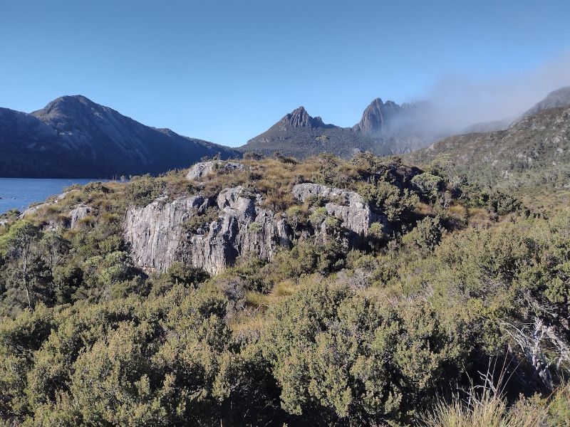
Marions Lookout from Dove Lake. On a fine day. Cradle Mountain National Park.
I had walked this track to Kitchen Hut and back via the Face Track way back in the late summer of 2007, so I convinced the troops that a jaunt on the Cradle Plateau was right up our alley.
Cradle Plateau on a fine late summer’s day in 2007.
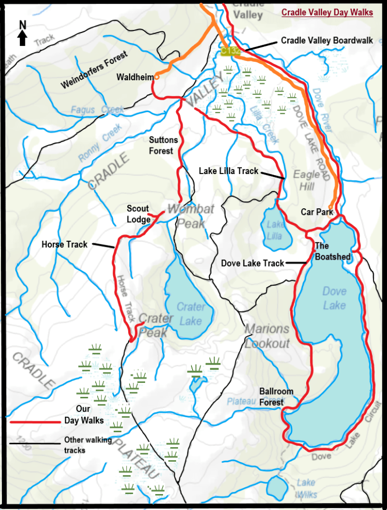
All well and good in fine weather, but this time, just above the Scout Lodge at 1000 metres, things turned decidedly nasty.
Things turned nasty on the Horse Track enroute to Marions Lookout
Tyrone T. Thomas describes the walk from Waldheim onto the Cradle Plateau as ‘unforgettable’. Which it was. Just not in the way he meant. The distant views of snow on the tops and the wind gusts in nearby trees gave us a clue as to what would unfold on the high tops.
Both cues for us to now don full Arctic Convoy kit. This time remembering we were in alpine Tasmania not sub-tropical Queensland. We gave up a lifetime of walking in shorts and gaiters and togged up into long trousers, rain pants, gloves, fleece coats and thermal shirts.
Fully kitted out for the impending cold wet and windy conditions at 1000 m.
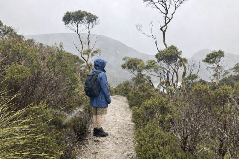
From our front door we ducked out onto open snow grass moors and descended to Ronny Creek courtesy of a netted boardwalk. The snow grass is predominately Poa gunnii, which, like button grass has a tussock habit. But it is a true grass with long blue-green leaves and feathery spikes for flower heads.
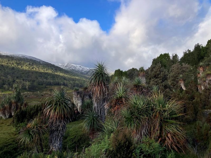
The weird looking plants found near this boardwalk are a grove of Pandani (Richea pandanifolia). Each plant has a single thin stem rising to a crown of green strap-like leaves and a skirt of grey dead leaves which hang untidily from the stem.
Grove of Pandani (Richea pandanifolia).
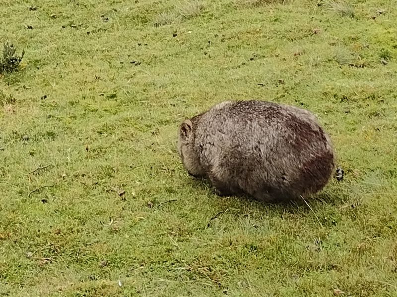
And if you are keen to see wombats, this is the place to be. The tourists thought so too. Endless streams of puffy jacketed visitors wander up the Ronny Creek boardwalk in the hope of spotting a wombat. And they aren’t disappointed. This is a veritable wombat Serengeti, with herds of them grazing even in the middle of the day. Seemingly unfazed by the predations of dozens of camera wielding humans.
Grazing wombat at Ronny Creek.
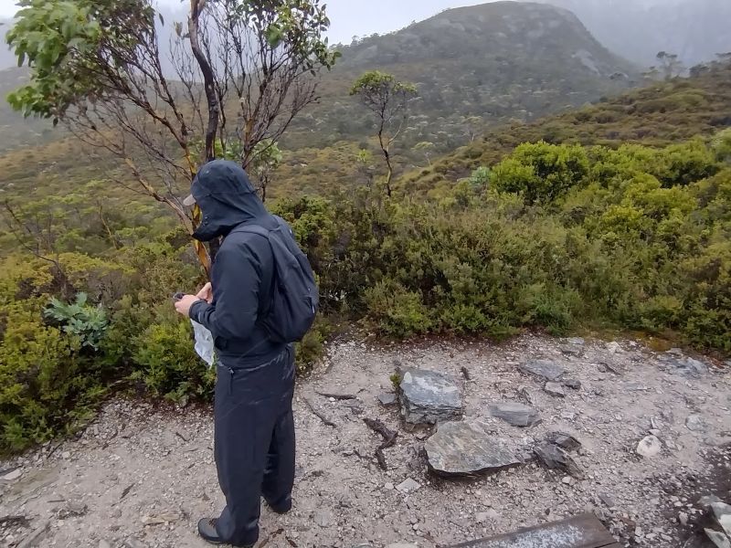
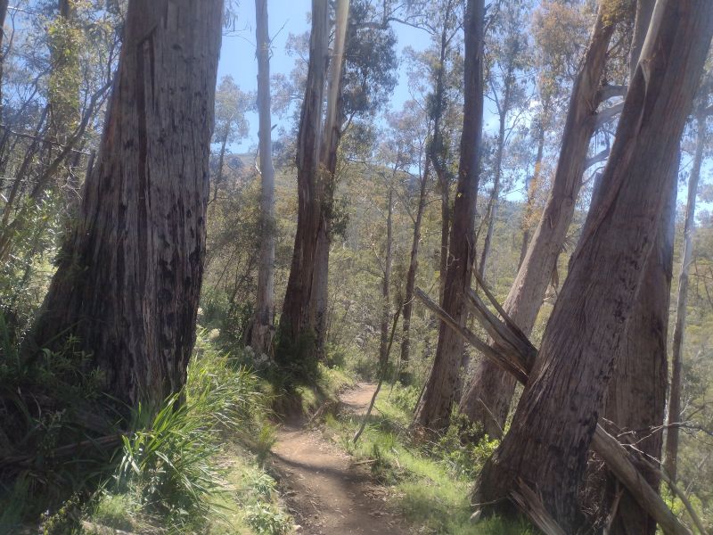
But for us, we headed for the Horse Track which traverses the high tops. Initially, the track crosses Ronny Creek and climbs gently through a landscape of hummocky button grass. Not far along, the Overland Track hives off to the left. But we turned right onto the Horse Track. From here a steep and very rough path weaves ever upward along the edge of Suttons Forest towards the Scout Lodge turnoff. Several hundreds of metres of altitude gain.
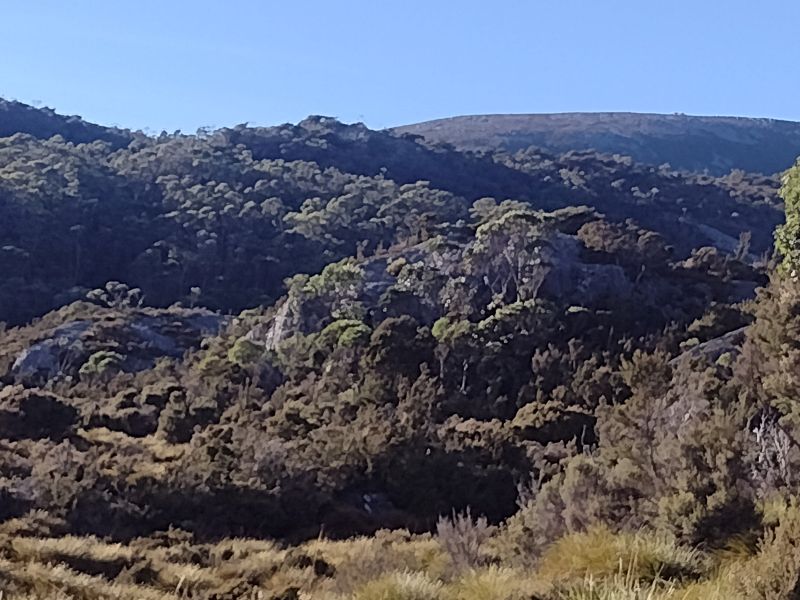
Suttons Forest is sub-alpine woodland dominated by Tasmanian snow gums (Eucalyptus coccifera) and Alpine yellow gums (E. subcrenulata). But I was too pooped to engage in surveying the understorey plants. Persistent scuds of rain/sleet quickly dampened my enthusiasm for things botanical.
Or much else, apart from keeping on the move to stave off the cold seeping into my gloved fingers. Suffice to say the understorey looked very wet, prickly and dense. Suttons Forest was named in the early 1900s by G. Weindorfer after Dr C.S. Sutton of Melbourne who did extensive botanical surveys of Cradle Valley.
View across to Suttons Forest. Sub-alpine woodland. In middle distance across Ronny Creek.
Soon after the Scout Lodge we popped out onto the alpine zone at 1000 metres. In the main, Australia’s alpine landscapes and weather are pretty benign in the global context.
The Scout Lodge on a fine day.
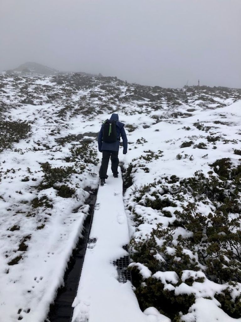
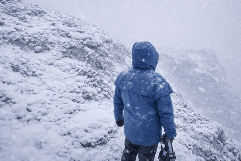
But, today, even here the weather was moderately unpleasant. Gusting wind and snow is potentially dangerous wherever you are on the planet. We had the right gear but a biting wind was scouring the Cradle Plateau. Middle son , realising what was about to unfold, retreatedto more equitable pastures.
Bad weather on Cradle Plateau.
The track, partly board-walked, climbs steadily on a NE-SW spur of the exposed plateau. By now we should have been able to look down into Crater Lake, off to our east and 200 metres below. Normally a spectacular sight, today our visibility was down to 50 metres.
Crater Lake nowhere to be seen.
Nothing to see here. Just snow and our boot prints in the snow.
On the Cradle Plateau’s Horse Track.
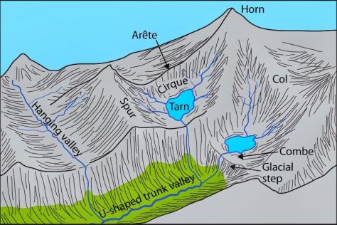
Crater Lake was named in 1905 for its likeness to a volcanic crater. Which it isn’t. It was formed by a valley glacier eroding a bowl-shaped trough some 60 metres deep. Crater Lake now occupies what was once a glacial cirque.
Crater Lake on a clear day.
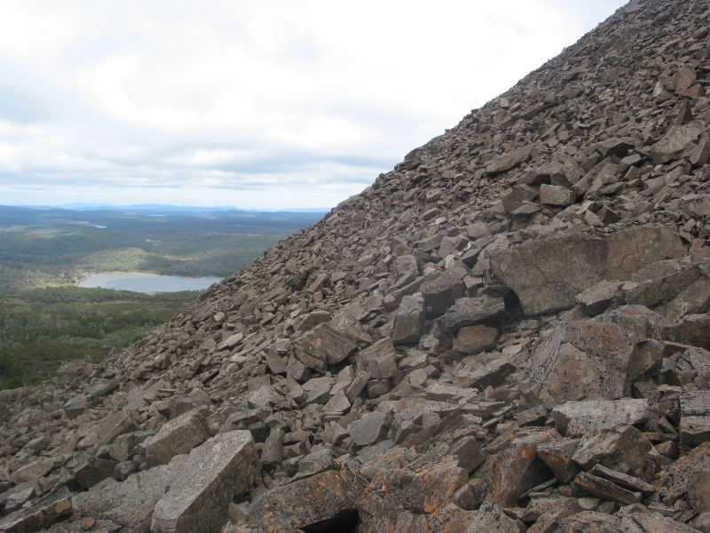
The lads were still bushy-tailed so we pushed on to a sheltered nook at Crater Peak (1270) metres. Here we took stock of the situation and decided it was risky continuing on over the now very cold, windy and exposed Cradle Plateau.
My minders, although well versed in this snow and ice stuff, were possibly thinking the old bloke wasn’t up to it anymore. Whatever the reason, it was a sensible decision to abandon ship… Read on to find out why….
Recent Incidents at Cradle Mountain
In the past year Tasmanian search and rescue have been on numerous callouts to rescue hikers in distress. Mainly it is bad luck, lack of preparation and just lack of experience that is causing the spike in rescues. Over the past winter/summer season, 200 helicopter rescues were needed in Tasmania, apart from all the ground rescues.
At Cradle Mountain specifically, a number of incidents played out over the year.
In late autumn a female tourist got lost on the Lake Wilks track and had to be rescued overnight. She was relying on her phone for navigation.
Mid-winter, a 52 year old male went missing and the search for him was abandoned. Presumed dead.
In early spring an incident involved a woman dying as her hiking group was ‘overwhelmed’ by the weather conditions. They required ground rescue after being assisted by a passing hikers. The group did not have appropriate equipment including a PLB.
Later in spring a man and woman suffering from mild hypothermia activated their PLB. While their equipment was suitable they underestimated the conditions and the effort required to cope with the weather.
Two hikers being helped out by Search and Rescue at Cradle Mountain National park. Source: ABC.
What you should know: Advice from Tasmanian Parks & Wildlife Service
Two safety videos from Tasmanian Parks and Wildlife Service.
The Cradle Mountain alpine zone can be unforgiving even for day walks.
Many incidents involved inadequate preparation such as: no PLB; relying on mobile phones for navigation and communications; underestimating weather risks; underestimating terrain; inadequate clothing; overestimating fitness and ability.
Don’t rely on helicopter rescue. Weather and terrain often make flying impossible. Ground extraction will always be hours away, so be proactive in trying to sort out your own problems.
Casual hikers are most at risk.
But for us there was, as always with this mob, the important matter of a mid-morning feed. Taken standing up with our backs to the buffeting wind. Much like the long-horned shaggy Highland cattle we had seen grazing in paddocks on our way to Cradle Mountain.
Crater Peak, our backs to the wind, a tad too cold for my liking.
Feed dispatched,we turned tail and headed for Waldheim, propelled off the snow-clad boardwalk with every fresh gust.Even my hiking poles gave no guarantee of staying firmly anchored on the boardwalk.
Homeward bound on the Horse Track.
Back at the ranch we hoovered up a very late lunch and took off to check out Waldheim Museum, thence to the lower section of the Cradle Valley Walk. The homeward run would, hopefully, take us past herds of grazing wombats along Ronny Creek.
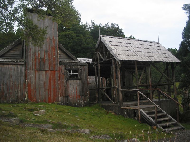
Waldheim
Set among the beech myrtles and King Billy pines of Cradle Valley is a replica of the original Waldheim Chalet built by German immigrant, Gustav Weindorfer. Gustav Weindorfer’s first trip to Cradle Valley was in 1909 with a naturalist friend, Dr Sutton. They attempted to climb Cradle Mountain but thick fog stymied their efforts.
Weindorfer returned in 1910 with his adventurous wife Kate and a Major R.E. Smith. This time they ascended Cradle Mountain. Here Weindorfer is said to have made that famous quote: ‘This must be a national park for the people for all time.’
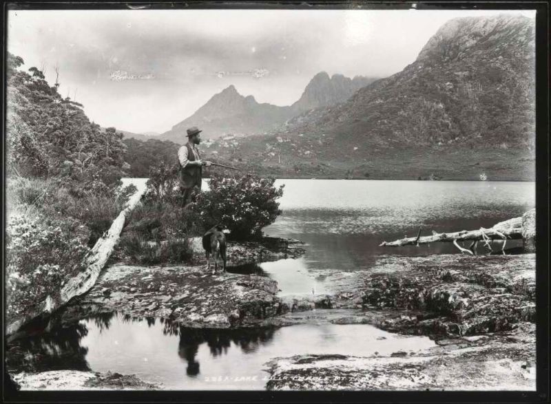
Gustav Weindorfer and his dog at Lake Lilla. Source: NLA.obj-145495378.
Gustav and Kate purchased some land in Cradle Valley and built a guest chalet and home in 1912 and called it Waldheim, meaning ’forest home’. Built of King Billy Pine from nearby stands, it was opened for visitors. It featured a living room, a dining room and two bedrooms. The energetic Weindorfers enlarged the chalet, cleared and marked trails and named many of the features of the area.
Waldheim Chalet
In 1974 the chalet was destroyed by a bushfire. The current museum building is a replica of Waldheim constructed in 1976. But the Weindorfers left an indelible legacy for the world. As a result of their lobbying, in 1922, Cradle Mountain and Lake St Clair were gazetted as a Scenic Reserve. In the 1980s the area was recognised as part of the Tasmanian World Heritage Area.
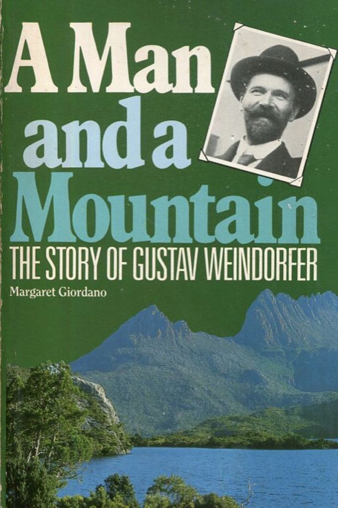
A great reference book on Weindorfer and the history of Cradle Mountain and illustrated with heaps of interesting historical photos.
Tuesday
A somewhat warmer morning at 4oC, with the sun and blue skies staging a comeback. As we still had time to squeeze in a morning walk before leaving for Hobart, we settled on a circuit of Dove Lake. There was the usual dissenting voter who opted to beetle off on a solo mission on the Cradle Valley Walk. Every family has one.
Cradle Valley walk.
On a re-run of Sunday’s walk we took off towards the Dove Lake Walk via Ronny Creek.
Map of Dove Lake Circuit
Dove Lake Circuit. Source: Tasmania Parks and Wildlife Service.
This time without the sheets of freezing rain. Soon after Ronny Creek the track climbs through what is loosely called ‘hummocky ground’.
Glacial Deposition
In fact, this hummocky ground is a belt of Pleistocene glacial deposition from the terminal moraines dumped by the Dove Valley glacier.
Unsorted moraine.
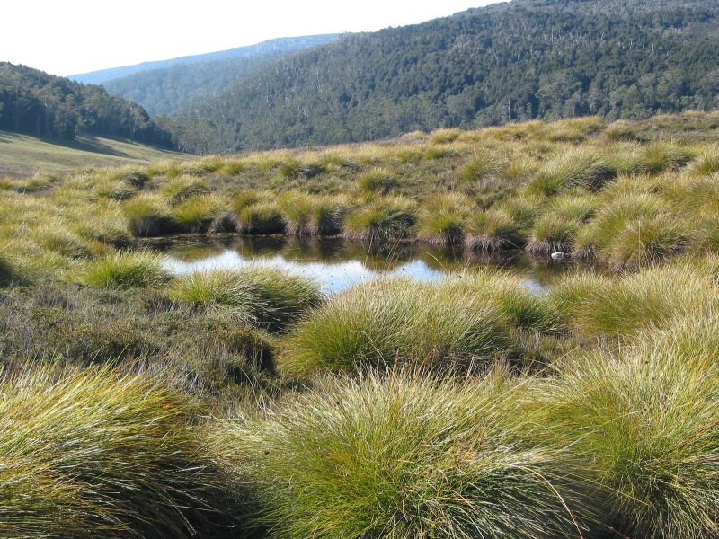
Hummocky ground is typically a chaotic micro-relief pattern of multitudinous small hummocks and low hills interspersed with undrained depressions holding swamps or ponds. This topography is technically called ‘kettling’.
A kettle pond in a moraine dump. Cradle Mountain.
Kettling formed along an active ice front or around masses of stagnant ice blocks from the Cradle Mountain glacier. The Ronny Creek topography likely formed during the Last Glacial Maximum (LGM). Datings for the deposition of the Dove Valley moraines are between 22,000 and 17,000 years ago.
Hummocky ground and Button grass.
Glacial Erosion
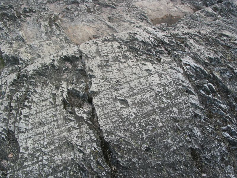
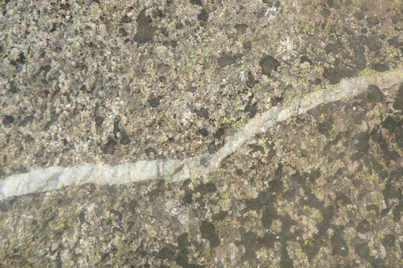
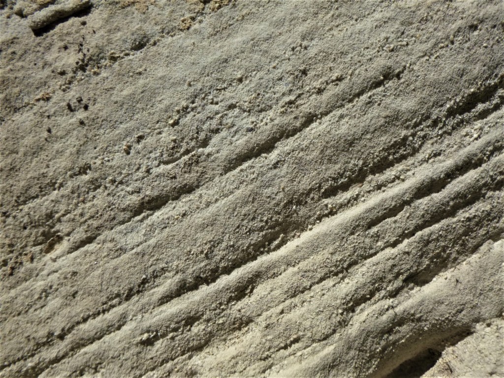
Soon after the belt of hummocky ground, the track steepens and passes into rockier terrain. Here one can find examples of landforms resulting from glacial abrasion of bare rock surfaces. Polished surfaces are the result of the passage of fine silt particles suspended in the basal ice. Examples of glacial striations, or scratches, in the bedrock were present but less frequently observed. Deeper striations or grooves are enlarged striations resulting from repeated channelling of basal debris along the same line.
Striations on Glacier Rock
The overall effect of abrasion is to smooth and round off bedrock in a process termed mammillation. I noticed these rounded surfaces faced upstream. Their orientation would be a good indicator of the direction of glacial flow.
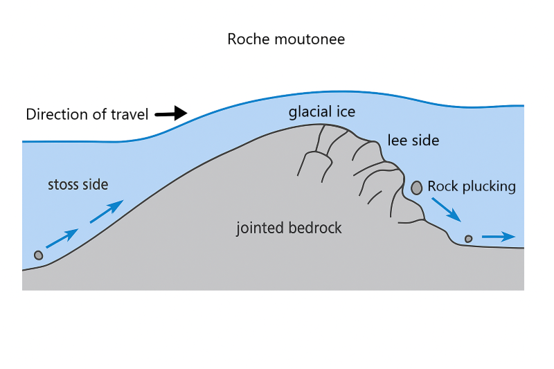
As we climbed to the Lake Lilla outlet, I identified a number of larger scale landforms known as roche moutonees, rock sheep. Said in many textbooks to resemble recumbent sheep, but this etymology is disputed. Roche moutonees are humps of rock, smoothed on the upstream side by abrasion and with a steep lee slope resulting from glacial plucking as the glacier swept over the bedrock.
A roche moutonee. The lee or plucked side facing the viewer.
Lake Lilla and its big brother, Dove Lake, are cirque basins scoured out by glacial ice. With the retreat of the glacier these basins filled with water forming the two lakes. Lilla was Miss Lilla Spurling, youngest sister of Stephen Spurling, who named the lake in 1905.
Lake Lilla. A cirque basin.
Stephen Spurling was a pioneer of Tasmanian wilderness photography. He was the first of an outstanding line of fine Tasmanian wilderness photographers which includes the likes of Olegas Truchanas, Peter Dombrovskis, Rob Blakers, Cameron Blake and Hillary Younger.
Stephen Spurling with field camera. 1905. Source: NLA.obj-152893019.
After crossing the Lake Lilla outlet, the track climbs through a myrtle beech forest, Thrush Forest, before descending to the boathouse on the shores of Dove Lake, or alternatively to the Dove Lake Car Park. We chose the latter for our clockwise circumnavigation of Dove Lake.
Dove Lake consists of two deep interconnected basins. The southern downstream basin (50m) is a scour basin formed under the moving valley glacier where the bedrock was possibly softer and more shattered. A peninsula of hard quartzite rock separates this scour basin from the upstream cirque basin.
Dove Lake with ridges of quartzite running down to the lake
The upper basin was the Dove Valley cirque. A cirque is an armchair hollow at the head of a valley glacier where snow and ice accumulate. A cirque has a steep backwall which is eroded out by downward sliding ice. Dove Lake’s backwall rises some 400 metres up to the level of Little Horn at 1355 metres. The cirque section of Dove Lake is very deep, nearly 64 metres.
A mountain glaciated landscape. Source: US NPS.
View of Monte Rosa massif (4634 m) in Swiss Alps featuring the Gorner Glacier. This is a mountain glaciated landscape. The dark streaks on the glacier surface are medial moraines (centre of glacier) and lateral moraine on edge of the glacier. The Gorner is retreating about 50 metres annually.
Meanwhile we crossed Dove River and headed south on our circumnavigation of the lake. It was named in 1905 by Weindorfer for a Mr Dove, an official of the Van Dieman’s Land Company.
The walking track takes you through a mix of terrains. Scrubby button grass gives way to sandy lake beaches, cascading waterfalls and dense rainforests on this loop trail.
Dove Lake itself is scenically outstanding especially when the wind isn’t howling across its surface. On a sunny day it is dark blue. The denser blue colouration the result of tinting from tea tree vegetation and button grass leaching into the water. From multiple points on the lakeside circuit, you can get brilliant photos of the lake and the snow-capped peaks in the background.
First stop, Suicide Rock. Oops… my new map shows a name change to Glacier Rock. This massive rock on the east coast of Dove Lake has a lookout and information boards to explain valley glaciers. Look carefully at the rock under your boots and you will see striations that run parallel to the length of the lake. This outcrop of hard quartzite withstood the erosive power of the Dove glacier.
The Dove Lake Circuit is an easy walk following the lake’s edge on good quality paths. On a sunny day like this it was an outstanding morning’s walk. Interestingly, it appears on old maps as the Truganini Track. But, again, that seems to have been erased from later maps.
Boardwalk at the southern end of Dove Lake.
Hordes of hiking tourists swept along the first kilometre but numbers thinned out the further we went. At the far end of the lake we bunkered down in a sheltered nook for a solitary morning tea. Couldn’t possibly miss out on Cheds, choc-coated licorice bullets and ginger chunks. Impressive mist-shrouded peaks loomed above.
Towards the northern end of the lake the track crosses the boggy outlet of Lake Wilks, another small cirque lake. If you look up, the peaks of Little Horn (1355m), Weindorfers Tower (1459m), Smithies Peak (1527m) and Cradle Mountain (1546m) rise spectacularly 500 metres vertically above you. Half a kilometre further on, and on the return leg, the path enters The Ballroom Forest, at the outlet of Plateau Creek.
The Ballroom Forest
This cool temperate rainforest is filled with ancient myrtle beech trees that are covered in moss. The rainforest floor is also covered in moss to give the whole scene a somewhat dank feeling. This rainforest is quite rare because these fire sensitive plants are usually destroyed when bushfires sweep across the area. But somehow this patch of the rainforest has survived.
After the Ballroom a somewhat rougher track climbs over the quartzite ridge separating the upper and lower basins of Dove Lake. From here it was a downhill trot back to the Boatshed and carpark. But we still had a few kilometres to trudge back to collect our car at Waldheim.
Quartzite ridge on Dove Lake Track.
Then it was off to the Interpretation Centre to collect the renegade walker who we found lurking in the carpark. Just to be different, the trip back to our palatial Sandy Bay digs in Hobart took an alternative route via Mole Creek and thence to Deloraine for a late lunch.
As I recollect, curried beef pies featured on the menu. The eldest appeared clutching something healthy… a bread roll overflowing with goodies like lettuce and sprouts. Fillings that would appeal only to Peter Rabbit.
Hobart
Late afternoon, we snailed through central Hobart. Well timed to join a peak hour Tasmanian traffic snarl. But our holiday house at Sandy Beach for the next two nights was pretty spiffy. A room each. Bonus, no snoring boys .
Wednesday
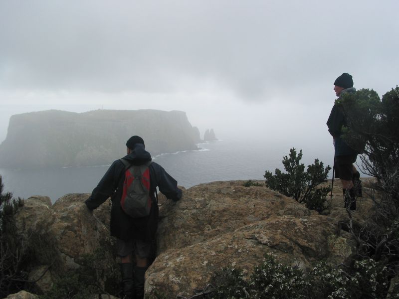
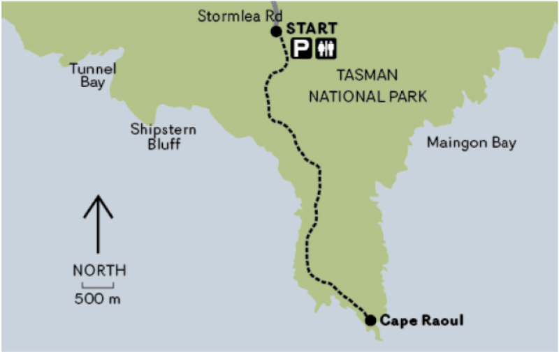
Our final full day in Tasmania. A brilliant blue sky and 21O C maximum. A welcome contrast to the previous three days. We pencilled in a foray to Cape Raoul on the southern tip of the Tasman Peninsula. The 14 kilometre return walk features dramatic dolerite sea cliffs, dry Eucalypt forest, patches of cool temperate rain forest and coastal heath.
Judging by the full carpark at the Cape Raoul track-head, the rest of Tasmania had decided to enjoy a rare sunny day in the bush too.
Cape Raoul: The Forgotten Cape
Cape Raoul was originally slated to be part of The Three Capes Track:Capes Raoul, Pillar and Hauy (Hoy). But, of course, it was just another casualty in the conga line of environmental vandalism, disasters and stuff-ups that seem to plague long suffering Tasmanians.
In the same camp as the Thylacine extinction, the Aboriginal wars, Atlantic salmon farms, the flooding of Lake Pedder, woodchipping, logging in the Tarkine, inoperable ferry terminals or the current $280 million AFL stadium own goal. Richard Flanagan should write a book about all this.
Image of old Lake Pedder, southwest Tasmania, taken between 1968 and 1972. Before it was flooded. Source: By Stephen Karpiniec, CCA 2.0 Generic.
In the building of the Three Capes Track, it is rumoured that logistical issues and cost over-runs may have led to the dumping of the Cape Raoul section. The ‘Two Capes’ with its old bushwalkers’ pad has been seriously tizzied up with steps, a hardened M1 highway masquerading as a bushwalking track, lookouts, art installations and bench seats. Grandiose huts have been constructed to house tent-free Three Capes hikers.
The Tasmanian Parks Service describes the walk : “the 48-kilometre track has been designed as an achievable experience for a wide range of ages and abilities. It has been built to a dry-boot standard from a range of materials, including timbers, stone and gravel and is wide enough for two people to walk side-by-side.
The journey begins with walkers checking in at the Port Arthur Historic Site. You will then board a Pennicott Wilderness Journeys purpose built vessel for a cruise of up to 75 minutes exploring coves and the tallest sea cliffs in the Southern Hemisphere before delivering walkers to the start of the track at Denmans Cove. Over four days and three nights, walkers will cover the 48 kilometres amongst tall eucalypt forests, coastal heath and Australia’s highest sea cliffs.
Evenings are spent in warm and comfortable environmentally-sensitive cabins; Surveyors, Munro and Retakunna.”
I’m not sure about the ‘environmentally-sensitive’ claim. The footprint of multiple huts and associated infrastructure is hardly in keeping with the national park ethos of habitat preservationor low key experiences.
As one disgruntled bushwalker wrote: “It’s not a hike, it’s a hotel stay with long corridors”.
But, apart from the few bushwalking curmudgeons like myself, the Three Capes Walk is widely acclaimed in much of the hiking community and is usually fully booked out.
There is still a lingering rearguard action to the plethora of private lodge style “ecotourism” ventures sniffing around our national parks. And, quite obviously, I’m not a fan of these private lodges or any overblown infrastructure in our national parks. But most of my acquaintances seem unfazed. The argument usually trotted out is that any development that gets people out in nature must be a good thing.QED.
If you happen to care about the commercialisaton our national park estate, check out the links below:
While I fully support the concept of encouraging people to be out and about in our national parks, I have some fundamental reservations about what is happening:
The incursions of private lodges and huts into our publicly owned national parks.
The overkill in the construction of tracks with widening and hardening.
The excessive footprints and glamping up of publicly owned huts.
The cost of walking some of these ‘Great Walks’ .
The Tasmanian National Parks Association suggested an alternative to the Three Capes Walk ( called the Tasman Trail) which linked existing tracks from Waterfall Bay in the north to Cape Pillar in the south. A bloody good proposal if you want my opinion. I’ve walked it.
The Three (Two) Capes project was opened for business in 2016. And it is a good businessthat attracts heaps of walkers. Goodfor its operators …. less so for cash-strapped taxpayers, some of whom will never be able to afford to use the huts on the Three Capes Track.
Meanwhile, back in Tasmania,hand over a fistful of shekels and you can walk the Three Capes track for the tidy sum of $600.00 per person, self-guided. A self-guided family (2 adults, 2 children) would need to shell out a cool $2210.00. But you can get an inner glow from knowing that your dollars are helping the Tasmanian Walking Company (TWC) pay for some of its advertising budget via a cack-handed agreement for the Tassie government to pay for some TWC media.
In an estimates committee meeting of the Tasmanian Parliament in June 2022, a government official owned up to payments totalling $361,000 of taxpayers’ dosh going to TWC for ‘marketing reimbursement‘ since 2018.
Well-heeled hikers, of whom there appears no shortage, can opt for a plush guided Three Capes Wilderness Experience with the TWC who the Tassie government has designated as the sole operator. Prices range between $3000 to $4000 for four nights. Inclusions are overnighting in luxury private lodges, gourmet meals, beverages, hot showers, massages and spas.
Delicious nosh awaiting guests on a TWC Three Capes Walk.Source TWC.
Some blurb from the TWC on their Signature Walk suggests that ‘… your pace might quicken in the knowledge there is a massage, facial or plunge bath on offer at Cape Pillar Lodge.‘ Tough stuff this hiking lurk. But sign me up as I inexorably slide into my eighth decade.
State governments all over Australia are joining the hiking gold rush, hatching similar ecotourism projects to transfer prime national park estate to the ecotourism spivocracy to turn a quick buck. Western Australia is, at present, the standout exception with very significant upgrades to park facilities for all people to enjoy. Not just those with deep pockets. Well done WA.
Elsewhere in Australia, park facilities are often handed over for peanuts in woeful commercial-in-confidence deals. The target demographic according to Brett Godfrey, CEO TWC, in an interview with the ABC was : ‘a 52 year old single female who finds going into the wilderness not her cup of tea’. I assume he was just kidding. The TWC model of bushwalking does seem to be a very popular and safe option.
A far cry from bushwalking in the days of yore when bushwalking could be hard yakka. But self-organised, egalitarian, family friendly, and affordable.
No huts !! Hikers camp at Lunchtime Creek enroute to Cape Pillar in days of yore.
In my biased and humble opinion, bushwalkers then were definitely more stoic and independent. I did this walk way back in 2010 as a three day 40 kilometre walk from Fortesque Bay out to Cape Pillar and back via Cape Hauy. No guides, grand huts, hot showers and spas then.
Looking towards Tasman Island from Cape Pillar. 2010.
Cape Pillar. 2010.
At the time I wrote in my journal: “Here is a landscape of coastal grandeur, of natural and cultural richness unsurpassed. For the bushwalker the Tasman Peninsula is a ‘must do’, the possible discomfort of pelting rain and and gale force winds as the track winds along the edge of massive cliff lines adding a modicum of spice to an otherwise easy 40 kilometre walk.”
On reflection, maybeit is easy to understand why today’s hikers might vote with their wallets and relax in a heated lounge with their drinkies before retiring under a cosy doona /sleeping bag.
Meanwhile, back at the Cape Raoul track head we followed the wide, manicured path that climbs two kilometres through open Eucalypt forest. The dominant trees are Silver peppermint (E. tenuiramis), Black peppermint (E. amygdalina) and White stringybark (E. obliqua). A dense understorey clothed the slopes. A few of the understorey plants that looked vaguely familiar were Native fuschia (Correa reflexa), Hop bush (Dodonaea viscosa), Bottlebrush (Banksia marginata) and a Prickly heath (Epacaris impressa).
Open Eucalypt forest. Cape Raoul walk.
Map of Cape Raoul Walking Track
Source: Tasmanian Parks and Wildlife Service
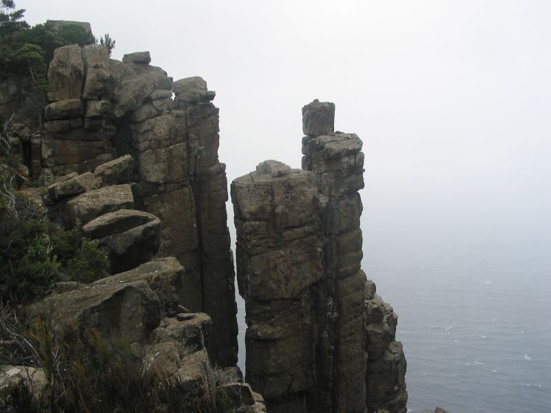
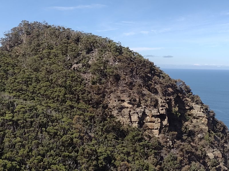
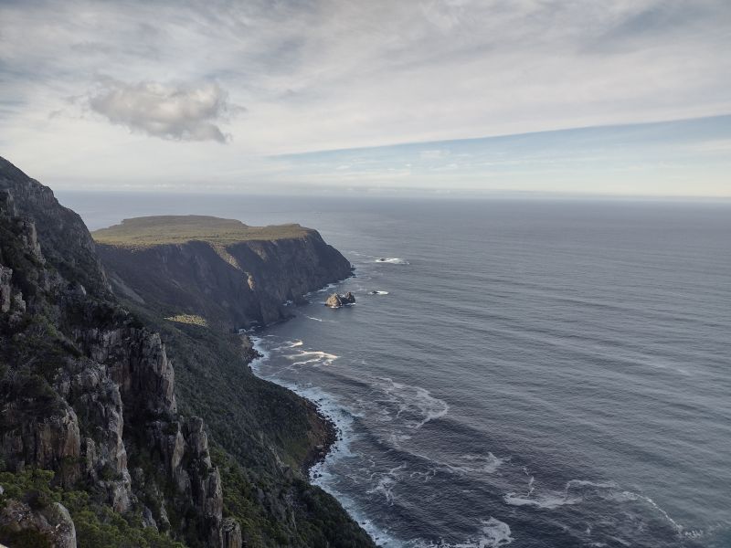
The forest opens out finally at the cliff’s edge at Cape Raoul Lookout. Here we had impressive views of Cape Raoul projecting far out into Raoul Bay. The famous dolerite-cliffed coastline dropped 400 metres into the clear blue waters of the bay.
Cape Raoul was named in 1792 by the French mariner D’Entrecasteaux after the pilot for his expedition, Jean Francois Raoul.
Cape Raoul from the lookout.Dolerite cliffs.
By now the inexorable march of time caught up on us, so we headed off to the Ship Stern Lookout for a peekaboo in the other direction.
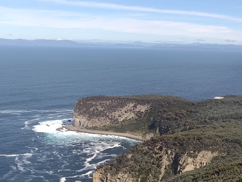
The Ship Stern track cuts westward from the Cape Raoul track. After a kilometre the track leads out to Ship Stern Lookout. The Ship Stern is a truncated bluff of glaciomarine sediments and also home to one of Australia’s famous large wave surfing breaks.
Waves here reach up to 9 metres, smashing down onto a rocky wavecut platform bounding Ship Stern. This notoriously dangerous wave break attracts surfers from around the world. Sensibly, they often opt to be towed through the swash zone on jet-skis, which we could see operating today.
In 2017 a huge chunk of the bluff collapsed, but that wasn’t unusual. A few years previously a car-sized boulder fell out of the cliff as walkers passed underneath. Suffice to say we saw no walkers or surfers mooching around on the platform today.
Ship Stern from Lookout.Glaciomarine sediments.
Ship Stern is a truncated headland with a fringing wave cut platform. The headland is not dolerite, but Late Carboniferous to Triassic glaciomarine sediments some 250-290 million years old. These sediments are predominately pebbly mudstones, sandstones and layers of limestone. One can find dropstones in the glacial layers. The presence of dropstones is a definitive indicator of glacial deposition.
A dropstone embedded in sediments.
These glacial deposits are much older than the Pleistocene glaciated landscapes that we had seen on the Central Plateau or Cradle Mountain. They are the consequence of an ice cap that covered Tasmania during a prolonged cold phase known as the Late Palaeozoic Ice Age, aka Late Palaeozoic Icehouse, some 360-255 million years ago. This was the longest and most extensive ice age in the Earth’s geological history but centred on the southern super-continent of Gondwana.
Back at the carpark, those Phar Laps of the track and trail were waiting patiently for the old nag to show up. A short road trip took us to the Lucky Ducks Café in Nubeena for a final celebratory feed. The food was delicious and we were seated near the large windows giving views across Parsons Bay. I ordered the lunch special, curry with steamed rice and local greens. The lads went traditional: chips and salad with fresh local fish (caution: see below) and lamb burgers.
View across Parsons Bay from Lucky Ducks Cafe, Nubeena.
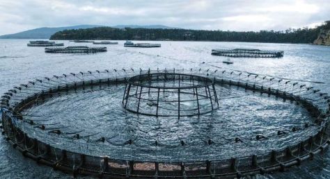
But if you peer across the placid waters of Parsons Bay, you will see fish pens floating in the bay. These are but a small part of Tasmania’s increasingly infamous salmon farming industry. News services report on mass salmon deaths and“great globules of fatty fish flesh” washing up on Tassie’s ‘pristine beaches’.
Data from the Tasmanian Government’s EPA revealed that four million salmon died prematurely in Tasmanian Salmon Farms in 2025, with 500,000 fish dying in November and December alone. In Norway, mass fish deaths can attract big fines. Aquaculture company Salaks copped a fine of A$286,000 for salmon deaths in November 2025. Tasmania has no equivalent legislation to hold salmon producers to account. Enjoy your swimand feed of farmed Atlantic salmon.
Atlantic Salmon farming is just another in Tasmania’s long line of environmental horror stories.Just ask Richard Flanagan, Tassie author and winner of Man Booker Prize.Flanagan has written a book about Salmon Farming in Tasmania: ‘ Toxic: The rotting underbelly of the Tasmanian Salmon Industry’.
A Tasmanian salmon farm.
With bulging bellies these lucky ducks headed back to our digs via the Cascade Brewery (est.1824) for a tankard or two. Except the chauffeur.
Late afternoon, back in Sandy Bay, eldest and youngest sons shrugged off my dire warnings about fatty fish balls and took the Polar Plunge into the frigid waters of the Derwent Estuary as their farewell salute to our Tassie adventure. We would all fly home to our respective states on the morrow.
And I must say it was a pleasure to share another Tassie adventure with my three sons. Every dad should be so lucky.
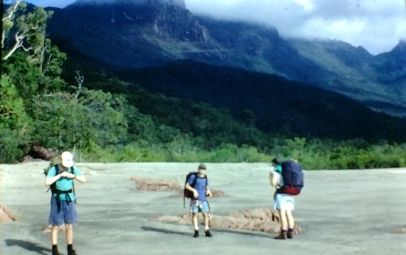
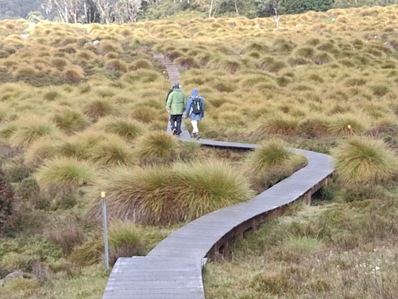
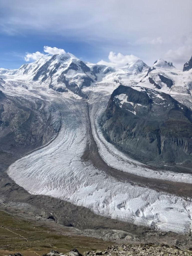
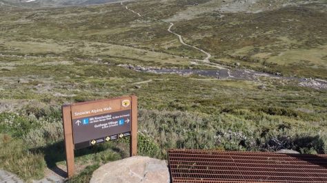
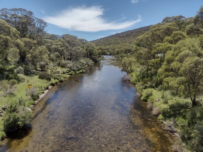
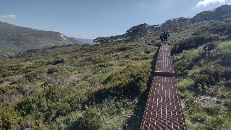
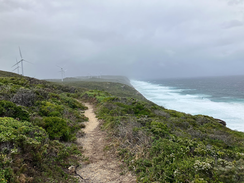
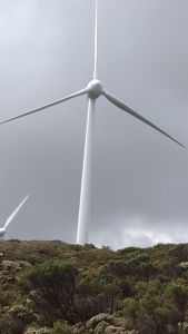
In 2018 construction started on the 55 kilometre Snowies Alpine Walk. The NSW Government boasted it would deliver ‘ a world-class, multi-day walk across the alpine roof of Australia in Kosciuszko National Park.’ The twelve kilometre hike from Perisher to Bullocks Flat is the final section of this longer walk. The hike traverses Kosciuszko National Park’s high alpine zone before descending hundreds of metres through snow gum woodland and dense eucalypt forest to the Thredbo Valley.
Snowies Alpine Walk near Snowy River
In its entirety, the Snowies Alpine Walk (SAW) connects Charlotte Pass, the Main Range, Guthega, Perisher and Bullocks Flat. The Perisher to Bullocks Flat section was the last part of the Snowies Alpine Walk to be constructed and was opened in the summer of 2024. Just in time for me to test drive it. And I was impressed.
It starts in the village of Perisher and finishes at the Thredbo River near Bullocks Flat. The track takes walkers from the alpine zone to a lookout high above the Thredbo River valley before a steep descent of the Crackenback Fall to reach the swiftly flowing waters of the river. From here the track follows the Thredbo upstream to Bullocks Flat, a popular day use area.
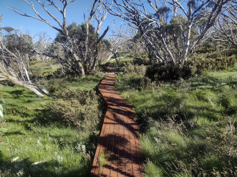
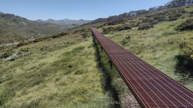
Board walk track climbing up to highest point at 1800 metres on the Perisher – Bullocks Flat track.
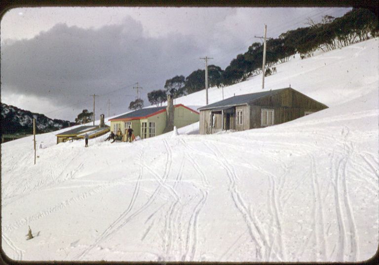
Perisher Village, my starting point, Is a small alpine village. In winter it is a picture perfect mountain village with architecturally interesting ski lodges, manicured snow runs, lifts and surrounded by snow-capped mountains. It takes its name from from one of these mountains, Mt Perisher.
Winter ski slopes at Perisher
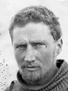
Mt Perisher was named by an early pastoralist, James Spencer, who, while chasing lost cattle with his stockman, climbed to the top of the 2054 metre peak for a better view. On the summit he was met by scuds of snow and an icy blasting wind, upon which he commented: “This is a bloody perisher.” Later they climbed the adjacent peak, The Paralyser and the stockman remarked,“Well, if that was a perisher, then this is a paralyser.
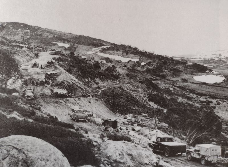
Perisher, in summer, is a less attractive proposition. Yet another man-made blot on an otherwise outstanding alpine landscape. Its development as a ski resort took off at the time of the Snowy Mountains Scheme.The Snowy Mountains project provided access roads, work camps including one at Perisher and an influx of skiing mad European migrants to work on the scheme. Perisher was born.
As my erstwhile walking companions, sons and grandchildren, had already deserted for greener pastures, I was on my lonesome for this section. My wife provided the vital taxi service connecting my drop off point at Perisher Village with Bullocks Flat. A road trip of some 50 kilometres. Otherwise, it is a return hike to and from Perisher of some 24 kilometres and 740 metres of altitude gain.
Source: NSW Parks and Wildlife.
I had the track basically to myself. There were two other walkers that day, young women who had walked the Charlotte Pass to Perisher section the previous day. And this was peak summer walking: great walking weather, wildflowers galore and school holidays. In my experience, the other sections of the SAW were always busy in summer. But, today, not the Perisher to Bullocks Flat track.
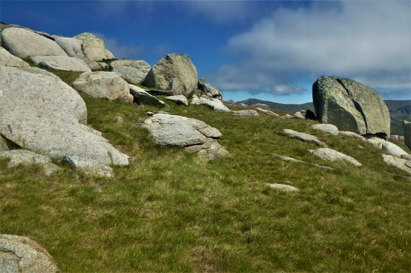
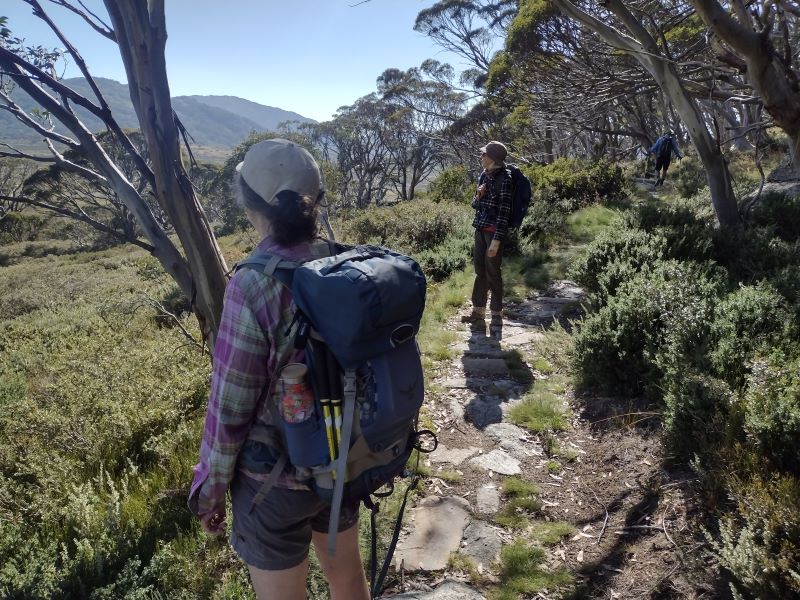
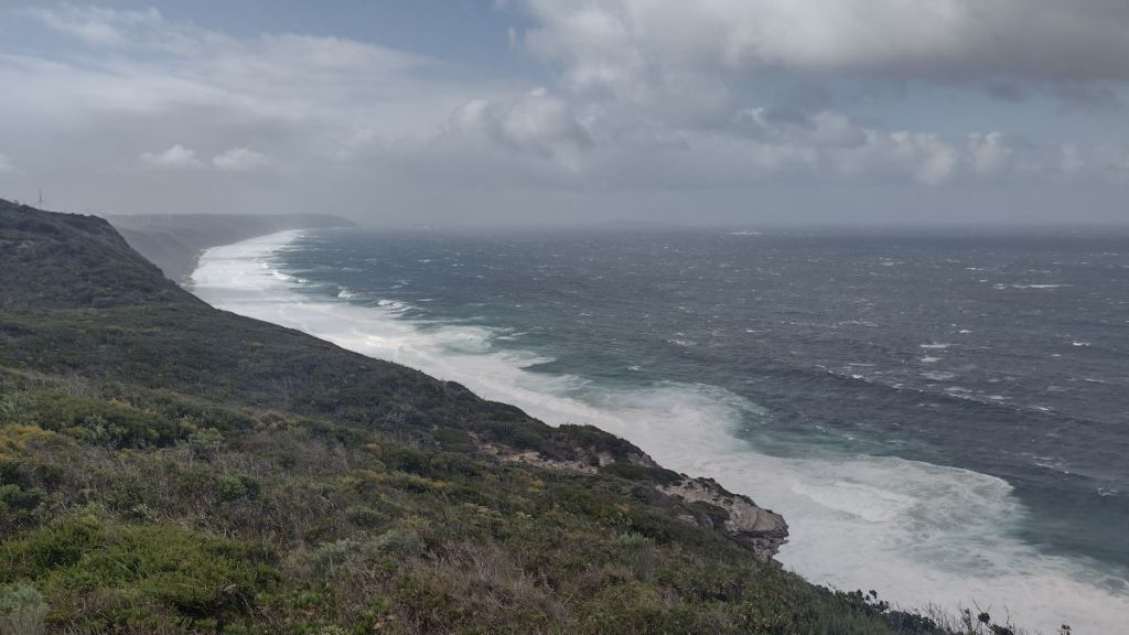
I started early, about 8.00 am. Blue skies and a very pleasant 8oC greeted me, without the blustery winds of previous days. It is an ideal half day walk winding through a magnificent landscape of alpine heath meadows, snow gum woodland, and a montane Eucalypt forest including stands of alpine ash. The track weaves in and out of huge granite tors before descending to reach the pristine waters of the Thredbo River. As a bonus there is the Thredbo lookout perched some 600 metres above the valley floor.
Alpine heath along the Perisher to Bullocks Flat walk.
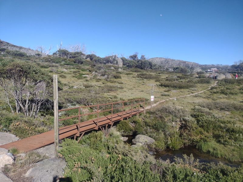
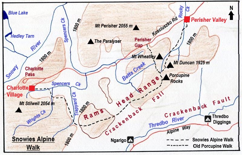
The walk starts at the Perisher village track-head sharing the Charlotte Pass/ Porcupine Rocks track. After a few hundred metres my path cleaved south east following Rocky Creek.
Bridge over Rocky Creek at Perisher track head.
The track then climbs steadily through Snow gum woodland with occasional patches of alpine heath. As I crossed the last of the heath, my map showed the line of the Ski Tube tunnel … under my boots, but some hundreds of metres below.
Steady climb through snow gum woodland
Ski Tube
The Ski Tube is a Swiss designed electric rack railway that connects Bullocks Flat and Blue Cow via Perisher village. It departs from the Bullocks Flat terminal (1134 m) before entering the Bilson tunnel that ascends to Perisher Villager (1720 m), with another tunnel connection to Blue Cow (1910 m). The 5.9 kilometre section from Bullocks Flat to Perisher was opened in 1987, while the 2.3 kilometre Blue Cow section opened in 1988.
From a high point at 1800 metres the track begins its long descent, initially through snow gum woodland, towards the Thredbo River. Some 3.5 kilometres from Perisher is the Thredbo Valley Lookout. This vantage point gives extensive views into the Thredbo Valley some 700 metres below with the Monaro Plain off to the east. Klaus Hueneke in his excellent tome “Huts of the High Country” gives this derivation of Monaro: ‘ Aboriginal for gently rounded woman’s breasts like the undulating country around Cooma. Also spelt Monaroo,Miniera Maneiro, Meneru and Monera’
View from Thredbo Lookout east to Monaro Plain
It was here that I came across the two young women again who were lounging on the lookout deck having a bite to eat. They didn’t seem in any hurry to leave and not wanting to intrude, I wandered off to find a sunny morning tea spot of my own. A nearby elevated slab of granodiorite at 1700 metres with equally spectacular views fitted the bill. Perfect.
View up the Thredbo River valley from my morning tea spot.
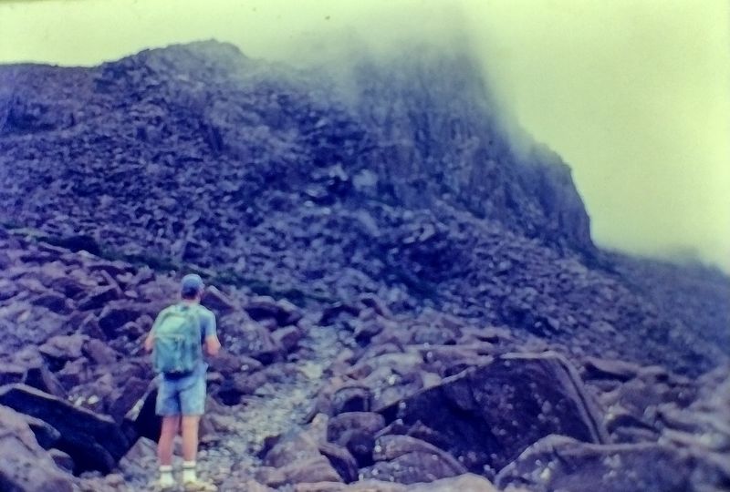
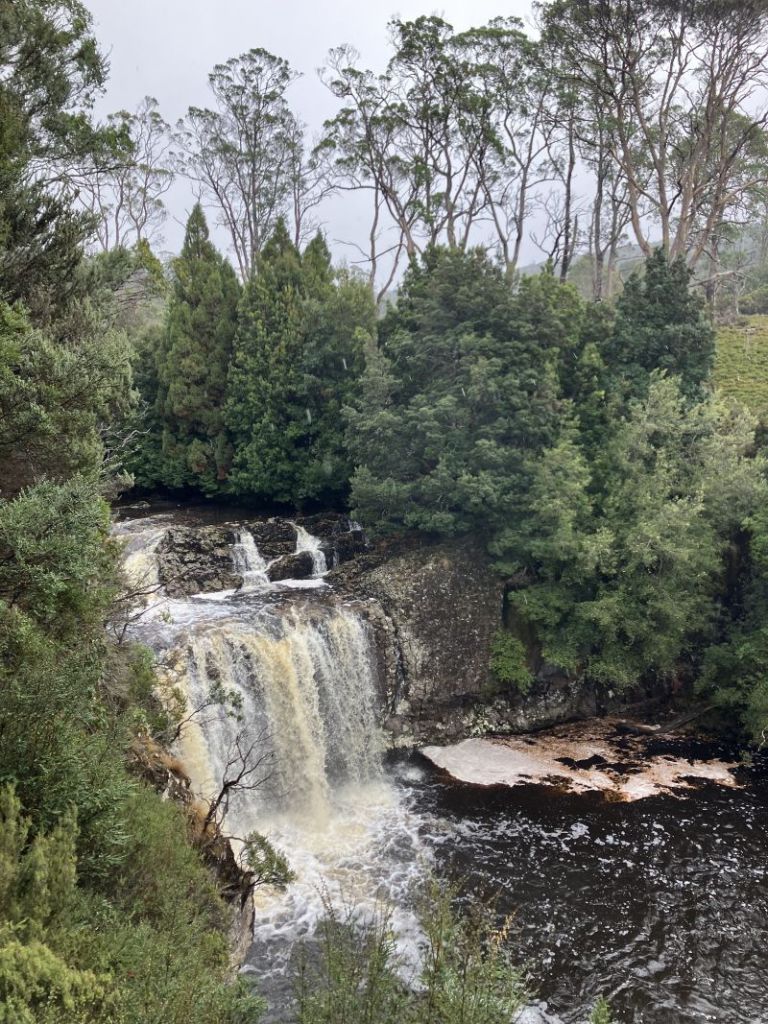
From here the track descended gently north east for 2.5 kilometres to the 1500 metres contour before switch-backing south west to drop steeply for 3.5 kilometres to the Thredbo River at 1100 metres. This was more in the category of a bushwalker’s pad rather than the heavily engineered tracks found on other sections of the SAW. The descent from the lookout takes you over the Crackenback Fall, a major geological feature of Kosciuszko National Park.
Crackenback Fall
From the lookout the Crackenback Fall drops 700 metres to the Thredbo River valley. This spectacular fall can be explained by a combination of tectonic uplift (called the Kosciuszko Uplift) during the Tertiary (66 to 2.6 mya) and the rapid downcutting of the Thredbo River into the shattered bedrock along the straight line of the Crackenback Fault. The Crackenback Fault dates back to a major tectonic contraction during the Lachlan orogeny some 390 to 380 mya.
View over Crackenback Fall to Thredbo Valley.
Klaus Hueneke in : “Huts of the High Country” writes: “stockmen who brought cattle and sheep on to the main range from the Thredbo valley over difficult terrain often said ‘it would Crack-your-back.’ Others said you had to crack the whip across their backs to get them up there.” The name was applied to the river, the Crackenback River which was later changed to the Thredbo River.
Position of Crackenback Fall
Map showing the Crackenback Fall, the Crackenback Fault and the rectilinear drainage pattern of the Thredbo River.
Vegetation Zones of the Crackenback Fall
As you descend the Crackenback Fall the vegetation changes from tall alpine herbfields on the high tops through a belt of snow gum woodland, thence to mixed Eucalypt forest before finally reaching a riparian shrub zone on the banks of the Thredbo River.
Tall Alpine Herbfield
The tall alpine herbfields are the most extensive of all Kosciuszko’s alpine plant communities and are found on well-drained and deeper soils. They are found on Kosciuszko’s highest peaks, plateaus and ridges, in conjunction with swathes of grassland, low heathland and bogs. These apparently delicate plants must withstand freezing rain, sleet, blanketing snow, howling winds, as well as heat and extreme UV radiation. Maybe not so delicate.
This plant community is the most diverse of all the high alpine vegetation types in terms of number of species. Showy wildflowers grow in a matrix dominated by the genera Celmisia (daisies) and Poa (snow grasses).
Tall alpine herbfield.
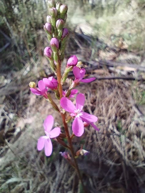
Wildflowers which I recognised included: silver snow daisy (Celmisia astelifolia), Australian bluebells (Wahlenbergia spp), star buttercups (Ranunculusspp), bidgee widgee (Acaena anserinifolia), Australian gentians (Gentiana spp), eyebrights (Euphrasia spp),billy buttons (Craspedia uniflora), andviolets(Viola betonicifolia).
Australian bluebell. Wahlenbergia sp.
Snow Gum Woodland
The low growing snow gum woodland is found above 1500 metres, the winter snowline. It is dominated by snow gums or white sallee (Eucalyptus pauciflora). Its growth habit is low, twisted, stunted and bent away from the prevailing winds. Snow gum woodland is invariably clothed in a dense scrubby understorey of beastly spikey plants like Bossiaea, Epacris, Hakea, Grevillea, Oxylobium, and Kunzea. These are usually waist high with tough whippy branches. This, presumably, an adaptation to withstand the weight of snow or overly rotund bushwalkers without breaking.
Snow gum woodland with dense scrubby understorey.
Mixed Eucalypt Forest
Below the tree line zone which is dominated by pure stands of snow gums, comes a mixed Eucalypt forest of snow gum, mountain gum (E. dalrympleana), Tingiringi gum (E. glaucescens), candlebark (E. rubida), manna gum (E. viminalis), and alpine ash (E. delegatensis).
Mixed Eucalypt Forest with a stand of Alpine Ash on Perisher to Bullocks Flat Track.
On your descent through the zone of Eucalypts you will encounter some nearly pure stands of alpine ash. This species is typically found between 1200 to 1350 metres on wetter south and south-easterly facing aspects. It is an unusual Eucalypt in that it does not have any specialised fire survival techniques (such as epicormic growth) and regenerates from seed after fire has destroyed surrounding heavy leaf litter which usually inhibits seed germination.
Ferny understorey in mixed Eucalypt forest
Riparian Shrubland
A diverse plant community of mainly shrubs occupies a narrow a strip alongside the Thredbo River. The main canopy species is an olive-green trunked gum called black sallee (E. stellulata). Occasional pockets of mountain gum and black sallee grow together. But the main botanical action is in the shrub layer which provides a profusion of wildflower displays in early summer.
Dense thickets of shrubs in riparian zone along the Thredbo River
Along the track as you work your upstream towards Bullocks Flat, here are a few to look out for: poison rice-bush (Pimelea pauciflora) with small slender leaves, creamy flowers and orange fruit; mountain tea-tree (Leptospermum grandifolium) with 5 petalled white flowers, forming dense thickets along the banks, and close to the river, alpine bottlebrush (Callistemon pityoides) with its distinctive brush flowers.
Alpine bottlebrush. Callistemon pityoides.
Useful reference book on plants in the Thredbo Valley
This handy little guide to plants in the Thredbo Valley won’t take up too much space in your rucksack(15 cm x 21 cm).
Thredbo River aka Crackenback River
On reaching the Thredbo River, the track closely parallels the river for a further one kilometre to Bullocks Flat, which is accessed by the Ski Tube bridge over the Thredbo River near the Ski Tube carpark. An eyesore of monumental proportions. How the Parks service gave planning approval for this hideous monstrosity is a mystery. Or maybe not. The slimy hands of NSW politicians would be at play in boosting ski tourism in the national park. A pattern of pandering to the ski industry that is repeated across most of Australia’s alpine ski fields.
But moving on from this well-ventilated gripe of mine. If you look upstream and downstream from an opening onto the river bank you will see how straight the course of the Thredbo River is. In fact, it flows in a reasonably straight line from Dead Horse Gap to Lake Jindabyne. A consequence of the structural control exerted by the Crackenback Fault.
Straight course of Thredbo River looking upstream towards Bullocks Flat
The course of the Thredbo River presents an interesting drainage pattern when viewed on a map. It is described by geomorphologists as a rectilinear drainage pattern, where the main bends of the Thredbo River change direction at right angles. In the case of the Thredbo, it initially flows south-east, then turns south-west, then north-west and finally into the main Thredbo valley which runs in a straight line north-east to Lake Jindabyne.
Faults show clear evidence of differential earth movements. The Crackenback Fault is a 35 kilometre long, south-west to north-east trending strike-slip fault between the Jindabyne Thrust Fault (at Jindabyne) and Dead Horse Gap.
Rectilinear drainage pattern of Thredbo River and position of strike-slip fault, the Crackenback Fault
A strike-slip fault has horizontal movement of the earth’s surface with little vertical displacement. It is along this straight fault structure that the Thredbo River flows towards Lake Jindabyne.
Other well-known strike-slip faults include New Zealand’s Alpine Fault, the Dead Sea, and the San Andreas fault in North America.
Strike-slip or horizontal fault. Source: Longwall & Flint: Introduction to Physical Geology.
Enter the World of Willie the Wombat
The walk upstream is an opportunity to keep your eyes open for signs of those bulldozers of bush and plain, wombats. You have to be lucky to chance upon a trundling wombat during the day, but their massive burrows, or their very distinctive cuboid poos are easily spotted. The common wombat (Vombatis ursinus: bear- like) is of tank-like stature: about 100 cm long, 30 kilograms in weight, short stubby legs and thickset body. The fur is coarse and of a grey, black or brown colour.
Wombat grazing
They are herbivores grazing on grasses, roots and fungi. Their teeth grow continuously to accommodate their gnawing on rough herbage and roots. In summer they leave their 10 to 15 metre long burrows on dusk and graze through the early part of the night. On one trip to Kosciuszko we spent quite a long time at dusk in the nearby Thredbo Diggings area hoping to spot a wombat for our little boys. A futile venture as it turned out. Plenty of fresh poo and burrows, but alas no Willie Wombat.
Distinctive cubes of wombat poo.
The preferred habitat for wombats is woodland or grassland but they can be found foraging above the tree-line. One was spotted ascending Mt Townsend at 2209 metres, Australia’s second highest peak.
Prime wombat territory on Thredbo River flats.
Bullocks Flat and Bullocks Hut
Bullocks Hut is on the banks the Thredbo River near that ugly Ski Tube car park. Quite a contrast. This is an enticing site of grassy flats and the picturesque fast flowing Thredbo River. Bullocks Hut was built in 1934 for Dr Bullock as a fishing lodge and used by the family until about 1950. A kitchen was added in 1938 and a garage and stables in 1947. The hut was resumed by the NPWS in 1969 and renovated in the 1990’s.
It is described in various publications as ‘built like a fortress’. As it is. The walls are constructed of cement blocks with the floor of tiles over a cement base. The original roof was constructed of shingles cut by a Snowy Mountains local identity, Bill Prendergast. The roof was later covered by sheets of iron. The chimney is made of cement. The use of cement has resulted in the hut being fenced off & declared out of bounds. Due to an OHS issue… silica dust contamination.
Bullocks Hut
The Crackenback Gold Rush
Bullocks Flats was just one of the many river flatsand river banks (like the nearby Thredbo Diggings campground) that were dug and sluiced for gold. The Crackenback gold rush took off in the 1870’s when small tributary streams were worked over by gold miners. The diggings were so remote that it took two months for bullock teams and drays to bring supplies from Sydney.
The last remaining miner was Alf Tissot who worked the area until the late 1930’s. Like many miners, he preferred to walk rather than ride the 20 kilometres into Jindabyne to get his supplies.
Look carefully and you will see flecks of gold and silver in the sandy riverine deposits. Unfortunately for you, this is merely ‘Fools’ Gold’, aka Pyrite or Chalcopyrite or Mica.
Iron Pyrite (Iron sulphide) looks like gold but is a pale brassy colour and isn’t malleable. Also pyrite forms perfect cubic crystals and if you scrape pyrite down a scratch plate it leaves a geenish-black powder rather than flakes of gold. Pyrite gets its name from the Greek ‘pyr‘ meaning fire, because it emits a spark when struck by iron.
Pyrite aka Fool’s Gold
Chalcopyrite (Copper pyrite) is a bright, brassy-yellow mineral, which tarnishes to a dull gold colour. Unlike gold it is brittle and breaks easily.
Mica is very common in the Thredbo River. and is derived from the local granitic bedrock. Any gold sparkles are the first two, but the silvery or yellowy-brown sparkles are most likely mica.
It is easily identified. You won’t be fooled for long. When split, mica cleaves into thin sheets or laminae which sparkle silvery or vaguely gold in sunlight. It has a wide variety of uses including in the manufacture of electronics, paints, plastics and cosmetics.
Platy flakes of mica
In the 1910’s and 1920’s Ned Irwin’s sawmill operated on the opposite bank from Bullocks to source the towering hardwood eucalypts, especially the alpine ash. Bullock teams dragged the timber into nearby towns for housing materials. There is supposed to be an old steam engine and flywheel in the area, but I didn’t see them.
Rutledges Hut
Several kilometres upstream from Bullocks Flat is the site of Rutledges Hut, now removed, another fisherman’s lodge. This was built in 1935 by a Colonel Rutledge and his fellow fishers Mr McKeown, Brigadier Broadbent and a Mr Burns. It was a long hut constructed of sheet iron and had a wooden floor. It was removed by the NPWS in the 1980’s, deemed unsafe. The NPWS was pretty keen on removing huts for a while.
Rutledges Hut 1982. Source: B. Powell. KHA.
In 1979 the NPWS issued a draft huts policy which created a huge, well-deserved backlash. They recommended removal of all huts in the summit area (except Seamans) and in the Whites River corridor (except Disappointment and Whites River Huts). In addition, the demolition of O’Keefes, Grey Hill Café and Tantangara were pencilled in. They were forced to back off, but removed Albina and Rawsons, the sacrificial lambs.
Fortunately, times have changed and the NPWS together with the Kosciuszko Huts Association is now heavily invested in conserving these heritage shelters for the use of bushwalkers and skiers needing a place of sanctuary in the oft changeable alpine weather.
Fishing on the Thredbo River
Fishing has a long history in the Snowy Mountains, especially fly fishing. The quarry was not the native mountain trout (Galaxis olidus) which struggles to reach to 10 cms in length, but the introduced North American Rainbow trout (Oncorhyncus mykiss) and the European brown trout (Salmo trutta). These were introduced in the 1890’s and are restocked regularly from the Gaden Trout Hatchery further downstream. An unfortunate outcome of these introductions has been a profound change in the local aquatic ecosystems with Galaxias missing from streams inhabited by trout. They are now confined to a few high alpine streams and lakes.
Native mountain trout: Galaxis sp.
By midday, my walk on this final section of the Snowies Alpine Walk was over. I found a bench seat in a sunny spot near Bullocks Hut and waited for the wife taxi and accompanying lunch supplies to arrive. A pleasant warm spot for us to eat, chat and, ever the inveterate cartography nerds, check off the landmarks from our map: the Rams Head Range, The Porcupine at 1921 metres, the Thredbo Lookout and the entrance to the Bilson Tunnel.
Sketch of Rams Head Range from Thredbo River Valley.
Aboriginal Occupation Of Thredbo Valley
Long before the unthinking predations of gold miners, loggers, fishermen, and cattlemen the Thredbo River valley was traversed by aborigines. Lithic scatters have been found near Bullocks Flat and other sites in the along the Thredbo. These scatters including stone hammers, scrapers and flakes. Waste lithic material accumulated in favourite campsites and these can be found if you are alert. Though they must be left in-situ.
During summer the Wogal tribe gathered in the valley, along with other tribal groups to feast on the bogong moth. Moth feasts were a great occasions for gatherings of friendly tribes. They were summons by message sticks to join the feasting, corroborees, trade, settling of disputes and marriage arrangements.
The gatherings took place at the foot of the mountains.The aborigines came from Yass and Braidwood, from Eden on the coast and from Omeo and Mitta Mitta in Victoria. All intent on having a good feed and a good time. Large camps formed with as many as 500 aborigines .
It is thought that advance parties would climb up to the tops, and if the moths had arrived they would send up a smoke signal to the camps below. The arrival of the moths is not a foregone conclusion. Migration numbers vary from year to year.
A tasty morsel. the Bogong Moth.
Some years they are blown off course and out into the Tasman Sea.1987 was a vintage year, but in 1988 the bright lights of New Parliament House in Australia’s bush capital, acted as a moth magnet, and they camped in Canberra for their summer recess, unlike our political masters.
Men caught the moths in bark nets or smoked them out of their crevices. They were generally cooked in hot ashes but it is thought that women sometimes pounded them into a paste to bake as a cake. Those keen enough to taste the Bogong moth mention a nutty taste.
Scientists say they are very rich in fat and protein; this diet sustained aborigines for months and the smoke from their fires was so thick that surveyors complained that they were unable to take bearings because the main peaks were always shrouded in smoke.
Europeans often commented on how sleek and well fed the aborigines looked after their moth diet. Edward Eyre who explored the Monaro in the 1830’s wrote: “The Blacks never looked so fat or shiny as they do during the Bougan season, and even their dogs get into condition then.” At summer’s end, with the arrival of the southerlies, the moths and aborigines all decamped and headed for the warmer lowlands. As did I. Back to the the heat and humidity of Queensland.
Should you want to read more about aboriginal moth hunters , then you should delve into Josephine Flood’s ‘Moth Hunters‘.
For me, it wasanother brilliant walk in Australia’s high country done and dusted.
Mt Stilwell (2054 m) is, for me, probably one of the best short walks in Kosciuszko National Park. At only 1.8 kilometres from Charlotte Pass, on a clear day, it gives unsurpassed views of the Snowy River valley, the peaks of the Main Range and in season, brilliant wildflower displays.
A bonus of the Stilwell hike is that it is ignored by most of the walking fraternity. Out of the summer school holiday period you will have this part of the park to yourself. It’s Kossie or bust for most hikers, trail runners and, in recent years, flocks of mountain bikers, all heading for Rawsons Passand Mt Kosciuszko.
But for those of us with more modest ambitions and time to spare, one can have a thoroughly enjoyable ramble to the top of Stilwell. And, should you have time, you can explore the extensive alpine meadows of upper Wrights Creek and Merritts Creek, duck across to nearby Little Stilwell, check out the ruins of the Stilwell Restaurant (aka the Ramshead Restaurant) or maybe head off along Kangaroo Ridge. Endless possibilitiesfor the enterprising bushwalker.
Boulders and meadows on Kangaroo Ridge
Our fifteen kilometre summer ramble would take us to Stilwell Trig, thence off-track, contouring along the eastern flanks of Kangaroo Ridge. Followed by a gentle overland descent towards the Merritts Creek crossing on the Summit Walk from Charlotte Pass to Mt Kosciuszko. From here it’s a short hop over the Snowy River then uphill to Seamans Hut. The return trip is downhill along the Summit Walk to Charlotte Pass.
Map showing Mt Stilwell to Seamans Hut hike
Based on map: Perisher 1: 25 000
And so, soon after 9 am on a blustery summer’s day, I set off with my ever keen walking companions, Neralie, Chris, Garry and Joe. Stilwell bound. Another cool 10O C but with the monotonously regular north-westerly idling along. Ideal walking conditions in my book.
From Charlotte Pass the track climbs through a belt of snow gum woodland to the rusting relics of Australia’s first mechanical ski ‘hoist’.
Snow gum woodland at start of Mt Stilwell walk
The Pulpit Ski Hoist
In 1938, the New South Wales Government Tourist Board (NSWGTB) built Australia’s first long ski tow from Charlotte Village to Kangaroo Ridge. It resembled a modern T-bar with steel cables suspended from wooden posts.
Way back in 1937-1938 it was a difficult build. The long poles for seven A frame towers were cut in Wilsons Valley and had to be carted and then assembled on a very steep slope. The wooden towers supported the heavy steel cable to which were attached non-OHS compliant J-bars for the skiers to hang on to.
But it was a very welcome addition to Australia’s skiing scene. Although it had a few issues. Rick Walkom in his wonderful book ‘Skiing off The Roof’ has this description:
‘Skiers experienced plenty of lengthy stoppages. The hangers travelled at no more than walking pace, and the build up of ice often caused derailments. Sometimes the J-bars would get caught up in the rocks or, worse still, the heavy hangers would fall off the cable.A veritable army of skiers was needed to lift the cable back onto the pulleys.’ All part of the fun.
Relics of old Pulpit Chairlift. Kangaroo Ridge. The NPWS removed the roof and cladding.
Some 600 metres further on is the Charlotte Village to Kangaroo Ridge Triple Chairlift, which does not operate in summer. Here, at 1920 metres, is a Cortan steel lookout with unimpeded views to the Main Range and Mt Stilwell, capped by its trig tower. An information board acknowledges indigenous links to Kosciuszko:
Triple Lift from Charlotte Pass Village to Kangaroo Ridge
‘The local rainmaker, Dyilligamberra, represents all the rain, snow and water from these mountains to the sea. His relatives make wind and cloud. They are very powerful, so we show our respect by going quietly in the mountains.’ Rod Mason. Aboriginal Education Officer.
The lookout platform provides a brilliant skyline view of the Main Range. On a clear day like this, all the high peaks are visible and you can identify them from the labelled panorama on the information board. From east to west (L to R): North Rams Head, Mt Kosciuszko, Mt Clarke, Mt Townsend, Mt Lee, Carruthers Peak, Mt Twynam, Mt Anton and Mt Tate. A Who’s Who of Australia’s highest peaks.
Main Range panorama
But the Stilwell summit beckoned. We were now in Australia’s true alpine zone. In Kosciuszko this equates to about 1850 metres ASL. Here the average summer temperatures are less than 10 C, too cold for even hardy snow gums to survive. Hence snow gum woodland is replaced by tall alpine herbfield.
Tall alpine herbfield
The tall alpine herbfields are the most extensive of all Kosciuszko’s alpine plant communities and are found on well-drained and deeper soils. These herbfields occur on a variety of bedrock types, suggesting that lithology has a negligible influence on location. Here, the bedrock is Mowambah granodiorite which erodes to form sandy and well-drained soils. Obviously perfect for wildflower meadows.
Crossing tall alpine herbfields under Mt Stilwell
This plant community is the most diverse of all the alpine vegetation types in terms of number of species. Showy wildflowers grow in a matrix of snow grasses (Poa caespitosa) and sedges (Carex sp). Technically, it is an association dominated by the genera Celmisia (daisies) and Poa.
As we were walking in late summer the wildflowers were well past their prime. Later the same year in mid-December the display was spectacular.
Meadow of silver snow daisies (Celmisia astelifolia). Mt Stilwell.
Here is my mid-December list: silver snow daisy (Celmisia astelifolia), Australian bluebells (Wahlenbergia spp), star buttercups (Ranunculus spp), bidgee widgee (Acaena anserinifolia), Australian gentians (Gentiana spp), eyebrights (Euphrasia collina spp), billy buttons (Craspedia uniflora), spoon daisy (Brachyscome sp), yellow Kunzea (Kunzea muelleri), tall rice-flower (Pimelea ligustrina), alpine mint-bush (Prostanthera sp), alpine Stackhousia (Stackhousia pulvinaris), mountain celery (Aciphylla glacialis) trigger plant (Stylidium montanum), purple alpine Hovea (Hovea montana), and violets (Viola betonicifolia).
Silver snow daisy. Celmisia astelifolia.
Bidgee widgee. Acaena anserinifolia. A pesky prickly plant if it attaches to your socks.
Gentianella muelleriana spp alpestris. An endemic to Kosciuszko.
Mountain celery. Aciphylla glacialis.Recovering well from overgrazing.
Eyebright. Euphrasia collina spp glacialis. Endemic to Kosciuszko.
Alpine trigger plant. Stylidium montanum. The trigger is a hammer shaped column which springs closed on the backs of foraging insects.
Alpine wildflower guide for your rucksack
Alpine wildflower guide. Small enough to go in your day pack. 15 cm x 21 cm.
A bushwalkers’ pad climbs up through these meadows and is very exposed. It was windy, the UV index was off the scale but the walking was brilliant. We crossed meadows, seepages and weaved in and out of the outcropping granodiorite boulders.
Seepages and boulders on the old bushwalkers’ pad to summit of Mt Stilwell.
Xenoliths
If you keep your eyes open, you will see large patches of foreign rock or minerals embedded in the granodiorite. These are Xenoliths. There is some argumentation over the origins of Xenoliths (Foreign Rock). At its simplest, it is thought they are fragments of existing country rock caught in the molten magma as it cools.
Xenolith in Mowambah granodiorite. Mt Stilwell
As usual, I couldn’t gee up much interest in Xenolith spotting, so we pushed on to the summit. It is topped by a trig tower atop a spine of heavily frost-shattered rock. With the summit photo shoot completed, we retreated to the lee of the summit. To a pleasant sunny spot that Garry and Neralie had secured for our morning tea, out of the wind.
Summit trig station. Mt Stilwell
Frank Leslie Stillwell
It is likely that Mt Stilwell was named after Frank Leslie Stillwell (1888 – 1963).
Stillwell (note spelling shift) was an Australian geologist and Antarctic Expeditioner (1911-1914). He served under the famous Douglas Mawson. Stillwell’s later career took him to the mining provinces of Broken Hill and Kalgoorlie.
Frank Leslie Stillwell. Antarctic Expeditioner & Geologist.
On the eastern side of Mt Stilwell, just below the summit, if you look carefully you should be able to find a massive vein of milky quartz embedded in a boulder of Mowambah granodiorite. Milky quartz is a very common mineral. I have sat here many times for morning tea, but 2024 was the first time I clocked this huge outcrop.
Sill of milky quartz. Mt Stilwell
Also nearby, if you peer hard enough off to the south east, there are the ruins of Top Station or Ramshead Restaurant. It is located near a biggish outcrop on the Rams Head range about 1.5 kilometres across the marshy valley of Wrights Creek.
Ramshead Restaurant looking across Wrights Creek. Restaurant to left of main outcrop
The World’s Longest Chairlift
A restaurant and lift transfer station were built at the highest point on the line of the Thredbo valley to Charlotte Village chairlift. Purportedly, the ‘World’s Longest Chairlift’. It was built in 1964-1965 at the junction of the two chairlifts. One from the Thredbo valley and the other from Charlotte Village.
The old terminal station at Charlotte village. Now accomodation for village workers.
Building the chairlift was a major engineering feat. Work started in 1963 on a ‘Sedan’ style chairlift moving 350 skiers per hour in both directions. The sedan seat was enclosed by a fibreglass cupola.
There were high hopes for the popularity of the chairlift which was to glide five kilometres over the freezing roof of Australia. As a bonus, punters could drop in for a feed at the Stilwell/Ramshead Restaurant. At 2057 metres touted to be the highest in Australia.
Rick Walkon in ‘Skiing off the Roof’ has this description of the chairlift’s history:
‘The chairlift was a disaster from the start.
The Snow gods wasted no time in showing disdain for the sea level engineers. With the first snow falls in 1964, a variety of design faults became glaringly obvious… Incessant strong winds on an extremely exposed plateau hit the chairs at right angles, causing them to swing violently and nearly collide with towers.
More often than not, a busload of sightseers complete with high-heeled shoes, cameras and bags ended up dangling in icy winds awaiting rescue. Inevitably a few passengers fell out of the chairs’.
Apparently, a blizzard started in July 1964 and lasted 31 days. At the time wind gauges registered 180 kph and eventually blew away. Chairs were ripped from the cables and towers buckled. More blizzards followed.
Ramshead Restaurant.
Understandably,rumours of frozen corpses arriving at the Top Station did not engender confidence in a ride on the World’s Longest Chairlift. Suffice to say, the chairlift closed after only two seasons.
For those of you keen about skiing and the history of skiing in Australia and Charlotte Pass in particular, look no further. Rick Walkom’s ‘Skiing off The Roof‘ is jammed packed with facts, anecdotes and hundreds of historical photographs. This book is a treasure.
Rick Walkom ‘Skiing off The Roof.’ 4th edition 2022. Broadcast Books.
But we were on a different mission. After a bite to eat, we headed off, travelling south west, paralleling the summit skyline of Kangaroo Ridge on the 2050 metre contour. What followed was an outstanding alpine walk. Our route had us crossing alpine meadows and ducking in and out of fields of granodiorite boulders.
Kangaroo Ridge
Several kilometres along we intersected the soggy headwaters of Merritts Creek. From here we swung north west, staying high but paralleling Merritts to where it crosses the Summit Track. This is a section of the Australian Alps Walking Track (AAWT) that joins Rawsons Pass (below Mt Kosciuszko) to Charlotte Pass.
On the Summit Track. Part of the Australian Alps Walking Track
We had stepped through into a parallel universe. From the solitude of Kangaroo Ridge we hit the teeming AAWT. Swarms of hikers and mountain bikers bustling along. All intent on summitting Mt Kosciuszko, at 2029 metres Australia’s highest mountain.
A short trot took us across Merritts and then the mighty Snowy River. We stood a mere two kilometres from its topmost seepages.
Snowy River crossing on Summit Track. Australian Alpine Walking Track
Headwaters of Snowy River above the Australian Alps Walking Tack crossing
Seamans Hut
From the Snowy, the AAWT climbs up a steep pinch onto Etheridge Ridge and Seamans Hut.
Seamans Hut with Etheridge Ridge in background.
Seamans is a nifty stone shelter on the Summit Trail below Rawsons Pass. The 7m X 3m granite stone hut was originally named the Laurie Seaman Memorial Chalet. A bit of a mouthful, so now is universally known as Seamans.
Seamans Hut
It was constructed in 1929 to commemorate W. Laurie Seaman who perished in a blizzard with his fellow skier, Evan Hayes. Seaman’s body was found leaning against a rock near the present site of the hut.
The two skiers had departed under blue skies but got caught in an afternoon blizzard while skiing off the summit of Kosciuszko. The men separated and Hayes’ body was found above Lake Cootapatamba. Lying on his skis. A cairn of stones marks the spot. He was found about one kilometre north of the hut on the side of Mt Kosciuszko.
Lake Cootapatamba. A benign summer’s day.
An emergency shelter was built near Lake Cootapatamba c 1952 as an emergency hut for Snowy Mountains Authority Hydrologists on Cootapatamba Creek for a proposed diversion of its waters via aqueducts and tunnels to the Kosciuszko Reservoir on Spencers Creek. The Koscuiszko Reservoir proposal was abandoned in about 1965.
Cootapatamba emergency hut. Mid winter. The ‘chimney’ is to allow entry into the hut during winter.
Seaman’s camera was retrieved and the processed photographs showed them standing next to Kosciuszko’s summit cairn.
Laurie’s parents travelled from the USA to visit the site where their son was found. They contributed 150 pounds to build a memorial shelter. The full story of the tragedy can be read in Nick Brodie’s ‘Kosciuszko’.
The hut now serves as an emergency shelter for skiers and bushwalkers caught out in Kosciuszko’s fickle alpine weather.
We ducked into Seamans for lunch and to dodge the westerlies that had been plaguing us all week. A quick bite, a gander at the hut’s log book and info board and we were off again. With the whiff of the finish line in the air, Chris, Neralie and Garry loped off, leaving Joe and I to wend our way back, at a pace more suitable for elderly gentlemen. A mere six kilometres downhill.
We fell in with happy throngs of summiteers. These ranged from two young turks who had just completed a 10 peaks challenge to a very stylish hiking couple. The latter, still to summit, were heading uphill at 2.30 pm, untrammeled by the weight of the basics like waterbottles, backpacks, rain gear and spare warm gear. Just Hokas, sunnies and light-weight outdoor apparel to speed them on their way to a sunset viewing from Kosciuszko summit.See photo below.
Storm clouds brewing over the Main Range late afternoon
The Ten Peaks Challenge
I hadn’t heard about this 10 peaks lark, but I discovered later that it is a 64 plus kilometre peak bagging ‘challenge’ involving ascents of the highest Main Range peaks over a 24 hour period.
Mt Kosciuszko 2228 m
Mt Townsend 2209 m
Mt Twynam 2195 m
Rams Head 2190 m
Etheridge Ridge Peak 2180 m
Rams Head North 2177 m
Alice Rawson 2160 m
Abbot Peak 2159 m
Abbot Peak East 2145 m
Carruthers Peak 2145 m
All of which I had climbed with bushwalking companions over the decades, but certainly not in 24 hours. Commmercial operators offer two/three/four day packages if you are not confident about this alpine stuff. Our two young friends being made of sterner stuff, had completed the feat over a weekend.
Joe and I gladly soaked up the easier downhill pace and the enjoyment of extensive views down the Snowy River Valley far below us.
So ended another brilliant day out and about in Australia’s Snowy Mountains with my fellow Kosciuszkians Joe, Neralie, Garry and Chris.Mt Stilwell is a short walk but if you look around, there is much to interest even the casual hiker.
After our previous day’s walking on the Snowies Alpine Walk from Charlotte Pass Village to Perisher via Porcupine Rocks, we were keen to check out another new section. This time we settled on the new nine kilometre walk from Charlotte Pass to Guthega village. A top day beckoned. Clear skies, maximums hovering around 21o C and an alpine ramble with my walking friends Joe, Chris, Neralie and Garry.
by Glenn Burns
Snowy River. Downstream of Charlotte Pass.
The BOM had issued a heatwave warning in its Snowy Mountains forecast. But for this quintet of Queenslanders the threatened 21o C maximum was just so. Not too hot, not too cold.
Snowies Alpine Walk
In 2018 construction started on the Snowies Alpine Walk. The NSW Government boasted it would deliver ‘ a world-class, multi-day walk across the alpine roof of Australia in Kosciuszko National Park.’
This 55 kilometre, 4 day walk, on Ngarigo Country, connects the existing Mt Kosciuszko-Main Range walk with three new sections. Namely, Charlotte Pass to Guthega Village; Charlotte Pass Village to Perisher Village via Porcupine Rocks and, as of 2024, the still incomplete section from Perisher Village to Bullocks Flat in the Thredbo River Valley.
Snowy River from the Snowies Alpine Walk track.
After a top day of alpine walking yesterday from Charlotte Pass to Perisher, life on the track was on the up and up. An uneventful drive, with Joe at the wheel, from our digs at Sawpit Creek, delivered us to Charlotte Pass (1840 m).
Bang into an unexpectedly biting wind. Someone had neglected to clock the forecasted 50 kph wind gusts. So with the wind chill effect, the ambient temperature was pretty cold. And this was mid-summer, Australia. As my old walking pal Brian was apt to say: ‘strong enough to blow a brown dog off its chain’. We pulled on an extra layer.
Charlotte Pass on a windy day
Pleistocene Glaciation in Kosciuszko National Park
If you had been standing at this very spot some 60,000 years ago, in the frozen depths of the last Pleistocene ice age, the scene in front of you would have been vastly different.
You would have gazed across a panorama of snow and ice. Rivers of ice poured out from ice-filled glacial bowls on the south east flanks of Mt Lee, Mt Clarke, Carruthers Peak, and Mt Twynam. The current valleys of Club Lake Creek, Blue Lake Creek, Twynam Creek would be brimming with glacial ice grinding bedrock to a pulp on its way to join the major valley glacier in the Snowy River.
In fact, it is possible that your perch at Charlotte Pass would have been covered by a mass of abrading Snowy River glacial ice pushing over this interfluve into the neighbouring Spencers Creek valley. Or so some geologists hypothesise.
Back then temperatures would have been much colder. The minimum temperature today was 12o C. 17,000 years ago it would have been at least 5 to 8o C lower.
In Kosciuszko there is evidence of at least two distinct glaciations. The Early and Late Kosciuszko glaciations. The Early Kosciuszko Glaciation consisted of a single major advance at approximately 60, 000 years ago called the Snowy River Advance. This was the most extensive advance with later advances less extensive.
Geologists tell us that the Snowy River glacier probably extended as far downstream as Illawong Hut. Possibly further. There is evidence of glacial debris downsteam at Island Bend, discovered during surveys for the Snowy Mountain Scheme.
The Late Kosciuszko glaciation consisted of three smaller glacier advances, starting about 32,00 years ago: Hedley Tarn Advance (32,000 years ago), Blue Lake Advance (19,000 years ago) and Mt Twynam Advance (17,000 years ago).
Blue Lake cirque under Mt Twynam.
The systematic search for evidence of glaciation in Kosciuszko got seriously under way in 1901. A scientific party of Professor T.W. Edgeworth David (geologist), Richard Helms (zoologist and botanist), E.F. Pittman , and F.B. Guthrie (Professor of Chemistry) found incontrovertible evidence of the action of glacial erosion and deposition:
striated rocks and boulders
erratics
terminal and lateral moraines
roches moutonnees
cirques
tarns
glacial polishing of rock surfaces
truncated spurs
U-shaped valleys
abraded interfluves
Early Geology Map of Kosciuszko’s Main Range by T.W.Edgeworth David.
Club Lake. A moraine dammed lake.
The Kosciuszko Plateau has been now been free of of glaciers for about 15,000 years. In addition to the glacial landforms mentioned above, the observant bushwalker can find ample evidence of periglacial landforms over much of the higher country. Some easily identified of these landforms include blockstreams, solifluction terraces and thermokarst ponds.
Meanwhile, back in the Anthropocene, the Snowies Alpine Walk (SAW) from Charlotte Pass initially heads downhill on the paved NPWS vehicular track towards the Snowy River. Some 500 metres of descent will deliver you to a junction and noticeboard trumpeting the start of the walk to Guthega village. We executed a hard right onto the SAW path.
SAW signage at junction to Guthega. Track over Snowy River to Main Range in background.
Map of Snowies Alpine Walk: Charlotte Pass to Guthega Village.
Here the SAW parallels the Snowy River on its eastern bank, winding around Guthrie Ridge on the 1700 m contour before dropping to Spencers Creek and the Snowy River at Illawong Hut. The final part of the day’s walk picks up the old Illawong-Guthega bushwalker’s pad to fetch up at Guthega Village, some nine kilometres from Charlotte Pass.
Back in the Day… 2009… Guthrie Ridge.
But, back in the day, in 2009, a 17 kilometre walk from our camp on Strzelecki Creek under The Sentinel to Charlotte Pass thence to Illawong Hut via Guthrie Ridge was more of a challenge. We set off with a brilliant off-track alpine ramble from Strzelecki Creek to Charlotte Pass via Carruthers Peak, Mt Northcote, Mt Clarke and the Snowy River Crossing.
Mt Clarke and Snowy River Valley.
Once at Charlotte Pass we swung off-track again to climb Mt Guthrie (1920 m). The usual suspect had cooked up this feral route that followed the spine of Guthrie Ridge (1900 m) and then descended to an overnight bivvi at the junction of Twynam Creek and the Snowy River. Close to Illawong Hut.
Mt Guthrie and Guthrie Ridge
Mt Guthrie and Guthrie Ridge were named by Richard Helms for his friend F.B. Guthrie, Professor of Chemistry.
My peak bagging companion had hinted at another exceptional alpine stroll to cap off what had been, so far, a matchless day of hiking. A mere two and a half kilometres or a one hour leisurely amble along the spine of Guthrie Ridge would deliver us to our campsite on the junction of Snowy River and Twynam Creek. Fun times.
Mid afternoon, on a steep mountainside, high above the valley floor three beleaguered peak baggers pushed wearily through the tangle of granite boulders and scratchy mountain peppers, Kunzeas, Epacris and snow gums that lay between them and the day’s end. Route wise, a bad call.
Tangle of boulders and vegetation. Guthrie Ridge.
But I was resigned to this stuff. Situation normal when walking with my bush-bashing, peak bagging buddy Brian. He claimed it was just the price we had to pay for a very satisfying and bludgy morning’s walk. Finally, we staggered in just on dusk. The campsite made it all worthwhile. We set up on a springy snow grass ledge… lulled to sleep by the riffling Snowy River. All was well in my little slice of bushwalking paradiseand all is forgiven Brian.
The new Snowies Alpine Walk.
After mulling over this previous cross country experience I gave thanks for the newly minted super SAW highway. Cortan steel elevated boardwalks, rock-armoured track surfaces and dry boots compliments of a high suspension bridge over Spencers Creek. A speedier passage than taking that infernal high road along Guthrie Ridge. But nowhere near as interesting.
The track took us initially over another of those eyesore Cortan steel boardwalks much favoured in Kosciuszko National Park. But I admit they do an excellent job of protecting the low heath and snow grasses below.
Snowies Alpine Walk. Cortan steel boardwalk over low heath.
Eventually the track leaves the low heath and climbs on its granite pavement ever upward through snow gum woodland. As did Garry. Left us, that is. We found him, as I expected, propped on a log in a bower of snow gums. The ideal morning tea stop.
Morning tea stop. Snow gum woodland
Snow gum woodland, invariably, is clothed in a dense scrubby understorey of beastly spikey undergrowth like Bossiaea, Epacris, Hakea, Grevillea, Oxylobium, and Kunzea . Here’s where those weird knee-length canvas gaiter things worn by Australian bushwalkers are a brilliant piece of kit.
The low growing snow gum woodland is found above 1500 metres and is dominated by snow gums or white sallee ( Eucalyptus pauciflora).
Snow gums (Eucalyptus pauciflora). Gnarled and wind shorn.
The snow gum zone is found extending down to the lower levels of winter snowfall and is the only tree to grow above 1500 metres. Above this woodland zone the landscape transitions suddenly into the true alpine zone of heathland, grassland and bogs.
Snow gum woodland with scrubby understorey of Bossiaea, Kunzea, Hakea, Oxylobium.
The undergrowth is called heath and can be waist-high with tough whippy branches to withstand the weight of snow (and, hopefully, bushwalkers) without breaking. Throw in the odd torpid highland copperhead and pit-fall traps of wombat and bunny burrows and hiking through this scrub quickly losses its appeal.
Fortunately, the new super SAW highway saved us from having to thrash through that stuff.
Much of the SAW walk parallels the Snowy River which flows NNE downstream towards Guthega Pondage. It is joined on its western bank by the south east flowing drainage lines of Blue Lake Creek, Twynams Creek and Pounds Creek.
These creeks have their headwaters along the highest parts of Australia’s Great Dividing Range: Carruthers Peak (2010 m), Mt Twynam (2196 m), Mt Anton ( 2010 m) and Mt Anderson (1997 m). The Main Range peaks all visible from this section of the SAW.
Today’s walk provided expansive and unimpeded views down the nearly straight Snowy River Valley. Its side slopes planed back by late Pleistocene valley glaciers. Glacial valleys all over the world typically exhibit these truncated spurs and U shaped valleys.
Glacially abraded valley slopes. Snowy River.
Some 4.5 kilometres after the track entrance our path left the snow gum woodland and descended across low heath covering a gently rounded spur at the intersection of the Snowy River and Spencers Creek. An abraded spur, ground down during the Pleistocene by the Snowy River and Spencers Creek valley glaciers.
Snow gum woodland on the Snowies Alpine Track.
Joe and I caught up Chris and Neralie just short of the Spencers Creek suspension bridge. They were magging with two walkers travelling in the reverse direction. Uphill to Charlotte Pass. I’m not sure of the rationale for doing this section uphill, but many people do. Meanwhile, Garry was last seen as a distant speck beetling toward Illawong Hut.
The SAW track builders had thoughtfully provided a nifty suspension bridge consisting of a steel mesh plank and handrails to usher walkers safely across Spencers Creek. Built in 2021 it is said to be, in terms of its location, at 1627 metres of altitude, the highest suspension bridge in Australia .
Suspension Bridge over Spencers Creek
Meanwhile Garry had escaped the wind by taking refuge at the side of the hut. Just don’t turn up here in a serious blizzard. You will find the inn door locked, as we did. An unusual arrangement for high country shelters. But this is because Illawong is the only private lodge outside the main ski resorts.
Illawong Hut.
But, to be fair, the illustrous Illawong Ski Tourers have thoughtfully provided a sealed crawl space for midgets under the hut for just such an emergency. And, they have thrown in as a goodwill gesture, a snow shovel to dig yourself out or in. Once out of your blizzard, don’t try to sit up. The upside is that you are safe and don’t have to share the under floor space with assorted snakes, wombatsand other creepy-crawlies.
Emergency Shelter at Illawong Hut.
Illawong Hut
Illawong, also known as Pounds Creek Hut and Tin Hut No1, was constructed in the summer of 1926-1927 as a shelter hut. Illawong is said to mean ‘view of the water’. A basic two roomer/four bunks, it was built by the NSW Tourist Board to assist Dr Herbert Schlink in his first Kiandra to Kosciuszko ski crossing during the winter of 1927.
Pounds Creek Hut ( now Illawong Lodge) in 1940s. Source: NLA: obj-147481686
After construction it was used for early ski touring, summer bushwalking and by mountain cattlemen. At the time only two other buildings existed in the high country: Betts Camp and Kosciusko Hotel.
In 1955, John Turner of the Ski Tourers Association brewed up a plan to convert Pounds Creek Hut into a ski lodge. A year later, in 1956, the Kosciuszko State Trust gave permission for the hut to be extended to become a private ski lodge managed by Illawong Ski Tourers.
The conversion was a bit of mission for lodge members. No helicopter lifts in those days. All materials and food supplies had to carried in. Though some ingenious work-arounds were dreamt up. Klaus Hueneke in his first-rate tome: Huts of the High Country provides this description:
” Over the next two years members, friends and passersby spent endless summer days and occasional premature wintry ones carrying, rowing, pushing and dragging materials to site. “
And this:
” Rowing the materials up Guthega Dam was a new twist to mountain transportation and not without incident… boat trips took on ice floes, wind driven sleet and polar wombats! The final leg was considerably aided by a sled and the muscle power of Mick, a horse from the Chalet. Unfortunately he had only two speeds – stop and run like hell. “
Those enterprising Illawongians weren’t finished yet. Over the years the Lodge was spruced up with a septic tank, electric lighting, a gas cooker, a refrigerator, a hot water service, decent mattresses, carpets and a phone. A veritable home away from home. My membership application is in the mail.
Members also designed and built the flying fox over Farm Creek and the suspension bridge over the often raging Snowy River. For this latter feat all skiers and bushwalkers wanting to access the Main Range should give them fulsome thanks. Two earlier bridges had been swept away before a decent one was installed in 1971. The final version was designed and built by one Tim Lamble and assembled with the help of the NPWS helicopter.
Tim, incidently, is also the author of my favourite piece of cartographic art: the Mt Jagungal and The Brassy Mountains 1:31680 map.
Extract from Tim Lamble’s map Mt Jagungal and The Brassy Mountains. 1:31680.
Illawong Hut has been placed on the National Heritage Register, the National Trust (NSW) Register and NPWS Historic Places Register. Its NPWS citation reads:
” Illawong Hut is one of the most historically significant huts in the park, being a rare remnant of early 20th century NSW Government Tourist Bureau efforts to promote alpine tourist recreational activities.”
For good measure the Farm Creek flying fox and the Snowy River suspension bridge are also on the register.
Snowy River suspension bridge accessing The Main Range.
With little over two kilometres to Guthega my friends had scarpered in a cloud of dust. The upgraded SAW track follows the old bushwalking pad between Illawong and Guthega. It skirts around the southern bank of Guthega Pondage. This pondage, a tunnel and Guthega (Munyang) hydro power station were built as part of the Snowy Mountains Scheme in the early 1950s.
Munyang (Guthega) Hydro Power Project
ThisMunyang (Guthega) project area is the start of many of my favourite walks in Kosciuszko.
And it is also the start of the first major project of the Snowy Mountains Scheme in 1951. The tender was awarded to a Norwegian firm, Ingenior F. Selmer. A serious player in global dam and hydro construction. The bulk of the workers were Norwegians (450, mainly labourers) from the rural areas of the Arctic Circle.
Norwegians working on Snowy Mountains Scheme.
On the 21 February 1955 , only a few weeks behind schedule, electricity flowed from Munyang.
Munyang (Guthega) Power Station under construction. Circa 1950.
The wordMunyang or Muniong derives from local aboriginal people. When camped on the Eucumbene Valley, they would point to the snow covered Main Range and repeat the word ‘Munyang’ or ‘Muniong’ . Said to mean ‘big’ or ‘high mountain’. Also ‘big white mountain’.
If you want to read more about the fascinating people and places of the Snowy Mountains Scheme, I can highly recommend Siobhan McHugh’s: ‘The Snowy, a History.‘
Siobhan McHugh: The Snowy, a History. Anniversary Edition. NewSouth Publishing. 2019.
Nearing the end of our walk, the SAW crosses Farm Creek via a metal bridge then climbs to Guthega Village. No need to risk life and limb on the the rusty old flying fox still there. Fortunately, it has been padlocked by some kill-joy to discourage thrill seekers like my walking companions.
Farm Creek bridge on SAW.
At the still to be completed track exit, rangers were busy fiddling around sorting out signage. Here we had views over the waters of Guthega Pondage, the dam wall and the intake for the tunnel to the top of the Munyang penstocks.
Approaching Guthega Pondage along SAW track.
Final construction work at lookout on track exit at Guthega.
Guthega Ski Village or Little Norway
Guthega village did not exist before 1950. The only building in the area was our old friend Illawong Hut. In 1951 when the Norwegian company Selmer started construction on the first major project of the Snowy Mountains Scheme , their construction camp became known as ‘Little Norway’ as it housed the largest number of Norwegians living outside of Norway at the time.
Road to Guthega still under construction 1950.
When Selmer returned to Norway in 1954, at the end of their contract, they took most of their construction camp with them, leaving just three huts. These huts kick-started the modern day Guthega Ski Resort.
Huts left by Selmer at Guthega. Source: Perisher Museum.
The huts were scooped up for peanuts in 1955 by SMA Cooma Ski Club, YMCA Canberra Ski Club and Sydney University Ski Club. The village now sports private lodges, a restaurant and bar, commercial resort accommodation and various tow knick-knacks to ferry skiers to the top of their runs.
Guthega serves as a winter base for downhill skiing, cross country skiers, snow-shoers and snow-boarders. The alpha adventurers head for Blue Lake to try out their ice climbing skills. But in summer, Guthega is pretty much dead. A ghost resort. Hopefully, this will change given the number of walkers I saw on the track.
It was now two hours past our lunch hour. A familiar pattern developing here, much to the chagrin of my fellow walkers. We found Garry’s vehicle, wheels still attached, piled in and headed for nearby Island Bend Campground on the Snowy River for a belated feed.
The campground was once the site of a construction village for the Snowy Mountains Scheme.
Island Bend Barracks. Snowy Mountains Scheme.
We ducked into a pleasant little nook with a picnic table and some soft grass for a post-prandial kip. All in all, a top day of alpine hiking with my walking companions, Joe, Chris, Neralie and Garry.
Happy Hikers.
I had many more days of alpine adventures for my fellow Kosciuszkians. God bless their little walking boots.Maybe not so little.
Up ahead, our path crossed its first cascade, then sidled up through stands of snow gum woodland, threading in and out of huge granite boulders before descending to a vast alpine grassland. With alpine scenery like this, and on a benign summer’s day, who could resist the opportunity to hike the new Snowy Alpine Walk?
by Glenn Burns
Certainly not me. Nor my walking friends Joe, Neralie, Chris and Garry. Surprising actually. Given the foul weather on our last foray together into the high plains of Northern Kosciuszko. Fortunately, my walking companions had remained undaunted by the cold wet weather over those six days. This time, however, a beneficent weather god smiled down on us. We luxuriated in sunny, pleasantly coolish, if somewhat windy days. Glorious alpine weather. Mr BOM promising a maximum of 17o C and a minimum of 8o C. But windy.
Brilliant blue sky and coolish a breeze. A glorious day of alpine walking.
The Snowies Alpine Walk
In 2018 construction started on the Snowies Alpine Walk. The NSW Government boasted it would deliver ‘ a world-class, multi-day walk across the alpine roof of Australia in Kosciuszko National Park.’
This is a 55 kilometre, 4 day walk connecting the existing Mt Kosciuszko-Main Range walks with three new sections. Namely, Charlotte Pass to Guthega Village; Charlotte Pass Village to Perisher Village via Porcupine Rocks and, as of 2024, the still incomplete section from Perisher Village to Bullocks Flat in the Thredbo River Valley.
Map: Perisher: 1:25000: Geoscience Australia.
Map of Snowies Alpine Walk: Charlotte Pass Village to Perisher Village via Porcupine Rocks.
Tuesday: Charlotte Pass Village to Perisher Village via the Porcupine Rocks: 13 kms.
An uneventful 25 minute drive took us from our Sawpit Creek digs to the start of of the day’s walk at Charlotte Pass Village. The corflute announcing ‘Cafe’ was duly noted by our resident caffeine addicts for future attention.
Charlotte Pass Village from Kangaroo Ridge
A Brief History of Charlotte Pass Village.
The first building at Charlotte Pass was the Charlotte Pass Chalet built in 1930 by the NSW Tourist Board ( NSWTB ). The NSWTB was prodded into action by the Seaman/Hayes tragedy in 1928 when both men perished in a blizzard on a skiing trip to Kosciuszko. It was thought that a much more efficient search could have been mounted from a site near Charlotte Pass.
The original Charlotte Pass Chalet.
The Chalet was burnt down in 1938 but was rebuilt for the 1939 season. For the next 30 years Charlotte Pass Chalet was the major centre of skiing in NSW. Since supplanted by the ski resorts of Perisher, Smiggins Holes, Guthega and Thredbo.
In 1962 the NSWTB leased the Chalet to a private company. A small alpine village sprung up, consisting of a hotel, private lodges, ski clubs, chairlifts, T-bars and Poma lifts.
Charlotte Pass was named after Charlotte Adams who, in 1881, was the first European woman to climb Mt Kosciuszko. Her father, Philip Francis Adams was Surveyor General of NSW from 1868 to 1887.
But we were on a different mission. A short stroll from the village took us to the track head.
Initially,the track heads over the boggy headwaters of Spencers Creek via a Cortan steel boardwalk. These boardwalks have spread like a rash over many sections of Kosciuszko’s alpine walks. But, dubious ambience aside, they do effectively minimise damage to fragile alpine ecosystems.
Bogs are areas of wet, spongy ground usually found in areas of impeded drainage. Floristically bogs are dominated by spagnum moss (Spagnum cristatum) and associated with a variety of rushes and sedges, especially the tufted sedge (Carex gaudichaudiana) and the Australian cord rush (Restio australis). Bogs are formed by the decomposition of organic matter which will ultimately become peat.
Bogs and fens of upper Spencers Creek.
From this point, at about 1770 metres, Spencers Creek wends its way downstream into the Snowy River some seven kilometres away.But for us, it was ever uphill to 1900 metres and the alpine grasslands and swamps that feed Spencers Creek and its major tributary, Betts Creek.
James Spencer
Spencers Creek was named after James Spencer, one of the first stockmen to take up a lease (Excelsior Run in 1880) and to graze his livestock on the ‘Tops’, including Mt Kosciuszko. The run extended over an area of 12,000 hectares.
Spencers Creek.
The story goes that he fell off his horse attempting to drive his stock across a swollen alpine creek. That creek now bears his name, Spencers Creek. Spencer also named the nearby peaks of The Paralyser (1942 m) and Mt Perisher (2054 m).
His homestead was built lower down at the junction of the Snowy and Thredbo Rivers. That location, West Point, now Waste Point, was a favoured camping area for aborigines travelling to the high country to feast on Bogong moths. But more on mothing later.
The Spencer Family. Waste Point. 1912.
Spencer’s other sideline was to act as a guide for visitors wishing to climb Mt Kosciuszko and explore other parts of the Main Range. Notables whom he led into the high alpine peaks included Thomas Townsend (surveyor), Baron von Mueller, Surveyor-General Adams and Dr von Lenderfeld.
Once on the southern bank of Spencers Creek the track rambles ever upwards through snowgum woodland to the 1800 metre mark, before thankfully, levelling off and contouring to the south-east. Wrights Creek, a tributary of Spencers Creek, is crossed as the track curves around a major SW-NE trending spur of the Rams Head Range.
Climbing up through snowgum woodland towards Rams Head Range.
Soon after the start of the climb onto the Rams Heads we met a bunch of older walkers perched trackside taking a quick breather. The first of many groups of hikers. The newly minted SAW tracks are obviously a big hit with summer visitors, and must be making the New South Wales Parks people very happy with their investment.
By now Garry had disappeared from my radar. But, having walked with him before, I knew there was no need to be concerned. He is a super fit, experienced walker. Soon enough we would find him waiting patiently at the next track junction or even, on occasion, having a catnap in a patch of springy snowgrass. And I could rely on him to suss out the best spots for our morning tea and lunch breaks.
This timewe found him idling in a pleasant glade with its own steel bridge spanning a gently cascading stream. Just the spot for morning tea. This was Trapyard Creek, a tributary of Spencers Creek. Upstream were falls and cascades, while downstream was Johnnies Plain on the southern bank of Spencers. The plain below is strewn with striated boulders providing evidence of the Pleistocene glaciation in the Kosciuszko area.
Johnnies Plain and the Kosciuszko Reservoir
At the start of the Snowy Mountains Scheme in the early 1950s, Johnnies Plain came within a whisker of being flooded. The background to this was that the wily SMA Commissioner, William Hudson, had to get a couple of projects on the go quickly to placate his political masters , some of whom were pretty twitchy about the whole scheme.
One of the projects on Hudson’s early bird list was a high altitude reservoir on Spencers Creek, to be completed about 1954. The Kosciuszko Reservoir.
At 1780 metres above sea level, the reservoir would have inundated Johnnies Plain and lapped up to the back door of the Chalet in Charlotte Village.
It was to be fed by Betts and Spencers Creeks and 150 kilometres of water races and aquaducts including one contouring along the western face of Mt Kosciuszko. Like the proponents of the the Lake Pedder debacle in Tasmania, these people had little sense of environmental stewardship. But, to be fair, in later phases of the scheme, the SMA’s work on soil conservation and landscape restoration was world-class.
Fortunately, test drilling revealed that the footings for the dam wall would be in moraine rubble and not solid rock. The engineers proposed a number of hare-brained work-arounds including some process to freeze the unconsolidated moraine.
Also the SMA feared a PR thrashing if it attempted to flood a pristine alpine environment. The project finally stalled when the Kosciuszko State Park Trust declared the Kosciuszko Primitive Area to be closed to road and engineering works, buildings and commercial activities. Vale the Kosciuszko Reservoir.
Of course, within a few short years equally damaging commercial ski developments took place around the periphery of the Kosciuszko Primitive Area. By and large, all blights on the landscape, if you want my opinion.
Extent of Kosciuszko Reservoir. Source: SMA.
Back on the track, our supplies of chocolate bullets, nuts and crystallised ginger dispatched, we puffed our way up onto the 1900 metre summit spine of the Rams Heads. Here were jagged outcrops of granodiorite, their outlines cutting a perfectly blue and cloudless skyline. Hence, I imagine, the derivation of the name Rams Head Range.
Jagged outcrops of granodiorite marking the crest of the Rams Head Range.
Then followed a gentle 150 metre descent into a vast grassy alpine saddle separating the north flowing Betts Creek headwaters from the Thredbo River system off to our south. The ‘grassland’ was a typical Tall Alpine Herbfield found over much of Kosciuszko’s terrain above 1800 metres.
Descending towards the saddle separating Betts Ck and Thredbo River systems.
Tall Alpine Herbfield and Tussock Grassland
Tall Alpine Herbfield dominated by silver snow daisy: Celmisia longifolia.
The Tall Alpine Herbfields are the most extensive of all Kosciuszko’s alpine plant communities and are found on well-drained and deeper soils. These herbfields occur on a variety of bedrock types , suggesting that lithology has a negligible influence on location.
This plant community is the most diverse of all the alpine vegetation types in terms of number of species. Showy wildflowers grow in a matrix of snowgrasses (Poa caespitosa) and sedges (Carex sp). Technically, it is an association dominated by the genera Celmisia and Poa.
Wildflowers which I recognised included: silver snow daisy (Celmisia astelifolia), Australian bluebells (Wahlenbergia spp), star buttercups (Ranunculusspp), bidgee widgee (Acaena anserinifolia), Australian gentians (Gentiana spp), eyebrights (Euphrasia spp),billy buttons (Craspedia uniflora), andviolets(Viola betonicifolia).
Silver snow daisy (Celmisia asteliifolia).
Australian gentians (Gentiana sp).
Billy buttons (Craspedia uniflora).
Bidgee widgee (Acaena anserinifolia). This sock- piercing prickly nuisance is the bane of high country walkers.
These summer wildflower displays are invariably spectacular, matched only, in the Australian context, by the wildflowers of the south-west of Western Australia.
During the era of extensive sheep and cattle grazing across Australia’s high country, some of the more palatable plant species were pushed to the edge of extinction as sheep and cattle munched away at their preferred herbage.
Summer grazing. Kosciuszko National Park.
Fortunately, small pockets survived in ‘refuges’ in rocky outcrops. Thankfully, sheep and cattle were given their marching orders with the declaration of Kosciuszko National Park in 1969. In the decades since, the threatened species have been re-colonising their earlier habitats.
The Crackenback Fault
From our vantage point in the saddle we peered over into the 600 metre Crackenback Fall to the Thredbo River Valley far below.
Steep drop over Crackenback Fall to Thredbo River valley.
This spectacular fall can be explained by a combination of tectonic uplift (called the Kosciuszko Uplift) during the Tertiary (66 to 2.6 mya) and the rapid downcutting of the Thredbo River into the shattered bedrock along the Crackenback Fault. The Crackenback Fault dates back to the Tabberabberan tectonic contraction of the Lachlan orogeny some 390 to 380 mya.
Thus, the Thredbo flows in a reasonably straight line from Dead Horse Gap to Lake Jindabyne. A consequence of the structural control exerted by the Crackenback Fault.
Snowy River.
The course of the Thredbo River presents an interesting drainage pattern when viewed on a map. It is described by geomorphologists as a rectilinear drainage pattern, where the main bends of the Thredbo River change direction at right angles. In the case of the Thredbo, it initially flows south-east, then turns south-west, then north-west and finally into the main Thredbo valley which runs north-east to Lake Jindabyne.
Map showing rectilinear drainage pattern of Thredbo River and the influence of Crackenback Fault
Map showing rectilinear drainage pattern of Thredbo River and position and influence of Crackenback Fault.
Joint lines are structures along which there has been no discernable differential movement. Large scale joints are are common feature of granitoid landscapes, like the Rams Heads.
Faults, however, show clear evidence of differential earth movements. The Crackenback Fault is a 35 kilometre long, south-west to north-east trending strike-slip fault between the Jindabyne Thrust Fault (at Jindabyne) and Dead Horse Gap.
A strike-slip fault has horizontal movement of the earth’s surface with little vertical displacement. It is along this straight fault structure that the Thredbo River flows towards Lake Jindabyne.
Other well-known strike-slip faults include New Zealand’s Alpine Fault, the Dead Sea, and the San Andreas fault in North America.
San Andreas Fault. North America.
San Andreas Fault. Pacific plate moving NW. North America plate SW. Plates slide approx 30 mm per year as an average along the 1200 km length of the fault.
Aerial view of San Andreas Fault.
Meanwhile, high above the Thredbo River,the saddle gave way to another climb, another group of elderly hikers and further on, Garry, bunked down in a grove of snow gums.
By now my fellow walkers had lost interest in Crackenback faults, Crackenback falls and such like geological POIs and were insinuating that lunchtime was long overdue. Our lunch spot should preferably be sheltered from the wind. North-westerlies were idling along at about 30 kph. Somewhere sunny, with a view would be nice. My advance scouts came up trumps. A spectacular eyrie on a jumble of boulders looking down the steep Crackenback Fall to the Thredbo River far below.
Lunch spot. Looking down the Crackenback fall to Thredbo River Valley.
This was an ideal lunch nook. Grand views, a pool of warm sunlight, and a chance to keep tabs on the passing elderly bushwalker caravanserai plodding its weary way along the path below. Wafting up to my rocky perch were bleats of dismay as the final steep climb to Porcupine Rocks hove into their view.My turn would come.
Porcupine Rocks
Half an hour later I too was obliged to struggle up said ridge and clambered onto the bouldery outcrops known as Porcupine Rocks. Their appearance explains the name. Piles of shattered, pointy boulders on the crest of the Rams Head Range extend for 25 kilometres in a SW to NE axis. The highest point is Mt Duncan trig at 1926 metres.
Porcupine Rocks.
These are outcrops of Silurian Mowambah granodiorite (443 to 419 mya). Granodiorite is a coarse-grained intrusive rock similar to granite.
Mowambah granodiorite with vein of quartz.
The spine of tooth-like boulders is a consequence of the tendency of granitic tors to weather in sheets. Then severe freeze-thaw action further breaks down the edges of boulders to give the characteristic jagged appearance of granitoids in cold alpine climates.
Looking back along the jagged spine of the Porcupine Rocks.
You can climb any of the boulders easily for fine views 800 metres down into the Thredbo Valley extending from Dead Horse Gap to Lake Jindabyne.
I have been here a number of times before and mused that we were standing at a crossroads in time. Present, early National Park days, grazing era and the distant past.
Pathways through Time
Kosciuszko’s most recent path is the freshly minted Snowies Alpine Walk. Built to entice visitors to the Snowy Mountains during the summer downtime. Walkers can now easily access previously lesser known parts of the Main Range.
New, also, in techniques of path construction. This was no rough bushwalker’s pad through the scrub. It is a wide, heavily engineered path.
Surfaces have been hardened by the placement of massive stepping stones of granite retrieved from the old Snowy adit rock pile. The interstices filled with compacted granite. Fragile bog and fen areas and creeks are bridged by boardwalks of Cortan steel.
Hardened track surface. Snowies Alpine Walk.
Given the hordes using the track today, I can well understand Parks thinking on the use of hardened track surfaces.
If visitor useage is a measure of success, the push for summer tourism has succeeded. The place was awash with active oldsters and legions of pint-sized trampers out in the fresh air on school excursions to the Snowy Mountains.
This onlooker was impressed by their youthful energy and boisterous enthusiasm. They were still going hammer and tongs after having already trekked the 12 kilometres from Charlotte Pass. Their principal less so. A recumbent figure sprawled trackside.
The old bushwalking pad and ski trail to Porcupine Rocks
Pre-dating the SAW are my earlier strolls to the Porcupines. These began at Perisher Gap. From the Perisher Gap car park a rough bushwalker’s pad and ski pole line contoured around Mt Wheatley (1900 metres).
The old bushwalkers’ pad from Perisher Gap to The Porcupines. A damp day out.
I often gave Mt Wheatley a miss as it is a pile of boulders overgrown with snowgums and an understorey of whippy, prickly shrubs. But if you persist and don’t mind a scratch or three, it does give an excellent view of much of the highest parts of the Kosciuszko Plateau. Between Wheatley and Porcupine Rocks the terrain is much more open as you leave the snowgum woodland and cut onto the high alpine meadows and bogs of upper Betts Creek. Wet boots always guaranteed. It was rare to see any other walkers.
Swampy ground in upper Betts Creek.
Old Kosciuszko Road
Older still, in the grazing era, was the Old Kosciuszko Road which passed by the Porcupine Rocks on its way to summer pastures and Mt Kosciuszko.
The Old Kosciuszko Road (circa 1870 to 1898) started on river flats near Old Jindabyne and passed near The Creel before ascending a spur east of Sawpit Creek. From there it went through Wilson’s Valley, Boggy Plain, Pretty Point and ascended to pass by the Porcupine Rocks. Then it edged south-west, paralleling the spine of the Rams Head Range to Rawsons Pass.
The Old Kosciuszko Road near the Porcupine Rocks shown in red. Source: Snowy Mts Walks. 4th edition. Geehi Club.
It was used mainly by graziers bringing stock up to high summer pastures.
A later Kosciuszko Road (1908) avoided the Rams Heads and followed valleys through through Smiggins Holes, Perisher and The Chalet before ascending to Rawsons Pass. Essentially the same route taken today.
Aboriginal Pathways
Aborigines ranged over Kosciuszko’s high alpine country during the summer months. Their stone tools have been found nearby at Perisher Gap as well as Mt Guthrie, Mt Carruthers, Little Twynam and the Rams Head Range.
It is likely that they followed ancient pathways to the high tops of the Ram Heads and the Main Range in search of a major food source, the Bogong moth (Agrotis infusa).
Bogong moth (Agrotis infusa)
The Bogong moths migrate from the hot inland plains of New South Wales and southern Queensland to hibernate in the cool rocky crevices and caves of Kosciuszko’s granitoid landscapes.
The aborigines, too, migrated to the high tops to feast on the moths. They came from far and wide. From Yass and Braidwood, from Eden on the coast, and from Omeo and Mitta Mitta in Victoria.
Europeans often commented on how sleek and well fed the aborigines looked after their moth diet. Edward Eyre who explored the Monaro in the 1830’s wrote: “The Blacks never looked so fat or shiny as they do during the Bougan season, and even their dogs get into condition then.”
At summer’s end, with the arrival of the cold southerlies, the moths and aborigines decamped and headed for lower altitudes. As did my walking companions.
Tempting as it was for me join our still recumbent principal for a quick kip, my companions had already galloped off. A final descent of 3.5 kilometres to Perisher village followed, where Garry had stashed his ute. The new SAW track follows the old bushwalking pad downstream along Rocky Creek to Perisher Village.
The walk exit at Perisher was still a work in progress. Rangers had set up a diversion around the final section of track. Here Joe and I caught up with Neralie and Chris chatting with two young track builders. Extracting useful information as is their wont. Apparently the rangers were experimenting with another system of hardening track surfaces in preparation for the final Perisher to Bullocks Flat section.
And so, after six hours and 14 kilometres, a most satisfying day of alpine walking was over. Garry’s ute waited patiently at The Man from Snowy River pub to ferry its passengers back to Charlotte Village where we retrieved the Joemobile.
Who could ask for a better bunch of walking companions? Thanks to Neralie, Garry, Chris and Joe for sharing the day with me. And I still had many more days of alpine adventures up my fleecy sleeves for their delectation.
Accommodation
I chose to hike sections of the SAW as day walks. We overnighted in a heritage-listed chalet at Kosciuszko Tourist Park, Sawpit Creek. Our abode was a little shabby on the outside but clean and refurbished inside. Entirely satisfactory for our purposes.
Still more walks in Kosciuszko National Park to whet your hiking appetite.
The Bibbulmun Track is Australia’s premierlong distance walking track, extending nearly 1,000 kilometres from its northern entrance at Kalamunda, a suburb in the Perth Hills, to Albany on Western Australia’s south coast.
The Bibbulmun meanders through some of the best scenery that Australia has to offer: majestic jarrah, karri, marri and tingle forests, granite domes and peaks, tranquil inlets, wetlands, peaceful rivers and the spectacular heath-covered coastline between Denmark and Albany.The latter is surely some of the best coastal scenery and walking that can be found anywhere in Australia.With limited time available in WA we settled on hiking the final section from West Cape Howe to Albany.
Typical coastal scenery. Bibbulmun Track. West Coast Howe National Park.
The word Bibbulmun derives from the aboriginal group occupying a section of coastal south west of Western Australia. The Bibulman (Pibelmen) are a clan of the Noongar. Pibelmen may be the word for stingray. Their territory was concentrated around the lower Blackwood River and the Warren River.
The Bibbulmun Track Foundation, supported by the Department of Parks and Wildlife (DPaW), made planning for our Bibb walk a breeze. There is no shortage of valuable information and advice for the interstate or overseas walker:
An information pack for each section. The section pack usually contains an excellent map at 1:50 000 scale, a Day Walk Pack containing suggested day walks for the section and an overall Track Handbook. I purchased the information pack for the Denmark to Albany section online for $30.00. For interstate and overseas visitors unfamiliar with hiking in Western Australian this is money well spent.
The Bibb Facebook page is really useful for troubleshooting problems (like crossing Torbay Inlet) and getting general advice on track conditions.
Comprehensive Bibbulmun Track Handbook
1:50 000 scale map
Although not a resident sandgroper, I was able to use the Bibb Track Foundation info to do all my planning before leaving home. Since we were driving to WA to visit family in Perth, a vehicle was available for shuttle service duty.
The Bibbulmun Foundation and DPaW have provided great basic campground facilities, directional signage, and decent tracks. This is a hiking experience that can be enjoyed by all, regardless of age or financial circumstances. I cannot praise them enough .
Bibbs track in sandy heathland above Dingo Beach
The Bibbulmun facilities are a marked contrast to the contagion of commercial ‘eco’ glamping stuff sprouting up in the public national park estate in much of the rest of Australia. High-end eco-lodges, huts and glamping operations provide a standard of facilities that are not really needed or in keeping with a conservation ethos and legislation that goes with the declaration of area as a national park.
Putting aside arguments about the ecological damage of these ‘eco’ huts/lodges and campgrounds, it seems grossly unfair that construction of some eco resorts and most of the associated track infrastructure is being paid for out of the public purse and leased back or handed over in opaque long term commercial-in-confidence deals.
But, I suspect , despite the best efforts of some in the bushwalking fraternity, the horse has already bolted.In speaking to other hikers, the majority are happy to put aside niggling environmental and social justice issues to assert that the opulent facilities make ‘bushwalking’ accessible to many more people.
True. But just make sure you and the taxpayer have deep pockets and minimal concern about commercialisation of our national park estate. I have no problem with decent basic public facilities that we can all enjoy, as on the Bibbulmun.
Mutton Bird shelter and campsite. Basic but much appreciated.
In the Bibbulmun sections that I have walked, the track is well-maintained without being over-engineered. Kept in reasonable condition by volunteers.
And it would be difficult to get ‘lost’ with a plethora of Waugal markers to show the way.
Waugal signage
The Bibb walkers’ three-sided shelters are a boon in WA’s somewhat trying cool, wet winters – basic hiking shelters but functional. Each campground has the shelter, toilet, table, water tank, and ample sites for tents for those not wishing to sleep in the shelter.
And you get to enjoy the camaraderie of people from all walks of life and parts of Australia and beyond.
Torbay Shelter
Weather
Weather was an important factor in planning a hike in this section of the Bibbulmun, after all, the aboriginal name for Albany is ‘Kilining‘, meaning place of rain. How wet can it be? Probably not as intense as my stomping grounds in SEQ butpersistently drizzly enough to be annoying.
Rigged for cool, damp weather in West Cape Howe National Park
South-West WA has a Mediterranean climate: hot, dry summers and cool, wet winters. The coastal section between Denmark and Albany is more accurately described as sub-Mediterranean. Temperature extremes are moderated by proximity to the ocean but rainfall and winds are higher than at the hinterland BOM stations.
September to November is a great time for hiking along this stretch of the coast. Temperatures are pleasantly mild. Denmark’s average minimum temperature is a bearable 6.9 C, while the average maximum temperature is a very pleasant 16.4 C.
Much better to walk autumn, winter, spring than summer when sections may be closed as the bushfire season ramps up. Spring… altogether brilliant hiking conditions. The only bugbear is the 99 mm average monthly rainfall over 15 rain days.
A mite damp for my liking , but it doesn’t seem to worry the WA locals. Before leaving I scoured the weather/ rain gear chit chat on the Bibbs Facebook page. Here’s a sample:
I live in Albany. I carry wet weather gear in the boot of my car everywhere, everyday of the year. The weather changes quickly down here.
Last week we had “feels like 3 degrees” and 20 mm rain around Walpole / Denmark. Weather is liable to change at short notice! I would say definitely a rain jacket. Pants if you want.If you get another day like Monday you would be pretty miserable without rain pants.
Many posts extolled the virtues of a poncho and one hardy 60 year old walked E2E in 44 days without rain gear. He copped only three rain days on the entire walk. They breed them tough in WA.
Storm clouds heading our way
Having perused maps and formulated a plan, I shot off a paternal missive to the Canberran, suggesting some dates, proposed walking itinerary and accommodation.
I intimated that rain gear and fleece might be the go for this trip. His usual Namadgi walking rig of merino tee and boardies might not cut it in the drizzly depths of WA’s Great Southland.
In any event, I need not have fretted, the Canberran duly appeared in Albany via his Perth bro, decked out in thick fleece, merino thermals and a pair of those nifty quick drying hiking shorts.
With our walk due to start on the morrow, youngest son insisted on being in charge of purchasing the necessary walking rations. According to family lore I had failed dismally as providore for childhood hikes and camps.
His shopping cart was soon brimming with Cheds (a cheesy biscuit), cheese, macadamia nuts, chocolate bullets and fruit. But none of my dry wheatmeal biscuits and peanut paste (that’s peanut butter for all you southerners).
Aboriginal Occupation
I was surprised by the lack of readily accessible information on aboriginal culture for hikers traversing this section of the Bibbulmun.
The First Nations people of the Albany region are the Menang people of the Noongar nation. The earliest date of occupation for south-west WA is 50,000 years BP at Devil’s Lair, inland from Cape Leeewin. This single unlit cave chamber has provided a date of 50,000 years BP. It derived its name from the numerous Tasmanian Devil bones found at the site as well as some megafauna bones. Another significant heritage site dating to 38,000 years BP has been excavated on an open floodplain in the upper Swan Valley. In Menang country a site at Kalgan Town Hall was dated at 18,500 years BP. Kalgan Town Hall was the meeting place of numerous aboriginal pathways and fish traps.
Source: NLA: Louis Boulanger, 1833: Habitans du Port du Roi Georges
Large bands of the Menang people ranged across beaches, rocky headland, inlets, rivers and lakes during warmer months where they harvested the rich coastal resources and came together to conduct social ceremony and contact.
In the cooler months they disbanded into smaller family groups and dispersed into the open woodlands of the hinterland to hunt kangaroos, wallabies, lizards, snakes and possums.
Evidence of their occupation is abundant. There are numerous listed heritage sites of fish traps, stone scatters, petroglyphs, grinding grooves, shell middens, ceremonial stone arrangements, quarries of dolerite and chert, stone wells, scarred trees and ochre quarries .
This lifestyle continued until the late 18th century when European expansion with its land grabs, pestilence and ‘dispersal’ finally disrupted traditional culture.
European Maritime Exploration
The first well documented European marine explorer along the south coast was a Dutchman, Pieter Nuyts, of the Dutch East India Company. He boarded the Guilden Zeepaerdt (Golden Seahorse), captained by Francois Thijssen, in the Netherlands in May 1626.
Seven months later in January 1627 they rounded Cape Leewin and continued east along the uncharted southern coastline, reaching as far east as Ceduna. Here they named St Francis and St Pieter Islands (now Nuyts Archipelago), after Thijssen and Nuyts. Dutch charts prepared following the voyage named the southern shoreline ‘Landt van P. Nuyts’.
Map of southern coast of New Holland, updated after 1627 from Guilden Zeepaerdt expedition.Top inset: Francois Thijssen. Bottom inset: Dutch East Indian vessel.
But now, back to the present.
Map of our route from Tennesse Road to Albany
Section One: West Cape Howe National Park.
West Cape Howe National Park
West Cape Howe National Park is a smallish park (36 square kilometres) located between Denmark and Albany on Western Australia’s southern coast. It is the most southerly point in Western Australia. The next port of call to the south over the vast Southern Ocean is Antarctica.
The WA Parks website paints an inviting picture of West Cape Howe: We all know that the southwest region has great coastal scenery and West Cape Howe National Park is no exception. The landscape is wild and dramatic – towering cliffs, white sandy beaches, granite headlands, huge crashing waves, coastal heathland and even some karri forest. It is breathtaking whichever way you look. The diverse landscape is home to lots of birds and wildlife.
Sign me up.
West Cape Howe National Park
Lowlands Beach to Shelley Beach: 17 kms.
The section through West Cape Howe National Park is truly one of the most scenic coastal walks in Australia. It is a landscape of coastal cliffs, windswept wildflower heathlands, massive granite and dolerite headlands, sandy dune fields and towering waves crashing ashore from the Great Southern Ocean. This is about as far south as you can go on the Australian mainland, with weather to match.
Our walk started at the Lowlands Carpark at 8.30 am. A far more civilised hour than my 6.30 am starts to beat Queensland’s heat and humidity.What’s not to like about a more civilised clock-in time.
Lowlands Beach
West Cape Howe was originally named Cape Howe by Captain George Vancouver in 1791 in honour of Admiral Howe. It was renamed as West Cape Howe by Matthew Flinders in December of 1801to distinguish it from Cape Howe in eastern Australia.
Initially the track climbs to the 100 metre contour, weaving in and out of groves of peppermints (Agonis flexuosa). Peppermint was easily one of the most common trees of our walk; its dense thickets giving protection from the winds gusting across the coastal heaths.
Normally, peppermints grow as a medium-sized tree to about 10 metres. Here, it was low, wind-pruned and often exhibited a multi-trunked mallee habit. It is not difficult to identify. It has distinctive weeping branches, long narrow leaves and white flowers. In WA it is also called willow myrtle and wonnil.
Peppermint grove( Agonis flexuosa )
Flowering Peppermint
A little distance on, we entered West Cape Howe National Park. The track climbed imperceptibly to 140 to 160 metres, finally opening out to impressive panoramic views: north-west back across Wilsons Inlet and Denmark; west to Lowlands Beach and Knaffs Head; south-east to the headlands of West Cape Howe 10 kilometres distant.
West Cape Howe National Park
After about an hour we turned off the main track and came face to face with the West Cape Howe Campsite. Like many Bibbulmun sites, there was the iconic 3-sided sleeping shelter. Also very welcome for cooking and dossing down during inclement weather (frequent, I’m advised by the locals). Facilities here included rainwater tanks, tent sites, bush toilet, and sometimes a fireplace (usage not to be encouraged).
West Cape Howe is probably not the place to be indulging in open fires, given the surrounding dense vegetation and the gusty winds. Signs tacked to the back of the toilet door gave dire warnings about wildfires. Certainly, there was evidence of fire along the track, and it made one really think hard about an exit plan if a bushfire blew up. I certainly wouldn’t be keen to walk this section during a hot summer spell, but many do.
This Bibbulmun Facebook post illustrates the lack of bushfire awareness of some hikers:
Just passed through Yubberup campsite for a lunch break. Empty of people and a live fire in the ring. Forecast is 29 degrees and windy. Have we learnt nothing? (I put out the fire).
The Bibbulmun map sheet has specific bushfire advice which starts with this paragraph:
Bushfires are dangerous and common in WA. They can start without warning throughout the year and can spread rapidly on hot and windy days. If conditions are too dangerous, rescuers will not be able to check the track and campsites .
West Cape Howe campsite set in fire prone coastal brush
Back out on the track, wind rippling the low heath. But for the time being rain scuds remained out to sea. It was easy to see scuds heading our way and hastily zip up the rain gear.
Bibbs track across heath at West Cape Howe National Park
The next two kilometres of the track contours ever eastwards above the ocean at 100 metres or more. Near Shepherdson Lagoon Road, it turns south, pitching down a steep gully.
The top of a 140 m descent, the steepest on this section of track
At the bottom of the gully, we disturbed a lunchtime encampment of eight walkers intent on a brew-up in the shelter of a thicket of peppermints. With our presence barely acknowledged, we pushed on.Chatty lot.
From here the Bibbulmun climbed again, working up to 200 metres through a maze of vegetated sand dunes and outcrops of calcarenite. Gusty scuds of rain now chased us to a jagged limestone outcrop . Here we found a plaque for the bushwalker Bruce Tarbotton and a memorial walk as a tribute to his exploration of this area.
Outcrops of limestone above Shelley Beach. Another rain scud heading our way
It would be good if the Bibbulmun track could be re-aligned from here to take in a circuit walk of the cliffed coastline ofWest Cape Howe, including the southern-most point of Torbay Head.
TheWCH cliffs are predominatelygranite but intrusions of dolerite, a dark fine- grained igneous rock, can be found on the western and southern clifflines of West Cape Howe.
Soon we popped out onto a boardwalk (Tarbotton Boardwalk) and followed it down to Shelley Beach Lookout, replete with hang-glider launch pads and stunning but misty views over Shelley Beach. Although a blasting wind offered no encouragement for us to linger.
Looking down on Shelley Beach
On a very different day years ago, bright, sunny and quiet, I stood at this exact spot. Below, two whales rested in quiet waters only a few metres offshore. Mother and calf. They were, from memory, Southern Right whales (Eubalaena australis) that come to this coastline from June to October with the females coming close to the shore, junior in tow.
Section 2: Shelley Beach to Mutton Bird via Torbay Inlet : 12.5 kms
This section features extensive granitic slabs and outcrops, some beach walking, headlands and the sometimes problematic crossing of Torbay Inlet. By this stage, my offsider had bunked off, returning to Perth for his flight eastside, leaving me to contend witha sudden disconcerting abundance of trackophilic reptiles. But more of that later.
The day’s walk started in typical mild conditions (14 0 C), but with the now familiar gusty WSW winds. From the crossing on Shelley Beach Road, the Bibbulmun climbs to slabs and domes consisting of Mesoproterozoic granites (1600 to 1000 mya), a porphyritic granite with a distinctive dark mica.
These were outcrops of the Burnside Batholith, intruded as part of the Albany-Fraser Orogen. The term orogen means mountain building. The Albany-Fraser Orogen occurred during the late Archean and the Proterozoic (2.6 billion to 1.0 billion years ago) when two crustal plates collided (Yilgarn – Western Australian and Mawson – Antarctica). These crustal plates were compressed and uplifted along their margins, forming mountain ranges.
From the highest domes a wide panorama unfolded. Eastwards across Torbay Bight were the rugged headlands of Torndirrup National Park and the windfarms of Grasmere and Torndirrup; 40 kilometres to the north-east I could make out the silhouette of the Porongurups, a batholith of Mesoproterozoic granites (Esperance granites), rising to 670 metres above sea level.
Granite domes of the Burnside Batholith
The Porongurups stretch in an east – west line for about 12 kilometres, the remnants of a mountain range formed during the dying shudders of the Albany – Fraser Orogeny.
Porongurup Range
Descending from the granite slabs, the track contours around Dingo Beach at above 100 metres above the sandy shoreline, with views across to Forsyth Bluff, another headland, this time featuring Mesoproterozoic gneisses (1600 to 1000 mya).
Dingo Beach looking north to Forsyth Bluff.
No dingoes, but things repitilian to liven up this section. Here the track was uncharacteristically overgrown. With a watery sun finally peaking through, snakes ventured out for the first time in days, enjoying a little bask in warm patches on the track. In my first hour I tallied six of the blighters, including two feisty western tigers.
They were in no mood to move on, reluctantly decamping as I blundered across them in the low heath. Being of the old school of bushwalking, I was unfashionably rigged out in old style leather boots and knee length canvas gaiters. As with most snake encounters, leave them alone and they will, hopefully, shuffle off into the undergrowth.
Western Tiger Snakes
I identified these interesting chaps from my pocket guides from Bush Books: Snakes of Western Australia authored by David Pearson, a Principal Reasearch Scientist at the WA Wildlife Research Centre. At 50 gms each this series of booklets are easily packable or can be popped in a pocket. Other Bush Books relevant to this part of the Bibbs that are worth carting along are: Geology and Landforms of the South-West, Wildflowers of the South Coast and Common Trees of the South – West Forests.
Bush Books. Practical pocket-sized field books published by the WA Dept of Conservation and Land Management.
But back to the dangerously venomous tiger snake (Notechis scutatus). They are found mainly around swamps, creeks and other moist habitats. But also in woodlands and heath. That is, tiger snakes could be prowling anywhere on the Bibbs. If startled they will flatten their heads and occasionally feign a strike. Tigers can be identified by their thick bodies and encicling yellow bands with a bright yellow bellies.
Dugites
The dugite (Pseudonaja affinis) is another dangerously venomous denizen of the Bibbulmun that you are very likely to encounter. A large snake (2 metres) coloured black to greyish brown with numerous random black spots on the back. Its belly is off-white to grey.
A preferred habitat is coastal shrubland and heath on sand dunes and its status is common. It is a nervous snake and will usually depart rapidly. But if cornered, it will quickly raise its body into an S shape and hiss. Time for you to also bunk off down the track.
Latest acquisition: Cloggers Snake Safe gaiters with trusty old leather boots. Gaiters developed & tested in Australia, but made in NZ .
The track exits West Cape Howe National Park at Torbay campsite. A mite dingy so I didn’t linger for a break and pressed on through a stand of she-oaks to stairs leading down to Cosy Corner beach. At the head of the stairs were expansive views eastwards across the ocean to The Sandpatch (tomorrow) and the headlands of Torndirrup.
Torbay Shelter
Here the Bibbulmun turns north east, following the wide Cosy Corner beach. My first beach walk thus far, something to savour on this sunny afternoon with a tail wind in my sails. But the beach walking fizzled all too soon.
My ever faithful Waugal signage posted me inland onto a somewhat confusing maze of tracks. Here I lost my Waugals and wandered off through a campground full of surfers, hippies and boomers. But with a bit of old school scrutiny of the Bibbs paper map and some backtracking, I picked up the Waugals again, which led me along the edge of an Environmental Education Centre where I popped out onto the lonely Perkins Beach.
Cosy Corner Beach looking north east towards Torbay Inlet
Another enjoyable beach ramble on wide, hard sand and propelled along by the tailwind for several kilometres. This landed landed me at Torbay Inlet. The Torbay Inlet crossing had been a gnawing concern for me since the beginning of my planning.
Torbay Inlet
If the channel is open to the ocean and running deep then the Torbay Inlet alternative route is a 19 kilometre bypass. Much of this a slog on dreary rural roads. But my guide notes left the door open and promised that an open channel can be waded with ‘extreme’ caution.
Opening of the Torbay Channel can make it difficult to cross
Perkins Beach looking north east toward Torbay Inlet
Torbay Inlet was named by mariner Matthew Flinders in 1801 after Tor Bay in Devon, England. Tor Bay was the home port of Admiral Richard Howe’s Channel Fleet. Matthew Flinders had served as a midshipman with Howe from 1793 to 1794. Captain Flinders is rightly famous for completing the first inshore circumnavigation of mainland Australia. (1802 to 1803) in the Investigator.
Best case scenario is that the Torbay channel is closed by the sand bar and no wading is required. Checking the Bibbs Facebook feed is very useful, but take into account tide times if the channel is reported to be crossable. Some details on the status of the crossing can be found on the Bibbs website. When onsite, wade across where the channel and ocean waters meet, as this point is often shallower than higher up the beach.
Instructions for crossing Torbay Inlet
An easy wade across Torbay Inlet
Torbay Channel looking towards Seagull Island
In any event the inlet was passable with knee deep wading at the ocean outlet. Another one and a half kilometres of beach walking lands you at the exit stairs leading up to Muttonbird Road Carpark.
Exit stairs to Muttonbird carpark
About 130 metres off shore from the carpark is Shelter Island which is mistakenly referred to as Muttonbird Island. Muttonbird Island is the much smaller island immediately to the east of Shelter Island. This 100 hectare Class 1A Nature Reserve protects breeding colonies of the Flesh-footed Shearwater (Mutton Bird) and Little Penguins.
Shelter or Muttonbird Island just offshore
Shearwater or Mutton Bird
Section 3: Muttonbird Carpark to Sandpatch Carpark: 13.5 kms.
This is another outstanding section of the Bibbulmun as it parallels the coastline, curving gently eastwards. For most of the day it follows the dune crest with sand cliffs dropping 100 metres into the surf crashing in from the Southern Ocean.
To the west, over the bight, was the beach and headland coastline stretching between Muttonbird Island and the distant dark cliffs of Torbay Head. Eastwards were the wind turbines of Grasmere and Torndirrup. Good waypoints for today’s hike. Further east still was the impressive cliffed coastline of Torndirrup National Park. Inland were old friends, the Porongurups, now enveloped by low clouds.
View towards Grasmere and Torndirrup Wind Farms
Looking south west from Muttonbird Hut to Forysth Bluff
Along today’s route are numerous high points and lookouts, ideal for spotting whales and dolphins. Although not today, as the Southern Ocean was a maelstrom of white caps and heaving rollers. We set out from Muttonbird on a wild and woolly day. Frequent scuds raced onshore, pushed along by steady 40 kph winds, gusting to over 60 kph. The day’s walking started at 11O C and stayed there all day. For me, this was the bee’s knees of walking weather.
Another wild day on the coast between Shelter Isand and Sandpatch
The Bibbulmun initially passes through property occupied by the Sporting Shooters Association. The red flag was an incentive to pick up the pace. The track climbs into a saddle at 100 metres allowing a view back to Torbay Head: in our direction of travel were the wind turbines, useful markers for the day’s progress; inland, the Lake Powell Nature Reserve.
After several kilometres the track cuts into Muttonbird campsite. Like most Bibby campsites it was well sheltered with all the usual accoutrements: three-sided shelter, firepit, toilet, tank and picnic bench. And plenty of tent sites. A spot of morning tea and we were on the march again.
Muttonbird Shelter
Another 2.5 kilometres along the spine of the high sand ridge brought us to the enormous Grasmere Wind Farm, 17 turbines by my reckoning.Thence to Torndirrup Wind Farm, where we encountered some unexpected engineering turbulence.
Trackside, on a prominent yellow noticeboard :
Walkers are advised that there are concerns with the structural integrity of the wind turbine close to the Bibbulmun Track ahead. Walkers should stay on the track…do not linger in the vicinity of the wind turbine.
With said turbine only 100 metres from our path and winds gusting upwards of 60 kph, we scuttled through.
The errant wind turbine
Safely across (12 turbines), we came to a lookout at the start of a long boardwalk which winds through thickets of wildflowers. Brilliant. But the gusty winds were something else. Each leg lift drove one inexorably inland, requiring a correction every few paces to stay on the boardwalk.
Boardwalks near Sand Patch road
Wildflower Thickets
Wildflower heath with flowering Bull Banksia in foreground
Thick-leaved Fanflower: (Scaevola crassifolia)
Banjine: (Pimelea sp)
Golden Guinea Flower: (Hibbertia aurea)
Smokebush: (Conospermum sp)
Pink Fairies: (Caladenia latifolia)
Dryandra sp.
Eggs and Bacon: (Nemcia sp)
Bull Banksia: (Banksia grandis)
Not much further on we arrived at Sand Patch road. At the car park there are wind farm information signs and short trails giving a 360o panorama including views of our destination, Albany. Also you can get scarily close to a turning wind turbine, hopefully structurally sound.
Here’s some guff I read on the information board that I thought was pretty interesting, but for you, possibly not:
towers are 65 m high
blades are 34 m long
towers are set in 16 m depth of concrete
blades start turning in 7 kph breeze
at this speed each blade tip is travelling at 130 kph
maximum power output is achieved in 50 kph winds
in 125 kph winds the turbines shut down
engineered to withstand 220 kph wind gusts
the nacelle, the box at the top, is bigger than a double decker bus
base tower circumference is 13.4 m.7 people, finger tips touching
Sandpatch to Albany via Frenchmans Bay: 16 kms.
A shortish final section, weather as usual: cloudy, driving scuds pushed landward by 40 kph north – westerlies. Situation normal. No doubt an enjoyable section for E2Eers no matter what the walking conditions.
The Bibbulmun initially cuts through the north – west quadrant of Torndirrup, climbing over vegetated dune country at 100 to 140 metres. A little over one and half kilometres from Sandpatch car park you drop into Sandpatch campsite. Another well maintained camp.
But moving on. From several high points are excellent views north over Albany and Princess Royal Harbour and the distant Porongurups. Our last chance to take in these outstanding landscapes which had been part of our walking over the past four days.
Source: NLA. William Westall 1801. Pencil and wash . View into King George Sound. Westall was the artist accompanying Matthew Flinders on his circum-navigation of Australia
Dropping from our vantage points we followed a network of 4WD tracks out to Frenchmans Bay Road. A concrete walking path shared by walkers, bikes and dogs skirts the Princess Royal Harbour for about four kilometres: flat, level and great harbour views. Unfortunately for E2Eers the path doesn’t parallel this magnificent harbour into central Albany.
Duncan Cooper: watercolour, 1854: Princess Royal Harbour
Princess Royal Harbour was named for Princess Charlotte Augusta Matilda, the first daughter of King George III.It was named by George Vancouver in HMS Discovery in 1791,the first European maritime explorer into the harbour.
View across King George Sound, Albany
A decade later, in 1801, Matthew Flinders dropped anchor in the harbour in his circumnavigation of Australia in the Investigator.Here he carried out necessary repairs and established a shore base on the beach.This allowed more survey work and collection of plants by the botanist Robert Brown.Flinders’ log makes reference to amicable relationships with the local ‘natives’.
Investigator
In fact, the final three kilometres are pretty disappointing and must be an anticlimax for those hardy E2E types. The track wanders off through an industrial zone, across railway tracks, and then disappears into suburban streets around the southern slopes of Mt Melville.On the plus side, we saw some impressive historical stone and brick architecture .
Especially interesting for my generation of Queenslanders growing up in 1950s and 1960s with asuburban housing landscape typically timber clad with corrugated iron roofing, sometimes perched on wooden/concrete stumps. But time marches on and Queensland suburbia is now rubbish architecture of lowset brick- on -slab. Usually capped by black tiled roofs. In the subtropics. Vale the Queenslander.
Still, a decent feed at one of Albany’s many excellent cafes/restaurants and a Waugal fridge magnet from the Albany Visitors Centre soon put our world in order again.
And so endedsome memorable days of Bibbulmun walking. All as promised: brilliant scenery, wildflowers and wild weather. I’ll certainly be back for more before I hang up the old hiking boots.
For those with plenty of fuel still left in their tanks. The challenging Bald Head walk. Torndirrup National Park.
Torndirrup National Park near Albany. 13 km rtn hike on Bald Head Walk along the spine of Flinders Peninsula.
The Bibbulmun Track is Australia’s premier long distance walking track, extending nearly 1,000 kilometres from its northern entrance at Kalamunda, a suburb in the Perth Hills, to Albany on Western Australia’s south coast. The track meanders through some of the best scenery that Australia has to offer: majestic jarrah, karri, marri and tingle forests, granite domes…
K’gari or Fraser Island, is the world’s largest sand island; a huge sandmass of 166 000 hectares in area and 123 kilometres long by 25 kilometres wide. It is a World Heritage listed landscape of high dunes, pristine freshwater lakes, wallum heathlands, extensive active sandblows, reedy swamps, sandy ocean beaches and towering forests. K’gari attracts…
Wallangarra Ridge is a little visited section of Girraween National Park in Queensland’s Granite Belt. It is a spectacular landscape of granite domes, extensive rock slabs and giant balancing tors. The dominant vegetation is a low Eucalypt woodland still showing the fire scars from 2019 bushfire season. As the bulk of the walk is off-track…
The Mount Moffatt section of Carnarvon National Park is a remote and relatively pristine landscape occupying the headwaters of the Maranoa River. It features broad sandy valleys, basalt tablelands and outcrops of sculpted sandstone rising abruptly from the plains. I first visited Mt Moffatt National Park on a 10 day natural history campout in 1988…
Mawson Plateau lies at at the northern extremity of South Australia’s Flinders Ranges. It is a very remote , inaccessible and arid wilderness. The plateau lies between 600 and 750 metres, reaching its highest point at Freeling Heights at 944 metres. A four day hike was to take us across this granite batholith by way…
Mt Moffatt is a remote and relatively pristine section of Carnarvon National Park in Central Queensland. It occupies the headwaters of the western flowing Maranoa River; a diverse landscape of broad valleys, basalt tablelands and isolated outcrops of Precipice sandstone . This former beef grazing property, was purchased by the Queensland Parks and Wildlife Service…
By Glenn Burns With the Easter long weekend closing in, I wasn’t surprised when my bushwalking friend Brian appeared at the front door clutching one of his well-used topo maps and muttering about “getting away from the crowds over Easter.” Here’s a thing about Brian. He’s a map-man of the old school. There’s nothing much…
By Glenn Burns The following account is of a three day bushwalking circuit that I did with two friends in southern Sundown National Park in which we followed up McAllisters Ck, a deeply incised tributary of the Severn River. From McAllisters we ascended onto the Roberts Range at about 900 metres. After a long hot…
By Glenn Burns Sundown is a remote and rugged National Park a mere thirty kilometre stone’s throw to the south-west of Queensland’s very popular Girraween National Park. My bushwalking friend Brian and I have, over the years, traipsed many a kilometre along the Severn River in Sundown. This is an account of one of our…
Thirty kilometres off New Zealand’s southern coast, and separated from it by the stormy waters of the Foveaux Strait, is the island of Rakiura… Land of the Glowing Skies. You may know it as Stewart Island. In 2002 Rakiura became New Zealand’s 14th national park with 83% or 140,000 hectares of the island protected. Rakiura’s…
The Mount Moffatt section of Carnarvon National Park is a remote and relatively pristine landscape occupying the headwaters of the Maranoa River. It features broad sandy valleys, basalt tablelands and outcrops of sculpted sandstone rising abruptly from the plains.
I first visited Mt Moffatt National Park on a 10 day natural history campout in 1988 and have returned a number of times , drawn back for exploratory hikes to Mt Moffatt’s high country on Consuelo Tableland , the upper Carnarvon Creek gorge and more recently the Carnarvon Great Walk. The report that follows is the first of the many accounts that I have written covering Mt Moffatt National Park.
The Chimneys, Mt Moffatt.
Location of Mt Moffatt Section
Mount Moffatt has a rich human history. Aboriginal art is abundant as the Bidjara and Nuri occupation of the Carnarvon Ranges stretches back at least 19,000 years. Excavations were carried out in the 1960s by Professor John Mulvaney at Kenniffs Cave and the Tombs.
At Kenniffs he found the remains of campfires extending three metres below the floor of the cave. Mulvaney used the new technology of radiocarbon dating to dial back the story of Aboriginal occupation of Australia 19,500 years. The Bidjara and Nuri had lived through the Pleistocene Ice Age.
Aboriginal Stencil Art: Mt Moffatt.
The Tombs: Kangaroo foot stencil
The Tombs: Digging stick or shaft of spear stencil
The Tombs: Shell pendant. Che-ka-ra. Collected by Cape York people and traded 1300 kilometres to Carnarvons.
The Tombs: Boomerang stencil.
The Tombs Art Site.
The Tombs: Full human figure stencil.
Mulvaney, J. and Kamminga, J: Prehistory of Australia. ( Allen & Unwin, 1999).
European Occupation of the Upper Maranoa District. The Mountain Cattle Runs.
The first European to pass through the area was the explorer Thomas Mitchell who, in June 1846, travelled along the Chesterton Range, Mt Moffatt’s western boundary, looking to extend the colony’s pastoral frontier northwards.
The ever optimistic Mitchell wrote glowingly of ‘ excellent open forest land’ and a landscape that ‘was park-like and most inviting’. Land hungry squatters soon followed his tracks and studied his sketch maps , with pastoralism in the Carnarvon Ranges commencing in the 1860s .
1896 Cadastral Map of Upper Maranoa River
TheMt Moffatt run was originally made up of five blocks cut from the Mt Ogilvie run, blocks three through to seven. These were first taken up under licence by George Fullerton in 1867.
Fullerton visitedthe upperMaranoa when he went out on an exploratory expedition in 1861 ( towards the Womblebank andTooloombilla runs ) with his brother-in-law , a Mr Moffatt. Moffatt was the nephew of Mr Thomas De Lacy Moffatt, later to become Queensland’s Colonial Treasurer.
TheQueensland Lands Department described the run as‘ rough and mountainous but generally well-grassed…fairly good pastoral country and very suitable for breeding cattle ‘. The rough country made it difficult country to work and its ownership changed hands a number of times.
The Waldron family took up the run in 1939 and built a family homestead that is now used by park rangers. In 1979 Mt Moffatt was purchased from the Vincent family and converted to national park status. Reminders of the area’s life as a cattle property are to be found in the homestead, old stockyards and fencing.
The De Lacy Moffatts
The name Mt Moffatt is likely connected to the De Lacy Moffatt family (or Moffat ). Queensland’s Geographic Placenames Board can shed no light on the matter, but I think it is named after the De Lacy Moffatt family .
Thomas De Lacy Moffatt ( 1824-1864) was a Queensland politician and Queensland’s second Colonial Treasurer, serving from 1862 to 1864. He was a squatter and established the run Callandoon on the Darling Downs. He was elected to the first Legislative Assembly of Queensland in April 1860 for the District of the Western Downs. My guess is that the Mt Moffatt run was probably named for Thomas de Lacy Moffatt by his son or his nephew.
Thomas De Lacy Moffatt: Colonial Treasurer 1862-1864.
The Mt Moffatt Circuit Drive.
Our little 4WD convoy piloted by my friends Frank and Julie left the Dargonelly Rock Holes Campsite just shy of an unusually tardy 8.45am. Come the following morning, our leader Frank had whipped us into shape and earlier departures ruled.
Today we would traverse sandplains at 700-800 metres, derived predominantly from Jurassic Precipice sandstones. These sandstones are the bottom stratum of the Surat Basin, deposited 200 – 186 million years ago.
Map of Mt Moffatt National Park: Circuit Drive
Dargonelly Rock Hole on Marlong Creek
Campground at Dargonelly Rock Holes
The Surat Basin sediments had their origins in a depositional phase after the momentous tectonic activity of the Triassic Period (250 – 201 million years ago). Sedimentation in the ensuing Jurassic Period was restricted to the Great Artesian Basin and its component basins: Surat, Nambour, Clarence-Moreton, Laura and Carpentaria. The landscapes of many of Central Queensland’s highly scenic National Parks, including Mount Moffatt, date from this period.
The component layers of the Surat Basin from oldest to youngest are: Precipice sandstone, Evergreen sandstones, its distinctive Boxvale and Westgrove Members , and Hutton sandstones.
Some three kilometres north along the Circuit Drive was our first stop, Marlong Arch. As we glided into the car park, two Eastern Grey roos and a joey took flight, one adult collecting a barrier post in its haste to decamp. But no harm done.
Marlong Arch
Marlong Arch is an arch of Precipice sandstone standing 50 metres or so above the surrounding plain. It is probably the most photographed feature in Mount Moffatt. Even the famous Australian Antarctic photographer Frank Hurley came to Mount Moffatt (in October 1949) and photographed Marlong Arch.
The photo, which shows Brenda Vincent on her pony Cupie under the arch, appears in his book Queensland, a Camera Study. Brenda Vincent had lived and worked on Mount Moffatt when it was a remote highland cattle property.
Photo: Frank Hurley. Brenda Vincent on Cupie. Circa 1950.
Frank Hurley, famous Australian Photographer visits Mt Moffatt
The photograph above was one of many taken by one of Australia’s most well known photographers, Frank Hurley ( b. 1885 ). Hurleywas the photographer for Ernest Shackleton’s 1914 Antarctic expedition.
He recorded the demise of their ship Enduranceas it was slowly destroyed by pack – ice. All the crew survived the ordeal and Hurley returned home to then become an Official War photographer for the AIF serving in the trenches with another famous Australian, Hubert Wilkins.
Frank Hurley’s classic book: Shackleton’s Argonauts. Published in 1948 by Angus and Robertson Ltd.
Anexcellent write – up of Hurley’s visit to the Carnarvons ( Tracks in the Sand – Frank Hurley and the Carnarvon Ranges ) can be found on Robert Ashdown’s blogsite.
Galley of images taken by Frank Hurley on his visit to Mt Moffatt Station in 1949.
The Tombs, Aboriginal rock art site, Mt Moffatt, qld, 1949.
Mountains and Cliff faces, Consuelo Tableland, Qld,1949
Trees in a valley, Consuelo Tableland, Qld , !949.
Booringa Shire Clerk, Arthur Donnelly leading a pack of horses, Mt Moffatt Station, Qld, 1949.
The Tombs, Aboriginal rock art site, Mt Moffatt, Qld, 1949.
Four men sitting at the head of a canyon, Consuelo Tableland, Mt Moffatt Station, qld.
Booringa Shire employees in their Blitz wagon on a log bridge, Mt Moffatt Station, Qld 1949.
Five men riding with pack horses, Carnarvon Range, Qld, 1949.
Pack Horses, Consuelo Tableland, Mt Moffatt, Qld
Men and Horses at a logoon, Jimmy’s Shelf above Carnarvon Gorge, Mt Moffatt, Qld, 1949.
Marlong Arch formed in a narrow, elongated outcrop of Precipice sandstone. A capping of harder sandstone remains intact while softer layers below have been eroded away, leaving the arch of rock. Around the base of the outcrop are caves, overhangs and tunnels, a number of which we investigated, finding stencil art, and roo and bat scats.
Open grassy woodlands clothe the surrounding plains, part of a diverse flora of more than 750 species in the national park. The dominant canopy species here are smooth-barked apple (Angophera leiocarpa), white cypress pine (Callitris glaucophylla), bull oak (Allocasuarinaluehmannii), and budgeroo (Lysicarpus angustifolius).
The shrub layer was more diverse but getting past its prime wildflower display. That said, Calytrix longiflora still provided brilliant massed displays of its pink star flowers. This was the case over much of the park.
Open grassy woodlands on sandy plains.
Massed flowering of Calytrix longiflora on the sandy plains.
Angophera leiocarpa
Fibrous bark of Budgeroo (Lysicarpus angustifolius). Aborigines used cylinders of Budgeroo bark to wrap dead bodies. Items such as necklaces, nets and plants were placed with the bodies. The cylinders were then bound with twine made from animal fur and sinew and placed in sandstone tunnels high up on cliff-faces. The Tombs is just one of many mortuary sites in the Carnarvon Ranges.
Other components of the shrub layer that we identified (thanks Frank) included Xanthorrea johnsonii, Boronia bipinnata, thread-leafed hopbush (Dodonea filifolia), wild rosemary (Cassinia sp.), slender rice flower (Pimelea linifolia) and beard heath (Leucopogon biflorus).
Grasstree: Xanthorrea johnsonii
The ground cover was dominated by swathes of buck spinifex (Triodiamitchelli), but there was still a significant assemblage of other ground covers: kangaroo grass (Themeda triandra), fake sarsaparilla (Hardenbergia violacea), Chloanthes parviflora and Lomandras.
Buck Spinifex. Triodia mitchelli
After morning tea at the arch, we drove on to Kookaburra cave. In a couple of the trees at the car park we saw babbler nests, and on cue two grey-crowned babblers appeared. Kookaburra cave is a shallow elongated overhang at the southern base of a bluff of Precipice sandstone.
The cave takes its name from a hand stencil which resembles a kookaburra with its beak open. As an art gallery it is nowhere near as spectacular as the Tombs, but it does have art work which includes stencils, abrasions and peckings.
The ‘ Kookaburra ‘ stencil at Kookaburra Cave.
On checking my reference book Visions of the Past by Michael Morwood, it would seem that this assemblage of Aboriginal art is typical of what he classifies as Central Queensland Phase 2 artwork dating from 5,000 to 36 years BP. Some of the other information from his Central Queensland Highlands research includes:
Hand stencils in Central Queensland sites are frequently associated with rocky outcrops which served as mortuaries, as found at The Tombs in Mt Moffatt.
Many of the varied hand stencils at Central Queensland correspond to hand signals reported by Walter Roth for the Mt Isa area of NW Queensland. It is thought that some of these were used when hunting and on other occasions of enforced silence. Kookaburra cave has several examples of distorted hand stencils.
Stencils are very useful to archaeologists as they provide evidence of Aboriginal material culture before the time of European contact: boomerangs, axes, spears, clubs, nets and pendants.
Morwood, M. J. Visions from the Past. The Archeology of Aust. Aboriginal Art. Smithsonian , 2012. The book contains a very comprehensive chapter on Queensland’s Central Highland sites.
The open woodland around Kookaburra cave was slightly different from what we had seen at Marlong Arch. Here we found a dense stand of budgeroo, as well as mature woody pears (Xylomelum cunninghamianum). Also in the canopy mix were a grey gum and a stringybark.
Under the canopy we identified (and photographed!) bush iris (Patersonia sericea), sandstone boronia (Boronia glabra), box-leaf wattle (Acacia buxifolia), spreading flax-lily (Dianella revoluta) and the alien-looking hair plant (Astrotricha cordata).
Bush Iris: Patersonia sericea
Boronia glabra
Always on the hunt for things geological, I spied on the steps leading up to the cave some trace fossils. These were probably the grazing trails of molluscs and worms. They were on a slab of the reddish-brown Boxvale Sandstone (an upper member of the Evergreen Formation).
Trace Fossils in Boxvale Member .
Next stop, Lot’s Wife, is a pillar of white Precipice sandstone, the solitary remnant of a bluff that extended across the area. These outcrops are known as ‘Hoodoos’ in North America but share a similar mode of formation as Lots Wife. Warwick Wilmot, in his book Rocks and Landscapes of the National Parks of Central Queensland, mentions the localised anomalous geology of Lot’s Wife.
Sixty metres to the east is the parent bluff. But this is an outcropping of Boxvales at the same elevation as Lot’s Wife. The Boxvale sequence should be higher altitudinally, suggesting a minor localised fault between the two outcrops: with the Boxvale layer down to the east and the Precipice sandstones raised to the west.
Lots Wife
Willmott, Warwick : Rocks and Landscapes of National Parks of Central Qld. ( Geological Soc. of Aust., Qld Div. 2006 ).
On our walk back to the cars, Judy pointed out stands of kurrajong (Brachychiton populnea) on a high ridge to the west of Lot’s Wife. Kurrajongs, frequently associated with Vine Scrub/Thicket were also found in a soft-wood scrub south west of Gee Gee Gap that we visited on the next day.
On our 1988 Mount Moffatt trip when we visited Gee Gee Gap, Rodney Tait, a keen botanist and fungi expert reported bottle trees and many seemingly “out of place plants, including a valley of many rainforest or softwood scrub species”. These are growing in soils derived from the basalt that caps the highest parts of the tableland.
Near Gee Gee Gap on track to Dooloogarah Station
Departing Lot’s Wife and its apostrophe-deficient signpost, we headed for Marlong Plain for lunch. The side track to the plain winds through a woodland of silver-leafed ironbark (Eucalyptus melanophloia) before fetching up at the southern edge of Marlong Plain. This is a vast, near-flat expanse composed of shallow Holocene alluviums derived from nearby basalts and sandstones.
Woodland of silver-leafed ironbark: Eucalyptus melanophlioa.
Ecologically, Marlong Plain is a very special place. It is a treeless plain dominated by a bluegrass (Dicanthium sericeum). This is an endangered regional ecosystem (11.3.21) with less than 10% remaining in this province (Brigalow Belt 24: Carnarvon) and only 10 – 30% remaining in all of Queensland.
Marlong Plain: an endangered regional ecosystem: RE11.3.21.
Bluegrass: Dicanthium sericeum.
Marlong Creek
Overall Marlong Plain protects rare and threatened flora which is why the stand of willows in the lower end of the plain is somewhat puzzling. I saw these willows on our 1988 trip and they are still flourishing in 2021. The weedy wheels of the Queensland Parks Service move ever so slowly.
Our lunch break was enlivened by a passing nankeen kestrel checking out the plain for its own lunch.
Leaving our shady lunch spot on the edge of the plain, we continued on round the circuit drive and took the side track to West Branch camping area. A far quieter area than caravan central at Dargonelly Rock Holes.
West Branch Camping Area
West Branch is also a pleasant overnight campsite for hikers walking the 87 kilometre Carnarvon Great Walk – a circuit walk starting and finishing at the Carnarvon Gorge section of the park. The walk’s West Branch ‘entrance statement’ is an excellent information board and a rather expensive suspension bridge over the usually dry bed of the west branch of the Maranoa river.
Frank and I were aware that an old map of Mount Moffatt showed an ochre mine and dance ring at the southern end of the campsite. We poked around and did find an outcrop of soft white clay in a small cliff face on the eastern bank of the river, but whether this was the ochre mine I cannot be sure.
Ochre Mine
Onward through woodlands of poplar box (E. populnea) and narrow-leafed ironbark (E. crebra) to the Mount Moffatt Park HQ and its first-rate information centre next to the old cattle yards. Hours could be spent looking at the display boards which cover Aboriginal occupation, grazing history, natural history and the unsavoury saga of the Kenniff brothers. A stop not to be missed.
Photos from Booringa Shire Heritage Library: Waldron Family Collection.
Life on Mt Moffatt Station 1930s to 1950s.
Mt Moffatt Homestead. 1950s.
‘Grizzlin Annie’. Bush shed houses old station truck called ‘Grizzlin Annie’. Note camp stretcher.
Written on the back of the photo: ” Stockmen at Mt Moffatt before leaving for mustering camp,1940s.
Aboriginal stockman. Fred Stockman at Kenniffs Lookout.
Mail Truck from Mitchell.
Ringers in cattle yard . Mt Moffatt Station.
Incineration Rock. 1920. Rock slab where the bones of Albert Dahlke and Constable George Doyle were burnt after they were shot by cattle duffers, the Kenniff Brothers.
Waldron girls on wash day. Mt Moffatt Station.
But the pre-dinner nibblies clock was ticking and so we turned to our home at Dargonelly Rock Holes. But not before the squatter pigeons obliged by squatting by the side of the track. Probably not the best survival strategy.
These birds respond to disturbance by either ‘freezing’ or by darting erratically through grass tussocks. Occasionally if pursued too closely they will burst into flight, heading for trees or nearby ground cover.
A black snake added to the excitement of our return journey. This fellow was propped mid-track and made it obvious that he/she was not in the mood to move on. Denise’s efforts to take a photograph produced a head-up pose and then thankfully both Denise and the reptile retreated.
After the obligatory showers, bucket baths and clean clothes, we gathered around Julie’s nifty EZYQ collapsible firepit to enjoy drinks, nibbles and companionable chit chat.
Just on dusk, our expected ‘Boobookians’ arrived: Craig, Michael and Eamon. Boobook is an ecological consultancy based in Roma and established by Craig and Meryl Eddie in 2000. They have since branched out and offer small group tours and adventure trips in SW Queensland.
Craig is the author of several field guides; his ‘Field Guide to Trees and Shrubs of Eastern Queensland Oil and Gas Fields’ is a widely used reference book. And he has discovered 50 new species of land snails and 6 new plants.
Eddie, C: Field Guide to Trees & Shrubs of Eastern Qld Oil & Gas Fields. ( Santos 2012 ).
We would have the benefit of the expertise of Craig, Michael (also an ecologist) and Eamon (scorpion expert) for tomorrow’s field outings and evening excursion.
While our three ecologists headed out to do some night field work down at the rock holes (finding cane toads but no frogs), the rest of us headed for bed, signing off on a very satisfactory day on the sand plains of Mount Moffatt National Park.
Our access point was an old winch and timber chute at the end of the of Winder Track. Soon after setting out from the car park it struck us that the Winder was going to be pretty snaky: sunny and overgrown with lanky weeds and long grass. Snake heaven.
Snake Heaven
Having tangled with an antsy Eastern Brown a few weeks earlier in the Bunya Mountains I came prepared with leather boots, long canvas gaiters, compression bandages and my Leki walking pole to brush aside any long grass. Ditto Brian. Long trousers would have a good after-thought.
Winch at end of the Winder Track
Sure enough, only 300 metres into our walk a grand-daddy Python lay comatose in the sun, stomach bulging with recent prey. We stepped around, took a few photos and walked on. The Python barely raised an eyebrow.
Small Carpet Python on Winder Track
By the end of our 16 kilometre recce the snake score was:
4 Pythons
3 Red-bellied Black snakes
1 Eastern Brown snake
At least I thought it was an Eastern Brown. One of my bushwalking friends from my youth was a bit of an amateur herpetologist and he would have grabbed it by the tail for a closer look. With the wisdom of years I realize this is definitely not wise. Unsurprisingly, he came to an untimely death, aged 39. Not from snake bite but in a downed F/A18 Hornet in the Northern Territory.
Making a lot of noise and sweeping the long grass generally does the trick. That said, I came close to standing on a curled up Red-bellied Black, my right boot hovering momentarily over the reptile. But some fancy footwork and an adrenaline rush saw me safely leap over our somnambulant friend.
But that’s not all. Later that afternoon as we drove down into the picnic area, a cute little bunny came bounding across the track, hotly pursued by a huge slavering goanna…fading fast. I’ll put my money on the bunny.
Maybe this snake danger thing is a tad overblown? Definitely when put in the context of other hazards we face every day. But while writing this report, a six year old girl from Walgett died from the bite of Brown snake. The Eastern Brown is the second most venomous terrestrial snake in the world. Over the past summer the Queensland Ambulance Service has averaged two snake-bite call-outs every day. Eleven call-outs in one 24 hour period.
To climb Mt Meharry in Western Australia’s Pilbara region is easy enough. A ramble of 11 kilometres will take you to its 1253 metre summit and back. A mere day walk for local Pilbara peakbaggers. But for this party of blow-ins from the east coast, the logistics of accessing Meharry were more complicated. For Don Burgher, Brian Manuel, Judy and I, there was the five and a half hour flight to Perth followed by a road trip of four days through the outback of W.A. We touched down at Meharry’s base on a glorious winter’s day in August.
Mt Meharry summit
After an overnight camp at Dales Gorge in Karijini National Park we left Dales at 7.45 am for the final 125 kilometre drive to Meharry.
Despite what we had read about the difficulty of access once you leave the sealed Northern Highway, it was all pretty straightforward. If you stay alert the unsealed Packsaddle Road-Juno Downs has adequate signage to get you close to Meharry’s base.
It wasn’t straightforward in 2002 when Nick and Ben Gough climbed Meharry as part of their ascents of the highest peaks in each state and territory of Australia. They described it thus:
… After 4200 kilometres of driving the final leg into Mt Meharry is along an old mining exploration track, overgrown with spinifex… There were a few washouts to navigate and plenty of spinifex seeds to remove from the radiator as we pushed through the undergrowth; there were also lots of spiders, angry at being removed.” Source: Wild No 87.
But times have changed. Now you can do all this in a 2WD. But if you are feeling lazy and are blessed with a high clearance 4WD having a bit of grunt, you can bump and grind your way all the way to Meharry’s summit. Cheaters.
We didn’t, it wasn’t part of our deal. We parked our borrowed 4WD ( thanks Joseph Mania) at the first major jump-up, under the shade of a solitary snappy gum. Here we left Judy in charge of birds, bees and botany while Brian, Don and I headed off for the five kilometre walk to the summit, an altitude gain of only 427 metres.
Parked under a shady snappy gum.
What’s in a name ?
At the top of the first jump-up we had our first clear views of Meharry. The story on how WA’s highest peak was determined is worth recounting. Such is the isolation of the Pilbara region that as late as the 1960s it was thought that nearby Mt Bruce (Bunurrunna) at 1,236 metres was WA’s highest peak.
Then, in 1967, an unnamed whaleback prominence 50 kilometres to the south east was checked out by surveyor Trevor Merky and found to be 17 metres higher than Mt Bruce.
Meharry was named after William Thomas (Tom) Meharry, Chief Surveyor for WA from 1959 to 1967. After a bit of ferretting around in Native Title documents I found its aboriginal name to be Wirlbiwirlbi.
On Tom Meharry’s death in 1967, the Minister for Lands approved the name ‘Mt Meharry’ on 28 July, 1967. That should have been the end of the matter. The plaque on the summit is dedicated to Tom Meharry and WA’s surveyors and it reads:
‘ Mount Meharry, at 1250 metres, is the highest point in Western Australia. It is named after William Thomas (Tom) Meharry (1912-1967), the states State’s Geodetic Surveyor from 1959 to 1967‘.
‘This survey cairn was constructed in September 2013 as a tribute to all surveyors who have explored and mapped the magnificent Western Australian outback‘.
Geoscience Australia gives the height of Meharry as 1253 metres, not 1250 metres as per the plaque or the 1248 metres on the summit signpost. Confused?
Gina Rinehart
Enter Gina Rinehart, daughter of iron ore baron Lang Hancock. In 1999 she applied to the Geographical Names Committee to re-name Meharry to Mt Hancock after her prospector father.
They declined but Australia’s wealthiest woman wasn’t so easily put off. In 2002 she went to the top and lobbied then Premier Geoff Gallop for the change. Fortunately, he too rejected the proposal.
Features named by F. T. Gregory or related to his 1858 and 1861 expeditions.
A Spinifex Steppe
From the first jump-up it is an easy two kilometres before the track does any serious climbing. At this point the track winds up an open spinifex (Triodia spp.) covered ridgeline.
The spinifex was everywhere, easily the dominant ground cover: it grows in either doughnut shapes or hummocks Some species have long spiny leaves that dig into bare skin so it is a matter of self preservation to wear thick canvas gaiters when going off track.
On warm days one of the common hummock species of spinifex (T. pungens) releases volatile oils, producing a very distinctive resinous scent. The resin from T. pungens (in the photo) was used by aboriginals as a glue to bind spear heads to their shafts. The resin is pliable when heated but sets rock hard.
The Spinifex Steppe: Trioda pungens
It was mid morning so the temperature was creeping up to its predicted 30°C, but tempered by a light west sou’wester. We pulled in for a water stop under the only shade, a stunted snappy gum (Eucalyptus leucophloia) located fortuitously at one of Brian’s infamous ‘uphill flat bits’.
This attractive and robust little gum is a familiar sight on the rocky hills and plateaus of the Pilbara, typically growing to three or four metres. A defining characteristic is its white powdery bark, sometimes pocked with black dimples. Hence the species name leucophloia, meaning white bark.
Brian standing in the shade of a solitary snappy gum on the flanks of Mt Meharry
The only other tree we found on Meharry was the desert bloodwood (Corymbia deserticola). With its multi-stemmed mallee growth form and rough tessellated bark it is another very striking tree of the Pilbara and easily distinguishable from the snappy gum.
Desert Bloodwood
Another two kilometres of plodding over loose scree took us to the crest of the ridge, a false summit. Meharry trig station was a further 800 metres on.
But there is no mistaking the real summit as it is marked by an elaborate rock cairn. We had left Judy and the 4WD some one hour forty five minutes earlier. Not too shabby a performance by three elderly bushwalking codgers.
Brian and Glenn at Mt Meharry summit cairn. Don wielding the camera.
Geology and Landscape
The view from the summit revealed a spectacular landscape of red whale-back mountains, razor-back ridges and steep-sided gorges that make up the Hamersley Range, one of the oldest geologic surfaces on the earth.
Karijini is the aboriginal name for the Hamersley Range. About 2,690 million years ago the Hamersley Basin began to fill with sediments forming the extensive deposits of banded ironstone formations (BIFs), cherts and metapelites collectively known to geologists as the Brockman Iron Formation.
Banded Ironstone Formation (BIF)
Mt Meharry is predominately an outcrop of this ancient Proterozoic banded ironstone.
Typically it appears as a very hard brown rock composed of iron oxide and fine grained quartz. Similar iron rich rocks occur in South Africa and Brazil but the best exposures occur in Australia’s Pilbara.
After the obligatory photos, a quick bite to eat and a good guzzle of water we turned tail and headed downhill, back to the 4WD and Judy who was busy dealing with the unwanted attentions of ‘sweat bees’.
It’s all downhill from here.
Sweat Bees.
Sweat bees is a generic term for a range of these inconspicuous little fellows (Family:Halicitdae) who are attracted to perspiration, specifically the salts in sweat and as Judy discovered, can be quite a nuisance, just like Australia’s notorious bush flies.
Birds
And what of Judy’s birding and botanizing? Well, the avians weren’t co-operating. Hardly surprising. We were, after all, in a desert, with no nearby surface water and the ocean five hundred kilometres to the west. The semi-arid tropical climate has a highly variable rainfall of only 250mm to 300mm per annum; the evaporation rate is twelve times greater, hence the minimal surface water.
The presence of surface water is very much dependent on incursions of the summer cyclonic rains sweeping in from the Indian Ocean to the west.
Back in bird land the meager offerings were a Black-faced Cuckoo-shrike, a Yellow-throated Miner and the seemingly ubiquitous Galah.
Plants
Royal mulla- mulla
However the abundance and showiness of plant life in the Australian outback is often exceptional, especially after rain.
Pink Royal mulla-mulla (Ptilotus rotundifolius) covered the rocky Meharry landscape, occupying the interstices between clumps of spinifex.
Royal mulla-mulla is a low perennial shrub growing to about one metre tall. The flower spikes are unmistakable: long, cylindrical and a bright pink. More than 35 species of mulla-mulla grow in the Pilbara and make for spectacular displays after good summer rains.
Other ground covers included the purple-flowering Flannel Bush (Solanum lasiophyllum), and the delicate blue pincushion flowers of the Native Cornflower (Brunonia australis).
Brunonia australisis the sole species in the genus Brunonia which is the only genus in the endemic family Brunoniaceae. It is named after Robert Brown, naturalist on Matthew Flinders’ Investigator.
Flannel Bush: Solanum lasiophyllum
Wattles and sennas dominated the Meharry shrub layer and included the golden-flowering Gregory’s Wattle (Acacia gregorii). This dense spreading shrub grows to only half a metre and has golden ball-like flower heads. The name commemorates Francis Thomas Gregory whose 1861 expedition passed through the Pilbara.
Gregory’s Wattle. Acacia gregorii
Another wattle found here was Acacia hamersleyensis, the Hamersley Range Wattle. This multi-stemmed wattle grows to about four metres and features bright golden dense cylindrical spikes.
Thomas Francis Gregory: The North-West Australian Exploring Expedition. 1861.
Thomas Gregory was the brother of the outstanding Australian explorer and bushman, Augustus Gregory. Their 1858 expedition to the Gascoyne River had attracted the attention of English capitalists interested in cotton ventures. The Home Office and Royal Geographical Society proposed a new colony on WA’s north-west coast with the special objective of cultivating cotton.
Francis Thomas Gregory; Source State LibQld
Thus F.T. Gregory was contracted by Captain Rowe, Surveyor General of WA to head a scaled back expedition prior to setting up a full colony. On the 23rd of April,1861 Gregory departed on the barque Dolphin with a party of nine, ten horses and supplies of flour, salted pork, dried beef preserved meat, bacon, sugar etc. Enough grub for eight months. If the desert , horses or aborigines didn’t do you in then it was a fair bet that the diet would.
On the 22nd May Gregory had transferred men, supplies and horses ashore at the head of Nickol Bay. By the 25th June he had reached the western edge of what is now Karijini National Park. On the 3rd of July he climbed Mt Samson and saw a high peak which he named Mt Bruce…
“I named Mt Bruce after the gallant commander of troops who had warmly supported me in carrying out explorations.”
And so, for well over a century, Mt Bruce was thought to be WA’s highest mountain. His journal also mentions Mt Augustus which he had named on his 1858 expedition into the Gascoyne River District after his brother Augustus Gregory. It was from Mt Augustus that he first saw Mt Bruce. But that is a story which I will keep for another time.
Mt Bruce ( Bunurrunna): 1236metres.
Such is the isolation of this area, modern day maps of the Pilbara still retain a plethora of the original names proposed by F.T. Gregory:
Mt Turner: J. Turner was second in command of the expedition.
Mt Brockman: E. Brockman was a member of the expedition.
Maitland River.
Hardy River.
Hamersley Range: Hamersley was one of the expedition’s backers.
Fortescue River: Fortescue was the British Under-secretary for colonies.
Dolphin Island: from their supply vessel Dolphin.
Ashburton River: President of the British Royal Geographical Society.
Capricorn Range: presumably because it straddles the Tropic of Capricorn.
Readers interested in the expedition journals of the Gregory brothers should acquaint themselves with an excellent facsimile edition published in 2002 by Western Australia’s Hesperian Press.
Source: Hesperian Press.
Photo Gallery: Plants of the Pilbara.
Holly Grevillea.G. wickhamii.Named after John Wickham. Captain of the Beagle who collected this plant with Charles Darwin during surveys of the north-west coast1837-1838.
Australian Desert Rose: Gossypium australe.
Sturt’s Desert Pea: Swainsona formosa.Its name honours the explorer Charles Sturt but was first collected by Willim Dampier in 1699 on an island on the Dampier Archipelago.
Common Rock Fig: Ficus brachypoda. Found growing in cooler moist gorges of the Pilbara. Often clings precariously to ledges and cliff faces.
Sticky Cassia:Senna glutinosa subsp. pruinosa
Grey Whorled Wattle: Acacia adoxa.
After reading this account you will have realised that Mt Meharry is no great challenge. For me, its interest lies in the opportunity to traverse an arid zone mountain landscape, a walk of outstanding scenic beauty as well as exceptional geologic and botanical interest. And as a bonus you can bag Western Australia’s highest mountain, a remote peak in outback Australia. Mission accomplished. Then it was back to the comfort of our camp site at Dales Gorge, under the welcome shade of a grove of Mulga trees.
A Job Well Done: resting back at Dales Gorge Campground, Karijini National Park.
Good info:
Bush Books series published by WA’s Dept of Conservation and Land management. These are pocket sized field books: Common Plants of the Pilbara, Wattles of the Pilbara, Geology and Landforms of the Pilbara.
P. Moore Plants of Inland Australia (Reed New Holland 2005)
P. Lane Geology of WA’s National Parks (Peter Lane 2007)
A.C. and F.T. Gregory Journals of Australian Explorations 1846-1861 ( Hesperian Press 2002). First published by J.C. Beal Government Printer, Brisbane 1884.
S. Mitchell Exploring WA’s Natural Wonders ( Dept of Environment & Conservation).
Hema Western Australia Road and 4WD Atlas
Aust. Geog. Western Australia State Map 1: 4 000 000
This pleasant little ramble is just the thing for walkers in Queensland’s hot and humid summers. Artists Cascades are a small set of falls and cascades on Booloumba Creek in the Conondale National Park, part of the Sunshine Coast’s forested hinterland. Although you could make this a short rock hopping trip, the numerous crystal clear pools are an ever present temptation for walkers to linger as they make their way upstream.
Cascades. Photo: Leanda Lane
My five walking friends Alf and Samantha(leaders) and hangers-on Brian, Leanda, Joe as well as yours truly, left the Booloumba Creek Day Use Area soon after 8.30am, a bit of a late start for an overcast, humid but decidedly warmish November day. The walk is only four and a half kilometres to the cascades with an easier but slightly longer return leg on the Conondale Great Walk Track.
A pretty relaxed day, all in all. In days of yore, before the advent of formed tracks, the Booloumba Creek walk was a different proposition. Hairy-chested bushwalkers generally entered a kilometre upstream of Artists Cascades at Booloomba Creek Falls near a feature called The Breadknife, an impressive blade-like slab of foliated phyllite, a flaky metamorphic rock. Below it, in a leap of faith, walkers would drop into Booloumba Creek for the start of the swim down through Booloumba Gorge. As my 1980’s bushwalking bible “Bushwalking in South-East Queensland” noted: “… the descent route in Booloumba Gorge… should only be tackled by competent scramblers.” Over nearly a full day walkers swam, floated and rock hopped down past Kingfisher Falls, Frog Falls, Artists Cascades to exit at the day use area, occasionally bruised and battered. Altogether a very satisfying little adventure.
The Breadknife: Booloumba Ck.
Our walk was a modest affair by comparison. Initially, it starts as an easy amble on a flat gravelly creek bank, but as the walk closes in on Artists Cascades, the walking changes to rock hopping. On the way up we passed a number of beautiful clear deep pools, ripe for swims and more swims. Booloumba Creek is set in sub-tropical rainforest. Some of the emergent species which I recognised included hoop pine Araucaria cunninghamii, piccabeen palm Archontophoenix cunninghamiana, bunya pine Araucaria bidwillii, flooded gum Eucalyptus grandis, black bean Castanospermum australe, and the strangler fig Ficus watkinsiana.
Strangling Fig. Ficus sp.
As an afficionado of the Booloumba Creek run I had come prepared, decked out in board shorts, quick dry shirt, track shoes in place of my Rossi heavy duty boots, nylon day pack with other hiking paraphernalia sequestered away in a dry bag. A pair of spiffy goggles found at a nearby a swimming hole enhanced my aquatic ensemble. No need to change into togs…sorry… bathers for you non-Queenslanders. Just flop or dive in.
Goggle Man. Photo: Samantha Rowe
Not unexpectedly, we crossed paths with a lethargic snake, a rather large carpet python curled up and in no mood to move. As with all snakes, the golden rule applied: leave well alone, even though pythons are fairly harmless. Snakes are always a consideration in the Conondales so some of us were sporting knee length, heavy duty, canvas gaiters.
Fortunately, heavy flooding over the past two summers had cleared the dense mist weed (Ageratina riparia) from the creek bed, making it much easier to hop from rock to rock and to spot the odd sunbaking reptile or three.
Around lunchtime we made our way onto the rocky benches surrounding the Artists Cascades. These smallish cascades drop into a deep inviting rock pool. But we needed no invitation and were soon frolicking around in the refreshing cool, clear water.
Artists Cascades
Revived, we tucked into lunch, allowing us time to start drying before squelching off on the five kilometre return leg along The Conondale Great Walk Track. If you have time I recommend you sidetrack to the old Gold Mine site and also find the short track to the “Egg”. The track was unmarked for a long time at the request of its creator but common sense prevailed and now it is well sign-posted. The construction of The Egg morphed into a political hot potato. The Egg is a $700,000 wilderness sculpture commissioned by the Queensland Government in 2010, and designed and built by Scottish artist Andy Goldsworthy. But more on that contentious issue another time.
The $700,000 Egg
Much of the conservation battle to save this relatively pristine area of South-East Queensland from further logging and mining was undertaken by the local Conondale Range Committee for which the bushwalking and camping fraternity can be thankful. If you are wondering about the origin of the name Booloumba as I did, my friends in the Conondale Range Committee provided the following information. Booloumba is aboriginal, from the dialect of the Dullumbara clan who were part of the Gubi Gubi language group. It is pronounced and spelt Balumbear or Balumbir and means butterfly; sometimes extended to mean place of the white butterfly. The national park name, Conondale, derives from Conondale Station, named by pastoralist D. T. MacKenzie in 1851 after Strath Conon in Scotland.
The Mt Borumba circuit. A golden oldie. Just like some of the nine of us who lined up for this enjoyable ramble through the Imbil State Forest in South East Queensland to the fire tower on Mt Borumba. The 11 kilometre circuit, mainly on forestry tracks in the Yabba and Borumba logging areas, starts with a steepish climb. Then it wends its way gently uphill for another three and a half kilometres, first through park-like open Eucalypt forest and as it climbs towards the summit, it enters the cool shade of mature rainforest. The summit is topped by a decidedly rickety wooden structure known as the No.8 Fire Tower, now ringed with security fencing. The return trip, mostly downhill, features a gravelly descent and then a soggy track out to cattle yards.
Meanwhile back at the start of the walk our little band had formed up, my good bushwalking mate Brian Manuel in the lead. A quick vault over the locked gate and then up the dozer line that climbs vertically for The Beacon at 423 metres, an altitude gain of nearly 300 metres in one and a half kilometres. This must have been one intrepid dozer driver, no pussy footing around with zigzags, contouring or switch backs. Just straight up. And as I tottered my way up, one of those pesky elderly hares bounded by, calling out:“A good heart starter, hey”. No doubt about that. Fortunately for me, Brian called time, a welcome smoko break on the summit of The Beacon. A grassy glade shaded by gnarly old bloodwoods, a cooling breeze, fantastic views and a good feed.
On a crisp autumn day like this we had extensive views over Lake Borumba and the Yabba Creek catchment to the west. To the east and south were the high rugged hills and deep valleys of state forests, a verdant patchwork of rainforest, wet and dry sclerophyll forest, and plantations of hoop and bunya pine. These hills, now little more than 400 metres elevation, are the remnants of an ancient mountain chain planed down to a dissected plateau. The hard metamorphosed sediments, the Amamoor Beds, have resisted erosion, thus forming the elevated ridgelines that we were now following. Forestry areas are always full of places with tantalising names and intriguing stories to match. Names like Breakneck Road, Derrier, Little Derrier, Tragedy, Buffalo and Gigher. One of my favourites was on a faded little sign outside Imbil which said: “The Foreign Legion.”Not as in French Foreign Legion but an encampment of 150 displaced persons from World War Two. Known generically as “The Balts”, they came mainly from Eastern Europe, few speaking English, and were allocated plantation work at one of three camps: Sterlings Crossing, Derrier and Araucaria. The Balts lived a hard life in tent camps without electricity and running water. The children had a different take on any perceptions about hardship: “It was the best years of my life. We kids were allowed to run riot through the bush…It was simply fantastic.”
After The Beacon, we briefly took to a cattle pad before dropping down onto the Beacon Road. The route now meandered along forested ridgelines at about 400 metres, winding inexorably upwards towards Mt Borumba. Through gaps in the trees we caught occasional glimpses of the Borumba tower which was number 8 in a network of more than 30 fire towers spread across South East Queensland’s forestry areas. This 20 metre, three storey tower and its neighbours No.5 Mt Allan, and No.12 Coonoon Gibber, were used to fix the location of fires by triangulation. Interestingly, a large number of these fire towers were built by a Sunshine Coast resident Arthur Leis, all in days before fancy construction gear. Some of the higher towers like Jimna (47 metres) took Arthur three years to construct. No. 8 is a four -legged tower built in 1958, but variations included a three-legged tripod and the cheapskate model with boards nailed to a tree trunk. You can read more about Queensland’s fire towers in Peter Holzworth’s:Silent Sentinels: the story of Queensland’s Fire Towers.
No.8 Firetower. Mt Borumba
It was not long before we swung south onto the No 8 Tower Road, as did a battered old 4WD ute, which caused a ripple of expectation among those of us plodding along in the rear. I recalled with deep fondness bygone days when said ute would grind to a halt and its driver, fag glued to bottom lip, would beckon walkers over: “Everything OK?”. A longish chat about the weather, cattle prices or his bee hives, and then our Good Samaritan would say: “Wanna lift?” This was the signal for us to pile in. But our latter day 4WDer merely glided past, stopping occasionally to nail up ever more Horses Ahead signs in preparation for an Easter horse endurance ride.
At the intersection with Borumba Mountain Road we swung west and climbed the final kilometre to the summit. As a veteran of Brian’s many forays into peak bagging I knew not to get overly excited about the possibility of majestic views over golden plains extended. And so it was. A view obscured not by the usual wreaths of claggy mist nor by sheets of bucketing rain. Just a wall of trees. Still it was a thoroughly pleasant spot for a lunch break: plenty of shade, grass to stretch out on and time to cast a covetous eye over one of Kiwi Ross’s mouth watering lunches. Take a chunk of crusty bread, add layers of rich red sliced tomatoes and then haystack the top with several acres of fresh alfafa sprouts. Joe to Kiwi Ross who was just about to sink in the tooth:“Hey, Ross. Would you like me to run the mower over that lot before you eat it?”
Lunch time on Borumba
The inbound trip involved some backtracking for two kilometres until Brian suddenly executed a sharp left, and then plunged down an ever steepening trail mantled with loose gravel. Marbles on tiles. Believe it or not, the best strategy is to jog down, skating over the top of the rolling gravel, just like those flocking sheep on NZ high country sheep runs. Michelle, Brian and Kiwi Ross, who are skilled exponents of this arcane ovine art, arrived first, fully intact. For the rest of us it was a matter of gingerly picking our way down, unfortunately not without mishap to a derrière or two. And then came the trudge along a sodden track before fetching up at the cattle yards. Leaving plenty time to scrape off the mud and head off for cold beer, coke or water at the Railway Hotel, Imbil. My thanks to Brian (leader), and fellow Borumbians Alf, Joe, Ross, Linda, Michelle, Robyn and Samantha.