Tag Archives: Cooleman Plain

Kiandra to Canberra Hike on the AAWT. A Late Autumn Traverse.

by Glenn Burns

I dug out my old journal of our Kiandra to Canberra hike after the 2019/2020 summer fires damaged parts of the northern section of the Australian Alps Walking Track ( AAWT) . I have visited the Northern Plains many times and was fortunate to walk from Kiandra to Canberra several years ago with some friends just before the devastating fires. Here is my account of that trip.

Much of the landscape we hiked through then was relatively intact . However in the summer of 2019/2020 this all changed. The summer fires burnt out the New South Wales trail head at Kiandra including the old Kiandra Court House, Wolgal Lodge and Matthews Cottage.

The last three days of the AAWT traverses Namadgi National Park in the Australian Capital Territory. In this section the Orroral Valley and Mt Tennant were burnt. Amazingly, the old Orroral Homestead was saved.


Through the years since the early 1970s I have wandered many a kilometre over Australia’s High Country and more than once have I peered through the grimy window of a high country hut into the pre-dawn gloom… often sleet or rain or mist swirling around outside.

Excellent… back to the sack for another forty winks. But then I hear my fellow hikers. Pesky eager beavers all. Busy rustling around, pulling on boots, donning warm stuff and getting ready their rain/snow gear. Champing at the bit , ever keen to hit the trail.
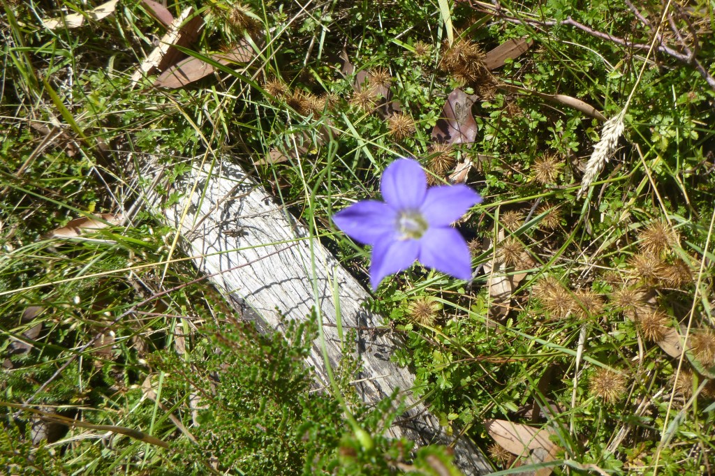
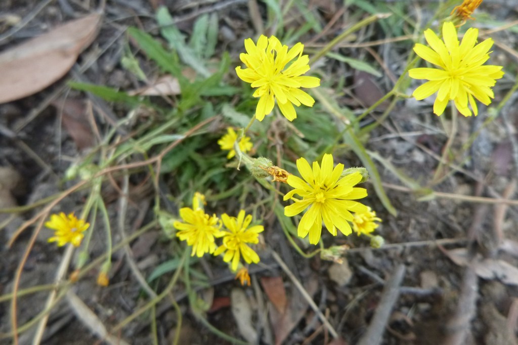
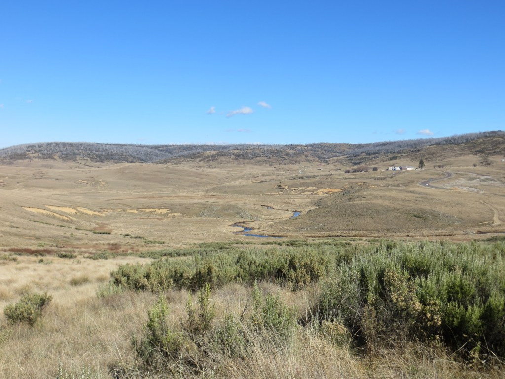

Photo Gallery

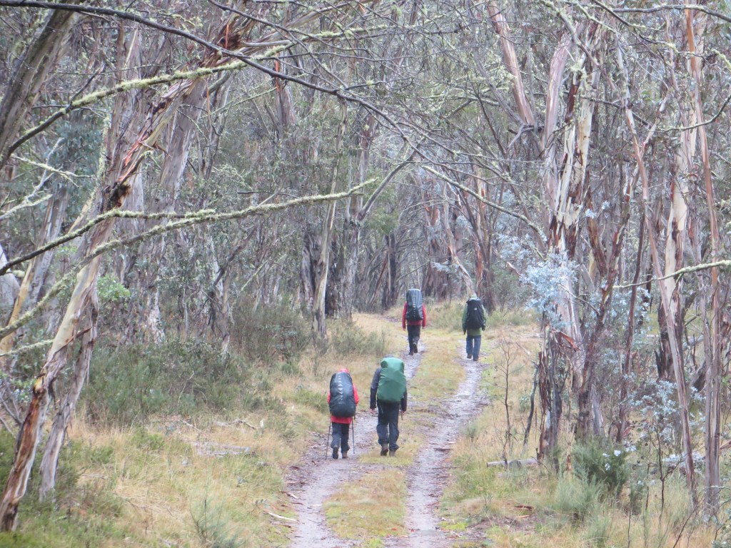
And so it was for five walkers on a late autumn, an eight day traverse of the final northern section of Australian Alpine Walking Track (AAWT), stretching 105 kilometres from Kiandra on the Snowy Mountain Highway to Namadgi Park HQ on the outskirts of Canberra.

Map of route Kiandra to Canberra. Kosciuszko National Park. AAWT
Kiandra to Canberra on AAWT.

The complete 659.6 kilometre AAWT crosses some of Australia’s remotest and highest alpine mountains and snowgrass plains with a weather regime that can be very hot on occasions but is more often than not cold, wet and highly unpredictable.

Signage on Aust Alps Walking Track

As Alfred Wainwright, a famous English fell walker, wrote: ” There’s no such thing as bad weather, only unsuitable clothing.”

Snowing at Pockets Hut. Kosciuszko National Park.
Rigged for cold weather on AAWT.

Useful Information

NSW Dept of Lands: 1: 25000 maps : Ravine, Tantangara, Rules Point, Peppercorn, Rendezous Creek, Corin Dam, Williamsdale.

NSW Rural Fire Service Brochure: Bushfire Safety for Bushwalkers.

Chapman, J Chapman, M & Siseman J: Australian Alps Walking Track (2009)

ACT Dept of Environment: 1:20000: Namadgi Guide & Map


Some of my other hikes in Kosciuszko National Park.

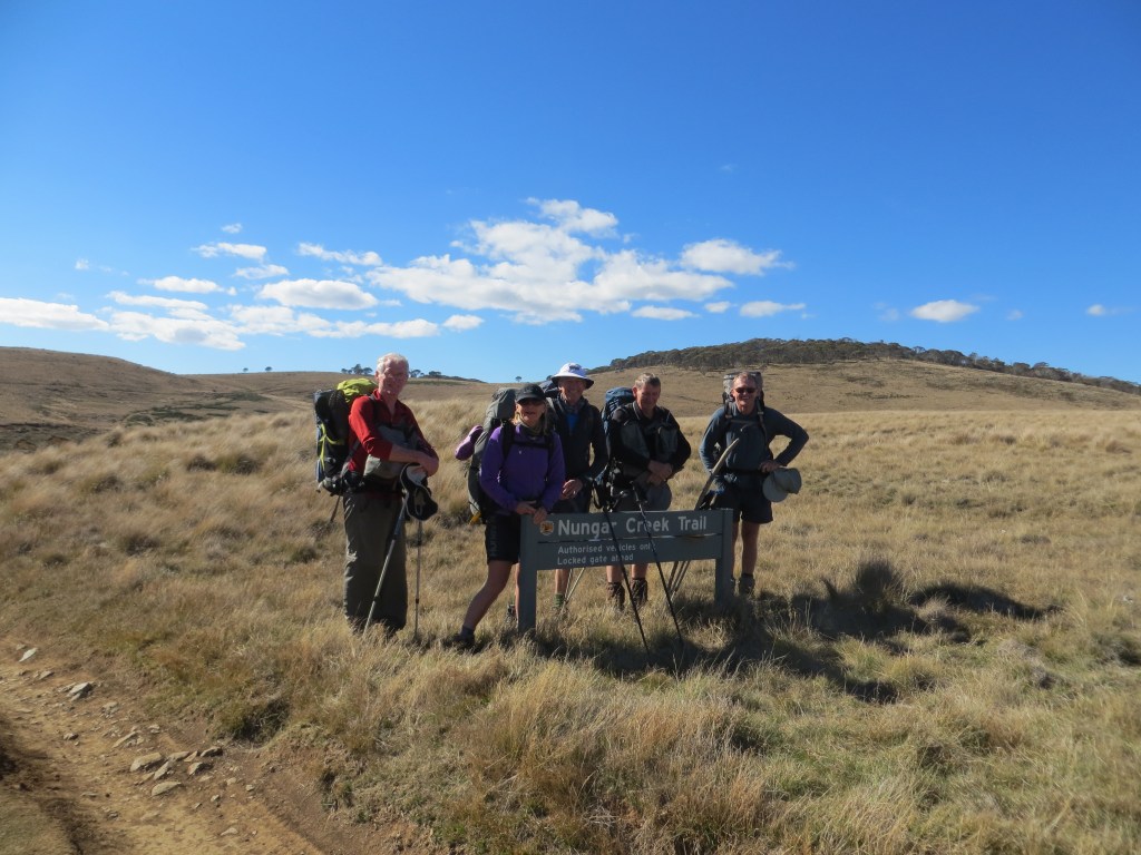
Day One: Saturday 11 May: Outward Bound: Kiandra to Witzes Hut: 12 kms.

Just after midday, youngest son Alex taxied our hire van to a halt outside the old Kiandra Courthouse since destroyed in the 2019/2020 summer fire season. The Old Court House was the only remaining building of the old gold mining town of Kiandra: population in 1859, 10,000; now.. zero population.

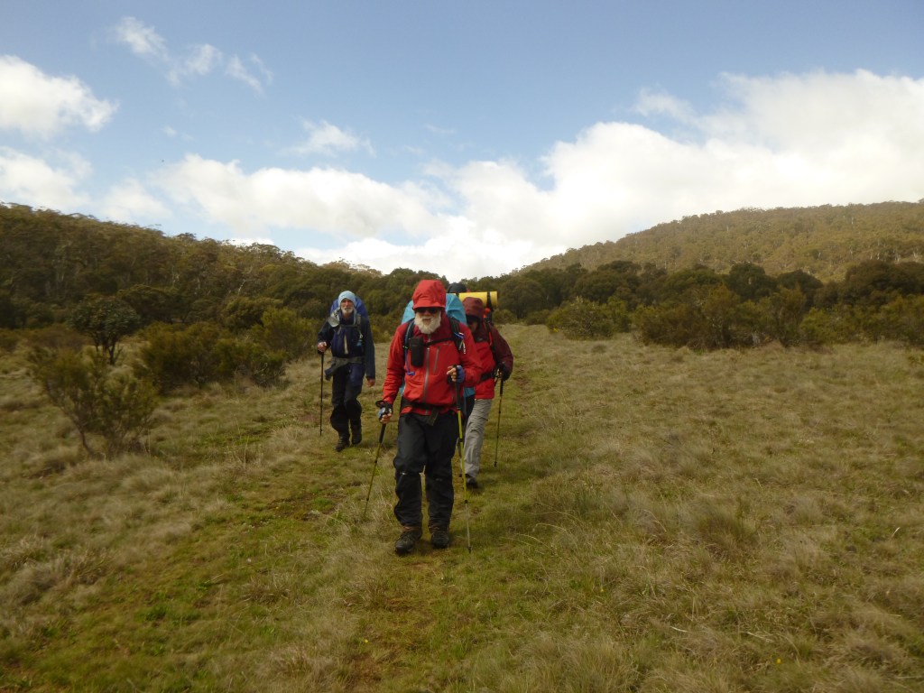
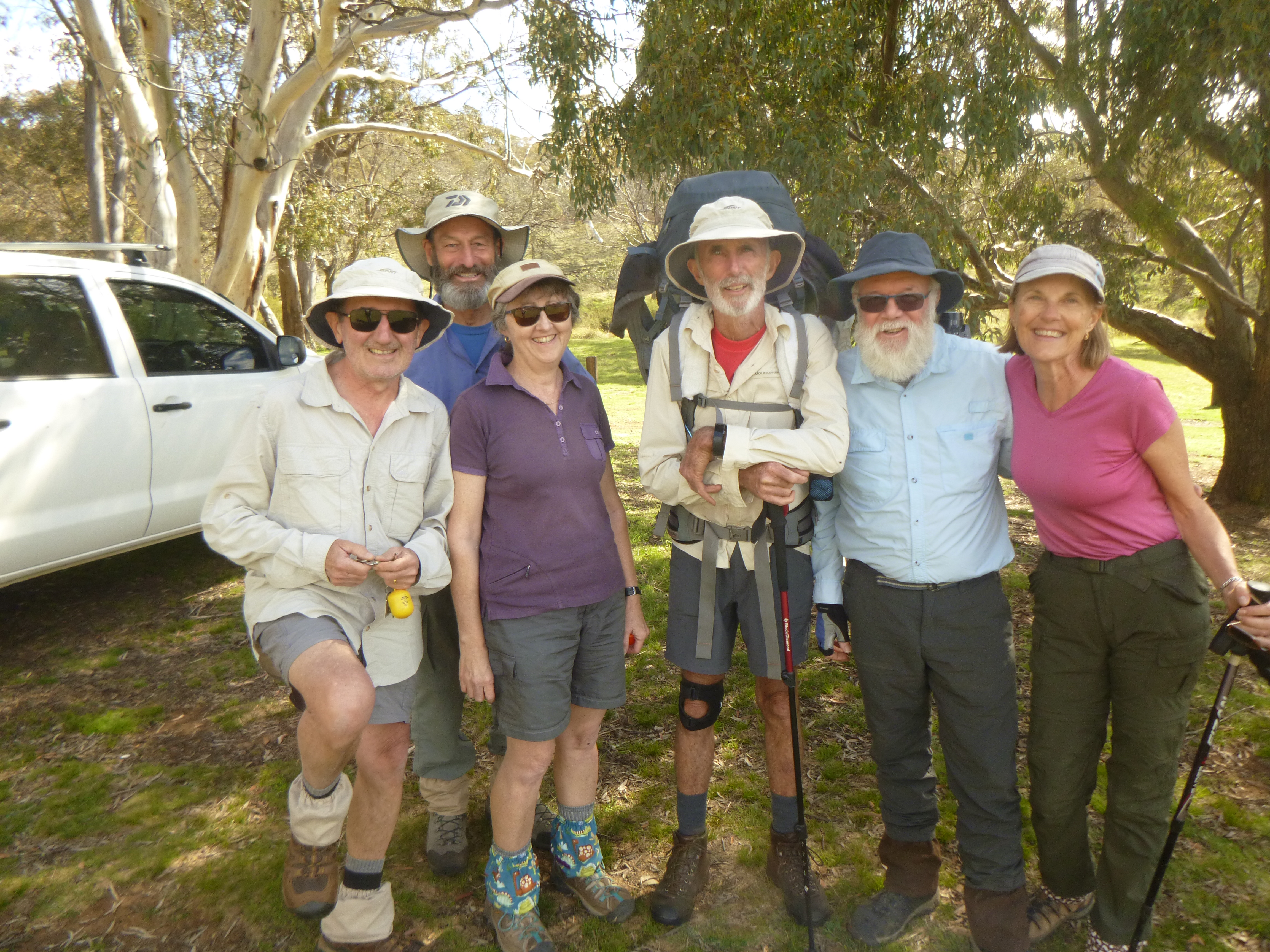
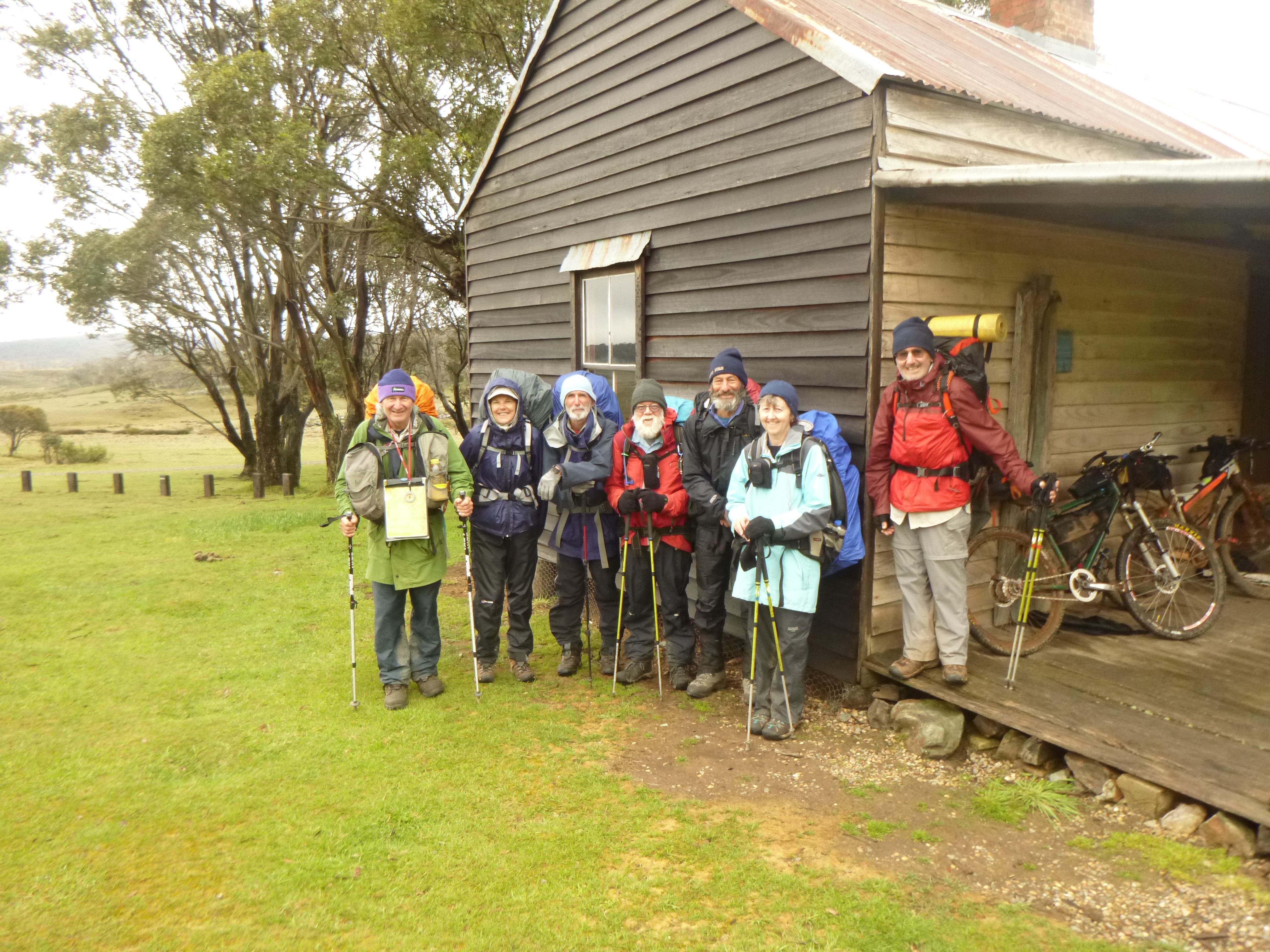
A sudden population explosion as five walkers plunged out of the warm van and into a blast of cool air:  Ross , Leanda , Peter, John and last but not least, their esteemed and worthy leader, yours truly.

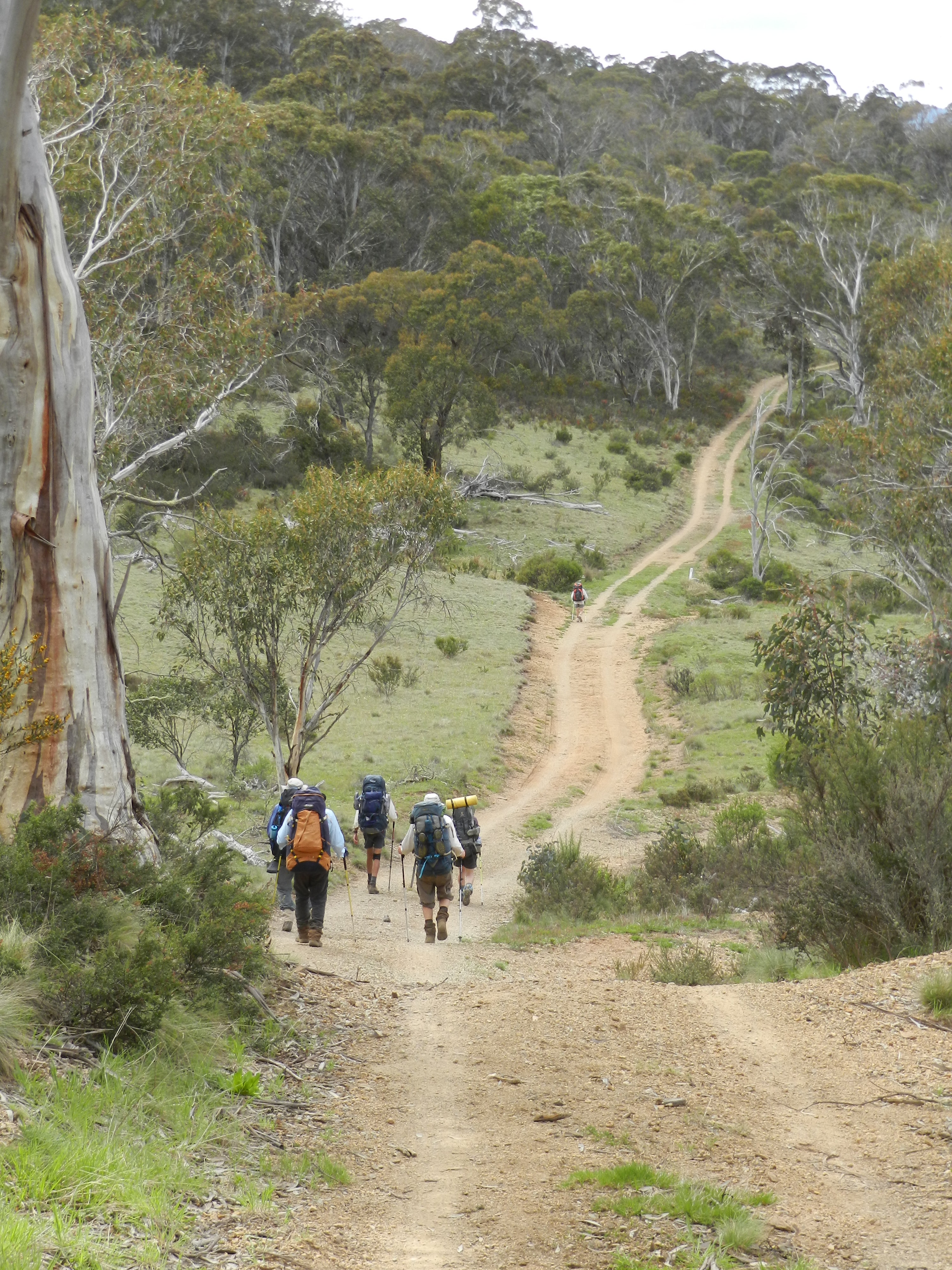
The race was on for the few sunny spots out of the cool blustery wind. We wolfed down our Cooma take-aways, bade Alex a fond farewell, then hit the track, the Nungar Hill Trail.

Our afternoon on the AAWT took us northward over rolling snowgrass plains at about 1450 metres, broken only by occasional alpine streams, which we forded with dry boots and socks intact: the Eucumbene River, Chance Creek, Kiandra Creek and just before Witzes Hut, Tantangara Creek.

After Chance Creek we climbed to the crest of the Great Dividing Range, known locally as the Monaro Range. A minor blip on this undulating high plains landscape.

Start of Nungar Hill Fire Trail near Kiandra. . Kosciuszko National Park.
Leaving Kiandra on the Nungar Hill Fire trail.

The seven day BOM forecast looked agreeably benign: early frosts (a mere -1° C) followed by sunny days (14° C). Perfect timing. But meteorology has a way of biting bushwalkers on the bum. In May this year maximum temperatures averaged 8.2°C while minimums hovered around a miserable 2.8°C. With a record low of minus 20°C, Kiandra is one of the coldest places on the Australian mainland.

Fortunately for this leader, my walking companions, all experienced bushwalkers, were kitted out for all eventualities. But most impressive of all was that they remained unfailingly positive and obliging under some pretty trying conditions.

Australian Alps Walking Track near Pockets Hut
Another cold day on High Plains of Kosciuszko.

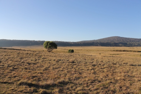
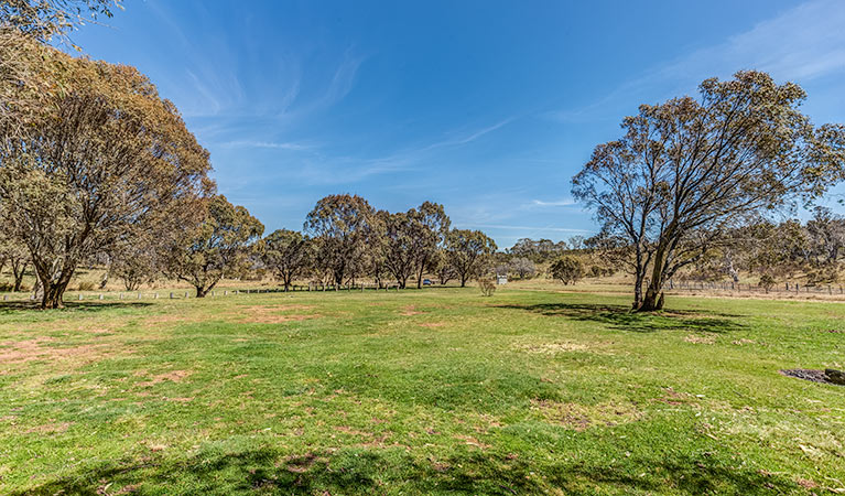
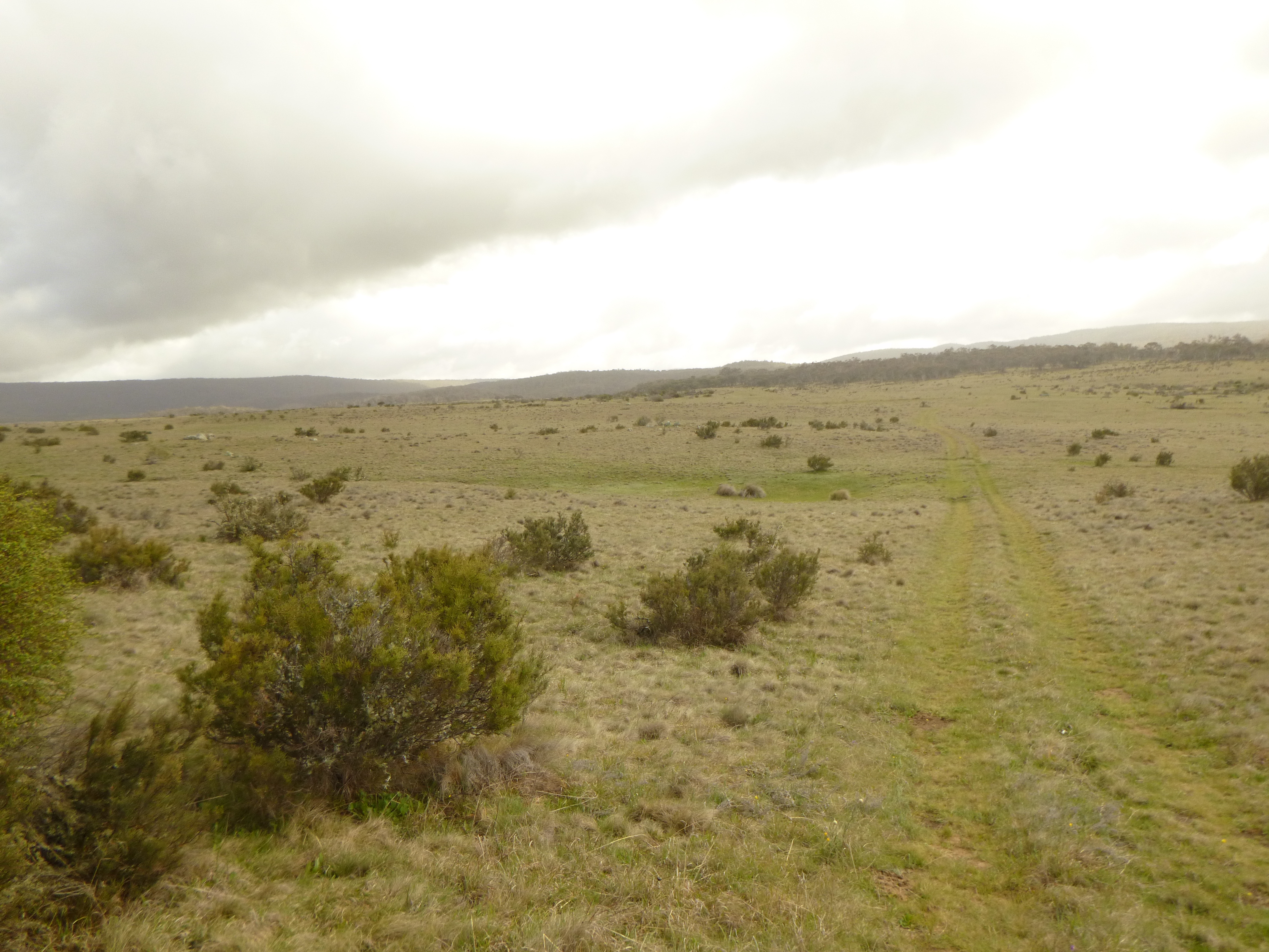
The huge grassy plains are an ancient peneplaned surface. They are the almost level remains of a long eroded mountain range system that was later uplifted in a major tectonic movement of the earth’s crust known as the Kosciuszko Uplift thus forming the Kosciuszko Plateau.

The combination of cold air and flat topography created ideal conditions for natural high plain grasslands, technically referred to as the Northern Cold Air Drainage Plains. These were highly prized for summer grazing.

View across High Plains of Kosciuszko National Park from Mt Gingera.
View across High Plains of Kosciuszko from Mt Gingera ACT.

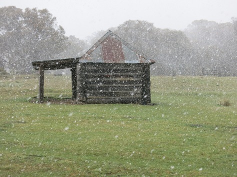
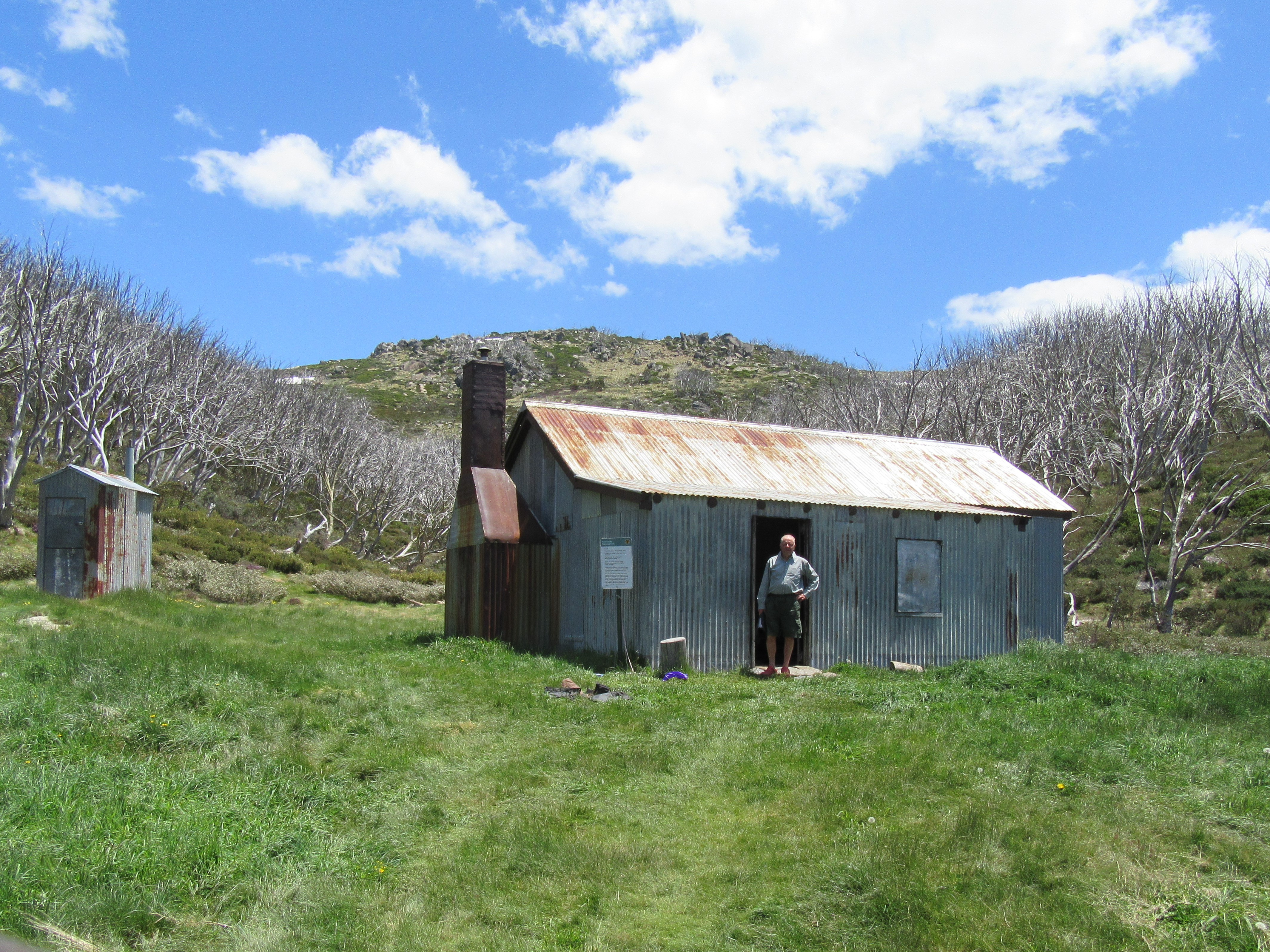
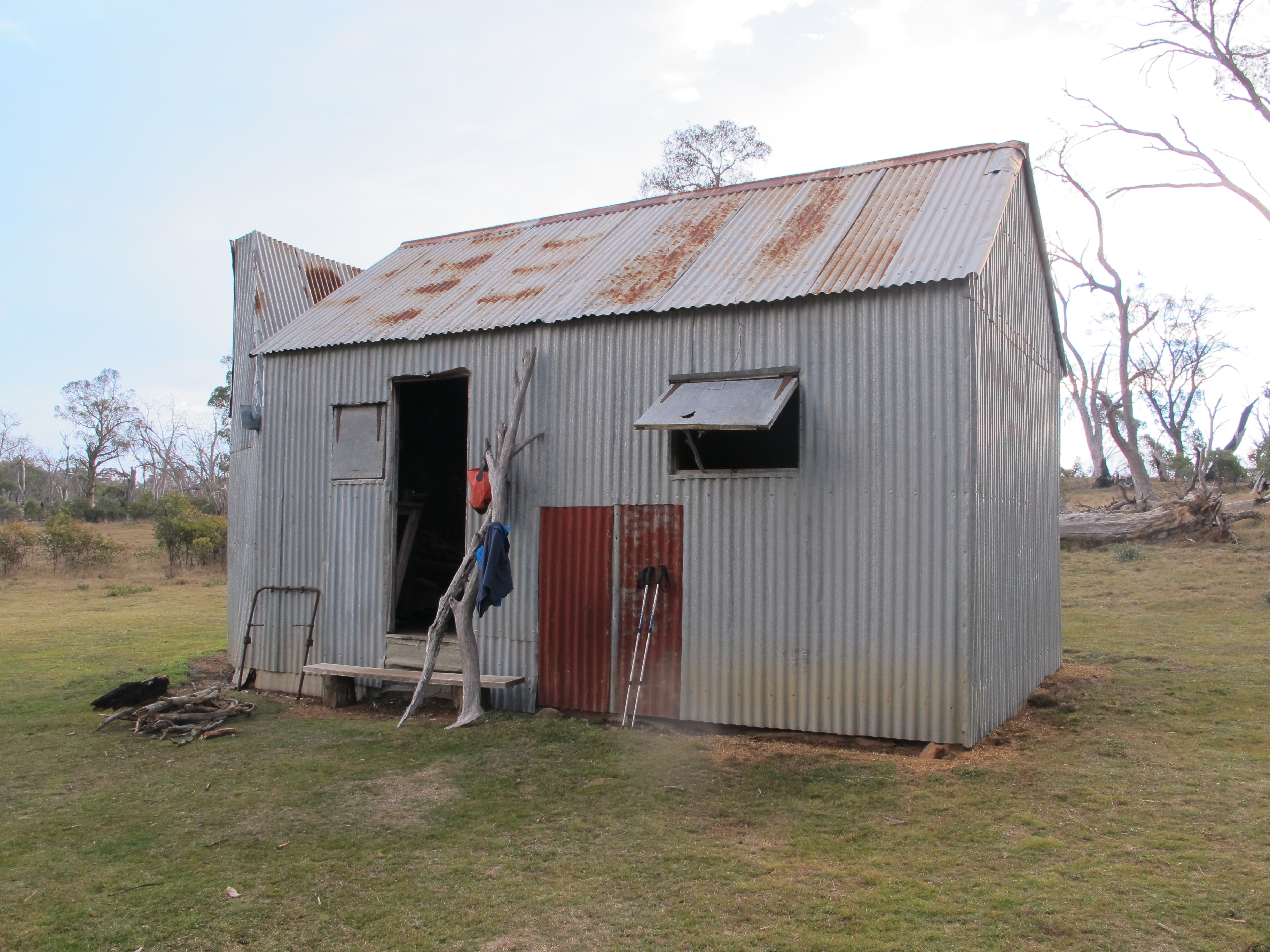
First stop, Witzes Hut. Witzes Hut, possibly a corruption of Whites Hut, like many Kosciuszko huts is set in a picturesque shelter belt of snow gums. Built in 1882 it is a vertical slab wooden hut, single room (about 6m x 3m) with a wooden floor and open fireplace. It is just one of many huts in Kosciuszko: cultural relics from the days of summer cattle and sheep grazing on the high plains.

They are invariably basic: shelters of last resort according to the NPWS signs tacked to the doors. Our late season crossing of the AAWT became hut dependant as the weather closed in. Although we had tents, it was a irresistable temptation for these warm-blooded Queenslanders to sidle into a snug dry hut at day’s end.

Witzes Hut. Kosciuszko National Park
“Is there room at the inn ?” Witzes Hut on Nungar Hill Fire Trail.
Witzes Hut. Kosciuszko National Park.
Witzes Hut on Nungar Hill Fire Trail.

Day Two: Sunday 12 May: Hayburners of the High Plains:  Witzes to Hainsworth Hut: 23 kms.

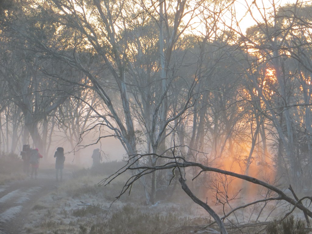
At 23 kilometres, a longish day beckoned. As a graduate of the Brian Manuel School of Bushwalking I had slyly insinuated to my friends that there was “no hurry” to pack up in the mornings. For those who have not been on the receiving end of this daily regime, expect a rousting out of your downy nest well before sunrise. About 5.00 am is Brian’s preferred time.

Unsurprisingly, a heavy frost carpeted the grass outside. Meanwhile, inside, my scouting friends Peter and John had worked their magic with two sticks, or whatever they use these days, and had succeeded in cranking up a fire of sorts. This we kept going until the last possible moment. Hut etiquette : Always make sure to thoroughly extinguish any fire before leaving the hut and replace firewood used.

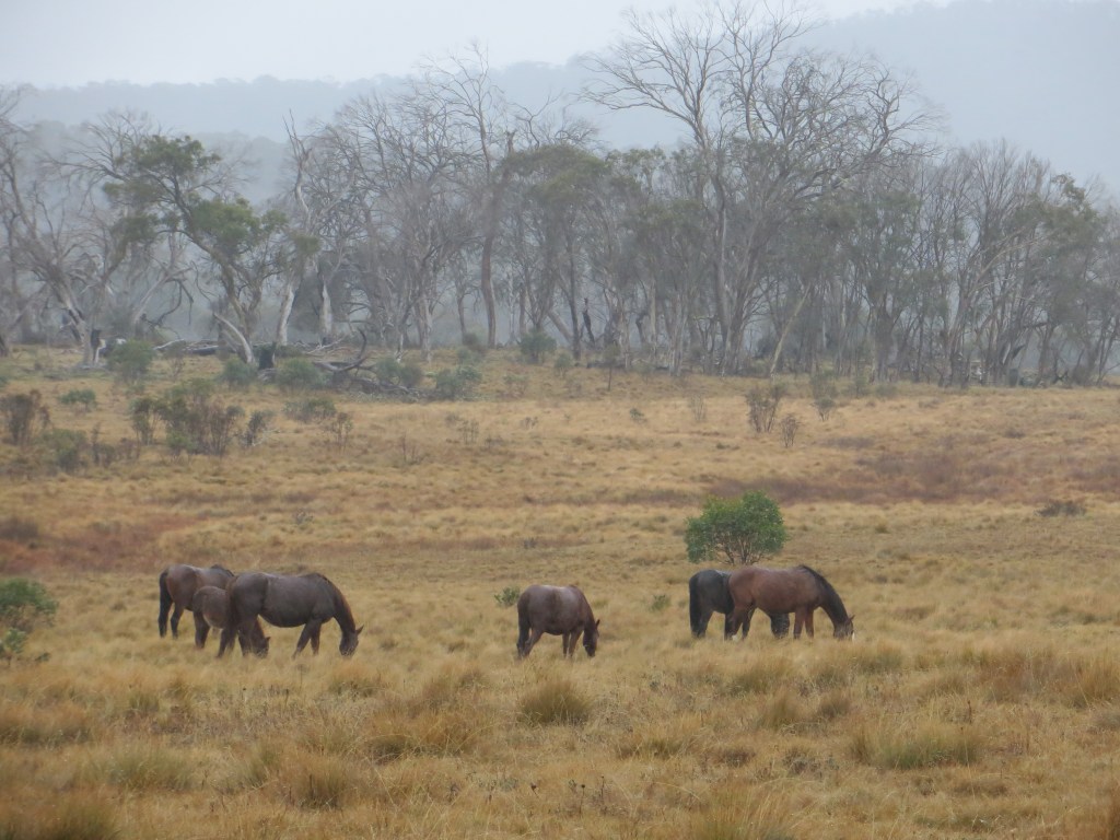
On schedule at 7.30 am we scrunched off along the Bullock Hill Trail. Ghosts in the freezing mist, frost nipping at any gloveless paws. Before long the mist dispersed, revealing a brilliant blue sky and vast frosted grassy plains. Sunny with the max creeping up to a sizzling 13°C. Even the brumbies were out picnicking in the glorious autumn sunshine.

Cold morning on Bullock Hill Trail. . Kosciuszko National Park.
Frosty morning on Bullock Hill trail.
Bullock Hill Fire Trail.  Kosciuszko National park.
By mid-morning the frost and mist had lifted. Descent to Murrumbidgee River.

Brumbies aka Wild Horses aka Feral Horses

A brumby sighting is always exciting for those misguided equinophiles we were harbouring in our midst. But brumbies are feral horses, much the same status as foxes, cats, goats, deer and pigs. And as such they have no place in these fragile alpine ecosystems.

In the ACT they are regularly culled, but in NSW, herds of these hayburners cavort over the snowgrass plains with impunity: brunching on the juiciest alpine wildflowers, carving out innumerable tracks through the scrub and trashing alpine streams and swamps with their hooves.

The Parks service does allow horse riding in Northern Kosciuszko and provides horse camps with yards , water troughs, loading ramps, hitching rails and full camping facilities. From my observations recreational horse riders act responsibly in the alpine environment by keeping to designated management tracks and horse trails . Feral horses are a different matter entirely.

Brumby damage. Kosciuszko National Park
Pugging at a creek crossing in the High Country.

In an attempt to manage brumbies, a 2016 draft Wild Horse Management Plan recommended reducing numbers in Kosciuszko by 90% over 20 years, primarily through culling. That would have left about 600 horses in the park.

Naturally the NSW parliament ignored the advice of its own scientific panel so there was no cull. Instead, the NSW Deputy Premier John Barilaro hatched his own plan, the now infamous: The Kosciuszko National Park Wild Horse Heritage Bill 2018.

The bill would prohibit lethal culling because of the heritage significance of brumbies. I, too, can understand the cultural imperative of maintaining a small sustainable herd of brumbies but there are still serious questions to be answered about the environmental impacts of large numbers of brumbies. The NSW Threatened Species Scientific Committee has described the damage done by brumbies as a ‘key threatening process’.

Fortunately, sanity has prevailed and by 2025 culling was well underway and brumby reproduction rates had dropped below replacement levels.

Brumbies. Kosciuszko National Park
Small herd of grazing brumbies.

Update on the Kosciuszko Brumbies
” About 4000 feral horses will be removed from Kosciuszko national park in New South Wales as part of an emergency response to protect the alpine ecosystem after large areas were devastated by bushfires. ” Graham Readfearn. The Guardian . 20 Feb 2020

In February 2020 the NSW Environment Minister Matt Kern announced ” the largest removal of horses in the park’s history”. He had an agreement between ” horse lovers and National Park lovers” to remove wild horses after the unprecedented bushfire damage over the Nungar, Boggy, Kiandra and Cooleman Plains of Northern Kosciuszko.

Recent surveys estimated wild horse numbers increasing from 6000 in 2014 to 19000 in 2019. Clearly environmentally unsustainable in these burnt out landscapes. Minister Kern was reporting on the outcome of a meeting of the Kosciuszko National Park Wild Horse Community Advisory Panel. It is to be hoped that the promised action is taken quickly to reduce horse numbers in the fragile High Plains.

The best summary of the brumby issue that I have read is Anthony Sharwood’s The Brumby Wars (2021, Hachette). This is a book about Australia’s brumbies and the intense culture wars that has erupted about their removal from Kosciuszko National Park. Highly recommended.


Our first obstacle was the mighty Murrumbidgee. We deployed a tried and tested technique, fanning out until someone discovered a likely looking rock or gravel bar. Okay for the four males, each outfitted with long spindly shanks but a big leap of faith for the resident shorty.

Crossing Murrumbidgee River. Kosciuszko National Park.
Crossing the Murrumbidgee River.
Murrumbidgee River. Kosciuszko National Park.
The climb out of the Murrumbidgee River.

Then came one of our few cross-country sections, a mere eight kilometres out to the Port Phillip Trail. For this geographically tricky bit I pressed into service my navigators. Using Peter’s trusty GPS as insurance they tracked to a line of old telegraph poles, which marched across the hills ahead, leading us inexorably towards the dusty Port Phillip Trail on Long Plain. Navigators extraordinaire.

Old Telegraph poles on descent to Port Phillip Fire Trail. Kosciuszko National Park.
Old Telegraph pole on descent to Port Phillip Fire Trail.

More pleasing was John’s distant sighting of the alpine dingo near the Murrumbidgee River crossing. In all my walks in the high country I have had only one previous encounter with this splendid canine, a subspecies of the grey wolf.

Today this solitary light coloured dingo stalked us from afar, surreptitiously tracking our movements from behind clumps of snowgrass. My dingo bible, Laurie Corbett’s The Dingo in Australia and Asia, says that the alpines are a distinctive subspecies, one of three in Australia.

They feast on rabbit, wallaby, wombat with the occasional brumby foal thrown in as a special treat. They are actually quite lazy hounds, rarely travelling more than two kilometres a day and their territories are comparatively small .


Hainsworth Hut

By now it was it was late in the day and with ugly dark clouds brewing we wasted no time, bypassing Millers Hut and Ghost Gully Campsite to reach Hainsworth Hut, on Dip Creek.

Millers Hut. Kosciuszko National Park.
Millers Hut near the Port Phillip Trail.

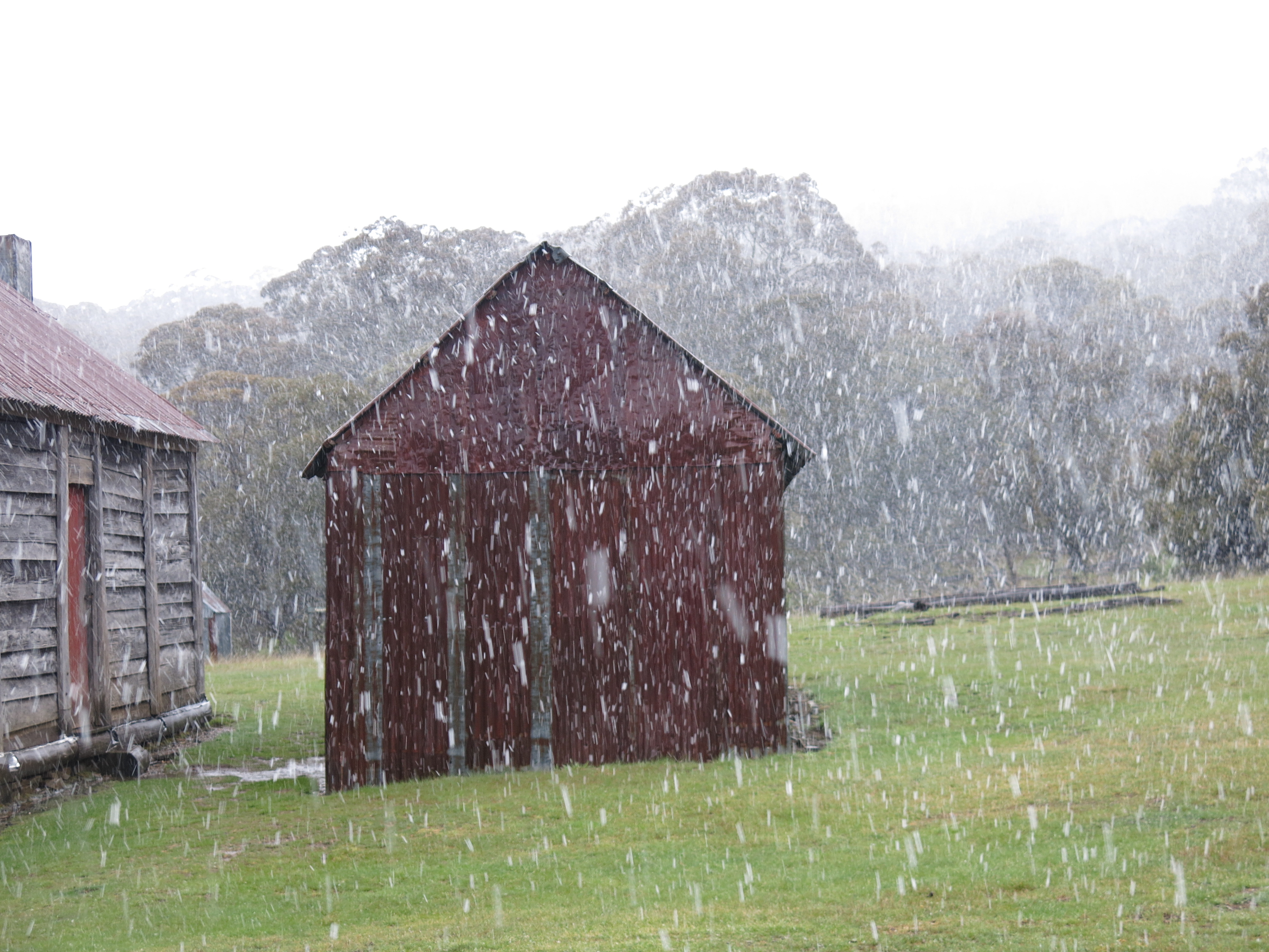
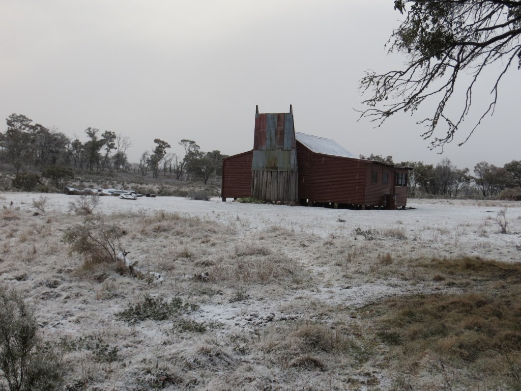
Just in time for a quick refreshing dip before sunset. Not. Hainsworth Hut, built in 1952, is the archetypal high country hut: a windowless coffin of corrugated iron, two rooms and a large open fireplace at one end. But hugely welcome for these weary walkers. A long 23 kilometre day of up hill and down dale.

Hainsworth Hut. Kosciuszko National Park.
Hainsworth Hut.

Day Three: Monday 13 May: Aquabots: Hainsworth to Pockets Hut via Bill Jones Hut: 24 kms.

7.30 am. We beetled off into light drifting rain, eastwards along the Mosquito Creek Trail, up and over the Gurrangorambla Range (Gurrangorambla granophyre – a hard, fine- grained granite) and then descended onto the Silurian limestones of Cooleman Plain.

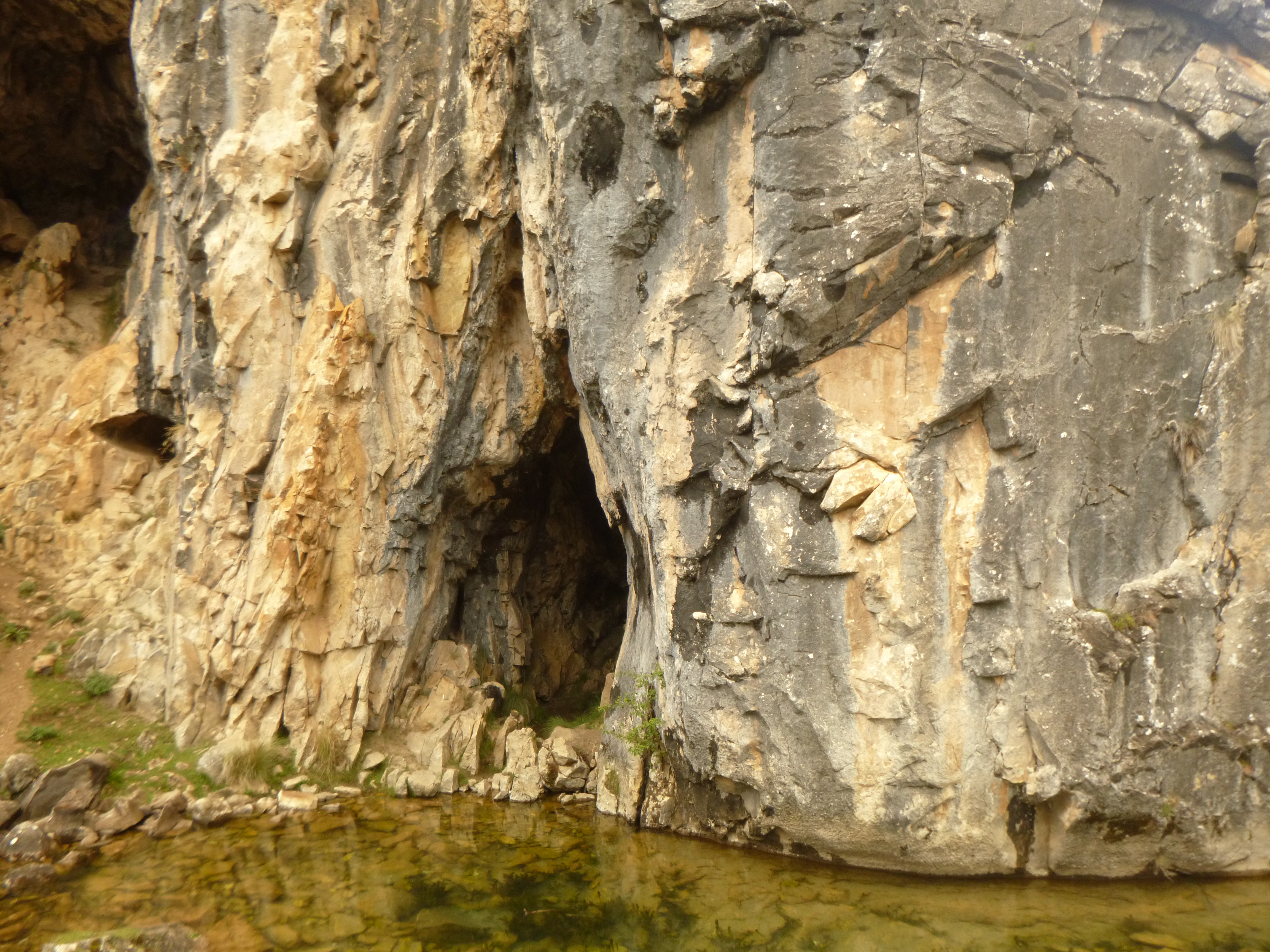
The Cooleman is similar in appearance to the other high plains we had traversed, but as it is underlain by limestone it displays the distinctive landforms of a karst landscape: subterranean creeks, caves, sink holes, stalactites, stalagmites, gorges and occasional brachiopod fossils.

When T.A. Murray first saw Cooleman in 1839 he described it as “almost treeless with grasses growing to stirrup height.”

Gurrangorambla Range. Kosciuszko National Park
Climbing over the Gurrangorambla Range at about 1600 metres.

Bill Jones Hut

With the cool, wet and windy conditions persisting we ducked into to Bill Jones hut for our morning tea. The hut is standard daggy and sports a dirt floor, but it was a haven for these five bedraggled walkers. Peter set to and soon had a cheery fire underway then we stood around drinking our piping hot mugs of tea and coffee. Wonderful.

Fire extinguished before we clomped off in saturated footware.

Bill Jones Hut. Kosciuszko National Park.
Bill Jones Hut on the edge of the Cooleman Plain.

Pockets Hut

My fellow aquabots and I seemed less than enthusiastic about doing the tent thing at Bluewater Holes limestone area so it was onward to Pockets Hut, a very comfortable wet weather bolt hole. Pockets is a large four-roomer weatherboard built in the 1930’s, originally hooked up with hot water and electricity. We settled in: a comforting fire, clothes drying in front of the fireplace, hot brews and long nana- naps snug in our warm sleeping bags. Life couldn’t be better.

Pockets Hut. . Kosciuszko National Park.
Pockets Hut on a sunny day.

Day Four: Tuesday 14 May: Rest Day: Pockets Hut to Bluewater Holes via Black Mountain: 14 kms.

A tad cool this morning, -2°C. I had naively promised an easy day walk along 4WD trails back to the Bluewater Holes limestone area on Cave Creek. But as is often the way when associating with these deviant bushwalking types some genius suggested a cross-country “short cut”, contouring around the 1497 metre Black Mountain then dropping into Cave Creek.

With a clearing sky, an easy day walk ahead, things were definitely on the up and up. Or so I thought. We quickly abandoned this contouring lurk, pushed ever uphill towards the summit by massively dense stands of alpine undergrowth.

This was bush-bashing on steroids. In the days of yore when bushwalkers were proper bushwalkers, the handy machete would have swung into action to clear the way ahead. Luckily, John, who is an excellent navigator, as well as scrub-basher, and the ‘genius’ who got us into this predicament, found the rocky summit and then led us down the long northern ridge to land precisely where we needed to be in Cave Creek.

After lunch we poked our way downstream, criss-crossing Cave Creek, checking out Clarke Gorge, Barbers Cave, the Bluewater Hole and Coolaman Cave, a cursory survey at best.

Cave Creek is worthy of several days of exploration but with the sky clouding over (think: it’s going to dump snow now) and the wind rising we hoofed off on the Bluewater Holes Trail toward Pockets. But not before considerable geographical angst as the four males bickered about the location of the trail head. Attn all male leaders: when in doubt always listen carefully to the female of the species who actually bother to read the maps on the Parks information boards.

Blue Waterholes on Cave Creek. Kosciuszko National Park.
Blue Waterholes limestone area: Cave Creek.

Day Five: Wednesday 15 May: An Antipodean Christmas: Pockets to Oldfields Hut: 7 kms.

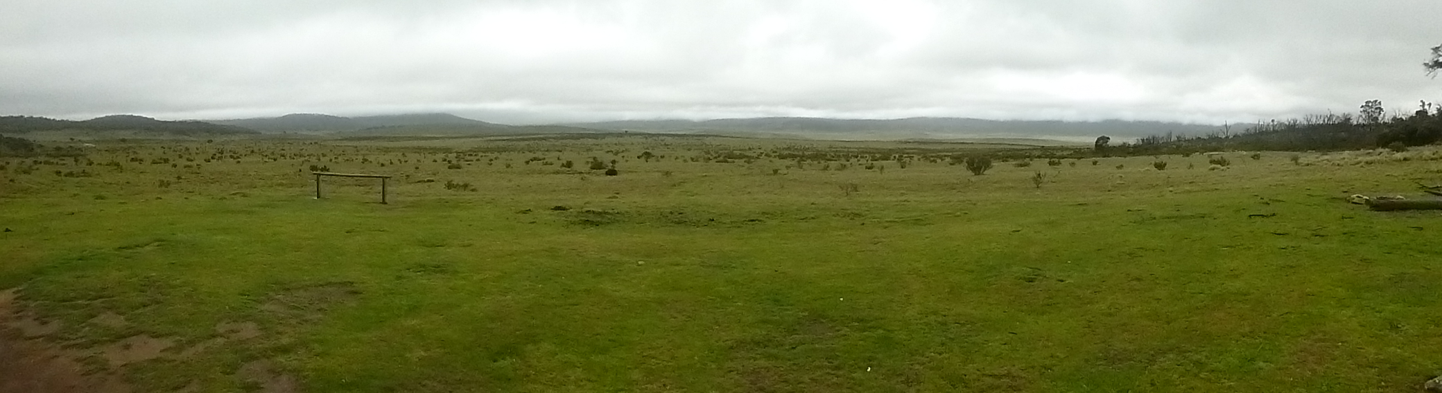
I peeked out. A white mantle of snow covered all. Snow floated down from a sullen sky. We could freeze our butts off in this stuff but the wild weather gave an exciting edge to the walk. Today’s maximum temperature barely made 3°C.

Pockets Hut. Kosciuszko National Park.
A cold morning at Pockets Hut.

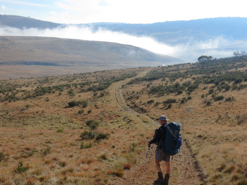
The walk across the snowy plains towards Murray Gap Trail was just magic, snow carpeting the vast Tantangara Plain.  After a Snowy Mountains Hydro valve house (the Goodradigbee Aqueduct) the AAWT climbs over a forested ridge before descending to fetch up at on the river flats of the Goodradigbee River. Tucked away in a stand of gnarled black sallees is Oldfields Hut.

Tantangara Plain. Kosciuszko National Park.
Tantangara Plain enroute to Oldfields Hut.

Oldfields Hut

Oldfields, with slab walls and a long verandah, was constructed in 1925 and is said to have excellent views to Bimberi Peak (1913 m) and Mt Murray (1845 m) on the ACT/NSW border.

Not today; mist and dumps of sleet obscured any views to the east. Our immediate priority as always was to scrounge up a supply of firewood. Then John and Co cut the wood into useable billets.

The golden rule of the huts is to always replace any timber burnt and leave a supply of dry kindling. Which we did in spades.

Oldfields Hut. Kosciuszko National Park.
Oldfields Hut.

Day Six: Thursday 16 May: Border Hoppers: Oldfields Hut to Sawpit Ck camp: 18.7 kms.

Today we would bid farewell to the high grasslands of Kosciuszko and traverse into the forested ranges of the Bimberi Wilderness and Namadgi National Park for our final three days.

We rugged up for the perverse conditions. At Oldfields my pack thermometer read 0°C while maximum temperatures barely held at 2°C all day. Westerly winds gusted to 70 kmh. The morning’s walk would climb 245 metres into Murrays Gap and at 1600 metres we copped the full force of the bad weather coming from the west. Sleet blanketed the mountain slopes and the wind drove rain and sleet horizontally onto our backs.

But soon we descended, over the Cotter Fault line and into the Cotter River System. The weather backed off and a watery sun finally leaked a few rays through a clearing sky.

Apart from cool windy conditions the wet weather was behind us. Relieved at this change of fortunes our little party trotted on, jaunty like: past Cotter Hut (locked to keep those dodgy bushwalkers at bay), and past our turn-off to the Cotter Gap track.

The site of another male navigational misadventure and bailed out again by Leanda who had taken the time to peruse a rat-eared A4 map tacked to a post. For the rest of the day we climbed steadily 350 metres up to Cotter Gap and then descended steeply to our cramped bush campsite on Sawpit Creek.

No more days of lurking in comfortable bush huts for this slack lot. Beyond Cotter Gap a significant change in vegetation occurs; gone are the alpine species, replaced by a drier Eucalypt forest growing on the granites of the vast Murrumbidgee Batholith.


Day Seven: Friday 17 May: One small step for Man: Sawpit Ck to Honeysuckle Ck: 15.6 kms.

With Ross now in full flight mode it was a quick hop down into the grasslands of the narrow Orroral Valley and its herds of Eastern Grey Kangaroos.

We sprawled out in the grass, absorbing the warmth of the sun on our tummies for the first time in several days. Sheer bliss.
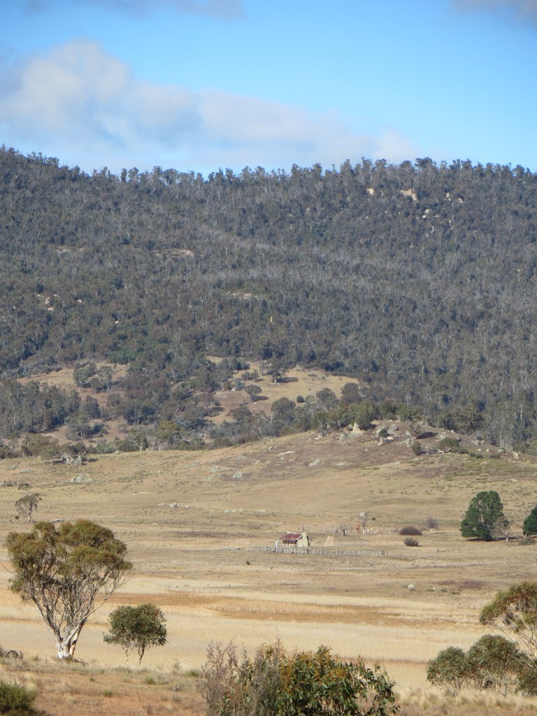
Further down the Orroral Valley is the Orroral Homestead and shearing shed built in the 1860s.

It has three rooms, chimney at each end and a full length verandah on the front.

As tempting as this sounded to us, overnight stays by bushwalkers are strictly verboten. Those ACT Parks rangers are pretty toey about that sort of stuff.

Orroral Valley and Orroral Homestead. ACT.
Orroral Valley and Orroral Homestead

Onward and upward to the well-appointed Honeysuckle Creek camping ground, with the small matter of a 420metre ascent onto the Orroral Ridge at 1350 metres to get there.

Honey suckle Creek Campground. Namadgi . ACT.
Honeysuckle Creek Campground. ACT.

Honeysuckle is, like the Orroral Valley, the site of a former space tracking station. A series of excellent info boards informed us that it operated from 1966 to 1981 and was a vital part of communications for the Apollo moon missions, Skylab,Voyager and Pioneer deep space probes. This included The Apollo 11 mission and Neil Armstrong’s signature, “one small step for man, one giant leap for mankind.”


Day Eight: Saturday 18 May: Homeward Bound: Honeysuckle to Namadgi Park HQ: 15.4 kms.

After an all-night rolling stoush with an encampment of feral Rover Scouts we set off in another heavy frost (- 0.3°C) on our final leg of the AAWT via Booroomba Rocks.

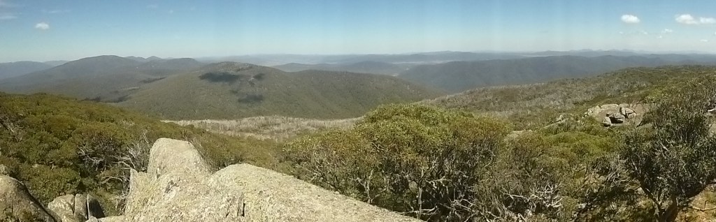
This granite outcrop at 1372 metres afforded us speccy views across the plains to Canberra. Several hot air balloons hung in the still air above the city.

But the AAWT wasn’t quite finished with us yet. Just before lunch Ross whipped us up the 240 metres to our lunch spot near Mt Tennent (1384 m), about an hour from the trail exit. You can imagine that I was pretty taken-aback when I pulled my tent fly out for a drying in the sun, and discovered that after five hours in my pack it was still heavily encrusted with layers of ice.

Thus ended one of Australia’s best long distance walks: over high ranges, extensive snowgrass plains, swampy meadows and sinuous alpine streams.

For my money the Kiandra to Canberra section was an unforgettable bushwalking experience. Brilliant high plains scenery, historic huts, caves, gorges, dingoes, brumbies and first-rate walking companions. Who could ask for more? And who among us will ever forget the wild and woolly weather?


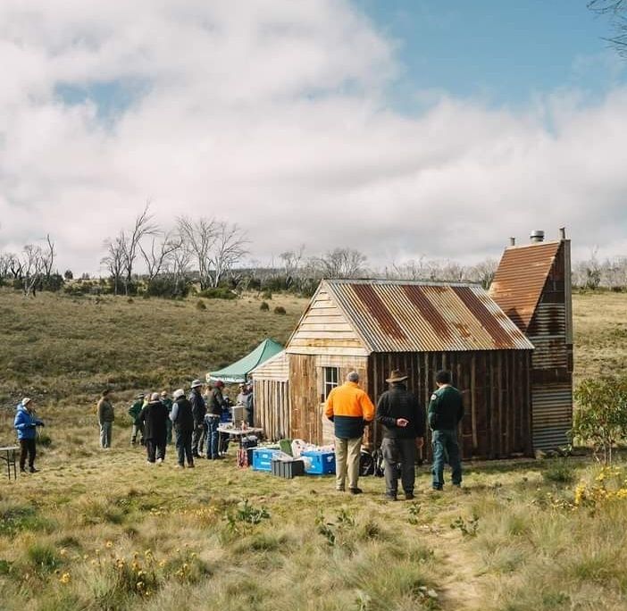
Huts destroyed in the 2019/2020 summer fires

Sawyers Hut, Wolgol Lodge, Kiandra Court House, Pattersons Hut, Matthews Cottage, Round Mountain Hut, Linesmans No3 Fifteen Mile Spur (1950), Linesman No 3 Fifteen Mile Spur (1980),Vickerys Hut, Delaneys Hut, Happys Hut, Brooks Hut ( badly burnt), Bradley and O’Briens, Four Mile and Demandering.

Happily, rebuilding of ten of these huts is happening at a rapid pace, thanks to herculean efforts by KHA volunteers and NSW Parks.

Restored Four Mile Hut 2024. Kosciuszko National Park.
Four Mile Hut after restoration by KHA volunteers and Parks NSW.

Hiking the High Plains of Northern Kosciuszko

by Glenn Burns

Northern Kosciuszko is a subdued 1400 metre landscape of rolling sub-alpine grasslands separated by low snow gum clad hills and ranges rising to a maximum of about 1600 metres.

This vast upland has a different feel to the landscapes of southern Kosciuszko where 2000 metre whaleback mountains and steep ridges predominate. With its open vistas, network of mountain huts and more benign weather, northern Kosciuszko offers its own easier but distinctive walking opportunities.


 Can I tempt you with a leisurely 50 kilometre, 6 day walk in the high country of northern Kosciuszko National Park? Nothing too taxing. Imagine stepping out along grassy 4WD tracks as they wind up through snow gum woodlands to low alpine passes then gently descend to vast open plains of swaying tussock grasses. Maybe camping overnight near historic mountain huts?

Throw in showy alpine wildflowers, perhaps a sighting of an elusive wombat, limestone caves, brilliantly coloured Flame Robins, or maybe the eerie nocturnal call of a Boobook as you lie snug in a warm sleeping bag.  

With these promises in mind, on a balmy November evening, seven walkers left Ghost Gully Campground on Long Plain to enjoy six days of hiking across the high plains of northern Kosciuszko.


Photo Gallery

Map of Hike Across High Plains of Nth Kosciuszko
Map of hike on high plains of Northern Kosciuszko National Park


The Weather

In the end, it was often about the weather.  Our late November trip coincided with the passage of several fronts and troughs gifting us days of unsettled mountain weather.  The pre-trip forecast for the week was a tad disconcerting.

Coolamine Homestead in light snow fall Kosciuszko National Park.
Light snowfall at Coolamine Homestead. Max temperature 4.1 C & winds gusting to 91 kph.
DAYFORECASTMIN oCMAX oCRAIN mmWIND
MONCloudy6.3 C17.8 C0 mm30 kph
TUESLate Storm10.8 C18.3 C0 mm57 kph
WEDRain10.8 C12 C24 mm63 kph
THUSnow0.4 C2.5 C34 mm 91 kph
FRISnow– 0.1 C4.2 C33 mm70 kph
SATSunny am1.2 C8.6 C61 mm46 kph

Hypothermia

Hypothermia is an under-estimated hazard for many walkers in Australia’s high country, even in summer. It is usually triggered by being out in cold, wet and windy conditions. Hypothermia can be easily prevented by wearing warm layers beneath wind and rain proof over-garments, by frequent consumption of carbohydrate-rich foods and by seeking shelter in a timely manner.

Our hike was marked by several days of conditions as described above, so I modified the walk accordingly: huts became the default overnight accommodation.

Fortunately for this leader, my fellow walkers, although denizens of the sub-tropics, were all well prepared for cold, wet, and windy conditions. Our party of Richard, Gary and Neralie, Joe, Larry, and Chris trucked in loads of rain jackets, rain pants, and multiple layers of thermals, fleece jackets, puffy jackets, beanies and gloves.

In fact, they seemed excessively bullish about our impending late week meteorological challenge. And this was a big plus as it was a different experience to gallivanting around in shorts and tee shirts.

Cooleman Plain on Blue Waterholes Trail.   Kosciuszko National Park.
Dressed for cold wet conditions on Cooleman Plain.

View from Old Currango Homestead across Cooleman Plain.  Kosciuszko National Park.
View from Old Currango Homestead across Cooleman Plain towards Bimberi Range in ACT

There are number of high plains in northern Kosciuszko mostly above 1300 metres. Known as frost hollows, frost plains or cold air drainage basins they are naturally occurring treeless plains.

The grasslands are an ecological consequence of cold heavy air draining down into the valleys of creeks and rivers. The pooling of this frosty air suppresses the growth of tree seedlings. Hence they are totally bereft of trees. Even the amazingly hardy snow gums refuse to thrive.

Instead, the snow gums (E. niphophila: Greek = snow lover) and black sallees (E. stellulata) grow on the hill tops above the valleys and the alpine grasses occupy the lower valleys. Thus the tree line here is said to be ‘inverted’.

There are about ten extensive northern frost plains lying between the Brindabellas in the ACT and Kiandra in NSW, including Tantangara, Gooandra, Boggy, Dairymans, Currango, Cooleman, Long, Wild Horse, Nungar and Gurrangorambla. All worthy of a visit.


The general rule is that the old grazing huts and homesteads should only be used in bad weather as a shelter and for warming up and drying out. But when the weather turns bad, as it often does, the huts become a magnet for skiers and snow-shoers in winter and bushwalkers, mountain bikers and horse trekkers in summer.

Most huts are equipped with a fireplace or stove and a modest supply of dry firewood. Although, I noticed on this trip, that the emergency wood supplies had been ratted and not replaced. Some huts are little better than ruins but those still standing are being conserved by caretaker groups affiliated with the Kosciuszko Huts Association and supported by Parks NSW rangers.

Bill Jones Hut.   Kosciuszko National Park.
Bill Jones Hut on western edge of the Cooleman Plain

The mountain huts of Australia’s high country form an integral part of its cultural heritage. In Kosciuszko the huts were often built as shelters on summer grazing leases using the most basic of tools: cross-cut saws, axes and adzes. Construction materials included split slabs, rough bush poles, wooden shingles for roofing, corrugated iron and stone cobbles for fireplaces.

Those of you who have walked in New Zealand, Europe or Tasmania may have misguided notions of the quality of Australia’s mountain huts.

On a fine summer’s day they are often hot and stuffy and not especially clean. Some are home to bush rats or even the occasional snake. White’s River Hut under Gungarten is said to be home to a multi-generational dynasty of pushy bush rats, the infamous “Bubbles the Bush Rat” clan whose mischief regularly features in the hut’s log book.

Personally, I haven’t been on the receiving end but fellow walkers have observed their nocturnal activities: chewing through rucksacks, raiding food bags and munching on the odd plastic torch or two. Although their noisy antics on the hut rafters are never appreciated.

Whites River Hut.   Kosciuszko National Park.
Whites River Hut & Rolling Grounds in background

The thing about these huts is their stunning locations. Sheltered from winter westerlies by copses of snow gums, close to an ample supply of running water, timber for firewood and magnificent views over grassy flats, the huts are high country gems. At sunrise, sit outside on a log or the door stoop and warming rays will soon have you thawed out.

On our trip we hoped to visit Hainsworth Hut, Old Currango Homestead, Coolamine Homestead, Cooinbil Homestead and the dirt-floored Bill Jones Hut as an emergency if we got caught out on the Cooleman Plain.

Hainsworth Hut.  Kosciuszko National Park.
Hainsworth Hut on Mosquito Ck Trail on a clear but cold morning.

Brumbies aka Wild Horses aka Feral Horses

In Australia, non-domestic horses are known as brumbies, wild horses or feral horses. It is estimated that there about 400,000 wild horses roaming Australia. Kosciuszko has about 19,000, and they represent an ecological disaster for these fragile alpine ecosystems.  

There is no doubt that horses were an important part of the cultural heritage of the high country. Today, the sighting of a herd of brumbies is very exciting, but they are feral animals with the same status as foxes, cats, goats, deer and camels.

Brumbies in campground.  Kosciuszko National Park.
Brumbies in campground , Kosciuszko Natinal Park.

In most states they are treated as a pest species being culled by aerial shooting or trapped then euthanaised or trapped and then broken in (rarely). In NSW the shooting of brumbies is a very contentious community issue as horse riding is a very popular recreational activity in northern Kosciuszko. Parks NSW recognises this by providing trails, horse camps, holding paddocks, water troughs and hitching rails.

In an attempt to manage brumbies, a 2016 draft Wild Horse Management Plan recommended reducing numbers in Kosciuszko by 90% over 20 years, primarily through culling.

That would have left about 600 horses in the park. Naturally the NSW parliament ignored the advice of its own scientific panel so there was be no meaningful cull. Instead, the NSW Deputy Premier John Barilaro hatched his own plan: The Kosciuszko National Park Wild Horse Heritage Bill 2018.

The bill would prohibit lethal culling because of the heritage significance of sustainable populations of brumbies. Certainly, the Fishers and Shooters Party and the Australia Brumby Alliance were pretty cock-a-hoop about the legislation but there were still serious questions to be answered about the environmental impacts of brumbies.

The NSW Threatened Species Scientific Committee has described the damage done by brumbies as a ‘key threatening process’. But hey, what would a bunch of scientists know? As a bushwalker who has visited Kosciuszko for many decades I can attest to the more obvious damage caused by brumbies: the pugging of swamps and watercourses, the myriad brumby trails criss-crossing the landscape, the fly infested dung heaps and the increasing incidence of brumby herds clomping through campgrounds at night.

Brumbies.  Kosciuszko National Park.
More brumbies in the Bramina Wilderness on the Broken Cart Track, Nth Kosciuszko.
Stop Press: Update on Brumbies after 2019/2020 Bushfire Season

” About 4000 feral horses will be removed from Kosciuszko national park in New South Wales as part of an emergency response to protect the alpine ecosystem after large areas were devastated by bushfires. “ Graham Readfearn. The Guardian . 20 Feb 2020.

As of 2025 culling of brumbies had reduced numbers to approximately 3000 . Although exact numbers are not known. It is expected that culling would continue until numbers reached 300 to 600.


After rescuing Chris from the eerily deserted Canberra Airport, our Hilux convoy converged on Cooma for a quick feed and yet another surreptitious peek at Mr BOM. No joy there.

Then it was on to the Snowy Mountains Highway past Kiandra to Ghost Gully Campground. The old gold mining ghost town of Kiandra is reputedly one of the coldest places on the Australian mainland, coming in at minus 17.8°C, second coldest to Charlottes Pass, something that I apparently neglected to brief my fellow travellers on.

According to Parks NSW Ghost Gully Campground is a “small hidden gem tucked away off the Long Plain Road… the site is sheltered and spacious and is surrounded by black sallee eucalypt trees.”

To which I can add that it is indeed as as pleasant as described and has firepits, standard issue long drop toilets and abundant water. For those horsing it in, substantial holding yards are part of the package deal. Ghost Gully is accessible by 2WD in fine weather but the road is closed in winter or any other time of snowfall.

Ghost Gully Campground.   Kosciuszko National Park.
Ghost Gully campground, Kosciuszko National Park

With four hours until the 8.00 pm sunset we hauled on our monkeys and headed off at a brisk Nerilee ,Gary and Chris trot along the Mosquito Creek Trail aiming for Hainsworth Hut a mere hour’s walk hence. This is an easy walk contouring along the perimeter of snow gum woodland above and the grassy plains below.   The weather was, thus far, obliging. We cantered along in warm sunshine, a balmy 17°C with a gentle 13 kph west-south-westerly. Ideal walking.

Departure from Ghost Gully Campground

Arriving at Hainsworth’s soon after 5.30 pm gave us heaps of time to fan out and collect firewood and water then put up our tents. Some tents pitched with commendable speed and efficiency. Others less so. Larry’s borrowed tent required half an hour of serious male engineering conferencing before it was coaxed upright. Sort of.

With a cheery fire blazing we moved inside to cook meals and sit around listening to Gary’s tall tales but true from his Antarctica days.


Hainsworth at 1360 m is one of a string of summer grazing huts built on Long Plain. At the peak of grazing there were up to 20 huts scattered over the plain.

This hut is a simple two-roomer grazing hut with a bedroom, kitchen and open fireplace. It was built in 1951 by Hainsworth and Corkhill and is unusual in its cladding of corrugated iron with two doors and two storm hatch windows.   But no pit toilet.

Hainsworth Hut.   Kosciuszko National Park.
Hainsworth Hut

Sixty years ago the grassy flats of Dip Creek below Hainsworth Hut would have been crawling with sheep; 3000 of them according to a log book entry by Bill Hainsworth’s daughter. Now brumbies and dingoes roam these flats unmolested.

Photo: Graham Scully Collection: Grazing of sheep in Kosciuszko

Speaking of roaming, I realised that my hiking cook-set had roamed into my ute’s camping kitchen box now abandoned at Ghost Gully. What to do? Well, the seven kilometre return ramble was firming up as a reasonable option on such a benign spring evening.


A clear and cool high plains morning. Just as we were about to  hit the road Ranger Tom arrived for a quick inspection of the hut and its inhabitants before driving on to Old Currango to give it a lick of paint.

Fortunately, the lads and ladies were wise to this hut etiquette stuff. Hainsworth had been swept clean, the fire doused, ample dry firewood collected and stacked neatly and doors and windows closed. Five gold stars from Ranger Tom.

Our morning’s walk across to Old Currango was one of those satisfying springtime walks, passing through unburnt old growth snow gum woodland climbing gently to 1460 metres at Harry’s Gap.

From here our 4WD track took a course downhill and parallel to Mosquito Creek. After some argy-bargy about where to sit for morning tea we perched on comfy logs provided by Gary while Chris and Larry whipped out hiking chairs which they luxuriated in at every idle moment.

Mosquito Ck Firetrail .  Kosciuszko National Park.
Stepping it out on the Mosquito Ck Trail to Old Currango Homestead.

With Gary’s cruise control firmly throttled back to a steady four kph we headed off on the final leg towards our overnight camp at Old Currango.

It is the oldest dwelling in Kosciuszko National Park dating back to the 1870s. Old Currango sits on an elevated site at 1275 metres, its back to the treeline but from its front verandah we had spectacular views to the north over the huge Gurrangorambla Plain.

Out to the north-east Mt Bimberi (1913 m) and Mt Murray (1846 m) rose abruptly above the rolling landscape of the high plains.

With an afternoon to spare we lolled on our verandah, taking a leisurely lunch and poking around doing nothing in particular. Around the back Ranger Tom and a contractor beavered away, trying to slap on a coat of paint ahead of the now threatening clouds.  

The old girl was, in these final stages of refurbishment, being decked out in heritage pink with a chocolate trim. Old Currango had copped a flogging in a severe wind and hail storm in February 2017. Roofing iron and shingles were ripped off exposing the homestead interior to the weather.

This has since been repaired but the gums on the ridgeline behind still bear testimony to the ferocity of that storm. Tree canopies were lopped and large old growth black sallees were snapped off at ground level.  A salutary lesson in the dangers of mountain weather in these parts.

Grazing began in the area in the 1830s when Dr Andrew Gibson moved stock into these high plains. The first hut on the site was a slab and bark job built by Tom O’Rourke in 1851. By the 1870s construction had started on a colonial style homestead.

The current iteration has four rooms, a central hallway and full length verandah. The posts are hand-split; the exterior walls clad in hand-worked weatherboard. The original shingle roof was covered by corrugated iron in the 1890s.

Interior walls are lined with milled Alpine ash and covered in several rooms with newspapers from the 1940s and 1950s. But best of all, the fireplace and chimney has been expertly rebuilt.

Old Currango Homestead.  Kosciuszko National Park.
Old Currango Homestead with fresh lick of paint and rebuilt fireplace and chimney.

Meanwhile, back at the ranch, the natives were getting restless. No longer content with reading , nana-napping or teasing each other they cast around for ‘things to do’.  A wood and water patrol formed up, while Joe and Larry disappeared around the back to pester Ranger Tom to give them some jobs.

On cue, late that evening a band of thunderstorms swept in, bringing lightning, rolling thunder and rain. But, of course, we were high and dry inside Old Currango.


As predicted, first light revealed a dank, overcast and windy dawn. Plan B. Watch the world go by from the dry cover of Old Currango’s superb verandah: rain scudding over the plains, brumbies grazing, flocks of sulphur crested cockatoos feeding in the dense grass and Larry digging ditches to drain the pooling water away from the homestead’s foundations.

Garrangorambla Range.   Kosciuszko National Park.
A scud of rain heading our way from the Gurrangorambla Range ( about 1600 m max altitude)

And behold, from the north a ragtag gang of interlopers. Bedraggled bushwalkers: sodden clothes, soggy footwear and saturated tents. Was there room at the inn for 18  teenage travellers and their 3 minders?

Fortunately, Gary and Joe had spent the morning fussing damp firewood into a satisfying blaze. The kitchen became a makeshift drying room and sauna. All available space taken up as kids piled in to dry out and warm up.

We retreated to the outside. Our new hut companions were year 9 students and staff from the local Tumut High School and what a cheerful, polite and well behaved bunch they were

Students from Tumut High setting up tents during a break in the weather.

By mid-afternoon the drizzle had cleared and the wind picked up allowing our little buddies to dry their tents and cook an evening feed on the verandah. A teachers’ satellite phone hook-up back to Tumut base confirmed that snow was expected on the morrow.


More rain overnight with the possibility of snow today. As we had already blown a day of our itinerary it was important to push on, whatever the weather was doing.

By 8.15 am we drifted out into a fall of light sago: snow with a particle size of less than 5mm. But it didn’t last long and at the Mosquito Creek Trail junction bundles of the fleecy stuff were stripped off. From here we climbed steadily back up to 1300 metres as the trail followed a minor fault line through the Gurrangorambla Range to Blue Waters Saddle.

Blue Waters Saddle.   Kosciuszko National Park.
Morning tea at Blue Waters Saddle

The Gurrangorambla Range is an elevated block of upper Silurian (400 million years ago) granophyres topping out at 1600 metres at Tom O’Rourkes Peak. Granophyre is an igneous rock that crystallises at shallow depths and has a mineral composition similar to granite and like granite forms elevated terrain.

But for much of our walk thus far we had been mainly traversing old Devonian Volcanics (419 to 358 mya). Kelly’s Plains Porphyry underlies the muted topography of the vast grasslands of the previous two days. Porphyry is an igneous rock consisting of large-grained crystals in a groundmass of fine-grained crystals. It forms when a column of magma is cooled in two stages. The initial slow cooling creates the large crystals of more than 2mm, later rapid cooling closer to the surface creates a matrix of small crystals almost invisible to the naked eye.

Ahead lay the flat treeless Cooleman Plain composed of cavernous limestone of Upper Silurian age. The Cooleman was described by explorer/grazier Terrance Murray of Yarralumla, Canberra in 1839 as “a grazing paradise covered with Kangaroo grass stirrup high, as well as snow grass and wildflowers”.

I had planned to camp here for two nights spending time exploring the myriad caverns and gorges of Cave Creek.

Cooleman Plain Karst Area. Cave Creek.  Kosciuszko National Park.
Cave Creek. Cooleman Plain Karst area. Site of Blue Waterholes Campground nearby.

But deteriorating weather forced a change of plan again. The wind had kicked up (WNW@30 kph) and the freezing drizzle (0.3°C) intensified making for a wind chill factor of minus 6°C.

So I piked out of the tenting game and headed instead for the shelter of Coolamine Homestead, three kilometres to the north west. But not before a cursory viewing from the Blue Waterholes lookout. Maybe next time. I’ve missed camping at this site on a previous walk from Kiandra to Canberra, again in dodgy weather.

Blue Waterholes.   Kosciuszko National Park.
Blue Waterholes.
Cooleman Plain.   Kosciuszko National Park.
Cooleman Plain underlain by cavernous Upper Silurian limestones.

At Coolamine our first priority was, as always, firewood and get the fire going. This is what we keep Gary and Joe for. Easier said than done with the mostly saturated firewood.

But persistence pays off and soon a grand fire was banked up and we could start drying boots and socks. But best of all we could luxuriate around the warm fire as snow fell outside and the wind gusted to its maximum of 90 kph just after 6.00 pm, whistling and whining through the numerous gaps in the single skinned walls.


This extensive Homestead complex lies on an open grassland under the shadow of Cooleman Mountain. Four buildings survive: Southwells House circa 1885, the Cheese Hut built in 1889, Campbell House circa 1892 and a kitchen built at the rear of Southwells. Campbell House was built as a summer residence for the lessee Fredrick Campbell.

Coolamine Homestead.   Kosciuszko National Park.
Coolamine Homestead complex. Circa 1885.

Campbells and Southwells are both constructed with drop slab walls and corrugated iron roofs. The chimneys are drop slab lined with stone and topped with corrugated iron.

Campbells has five rooms and very wide floor boards. The slab walls have been wall-papered with old newspapers which make for interesting reading. Southwells has four rooms and the same wide floor boards. The Cheese Hut is a one roomer of log construction and a dirt floor and was used for storing food.

PS: Coolamine sports a NPWS long drop toilet in the day use area several hundred metres from the homestead. A bit of a nuisance trek for us old blokes at 5.00 am on a bleak, snowy high country morning.


As anticipated, another overcast and drizzly morning. I had hoped to hang around for a break in the weather but by 9.30 am my fellow walkers were doing the agitated ant thing.

Clearly they thought it was time to move on.   And so it was out into the freezing gloom in wet weather gear. The original plan was to go cross country from Harris Hut ruins over the Cooleman Range climbing through a pass at 1560 metres before dropping down to Cooinbil Homestead on the edge of Long Plain at 1377 metres.

But navigating over the Cooleman Range in these conditions wasn’t something to be relished.  I took the easier option and followed the Blue Waterholes Trail, past Cooleman mountain Campground, then out to the Long Plain Road. No chance of navigational boo-boos this way. No unhappy campers either.

Cooleman Mountain Campsite.  Kosciuszko National Park.
Cooleman Mountain campsite in fine weather.

As we approached the junction with the Long Plain Road a 4WD driving ranger appeared in the drizzling mist. The not so bad news was that a fresh front was heading our way. ETA: 5 pm. Estimated precipitation: 100 mm. Take cover before its arrival. Our nearest shelter was Cooinbil Homestead, now a mere five kilometres hence. Ranger’s advice: head for shelter.

The bad news was that a big posse of mountain bikers were rumoured to be closing in on the hut to take shelter. The even worse news was that some had already arrived and had moved in.

And another forty of the wheeled blighters were leaving Canberra on the morrow. We hot- footed it to Cooinbil. A fleet of mud-splattered mountain bikers trundled by, followed soon after by a convoy of Outward Bound 4WDs. All intent on heading for shelter.

I hadn’t planned on sharing a hut with this lot. Fortunately, come late afternoon several of the MTBers saw the error of their ways and used an obliging Outward Bound taxi service to return to Canberra leaving plenty of room for the more deserving bushwalking types and hard-core MTBers.

Cooinbil Hut.  Kosciuszko National Park.
A heavily overcast afternoon at Cooinbil Hut.

Cooinbil or The Retreat is a weatherboard two roomer with an external kitchen/fireplace annex and verandah. It has an iron roof and is floored with wide slabs of wood. The internal lining is of cypress pine planks. The double hearth faces into both interior rooms, a bedroom and interior kitchen. By mountain hut standards it is quite fancy and has a great view over Long Plain from its position high above the Murrumbidgee River.

Cooinbil Hut.   Kosciuszko National Park.
Cooinbil Hut on a fine , cool day.

Cooinbil was built in 1905 for A. B. Triggs,  a Yass grazier, on the site of a pre-existing 1866 hut. In 1912 the homestead and summer lease of 16.690 acres was taken over by Cooinbil Pty Ltd, a Riverina property owned by Fredrick Campbell of Yarralumla, Canberra. Confused? Campbell’s stockmen would walk mobs of 4000 sheep from the Riverina holding up onto the Snowy high country every summer.

In 1934 Ossie Lewis used slabs from Thatchers hut (2km away) to build the verandah.  However, in 1987 a falling black sallee demolished the kitchen annex and part of the homestead which were both repaired by 1994. It also sports long- drop toilets as well as horse yards.


The pesky MTBers

The mountain bikers were already hunkered down in the kitchen drying out around a barely flickering fire. Wasting no time we bagged the adjoining as yet empty bedroom which also had a fireplace. Needing to dry out pronto we fanned out in the drizzle scouring the countryside for any remaining fragments of timber. No mean feat given the decades of firewood collection around this hut.

Firewood secured and sawn, we let Gary loose on wet kindling assisted by a fistful of Joe’s dinky firelighters and a container of mountain biker’s metho. Several deep puffs and the fire flared as did Gary’s eyebrows. Meanwhile other MTBers had been pretty busy too, sampling billets of our hard earned firewood from our verandah stockpile. Foolish of me to doss down in a hut with a bunch of mud-splattered Millennials who have abandoned pack and pole for the dubious pleasures of padded pants and pedals.

The only people seemingly unperturbed by doomsday weather reports were the nearby encampments of tough horse people.  Adults decked out in Drizabones and battered felt hats yakked around a huge blazing fire. Kids swooped around the paddocks on their bikes and toddlers waddled around in onesies and wellies whooping it up in the rain and muddy puddles. These were tough cookies. I wandered over and had a chat about the weather and ferreted out some info on tomorrow’s route from Cooinbil to Ghost Gully Campground, though I squibbed the brumby conversation.


Leaving Cooinbil Hut on a dampish morning with the promise of sunny periods.

Daylight broke to a clearing sky. Our final mornings walk was a cross country effort following a handy horse trail that skirted the lower western slopes of Skaines Mt (1602 m) and dropped into the open swampy plain of McPhersons Creek. From here we would cut up to Mosquito Creek Trail and then gallop the final four kilometres to Ghost Gully Campground.

This was high plains walking at its best: our route wound through low hills wooded with snow gums. Wildflowers aplenty and sightings of brumbies, black cockatoos and wedge-tailed eagles. The weather was just so: a sunny sky, temperature 4°C and a gentle breeze coming across the plains from the south-west.

Swamps of McPhersons Creek. Kosciuszko National Park.
The swampy plains of McPherson’s Creek


Back at Ghost Gully the vehicles stood unmolested, waiting patiently to ferry us to Long Plain hut for a blowout lunch of stale hiking leftovers and celebratory ales provided by Joe from his esky (still cold). With clouds banking again we made haste onto the bitumen of the Snowy Mountain Highway just as the first spots of the next rain band fell (60 mm apparently). Next stop, Cooma. That evening the Alpine Hotel, Cooma, was the venue for our final evening’s nosh and drinks together. And many thanks to my walking companions whose good humour carried us through several days of indifferent weather.


Maps:

NSW  Dept of Lands: Rules Point 1:25000  & Peppercorn 1:25000

Rooftop Maps: Kosciuszko Northern Activities Map 1:50000

Books:

C. Lewis & C. Savage: High Country Huts & Homesteads ( Boiling Billy Publications).

P. Codd, B. Payne & C. Woolcock: The Plant Life of Kosciuszko ( Kangaroo Press 1998).

K. Green & W. Osbourne: Field guide to Wildlife of the Australian Snow-Country (Reed New Holland 2012).

D. Slattery: Australian Alps (CSIRO 2015).