Tag Archives: The Chimneys

Summer Saunter in the Snowies #2. Cascade Hut, The Chimneys, Teddys Hut, The Brindle Bull.

And so to the Brindle Bull. You may have read my previous account of our seven day saunter #1 along Kosciuszko’s highest peaks and ridgelines on The Kerries, Rolling Grounds and The Main Range.  Our follow-up foray was into The Pilot Wilderness, south of Thredbo.

by Glenn Burns

But first, as it was Sunday, a day of rest, we parked ourselves in Thredbo. Along with hundreds of mountain bikers competing in the National Downhill Championships.

By Monday morning the drizzle eased, the BOM forecast was propitious so we set out again. This time on a shorter, forty kilometre circuit, at slightly lower altitudes but still over spectacular alpine terrain.

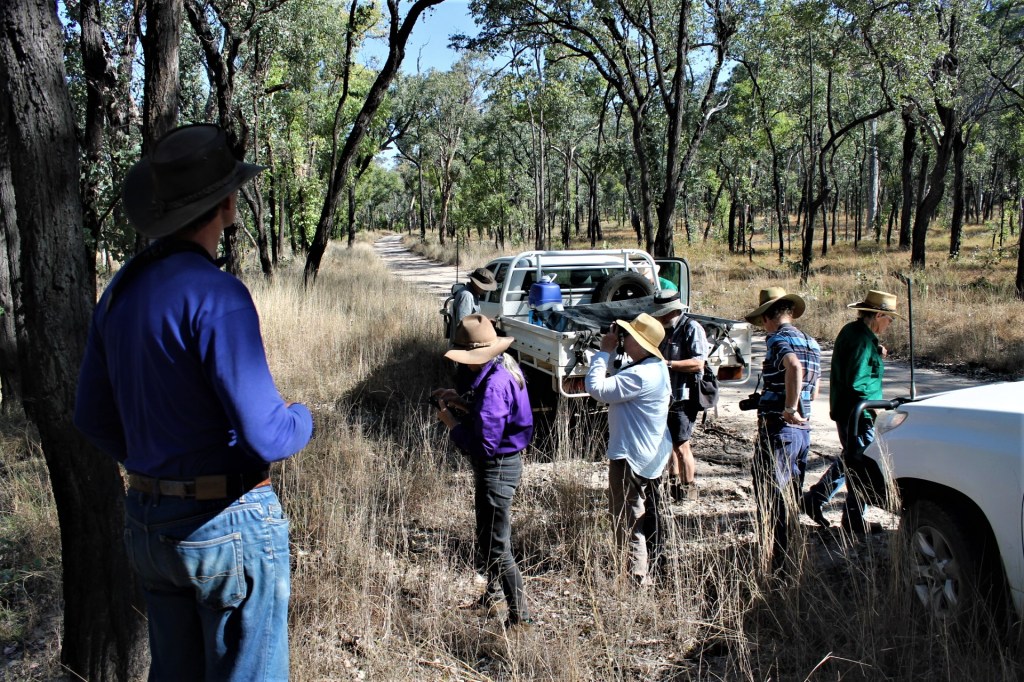
Our circuit started at Thredbo. Thence to Dead Horse Gap, the Cascade Trail, Bobs Ridge, Cascade Hut, the Big Boggy, Teddys Hut, The Chimneys, arriving back at Thredbo via the Brindle Bull Hill. A place name that Brian, our leader, seemed particularly smitten with and was determined to check out. My other companions on the Brindle Bull trip were Richard, Joe and Noel.

Map: Chimneys Ridge: 1:25,000. Geoscience Australia.


Map of Cascade Trail, Cascade Hut, The Chimney, Teddys Hut , Brindle Bull. Kosciuszko National Park.

Monday : Thredbo to Cascade Hut: 12 kms.

With the mist lifting, Richard loped off, at a disconcertingly eager pace after our lethargic day of rest. The morning’s walk took us up the four kilometre Thredbo River tourist track to Dead Horse Gap, the trail head for the Cascade Trail. From here we would climb the Cascade Trail to the crest of Bob’s Ridge (1800 metres), a major south-west spur of the Great Dividing Range.

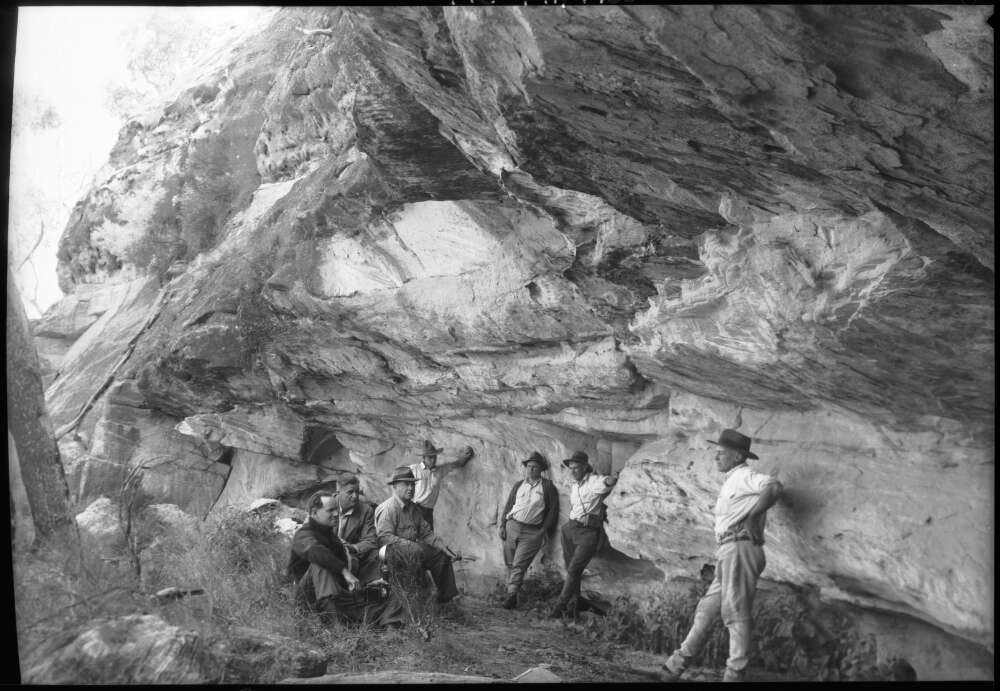
It is said that Dead Horse Gap takes its name from a herd of twenty or so unfortunate brumbies caught out in a blizzard. But today, the gap was merely a tame car park with an info board telling me that this was once the site of the Dead Horse Gap Hut, a summer grazing hut, built in 1932 by the Nankervis family of Tom Groggin Station.

Old Dead Horse Gap Hut. Kosciuszko National Park.
Old Dead Horse Gap Hut

This type of shelter hut, one of nearly 230 built in the Kosciuszko area, was an integral part of the transhumance practice of herding cattle and sheep up to the high summer pastures or snow leases as they were called. Other huts were built by miners and the Snowy Mountains Authority. But, as with many high country shelters, Dead Horse was lost to fire.


From Dead Horse Gap we engaged granny-gear for the five and a half kilometre drag up to the crest of Bobs Ridge at 1800 metres. Some 300 metres of altitude gain. The Murray River system to our right, the Thredbo- Snowy River to our left.

Thredbo River on Cascade Trail. Kosciuszko National park.
Thredbo River valley with Cascade Track contouring up Bobs Ridge

Here we settled into one of those outstanding lunch spots that leaders rave about, but rarely provide.

The lads loafed under the shade of gnarly old snow gums. Their bottoms comfortably settled on snow gum branches or sprawled out on the ground, padded by springy tuffs of snow grass. Best of all, none of those swarms of mini black alpine ants, the bane, one of several, of bushwalking in the high country.

Lunch break. Bobs Ridge. Kosciuszko National Park.
Lunch break on Bobs Ridge

But these alpine woodlands are swarming with something on a grander scale… wild horses, brumbies, feral horses. Choose your side in the culture wars over brumbies in Australia’s high country.

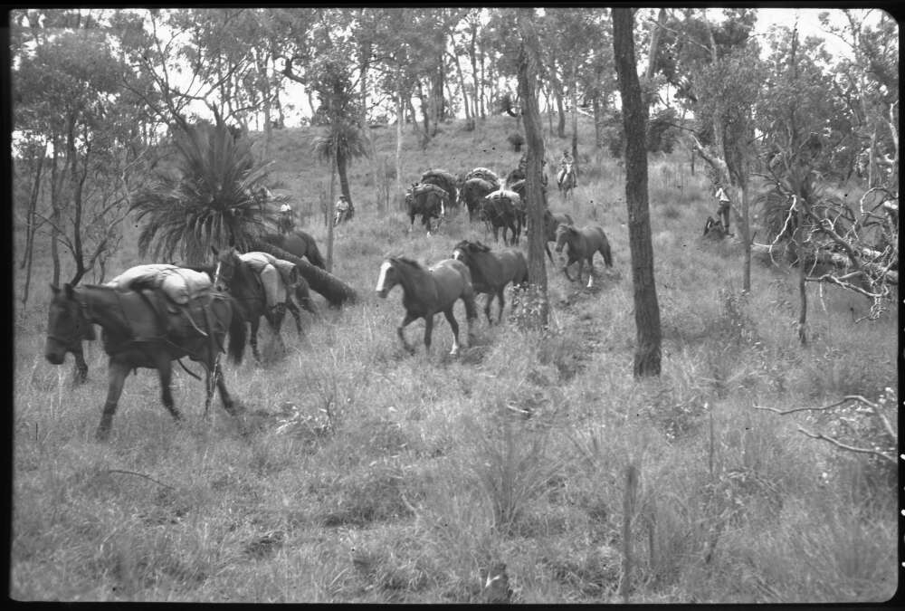
We discovered a set of portable stockyards behind our lunch site and our progress up Bobs Ridge had been marked by pyramids of horse poo of such grandeur they would do pharaoh Rameses II proud.

Brumby Traps. Bobs Ridge. Kosciuszko National Park.
Brumby traps

We were, of course, in the setting for Elyne Mitchell’s much loved Silver Brumby stories.  The presence of brumbies in Australia’s national parks is a divisive issue.

In other states they have been culled without much of a hue and cry from horse lovers. But in the high country of New South Wales and Victoria, a different mentality prevails. Here brumbies are cultural icons, Man from the Snowy River stuff.

Notwithstanding the damage wild horses do to alpine ecosystems, in parts of Kosciuszko National Park they seem free to roam pretty much unfettered. Their hooves trashing delicate alpine bogs and watercourses. As well, the brumbies selectively chomp out the tastier plant morsels.

No one likes to see horses killed, but the sad reality is that rehoming is not reducing the numbers of horses in Kosciuszko National Park fast enough to reduce population growth.

In 2023 the Australian Government’s Threatened Species Scientific Committee warned that feral horses could be a crucial factor in the final extinction of six critically endangered animals and two critically endangered plants.

Culling of feral horses started again in October 2023, with over 5,539 killed by aerial shooting. Another 427 were removed by trapping, rehoming and ground shooting. This is the first time that more horses were removed than their annual population growth.

Their days appear to be numbered. Under NSW legislation, the government must reduce the number of feral horses in Kosciuszko to 3000 by 2027. Still too many.

Pugging caused by brumbies

The best summary of the brumby issue that I have read is Anthony Sharwood’s The Brumby Wars (2021, Hachette). This is a book about Australia’s brumbies and the intense culture wars that have erupted about their removal from Kosciuszko National Park. Highly recommended.


From Bob’s Ridge we descended into the open Cascade Valley, currently hosting five brumbies chowing on their favourite alpine herbs and grasses. Clearly unfazed by the five plodders wandering past.

These open grassy alpine valleys are below the tree line at 1800 metres and you would expect them to be covered by snow gum woodland. Instead they are devoid of trees. A response to dense, freezing air rolling off the high tops and pooling in the lowest points of intervening valleys. Even snow gum seedlings cannot survive in these frost-hollows with their extreme swings of diurnal temperatures.


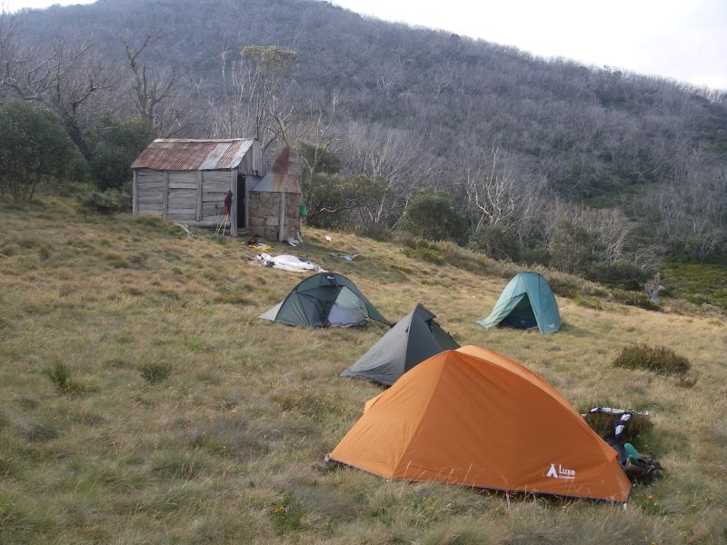
Cascade Hut, on the slopes of a ridge, is nestled in a grove of snow gums It is an old friend, a bushwalker’s and skier’s home away from home. The Nankervis family owned the snow lease at Cascades and had the hut built in 1935 with horizontal slabs and a bark roof.

Cascade Hut. Kosciuszko National Park.
Cascade Hut

The bark was later replaced by a corrugated iron roof. On one of our visits a reno job of a sheet of wildly flapping clear polycarbonate sheeting did nothing for its heritage value. This has since been rectified. The old hitching rail still stands, but these days serves only to prop up ever increasing numbers of mountain bikes.

Inside is a stone fireplace, dri-creted dirt floor, table, sleeping platform lurking under which, according to an old log book, is said to be a resident snake. This, undoubtedly, a rumour spread by its caretakers, the Illawarra Alpine Club, to deter those new-age mountain biking people and bushwalking riff-raff from sleeping in the hut.

The Illawarra Alpine Club have been Caretakers for Cascade, Tin Mines and Teddys Hut for over 40 years. A sterling effort and a job well done in maintaining these basic mountain shelters for the safety of bushwalkers, mountain bikers and skiers alike.

Unperturbed by the resident snake, we settled in anyway. First order of business, the peons spread out to collect water and fetch the firewood. Brian sawed the logs into useful sized billets. Just so. His favourite camp thing to do. Joe was tasked with lighting the fire. Finally, tents sprang up on the springy snow grass.

On dusk, five Gang-gang Cockatoos trailed above us, slow powerful wing beats. Impossible to mis-identify these distinctive dark grey cockatoos, the males sporting red heads and wispy red crests.

We whiled away the evening reading the log book, including a scary account of a dingo getting close up and too friendly with a solitary walker, not far from Cascade Hut. His advice: walk briskly and carry a bloody big stick.  


Tuesday: Cascade Hut to Teddys Hut via The Big Boggy: 15 kms.

A coolish morning with bushfire haze from the Victorian fires lingering in the valley below. Our Gang-gangs flew back overhead from whence they had roosted.

Brian’s original plan was that we would go cross-country to Teddys Hut via Jerusalem Hill (1810 metres) on the spine of the Great Dividing Range. From Jerusalem, our track would follow the GDR spine north-west for several kilometres to an outcrop at 1806 metres, from which we could drop into the Big Boggy on the upper Thredbo River. But a quick perusal of the thickly wooded hillslopes in front of us and the map’s ortho image disabused us of that option.

Instead we chickened out and retreated up the Cascade Trail to Bobs Ridge. From here, we could swing off the trail and wander over the top of that un-named knoll on the Great Dividing Range (1806 m) and drop into the Thredbo River (formerly the Crackenback) at the Big Boggy (aka Boggy Plain).

The Crackenback River is said to take its name from stockmen who herded their mobs of sheep and cattle up onto the Main Range from the Crackenback (Thredbo) Valley. It was rugged, difficult country and it was said it would ‘crack-your-back’. Another version was that stockmen had to crack their whips across the backs of the stock to get them to the high tops.

Looking into The Big Boggy. Thredbo River. Kosciuszko National Park.
Looking down into The Big Boggy and upper Thredbo River Valley

We pulled in for lunch at a clump of snow gums on the crest of the Great Dividing Range, at our prominent un-named hill. Before us were sweeping northerly views across to the Rams Head Range and the Main Range.

Lunch above The Big Boggy. Thredbo Valley. Kosciuszko National Park.
Lunch in snow gum woodland above The Big Boggy

Lunch over, we began a longish bush-bash down to the sodden edge of the Big Boggy. Here we swung east, contouring along the southern edge of the Thredbo River and the Big Boggy.

The plan was to aim for the extensive grassy plain that separates the Thredbo River headwaters from the Wombat Gully-Mowamba River System. Some four kilometres upstream.

The Big Boggy is a massive alpine wetland and frost hollow which, although outstandingly scenic, made our afternoon’s upstream walk to Teddys a bit damp underfoot and pretty tedious.

The Big Boggy. Upper Thredbo River. Kosciuszko National Park.
Picking our way up The Big Boggy (Boggy Plain)

Teddys, once called My Horse Hut, served as a cattlemens’ and brumby runners’ hut and was built by Teddy McGufficke and Noel and Dave Prendergast in 1948. Teddys lies at the headwaters of the Thredbo, a tributary of the Snowy River and is the only shelter on this isolated and often snow-bound plateau. 

Teddys Hut. Kosciuszko National Park.
Teddys hut with Mt Leo (1875 m) in background

According to the old timers it was on a sort of brumby motorway and clearly nothing much has changed over the decades. We watched as Serengeti-like herds of brumbies grazed peacefully on the vast snow grass plains in the vicinity of this remote hut.


Wednesday: Day Walk to The Chimneys and Chimneys Ridge: 8 kms.

For once, an easy day. In the overall scheme of Brian’s pantheon of dubious ‘rest days’ this one was brilliant. As we tucked into a leisurely breakfast even a bank of dense, damp fog hanging around Teddys rolled ever so slowly away from us, down the Mowamba River system. A promising omen of a great day’s walking.

The Chimneys and Chimneys Ridge form the divide between the Thredbo River and the Jacobs River, also a Snowy River tributary.
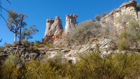
Upper Thredbo River. Kosciuszko National Park.
Crossing alpine meadows of upper Thredbo River heading for The Chimneys

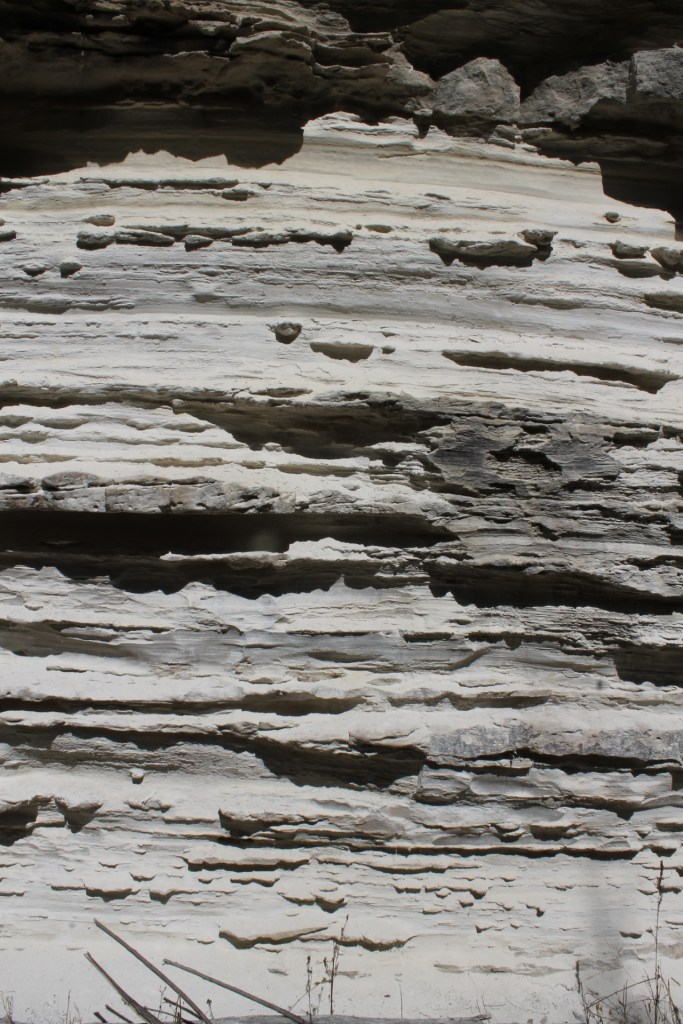
The Chimneys (1885 metres) rise, tooth like, a jumble of granitic boulders that are said, with a considerable stretch of the imagination, to resemble chimney pots on old houses. They are outcrops of Silurian Mowambah Granodiorite (age range 444 million years ago to 419 Mya). The view must be one of the finest in Kosciuszko. As a bonus, nary a backpacker, mountain biker, or tourist to clutter up our summit views.

The Chimneys. Kosciuszko National Park.
Chimneys Ridge

To the south was the deep valley of the Jacobs River with the Snowy River in the distance. The Pilot Wilderness area stretched out in a row of five hills: Purgatory, Jerusalem, Paradise, Wild Bullock and Stockwhip. With The Pilot (1829 m) and the Cobberas even further south.

To the north we looked to the Rams Head Range and the Main Range of Kosciuszko. Hundreds of metres below us were extensive views into the alpine grasslands, bogs and fens of the upper Thredbo valley.


The course of the Thredbo River presents an interesting drainage pattern when viewed on a map. It is described by geomorphologists as a rectilinear drainage pattern, where the main bends of the Thredbo River change direction at right angles. In the case of the Thredbo, it initially flows south-east, then turns south-west, then north-west and finally into the main valley which runs north-east to Lake Jindabyne.

Rectilinear drainage pattern of Thredbo River. Position & influence of Crackenback Fault.
Rectilinear drainage pattern of Thredbo River. Kosciuszko National Park.

All these changes of direction are controlled by a complex system of joint lines and faults which are both significant elements in the evolution of the Snowy Mountains landscape.

Joint lines are structures along which there has been no discernable differential movement. Large scale joints are are common feature of granitoid landscapes, like the Chimneys Ridge.

Faults, however, show clear evidence of differential earth movements. The Crackenback Fault is a 35 kilometre long south-west to north-east trending strike-slip fault between the Jindabyne Thrust Fault (at Jindabyne) and Dead Horse Gap. It is a consequence of the Tabberabberan tectonic contraction (390-380 mya).

A strike-slip fault has horizontal movement of the earth’s surface with little vertical displacement. It is along this straight fault structure that the Thredbo River flows towards Lake Jindabyne.

The Big Boggy. Kosciuszko National Park.
Looking over The Big Boggy with Main Range in background

Our return to Teddys was along the spine of the Chimneys Ridge. At nearly 1900 metres, this was a cool and pleasant ramble across snow grass meadows interspersed with outcropping granitic pillars. At Smiths Gap we propped and then looped north, descending to Teddys. One and a half kilometres away, but not visible.

No takers for Brian’s suggestion for an afternoon nip up Mt Terrible (1850m). A predictable response. Maybe we had been ambushed too many times before by Brian’s predilection for hikes to places with dodgy names like Furnace Creek, the Never-Never, the Madderhorn, Heartbreak Ridge, Perdition Plateau, Hurricane Heath, Snake Hill, Tornado Flat and Corruption Gully .


Mt Terrible. Kosciuszko National Park.
Mt Terrible (1850 m) across alpine meadows. If you peer carefully you will see a distant herd of brumbies

Mt Terrible was climbed by explorer John Lhotsky who named it Mt William IV, claiming it to be “the highest point ever reached on the Australian continent”. Historians are divided on whether he did, in fact, climb Mt Kosciuszko. The general consensus is that he probably did see Mount Kosciuszko 13 kilometres to the north-west but never climbed it. Lhotsky had better luck with his naming of the Snowy River, the placename which is still used. “I flatter myself that I am the first writer introducing this river into geography”.


It was Sir Paul Edmund Strzelecki who had the non-indigenous bagging and naming rights to Mt Kosciuszko, which he ascended (with others) in 1840. Though some historians believe he actually climbed Mt Townsend, the second highest peak in Australia.

Paul Strzelecki. Source NLA

But, who was Kosciuszko? Well might you ask why is Australia’s highest mountain named after a Polish freedom fighter? Tadeusz Kosciuszko (1746 – 1817) was a Polish military engineer, freedom fighter and hero of the American War of Independence and his native Poland. He inspired George Washington and was friends with Thomas Jefferson. Short story: Tadeusz Kosciuszko was a thoroughly admirable human being.

Read about Kosciuszko and the mountain in Anthony Sharwood’s: Kosciuszko, the Incredible Life of the Man Behind the Mountain.

Anthony Sharwood: Kosciuszko, Hachette 2024.

And so to Teddys. For me, an afternoon of indolence, lying around on my Thermarest banana lounge with nought to do but eat, drink, read and watch the grazing brumbies. But the inside of the hut was a happening place.

Joe and Noel were busy indoors engaged in epic DIY projects. Like constructing temporary seating, benches and shelves. Shuffling blocks of wood and milled planks around and around and around. Or in long-winded discussions on ways for the KHA maintence volunteers to wind-proof the slab walls. Exciting stuff like that.

For me, as I lounged on the snow grass at the front of the hut, I could see that old McGufficke’s siting of this hut was a stroke of genius. The front doorstep opened out onto beautiful snow grass plains, gently sloping down to Wombat Gully. In the far distance I watched dark rain squalls sweeping over Drift Hill and hoped the weather would be fine for our last day tomorrow. Nothing is ever a certainty with high country weather.


Thursday: Teddys to Thredbo via The Brindle Bull: 8 kms.

This is an outstanding alpine walk, climbing quickly through the tree line then out onto vast alpine meadows. Occasional granitic outcrops rise above the meadows. 

We planned our route from Teddys to take us four kilometres west-nor’-west up into the headwaters of the Thredbo River, then across to the Brindle Bull Hill. From its summit we would swing right to the north-east for another four kilometres to drop into Thredbo village at Friday Flats. It was an immensely satisfying walk for our last day.

The navigation was straightforward enough. Follow the Thredbo River up to its source, dodging Mt Leo (1875m) to our south, keeping Adams Monument (1908m) well to our right. No problems with that.

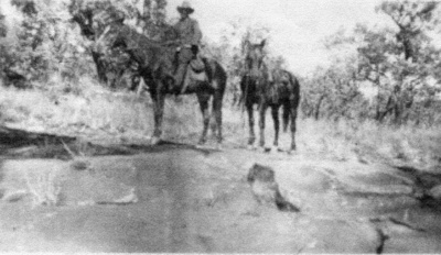
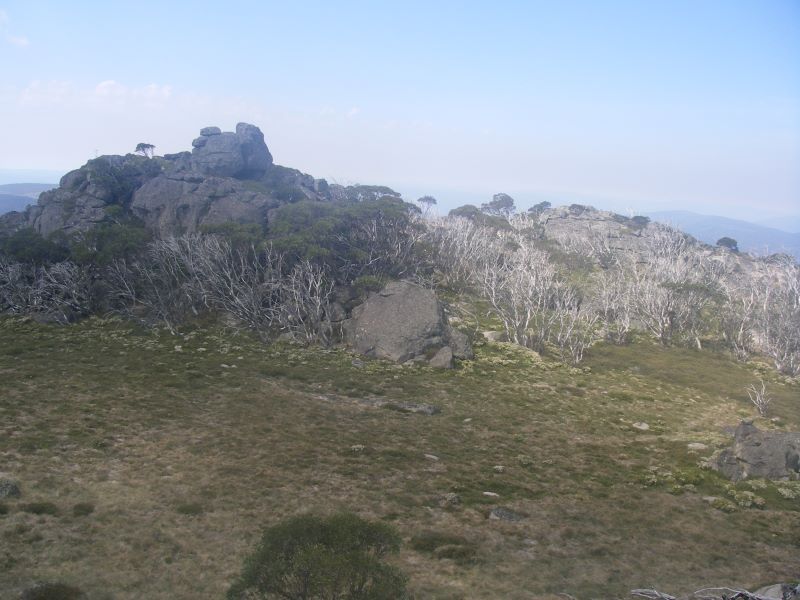
From the gap we continued beetling west, on a tour of outcrops standing at 1800 plus metres. And there ahead of us, apart from yet more brazen brumbies, was the domed form of the Brindle Bull Hill (1872m). Brian and the lads could legitimately claim another 1000 metre peak.

Brian indicated an easy route up that would have us contouring up to the summit tors. But he immediately ignored his own advice and departed posthaste up the closest vertical granite slab leading to the summit.

Clearly he has a different concept of ‘easy’ and ‘contouring’ to the rest of the hiking universe.  But the herd instinct kicked in and like dumbclucks we followed anyway, somehow juggling the clutter of map cases, compasses, cameras and walking poles as we hauled ourselves up for a well-earned breather on the summit.
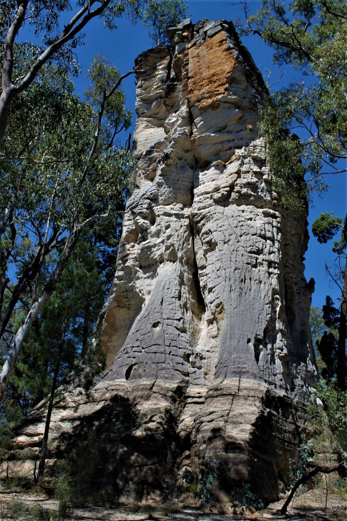

The Brindle Bull. Kosciuszko National Park.
The Brindle Bull

The treat was the expansive views south to The Chimneys and The Pilot and off to the north-east, the Rams Head Range from our previous throughwalk.

View to Rams Head from Brindle Bull. Kosciuszko National Park.
Looking towards Rams Heads and Main Range from below the Brindle Bull

Our final leg snaked down a four kilometre ridge to the Alpine Way (1400m) just above Thredbo Village. Joe, Richard and Noel, brandishing multiple GPSs, made sure that their old-school navigators stayed on track in order to gain the correct ridge down to Friday Flat. So we confidently contoured around BB5 (Brindle Bull 5) and BB6, climbed over the top of BB7 and BB8.

This led us finally to BB9, our exit point (at 1660m). But as Brian and I had learnt from a previous experience of coming off nearby Paddy Rushs Bogong, the drop to Thredbo was never going to be plain sailing. Intelligence that we failed to share with our companions.


The vegetation changes from open alpine meadows to a snow gum woodland with a dense scrubby understorey of beastly spikey stuff like Bossiaea, Epacris, Hakea, Grevillea, Oxylobium, and Kunzea . Here’s where those knee-length canvas gaiter things worn by Australian bushwalkers are a brilliant piece of kit.

Snow gum woodland and boulders. Kosciuszko National Park.
Dense vegetation and boulders in snow gum woodland

This undergrowth is called Tall Alpine Heath and is waist-high with tough whippy branches to withstand the weight of snow (and, hopefully, bushwalkers) without breaking. Throw in torpid highland copperheads and pit-fall traps of wombat and bunny burrows, and the Alpine Way to Thredbo couldn’t come fast enough for me.

So, a tad before 2.00 pm, five dishevelled bushwalkers burst through the thick brush and out onto the Alpine Way. Startling a young headphoned damsel who was out enjoying her daily power walk along the Alpine Way.

For us, two weeks of superb alpine walking were over. Anyone for a Kosciuszko Pale Ale?


Mt Moffatt National Park Circuit Drive

The Mount Moffatt section of Carnarvon National Park is a remote and relatively pristine landscape occupying the headwaters of the Maranoa River.  It features broad sandy valleys, basalt tablelands and outcrops of sculpted sandstone rising abruptly from the plains.

I first visited Mt Moffatt National Park on a 10 day natural history campout in 1988 and have returned a number of times , drawn back for exploratory hikes to Mt Moffatt’s high country on Consuelo Tableland , the upper Carnarvon Creek gorge and more recently the Carnarvon Great Walk. The report that follows is the first of the many accounts that I have written covering Mt Moffatt National Park.

The Chimneys. Mt Moffatt.
The Chimneys, Mt Moffatt.

Location of Mt Moffatt Section

Mount Moffatt has a rich human history.  Aboriginal art is abundant as the Bidjara and Nuri occupation of the Carnarvon Ranges stretches back at least 19,000 years. Excavations were carried out in the 1960s by Professor John Mulvaney at Kenniffs Cave and the Tombs.

At Kenniffs he found the remains of campfires extending three metres below the floor of the cave. Mulvaney used the new technology of radiocarbon dating to dial back the story of Aboriginal occupation of Australia 19,500 years. The Bidjara and Nuri had lived through the Pleistocene Ice Age.

Aboriginal Stencil Art: Mt Moffatt.
  • The Tombs: Kangaroo foot stencil
  • The Tombs: Digging stick or shaft of spear stencil
  • The Tombs: Shell pendant. Che-ka-ra. Collect by Cape York people and traded 1300 kilometres to Carnarvons.
  • The Tombs: Boomerang stencil.
  • The Tombs Art Site.
  • The Tombs: Full human figure stencil.
Mulvaney, J. and Kamminga, J: Prehistory of Australia. ( Allen & Unwin, 1999).

European Occupation of the Upper Maranoa District. The Mountain Cattle Runs.

The first European to pass through the area was the explorer Thomas Mitchell who, in June 1846, travelled along the Chesterton Range, Mt Moffatt’s western boundary, looking to extend the colony’s pastoral frontier northwards.

The ever optimistic Mitchell wrote glowingly of ‘ excellent open forest land’ and a landscape that ‘was park-like and most inviting’. Land hungry squatters soon followed his tracks and studied his sketch maps , with pastoralism in the Carnarvon Ranges commencing in the 1860s .

1896 Cadastral Map of Upper Maranoa River.
1896 Cadastral Map of Upper Maranoa River

The Mt Moffatt run was originally made up of five blocks cut from the Mt Ogilvie run, blocks three through to seven. These were first taken up under licence by George Fullerton in 1867.

Fullerton visited the upper Maranoa when he went out on an exploratory expedition in 1861 ( towards the Womblebank andTooloombilla runs ) with his brother-in-law , a Mr Moffatt. Moffatt was the nephew of Mr Thomas De Lacy Moffatt, later to become Queensland’s Colonial Treasurer.

The Queensland Lands Department described the run as‘ rough and mountainous but generally well-grassed…fairly good pastoral country and very suitable for breeding cattle ‘. The rough country made it difficult country to work and its ownership changed hands a number of times.

The Waldron family took up the run in 1939 and built a family homestead that is now used by park rangers. In 1979 Mt Moffatt was purchased from the Vincent family and converted to national park status. Reminders of the area’s life as a cattle property are to be found in the homestead, old stockyards and fencing.


The De Lacy Moffatts

The name Mt Moffatt is likely connected to the De Lacy Moffatt family (or Moffat ). Queensland’s Geographic Placenames Board can shed no light on the matter, but I think it is named after the De Lacy Moffatt family .

Thomas De Lacy Moffatt ( 1824-1864) was a Queensland politician and Queensland’s second Colonial Treasurer, serving from 1862 to 1864. He was a squatter and established the run Callandoon on the Darling Downs. He was elected to the first Legislative Assembly of Queensland in April 1860 for the District of the Western Downs. My guess is that the Mt Moffatt run was probably named for Thomas de Lacy Moffatt by his son or his nephew.

Thomas De Lacy Moffatt: Colonial Treasurer 1862-1864.

The Mt Moffatt Circuit Drive.

Our little 4WD convoy piloted by my friends Frank and Julie left the Dargonelly Rock Holes Campsite just shy of an unusually tardy 8.45am.  Come the following morning, our leader Frank had whipped us into shape and earlier departures ruled. 

Today we would traverse sandplains at 700-800 metres, derived predominantly from Jurassic Precipice sandstones.  These sandstones are the bottom stratum of the Surat Basin, deposited 200 – 186 million years ago. 

Map of Mt Moffatt National Park: Circuit Drive

Mt Moffatt. Circuit Drive
Dargonelly Rock Hole , Mt Moffatt NP
Dargonelly Rock Hole on Marlong Creek
Campground at Dargonelly Rock Holes

The Surat Basin sediments had their origins in a depositional phase after the momentous tectonic activity of the Triassic Period (250 – 201 million years ago).  Sedimentation in the ensuing Jurassic Period was restricted to the Great Artesian Basin and its component basins: Surat, Nambour, Clarence-Moreton, Laura and Carpentaria.   The landscapes of many of Central Queensland’s highly scenic National Parks, including Mount Moffatt, date from this period.

The component layers of the Surat Basin from oldest to youngest are:  Precipice sandstone, Evergreen sandstones, its distinctive Boxvale and Westgrove Members , and Hutton sandstones.


Precipice Sandstone
Crossbedding in Precipice Sandstone.
Crumbling boulders of Hutton Sandstone
Boulders of soft Hutton Sandstone at the base of The Mansions.

Some three kilometres north along the Circuit Drive was our first stop, Marlong Arch.  As we glided into the car park, two Eastern Grey roos and a joey took flight, one adult collecting a barrier post in its haste to decamp.  But no harm done.

Marlong Arch, Mt Moffatt NP
Marlong Arch

Marlong Arch is an arch of Precipice sandstone standing 50 metres or so above the surrounding plain.  It is probably the most photographed feature in Mount Moffatt.  Even the famous Australian Antarctic photographer Frank Hurley came to Mount Moffatt (in October 1949) and photographed Marlong Arch. 

The photo, which shows Brenda Vincent on her pony Cupie under the arch, appears in his book Queensland, a Camera Study.  Brenda Vincent had lived and worked on Mount Moffatt when it was a remote highland cattle property.

Brenda Vincent under Marlong Arch. Circa 1950.
Photo: Frank Hurley. Brenda Vincent on Cupie. Circa 1950.

Frank Hurley, famous Australian Photographer visits Mt Moffatt

The photograph above was one of many taken by one of Australia’s most well known photographers, Frank Hurley ( b. 1885 ). Hurley was the photographer for Ernest Shackleton’s 1914 Antarctic expedition.

He recorded the demise of their ship Endurance as it was slowly destroyed by pack – ice. All the crew survived the ordeal and Hurley returned home to then become an Official War photographer for the AIF serving in the trenches with another famous Australian, Hubert Wilkins.

Frank Hurley’s classic book: Shackleton’s Argonauts. Published in 1948 by Angus and Robertson Ltd.

An excellent write – up of Hurley’s visit to the Carnarvons ( Tracks in the Sand – Frank Hurley and the Carnarvon Ranges ) can be found on Robert Ashdown’s blogsite.

Galley of images taken by Frank Hurley on his visit to Mt Moffatt Station in 1949.
  • The Tombs, Aboriginal rock art site, Mt Moffatt, qld, 1949.
  • Racecourse Campsite, Consuelo Tableland, Mt Moffatt, Qld 1949.
  • Mountains and Cliff faces, Consuelo Tableland, Qld,1949
  • Trees in a valley, Consuelo Tableland, Qld , !949.
  • Booringa Shire Clerk, Arthur Donnelly leading a pack of horses, Mt Moffatt Station, Qld,
  • The Tombs, Aboriginal rock art site, Mt Moffatt, Qld, 1949.
  • Four men sitting at the head of a canyon, Consuelo Tableland, Mt Moffatt Station, qld.
  • Booringa Shire employees in their Blitz wagon on a log bridge, Mt Moffatt Station, Qld 1949.
  • Five men riding with pack horses, Carnarvon Range, Qld, 1949.
  • Frank Hurley: Pack Horses, Consuelo Tableland, Mt Moffatt
  • Men and Horses at a logoon, Jimmy's Shelf above Carnarvon Gorge, Mt Moffatt, Qld, 1949.

Marlong Arch formed in a narrow, elongated outcrop of Precipice sandstone.  A capping of harder sandstone remains intact while softer layers below have been eroded away, leaving the arch of rock.  Around the base of the outcrop are caves, overhangs and tunnels, a number of which we investigated, finding stencil art, and roo and bat scats. 

Open grassy woodlands clothe the surrounding plains, part of a diverse flora of more than 750 species in the national park.  The dominant canopy species here are smooth-barked apple (Angophera leiocarpa), white cypress pine (Callitris glaucophylla), bull oak (Allocasuarina luehmannii), and budgeroo (Lysicarpus angustifolius). 

The shrub layer was more diverse but getting past its prime wildflower display.  That said, Calytrix longiflora still provided brilliant massed displays of its pink star flowers.  This was the case over much of the park. 

Open grassy woodlands. Mt Moffatt
Open grassy woodlands on sandy plains.
Calytrix longiflora
Massed flowering of Calytrix longiflora on the sandy plains.
Angophera leiocarpa
Angophera leiocarpa
Fibrous bark of Budgeroo.  Aborigines used cylinders of Budgeroo to wrap dead bodies.
Fibrous bark of Budgeroo (Lysicarpus angustifolius). Aborigines used cylinders of Budgeroo bark to wrap dead bodies. Items such as necklaces, nets and plants were placed with the bodies. The cylinders were then bound with twine made from animal fur and sinew and placed in sandstone tunnels high up on cliff-faces. The Tombs is just one of many mortuary sites in the Carnarvon Ranges.

Other components of the shrub layer that we identified (thanks Frank) included Xanthorrea johnsonii, Boronia bipinnata, thread-leafed hopbush (Dodonea filifolia), wild rosemary (Cassinia sp.), slender rice flower (Pimelea linifolia) and beard heath (Leucopogon biflorus).

Xanthorrea johnsonii
Grasstree: Xanthorrea johnsonii

The ground cover was dominated by swathes of buck spinifex (Triodia mitchelli), but there was still a significant assemblage of other ground covers:  kangaroo grass (Themeda triandra), fake sarsaparilla (Hardenbergia violacea), Chloanthes parviflora and Lomandras.

Buck Spinifex. Triodia mitchelli

After morning tea at the arch, we drove on to Kookaburra cave.   In a couple of the trees at the car park we saw babbler nests, and on cue two grey-crowned babblers appeared.  Kookaburra cave is a shallow elongated overhang at the southern base of a bluff of Precipice sandstone.  

The cave takes its name from a hand stencil which resembles a kookaburra with its beak open.  As an art gallery it is nowhere near as spectacular as the Tombs, but it does have art work which includes stencils, abrasions and peckings.

Stencil art. Kookaburra Cave. Mt Moffatt.
The ‘ Kookaburra ‘ stencil at Kookaburra Cave.

On checking my reference book Visions of the Past by Michael Morwood, it would seem that this assemblage of Aboriginal art is typical of what he classifies as Central Queensland Phase 2 artwork dating from 5,000 to 36 years BP.  Some of the other information from his Central Queensland Highlands research includes:

  • Hand stencils in Central Queensland sites are frequently associated with rocky outcrops which served as mortuaries, as found at The Tombs in Mt Moffatt.
  • Many of the varied hand stencils at Central Queensland correspond to hand signals reported by Walter Roth for the Mt Isa area of NW Queensland.  It is thought that some of these were used when hunting and on other occasions of enforced silence.  Kookaburra cave has several examples of distorted hand stencils.
  • Stencils are very useful to archaeologists as they provide evidence of Aboriginal material culture before the time of European contact: boomerangs, axes, spears, clubs, nets and pendants. 
Morwood, M. J. Visions from the Past. The Archeology of Aust. Aboriginal Art. Smithsonian , 2012. The book contains a very comprehensive chapter on Queensland’s Central Highland sites.

The open woodland around Kookaburra cave was slightly different from what we had seen at Marlong Arch.  Here we found a dense stand of budgeroo, as well as mature woody pears (Xylomelum cunninghamianum).  Also in the canopy mix were a grey gum and a stringybark.

Under the canopy we identified (and photographed!) bush iris (Patersonia sericea), sandstone boronia (Boronia glabra), box-leaf wattle (Acacia buxifolia), spreading flax-lily (Dianella revoluta) and the alien-looking hair plant (Astrotricha cordata).

Patersonia sericea
Bush Iris: Patersonia sericea
Boronia glabra

Always on the hunt for things geological, I spied on the steps leading up to the cave some trace fossils.  These were probably the grazing trails of molluscs and worms.  They were on a slab of the reddish-brown Boxvale Sandstone (an upper member of the Evergreen Formation). 

Trace Fossils In Boxvale Member of Evergreen Sandstones.
Trace Fossils in Boxvale Member .

Next stop, Lot’s Wife, is a pillar of white Precipice sandstone, the solitary remnant of a bluff that extended across the area.  Warwick Wilmot, in his book Rocks and Landscapes of the National Parks of Central Queensland, mentions the localised anomalous geology of Lot’s Wife. 

Sixty metres to the east is the parent bluff.  But this is an outcropping of Boxvales at the same elevation as Lot’s Wife.  The Boxvale sequence should be higher altitudinally, suggesting a minor localised fault between the two outcrops: with the Boxvale layer down to the east and the Precipice sandstones raised to the west.

Lots Wife
Lots Wife
Book: Rocks and landscapes of Central Qld.
Willmott, Warwick : Rocks and Landscapes of National Parks of Central Qld. ( Geological Soc. of Aust., Qld Div. 2006 ).

On our walk back to the cars, Judy pointed out stands of kurrajong (Brachychiton populnea) on a high ridge to the west of Lot’s Wife.  Kurrajongs, frequently associated with Vine Scrub/Thicket were also found in a soft-wood scrub south west of Gee Gee Gap that we visited on the next day.  

On our 1988 Mount Moffatt trip when we visited Gee Gee Gap, Rodney Tait, a keen botanist and fungi expert reported bottle trees and many seemingly “out of place plants, including a valley of many rainforest or softwood scrub species”.  These are growing in soils derived from the basalt that caps the highest parts of the tableland.

On track to Dooloogarah  Station near Gee Gee Gap
Near Gee Gee Gap on track to Dooloogarah Station

Departing Lot’s Wife and its apostrophe-deficient signpost, we headed for Marlong Plain for lunch.  The side track to the plain winds through a woodland of silver-leafed ironbark (Eucalyptus melanophloia) before fetching up at the southern edge of Marlong Plain.  This is a vast, near-flat expanse composed of shallow Holocene alluviums derived from nearby basalts and sandstones.

Woodland of silver-leafed ironbark. E. melanophloia.
Woodland of silver-leafed ironbark: Eucalyptus melanophlioa.

Ecologically, Marlong Plain is a very special place.   It is a treeless plain dominated by a bluegrass (Dicanthium sericeum).  This is an endangered regional ecosystem (11.3.21) with less than 10% remaining in this province (Brigalow Belt 24: Carnarvon) and only 10 – 30% remaining in all of Queensland.

Marlong Plain
Marlong Plain: an endangered regional ecosystem: RE11.3.21.
Qld Blue Grass. Dicanthium sericeum
Bluegrass: Dicanthium sericeum.
Marlong Ck traversing Marlong Plain
Marlong Creek

Overall Marlong Plain protects rare and threatened flora which is why the stand of willows in the lower end of the plain is somewhat puzzling.  I saw these willows on our 1988 trip and they are still flourishing in 2021.  The weedy wheels of the Queensland Parks Service move ever so slowly.

Our lunch break was enlivened by a passing nankeen kestrel checking out the plain for its own lunch.

Leaving our shady lunch spot on the edge of the plain, we continued on round the circuit drive and took the side track to West Branch camping area.  A far quieter area than caravan central at Dargonelly Rock Holes.


West Branch Camping Area

West Branch is also a pleasant overnight campsite for hikers walking the 87 kilometre Carnarvon Great Walk – a circuit walk starting and finishing at the Carnarvon Gorge section of the park.  The walk’s West Branch ‘entrance statement’ is an excellent information board and a rather expensive suspension bridge over the usually dry bed of the west branch of the Maranoa river.

Frank and I were aware that an old map of Mount Moffatt showed an ochre mine and dance ring at the southern end of the campsite.  We poked around and did find an outcrop of soft white clay in a small cliff face on the eastern bank of the river, but whether this was the ochre mine I cannot be sure.

Ochre Mine
Ochre Mine

Onward through woodlands of poplar box (E. populnea) and narrow-leafed ironbark (E. crebra) to the Mount Moffatt Park HQ and its first-rate information centre next to the old cattle yards.  Hours could be spent looking at the display boards which cover Aboriginal occupation, grazing history, natural history and the unsavoury saga of the Kenniff brothers.  A stop not to be missed. 


Photos from Booringa Shire Heritage Library: Waldron Family Collection.

Life on Mt Moffatt Station 1930s to 1950s.

  • Mt Moffatt Homestead. 1950s.
  • 'Grizzlin Annie'. Bush shed houses old station truck called 'Grizzlin Annie'. Note camp stretcher.
  • Written on the back of the photo: " Stockmen at Mt Moffatt before leaving for mustering camp,1940s.
  • Aboriginal stockman. Fred Stockman at Kenniffs Lookout.
  • Mail Truck from Mitchell.
  • Ringers in cattle yard . Mt Moffatt Station.
  • Incineration Rock. 1920. Rock slab where the bones of Albert Dahlke and Constable George Doyle were burnt after they were shot by cattle duffers, the Kenniff Brothers.
  • Waldron girls on wash day. Mt Moffatt Station.

But the pre-dinner nibblies clock was ticking and so we turned to our home at Dargonelly Rock Holes.  But not before the squatter pigeons obliged by squatting by the side of the track.  Probably not the best survival strategy. 

These birds respond to disturbance by either ‘freezing’ or by darting erratically through grass tussocks.  Occasionally if pursued too closely they will burst into flight, heading for trees or nearby ground cover.

A black snake added to the excitement of our return journey.  This fellow was propped mid-track and made it obvious that he/she was not in the mood to move on.  Denise’s efforts to take a photograph produced a head-up pose and then thankfully both Denise and the reptile retreated.


After the obligatory showers, bucket baths and clean clothes, we gathered around Julie’s nifty EZYQ collapsible firepit to enjoy drinks, nibbles and companionable chit chat. 

Just on dusk, our expected ‘Boobookians’ arrived: Craig, Michael and Eamon.   Boobook is an ecological consultancy based in Roma and established by Craig and Meryl Eddie in 2000.  They have since branched out and offer small group tours and adventure trips in SW Queensland.  

Craig is the author of several field guides; his ‘Field Guide to Trees and Shrubs of Eastern Queensland Oil and Gas Fields’ is a widely used reference book.  And he has discovered 50 new species of land snails and 6 new plants. 

Eddie, C: Field Guide to Trees & Shrubs of Eastern Qld Oil & Gas Fields. ( Santos 2012 ).

We would have the benefit of the expertise of Craig, Michael (also an ecologist) and Eamon (scorpion expert) for tomorrow’s field outings and evening excursion.

While our three ecologists headed out to do some night field work down at the rock holes (finding cane toads but no frogs), the rest of us headed for bed, signing off on a very satisfactory day on the sand plains of Mount Moffatt National Park.


Other posts on the Mt Moffatt Section: