Tag Archives: Kosciuszko National Park Hikes.

Snowies Alpine Walk: Perisher to Bullocks Flat.

by Glenn Burns

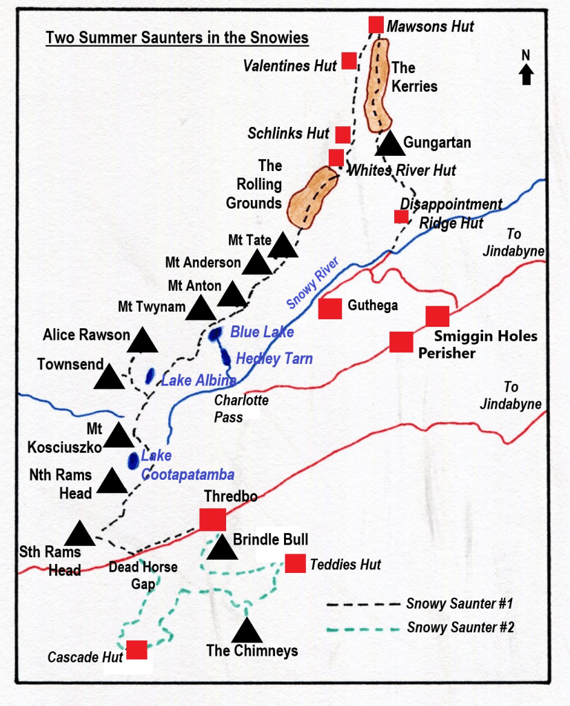
In 2018 construction started on the 55 kilometre  Snowies Alpine Walk. The NSW Government boasted it would deliver ‘ a world-class, multi-day walk across the alpine roof of Australia in Kosciuszko National Park.’  The twelve kilometre hike from Perisher to Bullocks Flat is the final section of this longer walk. The hike traverses Kosciuszko National Park’s high alpine zone before descending hundreds of metres through snow gum woodland and dense eucalypt forest to the Thredbo Valley.

Snowies Alpine Walk near Snowy River

In its entirety, the Snowies Alpine Walk (SAW) connects Charlotte Pass, the Main Range, Guthega, Perisher and Bullocks Flat.  The Perisher to Bullocks Flat section was the last part of the Snowies Alpine Walk to be constructed and was opened in the summer of 2024.  Just in time for me to test drive it.  And I was impressed.

It starts in the village of Perisher and finishes at the Thredbo River near Bullocks Flat.  The track takes walkers from the alpine zone to a lookout high above the Thredbo River valley before a steep descent of the Crackenback Fall to reach the swiftly flowing waters of the river.  From here the track follows the Thredbo upstream to Bullocks Flat, a popular day use area.

Perisher to Bullocks Flat Track. Kosciuszko National Park.
Board walk track climbing up to highest point at 1800 metres on the Perisher – Bullocks Flat track.

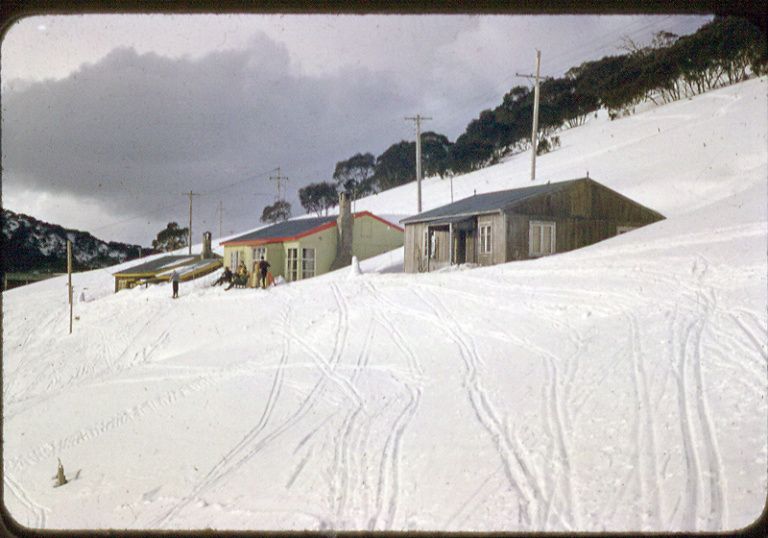
Perisher Village, my starting point, Is a small alpine village. In winter it is a picture perfect mountain village with architecturally interesting ski lodges, manicured snow runs, lifts and surrounded by snow-capped mountains. It takes its name from from one of these mountains, Mt Perisher.

Winter ski slopes at Perisher

Mt Perisher was named by an early pastoralist, James Spencer, who, while chasing lost cattle with his stockman, climbed to the top of the 2054 metre peak for a better view. On the summit he was met by scuds of snow and an icy blasting wind, upon which he commented: “This is a bloody perisher.” Later they climbed the adjacent peak, The Paralyser and the stockman remarked, “Well, if that was a perisher, then this is a paralyser.

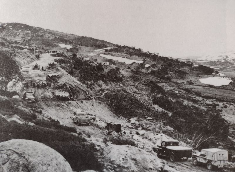
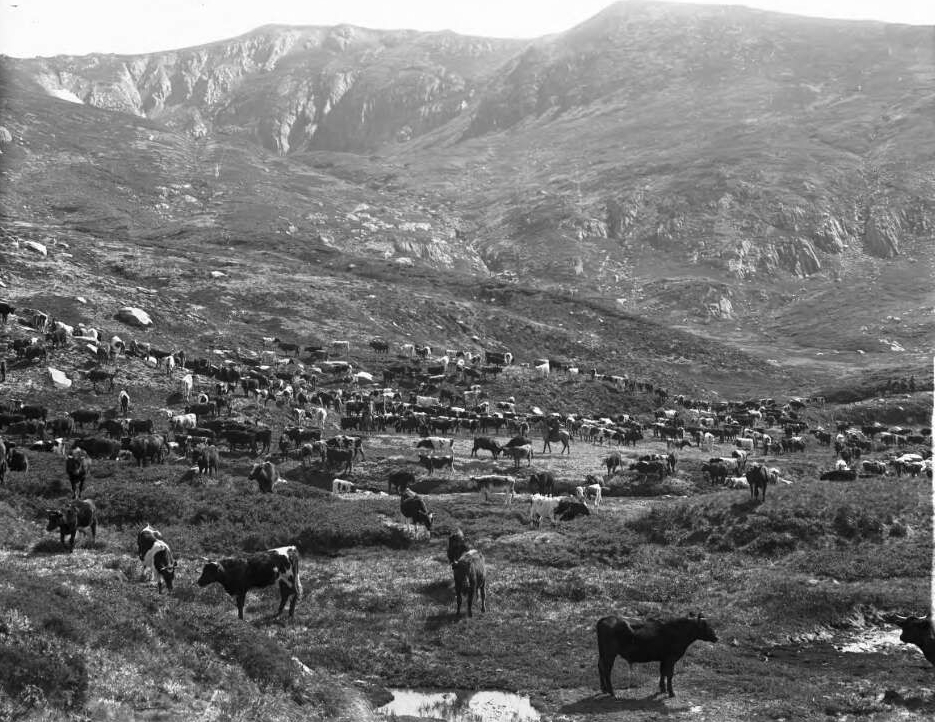
Perisher, in summer, is a less attractive proposition. Yet another man-made blot on an otherwise outstanding alpine landscape. Its development as a ski resort took off at the time of the Snowy Mountains Scheme. The Snowy Mountains project provided access roads, work camps including one at Perisher and an influx of skiing mad European migrants to work on the scheme. Perisher was born.

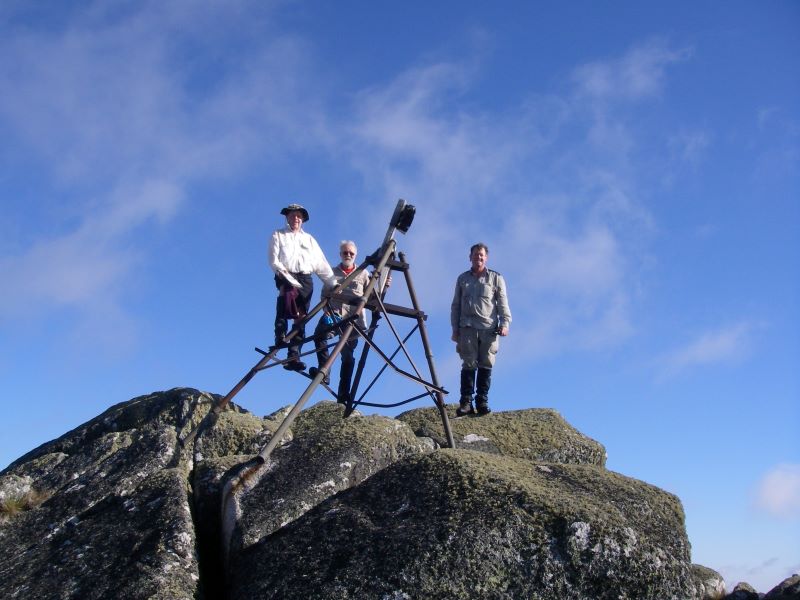
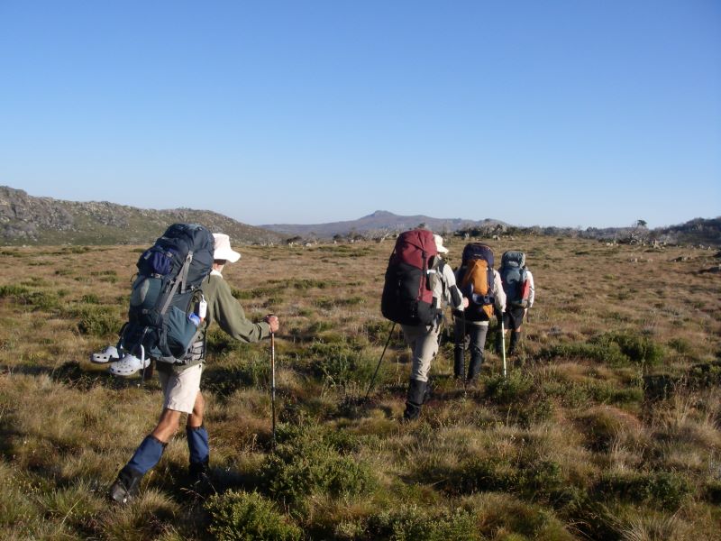
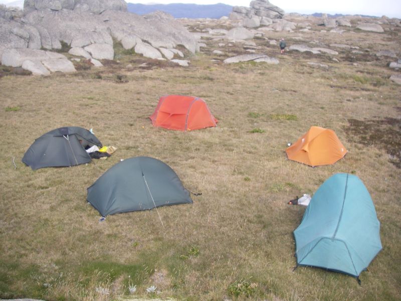
As my erstwhile walking companions, sons and grandchildren, had already deserted for greener pastures, I was on my lonesome for this section.   My wife provided the vital taxi service connecting my drop off point at Perisher Village with Bullocks Flat.  A road trip of some 50 kilometres. Otherwise, it is a return hike to and from Perisher of some 24 kilometres and 740 metres of altitude gain.

Source: NSW Parks and Wildlife.

I had the track basically to myself. There were two other walkers that day, young women who had walked the Charlotte Pass to Perisher section the previous day.  And this was peak summer walking: great walking weather, wildflowers galore and school holidays.  In my experience, the other sections of the SAW were always busy in summer. But, today, not the Perisher to Bullocks Flat track.

Wildflower. Trigger Plant. Kosciuszko National Park
Wildflowers galore. Alpine trigger plant: Stylidium montanum

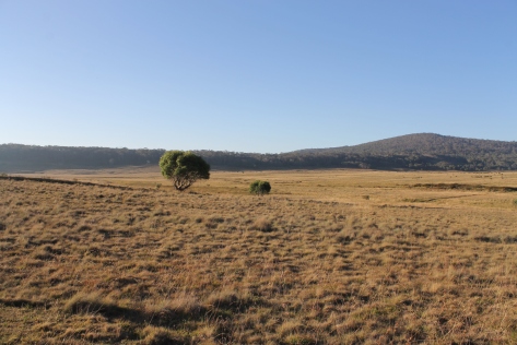
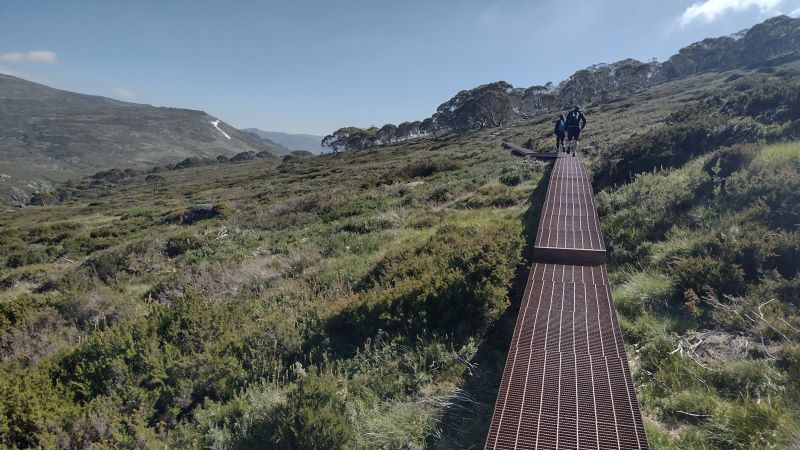
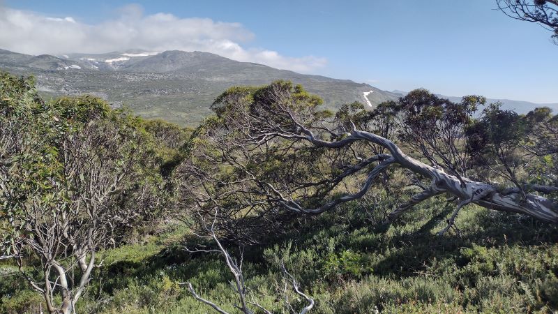
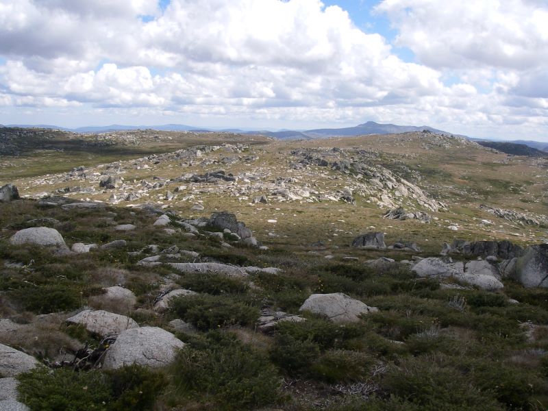
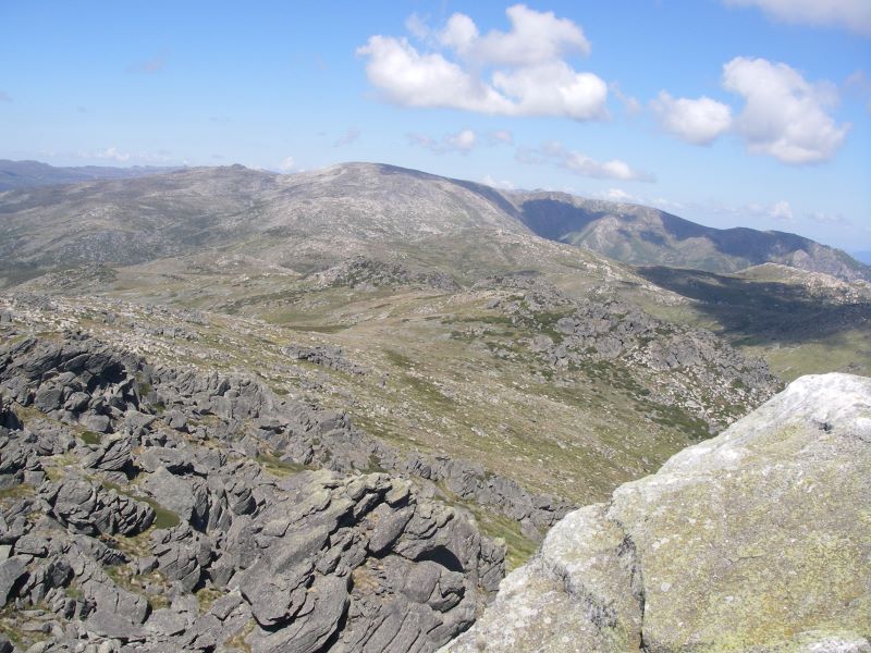
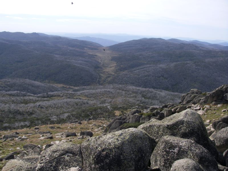
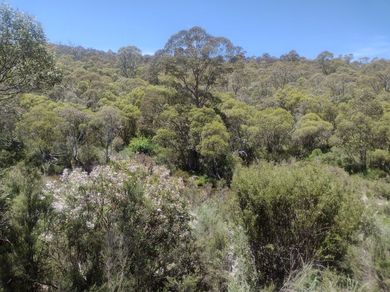
I started early, about 8.00 am.  Blue skies and a very pleasant 8oC greeted me, without the blustery winds of previous days.  It is an ideal half day walk winding through a magnificent landscape of alpine heath meadows, snow gum woodland, and a montane Eucalypt forest including stands of alpine ash. The track weaves in and out of huge granite tors before descending to reach the pristine waters of the Thredbo River.  As a bonus there is the Thredbo lookout perched some 600 metres above the valley floor.

High alpine meadows. Kosciuszko National Park
Alpine heath along the Perisher to Bullocks Flat walk.

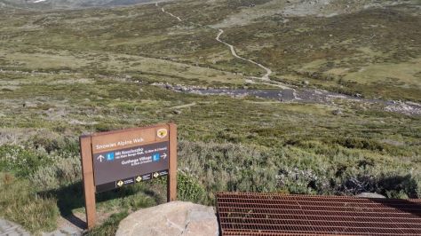
The walk starts at the Perisher village track-head sharing the Charlotte Pass/ Porcupine Rocks track.  After a few hundred metres my path cleaved south east following Rocky Creek.

Rocky Ck near Perisher. Kosciuszko National Park
Bridge over Rocky Creek at Perisher track head.

The track then climbs steadily through Snow gum woodland with occasional patches of alpine heath.  As I crossed the last of the heath, my map showed the line of the Ski Tube tunnel … under my boots, but some hundreds of metres below.
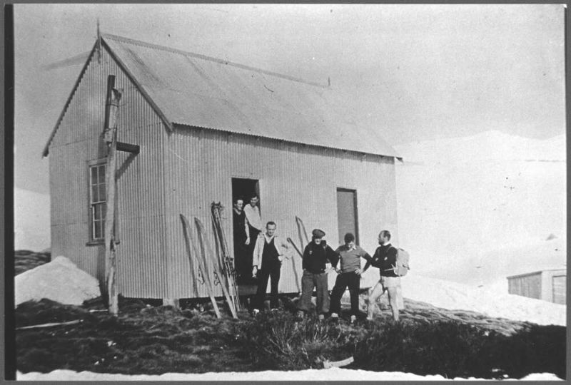
Track from Perisher to Bullocks Flat . Kosciuszko National Park.
Steady climb through snow gum woodland
Ski Tube

The Ski Tube is a Swiss designed electric rack railway that connects Bullocks Flat and Blue Cow via Perisher village.  It departs from the Bullocks Flat terminal (1134 m) before entering the Bilson tunnel that ascends to Perisher Villager (1720 m), with another tunnel connection to Blue Cow (1910 m). The 5.9 kilometre section from Bullocks Flat to Perisher was opened in 1987, while the 2.3 kilometre Blue Cow section opened in 1988.


From a high point at 1800 metres the track begins its long descent, initially through snow gum woodland, towards the Thredbo River.  Some 3.5 kilometres from Perisher is the Thredbo Valley Lookout.  This vantage point gives extensive views into the Thredbo Valley some 700 metres below with the Monaro Plain off to the east. Klaus Hueneke in his excellent tome “Huts of the High Country” gives this derivation of Monaro: ‘ Aboriginal for gently rounded woman’s breasts like the undulating country around Cooma. Also spelt Monaroo,Miniera Maneiro, Meneru and Monera’  

View from Thredbo Lookout. Snowies Alpine Walk. Kosciuszko National Park
View from Thredbo Lookout east to Monaro Plain

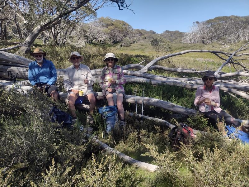
It was here that I came across the two young women again who were lounging on the lookout deck having a bite to eat.  They didn’t seem in any hurry to leave and not wanting to intrude, I wandered off to find a sunny morning tea spot of my own.  A nearby elevated slab of granodiorite at 1700 metres with equally spectacular views fitted the bill.  Perfect.

View up the Thredbo River valley from my morning tea spot.

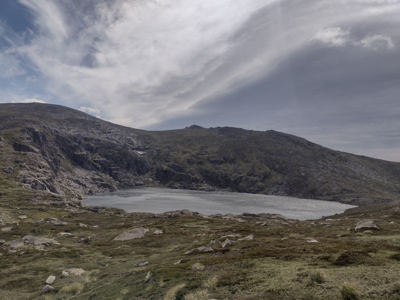
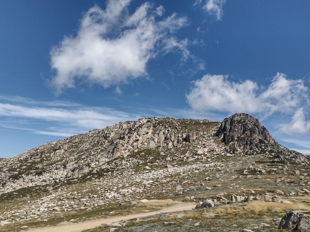
From here the track descended gently north east for 2.5 kilometres to the 1500 metres contour before switch-backing south west to drop steeply for 3.5 kilometres to the Thredbo River at 1100 metres. This was more in the category of a bushwalker’s pad rather than the heavily engineered tracks found on other sections of the SAW.  The descent from the lookout takes you over the Crackenback Fall, a major geological feature of Kosciuszko National Park.
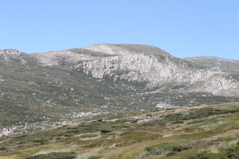
Crackenback Fall

From the lookout the Crackenback Fall drops 700 metres to the Thredbo River valley.  This spectacular fall can be explained by a combination of tectonic uplift (called the Kosciuszko Uplift) during the Tertiary (66 to 2.6 mya) and the rapid downcutting of the Thredbo River into the shattered bedrock along the straight line of the Crackenback Fault.  The Crackenback Fault dates back to a major tectonic contraction during the Lachlan orogeny some 390 to 380 mya.

Crackenback Fall. Kosciuszko National Park.
View over Crackenback Fall to Thredbo Valley.

Klaus Hueneke in : “Huts of the High Country” writes: “stockmen who brought cattle and sheep on to the main range from the Thredbo valley over difficult terrain often said ‘it would Crack-your-back.’ Others said you had to crack the whip across their backs to get them up there.” The name was applied to the river, the Crackenback River which was later changed to the Thredbo River.

Position of Crackenback Fall
Map showing Carackenback Fall. Kosciuszko National Park.
Map showing the Crackenback Fall, the Crackenback Fault and the rectilinear drainage pattern of the Thredbo River.
Vegetation Zones of the Crackenback Fall

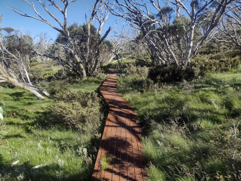
As you descend the Crackenback Fall the vegetation changes from tall alpine herbfields on the high tops through a belt of snow gum woodland, thence to mixed Eucalypt forest before finally reaching a riparian shrub zone on the banks of the Thredbo River.

Tall Alpine Herbfield

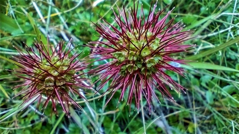
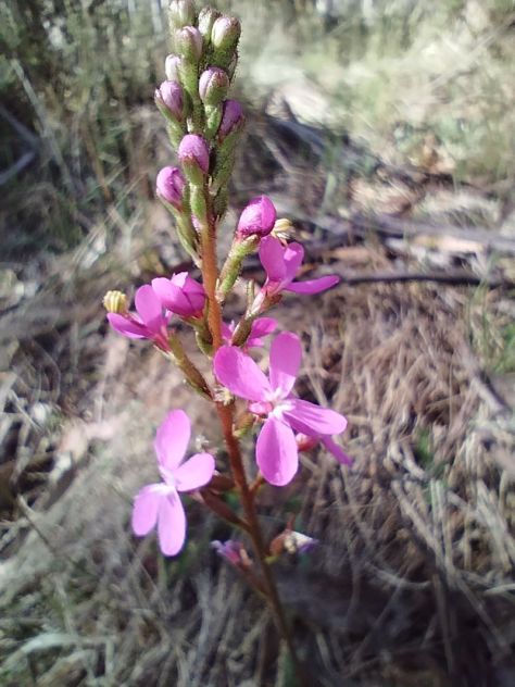
The tall alpine herbfields are the most extensive of all Kosciuszko’s alpine plant communities and are found on well-drained and deeper soils.  They are found on Kosciuszko’s highest peaks, plateaus and ridges, in conjunction with swathes of grassland, low heathland and bogs.  These apparently delicate plants must withstand freezing rain, sleet, blanketing snow, howling winds, as well as heat and extreme UV radiation.  Maybe not so delicate.

This plant community is the most diverse of all the high alpine vegetation types in terms of number of species. Showy wildflowers grow in a matrix dominated by the genera Celmisia (daisies) and Poa (snow grasses).

Tall alpine herbfield. Kosciuszko National Park.
Tall alpine herbfield.

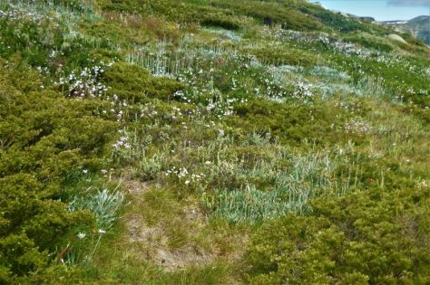
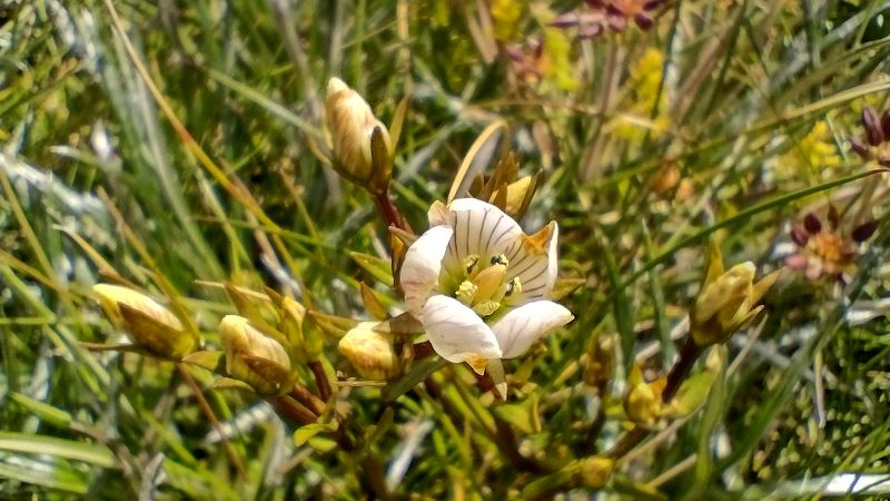
Wildflowers which I recognised included: silver snow daisy (Celmisia astelifolia), Australian bluebells (Wahlenbergia spp), star buttercups (Ranunculus spp), bidgee widgee (Acaena anserinifolia), Australian gentians (Gentiana spp), eyebrights (Euphrasia spp), billy buttons (Craspedia uniflora), and violets (Viola betonicifolia).
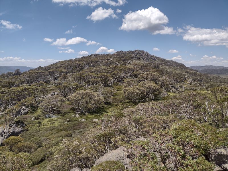
Australian bluebell. Kosciuszko National Park
Australian bluebell. Wahlenbergia sp.

Snow Gum Woodland

The low growing snow gum woodland is found above 1500 metres, the winter snowline.  It is dominated by snow gums or white sallee (Eucalyptus pauciflora).  Its growth habit is low, twisted, stunted and bent away from the prevailing winds.  Snow gum woodland is invariably clothed in a dense scrubby understorey of beastly spikey plants like Bossiaea, Epacris, Hakea, Grevillea, Oxylobium, and Kunzea.  These are usually waist high with tough whippy branches.  This, presumably, an adaptation to withstand the weight of snow or overly rotund bushwalkers without breaking.

Snow gum woodland. Kosciuszko National Park.
Snow gum woodland with dense scrubby understorey.

Mixed Eucalypt Forest

Below the tree line zone which is dominated by pure stands of snow gums, comes a mixed Eucalypt forest of snow gum, mountain gum (E. dalrympleana), Tingiringi gum (E. glaucescens), candlebark (E. rubida), manna gum (E. viminalis), and alpine ash (E. delegatensis).

Mixed Eucalypt forest. Perisher to Bullocks Flat track
Mixed Eucalypt Forest with a stand of Alpine Ash on Perisher to Bullocks Flat Track.

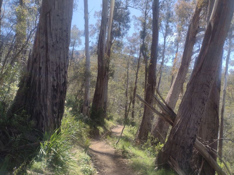
On your descent through the zone of Eucalypts you will encounter some nearly pure stands of alpine ash. This species is typically found between 1200 to 1350 metres on wetter south and south-easterly facing aspects.  It is an unusual Eucalypt in that it does not have any specialised fire survival techniques (such as epicormic growth) and regenerates from seed after fire has destroyed surrounding heavy leaf litter which usually inhibits seed germination. 
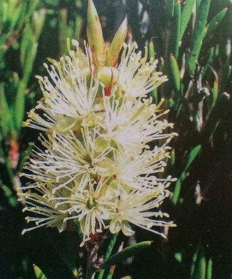
Ferny understorey in mixed Eucalypt forest

Riparian Shrubland

A diverse plant community of mainly shrubs occupies a narrow a strip alongside the Thredbo River.  The main canopy species is an olive-green trunked gum called black sallee (E. stellulata).  Occasional pockets of mountain gum and black sallee grow together.  But the main botanical action is in the shrub layer which provides a profusion of wildflower displays in early summer. 

Riparian Schrub zone along the Thredbo River. Kosciuszko National Park.
Dense thickets of shrubs in riparian zone along the Thredbo River

Along the track as you work your upstream towards Bullocks Flat, here are a few to look out for: poison rice-bush (Pimelea pauciflora) with small slender leaves, creamy flowers and orange fruit; mountain tea-tree (Leptospermum grandifolium) with 5 petalled white flowers, forming dense thickets along the banks, and close to the river, alpine bottlebrush (Callistemon pityoides) with its distinctive brush flowers.  

Alpine bottlebrush. Callistemon pityoides
Alpine bottlebrush. Callistemon pityoides.
Useful reference book on plants in the Thredbo Valley

This handy little guide to plants in the Thredbo Valley won’t take up too much space in your rucksack (15 cm x 21 cm).


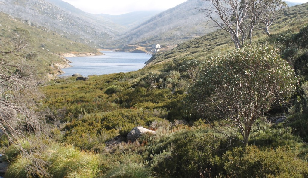
Thredbo River aka Crackenback River

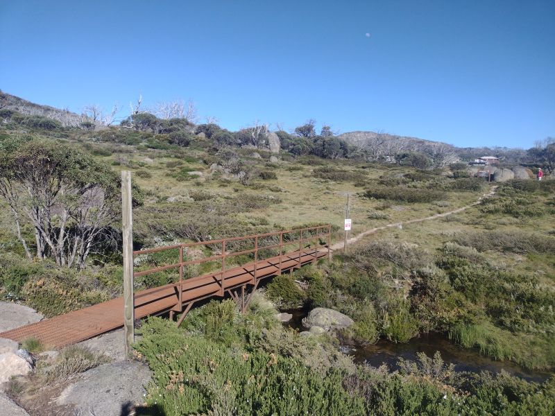
On reaching the Thredbo River, the track closely parallels the river for a further one kilometre to Bullocks Flat, which is accessed by the Ski Tube bridge over the Thredbo River near the Ski Tube carpark.  An eyesore of monumental proportions.  How the Parks service gave planning approval for this hideous monstrosity is a mystery.  Or maybe not. The slimy hands of NSW politicians would be at play in boosting ski tourism in the national park. A pattern of pandering to the ski industry that is repeated across most of Australia’s alpine ski fields.

But moving on from this well-ventilated gripe of mine.  If you look upstream and downstream from an opening onto the river bank you will see how straight the course of the Thredbo River is.  In fact, it flows in a reasonably straight line from Dead Horse Gap to Lake Jindabyne. A consequence of the structural control exerted by the Crackenback Fault.

Straight course of Thredbo River looking upsream to Bullocks Flat.
Straight course of Thredbo River looking upstream towards Bullocks Flat

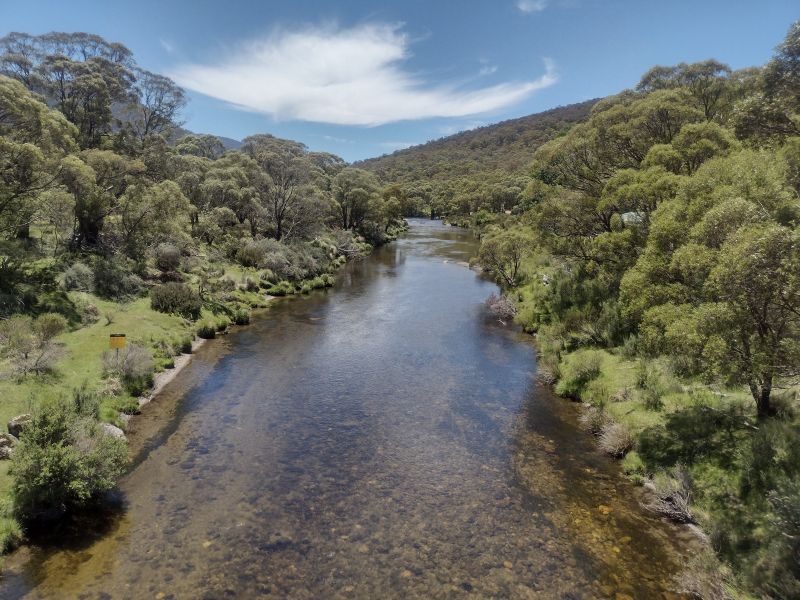
The course of the Thredbo River presents an interesting drainage pattern when viewed on a map. It is described by geomorphologists as a rectilinear drainage pattern, where the main bends of the Thredbo River change direction at right angles. In the case of the Thredbo, it initially flows south-east, then turns south-west, then north-west and finally into the main Thredbo valley which runs in a straight line north-east to Lake Jindabyne.

Faults show clear evidence of differential earth movements. The Crackenback Fault is a 35 kilometre long, south-west to north-east trending strike-slip fault between the Jindabyne Thrust Fault (at Jindabyne) and Dead Horse Gap.

Map showing rectilinear drainage pattern of Thredbo River and position of Crackenback Fault. Kosciuszko National Park.
Rectilinear drainage pattern of Thredbo River and position of strike-slip fault, the Crackenback Fault

A strike-slip fault has horizontal movement of the earth’s surface with little vertical displacement. It is along this straight fault structure that the Thredbo River flows towards Lake Jindabyne.

Other well-known strike-slip faults include New Zealand’s Alpine Fault, the Dead Sea, and the San Andreas fault in North America.

block diagram of strike slip fault
Strike-slip or horizontal fault. Source: Longwall & Flint: Introduction to Physical Geology.
Enter the World of Willie the Wombat

The walk upstream is an opportunity to keep your eyes open for signs of those bulldozers of bush and plain, wombats.  You have to be lucky to chance upon a trundling wombat during the day, but their massive burrows, or their very distinctive cuboid poos are easily spotted.  The common wombat (Vombatis ursinus: bear- like) is of tank-like stature: about 100 cm long, 30 kilograms in weight, short stubby legs and thickset body.  The fur is coarse and of a grey, black or brown colour.

Wombat grazing

They are herbivores grazing on grasses, roots and fungi.  Their teeth grow continuously to accommodate their gnawing on rough herbage and roots.  In summer they leave their 10 to 15 metre long burrows on dusk and graze through the early part of the night.  On one trip to Kosciuszko we spent quite a long time at dusk in the nearby Thredbo Diggings area hoping to spot a wombat for our little boys.  A futile venture as it turned out.  Plenty of fresh poo and burrows, but alas no Willie Wombat.

Wombat poo.
Distinctive cubes of wombat poo.

The preferred habitat for wombats is woodland or grassland but they can be found foraging above the tree-line.  One was spotted ascending Mt Townsend at 2209 metres, Australia’s second highest peak.  

Wombat territory along Thredbo River. Kosciuszko National Park.
Prime wombat territory on Thredbo River flats.
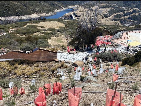
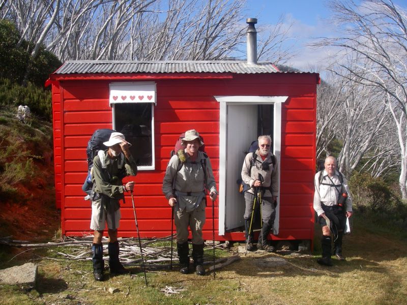
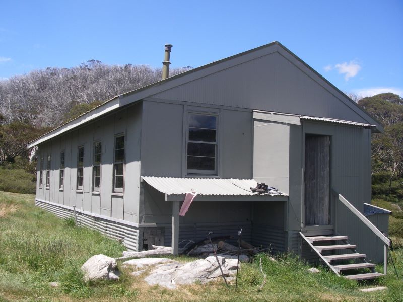
Bullocks Flat and Bullocks Hut

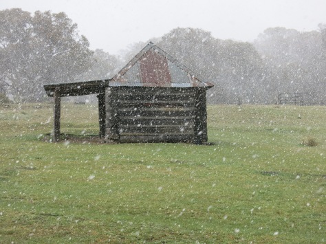
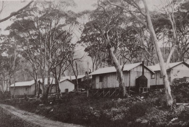
Bullocks Hut is on the banks the Thredbo River near that ugly Ski Tube car park.  Quite a contrast. This is an enticing site of grassy flats and the picturesque fast flowing Thredbo River.  Bullocks Hut was built in 1934 for Dr Bullock as a fishing lodge and used by the family until about 1950. A kitchen was added in 1938 and a garage and stables in 1947. The hut was resumed by the NPWS in 1969 and renovated in the 1990’s.  

It is described in various publications as ‘built like a fortress’.  As it is.  The walls are constructed of cement blocks with the floor of tiles over a cement base.  The original roof was constructed of shingles cut by a Snowy Mountains local identity, Bill Prendergast.  The roof was later covered by sheets of iron.  The chimney is made of cement.  The use of cement has resulted in the hut being fenced off & declared out of bounds. Due to an OHS issue… silica dust contamination.

Bullocks Hut. Kosciuszko National Park.
Bullocks Hut
The Crackenback Gold Rush

Bullocks Flats was just one of the many river flats and river banks (like the nearby Thredbo Diggings campground) that were dug and sluiced for gold.  The Crackenback gold rush took off in the 1870’s when small tributary streams were worked over by gold miners. The diggings were so remote that it took two months for bullock teams and drays to bring supplies from Sydney. 

The last remaining miner was Alf Tissot who worked the area until the late 1930’s.  Like many miners, he preferred to walk rather than ride the 20 kilometres into Jindabyne to get his supplies.

Look carefully and you will see flecks of gold and silver in the sandy riverine deposits. Unfortunately for you, this is merely ‘Fools’ Gold’, aka Pyrite or Chalcopyrite or Mica.

Iron Pyrite (Iron sulphide) looks like gold but is a pale brassy colour and isn’t malleable. Also pyrite forms perfect cubic crystals and if you scrape pyrite down a scratch plate it leaves a geenish-black powder rather than flakes of gold. Pyrite gets its name from the Greek ‘pyr‘ meaning fire, because it emits a spark when struck by iron.

Pyrite aka Fool’s Gold

Chalcopyrite (Copper pyrite) is a bright, brassy-yellow mineral, which tarnishes to a dull gold colour. Unlike gold it is brittle and breaks easily.

Mica is very common in the Thredbo River. and is derived from the local granitic bedrock.  Any gold sparkles are the first two, but the silvery or yellowy-brown sparkles are most likely mica.

It is easily identified.  You won’t be fooled for long.   When split, mica cleaves into thin sheets or laminae which sparkle silvery or vaguely gold in sunlight.  It has a wide variety of uses including in the manufacture of electronics, paints, plastics and cosmetics.

Platy flakes of mica

In the 1910’s and 1920’s Ned Irwin’s sawmill operated on the opposite bank from Bullocks to source the towering hardwood eucalypts, especially the alpine ash.  Bullock teams dragged the timber into nearby towns for housing materials.  There is supposed to be an old steam engine and flywheel in the area, but I didn’t see them.
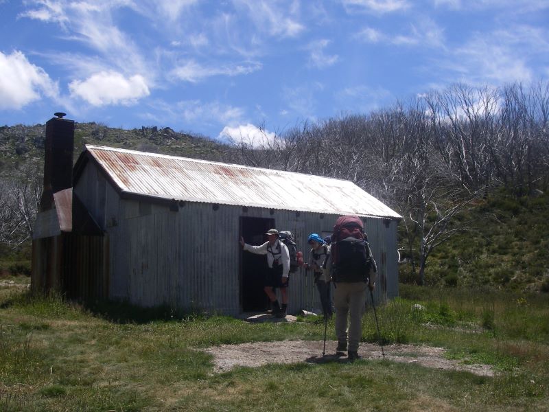
Rutledges Hut

Several kilometres upstream from Bullocks Flat is the site of Rutledges Hut, now removed, another fisherman’s lodge.  This was built in 1935 by a Colonel Rutledge and his fellow fishers Mr McKeown, Brigadier Broadbent and a Mr Burns.  It was a long hut constructed of sheet iron and had a wooden floor.  It was removed by the NPWS in the 1980’s, deemed unsafe.  The NPWS was pretty keen on removing huts for a while.   

Rutledges Hut. Kosciuszko National Park
Rutledges Hut 1982. Source: B. Powell. KHA.

In 1979 the NPWS issued a draft huts policy which created a huge, well-deserved backlash. They recommended removal of all huts in the summit area (except Seamans) and in the Whites River corridor (except Disappointment and Whites River Huts).  In addition, the demolition of O’Keefes, Grey Hill Café and Tantangara were pencilled in. They were forced to back off, but removed Albina and Rawsons, the sacrificial lambs.

Fortunately, times have changed and the NPWS together with the Kosciuszko Huts Association is now heavily invested in conserving these heritage shelters for the use of bushwalkers and skiers needing a place of sanctuary in the oft changeable alpine weather.

Fishing on the Thredbo River

Fishing has a long history in the Snowy Mountains, especially fly fishing. The quarry was not the native mountain trout (Galaxis olidus) which struggles to reach to 10 cms in length, but the introduced North American Rainbow trout (Oncorhyncus mykiss) and the European brown trout (Salmo trutta).   These were introduced in the 1890’s and are restocked regularly from the Gaden Trout Hatchery further downstream.  An unfortunate outcome of these introductions has been a profound change in the local aquatic ecosystems with Galaxias missing from streams inhabited by trout.  They are now confined to a few high alpine streams and lakes.

Native Mountain Trout. Galaxis sp. Kosciuszko National Park.
Native mountain trout: Galaxis sp.

By midday, my walk on this final section of the Snowies Alpine Walk was over.  I found a bench seat in a sunny spot near Bullocks Hut and waited for the wife taxi and accompanying lunch supplies to arrive.  A pleasant warm spot for us to eat, chat and, ever the inveterate cartography nerds, check off the landmarks from our map: the Rams Head Range, The Porcupine at 1921 metres, the Thredbo Lookout and the entrance to the Bilson Tunnel.

Sketch of Rams Head Range from Thredbo River Valley
Sketch of Rams Head Range from Thredbo River Valley.
Aboriginal Occupation Of Thredbo Valley

Long before the unthinking predations of gold miners, loggers, fishermen, and cattlemen the Thredbo River valley was traversed by aborigines. Lithic scatters have been found near Bullocks Flat and other sites in the along the Thredbo. These scatters including stone hammers, scrapers and flakes. Waste lithic material accumulated in favourite campsites and these can be found if you are alert. Though they must be left in-situ.

During summer the Wogal tribe gathered in the valley, along with other tribal groups to feast on the bogong moth. Moth feasts were a great occasions for gatherings of friendly tribes. They were summons by message sticks to join the feasting, corroborees, trade, settling of disputes and marriage arrangements.

The gatherings took place at the foot of the mountains. The aborigines came from Yass and Braidwood, from Eden on the coast and from Omeo and Mitta Mitta in Victoria. All intent on having a good feed and a good time.  Large camps formed with as many as 500 aborigines .

It is thought that advance parties would climb up to the tops, and if the moths had arrived they would send up a smoke signal to the camps below. The arrival of the moths is not a foregone conclusion. Migration numbers vary from year to year.

Bogong Moth
A tasty morsel. the Bogong Moth.

Some years they are blown off course and out into the Tasman Sea.  1987 was a vintage year, but in 1988 the bright lights of New Parliament House in Australia’s bush capital, acted as a moth magnet, and they camped in Canberra for their summer recess, unlike our political masters.

  Men caught the moths in bark nets or smoked them out of their crevices. They were generally cooked in hot ashes but it is thought that women sometimes pounded them into a paste to bake as a cake. Those keen enough to taste the Bogong moth mention a nutty taste.

Scientists say they are very rich in fat and protein; this diet sustained aborigines for months and the smoke from their fires was so thick that surveyors complained that they were unable to take bearings because the main peaks were always shrouded in smoke.  

Europeans often commented on how sleek and well fed the aborigines looked after their moth diet. Edward Eyre who explored the Monaro in the 1830’s wrote: “The Blacks never looked so fat or shiny as they do during the Bougan season, and even their dogs get into condition then.” At summer’s end, with the arrival of the southerlies, the moths and aborigines all decamped and headed for the warmer lowlands. As did I. Back to the the heat and humidity of Queensland.

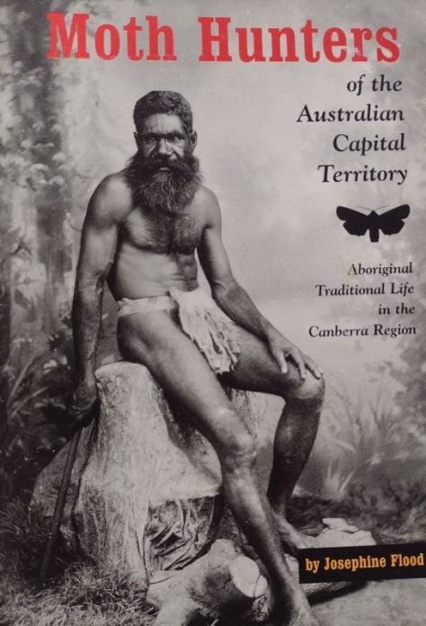
Should you want to read more about aboriginal moth hunters , then you should delve into Josephine Flood’s ‘Moth Hunters‘.


For me, it was another brilliant walk in Australia’s high country done and dusted. 

More of my hikes in Kosciuszko National Park

Snowies Alpine Walk: A Scenic Walk from Charlotte Pass to Guthega Village via Illawong Hut.

After our previous day’s walking on the Snowies Alpine Walk from Charlotte Pass Village to Perisher via Porcupine Rocks, we were keen to check out another new section. This time we settled on the new nine kilometre walk from Charlotte Pass to Guthega village. A top day beckoned. Clear skies, maximums hovering around 21o C and an alpine ramble with my walking friends Joe, Chris, Neralie and Garry.

by Glenn Burns

Snowy River. Kosciuszko National Park
Snowy River. Downstream of Charlotte Pass.

The BOM had issued a heatwave warning in its Snowy Mountains forecast. But for this quintet of Queenslanders the threatened 21o C maximum was just so. Not too hot, not too cold.


In 2018 construction started on the Snowies Alpine Walk. The NSW Government boasted it would deliver ‘ a world-class, multi-day walk across the alpine roof of Australia in Kosciuszko National Park.’

This 55 kilometre, 4 day walk, on Ngarigo Country, connects the existing Mt Kosciuszko-Main Range walk with three new sections. Namely, Charlotte Pass to Guthega Village; Charlotte Pass Village to Perisher Village via Porcupine Rocks and, as of 2024, the still incomplete section from Perisher Village to Bullocks Flat in the Thredbo River Valley.

Snowy River from the Snowies Alpine Track. Kosciuszko National Park.
Snowy River from the Snowies Alpine Walk track.

After a top day of alpine walking yesterday from Charlotte Pass to Perisher, life on the track was on the up and up. An uneventful drive, with Joe at the wheel, from our digs at Sawpit Creek, delivered us to Charlotte Pass (1840 m).

Bang into an unexpectedly biting wind. Someone had neglected to clock the forecasted 50 kph wind gusts. So with the wind chill effect, the ambient temperature was pretty cold. And this was mid-summer, Australia. As my old walking pal Brian was apt to say: ‘strong enough to blow a brown dog off its chain’. We pulled on an extra layer.

Charlotte Pass on a windy day

Pleistocene Glaciation in Kosciuszko National Park

If you had been standing at this very spot some 60,000 years ago, in the frozen depths of the last Pleistocene ice age, the scene in front of you would have been vastly different.

You would have gazed across a panorama of snow and ice. Rivers of ice poured out from ice-filled glacial bowls on the south east flanks of Mt Lee, Mt Clarke, Carruthers Peak, and Mt Twynam. The current valleys of Club Lake Creek, Blue Lake Creek, Twynam Creek would be brimming with glacial ice grinding bedrock to a pulp on its way to join the major valley glacier in the Snowy River.

In fact, it is possible that your perch at Charlotte Pass would have been covered by a mass of abrading Snowy River glacial ice pushing over this interfluve into the neighbouring Spencers Creek valley. Or so some geologists hypothesise.

Back then temperatures would have been much colder. The minimum temperature today was 12o C. 17,000 years ago it would have been at least 5 to 8o C lower.

In Kosciuszko there is evidence of at least two distinct glaciations. The Early and Late Kosciuszko glaciations. The Early Kosciuszko Glaciation consisted of a single major advance at approximately 60, 000 years ago called the Snowy River Advance. This was the most extensive advance with later advances less extensive.

Geologists tell us that the Snowy River glacier probably extended as far downstream as Illawong Hut. Possibly further. There is evidence of glacial debris downsteam at Island Bend, discovered during surveys for the Snowy Mountain Scheme.

The Late Kosciuszko glaciation consisted of three smaller glacier advances, starting about 32,00 years ago: Hedley Tarn Advance (32,000 years ago), Blue Lake Advance (19,000 years ago) and Mt Twynam Advance (17,000 years ago).

Blue Lake cirque. Kosciuszko National Park.
Blue Lake cirque under Mt Twynam.

The systematic search for evidence of glaciation in Kosciuszko got seriously under way in 1901. A scientific party of Professor T.W. Edgeworth David (geologist), Richard Helms (zoologist and botanist), E.F. Pittman , and F.B. Guthrie (Professor of Chemistry) found incontrovertible evidence of the action of glacial erosion and deposition:

Early Geology Map of Kosciuszko’s Main Range by T.W.Edgeworth David.
Club Lake. Kosciuszko National Park.
Club Lake. A moraine dammed lake.

The Kosciuszko Plateau has been now been free of of glaciers for about 15,000 years. In addition to the glacial landforms mentioned above, the observant bushwalker can find ample evidence of periglacial landforms over much of the higher country. Some easily identified of these landforms include blockstreams, solifluction terraces and thermokarst ponds.

Block stream Spencers Ck. Kosciuszko National Park
Periglacial landform. Block stream. Spencers Creek.

Meanwhile, back in the Anthropocene, the Snowies Alpine Walk (SAW) from Charlotte Pass initially heads downhill on the paved NPWS vehicular track towards the Snowy River. Some 500 metres of descent will deliver you to a junction and noticeboard trumpeting the start of the walk to Guthega village. We executed a hard right onto the SAW path.

Signage on Snowies Alpine Walk. Kosciuszko National Park.
SAW signage at junction to Guthega. Track over Snowy River to Main Range in background.
Map of Snowies Alpine Walk: Charlotte Pass to Guthega Village.
Map of Snowies Alpine Walk. Charlotte Pass to Guthega section. Kosciuszko National Park.

Here the SAW parallels the Snowy River on its eastern bank, winding around Guthrie Ridge on the 1700 m contour before dropping to Spencers Creek and the Snowy River at Illawong Hut. The final part of the day’s walk picks up the old Illawong-Guthega bushwalker’s pad to fetch up at Guthega Village, some nine kilometres from Charlotte Pass.


Back in the Day… 2009… Guthrie Ridge.

But, back in the day, in 2009, a 17 kilometre walk from our camp on Strzelecki Creek under The Sentinel to Charlotte Pass thence to Illawong Hut via Guthrie Ridge was more of a challenge. We set off with a brilliant off-track alpine ramble from Strzelecki Creek to Charlotte Pass via Carruthers Peak, Mt Northcote, Mt Clarke and the Snowy River Crossing.

Mt Clarke. Kosciuszko National Park.
Mt Clarke and Snowy River Valley.

Once at Charlotte Pass we swung off-track again to climb Mt Guthrie (1920 m). The usual suspect had cooked up this feral route that followed the spine of Guthrie Ridge (1900 m) and then descended to an overnight bivvi at the junction of Twynam Creek and the Snowy River. Close to Illawong Hut.

Mt Guthrie. Kosciuszko National Park
Mt Guthrie and Guthrie Ridge

Mt Guthrie and Guthrie Ridge were named by Richard Helms for his friend F.B. Guthrie, Professor of Chemistry.

My peak bagging companion had hinted at another exceptional alpine stroll to cap off what had been, so far, a matchless day of hiking. A mere two and a half kilometres or a one hour leisurely amble along the spine of Guthrie Ridge would deliver us to our campsite on the junction of Snowy River and Twynam Creek. Fun times.

Mid afternoon, on a steep mountainside, high above the valley floor three beleaguered peak baggers pushed wearily through the tangle of granite boulders and scratchy mountain peppers, Kunzeas, Epacris and snow gums that lay between them and the day’s end. Route wise, a bad call.

Gutherie Ridge. Kosciuszko National Park.
Tangle of boulders and vegetation. Guthrie Ridge.

But I was resigned to this stuff. Situation normal when walking with my bush-bashing, peak bagging buddy Brian. He claimed it was just the price we had to pay for a very satisfying and bludgy morning’s walk. Finally, we staggered in just on dusk. The campsite made it all worthwhile. We set up on a springy snow grass ledge… lulled to sleep by the riffling Snowy River. All was well in my little slice of bushwalking paradise and all is forgiven Brian.


The new Snowies Alpine Walk.

After mulling over this previous cross country experience I gave thanks for the newly minted super SAW highway. Cortan steel elevated boardwalks, rock-armoured track surfaces and dry boots compliments of a high suspension bridge over Spencers Creek. A speedier passage than taking that infernal high road along Guthrie Ridge. But nowhere near as interesting.

The track took us initially over another of those eyesore Cortan steel boardwalks much favoured in Kosciuszko National Park. But I admit they do an excellent job of protecting the low heath and snow grasses below.

Snowies Alpine Walk. Kosciuszko National Park.
Snowies Alpine Walk. Cortan steel boardwalk over low heath.

Eventually the track leaves the low heath and climbs on its granite pavement ever upward through snow gum woodland. As did Garry. Left us, that is. We found him, as I expected, propped on a log in a bower of snow gums. The ideal morning tea stop.

Morning tea stop. Snow gum woodland

Snow gum woodland, invariably, is clothed in a dense scrubby understorey of beastly spikey undergrowth like Bossiaea, Epacris, Hakea, Grevillea, Oxylobium, and Kunzea . Here’s where those weird knee-length canvas gaiter things worn by Australian bushwalkers are a brilliant piece of kit.

The low growing snow gum woodland is found above 1500 metres and is dominated by snow gums or white sallee ( Eucalyptus pauciflora).

Snow gums. Eucalyptus pauciflora. Kosciuszko National Park.
Snow gums (Eucalyptus pauciflora). Gnarled and wind shorn.

The snow gum zone is found extending down to the lower levels of winter snowfall and is the only tree to grow above 1500 metres. Above this woodland zone the landscape transitions suddenly into the true alpine zone of heathland, grassland and bogs.

Snow gum Woodland. Kosciuszko National Park.
Snow gum woodland with scrubby understorey of Bossiaea, Kunzea, Hakea, Oxylobium.

The undergrowth is called heath and can be waist-high with tough whippy branches to withstand the weight of snow (and, hopefully, bushwalkers) without breaking. Throw in the odd torpid highland copperhead and pit-fall traps of wombat and bunny burrows and hiking through this scrub quickly losses its appeal.

Fortunately, the new super SAW highway saved us from having to thrash through that stuff.


Much of the SAW walk parallels the Snowy River which flows NNE downstream towards Guthega Pondage. It is joined on its western bank by the south east flowing drainage lines of Blue Lake Creek, Twynams Creek and Pounds Creek.

These creeks have their headwaters along the highest parts of Australia’s Great Dividing Range: Carruthers Peak (2010 m), Mt Twynam (2196 m), Mt Anton ( 2010 m) and Mt Anderson (1997 m). The Main Range peaks all visible from this section of the SAW.

Today’s walk provided expansive and unimpeded views down the nearly straight Snowy River Valley. Its side slopes planed back by late Pleistocene valley glaciers. Glacial valleys all over the world typically exhibit these truncated spurs and U shaped valleys.

Glacially abraded Valley slopes. Snowy River. Kosciuszko National Park.
Glacially abraded valley slopes. Snowy River.

Some 4.5 kilometres after the track entrance our path left the snow gum woodland and descended across low heath covering a gently rounded spur at the intersection of the Snowy River and Spencers Creek. An abraded spur, ground down during the Pleistocene by the Snowy River and Spencers Creek valley glaciers.

Snow gum woodland. Kosciuszko National Park.
Snow gum woodland on the Snowies Alpine Track.

Joe and I caught up Chris and Neralie just short of the Spencers Creek suspension bridge. They were magging with two walkers travelling in the reverse direction. Uphill to Charlotte Pass. I’m not sure of the rationale for doing this section uphill, but many people do. Meanwhile, Garry was last seen as a distant speck beetling toward Illawong Hut.

The SAW track builders had thoughtfully provided a nifty suspension bridge consisting of a steel mesh plank and handrails to usher walkers safely across Spencers Creek. Built in 2021 it is said to be, in terms of its location, at 1627 metres of altitude, the highest suspension bridge in Australia .

Suspension Bridge over Spencers Creek. Kosciuszko National Park.
Suspension Bridge over Spencers Creek

Meanwhile Garry had escaped the wind by taking refuge at the side of the hut. Just don’t turn up here in a serious blizzard. You will find the inn door locked, as we did. An unusual arrangement for high country shelters. But this is because Illawong is the only private lodge outside the main ski resorts.

Illawong Hut. Kosciuszko National Park.
Illawong Hut.

But, to be fair, the illustrous Illawong Ski Tourers have thoughtfully provided a sealed crawl space for midgets under the hut for just such an emergency. And, they have thrown in as a goodwill gesture, a snow shovel to dig yourself out or in. Once out of your blizzard, don’t try to sit up. The upside is that you are safe and don’t have to share the under floor space with assorted snakes, wombats and other creepy-crawlies.

Emergency shelter. Illawong Lodge. Kosciuszko National Park.
Emergency Shelter at Illawong Hut.

Illawong Hut

Illawong, also known as Pounds Creek Hut and Tin Hut No1, was constructed in the summer of 1926-1927 as a shelter hut. Illawong is said to mean ‘view of the water’. A basic two roomer/four bunks, it was built by the NSW Tourist Board to assist Dr Herbert Schlink in his first Kiandra to Kosciuszko ski crossing during the winter of 1927.

Pounds Creek Hut, now Illawong Hut in 1940s. Kosciuszko National Park.
Pounds Creek Hut ( now Illawong Lodge) in 1940s. Source: NLA: obj-147481686

After construction it was used for early ski touring, summer bushwalking and by mountain cattlemen. At the time only two other buildings existed in the high country: Betts Camp and Kosciusko Hotel.

In 1955, John Turner of the Ski Tourers Association brewed up a plan to convert Pounds Creek Hut into a ski lodge. A year later, in 1956, the Kosciuszko State Trust gave permission for the hut to be extended to become a private ski lodge managed by Illawong Ski Tourers.

The conversion was a bit of mission for lodge members. No helicopter lifts in those days. All materials and food supplies had to carried in. Though some ingenious work-arounds were dreamt up. Klaus Hueneke in his first-rate tome: Huts of the High Country provides this description:

” Over the next two years members, friends and passersby spent endless summer days and occasional premature wintry ones carrying, rowing, pushing and dragging materials to site. “

And this:

” Rowing the materials up Guthega Dam was a new twist to mountain transportation and not without incident… boat trips took on ice floes, wind driven sleet and polar wombats! The final leg was considerably aided by a sled and the muscle power of Mick, a horse from the Chalet. Unfortunately he had only two speeds – stop and run like hell. “

Those enterprising Illawongians weren’t finished yet. Over the years the Lodge was spruced up with a septic tank, electric lighting, a gas cooker, a refrigerator, a hot water service, decent mattresses, carpets and a phone. A veritable home away from home. My membership application is in the mail.

Members also designed and built the flying fox over Farm Creek and the suspension bridge over the often raging Snowy River. For this latter feat all skiers and bushwalkers wanting to access the Main Range should give them fulsome thanks. Two earlier bridges had been swept away before a decent one was installed in 1971. The final version was designed and built by one Tim Lamble and assembled with the help of the NPWS helicopter.

Tim, incidently, is also the author of my favourite piece of cartographic art: the Mt Jagungal and The Brassy Mountains 1:31680 map.

Extract of Tim Lambles map of Mt Jagungal and Brassy Mountains. Kosciuszko National Park.
Extract from Tim Lamble’s map Mt Jagungal and The Brassy Mountains. 1:31680.

Illawong Hut has been placed on the National Heritage Register, the National Trust (NSW) Register and NPWS Historic Places Register. Its NPWS citation reads:

” Illawong Hut is one of the most historically significant huts in the park, being a rare remnant of early 20th century NSW Government Tourist Bureau efforts to promote alpine tourist recreational activities.”

For good measure the Farm Creek flying fox and the Snowy River suspension bridge are also on the register.

Snowy River suspension bridge. Kosciuszko National Park.
Snowy River suspension bridge accessing The Main Range.

With little over two kilometres to Guthega my friends had scarpered in a cloud of dust. The upgraded SAW track follows the old bushwalking pad between Illawong and Guthega. It skirts around the southern bank of Guthega Pondage. This pondage, a tunnel and Guthega (Munyang) hydro power station were built as part of the Snowy Mountains Scheme in the early 1950s.

This Munyang (Guthega) project area is the start of many of my favourite walks in Kosciuszko.

And it is also the start of the first major project of the Snowy Mountains Scheme in 1951. The tender was awarded to a Norwegian firm, Ingenior F. Selmer. A serious player in global dam and hydro construction. The bulk of the workers were Norwegians (450, mainly labourers) from the rural areas of the Arctic Circle.

Norwegians working on Snowy Mountains Scheme.

On the 21 February 1955 , only a few weeks behind schedule, electricity flowed from Munyang.

Historical photo of Munyang Power Station. Kosciuszko National Park.
Munyang (Guthega) Power Station under construction. Circa 1950.

The word Munyang or Muniong derives from local aboriginal people. When camped on the Eucumbene Valley, they would point to the snow covered Main Range and repeat the word ‘Munyang’ or ‘Muniong’ . Said to mean ‘big’ or ‘high mountain’. Also ‘big white mountain’.

If you want to read more about the fascinating people and places of the Snowy Mountains Scheme, I can highly recommend Siobhan McHugh’s: ‘The Snowy, a History.

Book. The Snowy. Siobhan McHugh
Siobhan McHugh: The Snowy, a History. Anniversary Edition. NewSouth Publishing. 2019.

Nearing the end of our walk, the SAW crosses Farm Creek via a metal bridge then climbs to Guthega Village. No need to risk life and limb on the the rusty old flying fox still there. Fortunately, it has been padlocked by some kill-joy to discourage thrill seekers like my walking companions.

Farm Creek bridge on SAW. Kosciuszko National Park.
Farm Creek bridge on SAW.

At the still to be completed track exit, rangers were busy fiddling around sorting out signage. Here we had views over the waters of Guthega Pondage, the dam wall and the intake for the tunnel to the top of the Munyang penstocks.

Guthega Pondage. Kosciuszko National Park.
Approaching Guthega Pondage along SAW track.
Final construction work at lookout on track exit at Guthega.

Guthega village did not exist before 1950. The only building in the area was our old friend Illawong Hut. In 1951 when the Norwegian company Selmer started construction on the first major project of the Snowy Mountains Scheme , their construction camp became known as ‘Little Norway’ as it housed the largest number of Norwegians living outside of Norway at the time.

Historical Photo of road to Guthega. 1950.Kosciuszko National Park.
Road to Guthega still under construction 1950.

When Selmer returned to Norway in 1954, at the end of their contract, they took most of their construction camp with them, leaving just three huts. These huts kick-started the modern day Guthega Ski Resort.

Huts left by Selmer at Guthega. Source: Perisher Museum.

The huts were scooped up for peanuts in 1955 by SMA Cooma Ski Club, YMCA Canberra Ski Club and Sydney University Ski Club. The village now sports private lodges, a restaurant and bar, commercial resort accommodation and various tow knick-knacks to ferry skiers to the top of their runs.

Guthega serves as a winter base for downhill skiing, cross country skiers, snow-shoers and snow-boarders. The alpha adventurers head for Blue Lake to try out their ice climbing skills. But in summer, Guthega is pretty much dead. A ghost resort. Hopefully, this will change given the number of walkers I saw on the track.


It was now two hours past our lunch hour. A familiar pattern developing here, much to the chagrin of my fellow walkers. We found Garry’s vehicle, wheels still attached, piled in and headed for nearby Island Bend Campground on the Snowy River for a belated feed.

The campground was once the site of a construction village for the Snowy Mountains Scheme.

Historical photo of Island Bend Barracks. Kosciuszko National Park.
Island Bend Barracks. Snowy Mountains Scheme.

We ducked into a pleasant little nook with a picnic table and some soft grass for a post-prandial kip. All in all, a top day of alpine hiking with my walking companions, Joe, Chris, Neralie and Garry.

Happy Hikers.

I had many more days of alpine adventures for my fellow Kosciuszkians. God bless their little walking boots. Maybe not so little.


Check out these Kosciuszko walks.


A Summer Saunter in the Snowies #1. The Kerries, Rolling Grounds, The Main Range and The Rams Heads.

 My bushwalking friend Brian  is nothing if not persistent.  And so it was that we were off again to walk the length of The Kerries Ridge, said to be ‘some of the finest walking in Kosciusko National Park.’   He for a third attempt and me for a second.  Our previous encounters had taught us that The Kerries ridge was not a good place to be in bad weather.

by Glenn Burns

This time we were accompanied by a surprisingly favourable weather report and that trio of venerable track dogs: Richard, Joe and his walking mate from Townsville, Noel .  As an added inducement Brian had suggested that we should check out The Brindle Bull. 

My initial thoughts on The Brindle Bull turned to one of Brian’s après-walk high country watering holes: a schooner of cold Kosciuszko Pale Ale or perhaps a Razorback Red Ale…..  Who could resist?

Later, far too late, while poring over some Kosciuszko maps on the flight down, I discovered that The Brindle Bull was, in fact, a 1890 m peak in The Pilot wilderness. Just another peak on Brian’s interminable 1000 m ‘to do’ list.

Kerries Ridge with Mt Jagungal in background. Kosciuszko National Park.
Kerries Ridge with Mt Jagungal, 2062 m,  in background

Our initial 90 kilometre circuit, big chunks of it off-track, was a grand tour of some of Australia’s highest peaks and ridges: Disappointment Ridge, Gungartan, The Kerries, The Rolling Grounds, Mt Tate, Mt Anderson, Mt Anton, Mt Twynam, Mt Carruthers, Mt Lee, Mt Townsend, Alice Rawson, The Rams Head, South Rams Head and at 2228 m, the biggest bogong of all, Mt Kosciuszko.

View of Main Range. Kosciuszko National Park. From Charlotte Pass.
View of Main Range from Charlotte Pass.

The final four days would follow The Main Range, also called the Snowy Mountains, over 2000 m, well above the tree line.In fine weather this is one of Australia’s premier walks, but it is very exposed and the weather highly changeable.  Storms and even sleet are not unusual in February so walkers need to be well prepared.

The Main Range from the north-western side. 1867 lithograph by Eugene von Guerard.
Ethridge Range. Koscuszko National Park.
Part of Kosciuszko’s Main Range area. Ethridge Range 2150 m on a fine, though windy day .

Map of Main Range hike in Kosiuszko National Park. 10 main peaks
Map showing saunter #1 over The Kerries, Rolling Grounds and Main Range.

Sunday: Munyang (Guthega) Power Station to Disappointment Ridge: 8 kms

Our people mover piloted by sons Alex and Ian discharged its cargo of old fellows at Munyang (Guthega) Power Station (1300m) soon after 9.00 am.


MUNYANG (Guthega) hydro power station is the start of many of my favourite walks in Kosciuszko.

Munyang was also the start of the construction of the first major project of the Snowy Scheme in 1951. The Guthega project was awarded to a Norwegian firm Ingenior F. Selmer. A serious player in global dam and hydro construction.

Selmer were required to construct a dam (Guthega Pondage) 30 metres high and 107 metres long; a 5 km tunnel with a penstock pipeline and power station producing 60,000 Kw, the smallest output of the Snowy power stations.

Opening of Guthega Project on 23 April, 1955 by PM Robert Menzies.

The bulk of the workers were Norwegians (450, mainly labourers) from the rural areas of the Arctic Circle.

Norwegian workers on the Guthega Project.

On the 21 February 1955 , only a few weeks behind schedule, electricity flowed from Munyang. Like my fellow bushwalkers the Snowy Scheme had sprung to life.

The word Munyang or Muniong derives from the First Nations people. When camped on the Eucumbene Valley, they would point to the snow covered Main Range and repeat the word ‘Munyang’ or ‘ Muniong’ . Said to mean ‘big’ or’ high mountain’. Also’ big white mountain’.


What followed was a salutatory introduction to alpine walking: hauling our backpacks, bulging with tucker for seven days and piles of warm clothing, four kilometres uphill on the Disappointment Spur fire trail to Disappointment Hut (1640 m).

Disappointment Spur Hut. Kosciuszko National Park.
Disappointment Spur Hut: Source P. Hoskins.

Disappointment is spiffy little four berther ex-Snowy Mountains Authority Hut set in a grove of snow gums and had been spruced up with a lick of green paint.  Built as a survey hut in the 1950’s by the Snowy Mountains Authority, it is of weatherboard and iron roof construction with wooden floor.  Cosy as.

Disappointment Spur is said to have been named by a group of stockmen travelling from alpine meadows near Gungartan through to Jindabyne. They followed the ridge down only to be ‘disappointed” at not being able to cross a raging Snowy River. Or so the story goes.

Any thoughts I had of settling in for a comfy overnighter in the hut were quickly scotched by our over-eager leader, ever anxious to press on.  But not before tucking into a hearty al fresco lunch prepared by Joe and Noel:  fresh Thredbo Bakery bread rolls packed with generous slabs of Jarlsberg cheese and slices of salami.  A decent lunch time feed for a change.

The afternoon’s off-track climb onto Disappointment Spur was a fair bugger, pushing uphill through whip-stick thickets of scrubby re-growth from the 2003 fires.  At 3.30 pm we hove to.  Thank god Eager Beaver wasn’t at all keen on the extra three kilometres over Gungartan to Gungartan Pass.

The make-do campsite at 1940 m on the picturesque alpine herbfields of Disappointment Ridge was no hardship.  Tickety-boo, in fact: springy snow grass bedding, speccy views north to Gungartan and Jagungal, nodding pastures of yellow billy buttons, silver snow daisies, Australian bluebells and white gentians all topped off by the promise of fine weather for our passage across The Kerries on the morrow.

Gungartan Pass. Kosciuszko National Park
Campsite near Gungartan Pass  1940 m.
Bidgee-widgee. Kosciuszko National Park.
Bidgee-widgee: Acaena novae-zelandia.AA prickly nuisance that loves your socks.
Muellers Snow Gentian. Kosciuszko National Park.
Mueller’s Snow Gentian: Chionogentias muelleriana.
Billy Buttons. Kosciuszko National Park.
Billy-buttons: Craspedia sp.
Carpet Heath. Kosciuszko National Park.
Carpet Heath: Pentachrondra pumilis.
Bluebell. Kosciuszko National Park.
Bluebell: Wahlenbergia sp.

Monday: Gungartan, The Kerries to Mawsons Hut: 9 kms.

Despite Brian’s daily assurances that there was ‘no hurry’ to pack up each morning, soon after 5.15am we heard the familiar zzzzzzzzip  from his green hutch and Brian would, wombat like, reverse out on all fours into the crisp, crepuscular dawn.Air temperature hovering at barely 1°C according to my pack thermometer.  A quick breakfast of weet-bix, muesli or maybe hot porridge, washed down with a mug of piping hot coffee or tea.   Our departure was invariably before 8.00 am. No hurry.No pressure.

First up, Gungartan, a jumble of granitic tors and a trig station which had seen better days.  At 2068 m this is the highest point north of the Main Range.   Stretching away to its north was the open rolling ridge of The Kerries (2040 m). A magnificent walk across trackless wildflower meadows dotted with granite boulders, alpine bogs and mountain streams.

Gungartan summit. Kosciuszko National Park.
Trig on Gungartan, 2068 m

As with much of the Kosciuszko plateau, the Kerries Ridge has been eroded to form a small peneplain. It’s surface is capped by granitic ( granodiorite) boulders rising only a 50 to 100 metres above the general landscape. Like much of the Main Range , the underlying rock is Silurian Mowambah Granodiorite, some 430 to 400 million years old. Granodiorite, superficially similiar to granite, is also a coarse grained intrusive igneous rock. But, there are important differences in mineral composition. I generally differentiate from granite by the greater abundance of dark minerals in granodiorite.

But this seemingly benign landscape can change dramatically in bad weather and walkers need to be competent off-track navigators to find the safety of Mawsons, Schlinks or Tin Hut in a whiteout.  No such problems today: perfect weather, duelling GPSs, a twin-set of maps, a cart load of compasses and the lads keeping two wayward old-school navigators on a tight reign.  Although the mushrooming cumulo-nimbus clouds suggested wet bums if we mooched around too long enjoying our sojourn on The Kerries.

The Kerrries. Kosciuszko National Park.
Lunch on The Kerries

Mawsons Hut

The three-roomed Mawson’s Hut (1800 m) was built in five days in 1929 by Herb Mawson, manager of Bobundra Station.  Not Sir Douglas Mawson, Antarctic hero, as generally supposed.It is typical of cattlemen’s summer huts built all over alpine and sub-alpine Australia: corrugated iron walls, corrugated iron roof, wooden floors and a granite fireplace. 

Generally dark, dirty and dingy but a welcome refuge when the weather turns bad.As it did.  Fortunately we were snugly ensconced in Mawsons with our NPWS issue ‘Ultimate 500’ cast iron stove blasting out mega BTUs of hot air once Brian and cub stove technician Joe nutted out its many irritating idiosyncrasies.

Mawsons Hut. Kosciuszko National Park.
Mawsons Hut

As the rain eased, ‘Ken from Canberra,’ docked at Mawsons.  A bespectacled public service mandarin type; pleasant, intelligent company and a mine of local bushwalking information.

Apparently Ken was road testing his born again status as light-weighter.  A three day shake-down cruise to Mawsons Hut and The Kerries thence to Tin Hut on the Brassy Mountains with brand new Golite pack and pup tent of some new fangle dangle wafer-thin nylon stuff.

 Ken joined us inside for an evening of tall story telling by those travelling troubadours, Joe and Noel… wild and woolly tales from  Far North Queensland .Of the ‘now I know you don’t believe me but it really is true’ genre, and populated with characters with names like Gorilla Biscuit, Half a Cowboy, Pedal Pete, PVK…

Cup and Saucer. Kosciuszko National Park.
Collecting water near Mawsons.  Cup and Saucer in background

Tuesday: Mawsons Hut to Whites River Hut via Valentine Hut. 13 kms.

An easy day starting with some minor off-tracking from Mawsons to Valentines Hut.

Cross country near Mawsons Hut. Kosciuszko National Park.
Cross country Mawsons Hut to Valentines Hut
Valentines Hut

Valentines Hut has to be my all time favourite hut.  A small weatherboard ex-SMAer, coated in cherry red paint and decorated with a frieze of six valentine hearts.  Hence the name Valentines Hut. Cute.  Maintained by the Squirrel Ski Club, it is always kept clean inside and out.

 After a brief pit stop at Valentines, the rest of the morning was spent in a pleasant ramble through a tunnel of snow gums along the Valentine fire trail before finally popping out onto the Schlink trail, just in time to flag down the passing Snowy Hydro 4WD. No luck hitch-hiking here.

Valentines Hut. Kosciuszko National Park.
Valentines Hut

Meanwhile, still on the hoof, The Schlink ‘Hilton’ appeared for us soon after midday.  None too soon as it was warm, windy and the high country horse flies were driving us batty.  We ducked inside this fly-free nirvana for lunch. 


March, Horse or Vampire Flies

No horse flies, nor their sneaky little bush-fly buddies, nor any of those Lilliputian black ants that swarmed over us whenever we propped on tussocks of snow grass or rocks for a break. Horse or March flies are known by southern bushwalkers as Vampire flies.For good reasons.  These bug-eyed pests lurk in piles of wet wombat and brumby poo waiting to pounce on any bushwalker foolish enough to be out and about without a full suit of body armour.

March Fly CSIRO
Source: CSIRO. March , Vampire or Horse fly. Family: Tabanidae.

It also behooves me to inform the reader that it is the female who bites and draws blood.  She lands on a likely victim, unfurls her proboscis and silently inserts it through multiple layers of clothing, canvas gaiters or even nylon rain pants to suck out your vital juices.

Meanwhile the real heroes of this story, the male horse flies, quietly go about their business, productively spending their days zooming from flower to flower, hoovering up nectar for a feed and pollinating those pretty alpine wildflowers as a sideline.


Schlink Trail on Aust Alpine Walking Track. Kosciuszko National Park.
On the Schlink Trail : Australian Alpine Walking Track near Schlinks Hut

The Schlink Hilton was named after Dr Bertie H. Schlink who,  in 1927, was the first to complete the 150 kilometre Kiandra to Kosciuszko ski run.  Built in 1960, it is another ex-SMA hut, a massive 11 roomer maintained by The Gourmet Walkers Club.Sign me up.

Schlink Hilton. Kosciuszko National Park.
Schlinks Hut

Whites River Hut

And so onto Whites River Hut, which was burnt down by some dumb-cluck skier in winter 2010.The original hut was built as summer grazing hut in 1935 by Bill Napthali and Fred Clarke.  It has been rebuilt in the mountain hut heritage style and the Kelvinator, a white annex, has been removed.

Whites River Hut. Kosciuszko National Park.
Whites River Hut

Whites River is now the official summer residence of Bubbles and Bubbles Jnr, bush rats extraordinaire.The mayhem and pandemonium caused by our two furry friends is well known to anyone who has ever checked out the hut log book or tried to snatch forty winks at Whites River. 

As with our previous visits we spent much of the our evening ‘Bubbles’-proofing our gear; all rucksacks and food bags were then suspended on the nails belted into the huge transverse hut beams.  Which seemed effective as there were no nocturnal disturbances from the Bubbles outfit but plenty from my hut mates who seemed to spend their night streaming outside to gaze at the brilliant star show, or so they would have you believe.

Whites River Hut Logbook rendition of Bubbles.

Wednesday: Whites River to Pound Ck via Mt Tate: 11 kms.

Today would be our hardest day, a distance of only eleven kilometres and a vertical ascent of 328 m… give or take a few major ups and downs. But the most problematic part was our traverse over the Rolling Grounds, which are described in one guidebook thus: ‘Known as the Rolling Grounds…. on a fine sunny day it is best described as bleak. What it is like in a blizzard is left to the imagination. The Rolling Grounds are notorious for difficult navigation in bad weather’.

Whites River Hut with Rolling Grounds in background.

Fortunately the day was fine and clear, ideal conditions for crossing these high level alpine meadows and bogs. Just absolutely brilliant walking.  It is said that The Rolling Grounds are so called because in the days of cattle grazing, stock horses would make their way up to roll in the numerous depressions between clumps of snow grass.

Rolling Grounds on brilliant walking day. Kosciuszko National Park.
The Rolling Grounds
Rolling Grounds. Kosciuszko National Park.
Rolling Grounds. Never truly lost. The Granites in mid-ground.

By 10.30 am we reluctantly vacated The Rolling Grounds and dropped into Consett Stephen Pass to begin the tedious haul up to Mt Tate, 2028 m and the start of the Main Range.

Consett Stephen Pass. Kosciuszko National Park.
Descending into Consett Stephen Pass. Guthega pondage in the distance.

The lads were in seventh heaven, an orgy of peak bagging for the next four days.

The Main Range. We were now in the Alpine Zone, well above the tree line, travelling at an average elevation of 2000 metres. Here are Australia’s highest peaks: Tate (2068 m), Carruthers (2145 m), Alice Rawson (2160 m), Ram’s Head (2188 m), Twynam (2196 m), Townsend (2210 m) and Kosciuszko at 2228 m. The Main Range is predominately granitic, an intrusive rock formed deep within the earth’s crust by the slow cooling of molten magma. The overlying rocks have been eroded away through eons of time. But a belt of older belt of Lower Ordovician sedimentaries sneakily outcrops for parts of the Main Range walk. Much of the granitic bedrock along the Main Range has been subjected to great stresses and thus has a layered appearance, and is called gneissic granite.

These highest of our mountain peaks are typically rounded humps, bearing little resemblance to the typical pyramidal alpine peaks of Europe or the Himalayas. It is possible that this rounding took place in an early stage of the Pleistocene when a large ice cap covered much of the Main Range, extending as far south as Mt Bogong.

Later glaciation was valley glaciation. Temperatures now average 10C in summer and -5C in winter, too low for tree growth and most plants require special adaptations to survive. We needed four more days of fine weather to traverse the Main Range back to Thredbo.

Mt Tate was named after Ralph Tate, Professor of Geology at the University of Adelaide. From Tate’s trig summit we looked down to Guthega Pondage near where we had started three days ago and across the valley to the confrontingly named The Paralyser and The Perisher.

View from Mt Tate. Kosciuszko National Park.
View along Main Range from summit of Mt Tate, 2028 m

Onwards to Mt Anderson (1997 m) and below its southern flanks our overnight campsite in the headwaters of Pound Creek.This campsite was bereft of any cover, sunny and exposed, but we made ourselves comfortable on the snow grass and tumbled into our tents before 8.00 pm.Knackered.

Camping in upper Pound Creek.  Kosciuszko National Park.
Camping in upper Pound Creek.

Thursday: Pound Creek to Wilkinson Valley: 12 kms.

Brian’s original plan had been to walk through to Alice Rawson (2160 m), camping high up on the saddle between Alice Rawson and Mt Townsend. But such is the nature of high country walking that the prudent leader always has a contingency plan. For much of our trip we had been plagued by 20-30 kmh winds that showed no sign of abating. In fact, they were about to get a lot worse.So with the nor’westerlies idling along at 40 km/h and maximum gusts hitting 61 kmh it was decided that camping in the relative shelter of Wilkinson Valley under Mt Kosciuszko was our best option.

Pound Creek & Mt Anton.  Kosciuszko National Park.
Early morning in Pound Creek looking towards Mt Anton, 2010 m

Despite the wind it was still an outstanding alpine walk along Australia’s highest points: Mt Anton (2010 m), the long crawl up Mt Twynam (2196 m), down onto the Main Range tourist track, back up to Mt Carruthers (2145 m) summit where we didn’t linger longer.

Instead we hunkered down for lunch behind a shelf of rocks overlooking Club Lake, one of the many moraine-dammed glacial lakes in Kosciuszko.  

Club Lake. Moraine dammed. Kosciuszko National Park.
Club Lake. A moraine- dammed glacial lake.

During the Pleistocene, small mountain glaciers ground their way down the valleys now occupied by glacial lakes. In recent historical times, during summer, huge flocks of sheep and later herds of cattle grazed these steep alpine slopes, fouling the pristine snow fed lakes below:  Club Lake, Lake Albina, Hedley Tarn, Blue Lake and Lake Cootapatamba.Fortunately, the sheep and cattle were shown the door in 1963.

Source: NLA. Frank Hurley: Cattle grazing in the Snowies.

Mt Carruthers named after Sir Joseph Carruthers, a Premier of NSW, who instigated the construction of the Kosciuszko Road and the old Kosciuszko Hotel.

Between Mt Carruthers and Mt Lee the track dips onto a sharp exposed ridge formed when valley glaciers cut back towards each other (a col). This is windswept Feldmark, location of the rarest alpine plant community. Plants here must survive on a wind blasted ridge where the soil has been blown away, leaving only cold rocky ground. A fortuitously located info plaque allowed us to identify Alpine Sunray (Leucochrysum albicans spp alpinium), Coral Heath (Epacris gunnii), Feldmark Grass (Rytidosperma pumilum) and Feldmark Eyebright (Euphrasia collina spp lapidosa) and Feldmark cushion-plant (Colobanthus pulvinatus).

 Far below was the basin of Club Lake, a moraine dammed glacial lake, the water held behind unsorted glacial debris. The track mercifully by-passed Mt Lee (2019 m) and skirted along the flanks of Mt Northcote (2131 m) and then descended into Mueller’s Pass. Descending further, we came to rest in the boulder strewn but picturesque Wilkinson’s Valley.

Blue Lake. A glaciated Cirque Lake.  Kosciuszko National Park.
Blue Lake. The only cirque basin lake in Kosciuszko National Park.
Hedley Tarn. Moraine dammed lake.  Kosciuszko National Park.
Hedley Tarn. A moraine dammed lake downstream of Blue Lake.
Lake Albina. Moraine dammed lake.  Kosciuszko National Park.
Lake Albina. A moraine-dammed glacial lake.
Wilkinson Valley.  Kosciuszko National Park.
Campsite in Wilkinson Valley

During the evening a pussy storm cell swept past accompanied by the roll of distant thunder, light rain and a lightning display of sorts.Which is just as well as I wouldn’t like to get caught out on this open valley in a bad electrical storm.   But it was enough to confine the lads to their tents for half an hour before a dose of tent fever broke out and they poured out to watch the last vestiges of sunlight fade over the Abbott Range.

Abbott Range.  Kosciuszko National Park.
Storm building over Abbott Range. View from Wilkinson Valley.

A blood red sunset from smoke haze drifting from the Victorian bushfires just 80 kilometres to our south west.


Friday: The Main Range and The Rams Head Range: 9 kms.

With the tents left up to dry, Brian herded his two-legged flock up Mt Townsend (2209 m) and Alice Rawson (2160 m) as a sort of a warm-up for what was to come later in the day. Minus our packs it was too easy, a brisk 45 minute trot to Townsend summit and then a pop over to Alice Rawson which had the more interesting views: down into Lake Albina and into the very precipitous western fall of Lady Northcote Canyon.

Mt Townsend.  Kosciuszko National Park.
Summit of Mt Townsend , 2209 m.
Source NLA: Frank Hurley: The Portal, Mt Townsend

We stood on Mt Kosciuszko( 2228 m) by midday. Sharing the summit was the usual crew of day walkers, grey nomads, young international backpackers and five debonair track dogs who, with a certain degree of satisfaction and nonchalance, would point out to any unsuspecting tourist type who would listen, the mighty Gungartan, where we had stood five days prior.

Mt Kosciuszko summit.  Kosciuszko National Park.
Kosciuszko Summit, 2228 m

Tadeusz Kosciuszko

Mt Kosciuszko was named by the Polish explorer Count Paul Edmund de Strzelecki who spent four years travelling in Australia. In February 1840 Strzelecki climbed to the highest point of the Snowy Mountains and decided to name it after his fellow Pole, General Tadeusz Kosciuszko, who had distinguished himself in the American War of Independence and had led an uprising in 1794 against Prussian and Russian control of Poland.

Thaddaeus Kosciuszko. Source: NLA.

 Strzelecki gave two reasons for using the name ‘Kosciuszko’.  Strzelecki pointed out that in Australia he was “amongst a free people, who appreciate freedom” hence the name of the Polish liberation fighter was an appropriate choice. Another reason he gave was that the profile of Mt Kosciuszko resembled the memorial mound that honours Kosciuszko on the outskirts of Krakow.  An interesting side line to this story is that Kosciuszko authorised the sale of all his Ohio (U.S.A.) property to buy freedom for slaves and provide them with an education.

Should you wish to read more about Tadeusz Kosciuszko, you could do no better than to have a gander at Anthony Sharwood’s tome: Kosciuszko, the Incredible Life of the Man behind the Mountain.


Then it was a dodder down to Rawsons Pass for lunch, hopefully sheltered from the near gale force 50 kmh wind gusts.After lunch we headed up onto the Rams Head Range but the boys were, strangely, more interested in finding a sheltered campsite than climbing North Rams Head.

The wind was now whipping across the open alpine meadows.Come 3.30 pm we called it off for the day and guyed our wildly flapping tents down behind a jumble of granite boulders.Evening showers drifted over, chasing us into our tents to cook our dinners only to re-emerge later to watch yet another red sunset.

Rams Head Range.  Kosciuszko National Park.
Campsite under North Ramshead

Saturday: Rams Head Range to Thredbo. 10 kms.

Our last day on the track.We woke to a sky laced with thin wispy cirrus cloud, the harbinger of rain predicted for Sunday. Our route would take us over The Rams Head (2188 m) and South Rams Head (1931 m), descend to through snow gum woodland to Dead Horse Gap and follow the Thredbo River back to Thredbo.

Rams Head Range.  Kosciuszko National Park.
Rams Head Range

As we approached South Rams Head a shaggy black swamp wallaby bounded past, closely pursued by a salivating dingo, closing fast. But this was one wily wallaby. On spotting us it saw its chance, performed a nifty u-turn, and headed back towards our group, placing us between it and the dingo. My last sighting was the swampy disappearing up into the pile of granite boulders behind us.  

From South Rams Head trig we saw The Pilot Wilderness stretching off to the distant south: the Thredbo River Valley, Cascade Trail, The Pilot, Little Pilot, The Chimneys, Paddy Rushes Bogong and the Brindle Bull, masquerading as a mountain.These were some of the landmarks that we would visit after a rest day in Thredbo, but more of that some other time.

View from South Rams Head. Looking towards upper Thredbo River

Meanwhile, a flock of Australian Ravens cawed overhead. These fellows were chasing the Bogong Moths that hibernate in vast numbers during summer in rocky crevices on our alpine peaks.

A final bush bash led down to Dead Horse Gap (1582 m).So named because a herd of brumbies perished there when trapped in a blizzard.

Photo of old Dead Horse Gap Hut. Built in 1932 by Nankervis family. Destroyed by fire in 1972.

Then came a four kilometre dash down the Thredbo River trail, arriving at Thredbo  just ahead of the first light sprinkles of rain. The first part of our summer Snowy Mountains adventure was over.It seemed to me that I had well and truly earned that schooner of Razorback Red. Which way to the Brindle Bull, Brian?