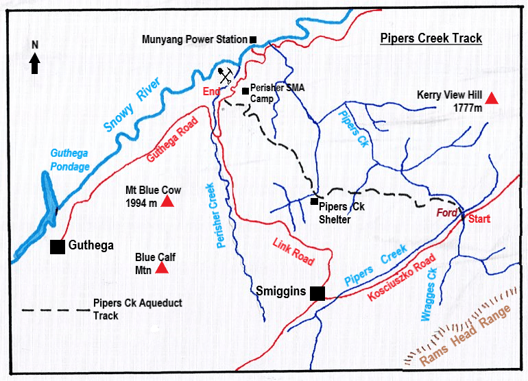
The Pipers Creek Track in Kosciuszko National Park is a little known management track that provides access to an aqueduct system feeding Guthega Pondage, part of the Snowy Mountains Hydro Scheme.
by Glenn Burns
It is also an easy and very pleasant seven and a half kilometre ramble that winds in and out of patches of snow gum woodland and alpine grasslands providing vistas across the Snowy River valley to Rolling Grounds and the peaks of the Main Range. Nothing strenuous and ideal for families; as a bonus it is away from the hustle and bustle of the Snowies Alpine Walk and the Kosciuszko Summit Track.
Although it is not on the radar of most bushwalkers, I have hiked it a number of times with family and friends and I never tire of this walk. My most recent walk was a summer trip with friends Joe, Chris, Garry and Neralie.
We started at a very civilised 8.30 am after depositing Garry’s ute on the Guthega Road for transport back to our starting point later in the morning. The walk starts about three kilometres north-east of Smiggins Hole where Dainers Creek and Wragges Creek join Pipers Creek. There is a smallish car park on the Kosciuszko Road where you can safely tuck a car.
Pipers Creek. Who was Piper?
Who was Piper? Here is the origin of the name according to Klaus Hueneke in his book ‘Huts of the High Country’:
‘James Spencer, when taking his cattle up to summer pastures, used to take a bullock team. The lead bullock called Piper was particularly powerful and at night would often break loose. He would be found next morning down the creek, hence Pipers Creek.’
From the road a short descent takes you to an easily crossable ford on Pipers Creek where it executes a tight ninety-degree turn to flow north west. A reflection of the rectilinear drainage common in this section of Kosciuszko National Park.
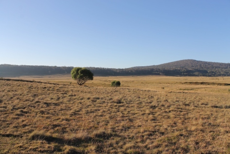
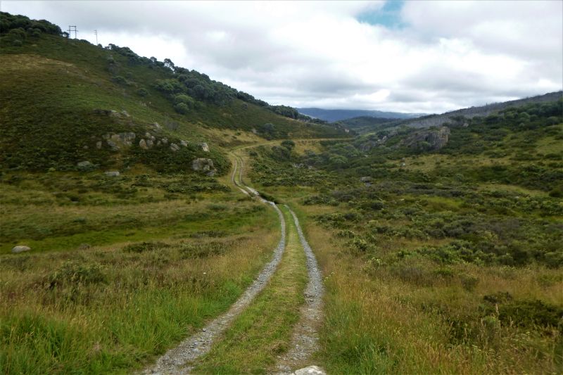
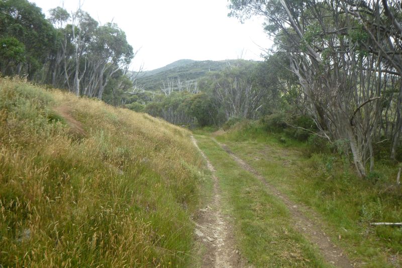
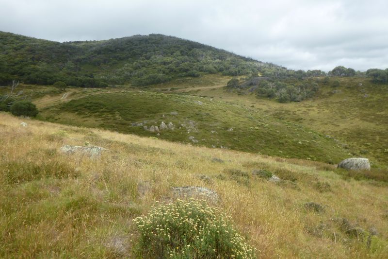
The path we followed is a very obvious 4WD management track. It commences in the valley of Pipers Creek on grassy flats called ‘frost hollows’. These are grassy plains which are the result of dense cold air draining from high tops and pooling on creek flats below. Usually totally devoid of shrubs or trees. The otherwise ubiquitous snow gums are unable to thrive in these freezing conditions but are found higher up on the nearby hillsides.
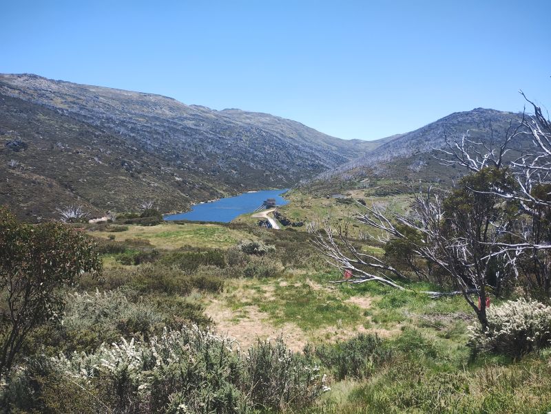
Our path dipped through this grassy plain before climbing steadily to the 1600 metre contour. After a kilometre we entered the first of several patches of snow gum woodland. At each gap in the woodland we had superb views out to the north, over Guthega Pondage in the Snowy River and the Main Range in the far background.
Aqueducts in Kosciuszko National Park
Following the 1600 metre contour line our track paralleled the Guthega Pondage aqueduct. The track providing the necessary access for maintenance purposes. It wasn’t long before Garry and Joe discovered the various sluices, channels and pipes that make up the aqueduct infrastructure. Their favourite engineering activity was to lift the sluice gate and allow any built-up sediment to flow downslope in a small rush of water, thereby flushing out any silt.
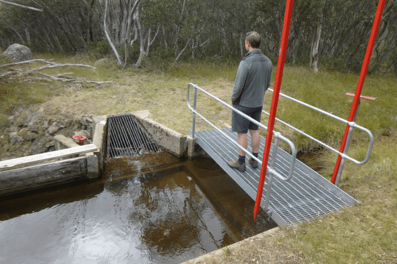
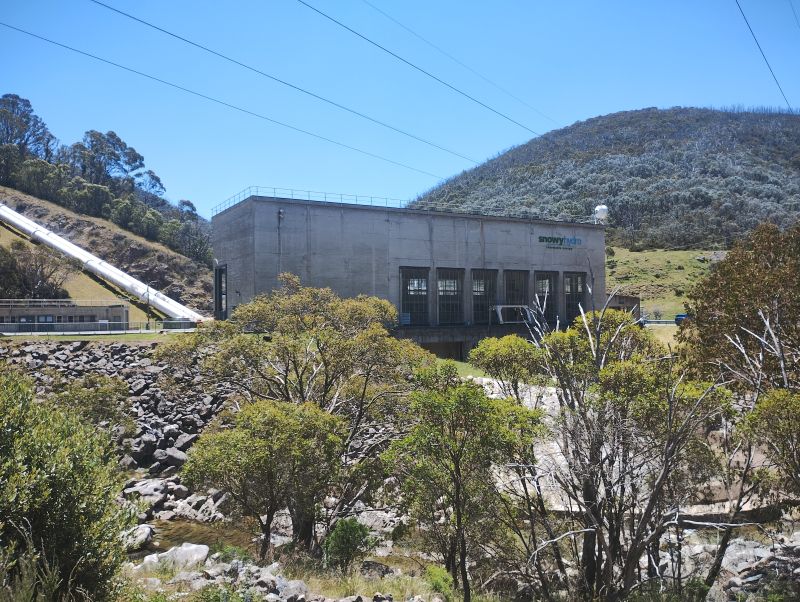
Aqueducts are but a minor part of the engineering masterpiece that is the Snowy Mountains Scheme. The Pipers Creek aqueduct intercepts and collects water from tributaries that might otherwise bypass the Guthega Dam. Even though the aqueducts and earthen diversion channels were constructed from 1953 to 1956, they still appear to be well maintained and functioning as intended. With some help from passing bushwalkers.
I have come across other aqueducts before on my journeys across the Kosciuszko landscape. A few years ago, I followed another aqueduct track, the Munyang -Guthega Aqueduct track, to get from Whites River Hut to Horse Camp Hut thence to Munyang Power Station on the final day of a hike out of Bluff Tarn. It was an unexpected find and great alternative to the ups and downs of trudging back along the Munyang-Geehi road aka Schlink Highway.
More on Racelines aka Water Races aka Head Races
On one of my Kiandra to Kosciuszko hikes in 2007 we crossed the headwaters of Nine Mile Creek about three kilometres after the Four Mile Hut turnoff and climbed towards Tabletop Mountain. We were following the Tabletop Fire Trail on the Australian Alps Walking Track (AAWT).
In the 1800’s earthen racelines were built to collect water from the flanks of Mt Tabletop and direct the flow to a sluicing header dam for the Empress gold operations.
The current AAWT track follows the line of these racelines. Soon after Nine Mile Creek the AAWT ascends steadily to the headwaters of Scotch Creek where hydraulic sluicing from about 1860 to the 1920’s had scoured the hillside in a final search for gold. The head races, water races or racelines collected water from the high range and fed it into pipes fitted with nozzles of decreasing diameter to increase the pressure. Here is a description provided in 1887 by the Government Geologic Surveyor of how a Kiandra raceline worked:
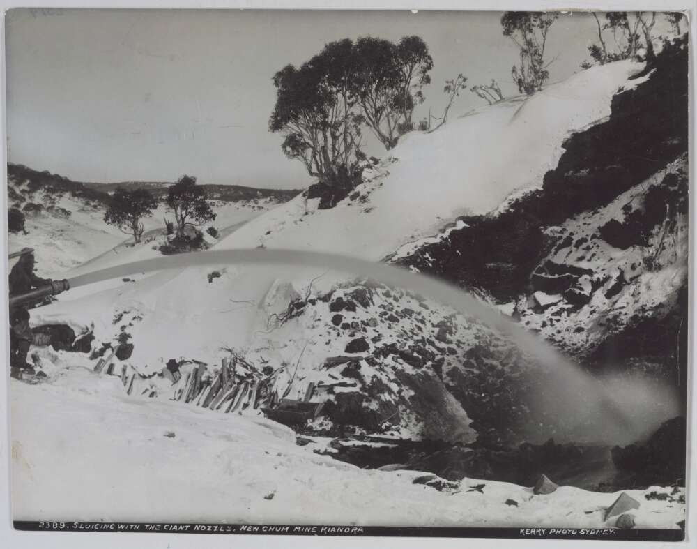
‘With average rainfall sluicing operations can be carried on at this claim almost all the year round. A constant supply of water is obtained from a dam which the Company has made in the Three Mile Creek. The water is conveyed in a race for a distance of three miles to the workings. The race comes in on the top of the face and the water is conveyed from it, first in 22-inch pipes, and then in 15-inch pipes to the bottom of the cutting, where the pipes are reduced to 13 inches. This size pipe carries the water to the nozzle, which has a diameter of five and a half inches. The pressure of the water at the nozzle head is 120 lbs to the square inch. The system is capable of throwing a stream of water for a distance of 150 feet. The system is duplicated and there are two sets of pipes from the race outlet to the bottom of the workings. In 1885 the amount of gold obtained from these workings was 1,100 oz.‘
The hillside scar was still there, 150 years later, 700 metre long, 100 metres wide and 15 metres deep.
They bred them tough on the Kiandra Gold Fields
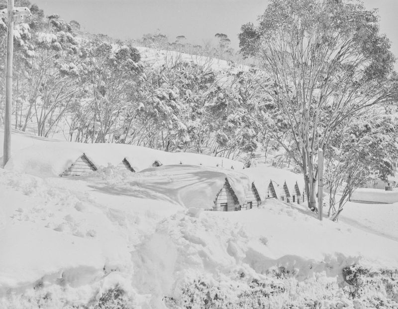
Nearly 10,000 miners swarmed to the Kiandra Goldfields in 1859, enduring severe winter blizzards hunkered down in canvas tents. Some miners even constructed primitive shelters of sod, rocks and branches. Not much different to the tented work camps of the Snowy Mountains Scheme in the 1950’s.
The Kiandra gold rush was short-lived, the shallow alluvial deposits worked out and attempts to find the main reef proving fruitless.
After the 1860 winter only 150 miners hung on. For these modern day pampered bushwalkers passing through the Nine Mile with our down jackets, four season sleeping bags and tents, staying warm in the 21st century was still a tad difficult.
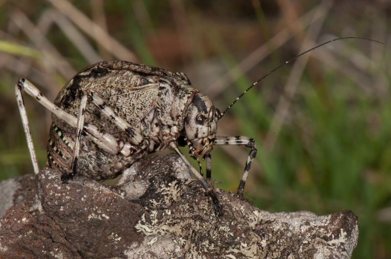
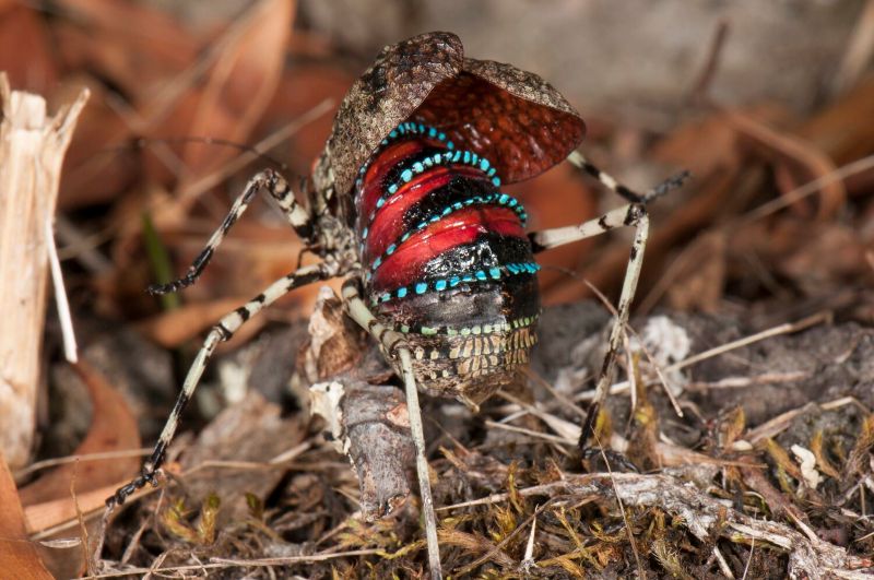
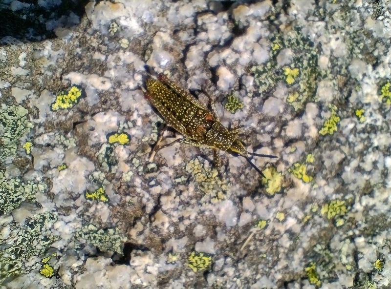
The Caped Crusader, a Mountain Katydid
Meanwhile, back at a summery Pipers Creek the day had warmed up. Now swarming grasshoppers and katydids had appeared on the grassy verges, especially in the snow gum woodlands. Two species seem prevalent. One, a chunky squat katydid, had a distinctive startle warning, making it easy to identify. Except it looks like a beetle if its wing covers are closed. Don’t be fooled.
Normally this species is a nondescript mottled grey-brown colour. But, if disturbed, it raises its wing covers, arches its abdomen and reveals shiny crimson and blue bands. I identified it as the Mountain Katydid (Acripeza reticulata). The female can’t fly but it feeds on fireweed and other plants that may make it distasteful to predators.
They are called katydids because the male makes a sound like it is saying “katy-did’.
In 2025 the Mountain Katydid was a finalist in the ABC’s Insect of the Year 2025.
Spotted Mountain-grasshopper
The Spotted Mountain-grasshopper (Monistria concinna) is another alpine insect that is easy to identify. It is large, flightless with a body that is usually olive-brown with a dense splatter of yellow or cream spots. It is very cold-tolerant, hence its ability to survive in our high alpine areas. It is said to have its own version of an anti-freeze.
Its bright colours may serve as warning to any passing lizard/bird that its body contains noxious chemicals. It is possible that the chemicals are derived from its main forage plant, the alpine mint bush (Prostanthera sp).
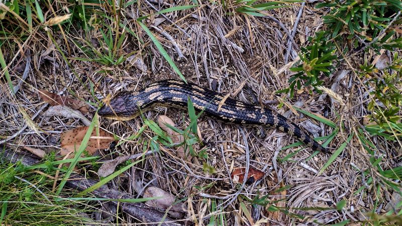
Things Reptilian
To me, the aqueduct track appears like a reptilian heaven. With long weeping grass, clumps of tussocky snow grass and warm sunny nooks for a sunbathing snake or three, I am ever vigilant. Logic and experience tell me that snakes, dragons and skinks aren’t well suited to these cold conditions and there are only two species of snakes that hang out at this altitude. I reflect on this, but at the last minute I always pull on my trusty gaiters… just in case.
The two snakes are the venomous copperhead and the mildly venomous white-lipped snake. Both feed on frogs and skinks. The docile copperhead grows to respectable 1.7 metre while the slim white-lipped can only manage a paltry 45 centimetres in length.
With no snakes to disturb my equilibrium, I was lucky to see an excellent specimen of a Blotched Blue Tongue lizard (Tiliqua nigrolutea) which quite likes these tussocky grasslands. They emerge from their overnight accommodation in rocky crevices or deep litter for an early morning sun bake before heading off to forage on the odd beetle or caterpillar that passes by.
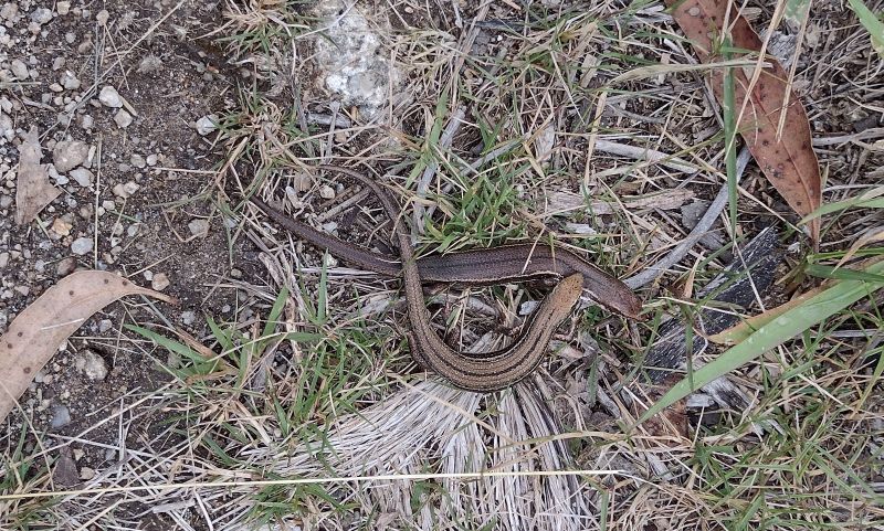
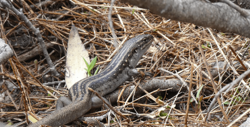
Further on I sprung two nondescript Skinks cavorting in the undergrowth. The most likely ID is the Mountain Log Skink (Pseudemonia entrecasteauxii), the most abundant reptile in alpine areas where it occurs at all altitudes. Their skin was not glossy which helps distinguish them from the Southern Tussock Skink , (Pseudemonia pagenstecheri), a close relative.
But the real prize would have been a sighting of the endangered Guthega Skink (Liapholis guthega). This is the highest occurring skink in Australia, found only in Kosciuszko National Park and the Victorian Alps above 1600 metres up to about 2100 metres. Its habitat is rocky outcrops, tussock grasslands and damp heath. But no luck today.
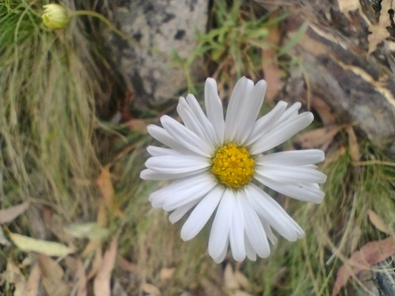
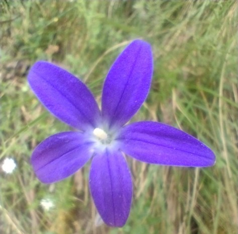
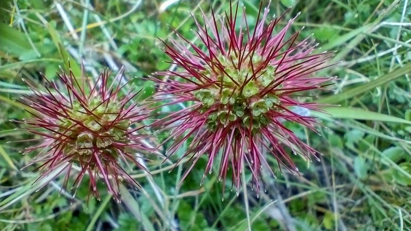
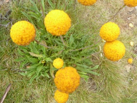
Wildflowers
It was well past peak wildflower season but I was still able to find few specimens to satisfy my botanical itches : a Sunray (Leucochrysum sp) Australian bluebells (Wahlenbergia sp), bidgee widgee (Acaena anserinifolia) and billy buttons (Craspedia uniflora), amongst others.
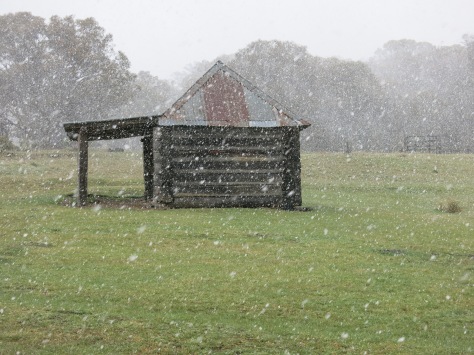
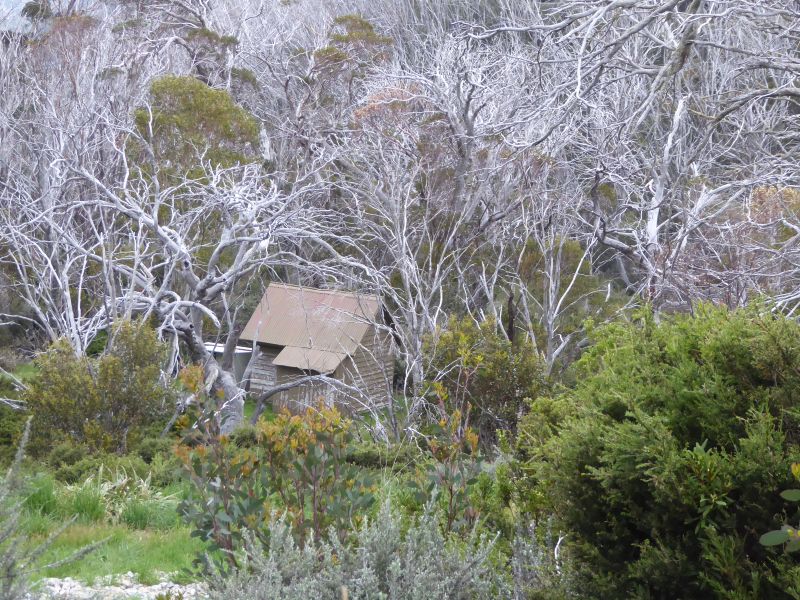
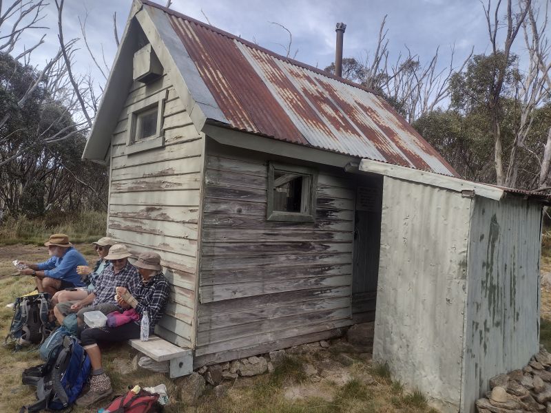
Pipers Creek Aqueduct Shelter
Some three kilometres into our Pipers Creek walk the track descends to ford an unnamed creek. Below the ford the creek drops over a small waterfall that is worth a photo or two. But if you head upstream a little you should be able to find the Pipers Creek Aqueduct Shelter, a still operational Snowy Hydro hut. It is hidden in a patch of snow gums above the creek. Look carefully for a barely discernible pad on your left, 200 metres upstream from the ford.
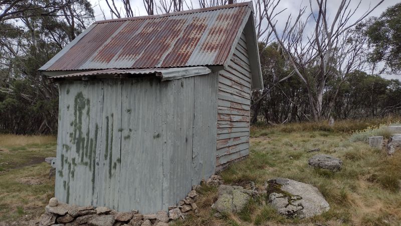
The shelter was built in the 1950’s by the Snowy Mountains Authority (SMA) for aqueduct maintenance. It is still used by Snowy Hydro, which explains why it is locked to keep out any of those bushwalking or skiing riff-raff who swing by. Or worse still those dastardly E- mountain bikers.
It is a smallish wooden hut with a corrugated iron roof, vertical slab wooden walls and wooden floor. The whole structure sits on huge wooden sleds. I imagine that it had been dragged into position by a bulldozer.
Here is an ideal morning tea spot, equipped as it was with a huge wooden bench along the entire length of its sunny eastern wall. A bonus was the hut’s wall providing a comfortable back rest. The nearby aqueduct infrastructure an added incentive to linger, giving the lads some final moments of delectation.
A good feed, some more sparkling engineering chit-chat about sluices and channels and we waddled off back downhill to the ford. From here the track climbs again to the 1600 m contour. The next section provided even better views out to the north-east over the extensive snow grass plains of Pipers Creek valley. Aptly named on my map as the ‘Plains of Heaven’.
We soldiered on, contouring around to a point on my map marked as ‘Perisher Camp’, some 2.5 kilometres from the ford. No remnants of a work camp though, much to my disappointment.
SMA Work Camps
The SMA had some 100 work camps scattered across Kosciuszko. I haven’t been able to find any information relating to this one. Although there was a Perisher Camp, but to add to my confusion, it is marked at various locations on other maps. During the construction period of the Snowy Scheme, the SMA managed over 100 camps and 8 towns, housing 100,000 workers, many of them migrants from Europe.
Early camps were rows of canvas tents with mess halls for communal dining, recreation and basic washing/toilet buildings. Initially there was no electricity or running water. Not much fun in winter I would think. Here’s a description of winter living conditions for SMA workers that I found in Brad Collis’s ‘Snowy. The Making of Modern Australia’:
‘The winters in the primitive conditions of the Snowy camps and towns imposed a harsh existence…. Little attempt was made to modify the style of housing for the conditions. Prefabricated weatherboard cottages, which would have served perfectly well in Central Australia, were simply transplanted into the mountains… the most precious household resource in winter was water. Pipes often froze and burst, leaving the house without water for cooking or washing. Mothers with babies had a terrible time… Nappies and sick babies and no water made life very hard… frozen washing outside in two metres of snow meant an or so of digging to get the snow away from a clothesline.’
Back in summer land we reached a junction. Here the track bifurcates. Be sure to check your map… I’m assuming you carry one. Follow the track which bears north and descends steeply through woodland and exits out onto the Guthega road. Otherwise you will be carted off and exit with a long dreary walk back to your car.
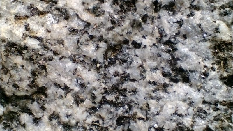
Some three hours after we started we were reunited with Garry’s jalopy which had been stashed near the old SMA quarry where I purloined a good hand sample of Mowambah granodiorite of Silurian age (443.8 to 419.2 Ma).
Mowambah Granodiorite
Like granite, granodiorite is a plutonic igneous rock with large crystals visible to the naked eye. I use the cue of its ‘salt and pepper’ appearance to differentiate it from granite. The dominant mineral crystals are quartz (white) and biotite (dark). It outcrops extensively over much of Kosciuszko National Park and was a source of road base and construction material for the Snowy Mountains Scheme.
Mowambah granodiorite was formed in a deep pluton, part of the Kosciuszko Batholith during the Early Silurian. A batholith is large igneous intrusion with a surface area of over 100 square kilometres.
Garry’s ute was waiting patiently for our return. Windscreen wipers, aerial and wheels still attached, ready to transport us back to our starting point.