Tag Archives: Bushwalking in Western Australia

Hiking the Southern Bibbulmun Track

Glenn Burns

The Bibbulmun Track is Australia’s premierlong distance walking track, extending nearly 1,000 kilometres from its northern entrance at Kalamunda, a suburb in the Perth Hills, to Albany on Western Australia’s south coast.

The Bibbulmun meanders through some of the best scenery that Australia has to offer: majestic jarrah, karri, marri and tingle forests, granite domes and peaks, tranquil inlets, wetlands, peaceful rivers and the spectacular heath-covered coastline between Denmark and Albany.The latter is surely some of the best coastal scenery and walking that can be found anywhere in Australia. With limited time available in WA we settled on hiking the final section from West Cape Howe to Albany.

Coastal scenery West Cape Howe NP
Typical coastal scenery. Bibbulmun Track. West Coast Howe National Park.

The word Bibbulmun derives from the aboriginal group occupying a section of coastal south west of Western Australia. The Bibulman (Pibelmen) are a clan of the Noongar. Pibelmen may be the word for stingray. Their territory was concentrated around the lower Blackwood River and the Warren River.


The Bibbulmun Track Foundation, supported by the Department of Parks and Wildlife (DPaW), made planning for our Bibb walk a breeze. There is no shortage of valuable information and advice for the interstate or overseas walker:

  • www. bibbulmuntrack.org.au
  • An information pack for each section. The section pack usually contains an excellent map at 1:50 000 scale, a Day Walk Pack containing suggested day walks for the section and an overall Track Handbook. I purchased the information pack for the Denmark to Albany section online for $30.00. For interstate and overseas visitors unfamiliar with hiking in Western Australian this is money well spent.
  • The Bibb Facebook page is really useful for troubleshooting problems (like crossing Torbay Inlet) and getting general advice on track conditions.
Comprehensive Bibbulmun Track Handbook
1:50 000 scale map

Although not a resident sandgroper, I was able to use the Bibb Track Foundation info to do all my planning before leaving home. Since we were driving to WA to visit family in Perth, a vehicle was available for shuttle service duty.

The Bibbulmun Foundation and DPaW have provided great basic campground facilities, directional signage, and decent tracks. This is a hiking experience that can be enjoyed by all, regardless of age or financial circumstances. I cannot praise them enough .

Bibbs track in sandy heathland above Dingo Beach

The Bibbulmun facilities are a marked contrast to the contagion of commercial ‘eco’ glamping stuff sprouting up in the public national park estate in much of the rest of Australia. High-end eco-lodges, huts and glamping operations provide a standard of facilities that are not really needed or in keeping with a conservation ethos and legislation that goes with the declaration of area as a national park.

Putting aside arguments about the ecological damage of these ‘eco’ huts/lodges and campgrounds, it seems grossly unfair that construction of some eco resorts and most of the associated track infrastructure is being paid for out of the public purse and leased back or handed over in opaque long term commercial-in-confidence deals.

If you, like I, feel strongly about this issue, then more information can be found at:https://protectournationalparks.org

But, I suspect , despite the best efforts of some in the bushwalking fraternity, the horse has already bolted.In speaking to other hikers, the majority are happy to put aside niggling environmental and social justice issues to assert that the opulent facilities make ‘bushwalking’ accessible to many more people.

True. But just make sure you and the taxpayer have deep pockets and minimal concern about commercialisation of our national park estate. I have no problem with decent basic public facilities that we can all enjoy, as on the Bibbulmun.


In the Bibbulmun sections that I have walked, the track is well-maintained without being over-engineered. Kept in reasonable condition by volunteers.

And it would be difficult to get ‘lost’ with a plethora of Waugal markers to show the way.

Waugal signage

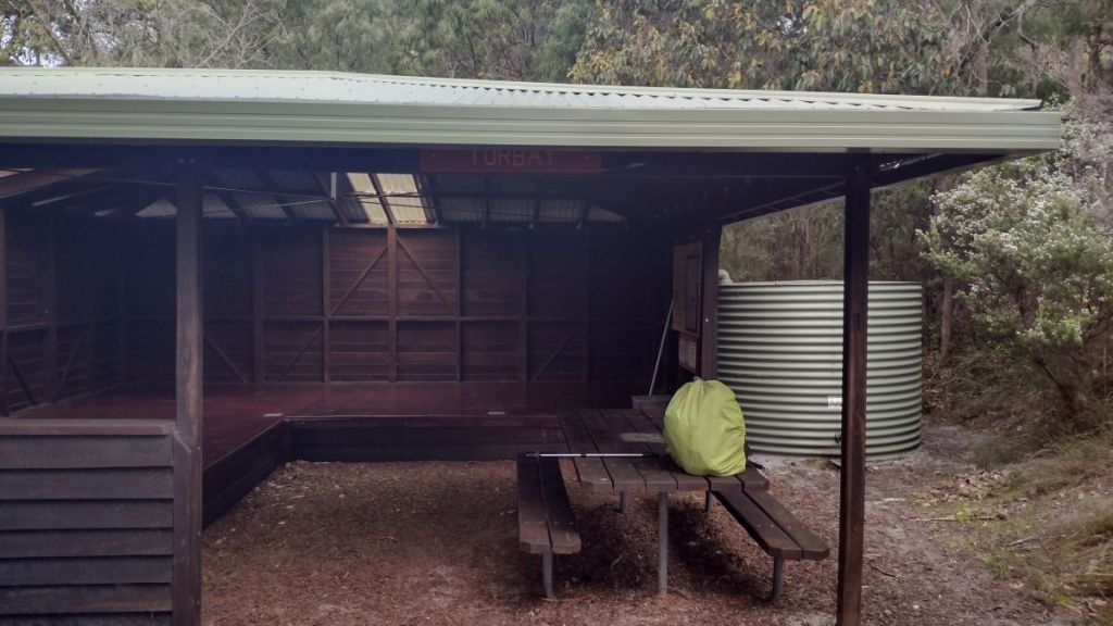
The Bibb walkers’ three-sided shelters are a boon in WA’s somewhat trying cool, wet winters – basic hiking shelters but functional. Each campground has the shelter, toilet, table, water tank, and ample sites for tents for those not wishing to sleep in the shelter.

And you get to enjoy the camaraderie of people from all walks of life and parts of Australia and beyond.

Torbay Shelter

Weather was an important factor in planning a hike in this section of the Bibbulmun, after all, the aboriginal name for Albany is Kilining, meaning place of rain. How wet can it be? Probably not as intense as my stomping grounds in SEQ but persistently drizzly enough to be annoying.

Cool damp weather at West Cape Howe National Park.
Rigged for cool, damp weather in West Cape Howe National Park

South-West WA has a Mediterranean climate: hot, dry summers and cool, wet winters. The coastal section between Denmark and Albany is more accurately described as sub-Mediterranean. Temperature extremes are moderated by proximity to the ocean but rainfall and winds are higher than at the hinterland BOM stations.

September to November is a great time for hiking along this stretch of the coast. Temperatures are pleasantly mild. Denmark’s average minimum temperature is a bearable 6.9 C, while the average maximum temperature is a very pleasant 16.4 C.

Much better to walk autumn, winter, spring than summer when sections may be closed as the bushfire season ramps up. Spring… altogether brilliant hiking conditions. The only bugbear is the 99 mm average monthly rainfall over 15 rain days.

A mite damp for my liking , but it doesn’t seem to worry the WA locals. Before leaving I scoured the weather/ rain gear chit chat on the Bibbs Facebook page. Here’s a sample:

I live in Albany. I carry wet weather gear in the boot of my car everywhere, everyday of the year. The weather changes quickly down here.

Last week we had “feels like 3 degrees” and 20 mm rain around Walpole / Denmark. Weather is liable to change at short notice! I would say definitely a rain jacket. Pants if you want.If you get another day like Monday you would be pretty miserable without rain pants.

Many posts extolled the virtues of a poncho and one hardy 60 year old walked E2E in 44 days without rain gear. He copped only three rain days on the entire walk. They breed them tough in WA.

Storm clouds heading our way

Having perused maps and formulated a plan, I shot off a paternal missive to the Canberran, suggesting some dates, proposed walking itinerary and accommodation.

I intimated that rain gear and fleece might be the go for this trip. His usual Namadgi walking rig of merino tee and boardies might not cut it in the drizzly depths of WA’s Great Southland.

In any event, I need not have fretted, the Canberran duly appeared in Albany via his Perth bro, decked out in thick fleece, merino thermals and a pair of those nifty quick drying hiking shorts.

With our walk due to start on the morrow, youngest son insisted on being in charge of purchasing the necessary walking rations. According to family lore I had failed dismally as providore for childhood hikes and camps.

His shopping cart was soon brimming with Cheds (a cheesy biscuit), cheese, macadamia nuts, chocolate bullets and fruit. But none of my dry wheatmeal biscuits and peanut paste (that’s peanut butter for all you southerners).


Aboriginal Occupation

I was surprised by the lack of readily accessible information on aboriginal culture for hikers traversing this section of the Bibbulmun.

The First Nations people of the Albany region are the Menang people of the Noongar nation. The earliest date of occupation for south-west WA is 50,000 years BP at Devil’s Lair, inland from Cape Leeewin. This single unlit cave chamber has provided a date of 50,000 years BP. It derived its name from the numerous Tasmanian Devil bones found at the site as well as some megafauna bones. Another significant heritage site dating to 38,000 years BP has been excavated on an open floodplain in the upper Swan Valley. In Menang country a site at Kalgan Town Hall was dated at 18,500 years BP. Kalgan Town Hall was the meeting place of numerous aboriginal pathways and fish traps.

Source: NLA: Louis Boulanger, 1833: Habitans du Port du Roi Georges

Large bands of the Menang people ranged across beaches, rocky headland, inlets, rivers and lakes during warmer months where they harvested the rich coastal resources and came together to conduct social ceremony and contact.

In the cooler months they disbanded into smaller family groups and dispersed into the open woodlands of the hinterland to hunt kangaroos, wallabies, lizards, snakes and possums.

Evidence of their occupation is abundant. There are numerous listed heritage sites of fish traps, stone scatters, petroglyphs, grinding grooves, shell middens, ceremonial stone arrangements, quarries of dolerite and chert, stone wells, scarred trees and ochre quarries .

This lifestyle continued until the late 18th century when European expansion with its land grabs, pestilence and ‘dispersal’ finally disrupted traditional culture.


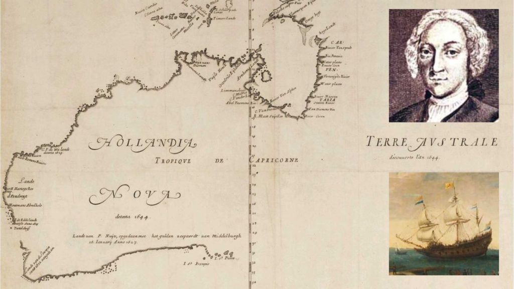
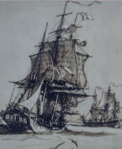
The first well documented European marine explorer along the south coast was a Dutchman, Pieter Nuyts, of the Dutch East India Company. He boarded the Guilden Zeepaerdt (Golden Seahorse), captained by Francois Thijssen, in the Netherlands in May 1626.

Seven months later in January 1627 they rounded Cape Leewin and continued east along the uncharted southern coastline, reaching as far east as Ceduna. Here they named St Francis and St Pieter Islands (now Nuyts Archipelago), after Thijssen and Nuyts. Dutch charts prepared following the voyage named the southern shoreline ‘Landt van P. Nuyts’.


But now, back to the present.
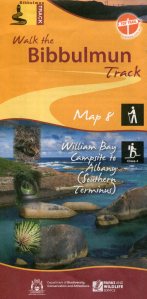

Section One: West Cape Howe National Park.

West Cape Howe National Park

West Cape Howe National Park is a smallish park (36 square kilometres) located between Denmark and Albany on Western Australia’s southern coast. It is the most southerly point in Western Australia. The next port of call to the south over the vast Southern Ocean is Antarctica.

The WA Parks website paints an inviting picture of West Cape Howe: We all know that the southwest region has great coastal scenery and West Cape Howe National Park is no exception. The landscape is wild and dramatic – towering cliffs, white sandy beaches, granite headlands, huge crashing waves, coastal heathland and even some karri forest. It is breathtaking whichever way you look. The diverse landscape is home to lots of birds and wildlife.

Sign me up.


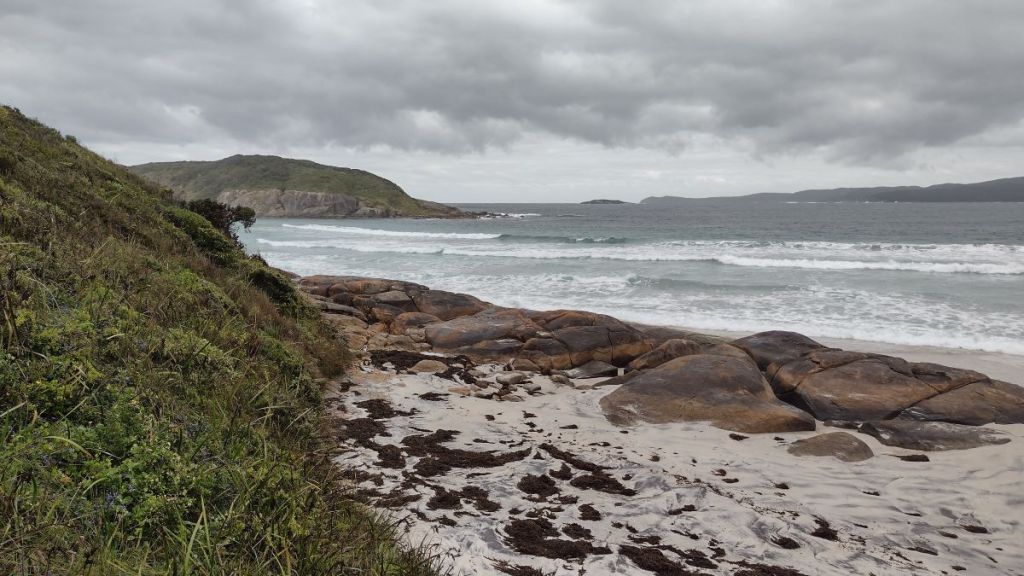
Lowlands Beach to Shelley Beach: 17 kms.

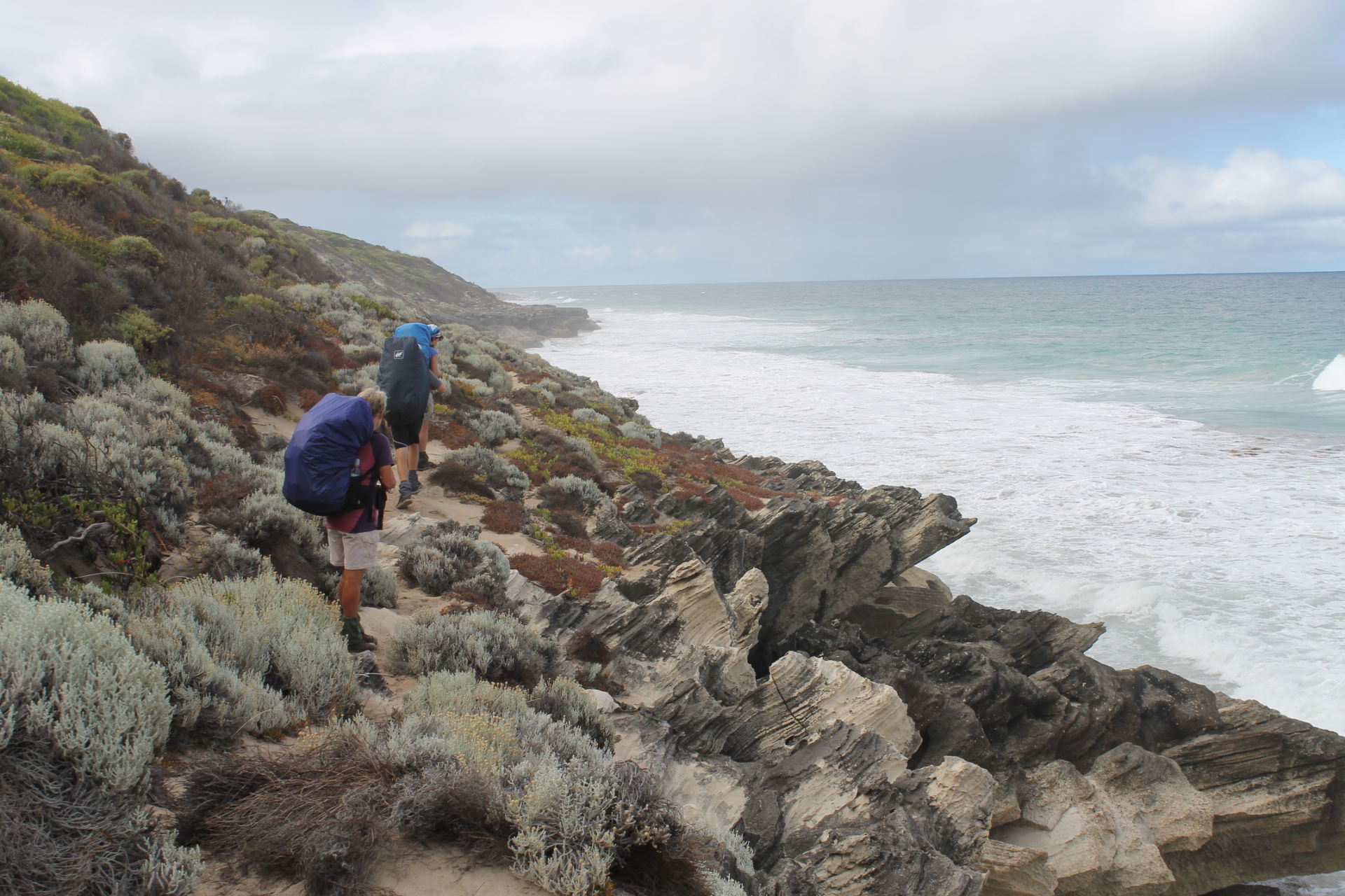
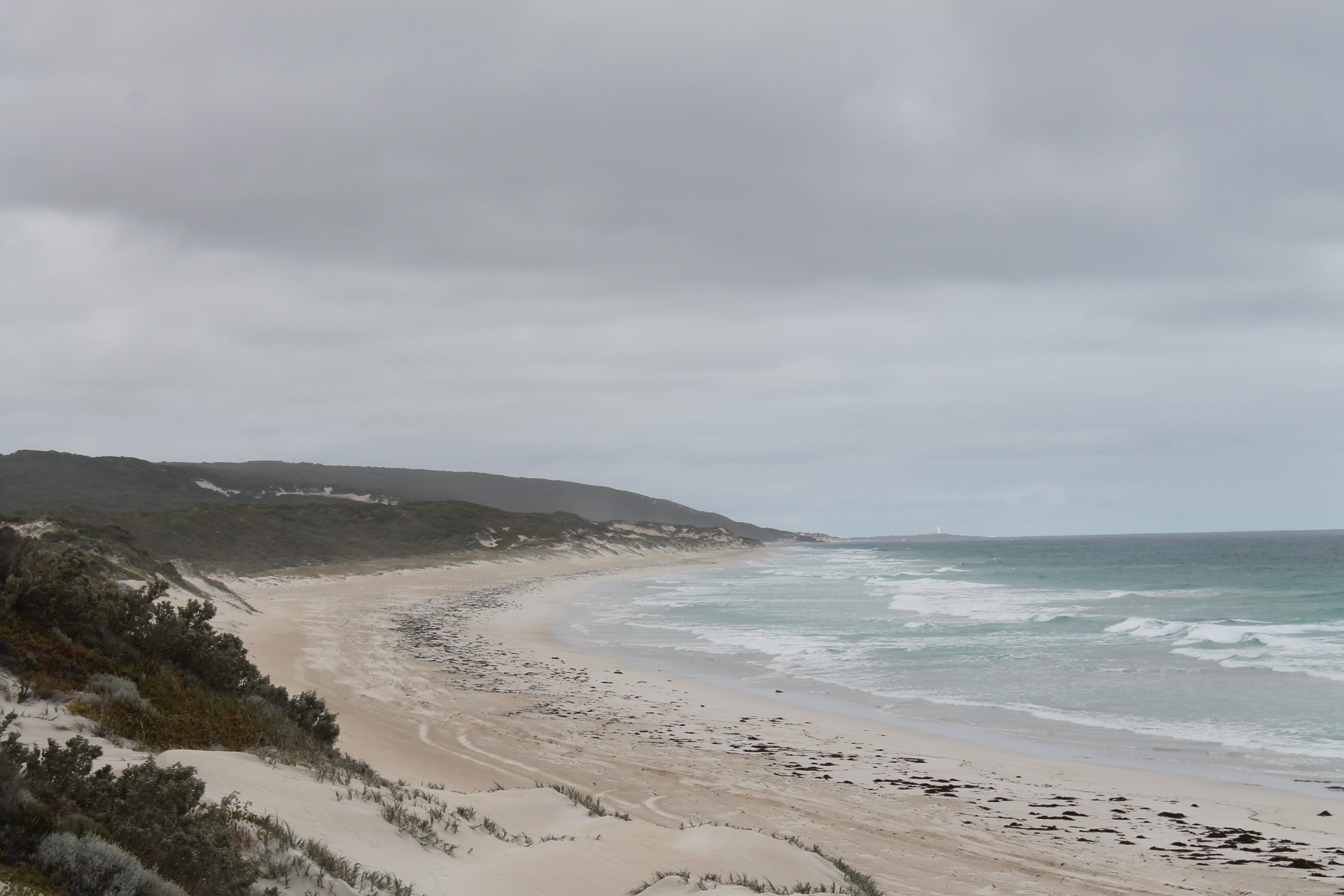
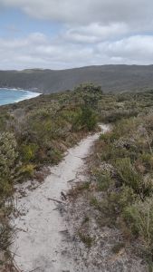
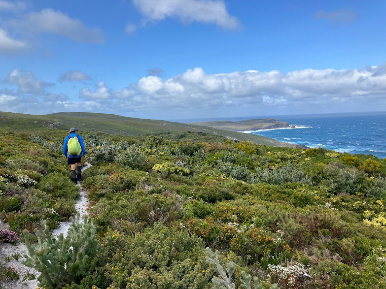
The section through West Cape Howe National Park is truly one of the most scenic coastal walks in Australia. It is a landscape of coastal cliffs, windswept wildflower heathlands, massive granite and dolerite headlands, sandy dune fields and towering waves crashing ashore from the Great Southern Ocean. This is about as far south as you can go on the Australian mainland, with weather to match.

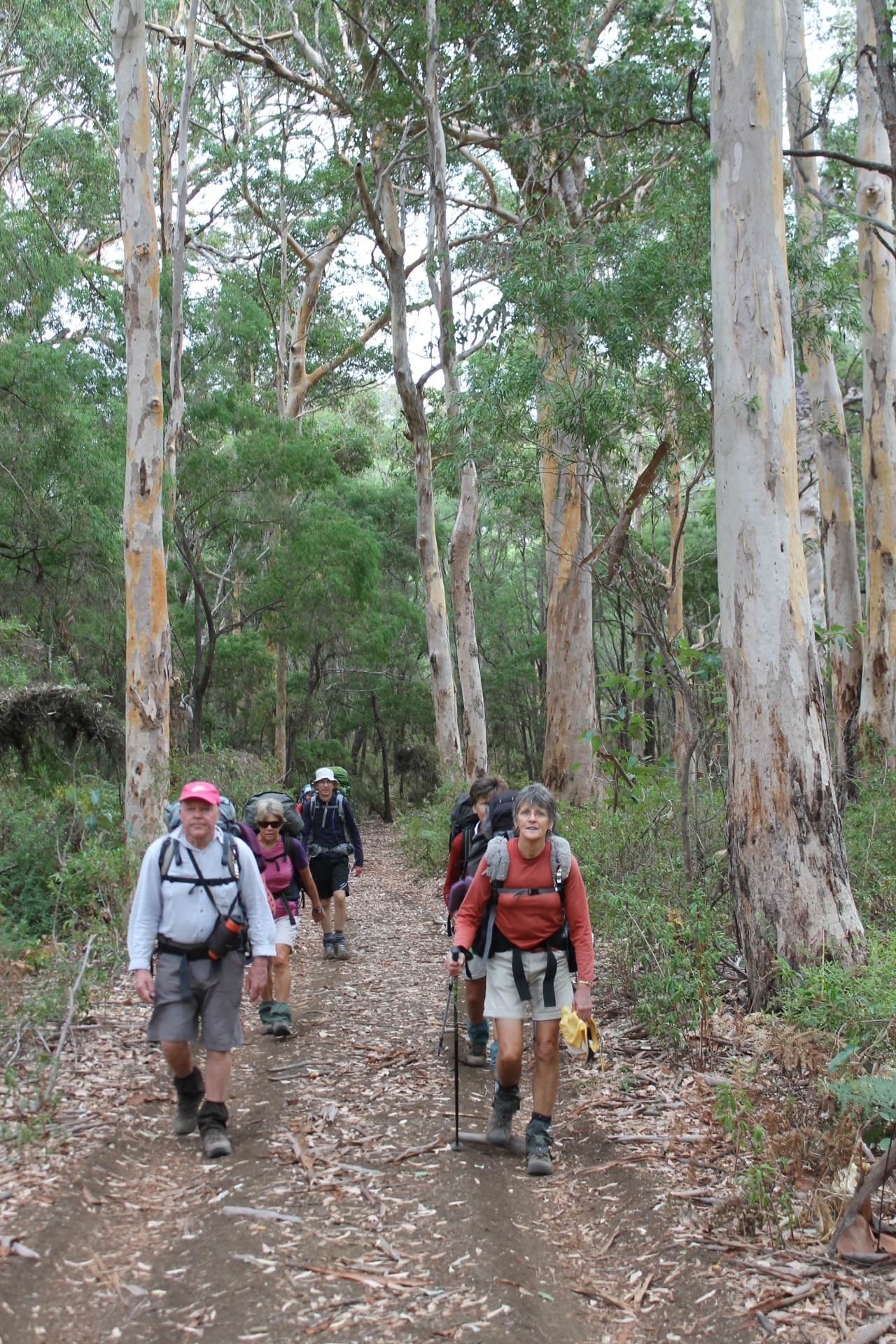
Our walk started at the Lowlands Carpark at 8.30 am. A far more civilised hour than my 6.30 am starts to beat Queensland’s heat and humidity.What’s not to like about a more civilised clock-in time.


West Cape Howe was originally named Cape Howe by Captain George Vancouver in 1791 in honour of Admiral Howe. It was renamed as West Cape Howe by Matthew Flinders in December of 1801 to distinguish it from Cape Howe in eastern Australia.

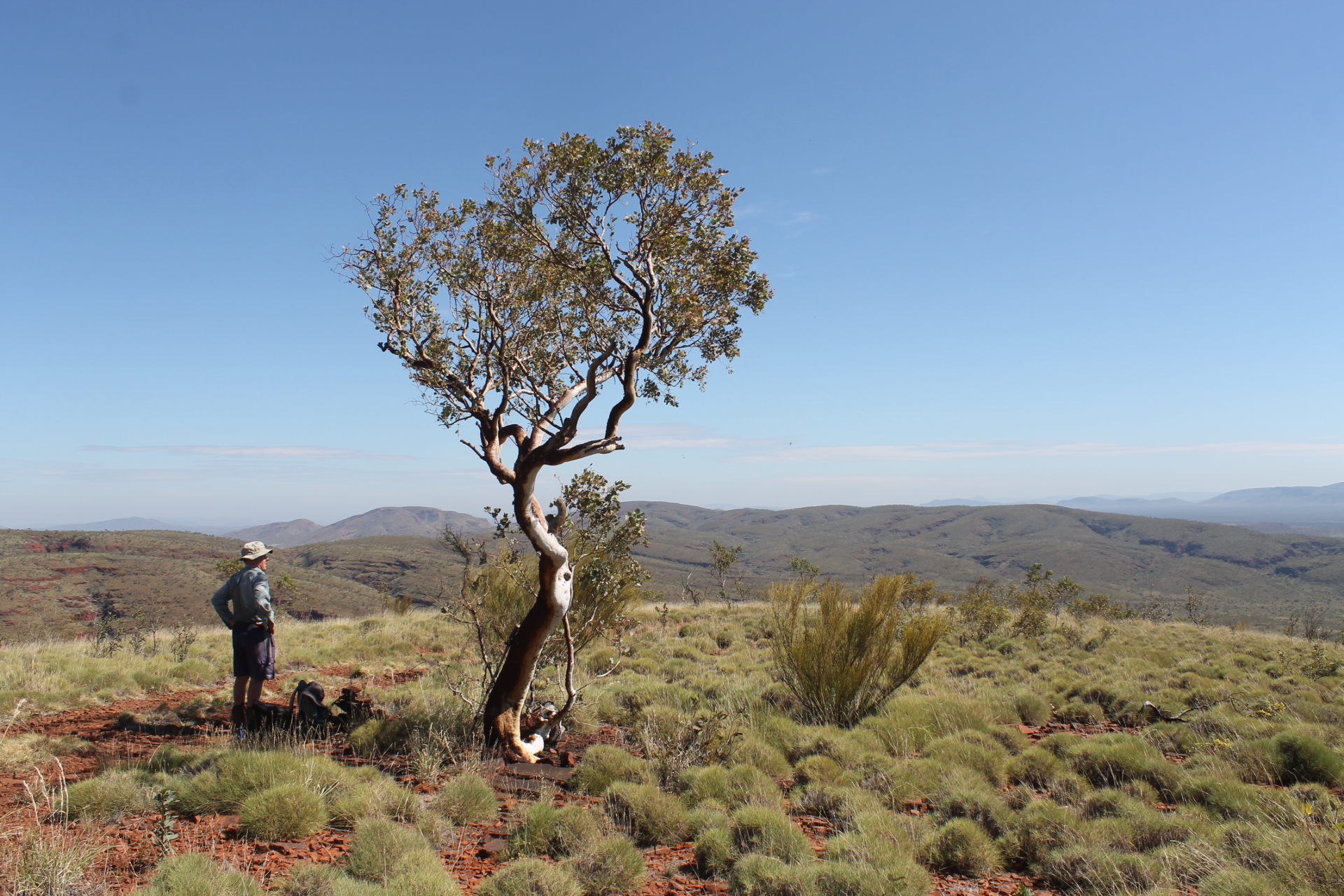
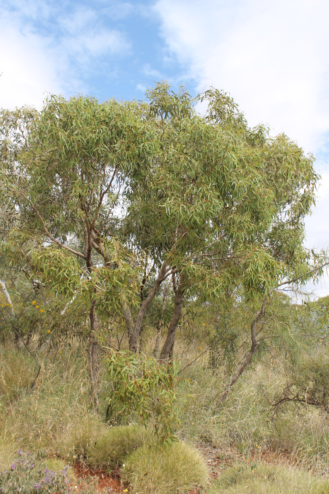
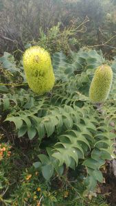
Initially the track climbs to the 100 metre contour, weaving in and out of groves of peppermints (Agonis flexuosa). Peppermint was easily one of the most common trees of our walk; its dense thickets giving protection from the winds gusting across the coastal heaths.

Normally, peppermints grow as a medium-sized tree to about 10 metres. Here, it was low, wind-pruned and often exhibited a multi-trunked mallee habit. It is not difficult to identify. It has distinctive weeping branches, long narrow leaves and white flowers. In WA it is also called willow myrtle and wonnil.

Peppermint grove ( Agonis flexuosa )
Flowering Peppermint

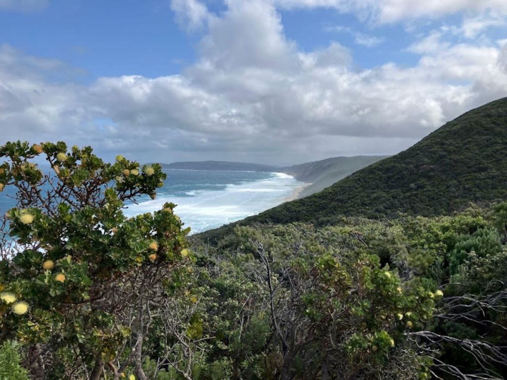
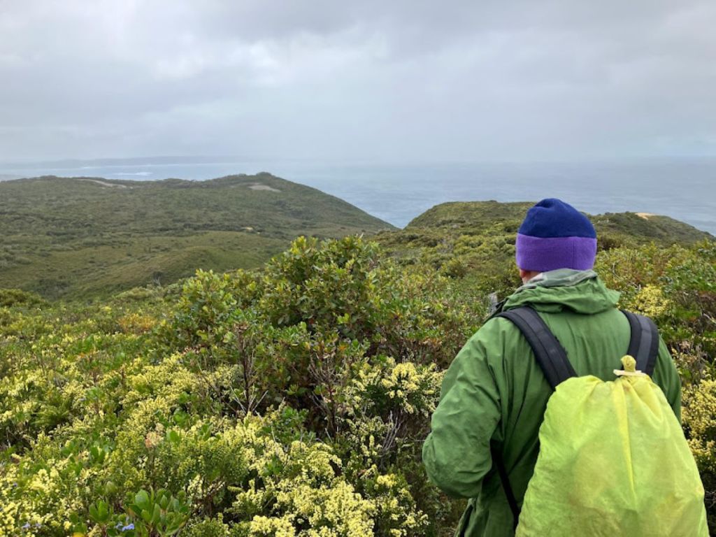
A little distance on, we entered West Cape Howe National Park. The track climbed imperceptibly to 140 to 160 metres, finally opening out to impressive panoramic views: north-west back across Wilsons Inlet and Denmark; west to Lowlands Beach and Knaffs Head; south-east to the headlands of West Cape Howe 10 kilometres distant.


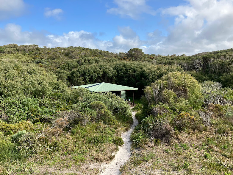
After about an hour we turned off the main track and came face to face with the West Cape Howe Campsite. Like many Bibbulmun sites, there was the iconic 3-sided sleeping shelter. Also very welcome for cooking and dossing down during inclement weather (frequent, I’m advised by the locals). Facilities here included rainwater tanks, tent sites, bush toilet, and sometimes a fireplace (usage not to be encouraged).

West Cape Howe is probably not the place to be indulging in open fires, given the surrounding dense vegetation and the gusty winds. Signs tacked to the back of the toilet door gave dire warnings about wildfires. Certainly, there was evidence of fire along the track, and it made one really think hard about an exit plan if a bushfire blew up. I certainly wouldn’t be keen to walk this section during a hot summer spell, but many do.

This Bibbulmun Facebook post illustrates the lack of bushfire awareness of some hikers:

Just passed through Yubberup campsite for a lunch break. Empty of people and a live fire in the ring. Forecast is 29 degrees and windy. Have we learnt nothing? (I put out the fire).

The Bibbulmun map sheet has specific bushfire advice which starts with this paragraph:

Bushfires are dangerous and common in WA. They can start without warning throughout the year and can spread rapidly on hot and windy days. If conditions are too dangerous, rescuers will not be able to check the track and campsites .

West Cape Howe campsite set in fire prone coastal brush

Back out on the track, wind rippling the low heath. But for the time being rain scuds remained out to sea. It was easy to see scuds heading our way and hastily zip up the rain gear.

The next two kilometres of the track contours ever eastwards above the ocean at 100 metres or more. Near Shepherdson Lagoon Road, it turns south, pitching down a steep gully.

The top of a 140 m descent, the steepest on this section of track

At the bottom of the gully, we disturbed a lunchtime encampment of eight walkers intent on a brew-up in the shelter of a thicket of peppermints. With our presence barely acknowledged, we pushed on.Chatty lot.

From here the Bibbulmun climbed again, working up to 200 metres through a maze of vegetated sand dunes and outcrops of calcarenite. Gusty scuds of rain now chased us to a jagged limestone outcrop . Here we found a plaque for the bushwalker Bruce Tarbotton and a memorial walk as a tribute to his exploration of this area.

Outcrops of limestone above Shelley Beach. Another rain scud heading our way

It would be good if the Bibbulmun track could be re-aligned from here to take in a circuit walk of the cliffed coastline of West Cape Howe, including the southern-most point of Torbay Head.
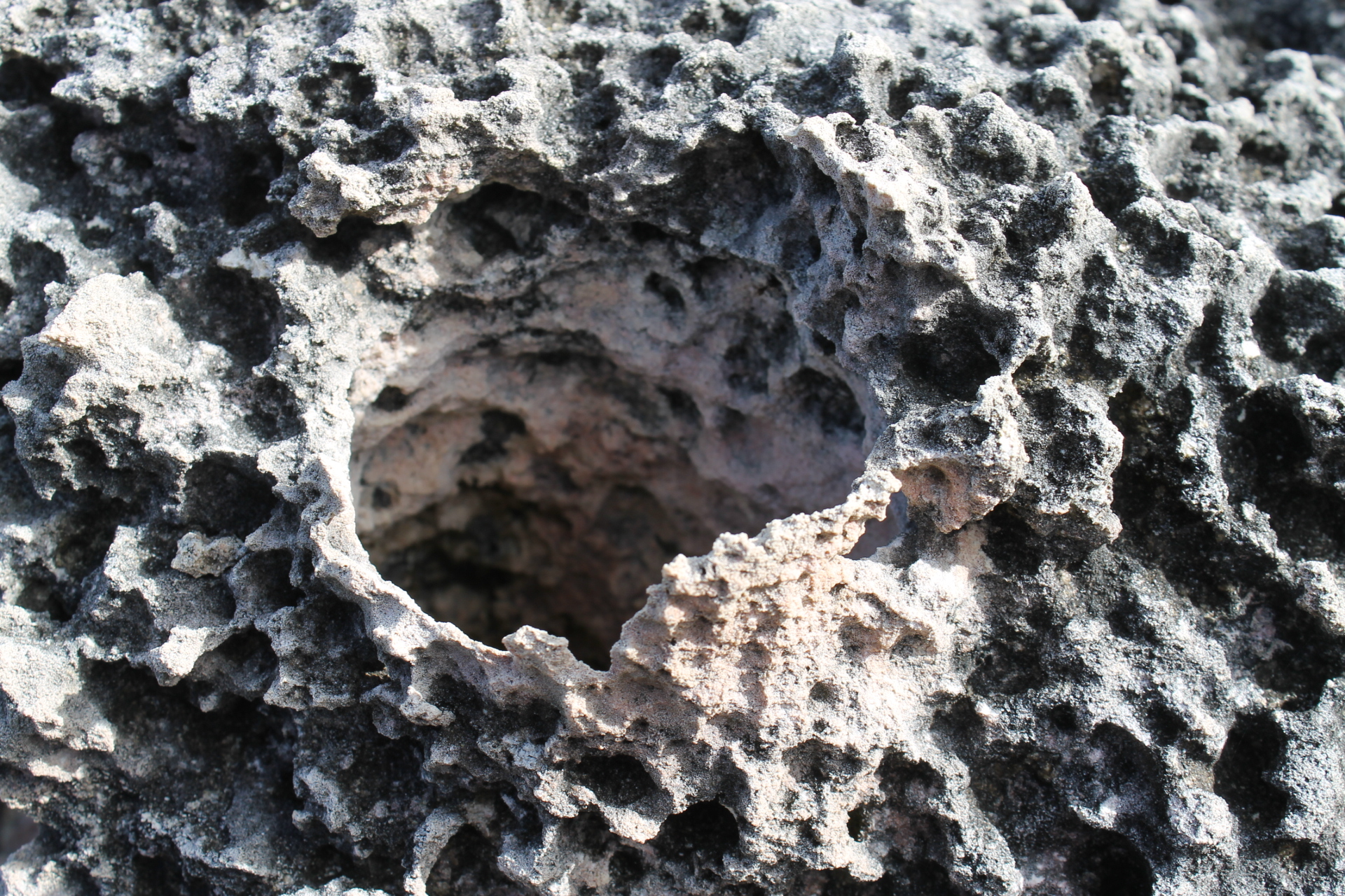
TheWCH cliffs are predominatelygranite but intrusions of dolerite, a dark fine- grained igneous rock, can be found on the western and southern clifflines of West Cape Howe.

Looking down on Shelley Beach

Section 2: Shelley Beach to Mutton Bird via Torbay Inlet : 12.5 kms

This section features extensive granitic slabs and outcrops, some beach walking, headlands and the sometimes problematic crossing of Torbay Inlet. By this stage, my offsider had bunked off, returning to Perth for his flight eastside, leaving me to contend with a sudden disconcerting abundance of trackophilic reptiles. But more of that later.

The day’s walk started in typical mild conditions (14 0 C), but with the now familiar gusty WSW winds. From the crossing on Shelley Beach Road, the Bibbulmun climbs to slabs and domes consisting of Mesoproterozoic granites (1600 to 1000 mya), a porphyritic granite with a distinctive dark mica.

These were outcrops of the Burnside Batholith, intruded as part of the Albany-Fraser Orogen. The term orogen means mountain building. The Albany-Fraser Orogen occurred during the late Archean and the Proterozoic (2.6 billion to 1.0 billion years ago) when two crustal plates collided (Yilgarn – Western Australian and Mawson – Antarctica). These crustal plates were compressed and uplifted along their margins, forming mountain ranges.


From the highest domes a wide panorama unfolded. Eastwards across Torbay Bight were the rugged headlands of Torndirrup National Park and the windfarms of Grasmere and Torndirrup; 40 kilometres to the north-east I could make out the silhouette of the Porongurups, a batholith of Mesoproterozoic granites (Esperance granites), rising to 670 metres above sea level.

Granite domes of the Burnside Batholith

The Porongurups stretch in an east – west line for about 12 kilometres, the remnants of a mountain range formed during the dying shudders of the Albany – Fraser Orogeny.

Porongurup Range

Descending from the granite slabs, the track contours around Dingo Beach at above 100 metres above the sandy shoreline, with views across to Forsyth Bluff, another headland, this time featuring Mesoproterozoic gneisses (1600 to 1000 mya).

No dingoes, but things repitilian to liven up this section. Here the track was uncharacteristically overgrown. With a watery sun finally peaking through, snakes ventured out for the first time in days, enjoying a little bask in warm patches on the track. In my first hour I tallied six of the blighters, including two feisty western tigers.

They were in no mood to move on, reluctantly decamping as I blundered across them in the low heath. Being of the old school of bushwalking, I was unfashionably rigged out in old style leather boots and knee length canvas gaiters. As with most snake encounters, leave them alone and they will, hopefully, shuffle off into the undergrowth.


Western Tiger Snakes

I identified these interesting chaps from my pocket guides from Bush Books: Snakes of Western Australia authored by David Pearson, a Principal Reasearch Scientist at the WA Wildlife Research Centre. At 50 gms each this series of booklets are easily packable or can be popped in a pocket. Other Bush Books relevant to this part of the Bibbs that are worth carting along are: Geology and Landforms of the South-West, Wildflowers of the South Coast and Common Trees of the South – West Forests.

Bush Books. Practical pocket-sized field books published by the WA Dept of Conservation and Land Management.

But back to the dangerously venomous tiger snake (Notechis scutatus). They are found mainly around swamps, creeks and other moist habitats. But also in woodlands and heath. That is, tiger snakes could be prowling anywhere on the Bibbs. If startled they will flatten their heads and occasionally feign a strike. Tigers can be identified by their thick bodies and encicling yellow bands with a bright yellow bellies.

The dugite (Pseudonaja affinis) is another dangerously venomous denizen of the Bibbulmun that you are very likely to encounter. A large snake (2 metres) coloured black to greyish brown with numerous random black spots on the back. Its belly is off-white to grey.

A preferred habitat is coastal shrubland and heath on sand dunes and its status is common. It is a nervous snake and will usually depart rapidly. But if cornered, it will quickly raise its body into an S shape and hiss. Time for you to also bunk off down the track.

Latest acquisition: Cloggers Snake Safe gaiters with trusty old leather boots. Gaiters developed & tested in Australia, but made in NZ .

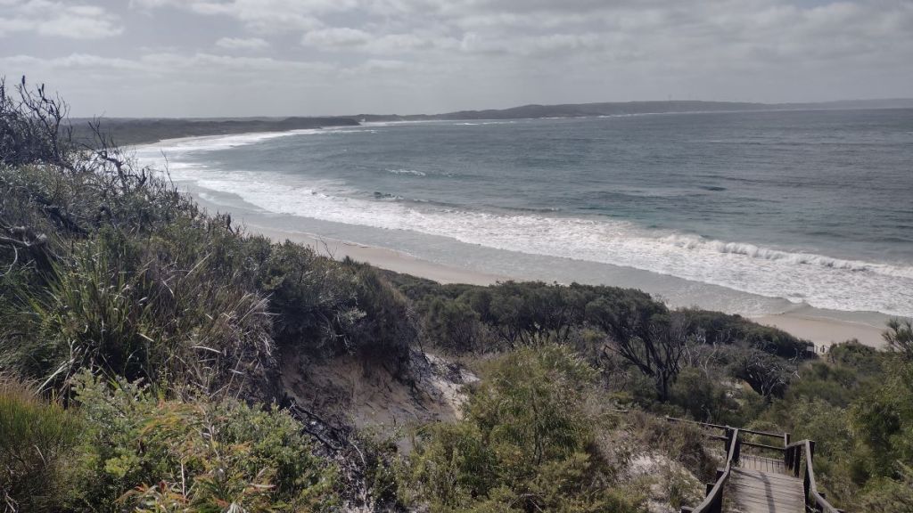
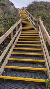
The track exits West Cape Howe National Park at Torbay campsite. A mite dingy so I didn’t linger for a break and pressed on through a stand of she-oaks to stairs leading down to Cosy Corner beach. At the head of the stairs were expansive views eastwards across the ocean to The Sandpatch (tomorrow) and the headlands of Torndirrup.

Torbay Shelter

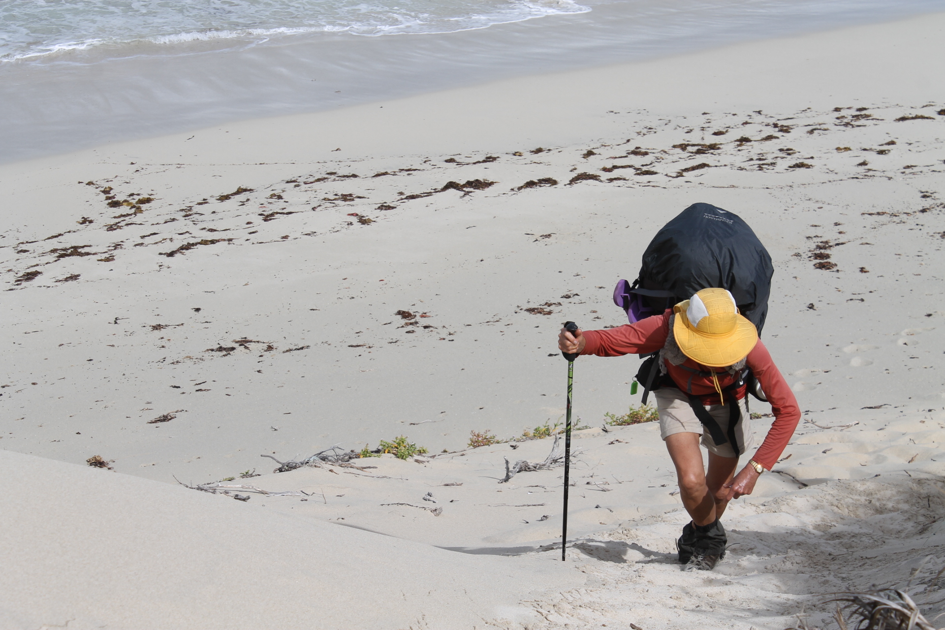
Here the Bibbulmun turns north east, following the wide Cosy Corner beach. My first beach walk thus far, something to savour on this sunny afternoon with a tail wind in my sails. But the beach walking fizzled all too soon.

My ever faithful Waugal signage posted me inland onto a somewhat confusing maze of tracks. Here I lost my Waugals and wandered off through a campground full of surfers, hippies and boomers. But with a bit of old school scrutiny of the Bibbs paper map and some backtracking, I picked up the Waugals again, which led me along the edge of an Environmental Education Centre where I popped out onto the lonely Perkins Beach.

Cosy Corner Beach looking north east towards Torbay Inlet

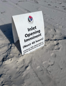
Another enjoyable beach ramble on wide, hard sand and propelled along by the tailwind for several kilometres. This landed landed me at Torbay Inlet. The Torbay Inlet crossing had been a gnawing concern for me since the beginning of my planning.


Torbay Inlet

If the channel is open to the ocean and running deep then the Torbay Inlet alternative route is a 19 kilometre bypass. Much of this a slog on dreary rural roads. But my guide notes left the door open and promised that an open channel can be waded with ‘extreme’ caution.

Opening of the Torbay Channel can make it difficult to cross
Perkins Beach looking north east toward Torbay Inlet

Torbay Inlet was named by mariner Matthew Flinders in 1801 after Tor Bay in Devon, England. Tor Bay was the home port of Admiral Richard Howe’s Channel Fleet. Matthew Flinders had served as a midshipman with Howe from 1793 to 1794. Captain Flinders is rightly famous for completing the first inshore circumnavigation of mainland Australia. (1802 to 1803) in the Investigator.

Best case scenario is that the Torbay channel is closed by the sand bar and no wading is required. Checking the Bibbs Facebook feed is very useful, but take into account tide times if the channel is reported to be crossable. Some details on the status of the crossing can be found on the Bibbs website. When onsite, wade across where the channel and ocean waters meet, as this point is often shallower than higher up the beach.

Instructions for crossing Torbay Inlet
An easy wade across Torbay Inlet
Torbay Channel looking towards Seagull Island

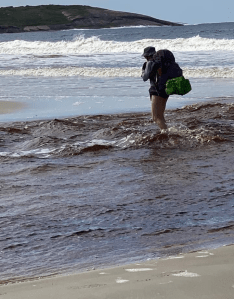
In any event the inlet was passable with knee deep wading at the ocean outlet. Another one and a half kilometres of beach walking lands you at the exit stairs leading up to Muttonbird Road Carpark.


Exit stairs to Muttonbird carpark

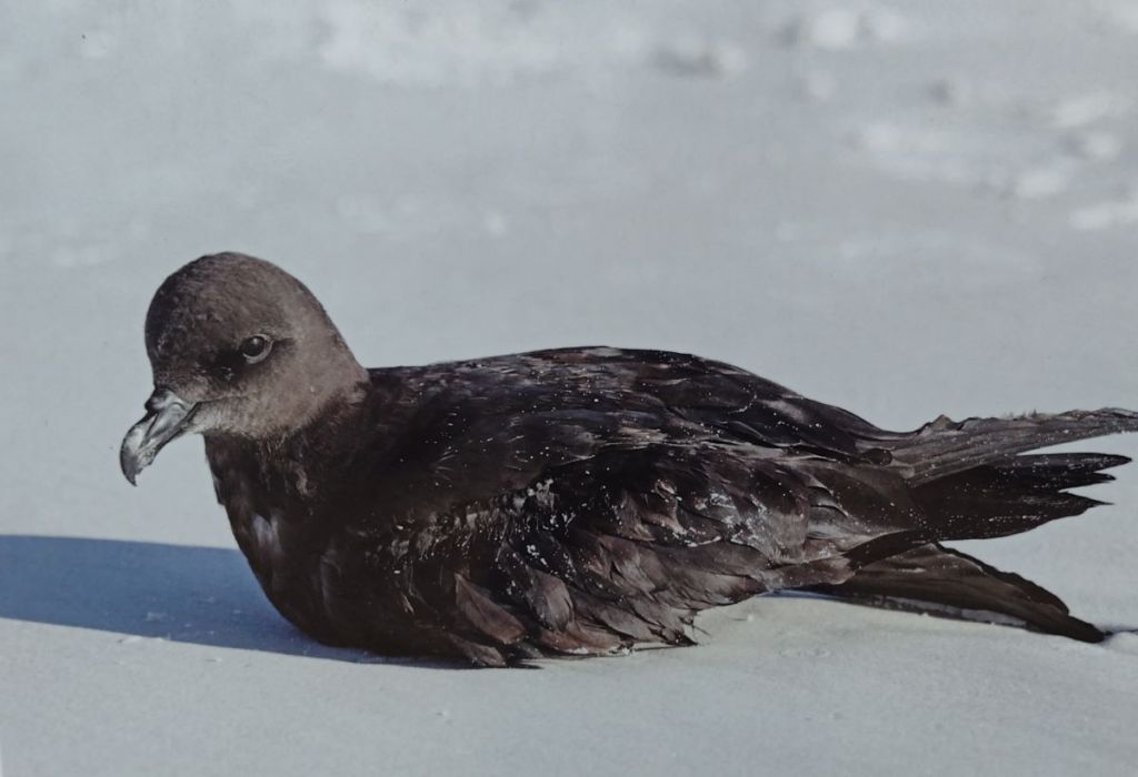
About 130 metres off shore from the carpark is Shelter Island which is mistakenly referred to as Muttonbird Island. Muttonbird Island is the much smaller island immediately to the east of Shelter Island. This 100 hectare Class 1A Nature Reserve protects breeding colonies of the Flesh-footed Shearwater (Mutton Bird) and Little Penguins.

Shelter or Muttonbird Island just offshore
Shearwater or Mutton Bird

Section 3: Muttonbird Carpark to Sandpatch Carpark: 13.5 kms.

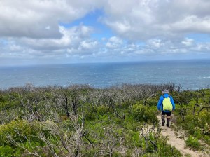
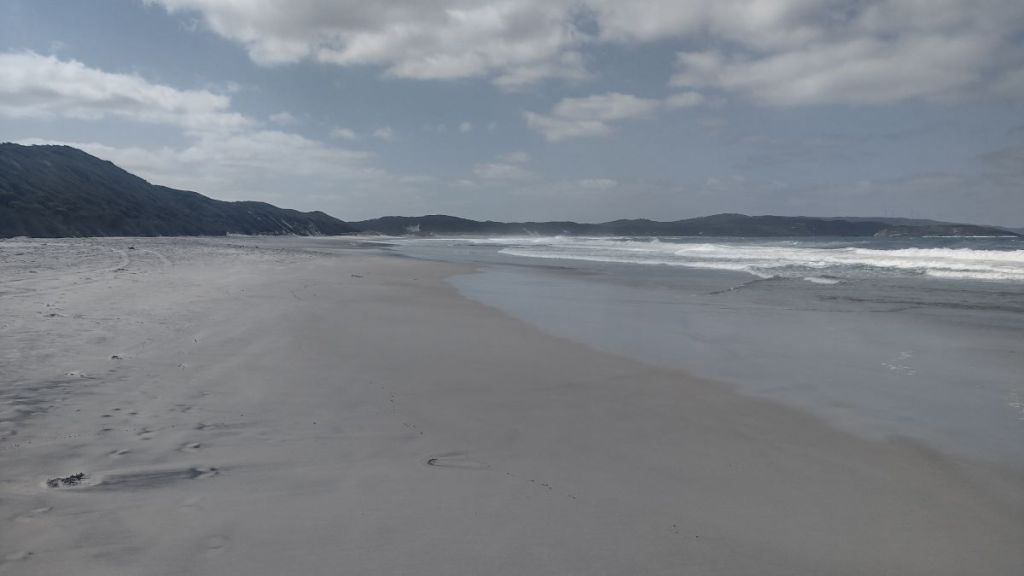
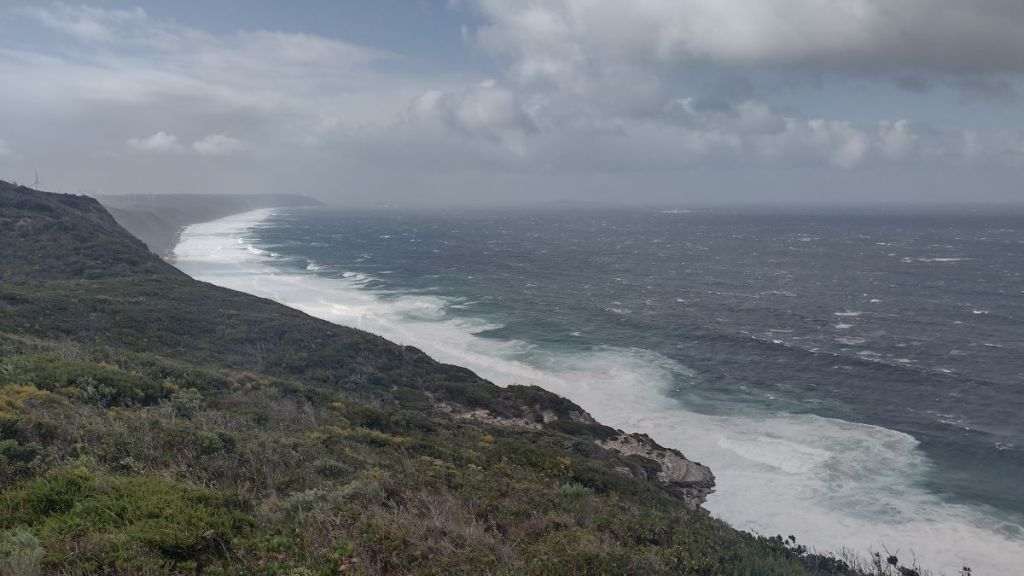
This is another outstanding section of the Bibbulmun as it parallels the coastline, curving gently eastwards. For most of the day it follows the dune crest with sand cliffs dropping 100 metres into the surf crashing in from the Southern Ocean.

To the west, over the bight, was the beach and headland coastline stretching between Muttonbird Island and the distant dark cliffs of Torbay Head. Eastwards were the wind turbines of Grasmere and Torndirrup. Good waypoints for today’s hike. Further east still was the impressive cliffed coastline of Torndirrup National Park. Inland were old friends, the Porongurups, now enveloped by low clouds.

View towards Grasmere and Torndirrup Wind Farms
Looking south west from Muttonbird Hut to Forysth Bluff

Along today’s route are numerous high points and lookouts, ideal for spotting whales and dolphins. Although not today, as the Southern Ocean was a maelstrom of white caps and heaving rollers. We set out from Muttonbird on a wild and woolly day. Frequent scuds raced onshore, pushed along by steady 40 kph winds, gusting to over 60 kph. The day’s walking started at 11O C and stayed there all day. For me, this was the bee’s knees of walking weather.

Another wild day on the coast between Shelter Isand and Sandpatch

The Bibbulmun initially passes through property occupied by the Sporting Shooters Association. The red flag was an incentive to pick up the pace. The track climbs into a saddle at 100 metres allowing a view back to Torbay Head: in our direction of travel were the wind turbines, useful markers for the day’s progress; inland, the Lake Powell Nature Reserve.

After several kilometres the track cuts into Muttonbird campsite. Like most Bibby campsites it was well sheltered with all the usual accoutrements: three-sided shelter, firepit, toilet, tank and picnic bench. And plenty of tent sites. A spot of morning tea and we were on the march again.

Muttonbird Shelter

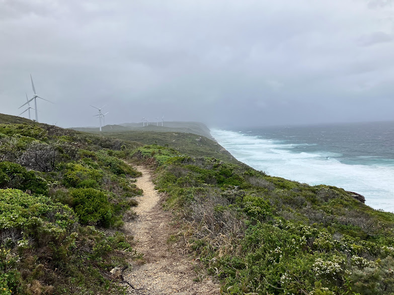
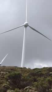
Another 2.5 kilometres along the spine of the high sand ridge brought us to the enormous Grasmere Wind Farm, 17 turbines by my reckoning.Thence to Torndirrup Wind Farm, where we encountered some unexpected engineering turbulence.


Trackside, on a prominent yellow noticeboard :

Walkers are advised that there are concerns with the structural integrity of the wind turbine close to the Bibbulmun Track ahead. Walkers should stay on the track…do not linger in the vicinity of the wind turbine.

With said turbine only 100 metres from our path and winds gusting upwards of 60 kph, we scuttled through.

The errant wind turbine

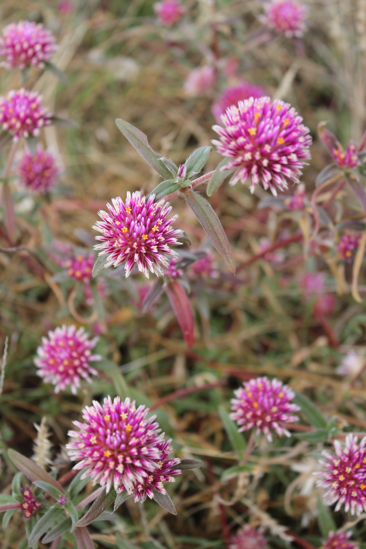
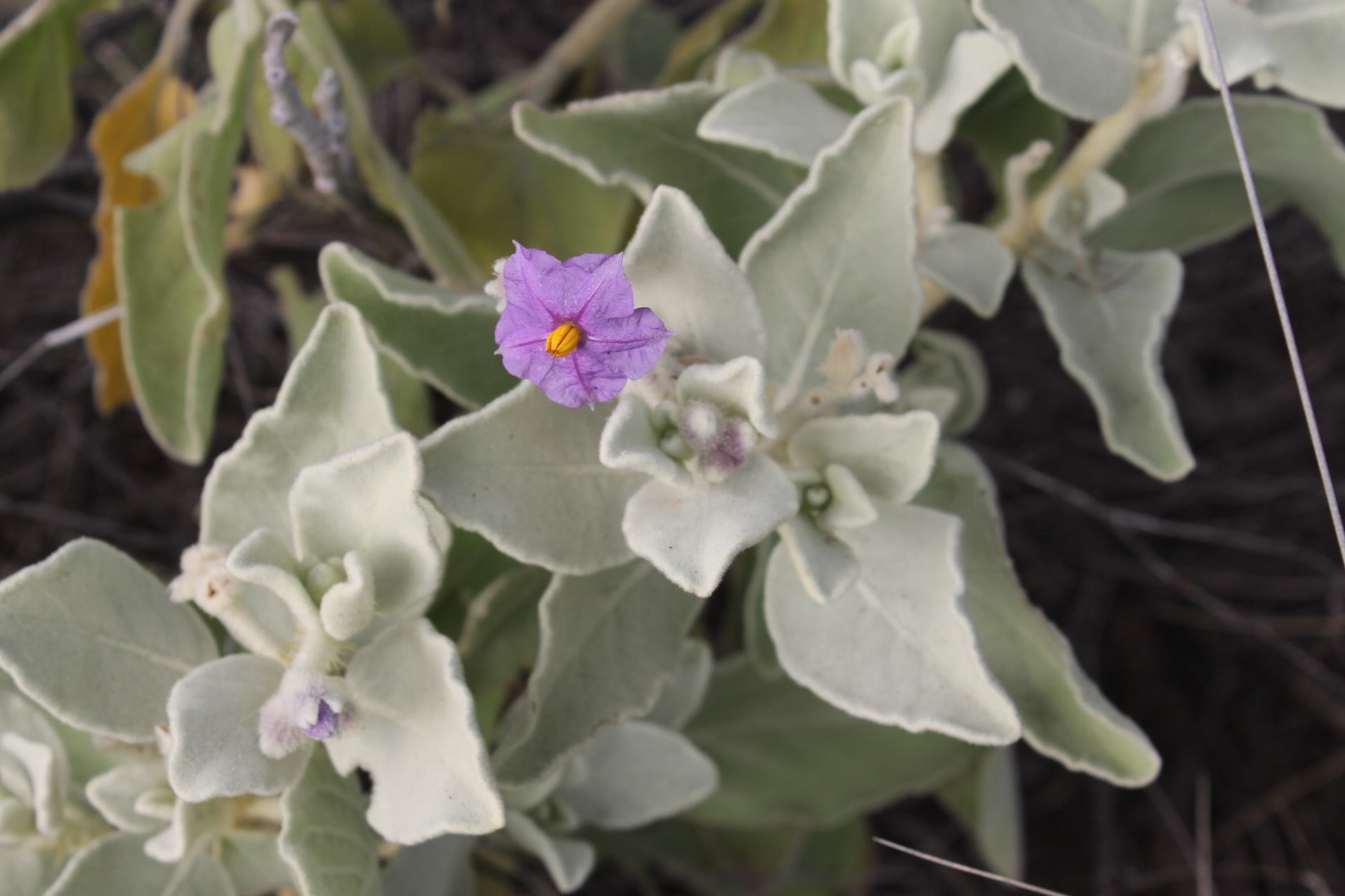
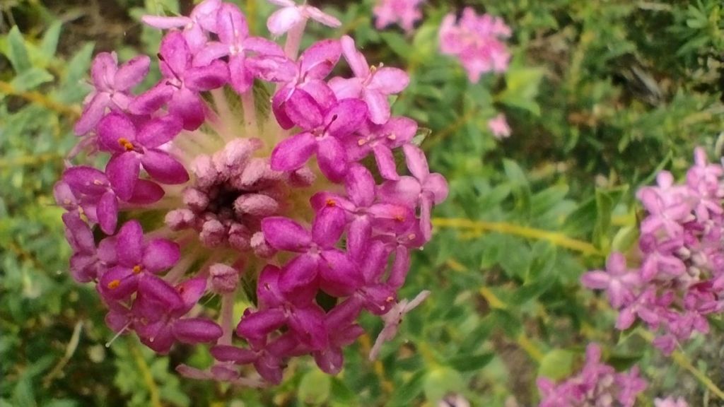
Safely across (12 turbines), we came to a lookout at the start of a long boardwalk which winds through thickets of wildflowers. Brilliant. But the gusty winds were something else. Each leg lift drove one inexorably inland, requiring a correction every few paces to stay on the boardwalk.

Boardwalks near Sand Patch road

Wildflower Thickets

Wildflower heath with flowering Bull Banksia in foreground
Thick-leaved Fanflower: (Scaevola crassifolia)
Banjine: (Pimelea sp)
Golden Guinea Flower: (Hibbertia aurea)
Smokebush: (Conospermum sp)
Pink Fairies: (Caladenia latifolia)
Dryandra sp.
Eggs and Bacon: (Nemcia sp)
Bull Banksia: (Banksia grandis)

Not much further on we arrived at Sand Patch road. At the car park there are wind farm information signs and short trails giving a 360o panorama including views of our destination, Albany. Also you can get scarily close to a turning wind turbine, hopefully structurally sound.

Here’s some guff I read on the information board that I thought was pretty interesting, but for you, possibly not:

  • towers are 65 m high
  • blades are 34 m long
  • towers are set in 16 m depth of concrete
  • blades start turning in 7 kph breeze
  • at this speed each blade tip is travelling at 130 kph
  • maximum power output is achieved in 50 kph winds
  • in 125 kph winds the turbines shut down
  • engineered to withstand 220 kph wind gusts
  • the nacelle, the box at the top, is bigger than a double decker bus
  • base tower circumference is 13.4 m.7 people, finger tips touching

Sandpatch to Albany via Frenchmans Bay: 16 kms.

A shortish final section, weather as usual: cloudy, driving scuds pushed landward by 40 kph north – westerlies. Situation normal. No doubt an enjoyable section for E2Eers no matter what the walking conditions.

The Bibbulmun initially cuts through the north – west quadrant of Torndirrup, climbing over vegetated dune country at 100 to 140 metres. A little over one and half kilometres from Sandpatch car park you drop into Sandpatch campsite. Another well maintained camp.


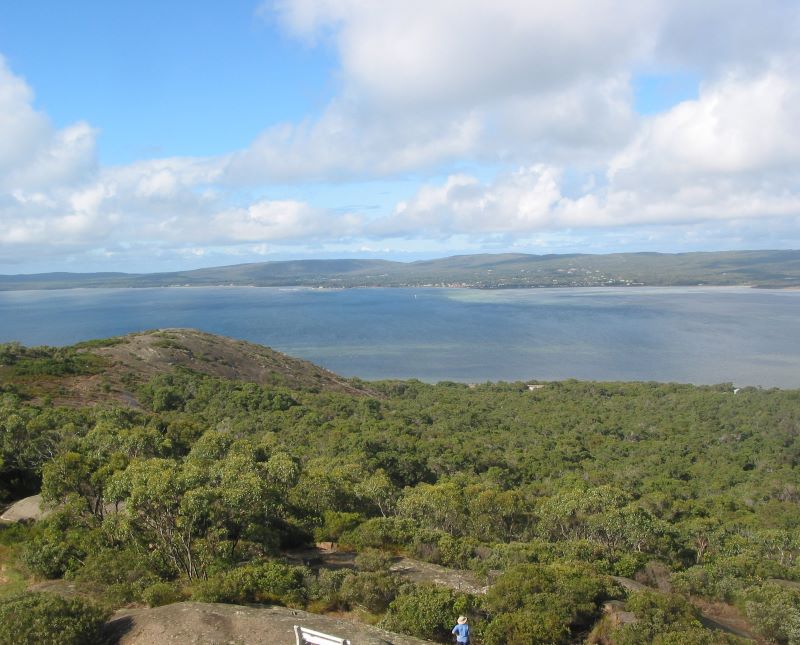
But moving on. From several high points are excellent views north over Albany and Princess Royal Harbour and the distant Porongurups. Our last chance to take in these outstanding landscapes which had been part of our walking over the past four days.

Source: NLA. William Westall 1801. Pencil and wash . View into King George Sound. Westall was the artist accompanying Matthew Flinders on his circum-navigation of Australia

Dropping from our vantage points we followed a network of 4WD tracks out to Frenchmans Bay Road. A concrete walking path shared by walkers, bikes and dogs skirts the Princess Royal Harbour for about four kilometres: flat, level and great harbour views. Unfortunately for E2Eers the path doesn’t parallel this magnificent harbour into central Albany.

Duncan Cooper: watercolour, 1854: Princess Royal Harbour

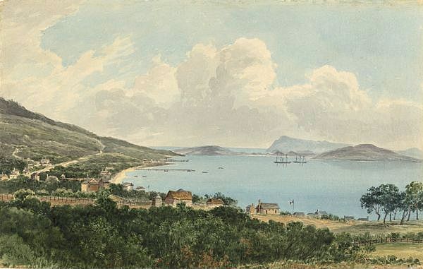
Princess Royal Harbour was named for Princess Charlotte Augusta Matilda, the first daughter of King George III.It was named by George Vancouver in HMS Discovery in 1791,the first European maritime explorer into the harbour.

View across King George Sound, Albany

A decade later, in 1801, Matthew Flinders dropped anchor in the harbour in his circumnavigation of Australia in the Investigator.Here he carried out necessary repairs and established a shore base on the beach.This allowed more survey work and collection of plants by the botanist Robert Brown.Flinders’ log makes reference to amicable relationships with the local ‘natives’. 

Investigator

In fact, the final three kilometres are pretty disappointing and must be an anticlimax for those hardy E2E types. The track wanders off through an industrial zone, across railway tracks, and then disappears into suburban streets around the southern slopes of Mt Melville.On the plus side, we saw some impressive historical stone and brick architecture .

Especially interesting for my generation of Queenslanders growing up in 1950s and 1960s with asuburban housing landscape typically timber clad with corrugated iron roofing, sometimes perched on wooden/concrete stumps. But time marches on and Queensland suburbia is now rubbish architecture of lowset brick- on -slab.  Usually capped by black tiled roofs. In the subtropics. Vale the Queenslander.

Still, a decent feed at one of Albany’s many excellent cafes/restaurants and a Waugal fridge magnet from the Albany Visitors Centre soon put our world in order again.

And so endedsome memorable days of Bibbulmun walking. All as promised: brilliant scenery, wildflowers and wild weather. I’ll certainly be back for more before I hang up the old hiking boots.


For those with plenty of fuel still left in their tanks. The challenging Bald Head walk. Torndirrup National Park.

Torndirrup National Park near Albany. 13 km rtn hike on Bald Head Walk along the spine of Flinders Peninsula.
Available at Albany Visitors Centre

Some of my recent hikes:

Snowies Alpine Walk: Perisher to Bullocks Flat.

by Glenn Burns In 2018 construction started on the 55 kilometre  Snowies Alpine Walk. The NSW Government boasted it would deliver ‘ a world-class, multi-day walk across the alpine roof of Australia in Kosciuszko National Park.’  The twelve kilometre hike from Perisher to Bullocks Flat is the final section of this longer walk. The hike…

Keep reading

Hiking the Southern Bibbulmun Track

The Bibbulmun Track is Australia’s premier long distance walking track, extending nearly 1,000 kilometres from its northern entrance at Kalamunda, a suburb in the Perth Hills, to Albany on Western Australia’s south coast. The track meanders through some of the best scenery that Australia has to offer: majestic jarrah, karri, marri and tingle forests, granite domes…

Keep reading

Dingo Days . Hiking K’gari’s Southern Lakes Circuit.

K’gari or Fraser Island, is the world’s largest sand island; a huge sandmass of 166 000 hectares in area and 123 kilometres long by 25 kilometres wide. It is a World Heritage listed landscape of high dunes, pristine freshwater lakes, wallum heathlands, extensive active sandblows, reedy swamps, sandy ocean beaches and towering forests. K’gari attracts…

Keep reading

Wallangarra Ridge: Girraween National Park

Wallangarra Ridge  is a little visited section of Girraween National Park in Queensland’s Granite Belt.  It is a spectacular landscape of   granite domes,  extensive rock slabs  and  giant balancing tors.  The dominant vegetation is a low Eucalypt woodland still showing the fire scars from 2019 bushfire season.  As the bulk of the walk is off-track…

Keep reading

Mt Moffatt National Park Circuit Drive

The Mount Moffatt section of Carnarvon National Park is a remote and relatively pristine landscape occupying the headwaters of the Maranoa River.  It features broad sandy valleys, basalt tablelands and outcrops of sculpted sandstone rising abruptly from the plains. I first visited Mt Moffatt National Park on a 10 day natural history campout in 1988…

Keep reading

Mt Meharry: WA’s Highest Mountain


By Glenn Burns

To climb Mt Meharry in Western Australia’s Pilbara region is easy enough. A ramble of 11 kilometres will take you to its 1253 metre summit and back. A mere day walk for local Pilbara peakbaggers. But for this party of blow-ins from the east coast, the logistics of accessing Meharry were more complicated. For Don Burgher, Brian Manuel, Judy and I, there was the five and a half hour flight to Perth followed by a road trip of four days through the outback of W.A. We touched down at Meharry’s base on a glorious winter’s day in August.

Mt Meharry summit
Mt Meharry summit

After an overnight camp at Dales Gorge in Karijini National Park we left Dales at 7.45 am for the final 125 kilometre drive to Meharry.

Despite what we had read about the difficulty of access once you leave  the sealed Northern Highway, it was all pretty straightforward. If you stay alert the unsealed Packsaddle Road-Juno Downs has adequate signage to get you close to Meharry’s base.


It wasn’t straightforward in 2002 when Nick and Ben Gough climbed Meharry as part of their ascents of the highest peaks in each state and territory of Australia. They described it thus:

… After  4200 kilometres of driving the final leg into Mt Meharry is along an old mining exploration track, overgrown with spinifex… There were a few washouts to navigate and plenty of spinifex seeds to remove from the radiator as we pushed through the undergrowth; there were also lots of spiders, angry at being removed.” Source: Wild No 87.


But times have changed. Now you can do all this in a 2WD. But if you are feeling lazy and are blessed with a high clearance 4WD having a bit of grunt, you can bump and grind your way all the way to Meharry’s summit.  Cheaters.

We didn’t, it wasn’t part of our deal. We parked our borrowed 4WD ( thanks  Joseph Mania) at the first major jump-up, under the shade of a solitary snappy gum. Here we left Judy in charge of birds, bees and botany while Brian, Don and I headed off for the five kilometre walk to the summit, an altitude gain of only 427 metres.

Parked under a shady snappy gum.


What’s in a name ?

At the top of the first jump-up we had our first clear views of Meharry. The story on how WA’s highest peak was determined is worth recounting. Such is the isolation of the Pilbara region that as late as the 1960s it was thought that nearby Mt Bruce (Bunurrunna) at 1,236 metres was WA’s highest peak.

Then, in 1967, an unnamed whaleback prominence 50 kilometres to the south east was checked out by surveyor Trevor Merky and found to be 17 metres higher than Mt Bruce.

Meharry was named after William Thomas (Tom) Meharry, Chief Surveyor for WA from 1959 to 1967. After a bit of ferretting around in Native Title documents I found its aboriginal name to be Wirlbiwirlbi. 

On Tom Meharry’s death in 1967, the Minister for Lands approved the name ‘Mt Meharry’ on 28 July, 1967. That should have been the end of the matter. The plaque on the summit is dedicated to Tom Meharry and WA’s surveyors and it reads:

Mount Meharry, at 1250 metres, is the highest point in Western Australia. It is named after William Thomas (Tom) Meharry (1912-1967), the states State’s Geodetic Surveyor from 1959 to 1967‘.

This survey cairn was constructed in September 2013 as a tribute to all surveyors who have explored and mapped the magnificent Western Australian outback‘.

Geoscience Australia gives the height of Meharry as 1253 metres, not 1250 metres as per the plaque or the 1248 metres on the summit signpost. Confused?

Gina Rinehart

Enter Gina Rinehart, daughter of iron ore baron Lang Hancock. In 1999 she applied to the Geographical Names Committee to re-name Meharry to Mt Hancock after her prospector father.

They declined but Australia’s wealthiest woman wasn’t so easily put off. In 2002 she went to the top and lobbied then Premier Geoff Gallop for the change. Fortunately, he too rejected the proposal.


Pilbara region WA
Features named by F. T. Gregory or related to his 1858 and 1861 expeditions.
A Spinifex Steppe

From the first jump-up it is an easy two kilometres before the track does any serious climbing. At this point the track winds up an open spinifex (Triodia spp.) covered ridgeline.

The spinifex was everywhere, easily the dominant ground cover: it grows in either doughnut shapes or hummocks Some species have long spiny leaves that dig into bare skin so it is a matter of self preservation to wear thick canvas gaiters when going off track.

On warm days one of the common hummock species of spinifex (T. pungens) releases volatile oils, producing a very distinctive resinous scent. The resin from T. pungens (in the photo) was used by aboriginals as a glue to bind spear heads to their shafts. The resin is pliable when heated but sets rock hard.

The Spinifex Steppe
The Spinifex Steppe: Trioda pungens

It was mid morning so the temperature was creeping up to its predicted 30°C, but tempered by a light west sou’wester. We pulled in for a water stop under the only shade, a stunted snappy gum (Eucalyptus leucophloia) located fortuitously at one of Brian’s infamous ‘uphill flat bits’.

This attractive and robust little gum is a familiar sight on the rocky hills and plateaus of the Pilbara, typically growing to three or four metres. A defining characteristic is its white powdery bark, sometimes pocked with black dimples. Hence the species name leucophloia, meaning white bark.

Brian standing in the shade of a solitary snappy gum on the flanks of Mt Meharry

The only other tree we found on Meharry was the desert bloodwood (Corymbia deserticola). With its multi-stemmed mallee growth form and rough tessellated bark it is another very striking tree of the Pilbara and easily distinguishable from the snappy gum.

Desert Bloodwood
Desert Bloodwood

Another two kilometres of plodding over loose scree took us to the crest of the ridge, a false summit.  Meharry trig station was a further 800 metres on.

But there is no mistaking the real summit as it is marked by an elaborate rock cairn. We had left Judy and the 4WD some one hour forty five minutes earlier. Not too shabby a performance by three elderly bushwalking codgers.

Brian & Glenn at Mt Meharry summit cairn
Brian and Glenn at Mt Meharry summit cairn. Don wielding the camera.
Geology and Landscape

The view from the summit revealed a spectacular landscape of red whale-back mountains, razor-back ridges and steep-sided gorges that make up the Hamersley Range, one of the oldest geologic surfaces on the earth.

Karijini is the aboriginal name for the Hamersley Range. About 2,690 million years ago the Hamersley Basin began to fill with sediments forming the extensive deposits of banded ironstone formations (BIFs), cherts and metapelites collectively known to geologists as the Brockman Iron Formation.

Banded Ironstone Formation (BIF)

Mt Meharry is predominately an outcrop of this ancient Proterozoic banded ironstone.

Typically it appears as a very hard brown rock composed of iron oxide and fine grained quartz. Similar iron rich rocks occur in South Africa and Brazil but the best exposures occur in Australia’s Pilbara.

After the obligatory photos, a quick bite to eat and a good guzzle of water we turned tail and headed downhill, back to the 4WD and Judy who was busy dealing with the unwanted attentions of ‘sweat bees’.

It's all downhill from here.
It’s all downhill from here.
Sweat Bees.

Sweat bees is a generic term for a range of these inconspicuous little fellows (Family:Halicitdae)  who are attracted to perspiration, specifically the salts in sweat and as Judy discovered, can be quite a nuisance, just like Australia’s notorious bush flies.

Birds

And what of Judy’s birding and botanizing? Well, the avians weren’t co-operating. Hardly surprising. We were, after all, in a desert, with no nearby surface water and the ocean five hundred kilometres to the west. The semi-arid tropical climate has a highly variable rainfall of only 250mm to 300mm per annum; the evaporation rate is twelve times greater, hence the minimal surface water.

The presence of surface water is very much dependent on incursions of the summer cyclonic rains sweeping in from the Indian Ocean to the west.

Back in bird land the meager offerings were a Black-faced Cuckoo-shrike, a Yellow-throated Miner and the seemingly ubiquitous Galah.

Plants
Royal mulla- mulla
Royal mulla- mulla

However the abundance and showiness of plant life in the Australian outback is often exceptional, especially after rain.

Pink Royal mulla-mulla (Ptilotus rotundifolius) covered the rocky Meharry landscape, occupying the interstices between clumps of spinifex.

Royal mulla-mulla is a low perennial shrub growing to about one metre tall. The flower spikes are unmistakable: long, cylindrical and a bright pink. More than 35 species of mulla-mulla grow in the Pilbara and make for spectacular displays after good summer rains.

Other ground covers included the purple-flowering Flannel Bush (Solanum lasiophyllum), and the delicate blue pincushion flowers of the Native Cornflower (Brunonia australis).

Brunonia australis is the sole species in the genus Brunonia which is the only genus in the endemic family Brunoniaceae. It is named after Robert Brown, naturalist on Matthew Flinders’ Investigator.

Flannel Bush: Solanum lasiophyllum

Wattles and sennas dominated the Meharry shrub layer and included the golden-flowering Gregory’s Wattle (Acacia gregorii). This dense spreading shrub grows to only half a metre and has golden ball-like flower heads. The name commemorates Francis Thomas Gregory whose 1861 expedition passed through the Pilbara.

Gregory's Wattle
Gregory’s Wattle. Acacia gregorii
Another wattle found here was Acacia hamersleyensis, the Hamersley Range Wattle. This multi-stemmed wattle grows to about four metres and features bright golden dense cylindrical spikes.
Thomas Francis Gregory: The North-West Australian Exploring Expedition. 1861.

Thomas Gregory was the brother of the outstanding Australian explorer and bushman, Augustus Gregory.  Their 1858 expedition to the Gascoyne River had attracted the attention of English capitalists interested in cotton ventures. The Home Office and Royal Geographical Society proposed a new colony on WA’s  north-west coast with the special objective of  cultivating cotton.

Francis Thomas Gregory; Source State LibQld
Francis Thomas Gregory;
Source State LibQld

Thus F.T. Gregory was contracted by Captain Rowe, Surveyor General of WA to head a scaled back expedition prior to setting up a full colony. On the 23rd of April,1861 Gregory departed on the barque Dolphin with a party of nine, ten horses and supplies of flour, salted pork, dried beef preserved meat, bacon, sugar etc. Enough grub for eight months. If the desert , horses or aborigines didn’t do you in then it was a fair bet that the diet would.

On the 22nd May Gregory had transferred men, supplies and horses ashore at the head of Nickol Bay. By the 25th June he had reached the western edge of what is now Karijini National Park.  On the 3rd of July he climbed Mt Samson and saw a high peak which he named Mt Bruce…

“I named Mt Bruce after the gallant commander of troops who had warmly supported me in carrying out explorations.”

And so, for well over a century, Mt Bruce was thought to be WA’s highest mountain. His journal also mentions  Mt Augustus which he had named on his 1858 expedition into the Gascoyne River District after his brother Augustus Gregory. It was from Mt Augustus that he first saw Mt Bruce.  But that is a story which I will keep for another time.

Mt Bruce:
Mt Bruce ( Bunurrunna): 1236metres.

Such is the isolation of this area, modern day maps of the Pilbara  still retain a plethora of the original names proposed by F.T. Gregory:

  • Mt Turner: J. Turner was second in command of the expedition.
  • Mt Brockman:  E. Brockman was a member of the expedition.
  • Maitland River.
  • Hardy River.
  • Hamersley Range: Hamersley was one of the expedition’s backers.
  • Fortescue River: Fortescue was the British Under-secretary for colonies.
  • Dolphin Island: from their supply vessel Dolphin.
  • Ashburton River: President of the British Royal Geographical Society.
  • Capricorn Range: presumably because it straddles the Tropic of Capricorn.

Readers interested in the expedition journals of the Gregory brothers  should acquaint themselves with an excellent facsimile edition published in 2002 by  Western Australia’s Hesperian Press.

Source: Hesperian Press.
Photo Gallery: Plants of the Pilbara.
Holly Grevilla

Holly Grevillea. G. wickhamii. Named after John Wickham. Captain of the Beagle who collected this plant with Charles Darwin during surveys of the north-west coast 1837-1838.

IMG_2933

Australian Desert Rose: Gossypium australe.


Sturts Desert Pea

Sturt’s Desert Pea: Swainsona formosa. Its name honours the explorer Charles Sturt but was first collected by Willim Dampier in 1699 on an island on the Dampier Archipelago.


Rock Fig

Common Rock Fig: Ficus brachypoda. Found growing in cooler moist gorges of the Pilbara. Often clings precariously to ledges and cliff faces.


Sticky Senna

Sticky Cassia: Senna glutinosa subsp. pruinosa


Grey Whorled Wattle

Grey Whorled Wattle: Acacia adoxa.

After reading  this account you will have realised that Mt Meharry is no great challenge. For me,  its interest lies in the opportunity to traverse an arid zone mountain landscape, a walk of outstanding scenic beauty as well as exceptional geologic and botanical interest. And as a bonus you can bag Western Australia’s highest mountain, a remote peak in outback Australia. Mission accomplished.  Then it was back to the comfort of our camp site at Dales Gorge, under the welcome shade of a grove of Mulga trees.

Day's end @ Dales Gorge Campground, Karijini National Park.
A Job Well Done: resting back at Dales Gorge Campground, Karijini National Park.
Good info:

Bush Books series published by WA’s Dept of Conservation and Land management. These are pocket sized field books: Common Plants of the Pilbara, Wattles of the Pilbara, Geology and Landforms of the Pilbara.

P. Moore Plants of Inland Australia (Reed New Holland 2005)

P. Lane Geology of WA’s National Parks (Peter Lane 2007)

A.C. and F.T. Gregory Journals of Australian Explorations 1846-1861 ( Hesperian Press 2002). First published by J.C. Beal Government Printer, Brisbane 1884.

S. Mitchell Exploring WA’s Natural Wonders ( Dept of Environment & Conservation).

Hema Western Australia Road and 4WD Atlas

Aust. Geog. Western Australia State Map 1: 4 000 000

Photo Gallery: Cape to Cape Track. WA. by Lyn Hewitt.

Photo Gallery: Cape to Cape Track. WA.

Photos: Lyn Hewitt

The Cape to Cape Track is situated in the far SW corner of Western Australia.  It runs 135 kilometres along the spine of the Leeuwin-Naturaliste Ridge, between the two lighthouses of Cape Naturaliste and Cape Leeuwin. It is renown for its spectacular coastal scenery, wildflower displays, geology, maritime history and surfing beaches.

The track parallels a pristine coastline but there are several inland loops including the very scenic Boranup Karri Forest. The Cape to Cape is not as easy as it superficially appears and you need to take into account some long 20+ kilometre days, long sandy sections and fickle weather. My walking friends and I spent eight days on the walk in autumn but some groups do the walk in five days.

The following  photos were taken by one of  my walking friends, Lyn Hewitt . Lyn records more than the standard bushwalker shots of landscapes and people hiking. In this collection are some of her excellent nature shots as well as a few of the usual  bushwalker landscape shots.

Cape to Cape Track WA


Cape to Cape Title WP Trudge


by Glenn Burns

 For many years walkers have headed to Western Australia to tackle the famous Bibbulman, a 965 kilometre long distance track. But now, for those of us with more modest ambitions, there is the coastal Cape to Cape, a 135 kilometre walk from Cape Naturaliste in the north to Cape Leeuwin in the south. This is an outstanding walk, renowned for its coastal scenery, wildflower displays, remote and wild surf beaches and maritime history. It follows a reasonably pristine cliffed coastline interspersed with headlands, long stretches of beach and backed by dune topography. For added variety there are several inland loops, including a welcome diversion into the Boranup Karri Forest.


But before you rush off on that cheap five hour red-eye flight to Perth, prospective walkers need to understand that the Cape to Cape is not a push-over. Our experience was of lengthy trudges through soft soupy sand; the weather was decidedly fickle during our autumn walk while high summer and the depths of winter would be best avoided; on our three warmish days (up to 30°C) with no cooling sea breezes, the exposure on beaches, dunes and cliff tops was pretty intense.

Exposed Clifflines and Rock Platforms
Picking our way along exposed rock platforms

On the plus side, the scenery is varied and spectacular; if you have a modicum of interest in natural history, this is the place to be, one of the earth’s 34 bio- hotspots. Usually, cool on-shore breezes make for comfortable walking. With some careful planning it is possible to mix comfortable overnight stops in small coastal villages with the hikers’ campsites. The track is well marked and a comprehensive guidebook is available.

Sunday: The Warm Up: Cape Naturaliste back to Dunsborough YHA via Meelup Track: 16 kms.

Perth- based son Dave and daughter-in-law Steph dropped our contingent, Brian, Sam, David, Lyn, Sally, Di and this scribe/ leader at Cape Naturaliste lighthouse in time for a walk around the Cape and the obligatory tour of the lighthouse. But by mid morning it was off on the shake-down walk back to Dunsborough YHA following the coastline. A wake-up call that we shouldn’t take this walk too lightly. The scenery was, indeed, outstanding: the blue seas of Geographe Bay, red gneiss outcrops, limestone cliffs and long white beaches. Even a few seals spotted by Lyn “Hawkeye” Hewitt. Lyn, I discovered, has outstanding distance vision. Just the ticket for spotting our dolphins, seals, sharks, elusive whales, shore birds and obscure track markers.

Limestone Cliffs
Limestone Cliffs

Although only 25°C max today, it seemed much hotter along beaches and clifftops. In fact, by midday, we were definitely hanging out for any modicum of shade for our lunch break. Even happier, when late in the afternoon Dave and Steph intercepted us shambling along the never ending Dunsborough foreshore walk. Out came a six pack of the local Eagle Bay ale. Cheers Dave ‘n Steph.


Cape to Cape final map WA
Cartography: Glenn Burns

Monday: Cape Naturaliste to Yallingup: 14.2 kms.

A short day to ease into things. Our already heavy packs were now topped up with two to three litres of water. The Perth transport corps kindly dropped us at the track head at Cape Naturaliste soon after 8.30am. A typical WA day: cloudless, a light SSW breeze to take the edge off the already warming conditions.

Cape Naturaliste Lighthouse

For the next seven days we would travel southwards along a wild and rugged coast. Much like Nicholas Baudin’s French maritime expedition of 1800-1803 in the Naturalise and Geographe. This expedition named many of the coastal headlands that we would see on our walk: Cape Naturaliste, Cape Clairault, Cape Mentelle, Cape Freycinet and Hamelin Bay. Except that Baudin made landfall at Cape Leeuwin and then sailed north. Strangely, Baudin’s name rarely features on Australia’s charts except for a minute coral cay in Shark Bay, WA and a small rocky outcrop off the coast of Tasmania.

There is a good reason for this. Baudin was a cautious mariner, much despised by his crew for standing the Naturaliste and Geographe well offshore, rarely landing, frustrating the scientists on board. The British navigators mocked this lame approach to exploration as “exploring by telescope”. By contrast, the great British navigator Matthew Flinders produced superbly detailed charts of the same coastline by hugging the coast. Baudin died before reaching France and the reports and maps of the explorations were prepared by his tormentors Peron and de Freycinet. Baudin was excised from the reports and most of his place naming was changed. Cape Naturaliste, for example, was originally named by Baudin as Cap de Mecontents, Cape of Discontent. One sub-lieutenant Picquet had disobeyed Baudin’s instructions hence Cap de Mecontents. Peron later changed the name to Cape Naturaliste and went further, rewarding our wayward sub-lieutentant by naming a nearby promontory Point Picquet. Personally, after walking this treacherous, rocky coastline and experiencing the size of the surf, I’m with Nicholas B. All you boaties should stay well offshore.

The Naturaliste and Geographe

The Cape to Cape Track follows the Leeuwin-Naturaliste Ridge, a major geologic feature between the two capes which reaches a very subdued maximum of 200 metres in height. It is composed of two different rock types: a  Precambrian granitic gneiss ( 1.5 billion to 655 million years old)  which forms the basement of the ridge and is best seen outcropping at the many headlands we clambered over. These were the relic core rocks of an ancient mountain range that formed when India collided with Australia.  Overlying the gneiss is the much younger Tamala Limestone which consolidated from windblown (aeolian) sand dune deposits formed in the last two million years. In places along the coast we found old rounded gneiss boulders cemented into the limestone to form conglomerate.

Our Yallingup accommodation was not under canvas but in the salubrious surroundings of a Yallingup Caravan Park cabin. Green and clean. Glamping. The Caves House Hotel built in 1904 for the local caves tourist trade, supplied our evening meal, the clincher being the $20.00 Seniors’ buffet in an art deco dining room. The choc slice was delicious. The like of which kept re-surfacing over the next several days at morning tea breaks. Bread rolls and tubs of butter had also been hoovered into doggy bags to reappear at lunchtimes.

Tuesday: Yallingup to Moses Rock Campsite: 20 kms.

Superb coastal scenery today but in the warm conditions our walk degenerated into an eight and a half hour marathon. Much of the day was slogging along sandy 4WD tracks and long beaches with nary a skerrick of shade. I now know why West Australians are called Sandgropers. In the soupy sand Samantha ‘Twinkletoes’ Rowe set a perky pace, hotly pursued by Sally and David. As for the Usain Plods, the trick was to walk in the compacted footsteps of those in front, or better still in the occasional 4WD tyre tracks.

Truding in the never ending sand.
Trudging in the never ending sand.

Eventually we descended to Quininup Beach where the creek, called a brook in WA, had backed up behind the beach. A very welcome cooling dip and a rock outcrop to provide some shade. I flopped in fully clothed. Quininup Beach area has several aboriginal heritage sites and the track skirts around these. Aboriginal occupation dates back to at least 40,000 years before the present. Local placenames are aboriginal in their derivation. For example: Boranup is place of the dingo; Yallingup means place of love and Cowaramup refers to the place of the parrot or purple-crowned lorikeet.

Just on 3.30pm we lobbed into Moses Rock Campsite, the large group site already annexed by an elderly German couple, so we settled into what spots we could find in the scrub. Moses Rock was a pretty grungy campsite cut into the wind-shorn scrub. But I shouldn’t complain. We had the luxury of picnic tables, a clean toilet, fresh water and ocean views only a minute’s walk from the campsite.

Wednesday: Moses Rock Campsite to Ellenbrook Campsite: 22 kms.

Another 7.15am start. Cool early on, but firing up as we ploughed ever southwards along Willyabrup Beach, Cullens Beach, past the Margaret River surfing spots of The Gallows and Guillotine thence to Gracetown for a general store pit stop. Here we tanked up on beer, ginger beer, fruit juice: anything to slake our thirst. The afternoon leg took in more surf breaks with more weird names, like The Womb and Left Handers and onto Ellenbrook Homestead. To me, these surf beaches look pretty formidable, mainly dumpers and rips. Giant swells rolling in from thousands of kilometres across the Indian Ocean. One surfing website cautions that: “The Womb has sent more than one Pro Surfer to the hospital after sampling the innards of this beast.”

Built in 1857, Ellenbrook was the first homestead between the two capes. It was the home of Alfred and Ellen Bussell who farmed there for eight years before moving. Its shady, grassed surrounds looked just peachy for pitching our tents. But the National Trust, owners of Ellenbrook, were having none of this hiking riff-raff squatting on the property, so we were off another kilometre or so to our overnighter.

This time occupied by an amiable Canadian backpacker. He was one strong lad. Didn’t need a can opener, simply whacked his evening meal, a can of baked beans, with a rock and it popped open. Our co-camper departed early the next morning with a massive rucksack as well as toting a 10 litre jerrycan of fresh water. He certainly hadn’t used any washing himself. His legs were caked with black sand, reminiscent of those thick black stockings that school girls used to wear in the 1960s. As Brian quipped: “He’s going to need a Gurney to get that lot off.”

Thursday: Ellenbrook Campsite to Prevelly Caravan Park: 13 kms.

The natives were on the move at 5.30am. I have no idea why, as we only had a 13 kilometre stroll today. As a bonus a cool change had swept in. The track trended inland at first over some 80 to 90 metre dunes. Easy walking in these cooler conditions. Eventually we bobbed out onto Kilcarnup Beach ending at Cape Mentelle (named after Edme Mantelle the French geographer). It was on this beach that we got our best sightings of shore birds: sooty oystercatchers on the rock shelves, pied oystercatchers patrolling the beach, pied cormorants and even a pair of the endangered hooded plovers, endemic to southern Australia. These little fellows wander through the inter-tidal zone in a stop-start fashion, grabbing any morsels that take their fancy

We rounded Cape Mantelle and ahead was the famous Margaret River and our overnight destination, Prevelly. Fortunately, the Margaret River estuary had closed, the river dammed behind a beach barrier. Just the place for Di and I to have another refreshing dip. The overnight accommodation was in two “Fibro Majestic” fishing cabins, 1960s style, but spacious and more than adequate for our purposes.

Our Fibro Majestic Beach Cabin.

Here also was an opportunity to experience some of that much hyped Margaret River cuisine: “…the choices of mouth-watering culinary possibilities are limited only by your imagination.” Limited too by the contents of your wallet. A feed of local fish and a sprig of salad weighed in at thirty dollars. We settled for a lunch of Burger ‘n Chips and Spare Ribs ‘n Chips. And very tasty they were too. So bring on the evening meal. Gastronomically a fizzer according to Brian. His Margharita Pizza was, quote: “A few slices of tomato, a drizzle of cheese plonked on a pizza base resembling a dry biscuit.”

Friday: Prevelly Caravan Park to Conto Campground: 18.5 kms.

Showers overnight with the prospect of a cool overcast day. Today’s walk took us to Boodjidup Brook which wends its way through the coastal dune system and out to the ocean. A great spot for a swim, but not today. Another long stretch of perversely steep and soft beach followed. Not a problem for the Phar Laps but a bit of a downer for the poor old Dobbins hobbling faithfully behind. Much of the rest of the day is spent above the beaches, scouting along low limestone cliffs, checking out limestone caves with a final three kilometres high above the ocean on a realigned and contoured track with fabulous views along the entire coastline.

And so to Conto. A shady, well-appointed campground with an info centre, tables, water, clean toilets, a kitchen shelter, fireplaces and a total fire ban. Pity about the arrival of a fleet of Vikings who dropped anchor where we were camping. International uni students from Norway, Denmark and Sweden, apparently. They were studying in WA but had spent the day rampaging through the Margaret River vineyards. Unfortunately at the campground two Aussie toolies attached themselves to the group. This lot had no intention of obeying camp rules about music and grog. Entreaties to the two boofheads and their hangers-on didn’t cut it. Most of the female students were far more considerate and went to bed. But by 2.00am even our tenacious ‘friends’ had run out of steam or grog or playlists or all of the above and retired to get some shut-eye.

Saturday: Conto Campground to Hamelin Bay Caravan Park: 22.5 kms.

A 5.00am wake-up and some packing-up noise seemed in order. Come 7.00am, a final jaunty toot toot from Brian’s old scout whistle and we were scuttling out of Conto and down the track towards Hamelin Bay. From Conto the track swings inland to cut through the Boranup Karri Forest, a green and shady contrast to much of the rest of the Cape to Cape. The vegetation is a mixed woodland of marri, jarrah, karri, peppermint, wattles, banksias and Xanthhorrea. Boranup is re-growth forest having been cut over for nearly 115 years.

The dominant tree is the karri (Eucalyptus diversicolor). Its light grey bark peels in autumn exposing the new bark, which can be yellow, brown or orange. In the 1870s karri became a popular timber, favoured for bridges, wharf scantlings and mine poppet heads. Much of it was hauled out of Hamelin Bay, our overnight stop.

Boranup Karri Forest

Hamelin Bay was named after Captain Hamelin, commander of the corvette The Naturaliste. It was a thriving timber port in the late 1800s with a long timber jetty built in 1882. However Hamelin Bay is not a sheltered inlet and like much of the Leeuwin-Naturaliste coast it is littered with shipwrecks: Agincourt (1882), Chaudiere (1883), Katinka (1900), Norwester (1900), Lovspring (1900) and Toba (1930). Today little is left of the jetty, a caravan park has been built where the timber yards stood and Hamelin Bay is now a very popular swimming, fishing and diving spot.

Hamelin Bay
Hamelin Bay

At beer o’clock, just before sunset, flocks of caravanners, lagers in hand, head for the foreshore. Happy hour you ask? Dolphin feeding perhaps? or maybe some real excitement with some whale watching? None of the above. The entertainment is in watching the fishermen and divers returning in their tinnies and their  oft ineffectual attempts to manoeuvre said tinnies onto their trailers.

Sunday: Hamelin Bay to Deepdene Campsite: 10 kms.

A late 9 o’oclock departure. We made our way to the Foul Bay Lighthouse. A Lilliputian construction at only 3.9 metres, it is still fully operational. And given the nature of the rocky coastline around Hamelin Bay it isn’t hard to understand why. The original lighthouse was built in 1937 on the nearby Hamelin Island, the remains of which are still there. It was moved to its present position in 1967 and stands 80 metres above the sea.

From the lighthouse we dropped back to the shoreline, on to a limestone platform leading to our proposed lunch spot on the granites of Cape Hamelin. This platform was a pretty wild place with Indian Ocean swells crashing up and over the limestone. The platform was a microcosm of karst topography. Deep solution hollows made for active blow holes as the waves rushed in and out; the whole surface was carved into large blocks delimited by deep crevasses, known as clints and grikes. At the micro level the exposed limestone surface wasn’t smooth but was pitted, grooved and fluted giving a very rough and intricately detailed surface called rillenkarren.

Fretted Limestone
Fretted Limestone

Deepdene campsite is a smallish site cut into coastal scrub and dunes about 500 metres inland. Even with our late start we had heaps of time for an arvo of washing clothes and bodies; eating, always a favourite activity on throughwalks; and walks along the beach from which we could see the Cape Leeuwin Lighthouse, our final destination. Two young German hikers, Alexander and Toby, wandered in late in the afternoon and occupied the other tentsite which we had left vacant for them.

Deepdene Beach
Deepdene Beach
 Monday: Deepdene Campsite to Cape Leeuwin: 17 kms.

Our final day of walking. Quite overcast with occasional showers, fortunately most of them scudding along just offshore. Another long beach haul, about eight kilometres ending in a scramble over a rocky cliffline. The final section of track wends its way through low scrub well above the Augusta Cliffs, now with clear views across to Cape Leeuwin lighthouse.

Cape Leeuwin
Cape Leeuwin

Cape Leeuwin is the extreme SW point of Australia and was named by Matthew Flinders in 1801, taking its name from the adjoining land which had been called Leeuwin’s land by the Dutch navigators when the Leeuwin (The Lioness) rounded this cape in March 1622. The Cape Leeuwin Lighthouse dates from 1896 and guards one of the busiest sea lanes on the Australian coast. It is here too that the Indian Ocean and Great Southern Ocean meet and where we finally made our landfall at the southern track head of the Cape to Cape after eight days on the hoof. After a major tuck-in at the well-stocked kiosk we took our leave by taxi and car and headed for our well earned R&R at the nearest town, Augusta.

Useful Info:

Aust. Geographic map: Cape to Cape 1:200,000.

Aust. Geographic: WA’s Cape of Contrast. Issue 98.

Dept. Environment and Conservation WA maps: Walk the Cape to Cape 1: 50,000.

Dept. Environment and Conservation WA: Discovering The Leeuwin-Naturaliste NP. and Geology and Landforms of the SW.

Cape to Cape Publishing: The Cape to Cape Guidebook.

Friends of Cape to Cape website: www.capetocapetrack.com.au

Photo Gallery: bymapandcompass.com/photo-gallery/